

Download 9.3 Mb pdf - IRIS
Download 9.3 Mb pdf - IRIS
Download 9.3 Mb pdf - IRIS

Create successful ePaper yourself
Turn your PDF publications into a flip-book with our unique Google optimized e-Paper software.
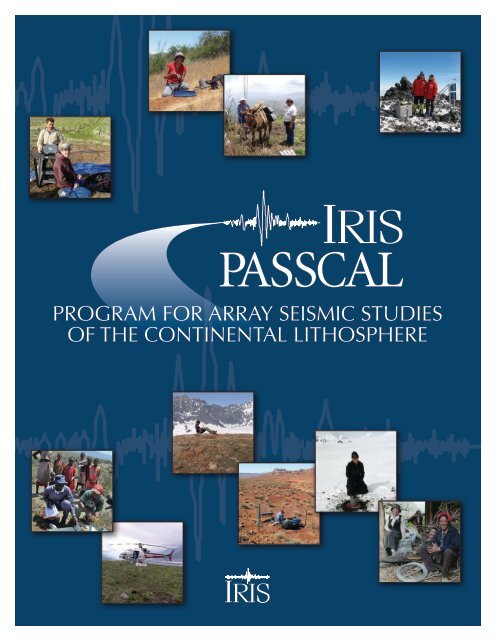
Program for Array Seismic Studies<br />
of the Continental Lithosphere
Program for Array Seismic Studies<br />
of the Continental Lithosphere
Contents<br />
Introduction...................................................................................................................................................1<br />
Scientific Impact............................................................................................................................................2<br />
Exploring the Earth..................................................................................................................................................2<br />
Innovation in Data Acquisition and Analysis.......................................................................................................3<br />
Discovery...................................................................................................................................................................5<br />
High-Resolution Seismology................................................................................................................................11<br />
Earthquakes and Earthquake Hazards.................................................................................................................12<br />
Nuclear Explosions Seismology............................................................................................................................14<br />
Polar Efforts.............................................................................................................................................................14<br />
References................................................................................................................................................................17<br />
Program History.......................................................................................................................................19<br />
Timeline...................................................................................................................................................................20<br />
Instrumentation.........................................................................................................................................22<br />
Long-Term Passive Deployments.........................................................................................................................22<br />
Controlled-Source Instruments............................................................................................................................27<br />
RAMP: Rapid Array Mobilization Program.......................................................................................................28<br />
Support..................................................................................................................................................................29<br />
Equipment Support................................................................................................................................................30<br />
Shipping Support....................................................................................................................................................31<br />
User Training...........................................................................................................................................................31<br />
Experiment Support...............................................................................................................................................32<br />
Software Support.....................................................................................................................................................32<br />
Data Processing Support........................................................................................................................................33<br />
Interactions Between the <strong>IRIS</strong> Data Management System and PASSCAL Programs....................................34<br />
Cooperation with Other Facilities and Agencies..............................................38<br />
UNAVCO.................................................................................................................................................................38<br />
Network for Earthquake Engineering Simulation (NEES)...............................................................................38<br />
Ocean Bottom Seismograph Instrument Pool (OBSIP)....................................................................................39<br />
University-National Oceanographic Laboratory System (UNOLS)................................................................39<br />
US Geological Survey.............................................................................................................................................40<br />
Departments of Energy and Defense...................................................................................................................40<br />
Foreign Institutions and International Partnerships..........................................................................................40
Management and Oversight........................................................................................................42<br />
PIC Operations.......................................................................................................................................................44<br />
Trends and recent developments..........................................................................................46<br />
Usage Trends...........................................................................................................................................................46<br />
Personnel Trends....................................................................................................................................................50<br />
Broadband Sensors—Protecting Past Investments............................................................................................50<br />
Future Trends..........................................................................................................................................................51<br />
Budget....................................................................................................................................................................52<br />
Appendices<br />
A. PASSCAL Standing Committee and Past Chairs..........................................................................................53<br />
B. Policy for the Use of PASSCAL Instruments..................................................................................................54<br />
C. PASSCAL Data Delivery Policy.......................................................................................................................57<br />
D. PI Acknowledgement........................................................................................................................................59<br />
E. PASSCAL Instrument Use Agreement............................................................................................................60<br />
F. PASSCAL Field Staffing Policy..........................................................................................................................61<br />
G. Policy for an <strong>IRIS</strong> Rapid Array Mobilization Program (RAMP)................................................................62
Introduction<br />
When it was established in 1984, the Program<br />
for Array Seismic Studies of the Continental Lithosphere<br />
(PASSCAL) represented a fundamentally new direction<br />
for multi-user facilities in the earth sciences. At that time,<br />
the National Science Foundation (NSF) was encouraging<br />
exploration of new modes of collaboration in the development<br />
of community-based facilities to support fundamental<br />
research. The US seismology community organized a<br />
new consortium—the Incorporated Research Institutions<br />
for Seismology (<strong>IRIS</strong>)—to present to NSF a coordinated<br />
plan defining the instrumentation, data collection, and<br />
management structure to support a broad range of research<br />
activities in seismology. PASSCAL, along with the Global<br />
Seismographic Network (GSN) and Data Management<br />
System (DMS), were the initial core programs presented to<br />
NSF. In 1997, <strong>IRIS</strong> added an Education and Outreach (E&O)<br />
program, and in 2003, NSF expanded <strong>IRIS</strong>’s responsibilities<br />
to include the USArray component of EarthScope.<br />
PASSCAL provides and supports a range of portable seismographic<br />
instrumentation and expertise to diverse scientific<br />
and educational communities. Scientific data collected with<br />
PASSCAL instruments are required to be archived at the<br />
open-access <strong>IRIS</strong> Data Management Center (DMC). These<br />
two basic <strong>IRIS</strong> PASSCAL concepts—access to professionally<br />
supported, state-of-the art equipment and archived, standardized<br />
data—revolutionized the way in which seismological<br />
research that incorporates temporary instrumentation<br />
is practiced at US research institutions. By integrating planning,<br />
logistical, instrumentation, and engineering services,<br />
and supporting these efforts with full-time professional staff,<br />
PASSCAL has enabled the seismology community to mount<br />
hundreds of large-scale experiments throughout the United<br />
States and around the globe at scales far exceeding the capabilities<br />
of individual research groups. Individual scientists<br />
and project teams can now focus on optimizing science<br />
productivity, rather than supporting basic technology and<br />
engineering. Small departments and institutions can now<br />
compete with large ones on an equal footing in instrumentation<br />
capabilities. Scientists working outside of traditional<br />
seismological subfields now have the ability to undertake<br />
new and multidisciplinary investigations. Standardized<br />
equipment and data formats greatly advanced long-term<br />
data archiving and data re-use for novel purposes.<br />
PASSCAL has also influenced academic seismology in all<br />
parts of the world explored by US seismologists, and the<br />
program has on many occasions provided significant instrumentation<br />
to spur or augment international collaborations.<br />
Many of the standards and facilities pioneered by <strong>IRIS</strong> for<br />
instrumentation and data collection, archival, and open<br />
exchange have been adopted by other groups in the United<br />
States (such as permanent networks) and by seismological<br />
networks and organizations worldwide. This open-data culture<br />
has been embraced by other US data collection groups<br />
(seismological and nonseismological), and obligatory data<br />
archival requirements and standards have increasingly been<br />
stipulated by federal agencies. Internationally, similar portable<br />
seismograph facilities have patterned their operations on<br />
the PASSCAL model, although comprehensive international<br />
open data policies have not yet been universally adopted.<br />
This document summarizes the scientific research supported<br />
by the PASSCAL facility, reviews the history and<br />
management of the PASSCAL program, and describes the<br />
breadth of PASSCAL facilities and operations, focusing<br />
largely on the PASSCAL Instrument Center at New Mexico<br />
Tech in Socorro, New Mexico. PASSCAL and other <strong>IRIS</strong><br />
core programs are funded by the NSF Earth Sciences<br />
Instrumentation and Facilities Program (David Lambert,<br />
Program Director). This report is part of a review of the <strong>IRIS</strong><br />
PASSCAL facility required as part of the five-year (2006–<br />
2011) cooperative agreement (EAR-0552316) between NSF<br />
and the <strong>IRIS</strong> Consortium. The report reflects inputs from<br />
the PASSCAL Program Manager, Deputy Program Manager,<br />
Standing Committee Chair, PASSCAL Instrument Center PI,<br />
Director, and staff at New Mexico Tech, and <strong>IRIS</strong> community<br />
sources, including the PASSCAL Standing Committee,<br />
2005 PASSCAL strategic planning workshop participants,<br />
and 2007 Tucson PASSCAL Review Workshop participants.
Scientific Impact<br />
Exploring the Earth<br />
Since its inception, PASSCAL has provided instrumentation<br />
for field investigations in remote corners of the globe<br />
(Figure 1), with seismologists exploring Earth’s deep interior<br />
by mounting expeditions similar in spirit to the classic<br />
scientific expeditions of the eighteenth, nineteenth, and<br />
early twentieth centuries. Among the earliest PASSCAL<br />
controlled-source experiments were investigations in Iceland<br />
and Arctic Alaska. Subsequent controlled- and naturalsource<br />
investigations examined the evolution of Earth’s great<br />
orogenic plateaus and mountain systems: the Himalayan-<br />
Alpine chain, the Andes, and the North American cordillera<br />
and orogenic plateau. In Asia, PASSCAL investigators have<br />
conducted a series of large-scale seismic investigations<br />
throughout the Himalayas and across the Tibetan plateau,<br />
in the Tien Shan mountains, and other parts of the Alpine-<br />
Himalayan chain. In Latin America, investigations have<br />
extended from Tierra del Fuego through Chile, Argentina,<br />
and Boliva, to the Caribbean margin of Venezuela and on<br />
many Caribbean islands. In Central America, US seismologists<br />
have investigated the volcanoes and subduction zones<br />
of Costa Rica and Nicaragua. In North America, a large<br />
number of projects have been fielded from Mexico to the<br />
northern tip of Alaska, the Aleutian Islands, and the Bering<br />
and Chuckchi Seas. PASSCAL experiments have covered the<br />
great rift system of east Africa, from Tanzania to Ethiopia,<br />
and a number of the African cratonic provinces, notably<br />
the Kaapvaal. Elsewhere, US seismologists have deployed<br />
PASSCAL instruments from the Kola Peninsula in western<br />
Russia to the Kamchatka Peninsula in far eastern Siberia,<br />
and from Greenland to the South Shetland Islands. This<br />
tradition continues today with large projects on every continent<br />
and novel investigations in Antarctica utilizing recently<br />
developed special polar equipment.<br />
Unlike the typical laboratory investigations of many sciences,<br />
the seismologist’s laboratory is the Earth, which makes seismic<br />
fieldwork both exciting, and also logistically and physically<br />
challenging (and sometimes dangerous). PASSCAL<br />
instruments have been deployed from almost every means<br />
of conveyance available, from ships, light aircraft, and helicopters;<br />
to light water craft and four-wheel-drive vehicles;<br />
to horses, donkeys, and backpacks. Instruments have been<br />
deployed in locations ranging from mountaintops to fjords,<br />
from the slopes of volcanoes to ice sheets and glaciers, and<br />
in tropical rain forests and deserts, and on desert islands.<br />
PASSCAL instruments have been damaged from excessive<br />
heat and cold, flooding, vehicle wrecks, landslides,<br />
mudslides, volcanic ejecta, and local wildlife (notably bears).<br />
Instruments have been stolen, deliberately shot, investigated<br />
by the local law enforcement agencies of several countries,<br />
paved over by road construction crews, and in one instance,<br />
destroyed by a native spear.<br />
The experiment-planning stage for instrument deployments<br />
everywhere in the world is becoming increasingly difficult<br />
and lengthy in nearly all environments, as seismologists<br />
and support staff are faced with ever-increasing numbers<br />
of permits to obtain, often from a variety of different<br />
agencies, and as experiments continue to grow in numbers<br />
of instruments. Global urbanization is posing new and<br />
challenging problems; cities are high-seismic-noise, densely<br />
packed, theft-prone environments. An example of careful<br />
planning in the urban environment is the successful series<br />
of controlled-source experiments conducted in the Los<br />
Angeles basin by the US Geological Survey and a team of<br />
university collaborators. Fielding over 1000 seismographs,<br />
these experiments deployed instruments in the backyards<br />
of residents throughout the greater metropolitan area,<br />
and detonated explosives in drillholes on public lands that<br />
included national forests, military facilities, watershed and<br />
flood-control lands, and even on school grounds.
La RISTRA, New Mexico.<br />
Tibet. Locals help with installation<br />
of a station.<br />
Alaska. STEEP experiment.<br />
Venezuela. Transporting gear<br />
the old fashioned way.<br />
PASSCAL Stations<br />
60<br />
0<br />
Figure 1: Global<br />
extent of station<br />
coverage for the history<br />
of the PASSCAL<br />
program, now totaling<br />
more than<br />
3800 stations.<br />
-60<br />
180 -120 -60 0 60 120 180<br />
Tiwi. Specialized enclosure<br />
for a rainy environment.<br />
Chile. Installing an intermediate<br />
period sensor.<br />
Kenya. A short period station<br />
being serviced while local<br />
Masai look on.<br />
Mt. Erebus. An intermediate<br />
period sensor is installed<br />
directly onto the bedrock<br />
flanking the volcano.<br />
Innovation in Data Acquisition and Analysis<br />
The initial desire for a single multi-use PASSCAL instrument<br />
proved to be excessively restrictive for community needs,<br />
and the instrument pool has evolved today into a small suite<br />
of specialized equipment packages, with many investigations<br />
making use of multiple instrumentation types and associated<br />
methodologies during a single project. For most earthquakerecording<br />
applications, PASSCAL stations are self-contained.<br />
Installations include solar and battery power, independent<br />
GPS clocks, large data-storage capabilities, usually broadband<br />
(120 s) or intermediate (30 s) period instruments and,<br />
if available, communication links facilitated by satellite, lineof-sight<br />
radio, and Internet or telephone networks. In contrast,<br />
crustal-scale, controlled-source experiments require<br />
rapid deployment and recovery of large numbers of instruments<br />
that have lower storage capacities and power requirements.<br />
These community needs led to the development
permit advanced wavefield imaging using P-to-S and S-to-P<br />
scattered waves from teleseismic sources, and multiply<br />
reflected P-wave signals, and provide structural velocity<br />
and impedance images with roughly an order of magnitude<br />
greater resolution than comparable transmission tomography<br />
(e.g., Bostock et al., 2001, Rondenay et al., 2001). These<br />
methods provide, for the first time, images of the upper<br />
mantle with resolution comparable to crustal images using<br />
controlled-source methods. Even common conversion point<br />
stacking (Dueker and Sheehan, 1997), which is less sensitive<br />
to spatial aliasing, can provide remarkably detailed images of<br />
crustal structure from teleseismic signals (Figure 2), although<br />
increasingly, single or multimode migration methods and/or<br />
scattering inversions are being pursued (e.g., Bostock et al.,<br />
2002; Wilson and Aster, 2005) (Figure 3).<br />
In controlled-source seismology, PASSCAL instruments<br />
have long been used for traditional two-dimensional<br />
refraction and reflection profiles, but the growing number<br />
of University of Texas, El Paso (UTEP), PASSCAL, and<br />
EarthScope TEXAN instruments now permits threedimensional<br />
surveys across relatively large areas. The crustal<br />
tomography community has been developing three-dimenof<br />
the RT125 (“TEXAN”) instrument. Many tens of these<br />
instruments can be deployed or recovered by a single team<br />
in a day. Demand for high-resolution reflection imaging of<br />
the shallow (< 1 km) subsurface required purchase and support<br />
of commercially available cable reflection systems.<br />
The availability of large numbers of each instrument type<br />
has followed or encouraged development of new analysis<br />
techniques that are either theoretically impossible or practically<br />
inconceivable for small numbers of instruments and<br />
low data volumes. For example, large aperture, increasingly<br />
dense, and increasingly two-dimensional arrays of broadband<br />
seismographs allow the identification and removal<br />
of multipath interference in surface wave measurements<br />
(Forsyth and Li, 2005), a longstanding problem in surface<br />
wave analysis. Cross correlation of the microseism noise<br />
field to estimate surface wave Green’s functions between<br />
stations in large, dense arrays has opened a whole new field<br />
of investigation of the crust and upper mantle with surface<br />
waves in the 5–40 s band (Shapiro et al., 2005). Similarly,<br />
large-aperture, dense arrays make correcting for Fresnel<br />
zone phenomena in body wave tomography possible,<br />
removing the ray-theoretical assumptions inherent in travel<br />
time methods, and providing improved<br />
images of the subsurface (Dahlen et al.,<br />
2000; Dahlen and Baig, 2002; Nolet et<br />
al., 2005). Anisotropy measurements<br />
made from shear-wave splitting across<br />
large dense arrays can reveal systematic<br />
variations in orientation that can be<br />
related to asthenospheric flow directions,<br />
often associated with plate edges,<br />
subduction zones, and mantle upwellings<br />
(e.g., Savage and Sheehan, 2000; Fischer<br />
et al., 2005; Walker et al., 2005; Zandt<br />
and Humphreys, in press). The seeming<br />
chaos of splitting directions observed<br />
across a coarse array can be geodynamically<br />
meaningful when viewed across<br />
a dense array.<br />
The densest broadband arrays now<br />
provide spatially unaliased recordings<br />
of teleseismic signals to relatively high<br />
frequencies (0.5–1 Hz). Such data sets<br />
Figure 2 Common conversion point (CCP) stacked receiver function image from an aereal<br />
array of broadband seismographs in Montana showing details of crustal structure. The thick<br />
lower crustal layer was first identified in a complementary PASSCAL controlled-source<br />
experiment deployed in the same region. (From Yuan et al., 2006)
very forearcs lowincluding surface heat Cascadia flow 10,11 (30–40 . In mWm Fig. 2b 22 ) we observed plot a in thermal<br />
most<br />
from distance ,40 of to ,50–100 .80 mWm km. 22 However, over ,20 a landward km signals increase an abrupt in heat increase<br />
flow<br />
model forearcs for including central Oregon Cascadia 12 corresponding 10,11 . In Fig. to 2bthe we teleseismic plot a thermal profile,<br />
from in deep ,40 temperatures. to .80 mWm In particular, 22 over ,20 Moho km signals temperatures an abrupt beneath increase the<br />
model for central Oregon 12 corresponding to the teleseismic profile,<br />
arc in deep and temperatures. backarc are significantly In particular, higher, Moho temperatures above 800 8C. beneath Thus ser-<br />
the<br />
pentine arc and should backarcexist arein significantly that portion higher, of the mantle above 800 forearc 8C. contained<br />
Thus ser-<br />
within pentinethe should dashed exist square in that in portion Fig. 2b, of but the it will mantle not forearc be stable contained beneath<br />
the within arc the and dashed backarc. square The in degree Fig. 2b, of but serpentinization it will not be stable in the beneath forearc<br />
will the sional arc depend and travel upon backarc. time thetomography The amount degree of H of methods for about the last<br />
2 O serpentinization that chemically interacts the forearc with<br />
will forearc 10 years depend mantle, and upon can which, the easily amount inexploit turn, of Hdepends the 2 O that expanded chemically on H 2 instrument O flux interacts frombase<br />
with the<br />
forearc subducting mantle, slab which, and the inpermeability turn, depends structure on H<br />
(e.g., Hole, 1992; Zelt and Barton, 1998).<br />
2 of O the fluxslab, fromplate<br />
the<br />
interface subducting and slab mantle.<br />
and the permeability structure of the slab, plate<br />
interface Serpentinite and mantle. exhibits elastic properties that are unique among<br />
commonly<br />
Theoretical Serpentinite occurring<br />
developments exhibits rock elastic types,<br />
and properties notably<br />
advances<br />
low that<br />
in<br />
elastic<br />
computational<br />
are unique wave velocities<br />
among<br />
and commonly high Poisson’s occurring ratio. rockThe types, very notably low S-velocity low elastic of wave serpentinite velocities is<br />
central and capabilities, highto Poisson’s thecoupled interpretation ratio. with Theseveral very of our low community results. S-velocity In particular, of efforts serpentinite its S-<br />
is<br />
velocity central<br />
methodological to(v the S ) is interpretation significantly exploration, of lower and our<br />
in than results.<br />
software that In of standardiza-<br />
particular, its peridotitic<br />
its S-<br />
protolith velocity (v(dv S < 2 2 km s 21 S ) is significantly) lower and commonly than that of occurring its peridotitic lower-<br />
protolith crustal tion and lithologies (dv dissemination (dv (e.g., S < 1 km s Computational 21 S < 2 2 km s 21 ) and) 13 commonly . Figure 3 shows Infrastructure<br />
occurring the S-wave<br />
lowercrustal<br />
velocity for Geophysics lithologies of mantle [CIG] (dv peridotite and Seismic S < 1 kmsamples s 21 ) 13 . wave Figure as a Propagation function 3 showsof the degree and<br />
S-wave of<br />
serpentinization velocity of mantle at a peridotite pressure of samples 1 GPa, which as a function is appropriate of degree for the<br />
of<br />
base serpentinization Imaging<br />
of a ,35-km-thick Complex at a pressure media<br />
continental of[SPICE]) 1 GPa, crust which are<br />
as<br />
facilitating is presented appropriate in<br />
the<br />
ref. for the 14.<br />
Correction base increased of a ,35-km-thick application from room of temperature continental waveform crust tomography 400–500 as presented 8C(i.e., will infull<br />
shift ref. this<br />
14.<br />
curve Correction downward from room to velocities temperature 0.1–0.2 tokm 400–500 s wavefield inversion) to two-dimensional, 21 lower. 8C will This shift information<br />
downward allows us to interpret velocitiesthe 0.1–0.2 image kmin s 21 Fig. lower. 2a quantitatively<br />
This infor-<br />
in mation land, terms marine, allows of degree us and to ofonshore-offshore serpentinization interpret the image ininvestigations the forearc Fig. 2amantle. quantitatively to provide As in a<br />
previous in<br />
this<br />
controlled-source<br />
curve<br />
extremely terms of study degree<br />
high-resolution 3 , we ofinterpret serpentinization<br />
images the change of in<br />
velocity the in forearc dip of and the mantle.<br />
density subducting<br />
As a<br />
plate previous by 45 study km 3 depth , we interpret to indicate the the change onset inof dip eclogitization of the subducting of the<br />
oceanic plate variations bycrust, 45 km in leading, crust. depthAlthough to eventually, indicatestill to thea a onset 15% computational increase of eclogitization in density challenge,<br />
of and the a<br />
pronounced oceanic<br />
three-dimensional crust, reduction leading,<br />
waveform eventually, in the seismic inversion to a 15% contrast increase<br />
of large with in<br />
data density underlying sets and<br />
for<br />
a<br />
oceanic pronounced mantle reduction 15 .<br />
in the seismic contrast with underlying<br />
oceanic controlled Although mantle and a continuous 15 . natural sources dehydration is within of downgoing sight. oceanic crust<br />
and Although entrained a continuous sediments is dehydration expected, the of downgoing water released oceanic by eclogi-<br />
crust<br />
tization and entrained (between sediments 1.2 and is3.3 expected, wt%; ref. the 16) water is especially released important<br />
by eclogitization<br />
expulsion (between into 1.2the and overlying 3.3 wt%; mantle ref. 16) wedge, is especially where important it causes<br />
hydration for teleseismic expulsion andwavefields, into serpentinization, the overlying and three-dimensional and mantle significantly wedge, active-source<br />
where diminished it causes velocities.<br />
hydration The<br />
Enhanced experimental developments, well-sampled<br />
for<br />
arrays, coupled and horizontal serpentinization, boundary<br />
with theoretical and near<br />
and significantly 32 km depth<br />
data processing<br />
diminished and between<br />
vel-<br />
2122.6 ocities. The and 2123.38 horizontal longitude boundary that near juxtaposes 32 km depth high- and (or neutral-)<br />
between<br />
velocity 2122.6 advances, and material are 2123.38 significantly above longitude withadvancing low-velocity that juxtaposes geological material high- and below (orgeody-<br />
neutral-) is thus<br />
inferred velocity<br />
namic insight to material manifest into above the Earth highly with<br />
history low-velocity unusual and occurrence processes. materialof Increasingly<br />
below an ‘inverted’<br />
is thus<br />
continental inferred to manifest Moho separating the highlylower-crustal unusual occurrence rocks from of an underlying,<br />
‘inverted’<br />
continental detailed seismic Moho structural separating imaging lower-crustal now rocks permits frominterpreta-<br />
underlying,<br />
tion of chemical- and phase-change boundaries, and more<br />
useful inferences on the presence or absence of free fluids<br />
or hydrated materials. This advance, in turn, allows the<br />
seismological community and an increasing diversity of<br />
collaborators in geology, geodynamics, and geochemistry to<br />
Figure 23. Comparison Scattered of wave scattered image wave made inversion using results a generalized with thermal Radon model. a, S-<br />
advance understanding of fundamental Earth processes.<br />
velocity Figure Transform 2perturbations Comparison inversion below of of scattered the P-to-S array, wave converted recovered inversion from waves results the from inversion with thermal a dense of scattered model. a, waves S- in<br />
the velocity broadband P-wave perturbations coda array of 31 across below earthquakes the the array, Oregon recorded recovered Cascadia at from teleseismic thesubduction inversion distances. of scattered zone, The image<br />
waves in<br />
represents the superimposed P-wavea coda bandpass-filtered of on 31a earthquakes thermal version model recorded of of true the at teleseismic perturbations subduction distances. to zone, a one-dimensional,<br />
The and image an<br />
smoothly represents interpretation varying a bandpass-filtered of reference the image. model. version The Discontinuities loss of theof true signal perturbations present from the where to continental<br />
a one-dimensional,<br />
steep changes in<br />
perturbation smoothly Moho in varying the polarity mantle reference occur. forearc b, model. Thermal is Discontinuities attributed model of Cascadia to aremantle present subduction serpentinization wherezone steep corresponding<br />
changes by<br />
approximately perturbation fluids released polarity to the<br />
from occur. profile<br />
the b, in<br />
subducting Thermal a. cool model subducting<br />
plate. of Cascadia (From<br />
plate subduction Bostock<br />
depresses zone et<br />
isotherms<br />
al., corresponding 2002.<br />
the<br />
forearc, approximately Field experiment<br />
rendering to the serpentine profile described instable a. The in<br />
within<br />
Nabelek coolthat subducting portion<br />
et al.,<br />
of plate 1993.)<br />
the mantle depresses encompassed isotherms in by the<br />
dashed forearc, rectangle; rendering serpentine solid lines stable indicate within locations that portion of subducting of the mantle oceanic encompassed crust and<br />
by the<br />
continental dashed rectangle; Moho. solid Note lines temperature indicatecontour locations interval of subducting is 200 8C. oceanic c, Interpretation crust and of<br />
structure continental in Moho. a. High Note degrees temperature of mantle contour serpentinization interval is where 200 8C. the c, subducting Interpretation oceanic<br />
of<br />
crust structure enters in the a. High forearc degrees mantle ofresults mantlein serpentinization an inverted continental where the Moho subducting (high-velocity oceanic crust<br />
on crust Discovery<br />
low-velocity enters themantle), forearc mantle which results gradually in an reverts inverted eastward continental to normal Moho polarity (high-velocity by 2122.38<br />
crust Figure 3 S-velocity of altered peridotite as a function of degree of serpentinization. Data<br />
longitude. low-velocity The signature mantle), which of the gradually subducting reverts oceanic eastward Moho to diminishes normal polarity with depth by 2122.38 as a<br />
from Figure ref. 3 14. S-velocity Bold line of altered shows peridotite best-fit linear as aregression function ofwith degree ^1j of error serpentinization. bounds. The<br />
Data<br />
result longitude. progressive The signature eclogitization of the subducting below 45 oceanic km. Inverted Moho triangles diminishes in with a and depth c show<br />
as a<br />
from predicted ref. 14. velocity Boldcontrast line shows at the best-fit wedge linear corner regression suggests with degrees ^1j error of serpentinization bounds. The as<br />
instrument result Over of85 progressive locations. institutions eclogitization contributed below 45 km. “one-pager” Inverted triangles research in a and csum-<br />
show<br />
high predicted shaping as 50–60%. velocity current contrast v S , S-wave scientific at the velocity.<br />
wedge discussions corner suggests about degrees Earth of serpentinization processes.<br />
as<br />
instrument<br />
maries, attributed locations.<br />
to PASSCAL instrumentation, to the 2005<br />
high<br />
Because as 50–60%.<br />
seismic v S , S-wave<br />
exploration velocity.<br />
of the Earth has never before<br />
NATURE | VOL 417 | 30 MAY 2002 | www.nature.com © 2002 Nature Publishing Group<br />
537<br />
NATURE <strong>IRIS</strong> proposal. | VOL 417 | 30These MAY 2002 summaries | www.nature.com provide a representative<br />
© 2002 Nature Publishing been Group undertaken at the spatial and temporal scales of the<br />
537<br />
overview of the variety of seismic experiments currently GSN and the aggregate of PASSCAL experiments, serendipitous<br />
discoveries are quite common.<br />
being fielded that is more comprehensive than space allows<br />
in this review. Here, we note a few key themes that are
Subduction and Whole-Mantle Convection<br />
The cover graphic on the April 1997 issue of GSA Today,<br />
showing the subducted Farallon plate beneath North<br />
America in P and S wave global tomograms (Grand et al.,<br />
1997), helped to forever change the debate in the earth<br />
science community about whole mantle versus layered<br />
mantle convection (Figure 4). Although primarily a result of<br />
measurements made on observatory seismographs, global<br />
tomographers are increasingly including data from the great<br />
number of PASSCAL broadband deployments around the<br />
globe to enhance resolution in their studies. This data use<br />
has driven a new policy that every PASSCAL broadband<br />
experiment is now required to declare one station open to<br />
the larger community as soon as it is installed. Note that all<br />
data become available after a maximum two-year period.<br />
Tomographers are providing ever more accurate images of<br />
the global plate circulation system at depth throughout the<br />
world. Dozens of PASSCAL experiments have been fielded<br />
with the goal of examining the primary convection system,<br />
(A)<br />
2770 km<br />
depth<br />
and an increasing number are being undertaken to investigate<br />
the secondary convective processes that modulate the<br />
whole mantle system and that often drive regional tectonics.<br />
PASSCAL experiments have been designed to provide structural<br />
images and infer processes in a wide range of subduction<br />
zones, the most obvious manifestation of the primary<br />
convection system. In northern China, a PASSCAL experiment<br />
will measure the spatial extent, and therefore length of<br />
time, the subducted Pacific slab rests on the 660-km phase<br />
transition beneath northern China before descending into<br />
the deeper mantle as the Japan trenches roll back. A series<br />
of passive- and controlled-source seismic experiments<br />
are examining the complex arc-continent collision of the<br />
Eurasian and Philippine plates that formed Taiwan, and the<br />
accretion of Taiwan to the Asian mainland. The controlledsource<br />
experiment is designed to relate surface structures in<br />
the Taiwan crust to the mantle deformation field. Combined<br />
land and marine experiments have investigated the structure<br />
of the backarc and slab of the Tonga-Fiji and Marianas<br />
trench systems, with complementary controlled-source<br />
experiment to examine evolution of oceanic island arc crust<br />
and back arc crust. Combined land-marine passive- and<br />
controlled-source experiments are examining the complex<br />
southeastern Caribbean plate boundary where the Atlantic-<br />
South America plate forms a slab tear edge propagator<br />
fault (STEP fault; Govers and Wortel, 2004) as the Atlantic<br />
subducts beneath the Caribbean plate. Simultaneous tearing<br />
and deformation of the South American lithosphere<br />
control mountain building and basin development along the<br />
northern South American margin. The causes and tectonic<br />
consequences of trench rollback in the Adriatic and Hellenic<br />
arcs are being determined by projects in the central and<br />
eastern Mediterranean. Other subduction zone experiments<br />
have examined the consequences of tears in or terminations<br />
of subducting plates in Mexico and the northwest Pacific,<br />
and the hydration state of slabs in Central America.<br />
(B)<br />
FARALLON SLAB<br />
2770 km<br />
depth<br />
Figure 4. Cover graphic from GSA Today showing the subducted<br />
Farallon plate beneath North America. (From Grand et al., 1997)<br />
The Andes mountains and Altiplano-Puna plateaus are<br />
being investigated because they form one of Earth’s great<br />
mountain chains and orogenic plateaus, and also because<br />
they are viewed by many as an analog to the western United<br />
States ~ 40–50 million years earlier in its history. These<br />
regions thus shed light on the complex Cenozoic history<br />
of western North America. For example, basement rooted,
Laramide-style uplifts occurring in South America are<br />
similar to those found in the Southern Rockies that formed<br />
~ 55 Ma. Andean studies provide a natural laboratory for<br />
contrasting lithospheric deformation and volcanic patterns.<br />
These patterns range between flat-slab subduction near 30°S,<br />
which is producing a volcanic gap with characteristic basement-rooted,<br />
Laramide-style uplifts, to steep slab subduction<br />
at 36°S, where a normal volcanic arc exists.<br />
depth (km)<br />
0<br />
100<br />
200<br />
300<br />
400<br />
500<br />
600<br />
Fiji LR CLSC VF<br />
dVp km/s<br />
200 400 600 800 1000 1200 1400<br />
Active and passive seismic experiments employing land and<br />
ocean bottom seismographs have probed subduction-related<br />
processes in the accretionary wedge, the seismogenic zone,<br />
the oceanic crust, and mantle wedge in a variety of trenches,<br />
including those in Central American, Cascadia, Alaska,<br />
and the western Pacific (Figure 5). In Cascadia and Alaska,<br />
high-resolution scattered wave and tomographic images of<br />
the descending plate and the mantle wedge have been used<br />
to identify zones of hydration and serpentinization in the<br />
mantle wedge, and track dehydration and eclogization of<br />
subducting oceanic crust.<br />
The Indian-Asian plate collision zone has produced Earth’s<br />
most extreme topography as ocean-continent subduction<br />
evolved into continent-continent collision. A large<br />
number of recent PASSCAL-supported controlled- and<br />
natural-source experiments have produced a much greater<br />
understanding of large-scale orogenesis and its structural<br />
underpinnings. In the early investigations in Tibet, for<br />
example, combined controlled- and passive-source investigations<br />
identified a wide-spread midcrustal low-velocity zone<br />
beneath the Tibetan plateau that is topped by seismic bright<br />
spots. These observations have been interpreted as a plateauwide<br />
partial melt zone, capped by either lenses of melt and/<br />
or melt-derived fluids. A similar widespread zone of partial<br />
melt was subsequently identified under the Altiplano of the<br />
Andes. More recent experiments have examined mantle<br />
flow fields created adjacent to the edges of collision zone, as<br />
Eurasia deforms in response to the collision. The seismologic<br />
database in Tibet and the Himalayas have led to several<br />
models of lithospheric descent under the Tibetan plateau;<br />
debate still exists as to whether the lithosphere consumption<br />
is one-sided or two-sided (i.e, whether the Indian mantle<br />
lithosphere is subducting alone, or both Indian and the<br />
Eurasian mantle lithosphere are descending into the mantle).<br />
depth (km)<br />
depth (km)<br />
dVp km/s<br />
0<br />
100<br />
200<br />
300<br />
400<br />
500<br />
600<br />
Fiji<br />
dVs km/s<br />
0<br />
100<br />
200<br />
300<br />
400<br />
500<br />
600<br />
dVp/Vs<br />
0.6 0.4 0.2 0 0.2 0.4 0.6<br />
LR<br />
CLSC<br />
dVs km/s<br />
Figure 5. Mantle seismic velocity structure of the Tonga subduction<br />
zone and Lau back arc basin as determined by broadband ocean<br />
bottom seismometers and PASSCAL instruments. Crustal structure is<br />
constrained by seismic refraction results. The figure shows (a) dVp, (b)<br />
dVs, and (c) d(Vp/Vs) anomalies relative to the IASP91 velocity model,<br />
contoured at 0.08 km/s for Vp, 0.06 km/s for Vs, and 0.012 units for<br />
Vp/Vs. Earthquake hypocenters are shown as black circles. The central<br />
Lau spreading center (CLSC) shows a large dVp/Vs anomaly in the<br />
uppermost mantle extending to ~100 km depth, with an anomaly<br />
amplitude larger than expected from thermal effects alone, suggesting<br />
a wide zone of melt production. (From Condor and Wiens, 2006)<br />
VF<br />
200 400 600 800 1000 1200 1400<br />
Fiji<br />
0.5 0 0.5<br />
LR<br />
CLSC<br />
VF<br />
dVp/Vs<br />
200 400 600 800 1000 1200 1400<br />
distance (km)<br />
0.1 0.05 0 0.05
Hotspots and Plumes<br />
Source-region depths for Earth’s hotspots, which have topographic,<br />
geothermal, and magmatically distinct signatures<br />
at Earth’s surface, have been seriously debated since before<br />
the theory of plate tectonics was proposed. Most recent<br />
discussion has focused upon whether they originate near the<br />
core-mantle boundary or in the upper mantle (or perhaps<br />
both). Global tomography with improved imaging capabilities,<br />
in some cases augmented with archived PASSCAL data<br />
is gradually determining that some source zones may indeed<br />
be at the core-mantle boundary, whereas others arise at shallower<br />
levels. A number of PASSCAL experiments have been<br />
carried out in recent years explicitly to address this debate.<br />
The Yellowstone caldera and hotspot have been the target of<br />
multiple PASSCAL experiments that identified low crustal<br />
velocities associated with surface thermal anomalies. Deeper<br />
imaging revealed a low-velocity pipe to the north-northwest<br />
of Yellowstone that is associated with a downward-deflecting<br />
410-km discontinuity and extends at least as deep as the<br />
660-km discontinuity, although it does not appear to penetrate<br />
the bottom of the transition zone. A related PASSCAL<br />
experiment across the Snake River plain to the southwest<br />
identified a high-velocity lower crust, interpreted as a frozen,<br />
plume-derived basalt intrusion<br />
atop a low-velocity upper mantle.<br />
(a)<br />
Seismic velocity and anisotropy<br />
interpretations ascribe the upper<br />
mantle anomaly to the flow of<br />
-200<br />
0<br />
a plume head, flattened and<br />
stretched by the overriding North<br />
-400<br />
American plate.<br />
Iceland has also been the site of<br />
several recent PASSCAL experiments<br />
(e.g., Figure 6). Integrated<br />
tomography and receiver-function<br />
imaging suggest that the<br />
plume extends at least to the<br />
top of the transition zone at the<br />
410-discontinuity. Receiver func-<br />
0<br />
-200<br />
-400<br />
tions suggest it may extend to its base, but the most recent<br />
global tomography suggests it is an upper mantle feature.<br />
This is still a very controversial topic.<br />
Global tomography data sets have been complemented by<br />
data from a number of PASSCAL experiments in the quest<br />
for plume sources. For example, data from the Kaapvaal<br />
PASSCAL seismic array has helped quantify the large-scale<br />
low-velocity zone at the core-mantle boundary under the<br />
southern Atlantic that extends under East Africa, the site of<br />
a developing continental rift system. A variety of PASSCAL<br />
active- and passive-source seismic experiments examined<br />
the details of the East African rift system from Tanzania<br />
through Ethiopia, finding large volumes of basaltic additions<br />
to the crust, and relatively narrow low-velocity zones<br />
in the mantle through upper mantle depths. Processes<br />
in the uppermost mantle directly beneath the crust are<br />
still poorly understood.<br />
Relatively thin crust and low upper mantle velocities in<br />
the Basin and Range province have been identified by a<br />
COCORP survey at 40°N and a number of controlled-source<br />
and broadband PASSCAL experiments. Until recently,<br />
tomographic images of the Basin and Range mantle relied<br />
largely on the existing earthquake monitoring seismograph<br />
0 200 400 600<br />
0<br />
0 200 400 600<br />
0<br />
(b)<br />
-8 -7 -6 -5 -4 -3 -2 -1 0 1 2<br />
percent velocity anomaly<br />
Figure 6. Tomographic images of Vs perturbation along two cross sections through Iceland showing the<br />
vertical plume conduit resolved to 200–400-km depth, and the plume head above 200 km. Anomalies<br />
are absolute velocity variations across (a) and parallel (b) to the rift zone as a percentage deviation<br />
from 4.5 km/s in the upper 210 km. Below 210 km, the percentages are relative to layer averages.<br />
Relative velocity anomalies (c and d) show velocity variations within the plume head including high<br />
velocities in the uppermost mantle above the plume core. (From Allen et al., 2002)<br />
-200<br />
-400<br />
-200<br />
-400<br />
0 200 400 600<br />
0<br />
(c)<br />
0 200 400 600<br />
0<br />
(d)<br />
-2 -1 0 1 2<br />
percent velocity anomaly
network, but are now being rapidly refined using data<br />
from the first USArray Transportable Array footprint.<br />
Explanations for the positive buoyancy required by the<br />
excess elevation and thin crust include “simple” orogenic<br />
collapse over an already perturbed mantle wedge following<br />
the Sevier and Laramide orogenies, a mantle plume impacting<br />
the entire region, and asthenospheric upwelling induced<br />
by Farallon plate removal. Each of these scenarios has<br />
different consequences for support of the Basin and Range<br />
lithosphere, ranging from an almost entirely thermal origin,<br />
to a mixed mode of thermal and chemical buoyancy, likely<br />
modulated by water added to the upper mantle over time by<br />
the Farallon plate. A remarkable circular anisotropy pattern<br />
in the central/northern Basin and Range has been attributed<br />
to the plume impact, or to toroidal asthenospheric flow arising<br />
beneath the edge of the descending Gorda/Juan de Fuca<br />
plate. A PASSCAL-facilitated study of the Rio Grande rift,<br />
marking the extreme eastern extent of Basin and Range-type<br />
extension, showed that it has an entirely uppermost mantle<br />
expression confined well above the 410-km discontinuity.<br />
The Upper Mantle and Secondary<br />
Convection Phenomena<br />
Several secondary convection mechanisms that are key to<br />
the history of Earth’s continental crust have been suggested,<br />
notably Rayleigh-Taylor instabilities and delamination<br />
processes, in which negatively buoyant mantle lithosphere<br />
and sometimes mafic lower crust are recycled into the<br />
deeper mantle without being part of a larger subducting<br />
plate system. A number of these have been subsequently<br />
identified by PASSCAL-supported projects. Rayleigh-Taylor<br />
instabilities were first predicted theoretically (Houseman et<br />
al., 1981), and somewhat later delamination processes were<br />
inferred from geochemical data in the Andes (e.g., Kay and<br />
Kay, 1990, 1993). These processes heavily modulate regional<br />
tectonics and magmatism, yet the triggers of the instabilities<br />
are not observable at the surface. Their a posteriori surface<br />
signatures are identifiable in local or regional thermal perturbations,<br />
in the magmatic record, and in abrupt changes in<br />
elevation. Various types of seismic investigations can identify<br />
descending lithospheric drips and the unusual crustal<br />
structures that ephemerally persist following delamination.<br />
Active- and passive-source PASSCAL experiments have<br />
examined probable mantle drips (1) in the Sierra Nevada,<br />
where a lithospheric keel is thought to have foundered from<br />
the batholith base, producing a characteristic suite of surface<br />
volcanics, (2) in the Wallowa Mountains, where a bull’s-eye<br />
uplift of a granitic pluton is associated temporally and<br />
spatially with the Columbia River flood basalts, (3) across<br />
the Rio Grande Rift and Colorado Plateau, and (4) in the<br />
Vrancea zone, Romania, where intermediate-depth seismicity<br />
and a mantle slab have been identified far from a typical<br />
subduction zone.<br />
Ancient Boundaries and Modern Processes<br />
Southwestern North America was assembled in Paleo-proterozoic<br />
times by successive accretion of island arcs to the<br />
Archean Wyoming protocontinent over some 600 million<br />
years. A suite of active and passive seismic experiments<br />
across the terrane boundaries separating these ancient island<br />
arcs in the southern Rocky Mountains show that the modern<br />
upper mantle has a fabric parallel to the northeastern trend<br />
of the Precambrian fabric, rather than the more north-south<br />
trend of the modern plate boundaries. These seismic data<br />
led to the insight that ancient lithosphere-scale mantle<br />
structure persists and controls much of modern tectonics in<br />
the western United States not directly affected by Farallon<br />
subduction. Upper mantle seismic velocities are low along<br />
northeasterly trends beneath a number of the terrane<br />
boundaries. One such feature is along the Jemez lineament,<br />
a trend of Cenozoic volcanics following the southeastern<br />
flank of the Colorado Plateau into the Great Plains, and<br />
crossing the east-west rifting of the Rio Grande. Combined<br />
controlled- and passive-source PASSCAL experiments such<br />
as CD-ROM and RISTRA identified a thinned crust and a<br />
mantle source for recently erupted basalts in northern New<br />
Mexico and showed dramatic and largely unanticipated<br />
uppermost mantle velocity contrasts associated with ongoing<br />
interactions between the Proterozoic boundaries, Laramide<br />
compressional, and Cenozoic extensional structures. A<br />
prominent and presently enigmatic mantle feature, which<br />
probably has a similar mixed provenance related to the interactions<br />
of ancient structures and recent tectonics, is in the<br />
Aspen Anomaly region of central Colorado. This structure<br />
underlies the highest topography of the present-day Rocky<br />
Mountains, and is now being investigated in a continental<br />
dynamics experiment embedded within the EarthScope<br />
USArray Transportable Array.
The Cratons<br />
The Archean cratons of Africa and North America have been<br />
extensively studied in PASSCAL-supported experiments.<br />
Four notable experiments are the Trans-Hudson, MOMA,<br />
Abitibi experiments in North America, and the Kaapvaal<br />
experiment in South Africa. The TransHudson experiment<br />
provided the first data to suggest that the anisotropy field<br />
beneath the cratons was related to absolute plate motions<br />
and resultant mantle shear strain, which was subsequently<br />
supported by observations in many other locations. The<br />
MOMA experiment identified the southern edge of the<br />
Canadian shield, showing distinct structures north and<br />
south of the array. The Kaapvaal experiment identified small<br />
positive velocity anomalies that have been interpreted as a<br />
tectonospheric root extending up to ~ 300 km (Figure 7).<br />
The Abitibi experiment data were used to make scattered<br />
wave images of apparent Grenville age subduction structures<br />
along the southeastern flank of the Superior province,<br />
contributing to our understanding of cratonic evolution and<br />
deformation (Figure 8).<br />
The Continental Crust<br />
The processes by which continental crust and underlying<br />
lithosphere forms and persists for up to gigayears has<br />
been a longstanding geological problem with fundamental<br />
implications for continental evolution and the history of plate<br />
tectonics. There appears to be no direct differentiation path<br />
from fertile mantle to bulk continental crust. Some intermediate<br />
differentiation processes must occur to produce a crust<br />
with the chemical properties recorded in sediments and also<br />
inferred from seismic data (~ 62% Si0 2<br />
). Field evidence suggests<br />
cratonic crust is an aggregation of island arcs; however,<br />
seismic evidence suggests that modern island arcs are too<br />
basaltic (< 50% Si0 2<br />
) to form what could be considered<br />
average continental crust. A number of different hypotheses<br />
have been put forward, including a marked change in plate<br />
tectonics since the early Archean, and various forms of<br />
chemical refining in island arcs or in continental arcs such<br />
as the Andes and Sierra Nevada, followed by delamination<br />
of a restite layer from the base of the crust along with mantle<br />
lithosphere. In addition to direct studies of the cratons,<br />
a number of experiments are examining formation and<br />
evolution of the continental crust as an arc process. These<br />
projects include controlled- and passive-source experiments<br />
in several island arc settings, including the Marianas, the<br />
southeastern Caribbean, and the Aleutians, complemented<br />
by studies of the continental arc process in the Andes and<br />
Figure 7. Summary figure from the Kaapvaal project in southern Africa<br />
showing geological provinces (top) with PASSCAL broadband seismograph<br />
stations (black dots). Kimberlite pipes are shown schematically<br />
from diamondiferous kimberlite localities showing their relationship to<br />
crustal and mantle seismic structure. The Moho is shown as a gridded<br />
surface at center. At the bottom are Vp velocity perturbations in the<br />
upper mantle, shown as a constant blue for anomalies > 0.45% and<br />
constant red for anomalies < -0.7. Inferred tectospheric roots of the<br />
Kaapvaal and Zimbabwe cratons are outlined in blue. (From James et<br />
al., 2001)<br />
Figure 8. (top) CCP stacked receiver function image of the Proterozoic<br />
Abitibi-Grenville boundary showing an offset Moho. (bottom)<br />
Scattered wave inversion of the same data set show velocity perturbations<br />
and more clearly delineate subduction-collision structures in the<br />
Moho. (From Rondenay et al., 2005)<br />
10
Sierra Nevada. Suspected delamination<br />
phenomena have been investigated by<br />
several PASSCAL-supported experiments,<br />
including in Arctic Alaska, the Sierra<br />
Nevada, the Wallowa Mountains, the<br />
eastern Rio Grande rift, and the Vrancea<br />
zone, Romania.<br />
The Core<br />
Improved global coverage afforded by<br />
PASSCAL experiments has proven important<br />
for core studies, giving seismologists<br />
new vantage points for viewing core<br />
phases across relatively dense seismograph<br />
arrays. Data from the Kaapvaal craton<br />
were used to discover that the edges of<br />
South African deep mantle low-velocity<br />
anomalies are very sharp, leading to a<br />
consensus that they arise from a combination<br />
of thermal and chemical perturbations. Data from the<br />
PASSCAL MOMA, FLED, RISTRA, and other US arrays<br />
have led to identification of core-mantle boundary anomalies<br />
under the western Caribbean plate that have various interpretations,<br />
including D’’ “slab graveyard” sites. As an example<br />
of serendipitous discovery, data from the BOLIVAR array<br />
in Venezuela displayed a previously undetected retrograde<br />
seismic phase, PKIIKP2, indicating that Earth’s center has a<br />
unique seismic structure (Niu and Chen, in review; Figure 9).<br />
177.0 o<br />
177.5 o<br />
Epicentral Distance<br />
178.5 o<br />
178.0 o<br />
179.0 o<br />
179.5 o<br />
06/06/2004 579 km 5.9 Mw<br />
PKIKP<br />
PKIIKP1<br />
PKIIKP2<br />
-10 0 10 20 30 40 50 60<br />
Time relative to PKIKP (s)<br />
Figure 9. (left) Bolivar array recording of an earthquake from the antipode displaying the<br />
major arc phase PKIIKP2. (top right) Ray paths for the minor arc phase PKIIKP1 and major<br />
arc phases PKIIKP2. Slowness-time stack for all antipode earthquakes recorded by the<br />
Bolivar array showing the PKIIKP phases. (From Niu and Chen, in review)<br />
Slowness relative to PKIKP (s/ o )<br />
3.0<br />
2.0<br />
1.0<br />
0.0<br />
-1.0<br />
-2.0<br />
-3.0<br />
PKIKP<br />
Currently and recently deployed PASSCAL arrays in<br />
Antarctica (see Polar Efforts section) are expected to provide<br />
valuable information on inner core anisotropy by providing<br />
the first set of dense measurements made along paths nearly<br />
parallel to Earth’s rotational axis. These measurements are key<br />
to deciphering the anisotropic structure of the inner core, and<br />
CMB<br />
its pronounced east-west hemispherical asymmetry.<br />
ICB<br />
PKPab<br />
PKIKP<br />
PKIIKP2<br />
PKIIKP1<br />
PKIIKP1?<br />
0 20 40<br />
Time relative to PKIKP (s)<br />
PKIIKP2<br />
178 o<br />
60<br />
-150 -50 -40 -30 -20 -10 0<br />
High-Resolution Seismology<br />
In contrast to large-scale experiments that commonly pursue<br />
the great themes of Earth evolution, many high-resolution<br />
seismology projects have more pragmatic motivations. For<br />
instance, high-resolution seismology is an important tool for<br />
assessing groundwater resources as we grapple with locating,<br />
characterizing, and protecting water sources for an increasingly<br />
urbanized society. Seismic investigations have proven<br />
particularly valuable in the arid southwestern United States<br />
where deep aquifers, often occupying tectonically controlled<br />
basins, are a crucial source of drinking, agricultural, and<br />
industrial water. Aquifer assessment commonly requires<br />
signal penetration of no more than 1–2 km.<br />
High-resolution seismology has proven to be one of several<br />
useful tools for delineating likely locations of contaminants<br />
deliberately or inadvertently lost to the subsurface. Away<br />
from the pollution-discharge point, seismic imaging can<br />
identify channels along which contaminants migrate and<br />
traps in which they pond. Such subsurface characterization<br />
of contaminant traps is critical information for the hydrologists<br />
and engineers designing successful surfactant flooding<br />
and pump-and-treat remediation programs. Surveying for<br />
contaminants frequently requires ultra-high-resolution seismology<br />
(sampling rates ~1 kHz or more), with targets often<br />
found as shallow as 10 m and resolution required at scales<br />
11
of tens of centimeters. PASSCAL multichannel systems and<br />
TEXAN instruments have been deployed in this manner<br />
for two- and three-dimensional surveys at a number of<br />
contaminant sites.<br />
PASSCAL high-resolution equipment also has an important<br />
educational use. High-resolution reflection and refraction<br />
experiments are ideally suited for teaching seismology<br />
fundamentals in exercises that are inexpensive and easy to<br />
conduct with student assistance. PASSCAL equipment has<br />
seen enormous class use for field geophysics classes, exploration<br />
geophysics courses, and has also been used by the NSF<br />
Research Experience for Undergraduates <strong>IRIS</strong> Internship<br />
Program and by the Summer of Applied Geophysical<br />
Experience (SAGE) geophysical field camp coordinated with<br />
Department of Energy and other partners. High-resolution<br />
instrumentation can be used to introduce and reinforce<br />
a number of important seismology concepts, including<br />
basic principles of wave propagation (reflection, refraction,<br />
surface waves); the power of seismic arrays for detecting<br />
weak signals; the strengths, limitations, and differences<br />
between imaging Earth structure with scattered waves and<br />
transmitted waves; and the importance of record keeping<br />
and quality control during data acquisition to successfully<br />
process seismic data.<br />
Earthquakes and Earthquake Hazards<br />
PASSCAL instrumentation has been used extensively<br />
for the study of earthquake sources and for earthquake<br />
hazards research and assessment in urban<br />
areas. Earthquake source studies using PASSCAL<br />
instrumentation include RAMP (Rapid Array<br />
Mobilization Program) deployments for determining<br />
aftershocks, controlled-source experiments and fault<br />
zone guided-wave studies to understand the structure<br />
of fault zones, and recent array studies of episodic<br />
tremor and slip (ETS) in Cascadia.<br />
PASSCAL RAMP consists of 10 six-channel instruments<br />
with strong-motion-capable sensors, reserved<br />
for rapid mobilization to record seismicity following<br />
an earthquake or associated with a volcanic eruption.<br />
RAMP instruments were used to monitor aftershocks<br />
following major shocks in: 1989 at Loma Prieta,<br />
CA; 1992 at Little Skull Mountain, NV; 1992 at<br />
Landers and Mendocino, CA; New Guinea in 1996;<br />
Pennsylvania in 1998; Ohio and Nisqually, WA in<br />
2001; Mexico in 2001; and Puerto Plata, Dominican<br />
Republic in 2003.<br />
A frequent use of PASSCAL’s high-resolution seismic<br />
equipment has been for imaging the shallow structure<br />
of active faults (Figure 10). Motivated by improving<br />
hazard awareness, such studies have been progres-<br />
DEPTH (km)<br />
SW<br />
0.0<br />
-0.5<br />
MSL<br />
-1.0<br />
SW<br />
0.0<br />
0.5<br />
MSL<br />
1.0<br />
SW<br />
0.0<br />
0.5<br />
MSL<br />
1.0<br />
VELOCITY (km/s)<br />
2.0 2.4 2.8 3.2 3.6 4.0<br />
A<br />
B<br />
C<br />
2<br />
4<br />
3<br />
SAF<br />
GHF<br />
-3 -2 -1 0 1<br />
-3 -2 -1 0 1<br />
-3 -2 -1 0 1<br />
DISTANCE (km)<br />
Figure 10: Tomographic and seismic reflection image of the near-vertical<br />
San Andreas and Gold Hill faults near the SAFOD drill hole (derrick)<br />
at Parkfield, CA. The acquisition used 840 channels of high-resolution<br />
seismic equipment, including the PASSCAL multichannel systems. (After<br />
Hole et al., 2001)<br />
nF<br />
nF<br />
nF<br />
SAF<br />
GHF<br />
SAF<br />
GHF<br />
NE<br />
NE<br />
NE<br />
12
Figure 11: High-resolution seismic reflection profile from urban Los<br />
Angeles showing shallow folding above the backlimb of the Compton<br />
blind thrust fault. The profile shows a narrow “kink band” above<br />
the location where a thrust ramp leaves a horizontal basal fault.<br />
Kinematic model is shown at top. Yellow lines show the locations<br />
of cores used to obtain ages and measure the thickness of the shallow<br />
strata, from which slip rates can be estimated. (Modified from<br />
Leon et al., submitted)<br />
sively moving into more urbanized areas as the number of<br />
available channels and quality of shallow seismic sources has<br />
increased. In addition to imaging the faults themselves, these<br />
studies have been imaging the shallow folds above deep<br />
“blind” thrust faults that lie kilometers below the surface,<br />
helping assess risks from faults which do not have a surface<br />
rupture (Figure 11).<br />
Figure 12. Ground shaking over the sediment-filled Seattle basin<br />
resulting from teleseismic signals from the 1999 Chi-Chi, Taiwan,<br />
earthquake, and during local earthquakes and blasts, as measured<br />
using PASSCAL instruments. The tomographic image of the basin was<br />
made using over 1000 seismometers that recorded large blasts. (Figure<br />
from Pratt et al., 2003 and Snelson et al., 2007)<br />
The availability of large numbers of instruments allows determination<br />
of the spatial distribution of strong-motion amplification<br />
and duration caused by the excitation of shallow sedimentary<br />
basins and deeper structures during earthquakes.<br />
In the Puget Sound region, for example, large numbers of<br />
PASSCAL sensors have been used to monitor ground shaking<br />
created by teleseismic and local earthquakes, large blasts, and<br />
even during the demolition of the King Dome sports stadium<br />
(Snelson et al., 2007; Figure 12). Similar studies have been<br />
carried out in Anchorage, Alaska, and Hawaii to map seismic<br />
amplification beneath urban areas.<br />
PASSCAL high-resolution seismic equipment also is used for<br />
geotechnical studies to characterize the shallow subsurface.<br />
In particular, measurements of the shallow S-wave velocity<br />
structure, either through small-scale refraction profiles or<br />
measurement of surface wave speeds via ambient noise analysis,<br />
are used to determine amplification factors to estimate<br />
damage likelihoods from shear waves during earthquakes.<br />
For example, one recent study mapped the shallow S-wave<br />
velocities along profiles in the Reno and Las Vegas, Nevada,<br />
urban areas, and in Los Angeles.<br />
13
Nuclear Explosion Seismology<br />
Nuclear explosion monitoring research is focused on lowmagnitude<br />
events (m b<br />
≤ 4.0) over broad areas, particularly<br />
in Eurasia. Monitoring normally requires observations of<br />
events at regional distances (< 1500 km) where signals are<br />
best observed at relatively high frequencies (0.05–10 Hz).<br />
Propagation through the heterogeneous crust and upper<br />
mantle has a strong impact on these signals, and requires<br />
calibration to account for path-specific seismic observables<br />
(e.g., travel times, amplitudes, surface wave dispersion,<br />
and regional phase propagation characteristics). The<br />
PASSCAL facility provides instrumentation for research<br />
experiments related to nuclear monitoring, as well as an<br />
archived global data set that indirectly supports nuclear<br />
explosion monitoring research by constraining crust-mantle<br />
structural models, particularly in the critical Eurasian<br />
region, and by improving empirical calibration methods.<br />
Specific experiments that have contributed to our knowledge<br />
of seismic structure and seismic monitoring calibration<br />
include: 1991–1992 Tibet (Owens et al., 1993), Tanzania<br />
(Nyblade et al., 1996), INDEPTH-II (Nelson et al., 1996),<br />
1995–1997 Saudi Arabia (Vernon and Berger, 1998), Eastern<br />
Turkey Seismic Experiment (Sandvol et al., 2003), and Iraq<br />
(Ghalib et al., 2006). The value of archived PASSCAL data is<br />
illustrated here; although these experiments were generally<br />
supported to address fundamental scientific objectives, they<br />
nonetheless provide data that benefit applied seismology<br />
for nuclear monitoring.<br />
Underground nuclear explosion monitoring is the main<br />
theme of verification research, but source phenomenology is<br />
a second important area of interest. In this vein, PASSCAL<br />
instrumentation has been used in experiments with the<br />
specific goal of improving understanding of large chemical<br />
explosions, such as the nuclear analog Non-Proliferation<br />
Experiment (Zucca, 1993; Tinker and Wallace, 1997), as well<br />
as the Source Phenomenology Experiment, which examined<br />
mining explosions (Leidig et al., 2005; Hooper et al., 2006).<br />
Polar Efforts<br />
Seismology in polar regions is a rapidly developing component<br />
of PASSCAL-supported science. Antarctic, Greenland,<br />
and past continental ice sheets and sea ice have dramatically<br />
affected climate and sea level throughout Earth’s history. Yet,<br />
great extents of these key regions are largely inaccessible<br />
to geologic study, and Antarctica remains a tectonic terra<br />
incognita. <strong>IRIS</strong> PASSCAL-supported seismology, principally<br />
funded by the NSF Office of Polar Programs (OPP), is<br />
enhancing fundamental understanding of basic crustal and<br />
upper mantle structure as a part of larger interdisciplinary<br />
studies, and is being used in novel studies of ice cap, glacial,<br />
and iceberg-related seismic phenomena. Facility support for<br />
these efforts requires significant new development efforts in<br />
sensor, telemetry, and station design. Currently, this effort<br />
is being accomplished through a joint <strong>IRIS</strong> PASSCAL/<br />
UNAVCO OPP Major Research Instrumentation (MRI)<br />
initiative, supplemented by a second <strong>IRIS</strong> MRI largely for<br />
equipment procurement.<br />
The far polar regions have the poorest seismographic<br />
coverage of any region on Earth, and temporary PASSCAL<br />
deployments at high latitudes not only provide regional<br />
structure but also unique raypaths for constraining important<br />
elements of deep structure in global tomographic models.<br />
Broadband seismic recording in polar regions is uniquely<br />
useful for constraining inner core anisotropy, because the<br />
axis of inner core anisotropy is oriented approximately<br />
parallel to Earth’s spin axis. The source of the anisotropy is<br />
believed to be the preferred orientation of anisotropic inner<br />
core iron crystals, but alignment mechanisms and crystallography<br />
are unclear. Improved understanding the inner core is<br />
key to understanding the evolution of the core system, core<br />
heat flow, and magnetic field throughout Earth history.<br />
A series of completed and ongoing PASSCAL experiments<br />
(e.g., Figure 13) is interrogating the seismic structure of<br />
the Antarctic lithosphere using specialized cold-weather<br />
instrumentation. Little has been known about the origin<br />
14
history of these highlands is of significant interest because<br />
the first glaciation of the Cenozoic nucleated here ~ 34 Ma.<br />
There are numerous proposed mechanisms for the origin of<br />
the highlands, including collisional tectonics, extensional<br />
tectonics, mantle plume (hotspot) processes, underplating<br />
and/or retrograde metamorphism of eclogite, dynamic<br />
support by mantle convection, and erosional isolation of<br />
an elevated region protected from denudation by resistant<br />
cap rocks. The plume hypotheses are particularly intriguing<br />
because of the potential for abnormal geothermal inputs to<br />
the bases of glaciers and ice sheets, which affect their coupling<br />
to Earth, the formation of subglacial lakes, and their<br />
long-term stability.<br />
Figure 13. Ongoing POLENET PASSCAL broadband<br />
seismograph/GPS deployment relative to bedrock<br />
topography and tectonic features. WARS=West Antarctic<br />
rift system; TAM=Transantarctic Mountains. Dotted<br />
lines: crustal block boundaries (black) AP=Antarctic<br />
Peninsula; TI=Thurston Island; MBL=Marie Byrd Land;<br />
EWM=Ellsworth-Whitmore Mtns]. POLENET has been<br />
funded by NSF OPP during the International Polar Year<br />
period. POLENET, and an East Antarctica project AGAP,<br />
are initial beneficiaries of recent PASSCAL polar instrumentation<br />
developments. (From Lythe et al., 2001)<br />
and timing of major mountain uplifts in the highlands of<br />
West Antarctica. The West Antarctic Rift System (WARS)<br />
is one of the largest regions of diffuse continental extension<br />
in the world, perhaps comparable to the western US Basin<br />
and Range, but the pattern of rifting and geologic history<br />
of WARS rift basins are virtually unknown. East Antarctica<br />
is characterized by the highest mean deglaciated elevation<br />
of any major continental region. The uplift mechanism and<br />
PASSCAL experiments are providing novel and important<br />
information on processes affecting glaciers, ice streams, and<br />
sea ice, frequently in consort with GPS, weather stations, icepenetrating<br />
radar, and other glaciological instrumentation<br />
(Figure 14). For example, the dynamics of outlet glaciers,<br />
ice shelves, and ice streams are of principal importance for<br />
understanding the stability of large continental ice sheets<br />
and the impacts of possible climate change. PASSCALfacilitated<br />
studies of seismicity associated with the flow of<br />
ice streams and some mountain glaciers have advanced<br />
understanding of, in many cases unanticipated, relationships<br />
between small external forcings (tidal, ocean swell, and possibly<br />
even smaller atmospheric pressure forcings; Figure 15)<br />
and cryosphere dynamics. PASSCAL seismographs have<br />
further been used as a principal component of multidisciplinary<br />
studies of interrelated glaciological, atmospheric,<br />
and oceanographic processes affecting giant tabular icebergs<br />
Icesheet-Climate Model Archean Craton Proterozoic Mobile Belts<br />
AFRICA<br />
INDIA<br />
East African Orogen<br />
6 50-550 M a<br />
AFRICA<br />
INDIA<br />
GSM<br />
Pinjarra Orogen<br />
600-500 Ma<br />
WI<br />
1330-1130 MA<br />
AUSTRALIA<br />
Archean<br />
Proterozoic<br />
AUSTRALIA<br />
EAST ANTARCTICA<br />
East Antarctica Ice Sheet<br />
Proterozoic<br />
-Paleozoic<br />
Figure 14. (left) Coupled ice sheet-climate model showing ice elevation 5 My following an increase in global CO 2<br />
about 35 Ma. The first glaciation<br />
in the cooling world localize over the Gamburtsev Mountains (site of the ongoing AGAP project). (center and right) Speculative tectonic structure<br />
of Antarctica. The geology of East Antarctica is presently unknown, so the history and uplift mechanism of its internal highlands is uncertain. East<br />
Antarctica may be comprised of a single Archean craton or multiple cratons. (Figure from DeConto and Pollard, 2003)<br />
15
West Antarctic Ice Stream Velocity from INSAR<br />
Whillans Ice Stream Velocity from GPS<br />
Regional distance Rayleigh waves from Whillans Slip<br />
Figure 15. (left) West Antarctic Ice Stream average velocities from INSAR (Joughin and Tulaczyk, 2002). (middle) The Whillans Ice Stream<br />
shows stick-slip behavior, with slip episodes requiring approximately 10–15 minutes to propagate from the nucleation point to the grounding<br />
line (data from the TIDES project, courtesy of S. Anandakrishnan). (right) Rayleigh waves excited by these slip events were detected—1100 km<br />
away at the PASSCAL TAMSEIS array, suggesting such behavior can be routinely monitored seismically with broadband instrumentation.<br />
(From Wiens et al., 2006)<br />
calved from the Ross Ice Shelf since 2000, including calving,<br />
breakup, and collision mechanisms producing tremor<br />
signals visible at teleseismic distances as oceanic T phases<br />
(Figure 16). Interest in seismic recordings of glaciological<br />
processes has been substantial, and over the past several<br />
years the number of polar PASSCAL experiments related to<br />
glaciology has exceeded the number with purely solid-Earth<br />
motivations. PASSCAL and associated longer-term seismic<br />
deployments in and around Ross Island and Mount Erebus<br />
volcano, as well as on the surfaces of large, recently calved<br />
megaicebergs, have identified a host of novel seismological<br />
and acoustic ice-ice and ice-seabed collision signals associated<br />
with the birth and evolution of Earth’s largest freely<br />
floating ice masses.<br />
Recently, Ekstrom et al. (2003) discovered a class of large<br />
(M w<br />
~ 5) long-period seismic sources from the periphery<br />
of Greenland that generate long-period seismic waves<br />
equivalent to those produced by magnitude-5 earthquakes,<br />
but no detectable high-frequency body waves. Although<br />
similar events are observed in Alaska and Antarctica, more<br />
than 95% are associated with Greenland outlet glaciers<br />
February 3, 2001, 00:00.00 UTC<br />
16<br />
Vertical Displacement Frequency (Hz)<br />
12<br />
8<br />
4<br />
0<br />
0 500 1000 1500 2000 2500 3000 3500<br />
Time (s)<br />
Figure 16. Megaiceberg tremor recorded at PASSCAL TAMSEIS, GSN, and Mount Erebus seismic stations (record section at left.) Note the<br />
exceptional duration of the seismic source (over 1 hr) and its regional visibility more than 300 km into the east Antarctic plateau. The complex<br />
and evolving spectral structure of this B15 iceberg-Ross Island collision (spectrogram at right) arises from tens of thousands of repetitive stick-slip<br />
subevents occurring during ice-ice or ice-ground collisions. (From MacAyeal et al., in prep.)<br />
16
(Figure 17). The seasonal signal and temporal<br />
increase apparent in these results are consistent<br />
with a dynamic response to climate warming<br />
driven by an increase in surface melting and to<br />
the supply of meltwater to the glacier base, which<br />
affects transport and calving in these very large<br />
and relatively warm glacial systems. In January<br />
2008, <strong>IRIS</strong> and NMT submitted a proposal to the<br />
NSF MRI program, “Development of a Greenland<br />
Ice Sheet Monitoring Network (GLISN),” specifically<br />
to improve the monitoring of Greenland<br />
seismicity, with particular attention to seismicity<br />
that may be associated with climate change affecting<br />
on the icecap and its outlet glaciers.<br />
Figure 17. (A) Topographic map of Greenland with locations of 136 glacial<br />
earthquakes (red circles): DJG, Daugard Jensen Glacier; KG, Kangerdlugssuaq<br />
Glacier; HG, Helheim Glacier; SG, southeast Greenland glaciers; JI,<br />
Jakobshavn Isbrae; RI, Rinks Isbrae; NG, northwest Greenland glaciers.<br />
(B) Histogram showing seasonality of Greenland glacial earthquakes. Green<br />
bars show the number of detected glacial earthquakes in each month, and<br />
gray bars show the earthquakes of similar magnitude detected elsewhere north<br />
of 45 N. C: Histogram showing the increasing number of glacial earthquakes<br />
(green bars). (From Ekstrom et al., 2006)<br />
References<br />
Allen R.M., G. Nolet, W. Jason Morgan, K. Vogfjörd, M. Nettles, G.<br />
Ekström, B.H. Bergsson, P. Erlendsson, G.R. Foulger, S. Jakobsdóttir,<br />
B.R. Julian, M. Pritchard, S. Ragnarsson, R. Stefánsson. 2002.<br />
Plume-driven plumbing and crustal formation in Iceland. Journal of<br />
Geophysical Research 107(B8), doi:10.1029/2001JB000584.<br />
Bostock, M.G., S. Rondenay, and J. Shragge. 2001. Multiparameter twodimensional<br />
inversion of scattered teleseismic body waves 1. Theory for<br />
oblique incidence. Journal of Geophysical Research 106:30,771–30,782.<br />
Bostock, M.G., R.D. Hyndman, S. Rondenay, and S.M. Peacock. 2002. An<br />
inverted continental mantle and serpentinization of the forearc mantle.<br />
Nature 417:536–538.<br />
Conder, J.A., and D.A. Wiens. 2006. Seismic structure beneath the<br />
Tonga arc and Lau back-arc basin determined from joint Vp, Vp/Vs<br />
tomography. Geochemistry, Geophysics, and Geosystems 7(Q03018),<br />
doi:10.1029/2005GC001113<br />
Dahlen, A.F., and A.M. Baig. 2002. Fréchet kernels for body wave amplitudes.<br />
Geophysical Journal International 150:440–446.<br />
Dahlen, F.A., S.-H. Hung, and G. Nolet. 2000. Fréchet kernels for body wave<br />
amplitudes. Geophysical Journal International 141:157–174.<br />
DeConto, R.M., and D. Pollard. 2003. Rapid Cenozoic glaciation of<br />
Antarctica induced by declining atmospheric CO 2<br />
. Nature 421:245–249.<br />
Dueker, K.G., and A.F. Sheehan. 1997. Mantle discontinuity structure from<br />
midpoint stacks of converted P to S waves across the Yellowstone<br />
hotspot track. Journal of Geophysical Research 102:8,313–8,327.<br />
Ekstrom, G., M. Nettles, and G. Abers. 2002. Glacial earthquakes. Science<br />
302:622–624.<br />
Ekstrom, G., M. Nettles, and V. Tsai. 2006. Seasonality and increasing<br />
frequency of Greenland glacial earthquakes. Science 311:1,956–1,758.<br />
Fischer, K.M, A. Li, D.W. Forsyth, and S.-H. Hung. 2005. Imaging<br />
three-dimensional anisotropy with broadband seismometer arrays.<br />
Pp. 99–116 in Seismic Earth: Array Analysis of Broadband Seismograms,<br />
A. Levander and G. Nolet, eds., Geophysical Monograph Series 157,<br />
American Geophysical Union, Washington, DC.<br />
Forsyth, D.W., and A. Li. 2005. Array analysis of two-dimensional variations<br />
in surface wave phase velocities and azimuthal anisotropy in the presence<br />
of multi-pathing interference. Pp. 81-98 in Seismic Earth: Array<br />
Analysis of Broadband Seismograms, A. Levander and G. Nolet, eds.,<br />
Geophysical Monograph Series 157, American Geophysical Union,<br />
Washington, DC.<br />
Ghalib, H., G. Aleqabi, B. Ali, B. Saleh, D. Mahmood, I. Gupta, R. Wagner,<br />
P. Shore, A. Mahmood, S. Abdullah, and others 2006. Seismic<br />
Characteristics of Northern Iraq and Surrounding Regions. 28 th Seismic<br />
Research Review, September 19-21, 2006, Orlando, FL.<br />
Govers, R., and M.J.R. Wortel. 2005. Lithosphere tearing at STEP<br />
faults: Responses to slab edges. Earth and Planetary Science Letters<br />
236:505–523.<br />
Grand, S.P., R.D. van der Hilst, and S. Widiyantoro. 1997. Global seismic<br />
tomography: A snapshot of convection in the Earth. GSA Today<br />
7(4):1–7.<br />
Hole, J.A. 1992. Nonlinear high-resolution three-dimensional travel-time<br />
tomography. Journal of Geophysical Research 97:6,553–6,562.<br />
Hole, J.A., R.D. Catchings, K.C. St. Clair, M.J. Rymer, D.A. Okaya, and B.J.<br />
Carney. 2001. Steep-dip imaging of the shallow San Andreas Fault near<br />
Parkfield. Science 294:1,513–1,515.<br />
Hooper, H., J. Bonner, and M. Leidig. 2006. Effects of confinement on shortperiod<br />
surface waves: Observations from a new dataset. Bulletin of the<br />
Seismological Society of America 96:697–712.<br />
17
Houseman, G.A., D.P. McKenzie, and P. Molnar. 1981. Convective instability<br />
of a thickened boundary layer and its relevance for the thermal evolution<br />
of continental convergent belts. Journal of Geophysical Research<br />
86:6,115–6,132.<br />
D.E. James, M.J. Fouch, J.C. VanDecar, S. van der Lee, and Kaapvaal<br />
Seismic Group. 2001. Tectospheric structure beneath southern Africa.<br />
Geophysical Research Letters 28:2,485–2,488.<br />
Kay, R.W., and S. Mahlburg Kay. 1990. Creation and destruction of lower<br />
continental crust. International Journal of Earth Sciences 80:259–278.<br />
Kay, R.W., and S.M. Kay. 1993. Delamination and delamination magmatism.<br />
Tectonophysics 219:177–189.<br />
Leidig, M.R., J.L. Bonner, and D.T. Reiter. 2005. Development of a velocity<br />
model for Black Mesa, Arizona, and the Southern Colorado Plateau<br />
from multiple data sets. Bulletin of the Seismological Society of America<br />
95:2,136–2,195.<br />
Leon, L.A., J.F. Dolan, J.H. Shaw, and T.L. Pratt. Submitted. Dead no more:<br />
Holocene earthquakes on the Compton thrust fault, Los Angeles,<br />
California. Nature Geoscience.<br />
Lythe, M.B., D.G. Vaughan, and BEDMAP Consortium. 2001. BEDMAP:<br />
A new ice thickness and subglacial topographic model of Antarctica.<br />
Journal of Geophysical Research 106(B6):11,335–11,352.<br />
MacAyeal, D.R., E.A. Okal, R.E. Aster, J.N. Basis, K.M. Brunt, L. Mac.<br />
Cathles, R. Drucker, H.A. Fricker, Y.-J. Kim, S. Martin, M.H. Okal,<br />
O.V. Sergienko, M.P. Sponsler, and J.E. Thom. 2006. Transoceanic wave<br />
propagation links iceberg calving margins of Antarctica with storms<br />
in tropics and northern hemisphere. Geophysical Research Letters<br />
33(L17502), doi:10.1029/2006GL027235.<br />
Nelson, K.D., W. Zhao, L. Brown, J. Kuo, J. Che, X. Liu, S. Klemperer, Y.<br />
Makovsky, R. Meissner, J. Mechie, and others. 1996. Partially molten<br />
middle crust beneath southern Tibet: Synthesis of Project INDEPTH<br />
results. Science 274:1,684-1,688.<br />
F. Niu, and Q.-F. Chen. In review. Seismic evidence for a distinctly anisotropic<br />
innermost inner core. Nature Geoscience.<br />
Nolet G., F.A. Dahlen, and R. Montelli, 2005 Traveltimes and amplitudes<br />
of seismic waves, a reassessment. Pp. 37-48 in Seismic Earth: Array<br />
Analysis of Broadband Seismograms, A. Levander and G. Nolet, eds.,<br />
Geophysical Monograph Series 157, American Geophysical Union,<br />
Washington, DC.<br />
Nyblade, A., C. Birt, C. Lanhston, T.J. Owens, and R. Last. 1996. Seismic<br />
experiment reveals rifting of craton in Tanzania. EOS, Transactions of<br />
the American Geophysical Union 77(517)520–521.<br />
Owens, T.J., G.E. Randall, F.T. Wu, and R. Zeng. 1993. Passcal instrument<br />
performance during the Tibetan Plateau Passive Seismic Experiment.<br />
Bulletin of the Seismological Society of America 83:1,959–1,970.<br />
Pratt, T.L., T.M. Brocher, C.S. Weaver, K.C. Miller, A.M. Tréhu, K.C.<br />
Creager, and R.S. Crosson. 2003. Amplification of seismic waves by the<br />
Seattle basin, Washington State. Bulletin of the Seismological Society of<br />
America 93:533–545.<br />
Rondenay, S., M.G. Bostock, and J. Shragge. 2001. Multiparameter<br />
two-dimensional inversion of scattered teleseismic body waves 3.<br />
Application to the Cascadia 1993 data set. Journal of Geophysical<br />
Research 106:30,795–30,807.<br />
Rondenay, S., M.G. Bostock, and K.M. Fischer. 2005. Multichannel inversion<br />
of scattered teleseismic body waves: Practical considerations and<br />
applicability. Pp. 187–204 in Seismic Earth: Array Analysis of Broadband<br />
Seismograms, A. Levander and G. Nolet, eds., Geophysical Monograph<br />
Series 157, American Geophysical Union, Washington, DC.<br />
Sandvol, E., N. Turkelli, and M. Barazangi. 2003. The Eastern Turkey<br />
Seismic Experiment: The study of a young continent-continent<br />
collision. Geophysical Research Letters 30(8038), doi:10.1029/<br />
2003GL018912, 2003<br />
Savage, M.K., and A.F. Sheehan. 2000. Seismic anisotropy and mantle flow<br />
from the Great Basin to the Great Plains, western United States. Journal<br />
of Geophysical Research 105:13,715–13,734.<br />
Shapiro, N.M., M. Campillo, S. Laurent, and M.H. Rotzwoller. 2005. Highresolution<br />
surface-wave tomography. Science 307:1,615–1,618.<br />
Snelson, C.M., T.M. Brocher, K.C. Miller, T.L. Pratt, and A.M. Tréhu.<br />
2007. Seismic amplification eithin the Seattle basin, Washington<br />
State: Insights from SHIPS seismic tomography experiments.<br />
Bulletin of the Seismological Society of America 97(5):1,432–1,448,<br />
doi:10.1785/0120050204.<br />
Tinker, M.A., and T.C. Wallace. 1997. Regional phase development of<br />
the Non-proliferation Experiment within the western United States.<br />
Bulletin of the Seismological Society of America 87:383–395<br />
Vernon, F., and J. Berger. 1998. Broadband Seismic Characterization of<br />
the Arabian Shield. Final Scientific Technical Report, Department of<br />
Energy Contract No. F 19628-95-K-0015, 36 pp.<br />
Walker, K.T., G.H.R. Bokelmann, S.L. Klemperer, and A. Nyblade. 2005.<br />
Shear wave splitting around hotspots: Evidence for upwelling-related<br />
flow? Pp. 171–192 in Plates, Plumes, and Paradigms, G.R. Foulger, J.H.<br />
Natland, D.C. Presnall, and D.L. Anderson eds., Geological Society of<br />
America Special Paper 388, doi: 10.1130/2005.2388(11)<br />
Wilson, D., and R. Aster. 2005. Seismic imaging of the crust and upper<br />
mantle using regularized joint receiver functions, frequency, wave<br />
number filtering, and multimode Kirchhoff migration. Journal of<br />
Geophysical Research 110(B05305), doi:10.1029/2004JB003430.<br />
Yuan, H., K. Dueker, and D. Schutt. 2006. Synoptic scale crustal thickness<br />
and velocity maps along the Yellowstone hotspot track. Eos<br />
Transactions of the American Geophysical Union 87(52), Fall Meeting<br />
Supplement, Abstract S43A-1376.<br />
Zandt, G., and E. Humphreys. In press. Toroidal mantle flow through the<br />
western US slab window. Geology.<br />
Zelt, C.A., and P.J. Barton. 1998. Three-dimensional seismic refraction<br />
tomography: A comparison of two methods applied to data from the<br />
Faeroe Basin. Journal of Geophysical Research 103:7,187–7,210.<br />
Zucca, J.J. 1993. DOE non-proliferation experiment includes seismic data.<br />
EOS, Transactions of the American Geophysical Union 74:527.<br />
18
Program History<br />
PASSCAL Instrument Center,<br />
Socorro, NM.<br />
Warehouse forklift and<br />
packing area.<br />
Sensors on rack in the<br />
warehouse.<br />
Sensor repair bench.<br />
Cable storage system.<br />
In the early 1980s, seismologists formed the Program for<br />
Array Seismic Studies of the Continental Lithosphere to<br />
develop a portable array seismograph facility. PASSCAL<br />
was subsequently merged with another group endeavoring<br />
to develop a modern global seismic network; the resultant<br />
collaboration became the <strong>IRIS</strong> Consortium. PASSCAL’s goals<br />
were to develop, acquire, and maintain a new generation<br />
of portable instruments for seismic studies of the crust and<br />
lithosphere, with an initial goal for instrumentation set<br />
at a somewhat arbitrary number of 6000 data-acquisition<br />
channels. PASSCAL formed the flexible complement (the<br />
“Mobile Array” in the 1984 <strong>IRIS</strong> proposal to NSF) to the<br />
permanent GSN observatories. During the first cooperative<br />
agreement between <strong>IRIS</strong> and NSF (1984–1990), the primary<br />
emphasis was on the careful specification of the design goals<br />
and the development and testing of what became the initial<br />
six-channel PASSCAL instruments. Three technological<br />
developments between 1985 and 1995 were critical to the<br />
success of portable array seismology: the development of<br />
low-power, portable broadband force-feedback sensors;<br />
the availability of highly accurate GPS absolute-time-base<br />
clocks; and the advent of compact, high-capacity hard disks.<br />
An initial purchase of 35 seismic systems were delivered in<br />
1989 and maintained through the first PASSCAL Instrument<br />
Center at Lamont-Doherty Geological Observatory of<br />
Columbia University. During the second cooperative agreement<br />
(1990–1995), the PASSCAL instrument base at the<br />
Lamont facility, which focused on the broadband sensors<br />
used primarily in passive-source experiments, grew to more<br />
than 100 instruments.<br />
In 1991, a second PASSCAL Instrument Center was established<br />
at Stanford University to support a new three-channel<br />
instrument that was designed for use in active-source<br />
experiments and for rapid deployment for earthquake<br />
aftershock studies. By 1995, almost 300 of these instruments<br />
were available at the Stanford facility. The rationale for the<br />
Stanford Instrument Center was in part driven by proximity<br />
to the USGS Menlo Park Crustal Studies Group, which was<br />
maintaining a fleet of 200 Seismic Group Recorders (SGRs)<br />
that were widely used in the controlled-source community.<br />
The SGRs were donated to Stanford by AMOCO, reconditioned<br />
for crustal studies, and maintained by the USGS with<br />
support from PASSCAL. Newer-generation TEXANs were<br />
developed by Refraction Technologies, Incorporated (REF<br />
TEK), UTEP, the University of Texas at Dallas (UTD), and<br />
Rice using funds available through the state of Texas. Initial<br />
instrument procurement began in 1999 and the aging SGRs<br />
were gradually decommissioned over a period of three years.<br />
In 1998, the instrument centers merged and moved to the<br />
current PASSCAL Instrument Center (PIC) at the New<br />
Mexico Institute of Mining and Technology in Socorro, NM<br />
(Figure 18). The consolidation and move were motivated by<br />
a number of considerations, principally: (1) the desire for<br />
greater technological synergy and coordination within the<br />
facility, (2) the cost savings of operating a single instrument<br />
center, and (3) the need for greater operational space. New<br />
Mexico Tech facilitated construction of a new, custom-<br />
19
Main<br />
Entrance<br />
107'-6"<br />
Offices<br />
Foyer 1<br />
North Entrance<br />
Offices<br />
61'-3"<br />
Offices<br />
Lab 1<br />
RR<br />
RR Pier 1<br />
Computer<br />
Lab 1<br />
Offices<br />
Patio 2<br />
Foyer 2<br />
143'-2 1/2"<br />
RR<br />
Offices<br />
Lab 2<br />
RR<br />
Break<br />
Rm.<br />
Break<br />
Rm.<br />
Patio 1<br />
RR<br />
RR<br />
Whse.<br />
Office<br />
Mechanical Yard<br />
Lab 3<br />
Conference<br />
Rm. 1<br />
Offices<br />
Patio 3<br />
Conf. Rm.<br />
2<br />
Computer<br />
Lab 2<br />
Pier 2<br />
Garage<br />
Door<br />
Mechanical Yard<br />
Offices<br />
138'-0"<br />
designed facility, with 7500 sq. ft. of office and lab space<br />
and 20,000 sq. ft. of warehouse space. This complex was<br />
later expanded to accommodate USArray operations, adding<br />
an additional 11,000 sq. ft. of office and lab space. The<br />
building was designed by the PASSCAL technical staff and<br />
NMT to optimize PIC operations. Land and construction<br />
funds to build the original facility building and USArray<br />
addition were entirely provided by the state of New Mexico<br />
through the university.<br />
Starting in 2002, the Department of Energy (DOE) provided<br />
funds to replace the original six-channel and three-channel<br />
data acquisition systems (DASs), which were becoming aged<br />
and failure prone, with modern systems. The new DASs,<br />
produced by REF TEK and Kinemetrics/Quanterra, incorporate<br />
the latest technologies from the computer industry,<br />
and as a consequence, require much less power, have higher<br />
recording capacity than the first-generation instruments, use<br />
modern memory components, and are configured to operate<br />
with a number of communication systems as either serial<br />
devices or TCPIP nodes. The preceding REF TEK 72a series<br />
recorders have been officially retired from use. However, <strong>IRIS</strong><br />
and REF TEK are presently making these retired instruments<br />
available to international partner institutions seeking to<br />
establish or upgrade their permanent networks.<br />
273'-9"<br />
Warehouse<br />
Garage<br />
Door<br />
MRO<br />
Figure 18. <strong>IRIS</strong>-PASSCAL Instrument Center,<br />
New Mexico Tech, Socorro, New Mexico.<br />
71'-5 7/16"<br />
Office Space =<br />
1,146 sq. ft.<br />
Computer Lab Space = 1,316 sq. ft.<br />
Lab Space =<br />
3,724 sq. ft.<br />
Warehouse Space = 17,912 sq. ft.<br />
A major enhancement to US seismological resources and<br />
increased activities at the PIC began in 2003 with the start<br />
of EarthScope, a continent-scale, multidisciplinary project<br />
funded under the NSF Major Research Equipment and<br />
Facility Construction account. <strong>IRIS</strong> is responsible for the<br />
operation of USArray, the seismological component of<br />
EarthScope. With separate funding through EarthScope,<br />
a Flexible Array, providing both broadband and high-frequency<br />
instruments for individual PI experiments, operates<br />
out of the PASSCAL instrument Center. Most Flexible Array<br />
operational needs and procedures closely parallel those of<br />
the core PASSCAL program. The largest part of USArray, the<br />
400-element Transportable Array that will gradually cross<br />
the conterminous United States and Alaska continent over<br />
a 15-year period, is based on many of the technologies and<br />
operational procedures developed by PASSCAL. A USArray<br />
Array Operations Facility (AOF) at the PIC (funded through<br />
a separate subaward to New Mexico Tech) supports the operation<br />
of both the Flexible Array and the Transportable Array.<br />
The AOF shares personnel and logistic support with the<br />
core PASSCAL program, leading to significant leverage and<br />
efficiencies for both programs. The AOF also acquires, tests,<br />
and assembles primary field Transportable Array components.<br />
A Transportable Array Coordinating Office (TACO),<br />
located at the PASSCAL Instrument Center, but staffed and<br />
operated as an independent USArray unit, is responsible for<br />
many of the specialized logistic and siting activities required<br />
in the operation of the Transportable Array. With EarthScope<br />
support, a remote backup for the <strong>IRIS</strong> DMC archive has been<br />
established at the PIC; office space is provided for a USArray<br />
data analyst and two UNAVCO employees who provide quality<br />
control for EarthScope PBO strain data.<br />
20
Timeline<br />
1984 ............... <strong>IRIS</strong> incorporated<br />
1985 ............... Start instrument development<br />
1986 ............... Ouachita Experiment (1 st <strong>IRIS</strong> sponsored experiment)<br />
1986 ............... Basin & Range Active Experiment<br />
1986 ............... Issue RFP for new instrument<br />
1987 ............... Issue contract to develop a new instrument<br />
1988 ............... REF TEK delivers first 10 prototype instruments<br />
1988 ............... Basin & Range Passive Experiment<br />
(1 st experiment with prototype instruments)<br />
1989 ............... Delivery of first 35 production instruments<br />
1989 ............... Open first instrument center at Lamont<br />
1989 ............... Greenland Experiment (1 st experiment with production<br />
instruments, 1 st onshore/offshore experiment)<br />
1989 ............... Loma Prieta (1 st aftershock experiment )<br />
1990 ............... Brooks Range (1 st large active source experiment).<br />
1990 ............... Receive first broadband sensors<br />
1990 ............... SAMSON (1 st experiment with broadband sensors)<br />
1990 ............... Development of three-channel instrument<br />
1990 ............... SERIS (1 st deployment to Antarctica)<br />
1991 ............... Received first three-channel instruments<br />
1991 ............... Instrument center at Stanford established<br />
1991 ............... Tibet (1 st large broadband experiment to produce SEED data)<br />
1993 ............... Cascadia (1 st broadband experiment with high station density)<br />
1993 ............... DOE funds Geometrics instruments for high-resolution imaging<br />
1993 ............... REF TEKs upgraded with 24-bit digitizers<br />
1995 ............... Acquisition of first GPS clocks for REF TEKs<br />
1997 ............... Issued community-wide RFP for instrument center<br />
1998 ............... Test of broadband array in Colorado<br />
1998 ............... Established PASSCAL Instrument Center at New Mexico Tech,<br />
closed LDEO and Stanford instrument centers<br />
1998 ............... Issued RFP for new type of data acquisition system<br />
1999 ............... First TEXAN instruments delivered to UTEP, funded by State of Texas<br />
1999 ............... CDROM refraction: First large experiment to use TEXANs<br />
1999 ............... Kaapvaal experiment: First experiment with over 50 broadband stations<br />
1999 ............... Broadband array deployed to Kaapvaal<br />
1999 ............... LARSE II first deployment of > 1000 instruments in metropolitan area<br />
2000 ............... First TEXAN instruments delivered to PASSCAL<br />
2000 ............... TAMSEIS (1 st large broadband experiment in Antarctica)<br />
2002 ............... First DOE money received to purchase new data acquisition system<br />
2002 ............... Hi Climb (1 st experiment with 75 broadband stations)<br />
2003 ............... USArray starts, construction of additional space at NMT<br />
2005 ............... Phase out of old data acquisitions system begins<br />
2007 ............... High Lava Plains Experiment fields first 100-instrument<br />
broadband experiment<br />
21<br />
Tibet. Transporting equipment<br />
in the field.<br />
Alaska. STEEP experiment.<br />
Utah, Hill AFB. High resolution<br />
imaging using TEXANs.<br />
Venezuela. Transporting gear.<br />
Mt. Erebus, Antarctica.
Instrumentation<br />
The 1984 <strong>IRIS</strong> proposal to NSF (the “Rainbow Proposal”)<br />
estimated that about 1000 instruments with 6000 recording<br />
channels would be needed to support modern field programs<br />
in seismology. The size and composition of the PASSCAL<br />
inventory has evolved through a continuing reassessment<br />
of the balance between technical and scientific pressures. A<br />
current instrument inventory is provided in Table 1.<br />
Although standardization of equipment, data formats, and<br />
operational procedures is an essential ingredient in the<br />
success of all <strong>IRIS</strong> programs, PASSCAL has had to handle<br />
special challenges and trade-offs as experiment designs<br />
have evolved as a result of changing scientific interests.<br />
The wide variety of experimental configurations supported<br />
by PASSCAL, and the need for performance optimization<br />
under extreme field conditions, have led PASSCAL<br />
to develop a number of “standardized” field systems<br />
(Figure 19). For recording earthquakes, PASSCAL offers selfcontained,<br />
short-period and broadband instruments, and<br />
telemetered broadband arrays. For active-source seismology,<br />
PASSCAL offers single-channel TEXAN reflection/refraction<br />
instruments, three-component short-period instruments,<br />
and multichannel cabled instruments for high-resolution,<br />
usually shallow, seismology.<br />
REF TEK developed the first PASSCAL data acquisition<br />
system under contract to <strong>IRIS</strong>. This RFP approach to<br />
development allowed <strong>IRIS</strong> to purchase equipment built to<br />
specifications that was optimized for PASSCAL use. After<br />
initial instrument development, PASSCAL continues to<br />
work with the manufacturers to improve the equipment<br />
and add capabilities that are driven by community needs.<br />
A close working relationship with manufacturers entails<br />
collaborative testing of prototypes and sometimes paying<br />
for delivery of prototype instruments. This collaboration<br />
with manufacturers results in equipment that is nearer to<br />
our desired specifications and is cheaper to develop for<br />
PASSCAL because the manufacturer underwrites part of the<br />
development with an eye to the broader market. Almost all<br />
of the second-generation acquisition systems and sensors in<br />
use today have resulted from this sort collaboration.<br />
Long-Term Passive Deployments<br />
Short-Period and Broadband Instruments<br />
Much of PASSCAL’s efforts center around fielding long-term<br />
deployments of up to 100 broadband stations for recording<br />
teleseismic, regional, and local earthquakes. These<br />
experiments are designed by individuals or small groups of<br />
investigators, usually funded by NSF or DOE, who target<br />
Earth structures from the crust to the inner core (see Box 1).<br />
Frequent motivations include structural seismology investigations<br />
and study of earthquake aftershocks, fault-zoneproperties,<br />
and active volcanoes.<br />
PASSCAL instruments now used for passive experiments are<br />
either three-channel REF TEK RT130s or Quanterra Q330s,<br />
typically coupled with broadband or intermediate-period<br />
sensors with long-period response extending to 120 or 30 s,<br />
respectively. Most stations are installed in a stand-alone<br />
mode away from commercial power or communications,<br />
and rely on solar power systems and local disks to record<br />
data.<br />
Although each portable PASSCAL network deployment is<br />
motivated by a specific research experiment, the combined<br />
effect of multiple experiments around the world is to effectively<br />
provide temporary, high-spatial-density augmentation<br />
22
Multichannel Equipment<br />
Cable with<br />
Sensor Takeouts<br />
Intermediate & Short Period Equipment<br />
Intermediate Period Sensors (40 sec)<br />
High Frequency Vertical Sensor<br />
Short Period Sensors (2 Hz)<br />
Trigger System Reel<br />
Short Period Sensor (4.5 Hz)<br />
24 Channel<br />
Data Acquisition System<br />
Power Distribution Controller<br />
Data Acquisition System<br />
Solar Power System<br />
Figure 19. PASSCAL major equipment. Instrumentation provided and supported by the PASSCAL facility can be divided<br />
into four categories: active source, passive source broadband, intermediate and short period, and multichannel.<br />
23
Table 1: PASSCAL Instrument Inventory (2/20/2007)<br />
DATA ACQUISITION SYSTEMS<br />
HIGH RESOLUTION<br />
PASSCAL<br />
Quanterra Q330, 3 Channel 381<br />
REF TEK RT130, 3 Channel 445<br />
REF TEK RT130, 6 Channel (RAMP) 10<br />
USArray Flexible Array<br />
REF TEK RT130, 3 Channel 407<br />
Quanterra Q330, 3 Channel 39<br />
USArray Transportable Array<br />
Quanterra Q330, 3 Channel 450<br />
Polar<br />
Quanterra Q330, 3 Channel 24<br />
TOTAL HIGH RESOLUTION 1756<br />
TEXANS<br />
PASSCAL<br />
REF TEK RT125, 32 MB 89<br />
REF TEK RT125, 64 MB 204<br />
REF TEK RT125A, 256 MB 249<br />
USArray Flexible Array<br />
REF TEK RT125A, 256 MB 1700<br />
UTEP<br />
REF TEK RT125A, 256 MB 440<br />
TOTAL TEXANS 2682<br />
CABLE RECORDING CHANNELS<br />
Geometrics Multichannel, 60 Channel 4 x 60 = 240<br />
Geometrics Geode, 24 Channel 8 x 24 = 192<br />
Polar<br />
Ice Streamer, 60 Channel 1 x 60 = 60<br />
TOTAL CABLE RECORDING CHANNELS 492<br />
SENSORS<br />
BROADBAND<br />
PASSCAL<br />
Streckheisen STS2 (120 sec) 219<br />
Guralp CMG 3T (120 sec) 216<br />
Trillium 240 (240 sec) 3<br />
USArray Flexible Array<br />
Guralp CMG 3T (120 sec) 326<br />
USArray Transportable Array<br />
Streckheisen ST2 (120 sec) 251<br />
Guralp CMG 3T (120 sec) 170<br />
Trillium 240 (240 sec) 50<br />
Polar<br />
Trillium 240 (240 sec) 20<br />
Guralp CMG3T (120 sec) 17<br />
TOTAL BROADBAND 1272<br />
INTERMEDIATE TO SHORT PERIOD<br />
PASSCAL<br />
Guralp CMG3 ESP (30 sec) 56<br />
Guralp CMG 40T (40 sec) 92<br />
Trillium 40 (40 sec) 6<br />
Trillium 40 (40 sec) RAMP 10<br />
USArray Flexible Array<br />
Guralp CMG 40T (1 sec) 100<br />
TOTAL INTERMEDIATE TO SHORT PERIOD 264<br />
HIGH FREQUENCY<br />
Mark Products L22 ( 2 Hz), 3 comp 168<br />
Mark Products L28 (4.5 Hz), 3 comp 406<br />
Geospace HS1 (2 Hz), 3 comp 21<br />
Teledyne S13, 1 comp 35<br />
TOTAL HIGH FREQUENCY 630<br />
STRONG MOTION<br />
Kinemetrics Episensor Accelerometer, 3 comp 10<br />
Terra Tech Accelerometer, 3 comp 11<br />
TOTAL STRONG MOTION 21<br />
24
Box 1. Anatomy of a PASSCAL Experiment<br />
Typical interactions between most PIs and the PASSCAL<br />
facility during experiment planning and implementation<br />
involve 10 key steps.<br />
Step 1: Planning<br />
Individually or collaboratively, PIs motivated by a scientific<br />
question plan an experiment requiring instruments<br />
provided by the PASSCAL facility. At this stage, the facility<br />
often provides a deployment strategy that will be part of the<br />
proposal to a funding agency. It also supplies information<br />
for budgets (e.g., shipping costs). An estimate of the equipment<br />
schedule can also be provided at this time.<br />
Step 2: Requesting Instruments<br />
The PI places a request for the instruments through the<br />
online request form (http://www.passcal.nmt.edu/forms/<br />
request.html). Typically, instruments are requested as the<br />
proposals are submitted to the funding agency. This step<br />
ensures an early spot in the queue once the project is<br />
funded.<br />
Step 3: Funding Notification<br />
When the PIs learn that their project will be supported,<br />
PASSCAL is notified and the experiment is officially scheduled.<br />
In case of schedule conflicts, a priority system exists<br />
where NSF and DOE projects share the same high-priority<br />
level. Most active-source experiments can be scheduled<br />
within a year of funding, whereas broadband deployments<br />
have a waiting period of up to 2.5 years.<br />
Step 4: Training and Logistics Meeting at the Facility<br />
Users are required to visit the PASSCAL facility for a<br />
briefing on logistics, and training on equipment use. A<br />
complete list of all needed equipment and a shipping plan<br />
are generated.<br />
Step 5: Shipment Preparation<br />
Equipment IDs are scanned, the equipment packed into<br />
rugged cases and, for larger experiments, placed on pallets.<br />
The facility helps the PI to generate shipping documents<br />
and arrange for shipment. In the case of international<br />
experiments, assistance in providing the needed contacts<br />
and letters for customs is provided to the investigator.<br />
Step 6: In-Field Training and Huddle Testing<br />
On site, PASSCAL provides additional instrument training<br />
for experiment participants. PASSCAL personnel perform a<br />
function test “huddle” and attempt to repair any equipment<br />
that was damaged during transport.<br />
Step 7: Assisting with Deployment<br />
For active-source experiments, PASSCAL engineers stay<br />
with the equipment for the duration of the experiment.<br />
They are responsible for all instrument programming and<br />
data offloading, with substantial help from experiment<br />
participants. For broadband and short-period type experiments,<br />
PASSCAL support usually is limited to the huddle<br />
test, initial station deployment, and perhaps the first data<br />
service run. The goal is to have equipment in good working<br />
order and to have fully trained investigators operating the<br />
equipment.<br />
Step 8: Service and Maintenance<br />
A typical service cycle for broadband and short-period<br />
stations is an interval of about three months. While in the<br />
field, if any equipment fails or needs repair, the PASSCAL<br />
facility works with the experimenter to supply replacement<br />
parts or to perform the repairs as soon as possible.<br />
Step 9: Data-Processing Support<br />
Although it is the PI’s responsibility to process the raw data<br />
into SEED format, PASSCAL offers extensive support. First,<br />
PASSCAL personnel train PIs on the use of programs used<br />
for data-quality support and data reduction. Data processed<br />
by the PIs are sent to the PASSCAL facility first for<br />
verification, are reviewed for completeness of waveforms<br />
and metadata, and are forwarded to the DMC for archiving.<br />
Step 10: End of the Experiment<br />
Coordination with PASSCAL at the end of an experiment<br />
is essential for a smooth transition to the next experiment.<br />
Final shipping documents are generated and PASSCAL<br />
personnel track the incoming equipment. Once the equipment<br />
is received from the field, it is scanned back into<br />
the inventory and routine testing and maintenance is conducted.<br />
PASSCAL personnel dedicated to data processing<br />
work with the experimenters to ensure that the final data<br />
are processed and archived. Any outstanding problems<br />
with the data are resolved at the PIC before being archived<br />
at the DMC.<br />
25
Telemetered Arrays<br />
Figure 20. Installation of a broadband sensor vault in southeastern<br />
Tibet with local assistance.<br />
to the permanent coverage provided by the GSN and other<br />
networks. Many global tomographers make increasing and<br />
extensive use of data from past PASSCAL deployments to<br />
enhance their data sets. At the request of this community,<br />
one station in each PASSCAL and EarthScope Flexible Array<br />
experiment is now designated as “open” with the typical twoyear<br />
data embargo waived.<br />
Maintaining and operating the broadband instrument pool<br />
consumes a significant portion of PASSCAL efforts. The<br />
broadband sensors were not designed for portable operations<br />
in the manner in which they are now employed; they<br />
are sensitive to shock and vibration during shipping. When<br />
being deployed in the field, care must be taken to ensure that<br />
the vaults do not flood or retain moisture.<br />
Using the same data-acquisition systems and sensors as in<br />
stand-alone deployments, telemetered arrays can be supported<br />
using specialized communications, software, and<br />
computing equipment. In addition to on-site recording to<br />
disk, data are telemetered to a central site and merged in<br />
real time (the on-site disks provide a backup for telemetry<br />
outages). The broadband telemetered array was developed<br />
in the early 1990s in collaboration with the University of<br />
California, San Diego, under the <strong>IRIS</strong> Joint Seismic Program<br />
(JSP) for deployment in the former Soviet Union for nuclear<br />
test-ban verification calibration tests. When the JSP program<br />
was completed, the equipment and expertise necessary to<br />
operate the array were transferred to PASSCAL. The original<br />
PASSCAL broadband array consisted of 32 broadband sensors<br />
and digitizers that telemetered the data via spread-spectrum<br />
radios to a concentrator site located up to 80 km away.<br />
This array was used for a number of experiments in locations<br />
as diverse as the South African craton, and the Wyoming<br />
province in the western United States. PASSCAL currently<br />
is supporting a 22-station telemetered array in southern<br />
Alaska. Telemetry expertise and new technologies developed<br />
and implemented in EarthScope are being incorporated<br />
into these systems.<br />
A large fraction of broadband experiments is conducted<br />
overseas in cooperation with foreign institutions. Foreign<br />
operations usually require significant effort in making<br />
arrangements for customs and shipping. While the PI is<br />
responsible for the costs associated with getting the instruments<br />
to the field, they usually rely on experienced PIC<br />
personnel to make these arrangements.<br />
Over PASSCAL’s lifetime, the average number of stations<br />
per deployment has steadily increased and is now 30, with<br />
many experiments exceeding 50, and several using more<br />
than 75. One ongoing NSF Continental Dynamics program<br />
experiment is fielding ~100 stations, 75 of which are from<br />
PASSCAL and 25 are university-owned.<br />
Figure 21. Radio telemetered broadband station on the Olympic<br />
Peninsula, above the Cascadia subduction zone.<br />
26
Controlled-Source Instruments<br />
provides support to UTEP at the level of approximately one<br />
FTE. EarthScope’s Flexible Array will also have 1700 TEXAN<br />
instruments upon completion of purchases.<br />
Active-source instruments can acquire large amounts of data<br />
in a short time period. To easily handle the data and make<br />
them easier to archive, PASSCAL is collaborating with the<br />
DMC to develop a new paradigm for archiving active-source<br />
data, based on the data format HDF-5. This new approach<br />
decouples the metadata (geographic and instrument data)<br />
from the seismic waveforms (similar to SEED), permitting<br />
more efficient archiving for PIs and PASSCAL.<br />
Figure 22. Single-channel TEXANs deployed in a dense array at Hill<br />
Air Force Base to image a toxic waste site.<br />
TEXANs<br />
Controlled-source experiments are designed to observe<br />
signals from man-made energy sources, such as explosions,<br />
airguns, and Vibroseis vibrators. The primary data<br />
requirements are for high-frequency recording (up to 500<br />
Hz) at high sample rates (100–1000 Hz) with precise timing.<br />
The REF TEK 125 “TEXAN,” designed and developed by a<br />
consortium of Texas universities and REF TEK, comprises<br />
the largest number of PASSCAL seismic channels used for<br />
controlled-source instruments. The single-channel TEXAN<br />
is small, lightweight (1 kg), runs on D-cell batteries, and<br />
especially easy to use. The typical experimental mode is<br />
to record specific timed segments, synchronized with the<br />
timing of artificial sources, although these instruments are<br />
also capable of recording for several days continuously. The<br />
instruments are often moved to occupy many sites—ease of<br />
deployment and recovery are principal design features.<br />
Multichannel Instruments<br />
PASSCAL maintains ten multichannel recording systems.<br />
These systems are commercial products developed for<br />
high-resolution seismic reflection and refraction experiments,<br />
including geotechnical applications and shallow<br />
petroleum exploration. The PASSCAL equipment consists<br />
of four Geometrics Stratavisor instruments that each record<br />
60 channels, and six Geometrics Geodes each of which<br />
record 24 channels.<br />
PASSCAL currently maintains ~ 550 TEXAN instruments<br />
and supports another ~ 440 through a cooperative agreement<br />
with the University of Texas, El Paso (UTEP). The UTEPowned<br />
systems are routinely used for PASSCAL experiments,<br />
effectively creating a combined pool for the user community.<br />
To maintain access to the UTEP instruments, PASSCAL<br />
Figure 23. Multichannel system recording mining<br />
blasts at the Tyrone Mine, New Mexico.<br />
27
PASSCAL owns two sets of cables for this system: one set<br />
is used for high-resolution shallow studies, and the second<br />
set, with longer stations spacing and lower-frequency geophones,<br />
is used in basin and crustal studies. PASSCAL also<br />
has Galperin mounts for high-resolution, three-component<br />
data acquisition.<br />
classrooms and field labs. One of the major uses for the<br />
multichannel equipment is in introductory geophysics<br />
courses such as the SAGE program (see http://www.sage.lanl.<br />
gov). The recorders along with associated processing software<br />
provide these courses with the ability to acquire, edit, and<br />
process reflection and refraction profiles.<br />
The multichannel equipment has been used very effectively<br />
for crustal imaging and a number of shallow studies of<br />
fault zones, aquifers, and hazardous waste sites, as well as<br />
extensively for training and education in undergraduate<br />
The number of experiments supported by this pool of instruments<br />
is now ~ 20 per year, with many experiments using<br />
multiple systems.<br />
RAMP: Rapid Array Mobilization Program<br />
PASSCAL reserves ten instruments for the RAMP instrument<br />
pool to enable very rapid response for aftershock recording<br />
following significant earthquakes. PASSCAL instruments<br />
were first used in an aftershock study at Loma Prieta, less<br />
than one month after the first instruments were delivered<br />
in 1989. The pool continues to be used both for aftershock<br />
studies and for special short-term projects that otherwise<br />
might not fit into the schedule. In the event of a significant<br />
earthquake requiring an aftershock response, RAMP instruments<br />
are available for shipping within 24 hours.<br />
The current RAMP pool now consists of 10 REF TEK RT130<br />
six-channel acquisition systems with 10 Trillium 40 (intermediate-period)<br />
sensors and 10 Kinemetrics ES-1 accelerometers.<br />
See Appendix G for RAMP deployment policy.<br />
Figure 24. Aftershock deployment after Landers<br />
earthquake in Southern California.<br />
28
Support<br />
The number of instruments available for use in experiments<br />
is frequently used to measure PASSCAL’s progress. However,<br />
the scope of the facility extends well beyond the hardware<br />
resource alone. The support the PIC provides to users is<br />
also essential to the overall success of a given experiment.<br />
PASSCAL support has evolved through time in response to<br />
experiment methodologies and technological advances, with<br />
a continuing emphasis on improving data return and finding<br />
more efficient methods of operation. Generally, the support<br />
provided can be divided into three categories (Figure 25):<br />
(1) pre-experiment, (2) experiment, and (3) post-experiment.<br />
Within these three categories efforts can be further<br />
usefully grouped into equipment support, shipping support,<br />
user training, experiment support, software support, and<br />
data processing support.<br />
Pre-Experiment Experiment Post-Experiment<br />
Logistics & Planning<br />
Pre-proposal<br />
Consultation<br />
Experiment<br />
Design Advice<br />
In-Field Support<br />
Huddle<br />
Training<br />
National & International<br />
Students & Collaborators<br />
Continued Data<br />
Archiving Support<br />
Conversion<br />
Software<br />
Gather<br />
Software<br />
pre-Archive<br />
Verification<br />
Documentation<br />
Software<br />
• Broadband deployment<br />
• Controlled Source<br />
Experiement<br />
Coordination<br />
Shipping & Customs<br />
Support<br />
Training<br />
Hardware<br />
Data QC<br />
Data QC<br />
Software<br />
metadata<br />
waveforms<br />
Experiment Specific<br />
Equipment<br />
Data Archiving<br />
state-of-healt<br />
Phone<br />
Shipping & Customs<br />
Support<br />
Troubleshooting<br />
email<br />
Equipment<br />
Maintanence<br />
Conversion<br />
Software<br />
Data<br />
Archiving Support<br />
Gather<br />
Software<br />
pre-Archive<br />
Verification<br />
Figure 25. PASSCAL Instrument Center Support Functions. There are three main phases of support from the PIC to the typical experiment: before,<br />
during and after the field deployment.<br />
29
Equipment Support<br />
With the exception of communications equipment,<br />
PASSCAL has traditionally developed instrument packages<br />
that use commercially supplied components from a variety<br />
of relatively small vendors. To maintain this fleet of highly<br />
specialized equipment, the PIC operates an extensive suite<br />
of instrument testing and repair procedures, particularly for<br />
the RT125s (TEXANs), RT130s, and Q330s, and broadband<br />
sensors and has developed an in-house inventory system that<br />
facilitates shipping and receiving equipment from the field,<br />
as well as tracks maintenance records (Figures 26 and 27).<br />
The PIC accepts instrument delivery from the manufacturer,<br />
performs acceptance tests, and maintains the equipment<br />
after receipt. In addition to initial equipment testing, the PIC<br />
provides general maintenance on all equipment. Personnel<br />
are trained to make board-level repairs as well as those that<br />
are identified by experience as “frequent.” Most major repairs<br />
are done by the manufacturers. In addition to repairing<br />
hardware, the PIC works with manufacturers to debug and<br />
test firmware bugs that are detected in the lab or field.<br />
The PIC coordinates shipping of instruments to and from<br />
locations all over the world in collaboration with the user<br />
community. Equipment is packed and shipped in special<br />
reusable shipping cases that are customized for various<br />
instrumentation components. All major items have barcode<br />
identification that is indexed to the inventory system and<br />
shipping records.<br />
Maintenance and Service<br />
Equipment supplied by PASSCAL commonly deployed under<br />
harsh field environments for periods sometimes exceeding<br />
two years. The PIC comprehensively tests and maintains<br />
instruments returned from the field to prepare them for<br />
further deployments. For a broadband station returning from<br />
the field, sensors are cleaned, function tested, then tested<br />
on a pier for several days. PASSCAL staff are responsible for<br />
reviewing and archiving sensor performance to ensure that<br />
they meet specifications. Generally, about 15% of sensors<br />
Sensor Sensor Flow Flow<br />
Datalogger<br />
Datalogger<br />
Flow<br />
Flow<br />
Receive Sensor Receive Sensor<br />
Receive Datalogger<br />
Receive Datalogger<br />
Inventory Sensor Inventory Sensor<br />
Inventory Datalogger<br />
Inventory Datalogger<br />
Clean and Prep Clean and Prep<br />
Routine Maintenance<br />
Routine Maintenance<br />
Sensor<br />
Repair<br />
Sensor<br />
Repair<br />
Fail<br />
‘old’ sensor‘old’ sensor<br />
Sensor TestSensor Test<br />
Fail<br />
Test Analysis Test Analysis<br />
Fail Fail Pass Pass<br />
new sensornew sensor<br />
Inventory Sensor Inventory Sensor<br />
RMA RMA<br />
Datalogger<br />
Repair<br />
Function Test<br />
Function Test<br />
Datalogger<br />
Repair<br />
Fail<br />
‘old’ datalogger Fail<br />
Test Analysis<br />
‘old’ datalogger<br />
Test Analysis<br />
Fail<br />
Pass<br />
new datalogger<br />
Fail<br />
Pass<br />
new datalogger<br />
Inventory Datalogger<br />
RMA Inventory Datalogger<br />
RMA<br />
Shipping<br />
Shipping<br />
Shipping<br />
Shipping<br />
Figure 26. Figure 27.<br />
30
FIELD QC1<br />
FIELD_QC2<br />
TRACKING<br />
Statistics<br />
& Reports<br />
INIT_PROJ<br />
WEB & DB<br />
GUI SEED<br />
Generation<br />
QC<br />
COMPLETENESS<br />
Ready for<br />
request<br />
Sending<br />
To PASSCAL<br />
ORB<br />
Report<br />
Sent<br />
DMC<br />
Summary<br />
Report<br />
ORB<br />
ftp & other<br />
alternative<br />
media<br />
ORB<br />
E-mail PI<br />
IN-HOUSE QC<br />
QC _1<br />
Completene s<br />
QC _2<br />
Data Format and<br />
consistency<br />
Working<br />
Area<br />
E-mail PI<br />
Sending<br />
to DMC<br />
Summary<br />
Report<br />
Report<br />
Sent<br />
INSTRUMENT CENTER<br />
40<br />
0<br />
-40<br />
-80<br />
Magnitude<br />
5.0<br />
9.5<br />
Earth<br />
Tides<br />
need additional attention during this turn-around evaluation.<br />
Sensors encountering problems are usually repaired in house<br />
by factory-trained staff (Figure 26 and 27).<br />
Three- or six-channel data acquisition systems, along<br />
with power systems and associated cables, are rigorously<br />
tested using routine procedures developed over the years.<br />
Specialized lab equipment and control software have been<br />
developed in house to streamline this testing process.<br />
Active-source and multichannel systems receive similar<br />
check-in and maintenance procedures after each use. The<br />
TEXAN active-source recorders additionally require routine<br />
adjustment of internal oscillators along with replacement<br />
and updates of batteries and firmware.<br />
All major repairs, testing, and maintenance procedures are<br />
logged into the equipment inventory database. Repair and<br />
other histories are readily accessible through this system,<br />
indexed by serial number.<br />
Shipping Support<br />
PASSCAL experiments are currently roughly split between<br />
domestic and international experiments. The PIC has two<br />
staff devoted to providing users with shipping support. These<br />
staff establish communications with carriers and provides<br />
users with quotes for various shipping options. They they<br />
typically arrange all carriers and provide shipping docu-<br />
mentation necessary for both domestic and international<br />
shipments. Once equipment leaves the PIC, PASSCAL<br />
tracks a shipments progress through customs clearance (in<br />
international cases) to delivery. At the end of an experiment<br />
PASSCAL provides assistance to PIs in arranging<br />
equipment return.<br />
User Training<br />
Instrument training for PIs, their students, postdocs, and<br />
staff is an essential component of PIC service. All PIs are<br />
required to visit the PIC for experiment-planning sessions<br />
and instrument training, as software and hardware upgrades<br />
often change best field practices for any particular instrument<br />
configuration.<br />
To reduce damage while the seismic equipment is deployed,<br />
PASSCAL personnel train users on instrument best use<br />
and care in the field. Training sessions include experiment<br />
planning meetings to ensure that the PASSCAL personnel<br />
understand experiment goals and can optimize how the<br />
equipment will be used during the experiment to meet these<br />
goals. Training materials, and hardware and software documentation,<br />
are provided during these sessions.<br />
PASSCAL also provides some liaison activities with international<br />
partners for joint experiments that use PASSCAL and<br />
other portable seismic instruments.<br />
T<br />
D<br />
<strong>IRIS</strong><br />
INSTRUMENT CENTER<br />
PASSCAL<br />
Program for Array Seismic Studies of the Continental Lithosphere<br />
100 East Road<br />
New Mexico Tech<br />
Socorro, NM 87801<br />
(505) 835-5070<br />
www.passcal.nmt.edu<br />
Data Archiving Support<br />
ata collected with PASSCAL and/or USArray Flexible Array equipment are required to be archived<br />
at the <strong>IRIS</strong> Data Management Center (DMC) and are required to be openly available to the community.<br />
To facilitate data archiving, the <strong>IRIS</strong> PASSCAL data group provides PI support during data collection,<br />
quality assurance, and submission to<br />
the DMC. These efforts ensure that metadata<br />
and waveform data are synchronized<br />
prior to submission to the DMC archive.<br />
Specific to USArray Flexible Array<br />
experiments with on-site recording, the<br />
PASSCAL data group is responsible for<br />
the data archiving with the DMC. PASS-<br />
CAL utilizes software and documentation<br />
developed in house, at the DMC,<br />
and commercially for data collection and<br />
archiving on multiple computer platforms<br />
(Solaris, Linux, Windows, and Mac OS<br />
X).<br />
n addition to archiving support, the<br />
<strong>IRIS</strong> PASSCAL data group offers training<br />
sessions on data handling and quality<br />
control. They maintain close contact with<br />
PIs and data archivers before, during, and<br />
after experiments are deployed to seamless shepherd data from the field to the DMC in a timely process.<br />
The data group also works closely with the USArray Array Network Facility (ANF) when Flexible Array<br />
mixed on-site recording and telemetry experiments are fielded.<br />
new Quality Control System using commercial software that interfaces with Python, MySQL, and<br />
existing SEED tools is geared toward a more efficient path to perform quality control and submission<br />
of data to/from PASSCAL to the DMC. This new system will guide the user through the complete process<br />
in an organized, simple, and practical manner preventing common errors and difficulties. The new system<br />
incorporates a visual tracking interface to provide better monitoring, and quantitative and historic statistics<br />
of data passing through PASSCAL to the DMC.<br />
Phase 1 Phase 2 Phase 3 Phase 4&5<br />
Phase 8<br />
PIC SYSTEM<br />
Phase 9<br />
A<br />
<strong>IRIS</strong><br />
U<br />
Phase 7<br />
PASSCAL<br />
Program for Array Seismic Studies of the Continental Lithosphere<br />
D<br />
INSTRUMENT CENTER<br />
Phase 6<br />
The PASSCAL Dataloggers<br />
I<br />
T<br />
he PASSCAL software suite consists of programs written over the last two decades. The primary<br />
function of our software is to assist with collecting, performing quality control, and transforming<br />
data into formats usable for analysis and archiving with the <strong>IRIS</strong> DMC. The software is primarily to<br />
support dataloggers provided by the PASSCAL Instrument<br />
Center but has been used by many international institutions<br />
not associated with <strong>IRIS</strong> or PASSCAL. There are over 150<br />
fully open source programs ranging from simple command<br />
line programs, to graphical user interface programs, to fully<br />
graphical data viewing programs. The suite also contains<br />
many user contributed programs for performing tasks such<br />
as reading and writing mini-seed files and converting raw<br />
data to SEGY.<br />
unctionality of the PASSCAL software suite can be<br />
roughly broken into three categories: 1) Command and<br />
control of dataloggers both in-house and in<br />
the field. This includes bench testing utilities<br />
Minimal Set of Programs by Function<br />
that allow PASSCAL to quickly and efficiently<br />
test multiple dataloggers. 2) Format conversion<br />
Command & Format Quality<br />
routines that help the user manipulate the data<br />
Control Conversion Control<br />
into usable formats. 3) Quality control software<br />
geared toward field and archiving applications. changeo fixhdr logpeek<br />
PASSCAL provides pre-configured field computers<br />
containing the PASSCAL software suite as<br />
petm ref2mseed mseedpeek<br />
hocus neo mseedhdr<br />
well as commercial programs that may be needed<br />
pocus ref2segy pqlII<br />
for a particular experiment.<br />
setosc sdrsplit 1 rawmeet2<br />
ASSCAL software is freely available as both tscript tkeqcut refpacket<br />
pre-compiled binaries and source packages.<br />
tsp<br />
Binaries and packages for Mac OS X, Linux, and<br />
1 segyhdr<br />
Solaris can be downloaded from our anonymous<br />
txn2segy segyreelhdr<br />
ftp site (ftp://ftp.passcal.nmt.edu/passcal/software).<br />
segyVista<br />
trdpeek<br />
P<br />
<strong>IRIS</strong><br />
he Incorporated Research Institutions for Seismology (<strong>IRIS</strong>) Program for Array Seismic Studies of<br />
the Continental Lithosphere (PASSCAL) Instrument Center and EarthScope USArray Array Operations<br />
Facility (AOF) at New Mexico Tech support cutting-edge seismological research into the Earth’s<br />
fundamental geological structure and processes.<br />
To support this research, PASSCAL maintains a<br />
pool of 24-bit Data Acquisition Systems (DAS),<br />
provides training on the installation and operation<br />
of the DAS, as well on site and remote technical<br />
support.<br />
sed with a variety of sensors for both active<br />
source and passive source experiments, the<br />
three-channel DAS is the most versatile in our<br />
pool. These DAS synchronize their internal oscillators<br />
to an on-site GPS receiver. They can store<br />
as much as 20 Gbytes locally or telemeter data<br />
to a central site via Ethernet or serial ports. The<br />
three-channel DAS can record sample rates ranging<br />
from 1 to 1000 samples per second (sps) continuously<br />
or in programmed recording windows.<br />
esigned as small, light weight, and easily deployed instruments, the single-channel DAS are primarily<br />
used for active source reflection and refraction surveys. Once deployed, the units can run for 7 to<br />
10 days on a single pair of “D” cell batteries. Data are stored in internal flash ram, ranging in size from<br />
32 <strong>Mb</strong>ytes to 256 <strong>Mb</strong>ytes, at sample rates up to 1000 sps. An internal oscillator is synchronized to GPS<br />
time before and after deployment.<br />
he multi-channel units are capable of<br />
recording up to 50,000 sps. The multichannel<br />
recorders can be connected together<br />
PASSCAL Flexible Array<br />
250 to provide more channels than a single unit<br />
1200 alone. These recorders are cable systems normally<br />
used with single component geophones<br />
x 60 for refraction or reflection surveys.<br />
x 24 6<br />
Sensor Type Channel 850 1000 4<br />
Three Single Channel Multi-Channel Multi-Channel DAS Inventory<br />
100 East Road<br />
New Mexico Tech<br />
Socorro, NM 87801<br />
(505) 835-5070<br />
www.passcal.nmt.edu<br />
P<br />
T<br />
<strong>IRIS</strong><br />
PASSCAL<br />
Program for Array Seismic Studies of the Continental Lithosphere<br />
PASSCAL Software Suite<br />
F<br />
INSTRUMENT CENTER<br />
PASSCAL<br />
Program for Array Seismic Studies of the Continental Lithosphere<br />
1-contributed programs<br />
2-not yet released<br />
100 East Road<br />
New Mexico Tech<br />
Socorro, NM 87801<br />
(505) 835-5070<br />
www.passcal.nmt.edu<br />
100 East Road<br />
New Mexico Tech<br />
Socorro, NM 87801<br />
(505) 835-5070<br />
www.passcal.nmt.edu<br />
he <strong>IRIS</strong> PASSCAL Instrument Center maintains sensor pools for both PASSCAL and USArray<br />
Flexible Array experiments. The equipment is loaned to research scientists to investigate Earth’s<br />
structure, deformation, and history. PASSCAL experiments typically target questions of Earth structure<br />
and history ranging from the uppermost crust<br />
down to the deep interior, using both artificial<br />
T<br />
and natural sources of seismic energy. Data<br />
from PASSCAL experiments also illuminate<br />
short-term deformation processes: earthquakes,<br />
volcanic eruptions, and tremor episodes. Recently,<br />
questions about Earth’s climate and glacial<br />
processes are being investigated. Flexible<br />
Array instruments are being used to increase<br />
resolution of key areas within the larger USArray<br />
Transportable Array.<br />
ensors available for loan to principal investigators<br />
range from broadband three-component<br />
seismometers to high-frequency, singlecomponent<br />
geophones. Broadband deployments<br />
typically record continuously for several years,<br />
most often as arrays of stand-alone stations.<br />
Earthquakes and other seismic sources recorded<br />
during the experiments provide data<br />
S<br />
PASSCAL Polar Support<br />
http://www.passcal.nmt.edu/Polar<br />
Sensor Inventory<br />
Flexible Array<br />
121<br />
100<br />
190 100<br />
High-Frequency 420<br />
Single Component High-Frequency<br />
Type Broadband Mid-Band Short-Period PASSCAL 450 3000 1610<br />
100 East Road<br />
New Mexico Tech<br />
Socorro, NM 87801<br />
(575) 835-5070<br />
www.passcal.nmt.edu<br />
ASSCAL currently supports approximately 60 experiments per year worldwide, with 5-10% currently<br />
funded by the National Science Foundation (NSF) Office of Polar Programs (OPP). Polar projects<br />
commonly require a level of support that is several times that of seismic experiments in less demanding<br />
environments inclusive of very remote deployments (e.g. Tibet). In order to ensure OPP funded Antarctic<br />
projects the highest level of success, we have established<br />
a PASSCAL Polar Program and have secured<br />
funds from OPP to support new and ongoing experiments<br />
in Antarctica.<br />
he primary focus of PASSCAL’s Polar support<br />
efforts are: 1) Developing successful cold station<br />
deployment strategies. 2) Collaborating with vendors<br />
to develop and test -55°C rated seismic equipment. 3)<br />
Establishing a pool of instruments for use in cold environments.<br />
4) Building a pool of cold station ancillary<br />
equipment. And 5) Creating a resource repository for<br />
cold station techniques and test data for seismologists<br />
and others in the polar sciences community.<br />
ur strategy for designing cold-hardened seismic<br />
systems is driven by the need to maximize heat<br />
efficiency and minimize payload while maintaining continuous recording throughout the Polar winter.<br />
Power is provided by a primary Lithium Thionyl Chloride battery pack and is backed by a secondary, solar<br />
charged AGM battery pack. Station enclosures are heavily insulated utilizing vacuum-sealed R-50 component<br />
panels and rely on instrument-generated heat to keep the dataloggers<br />
within operating specification. Although insulated, broadband sensors are<br />
operated close to ambient temperature.<br />
n parallel with PASSCAL’s internal Polar support efforts, <strong>IRIS</strong> and<br />
UNAVCO in 2006 received NSF MRI funding to develop a power and<br />
communications system for remote autonomous GPS and seismic stations<br />
in Antarctica. In 2007, <strong>IRIS</strong> was awarded a second NSF MRI to begin<br />
establishing a pool of seismic instrumentation and station infrastructure<br />
packages designed to operate PASSCAL experiments in Polar Regions.<br />
I<br />
<strong>IRIS</strong><br />
PASSCAL<br />
INSTRUMENT CENTER<br />
Program for Array Seismic Studies of the Continental Lithosphere<br />
The PASSCAL Sensors<br />
-120<br />
-160<br />
-200<br />
-240<br />
0.001 0.01<br />
Equivalent Earth Peak Acceleration (20 log m/sec 2 )<br />
Short Period<br />
Mid-Band<br />
Active Source<br />
Regional<br />
Low Earth Noise<br />
Magnitude<br />
0.1 1 10 100 1,000 10,000 100,000<br />
Period (Seconds)<br />
for mapping Earth structure on a variety of<br />
scales, as well as investigating regional and<br />
global tectonics. Active-source experiments<br />
use a large number of closely-spaced stations<br />
programmed to record artificial energy<br />
sources at high sample rates over the course<br />
of days or weeks. The high-frequency<br />
sources and close station spacing of these<br />
experiments can resolve fine structure of<br />
the crust and upper mantle and yield clues<br />
to their long-term history.<br />
Figure 28. The suite of PASSCAL one-pager documents used for<br />
general outreach.<br />
T<br />
O<br />
T<br />
Flexible Array Inventory<br />
3 Channel DAS 250<br />
1 Channel DAS 1200<br />
Broadband Sensor 121<br />
Short Period Sensor 100<br />
Broadband<br />
Teleseismic<br />
STS-1<br />
A celerometer<br />
he Incorporated Research Institutions for Seismology (<strong>IRIS</strong>) Program for Array Seismic Studies<br />
of the Continental Lithosphere (PASSCAL) Instrument Center and EarthScope USArray Array<br />
Operations Facility (AOF) at New Mexico Tech support cutting-edge seismological research into Earth’s<br />
fundamental geological structure and processes. The<br />
facility provides instrumentation for National Science<br />
Foundation, Department of Energy, and otherwise<br />
funded seismological experiments around the world.<br />
PASSCAL experiment support includes seismic instrumentation,<br />
equipment maintenance, software, data<br />
archiving, training, logistics, and field installation.<br />
ontinued expansion of <strong>IRIS</strong> activities at New<br />
Mexico Tech via the EarthScope and other<br />
initiatives has spurred a major facility expansion, the EarthScope USArray Array Operations Facility.<br />
The AOF was officially dedicated on April 6 2005 by the<br />
New Mexico Tech administration and the <strong>IRIS</strong> Board of<br />
Directors. The combined PASSCAL Instrument Center<br />
and AOF currently support a total of 32 professional New<br />
Mexico Tech and <strong>IRIS</strong> staff, as well as a contingent of 3 Channel DAS 850<br />
student workers.<br />
1 Channel DAS 1000<br />
Multichannel 4 x 60 Channel<br />
ASSCAL and USArray Flexible Array equipment is<br />
available to any research or educational institution to<br />
6 x 24 Channel<br />
use for research purposes within the guidelines of established<br />
policies. These policies provide that data collected Short Period Sensor 270<br />
Broadband Sensors 450<br />
with PASSCAL and/or USArray equipment be archived at High Frequency 400<br />
Sensors<br />
P<br />
<strong>IRIS</strong><br />
PASSCAL<br />
The PASSCAL Facility<br />
C<br />
INSTRUMENT CENTER<br />
Program for Array Seismic Studies of the Continental Lithosphere<br />
Dynamic Range<br />
100 East Road<br />
New Mexico Tech<br />
Socorro, NM 87801<br />
(505) 835-5070<br />
www.passcal.nmt.edu<br />
PASSCAL Inventory<br />
the <strong>IRIS</strong> Data Management Center and that the<br />
data are openly available to the community.<br />
Policies, guidelines and Instrument Request<br />
Forms can be found on the PASSCAL web<br />
site.<br />
31
Experiment Support<br />
For any type of experiment, PASSCAL personnel assist PIs<br />
throughout the project to solve technical problems, including<br />
repairing instruments on site, troubleshooting problems<br />
remotely via telephone, and arranging shipments of replacement<br />
equipment (see Appendix F).<br />
In passive-source experiments, PASSCAL personnel arrive<br />
shortly after the equipment arrives in the field. They are<br />
responsible for testing and repairing any equipment that<br />
may have been damaged during shipping, and providing<br />
in situ training for field personnel. PASSCAL staff usually<br />
participate in some initial station deployments to provide<br />
additional PI training. Once this initial support is finished,<br />
the PIC will continue to support the PI during the experiment,<br />
either on site or remotely, as necessary.<br />
PASSCAL staff normally accompany active-source groups<br />
for their entire duration to ensure time-critical instrument<br />
deployments, to make repairs on instruments in the field,<br />
and to assist in the download of data and organization of<br />
metadata.<br />
Software Support<br />
The PASSCAL software suite comprises programs written<br />
over the last two decades by PASSCAL staff and the wider<br />
community. The primary function of PASSCAL software<br />
is to assist with collecting, performing quality control, and<br />
transforming data into optimal formats for analysis and<br />
archiving with the <strong>IRIS</strong> DMC. The software is primarily<br />
designed to support dataloggers provided by the PIC but has<br />
been used by many international institutions not associated<br />
with <strong>IRIS</strong> or PASSCAL. There are over 150 fully open-source<br />
programs ranging from simple command line programs, to<br />
graphical user interface scripts, to fully graphical data viewing<br />
programs. The suite also contains many user-contributed<br />
programs for performing tasks such as reading and writing<br />
miniSEED files and converting raw data to SEGY format.<br />
In-house<br />
Inventory/Maintenance<br />
Database<br />
Lab Tools<br />
Data Flow<br />
Purchasing<br />
Forms<br />
Software Development<br />
Team<br />
Waveform QC<br />
State-of-Health<br />
Analysis<br />
Archive Formatting<br />
of data & metadata<br />
Datalogger<br />
Interfacing<br />
User Community<br />
Data Transfer<br />
Tools<br />
Field-Specific QC<br />
Tools<br />
Datalogger Offload<br />
Tools<br />
Figure 29: PASSCAL software development serves both PASSCAL staff and the user community.<br />
Development both in-house and user-community software is a dynamic process<br />
reliant on user feedback.<br />
Functionality of the PASSCAL software suite<br />
can be roughly broken into two partially<br />
overlapping categories (Figure 29): in-house<br />
and user-community software. In-house<br />
software includes bench-testing utilities<br />
that allow PASSCAL staff to quickly and<br />
efficiently test multiple dataloggers and to<br />
update associated inventory and maintenance<br />
database. User-community software includes<br />
quality control code geared toward field and<br />
archiving applications. Examples of widely<br />
used software with overlapping in-house<br />
and user-community uses include waveform<br />
viewing tools, state-of-health analysis tools,<br />
and format conversion routines. PASSCAL<br />
provides pre-configured field computers containing<br />
the PASSCAL software suite as well as<br />
commercial programs that may be needed for<br />
a particular experiment.<br />
32
Data Processing Support<br />
Prior to, during , and following an experiment, PASSCAL<br />
personnel work with the PI and staff responsible for<br />
archiving the data on the use of essential quality-control and<br />
processing tools (Figure 30). During passive experiments,<br />
PASSCAL personnel receive and verify preliminary SEED<br />
data, working closely with both the PI and DMC personnel<br />
to assure data and metadata completeness, accuracy, and<br />
quality. Verified SEED data sets from passive experiments<br />
are forwarded to the DMC for archiving as soon as possible,<br />
usually during the experiment.<br />
Active-source data are normally collated and verified following<br />
the experiment. A new archival data format, HDF-5, has<br />
recently been adopted so that active-source metadata can be<br />
corrected without having to re-archive the whole data set at<br />
the DMC. Software for archiving and retrieval is currently<br />
being tested. This software will provide the active-source<br />
experimentalists with a data-retrieval model similar to that<br />
for the passive experimentalists—the DMC acquires the data<br />
at an early stage, and maintains the waveform and metadata<br />
independently (see Appendix C).<br />
PASSCAL Experiment<br />
raw data<br />
metadata<br />
PI<br />
Archive<br />
ready<br />
SEED or<br />
SEGY<br />
ftp<br />
orb<br />
media<br />
PASSCAL/AOF<br />
Accept SEED data<br />
Delivery Verification<br />
Check SEED Veracity<br />
Archive<br />
ready<br />
SEED or<br />
SEGY<br />
Flexible Array Experiment<br />
PI<br />
raw data<br />
metadata<br />
ftp media orb<br />
raw data<br />
metadata<br />
Create datasync and<br />
update Sent db<br />
Bundle &<br />
Ship to DMC<br />
Archive<br />
ready<br />
SEED or<br />
SEGY<br />
ftp<br />
orb<br />
DMC<br />
bob<br />
Verify Delivery<br />
and Data Archiving<br />
Figure 30. Flow of data from the PI to the <strong>IRIS</strong> Data Management Center.<br />
33
Interactions Between the <strong>IRIS</strong> Data Management<br />
System and PASSCAL Programs<br />
Twenty years ago, few people anticipated the present scope<br />
of PASSCAL’s data-generation capabilities. Instead of being<br />
dominated by active-source data sets in SEGY format, the<br />
PASSCAL facility has evolved into one largely dominated<br />
by broadband data collected during dozens of multiyear<br />
experiments led by numerous PIs. Proper archival of data<br />
and metadata for the long-term benefit of the community is<br />
obligatory for essentially all science-driven uses of PASSCAL<br />
instrumentation, and requires substantial interaction<br />
between PASSCAL and the <strong>IRIS</strong> Data Management System.<br />
Data Availability<br />
Permanent archival of broadband data from PASSCAL<br />
experiments is now routine and relies heavily upon close<br />
coordination between the PIC and the <strong>IRIS</strong> DMC in<br />
Seattle. SEGY data sets from active-source experiments also<br />
continue to routinely flow to the DMC (Figure 31). PIC personnel<br />
performs all front-line quality control on PASSCAL<br />
data and metadata.<br />
At the end of 2007, the <strong>IRIS</strong> DMC had 2.22 terabytes of<br />
assembled PASSCAL data archived and 14.97 terabytes of<br />
broadband data available in SEED format.Total PASSCAL<br />
Archive Size (terabytes)<br />
80.0<br />
70.0<br />
60.0<br />
50.0<br />
40.0<br />
30.0<br />
20.0<br />
10.0<br />
0.0<br />
Jan-92<br />
Jan-93<br />
Jan-94<br />
Jan-95<br />
Jan-96<br />
<strong>IRIS</strong> DMC Archive Growth<br />
Single Sort<br />
January 1, 2008<br />
Jan-97<br />
Jan-98<br />
Jan-99<br />
Figure 31. PASSCAL data form one of the largest data volumes at the<br />
<strong>IRIS</strong> DMC, second only to US regional networks.<br />
Jan-00<br />
Date<br />
Jan-01<br />
Jan-02<br />
Jan-03<br />
EarthScope<br />
PASSCAL<br />
Engineering<br />
US Regional<br />
Other<br />
JSP<br />
FDSN<br />
GSN<br />
Jan-04<br />
Jan-05<br />
Jan-06<br />
Jan-07<br />
Jan-08<br />
DMC holdings are now approximately 25% of the DMS<br />
archive—roughly 30% more data than the <strong>IRIS</strong> GSN archive,<br />
and include data from 3,862 PASSCAL stations in its archives.<br />
A key feature at the DMC is that its various request tools<br />
can generate requests for SEED-formatted data volumes<br />
for users regardless of whether those data were collected by<br />
the GSN, FDSN partners, US regional networks, USArray,<br />
or PASSCAL. For instance, a simple query procedure using<br />
the jWEED program allows a user to draw a region on a<br />
world map and request all broadband data collected within<br />
that box. This was not originally anticipated as a capability<br />
when <strong>IRIS</strong> was originally formed, but now allows for the<br />
seamless use of the worldwide broadband data resource by<br />
the broad community.<br />
PASSCAL Data Distribution<br />
GSN data are the most frequently requested single data<br />
source at the DMC, but the amount of distributed PASSCAL<br />
data is also very large (Figure 32). The annual request rate<br />
is also accelerating for both data sets with a doubling time<br />
of approximately two years. Data volume requested from<br />
PASSCAL sources is currently more than one-half of that<br />
requested from GSN sources (e.g., 9.9 terabytes total as<br />
compared with 18.4 terabytes for the GSN). Although the<br />
Transportable Array is in many respects the most exciting<br />
new data source in seismology, total shipments from<br />
PASSCAL experiments currently still exceed data shipments<br />
for the Transportable Array (9.9 terabytes as compared to 7.4<br />
terabytes) and only last year did more data ship on an annual<br />
basis from the Transportable Array than from PASSCAL (3.8<br />
terabytes from the Transportable Array as compared with 3.4<br />
terabytes for PASSCAL).<br />
Support for Assembled Data from Controlled<br />
Source Seismic Experiments<br />
The PASSCAL Instrument Center continues to improve<br />
support for SEGY format data. Over the past two years,<br />
PASSCAL and the DMS have developed a system based<br />
34
Shipments By Program<br />
(all methods)<br />
through December 31, 2007<br />
gigabytes shipped<br />
30,000.00<br />
25,000.00<br />
20,000.00<br />
15,000.00<br />
10,000.00<br />
2007<br />
2006<br />
2005<br />
2004<br />
2003<br />
2002<br />
5,000.00<br />
0.00<br />
GSN PASSCAL DMS (Other) USArray<br />
(TA,BK,CI)<br />
Figure 32. Data volume distributed by the DMC for GSN,<br />
PASSCAL, other DMC sources, and for the major components<br />
of the EarthScope Transportable Array. These statistics have<br />
been compiled since 2002 and are updated monthly by the<br />
DMC.<br />
upon the HDF-5 format that allows better management of<br />
and access to SEGY data, the standard archive format for<br />
controlled-source data. PASSCAL electronically transfers<br />
HDF-5 files to a specific directory on a DMC machine.<br />
Scripts at the DMC produce Web forms that allow users to<br />
view details about shot points and sensor locations from<br />
which they can determine what data can be requested.<br />
The motivation to develop this PASSCAL-DMS Web form<br />
was to simplify data curation, specifically in the area of<br />
separating metadata from waveform data. This structure<br />
reduces the data-processing burden on PIs as they uncover<br />
errors in the metadata; they no longer have to rewrite an<br />
entire data set, but instead simply correct the metadata. This<br />
development has also produced a new request tool where the<br />
<strong>IRIS</strong> DMC is better able to service the community’s requests<br />
for this type of data.<br />
The new system to support SEGY data was developed by<br />
PASSCAL staff and allowed DMC staff to focus on the development<br />
of the Web components of the system. Although<br />
this new system has not yet been officially released, it is well<br />
developed and will improve distribution and support for<br />
SEGY data sets to the broad community.<br />
35
Box 2: A Guide to the PASSCAL Instrumentation Center Web Site<br />
www.passcal.nmt.edu<br />
Information provided on the PASSCAL Web site is targeted<br />
at the user community. Although every project has unique<br />
features, basic policy and contact information needed by<br />
the user community to initiate support is present there. PIs<br />
can use the Web site to interact with PIC staff for instrument<br />
and scheduling requests, and during experiment and<br />
logistics planning, training, data collection, and data archival.<br />
During proposal writing or experiment planning, the<br />
PIC Web site provides general technical information about<br />
supported instrumentation and online access to PASSCAL<br />
support schedules, which can be especially important<br />
when contemplating large, broadband experiments. While<br />
an experiment is active, users frequently access the Web<br />
site for detailed procedures or technical specifications, to<br />
access PASSCAL software, and for data archiving information.<br />
The Web site also services requests for software or<br />
instrumentation specifications for researchers or students<br />
using archived data from the <strong>IRIS</strong> DMC. The PIC Web site<br />
was designed and developed prior to the advent of content<br />
management systems (CMS), which are now standard for<br />
maintaining and creating large Web sites. Thus, PASSCAL<br />
initiated a site redesign in January 2008 with professional<br />
consultation. This redesign will implement CMS and<br />
organize the site based on common-use profiles. The new<br />
site is scheduled to be operational in late 2008. The current<br />
structure and content of the Web site is outlined below.<br />
SUPPORT<br />
Equipment<br />
available Equipment (http://www.passcal.nmt.edu/user_support/equipment_inventory.html)<br />
inventory (http://www.passcal.nmt.edu/user_support/inventory_chart.html)<br />
Software (http://www.passcal.nmt.edu/software/software.html)<br />
Shipping<br />
estimate shipping (http://www.passcal.nmt.edu/user_support/shipping.html)<br />
list of shippers (http://www.passcal.nmt.edu/user_support/shippers.html)<br />
Training<br />
Scheduling and planning (http://www.passcal.nmt.edu/user_support/Training/preparing.html)<br />
agenda (http://www.passcal.nmt.edu/user_support/Training/planning.html)<br />
feedback form (http://www.passcal.nmt.edu/user_support/Training/feedback.html)<br />
Visiting PASSCAL<br />
directions and maps (http://www.passcal.nmt.edu/user_support/map2PASSCAL.html)<br />
lodging (http://www.passcal.nmt.edu/user_support/lodging.html)<br />
Virtual tour (http://www.passcal.nmt.edu/user_support/tour_1.html)<br />
Contact Information<br />
general contact (http://www.passcal.nmt.edu/user_support/contact.html)<br />
Staff directory (http://www.passcal.nmt.edu/user_support/staff.html)<br />
How Tos<br />
racS (Redundant Array Copy System) (http://www.passcal.nmt.edu/user_support/Training/racs.html)<br />
ref TEK timing correction file (http://www.passcal.nmt.edu/user_support/Training/PCF_tutorial.doc.<strong>pdf</strong>)<br />
calibrating and Autosensorting (http://www.passcal.nmt.edu/user_support/Training/Calibration.html)<br />
emergency laptop install of RH 7.0 (http://www.passcal.nmt.edu/user_support/Training/RHInstall.html)<br />
FAQs (http://www.passcal.nmt.edu/user_support/faqs.html)<br />
SCHEDULES<br />
Broadband<br />
2007–2008 (http://www.passcal.nmt.edu/schedules/BB07-08.html)<br />
2008–2009 (http://www.passcal.nmt.edu/schedules/BB08-09.html)<br />
2009–2010 (http://www.passcal.nmt.edu/schedules/BB09-10.html)<br />
Intermediate period 2007–2008 (http://www.passcal.nmt.edu/schedules/IP07-08.html)<br />
Short period 2007–2008 (http://www.passcal.nmt.edu/schedules/SP07-08.html)<br />
TEXAN 2007–2008 (http://www.passcal.nmt.edu/schedules/TXN07-08.html)<br />
36
FORMS<br />
Instrument request forms PASSCAL and USArray (http://www.passcal.nmt.edu/forms/request.html)<br />
PASSCAL rebill (http://www.passcal.nmt.edu/forms/PASSCAL_Rebill_Form.html)<br />
Request FDSN network code (http://www.iris.edu/scripts/getcode.html)<br />
Mobilization form (http://www.iris.edu/stations/mob.htm)<br />
Demobilization form (http://www.iris.edu/stations/demob.htm)<br />
Evaluation forms (http://www.passcal.nmt.edu/forms/EvalForms.html)<br />
INSTRUMENTATION<br />
Sensors<br />
comparison chart (http://www.passcal.nmt.edu/instrumentation/Sensor/sensor_comp_chart.html)<br />
Specification sheets (http://www.passcal.nmt.edu/instrumentation/Sensor/sensor_info.html)<br />
Data Acquisition Systems<br />
geode (http://www.geometrics.com/seismographs/Geode/geode.html)<br />
geometrics RX60 (http://www.geometrics.com/nxdesc.html)<br />
Quanterra Q330 (http://www.q330.com/)<br />
ref TEK R125 (http://www.reftek.com/products/125-01.html)<br />
ref TEK RT130 (http://www.reftek.com/products/130-01.html)<br />
Information and Policy<br />
Instrument use policy (http://www.passcal.nmt.edu/information/Policies/InstUse_Policy.htm)<br />
Instrument use agreement (http://www.passcal.nmt.edu/information/Policies/InstUse_Agreement.htm)<br />
Field staffing policy (http://www.passcal.nmt.edu/information/Policies/PASSCAL_Field_Policy.htm)<br />
Data delivery policy (http://www.passcal.nmt.edu/information/Policies/data.delivery.html)<br />
RAMP policy (http://www.passcal.nmt.edu/information/Policies/RAMP_policy.html)<br />
Standing committee (http://www.iris.washington.edu/about/committees.htm#passcal)<br />
Instrumentation report (http://www.passcal.nmt.edu/information/inst_rpt_2001.html)<br />
USArray<br />
Flexible Array information for the PI (http://www.passcal.nmt.edu/information/Flexible_Array.html)<br />
Instrument request form (http://www.passcal.nmt.edu/forms/requestUS.fillout.html)<br />
Flexible Array data policy (http://www.passcal.nmt.edu/information/Policies/FA_DataPolicy.html)<br />
Data archiving responsibilities (http://www.passcal.nmt.edu/information/Policies/FA_archiving.<strong>pdf</strong>)<br />
Schedules (http://www.passcal.nmt.edu/schedules_FA/Index.html)<br />
EarthScope home page (http://www.earthscope.org/)<br />
EarthScope data management plan (http://www.iris.iris.edu/USArray/files/USDataPlan_FinalV7.<strong>pdf</strong>)<br />
USArray design workshop (http://www.passcal.nmt.edu/information/arraydesign.html)<br />
Experiment Profiles<br />
1986–1995 (http://www.passcal.nmt.edu/schedules/experiment_profiles/exp8695.html)<br />
1996–1999 (http://www.passcal.nmt.edu/schedules/experiment_profiles/exp9699.html)<br />
2000 (http://www.passcal.nmt.edu/schedules/experiment_profiles/exp2000.html)<br />
2001 (http://www.passcal.nmt.edu/schedules/experiment_profiles/exp2001.html)<br />
2002 (http://www.passcal.nmt.edu/schedules/experiment_profiles/exp2002.html)<br />
2003 (http://www.passcal.nmt.edu/schedules/experiment_profiles/exp2003.html)<br />
2004 (http://www.passcal.nmt.edu/schedules/experiment_profiles/exp2004.html)<br />
2005 (http://www.passcal.nmt.edu/schedules/experiment_profiles/exp2005.html)<br />
2006 (http://www.passcal.nmt.edu/schedules/experiment_profiles/exp2006.html)<br />
Polar Support (http://www.passcal.nmt.edu/Polar/index.html)<br />
37
Cooperation with Other<br />
Facilities and Agencies<br />
NSF funds <strong>IRIS</strong> to support facilities for a broad range of<br />
seismological studies. All <strong>IRIS</strong> data are openly available to<br />
all interested researchers and to the public, and requests for<br />
use of PASSCAL instrumentation will be accepted from any<br />
qualified research organization. NSF- or DOE-funded proj-<br />
ects receive first priority. Other requests are filled based on a<br />
priority ranking, as defined in the PASSCAL Instrument Use<br />
Policy (Appendix B), and on an as-available basis to other<br />
US federal projects and foreign institutions.<br />
UNAVCO<br />
Collaborative efforts with the geodetic consortium,<br />
UNAVCO, have been strengthened recently through<br />
EarthScope and NSF Office of Polar Programs (OPP)<br />
activities. The USArray Array Operations Facility hosts<br />
computers used by the GAMIT-based Analysis Center of the<br />
EarthScope Plate Boundary Observatory (PBO) in association<br />
with PI Mark Murray (NMT). The PIC also hosts a PBO<br />
Strainmeter Analysis Center for two full-time UNAVCO<br />
staff and provides a server room to accommodate a backup<br />
data management facility for PBO.<br />
Figure 33. UNAVCO collaboration.<br />
PASSCAL and GSN collaborations with UNAVCO driven by<br />
new opportunities in polar science have fostered successful<br />
pursuit of a joint Antarctic facility project under NSF Major<br />
Research Instrumentation (MRI) grant for instrument development<br />
(“A Power and Communication System for Remote<br />
Autonomous GPS”). This effort was first funded in 2006 and<br />
has recently resulted in the deployment of second-year field<br />
prototypes of geodetic and seismological instrumentation in<br />
the deep Antarctic interior for two NSF-funded OPP efforts:<br />
POLENET and AGAP. This Antarctic MRI effort is advised<br />
by a Polar Networks Science Committee, currently chaired<br />
by Terry Wilson (Ohio State University).<br />
Network for Earthquake Engineering Simulation (NEES)<br />
NEES is a national earthquake engineering resource funded<br />
by the NSF Engineering Directorate that includes geographically<br />
distributed, shared-use experimental research equipment<br />
sites built and operated to advance research in earth-<br />
quake engineering. One of the NEES equipment sites with<br />
particular relevance to PASSCAL is located at the University<br />
of Texas at Austin. This facility is home to three truckmounted<br />
vibrators purchased to study near-surface soil<br />
38
properties and investigate soil-structure interactions. These<br />
vibrators also have been used in collaborative geophysical<br />
investigations as sources for studies of deep basin structure.<br />
Over the last few years, several experiments have been conducted<br />
combining the NEES vibrators and sensors from the<br />
PASSCAL pool. In these experiments the PIs make the initial<br />
arrangements for the experiment while PASSCAL and NEES<br />
staff coordinate scheduling and technical arrangements.<br />
Figure 34. NEES vibrator deployed with PASSCAL multichannel<br />
systems in Garner Valley, California (Photo c/o Jamie Steidl, UCSB)<br />
Ocean Bottom Seismograph Instrument Pool (OBSIP)<br />
OBSIP is analogous to PASSCAL in that it is a multi-user<br />
pool of seismological instruments made available to the<br />
research community. In the case of OBSIP, instruments are<br />
funded through the NSF Division of Ocean Sciences and are<br />
designed to operate autonomously on the ocean floor. Some<br />
OBSIP experiments are carried out in remote ocean basins<br />
and rely solely on ocean bottom instruments. Experiments<br />
involving interactions with PASSCAL, include active-source,<br />
onshore-offshore experiments (often coupled with air guns<br />
and hydrophone streamers), and long-term deployments for<br />
earthquake and structure studies at continental margins and<br />
oceanic islands.<br />
Because of complex logistics and the high cost of ship time,<br />
the PASSCAL and OBSIP groups work closely together to<br />
schedule joint experiments. One of the OBSIP PIs (John<br />
Collins) was recently a member of the PASSCAL Standing<br />
Committee. Although no longer a voting member, Dr. Collins<br />
continues to attend meetings and otherwise advise PASSCAL.<br />
The PASSCAL Program Manager is a member of the OBSIP<br />
Oversight Committee and regularly communicates with<br />
OBSIP operations. The PASSCAL Instrument Request Form<br />
flags experiments proposing use of equipment from both the<br />
PASSCAL and OBSIP facility. This additional alert ensures<br />
that schedulers become aware of the need to coordinate at<br />
the earliest opportunity. In addition to interactions with <strong>IRIS</strong><br />
related to PASSCAL instrumentation, OBSIP facilities also<br />
arrange for all OBSIP data to be archived at the <strong>IRIS</strong> DMC.<br />
University-National Oceanographic<br />
Laboratory System (UNOLS)<br />
UNOLS is responsible for coordinating activities of the<br />
academic research fleet used in most NSF experiments in<br />
ocean sciences. UNOLS also sets schedules for vessels used<br />
in marine geophysical studies, including those involving<br />
PASSCAL instruments. Staff from OBSIP and PASSCAL staff<br />
attend scheduling meetings for the UNOLS ships and work<br />
to identify and resolve potential problems associated with<br />
coordinating instrument and ship schedules.<br />
39
US Geological Survey<br />
There is close collaboration between <strong>IRIS</strong> and the USGS<br />
throughout all <strong>IRIS</strong> programs. PASSCAL instruments<br />
are used in USGS-sponsored experiments (frequently<br />
with participation of university PIs) and USGS investigators<br />
frequently are collaborators on NSF-funded<br />
experiments. USGS participation is especially com-<br />
mon in earthquake hazard studies as part of the USGS<br />
National Earthquake Hazards Reduction Program<br />
(NEHRP), and in active-source studies in which the<br />
USGS brings valuable capabilities in explosive handling<br />
and permitting that university partners commonly lack.<br />
Departments of Energy and Defense<br />
US programs in seismic verification of nuclear test ban treaties<br />
and nuclear nonproliferation are primarily supported<br />
by DOE and DOD. These programs also support the US<br />
mission to monitor nuclear explosions in real time, support<br />
research efforts in the identification and characterization<br />
of explosion sources, and the characterization of regional<br />
seismic wave propagation. Efforts conducted by academic,<br />
private, and government investigators, make use of openly<br />
available, archived data from <strong>IRIS</strong>—including PASSCAL<br />
and GSN. In many cases, PASSCAL data, often collected for<br />
other scientific reasons, provide unique regional data that are<br />
key to characterizing natural and anthropogenic seismicity<br />
and wave propagation. Field experiments directly supported<br />
by DOE’s National Nuclear Security Administration and the<br />
Air Force Research Laboratory have used instrumentation<br />
from the PASSCAL facility. In 2001–2004, DOE provided<br />
funding, through interagency transfer to NSF, to support<br />
the upgrading of a significant portion of the PASSCAL<br />
broadband instrument pool. In recognition of this support,<br />
the PASSCAL Instruments Use Policy (Appendix B) was<br />
modified to provide DOE-funded experiments equal priority<br />
in scheduling with NSF experiments.<br />
Foreign Institutions and International Partnerships<br />
A number of international groups have acquired portable<br />
instruments that are similar (and in many cases identical),<br />
to those of PASSCAL. Centrally managed facilities operating<br />
and maintaining seismic sensors exist in Canada and many<br />
European and Asian countries, and large-scale projects<br />
modeled after US initiatives, such as EuroArray, have<br />
started to develop.<br />
International, multi-institutional experiments have been<br />
organized to take advantage of merged instrument pools,<br />
permitting experiments to draw on a larger instrument base<br />
than is typically realizable with instruments from only one<br />
facility. These collaborative opportunities include both use of<br />
PASSCAL equipment overseas and use of foreign equipment<br />
in the United States.<br />
This is especially true in the case of large-scale, active-source<br />
crustal investigations incorporating TEXAN-style instruments.<br />
Although PASSCAL does not officially exchange<br />
instruments with other facilities, the PASSCAL staff work<br />
with PIs and their foreign collaborators to coordinate instrument<br />
schedules so that, if at all possible, PASSCAL instruments<br />
can be in the field at the same time as instruments<br />
from international pools. During the last five years, joint<br />
international experiments of this type have been conducted<br />
in Poland, Denmark, Jordan, Israel, Tibet, Venezuela, Costa<br />
Rica, New Zealand, Ethiopia, and Italy. For longer-term<br />
broadband deployments, US investigators sometimes<br />
develop collaborative, but separately funded, experiments<br />
with foreign teams to achieve expanded coverage in<br />
complementary studies. This future mode of collaboration<br />
has significant potential, for example, in Europe and China,<br />
40
where a moderately large national, PASSCAL-like facilities,<br />
are being developed, and in Antarctica, with its many international<br />
research participants and bases.<br />
groups of regional scientists, assistance with hardware or<br />
software development, or in minor repairs and upgrades of<br />
PASSCAL-compatible instrumentation.<br />
In addition to working with the international community to<br />
coordinate instrument deployments, <strong>IRIS</strong> also works with the<br />
international Federation of Digital Seismographic Networks<br />
(FDSN) to make data from foreign-coordinated experiments<br />
with portable instruments openly available after a short<br />
waiting period in a manner that is analogous to the PASSCAL<br />
data policy. The “open” data policy and culture encouraged<br />
by <strong>IRIS</strong> has already had significant impact on the routine<br />
sharing data from permanent global networks and US-lead<br />
portable experiments. The extension of this culture to include<br />
data from all portable deployments worldwide would be a<br />
significant advance international earth science.<br />
PASSCAL’s primary function has been to support NSFfunded<br />
experiments. However, opportunities exist at little<br />
cost to expand the purview of this resource to benefit seismology<br />
more broadly through the world. Through numerous<br />
field programs, PASSCAL investigators have developed<br />
a web of international scientific contacts throughout most of<br />
the scientifically interesting regions of the planet. In many<br />
cases, PASSCAL field personnel have provided technical<br />
advice and assistance to scientists in developing countries<br />
on an ad hoc basis, appropriate to the particular experiment<br />
being supported. In a small number of carefully selected<br />
cases, this relationship has been extended on a more formal<br />
basis through long-term loans of depreciated equipment and<br />
by serving as a pool of expertise to frequent foreign scientists<br />
who are also operators of in-country seismic equipment. In<br />
2006, <strong>IRIS</strong> instituted a long-term loan program with foreign<br />
partners to utilize the retired PASSCAL REF TEK 72a<br />
series recorders. This program is coordinated through a<br />
proposal and selection process overseen by a panel that<br />
includes representation from <strong>IRIS</strong> Planning, PASSCAL,<br />
and DMS staff. A flagship pilot project for this effort has<br />
been working with AfricaArray, an NSF Partnerships for<br />
International Research and Education (PIRE) program that<br />
is seeding new long-term seismographic stations and student<br />
opportunities throughout the continent. Future initiatives<br />
could take the form of technical training sessions at PIC for<br />
Developing World<br />
• PASSCAL is a principal global technical resource for<br />
seismology.<br />
• Many of the established contacts in Africa, central Asia,<br />
and South America can be formalized to provide technical<br />
guidance on equipment purchase, installation, and<br />
maintenance.<br />
• In some cases, PASSCAL can act as an equipment<br />
resource for long-term loan of depreciated instruments.<br />
This model has been successfully used to develop<br />
AfricaArray and is being pursued in the <strong>IRIS</strong> Long-term<br />
Loan Program.<br />
Developed World<br />
• <strong>IRIS</strong> and PASSCAL can establish collaborative agreements,<br />
including joint use of instrumentation, with other<br />
centers for portable seismology.<br />
• PASSCAL can use its successes and user community to<br />
advocate that the open data model be adopted for all<br />
portable experiments and central data centers.<br />
41
Management and<br />
Oversight<br />
The PASSCAL Instrument Center operates under annually<br />
revised subawards from <strong>IRIS</strong> to New Mexico Tech. The PIC<br />
presently has a total PASSCAL and USArray staff of 31 (with<br />
two pending), including a Director, software and hardware<br />
staff, office managers, and office personnel (Figure 35).<br />
The PIC supports PASSCAL core operations as well as<br />
significant EarthScope Flexible and Transportable Array<br />
operations. EarthScope support is provided by the Array<br />
Operations Facility (AOF), which is responsible for most<br />
purchasing, delivery, checkout, and final integration and<br />
Marcos Alvarez<br />
Deputy Program Manager<br />
<strong>IRIS</strong><br />
Jim Fowler<br />
Program Manager<br />
<strong>IRIS</strong> PASSCAL<br />
Standing Committee<br />
Alan Levander, Rice Univ.<br />
Chair<br />
Figure 35. Organizational chart for<br />
the <strong>IRIS</strong> PASSCAL Instrument Center<br />
as of February 2008.<br />
NMT<br />
Rick Aster<br />
Faculty<br />
Principal Investigator<br />
PASSCAL<br />
EarthScope Array Operations Facility<br />
Earthscope TA Coordinating Office<br />
Distributed<br />
Bruce Beaudoin<br />
Director<br />
Mike Fort<br />
Associate Director<br />
Hardware Manager<br />
Noel Barstow<br />
Logistics/Sensor Manager<br />
Steve Azevedo<br />
Software Manager<br />
Bob Busby<br />
TA Manager<br />
Patricia Griego<br />
Office Manager<br />
Jackie Gonzales<br />
Shipping<br />
Michael Gorton<br />
Inventory Control<br />
Pina Miller<br />
Logistics<br />
Bob Greschke<br />
Software<br />
Steve Welch<br />
TACO Manager<br />
Cheryl Etsitty<br />
Coord. Office Tech<br />
Elena Prusin<br />
Accounting<br />
Cathy Pfeifer<br />
TA Manager<br />
Pete Ulbricht<br />
Sensor Repair<br />
Kanglin Xu<br />
Software<br />
Sandra Azevedo<br />
Site Coordinator<br />
Tim Parker<br />
Polar Projects<br />
Cynthia<br />
Lawrence-Dever<br />
TA Ops<br />
Derry Webb<br />
Sensor Repair<br />
Lloyd Corothers<br />
Software/SysAdmin<br />
Denise Elvrum<br />
Permit Coordinator<br />
Brian Bonnett<br />
Polar Projects<br />
(Open)<br />
Warehouse Supervisor<br />
William Zamora<br />
Hardware<br />
Shane Ingate<br />
Sensor Testing<br />
Michael Love<br />
SysAdmin<br />
(Open)<br />
Software<br />
Alan Sauter<br />
Hardware/<br />
Field Support<br />
Eliana Arias<br />
Data Specialist<br />
George Slad<br />
Data Specialist<br />
Greg Chavez<br />
Hardware<br />
(Open)<br />
Data Specialist<br />
Michael Johnson<br />
Hardware<br />
New Mexico Tech Student Assistants<br />
Hardware Group Sensors and Logistics Software Group TA Coordining Office<br />
Front Office Group<br />
Polar, Data, Accounting,<br />
and Shipping Group<br />
42
Derry Webb prepares a<br />
cart of broadband sensors<br />
for maintenance and<br />
repair in Socorro, NM.<br />
Marcos Alvarez prepares to<br />
install a broadband sensor,<br />
eastern Tibet.<br />
Crew work quickly to<br />
install a station on mount<br />
Erebus, Antarctica.<br />
Bob Greschke and Greg<br />
Chavez work together to<br />
develop new testing procedures,<br />
Socorro, NM.<br />
Bruce Beaudoin in<br />
Tibet, 2003.<br />
Mike Fort sets up a test<br />
on the Q330 work bench,<br />
Socorro, NM.<br />
Noel and Mingmar<br />
Sherpa at station<br />
in Namche Bazaar,<br />
Nepal for experiment<br />
HICLIMB. Photo by<br />
Anne Sheehan.<br />
Pnina Miller conducts a<br />
training session the use of<br />
the Reftek data loggers,<br />
Socorro, NM.<br />
Greg Chavez programs a<br />
broadband station, Paso<br />
Robles, CA.<br />
Jim Fowler installs<br />
an early TA station in<br />
California.<br />
assembly of Transportable Array and Flexible Array equipment.<br />
PASSCAL and AOF efforts are physically integrated<br />
to take advantage of numerous commonalities, and nine<br />
personnel at the PIC are presently supported by a combination<br />
of PASSCAL and EarthScope funding sources. The<br />
Transportable Array Coordinating Office (TACO) is an AOF<br />
group that responsible for logistical and siting support for<br />
Transportable Array field efforts.<br />
The PIC Director, Bruce Beaudoin, manages and reviews the<br />
activities of all NMT PIC staff, organized into six groups.<br />
The Director allocates fiscal and personnel resources on<br />
a daily basis, and coordinates longer-term budgeting and<br />
planning in association with the New Mexico Tech PI (Rick<br />
Aster) and <strong>IRIS</strong> staff. General PIC activities are coordinated<br />
by <strong>IRIS</strong> and implemented through the PIC PI, Rick Aster<br />
and Director, Bruce Beaudoin. The PI also acts as the principal<br />
point of contact with and representative of New Mexico<br />
Tech to collaborate with the director in budget, human<br />
resources, construction, student, education and outreach,<br />
employee evaluation, and general administration.<br />
General PIC activities are coordinated by the PASSCAL<br />
Program Manager with assistance from the Deputy Program<br />
Manager and implemented through the PIC PI and Director.<br />
The <strong>IRIS</strong> PASSCAL Program Manager, Jim Fowler, and<br />
Deputy PASSCAL Program Manager, Marcos Alvarez, are<br />
<strong>IRIS</strong> employees stationed in Socorro. The Program Manager<br />
is responsible for the PASSCAL Program as well as the<br />
overall <strong>IRIS</strong>/NMT operation. Marcos Alvarez oversees the<br />
Flexible Array component of the USArray and works with the<br />
Program Manager to optimize the overall instrument pool.<br />
43
The development of budgets, managing contracts, placing<br />
major equipment purchases and the tracking of expenditures<br />
are performed by the Program Manager and Deputy Program<br />
Manager. Additionally, initial communications with the PIs<br />
for instrument scheduling are conducted by the <strong>IRIS</strong> staff on<br />
site in Socorro. Transportable Array Manager Robert Busby,<br />
based in Massachusetts, coordinates with the overall AOF<br />
operations and remotely directs day-to-day TACO operations<br />
in association with TACO Manager, Steven Welch.<br />
Resource prioritization, aspects of instrument development<br />
and acquisition schedules, and annual budget recommendations<br />
for the PASSCAL Program and the PIC are provided<br />
by the <strong>IRIS</strong> PASSCAL Standing Committee (Appendix A),<br />
which meets semiannually and reports directly to the<br />
<strong>IRIS</strong> Board of Directors.<br />
PIC Operations<br />
PASSCAL management and staff are generally organized<br />
into supervisory and specialization groups. Five of these<br />
groups have supervisors reporting to the director: Hardware,<br />
Sensors and Logistics, Software, the Transportable Array<br />
Coordinating Office, and a Front Office. The Director<br />
directly supervises a sixth group that includes Polar,<br />
Data, and Accounting and Shipping activities. Because<br />
personnel are frequently working directly with PIs in the<br />
field, there is considerable overlapping expertise and a<br />
sharing of tasks across these groups. Many of the staff have<br />
distributed support reflecting overlapping responsibilities<br />
between PASSCAL and EarthScope Array Operations<br />
Facility operations.<br />
Hardware<br />
The Hardware Group overseen by Associate Director<br />
Mike Fort is responsible for quality assurance and maintenance<br />
of dataloggers and ancillary electronic equipment<br />
and power systems.<br />
Sensors<br />
Between the PASSCAL core program and EarthScope,<br />
PASSCAL supports over 1200 broadband and a nearly equal<br />
number of intermediate- to short-period seismometers.<br />
Sensor staff are responsible for both testing and repair, with<br />
three staff using the PIC’s two seismic piers essentially full<br />
time. Broadband sensor evaluation for new and returning<br />
seismometers is typically done in simultaneous batches of<br />
ten sensors per pier. Each pier test typically takes from three<br />
to five days, after which staff reviews the time series, both<br />
individually and in comparison with a reference sensor. A<br />
sensor that fails a pier test will evaluated by a repair staff of<br />
two, who have received special training from both of our<br />
principal broadband sensor vendors, Guralp and Streckeisen.<br />
Logistics and Shipping<br />
PASSCAL currently supports roughly 60 unique experiments<br />
per year worldwide. Logistics and shipping, overseen<br />
by Noel Barstow, typically handles all shipping arrangements<br />
from the PIC to the remote field in close association with the<br />
Hardware Group. Logistics and shipping staff work closely<br />
with PIs at all project stages to ensure that projects run<br />
smoothly and that science objectives are achieved. Services<br />
include shipping and customs documentation, carrier information,<br />
and general liaison activities with brokers and carriers.<br />
Shipping activities are also assisted by Jackie Gonzales<br />
under the direct supervision of the Director.<br />
Software<br />
The Software Group, supervised by Steve Azevedo, includes<br />
software developers and systems administrators. The group<br />
supports software development and implementation essential<br />
for processing PASSCAL data from raw field format to<br />
formats suitable for quality assurance, archival and scientific<br />
analysis. The staff also develops software for in-house hardware<br />
testing, programming, and quality-control tools, as well<br />
as supporting and distributing a PASSCAL software suite of<br />
data format-conversion, inventory control, metadata, data<br />
visualization, and quality-control tools that have overlapping<br />
uses both in-house and for the user community.<br />
44
Polar<br />
Approximately five to ten projects per year, predominantly<br />
funded by the NSF Office of Polar Programs, have recently<br />
been supported in polar regions. These projects typically<br />
require a level of support that is several times that of deployments<br />
in nonpolar environments. To ensure that these<br />
challenging projects achieve the highest level of success,<br />
PASSCAL has established a polar projects effort and has<br />
secured NSF MRI funds to support the unique instrumentation<br />
needs of a growing group of novel deployments,<br />
especially for OPP-funded research in Antarctica. At present,<br />
the PIC has two staff members dedicated to these efforts.<br />
This group is pursuing unique approaches to maintaining<br />
continuous operation throughout the polar winter, and to<br />
generally maximize data return in consideration of veryhigh-cost<br />
polar logistics. Specific efforts include extreme<br />
environmental enclosures, IRIDIUM satellite telemetry,<br />
low-temperature broadband sensors, and advanced power<br />
and battery systems.<br />
Accounting<br />
<strong>IRIS</strong> staff, the Director, and the PI use an accounting<br />
specialist, Elena Prusin, to facilitate budget monitoring,<br />
preparation, and reporting for PASSCAL and EarthScope<br />
funds and projects.<br />
Transportable Array Coordinating Office<br />
A staff of four under the overall guidance of Transportable<br />
Array Manager Bob Busby provides core site selection,<br />
scheduling, permitting, and general field coordination<br />
services for the 400-station EarthScope Transportable Array<br />
in close coordination with AOF staff at the PIC.<br />
Front Office<br />
A front office staff of two assists <strong>IRIS</strong> and NMT staff in the<br />
overall coordination of visitors, special events, visitor and<br />
employee travel, student employees, Web content updates,<br />
and purchasing.<br />
Data<br />
The Data Group provides direct user support for data<br />
archival and acts as the principal intermediary between the<br />
PI and the <strong>IRIS</strong> DMC during the archiving process to ensure<br />
proper archival of experiment data and metadata. PASSCAL<br />
data staff are expert in addressing special issues relevant to<br />
PASSCAL data sets and are thus critical to ensuring timely<br />
and accurate archival of data at the DMC.<br />
45
Trends and<br />
Recent Developments<br />
Throughout its history, PASSCAL has evolved and program<br />
emphases have changed in response to the demands of<br />
science and the scientific community. In this section,<br />
we explore some of this evolution, its impact on operational<br />
procedures and budget structure, and anticipate<br />
future directions.<br />
As initially conceived in 1984, PASSCAL was a basic community<br />
instrument resource facility, and acquiring and<br />
maintaining hardware were the primary activities. As the<br />
program has evolved, there has been increasing emphasis<br />
on training, field services, and software support. All of these<br />
activities place high demand on human resources, which<br />
has in turn increased pressure on balancing budgets to<br />
include both growth of the instrument pool and attendant<br />
expanded services.<br />
As <strong>IRIS</strong> completed the fourth five-year cooperative<br />
agreement with NSF (2001–2006), the PASSCAL facility<br />
approached the initial targets set in 1984 in terms of numbers<br />
of instruments and channels. In recent years, the budget<br />
profile for PASSCAL has shifted from growth of the pool<br />
through acquisition of new instruments to sustaining the<br />
pool through replacement of aging and damaged equipment.<br />
Unlike the USArray project where the focus of study lies<br />
within the North American continent, the PASSCAL<br />
program provides instruments for worldwide investigations.<br />
Most PI’ using the facility are funded by national organizations<br />
such as NSF and DOE to conduct studies driven by<br />
global tectonics. In particular, the majority of broadband and<br />
active-source (TEXAN) experiments have been conducted<br />
outside the US (Figure 36). This has been a consistent trend<br />
since the beginning of the program. In 2007, for example,<br />
out of a total of 18 broadband deployments, 11 were conducted<br />
overseas. In contrast, experiments using short period<br />
equipment have remained predominantly within the United<br />
States (Figure 36). Short period equipment is mainly used for<br />
regional or local seismicity studies often augmenting existing<br />
networks. All PASSCAL equipment types combined, the<br />
distribution of experiment are evenly split between foreign<br />
and domestic locations.<br />
Usage Trends<br />
Demand for instruments from the user community has<br />
exceeded the available resources. The PASSCAL pool has<br />
grown over the years to a complement of over 1000 digital<br />
recording systems (Table 1). What has changed is the<br />
character of the typical experiment. Through time,<br />
experiments have evolved to deploy larger numbers of<br />
instruments, reflecting the scientific need for higherresolution<br />
studies, and longer durations, reflecting the<br />
higher data return through capturing more earthquakes<br />
(Figure 36). Experiments using multiple instrumentation<br />
types have also increased.<br />
The average number of stations deployed in a typical broadband<br />
experiment now exceeds 30 (Figure 37a), and several<br />
deployments have been fielded in recent years that have<br />
exceeded 75. Instruments used for controlled-source studies<br />
(primarily the single-channel TEXANs) have also grown with<br />
the available pool now in excess of 2600 stations (including<br />
USArray equipment, Table 1). Interestingly, the number of<br />
broadband experiment starts has remained relatively level<br />
at around 10 experiments per year (Figure 37b). Another<br />
important trend observed in passive-source recording is the<br />
duration of an average experiment, which has increased gradually<br />
to around 2.5 years from approximately 1 year in the<br />
46
25<br />
20<br />
Foreign<br />
Domestic<br />
Broadband Experiments<br />
A<br />
35<br />
30<br />
PASSCAL Broadband Station Usage Patterns<br />
ave. no. sta.<br />
max. tot. exp.<br />
Number<br />
15<br />
10<br />
25<br />
20<br />
15<br />
5<br />
10<br />
5<br />
0<br />
1999 2000 2001 2002 2003 2004 2005 2006 2007<br />
Year<br />
0<br />
1988 1990 1992 1994 1996 1998 2000 2002 2004 2006 2008<br />
25<br />
Foreign<br />
Domestic<br />
Short Period Experiments<br />
B<br />
30<br />
25<br />
expnt strts<br />
exp duration (mo)<br />
20<br />
20<br />
Number<br />
15<br />
10<br />
15<br />
10<br />
5<br />
5<br />
0<br />
1988 1990 1992 1994 1996 1998 2000 2002 2004 2006 2008<br />
0<br />
25<br />
20<br />
1999 2000 2001 2002 2003 2004 2005 2006 2007<br />
Year<br />
Texan Experiments<br />
Foreign<br />
Domestic<br />
C<br />
35<br />
30<br />
25<br />
20<br />
15<br />
expnt strts<br />
max. tot. exp.<br />
Number<br />
Number<br />
15<br />
10<br />
5<br />
0<br />
45<br />
40<br />
35<br />
30<br />
25<br />
20<br />
1999 2000 2001 2002 2003 2004 2005 2006 2007<br />
Year<br />
Combined Experiments<br />
Foreign<br />
Domestic<br />
10<br />
5<br />
0<br />
1988 1990 1992 1994 1996 1998 2000 2002 2004 2006 2008<br />
Figure 37. PASSCAL Broadband Sensor Usage Patterns. (A) Average<br />
number of stations per experiment (yellow) vs. total experiments<br />
deployed in a given year (purple). The average size of broadband<br />
experiments has steadily increased to approximately 30 stations. Due<br />
to the limited pool size, the number of new experiments fielded in a<br />
given year has declined with increasing experiment size. (B) Number<br />
of new experiment starts (blue) has stayed relatively constant through<br />
time while the maximum number of experiments deployed has<br />
gradually risen as a result of increased instrument pool. (C) Number<br />
of new experiment starts (blue) vs. average experiment duration.<br />
Deployment length (red) has gradually increased to an average of<br />
approximately 18 months.<br />
15<br />
10<br />
5<br />
0<br />
1999 2000 2001 2002 2003 2004 2005 2006 2007<br />
Year<br />
Figure 36. Distribution of experiment location as a function of equipment<br />
type (multichannel experiments not shown). The majority of<br />
broadband and TEXAN instruments are used in overseas deployments.<br />
This trend has been constant through time with increasing total<br />
number of experiments supported. The majority of short period experiments<br />
are conducted domestically. The graphs show concurrently<br />
conducted experiments.<br />
early 1990s (Figure 37c). This reflects community advances<br />
in higher-resolution studies incorporating large numbers of<br />
events. The time between experiments where the equipment<br />
is reconditioned and maintained at the PIC has always been a<br />
critical interval for optimal utilization of the PASSCAL pool.<br />
Larger experiments mean that large pulses of equipment<br />
need to be processed in a short amount of time, straining the<br />
multitasking personnel and other resources.<br />
47
600<br />
Broadband Instruments in the Field<br />
Future<br />
Commitments<br />
500<br />
Series1<br />
400<br />
Number of Instruments<br />
300<br />
200<br />
100<br />
0<br />
Figure 38. History of the short-period instrument pool. The reduction<br />
in short-period stations between 1995 and 2000 reflects retirement of<br />
three-channel, controlled-source experiments that were replaced by<br />
the TEXAN instruments in 2000.<br />
Overall, new projects each year have remained constant<br />
while the size and duration (and number of PIs) for a typical<br />
experiment continues to grow. In the past, PASSCAL<br />
has been able to manage these trends with an increasing<br />
yearly inventory (Figure 38). If the total equipment inventory<br />
reaches a stable level, the net effect will manifest itself<br />
predictably into longer wait times for instruments. This<br />
trend can be seen in Figures 39 and 40, where the cumulative<br />
number of experiments and future equipment requests are<br />
plotted versus the total inventory of equipment.<br />
Jan- Jan- Jan- Jan- Jan- Jan- Jan- Jan- Jan- Jan- Jan- Jan- Jan- Jan- Jan- Jan- Jan- Jan- Jan- Jan- Jan-<br />
90 91 92 93 94 95 96 97 98 99 00 01 02 03 04 05 06 07 08 09 10<br />
Figure 39. PASSCAL broadband experiment history. Histogram of<br />
all experiments through time plotted as a total of stations. Current<br />
broadband inventory is approximately 460 sensors. Average wait time<br />
for equipment has remained constant at approximately 2.5 years.<br />
Actual experiments are plotted before the current time, equipment<br />
requests after 2007.<br />
available to fund field programs. Indirectly, the pressure<br />
of wait times may also influence the number of proposals<br />
submitted. A reasonable delay between the funding decision<br />
and the start of field programs can sometimes be an<br />
advantage in planning and logistical preparation, but significant<br />
delays are problematic, especially for young faculty,<br />
students, and postdocs.<br />
PASSCAL Broadband Experiments<br />
PASSCAL Broadband Experiments<br />
The “wait time” for instruments—the time<br />
between NSF’s or some other agency’s decision<br />
to fund a proposal and when the full<br />
complement of instruments are available for<br />
deployment—has been a constant source of<br />
concern for the user community. As noted<br />
above, in spite of increasing numbers of<br />
instruments, the general growth in experiment<br />
size has meant that the broadband pool<br />
remains in continual use—and there has not<br />
been a decrease in wait time. For most of<br />
the lifetime of PASSCAL, the wait time has<br />
remained at 2–2.5 years. The length of the<br />
wait time depends on a complex interaction<br />
among the number of instruments available,<br />
the desired size of arrays, the number of<br />
proposals funded, and the level of resources<br />
Number of Instruments<br />
Figure 40. Time history of PASSCAL broadband experiments. Each experiment is one<br />
line. The earliest experiments are in the front; recent and proposed experiments are<br />
in the back. The size of each box shows experiment duration (length on the time axis)<br />
and number of instruments (vertical axis). The trend toward longer experiments (wider<br />
boxes) with more instruments (higher boxes) is clearly seen.<br />
48
Box 3. PASSCAL Education and Outreach<br />
PASSCAL-supported projects often incorporate graduate<br />
students (and sometimes undergraduates) in preparation,<br />
deployment, data collection, and science analysis,<br />
publication, and thesis efforts. For example, during 2007,<br />
new or ongoing student-associated projects included<br />
efforts in Antarctica, many sites in the western United<br />
States, Montserrat, Argentina, Venezuela, and Vietnam.<br />
Additionally, PASSCAL annually supports numerous<br />
equipment requests for purely educational efforts. The<br />
majority of these requests are for short-term use of the<br />
cabled multichannel systems for university classes and<br />
educational field programs (e.g., the Summer of Applied<br />
Geophysical Experience [SAGE] program) supported by the<br />
US Department of Energy and NSF.<br />
Since 2006, in association with <strong>IRIS</strong> E&O, the PIC<br />
and NMT host an annual orientation week for the <strong>IRIS</strong><br />
Intern Program (an NSF-funded Research Experience for<br />
Undergraduates [REU] initiative). During the orientation,<br />
<strong>IRIS</strong> interns (typically 10) from a broad range of backgrounds<br />
participate in field trips and lectures lead by <strong>IRIS</strong><br />
E&O staff, and by NMT and other <strong>IRIS</strong> community faculty.<br />
The agenda includes seismology “state-of-the-science”<br />
talks, elements of instrumentation and data analysis,<br />
geological and geophysical field trips, PASSCAL instrumentation<br />
data acquisition exercises, and a career discussion<br />
panel of professionals from government, academia, and<br />
industry. The orientation is designed to provide a common<br />
introduction to the field prior to the students’ departure for<br />
their summer intern research at widely scattered <strong>IRIS</strong> institutions<br />
and field sites. Since 1999, PASSCAL has also supported<br />
a Summer Graduate Intern at the Instrument Center.<br />
PASSCAL Graduate Interns acquire a detailed knowledge<br />
of many aspects of seismographic instrumentation and data<br />
collection by working with PIC staff for up to 12 weeks in<br />
a wide variety of efforts, both at the PIC and in the field.<br />
To participate in outreach at the local level, <strong>IRIS</strong> supports<br />
an annual science award to a deserving student at Socorro<br />
High School.<br />
PIC staff and NMT faculty frequently gives tours and overview<br />
talks for diverse groups, including NMT graduate and<br />
undergraduate classes, groups on earth science field trips to<br />
the region, visiting administrators, lawmakers, and foreign<br />
colleagues (e.g., a 2007 delegation of Chinese colleagues<br />
on a planning trip for establishing a PASSCAL-like facility<br />
in China). The PIC is also used several times per year for<br />
<strong>IRIS</strong> and partner science groups for science, review, and<br />
facility meetings.<br />
49
ALLpeople,instrmt, & ratio<br />
All programs, 1988 -2006; Total Stations, People, Ratio<br />
4500<br />
4000<br />
Personnel Trends<br />
3500<br />
DOE DAS replacement<br />
140<br />
120<br />
ALLpeople,instrmt, ALLpeople,instrmt,<br />
& &<br />
ratio<br />
ratio<br />
Faced with 3000 the trend of larger experiments and bigger<br />
inventories,<br />
2500<br />
PASSCAL has been able to maintain a high<br />
level of service, with only minor increases in staff, by<br />
2000<br />
PIC<br />
becoming more efficient in all aspects consolidation of the operation, most<br />
1500<br />
fundamentally by consolidating PASSCAL operations to a<br />
1000<br />
single Instrument Center in 1998. Advances in warehousing<br />
USArray begins<br />
techniques,<br />
500<br />
testing procedures, automated processing tools,<br />
and improved 0 facilities have all contributed to our ability to<br />
1988 1989 1990 1991 1992 1993 1994 1995 1996 1997 1999 2000 2001 2002 2003<br />
keep up with the increased workload. Nevertheless, Year there<br />
have been inevitable stresses on the staff, as the personnel<br />
Page 1<br />
levels have only slightly increased as the number of instruments<br />
has steadily risen. For example, in the early 1990s, the<br />
personnel-to-instrument ratio was approximately 35 instruments<br />
per person, with a staff of approximately 13. In 2008,<br />
there are approximately 31 staff positions with a ratio of<br />
roughly 130 instruments per person (Figure 41). These ratios<br />
include USArray equipment and personnel, but do not differ<br />
substantially if only PASSCAL personnel and equipment are<br />
considered. One present effect of this increased workload is<br />
a reduction in our ability to advance user support in such<br />
important areas as documentation, training resources, and<br />
new instrumentation development.<br />
Total Instruments<br />
4500<br />
4500<br />
80<br />
4000<br />
4000<br />
60<br />
3500<br />
3500<br />
3000<br />
40<br />
3000<br />
2500<br />
2500 20<br />
2000<br />
2000<br />
0<br />
1 2 3 4 5 6 7 8 9 10 11<br />
1998<br />
12 13 14 15 16 17<br />
2004<br />
18<br />
2005<br />
19<br />
2006<br />
20<br />
1500<br />
1500<br />
Total Instruments<br />
Total Instruments<br />
100<br />
1000<br />
1000<br />
500<br />
500<br />
number<br />
All All<br />
All<br />
programs, programs,<br />
1988 1988<br />
-2006; -2006;<br />
Total Total<br />
Stations, Stations,<br />
People, People,<br />
Ratio<br />
Ratio<br />
Year<br />
Instruments<br />
People<br />
Instr/People<br />
PIC<br />
PIC<br />
consolidation<br />
consolidation<br />
DOE DOE<br />
DAS DAS<br />
replacement<br />
replacement<br />
USArray USArray<br />
begins<br />
begins<br />
0<br />
0<br />
0<br />
1988 0<br />
1<br />
1989 10 11 12 13 14 15 16 17 18 19 1988<br />
1<br />
21989 1990<br />
2<br />
3<br />
1991 1992<br />
1990 3<br />
41991 4<br />
51992 5<br />
61993 6<br />
71994 1995 1996<br />
71994 8 1995 1996<br />
8<br />
9<br />
9<br />
10<br />
1997<br />
10<br />
1997 11<br />
1998<br />
11<br />
1998 12<br />
1999<br />
12<br />
1999 13<br />
2000<br />
13<br />
2000 14<br />
2001<br />
14<br />
2001 15<br />
2002<br />
15<br />
2002 16<br />
2003<br />
16<br />
2003 17<br />
2004<br />
17<br />
2004 18<br />
2005<br />
18<br />
2005 19<br />
2006<br />
19<br />
2006<br />
20<br />
Year<br />
Year<br />
140<br />
140<br />
120<br />
120<br />
100<br />
100<br />
Figure 41. PIC personnel. Instruments and ratio for all programs,<br />
1988–2006. The PASSCAL equipment inventory Page has dramatically<br />
Page<br />
1<br />
1<br />
increased since 1998 while total personnel levels have risen only<br />
slightly. Currently, the instrument-to-person ratio is near 130, up from<br />
35 in 1998. This plot shows all PASSCAL and USArray personnel and<br />
equipment but does not include TACO or contracted personnel.<br />
80 80<br />
80<br />
60 60<br />
60<br />
40 40<br />
40<br />
20 20<br />
20<br />
number<br />
number<br />
Year<br />
Year<br />
Instruments<br />
Instruments<br />
People<br />
People<br />
Instr/People<br />
Instr/People<br />
Broadband Sensors—Protecting Past Investments<br />
A powerful trend during the 20-year lifetime of <strong>IRIS</strong> and<br />
PASSCAL has been the increased use of broadband instruments.<br />
Modern computers make it possible to record and<br />
analyze large quantities of long-duration, high-sample-rate<br />
data, resulting in increased interest in full waveforms and<br />
long seismograms, and new seismological methodologies<br />
have opened up that exploit the full bandwidth of these<br />
data. Small, relatively low-power feedback designs provide<br />
stable sensors that can be easily transported and installed<br />
in relatively simple vaults. The feedback sensors used in<br />
these experiments, however, are inherently more complex,<br />
fragile, and higher power than the passive short- or longperiod<br />
sensors. Note that the PASSCAL broadband sensors,<br />
the Streckheisen STS2 and the Guralp CMG3T, were not<br />
inherently designed to be portable in the frequent redeployment<br />
sense that they are now used by PASSCAL, but were<br />
instead designed primarily as observatory instruments for<br />
infrequent transport and long-term installation. However,<br />
the majority of the broadband sensors purchased throughout<br />
the buildup of the PASSCAL inventory are still in use today.<br />
In a large part, that so many of these sensors are still in use is<br />
the result of careful maintenance and repair by PIC staff, and<br />
commitment of resources to sensor testing and repair. The<br />
median age of a PASSCAL broadband sensor is now 10 years<br />
(Figure 42). Some of these older sensors are now beginning<br />
to fail and are no longer reparable. Additional resources per<br />
sensor are furthermore commonly required to replace and<br />
repair these older instruments.<br />
PASSCAL and other national and international groups<br />
have worked closely with a small number of commercial<br />
companies to develop sensors with higher reliability and<br />
50
lower power that will be more appropriate for rugged<br />
field programs and long-term deployments. Both new<br />
manufacturing techniques and fundamental new designs<br />
have been explored. In spite of some refinements in design<br />
and improvements in the manufacturing process (resulting<br />
in modest improvements in ruggedness and reliability),<br />
the approximately 30-year-old fundamental mass-springfeedback<br />
design has not been changed. There may be new<br />
design options on the horizon for rugged, short-period (few<br />
seconds) sensors, but it appears unlikely that there will be<br />
significant breakthroughs in the intermediate and longperiod<br />
range (tens to hundreds of seconds). In this environment,<br />
PASSCAL will continue to explore the best means<br />
to maintain and repair the current designs and work with<br />
PIs to develop procedures for proper care of sensors during<br />
shipping and in the field.<br />
BB Sensors<br />
80<br />
70<br />
60<br />
50<br />
40<br />
30<br />
20<br />
10<br />
0<br />
Broadband Sensor Purchase History, NSF & DOE<br />
Median Age of BB Sensor in 2007 = 10 years<br />
1989<br />
1990<br />
1991<br />
1992<br />
1993<br />
1994<br />
1995<br />
1996<br />
1997<br />
1998<br />
Year<br />
DOE award<br />
1999<br />
2000<br />
2001<br />
2002<br />
2003<br />
2004<br />
2005<br />
Figure 42. Broadband sensor purchase history from NSF and<br />
DOE funds. The median age of the PASSCAL broadband sensor in<br />
2007 was 10 years. Most broadband sensors purchased are still in<br />
service today.<br />
2006<br />
2007<br />
Future Trends<br />
The composition of the PASSCAL instrument pool and its<br />
modes of field and software support evolve as new scientific<br />
opportunities arise and as advanced technologies develop.<br />
Sustaining state-of-the art instrumentation thus entails<br />
adopting new technologies, notably in communications,<br />
power sources, and sensors, as they become available and<br />
pursuing the development of increasingly lower-power and<br />
lower-cost instrumentation.<br />
Recent experience with the USArray has demonstrated<br />
that real-time data recovery increases data quality and data<br />
return while optimizing field resources. However, the cost for<br />
operating a real-time network is associated with significant<br />
service fees and data center infrastructure that still precludes<br />
its use in the typical PASSCAL experiment. The technology is<br />
continuing to progress, and we expect real-time communications<br />
will be increasingly feasible for more experiments in the<br />
near future. The funding of recurring communications fees is<br />
an issue that will need to be worked out with PIs and NSF.<br />
The new generation data loggers that comprise the PASSCAL<br />
pool (REF TEK RT130s and Quanterra Q330s) are all<br />
equipped with modern communications protocols. These<br />
systems have been configured to work well with modern<br />
radio, cell phone, IRIDIUM, and VSAT communications<br />
systems. Although setting up a real-time seismic network<br />
in a foreign country is still very challenging, worldwide<br />
communications are advancing and becoming standardized<br />
so rapidly that we expect that real-time communications for<br />
overseas projects will also be realistic in the near future. But,<br />
here again, the budgeting of communications costs will be an<br />
issue. We are also watching with interest several initiatives in<br />
the community for “mote” or other small-scale, self-organizing<br />
sensor networks that may eventually offer other robust<br />
telemetry options in smaller scale experiment situations<br />
such as volcano or glacier seismology.<br />
A promising integration into the PASSCAL mode of operations<br />
is the development of power and telemetry systems<br />
suitable for Antarctic deployments. The use of a combined<br />
solar, wind, and lithium battery system matched with a verylow-power<br />
seismic system is currently being implemented<br />
in two deep-field projects. The knowledge and experience<br />
acquired in support of deployments in such extreme environments<br />
permeates into the rest of the program, and helps<br />
to improve support throughout.<br />
51
Budget<br />
The primary source for PASSCAL core funding has been<br />
through a series of five-year cooperative agreements between<br />
<strong>IRIS</strong> and the National Science Foundation. Figure 43 shows<br />
the overall <strong>IRIS</strong> core (without EarthScope) funding. Each<br />
of the three major programs—PASSCAL, DMS, and GSN—<br />
operate with a base budget of about $3.2M. This funding<br />
has remained level over the last several years. A significant<br />
enhancement of over $9M to the PASSCAL budget has come<br />
from special Congressional appropriations coordinated<br />
through the Department of Energy between 2001 and 2005.<br />
This money was targeted for the replacement of the original<br />
data acquisition systems. EarthScope and USArray funding<br />
come through a separate 7.0 cooperative agreement, and<br />
includes separate budgets for Major Research Equipment<br />
and Operations and Maintenance.<br />
Figure 44 shows<br />
6.0<br />
a breakdown of core PASSCAL spending<br />
3.0<br />
by category. 5.0 With the exception of the money spent on<br />
2.0<br />
hardware, the spending levels for the rest of the program<br />
Millions of Dollars<br />
7.0<br />
4.0<br />
are relatively constant. The<br />
1.0major non-equipment items in<br />
3.0<br />
the budget are subawards. 0Currently, there are two major<br />
2.0<br />
subawards: one to the UTEP and one for the PIC at NMT.<br />
1.0<br />
Millions of Dollars<br />
6.0<br />
5.0<br />
4.0<br />
PASSCAL Total Funding<br />
FY97 FY98 FY99<br />
0<br />
The PIC award FY97 to NMT FY98 provides FY99 salary support for 13 fulltime<br />
employees. Included within the overhead structure<br />
of this award is the provision and maintenance of office,<br />
laboratory, and warehouse facilities. Other basic services,<br />
such as administrative support and Internet bandwidth, are<br />
supported through this award. The yearly costs associated<br />
operating the core instrument center stabilized markedly<br />
after the consolidation of instrument centers from Lamont<br />
and Stanford to NMT in 1998 (Figure 45). For fiscal year<br />
2007, the NMT PIC award was $1.637M.<br />
The UTEP award provides support for approximately<br />
1.2 full-time employees. UTEP has title to 440 singlechannel<br />
TEXAN instruments purchased by the state of<br />
Texas. This subaward ensures PASSCAL user community<br />
access to these instruments and thus more than doubling the<br />
number of PASSCAL TEXAN instruments. For fiscal year<br />
2007, the UTEP award was $199K.<br />
Millions of Dollars<br />
PASSCAL Total Funding<br />
Millions of Dollars<br />
<strong>IRIS</strong> Funding (Core Cooperative Agreements)<br />
EAR-0004370<br />
EAR-0552316<br />
5-Year Funding Total:<br />
2-Year Funding Total:<br />
$75,578,575<br />
$23,813,768<br />
18.0<br />
$16,214,83 $16,357,79<br />
$15,812,28<br />
16.0<br />
$14,832,93<br />
14.0<br />
$12,360,72<br />
$12,325,24<br />
$11,488,51<br />
12.0<br />
10.0<br />
8.0<br />
6.0<br />
4.0<br />
2.0<br />
0<br />
FY02 FY03 FY04 FY05 FY06 FY07 FY08<br />
7.0<br />
6.0<br />
5.0<br />
Figure 43.<br />
Other<br />
FY00 FY01 FY02 FY03 FY04 FY05 4.0 FY06Subawards<br />
FY07 FY08<br />
Salaries+Fringe<br />
3.0<br />
2.0<br />
FY00 FY01 FY02 FY03 FY04 FY05 FY06 FY07 FY08<br />
Millions of Dollars<br />
Figure 44.<br />
Figure 45.<br />
Materials & Supplies<br />
Equipment<br />
Publications<br />
Participant Support<br />
PASSCAL Total Funding<br />
Travel<br />
Consultants<br />
Materials & Supplies Other<br />
Equipment<br />
Subawards<br />
Publications<br />
Salaries+Fringe<br />
Participant Support<br />
Travel<br />
Consultants<br />
PASSCAL<br />
DOE<br />
GSN<br />
DMS (incl. O/H)<br />
Management Fees<br />
E&O<br />
H2O<br />
G&A<br />
DC OFFICE O/H<br />
OTHER<br />
COMM. ACT.<br />
1.0<br />
0<br />
FY97 FY98 FY99 FY00 FY01 FY02 FY03 FY04 FY05 FY06 FY07 FY08<br />
Instrument Center Costs (PASSCAL Budget)<br />
2.5<br />
Instrument Center Consolidation<br />
2<br />
1.5<br />
1<br />
.5<br />
0<br />
1991 1992 1993 1994 1995 1996 1997 1998 1999 2000 2001 2002 2003 2004 2005 2006 2007<br />
Year<br />
Materials & Supplies<br />
Equipment<br />
Publications<br />
Participant Support<br />
Travel<br />
Consultants<br />
Other<br />
Subawards<br />
Salaries+Fringe<br />
52
Appendix A<br />
PASSCAL Standing Committee and Past Chairs<br />
Current Members<br />
Alan Levander (Chair)......... Rice University<br />
Richard Allen......................... University of California, Berkeley<br />
Matthew Fouch...................... Arizona State University<br />
Tom Pratt................................ University of Washington<br />
Stéphane Rondenay.............. Massachusetts Institute of Technology<br />
Arthur Rodgers..................... Lawrence Livermore National Laboratory<br />
Ray Russo............................... University of Florida<br />
George Zandt......................... University of Arizona<br />
Past Chairs<br />
Larry Braile............................ Purdue University (1987–1990)<br />
Anne Trehu............................ Oregon State University (1991–1992)<br />
Gary Pavlis............................. University of Indiana (1993–1995)<br />
Anne Meltzer......................... Lehigh University (1996–1998)<br />
Roy Johnson........................... University of Arizona (1999–2001)<br />
David James........................... Carnegie Institution of Washington (2003–2005)<br />
Alan Levander....................... Rice University (2006–2008)<br />
53
Appendix B<br />
Policy for the Use of PASSCAL Instruments<br />
September 12, 2006<br />
Introduction<br />
Portable field recording equipment and field computers<br />
purchased by the PASSCAL Program are available to any<br />
research or educational institution to use for research<br />
purposes within the guidelines established in this document.<br />
The intent of these guidelines is to establish the procedures<br />
to enable investigators to request the instruments, to let<br />
them know what requirements and responsibilities are<br />
incurred in borrowing the equipment and to know when and<br />
how the decisions on instrument allocation will be made.<br />
support which is provided. Only through your continued<br />
support and feedback will <strong>IRIS</strong> be able to develop and<br />
expand the services it provides for seismological research.<br />
PASSCAL publishes an inventory of all of its equipment<br />
through the <strong>IRIS</strong> World Wide Web site (http://www.iris.<br />
edu). This inventory includes all data loggers, sensors, field<br />
computers and major ancillary equipment. A description<br />
of the capabilities of the various pieces of equipment are<br />
available with the inventory as well as a copy of the current<br />
instrument schedule.<br />
The efficient use of the instruments will require close<br />
cooperation among all of the parties involved. The Principal<br />
Investigator is encouraged to contact the PASSCAL Program<br />
Manager about any planned experiment during the proposal<br />
development stage in order to determine if there are any<br />
problems in operating the equipment in the environment<br />
called for in the experiment. It is also important for everyone<br />
to know of possible schedule conflicts as early as possible.<br />
Open communications will allow the development of alternative<br />
plans early in the scheduling process.<br />
The PASSCAL instrumentation and associated services<br />
are provided, without charge, as part of the facility<br />
support developed by <strong>IRIS</strong> through funding from the<br />
Instrumentation and Facilities Program, Earth Sciences<br />
Division, National Science Foundation, with additional<br />
equipment provided through the Air Force Office of<br />
Scientific Research, the Office of Nonproliferation Research<br />
& Engineering of the Department of Energy and the Office<br />
of Basic Energy Sciences of the Department of Energy. As a<br />
community resource, <strong>IRIS</strong> and NSF rely on the individual<br />
PIs to conform to a limited number of rules and conditions<br />
related to the use of PASSCAL instruments, to treat the<br />
instruments with care and respect, and to acknowledge the<br />
Procedure for<br />
Borrowing Instruments<br />
Any research or educational institution may request the<br />
use of the equipment for experiments of scientific merit.<br />
The initial request will be submitted to the <strong>IRIS</strong> via the<br />
Worldwide Web using:<br />
• http://www.iris.edu<br />
The initial request should be sent to <strong>IRIS</strong> at the time the<br />
proposal is sent to the funding agency.<br />
Each request will as a minimum contain the following<br />
information:<br />
1. A short description of the experiment to be conducted;<br />
including any unusual field conditions which may be<br />
encountered;<br />
2. The location of the experiment (latitude - longitude as<br />
well as an estimate of the aerial extent);<br />
3. Starting and ending dates of the experiment along with<br />
information on any extenuating circumstances which may<br />
make it impossible to slide the date forward or backward;<br />
54
4. The types and number of pieces of equipment requested<br />
for the experiment;<br />
5. An estimate of the amount of data to be gathered and<br />
archived;<br />
6. A notification of any special support which may be<br />
required;<br />
7. The name of the funding agency and status of the funding<br />
support; and<br />
8. A mailing address, email address, phone and fax numbers<br />
for the designated contact person for this experiment.<br />
Scheduling<br />
Experiments which receive funding after January 1 will be<br />
entered into the schedule so as not to interfere with previously<br />
approved experiments. Requests can be made for<br />
instruments at any time during the year, and they will be<br />
made available to users as the schedule permits. If an experiment<br />
can not go in its allocated slot for some reason it goes<br />
to the back of the line unless:<br />
1. The PI’s in affected experiments voluntarily agree to delay<br />
or modify the experiment schedule, or<br />
2. The applicable NSF and/or DOE Program Manager(s)<br />
decides that the delayed experiment takes priority over<br />
one of their subsequent experiments.<br />
The schedule is determined in the fall of each year for the<br />
next year. If conflicts exist, a committee of impartial members<br />
from the PASSCAL Standing Committee along with<br />
any interested representatives from the National Science<br />
Foundation will meet to make the final determinations. Only<br />
experiments with established funding will be entered into<br />
the schedule. Priorities will be set in the following order:<br />
1. Programs funded by the Earth Sciences Division of<br />
NSF or by the Office of Nonproliferation Research &<br />
Engineering of the Department of Energy;<br />
2. Programs funded by other divisions of NSF;<br />
3. Programs funded by other US government agencies; and<br />
4. Other programs.<br />
All other conditions being equal, the highest priority will<br />
go to experiments with the earliest funding dates, then the<br />
earliest request dates. The goal of the scheduling is to optimize<br />
the use of the instruments, and accommodate as many<br />
experiments as possible. Therefore, it is sometimes necessary<br />
to negotiate with the PI the exact type and number of instruments<br />
or to move the scheduled time of the experiment.<br />
<strong>IRIS</strong> will publish the schedule for the coming year as soon<br />
as the committee recommendations are completed and<br />
approved by the President of <strong>IRIS</strong>. Once the experiment<br />
has been scheduled, the PI will be contacted to work out<br />
the details about the exact type of equipment, the ancillary<br />
equipment and the field support personnel who will be<br />
assigned to the experiment. At this point the PI will also<br />
have to start working with PASSCAL to provide information<br />
to the Data Management System about the experiment and<br />
the data delivery.<br />
55<br />
Principal Investigator<br />
Commitments<br />
Investigators borrowing instruments will be required to meet<br />
the following conditions:<br />
1. Copies of all data sets acquired with the instruments will<br />
be made available to the <strong>IRIS</strong> Data Management Center<br />
in accordance with the PASSCAL Data Delivery Policy.<br />
The delivery of the data is considered the equivalent of<br />
delivery of a final report.<br />
2. The PI and key experiment personnel are required to<br />
attend an Experiment Planning Session at the PASSCAL<br />
Instrument Center. At this session they will work with<br />
the PASSCAL personnel to finalize the operational plans<br />
for the experiment and receive training on the recording<br />
instruments and the field computers. This is necessary<br />
even for a repeat users, as equipment and software are<br />
being upgraded continuously.<br />
3. Experiments should budget to pay travel expenses for<br />
personnel from the PASSCAL Instrument Center to<br />
accompany the equipment to the field to insure that the<br />
equipment is functioning properly and to provide additional<br />
in-field training to the experiment personnel. This<br />
personnel support, which can be requested by the PI or at<br />
the discretion of PASSCAL, is intended to be short-term<br />
support to insure that the experiment can start collecting<br />
useful data in a timely manner. Experiments with very<br />
large numbers of instrument (> 100) or other special
equirements should be prepared to pay for more than<br />
one person to come to the field. The final arrangements<br />
for support will be negotiated after the experiment is on<br />
the schedule.<br />
4. The experiment will be responsible for all shipping costs<br />
and duties which may be incurred in getting the equipment<br />
to and from the field site. The PASSCAL Instrument<br />
Centers provide advice, documentation and other support<br />
in this effort. For international experiments the PI is<br />
responsible for making all shipping and customs arrangements<br />
and paying any fees involved.<br />
5. The PI is responsible to see that the equipment is returned<br />
to the appropriate instrument center on the date specified.<br />
In the case of foreign experiments, the PI will have at least<br />
one person in country overseeing the customs and shipping<br />
efforts until the equipment has cleared customs and<br />
is in transit back to the US.<br />
“The instruments used in the field program were provided<br />
by the PASSCAL facility of the Incorporated Research<br />
Institutions for Seismology (<strong>IRIS</strong>) through the PASSCAL<br />
Instrument Center at New Mexico Tech. Data collected<br />
during this experiment will be available through the<br />
<strong>IRIS</strong> Data Management Center. The facilities of the<br />
<strong>IRIS</strong> Consortium are supported by the National Science<br />
Foundation under Cooperative Agreement EAR-0004370<br />
and by the Department of Energy National Nuclear<br />
Security Administration.”<br />
9. The Principal Investigator must sign and return a PI<br />
Acknowledgement Form such as the one attached below.<br />
Please provide <strong>IRIS</strong> with copies of any publications related to<br />
your experiment.<br />
<strong>IRIS</strong> Commitment<br />
6. The investigators will be responsible for loss or damage<br />
that occurs as a result of negligence or improper handling<br />
of the equipment. <strong>IRIS</strong> will carry an insurance policy on<br />
all of the equipment but this is intended to cover major<br />
losses due to theft or accident.<br />
7. Immediately after the field work has been completed,<br />
the PI will submit a short report summarizing the field<br />
portion of the experiment. This report will contain the<br />
following:<br />
• A short description of the completed field experiment;<br />
• A list of station locations;<br />
• A summary of the data collected as well as any unusual<br />
events which may be included;<br />
• A description of problems encountered with either the<br />
hardware or the software furnished by the PASSCAL<br />
program; and<br />
• Recommendations for further improvement in the<br />
facility.<br />
8. Acknowledgment - In any publications or reports resulting<br />
from the use of these instruments, please include the<br />
following statement in the acknowledgment section. You<br />
are also encouraged to acknowledge NSF and <strong>IRIS</strong> in any<br />
contacts with the news media or in general articles.<br />
<strong>IRIS</strong>/PASSCAL will provide the following services to the<br />
experiment:<br />
1. The equipment will be ready to ship from the instrument<br />
center on the date specified.<br />
2. Appropriate technical support as negotiated with the PI<br />
during planning. <strong>IRIS</strong> will contract for the salaries for the<br />
support personnel, but it is up to the experiment to pay<br />
any travel costs for these personnel.<br />
3. Maintenance on units which malfunction in the field.<br />
<strong>IRIS</strong> will attempt to repair or replace the equipment as<br />
quickly as possible.<br />
4. Computer support in the form of a full capability<br />
field computer which will be located at the PASSCAL<br />
Instrument Center. This system, which may be in addition<br />
to the field computer provided for use during the field<br />
experiment, is to help investigators who do not have<br />
access to a field computer to get the data into formats<br />
acceptable to the Data Management Center.<br />
5. <strong>IRIS</strong> will provide system support to help investigators<br />
install <strong>IRIS</strong>-developed non-proprietary field computer<br />
software on the PI’s own compatible systems.<br />
This policy is effective as of May 12, 2003 and is subject to<br />
change and revision as needs dictate.<br />
56
Appendix C<br />
PASSCAL Data Delivery Policy<br />
November 18, 2004<br />
The equipment in the PASSCAL facility represents a significant<br />
community resource. The quality of the data collected<br />
by this resource is such that it will be of interest to investigators<br />
for many years. In order to encourage the use of the<br />
data by others and thereby make the facility of more value to<br />
the community, <strong>IRIS</strong> policy states that all data collected by<br />
instruments from the PASSCAL Facility should be submitted<br />
to the Data Management Center so that they can be accessed<br />
by other interested investigators after the proprietary period.<br />
This policy outlines the guidelines for data submission. <strong>IRIS</strong>’s<br />
policy is that delivery of data to the DMC is an obligation<br />
of the PI. It is important to <strong>IRIS</strong> that the PI acknowledges<br />
this obligation and meets it within the required time frame.<br />
Failure to complete this requirement not only deprives the<br />
community of a valuable data resource, but also may jeopardize<br />
future requests to borrow <strong>IRIS</strong> equipment.<br />
<strong>IRIS</strong> expects data delivery while the experiment is in the<br />
field (for long term deployments), or immediately at the<br />
conclusion of the field deployment. The data and Data<br />
Report will remain confidential for a period of 2 years<br />
after the end of the fieldwork.<br />
Data Report<br />
The Data Report is not intended as a formal technical paper<br />
but it should contain enough information to allow someone<br />
to work with the data. If possible the report should be in a<br />
widely accepted electronic format such as RTF or PDF. Any<br />
figures can be included as Postscript files. The following<br />
types of information should be included:<br />
• A short description of the experiment;<br />
• A list of stations occupied along with coordinates and a<br />
short description of the sites;<br />
• A description of the type of calibration information<br />
acquired; and<br />
• For non-SEED data a description of the data archive<br />
volume.<br />
The Data Report and completed Demobilization Form are<br />
due immediately after the completion of the experiment.<br />
Data<br />
The actual format of the data and the amount of data depend<br />
upon the type of experiment. Most PASSCAL experiments<br />
fall into one of the following categories: Broadband, short<br />
period or reflection /refraction. The first two are passive<br />
source experiments while the third utilizes active sources.<br />
Broadband (Continuous Data)<br />
The data from broadband experiments (that is experiments<br />
collecting continuous data from broadband sensors at<br />
sample rates less than or equal to 40 sps) can be used in a<br />
variety of different investigations. Therefore, it is in the best<br />
interest of the community to archive these data for easy<br />
access by the seismology community. Each PI conducting a<br />
broadband experiment will utilize the PASSCAL database or<br />
equivalent software to provide all of the data collected to the<br />
DMC for archive in SEED format. It is expected that the PI<br />
will ship the data to the DMC on a continuing basis during<br />
the experiment as soon as timing and other corrections<br />
are made and that the final data will arrive shortly after the<br />
experiment is over. The DMC will make the data available<br />
57
only to the PI or his designated representative for a period of<br />
two years after the completion of the experiment. After that,<br />
the data will be made available to the public.<br />
be provided by the DMC to the PI. The PI can share the<br />
password with anyone he/she wishes. The PI will be notified<br />
when anyone registers for access to a proprietary dataset.<br />
Short Period (Triggered)<br />
Short period experiments are generally different from broadband<br />
experiments in both the amount and the bandwidth<br />
of the data they produce. Short period sensors are generally<br />
run at higher sample rates than broadband sensors, and the<br />
ability to record low frequency signals is very limited. As<br />
the short period data are typically recorded in a triggered<br />
mode, their principal archive will be as event data. The time<br />
windows should be long enough to include a reasonable<br />
amount of pre-event noise signal as well as all of the significant<br />
seismic phases for the event. As above, the data should<br />
be delivered to the DMC for distribution in SEED format.<br />
The PASSCAL field computers have the necessary software<br />
for this delivery.<br />
Reflection/Refraction<br />
Reflection/Refraction experiments differ from the above<br />
experiments in that they nearly always involve active<br />
sources. The receivers are typically arranged in regular one<br />
or two-dimensional arrays. The accepted data format for<br />
these active source experiments is conventional SEG-Y<br />
format. The data should include all of the necessary information<br />
on the geometry of the experiment (metadata) and they<br />
should be corrected for all known timing problems.<br />
Information about the experiment such as station locations<br />
and characteristics will be made publicly available during the<br />
experiment, only waveform data will be limited in distribution<br />
during the proprietary period.<br />
All passive experiments with five or more stations will<br />
designate at least one station as and “open station”. The<br />
data from the “open station/s” will be made available to<br />
the public immediately upon being archived.<br />
Support Available from <strong>IRIS</strong><br />
Every field computer has the software necessary to accomplish<br />
the data delivery task, and the PASSCAL Instrument<br />
Center has personnel who can provide assistance to the PI<br />
during and after the experiment. The Instrument Center also<br />
has software, computers, and large disk systems available for<br />
use by the PI. The Data Management System has additional<br />
facilities and support available to the PI. The PI is encouraged<br />
to utilize these resources at all stages of the work. In all<br />
cases, however, the ultimate responsibility for delivery of the<br />
data rests with the Principal Investigator. The PI must ensure<br />
that adequate resources are budgeted to accomplish this task.<br />
Non-Standard<br />
There will always be some experiments that do not fit<br />
directly into one of the above categories. In those cases the<br />
exact form of the data delivery will be negotiated between<br />
the PI, the <strong>IRIS</strong> Data Management System and PASSCAL.<br />
Proprietary Data<br />
Data of all types should be delivered to the DMC, in the<br />
appropriate format, as soon as possible and normally<br />
well before the general release of the data. The DMC will<br />
only allow access to the waveforms to the PI and others<br />
designated by the PI. Access will be by password that will<br />
A PASSCAL data submission is not considered complete<br />
until both the PASSCAL and DMS Program Managers certify<br />
that the information contained in the report is sufficient<br />
to allow other members of the community to utilize the data.<br />
<strong>IRIS</strong> will not certify that it has received data from any PI<br />
until the data submission is deemed usable.<br />
This policy is effective as of November 18, 2004 and is<br />
subject to change and revision as needs dictate. For updated<br />
versions of the policy and additional information on data<br />
delivery see the PASSCAL and DMS pages on the <strong>IRIS</strong> web<br />
site (http://www.iris.edu).<br />
58
Appendix D<br />
PI Acknowledgement<br />
PI ACKNOWLEDGMENT<br />
May 12, 2003<br />
The undersigned (User) acknowledges that User will be receiving Government-owned equipment from<br />
Incorporated Research Institutions for Seismology (<strong>IRIS</strong>) pursuant to the PASSCAL Program:<br />
This equipment is being made available to User, free of charge, as a scientific resource. The equipment<br />
will be treated with care and returned in an undamaged condition at the specified return date, to the<br />
appropriate Instrument Center. User will be solely responsible for the use and care of the equipment<br />
until its return, including all shipping and handling costs and fees. User has read and agrees to abide by<br />
the conditions of the Data Delivery Policy and the Instrument Use Policy including proper<br />
acknowledgement of support in all publications.<br />
PASSCAL Instrument Centers will upon request provide advice, documentation and other support, and<br />
at User’s expense will send personnel to the field to insure that the equipment is functioning properly.<br />
Date:<br />
Principal Investigator (Printed)<br />
Signed<br />
Relevant policies:<br />
Instrument Use Policy (5/12/03)<br />
Data Delivery Policy (5/12/03)<br />
Return to:<br />
Jim Fowler<br />
<strong>IRIS</strong>/PASSCAL – NMT<br />
100 East Road<br />
Socorro, NM 87801<br />
(505) 835 5072 ph<br />
(505) 835 5079 fx<br />
Institution<br />
59
Appendix E<br />
PASSCAL Instrument Use Agreement<br />
Principal Investigator: _________________________<br />
Experiment: ________________<br />
PASSCAL Instrument Use Agreement<br />
Portable field recording equipment, field computers and other associated equipment purchased by the PASSCAL<br />
Program are being made available to the experiment referenced above. In return for the use of this equipment, the<br />
Principal Investigator (PI) is expected to adhere to the following conditions with respect to the operation, care and<br />
disposition of the equipment and data obtained:<br />
1. Copies of all data sets acquired with the instruments will be made available to the <strong>IRIS</strong> Data Management<br />
Center in accordance with the PASSCAL Data Delivery Policy. This policy can be found through the <strong>IRIS</strong> web<br />
site (http://www.iris.edu);<br />
2. The PI and key experiment personnel are required to have proper training on the recording instruments and the<br />
field computers;<br />
3. The PI is responsible for all travel expenses for personnel from the PASSCAL Instrument Center who<br />
accompany the equipment to the field;<br />
4. The experiment will be responsible for all shipping arrangements, costs and customs duties which may be<br />
incurred in getting the equipment legally to and from the field site. The PASSCAL Instrument Centers provide<br />
advice, documentation and other support in this effort;<br />
5. The PI is responsible to see that the equipment is returned to the instrument center on the date specified. In the<br />
case of foreign experiments, the PI will have at least one person in country overseeing the customs and shipping<br />
efforts until the equipment has cleared customs and is in transit back to the US;<br />
6. The investigators will be responsible for appropriate care and handling of the equipment;<br />
7. The PI is responsible for obtaining all permits (Federal, State, local and private), prior to installation necessary<br />
for the lawful operation of the equipment;<br />
8. Immediately after the field work has been completed, the PI will submit an Experiment Evaluation Form<br />
(http://www.passcal.nmt.edu/forms/EvalForms.html) summarizing the field portion of the experiment; and<br />
9. Following completion of data archiving with the DMC, the PI will submit a Data Evaluation Form<br />
(http://www.passcal.nmt.edu/forms/EvalForms.html) summarizing the data archiving portion of the experiment.<br />
Acknowledgment - In any publications or reports resulting from the use of these instruments, please include the<br />
following statement in the acknowledgment section. You are also encouraged to acknowledge NSF and <strong>IRIS</strong> in any<br />
contacts with the news media or in general articles.<br />
"The instruments used in the field program were provided by the PASSCAL facility of the Incorporated Research<br />
Institutions for Seismology (<strong>IRIS</strong>) through the PASSCAL Instrument Center at New Mexico Tech. Data collected<br />
during this experiment will be available through the <strong>IRIS</strong> Data Management Center. The facilities of the <strong>IRIS</strong><br />
Consortium are supported by the National Science Foundation under Cooperative Agreement EAR-0004370 and by the<br />
Department of Energy National Nuclear Security Administration."<br />
The undersigned ( ________ ) acknowledges that _________ will be receiving Government-owned equipment from<br />
Incorporated Research Institutions for Seismology (<strong>IRIS</strong>) pursuant to the PASSCAL Program: This equipment is being<br />
made available to _________ , free of charge, as a scientific resource. The equipment will be treated with care and<br />
returned in an undamaged condition at the specified return date, to the appropriate Instrument Center. ________ will<br />
be solely responsible for the use and care of the equipment until its return, including all shipping and handling costs<br />
and fees. _________ has read and agrees to abide by the conditions of the<br />
http://www.passcal.nmt.edu/information/Policies/data.delivery.html and the Instrument Use Policy including proper<br />
acknowledgement of support in all publications.<br />
PASSCAL Instrument Centers will upon request provide advice, documentation and other support, and at _________<br />
expense will send personnel to the field to insure that the equipment is functioning properly.<br />
Relevant policies:<br />
Instrument Use Policy (9/12/06)<br />
Data Delivery Policy (11/18/04)<br />
60
Appendix F<br />
PASSCAL FIELD STAFFING POLICY<br />
August 23, 2006<br />
PIC Staffing Support for<br />
Field Operations<br />
PIC Staff Responsibilities<br />
in the Field<br />
PIs may request PASSCAL Instrument Center (PIC) staff to<br />
support field operations. The PIC will do its best to provide<br />
the requested support given the available resources at the<br />
time of the field campaign. The PIC also reserves the right<br />
not to provide field support if the field area is deemed to<br />
dangerous; in such a case the PIC will do all that is possible<br />
to ensure the success of the experiment. The PIC strongly<br />
recommends that all PIs take advantage of this resource<br />
recognizing the expertise that the PIC staff offers field<br />
operations. Any individual PIC staff will not be required to<br />
spend more than four (4) weeks supporting a field campaign<br />
unless special circumstances exist and all parties, PI, PIC<br />
management and PIC field personnel, have agreed. For field<br />
campaigns that last longer than four (4) weeks PIs can opt<br />
to have rotating shifts of PIC staff support. Arrangements<br />
should be made such that PIC staff arrive in-country after<br />
the equipment has cleared customs. PIC personnel travel<br />
arrangements are the responsibility of PASSCAL staff and<br />
will be coordinated with the PI for both schedule and<br />
budget considerations.<br />
PIC Staff and PI Relations<br />
PIC staff is ‘in the field’ at the request and invitation of the<br />
PI. As such, PIC staff is there to provide technical support<br />
and advice to the PI and will defer to the PI regarding<br />
decisions that impact the experiment. PIC staff will also<br />
abide by guidelines established by the PI for doing fieldwork<br />
and respect cultural, religious, and social mores of<br />
the host country.<br />
General (applies to all types of experiments)<br />
On arriving in country, PIC staff is responsible for checking<br />
the shipment inventory, setting up the field lab, and providing<br />
all in-country software and hardware training. PIC staff<br />
is responsible for determining that all PASSCAL equipment<br />
is functioning prior to deployment. Any equipment damaged<br />
in shipping will be repaired to the best of PIC staff<br />
ability. The equipment will be tested during a huddle test<br />
at which time complete stations will be assembled in a lab<br />
environment and the PI approved recording parameters will<br />
be tested. If time permits and the above responsibilities have<br />
been satisfied, PIC staff can participate in the deployment<br />
of seismic stations or any other tasks identified by the PI<br />
that will aid in the success of the experiment. Under no<br />
circumstances will PIC staff take personal time during an<br />
experiment unless granted by the PI.<br />
Active Source<br />
For active source experiments PIC staff is responsible for<br />
ensuring that all of the instruments have been correctly<br />
programmed prior to deployment. After the recording, PIC<br />
staff is responsible for offloading all of the data, performing<br />
QC, creating backups of the raw data, and reprogramming<br />
the instruments if necessary. If time permits, PIC staff can<br />
produce record sections at the PI’s request.<br />
Passive Recording<br />
For broadband passive experiments an overnight huddle<br />
test will be performed to allow for the sensors to stabilize.<br />
PIC staff should participate in at least the first several<br />
installations to provide expert advice and help finalize<br />
the station design.<br />
61
Appendix G<br />
Policy for an <strong>IRIS</strong> Rapid Array<br />
Mobilization Program (RAMP)<br />
Introduction: What is RAMP?<br />
RAMP is a component of the <strong>IRIS</strong> response to unanticipated<br />
seismic events such as earthquakes or volcanic eruptions. It<br />
permits deployment of instruments in the field on a timetable<br />
that is not possible within the conventional PASSCAL<br />
structure. It is justified on the basis of the potential scientific<br />
return from studies of aftershocks of a significant earthquake<br />
or of other seismic sources, and represents a natural and<br />
responsible effort by the seismological community to address<br />
a societal need.<br />
<strong>IRIS</strong> Policy and Resources<br />
The initiative for a RAMP must come from the scientific<br />
community. The decision on whether <strong>IRIS</strong> will support a<br />
RAMP is ultimately the decision of the <strong>IRIS</strong> president and<br />
will generally be made within 24 hours of a request for<br />
RAMP instruments. The decision will be based on the guidelines<br />
outlined in Appendix A. <strong>IRIS</strong> will provide the following<br />
services to scientists undertaking a RAMP.<br />
• Large scale effort (>$100K) for an exceptional event<br />
such as Loma Prieta.<br />
• Modest support ($10-30K) to support small arrays<br />
deployed for relatively short times.<br />
• Loan of instruments only.<br />
These levels of support include, at most, funds for data<br />
acquisition and processing to generate a data base suitable<br />
for submission to the DMC in a timely manner. Funds<br />
for scientific analysis of the data or for instrument loan<br />
on a long-term basis must be arranged separately. Given<br />
expected rates of seismicity and funding limitations, level<br />
2 efforts might be supported 2-4 times/year, whereas level<br />
1 efforts might be supported once every 2-5 years. Of<br />
course, there may be exceptions to these estimates, given<br />
the unpredictability of Mother Nature.<br />
C. <strong>IRIS</strong> will be responsible for coordinating RAMP activities<br />
with other agencies such as NSF, USGS, NCEER, EERI,<br />
UNAVCO, SCEC, FEMA, CDMG. Policies pertaining to<br />
detailed coordination will be developed in conjunction<br />
with these agencies.<br />
A. <strong>IRIS</strong> has dedicated 10 6-component REF TEKs to this<br />
program at the present. RAMP instruments are expected<br />
to be at the instrument center when not in the field for a<br />
RAMP deployment, and are not considered as part of the<br />
general PASSCAL instrument pool during the normal<br />
PASSCAL scheduling process.<br />
D. <strong>IRIS</strong> maintains the right to recall instruments lent<br />
either through RAMP or through the normal PASSCAL<br />
program in the case of an instrument shortage due to an<br />
important event occurring on the heels of another. <strong>IRIS</strong><br />
hopes that the instrument pool will be large enough for<br />
this to rarely be necessary.<br />
B. The level of <strong>IRIS</strong> support for a RAMP response will fall<br />
within one of three possible categories, depending on the<br />
significance of the event and the scientific potential of the<br />
opportunity.<br />
E. Additional resources provided by <strong>IRIS</strong>:<br />
1. Training interested scientists on use of instrumentation.<br />
<strong>IRIS</strong> expects that PI’s proposing a RAMP will<br />
have already undergone training and does not intend<br />
to routinely provide technical field support for<br />
RAMPS activities.<br />
62
2. Maintaining current lists of trained instrument users<br />
and compatible instrumentation that might be available<br />
within the <strong>IRIS</strong> community .<br />
3. Facilitating organization of regional planning groups<br />
(see III.A.).<br />
4. Acting as an scientific information center during a<br />
RAMP response.<br />
5. Developing and distributing software at the DMC for<br />
rapid processing of data from a RAMP.<br />
Obligations of RAMP<br />
Participants<br />
A. Initiation of a RAMP will generally be in response to a<br />
request from the scientific community. <strong>IRIS</strong> expects that<br />
individual groups interested in conducting a RAMP for<br />
a given event will communicate among themselves and<br />
develop a deployment plan before contacting <strong>IRIS</strong>. To<br />
facilitate this process <strong>IRIS</strong> will conduct workshops to<br />
organize regional interest groups and plan responses.<br />
B. Participants are responsible for obtaining training on<br />
PASSCAL instruments prior to deployment.<br />
C. Participants are responsible for obtaining necessary permission<br />
and/or official permits for deploying instruments.<br />
D. Data collected during a RAMP must be submitted to the<br />
DMC within 6 months of the deployment. This deadline<br />
is shorter than that for a normal PASSCAL program (ie.<br />
1 year) because of the timely nature of the data collected.<br />
Appendix A:<br />
Guidelines and Procedures<br />
Criteria for Supporting a RAMP<br />
Level 1: A very important event because of magnitude,<br />
location, and/or social impact. (examples: Loma Prieta, New<br />
Madrid [1811])<br />
Level 2: An important event with broad-based scientific<br />
interest (examples: Joshua Tree, Mendocino Triple Junction,<br />
Borah Peak)<br />
Level 3: Events of significant scientific interest when other<br />
instruments are not available (examples: large man-made<br />
shots of opportunity, moderate-size regional earthquakes of<br />
significant scientific interest)<br />
(note: Requests for instruments to support RAMPs outside<br />
of the US must also demonstrate advance preparation to<br />
assure customs clearance for the equipment and adequate<br />
access to deployment sites.)<br />
How to Activate a RAMP<br />
Call or send email to:<br />
Jim Fowler<br />
(505) 835-5072<br />
jim@iris.edu<br />
or<br />
David Simpson<br />
(202) 682-2220<br />
simpson@iris.edu<br />
63
www.passcal.nmt.edu<br />
February 2008


