MacArthur Copper Project - Quaterra Resources Inc
MacArthur Copper Project - Quaterra Resources Inc
MacArthur Copper Project - Quaterra Resources Inc

You also want an ePaper? Increase the reach of your titles
YUMPU automatically turns print PDFs into web optimized ePapers that Google loves.
M3-PN 110127<br />
May 23, 2012<br />
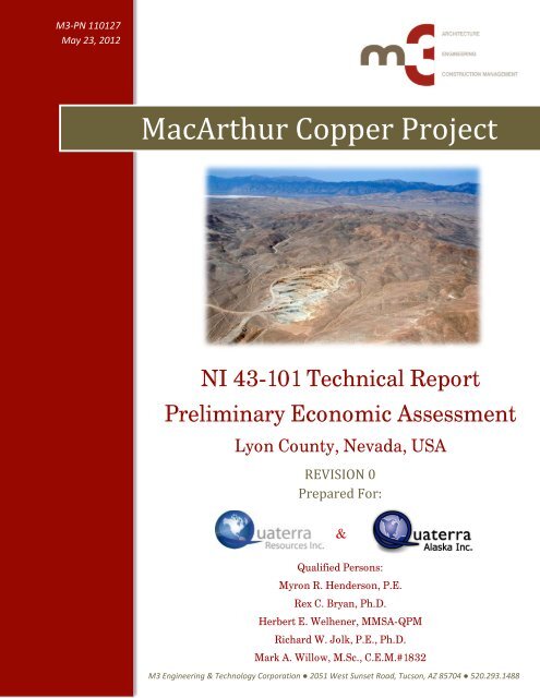
<strong>MacArthur</strong> <strong>Copper</strong> <strong>Project</strong><br />
NI 43-101 Technical Report<br />
Preliminary Economic Assessment<br />
Lyon County, Nevada, USA<br />
REVISION 0<br />
Prepared For:<br />
Qualified Persons:<br />
Myron R. Henderson, P.E.<br />
Rex C. Bryan, Ph.D.<br />
Herbert E. Welhener, MMSA-QPM<br />
Richard W. Jolk, P.E., Ph.D.<br />
Mark A. Willow, M.Sc., C.E.M.#1832<br />
M3 Engineering & Technology Corporation ● 2051 West Sunset Road, Tucson, AZ 85704 ● 520.293.1488<br />
&
MACARTHUR COPPER PROJECT<br />
FORM 43-101F1 PRELIMINARY ECONOMIC ASSESSMENT<br />
DATE AND SIGNATURES PAGE<br />
The Qualified Persons contributing to this report are noted below. The Certificates and Consent<br />
forms of the qualified persons are located in Appendix A, Certificate of Qualified Persons<br />
(“QP”) and Consent of Authors.<br />
• Mr. Myron R. Henderson. P.E.; <strong>Project</strong> Manager with M3Engineering & Technology<br />
Corporation; principal author of this technical report and responsible for Sections 1<br />
through 3, Sections 17 through 19, Sections 21 and 22, and Sections 24 through 26.<br />
• Dr. Rex C. Bryan, Ph.D.; Senior Geostatistician with Tetra Tech MM, <strong>Inc</strong>.; responsible<br />
for Sections 4 through 12, Section 14, and Section 23.<br />
• Mr. Herbert E. Welhener, MMSA-QPM; Vice President of Independent Mining<br />
Consultants, <strong>Inc</strong>.; responsible for Section 16 – Mining Methods.<br />
• Dr. Richard W. Jolk, P.E., Ph.D., Principal Mine Engineer, Metallurgical Engineer, and<br />
Certified Minerals Appraiser with Tetra Tech MM, <strong>Inc</strong>.; responsible for Section 13 -<br />
Mineral Processing and Metallurgical Testing.<br />
• Mr. Mark A. Willow, M.Sc., C.E.M., Practice Leader with SRK Consulting (U.S.), <strong>Inc</strong>.;<br />
responsible for Section 20 – Environmental Studies, Permitting and Social or Community<br />
Impact.<br />
This Technical Report is current as of May 23, 2012<br />
(Signed) “Myron R. Henderson” June 26, 2012<br />
Myron R. Henderson, P.E. Date<br />
(Signed) “Rex C. Bryan” June 26, 2012<br />
Rex C. Bryan, Ph.D. Date<br />
(Signed) “Herbert E. Welhener” June 26, 2012<br />
Herbert E. Welhener, MMSA-QPM Date<br />
(Signed) “Richard W. Jolk” June 25, 2012<br />
Richard W. Jolk, P.E., Ph.D. Date<br />
(Signed) “Mark A. Willow” June 25, 2012<br />
Mark A. Willow, M.Sc., C.E.M. #1832 Date<br />
M3-PN110127<br />
23 May 2012<br />
Revision 0 i
MACARTHUR COPPER PROJECT<br />
FORM 43-101F1 PRELIMINARY ECONOMIC ASSESSMENT<br />
TABLE OF CONTENTS<br />
SECTION PAGE<br />
MACARTHUR COPPER PROJECT<br />
FORM 43-101F1 PRELIMINARY ECONOMIC ASSESSMENT<br />
DATE AND SIGNATURES PAGE ................................................................................................... i<br />
TABLE OF CONTENTS.................................................................................................................... ii<br />
LIST OF FIGURES AND ILLUSTRATIONS ............................................................................... ix<br />
LIST OF TABLES ............................................................................................................................ xii<br />
LIST OF APPENDICES .................................................................................................................. xv<br />
1 SUMMARY ............................................................................................................................. 1<br />
1.1 PROPERTY DESCRIPTION AND OWNERSHIP ............................................................... 1<br />
1.2 HISTORY ....................................................................................................................... 2<br />
1.3 GEOLOGY AND MINERALIZATION .............................................................................. 2<br />
1.3.1 Geophysics ............................................................................................... 3<br />
1.4 EXPLORATION STATUS ................................................................................................ 4<br />
1.4.1 Exploration Drilling Program ............................................................... 4<br />
1.5 RESOURCE ESTIMATE .................................................................................................. 5<br />
1.5.1 Block Model Definition .......................................................................... 5<br />
1.5.2 Assay Database ....................................................................................... 6<br />
1.5.3 Compositing ............................................................................................ 6<br />
1.5.4 Geostatistical Analysis and Variography ............................................. 7<br />
1.5.5 Kriging and Resource Classification .................................................... 7<br />
1.5.6 Estimated <strong>Resources</strong> .............................................................................. 9<br />
1.6 METALLURGY ............................................................................................................ 11<br />
1.7 ECONOMIC ASSESSMENT ........................................................................................... 12<br />
1.8 CONCLUSIONS AND RECOMMENDATIONS................................................................. 13<br />
2 INTRODUCTION ................................................................................................................ 14<br />
2.1 GENERAL .................................................................................................................... 14<br />
2.2 PURPOSE OF REPORT ................................................................................................. 14<br />
2.3 SOURCES OF INFORMATION ...................................................................................... 14<br />
2.4 CONSULTANTS AND QUALIFIED PERSONS ................................................................ 15<br />
2.5 DEFINITION OF TERMS USED IN THIS REPORT ........................................................ 16<br />
M3-PN110127<br />
23 May 2012<br />
Revision 0 ii
MACARTHUR COPPER PROJECT<br />
FORM 43-101F1 PRELIMINARY ECONOMIC ASSESSMENT<br />
3 RELIANCE ON OTHER EXPERTS ................................................................................. 20<br />
4 PROPERTY DESCRIPTION AND LOCATION ............................................................ 21<br />
4.1 LOCATION .................................................................................................................. 21<br />
4.2 PROPERTY OWNERSHIP ............................................................................................. 21<br />
4.3 MINERAL TENURE AND TITLE .................................................................................. 21<br />
4.4 RELEVANT INFORMATION ......................................................................................... 22<br />
5 ACCESSIBILITY, CLIMATE, LOCAL RESOURCES, INFRASTRUCTURE<br />
AND PHYSIOGRAPHY ...................................................................................................... 26<br />
5.1 ACCESSIBILITY ........................................................................................................... 26<br />
5.2 CLIMATE .................................................................................................................... 26<br />
5.3 LOCAL RESOURCES AND INFRASTRUCTURE ............................................................ 26<br />
6 HISTORY .............................................................................................................................. 28<br />
6.1 PROPERTY HISTORY .................................................................................................. 28<br />
6.2 HISTORICAL RESOURCES .......................................................................................... 30<br />
6.3 HISTORIC MINING ..................................................................................................... 30<br />
6.4 HISTORIC METALLURGICAL TESTWORK AND MINERAL PROCESSING .................. 30<br />
7 GEOLOGICAL SETTING AND MINERALIZATION ................................................. 31<br />
7.1 REGIONAL GEOLOGY ................................................................................................ 31<br />
7.2 LOCAL GEOLOGY ...................................................................................................... 33<br />
7.3 PROPERTY GEOLOGY ................................................................................................ 33<br />
7.3.1 Alteration ............................................................................................... 36<br />
7.4 MINERALIZATION ...................................................................................................... 38<br />
8 DEPOSIT TYPES ................................................................................................................. 40<br />
8.1 OXIDE ZONE EXPLORATION ..................................................................................... 43<br />
8.2 CHALCOCITE/OXIDE ZONE EXPLORATION .............................................................. 43<br />
8.3 PRIMARY SULFIDE ZONE EXPLORATION ................................................................. 43<br />
9 EXPLORATION ................................................................................................................... 45<br />
9.1 GEOPHYSICS ............................................................................................................... 45<br />
9.1.1 IP/Resistivity Surveys ........................................................................... 45<br />
9.1.2 Airborne Magnetic Surveys................................................................. 60<br />
10 DRILLING ............................................................................................................................ 63<br />
10.1 HISTORICAL ............................................................................................................... 63<br />
M3-PN110127<br />
23 May 2012<br />
Revision 0 iii
MACARTHUR COPPER PROJECT<br />
FORM 43-101F1 PRELIMINARY ECONOMIC ASSESSMENT<br />
10.2 EXPLORATION & DRILLING HISTORY ...................................................................... 63<br />
10.3 HISTORIC MINING ..................................................................................................... 68<br />
10.4 CURRENT DRILLING .................................................................................................. 68<br />
10.5 SURVEYING DRILL HOLE COLLARS .......................................................................... 69<br />
10.6 DOWNHOLE SURVEYS ................................................................................................ 71<br />
10.7 CURRENT DRILLING METHODS AND DETAILS ......................................................... 71<br />
10.8 REVERSE CIRCULATION DRILLING SAMPLING METHOD ....................................... 72<br />
10.9 CORE DRILLING SAMPLING METHOD ...................................................................... 73<br />
10.10 DRILLING, SAMPLING, AND RECOVERY FACTORS .................................................. 73<br />
10.11 SAMPLE QUALITY ...................................................................................................... 73<br />
11 SAMPLE PREPARATION, ANALYSES AND SECURITY ......................................... 75<br />
11.1 RC SAMPLE PREPARATION AND SECURITY ............................................................. 75<br />
11.2 CORE SAMPLE PREPARATION AND SECURITY ......................................................... 75<br />
11.3 SAMPLE ANALYSIS ..................................................................................................... 76<br />
11.4 LEACH ASSAY ANALYSIS ........................................................................................... 77<br />
11.5 QUALITY CONTROL ................................................................................................... 79<br />
11.6 REVIEW OF ADEQUACY OF SAMPLE PREPARATION, ANALYSES, AND<br />
SECURITY ................................................................................................................... 80<br />
12 DATA VERIFICATION ...................................................................................................... 82<br />
12.1 HISTORIC DATA CHECK ............................................................................................ 82<br />
12.2 CURRENT DATA CHECK ............................................................................................ 82<br />
12.2.1 Adequacy of Data ................................................................................. 84<br />
13 MINERAL PROCESSING AND METALLURGICAL TESTING ............................... 85<br />
13.1 OXIDE ORE COPPER EXTRACTION ........................................................................... 86<br />
13.2 OXIDE ORE ACID CONSUMPTION ............................................................................. 87<br />
13.3 TRANSITION ORE EXTRACTION AND ACID CONSUMPTION ..................................... 87<br />
13.4 LEACH CYCLE TIME .................................................................................................. 88<br />
13.5 LEACH SOLUTION APPLICATION RATE .................................................................... 88<br />
13.6 PAD HEIGHT ............................................................................................................... 89<br />
13.7 PLS FLOW RATE AND PLS GRADE .......................................................................... 89<br />
13.8 PARTICLE SIZE TO HEAP LEACH .............................................................................. 89<br />
13.9 HEAP LEACH DESIGN CRITERIA ............................................................................... 89<br />
M3-PN110127<br />
23 May 2012<br />
Revision 0 iv
MACARTHUR COPPER PROJECT<br />
FORM 43-101F1 PRELIMINARY ECONOMIC ASSESSMENT<br />
14 MINERAL RESOURCE ESTIMATES ............................................................................. 92<br />
14.1 INTRODUCTION .......................................................................................................... 92<br />
14.2 MACARTHUR RESOURCE ESTIMATION .................................................................... 93<br />
14.3 MACARTHUR BLOCK MODEL ................................................................................... 95<br />
14.4 ASSAY DATA ............................................................................................................... 98<br />
14.5 COMPOSITE DATA .................................................................................................... 104<br />
14.6 GEOSTATISTICAL ANALYSIS AND VARIOGRAPHY.................................................. 109<br />
14.7 KRIGING ................................................................................................................... 112<br />
14.8 KRIGING ERROR AND RESOURCE CLASSIFICATION .............................................. 118<br />
14.9 VALIDATION OF BLOCK MODEL: VISUAL AND STATISTICAL CHECKS ................ 122<br />
14.10 MINERAL RESOURCE ESTIMATE ............................................................................ 127<br />
15 MINERAL RESERVE ESTIMATES .............................................................................. 132<br />
16 MINING METHODS ......................................................................................................... 133<br />
16.1 GEOTECHNICAL PARAMETERS ............................................................................... 133<br />
16.2 DILUTION MODELING AND FACTORS ..................................................................... 133<br />
16.3 OPEN PIT MINING .................................................................................................... 133<br />
16.4 MINING SCHEDULE .................................................................................................. 143<br />
16.5 WASTE DUMPS ......................................................................................................... 147<br />
16.6 MINING EQUIPMENT ................................................................................................ 154<br />
16.7 MINE LABOR ............................................................................................................ 155<br />
16.8 MINE CAPITAL COSTS ............................................................................................. 156<br />
16.9 MINE OPERATING COSTS ........................................................................................ 156<br />
17 RECOVERY METHODS .................................................................................................. 158<br />
17.1 OVERVIEW OF PLANNED FACILITIES ...................................................................... 158<br />
17.2 HEAP LEACH PAD .................................................................................................... 158<br />
17.3 SOLVENT EXTRACTION ........................................................................................... 159<br />
17.4 ELECTROWINNING ................................................................................................... 160<br />
17.5 SULFURIC ACID PLANT ............................................................................................ 161<br />
17.6 POWER PLANT .......................................................................................................... 162<br />
17.7 ANCILLARY FACILITIES ........................................................................................... 162<br />
18 PROJECT INFRASTRUCTURE ..................................................................................... 164<br />
18.1 SITE LOCATION ........................................................................................................ 164<br />
M3-PN110127<br />
23 May 2012<br />
Revision 0 v
MACARTHUR COPPER PROJECT<br />
FORM 43-101F1 PRELIMINARY ECONOMIC ASSESSMENT<br />
18.2 PROCESS BUILDINGS ................................................................................................ 164<br />
18.3 ANCILLARY BUILDINGS ........................................................................................... 164<br />
18.3.1 Administration Building .................................................................... 165<br />
18.3.2 Warehouse / Plant Maintenance Building ....................................... 165<br />
18.3.3 Analytical Laboratory ........................................................................ 165<br />
18.3.4 Mine Truck Shop ................................................................................ 165<br />
18.3.5 Change House ..................................................................................... 165<br />
18.3.6 Main Gatehouse .................................................................................. 165<br />
18.3.7 Fuel Storage and Dispensing ............................................................. 166<br />
18.4 ACCESS ROADS......................................................................................................... 166<br />
18.5 RAILROAD FACILITIES............................................................................................. 166<br />
18.6 POWER SUPPLY & DISTRIBUTION ........................................................................... 166<br />
18.7 WATER SUPPLY & DISTRIBUTION .......................................................................... 166<br />
18.8 WASTE MANAGEMENT ............................................................................................ 167<br />
18.9 SURFACE WATER CONTROL ................................................................................... 167<br />
18.10 TRANSPORTATION & SHIPPING............................................................................... 167<br />
18.11 COMMUNICATIONS .................................................................................................. 168<br />
19 MARKET STUDIES AND CONTRACTS ...................................................................... 170<br />
20 ENVIRONMENTAL STUDIES, PERMITTING AND SOCIAL OR<br />
COMMUNITY IMPACT .................................................................................................. 172<br />
20.1 ENVIRONMENTAL LIABILITIES ............................................................................... 172<br />
20.2 PERMITS ................................................................................................................... 172<br />
20.2.1 Federal Permitting .............................................................................. 174<br />
20.2.2 State Permitting .................................................................................. 176<br />
20.2.3 Local Permitting ................................................................................. 178<br />
20.3 ENVIRONMENTAL STUDIES ...................................................................................... 178<br />
20.4 WASTE AND TAILINGS DISPOSAL ............................................................................ 179<br />
20.5 PROJECT PERMITTING REQUIREMENTS ................................................................. 179<br />
20.6 SOCIAL OR COMMUNITY RELATED REQUIREMENTS ............................................ 179<br />
20.7 MINE CLOSURE REQUIREMENTS ............................................................................ 180<br />
21 CAPITAL AND OPERATING COSTS ........................................................................... 182<br />
21.1 CAPITAL COST ......................................................................................................... 182<br />
21.1.1 Mine Capital Cost ............................................................................... 182<br />
21.1.2 SX/EW Capital Cost ........................................................................... 182<br />
21.1.3 Sulfuric Acid Plant Capital Cost....................................................... 185<br />
M3-PN110127<br />
23 May 2012<br />
Revision 0 vi
MACARTHUR COPPER PROJECT<br />
FORM 43-101F1 PRELIMINARY ECONOMIC ASSESSMENT<br />
21.1.4 Exclusions ............................................................................................ 188<br />
21.2 RECLAMATION COST ESTIMATE ............................................................................ 188<br />
21.3 OPERATING COST .................................................................................................... 189<br />
21.3.1 Mine Operating Cost .......................................................................... 190<br />
21.3.2 SX/EW Operating Cost ...................................................................... 190<br />
21.3.3 Sulfuric Acid Plant Operating Cost .................................................. 191<br />
21.3.4 General and Administrative Costs ................................................... 193<br />
22 ECONOMIC ANALYSIS .................................................................................................. 195<br />
22.1 INTRODUCTION ........................................................................................................ 195<br />
22.2 MINE PRODUCTION STATISTICS ............................................................................. 195<br />
22.3 HEAP LEACH PAD AND SX/EW PRODUCTION STATISTICS ................................... 195<br />
22.3.1 Cathode Shipping ............................................................................... 195<br />
22.4 CAPITAL EXPENDITURE ........................................................................................... 196<br />
22.4.1 Initial Capital ...................................................................................... 196<br />
22.4.2 Sustaining Capital .............................................................................. 196<br />
22.4.3 Working Capital ................................................................................. 196<br />
22.4.4 Salvage Value ...................................................................................... 196<br />
22.5 REVENUE .................................................................................................................. 197<br />
22.6 OPERATING COST .................................................................................................... 197<br />
22.7 TOTAL CASH COST .................................................................................................. 197<br />
22.7.1 Royalty ................................................................................................. 197<br />
22.7.2 Reclamation and Closure ................................................................... 198<br />
22.8 DEPRECIATION AND DEPLETION ............................................................................. 198<br />
22.9 TAXATION ................................................................................................................. 198<br />
22.9.1 <strong>Inc</strong>ome Tax and Mineral Tax ............................................................ 198<br />
22.10 PROJECT FINANCING ............................................................................................... 198<br />
22.11 NET INCOME AFTER TAX ........................................................................................ 199<br />
22.12 NPV AND IRR .......................................................................................................... 199<br />
22.13 SENSITIVITIES........................................................................................................... 199<br />
23 ADJACENT PROPERTIES .............................................................................................. 203<br />
23.1 SINGATSE PEAK SERVICES PROPERTIES ................................................................ 203<br />
23.2 OTHER PROPERTIES ................................................................................................ 204<br />
24 OTHER RELEVANT DATA AND INFORMATION ................................................... 207<br />
24.1 RE-PROCESSING OF YERINGTON RESIDUALS ........................................................ 207<br />
M3-PN110127<br />
23 May 2012<br />
Revision 0 vii
MACARTHUR COPPER PROJECT<br />
FORM 43-101F1 PRELIMINARY ECONOMIC ASSESSMENT<br />
24.1.1 Introduction ........................................................................................ 207<br />
24.1.2 Residual <strong>Copper</strong> <strong>Resources</strong> ............................................................... 207<br />
24.1.3 Mining Methods .................................................................................. 209<br />
24.1.4 Capital Cost Summary ....................................................................... 210<br />
24.1.5 Operating Costs .................................................................................. 211<br />
24.1.6 Economic Analysis .............................................................................. 213<br />
25 INTERPRETATION AND CONCLUSIONS ................................................................. 215<br />
25.1 RESOURCES .............................................................................................................. 215<br />
25.2 MINING METHODS ................................................................................................... 215<br />
25.3 METALLURGY .......................................................................................................... 216<br />
25.3.1 Run-of-Mine Heap Leaching ............................................................. 216<br />
25.3.2 Spatial Variability of In-Situ Size Distribution ............................... 216<br />
25.3.3 Chemical Degradation of the Ore during Leaching ....................... 216<br />
25.3.4 Permeability and Agglomeration ...................................................... 217<br />
25.3.5 Spatial Variability of <strong>Copper</strong> Extraction and Acid<br />
Consumption ....................................................................................... 217<br />
25.3.6 Relationship of Total Iron Mineralization to Acid<br />
Consumption ....................................................................................... 217<br />
25.4 ECONOMIC ASSESSMENT ......................................................................................... 217<br />
25.5 RISKS ........................................................................................................................ 218<br />
26 RECOMMENDATIONS ................................................................................................... 219<br />
26.1 METALLURGY TEST PROGRAM .............................................................................. 219<br />
26.1.1 Stage I- Sample Preparation ............................................................. 219<br />
26.1.2 Stage II- Acid Bottle Roll and Acid Characterization Testing ...... 219<br />
26.1.3 Stage III- Small Column Leach Tests .............................................. 220<br />
26.1.4 Stage IV- Large Column Leach Tests .............................................. 220<br />
26.1.5 Stage V- Study Preparation and Recommendations for a<br />
Final Feasibility ................................................................................... 220<br />
26.2 BUDGET AND SCHEDULE .......................................................................................... 220<br />
27 REFERENCES.................................................................................................................... 222<br />
APPENDIX A: CERTIFICATE OF QUALIFIED PERSON (“QP”) AND CONSENT<br />
OF AUTHOR ...................................................................................................................... 224<br />
APPENDIX B: PROPERTY LISTING ........................................................................................ 240<br />
APPENDIX C: EXPLORATION HISTORY OF THE MACARTHUR OXIDE<br />
COPPER PROPERTY ....................................................................................................... 255<br />
APPENDIX D: EXPLORATION DRILL HOLES WITH INTERCEPTS ............................. 260<br />
APPENDIX E: RESOURCE MODEL DRILL HOLE LISTING ............................................ 300<br />
M3-PN110127<br />
23 May 2012<br />
Revision 0 viii
MACARTHUR COPPER PROJECT<br />
FORM 43-101F1 PRELIMINARY ECONOMIC ASSESSMENT<br />
LIST OF FIGURES AND ILLUSTRATIONS<br />
FIGURE DESCRIPTION PAGE<br />
Figure 1-1: <strong>Quaterra</strong> Exploration Drilling by Year .........................................................................4<br />
Figure 4-1: General Location Map ................................................................................................23<br />
Figure 4-2: Regional Layout May..................................................................................................24<br />
Figure 4-3: <strong>MacArthur</strong> Property May ............................................................................................25<br />
Figure 6-1: Major Physiographic Features ....................................................................................29<br />
Figure 7-1: Regional Geology .......................................................................................................32<br />
Figure 7-2: Generalized Alteration Types .....................................................................................38<br />
Figure 8-1: Datamine© View of Resource Block Model Looking West ......................................40<br />
Figure 8-2: East-West Section 14,691,000N (Looking North) ......................................................41<br />
Figure 8-3: North- South Section 2,438,324 (Looking West) .......................................................42<br />
Figure 9-1: IPR line locations over the central <strong>MacArthur</strong> <strong>Project</strong> area. ......................................47<br />
Figure 9-2: Line 4300 (304300E) IP pseudo-section and inverted phase/depth model .................48<br />
Figure 9-3: Line 4300 Resistivity pseudo-section and inverted resistivity/depth model...............49<br />
Figure 9-4: Line 4900 IP pseudo-section and inverted phase/depth model ...................................50<br />
Figure 9-5: Line 4900 Resistivity pseudo-section and inverted resistivity/depth model...............51<br />
Figure 9-6: Line 7500 IP pseudo-section and inverted phase/depth model ...................................52<br />
Figure 9-7: Line 7500 Resistivity pseudo-section and inverted resistivity/depth model...............53<br />
Figure 9-8: QM-164 down hole electrode to remote electrode transmitter pair ............................54<br />
Figure 9-9: QM-177 down hole electrode to remote electrode transmitter pair ............................55<br />
Figure 9-10: Line location of the 1960’s Kennecott lines (in black) and the 2009 replacement line<br />
(in white). ...............................................................................................................57<br />
Figure 9-11: Historic and 2009 IP data on a modeled magnetic susceptibility depth slice ...........58<br />
Figure 9-12: Inversion model and pseudo-sections for line 6075 recorded in 2009. ....................59<br />
Figure 9-13: Location of the 2012 detailed helicopter magnetic survey .......................................61<br />
Figure 10-1: Location of Historic Drill holes ................................................................................65<br />
Figure 10-2: Drill hole Location Map ............................................................................................70<br />
Figure 10-3: <strong>Quaterra</strong> Exploration Drilling by Year .....................................................................72<br />
Figure 10-4: Letter from Mr. Henry Koehler .................................................................................74<br />
Figure 11-1: <strong>MacArthur</strong> Check Assay Results ..............................................................................80<br />
Figure 11-2: Reviewing Established Protocol for Data Entry .......................................................80<br />
M3-PN110127<br />
23 May 2012<br />
Revision 0 ix
MACARTHUR COPPER PROJECT<br />
FORM 43-101F1 PRELIMINARY ECONOMIC ASSESSMENT<br />
Figure 11-3: Manually Creating Geologic Sections from the Drill Data .......................................81<br />
Figure 12-1: Twin Hole Charted Results .......................................................................................84<br />
Figure 13-1: Comparison of Grade versus <strong>Copper</strong> Recovery Oxide Leach Ore ...........................86<br />
Figure 14-1: Drill Location and Search Zones for the <strong>MacArthur</strong> 2011 Model ............................95<br />
Figure 14-2: Side-by-Side Histograms – TCu% Assay SE-PIT area and NW-OUT area ...........104<br />
Figure 14-3: Side-by-Side Histograms – TCu% Composites SE-PIT area & NW area ..............109<br />
Figure 14-4: 0.12% Indicator Variograms (Omni Direction) For NW-Out and SE-Pit Areas ....110<br />
Figure 14-5: Selected Cu% Correlograms For SE-Pit And NW-Out Areas ................................111<br />
Figure 14-6: Side-by-Side Histograms M&I vs INF for (a) SE and (b) NW-Out .......................117<br />
Figure 14-7: Probability plot of kriging error ..............................................................................119<br />
Figure 14-8: Jackknife Method of Model Validation ..................................................................120<br />
Figure 14-9: Jackknife validation of kriging model (SE Area, MinZones 10 and 11) ................121<br />
Figure 14-10: Side-by-Side Samples, Composites and Blocks ...................................................122<br />
Figure 14-11: East West Cross Section Looking North (Cu blocks) ...........................................123<br />
Figure 14-12: East-West Cross Section Looking North (Resource Class) ..................................124<br />
Figure 14-13: North-South Cross Section Looking West (Cu Blocks) .......................................125<br />
Figure 14-14: North South Cross Section Looking West (Resource Class) ................................126<br />
Figure 16-1: Final Pits .................................................................................................................136<br />
Figure 16-2: Mining Phase 1 in <strong>MacArthur</strong> Pit ...........................................................................137<br />
Figure 16-3: Mining Phase 2 in <strong>MacArthur</strong> Pit ...........................................................................138<br />
Figure 16-4: Mining Phase 3 in North Pit Area ...........................................................................139<br />
Figure 16-5: Mining Phase 4 in North Pit Area ...........................................................................140<br />
Figure 16-6: Mining Phase 5 (Gallagher Pit) ...............................................................................141<br />
Figure 16-7: Mining Phase 6 in <strong>MacArthur</strong> Pit ...........................................................................142<br />
Figure 16-8: Final Pit and Dumps (including pit backfill) ..........................................................148<br />
Figure 16-9: End of Year 1 ..........................................................................................................149<br />
Figure 16-10: End of Year 3 ........................................................................................................150<br />
Figure 16-11: End of Year 5 ........................................................................................................151<br />
Figure 16-12: End of Year 7 ........................................................................................................152<br />
Figure 16-13: End of Year 10 ......................................................................................................153<br />
Figure 17-1: Overall Process Flowsheet ......................................................................................163<br />
Figure 18-1: <strong>MacArthur</strong> Heap Leach and Process Facilities .......................................................169<br />
M3-PN110127<br />
23 May 2012<br />
Revision 0 x
MACARTHUR COPPER PROJECT<br />
FORM 43-101F1 PRELIMINARY ECONOMIC ASSESSMENT<br />
Figure 19-1: Historic <strong>Copper</strong> Price ..............................................................................................170<br />
Figure 22-1: <strong>MacArthur</strong> <strong>Project</strong> NPV Sensitivities .....................................................................200<br />
Figure 23-1: Adjacent Properties .................................................................................................206<br />
Figure 24-1: Yerington Mine Residuals ......................................................................................214<br />
M3-PN110127<br />
23 May 2012<br />
Revision 0 xi
MACARTHUR COPPER PROJECT<br />
FORM 43-101F1 PRELIMINARY ECONOMIC ASSESSMENT<br />
LIST OF TABLES<br />
TABLE DESCRIPTION PAGE<br />
Table 1-1: Exploration Drilling History ..........................................................................................2<br />
Table 1-2: <strong>MacArthur</strong> Model Parameters ........................................................................................5<br />
Table 1-3: MinZone Codes and Density ..........................................................................................6<br />
Table 1-4: Kriging and Search Parameters ......................................................................................8<br />
Table 1-5: Measured + Indicated <strong>Copper</strong> <strong>Resources</strong> .....................................................................10<br />
Table 1-6: Inferred <strong>Copper</strong> <strong>Resources</strong> ...........................................................................................11<br />
Table 10-1: Historic Exploration Drilling......................................................................................63<br />
Table 10-2: U.S. Bureau of Mines 1947-1950 Drilling Highlights ...............................................64<br />
Table 10-3: Anaconda Company 1955-1957 Drilling Highlights .................................................66<br />
Table 10-4: Pangea Exploration 1987-1991 Drilling Highlights ...................................................67<br />
Table 11-1: Sequential <strong>Copper</strong> Leach Assay Results ....................................................................78<br />
Table 11-2: Ferric Sulfate Leach (QLT) Assay Results ................................................................79<br />
Table 11-3: <strong>MacArthur</strong> 2011 QA/QC Program Results ................................................................79<br />
Table 12-1: List of Twin Holes Drilled By <strong>Quaterra</strong> .....................................................................83<br />
Table 13-1: <strong>MacArthur</strong> Historical Test Work ...............................................................................91<br />
Table 14-1: <strong>MacArthur</strong> Model Parameters ....................................................................................95<br />
Table 14-2: MinZone Codes and Density ......................................................................................96<br />
Table 14-3: MinZone Interval Data Count and Drill hole Assay Statistics ...................................97<br />
Table 14-4: Statistics of Cu Assay Data (All Areas) .....................................................................99<br />
Table 14-5: SE-Pit Area Cu Assay Statistics ...............................................................................102<br />
Table 14-6: NW Area TCu Assay Statistics ................................................................................103<br />
Table 14-7: MinZone Composite Count (All Areas) ...................................................................105<br />
Table 14-8: All Cu Assay Statistics for <strong>Quaterra</strong> Composites ....................................................106<br />
Table 14-9: SE Area Cu Assay Statistics for <strong>Quaterra</strong> Composites ............................................107<br />
Table 14-10: NW Area Cu Assay Statistics for <strong>Quaterra</strong> Composites ........................................108<br />
Table 14-11: Variogram and Search Parameters .........................................................................112<br />
Table 14-12: MinZone Block Count (All Areas) .........................................................................113<br />
Table 14-13: SE-Pit and NW Areas Cu Block Statistics .............................................................114<br />
Table 14-14: SE Area Cu Block Statistics ...................................................................................115<br />
M3-PN110127<br />
23 May 2012<br />
Revision 0 xii
MACARTHUR COPPER PROJECT<br />
FORM 43-101F1 PRELIMINARY ECONOMIC ASSESSMENT<br />
Table 14-15: NE Area Cu Block Statistics ..................................................................................116<br />
Table 14-16: Measured <strong>Copper</strong> <strong>Resources</strong> ..................................................................................128<br />
Table 14-17: Indicated <strong>Copper</strong> <strong>Resources</strong> ...................................................................................129<br />
Table 14-18: Measured + Indicated <strong>Copper</strong> <strong>Resources</strong> ...............................................................130<br />
Table 14-19: Inferred <strong>Copper</strong> <strong>Resources</strong> .....................................................................................131<br />
Table 16-1: Pit Definition Inputs .................................................................................................134<br />
Table 16-2: Floating Cone Geometries Used for Pit Designs......................................................135<br />
Table 16-3: Phase Tonnage and Grade Available for Mine Production Schedule ......................135<br />
Table 16-4: Production Schedule .................................................................................................143<br />
Table 16-5: Ore Production Schedule by Mining Phase ..............................................................144<br />
Table 16-6: Ore Production Schedule by Mining Phase and Resource Classification ................145<br />
Table 16-7: Waste Tonnage by Source and Destination ..............................................................147<br />
Table 16-8: Mine Equipment .......................................................................................................155<br />
Table 16-9: Mine Capital Estimate ..............................................................................................156<br />
Table 16-10: Mine Operating Costs .............................................................................................157<br />
Table 18-1: Products & Consumables .........................................................................................168<br />
Table 20-1: Summary of Major Permits for Future Mining ........................................................173<br />
Table 20-2: Future Baseline Studies ............................................................................................176<br />
Table 21-1: SX/EW Capital Cost .................................................................................................182<br />
Table 21-2: SX/EW Sustaining Capital .......................................................................................183<br />
Table 21-3: Sulfuric Acid Plant Capital Cost ..............................................................................186<br />
Table 21-4: Reclamation Cost Estimate ......................................................................................189<br />
Table 21-5: <strong>MacArthur</strong> SX/EW and Mine Operating Cost .........................................................190<br />
Table 21-6: SX/EW Operating Cost ............................................................................................190<br />
Table 21-7: Reagent Cost.............................................................................................................191<br />
Table 21-8: Sulfuric Acid Plant Operating Cost ..........................................................................192<br />
Table 21-9: General & Administrative Cost Summary ...............................................................193<br />
Table 21-10: General & Administrative Labor Cost Summary ...................................................194<br />
Table 22-1: Life of Mine Ore, Waste Quantities, and Ore Grade ................................................195<br />
Table 22-2: Initial Capital ............................................................................................................196<br />
Table 22-3: Life of Mine Operating Cost ....................................................................................197<br />
Table 22-4: Economic Indicators .................................................................................................199<br />
M3-PN110127<br />
23 May 2012<br />
Revision 0 xiii
MACARTHUR COPPER PROJECT<br />
FORM 43-101F1 PRELIMINARY ECONOMIC ASSESSMENT<br />
Table 22-5: Sensitivity Analysis ..................................................................................................199<br />
Table 22-6: Discounted Cash Flow Model ..................................................................................201<br />
Table 23-1: Singatse Peak Services, LLC – Yerington Mine <strong>Resources</strong>, Feb. 2012 ..................203<br />
Table 23-2: Yerington Mine Residual <strong>Copper</strong> <strong>Resources</strong>, SRK March, 2012 (Non NI43-101<br />
Compliant) ...........................................................................................................204<br />
Table 23-3: Adjacent Property Resource Estimates ....................................................................205<br />
Table 24-1: Yerington Residual Oxide <strong>Copper</strong> <strong>Resources</strong>, SRK March 2012 ............................209<br />
Table 24-2: Combined Yerington Oxide Residuals / <strong>MacArthur</strong> Mine Capital & Sustaining<br />
Costs .....................................................................................................................211<br />
Table 24-3: Combined Yerington Oxide Residuals / <strong>MacArthur</strong> Mine Operating Costs............212<br />
Table 24-4: Combined Yerington Oxide Residuals / <strong>MacArthur</strong> Mine Economic Indicators ....213<br />
Table 26-1: Budget for <strong>MacArthur</strong> Follow on Test Work ...........................................................221<br />
M3-PN110127<br />
23 May 2012<br />
Revision 0 xiv
MACARTHUR COPPER PROJECT<br />
FORM 43-101F1 PRELIMINARY ECONOMIC ASSESSMENT<br />
APPENDIX DESCRIPTION<br />
LIST OF APPENDICES<br />
A Certificate of Qualified Person (“QP”) and Consent of Author<br />
B Property Listing<br />
C Exploration History of the <strong>MacArthur</strong> Oxide <strong>Copper</strong> Property<br />
D Exploration Drill Holes with Intercepts<br />
E Resource Model Drill Hole Listing<br />
M3-PN110127<br />
23 May 2012<br />
Revision 0 xv
MACARTHUR COPPER PROJECT<br />
FORM 43-101F1 PRELIMINARY ECONOMIC ASSESSMENT<br />
1 SUMMARY<br />
<strong>Quaterra</strong> Alaska, <strong>Inc</strong>. (<strong>Quaterra</strong>), a wholly owned subsidiary of <strong>Quaterra</strong> <strong>Resources</strong>, <strong>Inc</strong>.<br />
commissioned M3 Engineering and Technology Corporation (M3) to prepare a Canadian<br />
National Instrument 43-101 (NI 43-101) compliant Preliminary Economic Assessment (PEA) for<br />
the <strong>MacArthur</strong> <strong>Copper</strong> <strong>Project</strong> in Lyon County, Nevada. Tetra Tech <strong>Inc</strong>. (Tt) and Independent<br />
Mining Consultants, <strong>Inc</strong>. (IMC) prepared several sections of the PEA. This report includes an<br />
update of the January 2011 <strong>MacArthur</strong> technical report and reflects changes to the resource<br />
estimate as a result of the 2011 exploration drilling and continued geologic investigations.<br />
The Qualified Person for Sections 4 through 12, Section 14, and Section 23 of this report is Mr.<br />
Rex Bryan, PhD, Senior Geostatistician for Tetra Tech, Golden Colorado. The Qualified Person<br />
for Section 13 of this report is Mr. Richard W. Jolk, P.E., PhD, Principal Minerals Engineer for<br />
Tetra Tech, Golden Colorado. The Qualified Person for Section 16 of this report is Mr. Herb<br />
Welhener, Principal Mining Engineer for Independent Mining Consultants, <strong>Inc</strong>., Tucson,<br />
Arizona.<br />
The <strong>MacArthur</strong> <strong>Copper</strong> Property is located near the geographic center of Lyon County, Nevada,<br />
USA along the northeastern flank of the Singatse Range approximately seven miles northwest of<br />
the town of Yerington, Nevada. The property is accessible from Yerington by approximately five<br />
miles of paved roads and two miles of maintained gravel road. Topographic coverage is on US<br />
Geological Survey “Mason Butte” and “Lincoln Flat” 7.5’ topographic quadrangles. The nearest<br />
major city is Reno, Nevada approximately 75 miles to the northwest.<br />
The Preliminary Economic Assessment within this Technical Report is based upon the oxide /<br />
chalcocite portion of the updated resource. This oxide / chalcocite portion includes a measured<br />
and indicated resource of 159.1 million tons averaging 0.21% Cu (percent total copper or TCu)<br />
containing 676 million pounds of copper at a 0.12% Cu cutoff and an inferred resource of 243<br />
million tons averaging 0.20% Cu at a 0.12% Cu cutoff containing 980 million pounds of copper.<br />
It should also be noted that integration of some 120 million tons of resource piles (non-compliant<br />
NI 43-101 “Residuals”) from <strong>Quaterra</strong> <strong>Resources</strong> 2011 acquisition of the historic, neighboring<br />
Yerington copper mine, could provide a significant positive impact on the economics of the<br />
<strong>MacArthur</strong> <strong>Project</strong>. Residuals consist of oxide-copper bearing sub-grade material representing<br />
stripped material from the Yerington mine, vat leach tailings representing oxide tailings from<br />
copper oxide vat leaching, and partially leached tailings and ore previously mined by Arimetco.<br />
The residuals are currently being characterized to elevate to a NI 43-101 status.<br />
1.1 PROPERTY DESCRIPTION AND OWNERSHIP<br />
The <strong>MacArthur</strong> <strong>Copper</strong> Property is located near the geographic center of Lyon County, Nevada,<br />
USA along the northeastern flank of the Singatse Range approximately seven miles northwest of<br />
the town of Yerington, Nevada. The property is accessible from Yerington by approximately five<br />
miles of paved roads and two miles of Lyon County maintained gravel road. Topographic<br />
coverage is on US Geological Survey “Mason Butte” and “Lincoln Flat” 7.5’ topographic<br />
quadrangles. The nearest major city is Reno, Nevada approximately 75 miles to the northwest.<br />
M3-PN110127<br />
23 May 2012<br />
Revision 0 1
MACARTHUR COPPER PROJECT<br />
FORM 43-101F1 PRELIMINARY ECONOMIC ASSESSMENT<br />
The property consists of 470 unpatented lode claims totaling approximately 9700 acres on lands<br />
administered by the US Department of Interior - Bureau of Land Management (BLM). All<br />
required annual payments to the BLM and Lyon County have been paid in a timely manner and<br />
the claims are current.<br />
1.2 HISTORY<br />
Over the history of the project, previous operators have contributed more than 300 holes to the<br />
current drill hole database. Table 1-1 summarizes the exploration history of the <strong>MacArthur</strong> area.<br />
Of the historic holes, 280 of those holes drilled by the Anaconda Company (Anaconda) during<br />
1972-73 have been deemed acceptable under NI 43-101 standards and have been used during the<br />
resource estimation.<br />
Operator<br />
Table 1-1: Exploration Drilling History<br />
MACARTHUR PROJECT<br />
February 2009<br />
Drill Program<br />
Date Range<br />
Number of<br />
Holes Drilled<br />
Feet Drilled<br />
U.S. Bureau of Mines 1947-50 8 3,414<br />
Anaconda Company 1955-57 14 3,690<br />
Bear Creek Mining Company 1963-?? ~14 Unknown<br />
Superior Oil Company 1967-68 11 13,116<br />
Anaconda Company 1972-73 280 55,809<br />
Pangea Explorations, <strong>Inc</strong>. 1987-1991 15 2,110<br />
Arimetco International, <strong>Inc</strong>. Unknown Unknown Unknown<br />
Total ~342 ~78,139<br />
1.3 GEOLOGY AND MINERALIZATION<br />
The <strong>MacArthur</strong> property is one of several copper deposits and prospects located near the town of<br />
Yerington that collectively comprise the Yerington Mining District. The property is underlain by<br />
Middle Jurassic granodiorite and quartz monzonite intruded by west-northwesterly-trending,<br />
moderate to steeply north-dipping quartz porphyry dike swarms. These dikes host a large portion<br />
of the primary copper mineralization at the nearby Yerington mine and are associated with all<br />
porphyry copper occurrences in the district.<br />
The <strong>MacArthur</strong> copper deposit consists of a 50-150 foot thick, tabular zone of secondary copper<br />
(oxides and/or chalcocite) covering an area of approximately two square miles. This mineralized<br />
zone has yet to be fully delineated and remains open to the west and north. Limited drilling has<br />
also intersected underlying primary copper mineralization open to the north, but only partially<br />
tested to the west and east.<br />
M3-PN110127<br />
23 May 2012<br />
Revision 0 2
MACARTHUR COPPER PROJECT<br />
FORM 43-101F1 PRELIMINARY ECONOMIC ASSESSMENT<br />
Oxide copper mineralization is most abundant and particularly well exposed in the walls of the<br />
<strong>MacArthur</strong> pit. The most common copper mineral is chrysocolla; also present is black copper<br />
wad (neotocite) and trace cuprite and tenorite. The flat-lying zones of oxide copper mirror<br />
topography, exhibit strong fracture control and range in thickness from 50 to 100 feet. Secondary<br />
chalcocite mineralization forms a blanket up to 50 feet or more in thickness that is mixed with<br />
and underlies the oxide copper. Primary chalcopyrite mineralization has been intersected in<br />
several locations mixed with and below the chalcocite. The extent of the primary copper is<br />
unknown as many of the drill holes bottomed at 400 feet or less. The primary copper is currently<br />
not included in the mine plan for the PEA.<br />
The <strong>MacArthur</strong> deposit is part of a large, partially defined porphyry copper system that has been<br />
complicated by complex faulting and post-mineral tilting. Events leading to the current geometry<br />
and distribution of known mineralization include 1) Middle Jurassic emplacement of primary<br />
porphyry copper mineralization by quartz monzonite dikes intruding the Yerington Batholith; 2)<br />
Late Tertiary westward tilting of the porphyry deposit 60-90° by Basin and Range extensional<br />
faulting; 3) secondary (supergene) enrichment resulting in the formation of a widespread, tabular<br />
zone of secondary chalcocite mineralization below outcrops of oxidized rocks called leached<br />
cap; 4) oxidation of outcropping and near-surface parts of this chalcocite blanket, as well as<br />
oxidation of the primary porphyry sulfide system.<br />
1.3.1 Geophysics<br />
<strong>Quaterra</strong> contracted three surveys at the <strong>MacArthur</strong> <strong>Project</strong> in 2011 and 2012. A borehole<br />
geophysical survey and a surface IP/resistivity (IPR) survey were carried out by Zonge<br />
International in 2011, and a detailed helicopter magnetic survey was flown by Geosolutions Pty.<br />
Ltd. in 2012. These surveys supplement previous geophysical work on the property that includes:<br />
a 2009 IPR survey carried out by Zonge; a 2007 helicopter magnetic survey carried out by<br />
EDCON-PRJ; a series of historic aeromagnetic surveys (1966 to 1975) available in analog form<br />
from the Anaconda Archives; and a series of historic IPR surveys (1963 – 1964) carried out by<br />
Kennecott Exploration Services/Bear Creek Mining Company and Superior Oil.<br />
The mineralized system at <strong>MacArthur</strong> has an anomalous IP and resistivity response first detected<br />
in the Kennecott and Superior Oil IPR surveys in the 1960’s. The <strong>Quaterra</strong> 2009 and 2011 IPR<br />
surveys confirmed the reliability of the earlier surveys and further defined the depth extent of the<br />
IP anomalies. The 2009 and 2011 <strong>Quaterra</strong> surveys confirmed that the 1963-64 Kennecott data is<br />
of good quality and is useful for mapping anomalous IP zones within the upper 1,000-1,200 feet<br />
from the surface. Below this depth, the older data cannot effectively resolve the bottom of the IP<br />
anomalies nor determine if any of the anomalies extend to great depths.<br />
The 2009 and 2011 data sets show this increased depth of exploration is important. Portions of<br />
the IP response are flat lying with limited depth extent. However both the 2009 and 2011 surveys<br />
have identified anomalous IP responses with depth extent in excess of 2000 feet and possibly<br />
feeder zones of the near surface zones. In 2011 two borehole IP surveys were run that<br />
demonstrate <strong>Quaterra</strong>’s ability to explore for deep sulfide responses below the depth of<br />
exploration of surface techniques. The modern data maps subtle low resistivity features which<br />
are interpreted to be porphyry alteration systems and have identified anomalous IP responses that<br />
M3-PN110127<br />
23 May 2012<br />
Revision 0 3
MACARTHUR COPPER PROJECT<br />
FORM 43-101F1 PRELIMINARY ECONOMIC ASSESSMENT<br />
extend under post-mineral volcanic cover to the north and west of the main <strong>MacArthur</strong> system.<br />
These buried anomalies are high priority drill targets.<br />
Two high resolution helicopter magnetic surveys were flown over the <strong>MacArthur</strong> <strong>Project</strong> in 2007<br />
(EDCON-PRJ) and 2012 (Geosolutions). The modern, high resolution data has a broad<br />
frequency bandwidth and will be used for 3D modeling and exploring beneath the magnetic<br />
volcanic cover.<br />
1.4 EXPLORATION STATUS<br />
1.4.1 Exploration Drilling Program<br />
<strong>Quaterra</strong> has completed 204,656 feet of drilling in 401 holes since beginning drilling in 2007.<br />
Core holes total 40,233 feet in 58 holes and reverse circulation holes total 164,423 feet in 343<br />
holes. (Note that one previously listed, but abandoned 115 foot drill hole, has now been removed<br />
from the database and reported totals). Figure 1-1 show <strong>Quaterra</strong>'s yearly exploration drilling<br />
footage by year.<br />
Figure 1-1: <strong>Quaterra</strong> Exploration Drilling by Year<br />
<strong>Quaterra</strong>’s initial objective was to verify and expand the <strong>MacArthur</strong> oxide resource as had been<br />
defined by the 1972-1973 Anaconda drilling program and, importantly, to follow up chalcocite<br />
intercepts in several Anaconda holes as well as in a few outlying early 1960’s holes drilled by<br />
Bear Creek Mining Company, in late 1960’s drilling by Superior Oil, and holes drilled by the US<br />
M3-PN110127<br />
23 May 2012<br />
Revision 0 4
MACARTHUR COPPER PROJECT<br />
FORM 43-101F1 PRELIMINARY ECONOMIC ASSESSMENT<br />
Bureau of Mines in 1950. <strong>Quaterra</strong>’s drilling through 2010 successfully expanded the oxide<br />
mineralization outbound from the <strong>MacArthur</strong> pit and encountered a widespread, underlying<br />
tabular blanket of mixed oxide-chalcocite mineralization as well as primary copper intercepts<br />
that remain incompletely tested.<br />
During 2011, exploration and infill drilling focused north of the <strong>MacArthur</strong> pit where earlier<br />
drilling encountered better grades of oxide and chalcocite mineralization. Holes were angled<br />
both southerly and northerly to test high angle fractures common in the west-northwest structural<br />
grain. Strong chalcocite and chalcopyrite mineralization was intersected in several holes in the<br />
North Ridge zone including QM-183: 1.37% Cu over 40 feet and QM-187: 1.66% Cu over 90’.<br />
These results were followed by a tightened drill spacing from 500 feet to 250 feet over an<br />
approximate 2,500 feet by 2,500 feet area north of the <strong>MacArthur</strong> pit, forming the basis for the<br />
2011 resource.<br />
Deep drilling north of the North Ridge Zone intersected significant primary sulfide<br />
mineralization grading 1.32% Cu over 64 feet in hole QM-164 which is open to the north and<br />
partially open to the west and east. Although the mineralization at <strong>MacArthur</strong> has yet to be<br />
completely closed off to the west and north, the 2011 drilling program expanded and in-filled<br />
earlier drill results and defined the footprint for the mineral resource estimation published in this<br />
document.<br />
1.5 RESOURCE ESTIMATE<br />
An updated mineral resource estimate has been generated using drill hole sample assays results<br />
and the interpretation of a geologic model which relates to the spatial distribution of copper in<br />
the <strong>MacArthur</strong> deposit. Interpolation characteristics have been defined based on geology, drill<br />
hole spacing and geostatistical analysis of the data.<br />
1.5.1 Block Model Definition<br />
The block model parameters for <strong>MacArthur</strong> were defined to best reflect both the drill hole<br />
spacing and current geologic model. Table 1-2 shows the block model parameters used for the<br />
2011 estimates.<br />
Table 1-2: <strong>MacArthur</strong> Model Parameters<br />
<strong>MacArthur</strong> East Model Parameters X (Columns) Y (Rows) Z (Levels)<br />
Origin (lower left corner): 2,429,300 14,685,800 2,800<br />
Block size (feet) 25 25 20<br />
Number of Blocks 548 400 150<br />
Rotation 0 degrees azimuth from North to left boundary<br />
Composite Length 10 feet (Zone)<br />
M3-PN110127<br />
23 May 2012<br />
Revision 0 5
MACARTHUR COPPER PROJECT<br />
FORM 43-101F1 PRELIMINARY ECONOMIC ASSESSMENT<br />
1.5.2 Assay Database<br />
An Excel database provided by <strong>Quaterra</strong> contained the pertinent drill hole and assay information<br />
for the <strong>MacArthur</strong> <strong>Copper</strong> deposit. The database contained 737 drill holes of which 676 drill<br />
holes from <strong>Quaterra</strong> and Anaconda (sometimes referred to as the Metech holes) were used. The<br />
61 holes removed included holes with limited or no information on the assays (Pangea Gold<br />
1991, Superior, USBM 1952, Anaconda 1955-57), and six <strong>Quaterra</strong> holes outside the model<br />
limits. Of the 676 holes used, there are 280 Anaconda (Metech) RC holes and 396 <strong>Quaterra</strong> holes<br />
(58 core and 338 RC holes). These drill holes traversed 257,895 feet, producing 51,258 total<br />
copper sample assay values at a nominal five feet in length.<br />
A total of 151 drill holes totaling 80,800 feet were added to the database used for the resource<br />
estimation. These included two holes for which data was unavailable at the time of the last<br />
estimate, but did not include three 2011 holes which were outside the model limits.<br />
The variables available in the database are for total copper from <strong>Quaterra</strong> and Anaconda<br />
intervals, and acid-soluble copper, a limited number of ferric sulfate soluble (QLT) copper<br />
assays and a very limited number of cyanide leach copper assays from <strong>Quaterra</strong> holes.<br />
1.5.3 Compositing<br />
The assay data was composited using a 10-foot “zone method”. The zone method is a variant of<br />
down hole compositing, with the distinction that the composite begins as the drill interval enters<br />
a rock code zone. This method tends to reduce averaging composites across zones. The process<br />
first used DataMine ® to assign a MinZone to each 25x25x20-foot block within the model<br />
specified in Table 1-3. When the majority of a block fell within the interpreted MinZone<br />
wireframe it was assigned the appropriate code. These coded blocks were then imported into<br />
MicroModel ® and used to “back-mark” each composite using a simple majority rule. No capping<br />
was applied. Table 1-3 presents the MinZone codes used in the model. Initial codes of alluvium,<br />
oxide, oxide and chalcocite mix, and sulfide were 10, 20 and 30 respectively. These codes were<br />
altered by the addition of 1 if the assays, composites or blocks fell within a 0.12% Cu grade<br />
envelope predicted by indicator kriging. The codes were also altered by the addition of 100 if the<br />
data was within a modeled dike.<br />
Table 1-3: MinZone Codes and Density<br />
MinZone Code Description Density (cu.ft/ton)<br />
0 Air and previously mined pit<br />
Air (0) and Mined<br />
(12.5)<br />
5, 6, 105, 106 Alluvium 12.5<br />
10, 11, 110, 111 Oxide zone 12.5<br />
20, 21, 120, 121 Chalcocite mix zone 12.5<br />
30, 31, 130, 131 Sulfide zone 12.5<br />
9999 Undefined 12.5<br />
M3-PN110127<br />
23 May 2012<br />
Revision 0 6
MACARTHUR COPPER PROJECT<br />
FORM 43-101F1 PRELIMINARY ECONOMIC ASSESSMENT<br />
1.5.4 Geostatistical Analysis and Variography<br />
A total of twenty-two (21 directional and a omni-directional) variograms were calculated using<br />
MicroModel® for each MinZone within each area. The program searches along each direction<br />
for data pairs within a 12.5-degree window angle and 5-feet tolerance band. All experimental<br />
variograms are inspected so that spatial continuity along a primary, secondary and tertiary<br />
direction can be modeled.<br />
Each variogram model was then validated using the “jackknifing” method. This method<br />
sequentially removes values and then uses the remaining composites to krige the missing value<br />
using the proposed variogram.<br />
1.5.5 Kriging and Resource Classification<br />
Table 1-4 presents the search and kriging parameters employed in the resource model. The<br />
composite and block codes were used to determine which composites were selected to estimate a<br />
particular block.<br />
M3-PN110127<br />
23 May 2012<br />
Revision 0 7
MACARTHUR COPPER PROJECT<br />
FORM 43-101F1 PRELIMINARY ECONOMIC ASSESSMENT<br />
Table 1-4: Kriging and Search Parameters<br />
Tt used a two-part approach to classify the total copper resources. This approach takes into<br />
account the spatial distribution of the drilling, the distance to the nearest data points used to<br />
estimate a block, and finally the relative kriging error generated by the estimate. Tt has found<br />
this approach to be very robust and provide highly reproducible results. The following points<br />
detail this approach:<br />
1. A measured block requires 16 samples, with a maximum of five samples per sector in a<br />
six sector search pattern and a maximum of 2 composites coming from a single drill hole.<br />
This implies that in most cases, for a block to be classified as measured there must be a<br />
least 8 drill holes in four cardinal directions.<br />
M3-PN110127<br />
23 May 2012<br />
Revision 0 8
MACARTHUR COPPER PROJECT<br />
FORM 43-101F1 PRELIMINARY ECONOMIC ASSESSMENT<br />
2. The constraints for an indicated block are not as stringent for a measured block. An<br />
indicated block requires a minimum of 6 samples, with a maximum of 4 samples per<br />
sector in a sector search pattern and a maximum number of 2 samples coming from a<br />
single drill hole. This implies that for most cases an indicated block must have at least 3<br />
drill holes in three of the four cardinal directions.<br />
3. Relaxing the constraints even more, a inferred block requires a minimum of 2 samples,<br />
with a minimum of 2 samples per sector in a sector search pattern and a maximum of 2<br />
composites from a single drill hole. This implies that an inferred block must have a least<br />
one drill hole from one of the four cardinal directions.<br />
In addition to the search parameters, kriging error comes into play when determining if a block<br />
falls into a particular class. Tt has found that by plotting the kriging error as a log-probability<br />
plot, there is a natural break in the distribution which signifies when the error is too great to<br />
allow a block to be classified as measured or indicated. In the case of the <strong>MacArthur</strong> deposit,<br />
any block with a kriging error of 0.75 or greater was classified as inferred.<br />
1.5.6 Estimated <strong>Resources</strong><br />
Table 1-5 presents the measured + indicated resources, and Table 1-6 presents the inferred<br />
resources. The base case cutoff grade for the leachable resource is 0.12% Cu (or TCu) while the<br />
base case cutoff grade for the primary sulfide resources is 0.15% Cu. Both of these values are<br />
representative of actual operating cutoff grades in use as of the date of this report. It is Tt’s<br />
opinion that the <strong>MacArthur</strong> Mineral <strong>Resources</strong> meet current CIM definitions for classified<br />
resources.<br />
M3-PN110127<br />
23 May 2012<br />
Revision 0 9
MACARTHUR COPPER PROJECT<br />
FORM 43-101F1 PRELIMINARY ECONOMIC ASSESSMENT<br />
Oxide and Chalcocite<br />
Material<br />
(MinZone 10 and 20)<br />
Primary Material<br />
(MinZone 30)<br />
Table 1-5: Measured + Indicated <strong>Copper</strong> <strong>Resources</strong><br />
MEASURED+INDICATED COPPER RESOURCES<br />
MACARTHUR COPPER PROJECT –YERINGTON, NEVADA<br />
May 2011<br />
Cutoff Grade Tons Average Grade Contained <strong>Copper</strong><br />
%TCu (x1000) %TCu (lbs x 1000)<br />
0.50 3,401 0.720 48,974<br />
0.40 6,730 0.583 78,485<br />
0.35 10,092 0.513 103,544<br />
0.30 16,251 0.441 143,171<br />
0.25 29,859 0.364 217,075<br />
0.20 65,421 0.286 374,601<br />
0.18 89,306 0.260 465,106<br />
0.15 125,659 0.233 585,822<br />
0.12 159,094 0.212 675,513<br />
0.50 98 0.720 1,411<br />
0.40 193 0.586 2,263<br />
0.35 273 0.523 2,857<br />
0.30 354 0.478 3,382<br />
0.25 507 0.416 4,216<br />
0.20 670 0.369 4,938<br />
0.18 796 0.340 5,414<br />
0.15 1,098 0.292 6,408<br />
M3-PN110127<br />
23 May 2012<br />
Revision 0 10
MACARTHUR COPPER PROJECT<br />
FORM 43-101F1 PRELIMINARY ECONOMIC ASSESSMENT<br />
Table 1-6: Inferred <strong>Copper</strong> <strong>Resources</strong><br />
TABLE 1-6: INFERRED COPPER RESOURCES<br />
MACARTHUR COPPER PROJECT –YERINGTON, NEVADA<br />
May 2011<br />
Oxide and Chalcocite<br />
Material<br />
(MinZone 10 and 20)<br />
Primary Material<br />
(MinZone 30)<br />
1.6 METALLURGY<br />
Cutoff<br />
Grade<br />
%TCu<br />
Tons<br />
(x1000)<br />
Average<br />
Grade<br />
%TCu<br />
Contained<br />
<strong>Copper</strong><br />
(lbs x 1000)<br />
0.50 4,294 0.657 56,423<br />
0.40 9,656 0.538 103,899<br />
0.35 15,357 0.477 146,444<br />
0.30 25,851 0.414 213,788<br />
0.25 43,695 0.356 311,108<br />
0.20 82,610 0.293 483,929<br />
0.18 109,920 0.267 587,412<br />
0.15 166,930 0.232 774,889<br />
0.12 243,417 0.201 979,510<br />
0.50 10,644 0.819 174,413<br />
0.40 18,442 0.653 240,742<br />
0.35 23,316 0.594 277,181<br />
0.30 33,831 0.511 345,415<br />
0.25 53,060 0.423 449,312<br />
0.20 89,350 0.341 609,188<br />
0.18 101,375 0.323 654,680<br />
0.15 134,900 0.283 764,074<br />
Considering both recent and historical test work, along with information from previous mining<br />
operations at the <strong>MacArthur</strong> site, the design basis for this PEA considers a ROM heap leach<br />
operation with processing of the pregnant leach solution (PLS) through traditional solvent<br />
extraction / electrowinning (SX/EW). <strong>Copper</strong> extraction is predicted to range between 60 and 70<br />
percent depending on material type. Acid consumption projections range between 30 and 35<br />
pounds of acid per ton of material. The historic <strong>MacArthur</strong> Pit contains 133 million tons of oxide<br />
material which is predicted to yield 70% copper extraction with acid consumption of 30 pounds<br />
of acid per ton of material leached. Material from the <strong>MacArthur</strong> pit is predominately mined and<br />
processed over the first 7 years of operation.<br />
The leach pad will be constructed using an HDPE liner system meeting Nevada requirements<br />
(NR 455). Conventional solvent extraction will be used. Electrowinning will include permanent<br />
mother blank stainless steel technology and harvesting of Grade A copper cathode on a 7 day pull<br />
schedule. All process facilities will incorporate proven industry standard designs and equipment.<br />
M3-PN110127<br />
23 May 2012<br />
Revision 0 11
MACARTHUR COPPER PROJECT<br />
FORM 43-101F1 PRELIMINARY ECONOMIC ASSESSMENT<br />
It is recommended that additional metallurgical test work be performed for the pre-feasibility<br />
study (PFS), to better understand the metallurgy of this project. A preliminary test program<br />
design for the PFS is discussed in Section 26 of this PEA.<br />
The <strong>MacArthur</strong> <strong>Project</strong> has a long history of metallurgical testing from 1976 through 2011<br />
including bottle roll and column leach testing and full scale heap leach operations. Anaconda<br />
performed the first test work in 1976 and multiple subsequent owners continued test work<br />
through 2011. The most comprehensive test work was performed by the current owner, <strong>Quaterra</strong><br />
Alaska, <strong>Inc</strong>., during 2010 and 2011. <strong>Quaterra</strong> ran a substantial number of bottle roll leach tests<br />
along with 32 column leach tests on 26 new PQ size core drill holes. These drill holes provided<br />
reasonable representivity of the <strong>MacArthur</strong> <strong>Project</strong> mineral resources. The testwork, both historic<br />
and that most recently performed, shows the mineralized material is amenable to standard heap<br />
leaching with good copper extraction.<br />
The <strong>MacArthur</strong> <strong>Project</strong> deposits generally consist of oxidized copper caps transitioning through a<br />
mixed oxide/secondary sulfide interface into primary sulfides at depth. Of the 271 million tons of<br />
acid soluble material, 185 million tons is classified as oxide, and 86 million tons is classified as<br />
mixed or secondary sulfide mineralization.<br />
Arimetco operated a run of mine (ROM) heap leach/solvent extraction / electrowinning facility<br />
from 1989 through 1998 leaching low grade oxide stockpile material. Additionally, 6.1 million<br />
tons of ROM oxide ore from the historic <strong>MacArthur</strong> pit was leached by Arimetco at the<br />
Yerington Site.<br />
1.7 ECONOMIC ASSESSMENT<br />
The mine and process facilities include a heap leach pad, solvent extraction / electrowinning<br />
facilities, a sulfuric acid plant with power plant, and the necessary infrastructure to support the<br />
mine and process facilities. The initial capital cost for the mine and process facilities are<br />
estimated to be $232.75 million with an additional $147.57 million in sustaining capital. The<br />
sustaining capital includes a phased expansion of the heap leach pad, additional mine equipment,<br />
and mobile equipment replacement throughout the life of mine. Closure and reclamation costs at<br />
the end of the 18 year mine life are estimated to be an additional $82.96 million including a<br />
salvage value for equipment and materials at mine closure.<br />
The overall life of mine operating cost for the facilities is $1.89 per pound of recovered copper<br />
and includes mining, solvent extraction / electrowinning, sulfuric acid plant, general and<br />
administrative cost, and transportation cost to transport the final cathode copper product to<br />
market.<br />
The Net Present Value (NPV) was calculated based on an average annual copper production of<br />
41.5 million pounds of copper per year and a price of copper of $3.48 per pound. The <strong>Project</strong><br />
will generate after tax NPV of $201.57 million at a discount rate of 8% with an Internal Rate of<br />
Return of 24.2% and a payback period of 3.1 years.<br />
M3-PN110127<br />
23 May 2012<br />
Revision 0 12
MACARTHUR COPPER PROJECT<br />
FORM 43-101F1 PRELIMINARY ECONOMIC ASSESSMENT<br />
1.8 CONCLUSIONS AND RECOMMENDATIONS<br />
<strong>Quaterra</strong> intends to develop the <strong>MacArthur</strong> <strong>Copper</strong> <strong>Project</strong> as a stand-alone project; however,<br />
other mineral resources owned by Singatse Peak Services (SPS), a subsidiary of <strong>Quaterra</strong> Alaska<br />
<strong>Inc</strong>. at the Yerington mine may be added to the development as appropriate. The <strong>MacArthur</strong><br />
<strong>Copper</strong> <strong>Project</strong> has shown potential for development as a large scale copper oxide heap leach<br />
operation.<br />
The following additional work is recommended as part of a pre-feasibility study to advance the<br />
project.<br />
a) Additional exploration and delineation drilling to better define the resource, particularly<br />
in the area north of the <strong>MacArthur</strong> pit and at depth, reduce technical risk and increase the<br />
project resources.<br />
b) Update the project resource model with the additional drilling information.<br />
c) Optimize the mine plan based on the new resource model.<br />
d) Additional metallurgical test work to confirm the extraction rates and acid consumption<br />
as outlined in Section 26.<br />
e) Confirm the design parameters for the heap leach pad, including lift height, irrigation rate<br />
and inter-lift liners.<br />
M3-PN110127<br />
23 May 2012<br />
Revision 0 13
MACARTHUR COPPER PROJECT<br />
FORM 43-101F1 PRELIMINARY ECONOMIC ASSESSMENT<br />
2 INTRODUCTION<br />
2.1 GENERAL<br />
<strong>Quaterra</strong> Alaska, <strong>Inc</strong>.’s parent company, <strong>Quaterra</strong> <strong>Resources</strong>, <strong>Inc</strong>. (NYSE Amex: QMM; TSX-V:<br />
QTA), with headquarters located in Vancouver, British Columbia, Canada, is a mineral<br />
exploration company focused on making significant base and precious metals discoveries in<br />
North America. The company also has a local office located in Yerington, Nevada.<br />
<strong>Quaterra</strong> requested a number of consultants to provide a Preliminary Economic Assessment<br />
Technical Report, compliant with Canadian National Instrument 43-101 Standards of Disclosure<br />
for Mineral <strong>Project</strong>s, for the <strong>MacArthur</strong> <strong>Copper</strong> <strong>Project</strong> located in Lyon County, Nevada,<br />
approximately 75 miles southeast of Reno, Nevada. Tetra Tech MM, <strong>Inc</strong>. of Golden, Colorado,<br />
was commissioned to prepare an update of the resource estimate and provide a review of the<br />
metallurgical test work. Independent Mining Consultants, <strong>Inc</strong>. (IMC) of Tucson, Arizona, was<br />
commissioned to provide the mining methods and pit design. SRK Consulting (U.S.), <strong>Inc</strong>. of<br />
Reno, Nevada, was commissioned to provide the environmental and permitting review; and M3<br />
Engineering & Technology Corporation of Tucson, Arizona, was commissioned to provide the<br />
process and infrastructure, capital and operating costs, and the economic assessment for the<br />
project.<br />
2.2 PURPOSE OF REPORT<br />
The purpose of this report is to present updated mineral resource information and a mine<br />
production plan, process and metallurgical testing information, infrastructure, capital and<br />
operating costs, a preliminary economic analysis, and other relevant data and information for the<br />
<strong>MacArthur</strong> <strong>Copper</strong> <strong>Project</strong> since the issuance of the updated mineral resource estimate 43-101<br />
Technical Report dated January 21, 2011. It is the intent of <strong>Quaterra</strong> to continue to develop the<br />
<strong>MacArthur</strong> <strong>Copper</strong> <strong>Project</strong> with possible integration of other resources within the Yerington<br />
mining district.<br />
The effective date of this report is May 23, 2012.<br />
2.3 SOURCES OF INFORMATION<br />
This report is based on data supplied by <strong>Quaterra</strong> with the use of historic data from Anaconda,<br />
Pangea Explorations (Pangea), North Exploration LLC (North), Bear Creek Mining Company,<br />
The Superior Oil Company (Superior), U.S. Bureau of Mines, and Arimetco International, <strong>Inc</strong>.<br />
(Arimetco). Drilling and sampling at the <strong>MacArthur</strong> site started in 1955 with Anaconda and has<br />
continued through November 2011 with <strong>Quaterra</strong>’s last exploration program.<br />
The information presented, opinions and conclusions stated, and estimates made are based on the<br />
following information:<br />
• Source documents used for this report as summarized in Section 27,<br />
• Assumptions, conditions, and qualifications as set forth in this report,<br />
M3-PN110127<br />
23 May 2012<br />
Revision 0 14
MACARTHUR COPPER PROJECT<br />
FORM 43-101F1 PRELIMINARY ECONOMIC ASSESSMENT<br />
• Data, reports, and opinions from prior owners and third-party entities, and<br />
• Personal inspection and reviews.<br />
Tetra Tech, in the preparation of its sections, has not independently conducted any title or other<br />
searches, but has relied upon <strong>Quaterra</strong> for information on the status of claims, property title,<br />
agreements, permit status, and other pertinent conditions. In addition, Tetra Tech has not<br />
independently conducted any sampling, mining, processing, economic studies, permitting or<br />
environmental studies on the property.<br />
Information provided by <strong>Quaterra</strong> includes:<br />
• Assumptions, conditions, and qualifications as set forth in the report,<br />
• Drill hole records,<br />
• Property history details,<br />
• Sampling protocol details,<br />
• Geological and mineralization setting,<br />
• Data, reports, and opinion from prior owners and third-party entities, and<br />
• <strong>Copper</strong> and other assays from original records and reports.<br />
Additional information provided by third-party entities includes a Preliminary Column Leach<br />
Study prepared by METCON Research, dated December 2011 and a Scoping Study dated March<br />
2012 for the Re-mining and Processing of Residual Ore Stockpiles and Tailings at Yerington<br />
prepared by SRK Consulting.<br />
2.4 CONSULTANTS AND QUALIFIED PERSONS<br />
<strong>Quaterra</strong> contracted a number of consultants, including M3 Engineering & Technology<br />
Corporation, to provide a review of prior and new work on the project and to prepare technical<br />
and cost information to support a Preliminary Economic Assessment (PEA) and this Technical<br />
Report. M3 Engineering & Technology Corporation was responsible for defining the process<br />
facilities, infrastructure, capital cost, operating cost, preliminary financial assessment, and<br />
integrating the work by other consultants into a final Technical Report compliant with the<br />
Canadian National Instrument 43-101 standards.<br />
Mr. Myron R. Henderson, P.E., of M3 Engineering and Technology Corporation is the principal<br />
author and Qualified Person responsible for preparation of this report. Mr. Henderson visited the<br />
site on November 30, 2011 and December 1, 2011 to review the physical conditions and the<br />
existing infrastructure at site. Other contributing authors and Qualified Persons responsible for<br />
preparing sections of this report include Dr. Rex C. Bryan of Tetra Tech, Dr. Richard W. Jolk,<br />
P.E. of Tetra Tech, Mr. Herbert E. Welhener of Independent Mining Consultants, <strong>Inc</strong>. (IMC),<br />
and Mr. Mark Willow of SRK Consulting (U.S.) <strong>Inc</strong>.<br />
M3-PN110127<br />
23 May 2012<br />
Revision 0 15
MACARTHUR COPPER PROJECT<br />
FORM 43-101F1 PRELIMINARY ECONOMIC ASSESSMENT<br />
Dr. Rex C. Bryan, Ph.D., of Tetra Tech is the Qualified Person responsible for preparation of the<br />
property description, property history, geological setting and mineralization, deposit types,<br />
exploration, drilling, sample preparation and security, data verification, and description of<br />
adjacent properties. These sections of the report were taken or updated from the <strong>MacArthur</strong><br />
<strong>Copper</strong> <strong>Project</strong> NI 43-101 Technical Report, Lyon County, Nevada, USA dated January 21, 2011<br />
prepared by Mr. John W. Rozelle, P.G., Principal Geologist of Tetra Tech. Dr. Bryan was also<br />
responsible for preparation of the updated resource estimate. Dr. Bryan visited the site in<br />
September 2011 for a physical review of sample preparation and security procedures, as well as<br />
discussions with geologists and individuals regarding data handling and project geology. It is Dr.<br />
Bryan’s opinion that there were no deficiencies in the company’s protocols or procedures.<br />
Mr. Herbert E. Welhener, MMSA-QPM, of IMC was responsible for preparation of the mining<br />
methods. Mr. Welhener visited the site on November 30, 2011 and December 1, 2011 to inspect<br />
the physical conditions at the site and the existing <strong>MacArthur</strong> pit.<br />
Dr. Richard W. Jolk. P.E., Ph.D., of Tetra Tech was responsible for the review of the new and<br />
historical metallurgical test work and preparation of the mineral processing and metallurgical<br />
testing section of this report. Dr. Jolk visited the site on February 20, 2012, March 19, 2012, and<br />
April 17, 2012.<br />
Mr. Mark A. Willow, M.Sc., C.E.M. #1832, of SRK Consulting was responsible for the<br />
preparation of the environmental studies, permitting and social impact section of this report. Mr.<br />
Willow visited the site on January 30, 2012 and April 17, 2012.<br />
2.5 DEFINITION OF TERMS USED IN THIS REPORT<br />
Unless explicitly stated, all units presented in this report are in the Imperial System (i.e. short<br />
tons, miles, feet, inches, pounds, percent, parts per million, and troy ounces). All monetary<br />
values are in United States (US) dollars unless otherwise stated.<br />
Common units of measure and conversion factors used in this report include:<br />
Linear Measure:<br />
Area Measure:<br />
1 inch = 2.54 centimeters<br />
1 foot = 0.3048 meter<br />
1 yard = 0.9144 meter<br />
1 mile = 1.6 kilometers<br />
1 acre = 0.4047 hectare<br />
1 square mile = 640 acres = 259 hectares<br />
Capacity Measure (liquid):<br />
M3-PN110127<br />
23 May 2012<br />
Revision 0 16
MACARTHUR COPPER PROJECT<br />
FORM 43-101F1 PRELIMINARY ECONOMIC ASSESSMENT<br />
Weight:<br />
1 US gallon = 4 quarts = 3.785 liter<br />
1 cubic meter per hour = 4.403 US gpm<br />
1 short ton = 2000 pounds = 0.907 tonne<br />
1 pound = 16 oz = 0.454 kg<br />
1 oz (troy) = 31.103486 g<br />
Analytical Values:<br />
percent grams per troy ounces per<br />
metric tonne short ton<br />
1% 1% 10,000 291.667<br />
1 gm/tonne 0.0001% 1.0 0.0291667<br />
1 oz troy/short ton 0.003429% 34.2857 1<br />
10 ppb 0.00029<br />
100 ppm 2.917<br />
Frequently used acronyms and abbreviations:<br />
ac-ft = acre feet<br />
ACu or AsCu = Acid Soluble <strong>Copper</strong> Assay<br />
Ag = silver<br />
Au = gold<br />
Ag oz/t = troy ounces silver per short ton (oz/ton)<br />
Au oz/t = troy ounces gold per short ton (oz/ton)<br />
BADCT = Best Available Demonstrated Control Technology<br />
BLM = Bureau of Land Management<br />
CIM = Canadian Institute of Mining, Metallurgical, and Petroleum<br />
CNCu = Cyanide Soluble <strong>Copper</strong> Assay<br />
EPA or USEPA = United States Environmental Protection Agency<br />
EIS = Environmental Impact Statement<br />
°F = degrees Fahrenheit<br />
FA = Fire Assay<br />
ft = foot or feet<br />
M3-PN110127<br />
23 May 2012<br />
Revision 0 17
MACARTHUR COPPER PROJECT<br />
FORM 43-101F1 PRELIMINARY ECONOMIC ASSESSMENT<br />
ft2 = square foot or feet<br />
ft3 = cubic foot or feet<br />
GCL = Geosynthetic Clay Liner<br />
g = gram(s)<br />
gpl = grams per liter<br />
gpm = gallons per minute<br />
h = hour<br />
HDPE = High Density Polyethylene<br />
km = kilometer<br />
kV = kilovolts<br />
kWh = Kilowatt hour<br />
kWh/t = Kilowatt hours per ton<br />
l = liter<br />
lb(s) = pound(s)<br />
lbs/ft 3 = pounds per cubic foot<br />
LME = London Metal Exchange<br />
MW = megawatts<br />
NDEP = Nevada Division of Environmental Protection<br />
NEPA = National Environmental Policy Act<br />
NSR = net smelter return<br />
PEA = Preliminary Economic Assessment<br />
PFS = Preliminary Feasibility Study<br />
PLS = Pregnant Leach Solution<br />
PoO = Plan of Operations<br />
ppm = parts per million<br />
ppb = parts per billion<br />
QLT = Quick Leach Test, also Ferric Soluble <strong>Copper</strong><br />
RC = reverse circulation drilling method<br />
ROD = Record of Decision<br />
SCFM = standard cubic feet per minute<br />
SX/EW = Solvent extraction & electrowinning<br />
TCu = Total <strong>Copper</strong> Assay<br />
M3-PN110127<br />
23 May 2012<br />
Revision 0 18
MACARTHUR COPPER PROJECT<br />
FORM 43-101F1 PRELIMINARY ECONOMIC ASSESSMENT<br />
ton = short ton(s)<br />
tph = tons per hour<br />
tpy = tons per year<br />
tpm = tons per month<br />
tpd = tons per day<br />
tph = tons per hour<br />
μm = micron(s)<br />
VLT = Vat Leach Tailings<br />
% = percent<br />
Abbreviations of the Periodic Table<br />
actinium = Ac aluminum = Al americium = Am antimony = Sb argon = Ar<br />
arsenic = As astatine = At barium = Ba berkelium = Bk beryllium = Be<br />
bismuth = Bi bohrium = Bh boron = B bromine = Br cadmium = Cd<br />
calcium = Ca californium = Cf carbon = C cerium = Ce cesium = Cs<br />
chlorine = Cl chromium = Cr cobalt = Co copper = Cu curium = Cm<br />
dubnium = Db dysprosium = Dy einsteinum = Es erbium = Er europium = Eu<br />
fermium = Fm fluorine = F francium = Fr gadolinium = Gd gallium = Ga<br />
germanium = Ge gold = Au hafnium = Hf hahnium = Hn helium = He<br />
holmium = Ho hydrogen = H indium = In iodine = I iridium = Ir<br />
iron = Fe juliotium = Jl krypton = Kr lanthanum = La lawrencium = Lr<br />
lead = Pb lithium = Li lutetium = Lu magnesium = Mg manganese = Mn<br />
meltnerium = Mt<br />
mendelevium =<br />
Md<br />
mercury = Hg<br />
molybdenum =<br />
Mo<br />
neodymium = Nd<br />
M3-PN110127<br />
23 May 2012<br />
Revision 0 19
MACARTHUR COPPER PROJECT<br />
FORM 43-101F1 PRELIMINARY ECONOMIC ASSESSMENT<br />
3 RELIANCE ON OTHER EXPERTS<br />
The <strong>MacArthur</strong> <strong>Copper</strong> <strong>Project</strong> has been an operating mine for several years during the 1990’s<br />
and has been the subject of numerous written reports. The reports were prepared by mining<br />
consulting firms on behalf of the owners or operators of the property at the time. M3 Engineering<br />
and Technology Corporation (M3) have relied on the information provided by Quarterra<br />
<strong>Resources</strong>, <strong>Inc</strong>., its consultants, and the information provided in the numerous reports on the<br />
<strong>Project</strong>. The key reports relied on are listed below:<br />
a) John W. Rozelle, P. G., Principal Geologist, Tetra Tech MM, <strong>Inc</strong>., “<strong>MacArthur</strong> <strong>Copper</strong><br />
<strong>Project</strong>, NI 43-101 Technical Report, Lyon County, Nevada, U.S.A.” dated January 21,<br />
2011.<br />
b) Rodrigo R. Carneiro, MS, Director, METCON Research, “<strong>MacArthur</strong> <strong>Project</strong><br />
Preliminary Column Leach Study (Volume I)” dated December 2011.<br />
c) J. Pennington, Principal Mining Geologist, Kent Hartley, Senior Mining Engineer, Jim<br />
Lommen, Associate-Principal Metallurgist, Mark Willow, Principal Environmental<br />
Scientist; SRK Consulting (USA), <strong>Inc</strong>.; “Scoping Study for the Re-mining and<br />
Processing of Residual Ore Stockpiles and Tailings, Yerington <strong>Copper</strong> Mine, Lyon<br />
County, Nevada” dated March 14, 2012.<br />
M3 Engineering & Technology Corporation has relied on Information provided by Dr. Rex C.<br />
Bryan of Tetra Tech who authored Section 14 – Mineral Resource Estimate. Dr. Bryan also<br />
reviewed the information from the January 21, 2011, technical report by John W. Rozelle of<br />
Tetra Tech MM, <strong>Inc</strong>. regarding Section 4 – Property Description; Section 5 – Accessibility,<br />
Climate, Local <strong>Resources</strong>, Infrastructure, and Physiography; Section 6 – History; Section 7 –<br />
Geological Setting and Mineralization; Section 8 – Deposit Types; Section 9 – Exploration;<br />
Section 10 – Drilling; Section 11 – Sample Preparation, Analysis and Security; Section 12 – Data<br />
Verification; and Section 23 – Adjacent Properties. Dr. Bryan is the Qualified Person<br />
responsible for these sections in the current report.<br />
M3 has relied on Dr. Richard W. Jolk, P.E. of Tetra Tech MM, <strong>Inc</strong>. who authored Section 13 –<br />
Mineral Processing and Metallurgical Testing. M3 reviewed the work performed by Tetra Tech<br />
and are in agreement with the conclusions reached regarding copper recoveries and acid<br />
consumption.<br />
M3 has relied on Mr. Herbert E. Welhener of Independent Mining Consultants, <strong>Inc</strong>. (IMC) who<br />
authored Section 16 – Mining Methods and also provided capital and operating costs for the<br />
mine operation.<br />
M3 has relied on Mr. Mark A. Willow of SRK Consulting who authored Section 20 –<br />
Environmental Studies, Permitting and Social or Community Impact.<br />
M3-PN110127<br />
23 May 2012<br />
Revision 0 20
MACARTHUR COPPER PROJECT<br />
FORM 43-101F1 PRELIMINARY ECONOMIC ASSESSMENT<br />
4 PROPERTY DESCRIPTION AND LOCATION<br />
4.1 LOCATION<br />
The <strong>MacArthur</strong> <strong>Copper</strong> Property is located near the geographic center of Lyon County, Nevada,<br />
USA along the northeastern flank of the Singatse Range approximately seven miles northwest of<br />
the town of Yerington, Nevada (Figure 4-1 and Figure 4-2). The property is accessible from<br />
Yerington by approximately five miles of paved roads and two miles of maintained gravel road.<br />
Topographic coverage is on US Geological Survey “Mason Butte” and “Lincoln Flat” 7.5’<br />
topographic quadrangles. The nearest major city is Reno, Nevada approximately 75 miles to the<br />
northwest.<br />
4.2 PROPERTY OWNERSHIP<br />
The property consists of 470 unpatented lode claims totaling approximately 9700 acres on lands<br />
administered by the US Department of Interior - Bureau of Land Management (BLM) (Figure<br />
4-3). Sixty one claims are held by <strong>Quaterra</strong> by means of a mineral lease with option to purchase,<br />
executed on August 27, 2005, followed by three amendments dated January 16, 2007, August 6,<br />
2007, and January 9, 2011. The agreement gives <strong>Quaterra</strong> the right to purchase the claims from<br />
North Exploration by making three annual payments of $524,000 (option balance) plus interest at<br />
the rate of six percent per annum by January 15, 2013. <strong>Quaterra</strong>’s purchase is subject to a two<br />
percent Net Smelter Return (NSR) royalty with a royalty buy down option of $1,000,000 to<br />
purchase one percent of the NSR, leaving a perpetual one percent NSR. The agreement with<br />
North Exploration is in good standing. The remaining 409 claims were staked as lode mining<br />
claims by <strong>Quaterra</strong>. These claims are in good standing with all annual payments to the BLM and<br />
Lyon County having been paid.<br />
A portion of the <strong>MacArthur</strong> claim group is also included in the area referred to as the “Royalty<br />
Area” in <strong>Quaterra</strong> Resource's purchase agreement for the acquisition of Arimetco’s Yerington<br />
properties. Under this agreement, <strong>MacArthur</strong> claims within this area (as well as the Yerington<br />
properties) are subject to a two percent NSR production royalty derived from the sales of ores,<br />
minerals and materials mined and marketed from the property up to $7,500,000. The northernmost<br />
limit of the Royalty Area is shown in Figure 4-3.<br />
<strong>Quaterra</strong>’s claims are located in sections 2 and 3, Township 13 North, Range 24 East; in sections<br />
10-15, 22-27, and 34-36, Township 14 North, Range 24 East; and in sections 18- 20 and 29-31,<br />
Township 14 North, Range 25 East, Mount Diablo Base & Meridian. Claim outlines and<br />
boundaries are displayed on Figure 4-2 and Figure 4-3 and a complete listing of the claims with<br />
serial numbers is included in Appendix B.<br />
4.3 MINERAL TENURE AND TITLE<br />
All claims on the project are unpatented lode-mining claims, and as such require a Federal<br />
annual maintenance fee of $140 each, due by 12:00 PM (noon) of September 1 of each year.<br />
Further, each lode claim staked in Nevada requires an Intent to Hold fee of $10.50 each, plus a<br />
M3-PN110127<br />
23 May 2012<br />
Revision 0 21
MACARTHUR COPPER PROJECT<br />
FORM 43-101F1 PRELIMINARY ECONOMIC ASSESSMENT<br />
$4.00 filing fee, due 60 days after September 1 of each year. All fees for all claims within the<br />
project have been paid in a timely manner and all claims are current.<br />
All claims were staked by placing a location monument (two- by two-inch wood post) along the<br />
center line of each claim and two- by two-inch wood posts at all four corners, with all posts<br />
properly identified in accordance with the rules and regulations of the BLM and the State of<br />
Nevada. Maximum dimension of unpatented lode claims is 600 feet x 1500 feet. The author<br />
observed various location monuments and claim corners during the field examination. No legal<br />
survey of the claims has been undertaken.<br />
4.4 RELEVANT INFORMATION<br />
<strong>Quaterra</strong>’s 2007-2008 core and reverse circulation exploration drilling programs were approved<br />
by the BLM at the Notice of Intent level supported by posting of a $37,075 bond (File Name:<br />
NVN-083324, 3809, (NV-033)). <strong>Quaterra</strong> is currently conducting exploration under a BLM Plan<br />
of Operations / Environmental Assessment (File name 3809 (NV923Z), BLM Bond Number<br />
NVB001150) and under Reclamation Permit #0294 with the Nevada Division of Environmental<br />
Protection.<br />
M3-PN110127<br />
23 May 2012<br />
Revision 0 22
MACARTHUR COPPER PROJECT<br />
FORM 43-101F1 PRELIMINARY ECONOMIC ASSESSMENT<br />
Figure 4-1: General Location Map<br />
M3-PN110127<br />
23 May 2012<br />
Revision 0 23
MACARTHUR COPPER PROJECT<br />
FORM 43-101F1 PRELIMINARY ECONOMIC ASSESSMENT<br />
Figure 4-2: Regional Layout May<br />
M3-PN110127<br />
23 May 2012<br />
Revision 0 24
MACARTHUR COPPER PROJECT<br />
FORM 43-101F1 PRELIMINARY ECONOMIC ASSESSMENT<br />
Figure 4-3: <strong>MacArthur</strong> Property May<br />
M3-PN110127<br />
23 May 2012<br />
Revision 0 25
MACARTHUR COPPER PROJECT<br />
FORM 43-101F1 PRELIMINARY ECONOMIC ASSESSMENT<br />
5 ACCESSIBILITY, CLIMATE, LOCAL RESOURCES, INFRASTRUCTURE<br />
AND PHYSIOGRAPHY<br />
5.1 ACCESSIBILITY<br />
Access to the property from the town of Yerington is approximately three miles north along US<br />
Highway ALT 95 to Luzier Lane, then west approximately two miles by pavement to the Mason<br />
Pass road, an improved county gravel road leading two miles northerly to the property (Figure<br />
4-2). Property entry is along a 100-foot wide improved gravel mine road that accessed the<br />
<strong>MacArthur</strong> open pit copper mine during the 1990s. Beyond the <strong>MacArthur</strong> pit area are several<br />
historic two-track dirt roads that provide access throughout the property.<br />
5.2 CLIMATE<br />
Elevations on the property range from 4,600 to 5,600 feet as low-rolling to moderately steep<br />
terrain, sparsely covered by sagebrush interspersed with low profile desert shrubs. There are no<br />
active streams or springs on the property. All gulches that traverse the property are dry yearround.<br />
The climate is temperate, characterized by cool winters with temperatures between zero<br />
and 50 °F and warm to hot summers with temperatures between 50 and 100 °F. Average annual<br />
precipitation is estimated at three to eight inches per year, with a significant part of this total<br />
precipitation falling as snow and increasing with elevation. Work can be conducted throughout<br />
the year with only minor stoppage during winter months due to heavy snowfall or unsafe travel<br />
conditions when roads are particularly muddy.<br />
5.3 LOCAL RESOURCES AND INFRASTRUCTURE<br />
The nearest incorporated town is the agricultural community of Yerington located seven miles to<br />
the southeast along improved gravel roads and pavement. Formerly an active mining center from<br />
1953 to 1978 when Anaconda operated the Yerington copper mine and from 1995 to 1997 when<br />
Arimetco operated the <strong>MacArthur</strong> oxide copper mine, Yerington now serves as a base for three<br />
active exploration groups: <strong>Quaterra</strong> <strong>Resources</strong>, <strong>Inc</strong>. (<strong>MacArthur</strong> and Yerington copper properties<br />
held by <strong>Quaterra</strong> Alaska and Singatse Peak Services, respectively), Entrée Gold <strong>Inc</strong>. (Ann Mason<br />
copper-molybdenum property), and Nevada <strong>Copper</strong> Corporation (Pumpkin Hollow <strong>Copper</strong><br />
<strong>Project</strong>) as displayed on Figure 4-2. Yerington hosts a work force active in, qualified for, and<br />
familiar with mining operations within a one-hour drive to the property.<br />
Yerington offers most necessities and amenities including police, hospital, groceries, fuel,<br />
regional airport, hardware, and other necessary items. A propane-fired 220 megawatt electrical<br />
generating power plant, operated by NV Energy, is located approximately 12 road miles north of<br />
Yerington accessed off State Highway 95A. The Wabuska railhead is located approximately ten<br />
miles north of Yerington along State Highway 95A, two miles north of the turnoff to the power<br />
plant. Drilling supplies and assay laboratories can be found in Reno, a 1.5-hour drive from<br />
Yerington. Reverse circulation drilling contractors are found in Silver Springs, Nevada 33 miles<br />
north of Yerington and in Winnemucca and Elko, Nevada areas, from three to five driving hours<br />
from Yerington.<br />
M3-PN110127<br />
23 May 2012<br />
Revision 0 26
MACARTHUR COPPER PROJECT<br />
FORM 43-101F1 PRELIMINARY ECONOMIC ASSESSMENT<br />
During the Arimetco operating period, approximately 6.1 million tons of leach ore mined from<br />
the <strong>MacArthur</strong> pit was trucked approximately five miles south to the former Anaconda<br />
Yerington mine site onto leach pads (with approved liners). Leach pad sites and ancillary<br />
facilities for the <strong>MacArthur</strong> <strong>Project</strong> are proposed on unpatented claims controlled by <strong>Quaterra</strong><br />
located northeast of the <strong>MacArthur</strong> pit, as discussed in Section 18 of this report (Figure 18-1).<br />
M3-PN110127<br />
23 May 2012<br />
Revision 0 27
MACARTHUR COPPER PROJECT<br />
FORM 43-101F1 PRELIMINARY ECONOMIC ASSESSMENT<br />
6 HISTORY<br />
6.1 PROPERTY HISTORY<br />
Following the early 1860’s bonanza silver discoveries along the Comstock Lode in the Virginia<br />
City mining district, prospectors stepped out 30 miles to the southeast to investigate the colorful<br />
oxide copper showings along the Singatse Range within the present-day Yerington mining<br />
district (Figure 6-1). A majority of the early work (earliest recorded date of 1883) concentrated<br />
on contact-metamorphic replacement copper deposits hosted in limestone or limey sedimentary<br />
rocks clustered from four to six miles south-southwest of the <strong>MacArthur</strong> property (Moore, 1969).<br />
These contact copper deposits were mined on a small scale, shipping 2,000 to 1.7 million tons of<br />
copper ore. Most of this early activity took place before and during World War I. Tingley, et al<br />
(1993) estimates production from the Yerington district at over 85 million pounds of copper from<br />
1905 to 1920, ostensibly with very little contribution from the shallow prospects in the<br />
<strong>MacArthur</strong> area.<br />
After the 1920s, only minor copper production is recorded from the contact replacement<br />
prospects and mines (Moore, 1969). The largest nearby operation, located in the Buckskin<br />
mining district approximately five miles northwest of the <strong>MacArthur</strong> property, was the<br />
Minnesota Mine where copper was mined in the early 1920s, but sizeable production of skarn<br />
(contact) magnetite iron ore began in 1952 with approximately four million tons of ore produced<br />
by the end of 1966.<br />
During the 1940s, Anaconda geologists investigated copper showings over the <strong>MacArthur</strong><br />
property and conducted pre-development drilling over the present day Yerington Mine. US<br />
Government-funded strategic minerals exploration in the early 1950s supported Anaconda’s<br />
initial development of the Yerington mine (fully funded by Anaconda following expiration of<br />
strategic minerals funding in the late 1950s). During 1953 to 1978, Anaconda produced 162<br />
million tons of 0.55% Cu ore amounting to over 1.75 billion pounds of copper from a single<br />
open pit mine known as the Yerington Mine located five miles south of the <strong>MacArthur</strong> property<br />
(Tingley, et al, 1993). Oxide and sulfide copper ores, hosted in a Middle Jurassic porphyry<br />
system of granodiorite, quartz monzonite, and quartz monzonite porphyry dike swarms, were<br />
extracted from the Yerington Mine.<br />
Anaconda, the US Bureau of Mines, Bear Creek Mining Company, Superior Oil and others<br />
conducted mineral exploration campaigns at the <strong>MacArthur</strong> property from the mid-1940s<br />
through the early 1970s. The most significant program was conducted in 1972 to 1973 by<br />
Anaconda following an extensive trenching and drilling program that resulted in a non-NI 43-<br />
101 compliant 13 million tons of plus 0.4% Cu mineralization (Heatwole, 1978).<br />
During the late 1980s, Arimetco permitted heap leaching sites at the Yerington mine site with<br />
feed sourced from Yerington mine dumps, oxide stockpiles, and vat leach tailings. Arimetco<br />
expanded their operations to include approximately 6.1 million tons grading about 0.30% Cu<br />
mined from 1995 to 1997 from what is now the present day <strong>MacArthur</strong> pit. Based on 1972 and<br />
1973 Anaconda drilling, Arimetco published a non-NI 43-101 compliant reserve of 29 million<br />
tons of 0.28% Cu ore remaining in the planned <strong>MacArthur</strong> pit (MineMarket.com, 2000).<br />
M3-PN110127<br />
23 May 2012<br />
Revision 0 28
MACARTHUR COPPER PROJECT<br />
FORM 43-101F1 PRELIMINARY ECONOMIC ASSESSMENT<br />
Figure 6-1: Major Physiographic Features<br />
Major Physiographic Features<br />
M3-PN110127<br />
23 May 2012<br />
Revision 0 29
MACARTHUR COPPER PROJECT<br />
FORM 43-101F1 PRELIMINARY ECONOMIC ASSESSMENT<br />
6.2 HISTORICAL RESOURCES<br />
Anaconda, the US Bureau of Mines, Bear Creek Mining Company, Superior Oil and others<br />
conducted mineral exploration campaigns at the <strong>MacArthur</strong> property from the mid-1940s<br />
through the early 1970s. The most significant program was conducted in 1972 to 1973 by<br />
Anaconda following an extensive trenching and drilling program that resulted in a non-NI 43-<br />
101 compliant estimate of 13 million tons of plus 0.4% Cu mineralization (Heatwole, 1978).<br />
During the late 1980s, Arimetco permitted heap leaching sites at the Yerington mine site with<br />
feed sourced from Yerington mine dumps, oxide stockpiles, and vat leach tailings. Arimetco<br />
expanded their operations to include approximately 6.1 million tons grading about 0.30% Cu<br />
mined from 1995 to 1997 from what is now the present day <strong>MacArthur</strong> pit. Based on 1972 and<br />
1973 Anaconda drilling, Arimetco published a non-NI 43-101 compliant reserve of 29 million<br />
tons of 0.28% Cu ore remaining in the planned <strong>MacArthur</strong> pit (MineMarket.com, 2000).<br />
6.3 HISTORIC MINING<br />
The <strong>MacArthur</strong> <strong>Project</strong> area has seen limited historic mining activity, and there is no indication<br />
of any historic, small-scale, artisanal mining activity. The most recent activity occurred between<br />
1995 and 1997, when Arimetco mined a limited tonnage of surface oxide copper for heap<br />
leaching at the historic Yerington Mine site. No consistent, large-scale mining has occurred on<br />
the site.<br />
6.4 HISTORIC METALLURGICAL TESTWORK AND MINERAL PROCESSING<br />
The metallurgical testwork performed on material from the <strong>MacArthur</strong> property is dated and<br />
focused on leach performance of material typical of what was historically mined from the<br />
<strong>MacArthur</strong> pit. Anaconda, Bateman Engineering (Bateman), and Mountain States R&D<br />
International (Mountain States) have all performed various metallurgical testwork for the<br />
<strong>MacArthur</strong> property.<br />
Anaconda completed bottle roll and vat leaching tests on crushed ore. Anticipated recoveries<br />
ranged from 82 to 85% of total copper while consuming 4 to 5 pounds acid per pound recovered<br />
copper. Bateman ran 18 and 24-inch diameter 20-foot high column leach tests on run-of-mine<br />
ore and achieved 50 to 60% recovery of total copper while consuming 3 to 4 pounds acid per<br />
pound copper. Mountain States testing consisted of crushed un-treated ore and acid-cured ore<br />
column leach testing at 1.5 and 2.5 inch sizes. Mountain States estimated recoveries for the untreated<br />
ore at approximately 70% of soluble copper at a 2.5 inch crushed ore size with only<br />
slightly better recovery at a 1.5 inch size. Acid consumption was approximately 3 pounds acid<br />
per pound copper. Recoveries for the acid-cured ore were increased by 5 to 10%, and the<br />
indicated acid consumption was reduced by approximately 1 pound acid per pound copper.<br />
Acid-cured ore also leached faster than the un-treated ore, with recovery times going from 30 to<br />
60 days down to less than 30 days.<br />
A more detailed discussion concerning the historical metallurgy in light of the current<br />
metallurgical work can be found in Section 13, Mineral Processing and Metallurgical Testing.<br />
M3-PN110127<br />
23 May 2012<br />
Revision 0 30
MACARTHUR COPPER PROJECT<br />
FORM 43-101F1 PRELIMINARY ECONOMIC ASSESSMENT<br />
7 GEOLOGICAL SETTING AND MINERALIZATION<br />
7.1 REGIONAL GEOLOGY<br />
The <strong>MacArthur</strong> <strong>Project</strong> area is located within the western Basin and Range Province in Nevada<br />
on the east side of the Sierra Nevada Mountains. Within the Basin and Range, north trending<br />
normal faults have down-dropped basins on either side of upland ranges. In a similar setting in<br />
western Nevada, the Singatse Range and Wassuk Range form the western and eastern<br />
boundaries, respectively, of Mason Valley. The <strong>MacArthur</strong> property, in the Yerington mining<br />
district, is located in the west-central portion of Mason Valley along the eastern slopes of the<br />
Singatse Range.<br />
The regional geology is displayed on Figure 7-1 (Proffett and Dilles, 1984). The oldest rocks in<br />
the Yerington area of Mason Valley consist of an approximate 4,000-foot thick section of Late<br />
Triassic, intermediate and felsic metavolcanics and lesser sedimentary rocks, the McConnell<br />
Canyon Formation, associated with volcanic arc development along the North American<br />
continent during the Mesozoic.<br />
This sequence is disconformably overlain by a series of Upper Triassic carbonates, clastic<br />
sediments, and volcaniclastics that are in turn overlain by the Norian (aka Mason Valley)<br />
Limestone, a massive limestone nearly 1,000 feet thick. During the Upper Triassic – Lower<br />
Jurassic, a section of limestones, clastic sediments, tuffs, and argillites, in part correlative with<br />
the Gardnerville Formation, were deposited. The Ludwig Limestone, containing gypsum,<br />
sandstone, and arkose, overlies the Gardnerville Formation.<br />
Mesozoic plutonism, possibly related to the igneous activity that formed the Sierra Nevada<br />
Mountains, followed during the Middle Jurassic with emplacement of the Yerington batholith of<br />
granodiorite (field name) composition and the Bear quartz monzonite. Mesozoic plutonism,<br />
emplaced approximately 169 Ma (Proffett and Dilles, 1984), was closely followed by Middle<br />
Jurassic quartz monzonite porphyry dikes and dike swarms related to the Luhr Hill granite<br />
porphyry. Andesite and rhyolite dikes represent the final phase of Mesozoic igneous activity.<br />
Mesozoic rocks were deeply eroded and then overlain by Mid-Tertiary tuffs and lesser<br />
sedimentary rocks. Coarser grained andesite dikes are tabbed as Tertiary. The entire package was<br />
subsequently faulted along north-trending, down-to-the-east dipping faults that resulted in<br />
extension and major westerly tilting.<br />
M3-PN110127<br />
23 May 2012<br />
Revision 0 31
MACARTHUR COPPER PROJECT<br />
FORM 43-101F1 PRELIMINARY ECONOMIC ASSESSMENT<br />
Figure 7-1: Regional Geology<br />
M3-PN110127<br />
23 May 2012<br />
Revision 0 32
MACARTHUR COPPER PROJECT<br />
FORM 43-101F1 PRELIMINARY ECONOMIC ASSESSMENT<br />
7.2 LOCAL GEOLOGY<br />
The <strong>MacArthur</strong> <strong>Copper</strong> Property is one of several copper deposits and occurrences hosted in or<br />
related to Middle Jurassic intrusive rocks within the Yerington Mining District, Lyon County,<br />
Nevada. The Yerington area is underlain by early Mesozoic volcanic and sedimentary rocks now<br />
exposed along uplands in the Singatse Range to the west and the Wassuk Range to the east.<br />
These Mesozoic rocks were intruded by three Middle Jurassic batholiths, the oldest known as the<br />
McLeod Hill Quartz Monzodiorite (field map name granodiorite), followed by the Bear Quartz<br />
Monzonite that comprise the majority of outcropping rocks on the <strong>MacArthur</strong> property. A finer<br />
grained phase of the Bear Quartz Monzonite, known as the Border Phase Quartz Monzonite,<br />
occurs at the contact between the McLeod Hill Quartz Monzonite and the Bear Quartz<br />
Monzonite. These batholiths were subsequently intruded during the Middle Jurassic by the Luhr<br />
Hill Granite, the source of quartz monzonitic (or granite) porphyries, consisting of moderately to<br />
steeply north dipping quartz-biotite-hornblende porphyry dike swarms, responsible for copper<br />
mineralization, striking west-northwesterly across the <strong>MacArthur</strong> property as well as across the<br />
entire mining district.<br />
The geologic record is absent until the middle Tertiary when basalt and voluminous ash flow<br />
tuffs were deposited over the Mesozoic rocks.<br />
During advent of Basin and Range normal faulting, ca 18-17 Ma, this entire package of rocks<br />
was down-dropped to the east along northerly striking, east dipping, low-angle faults that flatten<br />
at depth creating an estimated 2.5 miles of west to east dilation-displacement (Proffett and Dilles,<br />
1984). Such extension rotated the section such that the near vertically-emplaced batholiths were<br />
tilted westerly to an almost horizontal position. Pre-tilt, flat-lying younger volcanics now crop<br />
out as steeply west dipping units in the Singatse Range west of the <strong>MacArthur</strong> property. Easterly<br />
extension thus created a present-day surface that in plan view actually represents a cross-section<br />
of the geology.<br />
7.3 PROPERTY GEOLOGY<br />
The <strong>MacArthur</strong> property is underlain by two Middle Jurassic batholiths, granodiorite (McLeod<br />
Hill Quartz Monzodiorite) intruded by quartz monzonite, (Bear Quartz Monzonite) both of<br />
which are intruded by Middle Jurassic quartz porphyry hornblende and quartz porphyry biotite<br />
(hornblende) dikes. The north dipping porphyry dike swarms follow penetrative west-northwest<br />
and east-west structural fabrics. Narrow (
MACARTHUR COPPER PROJECT<br />
FORM 43-101F1 PRELIMINARY ECONOMIC ASSESSMENT<br />
The quartz monzonite, formal designation as Bear Quartz Monzonite, cropping out along the east<br />
part of the claim block and underlying the <strong>MacArthur</strong> pit, is beige to light gray to off white, fine<br />
to medium grained, hard but well-fractured, with minor textural variants. Megascopic<br />
constituents include ~30% orthoclase, ~30% plagioclase, ~ 20% quartz, and 5- to 10-percent<br />
hornblende. In bench walls at the <strong>MacArthur</strong> Pit, quartz monzonite hosts conspicuous light<br />
brown limonite banding (averaging 4 to 6 per foot) sub-parallel to the steeply north dipping,<br />
west-northwest trending quartz porphyry dikes. Along the eastern portions of the property,<br />
including the eastern third of the <strong>MacArthur</strong> pit, quartz monzonite assumes a light gray color due<br />
to widespread sodic-calcic alteration.<br />
A phase known as the “border-phase quartz monzonite” is found at the top of the Bear Quartz<br />
Monzonite pluton (Proffett and Dilles, 1984) and is often mapped at the contact between the<br />
granodiorite and the quartz monzonite. The border-phase is finer-grained than the quartz<br />
monzonite and contains more abundant potassium feldspar.<br />
Quartz-hornblende / biotite porphyry dikes, originating from the Jurassic Luhr Hill Granite<br />
intrude both granodiorite and quartz monzonite at the <strong>MacArthur</strong> property and are recognized in<br />
dike swarms regionally throughout the Yerington mining district. Porphyry dikes hosted a large<br />
portion of the primary copper mineralization at Anaconda’s Yerington mine and are associated<br />
with all copper occurrences in the district. Not all porphyry dikes host copper mineralization, be<br />
it sulfide or oxide. At the <strong>MacArthur</strong> property, porphyry dikes strike west-northwesterly, dipping<br />
moderate to steeply north, typically as ridge-formers with widths to 50 feet or more. Porphyry<br />
dikes at <strong>MacArthur</strong> are classified by dominant mafic minerals as quartz biotite porphyry and<br />
quartz hornblende porphyry, each subdivided further based on composition and alteration. Dikes<br />
contain feldspar crystals and either hornblende or biotite crystals set in an aphanitic matrix.<br />
<strong>MacArthur</strong> pit walls offer excellent exposures of the dikes that host (fracture-controlled) oxide<br />
copper mineralization. The following descriptions originate from <strong>Quaterra</strong>’s surface mapping<br />
and from core and chip logging:<br />
• Quartz biotite porphyry: contains 2 to 4 mm, generally euhedral, blackish biotite “books”<br />
(5 to 10%) and 2 to 8 mm cloudy quartz phenocrysts (“quartz eyes”) 2 to 5%.<br />
Hornblende is rare to absent. Feldspars commonly 3 to 5 mm. May host sulfide or oxide<br />
copper. May or may not have indigenous limonite. If hornblende is present and altered to<br />
secondary biotite, the dike is mapped as QMpb-2, otherwise mapped as QMpb-1.<br />
• Quartz hornblende porphyry: contains acicular hornblende crystals, typically thin,<br />
“needle-like” to 5 mm long; feldspars vary from 2 to 5 mm. Variety QMph-1 contains 1-<br />
5% sulfide (mostly pyrite) with or without indigenous limonite and 3-5% quartz<br />
phenocrysts (2 to 5 mm). Variety QMph-2 contains 2-3% sulfides (common) and always<br />
has indigenous glass (resinous) limonite derived from primary oxidized chalcopyrite, it<br />
also contains oxide copper, and quartz phenocrysts (2-5 mm) present to 2-5%.<br />
Variety QMph-3 commonly contains large (to 10 mm) epidote “splotches” (phenocrysts<br />
or “epidotization”) with 0% to trace fine grained (~1 mm) quartz phenocrysts, 0% to trace<br />
sulfides. Any oxide copper is transported from nearby copper-bearing rocks and not<br />
oxidized from the porphyry itself.<br />
M3-PN110127<br />
23 May 2012<br />
Revision 0 34
MACARTHUR COPPER PROJECT<br />
FORM 43-101F1 PRELIMINARY ECONOMIC ASSESSMENT<br />
The best exposures of Jurassic age andesite dikes are found in the walls of the <strong>MacArthur</strong> Pit<br />
where the typically soft- to medium-hard, recessive, olive-greenish dikes can be traced from<br />
bench to bench and in some cases followed across the pit floors. Andesite dikes are commonly<br />
very fine grained, plagioclase-bearing porphyries that pinch and swell as they fill fractures. Fistsized<br />
pillows may be a weathering product. Andesite dikes intrude the hornblende and biotite<br />
quartz porphyry dikes, again best exposed in <strong>MacArthur</strong> pit walls. Andesite dikes commonly<br />
contain oxide copper derived from nearby copper-bearing rocks rather than from the andesite<br />
dikes themselves.<br />
Jurassic age rhyolite dikes are also well exposed within the <strong>MacArthur</strong> Pit walls. The rhyolite is<br />
a white to gray, dense, siliceous rock. Rhyolite dikes contain approximately 5% mafic minerals<br />
(hornblende and biotite) and rare (1-2%) quartz phenocrysts. Within the <strong>MacArthur</strong> pit the<br />
rhyolite can contain oxide copper mineralization; elsewhere on the property it is barren.<br />
Tertiary hornblende andesite dikes have also been identified on the <strong>MacArthur</strong> property. These<br />
dikes are similar, but coarser grained than the Jurassic andesite dikes, containing abundant,<br />
acicular, black hornblende phenocrysts and occasionally plagioclase phenocrysts up to 5-10 mm<br />
in long dimension. Tertiary hornblende andesite dikes are frequently observed intruding Basin &<br />
Range fault structures. These dikes occasionally contain exotic oxide copper mineralization.<br />
The Mesozoic intrusive rocks are unconformably overlain by a series of nine, moderate to<br />
steeply west dipping Mid-Tertiary ash flow tuff units with minor mafic flows and tuffaceous<br />
sediments dated at 27.1 to 25.1 Ma (Proffett and Proffett, 1976). The volcanic units make up the<br />
uplands in this part and throughout the Singatse Range and cover alteration and structure in the<br />
Jurassic igneous rocks.<br />
The dominant west-northwest (N60⁰W to N80⁰W) structural fabric recognized throughout the<br />
Yerington District is manifested at the <strong>MacArthur</strong> property as porphyry dike swarms and as high<br />
angle shears, faults, and joints along which andesite dikes developed. Structure played a key role<br />
in localizing copper oxide mineralization around the historic pit area, principally along the westnorthwest<br />
fabric and, secondarily, along generally orthogonal northeast structure bearing N20°E<br />
to N40°E.<br />
The <strong>MacArthur</strong> fault, a low angle, easterly striking, north dipping, normal fault is the largest<br />
structure recognized on <strong>Quaterra</strong>’s claims. The hanging wall of the fault displaces the basal unit<br />
of the Tertiary ash flow tuff sequence approximately 2,000 feet to the east. The displacement of<br />
Jurassic intrusive as defined by the offset of the contact of the border quartz monzonite with<br />
granodiorite is on the order of 4,000 feet to the east. The <strong>MacArthur</strong> fault is one of few faults in<br />
the Yerington district known to have been active in both Jurassic and Tertiary time.<br />
Chalcocite/oxide mineralization has a close spatial relation to the trace of the <strong>MacArthur</strong> fault<br />
north and west of the <strong>MacArthur</strong> pit. Gouge in the fault frequently contains chalcocite and/or<br />
copper oxide suggesting a structural mineralizing trap.<br />
M3-PN110127<br />
23 May 2012<br />
Revision 0 35
MACARTHUR COPPER PROJECT<br />
FORM 43-101F1 PRELIMINARY ECONOMIC ASSESSMENT<br />
7.3.1 Alteration<br />
Alteration types recognized at the <strong>MacArthur</strong> property represent those found in mineralized<br />
porphyry copper systems. A generalized distribution of the <strong>MacArthur</strong> alteration types is<br />
displayed in Figure 7-2. The following descriptions are derived from field observation and from<br />
drill core and chip logging.<br />
7.3.1.1 Propylitic Alteration<br />
Propylitic alteration is common throughout the <strong>MacArthur</strong> property in the granodiorite, quartz<br />
monzonite, quartz monzonite porphyries, and in the Jurassic andesite. This alteration type occurs<br />
as chlorite replacing hornblende, and especially epidotization as veining, coatings, and or<br />
flooding on the granodiorite. Calcite veining is present but not common, observed largely in core<br />
or drill cuttings. Feldspars are commonly unaltered. Propylitic alteration frequently overprints or<br />
occurs with the alteration types described below.<br />
7.3.1.2 Quartz-Sericite-Pyrite (QSP) or Phyllic Alteration<br />
Phyllic alteration is most frequently characterized by tan or light green sericite partially or<br />
completely replacing hornblende and/or biotite sites. When phyllic alteration becomes more<br />
intense, plagioclase and/or K-feldspar sites are also replaced by sericite. Maroon limonite,<br />
hematite, and trace sulfide (chalcocite, pyrite, and chalcopyrite) accompany sericite. However,<br />
these minerals do not replace mafic or felsic sites. Sericitic altered zones are often quite<br />
siliceous; however, it is unclear if it is due to quartz addition or simply the destruction of other<br />
primary minerals.<br />
Phyllic alteration is most pervasive and intense in the Gallagher area and in the northeastern part<br />
of the deposit, around hole QM-072. Weak and less pervasive phyllic alteration is found just<br />
west of the <strong>MacArthur</strong> pit and in limited areas around the <strong>MacArthur</strong> fault. The alteration type<br />
does not show preference with rock type and has been described in the granodiorite, quartz<br />
monzonite, and quartz monzonite porphyries.<br />
7.3.1.3 Potassic Alteration<br />
Potassic alteration occurs as shreddy, fine-grained biotite replacing hornblende and rarely as<br />
pinkish potassium feldspar flooding or in vein haloes, along with disseminated magnetite.<br />
Potassic alteration as shreddy secondary biotite is most obvious in the western and central areas<br />
of the <strong>MacArthur</strong> pit. However, there is occasional biotite replacing hornblende in the<br />
northwestern and western portions of the <strong>MacArthur</strong> property, but is usually less than 20%. Kfeldspathization<br />
is conspicuous at the base of the mineralized drill intercept of drill hole QM-<br />
100. Potassic alteration of some degree has been identified in the granodiorite, quartz monzonite,<br />
and quartz monzonite porphyries.<br />
M3-PN110127<br />
23 May 2012<br />
Revision 0 36
MACARTHUR COPPER PROJECT<br />
FORM 43-101F1 PRELIMINARY ECONOMIC ASSESSMENT<br />
7.3.1.4 Sodic-Calcic Alteration<br />
Pervasive sodic-calcic alteration has been identified within the eastern portions of the <strong>MacArthur</strong><br />
pit and as broad zones in the far northeastern portion of the district and south of the <strong>MacArthur</strong><br />
pit. This type of alteration most frequently occurs as albite replacing K-feldspar and as chlorite<br />
replacing hornblende in the quartz monzonite, Sodic-calcic alteration has also been identified in<br />
the granodiorite and quartz monzonite porphyries. Epidote staining and phenocrysts as well as<br />
sphene crystals are ubiquitous. Actinolite replaces hornblende in the more intense zones of sodiccalcic<br />
alteration occurring most commonly in the Albite Hills east of the <strong>MacArthur</strong> pit.<br />
7.3.1.5 Silicification<br />
Silicification occurs as a wholesale replacement of the rock, but only occurs as small and<br />
irregular zones that are less than 200 feet across. Typically silification is confined as a narrow<br />
halo (less than five feet) along structure and quartz veining. Silicification is present in the<br />
western portion of the district, around the Gallagher area and as isolated occurrences within the<br />
<strong>MacArthur</strong> pit.<br />
7.3.1.6 Multiple alteration types<br />
Multiple alteration types are common throughout the area and tend to occur together. Shreddy<br />
chlorite has been identified in the <strong>MacArthur</strong> pit, which likely represents propylitic alteration<br />
overprinting potassic alteration. Zones of QSP and propylitic alteration have been identified<br />
between the Gallagher area and the <strong>MacArthur</strong> pit.<br />
7.3.1.7 Supergene alteration<br />
Sulfuric acid (H2SO4), formed by the oxidation of sufides, has altered feldspars and mafic<br />
minerals to clay and sericite. At the Gallagher area and north of the <strong>MacArthur</strong> pit, supergene<br />
alteration has formed leached capping which is underlain by chalcocite mineralization.<br />
M3-PN110127<br />
23 May 2012<br />
Revision 0 37
MACARTHUR COPPER PROJECT<br />
FORM 43-101F1 PRELIMINARY ECONOMIC ASSESSMENT<br />
7.4 MINERALIZATION<br />
Figure 7-2: Generalized Alteration Types<br />
<strong>Copper</strong> mineralization has been identified across nearly the entire area investigated by <strong>Quaterra</strong>’s<br />
drilling program at <strong>MacArthur</strong> and gives every indication of extending well beyond. As currently<br />
defined by drilling, copper mineralization covers an area of approximately two square miles as<br />
defined by drill holes on 500 feet to 250 feet spacing north of the <strong>MacArthur</strong> pit to<br />
approximately 150 feet spacing within the pit.<br />
Oxide, chalcocite, and primary copper mineralization is hosted in both granodiorite and quartz<br />
monzonite, and in quartz biotite-hornblende (quartz monzonite) porphyry dikes all of middle<br />
Jurassic age. An insignificant percentage of oxide copper is also hosted in northwest striking<br />
andesite dikes that make up less than approximately one to two percent of the host rocks on the<br />
property. Fracturing and favorable ground preparation supplied the passage ways for the copper<br />
to migrate.<br />
<strong>Copper</strong> oxide minerals are exposed throughout <strong>Quaterra</strong>’s <strong>MacArthur</strong> property, in <strong>MacArthur</strong> pit<br />
walls as primarily green and greenish-blue chrysocolla CuSiO3·2H20 along with black neotocite,<br />
aka copper wad (Cu, Fe, Mn) SiO2, with very minor azurite Cu3(OH2)(CO3) and malachite<br />
M3-PN110127<br />
23 May 2012<br />
Revision 0 38
MACARTHUR COPPER PROJECT<br />
FORM 43-101F1 PRELIMINARY ECONOMIC ASSESSMENT<br />
Cu2(OH2)CO3, while tenorite (CuO) was identified with the electron microprobe (Schmidt,<br />
1996). <strong>Copper</strong>-enriched limonite was identified by Anaconda as the mineral delafossite<br />
(CuFeO2). Chalcocite has been identified in drill holes below and north of the <strong>MacArthur</strong> pit and<br />
in drilling throughout the property. The sulfides digenite (Cu9S5) and covellite (CuS) have been<br />
identified petrographically in drill cuttings. Bornite (Cu5FeS4) has also been identified<br />
petrographically in the Gallagher area. The oxide copper mineralization is fracture controlled,<br />
coating joint and fracture surfaces and within shears and faults. Both green and black copper<br />
oxides are frequently found on 1-5 millimeter fractures, as coatings and selvages and may be<br />
mixed with limonite. The fractures trend overall N60°W to N80°W (bearing 300° to 280°<br />
azimuth) and generally dip to the north. Limited turquoise is found on the property, mainly in<br />
small veinlets. On a minor scale, oxide copper mineralization replaces feldspar phenocrysts in<br />
the igneous host units, favoring andesite.<br />
A significant amount of chalcocite has been intersected in drill holes. Chalcocite is seen on drill<br />
chips or drill core coating pyrite and replacing chalcopyrite as tiny, blackish “dustings” and thin<br />
to thick coatings, strongest when occurring on and near the <strong>MacArthur</strong> fault. Chalcopyrite is<br />
present as disseminations and veinlets, with or without chalcocite. As much of the historic and<br />
current drilling was stopped at shallow (
MACARTHUR COPPER PROJECT<br />
FORM 43-101F1 PRELIMINARY ECONOMIC ASSESSMENT<br />
8 DEPOSIT TYPES<br />
The <strong>MacArthur</strong> deposit is a supergene enriched, oxidized porphyry copper system. Although the<br />
porphyry system likely developed in near-vertical geometry, regional studies by Proffett and<br />
Dilles (1984) suggest the <strong>MacArthur</strong> area is tilted westerly approximately 60 to 90 degrees from<br />
its original vertical position and extended to the east so that the map view is actually a structural<br />
cross section. The original northwest strike of the near vertical porphyry dikes resulted in a<br />
northerly dip of the structures with the post mineral tilting (Figure 8-1).<br />
Figure 8-1: Datamine© View of Resource Block Model Looking West<br />
(Figure 8-1 View of Datamine© resource block model with planned open pits looking West below the North Ridge<br />
showing the northerly dip of primary sulfide mineralization (red).)<br />
The alteration visible in outcrops and drill samples is consistent with the west tilted, near<br />
horizontal orientation of the porphyry system. Phyllic alteration from the upper portion of the<br />
porphyry system dominates to the west. The alteration grades to potassic in the central<br />
<strong>MacArthur</strong> pit area and pervasive sodic-calcic alteration dominates in the eastern portions of the<br />
<strong>MacArthur</strong> pit and in the far northeastern portion of the district.<br />
<strong>Copper</strong> occurrences in the <strong>MacArthur</strong> pit area are related to primary copper sulfides associated<br />
with the porphyry copper center. The primary chalcopyrite (CuFeS2) was enriched by supergene<br />
chalcocite (Cu2S) and later exposed to oxidation forming chrysocolla (CuSiO3) and black<br />
copper wad (Cu,Fe,Mn SiO2). In the North Ridge area the chalcocite blanket shows only minor<br />
oxidation. The supergene blanket follows current topography except to the north of 14,691,501E<br />
(approximately) where it has a shallow dip to the north (Figure 8-2 and Figure 8-3).<br />
Primary porphyry copper sulfides have also been intersected north of the North Ridge area in<br />
drill thicknesses up to 100 feet and in the Gallagher area. These intercepts maybe related to the<br />
<strong>MacArthur</strong> pit porphyry center or a new, yet to be discovered porphyry copper deposit.<br />
M3-PN110127<br />
23 May 2012<br />
Revision 0 40
MACARTHUR COPPER PROJECT<br />
FORM 43-101F1 PRELIMINARY ECONOMIC ASSESSMENT<br />
Figure 8-2: East-West Section 14,691,000N (Looking North)<br />
M3-PN110127<br />
23 May 2012<br />
Revision 0 41
MACARTHUR COPPER PROJECT<br />
FORM 43-101F1 PRELIMINARY ECONOMIC ASSESSMENT<br />
Figure 8-3: North- South Section 2,438,324 (Looking West)<br />
Figure 8-3<br />
Drillhole Section 2,438,324E<br />
(Looking West)<br />
M3-PN110127<br />
23 May 2012<br />
Revision 0 42<br />
Fig8-3.cdr
MACARTHUR COPPER PROJECT<br />
FORM 43-101F1 PRELIMINARY ECONOMIC ASSESSMENT<br />
Exploration<br />
Starting in April 2007 and continuing through October 2008, and from December 2009 through<br />
November 2011 <strong>Quaterra</strong> completed extensive reverse circulation and core drilling at the<br />
<strong>MacArthur</strong> property. Drill results through October 2008 coupled with 1972-1973 Anaconda<br />
drilling provided the data for Tetra Tech to publish the February 2009, revised March 2009,<br />
<strong>MacArthur</strong> NI43-101 Technical Report. An additional 77 drill holes completed through<br />
September 2010 formed the basis for the January 2011 NI 43-101 Technical Report. During<br />
2011 an additional 152 holes were completed, and are the basis of this updated Technical Report.<br />
There are three different mineralization zones encountered at <strong>MacArthur</strong>. All three<br />
mineralization zones - oxide, mixed chalcocite/oxide, and primary sulfide - have grown with<br />
additional drilling and none are yet entirely closed off.<br />
8.1 OXIDE ZONE EXPLORATION<br />
Extents of the oxide mineralization on the property remain open to the west and are only partially<br />
defined to the south.<br />
Five thousand feet west of the <strong>MacArthur</strong> pit, <strong>Quaterra</strong> holes QM-133 and QM-153 intersected<br />
0.27% Cu over 235 feet and 0.16% Cu over 125 feet, respectively, of oxide and acid soluble<br />
copper. The mineralization is open 1,000 feet farther to the west.<br />
Southeast of the <strong>MacArthur</strong> pit, holes spaced from 500 to 1,000 feet apart contain 0.1 to 0.3% Cu<br />
intercepts. Drill holes QM-142, QM-108, and QM-140 encountered 0.21% Cu over 50 feet to<br />
0.31% Cu over 10 feet in an area that remains untested for 3000 feet to the Shuman area (3,500<br />
feet south of the <strong>MacArthur</strong> pit) where oxide intercepts of 0.24% Cu over 45 feet and 0.39% Cu<br />
over 30 feet were encountered from surface. Mineralization in these holes (referred to as the<br />
Shuman drill holes) is open in all directions, but obscured to the south by Tertiary volcanic<br />
cover.<br />
8.2 CHALCOCITE/OXIDE ZONE EXPLORATION<br />
Chalcocite/oxide mineralization remains open to various degrees in all directions, in light of the<br />
500 foot drill spacing. Chalcocite mineralization is partially open to the northwest.<br />
8.3 PRIMARY SULFIDE ZONE EXPLORATION<br />
Primary, porphyry-style copper mineralization has been encountered at the North Porphyry<br />
Target area and is described in the following paragraph. In the Gallagher area, primary copper<br />
mineralization occurs from 450 feet depth in QM-10, with 0.43% Cu over 155 feet to 0.74% over<br />
76 feet in QM-46 from 1,279 feet depth as chalcopyrite disseminations and veinlets. Additional<br />
drilling to target primary sulfide mineralization is warranted for as there are only eight holes<br />
exceeding 800 feet depth over an approximate one half square mile area.<br />
<strong>Quaterra</strong>’s drilling program at the North Porphyry Target, some 3,000 feet north of the<br />
<strong>MacArthur</strong> pit, encountered 115 feet of mineralization (partially enriched with chalcocite)<br />
M3-PN110127<br />
23 May 2012<br />
Revision 0 43
MACARTHUR COPPER PROJECT<br />
FORM 43-101F1 PRELIMINARY ECONOMIC ASSESSMENT<br />
averaging 1.15% Cu at a depth of 470 feet in drill hole QM-68. A similar section of<br />
mineralization in QM-070 (500 feet east of QM-068) averaged 1.02% Cu over a thickness of 45<br />
feet at a depth of 435 feet. Together with mineralized intercepts in QM-072, (500 feet east of<br />
QM-070) which cut 15 feet of 1.2% Cu, the results indicated a possible porphyry center in the<br />
foot wall of the <strong>MacArthur</strong> fault. In 2010 this concept was favorably tested 1,500 feet north of<br />
QM-68 where drill hole QM-100 intersected 0.58% Cu over 65’ from 1203.5 feet. During 2011,<br />
QM-100 was offset 1,000 feet north by QM-164 returning 1.32% Cu over 64 feet from 1,673 feet<br />
depth. These primary sulfide intercepts define a 6,000 foot mineralized zone (corridor), including<br />
the oxide mineralization at the <strong>MacArthur</strong> Pit north to the sulfide intercepts in QM-164, untested<br />
500 feet east and west of QM-100 and QM-164 and open to the north.<br />
M3-PN110127<br />
23 May 2012<br />
Revision 0 44
MACARTHUR COPPER PROJECT<br />
FORM 43-101F1 PRELIMINARY ECONOMIC ASSESSMENT<br />
9 EXPLORATION<br />
9.1 GEOPHYSICS<br />
<strong>Quaterra</strong> contracted three surveys at the <strong>MacArthur</strong> <strong>Project</strong> in 2011 and 2012. A borehole<br />
geophysical survey and a surface Induced Polarization/Resistivity (IPR) survey were carried out<br />
by Zonge International in 2011. A detailed helicopter magnetic survey was flown by<br />
Geosolutions Pty. Ltd. in 2012. These surveys supplement previous geophysical work on the<br />
property that includes: a 2009 IPR survey carried out by Zonge; a 2007 helicopter magnetic<br />
survey carried out by EDCON-PRJ; a series of historic aeromagnetic surveys (1966 to 1975)<br />
available in analog form from the Anaconda Archives; and a series of historic IPR surveys (1963<br />
– 1964) carried out by Kennecott Exploration Services/Bear Creek Mining Company and<br />
Superior Oil.<br />
The 2009 and 2011 IPR surveys were designed to confirm the reliability of the earlier surveys<br />
and to further define the depth extent of the IP anomalies. The 1963-64 data indicate that the<br />
zone of anomalous IP response is typically flat-lying with a thickness of less than 1,000 feet and<br />
does NOT extend beyond a depth of 1500 feet. Comparison of data from the surveys done more<br />
than 45 years apart is that the 1963-64 Kennecott data is of good quality and can be used<br />
effectively to define IP anomalous zones within the upper 1,000-1,200 feet of the subsurface.<br />
However beyond that depth the 1963-64 data cannot effectively resolve the bottom of the IP<br />
anomalies nor determine if any of the anomalies extend to great depths. The modern data sets<br />
show this increased depth of exploration is important. For example a portion of the anomalous IP<br />
zone on line 306075E is depth limited however the anomalies on the north and south ends of the<br />
lines extend much deeper, to a depth exceeding 2,000 feet.<br />
The 2007 EDCON-PRJ high-resolution, helicopter-borne aeromagnetic survey was flown over<br />
the <strong>MacArthur</strong> <strong>Copper</strong> <strong>Project</strong>. The survey was designed so that data from historic Anaconda<br />
surveys (1966 to 1975) could be merged with the new data. The historic surveys were recovered<br />
from the Anaconda Archive collection maintained by the American Heritage Center, University<br />
of Wyoming. EDCON-PRJ digitized the historic survey data from the paper maps, as no digital<br />
data was available for those surveys.<br />
Note that all modern geophysical surveys have been run on Nad27 UTM Zone 1N metric grids,<br />
but for purposes of consistency, depths and distances are given in feet.<br />
9.1.1 IP/Resistivity Surveys<br />
9.1.1.1 2011 Work<br />
Surface and down hole IP/resistivity (IPR) surveys were run at the <strong>MacArthur</strong> <strong>Project</strong> area in<br />
2011. The surface IPR survey was conducted by Zonge International in February of 2011. The<br />
primary purpose was to continue to cover the project area with modern high quality IPR data to<br />
replace the historic data collect by Kennecott and Superior Oil in the early 1960’s. The goal of<br />
the survey was to map sulfide and alteration response at depth within the central alteration zone<br />
(Figure 9-1) and beneath volcanic cover adjacent to the alteration zone. Four lines of surface IPR<br />
M3-PN110127<br />
23 May 2012<br />
Revision 0 45
MACARTHUR COPPER PROJECT<br />
FORM 43-101F1 PRELIMINARY ECONOMIC ASSESSMENT<br />
were run in 2011. The quality of the data recorded is good. Previous interpretations are supported<br />
and a number of new targets have been identified. Of particular interest are targets identified<br />
beneath volcanic cover to the north and west of the main alteration zone and low resistivity/high<br />
IP phase anomalies which continue to depth indicating possible fluid feeder zones from depth.<br />
Figure 9-2 through Figure 9-7 show the pseudo-sections and inversion models for three of the<br />
2011 IPR lines. In each figure the top panel shows the inversion model for IP or resistivity. The<br />
observed data is shown in the middle panel and the bottom panel is the calculated pseudo-section<br />
generated from the inversion model.<br />
The IP models and pseudo-sections for lines 4300 (Figure 9-2) and 4900 (Figure 9-4) run over<br />
the Gallagher Zone and continue into the volcanic cover to the north. Both lines show deeper IP<br />
response continuing under the near surface volcanic cover (see black arrow). Although the<br />
amplitude of the deeper response is lower, 20 to 30 milliradian (mrads) at depth versus up to 80<br />
mrads at the surface this may not accurately reflect sulfide content at depth. Also note that the<br />
base of the IP response is poorly resolved and there is some evidence of continuation to depth on<br />
all four lines (L4300, L4900, L5300 and L7500) runs in 2011. Figure 9-3 and Figure 9-5 on line<br />
L4300 and L4900 respectively show lower resistivity zones associated with the higher IP<br />
responses. These low resistivity zones are interpreted to indicate alteration associated with<br />
mineralization. A possible interpretation of the deeper IP and resistivity anomalies is that they<br />
are feeder zones for the shallower, flat lying mineralization.<br />
Figure 9-6 and Figure 9-7 show IPR models and pseudo-sections for line L7500 located to the<br />
east of the North Porphyry target. The top of the IP response is approximately 800 feet (250<br />
meters) depth and the response is weak. A low resistivity zone surrounds the IP response. This<br />
response may indicate a porphyry system style of zonation.<br />
M3-PN110127<br />
23 May 2012<br />
Revision 0 46
MACARTHUR COPPER PROJECT<br />
FORM 43-101F1 PRELIMINARY ECONOMIC ASSESSMENT<br />
Figure 9-1: IPR line locations over the central <strong>MacArthur</strong> <strong>Project</strong> area.<br />
(Figure 9-1: The 2011 lines are shown in black and the 2009 lines in grey. The lines are plotted on an image of the<br />
Reduced to Pole - Total Magnetic Intensity (RTP) data acquired by EDCON-PRJ in 2007. The magnetic low located<br />
between the Gallagher Adit and the North Porphyry target is interpreted to represent the central alteration zone<br />
which is targeted by the IPR data set. The location of drill holes QM-164 and QM-177 used for borehole IP surveys<br />
are shown and are further discussed within the text).<br />
The second ground geophysical program carried out at the <strong>MacArthur</strong> <strong>Project</strong> in 2011 was a<br />
down hole IP/resistivity survey utilizing drill holes QM-164 and QM-177. This work was carried<br />
out by Zonge International in August 2011. The surveys were designed to explore for sulfide<br />
response at depths greater than can be resolved using surface arrays. The goal was to determine<br />
which direction from the drill hole sulfides occur. The drill hole acts as the pathway to place an<br />
M3-PN110127<br />
23 May 2012<br />
Revision 0 47
MACARTHUR COPPER PROJECT<br />
FORM 43-101F1 PRELIMINARY ECONOMIC ASSESSMENT<br />
electrode to depth. The technique maps sulfides at or above the level of the buried electrode.<br />
Drill holes QM-164 and 177 are of moderate depth and were used to test the process for<br />
emplacing electrodes in holes that are difficult to keep open (Figure 9-8 and Figure 9-9).<br />
Figure 9-2: Line 4300 (304300E) IP pseudo-section and inverted phase/depth model<br />
(Figure 9-2 - Line 4300 runs over the western side of the Gallagher target area. The primary feature of interest on<br />
this line is extension of the near surface phase anomaly to depth (800-1000 feet (200 to 300 meters)) under volcanic<br />
cover to the north (see black arrow). Approximate location of QM-177(328 feet (100 meters) to east) is shown as<br />
circled + sign.)<br />
M3-PN110127<br />
23 May 2012<br />
Revision 0 48
MACARTHUR COPPER PROJECT<br />
FORM 43-101F1 PRELIMINARY ECONOMIC ASSESSMENT<br />
Figure 9-3: Line 4300 Resistivity pseudo-section and inverted resistivity/depth model<br />
(Figure 9-3 - Line 4300 (304300E) The weak low resistivity zone may be associated with alteration coincident with<br />
the buried sulfide system (see black arrow).<br />
M3-PN110127<br />
23 May 2012<br />
Revision 0 49
MACARTHUR COPPER PROJECT<br />
FORM 43-101F1 PRELIMINARY ECONOMIC ASSESSMENT<br />
Figure 9-4: Line 4900 IP pseudo-section and inverted phase/depth model<br />
Figure 9-4 - Line 4900 (304900E) runs over the eastern side of the Gallagher target area. Note phase response<br />
beneath volcanic cover (black arrow).<br />
M3-PN110127<br />
23 May 2012<br />
Revision 0 50
MACARTHUR COPPER PROJECT<br />
FORM 43-101F1 PRELIMINARY ECONOMIC ASSESSMENT<br />
Figure 9-5: Line 4900 Resistivity pseudo-section and inverted resistivity/depth model.<br />
(Figure 9-5 - Line 4900 (304900E) The weak low resistivity zone is possible alteration coincident with the buried<br />
sulfide system (black arrow)).<br />
M3-PN110127<br />
23 May 2012<br />
Revision 0 51
MACARTHUR COPPER PROJECT<br />
FORM 43-101F1 PRELIMINARY ECONOMIC ASSESSMENT<br />
Figure 9-6: Line 7500 IP pseudo-section and inverted phase/depth model<br />
(Figure 9-6 - Line 7500 (307500E) cuts off the <strong>MacArthur</strong> Pit North Target to the east. The weak phase anomaly<br />
(20+ mrads) indicates the continuation of sulfides to depth.)<br />
M3-PN110127<br />
23 May 2012<br />
Revision 0 52
MACARTHUR COPPER PROJECT<br />
FORM 43-101F1 PRELIMINARY ECONOMIC ASSESSMENT<br />
Figure 9-7: Line 7500 Resistivity pseudo-section and inverted resistivity/depth model<br />
(Figure 9-7 - Line 7500 (307500E) The weak resistivity lows surround the IP response and may indicate a classic<br />
porphyry alteration zonation.)<br />
M3-PN110127<br />
23 May 2012<br />
Revision 0 53
MACARTHUR COPPER PROJECT<br />
FORM 43-101F1 PRELIMINARY ECONOMIC ASSESSMENT<br />
Figure 9-8: QM-164 down hole electrode to remote electrode transmitter pair<br />
(Figure 9-8 – IP response plotted in upper image and resistivity response in lower image. No significant IP<br />
response was detected in this drill hole.)<br />
M3-PN110127<br />
23 May 2012<br />
Revision 0 54
MACARTHUR COPPER PROJECT<br />
FORM 43-101F1 PRELIMINARY ECONOMIC ASSESSMENT<br />
Figure 9-9: QM-177 down hole electrode to remote electrode transmitter pair<br />
(Figure 9-9 - IP response plotted in upper image and resistivity response in lower image. A significant IP response<br />
is located to the east of the drill hole in this image.)<br />
M3-PN110127<br />
23 May 2012<br />
Revision 0 55
MACARTHUR COPPER PROJECT<br />
FORM 43-101F1 PRELIMINARY ECONOMIC ASSESSMENT<br />
9.1.1.2 2009 and older IP/Resistivity (IPR) Surveys<br />
Seven lines of surface IPR were run in 2009. These lines together with the 2011 IPR lines make<br />
up the modern data set which replaces the historic data sets in this area. The purpose of this<br />
survey was to confirm the results from historic early 1960’s surveys run by Kennecott and<br />
Superior Oil. Those surveys although useful in initially detecting sulfide response were recorded<br />
on old generation analog systems and have limited depth extent and unknown quality.<br />
Figure 9-10 shows the location of the IPR lines conducted in 1963-64 by Kennecott Exploration<br />
Services (KES) for the Bear Creek Mining Company. KES collected 11 lines of IPR data which<br />
are plotted in black. The Superior Oil IP lines have not been used in this compilation as the data<br />
quality and line locations are questionable.<br />
The 2009 Zonge data confirmed the results of this previous work, explored to greater depth with<br />
higher quality data and essentially replaced the older data. Seven (7) lines were surveyed and are<br />
plotted in white (Figure 9-10).<br />
To put the 2009 and 2011 surveys in perspective it has been observed that high quality IPR<br />
surveys are capable of sensing and mapping metallic sulfide concentrations of pyrite and/or<br />
chalcopyrite as low as 1-2% by volume. A significant volume of rock containing 3-5%<br />
pyrite/chalcopyrite will result in an IP anomaly exceeding 30-40 milliradians, whereas 7-10%<br />
metallic sulfides will result in anomalies exceeding 75 milliradians. (Nelson and Van Voorhis,<br />
1983) Both the 2009 and 2011 surveys are of this high quality.<br />
A number of gaps existed in the 2009 data set which were later filled in by the 2011 survey<br />
(described above) or are yet to be filled in by future work.<br />
Figure 9-11 is a summary interpretation of the historic and 2009 IP data sets plotted on a<br />
magnetic susceptibility inversion image. It is important to note that the stronger amplitude IP<br />
responses, shown as red bars along the lines, generally reflect shallow responses. The fact that<br />
the deeper responses are lower amplitude may not reflect relative sulfide content accurately.<br />
This is important as the exploration program under volcanic cover develops.<br />
Note that the Central Zone (outlined in brown) is characterized by low magnetic susceptibility,<br />
probably destruction of magnetite, and high IP effect due to increased sulfides (Figure 9-1 and<br />
Figure 9-11). Where the NW trending Qmp dike swarm occurs at the SW edge of the Central<br />
Zone (Figure 9-1) the magnetic susceptibility increases due to magnetite in the dikes. The IP<br />
effect is high in this area as well.<br />
The North Porphyry Target, located NNE of the Central Zone (outlined in grey, Figure 9-1 and<br />
Figure 9-11) is characterized by high IP effect and increased magnetic susceptibility due to<br />
quartz porphyry dikes. The strongest IP anomalies are coincident with the more intense magnetic<br />
highs.<br />
The Gallagher Adit area occurs to the SW of the Central Zone. Similar to the North Porphyry<br />
target, the northern edge of the Gallagher Adit area is characterized by a zone of moderate<br />
magnetic susceptibility (Qmp) with zones of moderately strong to strong IP anomalies.<br />
M3-PN110127<br />
23 May 2012<br />
Revision 0 56
MACARTHUR COPPER PROJECT<br />
FORM 43-101F1 PRELIMINARY ECONOMIC ASSESSMENT<br />
Figure 9-10: Line location of the 1960’s Kennecott lines (in black) and the 2009<br />
replacement line (in white).<br />
The NW and NW Gallagher Targets are shown by the grey outlines and arrows pointing under<br />
the Tertiary volcanic cover (Figure 9-1 and Figure 9-11). Alteration and copper mineralization as<br />
well as zones of coincident high magnetic susceptibility and IP response continue to the contact<br />
with the post-mineral Tertiary volcanic front in the western portion of <strong>Quaterra</strong>’s claim block.<br />
Lines 4300 and 4900 from the 2011 survey indicate those IP responses continue under the<br />
volcanic cover.<br />
M3-PN110127<br />
23 May 2012<br />
Revision 0 57
MACARTHUR COPPER PROJECT<br />
FORM 43-101F1 PRELIMINARY ECONOMIC ASSESSMENT<br />
Figure 9-11: Historic and 2009 IP data on a modeled magnetic susceptibility depth slice<br />
(Figure 9-11 A qualitative interpretation of the historic and 2009 IP data plotted on a modeled magnetic<br />
susceptibility depth slice. Note all of the surface IP work at <strong>MacArthur</strong>, including the 2011 survey (not shown here)<br />
cover this central zone between the Gallagher Adit and the North Porphyry target. )<br />
Figure 9-12 shows the inverted IP and resistivity model for line 6075 (306075E) recorded in<br />
2009. The line runs directly over the <strong>MacArthur</strong> pit to North Porphyry target area. The IP model<br />
shows a flat lying near surface response with deep responses to the north and south of the Central<br />
zone. The resistivity model shows the low resistivity alteration pattern associated with the<br />
modeled IP response. This is a good example of strong IP response surrounded by low resistivity<br />
due to alteration. The deep, vertical features may be reflecting feeder zones continuing to depth.<br />
M3-PN110127<br />
23 May 2012<br />
Revision 0 58
MACARTHUR COPPER PROJECT<br />
FORM 43-101F1 PRELIMINARY ECONOMIC ASSESSMENT<br />
Figure 9-12: Inversion model and pseudo-sections for line 6075 recorded in 2009.<br />
Figure 9-12 Line 6075 (306075E) The line runs directly over the <strong>MacArthur</strong> pit to North Porphyry target area. The<br />
importance of this line is that it indicates that both the IP response and low resistivity alteration zones are open to<br />
depth. One interpretation is that these deep features are feeder zones for mineralizing fluids coming from depth.<br />
M3-PN110127<br />
23 May 2012<br />
Revision 0 59
MACARTHUR COPPER PROJECT<br />
FORM 43-101F1 PRELIMINARY ECONOMIC ASSESSMENT<br />
9.1.2 Airborne Magnetic Surveys<br />
9.1.2.1 2012 Survey<br />
A small 428 line kilometer airborne magnetic survey was flown over the northern extension of<br />
the <strong>MacArthur</strong> <strong>Project</strong> area in April of 2012 by Geosolution’s Pty Ltd. The block is located to<br />
the north of the previous survey as shown in Figure 9-13. The flight line direction is N-S, line<br />
spacing 164 feet (50 meters) and the attempted sensor terrain clearance is 98 feet (30 meters)<br />
although the mean sensor clearance is somewhat higher, 148 feet (45 meters) due to steep<br />
topography which required the pilot to fly higher in some areas.<br />
The objectives of the survey were: 1) to map the contact between batholithic intrusive and<br />
sedimentary basement; 2) to explore for magnetite rich skarn bodies along this contact; 3) to map<br />
quartz porphyry dikes and other intrusives; and 4) to map alteration of volcanic rocks,<br />
destruction of magnetite, associated with porphyry style mineralization in this area.<br />
Interpretation of this data set is currently in progress and results will not be discussed in this<br />
report.<br />
The particular magnetometer system that was used was designed to maintain high frequency<br />
information that will allow 3D modeling of the broad band magnetic data set. The 3D model will<br />
be used to explore beneath volcanic cover which masks the magnetic response of deeper units of<br />
interest.<br />
M3-PN110127<br />
23 May 2012<br />
Revision 0 60
MACARTHUR COPPER PROJECT<br />
FORM 43-101F1 PRELIMINARY ECONOMIC ASSESSMENT<br />
Figure 9-13: Location of the 2012 detailed helicopter magnetic survey<br />
(Figure 9-13 – Location of the 2012 detailed helicopter magnetic survey (black polygon) with respect to the<br />
previous magnetic and IP/resistivity work. Note the NE-SW striking ellipse is interpreted to be associated with the<br />
mineralized alteration zone.)<br />
M3-PN110127<br />
23 May 2012<br />
Revision 0 61
MACARTHUR COPPER PROJECT<br />
FORM 43-101F1 PRELIMINARY ECONOMIC ASSESSMENT<br />
9.1.2.2 2007 Survey<br />
The 2007 detailed magnetic data set was flown over the <strong>MacArthur</strong> land block by Edcon-PRJ<br />
(see Figure 9-1 and Figure 9-13). The data set was flown with a stinger mounted system at a<br />
terrain clearance of 328 feet (100 meters). The combination of a stinger mounted system and the<br />
large terrain clearance results in the removal of the high frequency information required in 3D<br />
modeling. Because of the frequency content difference between the 2007 and 2012 data sets the<br />
initial modeling program will not use the 2007 data. Ultimately the data sets will be merged and<br />
modeled together but as a second pass at the modeling.<br />
The 2007 <strong>MacArthur</strong> dataset (Figure 9-1) illustrates several features that correlate to the geology,<br />
alteration and mineralization at <strong>MacArthur</strong>. The magnetic field in the <strong>MacArthur</strong> area is<br />
dominated by intense highs and lows caused by Tertiary volcanic rocks. The northwest quarter<br />
and the southeast corner of the <strong>MacArthur</strong> claim block contain highly magnetic volcanic units.<br />
These areas are denoted in the figure by “Tv”. The intense magnetic lows (deep blue in Figure<br />
9-1) correlate with specific geologic units within the Tertiary volcanic sequence. Some of these<br />
units have very strong remnant magnetization which has a major component in the opposite<br />
direction to the current magnetic field. Hence the strong magnetic field lows.<br />
The area between the two Tertiary volcanic “fronts” contains the altered and mineralized<br />
<strong>MacArthur</strong> hydrothermal system. It appears as a zone of moderately suppressed magnetism but<br />
not the intense lows associated with remnant magnetization. This zone is approximately 3 miles<br />
long, NE-SW and 2 miles wide, NW-SE. Alteration, favorable Jurassic dikes, and mineralization<br />
extend to the edges of Tertiary volcanic rocks, and likely continue under the post-ore ‘volcanic<br />
cover’ in some areas.<br />
M3-PN110127<br />
23 May 2012<br />
Revision 0 62
MACARTHUR COPPER PROJECT<br />
FORM 43-101F1 PRELIMINARY ECONOMIC ASSESSMENT<br />
10 DRILLING<br />
10.1 HISTORICAL<br />
10.2 EXPLORATION & DRILLING HISTORY<br />
Although the <strong>MacArthur</strong> area is dotted with numerous shallow pits and prospects, there is little<br />
available published information. Over the history of the project, several operators have<br />
contributed to the current drill hole database of more than 300 holes. Table 10-1 summarizes the<br />
exploration history of the <strong>MacArthur</strong> area prior to <strong>Quaterra</strong>’s entry. Figure 10-1 shows the<br />
location of all historical drill holes.<br />
Operator<br />
Table 10-1: Historic Exploration Drilling<br />
MACARTHUR PROJECT<br />
February 2009<br />
Drill Program<br />
Date Range<br />
Number of<br />
Holes Drilled<br />
Feet Drilled<br />
U.S. Bureau of Mines 1947-50 8 3,414<br />
Anaconda Company 1955-57 14 3,690<br />
Bear Creek Mining Company 1963-?? ~14 Unknown<br />
Superior Oil Company 1967-68 11 13,116<br />
Anaconda Company 1972-73 280 55,809<br />
Pangea Explorations, <strong>Inc</strong>. 1987-1991 15 2,110<br />
Arimetco International, <strong>Inc</strong>. Unknown Unknown Unknown<br />
Total ~342 ~78,139<br />
During the late 1940s, Consolidated <strong>Copper</strong> Mines consolidated various claims into a single<br />
package that became known as <strong>MacArthur</strong>, and then attracted the interest of the US Bureau of<br />
Mines during their investigation and development of domestic mineral resources. The Bureau of<br />
Mines completed 7,680 feet of trenching in 1948 and followed up with eight diamond drill holes<br />
for 3,414 feet in 1950 (Matson, 1952). Five of the US Bureau of Mines’ holes (#1-5) fall within<br />
the northern segment of the present day <strong>MacArthur</strong> open pit (Table 10-2). Holes #6-8 were<br />
collared in an area of widespread iron oxide staining approximately 2,000 feet north of the<br />
<strong>MacArthur</strong> pit within <strong>Quaterra</strong>’s mineral resource mine plan footprint. Oxide copper was<br />
intersected in the southern holes #1-5 while secondary, sooty, chalcocite enrichment was found<br />
M3-PN110127<br />
23 May 2012<br />
Revision 0 63
MACARTHUR COPPER PROJECT<br />
FORM 43-101F1 PRELIMINARY ECONOMIC ASSESSMENT<br />
in the northern holes #6-8. Following the US Bureau of Mines exploration and drilling programs,<br />
Consolidated <strong>Copper</strong> abandoned their claims.<br />
Table 10-2: U.S. Bureau of Mines 1947-1950 Drilling Highlights<br />
Hole ID Total Depth<br />
(feet)<br />
MACARTHUR PROJECT<br />
Feb-09<br />
Key Intercepts<br />
(Interval or thickness in feet<br />
and % Cu)<br />
Notes<br />
Hole 1 220 110+: 0.2% Bottomed in +0.2% Cu<br />
Hole 2 556 (-45º) 509-556: 0.55% Bottomed in 0.55% Cu<br />
Hole 3 428 245-286: 0.40%<br />
Hole 4 469 (-45º) 79-114: 0.82%, av. 0.2+/-% Lost hole<br />
Hole 5 510 291+: 0.25%; av.. 0.2+/-% Bottomed in 0.25% Cu<br />
Hole 6 409 241-303: 0.61%. 303+: ~0.15%<br />
Hole 7 428 262-297: 0.51%<br />
Bottomed in 0.2% Cu<br />
Hole 8 394 250-299: 0.36% Lost hole<br />
During the middle 1950s, Anaconda, by then operating the Yerington Mine, acquired leases and<br />
began investigations at <strong>MacArthur</strong> including 33 shallow drill holes (only 11 exceeding 100 feet)<br />
during 1955, 1956, and 1957. Six Anaconda holes (#’s 12, 14-17, and 19) fall within the current<br />
<strong>MacArthur</strong> pit limits. Key interval assay results from the holes exceeding 100 feet in depth are<br />
shown in Table 10-3 (Anaconda Collection-American Heritage Center). Anaconda, likely<br />
searching for shallow oxide feed for their Yerington mine, abandoned the claims sometime after<br />
1957.<br />
M3-PN110127<br />
23 May 2012<br />
Revision 0 64
MACARTHUR COPPER PROJECT<br />
FORM 43-101F1 PRELIMINARY ECONOMIC ASSESSMENT<br />
Figure 10-1: Location of Historic Drill holes<br />
M3-PN110127<br />
23 May 2012<br />
Revision 0 65
MACARTHUR COPPER PROJECT<br />
FORM 43-101F1 PRELIMINARY ECONOMIC ASSESSMENT<br />
Table 10-3: Anaconda Company 1955-1957 Drilling Highlights<br />
MACARTHUR PROJECT<br />
Feb-09<br />
Hole ID Total Depth (ft) Key Intercepts<br />
(Interval in feet and % Cu)<br />
Notes<br />
Mc 9 388 153-188: 0.52% Cu Bottomed in
MACARTHUR COPPER PROJECT<br />
FORM 43-101F1 PRELIMINARY ECONOMIC ASSESSMENT<br />
not NI 43-101 compliant), described as an oxidized low-grade copper deposit which has been<br />
locally enriched by exotic copper (Heatwole, 1978). Anaconda’s resource calculations were<br />
developed into the mine plan supporting the 5.0 million tons at 0.30% Cu mined from the<br />
<strong>MacArthur</strong> pit by Arimetco during 1995-1997. A discussion of Anaconda’s drilling program<br />
with sampling protocol is presented in Appendix C.<br />
During 1987 to 1991, Pangea Explorations, <strong>Inc</strong>. located 304 unpatented lode claims and<br />
conducted an aggressive gold evaluation of the <strong>MacArthur</strong> area from the present day <strong>MacArthur</strong><br />
pit westerly to the Gallagher area. Pangea’s program included over 549 rock chip samples,<br />
geologic and alteration mapping, followed by trenching two target areas (Adams, 1987). Eight<br />
trenches totaling over 1,420 feet were cut and sampled in the Gallagher area and four additional<br />
trenches totaling over 720 feet located in an undefined “north target.” Table 10-4 details some of<br />
Pangea’s exploration drilling results. Anomalous gold values (41 samples exceeding 0.015 Au<br />
oz/ton) led to a 15-hole / 2,110-foot reverse circulation drilling program with 1,310 feet in seven<br />
holes testing the Gallagher area. Pangea found the drilling results discouraging (best assay value<br />
of 0.026 Au oz/ton over 5 feet) and abandoned the property.<br />
Table 10-4: Pangea Exploration 1987-1991 Drilling Highlights<br />
MACARTHUR PROJECT<br />
Feb-09<br />
Interval<br />
Interval Length Gold Grade<br />
Hole ID (ft) (ft) (Au oz/ton)<br />
20-45 25 0.012<br />
MAC 91-1 165-175 10 0.013<br />
100-110 10 0.012<br />
MAC 91-2 130-145 15 0.016<br />
MAC 91-3 75-90 15 0.013<br />
45-55 10 0.011<br />
MAC 91-4 145-155 10 0.015<br />
MAC 91-5 90-100 10 0.011<br />
85-95 10 0.021<br />
100-110 10 0.014<br />
MAC 91-6 85-110 25 0.014<br />
5-15 10 0.015<br />
MAC 91-7 55-75 20 0.016<br />
MAC 91-8 105-115 10 0.016<br />
MAC 91-9 75-85 10 0.015<br />
MAC 91-10 60-80 20 0.014<br />
MAC 91-11 20-30 10 0.011<br />
M3-PN110127<br />
23 May 2012<br />
Revision 0 67
MACARTHUR COPPER PROJECT<br />
FORM 43-101F1 PRELIMINARY ECONOMIC ASSESSMENT<br />
During the late 1980s through the late 1990s, Arimetco consolidated a major land position in the<br />
Yerington mining district consisting of over 8,500 acres including 85 patented claims. Arimetco<br />
entered the district to extract copper by heap leaching methods, with initial production from the<br />
Anaconda Yerington mine dumps, oxide stockpiles and Yerington mine vat leach tailings.<br />
Arimetco’s leach pads were located on the Yerington mine property approximately five miles<br />
south of the <strong>MacArthur</strong> property. During evaluation and mining of the <strong>MacArthur</strong> mine,<br />
Arimetco drilled an unknown number of holes as a check on Anaconda’s 1972 to 1973 drilling.<br />
Anaconda’s drilling and resource calculations provided the mine planning data for Arimetco’s<br />
<strong>MacArthur</strong> mine. Due to rising costs and depressed copper prices, Arimetco was forced to<br />
abandon their claim position and file for bankruptcy in 1999.<br />
In 2004, North Exploration located unpatented claims covering portions of the <strong>MacArthur</strong><br />
property and the <strong>MacArthur</strong> pit that were leased to <strong>Quaterra</strong> in 2005. Subsequently, <strong>Quaterra</strong> has<br />
staked additional claims, bringing the current total to 470 unpatented lode claims over the project<br />
area. <strong>Quaterra</strong>’s current land position is displayed on Figure 4-2.<br />
10.3 HISTORIC MINING<br />
The <strong>MacArthur</strong> <strong>Project</strong> area has seen limited historic mining activity. The most recent activity<br />
occurred between 1995 and 1997, when Arimetco mined a limited tonnage (estimated 6.1 million<br />
tons) of surface oxide copper for heap leaching at the historic Yerington Mine site. No<br />
consistent, large-scale mining has occurred on the site.<br />
10.4 CURRENT DRILLING<br />
Although 2011 step out RC drilling at 500 foot centers continued to intersect acid soluble and<br />
primary copper mineralization, <strong>Quaterra</strong> focused mid-year on defining a resource that could<br />
support a positive mine plan. Drilling was therefore centered on an approximate one-half square<br />
mile area from North Ridge south to the <strong>MacArthur</strong> Pit, and the Gallagher area located west of<br />
the existing <strong>MacArthur</strong> Pit. Drill spacing was reduced to 250 foot centers on several drill fences.<br />
South-bearing angle holes tested the WNW, north dipping structural / mineralized grain and east-<br />
and west-bearing angle holes tested orthogonal structure resulting in the upgraded resource<br />
calculation reported Section 14.0 of this TR.<br />
During 2011, 81,651 feet of exploration drilling in 152 holes were completed including 69,890<br />
feet in 146 RC holes and 11,761 feet in six core holes. (See Figure 10-2)<br />
Also during 2011, 3,274.8 feet of PQ size core (3.35 inches) were drilled at 26 sites for<br />
metallurgical testwork. PQ holes twinned existing <strong>Quaterra</strong> RC and core holes. PQ holes were<br />
prefixed by “PQ-11” followed by the ID of the twinned hole.<br />
<strong>Quaterra</strong>’s complete exploration drill hole database, along with significant intercepts is listed in<br />
Appendix D.<br />
M3-PN110127<br />
23 May 2012<br />
Revision 0 68
MACARTHUR COPPER PROJECT<br />
FORM 43-101F1 PRELIMINARY ECONOMIC ASSESSMENT<br />
10.5 SURVEYING DRILL HOLE COLLARS<br />
Drill hole locations are surveyed by <strong>Quaterra</strong> staff using a Trimble XHT unit, and are shown in<br />
Figure 10-2.<br />
M3-PN110127<br />
23 May 2012<br />
Revision 0 69
MACARTHUR COPPER PROJECT<br />
FORM 43-101F1 PRELIMINARY ECONOMIC ASSESSMENT<br />
Figure 10-2: Drill hole Location Map<br />
M3-PN110127<br />
23 May 2012<br />
Revision 0 70
MACARTHUR COPPER PROJECT<br />
FORM 43-101F1 PRELIMINARY ECONOMIC ASSESSMENT<br />
10.6 DOWNHOLE SURVEYS<br />
During 2011 five holes were downhole surveyed by International Directional Services, Elko,<br />
Nevada USA operating a surface recording Gyroscope. Downhole surveyed holes included:<br />
QM-163, 164, 165, 166, and 177. To date, downhole surveys have been completed on 57 of the<br />
<strong>Quaterra</strong> drill holes, and are now routinely done for holes greater than 1000 feet deep.<br />
10.7 CURRENT DRILLING METHODS AND DETAILS<br />
<strong>Quaterra</strong> has explored the <strong>MacArthur</strong> property with both reverse circulation (RC) and diamond<br />
core drilling methods. Reverse circulation holes have been drilled by Diversified Drilling LLC,<br />
Missoula, Montana, USA, DeLong Construction <strong>Inc</strong>., Winnemucca, Nevada, USA and by Leach<br />
Drilling <strong>Inc</strong>., Silver Springs, Nevada, USA. During 2007-2008 the core drilling was contracted to<br />
Kirkness Diamond Drilling of Dayton, Nevada, USA and Kirkness Brothers Diamond Drilling<br />
(aka KB Drilling Co, <strong>Inc</strong>.) of Carson City, Nevada, USA. Major Drilling America, <strong>Inc</strong>., Salt<br />
Lake City, Utah, conducted core drilling during 2009-2010. Core drilling during 2011 was<br />
contracted to Ruen Drilling <strong>Inc</strong>., Clark Fork, Idaho, USA. The RC crews ran one 10-12 hour<br />
shift per day; the core drill crews operated 24 hours per day.<br />
<strong>Quaterra</strong> has completed 204,656 feet of drilling in 401 holes since beginning drilling in 2007.<br />
Core holes total 40,233 feet in 58 holes and reverse circulation holes total 164,423 feet in 343<br />
holes. (Note that one previously listed, but abandoned 115 foot drill hole, has now been removed<br />
from the database and reported totals). Figure 10-3 show <strong>Quaterra</strong>'s yearly exploration drilling<br />
footage by year.<br />
M3-PN110127<br />
23 May 2012<br />
Revision 0 71
MACARTHUR COPPER PROJECT<br />
FORM 43-101F1 PRELIMINARY ECONOMIC ASSESSMENT<br />
Figure 10-3: <strong>Quaterra</strong> Exploration Drilling by Year<br />
During 2011, 69,890 feet in 146 RC holes and 11,761 feet in six core holes were drilled resulting<br />
in over 16,300 samples collected for analysis for total copper, acid soluble copper, ferric sulfate<br />
soluble (“QLT”), gold (selected samples), and trace elements (selected samples). Selected core<br />
was used to calculate rock quality designation (RQD) and measure bulk density. In addition<br />
3,274.8’ of PQ size core was drilled in 26 holes for metallurgical testwork. The total area<br />
covered by the <strong>MacArthur</strong> drilling is approximately 11,000 feet east-west by 6,000 feet northsouth<br />
at approximate drill spacing of 500 feet. Drill spacing reduces to approximately 250 feet<br />
within an approximate 1,500 feet east-west by 1,000 feet north-south within the northeast portion<br />
of the <strong>MacArthur</strong> pit and reduces to 250 foot spacing over portions of a 5000 foot square area<br />
north of the <strong>MacArthur</strong> pit. Historic Anaconda drilling spacing is 125 feet in the <strong>MacArthur</strong> pit.<br />
10.8 REVERSE CIRCULATION DRILLING SAMPLING METHOD<br />
All reverse circulation (RC) drilling is conducted with water added to eliminate dust. A<br />
percussion hammer with interchange sampling system has been used by the RC drill. Samples<br />
are collected in a conventional manner via a cyclone and standard wet splitter in 17-inch by 26inch<br />
cloth bags placed in five-gallon buckets to avoid spillage of material. Sample bags are premarked<br />
by <strong>Quaterra</strong> personnel at five-foot intervals and also include a numbered tag bearing the<br />
hole number and footage interval. Collected samples, weighing approximately 15 to 20 pounds<br />
each, are wire tied, and then loaded onto a ten-foot trailer with wood bed allowing initial<br />
draining and drying. Each day, <strong>Quaterra</strong> personnel, or the drillers at end of their shift, haul the<br />
sample trailer from drill site to <strong>Quaterra</strong>’s secure sample preparation warehouse in Yerington,<br />
M3-PN110127<br />
23 May 2012<br />
Revision 0 72
MACARTHUR COPPER PROJECT<br />
FORM 43-101F1 PRELIMINARY ECONOMIC ASSESSMENT<br />
Nevada. Geologic logging samples are collected at the drill site in a mesh strainer, washed, and<br />
placed in standard plastic chip trays collected daily by <strong>Quaterra</strong> personnel.<br />
10.9 CORE DRILLING SAMPLING METHOD<br />
For 2011 exploration drilling core diameter was HQ (approximately 2.75-inch diameter.<br />
Following convention, at the drill site core was placed in wax-impregnated, ten-foot capacity<br />
cardboard boxes. Sample intervals vary from less than one foot to six feet, dependent upon rock<br />
consistency. Sample boxes were delivered to <strong>Quaterra</strong>’s secure sample warehouse in Yerington,<br />
Nevada by the drill crew following each 12-hour shift.<br />
PQ core drilling for metallurgical testwork followed similar protocol as exploration drilling. PQ<br />
core was placed in wax-impregnated, five-foot capacity cardboard boxes and delivered to<br />
<strong>Quaterra</strong>’s secure sample warehouse by the drill crew following each 12-hour shift.<br />
Special treatment was required for PQ core metallurgical samples to avoid undue oxidation prior<br />
to column testwork. PQ core was “quick-logged” without removing the core from core box or<br />
without breaking up the core. Prior to photographing, magnetic susceptibility and RQD<br />
measurements were collected. The entire core box was then sealed with plastic wrap to avoid<br />
oxidation. Shrink-wrapped core boxes were stacked on pallets, secured with plastic wrap and<br />
steel banding for shipment to METCON Research Laboratories in Tucson, Arizona USA. Time<br />
from core arrival at the core shed to plastic wrap of the core box was less than 24 hours.<br />
10.10 DRILLING, SAMPLING, AND RECOVERY FACTORS<br />
No factors were shown that could materially impact the accuracy and reliability of the above<br />
results. With few exceptions, core recovery exceeded 80% while RC recovery is estimated to be<br />
greater than 95%.<br />
10.11 SAMPLE QUALITY<br />
It is Tt’s opinion that <strong>Quaterra</strong>’s samples of the <strong>MacArthur</strong> <strong>Project</strong> are of high quality and are<br />
representative of the property. This statement applies to samples used for the determination of<br />
grades, lithologies, densities, and for planned metallurgical studies.<br />
It is the opinion of the author that during the period in 1972 to 1973 when Anaconda explored<br />
and drill tested the <strong>MacArthur</strong> property, the drill samples taken by Anaconda were representative<br />
of the deposit and the methodologies commonly used by the industry at that time. This statement<br />
applies to samples used for the determination of grades, lithology, and densities, as well as<br />
metallurgical performance, supported by similar determinations and conditions being carried out<br />
at that time at Anaconda’s Yerington mine operation and as referenced below in an internal<br />
Anaconda report (Heatwole, 1972), portions of which follow:<br />
“From March to November, 1972, over 225 holes were drilled... Approximately 33,000 feet of<br />
vertical hole and 13,000 feet of angle hole were drilled using percussion and rotary methods.”<br />
M3-PN110127<br />
23 May 2012<br />
Revision 0 73
MACARTHUR COPPER PROJECT<br />
FORM 43-101F1 PRELIMINARY ECONOMIC ASSESSMENT<br />
The majority (62%) of the drilling, which was supervised by Anaconda’s Mining Research<br />
Department, was accomplished using Gardner-Denver PR123J percussion drills. The percussion<br />
drill was fitted with a sampling system designed by the Mining Research Department, which<br />
collected the entire sample discharged from the hole. The remainder of the drilling was done by<br />
Boyles Brothers Drilling Company using rotary and down-the-hole percussion equipment. The<br />
sampling system used by Boyles, especially during the early stages of drilling is not considered<br />
to be as accurate as the system designed by Mining Research.<br />
While no details are available regarding Anaconda’s exact assaying protocol and quality control<br />
during drilling at the <strong>MacArthur</strong> property, an interview conducted by <strong>Quaterra</strong> personnel in<br />
October 2008 with Mr. Henry Koehler, Anaconda’s Chief Chemist during the 1960s and 1970s,<br />
confirmed that the techniques and procedures implemented conformed to industry standards for<br />
that era. Mr. Koehler was employed in Anaconda’s analytical laboratory from 1952 to mine<br />
closure in 1978. He currently resides in Yerington, Nevada.<br />
Figure 10-4: Letter from Mr. Henry Koehler<br />
M3-PN110127<br />
23 May 2012<br />
Revision 0 74
MACARTHUR COPPER PROJECT<br />
FORM 43-101F1 PRELIMINARY ECONOMIC ASSESSMENT<br />
11 SAMPLE PREPARATION, ANALYSES AND SECURITY<br />
Tt has reviewed all of the <strong>Quaterra</strong> sample preparation, handling, analyses, and security<br />
procedures. It is Tt’s opinion that the current practices meet NI 43-101 and CIM defined<br />
requirements. Following a Tt recommendation, standards are stored in a locked and secured area<br />
11.1 RC SAMPLE PREPARATION AND SECURITY<br />
RC sample bags, having been transported on a ten-foot trailer by <strong>Quaterra</strong> personnel from the<br />
drill site to the secure sample warehouse, are unloaded onto suspended wire mesh frames for<br />
further drying. Diesel-charged space heaters assist in drying during winter months. Once dry,<br />
sets of three samples are combined in a 24- by 36-inch woven polypropylene transport (“rice”)<br />
bag, wire tied, and carefully loaded on plastic lined pallets. Each pallet, holding approximately<br />
13 to 15 rice bags, is shrink-wrapped and further secured with wire bands. <strong>Quaterra</strong>’s samples<br />
were shipped via UPS Freight to Skyline Assayers & Laboratories (Skyline), Tucson, Arizona<br />
USA through 2008. During the 2009-2010 drill campaign, Skyline dispatched a transport truck<br />
from Tucson to collect samples. In 2011, Skyline established a sample preparation facility in<br />
Battle Mountain, Nevada, from which trucks were dispatched to pick up <strong>Quaterra</strong>’s drill samples<br />
under a chain of custody protocol. Following sample preparation in the Battle Mountain facility,<br />
Skyline ships a representative pulp sample to the Skyline laboratory in Tucson, Arizona for<br />
analysis.<br />
Complying with earlier recommendations from Tt, <strong>Quaterra</strong> now weighs each shrink-wrapped<br />
pallet of samples prior to departure from Yerington. Rejects and pulps are returned to <strong>Quaterra</strong><br />
and stored under cover in a secure location.<br />
11.2 CORE SAMPLE PREPARATION AND SECURITY<br />
Drill core, having been transported at end of each shift by the drill crew to <strong>Quaterra</strong>’s secure<br />
sample warehouse, is logged by a <strong>Quaterra</strong> geologist who marks appropriate sample intervals<br />
(one to nominal five feet) with colored flagging tape. Each core box, bearing a label tag showing<br />
drill hole number, box number, and box footage interval, is then photographed. Rock quality<br />
designations (RQD), magnetic susceptibility, and recovery measurements are taken. Core<br />
preceding drill hole QMCC-20 was sawed in half by <strong>Quaterra</strong> personnel; core holes QM-026,<br />
QM-036, QM-041, QM-046, and QM-049 were split in half using a hydraulic powered blade at<br />
the warehouse by <strong>Quaterra</strong> personnel (for approximately six months through core hole QMCC-<br />
20, core was sawed rather than hydraulically split). One half of the split was bagged in 11- by<br />
17-inch cloth bags for assay while the other half was returned to the appropriate core box for<br />
storage in the sample warehouse. Approximately five to six cloth sample bags are combined in a<br />
larger 24- by 36-inch transport polypropylene (“rice”) bag, wire tied, and carefully loaded on<br />
plastic lined pallets. Each pallet, holding approximately 13 to 15 rice bags, was shrink-wrapped<br />
and further secured with wire bands for shipment to Skyline in Tucson. The same chain of<br />
custody protocol is used for both RC and core samples.<br />
Following geologic logging and RQD measurements, the core portions of holes QM-99, QM-<br />
100, and QM-109 (2009-2010) and QM-163, QM-164, QM-165, QM-177 and QM-185 (2011<br />
M3-PN110127<br />
23 May 2012<br />
Revision 0 75
MACARTHUR COPPER PROJECT<br />
FORM 43-101F1 PRELIMINARY ECONOMIC ASSESSMENT<br />
program) were strapped and shrink wrapped on pallets for shipment to ALS Minerals laboratory<br />
in Reno, Nevada. Core samples were picked up from the warehouse by a Reno, Nevada-based<br />
ALS Minerals driver, and sample pallets were weighed upon receipt by the laboratory. ALS<br />
personnel sawed the core in half, one half for assay at the ALS laboratory, storing the other half<br />
in the core box for return to <strong>Quaterra</strong>. Chain of custody procedures for ALS Minerals follow the<br />
format described for Skyline.<br />
Following geologic logging, magnetic susceptibility and RQD measurements, and photography,<br />
PQ core for metallurgical testing was shrink-wrapped in its cardboard core box, stacked on<br />
pallets, shrink-wrapped together, wire banded, and weighed. Pallets were shipped to METCON<br />
Research Laboratories, Tucson, Arizona via UPS Ground. Chain of Custody was signed upon<br />
departure from Yerington and receipt in Tucson.<br />
11.3 SAMPLE ANALYSIS<br />
During 2007, 12 drill holes (core) were analyzed at American Assay Laboratories (AAL) in<br />
Sparks, Nevada, USA. AAL is ISO/UEC 17025 certified as well as a Certificate of Laboratory<br />
Proficiency PTP-MAL from the Standards Council of Canada.<br />
With sample submission-to-reporting time exceeding two months at AAL, <strong>Quaterra</strong> elected to<br />
use Skyline Assayers & Laboratories (Skyline) and ISO certified assay lab in Tucson, Arizona,<br />
USA for all further analytical work. Samples submitted to AAL were re-assayed (pulps or<br />
rejects) by Skyline for consistency of the data set.<br />
Core from drill holes QM-99, QM-100, and QM-109 (2009-2010) and QM-163, QM-164, QM-<br />
165, QM-166, QM-177 and QM-185 (2011 program) were submitted to ALS Minerals, Sparks,<br />
Nevada, USA. ALS Minerals is an ISO registered and accredited laboratory in North America.<br />
<strong>Quaterra</strong> samples arrive at Skyline via UPS truck freight and in 2009-2010 by a transport truck<br />
dispatched from Tucson by Skyline. A Quality Assurance and Quality Control Assay Protocol<br />
have been implemented by <strong>Quaterra</strong> where one blank and one standard are inserted with every<br />
18 drill hole samples going into the assay stream. The Skyline assay procedures are as follows:<br />
• For Total <strong>Copper</strong>: a 0.2000 to 0.2300 gram (g) sample is weighed into a 200-milliliter<br />
(ml) flask in batches of 20 samples plus two checks (duplicates) and two standards per<br />
rack. A three-acid mix, 14.5 ml total is added and heated to about 250°C for digestion.<br />
The sample is made to volume and read on an ICP/AAS using standards and blanks for<br />
calibration.<br />
• For Acid Soluble <strong>Copper</strong>: a 1.00 to 1.05 g sample is weighed into a 200 ml flask in<br />
batches of 20 samples plus two checks (duplicates) and two standards per rack. Sulfuric<br />
acid (2.174 l) in water and sodium sulfite in water are mixed and added to the flask and<br />
allowed to leach for an hour. The sample is made to volume and read on an ICP/AAS<br />
using standards and blanks for calibration.<br />
• For Ferric Soluble <strong>Copper</strong> (QLT): uses an assay pulp sample contacted with a strong<br />
sulfuric acid-ferric sulfate solution. The sample is shaken with the solution for 30 minutes<br />
M3-PN110127<br />
23 May 2012<br />
Revision 0 76
MACARTHUR COPPER PROJECT<br />
FORM 43-101F1 PRELIMINARY ECONOMIC ASSESSMENT<br />
at 75ºC, and then filtered. The filtrate is cooled, made up to a standard volume, and the<br />
copper determined by AA with appropriate standards and blanks for calibration.<br />
• For Sequential <strong>Copper</strong> Leach: consists of four analyses: Total <strong>Copper</strong>, Acid Soluble<br />
<strong>Copper</strong>, Cyanide Soluble <strong>Copper</strong>, and the difference, or Residual. Following analysis for<br />
Total <strong>Copper</strong> and Acid Soluble <strong>Copper</strong>, the residue from the acid soluble test is leached<br />
(shake test) in a sodium cyanide solution to determine percent cyanide soluble minerals.<br />
The Sequential <strong>Copper</strong> Leach is a different approach to the Ferric Soluble <strong>Copper</strong> (QLT)<br />
leach, with possible greater leaching of certain sulfides (e.g. chalcocite or bornite) during<br />
the cyanide leach step.<br />
Beginning in 2009, <strong>Quaterra</strong> requested 34-element trace element geochemistry from Skyline on<br />
selected samples which were analyzed by ICP.OES Aqua Regia Leach.<br />
During 2009-2010 <strong>Quaterra</strong> core samples were picked up at <strong>Quaterra</strong>’s warehouse facility by<br />
ALS Minerals personnel and transported to ALS Minerals laboratory in Sparks, Nevada, USA.<br />
ALS Minerals personnel sawed the core, saving one-half for return to <strong>Quaterra</strong>. ALS assayed<br />
core for trace element geochemistry with 48-element Four Acid “Near-Total” Digestion.<br />
In keeping with Tt recommendations, beginning in 2009, <strong>Quaterra</strong> began a program to re-assay<br />
selected samples when blanks, standards, or repeat assays exceeded or were below the expected<br />
values by 15%, or blanks returned an assay of >.015% Cu. The QC program now re-assays<br />
standards outside +/- 2 standard deviations of the expected value, repeat assays +/- 15% of the<br />
original assay, and blanks greater than .015% Cu.<br />
11.4 LEACH ASSAY ANALYSIS<br />
Both Sequential copper leach assays and QLT leach assays, when combined with column leach<br />
tests can be indicative of actual heap leach recoveries. Historically, sequential copper leach<br />
assays were not performed on samples at <strong>MacArthur</strong>. Section 6.4 discusses the problems<br />
encountered by previous operators while leaching ore material from the <strong>MacArthur</strong> pit. Since<br />
previous operators were unable to explain the longer leach times and low solution head grades<br />
they encountered, Tt recommended that <strong>Quaterra</strong> perform sequential copper leach assays on<br />
some of the available sample coarse rejects. While only early results were available for the 2009<br />
TR, Table 11-1 shows a January 2011 updated summary of the total copper, acid-soluble copper<br />
(ACu), and cyanide-soluble copper (CNCu) quantities categorized by mineralized zones. The<br />
acid-soluble fraction of total copper is greatest in the oxide zone. The cyanide-soluble fraction of<br />
total copper is greatest in the chalcocite/oxide zone where the dominant species of copper<br />
mineral is chalcocite. In the primary sulfide zone, both acid- and cyanide-soluble fractions of<br />
total copper are low due to high levels of chalcopyrite.<br />
M3-PN110127<br />
23 May 2012<br />
Revision 0 77
MACARTHUR COPPER PROJECT<br />
FORM 43-101F1 PRELIMINARY ECONOMIC ASSESSMENT<br />
Table 11-1: Sequential <strong>Copper</strong> Leach Assay Results<br />
QUATERRA ALASKA, INC. – MACARTHUR PROJECT<br />
January 2011<br />
Average Values<br />
Mineralized Zone %Cu %ACu %CNCu ACu : Cu CNCu : Cu<br />
% Soluble<br />
Cu<br />
# of<br />
Samples<br />
Oxide 0.185 0.103 0.015 0.56 0.08 64% 213<br />
Chalcocite/Oxide 0.252 0.065 0.084 0.26 0.33 59% 281<br />
Primary 0.186 0.019 0.030 0.10 0.16 27% 60<br />
Tt proposed that <strong>Quaterra</strong> performed either, standard CU assays, warm H2SO4 assay, and QLT<br />
or standard sequential copper leach assays on all drill hole samples that exceed 0.10% Cu for all<br />
future drilling programs. This data will help <strong>Quaterra</strong> to better understand potential<br />
mineralogical differences between the oxide, secondary, and primary mineral zones as well as<br />
help link column leach test composites with in situ material to better predict heap leach<br />
performance.<br />
Beginning with drill hole QM-086 in December 2009, <strong>Quaterra</strong> continued to request analyses for<br />
total copper (Cu or TCu) from all drill samples. Analyses for acid soluble copper (ACu) and for<br />
ferric sulfate leach aka Quick Leach Tests (QLT) were requested for drill samples (plus an<br />
additional 50 feet downhole) containing visible green or black copper or containing chalcocite.<br />
These analyses were completed by Skyline Laboratories, Tucson, Arizona for all reverse<br />
circulation drilling. A high acid soluble copper to total copper ratio indicates that leachable oxide<br />
copper is present. QLT minus acid soluble offers an estimate of acid soluble (leachable) sulfide<br />
copper, i.e. chalcocite. The Cu-ACu-QLT analysis combination is an alternative approach, rather<br />
than using the Sequential Leach analysis (Cu, ACu, cyanide soluble copper, then calculate<br />
residual).<br />
Skyline Laboratories performed QLT analyses from both core and reverse circulation drill<br />
samples at the onset of <strong>Quaterra</strong>’s exploration program in 2007. In order to complete the QLT<br />
analyses through drill hole QM-085, Skyline analyzed an additional 2,747 pulps representing<br />
both core and reverse circulation drill footages.<br />
Table 11-2 summarizes the results of the Cu, ACU, and QLT testing for those intervals<br />
containing all three assays and where the Cu value is >0.1% Cu. It should be noted that no ACU<br />
or QLT assays were included in the data received for the Anaconda drilling within the<br />
<strong>MacArthur</strong> oxide deposit. The data shown in Table 11-2 therefore reflects only the <strong>Quaterra</strong><br />
drilling and reflects averages over the entire project area.<br />
M3-PN110127<br />
23 May 2012<br />
Revision 0 78
MACARTHUR COPPER PROJECT<br />
FORM 43-101F1 PRELIMINARY ECONOMIC ASSESSMENT<br />
Table 11-2: Ferric Sulfate Leach (QLT) Assay Results<br />
QUATERRA ALASKA, INC. - MACARTHUR PROJECT<br />
January 2012<br />
Averages for samples with Cu>.1%Cu with ACU and QLTCU Assays<br />
Mineralized Zone %Cu ACu QLTCu ACu : Cu QLTCu:Cu % Soluble Cu<br />
# of<br />
Samples<br />
Oxide 0.236 0.116 0.128 0.425 0.471 47% 1585<br />
Chalcocite/Oxide 0.341 0.066 0.143 0.215 0.401 40% 2576<br />
Primary 0.315 0.029 0.063 0.096 0.171 17% 486<br />
Further metallurgical work is expected to provide a better understanding of the differences noted<br />
when comparing the QLT and sequential leach method results.<br />
11.5 QUALITY CONTROL<br />
As part of the quality control program, 675 standards and 622 blanks were submitted (Table<br />
11-3) along with 15,063 individual drill hole samples to Skyline Laboratories. Additionally, 87<br />
standards and 85 blanks were submitted along with 1,748 core samples to ALS Mineral Labs in<br />
Reno.<br />
Lot failure criteria were established as any standard assaying beyond two standard deviations of<br />
the expected value, or any blank assay greater than 0.015% Cu. Failed lots were reviewed and lot<br />
samples were selected for reassay. Results indicated that all original assays, with the exception of<br />
4, in which sample numbers had been switched, would be accepted as originally received.<br />
Table 11-3: <strong>MacArthur</strong> 2011 QA/QC Program Results<br />
Skyline Labs ALS Mineral Labs<br />
Total Drill Hole Samples 15,063 1,748<br />
Submitted Standards 675 87<br />
Failed Standards 27 3<br />
% Standards Failure 4.0% 3.4%<br />
Submitted Blanks 622 85<br />
Failed Blanks 7 0<br />
% Blank Failure 1.1% 0%<br />
Check assays from ALS Mineral Labs compared well with Skyline assays, providing additional<br />
confidence in the assay database, as shown in Figure 11-1.<br />
M3-PN110127<br />
23 May 2012<br />
Revision 0 79
MACARTHUR COPPER PROJECT<br />
FORM 43-101F1 PRELIMINARY ECONOMIC ASSESSMENT<br />
Figure 11-1: <strong>MacArthur</strong> Check Assay Results<br />
11.6 REVIEW OF ADEQUACY OF SAMPLE PREPARATION, ANALYSES, AND SECURITY<br />
During the visit to the project in 2011, Dr. Bryan observed geologic logging and data entry of<br />
drill data following an established protocol (Figure 11-2), and procedures for manually creating<br />
geologic sections from the drill data (Figure 11-3).<br />
Figure 11-2: Reviewing Established Protocol for Data Entry<br />
M3-PN110127<br />
23 May 2012<br />
Revision 0 80
MACARTHUR COPPER PROJECT<br />
FORM 43-101F1 PRELIMINARY ECONOMIC ASSESSMENT<br />
Figure 11-3: Manually Creating Geologic Sections from the Drill Data<br />
M3-PN110127<br />
23 May 2012<br />
Revision 0 81
MACARTHUR COPPER PROJECT<br />
FORM 43-101F1 PRELIMINARY ECONOMIC ASSESSMENT<br />
12 DATA VERIFICATION<br />
Dr. Rex Bryan of Tt conducted a site visit to the <strong>MacArthur</strong> <strong>Project</strong> area and <strong>Quaterra</strong>’s field<br />
office in Yerington, Nevada on September 9, 2011. During this visit <strong>Quaterra</strong> staff discussed the<br />
history of the project, presented all requested data, answered questions posed by Tt, presented<br />
the current geologic interpretation of the <strong>MacArthur</strong> deposit, and guided Dr. Bryan on a field<br />
examination through the <strong>MacArthur</strong> property which included observing drill sample collection<br />
during reverse circulation drilling. This section details the results of Tt’s verification of existing<br />
data for the <strong>MacArthur</strong> <strong>Project</strong>.<br />
12.1 HISTORIC DATA CHECK<br />
Tt did not collect independent samples to corroborate historic data. It is Tt’s opinion that the<br />
previous owners of the <strong>MacArthur</strong> <strong>Project</strong> area were competent established companies that<br />
followed industry standard practices for drilling, sampling, and assaying according to the<br />
industry standards in place at the time of the work. However, <strong>Quaterra</strong> has completed<br />
verification work on the historic data by re-assaying, when material was available, and twin hole<br />
drilling.<br />
As an assay check on the historic Anaconda drilling within the confines of the current<br />
<strong>MacArthur</strong> pit, <strong>Quaterra</strong> twinned nineteen Anaconda holes using both reverse circulation and<br />
core drilling methods (Table 12-1). The attached histogram (Figure 12-1) contains information<br />
on 57 total holes: 38 <strong>Quaterra</strong> and 19 Anaconda. It provides a comparison of average copper<br />
grades between the 1972-1973 Anaconda drilling (all as dry drilling, capturing 100% of the dry<br />
sample) and <strong>Quaterra</strong>’s twin holes (wet sample recovery for all <strong>Quaterra</strong> reverse circulation<br />
drilling). Some of the twin holes drilled by <strong>Quaterra</strong> are angled whereas the corresponding<br />
Anaconda hole was drilled vertically. For these twin angle-drilled holes, the intercept displayed<br />
in Figure 12-1 is the length-weighted average over the projected vertical interval. The<br />
abbreviations Q-aRC and Q-bRC are first and second twins of existing holes.<br />
A complete discussion of the twin hole program is available in the "<strong>MacArthur</strong> <strong>Copper</strong> <strong>Project</strong><br />
NI 43-101 Technical Report", dated Feb 17, 2009.<br />
12.2 CURRENT DATA CHECK<br />
Tt has made several data checks and verifications of <strong>Quaterra</strong> work that has been performed for<br />
the <strong>MacArthur</strong> <strong>Project</strong>. These checks include validation of assays from Skyline and comparing<br />
geologic field logs with drill hole data. No discrepancies have been found.<br />
M3-PN110127<br />
23 May 2012<br />
Revision 0 82
MACARTHUR COPPER PROJECT<br />
FORM 43-101F1 PRELIMINARY ECONOMIC ASSESSMENT<br />
Table 12-1: List of Twin Holes Drilled By <strong>Quaterra</strong><br />
QUATERRA ALASKA, INC. – MACARTHUR PROJECT<br />
Twin Group Anaconda Hole<br />
February 2009<br />
<strong>Quaterra</strong><br />
Twin Core<br />
Hole<br />
1 M120-C50-1 QMT-4<br />
<strong>Quaterra</strong> Twin<br />
aRC Hole<br />
2 M120-C50-2 QMT-5 QMT-5aR<br />
3 M165-K-1 QMT-11 QMT-11aR<br />
4 M172.5-I-1 QMT-8 QMT-8aR<br />
5 M195-M-1 QMT-13 QMT-13aR<br />
<strong>Quaterra</strong> Twin<br />
bRC Hole<br />
6 M195-M-2 QMT-14 QMT-14aR QMT-14bR<br />
7 M205-G-2 QMT-6<br />
8 M210-K-1 QMT-10 QMT-10aR QMT-10bR<br />
9 M210-O-1 QMT-15 QMT-15aR<br />
10 M270-Q-1 QMT-17 QMT-17aR QMT-17bR<br />
11 M270-S-1 QMT-18 QMT-18aR QMT-18bR<br />
12 M30-K-1 QMT-12 QMT-12aR<br />
13 M45-C1-1 QMT-1 QMT-1aR QMT-1bR<br />
14 M45-C1-2 QMT-2 QMT-2aR<br />
15 M75-I-1 QMT-9<br />
16 M90-B-1-2 QMT-3 QMT-3aR<br />
17 M-90-G-4 QMT-19<br />
18 M90-O-1 QMT-16 QMT-16aR<br />
19 M95-G-1 QMT-7<br />
M3-PN110127<br />
23 May 2012<br />
Revision 0 83
MACARTHUR COPPER PROJECT<br />
FORM 43-101F1 PRELIMINARY ECONOMIC ASSESSMENT<br />
12.2.1 Adequacy of Data<br />
Figure 12-1: Twin Hole Charted Results<br />
It is Tetra Tech’s opinion that the data collection of both historic and modern data by <strong>Quaterra</strong> is<br />
adequate for the use of a 43-101 resource for the following reasons:<br />
• The sampling is representative of the deposit in both survey and geological context<br />
• The drill hole cores have been archived and are available for further checking<br />
M3-PN110127<br />
23 May 2012<br />
Revision 0 84
MACARTHUR COPPER PROJECT<br />
FORM 43-101F1 PRELIMINARY ECONOMIC ASSESSMENT<br />
13 MINERAL PROCESSING AND METALLURGICAL TESTING<br />
The <strong>MacArthur</strong> deposit generally consists of an oxidized copper capping transitioning through a<br />
mixed oxide/secondary copper interface into primary sulfides at depth. Essentially all<br />
metallurgical testwork to date has been conducted on the copper oxide resources with a few tests<br />
having been performed on mixed oxide/sulfide material.<br />
The <strong>MacArthur</strong> <strong>Project</strong> has a long history of metallurgical bottle roll and column testwork from<br />
1976 through 2011. Historical test work by Anaconda in 1976 included bottle roll and column<br />
leach tests on samples collected from surface trenches. Arimetco performed a number of bottle<br />
and column leach tests on surface samples between 1992 and 1995 using several different<br />
metallurgical laboratories. <strong>Quaterra</strong> performed bottle roll and column tests between 2010 and<br />
2011 through METCON Research in Tucson, Arizona. A list summarizing this testwork can be<br />
found in Table 13-1 at the end of this section.<br />
Of significance, Anaconda operated a vat leach facility processing oxide ore from the Yerington<br />
Pit, the results from which were documented over the many years of operation. Arimetco also<br />
operated a number of leach pads between 1989 and 1995 treating oxide and transition ores mined<br />
from the Yerington Pit. However, between 1994 and 1997, approximately 6.1 million tons of ore<br />
was mined from the <strong>MacArthur</strong> Pit and hauled Run of Mine (ROM) to the Arimetco pads for<br />
processing. This commercial operational database for both the vat and heap leach operations was<br />
significant since both Yerington and <strong>MacArthur</strong> ore deposits are very similar in origin, geology<br />
and mineralization. A summary of several years of data from the vat leach operation is available<br />
for review.<br />
A review of the METCON metallurgical test work shows good copper extraction but variable<br />
acid consumption spatially throughout the deposit. METCON column test work (32 columns)<br />
conducted in 2011 using material from 32 different PQ core drill holes (rather than material<br />
taken during surface sampling) was completed for the PEA. The drill holes provided reasonable<br />
spatial representivity of the <strong>MacArthur</strong> resources in all the deposit area. The METCON column<br />
study completed in 2011 is available for review.<br />
Combined, the 2011 METCON study, the Anaconda vat leaching data, and the Arimetco<br />
commercial leach pad data provided sufficient metallurgical information to gain a preliminary<br />
level of confidence used in developing this PEA Study. However, to achieve the level of<br />
confidence for a prefeasibility study (PFS), additional metallurgical test work is necessary to<br />
better understand acidification techniques and the resultant copper extraction spatially in<br />
mineralized resource contained within the mine plan. This metallurgical test work will be<br />
undertaken during the PFS. Recommendations for this test program are provided in Section 26 of<br />
this report.<br />
The following sections discuss the criteria upon which generation of the heap leach design<br />
parameters for the PEA were made. The design parameters are summarized in sub-section 13.9<br />
Heap Leach Design Criteria.<br />
M3-PN110127<br />
23 May 2012<br />
Revision 0 85
MACARTHUR COPPER PROJECT<br />
FORM 43-101F1 PRELIMINARY ECONOMIC ASSESSMENT<br />
13.1 OXIDE ORE COPPER EXTRACTION<br />
Predicted copper extraction and acid consumption was derived from the existing metallurgical<br />
data base, METCON columns and Arimetco historical information. Figure 13-1 below shows<br />
column copper extraction versus grade during a 120 day leach cycle. The 32 METCON columns<br />
average 60% extraction, which is globally near the extraction achieved by Arimetco at a similar<br />
copper grade. Half of the columns averaged 0.11% copper head grade which likely provides a<br />
downward bias on copper extraction. As grade increases, copper extraction increases. Assuming<br />
a 0.15% copper cutoff grade, Figure 13-1 shows column copper extraction of 65%. Using a<br />
permanent heap leach pad, extraction is predicted to increase during residual leaching of the<br />
overlaid pads, greater than offsetting solution copper inventory buildup in the pad.<br />
Figure 13-1: Comparison of Grade versus <strong>Copper</strong> Recovery Oxide Leach Ore<br />
The 32 METCON column tests showed that the leaching performance in the old <strong>MacArthur</strong> Pit<br />
area provided higher copper extraction and lower acid consumption compared to both the<br />
Gallagher Pit area and the North and Northwest <strong>MacArthur</strong> Pit areas. The variation in leach<br />
performance is not fully understood and will be addressed with future drilling and metallurgical<br />
test work in the PFS (discussed in Section 26).<br />
The nine columns from the historic <strong>MacArthur</strong> Pit area averaged 83.9% extraction. Based on the<br />
65% average column extraction of the 32 columns using a 0.15% cutoff grade, <strong>MacArthur</strong> Pit<br />
resources were conservatively predicted to achieve 70% copper extraction while all other pit<br />
areas were predicted to achieve 65% extraction. Acid consumption for the <strong>MacArthur</strong> Pit<br />
M3-PN110127<br />
23 May 2012<br />
Revision 0 86
MACARTHUR COPPER PROJECT<br />
FORM 43-101F1 PRELIMINARY ECONOMIC ASSESSMENT<br />
material only was also reduced from the estimated global acid consumption of 35 pounds of acid<br />
per ton of oxide ore to 30 pounds per ton. Oxide ore from the other pit areas was projected at 35<br />
pounds of acid per ton of ore. Mixed oxide/secondary sulfide ores were projected to consume 30<br />
pounds of acid per ton of ore.<br />
The project life of mine (LOM) mine plan shows that, of the 271 million tons of ore, 132 million<br />
consists of the <strong>MacArthur</strong> Pit oxide ore (49%). The plan also shows that 68.4% of the total ore is<br />
oxide mineralization, mixed oxide and secondary sulfide making up the remaining 31.6 percent.<br />
Of importance to project economics are the timing and sequence of ore production. <strong>MacArthur</strong><br />
Pit oxide ore constitutes 90 percent of the material leached during the first 7 years of mine life.<br />
<strong>MacArthur</strong> oxide ore having the highest copper leach extraction, the lowest acid consumption,<br />
and the lowest strip ratio in these first years’ works to optimize project economics.<br />
13.2 OXIDE ORE ACID CONSUMPTION<br />
Column test work assumed the use of an acid cure application followed by continued<br />
acidification during leaching/rinsing of the columns. During the cure stage, 31.59 pounds of acid<br />
per ton of ore was added. Following the acid cure, leaching of most columns consumed almost<br />
an equal amount of additional acid during the 120 day leach cycle. Most columns were operated<br />
between 1.5 and 1.6 pH during this leach cycle. It is probable that all 32 columns were over<br />
acidified both during the acid cure and leaching which resulted in excess acid consumption,<br />
averaging 57.3 pounds of sulfuric acid per ton of ore processed.<br />
Using leach test results from only the 16 columns at a cut-off grade of 0.15% copper, and<br />
disregarding the test work results from the Gallagher Pit zone, acid consumption was determined<br />
to be 45.4 pounds of sulfuric acid per ton of ore. These test work results, taken in conjunction<br />
with qualified opinion predicts that acid consumption may be reduced 20% to 36.3 pounds of<br />
acid per ton of ore considering the column over acidification that was realized combined with<br />
shortening of the leach cycle time to 90 days. Arimetco added 25 to 30 pounds of acid per ton of<br />
ore with 7.7 pounds of acid consumed per pound of copper produced. However, since acid<br />
consumption appears to increase on the periphery of the <strong>MacArthur</strong> Pit, average acid<br />
consumption for all ore was estimated at 35 pounds of acid per ton of ore.<br />
13.3 TRANSITION ORE EXTRACTION AND ACID CONSUMPTION<br />
Research for prediction of copper leach extraction from secondary sulfides (chalcocite) in the<br />
transition ores is limited to one METCON column. A number of bottle roll tests with high levels<br />
of secondary copper were also run but bottle roll tests are considered index tests and do not<br />
produce data with an acceptable level of confidence on their own for heap leach design purposes.<br />
The total grade of the METCON column #4 was 0.363% copper with a cyanide soluble copper of<br />
0.203% (secondary sulfide). Leach extraction of the secondary copper values was 56%, the<br />
extraction kinetics being slower than the oxide columns which is typical of secondary sulfide<br />
leaching. Leach extraction after 120 days was still significant and would continue in practice<br />
through the residual leaching of lifts as this material is overlaid by fresh ore.<br />
M3-PN110127<br />
23 May 2012<br />
Revision 0 87
MACARTHUR COPPER PROJECT<br />
FORM 43-101F1 PRELIMINARY ECONOMIC ASSESSMENT<br />
The total head iron content was 3.87%Fe with a tail residue of 3.32%Fe, showing an iron leach<br />
extraction of 6.22%. Test results from this column showed the least continuing acid consumption<br />
and iron extraction. Acid added during the cure was 32.5 pounds of acid per ton of ore. A total of<br />
45.56 pounds of acid per ton of ore were consumed during this 120 day column test. The pH of<br />
the leach solution on day one of the column test was 0.43 indicating that the column was likely<br />
over acidified.<br />
During the leach cycle the column pH ran between 1.45 and 1.55 and was much easier to<br />
maintain at this level.<br />
Ferric iron concentration was 14.3 g/l the first day of rinsing which supplies ferric iron for<br />
chalcocite leaching. The ferrous iron was near zero after about 20 days of leaching showing that<br />
first stage chalcocite leaching was complete. The solution oxidation/reduction potential (ORP)<br />
remained about 650 mV after 20 days, ideal for second stage chalcocite leaching.<br />
The head screen analysis of the one secondary sulfide column tested was coarser than the<br />
materials in the other 31 columns. This column also showed minimal chemical degradation. The<br />
head screen analysis was significantly coarser than the column averages and very little chemical<br />
degradation occurred. Chalcocite may tend to be more disseminated within the host rock than<br />
oxide ore. Although the copper grade in the column is not high, some acid will be generated<br />
during residual leaching as the second stage of chalcocite (covellite) is slowly leached resulting<br />
in elemental sulfur formation. Therefore, considering a shorter leach cycle time, acid<br />
consumption for secondary sulfide ore leaching was predicted to be 30 pounds of sulfuric acid<br />
per ton of ore. <strong>Copper</strong> leach extraction with residual leaching is predicted at 60 percent.<br />
13.4 LEACH CYCLE TIME<br />
A review of the column test work shows that copper extraction was nearing completion after 75<br />
to 90 days. Overall extraction kinetic curves of the 32 columns were marginally slower than<br />
typical oxide leach columns, perhaps due to some oxide mineral dissemination within the host<br />
rock. A 90 day leach cycle was selected. This cycle time was also chosen to minimize the<br />
continuing acid consumption with little copper extraction occurring over the remaining 30 days<br />
of the 120 day leach as realized in the columns. Residual leaching beneath an overlaid lift will<br />
not see the 6 to 8 g/l acid concentration of a new lift. Once overlaid, the lift will see between 2<br />
and 4 grams per liter, still promoting leaching but at significantly lower acid consumption,<br />
thereby optimizing overall copper extraction and acid consumption globally.<br />
13.5 LEACH SOLUTION APPLICATION RATE<br />
Considering the chemical degradation experienced during the column leach tests and with the<br />
Arimetco leach pads, a leach application rate of 0.0035 gpm per square foot was selected. With<br />
multiple lift overlays, the leach pad will see continuing consolidation by chemical degradation<br />
and ore column weight. Thus permeability will tend to decrease probably limiting the leach<br />
application rate to 0.0035 gallons per minute per square foot. The new leach pads can still be<br />
leached at higher application rates for the first 20 to 30 days to optimize copper extraction<br />
kinetics while the bulk of the pads can be operated at a lower application rate.<br />
M3-PN110127<br />
23 May 2012<br />
Revision 0 88
MACARTHUR COPPER PROJECT<br />
FORM 43-101F1 PRELIMINARY ECONOMIC ASSESSMENT<br />
13.6 PAD HEIGHT<br />
Production lift height was selected to be 20 feet even though a 15 foot lift may be preferable<br />
metallurgically. The pad footprint, leach flow rate, and capital and operating costs increase<br />
proportionally with reduced lift heights. Extraction performance at the grade of this ore with a 15<br />
foot high lift height would likely not justify these significant capital and operating costs.<br />
Additional test work in the pre-feasibility stage will supply better data to refine the lift height.<br />
13.7 PLS FLOW RATE AND PLS GRADE<br />
Assuming no intermediate leach solution recycle, the PLS flow rate is estimated at 10,400<br />
gallons per minute with a PLS grade of 1.0 g/l copper, including raffinate recycle of 0.1 g/l<br />
copper considering 90% SX recovery of copper. M3 Engineering confirmed the flowrate of<br />
10,400 gpm and PLS grade of 1 g/liter based on leach duration, irrigation rates and lift height.<br />
The PLS grade was determined by copper recovery and PLS flow rate.<br />
13.8 PARTICLE SIZE TO HEAP LEACH<br />
Historic test work provides limited ROM data for copper extraction and acid consumption.<br />
However, <strong>MacArthur</strong> ROM ore was successfully processed by Arimetco with good copper<br />
extraction and acid consumption, supporting the ROM leaching approach. The proposed Phase<br />
II PFS metallurgical program will address particle size vs. copper extraction and acid<br />
consumption (refer to section 26 for additional detail).<br />
13.9 HEAP LEACH DESIGN CRITERIA<br />
As a result of studying and analyzing all metallurgical test work to date, the following design<br />
criteria were developed for the <strong>MacArthur</strong> <strong>Project</strong> PEA.<br />
• Annual leach ore mining rate -15,000,000 tons<br />
• Daily leach ore mining rate - 41,095 tons<br />
• ROM truck dumping direct to the leach pad<br />
• Acidification procedures to be determined during the pre-feasibility test work<br />
• Leach pad slope at 1.75 to 1 with step backs between each lift<br />
• One inner-lift liner at mid-point of the final pad elevation<br />
• Leach cycle time-90 days<br />
• Leach solution application rate-0.0035 gallon per minute per square foot<br />
• Lift height-20 feet<br />
• Individual leach module lift size- 250 feet by 600 feet by 20 feet deep<br />
• PLS grade-1.0 grams per liter<br />
• PLS flow rate- 10,400 gallons per minute<br />
• Ore bulk density- 125 pounds per cubic foot<br />
• <strong>MacArthur</strong> Pit oxide ore<br />
o <strong>Copper</strong> extraction- 70%<br />
o Acid consumption 30 pounds of acid per ton of ore<br />
M3-PN110127<br />
23 May 2012<br />
Revision 0 89
MACARTHUR COPPER PROJECT<br />
FORM 43-101F1 PRELIMINARY ECONOMIC ASSESSMENT<br />
• Other oxide ore<br />
o <strong>Copper</strong> extraction- 65%<br />
o Acid consumption- 35 pounds of acid per ton of ore<br />
• Transition sulfide ore<br />
o <strong>Copper</strong> extraction- 60%<br />
o Acid consumption-30 pounds of acid per ton of ore<br />
M3-PN110127<br />
23 May 2012<br />
Revision 0 90
MACARTHUR COPPER PROJECT<br />
FORM 43-101F1 PRELIMINARY ECONOMIC ASSESSMENT<br />
Date Laboratory Prepared for Sample type<br />
1995 Leach <strong>Inc</strong>., Tucson,AZ Arimetco, <strong>Inc</strong>.<br />
1995 Leach <strong>Inc</strong>., Tucson,AZ Arimetco, <strong>Inc</strong>.<br />
Head<br />
Grade<br />
% Tcu<br />
Bulk 2,450 lb<br />
from<br />
<strong>MacArthur</strong> 0.302<br />
Bulk 2,450 lb<br />
from<br />
<strong>MacArthur</strong> 0.348<br />
Bulk 2,450 lb<br />
from<br />
<strong>MacArthur</strong> 0.347<br />
Table 13-1: <strong>MacArthur</strong> Historical Test Work<br />
Head<br />
Grade<br />
% AsCu Treatment<br />
%<br />
Recovery<br />
Tcu<br />
%<br />
Recovery<br />
AsCu<br />
M3-PN110127<br />
23 May 2012<br />
Revision 0 91<br />
Cumulative<br />
PLS Grade<br />
gpl<br />
Cure Acid,<br />
lb/ton ore<br />
Acid<br />
Consumption<br />
lb. / ton ore<br />
Acid<br />
Consumption<br />
lb acid/lb Cu<br />
Extracted Irrigation Rate gpm/ft.2 Remarks<br />
BM-1 Crush-6" 24"x 8.2'<br />
c olumn 65.5% 0.77 20.5 34.0 8.6 Initial 0.0045 gpm/ft.2 Cu present as Chrysocolla.<br />
BM-2 Crush-3" 12"x9.3'<br />
c olumn 75.0% 0.52 24.5 35.5 6.8 for 42 days , then reduced No malachite, azutite or Cuprite<br />
1995 Leach <strong>Inc</strong>., Tucson,AZ Arimetco, <strong>Inc</strong>.<br />
BM-3 Crush-1"; 8"x 9.9'<br />
c olumn 84.6% 1.32 36.2 59.3 10.1 to 0.0030 gpm/ft2 for 18 days All samples - acid cure 7 days<br />
Acid Consumption 8 hour test of<br />
1995 55<br />
sample, with pH of 1.8<br />
Calculated Head Grades Acid Consumption Calculate<br />
Acid consumption after SX/EW Credit<br />
1992<br />
1992<br />
1990<br />
1990<br />
McClelland, Sparks, NV-1<br />
Summary Progress Report<br />
McClelland, Sparks, NV-2<br />
Summary Progress Report<br />
Mountain States, Tucson,<br />
AZ - Final Report<br />
Mountain States, Tucson,<br />
AZ - Final Report<br />
1989 Bateman Metallurgical<br />
1989 Bateman Metallurgical<br />
1989 Bateman Metallurgical<br />
1989 Bateman Metallurgical<br />
1989 Bateman Metallurgical<br />
1989 Bateman Metallurgical<br />
1989 Bateman Metallurgical<br />
1989 Bateman Metallurgical<br />
Mine Development<br />
Associates Bulk 2,300 lbs 0.8315 0.6285<br />
Mine Development<br />
Associates Bulk 2,180 lbs 0.8315<br />
Total Cu<br />
0.6285<br />
Crush-6",24"x10' column,no<br />
acid agglom 19.5% 25.9% N/A 0 17.5 7.6 N/A<br />
Crush-6",24'x10' column,<br />
acid agglom 54.2% 71.7% N/A 30 33.4 5.5 N/A<br />
<strong>MacArthur</strong> Mining &<br />
Processing Bulk 520lb BM-<br />
Company<br />
14 0.56 Crush-2 1/2' 10"x10' Column 81.6% N/A 30 30.2 3.3 0.004 gpm/ft2<br />
<strong>MacArthur</strong> Mining &<br />
Processing Bulk 520lb BM-<br />
Company<br />
15 0.51 Crush-2 1/2' 10"x10' Column 75.6% N/A 30 27.7 3.6 0.004 gpm/ft3<br />
Calculated Head Grade Recovery after 48 days<br />
Timberline<br />
Minerals, <strong>Inc</strong>.<br />
Timberline<br />
Minerals, <strong>Inc</strong>.<br />
Timberline<br />
Minerals, <strong>Inc</strong>.<br />
Timberline<br />
Minerals, <strong>Inc</strong>.<br />
Timberline<br />
Minerals, <strong>Inc</strong>.<br />
1992 Arimet c o Arimet c o<br />
1992 Arimet c o Arimet c o<br />
1976 Anaconda<br />
1976 Anaconda<br />
Phase 1<br />
Trench-8 tons<br />
TMI-A 1.114 0.862<br />
Phase 1<br />
TMI-B<br />
Phase 2<br />
Trench-8 tons<br />
0.334 0.269<br />
TMI-A 22 lbs 1.108 0.862<br />
Phase 2 TMI-<br />
B 22 lbs 0.345 0.269<br />
Phase 3<br />
TMI-B 22 lbs 0.338 0.269<br />
Phase 1 Bottle Roll, Crush -<br />
2" (average of 2 runs) 79.2% 84.1% N/A 175 85.9 4.9<br />
Phase 1 Bottle Roll, Crush -<br />
2" (average of 2 runs) 38.0% 51.1% N/A 144 49.8 19.6<br />
Phase 2 Bottle Roll, Crush -<br />
2" (average of 4 runs) 67.9% N/A 70 & 105 81.75 5.4<br />
Phase 2 Bottle Roll, Crush -<br />
2" (average of 3 runs) 48.2% N/A 57.5 35.8 10.8<br />
Phase 3 Bottle Roll, Crush -<br />
2" (Run #6) 40.6% 51.1% N/A 57.5 36.1 13.2<br />
Bulk Sample A<br />
(TMI-A) 2,100<br />
Crushed to minus 3 inches,<br />
<strong>MacArthur</strong> Mining & lbs duplicate<br />
column leach 18 inch dia by<br />
Processing samples<br />
Sample B (T MI-<br />
0.675 0.485<br />
15 ft 44.2% 61.6% N/A<br />
B) 3,500 lbs<br />
Crushed to minus 3 inches,<br />
<strong>MacArthur</strong> Mining & duplicate<br />
column leach 24 inch dia by<br />
Processing samples 0.335 0.26<br />
15 ft 22.8% 29.3% N/A<br />
<strong>MacArthur</strong> Mining & sample B with<br />
Processing chloride ion 0.216 0.167 49.3% 64.0% N/A 57.5 38.1 17.9<br />
Calculated Head Grades<br />
Samples from<br />
existing<br />
trenches N/A<br />
Samples from<br />
existing<br />
trenches N/A<br />
Composit e<br />
Samples by<br />
ore type by<br />
Anaconda<br />
MRD 76-118-A<br />
Composit e<br />
Samples by<br />
ore type by<br />
Anaconda<br />
0.48 0.4<br />
MRD 76-118-B 0.85 0.74<br />
50 & 100 gpl<br />
acid<br />
preconditioning 32.85 5.5 .004 gpm/ft2<br />
51 & 100 gpl<br />
acid<br />
preconditioning 10.95 7.2 .004 gpm/ft3<br />
ROM? 12'"x10' column A,<br />
Leached 93 days 82.7% N/A N/A 7.8<br />
ROM? 12'"x10' column B,<br />
leached 58 days 91.6% N/A N/A 8.1<br />
Bottle Role Crushed to -3/8<br />
in., 2 kg samples leached<br />
for 120 hours 83.24% N/A N/A 80.7 12.5<br />
Bottle Role Crushed to -3/8<br />
in., 2 kg samples leached<br />
for 120 hours 87.0% N/A N/A 86.0 9.4<br />
Composit e<br />
Samples by<br />
ore type by<br />
Bottle Role Crushed to -3/8<br />
Anaconda<br />
in., 2 kg samples leached<br />
1976 Anaconda<br />
Duplicate of above tests<br />
MRD 76-118-C 0.14 0.08<br />
for 120 hours 63.3% N/A N/A 72.0 38.8<br />
1976 done in Tucson<br />
Duplicate of above tests<br />
MRD 76-118-A 1 0.88 89.1% N/A N/A 134.0 6.4<br />
1976 done in Tucson<br />
Duplicate of above tests<br />
MRD 76-118-B 2.17 2.16 96.5% N/A N/A 114.0 2.6<br />
1976 done in Tucson MRD 76-118-C 0.23 0.15 65.3% N/A N/A 64.0 14.1<br />
NOTE:Acid consumption in<br />
tests give as Lbs/Ton ore.<br />
Lb acid/Lb Cu calculated as<br />
((head gradeX20)X%<br />
recovery)/Lbs Acid/Ton<br />
Calculated Values<br />
One bulk sample split to 2 tests.<br />
Tests were in progress 51 days.<br />
Tests were in progress and not<br />
completed. Recoveries are a<br />
projections on total copper. Acid<br />
cure was for 5 days before leaching.<br />
Test period was 48 days Acid<br />
consumption "30lbs/ton ore". Cure<br />
time was 7 days<br />
Test period was 48 days Acid<br />
consumption "30lbs/ton ore". Cure<br />
time was 7 days<br />
Head grade is average of calculated<br />
head grades. Acid consumption =lbs<br />
acid /ton divided by lbs recovered Cu<br />
Head grade is average of calculated<br />
head grades. Acid consumption =lbs<br />
acid /ton divided by lbs recovered Cu<br />
Head grade is average of calculated<br />
head grades. Acid consumption =lbs<br />
acid /ton divided by lbs recovered Cu<br />
Head grade is average of calculated<br />
head grades. Acid consumption =lbs<br />
acid /ton divided by lbs recovered Cu<br />
Head grade is average of calculated<br />
head grades. Acid consumption =lbs<br />
acid /ton divided by lbs recovered Cu<br />
Mixed <strong>Copper</strong> Ores. Head Grade is<br />
calculated and averaged.<br />
Predominantly chrysocolla<br />
mineralization. Head grade is<br />
calculated and averaged<br />
Recovery = % of ASCu; acid<br />
consumption excludes EW Credit<br />
Recovery = % of ASCu; acid<br />
consumption excludes EW Credit<br />
Rock mineralogy black Cu WAD in<br />
quartz monzonite, andesite, limonite<br />
and quartz monzonite, quartz<br />
monzonite porphyry and limonite or<br />
quartz monzonite and andesite.<br />
Samples were chrisocolla with minor<br />
amounts of malachite in quartz<br />
monzonite, quartz monzonite and<br />
limonite, or andesite.<br />
Sampes were limonite in quartz<br />
monzonite
MACARTHUR COPPER PROJECT<br />
FORM 43-101F1 PRELIMINARY ECONOMIC ASSESSMENT<br />
14 MINERAL RESOURCE ESTIMATES<br />
14.1 INTRODUCTION<br />
An updated resource model has been prepared for the <strong>MacArthur</strong> <strong>Copper</strong> <strong>Project</strong>, located near<br />
Yerington Nevada, that supersedes previous estimates reported in the January 2011 Technical<br />
Report (Tetra Tech, 2011). The previous report included data obtained only through year 2010.<br />
Updated mineral resource estimates have been generated by incorporating new exploration<br />
drilling and sampling conducted as part of the 2011 exploration program conducted by <strong>Quaterra</strong><br />
Alaska. A listing of all the drill holes used in the model is found in Appendix E, which includes<br />
the drill hole type and location. Interpolation characteristics have been defined based on the<br />
geology, drill hole spacing and geostatistical analysis of the data. The mineral resources have<br />
been classified by their proximity to the sample locations and are reported, as required by NI 43-<br />
101 guidelines, according to the CIM standards on Mineral <strong>Resources</strong> and Reserves.<br />
A total of 151 drill holes totaling 80,800 feet were added to the database used for the resource<br />
estimation. These included two holes for which data was unavailable at the time of the last<br />
estimate, but did not include three 2011 holes which were outside the model limits. This model<br />
differs from the previous resource estimate in the following ways:<br />
• The physical dimensions of the overall block model were increased to include the new<br />
drilling. The 2010 model (Tetra Tech, 2011) contained only 512 blocks in the x-direction<br />
whereas the current updated model contains 548. The other dimension of 400 blocks in<br />
the y-direction and 150 levels are unchanged. The individual block size utilized is<br />
25x25x20 feet.<br />
• The interpretation of the mineralized zones for the oxide, mixed (transition) and sulfide<br />
mineralization was updated based on the assay data obtained in 2011.<br />
• Dikes were added to the model, steeply dipping to the north, and modified search<br />
conditions were used in grade estimations.<br />
• Indicator kriging (IK), based on total copper grades above and below 0.12%, was<br />
employed to modify search conditions used in grade estimation.<br />
• More codes were assigned to blocks based on conditions of oxide-mixed-sulfide<br />
mineralization, the IK grade envelopes, and whether a block was within a dike or not.<br />
• Dynamic kriging was used to alter the direction of the search ellipsoid for each block<br />
sub-areas such as the SE-pit area and areas north and south of the “Hinge Line” that had<br />
distinct azimuth and directions of the search ellipsoids<br />
• Search parameters such as the maximum number of samples per sector, the number of<br />
samples per drill hole and the minimum samples required were modified.<br />
• Compositing was changed from 20 foot-level style to a 10 foot-zone style.<br />
M3-PN110127<br />
23 May 2012<br />
Revision 0 92
MACARTHUR COPPER PROJECT<br />
FORM 43-101F1 PRELIMINARY ECONOMIC ASSESSMENT<br />
• Correlograms were used to model the spatial structure used in kriging.<br />
• Some modifications to the search parameters were done on criteria which determined<br />
whether an estimated block was to be classified as measured, indicated or inferred.<br />
• New jackknife studies were done to determine the required kriging parameters for block<br />
class.<br />
14.2 MACARTHUR RESOURCE ESTIMATION<br />
This section describes the methodology used in developing the mineral resource estimate for<br />
contained copper resources in the <strong>MacArthur</strong> deposit. Recent drilling on the <strong>MacArthur</strong> property,<br />
which further defines a significant amount of copper, coupled with updated geologic and mineral<br />
zone interpretations, provides the basis for an updated mineral resource estimate. Figure 14-1<br />
details the drill holes used in the updated estimation of the <strong>MacArthur</strong> deposit.<br />
The <strong>MacArthur</strong> mineral resource estimate was prepared in the following manner:<br />
• Data from an additional 151 holes was added for this report.<br />
• The density values for each rock code based on the previous studies are unchanged from<br />
the previous model.<br />
• The resource estimate was broken into two areas: the southeast historical pit area<br />
(variously called SE or SE-Pit area in this report) and the northwest area (variously called<br />
NW or NW-Out in this report).<br />
• <strong>Quaterra</strong> provided cross-sections with interpreted geology, lithology units, mineral zones<br />
(MinZones) and dikes. The MinZones were digitized by <strong>Quaterra</strong> and Tetra Tech (Tt) to<br />
produce wireframes surfaces.<br />
• Dike intercepts were used to create dike blocks, oriented east-west or N70 o W, dipping<br />
60 o to the north to allow separate grade interpolation within those blocks.<br />
• Statistics for drill hole five-foot interval assays were analyzed for each of the MinZone<br />
codes broken out by the southeast and northwest areas and by drill holes completed by<br />
Metech and <strong>Quaterra</strong>.<br />
• The interval assays were composited to a ten-foot zone-length. Statistics for the<br />
composites were analyzed for each of the rock codes within the southeast and northwest<br />
areas. As with the five-foot interval data, analyses were done separately on the Metech<br />
(Anaconda) and <strong>Quaterra</strong> data.<br />
• Geostatisitcal analysis was done on the ten-foot composite data. Unitized General<br />
Relative variograms (UGR) were generated. The directional variograms were modeled<br />
with the spherical function using a nugget and up to three nested structures.<br />
M3-PN110127<br />
23 May 2012<br />
Revision 0 93
MACARTHUR COPPER PROJECT<br />
FORM 43-101F1 PRELIMINARY ECONOMIC ASSESSMENT<br />
• The quality of the variogram models was checked using a model-validation technique<br />
called “jackknifing”. The method helps determine the best variogram parameters to be<br />
used for the theoretical model, and to determine the best kriging parameters (range,<br />
direction and search parameters).<br />
• The resource model used multiple pass ordinary kriging (OK) to estimate total copper<br />
within each MinZone. The kriged grades were checked by comparing block, composite<br />
and assay histograms.<br />
• The block model values were visually inspected in multiple sections and plan maps.<br />
These values were compared to the drill hole traces that contain both interval assay data<br />
and composite data;<br />
• A resource classification of measured, indicated and inferred was developed based on a<br />
combination of minimum required data points, jackknifing and kriging error analysis.<br />
• The <strong>MacArthur</strong> copper resource was tabulated for volume, tonnage and contained metal<br />
for the measured, indicated and inferred classes.<br />
• The resource estimate was broken into two areas for evaluation: the southeast historical<br />
pit area and the northwest area.<br />
M3-PN110127<br />
23 May 2012<br />
Revision 0 94
MACARTHUR COPPER PROJECT<br />
FORM 43-101F1 PRELIMINARY ECONOMIC ASSESSMENT<br />
Figure 14-1: Drill Location and Search Zones for the <strong>MacArthur</strong> 2011 Model<br />
14.3 MACARTHUR BLOCK MODEL<br />
Block model parameters for the <strong>MacArthur</strong> <strong>Copper</strong> <strong>Project</strong> were defined to best reflect both the<br />
drill spacing and current geologic interpretations. Table 14-1 shows the <strong>MacArthur</strong> block model<br />
parameters.<br />
Table 14-1: <strong>MacArthur</strong> Model Parameters<br />
<strong>MacArthur</strong> East Model Parameters X (Columns) Y (Rows) Z (Levels)<br />
Origin (lower left corner): 2,429,300 14,685,800 2,800<br />
Block size (feet) 25 25 20<br />
Number of Blocks 548 400 150<br />
Rotation 0 degrees azimuth from North to left boundary<br />
Composite Length 10 feet (Bench)<br />
An Excel database provided by <strong>Quaterra</strong> contained the pertinent drill hole and assay information<br />
for the <strong>MacArthur</strong> <strong>Copper</strong> deposit. The database contained 737 drill holes of which 676 drill<br />
holes from <strong>Quaterra</strong> and Anaconda (Metech) were used. The 61 holes removed included holes<br />
M3-PN110127<br />
23 May 2012<br />
Revision 0 95
MACARTHUR COPPER PROJECT<br />
FORM 43-101F1 PRELIMINARY ECONOMIC ASSESSMENT<br />
with limited or no information on the assays (Pangea Gold 1991, Superior, USBM 1952,<br />
Anaconda 1955-57), and six <strong>Quaterra</strong> holes which were outside the model limits. Of the 676<br />
holes used, there are 280 Anaconda (Metech) RC holes and 396 <strong>Quaterra</strong> holes (58 core and 338<br />
RC holes). These drill holes traversed 257,895 feet, producing 51,258 total copper sample assay<br />
values at a nominal five feet in length. A list of drill holes used in this resource estimate is<br />
provided in Appendix E.<br />
Table 14-2 shows the MinZone codes, which can be considered levels of oxidation from<br />
topography changing with depth. Ideally, the top zone is the oxide zone with the chalcocite mix<br />
at a deeper level until a sulfide zone is encountered at depth.<br />
These zones were modeled as strata determined by <strong>Quaterra</strong> geologists by inspecting the<br />
mineralogy of samples from core and RC cuttings. The transition from air (MinZone 0) to the<br />
oxide zone/chalcocite mix transition was modeled as MinZone 10. The transition from the oxide<br />
zone to the sulfide was modeled as MinZone 20. The MinZone code below the chalcocite to<br />
sulfide zones was given the code MinZone 30. Finally, any undefined zones were given the code<br />
9999.<br />
By creating and then combining boundary lines on sections, these transition lines were used to<br />
generate MinZone transition surfaces. Then by using wireframe techniques the model produced<br />
3-D MinZone volumes (Tetra Tech used MicroModel ® and <strong>Quaterra</strong> used DataMine ® ). These<br />
initial zones codes were modified by the addition of 100 if the material was within a dike and the<br />
addition of 1 if indicator kriging defined the material to be within a higher grade zone.<br />
Table 14-2: MinZone Codes and Density<br />
MinZone Code Description Density (cu.ft/ton)<br />
0 Air and previously mined pit Air (0) and Mined (12.5)<br />
5, 6, 105, 106 Alluvium 12.5<br />
10, 11, 110, 111 Oxide zone 12.5<br />
20, 21, 120, 121 Chalcocite mix zone 12.5<br />
30, 31, 130, 131 Sulfide zone 12.5<br />
9999 Undefined 12.5<br />
Table 14-3 shows the count of the described MinZones of the 5-foot intervals. The table is<br />
broken into two parts. Note that the term “POLYGON” which designates a subset of the drill<br />
holes that has been isolated for statistical work. In the second section of Table 14-3 the drill hole<br />
data from the “NW-Out Area” (Northwest area) has been segregated for the count. Some of the<br />
counted assays are now above the current post-mine topography and are coded with a MinZone<br />
Code of 0. Even though these particular samples are above the current topography their assay<br />
values contain geostatistical information that was used in estimating remaining resources.<br />
M3-PN110127<br />
23 May 2012<br />
Revision 0 96
MACARTHUR COPPER PROJECT<br />
FORM 43-101F1 PRELIMINARY ECONOMIC ASSESSMENT<br />
-<br />
Table 14-3: MinZone Interval Data Count and Drill hole Assay Statistics<br />
<strong>Quaterra</strong>-RC-2009, <strong>Quaterra</strong>-Core-2009, Metech-RC, Metech-RC-Twin, QM-Core-Twin-2010<br />
QM-RC-Twin-2010, <strong>Quaterra</strong>-RC-2010, <strong>Quaterra</strong>-Core-2010, QM_2011<br />
---------------------------------------------------------------------------------------<br />
POLYGON: None<br />
ALL Areas<br />
TOTAL DRILL HOLES 676<br />
TOTAL LENGTH 257895.1<br />
EASTING NORTHING ELEVATION AZIMUTH DIP DEPTH<br />
MINIMUM 2430272.0 14686098.0 4563.0 0.0 45.0 0.0<br />
MAXIMUM 2442063.2 14694670.0 5491.0 357.1 90.0 2685.5<br />
AVERAGE 2437574.3 14689347.1 4818.6 64.1 75.3 381.5<br />
RANGE 11791.2 8572.0 928.0 357.1 45.0 2685.5<br />
AVERAGE VALUES OF SELECTED DATA<br />
LABEL NUMBER AVERAGE STD DEVIATION MIN. VALUE MAX. VALUE # MISS.<br />
FROM-TO 51550 5.00202 0.96702 0.40000 55.90002 0<br />
Cu% 51258 0.12289 0.19754 0.00000 13.80000 292<br />
asCu% 36206 0.03203 0.08982 0.00100 4.30000 15344<br />
QltCu% 18388 0.05205 0.13421 0.00500 6.16000 33162<br />
cnCu% 578 0.05150 0.14173 0.00500 2.43000 50972<br />
----------------------------------------------------------------------------------------<br />
POLYGON: SE-PIT<br />
INSIDE SE-PIT AREA DRILL HOLES 405<br />
TOTAL LENGTH 104865.7<br />
AVERAGE VALUES OF SELECTED DATA<br />
LABEL NUMBER AVERAGE STD DEVIATION MIN. VALUE MAX. VALUE # MISS.<br />
FROM-TO 21006 5.00028 0.75582 0.40000 54.80000 0<br />
Cu% 20885 0.17185 0.17696 0.00500 3.84000 121<br />
asCu% 9615 0.05856 0.12198 0.00300 2.30000 11391<br />
QltCu% 4202 0.07795 0.12791 0.00500 2.30000 16804<br />
cnCu% 180 0.02864 0.05539 0.00500 0.42000 20826<br />
---------------------------------------------------------------------------------------<br />
POLYGON: NW-OUT<br />
OUTSIDE PIT AREA DRILL HOLES 271<br />
TOTAL LENGTH 153029.4<br />
AVERAGE VALUES OF SELECTED DATA<br />
LABEL NUMBER AVERAGE STD DEVIATION MIN. VALUE MAX. VALUE # MISS.<br />
FROM-TO 30544 5.00323 1.08874 0.40001 55.90002 0<br />
Cu% 30373 0.08927 0.20380 0.00000 13.80000 171<br />
asCu% 26591 0.02244 0.07252 0.00100 4.30000 3953<br />
QltCu% 14186 0.04437 0.13508 0.00500 6.16000 16358<br />
cnCu% 398 0.06183 0.16573 0.00500 2.43000 30146<br />
M3-PN110127<br />
23 May 2012<br />
Revision 0 97
MACARTHUR COPPER PROJECT<br />
FORM 43-101F1 PRELIMINARY ECONOMIC ASSESSMENT<br />
MinZone Interval Data Count (continued)<br />
<strong>Quaterra</strong>-RC-2009, <strong>Quaterra</strong>-Core-2009, Metech-RC, Metech-RC-Twin, QM-Core-Twin-2010<br />
QM-RC-Twin-2010, <strong>Quaterra</strong>-RC-2010, <strong>Quaterra</strong>-Core-2010,<br />
POLYGON: None<br />
Drill Data before 2011<br />
EASTING NORTHING ELEVATION AZIMUTH DIP DEPTH<br />
MINIMUM 2430272.0 14684114.0 4533.3 0.0 45.0 35.0<br />
MAXIMUM 2442821.8 14694670.0 5491.0 357.1 90.0 2000.0<br />
AVERAGE 2437692.1 14689147.7 4801.0 55.3 78.3 338.3<br />
RANGE 12549.8 10556.0 957.7 357.1 45.0 1965.0<br />
TOTAL COUNT 531<br />
TOTAL LENGTH 179649.1<br />
AVERAGE VALUES OF SELECTED DATA<br />
LABEL NUMBER AVERAGE STD DEVIATION MIN. VALUE MAX. VALUE # MISS.<br />
FROM-TO 17682 5.01859 1.39921 0.40001 55.90002 0<br />
Cu% 17547 0.09064 0.19562 0.00000 8.85000 135<br />
asCu% 16326 0.02135 0.06956 0.00100 3.56000 1356<br />
QltCu% 3979 0.06491 0.15691 0.00500 4.81000 13703<br />
cnCu% 398 0.06183 0.16573 0.00500 2.43000 17284<br />
---------------------------------------------------------------------------------------<br />
QM_2011<br />
POLYGON: None<br />
Drill Data 2011<br />
EASTING NORTHING ELEVATION AZIMUTH DIP DEPTH<br />
MINIMUM 2431342.5 14686098.0 4613.9 0.0 45.0 0.0<br />
MAXIMUM 2440325.0 14694458.0 5301.7 270.0 90.0 2685.5<br />
AVERAGE 2437248.7 14689948.0 4876.0 92.3 64.7 535.1<br />
RANGE 8982.5 8360.0 687.7 270.0 45.0 2685.5<br />
TOTAL COUNT 151<br />
TOTAL LENGTH 80806.0<br />
AVERAGE VALUES OF SELECTED DATA<br />
LABEL NUMBER AVERAGE STD DEVIATION MIN. VALUE MAX. VALUE # MISS.<br />
FROM-TO 12862 4.98220 0.34916 0.59998 20.00000 0<br />
Cu% 12826 0.08739 0.21453 0.00000 13.80000 36<br />
asCu% 10265 0.02417 0.07696 0.00100 4.30000 2597<br />
QltCu% 10207 0.03636 0.12464 0.00500 6.16000 2655<br />
14.4 ASSAY DATA<br />
The assay data was assigned MinZones using the interpreted wireframes. The process first used<br />
DataMine ® to assign a MinZone to each 25x25x20-foot block within the model specified in<br />
Table 14-1. When the majority of a block fell within the interpreted MinZone wireframe it was<br />
assigned the corresponding code. These coded blocks were then imported into MicroModel ® and<br />
used to “back-mark” each sample using a simple majority rule. Table 14-4 gives the count of<br />
MinZone for composites. The table is divided into three sections. The first section gives a count<br />
of the Minzone codes for assays from all drill hole types, and no limiting polygon. For example<br />
the count of assays above the current topography (Code 0) is 7,733. The second section gives the<br />
statistics for the assays. For example the mean Cu grade in % in MinZone 0 is 0.327. The<br />
M3-PN110127<br />
23 May 2012<br />
Revision 0 98
MACARTHUR COPPER PROJECT<br />
FORM 43-101F1 PRELIMINARY ECONOMIC ASSESSMENT<br />
average for all zones, combined SE and SW areas is 0.125. The third section is a classic<br />
histogram plotted with a log scale.<br />
MINZONE COUNT FOR SAMPLES<br />
Table 14-4: Statistics of Cu Assay Data (All Areas)<br />
All Classes: 1 = <strong>Quaterra</strong> RC 2 = <strong>Quaterra</strong> Core 3 = Metech RC 4 = Metech RC-Twin<br />
5 = QMT-Core-Twin 6 = QMT-RC-Twin 11 = quaterra-2010 13 = quaterra-core-2010 14 = QM-<br />
2011<br />
POLYGON LIMITING FILE USED: None<br />
CODE* COUNT MINCOL MAXCOL MINROW MAXROW MINLEV MAXLEV<br />
0 7733 39 507 12 355 1 130<br />
5 701 44 511 32 253 81 135<br />
6 95 167 426 55 231 89 117<br />
10 14118 42 511 12 269 68 134<br />
11 10153 50 491 30 250 71 130<br />
20 5343 39 511 12 307 70 118<br />
21 2622 82 462 51 253 70 119<br />
30 3624 102 455 52 253 47 114<br />
31 487 158 441 72 253 48 108<br />
105 39 122 439 90 231 89 124<br />
106 16 273 302 210 232 102 108<br />
110 2468 42 474 52 269 75 126<br />
111 1167 119 431 35 233 74 112<br />
120 1257 39 474 39 251 73 114<br />
121 537 119 437 72 250 74 115<br />
130 939 122 455 72 251 58 114<br />
131 43 261 400 191 253 68 83<br />
9999 208 184 425 307 347 1 1<br />
TOTAL 51550<br />
• 2010 43-101 base codes of 5, 10, 20 and 30 have been modified such that:<br />
All Dike Material has had a 100 added to the base code.<br />
All composites within a grade shell of 0.12% Cu have a 1 added to the base code.<br />
Codes 0 and 9999 are exceptions.<br />
M3-PN110127<br />
23 May 2012<br />
Revision 0 99
MACARTHUR COPPER PROJECT<br />
FORM 43-101F1 PRELIMINARY ECONOMIC ASSESSMENT<br />
All Cu Assay Statistics (continued)<br />
M3-PN110127<br />
23 May 2012<br />
Revision 0 100
MACARTHUR COPPER PROJECT<br />
FORM 43-101F1 PRELIMINARY ECONOMIC ASSESSMENT<br />
Table 14-5 and Table 14-6 show the statistics in the SE area and NW areas respectively.<br />
The SE data is “lognormal-like”, in that it generally follows a bell shaped curve with some<br />
notable deviations and an average total copper grade of 0.172. The NW data has a mean grade of<br />
0.091 with a highly skewed distribution.<br />
M3-PN110127<br />
23 May 2012<br />
Revision 0 101
MACARTHUR COPPER PROJECT<br />
FORM 43-101F1 PRELIMINARY ECONOMIC ASSESSMENT<br />
Table 14-5: SE-Pit Area Cu Assay Statistics<br />
M3-PN110127<br />
23 May 2012<br />
Revision 0 102
MACARTHUR COPPER PROJECT<br />
FORM 43-101F1 PRELIMINARY ECONOMIC ASSESSMENT<br />
Table 14-6: NW Area TCu Assay Statistics<br />
M3-PN110127<br />
23 May 2012<br />
Revision 0 103
MACARTHUR COPPER PROJECT<br />
FORM 43-101F1 PRELIMINARY ECONOMIC ASSESSMENT<br />
Figure 14-2 shows the SE and NW copper assay grades together in a side-by-side format. The<br />
length of the histogram bars is proportional to the total count of assays from each area. Note the<br />
enhanced grade of the SE-Pit area (blue bars) is quite apparent with respect to the NW-Out<br />
values (green bars).<br />
Figure 14-2: Side-by-Side Histograms – TCu% Assay SE-PIT area and NW-OUT area<br />
14.5 COMPOSITE DATA<br />
The assay data was composited using a 10-foot “zone method”. The zone method is a variant of<br />
down hole compositing, with the distinction that the composite begins as the drill interval enters<br />
a rock code zone. This method tends to reduce averaging composites across zones. The process<br />
first used DataMine ® to assign a MinZone to each 25x25x20-foot block within the model<br />
specified in Table 14-1. When the majority of a block fell within the interpreted MinZone<br />
wireframe it was assigned the code. These coded blocks were then imported into MicroModel ®<br />
and used to “back-mark” each composite using a simple majority rule. No capping was applied.<br />
Table 14-7 gives the count of MinZone for composites. Note that the plotted histograms shown<br />
in Table 14-8 through Table 14-10 are more lognormal-like than the original assay data. Also<br />
M3-PN110127<br />
23 May 2012<br />
Revision 0 104
MACARTHUR COPPER PROJECT<br />
FORM 43-101F1 PRELIMINARY ECONOMIC ASSESSMENT<br />
note that the average values of the composites are quite similar to the averages shown for assays,<br />
and the coefficient of variation (CV) has been reduced.<br />
Table 14-7: MinZone Composite Count (All Areas)<br />
MINZONE COUNT FOR COMPOSITES (10-foot Zone)<br />
<strong>Quaterra</strong> & Metech Class: 1 = <strong>Quaterra</strong> RC 2 = <strong>Quaterra</strong> Core 3 = Metech RC 4 = Metech RC-Twin<br />
5 = QMT-Core-Twin 6 = QMT-RC-Twin 11 = quaterra-2010 13 = quaterra-core-2010 14 = QM-2011<br />
POLYGON LIMITING FILE USED: None<br />
CODE* COUNT MINCOL MAXCOL MINROW MAXROW MINLEV MAXLEV<br />
0 560 223 421 87 250 91 108<br />
5 347 44 541 32 253 81 135<br />
6 47 167 426 55 231 90 117<br />
10 7118 42 541 12 269 68 134<br />
11 5084 50 541 30 250 72 130<br />
20 2669 39 541 12 307 70 118<br />
21 1317 82 462 51 253 70 119<br />
30 1816 102 455 52 253 47 114<br />
31 244 158 441 72 253 48 108<br />
105 15 122 437 90 209 90 124<br />
106 9 273 302 210 232 102 108<br />
110 1227 42 474 52 269 75 126<br />
111 565 119 431 35 233 74 112<br />
120 624 39 474 39 251 73 114<br />
121 268 119 437 72 250 74 115<br />
130 525 122 455 72 251 66 114<br />
131 18 261 400 191 253 68 83<br />
9999 3577 39 541 1 355 1 130<br />
TOTAL 26030<br />
• 2010 43-101 base codes of 5, 10, 20 and 30 have been modified such that:<br />
All Dike Material has had a 100 added to the base code.<br />
All composites within a grade shell of 0.12% Cu have a 1 added to the base code.<br />
Codes 0 and 9999 are exceptions.<br />
M3-PN110127<br />
23 May 2012<br />
Revision 0 105
MACARTHUR COPPER PROJECT<br />
FORM 43-101F1 PRELIMINARY ECONOMIC ASSESSMENT<br />
Table 14-8: All Cu Assay Statistics for <strong>Quaterra</strong> Composites<br />
M3-PN110127<br />
23 May 2012<br />
Revision 0 106
MACARTHUR COPPER PROJECT<br />
FORM 43-101F1 PRELIMINARY ECONOMIC ASSESSMENT<br />
Table 14-9: SE Area Cu Assay Statistics for <strong>Quaterra</strong> Composites<br />
M3-PN110127<br />
23 May 2012<br />
Revision 0 107
MACARTHUR COPPER PROJECT<br />
FORM 43-101F1 PRELIMINARY ECONOMIC ASSESSMENT<br />
Table 14-10: NW Area Cu Assay Statistics for <strong>Quaterra</strong> Composites<br />
M3-PN110127<br />
23 May 2012<br />
Revision 0 108
MACARTHUR COPPER PROJECT<br />
FORM 43-101F1 PRELIMINARY ECONOMIC ASSESSMENT<br />
Figure 14-3 shows the SE and NW copper composite grades together in a side-by-side format.<br />
The length of the histogram bars is proportional to the total count of assays from each area.<br />
Again the enhanced grade of the SE-Pit area (blue bars) is quite apparent with respect to the<br />
NW-Out values (green bars).<br />
Figure 14-3: Side-by-Side Histograms – TCu% Composites SE-PIT area & NW area<br />
14.6 GEOSTATISTICAL ANALYSIS AND VARIOGRAPHY<br />
A total of twenty-two (21 directional and one omni-directional) variograms were calculated<br />
using MicroModel® for each MinZone within each area. The program searches along each<br />
direction for data pairs within a 12.5-degrees window angle and 5-feet tolerance band. All<br />
experimental variograms are inspected so that spatial continuity along a primary, secondary and<br />
tertiary direction can be modeled.<br />
M3-PN110127<br />
23 May 2012<br />
Revision 0 109
MACARTHUR COPPER PROJECT<br />
FORM 43-101F1 PRELIMINARY ECONOMIC ASSESSMENT<br />
Each variogram model was then validated using the “jackknifing” method. This method<br />
sequentially removes values and then uses the remaining composites to krige the missing value<br />
using the proposed variogram.<br />
Figure 14-4 shows the horizontal omni-variogram of indicator 0-1 values of total copper grades<br />
equal to and below 0.12% Cu (indicator=0) and above (indicator=1). A nugget and three<br />
spherical model structures are modeled. Indicator kriging was used to partition the blocks into<br />
“high (1)” and “low (0)” grade sub-areas. These sub-areas were used to recode the blocks. For<br />
example, a block with a 10 code within a high grade area was recoded with an “11” code.<br />
The second panel of Figure 14-5 shows two figures containing experimental correlograms of<br />
total copper in various directions. A correlogram can be considered as a variation of a variogram,<br />
with the graph plotting the correlation of data at increasing separation distances. A perfect<br />
correlation plots as a “1.0”. A nugget effect is when two samples at nearly the same location<br />
have a correlation less than 1. When samples are no longer correlated (0.0), the distance is<br />
considered to be the “range” of the data.<br />
Figure 14-4: 0.12% Indicator Variograms (Omni Direction) For NW-Out and SE-Pit Areas<br />
M3-PN110127<br />
23 May 2012<br />
Revision 0 110
MACARTHUR COPPER PROJECT<br />
FORM 43-101F1 PRELIMINARY ECONOMIC ASSESSMENT<br />
(a) SE Correlograms<br />
(b) NW-OUT Correlogram<br />
Figure 14-5: Selected Cu% Correlograms For SE-Pit And NW-Out Areas<br />
M3-PN110127<br />
23 May 2012<br />
Revision 0 111
MACARTHUR COPPER PROJECT<br />
FORM 43-101F1 PRELIMINARY ECONOMIC ASSESSMENT<br />
14.7 KRIGING<br />
Kriging requires not only a variogram model but other search parameters. Table 14-11 shows the<br />
search parameters and variogram parameters used for block kriging of total copper. As<br />
discussed, the initial MinZone codes of 10, 20 and 30 have been modified. Zone codes within<br />
modeled dikes have been increased by 100. Zones within areas considered to be of higher grade<br />
using a 0.12% indicator have been increased by 1. Dynamic kriging was used in this estimate;<br />
the method changes both the search and variogram parameters for every estimate block. The dip<br />
parameter for all 30 and 100 codes are defined in the table.<br />
Table 14-11: Variogram and Search Parameters<br />
For example, for MinZone 10 in the SE area, the search ellipse of 300x400x100 feet will be<br />
oriented so its primary axis has an azimuth of 20 degrees north, a dip of 0 degrees. Conditions<br />
regarding the minimum number of drill holes to be used for each resource class and how an<br />
M3-PN110127<br />
23 May 2012<br />
Revision 0 112
MACARTHUR COPPER PROJECT<br />
FORM 43-101F1 PRELIMINARY ECONOMIC ASSESSMENT<br />
additional condition that the kriging error must be within certain bounds may also impact a<br />
resource classification are discussed further in Section 14.8.<br />
Table 14-12 gives the count of potentially estimated blocks for each of the MinZones in the SE<br />
and NW areas. It should be noted that not all of these blocks will be estimated. Table 14-13<br />
through Table 14-15 give the statistics for the kriged blocks within the SE and NW Areas,<br />
respectively.<br />
Figure 14-6(a) shows the block values in the SE-Pit area (Zones 10 and 20) for measured +<br />
indicated (M&I, green bars) and inferred (red bars) in side-by-side format. Note that M&I have<br />
sharply defined the higher grade population. The inferred distribution is more complex, perhaps<br />
reflecting a mix of several grade populations. Figure 14-6(b) shows a lesser grade enhancement<br />
in the NW zones 10 and 20 for the M&I blocks versus the inferred. In both cases, the<br />
enhancement is due to the geologic modeling.<br />
Table 14-12: MinZone Block Count (All Areas)<br />
M3-PN110127<br />
23 May 2012<br />
Revision 0 113
MACARTHUR COPPER PROJECT<br />
FORM 43-101F1 PRELIMINARY ECONOMIC ASSESSMENT<br />
Table 14-13: SE-Pit and NW Areas Cu Block Statistics<br />
M3-PN110127<br />
23 May 2012<br />
Revision 0 114
MACARTHUR COPPER PROJECT<br />
FORM 43-101F1 PRELIMINARY ECONOMIC ASSESSMENT<br />
Table 14-14: SE Area Cu Block Statistics<br />
M3-PN110127<br />
23 May 2012<br />
Revision 0 115
MACARTHUR COPPER PROJECT<br />
FORM 43-101F1 PRELIMINARY ECONOMIC ASSESSMENT<br />
Table 14-15: NE Area Cu Block Statistics<br />
M3-PN110127<br />
23 May 2012<br />
Revision 0 116
MACARTHUR COPPER PROJECT<br />
FORM 43-101F1 PRELIMINARY ECONOMIC ASSESSMENT<br />
(a) INF (RED) and M&I (Green) Blocks – SE-Pit Area<br />
(b) INF (RED) and M&I (Green) Blocks – NW-Out Area<br />
Figure 14-6: Side-by-Side Histograms M&I vs INF for (a) SE and (b) NW-Out<br />
M3-PN110127<br />
23 May 2012<br />
Revision 0 117
MACARTHUR COPPER PROJECT<br />
FORM 43-101F1 PRELIMINARY ECONOMIC ASSESSMENT<br />
14.8 KRIGING ERROR AND RESOURCE CLASSIFICATION<br />
Tt used a two-part approach to classify the total copper resources. This approach takes into<br />
account the spatial distribution of the drilling, the distance to the nearest data points used to<br />
estimate a block, and finally the relative kriging error generated by the estimate. Tt has found<br />
this approach to be very robust and provide highly reproducible results. The following points<br />
detail this approach.<br />
• A measured block requires 16 samples, with a maximum of five samples per sector in a 6<br />
sector search pattern and a maximum of 2 composites coming from a single drill hole.<br />
This implies that in most cases, for a block to be classified as measured there must be a<br />
least 8 drill holes in four cardinal directions<br />
• The constraints for an indicated block are not as stringent as those for a measured block.<br />
An indicated block requires a minimum of 6 samples, with a maximum of 4 samples per<br />
sector in a sector search pattern and a maximum number of 2 samples coming from a<br />
single drill hole. This implies that for most cases an indicated block must have at least 3<br />
drill holes in three of the four cardinal directions.<br />
• Relaxing the constraints even more, an inferred block requires a minimum of 2 samples,<br />
with a minimum of 2 samples per sector and a maximum of 2 composites from a single<br />
drill hole. This implies that an inferred block must have a least one drill hole from one of<br />
the four cardinal directions.<br />
In addition to the search parameters, kriging error comes into play when determining if a block<br />
falls into a particular class. Tt has found that by plotting the kriging error as a log-probability<br />
plot, there is a natural break in the distribution which signifies when the error is too great to<br />
allow a block to be classified as measured or indicated (Figure 14-7). In the case of the<br />
<strong>MacArthur</strong> deposit, any block with a kriging error of 0.75 or larger was classified as inferred.<br />
M3-PN110127<br />
23 May 2012<br />
Revision 0 118
MACARTHUR COPPER PROJECT<br />
FORM 43-101F1 PRELIMINARY ECONOMIC ASSESSMENT<br />
Figure 14-7: Probability plot of kriging error<br />
M3-PN110127<br />
23 May 2012<br />
Revision 0 119
MACARTHUR COPPER PROJECT<br />
FORM 43-101F1 PRELIMINARY ECONOMIC ASSESSMENT<br />
(a) Scatter plot of the Jackknife estimate and target grades<br />
(b) Histogram of the Jackknife estimate and target difference.<br />
Figure 14-8: Jackknife Method of Model Validation<br />
M3-PN110127<br />
23 May 2012<br />
Revision 0 120
MACARTHUR COPPER PROJECT<br />
FORM 43-101F1 PRELIMINARY ECONOMIC ASSESSMENT<br />
The use of a model validation technique called “jackknifing” has been used to help validate the<br />
chosen search parameters. The technique removes, in sequence, a target value and uses the<br />
chosen estimation method to predict its value. The target and estimate are then compared. Figure<br />
14-8(a) shows a scatter plot of the plotted target and estimated grades. A perfect estimation<br />
would produce a 45-degree slope of points and a correlation of 1.0. This plot has a correlation of<br />
0.62 with approximately 80% of the points falling within the plotted ellipse. Figure 14-8(b) show<br />
the histogram of the difference between the target and estimate grades. An unbiased estimation<br />
would show a difference of zero. A precise estimate should have a small spread in the<br />
differences. Figure 14-9 show a jackknife scatterplot with the results of the three passes for<br />
MinZones 10 and 11. Correlation for pass 1 is 0.7. Pass 2 has a correlation of 0.5 and Pass 3 a<br />
correlation of 0.3. The nested ellipses capture approximately 80% of the plotted points for each<br />
test.<br />
Figure 14-9: Jackknife validation of kriging model (SE Area, MinZones 10 and 11)<br />
M3-PN110127<br />
23 May 2012<br />
Revision 0 121
MACARTHUR COPPER PROJECT<br />
FORM 43-101F1 PRELIMINARY ECONOMIC ASSESSMENT<br />
14.9 VALIDATION OF BLOCK MODEL: VISUAL AND STATISTICAL CHECKS<br />
The resultant block model was validated both with visual checking of the block model grades<br />
against drill hole assays and composites using DataMine ® . Figure 14-10 shows a graphic of one<br />
of the statistical comparisons. Side-by-side histograms of samples assays, composite grades and<br />
block grades shows that the three histograms are well centered. The histogram of the assays<br />
shows the grade spikes at low grades, which may be a function of laboratory detection limits.<br />
Figure 14-10: Side-by-Side Samples, Composites and Blocks<br />
Figure 14-11 and Figure 14-12 show an east-west cross section used for visual check of the<br />
copper grades and resource classes and Figure 14-13 and Figure 14-14 similarly show a northsouth<br />
section used for visual inspection. Surfaces shown below the current topography are the<br />
bottom of oxide /top of chalcocite, and the bottom of chalcocite-mix / top of primary sulfides.<br />
M3-PN110127<br />
23 May 2012<br />
Revision 0 122
MACARTHUR COPPER PROJECT<br />
FORM 43-101F1 PRELIMINARY ECONOMIC ASSESSMENT<br />
Figure 14-11: East West Cross Section Looking North (Cu blocks)<br />
M3-PN110127<br />
23 May 2012<br />
Revision 0 123
MACARTHUR COPPER PROJECT<br />
FORM 43-101F1 PRELIMINARY ECONOMIC ASSESSMENT<br />
Figure 14-12: East-West Cross Section Looking North (Resource Class)<br />
M3-PN110127<br />
23 May 2012<br />
Revision 0 124
MACARTHUR COPPER PROJECT<br />
FORM 43-101F1 PRELIMINARY ECONOMIC ASSESSMENT<br />
Figure 14-13: North-South Cross Section Looking West (Cu Blocks)<br />
M3-PN110127<br />
23 May 2012<br />
Revision 0 125
MACARTHUR COPPER PROJECT<br />
FORM 43-101F1 PRELIMINARY ECONOMIC ASSESSMENT<br />
Figure 14-14: North South Cross Section Looking West (Resource Class)<br />
M3-PN110127<br />
23 May 2012<br />
Revision 0 126
MACARTHUR COPPER PROJECT<br />
FORM 43-101F1 PRELIMINARY ECONOMIC ASSESSMENT<br />
14.10 MINERAL RESOURCE ESTIMATE<br />
A summary of the measured copper resource is shown in Table 14-16. A summary of the<br />
indicated copper resources is shown in Table 14-17. The combined Measured and Indicated<br />
<strong>Copper</strong> <strong>Resources</strong> are shown in Table 14-18, and a summary of the inferred copper resources by<br />
deposit area is shown in Table 14-19. The base case cutoff grade for the leachable resources is<br />
0.12% Cu. The base case cutoff grade for the primary sulfide resources is 0.15% Cu. Both of<br />
these values are representative of actual operating cutoff grades in use as of the date of this<br />
report. It is Tt’s opinion that the <strong>MacArthur</strong> Mineral <strong>Resources</strong> meet the current CIM definitions<br />
for classified resources.<br />
A “Measured Mineral Resource” is that part of a Mineral Resource for which quantity,<br />
grade or quality, densities, shape, and physical characteristics are so well established that<br />
they can be estimated with confidence sufficient to allow the appropriate application of<br />
technical and economic parameters, to support production planning and evaluation of the<br />
economic viability of the deposit. The estimate is based on detailed and reliable exploration,<br />
sampling and testing information gathered through appropriate techniques from locations<br />
such as outcrops, trenches, pits, workings and drill holes that are spaced closely enough to<br />
confirm both geological and grade continuity.<br />
Mineralization or other natural material of economic interest may be classified as a Measured<br />
Mineral Resource by the Qualified Person when the nature, quality, quantity and distribution of<br />
data are such that the tonnage and grade of the mineralization can be estimated to within close<br />
limits and that variation from the estimate would not significantly affect potential economic<br />
viability. This category requires a high level of confidence in, and understanding of, the geology<br />
and controls of the mineral deposit.<br />
An “Indicated Mineral Resource” is that part of a Mineral Resource for which quantity,<br />
grade or quality, densities, shape and physical characteristics, can be estimated with a level<br />
of confidence sufficient to allow the appropriate application of technical and economic<br />
parameters, to support mine planning and evaluation of the economic viability of the<br />
deposit. The estimate is based on detailed and reliable exploration and testing information<br />
gathered through appropriate techniques from locations such as outcrops, trenches, pits,<br />
workings and drill holes that are spaced closely enough for geological and grade continuity<br />
to be reasonably assumed.<br />
Mineralization may be classified as an Indicated Mineral Resource by the Qualified Person<br />
when the nature, quality, quantity and distribution of data are such as to allow confident<br />
interpretation of the geological framework and to reasonably assume the continuity of<br />
mineralization. The Qualified Person must recognize the importance of the Indicated Mineral<br />
Resource category to the advancement of the feasibility of the project. An Indicated Mineral<br />
Resource estimate is of sufficient quality to support a Preliminary Feasibility Study which can<br />
serve as the basis for major development decisions.<br />
An “Inferred Mineral Resource” is that part of a Mineral Resource for which quantity and<br />
grade or quality can be estimated on the basis of geological evidence and limited sampling<br />
M3-PN110127<br />
23 May 2012<br />
Revision 0 127
MACARTHUR COPPER PROJECT<br />
FORM 43-101F1 PRELIMINARY ECONOMIC ASSESSMENT<br />
and reasonably assumed, but not verified, geological and grade continuity. The estimate is<br />
based on limited information and sampling gathered through appropriate techniques from<br />
locations such as outcrops, trenches, pits, workings and drill holes.<br />
Due to the uncertainty that may be attached to Inferred Mineral <strong>Resources</strong>, it cannot be assumed<br />
that all or any part of an Inferred Mineral Resource will be upgraded to an Indicated or<br />
Measured Mineral Resource as a result of continued exploration. Confidence in the estimate is<br />
insufficient to allow the meaningful application of technical and economic parameters or to<br />
enable an evaluation of economic viability worthy of public disclosure. Inferred Mineral<br />
<strong>Resources</strong> must be excluded from estimates forming the basis of feasibility or other economic<br />
studies.<br />
Source: CIM DEFINITION STANDARDS - For Mineral <strong>Resources</strong> and Mineral Reserves CIM Standing<br />
Committee on Reserve Definitions, November 27, 2010<br />
Table 14-16: Measured <strong>Copper</strong> <strong>Resources</strong><br />
MEASURED RESOURCES<br />
MACARTHUR COPPER PROJECT –YERINGTON, NEVADA<br />
May 2011<br />
Oxide and Chalcocite Material<br />
(MinZone 10 and 20)<br />
Primary Material<br />
(MinZone 30)<br />
Cutoff<br />
Grade<br />
Tons<br />
Average<br />
Grade<br />
Contained<br />
<strong>Copper</strong><br />
%TCu (x1000) %TCu (lbs x 1000)<br />
0.5 1,444 0.675 19,491<br />
0.4 3,196 0.548 35,041<br />
0.35 5,074 0.483 49,025<br />
0.3 8,633 0.417 71,930<br />
0.25 15,929 0.35 111,599<br />
0.2 33,472 0.283 189,518<br />
0.18 43,753 0.261 228,566<br />
0.15 58,388 0.237 276,993<br />
0.12<br />
0.5<br />
0.4<br />
0.35<br />
0.3<br />
0.25<br />
0.2<br />
0.18<br />
71,829 0.218 313,174<br />
0.15<br />
N/A N/A N/A<br />
M3-PN110127<br />
23 May 2012<br />
Revision 0 128
MACARTHUR COPPER PROJECT<br />
FORM 43-101F1 PRELIMINARY ECONOMIC ASSESSMENT<br />
Table 14-17: Indicated <strong>Copper</strong> <strong>Resources</strong><br />
INDICATED COPPER RESOURCES<br />
MACARTHUR COPPER PROJECT –YERINGTON, NEVADA<br />
May 2011<br />
Oxide and Chalcocite Material<br />
(MinZone 10 and 20)<br />
Primary Material<br />
(MinZone 30)<br />
Cutoff<br />
Grade<br />
Tons<br />
Average<br />
Grade<br />
Contained<br />
<strong>Copper</strong><br />
%TCu (x1000) %TCu (lbs x 1000)<br />
0.5 1,957 0.753 29,484<br />
0.4 3,533 0.615 43,442<br />
0.35 5,018 0.543 54,516<br />
0.3 7,618 0.468 71,259<br />
0.25 13,930 0.379 105,478<br />
0.2 31,949 0.29 185,049<br />
0.18 45,554 0.26 236,607<br />
0.15 67,271 0.229 308,639<br />
0.12 87,264 0.208 362,320<br />
0.5 98 0.72 1,411<br />
0.4 193 0.586 2,263<br />
0.35 273 0.523 2,857<br />
0.3 354 0.478 3,382<br />
0.25 507 0.416 4,216<br />
0.2 670 0.369 4,938<br />
0.18 796 0.34 5,414<br />
0.15 1,098 0.292 6,408<br />
M3-PN110127<br />
23 May 2012<br />
Revision 0 129
MACARTHUR COPPER PROJECT<br />
FORM 43-101F1 PRELIMINARY ECONOMIC ASSESSMENT<br />
Table 14-18: Measured + Indicated <strong>Copper</strong> <strong>Resources</strong><br />
MEASURED + INDICATED RESOURCES<br />
MACARTHUR COPPER PROJECT –YERINGTON, NEVADA<br />
May 2011<br />
Oxide and Chalcocite Material<br />
(MinZone 10 and 20)<br />
Primary Material<br />
(MinZone 30)<br />
Cutoff<br />
Grade<br />
Tons<br />
Average<br />
Grade<br />
Contained<br />
<strong>Copper</strong><br />
%TCu (x1000) %TCu (lbs x 1000)<br />
0.5 3,401 0.72 48,974<br />
0.4 6,730 0.583 78,485<br />
0.35 10,092 0.513 103,544<br />
0.3 16,251 0.441 143,171<br />
0.25 29,859 0.364 217,075<br />
0.2 65,421 0.286 374,601<br />
0.18 89,306 0.26 465,106<br />
0.15 125,659 0.233 585,822<br />
0.12 159,094 0.212 675,513<br />
0.5 98 0.72 1,411<br />
0.4 193 0.586 2,263<br />
0.35 273 0.523 2,857<br />
0.3 354 0.478 3,382<br />
0.25 507 0.416 4,216<br />
0.2 670 0.369 4,938<br />
0.18 796 0.34 5,414<br />
0.15 1,098 0.292 6,408<br />
M3-PN110127<br />
23 May 2012<br />
Revision 0 130
MACARTHUR COPPER PROJECT<br />
FORM 43-101F1 PRELIMINARY ECONOMIC ASSESSMENT<br />
Table 14-19: Inferred <strong>Copper</strong> <strong>Resources</strong><br />
INFERRED COPPER RESOURCES<br />
MACARTHUR COPPER PROJECT –YERINGTON, NEVADA<br />
May 2011<br />
Oxide and Chalcocite Material<br />
(MinZone 10 and 20)<br />
Primary Material<br />
(MinZone 30)<br />
Cutoff<br />
Grade<br />
Tons<br />
Average<br />
Grade<br />
Contained<br />
<strong>Copper</strong><br />
%TCu (x1000) %TCu (lbs x 1000)<br />
0.5 4,294 0.657 56,423<br />
0.4 9,656 0.538 103,899<br />
0.35 15,357 0.477 146,444<br />
0.3 25,851 0.414 213,788<br />
0.25 43,695 0.356 311,108<br />
0.2 82,610 0.293 483,929<br />
0.18 109,920 0.267 587,412<br />
0.15 166,930 0.232 774,889<br />
0.12 243,417 0.201 979,510<br />
0.5 10,644 0.819 174,413<br />
0.4 18,442 0.653 240,742<br />
0.35 23,316 0.594 277,181<br />
0.3 33,831 0.511 345,415<br />
0.25 53,060 0.423 449,312<br />
0.2 89,350 0.341 609,188<br />
0.18 101,375 0.323 654,680<br />
0.15 134,900 0.283 764,074<br />
M3-PN110127<br />
23 May 2012<br />
Revision 0 131
MACARTHUR COPPER PROJECT<br />
FORM 43-101F1 PRELIMINARY ECONOMIC ASSESSMENT<br />
15 MINERAL RESERVE ESTIMATES<br />
At this time, the <strong>MacArthur</strong> <strong>Copper</strong> Property does not have any CIM definable mineral reserves.<br />
M3-PN110127<br />
23 May 2012<br />
Revision 0 132
MACARTHUR COPPER PROJECT<br />
FORM 43-101F1 PRELIMINARY ECONOMIC ASSESSMENT<br />
16 MINING METHODS<br />
Mining of the <strong>MacArthur</strong> deposit will be done by open pit methods utilizing a traditional drill,<br />
blast, load and haul sequence. Ore will be delivered to the run of mine heap leach and waste rock<br />
will be deposited in the waste dumps located to the north and south of the proposed pits along<br />
with pit backfilling of the pits later in the mine life. The pit design is based on a 20 foot bench<br />
height to match the resource model bench height. The mine plan calls for the delivery of 15<br />
million short tons (tons) per year (approximately 41,000 tons per day, tpd) of ore to the heap<br />
leach. During peak production about 96,000 tpd of total material (ore plus waste) will be mined.<br />
The mine equipment fleet requirements are estimated so as to mine and deliver the ore and waste<br />
tonnages to the appropriate locations. The major mining equipment fleet will include 9 inch blast<br />
hole drills, 26 cubic yard (cu yd) hydraulic shovels, a 17 cu yd loader, and multiple 150 ton<br />
trucks. From the estimate of the mine fleet requirements, an estimate of capital and operating<br />
costs was developed.<br />
The open pit resource tonnages included in this section are a sub-set of the mineral resource<br />
presented in Section 14. The open pit resource is contained within three pits. The mine schedule<br />
includes a brief pre-production period followed by 18 years of ore delivery to the heap leach pad<br />
totaling 271 million tons averaging 0.21% total copper. The life of mine average waste to ore<br />
ratio is 0.90. The heap leach material is the sum of oxide overburden, oxide rock and transition<br />
rock. Metallurgical test work estimates recovery of 70% for oxide material in the main pit, 65%<br />
for oxide in the north area and Gallagher and 60% recovery for all transition material from their<br />
respective total copper grades. No sulfide material is included in the open pit resource used for<br />
the mine production schedule.<br />
16.1 GEOTECHNICAL PARAMETERS<br />
No geotechnical investigations for pit slope angles have been completed for this PEA. An overall<br />
slope angle of 42 degrees was used for the pit definition floating cone runs and an inter-ramp<br />
slope angle of 45 degrees was used for the final pit and phase designs for the east, south and west<br />
pit walls. An inter-ramp slope angle of 46 degrees was used on the north wall because it is<br />
cutting the north dipping bedding.<br />
16.2 DILUTION MODELING AND FACTORS<br />
The resource model is described in section 14. At this time, no additional dilution factors or<br />
mining losses have been applied to the grade model.<br />
16.3 OPEN PIT MINING<br />
The PEA open pit design is based on a floating cone geometry using the available process<br />
recoveries, cost data and copper prices which range from $2.00 to $2.85/lb copper. Table 16-1<br />
summarizes inputs to the floating cone algorithm used for pit definition and internal phases. The<br />
process costs and recoveries are provided by M3 Engineering & Technology (M3). IMC<br />
provided the mining costs based on recent, similar size projects. Process cost for the heap<br />
leaching of copper is estimated on per pound of refined copper and the G&A costs are per ton of<br />
M3-PN110127<br />
23 May 2012<br />
Revision 0 133
MACARTHUR COPPER PROJECT<br />
FORM 43-101F1 PRELIMINARY ECONOMIC ASSESSMENT<br />
ore. Mining costs are estimated using a base cost of $1.25 per ton of material moved with an<br />
addition haul cost from benches below the 4670 elevation of $0.02/t per 20 foot bench. The<br />
floating cones were run with a discount rate of 0.5% per bench of depth.<br />
Final pits for the PEA are designed from the floating cone geometry with the inclusion of haul<br />
ramps and the smoothing of the pit walls. The inter-ramp slope angle is 45 degrees on all but the<br />
north walls where it is 46 degrees. Ramps have a maximum grade of 10% and are 112 feet wide<br />
(including an allowance for berms and ditches). There are three final pits (Main, North and<br />
Gallagher).The Main pit is sub-divided into three mining phases. The North pit is divided into<br />
two phases with Gallagher a single phase. The mining phases and the copper price cone<br />
geometry used for each of the mining phases are in Table 16-2. The pits and phases are tabulated<br />
on Table 16-3 and illustrated as Figure 16-1 (final pits) and Figure 16-2 through Figure 16-7<br />
show the mining phase development. The pit exits are on the east side of the pits because the<br />
heap leach area is located to the east of the pits. On the figures, the bold lines show the mining<br />
faces of the current phase and the gray lines represent mining advances from previous mining<br />
phases.<br />
The tabulations on Table 16-3 show the heap leach tonnage split into material types and class<br />
(measured (26%), indicated (29%) and inferred (45%) categories, all of which will be used for<br />
developing the mine production schedule. The term ‘ore’ is used to describe the tonnage being<br />
delivered to the heap, but this does not imply that there is a mineral reserve at <strong>MacArthur</strong>. No<br />
pre-feasibility or feasibility study has been completed which is required to declare a mineral<br />
reserve. The tonnages of the heap leach material are tabulated using the 0.12% total copper<br />
cutoff grade. The mine schedule presented later in Table 16-4 uses an elevated cutoff grade in<br />
some years to improve the head grade, thus all of the tonnage shown on Table 16-3 will not be<br />
delivered to the heap for leaching.<br />
Table 16-1: Pit Definition Inputs<br />
<strong>Copper</strong> Recovery:<br />
Oxide in Main <strong>MacArthur</strong> Pit 70% of TCu<br />
Oxide in North Area and 65% of TCu<br />
Gallagher<br />
Transition ore type 60% of TCu<br />
Costs:<br />
Process (Heap and SXEW) $1.02/lb recovered copper<br />
G&A Cost $0.50/ton ore<br />
Ore Haul and Heap dozing $0.25/ton ore<br />
Mining (ore and waste), base $1.50/ton<br />
cost<br />
Mining Lift Charge $0.02/ton per 20 ft bench below<br />
4760<br />
Floating Cone Discount Rate 0.5% per 20 ft bench<br />
M3-PN110127<br />
23 May 2012<br />
Revision 0 134
MACARTHUR COPPER PROJECT<br />
FORM 43-101F1 PRELIMINARY ECONOMIC ASSESSMENT<br />
Table 16-2: Floating Cone Geometries Used for Pit Designs<br />
Mining Location Active Mining Floating Cone Used to Design Phase<br />
Phase<br />
Years<br />
1 Main Pit PP – 5 $2.00/lb Cu cone<br />
2 Main Pit 3 – 10 <strong>Inc</strong>rement between $2.00/lb & $2.25/lb cone<br />
3 North Area 3 – 12 $2.50/lb cone<br />
4 North Area 8 – 15 <strong>Inc</strong>rement between $2.50/lb & $2.75/lb cone<br />
5 Gallagher 12 – 17 $2.60/lb cone<br />
6 Main Pit 12 - 19 <strong>Inc</strong>rement between $2.25/lb & $2.85/lb cone<br />
Table 16-3: Phase Tonnage and Grade Available for Mine Production Schedule<br />
Phase Class Overburden Oxide<br />
Transition Total Ore Waste Total Waste/Ore<br />
kton %Tcu kton %Tcu kton %Tcu kton %Tcu kton kton Ratio<br />
Measured 426 0.19 39,656 0.22 755 0.23 40,837 0.22<br />
Indicated 283 0.18 15,206 0.20 2,154 0.24 17,643 0.20<br />
1 Meas&Indic 709 0.19 54,862 0.21 2,909 0.24 58,480 0.22<br />
Inferred 26 0.19 186 0.18 2,020 0.22 2,232 0.22<br />
Total 735 0.19 55,048 0.21 4,929 0.23 60,712 0.22 9,905 70,617 0.16<br />
Measured 94 0.17 17,293 0.20 14 0.17 17,401 0.20<br />
Indicated 362 0.16 22,652 0.18 120 0.18 23,134 0.18<br />
2 Meas&Indic 456 0.16 39,945 0.19 134 0.18 40,535 0.19<br />
Inferred 333 0.17 6,387 0.19 2,537 0.19 9,257 0.19<br />
Total 789 0.17 46,332 0.19 2,671 0.19 49,792 0.19 9,574 59,366 0.19<br />
Measured 0 409 0.20 647 0.22 1,056 0.21<br />
Indicated 56 0.20 3,967 0.19 3,550 0.23 7,573 0.21<br />
3 Meas&Indic 56 0.20 4,376 0.19 4,197 0.23 8,629 0.21<br />
Inferred 604 0.19 21,229 0.19 16,678 0.24 38,511 0.21<br />
Total 660 0.20 25,605 0.19 20,875 0.24 47,140 0.21 55,932 103,072 1.19<br />
Measured 0 173 0.21 4,520 0.31 4,693 0.31<br />
Indicated 4 0.14 1,179 0.18 13,371 0.28 14,554 0.27<br />
4 Meas&Indic 4 0.14 1,352 0.18 17,891 0.29 19,247 0.28<br />
Inferred 112 0.15 4,414 0.17 9,958 0.25 14,484 0.22<br />
Total 116 0.15 5,766 0.17 27,849 0.27 33,731 0.26 62,063 95,794 1.84<br />
Measured 2 0.14 565 0.23 0 567 0.23<br />
Indicated 22 0.18 3,250 0.21 348 0.26 3,620 0.21<br />
5 Meas&Indic 24 0.18 3,815 0.21 348 0.26 4,187 0.22<br />
Inferred 340 0.17 18,851 0.19 12,444 0.21 31,635 0.20<br />
Total 364 0.17 22,666 0.20 12,792 0.22 35,822 0.20 25,104 60,926 0.70<br />
Measured 4 0.16 4,688 0.18 2,017 0.21 6,709 0.19<br />
Indicated 135 0.14 11,166 0.17 4,232 0.21 15,533 0.18<br />
6<br />
Meas&Indic 139 0.14 15,854 0.17 6,249 0.21 22,242 0.18<br />
Inferred 755 0.16 17,933 0.18 10,347 0.26 29,035 0.21<br />
Total 894 0.16 33,787 0.18 16,596 0.24 51,277 0.20 74,778 126,055 1.46<br />
Measured 526 0.19 62,784 0.21 7,953 0.27 71,263 0.22<br />
Indicated 862 0.17 57,420 0.19 23,775 0.26 82,057 0.21<br />
Total Pits Meas&Indic 1,388 0.17 120,204 0.20 31,728 0.26 153,320 0.21<br />
Inferred 2,170 0.17 69,000 0.19 53,984 0.24 125,154 0.21<br />
Total 3,558 0.17 189,204 0.19 85,712 0.24 278,474 0.21 237,356 515,830 0.85<br />
M3-PN110127<br />
23 May 2012<br />
Revision 0 135
MACARTHUR COPPER PROJECT<br />
FORM 43-101F1 PRELIMINARY ECONOMIC ASSESSMENT<br />
GALLAGHER<br />
NORTH AREA<br />
MAIN MACARTHUR PIT<br />
Figure 16-1: Final Pits<br />
M3-PN110127<br />
23 May 2012<br />
Revision 0 136
MACARTHUR COPPER PROJECT<br />
FORM 43-101F1 PRELIMINARY ECONOMIC ASSESSMENT<br />
Figure 16-2: Mining Phase 1 in <strong>MacArthur</strong> Pit<br />
M3-PN110127<br />
23 May 2012<br />
Revision 0 137
MACARTHUR COPPER PROJECT<br />
FORM 43-101F1 PRELIMINARY ECONOMIC ASSESSMENT<br />
Figure 16-3: Mining Phase 2 in <strong>MacArthur</strong> Pit<br />
M3-PN110127<br />
23 May 2012<br />
Revision 0 138
MACARTHUR COPPER PROJECT<br />
FORM 43-101F1 PRELIMINARY ECONOMIC ASSESSMENT<br />
Figure 16-4: Mining Phase 3 in North Pit Area<br />
M3-PN110127<br />
23 May 2012<br />
Revision 0 139
MACARTHUR COPPER PROJECT<br />
FORM 43-101F1 PRELIMINARY ECONOMIC ASSESSMENT<br />
Figure 16-5: Mining Phase 4 in North Pit Area<br />
M3-PN110127<br />
23 May 2012<br />
Revision 0 140
MACARTHUR COPPER PROJECT<br />
FORM 43-101F1 PRELIMINARY ECONOMIC ASSESSMENT<br />
Figure 16-6: Mining Phase 5 (Gallagher Pit)<br />
M3-PN110127<br />
23 May 2012<br />
Revision 0 141
MACARTHUR COPPER PROJECT<br />
FORM 43-101F1 PRELIMINARY ECONOMIC ASSESSMENT<br />
Figure 16-7: Mining Phase 6 in <strong>MacArthur</strong> Pit<br />
M3-PN110127<br />
23 May 2012<br />
Revision 0 142
MACARTHUR COPPER PROJECT<br />
FORM 43-101F1 PRELIMINARY ECONOMIC ASSESSMENT<br />
16.4 MINING SCHEDULE<br />
A mining schedule to deliver 15 million tpy to the heap was developed from the mining phases<br />
previously described. Mining starts in the Main pit (phases 1 and 2), progresses to the North pit<br />
(phases 3 and 4), then to Gallagher (phase 5) and returns to the outer limits of the Main pit<br />
during phase 6. The mine production schedule is presented in Table 16-4. The tonnage of leach<br />
feed mined by mining phase by year is summarized in Table 16-5. During years 3, 4, 6 and 7, the<br />
cutoff grade for tonnage going to the heap is raised above the 0.12% total copper cutoff in order<br />
to improve the head grade to the heap. Maps showing mine advance in the pits are included in<br />
Section 16.5.<br />
The percent of the heap leach tonnages in the measured plus indicated and the inferred categories<br />
are shown on Table 16-6. During years 1 through 4, over 90% of the heap leach tonnage is in the<br />
measured plus indicated categories. In years 5 and 6, this percentage drops to 77% and 72%.<br />
Table 16-4: Production Schedule<br />
Cutoff<br />
Pounds of <strong>Copper</strong> Ore Tonnage by Type<br />
Grade Ore Tonnage & Grade Main Pit Area Other Areas All Areas<br />
Year %Tcu Waste Total Contained Recoverable Oxide (ox + ovb) Oxide (ox + ovb) Mixed<br />
ktons %Tcu Avg recCu ktons ktons x 1000 x 1000 kt %Tcu kt %Tcu kt %Tcu<br />
Pre-Prod 0.12 399 0.24 0.17 101 500 1,920 1,344 399 0.24 0 0<br />
1 0.12 15,000 0.21 0.15 4,042 19,042 62,851 43,996 15,000 0.21 0 0<br />
2 0.12 15,000 0.24 0.17 2,174 17,174 71,590 50,113 15,000 0.24 0 0<br />
3 0.14 15,000 0.21 0.15 5,000 20,000 62,445 43,572 14,204 0.21 790 0.17 6 0.24<br />
4 0.14 15,000 0.21 0.15 5,000 20,000 62,785 43,745 14,228 0.21 538 0.19 234 0.22<br />
5 0.12 15,000 0.21 0.14 5,000 20,000 62,358 41,313 9,306 0.20 1040 0.19 4,654 0.23<br />
6 0.14 15,000 0.19 0.13 15,000 30,000 58,368 40,166 11,794 0.19 3149 0.21 57 0.19<br />
7 0.13 15,000 0.19 0.13 20,000 35,000 56,740 38,134 8,181 0.18 5723 0.20 1,096 0.20<br />
8 0.12 15,000 0.20 0.13 20,000 35,000 60,395 39,018 4,369 0.18 6360 0.19 4,271 0.24<br />
9 0.12 15,000 0.20 0.13 20,000 35,000 60,655 38,923 4,405 0.19 4771 0.18 5,824 0.23<br />
10 0.12 15,000 0.21 0.13 20,000 35,000 63,881 39,475 1,190 0.19 4337 0.16 9,473 0.24<br />
11 0.12 15,000 0.23 0.14 20,000 35,000 69,140 41,913 0 2383 0.18 12,617 0.24<br />
12 0.12 15,000 0.25 0.15 17,403 32,403 75,051 46,021 1,202 0.16 2841 0.21 10,957 0.27<br />
13 0.12 15,000 0.24 0.15 18,156 33,156 71,036 45,714 3,440 0.21 7862 0.21 3,698 0.32<br />
14 0.12 15,000 0.22 0.14 20,000 35,000 65,071 41,281 3,670 0.18 5124 0.18 6,206 0.27<br />
15 0.12 15,000 0.21 0.13 17,261 32,261 63,113 39,970 4,400 0.16 4093 0.17 6,507 0.27<br />
16 0.12 15,000 0.20 0.12 12,749 27,749 58,730 37,360 4,639 0.17 3108 0.18 7,253 0.22<br />
17 0.12 15,000 0.20 0.13 15,256 30,256 59,232 38,748 8,809 0.18 418 0.14 5,773 0.23<br />
18 0.12 15,000 0.18 0.12 7,612 22,612 54,907 35,830 8,489 0.17 0 6,511 0.2<br />
19 0.12 482 0.18 0.11 194 676 1,735 1,052 31 0.18 0 451 0.18<br />
Total 270,881 0.21 0.14 244,948 515,829 1,142,003 747,688 132,756 0.20 52,537 0.19 85,588 0.24<br />
0.90<br />
M3-PN110127<br />
23 May 2012<br />
Revision 0 143
MACARTHUR COPPER PROJECT<br />
FORM 43-101F1 PRELIMINARY ECONOMIC ASSESSMENT<br />
Table 16-5: Ore Production Schedule by Mining Phase<br />
Summary Sum of Oxide and Transition Ore Types<br />
Cutoff<br />
Main Pit North Area Pit Gallager Pit<br />
Grade Total Ore Phase 1 Phase 2 Phase 6 Total - Main Pit<br />
Phase 3 Phase 4 Total - North Area Gallager, Phase 5<br />
Year %Tcu<br />
ktons %Tcu ktons %Tcu ktons %Tcu ktons %Tcu ktons %Tcu ktons %Tcu ktons %Tcu ktons %Tcu ktons %Tcu<br />
Pre-Prod 0.12 399 0.24 399 0.24 399 0.24<br />
1 0.12 15,000 0.21 15,000 0.21 15,000 0.21<br />
2 0.12 15,000 0.24 15,000 0.24 15,000 0.24<br />
3 0.14 15,000 0.21 12,764 0.21 1,446 0.22 14,210 0.21 790 0.17 790 0.17<br />
4 0.14 15,000 0.21 6,920 0.20 7,543 0.22 14,463 0.21 537 0.19 537 0.19<br />
5 0.12 15,000 0.21 8,727 0.22 5,233 0.19 13,960 0.21 1,040 0.18 1,040 0.18<br />
6 0.14 15,000 0.19 11,796 0.19 11,796 0.19 3,204 0.21 3,204 0.21<br />
7 0.13 15,000 0.19 8,182 0.18 8,182 0.18 6,818 0.20 6,818 0.20<br />
8 0.12 15,000 0.20 4,398 0.18 4,398 0.18 10,394 0.21 207 0.14 10,601 0.21<br />
9 0.12 15,000 0.20 4,963 0.19 4,963 0.19 9,418 0.21 618 0.16 10,036 0.21<br />
10 0.12 15,000 0.21 3,268 0.19 3,268 0.19 8,057 0.24 3,676 0.19 11,733 0.22<br />
11 0.12 15,000 0.23 0 4,006 0.23 10,994 0.23 15,000 0.23<br />
12 0.12 15,000 0.25 1,203 0.16 1,203 0.16 148 0.19 11,214 0.27 11,362 0.27 2,436 0.21<br />
13 0.12 15,000 0.24 3,533 0.21 3,533 0.21 3,614 0.32 3,614 0.32 7,853 0.21<br />
14 0.12 15,000 0.22 5,289 0.22 5,289 0.22 2,589 0.33 2,589 0.33 7,122 0.18<br />
15 0.12 15,000 0.21 6,435 0.21 6,435 0.21 818 0.25 818 0.25 7,747 0.21<br />
16 0.12 15,000 0.20 6,514 0.20 6,514 0.20 8,486 0.20<br />
17 0.12 15,000 0.20 12,821 0.19 12,821 0.19 2,179 0.20<br />
18 0.12 15,000 0.18 15,000 0.18 15,000 0.18<br />
19 0.12 482 0.18 482 0.18 482 0.18<br />
Total 270,881 0.211 58,810 0.218 46,829 0.193 51,277 0.195 156,916 0.203 44,412 0.214 33,730 0.255 78,142 0.232 35,823 0.201<br />
M3-PN110127<br />
23 May 2012<br />
Revision 0 144
MACARTHUR COPPER PROJECT<br />
FORM 43-101F1 PRELIMINARY ECONOMIC ASSESSMENT<br />
Table 16-6: Ore Production Schedule by Mining Phase and Resource Classification<br />
Summary<br />
Sum of Oxide and Transition Ore Types (Measured + Indicated)<br />
Cutoff<br />
Main Pit North Area Pit Gallager Pit<br />
TOTAL PITS<br />
Grade Total Ore Phase 1 Phase 2 Phase 6 Total - Main Pit<br />
Phase 3 Phase 4 Total - North Area Gallager, Phase 5<br />
% of<br />
Year %Tcu Total<br />
ktons %Tcu ktons %Tcu ktons %Tcu ktons %Tcu ktons %Tcu ktons %Tcu ktons %Tcu ktons %Tcu ktons %Tcu ktons %Tcu<br />
Pre-Prod 0.12 399 0.24 396 0.24 396 0.24 396 0.24 99.2%<br />
1 0.12 15,000 0.21 14,891 0.21 14,891 0.21 14,891 0.21 99.3%<br />
2 0.12 15,000 0.24 15,000 0.23 15,000 0.23 15,000 0.23 100.0%<br />
3 0.14 15,000 0.21 12,761 0.21 1,186 0.23 13,947 0.21 1 0.15 1 0.15 13,948 0.21 93.0%<br />
4 0.14 15,000 0.21 6,747 0.20 7,129 0.22 13,876 0.21 8 0.29 8 0.29 13,884 0.21 92.6%<br />
5 0.12 15,000 0.21 6,815 0.22 4,665 0.19 11,480 0.21 42 0.23 42 0.23 11,522 0.21 76.8%<br />
6 0.14 15,000 0.19 10,029 0.19 10,029 0.19 791 0.22 791 0.22 10,820 0.19 72.1%<br />
7 0.13 15,000 0.19 7,425 0.18 7,425 0.18 1,419 0.19 1,419 0.19 8,844 0.18 59.0%<br />
8 0.12 15,000 0.20 4,061 0.18 4,061 0.18 1,868 0.20 22 0.14 1,890 0.20 5,951 0.19 39.7%<br />
9 0.12 15,000 0.20 2,895 0.19 2,895 0.19 1,647 0.20 100 0.21 1,747 0.20 4,642 0.19 30.9%<br />
10 0.12 15,000 0.21 384 0.17 384 0.17 1,677 0.22 931 0.20 2,608 0.22 2,992 0.21 19.9%<br />
11 0.12 15,000 0.23 0 715 0.23 6,168 0.24 6,883 0.24 6,883 0.24 45.9%<br />
12 0.12 15,000 0.25 38 0.15 38 0.15 7 0.19 7,823 0.29 7,830 0.29 273 0.21 8,141 0.28 54.3%<br />
13 0.12 15,000 0.24 923 0.20 923 0.20 2,529 0.33 2,529 0.33 1,426 0.23 4,878 0.27 32.5%<br />
14 0.12 15,000 0.22 1,794 0.18 1,794 0.18 1,474 0.36 1,474 0.36 927 0.18 4,195 0.24 28.0%<br />
15 0.12 15,000 0.21 2,332 0.17 2,332 0.17 197 0.27 197 0.27 771 0.22 3,300 0.19 22.0%<br />
16 0.12 15,000 0.20 2,713 0.17 2,713 0.17 714 0.22 3,427 0.18 22.8%<br />
17 0.12 15,000 0.20 7,307 0.19 7,307 0.19 76 0.21 7,383 0.19 49.2%<br />
18 0.12 15,000 0.18 7,117 0.18 7,117 0.18 7,117 0.18 47.4%<br />
19 0.12 482 0.18 17 0.20 17 0.20 17 0.20 3.5%<br />
Total 270,881 0.211 56,610 0.216 37,774 0.194 22,241 0.182 116,625 0.203 8,175 0.209 19,244 0.279 27,419 0.258 4,187 0.214 148,231 0.213 54.7%<br />
M3-PN110127<br />
23 May 2012<br />
Revision 0 145
MACARTHUR COPPER PROJECT<br />
FORM 43-101F1 PRELIMINARY ECONOMIC ASSESSMENT<br />
Ore Production Schedule by Mining Phase and Resource Classification (Continued)<br />
Summary Sum of Oxide and Transition Ore Types (Inferred)<br />
Cutoff<br />
Main Pit North Area Pit Gallager Pit TOTAL PITS<br />
Grade Total Ore Phase 1 Phase 2 Phase 6 Total - Main Pit Phase 3<br />
Phase 4 Total - North Area Gallager, Phase 5<br />
% of<br />
Year %Tcu Total<br />
ktons %Tcu ktons %Tcu ktons %Tcu ktons %Tcu ktons %Tcu ktons %Tcu ktons %Tcu ktons %Tcu ktons %Tcu ktons %Tcu<br />
Pre-Prod 0.12 399 0.24 3 0.14 3 0.14 3 0.14 0.8%<br />
1 0.12 15,000 0.21 109 0.19 109 0.19 109 0.19 0.7%<br />
2 0.12 15,000 0.24 0 0 0 0.0%<br />
3 0.14 15,000 0.21 2 0.28 259 0.20 261 0.20 789 0.18 789 0.18 1,050 0.18 7.0%<br />
4 0.14 15,000 0.21 173 0.22 414 0.18 587 0.19 529 0.19 529 0.19 1,116 0.19 7.4%<br />
5 0.12 15,000 0.21 1,911 0.22 568 0.17 2,479 0.21 998 0.18 998 0.18 3,477 0.20 23.2%<br />
6 0.14 15,000 0.19 1,767 0.20 1,767 0.20 2,413 0.22 2,413 0.22 4,180 0.21 27.9%<br />
7 0.13 15,000 0.19 757 0.20 757 0.20 5,398 0.20 5,398 0.20 6,155 0.20 41.0%<br />
8 0.12 15,000 0.20 337 0.18 337 0.18 8,527 0.21 185 0.14 8,712 0.21 9,049 0.21 60.3%<br />
9 0.12 15,000 0.20 2,069 0.19 2,069 0.19 7,771 0.21 518 0.15 8,289 0.21 10,358 0.21 69.1%<br />
10 0.12 15,000 0.21 2,884 0.18 2,884 0.18 6,380 0.24 2,744 0.18 9,124 0.22 12,008 0.21 80.1%<br />
11 0.12 15,000 0.23 0 3,291 0.22 4,826 0.21 8,117 0.21 8,117 0.21 54.1%<br />
12 0.12 15,000 0.25 1,164 0.17 1,164 0.17 141 0.19 3,391 0.23 3,532 0.23 2,163 0.21 6,859 0.21 45.7%<br />
13 0.12 15,000 0.24 2,610 0.22 2,610 0.22 1,086 0.31 1,086 0.31 6,428 0.21 10,124 0.22 67.5%<br />
14 0.12 15,000 0.22 3,495 0.24 3,495 0.24 1,115 0.28 1,115 0.28 6,194 0.19 10,804 0.21 72.0%<br />
15 0.12 15,000 0.21 4,103 0.24 4,103 0.24 621 0.24 621 0.24 6,976 0.21 11,700 0.22 78.0%<br />
16 0.12 15,000 0.20 3,802 0.21 3,802 0.21 7,772 0.19 11,574 0.20 77.2%<br />
17 0.12 15,000 0.20 5,514 0.19 5,514 0.19 2,103 0.21 7,617 0.20 50.8%<br />
18 0.12 15,000 0.18 7,883 0.19 7,883 0.19 7,883 0.19 52.6%<br />
19 0.12 482 0.18 465 0.18 465 0.18 465 0.18 96.5%<br />
Total 270,881 0.211 2,198 0.217 9,055 0.190 29,036 0.207 40,289 0.203 36,237 0.215 14,486 0.222 50,723 0.217 31,636 0.198 122,648 0.208 45.3%<br />
M3-PN110127<br />
23 May 2012<br />
Revision 0 146
MACARTHUR COPPER PROJECT<br />
FORM 43-101F1 PRELIMINARY ECONOMIC ASSESSMENT<br />
16.5 WASTE DUMPS<br />
Two exterior dumps and one backfill pit have been designed to hold the 245 million tons of<br />
waste rock. The exterior dumps are located to the north and south of the pits and the pit backfill<br />
is primarily in the north pit area with some extending to the west of the north pit. The pit backfill<br />
has the potential of sterilizing further transition and sulfide resources and this will be further<br />
evaluated during the pre-feasibility (PFS) stage of the project. No extensive condemnation<br />
drilling has been done in the north and south waste dump areas. Further optimization of the mine<br />
plan including waste rock management will be completed as part of the PFS.<br />
The dumps are designed using 20 foot contours with a setback between them so that the overall<br />
slope of the dump face is 2.5:1.0 (horizontal to vertical) to allow for either concurrent<br />
reclamation or reclamation of the dump faces at the end of mining. The overall slopes in areas<br />
with haul ramps for truck access to the upper lifts will be even flatter than 2.5:1.0. The dump<br />
locations relative to the final pit are shown on Figure 16-8.<br />
The average density of the waste tonnage is 12.5 cuft/t in place, dry. A 30% swell factor has<br />
been applied for determining the waste volume required to hold the waste tonnage. The average<br />
density in the dump volume is 16.25 loose cuft/t, dry. The tonnage placed in the waste dumps by<br />
year is shown on Table 16-7. Figure 16-9 through Figure 16-13 show the pit and dump advances<br />
through the first 10 years of mining.<br />
Table 16-7: Waste Tonnage by Source and Destination<br />
Year<br />
Source Phases - Waste ktons Waste Destinations<br />
1 2 3 4 5 6 Total South North North Pit Backfill<br />
Dump Dump SW area Expand<br />
PP 101 101 101<br />
1 4,042 4,042 4042<br />
2 2,174 2,174 2174<br />
3 2,866 350 1,784 5,000 3,216 1,784<br />
4 1,308 3,013 679 5,000 4,321 679<br />
5 1,316 2,236 1,448 5,000 3,552 1,448<br />
6 4,513 10,487 15,000 4,513 10,487<br />
7 993 19,007 20,000 993 19,007<br />
8 188 12,365 7,447 20,000 188 19,812<br />
9 387 7,127 12,486 20,000 387 19,613<br />
10 858 3,820 15,322 20,000 858 19,142<br />
11 1,780 17,968 251 19,999 12,402 7,597<br />
12 161 6,503 4,162 6,577 17,403 6,577 10,826<br />
13 911 6,143 10,891 17,945 5,446 7,054 5,446<br />
14 1,031 6,777 12,402 20,210 6,000 7,808 6,402<br />
15 394 4,002 12,865 17,261 4,396 12,865<br />
16 2,670 10,079 12,749 12,749<br />
17 1,099 14,158 15,257 15,257<br />
18 7,612 7,612 7,612<br />
19 194 194 194<br />
Total 11,807 12,538 58,658 62,062 25,104 74,778 244,947 42,368 85,232 56,823 60,525<br />
M3-PN110127<br />
23 May 2012<br />
Revision 0 147
MACARTHUR COPPER PROJECT<br />
FORM 43-101F1 PRELIMINARY ECONOMIC ASSESSMENT<br />
Figure 16-8: Final Pit and Dumps (including pit backfill)<br />
M3-PN110127<br />
23 May 2012<br />
Revision 0 148
MACARTHUR COPPER PROJECT<br />
FORM 43-101F1 PRELIMINARY ECONOMIC ASSESSMENT<br />
Figure 16-9: End of Year 1<br />
M3-PN110127<br />
23 May 2012<br />
Revision 0 149
MACARTHUR COPPER PROJECT<br />
FORM 43-101F1 PRELIMINARY ECONOMIC ASSESSMENT<br />
Figure 16-10: End of Year 3<br />
M3-PN110127<br />
23 May 2012<br />
Revision 0 150
MACARTHUR COPPER PROJECT<br />
FORM 43-101F1 PRELIMINARY ECONOMIC ASSESSMENT<br />
Figure 16-11: End of Year 5<br />
M3-PN110127<br />
23 May 2012<br />
Revision 0 151
MACARTHUR COPPER PROJECT<br />
FORM 43-101F1 PRELIMINARY ECONOMIC ASSESSMENT<br />
Figure 16-12: End of Year 7<br />
M3-PN110127<br />
23 May 2012<br />
Revision 0 152
MACARTHUR COPPER PROJECT<br />
FORM 43-101F1 PRELIMINARY ECONOMIC ASSESSMENT<br />
Figure 16-13: End of Year 10<br />
M3-PN110127<br />
23 May 2012<br />
Revision 0 153
MACARTHUR COPPER PROJECT<br />
FORM 43-101F1 PRELIMINARY ECONOMIC ASSESSMENT<br />
16.6 MINING EQUIPMENT<br />
Mine equipment requirements were calculated based on the annual mine production schedule,<br />
the mine work schedule, and equipment shift production estimates. The size and type of mining<br />
equipment is consistent with the size of the project, i.e. peak run-of-mine material movements of<br />
35 million tons per year.<br />
A summary of the total mine fleet by year for the major mine equipment is shown in Table 16-8.<br />
There is sufficient equipment to perform the following duties:<br />
• Construct additional roads, after preproduction, as needed to support mining activity,<br />
including pioneering work necessary for mine and dump expansion.<br />
• Strip topsoil in advance of mining and dumping.<br />
• Mine and transport the ore to the heap leach pad. Mine and transport the waste material<br />
from the pit areas to the waste storage areas.<br />
• Maintain all the mine work areas, in-pit haul roads, waste storage areas, and external haul<br />
roads.<br />
• Build and maintain in pit and on dump drainage structures as required.<br />
Mine equipment requirements were not estimated for the following activities:<br />
• Construction of any major surface water diversion channels and settlement ponds and<br />
dams, other than the ditching and sedimentation ponds for the waste storage areas.<br />
• Construction of the shop area and plant area.<br />
• Preproduction road construction outside of the immediate mine area.<br />
• Contouring or reclamation of dumps at the end of the project.<br />
• Mine dewatering for slope stability.<br />
The mine equipment fleet calculations are based on two 12 hour shifts for 355 days per year (710<br />
operating shifts). The number of pieces of equipment is based on equipment productivity for<br />
projects of similar tonnage movements. Detailed equipment requirement calculations on a year<br />
by year basis have not been completed for the PEA.<br />
The truck haul routes and profiles were measured for ore to the heap and waste to the waste<br />
dumps or pit backfill areas. Truck cycles were simulated to determine the cycle times and tons<br />
hauled per truck shift. From this, the number of operating trucks required was determined. The<br />
reference to specific equipment vendors is intended only to associate these vendors with the size<br />
M3-PN110127<br />
23 May 2012<br />
Revision 0 154
MACARTHUR COPPER PROJECT<br />
FORM 43-101F1 PRELIMINARY ECONOMIC ASSESSMENT<br />
of the equipment included for this PEA and is not intended to be a recommendation of a<br />
particular equipment vendor.<br />
The major mine equipment consists of 9 inch blast hole drills, 26 cubic yard hydraulic shovels, a<br />
17 cubic yard loader, and multiple 150 ton trucks plus major and minor support equipment.<br />
Years 7 through 11 have the peak tonnage movement at 35 million tons per year; during year 6<br />
the mine is ramping up to this capacity. One additional drill, shovel and 3 more trucks are added<br />
to the fleet in year 5 to handle the increased tonnage.<br />
16.7 MINE LABOR<br />
Table 16-8: Mine Equipment<br />
Equipment Initial Fleet Peak Fleet<br />
Mine Major Equipment:<br />
Yr -1 & 1 Start Yr. 6<br />
9 inch Blast Hole Drill 3 4<br />
26 cu yd Shovel 1 2<br />
17 cu yd Front End Loader 1 1<br />
150 t Haul Truck 8 11<br />
D10T Track Dozer 2 2<br />
16m Motor Grader 2 2<br />
777F Water Truck<br />
Mine Major Support Eqpt.:<br />
2 2<br />
988HH Wheel Loader 1 1<br />
385C Excavator 1 1<br />
D8T Dozer 1 1<br />
735 ATD Haul Truck 2 2<br />
CM 785 Rock Drill 1 1<br />
1 cum Backhoe Loader<br />
Support Equipment:<br />
Cable reeler, fuel & lube<br />
1 1<br />
trucks, cranes, flatbed trucks,<br />
tire handler, forklifts light<br />
plants, etc.<br />
1 lot 1 lot<br />
Mine communications &<br />
radios, dispatch system,<br />
survey equipment, safety 1 lot 1 lot<br />
equipment, engineering &<br />
geology supplies<br />
Mine personnel includes all salaried supervisory and staff people working in mine operations,<br />
maintenance, and engineering/geology departments, and the hourly people required to operate<br />
and maintain the drilling, blasting, loading, hauling, and mine support activities. In general<br />
mining activities end once the ore is delivered to the heap lead pad.<br />
M3-PN110127<br />
23 May 2012<br />
Revision 0 155
MACARTHUR COPPER PROJECT<br />
FORM 43-101F1 PRELIMINARY ECONOMIC ASSESSMENT<br />
The mine operating and maintenance labor will operate on a three crew rotation. The estimates of<br />
personnel are based on similar size projects. The salaried staff includes supervision labor in<br />
operations and maintenance and the personnel in the engineering and geology departments. This<br />
staff is between 35 and 40 people and includes the shift supervisors in both operations and<br />
maintenance. The number of hourly personnel in mine operations could range from 90 to 110<br />
people during peak of operations. The number of mine maintenance personnel will range<br />
between 50 to 70 people depending on the maintenance philosophy adopted by the management<br />
(how much component replacement programs along with equipment dealer maintenance support<br />
is used).<br />
The Yerington District has a strong mining history and the state of Nevada has many active<br />
mines thus a skilled labor force is available for this operation.<br />
16.8 MINE CAPITAL COSTS<br />
The mine initial and sustaining costs are based on similar projects, estimated equipment<br />
requirements and file quotations for major equipment. Major ancillary equipment (dozers,<br />
graders, etc.), are shown as lot purchases as is support equipment (blasting truck, fuel trucks,<br />
pickups, cranes, etc.) and the engineering, geology and safety equipment (listed as other). The<br />
replacement of equipment is based on years of service versus hours of operation, which could<br />
change the replacement schedule. No mine capital purchases are made after year 11 and the last<br />
major equipment replacement is in year 8 when the initial fleet of 6 trucks, one drill and the<br />
loader are replaced. Table 16-9 shows the purchases of the mine capital equipment. Cost for the<br />
mine shops, warehouse and allowance for explosives storage are carried elsewhere in the overall<br />
capital estimate.<br />
Table 16-9: Mine Capital Estimate<br />
Purchased Units Pre-Prod 1 2 3 4 5 6 7 8 9 10 11 Total<br />
Drills 1 2 1 1 1<br />
Hyd Shovel 1 1 1<br />
Loader 1 1<br />
Trucks 6 1 1 3 1 6 1<br />
Major Aux Equip 1 1 0.5<br />
Mine Support Equip 1 1<br />
Other 1<br />
Capital Cost Unit Price<br />
$ x 1000<br />
Capital Purchases<br />
Drills 1,091 1,091 2,182 0 0 0 1,091 0 0 1,091 1,091 0 0<br />
Hyd Shovel 6,204 6,204 0 0 0 0 6,204 0 0 0 0 0 6,204<br />
Loader 2,900 2,900 0 0 0 0 0 0 0 2,900 0 0 0<br />
Trucks 2,564 15,384 0 2,564 2,564 0 7,692 0 2,564 15,384 0 0 2,564<br />
Major Aux Equip 16,200 16,200 0 0 0 0 0 0 16,200 0 0 8,100 0<br />
Mine Support Equip 5,000 5,000 0 0 0 0 0 5,000 0 0 0 0 0<br />
Other 1,000 1,000 0 0 0 0 0 0 0 0 0 0 0<br />
Total 47,779 2,182 2,564 2,564 0 14,987 5,000 18,764 19,375 1,091 8,100 8,768 131,174<br />
rounded 48,000 2,200 2,600 2,600 15,000 5,000 18,800 19,400 1,100 8,100 8,800 131,600<br />
16.9 MINE OPERATING COSTS<br />
An estimate of mine operating cost includes costs for drilling, blasting, loading and hauling plus<br />
ancillary activities (dump maintenance, road development and maintenance, pit clean up, etc.),<br />
M3-PN110127<br />
23 May 2012<br />
Revision 0 156
MACARTHUR COPPER PROJECT<br />
FORM 43-101F1 PRELIMINARY ECONOMIC ASSESSMENT<br />
plus the mine services, mine maintenance and mine G&A departments. The general mine (mine<br />
services), general maintenance (maintenance supervision and maintenance of the smaller<br />
vehicles) and the mine G&A are estimated on a total cost per year basis with an increase in year<br />
6 as the mine begins the ramp up to the maximum material rate. The direct mining activities of<br />
drill ($0.15/t), blast ($0.20/t), load ($0.18/t), haul (range from $0.25/t to $0.47/t) and ancillary<br />
services ($0.22/t) are estimated on a cost per ton basis using information from similar size<br />
operations. The haul costs are escalated by year assuming longer hauls as the pits deepen and the<br />
waste dumps and heap leach facilities gain height. Table 16-10 is a summary of the mine<br />
operating costs by year.<br />
Table 16-10: Mine Operating Costs<br />
General General<br />
Year Total Drill Blast Load Haul<br />
Auxiliary Mine Maint. G&A Total $ Total $/t<br />
ktons 0.15 0.20 0.18 cost/ton $ x 1000 0.22 $ x 1000 $ x 1000 $ x 1000 $ x 1000<br />
Pre-Prod 500 75 100 90 0.25 125 1,000 500 500 1,000 3,390 6.78<br />
1 19,042 2,856 3,808 3,428 0.25 4,761 4,189 2,000 2,000 4,000 27,042 1.42<br />
2 17,174 2,576 3,435 3,091 0.27 4,637 3,778 2,000 2,000 4,000 25,517 1.49<br />
3 20,000 3,000 4,000 3,600 0.30 6,000 4,400 2,000 2,000 4,000 29,000 1.45<br />
4 20,000 3,000 4,000 3,600 0.32 6,400 4,400 2,000 2,000 4,000 29,400 1.47<br />
5 20,000 3,000 4,000 3,600 0.31 6,200 4,400 2,000 2,000 4,000 29,200 1.46<br />
6 30,000 4,500 6,000 5,400 0.32 9,600 6,600 2,500 2,500 4,000 41,100 1.37<br />
7 35,000 5,250 7,000 6,300 0.35 12,250 7,700 2,500 2,500 5,000 48,500 1.39<br />
8 35,000 5,250 7,000 6,300 0.37 12,950 7,700 2,500 2,500 5,000 49,200 1.41<br />
9 35,000 5,250 7,000 6,300 0.39 13,650 7,700 2,500 2,500 5,000 49,900 1.43<br />
10 35,000 5,250 7,000 6,300 0.33 11,550 7,700 2,500 2,500 5,000 47,800 1.37<br />
11 35,000 5,250 7,000 6,300 0.33 11,550 7,700 2,500 2,500 5,000 47,800 1.37<br />
12 32,403 4,860 6,481 5,833 0.35 11,341 7,129 2,500 2,500 5,000 45,644 1.41<br />
13 33,156 4,973 6,631 5,968 0.36 11,936 7,294 2,500 2,500 5,000 46,802 1.41<br />
14 35,000 5,250 7,000 6,300 0.37 12,950 7,700 2,500 2,500 5,000 49,200 1.41<br />
15 32,261 4,839 6,452 5,807 0.38 12,259 7,097 2,500 2,500 5,000 46,454 1.44<br />
16 27,749 4,162 5,550 4,995 0.40 11,100 6,105 2,500 2,500 5,000 41,912 1.51<br />
17 30,256 4,538 6,051 5,446 0.43 13,010 6,656 2,500 2,500 5,000 45,701 1.51<br />
18 22,612 3,392 4,522 4,070 0.45 10,175 4,975 2,500 2,500 5,000 37,134 1.64<br />
19 676 101 135 122 0.47 318 149 500 500 500 2,325 3.44<br />
Total 515,829 77,372 103,165 92,850 0.354 182,762 114,372 43,500 43,500 85,500 743,021 1.44<br />
M3-PN110127<br />
23 May 2012<br />
Revision 0 157
MACARTHUR COPPER PROJECT<br />
FORM 43-101F1 PRELIMINARY ECONOMIC ASSESSMENT<br />
17 RECOVERY METHODS<br />
17.1 OVERVIEW OF PLANNED FACILITIES<br />
The process facilities planned for the <strong>MacArthur</strong> <strong>Copper</strong> <strong>Project</strong> include a ROM heap leach<br />
facility to recover copper in a leach solution, and a solvent extraction and electrowinning<br />
(SX/EW) facility to recover the copper from the leach solution and produce a cathode quality<br />
copper for sale. Also included is a sulfur burning sulfuric acid plant with a power plant to<br />
generate electrical power from the waste heat produced from the combustion of sulfur. Other<br />
facilities include solution ponds, water and power distribution, and infrastructure to support the<br />
facilities. An overall flow sheet for the heap leach and SX/EW facilities is shown in Figure 17-1<br />
at the end of this section.<br />
17.2 HEAP LEACH PAD<br />
<strong>MacArthur</strong> ore will be mined from open benches, loaded into mine haul trucks, transported<br />
directly to the heap leach pad and stacked. The ore will be dumped on the leach pad and irrigated<br />
with an acidified leach solution (raffinate). Raffinate will be pumped from the raffinate pond<br />
through a pipeline and distribution network to drip emitters which will distribute the leach<br />
solution to the surface of the ore pile on the leach pad to minimize evaporation losses. Some<br />
sprays may be used on side slopes or to increase evaporation if required to maintain the process<br />
water balance. The leach solution will percolate through the ore pile and dissolve soluble copper<br />
from the ore before being directed along the impermeable leach pad liner system to the solution<br />
collection system.<br />
The heap leach pad design will conform to the Nevada Division of Environmental Protection<br />
(NDEP) requirements and will consist of, from bottom to top, a compacted soil base, covered by<br />
clay or a geosynthetic clay liner (GCL), an HDPE liner, and HDPE perforated piping network of<br />
collection pipes with 24 inches of crushed over-liner to protect the collection piping.<br />
<strong>Copper</strong> bearing leach solution, called pregnant leach solution (PLS), will flow by gravity from<br />
the leach pad collection system to a lined collection pond (pregnant pond). The PLS will be<br />
pumped at a rate of 10,400 gallons per minute with 1 gpl copper to the solvent extraction mixersettlers.<br />
The pump discharge pipes will be combined in a single pipeline to the solvent extraction<br />
circuit.<br />
While one lot of ore is being leached, the next will be mined and placed in another section of the<br />
leach pad. When an ore lot has completed the primary leach cycle, solution application will be<br />
transferred to the next lot of ore. When all the ore on a lift (or layer) has been leached, additional<br />
ore lifts will be placed on top of the previous lift and leaching will continue. The process of<br />
layering and leaching the ore will be repeated to a maximum acceptable number of ore lifts on<br />
the leach pad. If required, one inner-lift liner may be used at one-half the pad height.<br />
A storm water pond will be installed to handle excess water that might occur during a large<br />
precipitation event. The PLS collection pond will be designed to overflow to the storm water<br />
M3-PN110127<br />
23 May 2012<br />
Revision 0 158
MACARTHUR COPPER PROJECT<br />
FORM 43-101F1 PRELIMINARY ECONOMIC ASSESSMENT<br />
pond which is sized to accommodate a 100 year storm event. Water that may accumulate in the<br />
storm water pond will be periodically pumped to the raffinate solution pond.<br />
17.3 SOLVENT EXTRACTION<br />
<strong>Copper</strong> contained in the aqueous phase PLS will be extracted by contact with organic reagents<br />
carried in an organic solution (organic phase) in the solvent extraction circuit. <strong>Copper</strong> transferred<br />
to the organic phase will be stripped from the organic solution by contact with an acidic<br />
electrolyte solution (lean electrolyte) that will have circulated through the electrowinning cells.<br />
This transfer of copper enriches the electrolyte solution to form the rich electrolyte. The rich<br />
electrolyte will be pumped to the electrowinning cells for copper electrowinning onto stainless<br />
steel cathode blanks. <strong>Copper</strong> loaded on the stainless steel blanks will be harvested from the<br />
electrowinning cells on a weekly schedule. <strong>Copper</strong> will be removed from the stainless steel<br />
blanks by a stripping machine. <strong>Copper</strong> plates produced by this process, LME Grade A, will be<br />
weighed and bundled into 2 to 3 ton packages for shipment to market.<br />
The solvent extraction plant will consist of one train of mixer-settlers. The train will have three<br />
stages of extraction arranged in a series parallel configuration and one stage of stripping.<br />
Aqueous and organic streams will flow counter-currently in extraction.<br />
The PLS will be divided into two streams. One stream enters the two stage extraction pumper<br />
mixers, operated in series, and is contacted with stripped organic. After the two phases, organic<br />
and aqueous, have been mixed by flowing through mix tanks in series, the resulting mixture will<br />
be discharged into a single extraction settler to allow the two phases to disengage. The organic<br />
solution will float on top of the aqueous solution (raffinate) allowing the two phases to be<br />
separated by a weir system at the discharge end of the settler. The partially loaded organic then<br />
passes on to two other mixer-settlers, operated in series, where it counter-currently contacts the<br />
other half of the remaining leach solution to produce another raffinate stream and loaded organic.<br />
The resulting copper depleted aqueous solution, or raffinate, will flow by gravity to the raffinate<br />
pond.<br />
The stripping mixer-settler will process loaded organic solution to remove copper extracted from<br />
the aqueous solution. Loaded organic solution from the first stage of extraction will flow by<br />
gravity to a loaded organic tank. Loaded organic solution will be pumped to the stripping stage<br />
pumper mixer and will be mixed with lean electrolyte solution from electrowinning. The same<br />
flow pattern occurs in the stripping circuit as in each stage of the extraction circuit. Organic<br />
solution will enter the strip stage mix tank and will be mixed with lean electrolyte solution. After<br />
the two phases, organic and aqueous will have been mixed by flowing through mix tanks in<br />
series, the resulting mixture will be discharged into settlers to allow the two phases to disengage.<br />
The organic solution will float on top of the aqueous solution allowing the two phases to be<br />
separated by a weir system at the discharge end of the settler. The stripped organic solution will<br />
flow to the second stage of extraction. The aqueous enriched electrolyte solution will be split<br />
with a portion advancing to electrowinning and the balance recycled within the organic strip<br />
stage.<br />
M3-PN110127<br />
23 May 2012<br />
Revision 0 159
MACARTHUR COPPER PROJECT<br />
FORM 43-101F1 PRELIMINARY ECONOMIC ASSESSMENT<br />
17.4 ELECTROWINNING<br />
The rich electrolyte solution from solvent extraction will flow by gravity to the electrolyte filter<br />
feed tank and will be pumped through two electrolyte filters operating in parallel. The filters will<br />
be backwashed periodically with lean electrolyte solution and air from a scour air blower. Filter<br />
backwash solution will be returned to the extraction settlers.<br />
Filtered electrolyte solution will be pumped from the filtered electrolyte storage tank to the<br />
electrolyte heating circuit. The filtered electrolyte will flow through two heat exchangers<br />
operating in series. In the first heat exchanger, electrolyte will be warmed by lean electrolyte<br />
returning to solvent extraction from electrowinning. In the second heat exchanger, electrolyte<br />
will be heated, if necessary, with supplemental heat to final temperature for electrowinning. A<br />
hot water heating system will be installed to provide supplemental heat.<br />
A diesel fired steam boiler will heat water in a hot water tank through a steam loop from the<br />
boiler. Hot water will be circulated through the heat exchanger when additional heat is required<br />
to heat the electrolyte solution, as during start-ups.<br />
The electrowinning circuit tank house will contain 54 electrowinning cells. Heated electrolyte<br />
solution will enter the electrowinning cell circuit by flowing to an electrolyte recirculation tank<br />
where it will be mixed with electrolyte solution returning from the other electrowinning cells.<br />
The electrolyte recirculation tank will be a two compartment tank. The lean electrolyte from<br />
electrowinning will return to the smaller compartment that contains a pump connection for<br />
returning the electrolyte to the stripping circuit. The excess solution will overflow a baffle and be<br />
mixed with rich electrolyte and will be pumped to electrowinning cells. Lean electrolyte will be<br />
pumped from the recirculation tank through the heat exchanger and to the strip stage in the<br />
solvent extraction circuit.<br />
<strong>Copper</strong> will be plated onto stainless steel cathode blanks. A cathode stripping machine will be<br />
used to remove the copper plates from the stainless steel blanks. The cathode stripping machine<br />
will perform several steps in sequence; cathode washing, hammering and flexing the blanks to<br />
loosen the copper plates, stripping the plates from the blanks, stacking and banding the copper<br />
plates, and stainless steel blank preparation for return to the electrowinning cells.<br />
The tank house will have an overhead bridge type crane for transporting cathodes and anodes to<br />
and from the cells.<br />
A filter system will be installed to process solvent extraction “crud” (the material that forms<br />
from an accumulation of solids and organic and aqueous solution at the organic/aqueous<br />
interface in the settlers) to separate organic solution that will be reused in solvent extraction.<br />
Crud will be drained or decanted from the settlers to a crud holding tank. When sufficient<br />
material has been collected it will be pumped to a crud decant tank. The crud will be diluted with<br />
diluent and alternatively mixed and allowed to settle in the decant tank. The organic layer that<br />
will form in the decant tank will be pumped from the tank to the loaded organic tank. Sediment<br />
from the crud holding tank will be pumped to a mix tank where it will be mixed with<br />
diatomaceous earth filter media. The mixture will be pumped to a plate and frame filter. Filtrate<br />
M3-PN110127<br />
23 May 2012<br />
Revision 0 160
MACARTHUR COPPER PROJECT<br />
FORM 43-101F1 PRELIMINARY ECONOMIC ASSESSMENT<br />
will be collected in a tank. Filtrate will be periodically transferred, depending on the phase<br />
content of the filtrate, to the solvent extraction aqueous system or to the solvent extraction<br />
organic system.<br />
17.5 SULFURIC ACID PLANT<br />
Molten sulfur will be received at a rail siding offsite in rail tank cars of approximately 100 ton<br />
capacity. The rail cars must be heated by steam to liquefy the sulfur since heat loss in the car<br />
during transit will solidify some of the sulfur. When re-heated, the molten sulfur is discharged to<br />
a receiving pit and pumped into a heated storage tank. The molten sulfur will be transferred from<br />
the heated storage tank at the rail siding by truck and tanker to heated storage tanks at the<br />
sulfuric acid plant.<br />
Molten sulfur is pumped from the storage tanks at the acid plant to the sulfur furnace where it is<br />
mixed with high pressure air to atomize the sulfur and air to combust the sulfur. A bleed stream<br />
of sulfur recirculates back to the sulfur storage tanks to ensure a consistent feed of sulfur to the<br />
sulfur burners. Excess air is provided at the burners to ensure complete combustion and<br />
sufficient excess oxygen in the off gas for the conversion of SO2 to SO3 in the acid plant. The<br />
combustion process in the sulfur burner produces an off-gas at about 11% SO2.<br />
The combustion air for the sulfur furnace is first dried to remove any moisture in the air prior to<br />
combustion. This is to prevent corrosion in the rest of the downstream equipment. Ambient air is<br />
drawn into an air inlet filter and silencer ahead of the main acid plant blower and then delivered<br />
to the bottom of a packed drying tower by the main acid plant blower. In the drying tower, the<br />
ambient air flows through a packed section of ceramic saddles in countercurrent flow with 96%<br />
H2SO4. The air leaves the top of the drying tower and is delivered to the sulfur furnace for<br />
combustion. The circulating acid, at 96% H2SO4, will absorb the water in the air, which will<br />
tend to reduce the acid strength in the drying tower. This will be offset by a cross bleed of higher<br />
strength acid from the absorption towers downstream. Excess 96% H2SO4 generated in the<br />
drying tower is advanced to the absorption towers.<br />
Off gas from the combustion process in the sulfur furnace will pass through a fire tube waste<br />
heat boiler and then to the converter. Steam is generated in the waste heat boiler which can be<br />
used to generate electrical power, discussed later. The converter is a four bed converter with<br />
vanadium pentoxide catalyst in each bed. As the gas passes through the catalyst beds, SO2 is<br />
converted to SO3. The reaction is exothermic and increases the temperature of the gas. After<br />
each pass through a converter bed, the gas is cooled through gas-to-gas heat exchangers to cool<br />
the gas for the next pass. After the second or third pass, approximately 85% of the SO2 has been<br />
converted to SO3 and the gas then passes to an intermediate absorption tower before returning to<br />
the final one or two passes. At the outlet of the fourth pass, the gas then passes to the final<br />
absorption tower.<br />
The intermediate and final absorption towers are similar in design as the drying tower. The gas<br />
stream from the converter enters the absorption towers at the bottom and passes through a<br />
section of ceramic packing saddles where the SO3 comes in contact with, and absorbed by, the<br />
circulating 98.5% H2SO4. The gas leaves the absorption tower at the top and returns to the<br />
M3-PN110127<br />
23 May 2012<br />
Revision 0 161
MACARTHUR COPPER PROJECT<br />
FORM 43-101F1 PRELIMINARY ECONOMIC ASSESSMENT<br />
converter for further SO2 conversion (in the case of the intermediate absorption tower) or is<br />
discharged to atmosphere through a stack (in the case of the final absorption tower). As the SO3<br />
is absorbed into the 98.5% circulating acid, the acid will tend to gain in strength. A cross bleed<br />
of the higher strength acid from the absorption towers is directed to the drying tower to maintain<br />
96% acid strength in the drying tower. Excess 96% acid in the drying tower advances to the<br />
intermediate and final absorption towers. Water is also added to the absorption towers to<br />
maintain a constant acid strength of 98.5% acid. Excess 98.5% acid in the absorption towers is<br />
pumped to storage as the final product from the acid plant.<br />
The double-contact double-absorption sulfuric acid plant conforms to the Best Available<br />
Demonstrated Control Technology (BADCT) for controlling sulfur dioxide emissions.<br />
17.6 POWER PLANT<br />
The power plant will be located adjacent to the sulfuric acid plant. Steam from the waste heat<br />
boiler will drive a steam turbine generator to generate electrical power. The turbine exhaust will<br />
be directed to a shell and tube steam condenser operating under vacuum. The condensate from<br />
the steam condenser is collected and pumped through a water treatment system to maintain boiler<br />
quality water. A dump condenser will also be provided to condense steam in the event the<br />
turbine generator cannot accept the steam from the waste heat boiler. Boiler blow down will be<br />
cooled and directed to the raffinate pond.<br />
The power plant turbine generator will be connected to the main electrical substation buss for<br />
distribution to the SX/EW and acid plant facilities.<br />
Fresh water make-up to the steam system will be treated by filtration to remove particulates,<br />
cation exchange water softening to remove scale producing ions, chemical treatment of the<br />
softened water with a dispersant and anti-scalant, and Reverse-Osmosis (RO) filter to achieve the<br />
desired water quality. The circulating condensate water will be treated through a condensate<br />
polishing system as a precautionary measure to ensure boiler quality water is maintained.<br />
Cooling towers will be required to provide cooling water for the sulfuric acid plant acid coolers<br />
and the dump condensers at the power plant. The cooling towers will have chemical water<br />
treatment for the fresh water make-up. Fresh water will be required for make-up to the system to<br />
account for the evaporation loss and blow down. Blow down from the cooling towers is required<br />
to maintain a proper level of dissolved solids in the cooling towers. The blow down will be<br />
directed to the raffinate pond.<br />
17.7 ANCILLARY FACILITIES<br />
Ancillary facilities to support the <strong>MacArthur</strong> process facilities include fuel storage and<br />
distribution systems for heavy equipment and light vehicles, an electrical substation, a<br />
guardhouse and truck scale at the entrance to the property. Existing buildings at the Yerington<br />
site will be refurbished and used for administration, an analytical lab, a mine truck shop,<br />
warehouse, and maintenance facilities.<br />
M3-PN110127<br />
23 May 2012<br />
Revision 0 162
MACARTHUR COPPER PROJECT<br />
FORM 43-101F1 PRELIMINARY ECONOMIC ASSESSMENT<br />
Figure 17-1: Overall Process Flowsheet<br />
M3-PN110127<br />
23 May 2012<br />
Revision 0 163
MACARTHUR COPPER PROJECT<br />
FORM 43-101F1 PRELIMINARY ECONOMIC ASSESSMENT<br />
18 PROJECT INFRASTRUCTURE<br />
18.1 SITE LOCATION<br />
The <strong>MacArthur</strong> <strong>Copper</strong> <strong>Project</strong> is located near the geographic center of Lyon County, Nevada,<br />
along the northeastern flank of the Singatse Range, approximately seven miles northwest of the<br />
town of Yerington, Nevada. The property is accessible from Yerington by approximately five<br />
miles of paved roads and two miles of Lyon-county maintained gravel road. The nearest major<br />
city is Reno, Nevada, approximately 75 miles to the northwest.<br />
The process facilities are located east of the ore body and west of Alternate Highway 95. The<br />
heap leach pad is directly east of the <strong>MacArthur</strong> pit with the process facilities located south of<br />
the heap leach pad. The area covered by the heap leach pad is approximately 390 acres and the<br />
process facilities occupy another 85 acres. The heap leach pad and process facilities are shown in<br />
Figure 18-1 at the end of this section.<br />
18.2 PROCESS BUILDINGS<br />
The process facility generally consists of solvent extraction settlers, a tank farm, and an<br />
electrowinning building. The solvent extraction settlers are four covered tanks approximately 60<br />
feet by 115 feet and 4 foot deep. The tank farm is located below the solvent extraction facilities<br />
and contains all the circulation tanks, pumps, heat exchangers, and filters that service the solvent<br />
extraction and electrowinning facilities. The electrowinning building is a pre-engineered steel<br />
building with corrugated metal roofing and siding. The main cell area is approximately 150 feet<br />
long and 70 feet wide holding two rows of 27 electrowinning cells each. A building extension,<br />
approximately 98 feet by 180 feet, is located at one end of the electrowinning cells to house the<br />
automatic stripping machine and the cathode handling equipment. An overhead crane in the<br />
building services the electrowinning cells and stripping machine. An electrical equipment room<br />
and control room is located on one side of the cathode handling section which overlooks the<br />
cathode stripping operation. Cathode handling, weighing and banding is performed at the other<br />
side of the cathode handling section. An asphalt paved laydown area is provided outside the<br />
cathode handling area to allow cathode storage and loading of cathodes onto flatbed trailers for<br />
shipment to market. The building is provided with ventilation fans and scrubbers to ventilate the<br />
cell area.<br />
The control room will have space for offices, a laboratory, and restrooms. The laboratory will be<br />
for analyzing routine shift samples. An existing building in the Yerington operation will be<br />
refurbished for a main analytical laboratory to supplement the laboratory at in the tank house.<br />
The grey and black water from the restrooms will report to a dedicated septic system.<br />
18.3 ANCILLARY BUILDINGS<br />
Ancillary buildings necessary to support the <strong>MacArthur</strong> <strong>Copper</strong> <strong>Project</strong> include an<br />
administration building, a warehouse / maintenance building, an analytical laboratory, mine truck<br />
shop, a change house, fuel storage and dispensing facilities, and the main gatehouse with truck<br />
M3-PN110127<br />
23 May 2012<br />
Revision 0 164
MACARTHUR COPPER PROJECT<br />
FORM 43-101F1 PRELIMINARY ECONOMIC ASSESSMENT<br />
scale. Some ancillary buildings at the existing Yerington facility will be refurbished and used to<br />
support the <strong>MacArthur</strong> <strong>Copper</strong> <strong>Project</strong>.<br />
18.3.1 Administration Building<br />
<strong>Quaterra</strong> occupies offices in the town of Yerington that will continue to be used for some of the<br />
administrative functions. A smaller building at the Yerington mine site will be re-furbished to<br />
provide additional offices for onsite supervisors. An allowance was provided to include<br />
approximately 1,200 square feet of office space at the mine site.<br />
18.3.2 Warehouse / Plant Maintenance Building<br />
An existing industrial building at the Yerington mine site will be converted to a maintenance<br />
building and warehouse. The building is approximately 12,000 square feet and will be<br />
partitioned in the center to provide 6,000 square feet for warehouse space and 6,000 square feet<br />
for maintenance space. The building is of steel construction and corrugated roofing and siding.<br />
Metal shelving will be provided for the warehouse and the maintenance side will have offices<br />
and restrooms and will house the plant maintenance facilities. A fenced area will be provided<br />
outside the warehouse for secure outdoor storage.<br />
18.3.3 Analytical Laboratory<br />
An analytical laboratory will be provided at the Yerington mine site to supplement the SX/EW<br />
laboratory. An existing building, approximately 1,500 square feet, will be re-furbished and<br />
provisioned with sample preparation equipment, laboratory equipment, ventilation systems and<br />
offices. Mine samples will be processed at this laboratory.<br />
18.3.4 Mine Truck Shop<br />
An existing mine truck shop exists at the Yerington mine site and can continue to be used. The<br />
building is approximately 9,000 square feet and is equipped with an overhead crane. An<br />
allowance was provided for re-furbishing of the building and an allowance for new equipment.<br />
18.3.5 Change House<br />
A new change house building will be provided at the <strong>MacArthur</strong> SX/EW facility. The change<br />
house is a pre-engineered steel building with corrugated roofing and siding. The building is<br />
approximately 1,000 square feet.<br />
18.3.6 Main Gatehouse<br />
A new modular building will be provided at the main gate to control access to the SX/EW plant.<br />
The building is 44 feet by 14 feet with 10 foot eaves. A truck scale will be provided at the main<br />
plant entrance to weigh all receipts of reagents and consumables as well as cathode copper<br />
production leaving the plant.<br />
M3-PN110127<br />
23 May 2012<br />
Revision 0 165
MACARTHUR COPPER PROJECT<br />
FORM 43-101F1 PRELIMINARY ECONOMIC ASSESSMENT<br />
18.3.7 Fuel Storage and Dispensing<br />
Fuel storage and dispensing facilities will be provided for mine trucks and in-plant vehicles.<br />
Two 50,000 gallon diesel storage tanks are provided to service the mine trucks and mining<br />
equipment. Two 5,000 gallon storage tanks will also be provided for small vehicles and<br />
equipment. One tank will be for diesel and the second tank for gasoline. Fuel will be received by<br />
tank trucks from Reno, Nevada or other nearby source and dispensed at site.<br />
18.4 ACCESS ROADS<br />
Access to site is from Alternate Highway 95, west on Luzier Lane, and north on Mason Pass<br />
Road. Entrance to the SX/EW facility is off of Mason Pass Road. Once on site existing haul<br />
roads connect to the mine site and the existing Yerington facilities. No new access roads will be<br />
required.<br />
18.5 RAILROAD FACILITIES<br />
A railroad and siding exists at Wabuska, Nevada, approximately 10 miles north of Yerington on<br />
Alternate Highway 95. The rail line connects from Hawthorn, Nevada to Salt Lake City, Utah,<br />
generally following Interstate Highway 80 east. The existing siding will be used to receive<br />
molten sulfur by rail, with the sulfur transferred from rail cars to truck and tankers at Wabuska<br />
for the final transport to site. Molten sulfur will be received in 100 ton rail cars at the rate of<br />
approximately 14 rail cars per week.<br />
18.6 POWER SUPPLY & DISTRIBUTION<br />
Power for the facility will be taken from an existing 69 kV power line feeding from the existing<br />
Fort Churchill generating facility to the town of Yerington, a distance of approximately 10.5<br />
miles. The 69kV power line approaches the SX/EW plant site along the eastern project boundary.<br />
A tap will be taken from the existing power line and a short, 800-foot long, power line will be<br />
constructed to connect to the SX/EW main electrical substation. The condition of the existing 69<br />
kV power line from Fort Churchill has not been assessed at this time and may require upgrades<br />
in order to service the <strong>MacArthur</strong> <strong>Project</strong> site.<br />
At the SX/EW main substation, power will be transformed to 34.5 kV or 13.8kV for distribution<br />
throughout the plant. Additional transformers will be provided in the various process areas to<br />
provide medium voltage (4160 V) and low voltage (480 V) to feed the end users. Electrical<br />
equipment rooms and motor control centers will be located at solvent extraction, tank farm,<br />
electrowinning, acid storage, and the solution ponds. Step down transformers will be provided to<br />
serve the change house, guard house and fuel storage facilities.<br />
18.7 WATER SUPPLY & DISTRIBUTION<br />
The total water consumption for the project is estimated to be approximately 1,600 gpm, or 2,590<br />
ac-ft per year. <strong>Quaterra</strong> and its subsidiary companies own approximately 8,600 ac-ft of water<br />
rights at the Yerington Mine Site. Fresh water for the project will be taken from wells on or near<br />
the <strong>MacArthur</strong> property and pumped to a 380,000 gallon fresh water/fire water storage tank. The<br />
M3-PN110127<br />
23 May 2012<br />
Revision 0 166
MACARTHUR COPPER PROJECT<br />
FORM 43-101F1 PRELIMINARY ECONOMIC ASSESSMENT<br />
lower 120,000 gallons in the storage tank will be reserved for fire water. Fresh water for plant<br />
use will be taken from the storage tank above this reserve level for fire suppression. An<br />
additional 10,000 gallon potable water tank will be provided to service the potable water system.<br />
The fresh water will be filtered and chlorinated before stored in the potable water tank and<br />
distributed throughout the plant. Potable water will be used for offices, labs, restrooms, and eye<br />
wash stations. Fresh water will be used for fire suppression, wash down, and process water<br />
make-up. The facility will be designed as a zero discharge facility.<br />
18.8 WASTE MANAGEMENT<br />
It is assumed a private landfill will be provided on the property for non-hazardous solid waste.<br />
This facility will not accept any off site wastes and will be used primarily for construction debris,<br />
non-putrescible materials and waste from maintenance and operations meeting the definition of<br />
inert or non-hazardous materials; such as air filters, gloves, boxes, non-recyclable packaging<br />
material, hoses, piping, etc.<br />
Recyclable materials that are non-hazardous, such as scrap metal, paper, used oil, batteries, wood<br />
products, etc., will be collected in suitable containers and disposed of through recyclers.<br />
Hazardous materials such as contaminated greases, chemicals, paint, reagents, etc. will be<br />
collected shipped off-site for destruction or disposal. Some hazardous materials, such as lead<br />
flakes and anodes, may also be recycled through appropriate recyclers.<br />
18.9 SURFACE WATER CONTROL<br />
Storm water run-off will be diverted around the plant facilities as much as possible. The natural<br />
gradient of the heap leach area generally slopes to the northeast. The SX/EW facilities slope to<br />
the south east. A diversion channel is provided to direct non-impacted run-off water around or<br />
through the plant without contacting impacted areas. Impacted run-off water from within the<br />
plant will flow to the tank farm area and collected in the tank farm sump. The impacted water<br />
will be pumped from the tank farm sump to the raffinate pond. A storm water pond is located<br />
adjacent to the PLS pond to accept any overflow from the PLS pond during storm events. The<br />
overflow will then be pumped back to the process or the raffinate pond. Annual precipitation<br />
ranges from 5 to 8 inches per year, more in the higher elevations.<br />
18.10 TRANSPORTATION & SHIPPING<br />
All materials coming into the plant will be by truck, including the molten sulfur transferred from<br />
the rail facilities at Wabuska. The facility will also be able to receive sulfuric acid by truck in<br />
emergencies, if needed, with the acid unloaded into the same sulfuric acid storage tanks.<br />
<strong>Inc</strong>oming materials include reagents, extractant, kerosene, gasoline, diesel, warehouse stock and<br />
spare parts.<br />
The primary product leaving the plant is cathode copper, which will be by flatbed tractor trailers.<br />
Recycle materials leaving the plant will also be by truck. Scales to weigh full loads and empty<br />
loads into and out of the plant are provided at the main gate for the highway trucks. The<br />
M3-PN110127<br />
23 May 2012<br />
Revision 0 167
MACARTHUR COPPER PROJECT<br />
FORM 43-101F1 PRELIMINARY ECONOMIC ASSESSMENT<br />
approximate quantity of major products and consumables entering and leaving the plant are<br />
shown in Table 18-1 below.<br />
Table 18-1: Products & Consumables<br />
Quantity<br />
Quantity<br />
Material<br />
per Year Units per day Units<br />
Extractant 38,700 lbs. / yr. 106 lbs. / day<br />
Diluent (Kerosene) 516,500 lbs. / yr. 1,415 lbs. / day<br />
Cobalt Sulfate 59,500 lbs. / yr. 163 lbs. / day<br />
Guar 107,700 lbs. / yr. 295 lbs. / day<br />
Sulfur for Sulfuric Acid 77,400 tons / yr. 212 tons / day<br />
Cathode <strong>Copper</strong> (Production) 20,700 ton / yr. 57 tons / day<br />
18.11 COMMUNICATIONS<br />
The connection to telephone and internet services for the project has not been confirmed at this<br />
time; however, telephone service is available at the town of Yerington and the existing Yerington<br />
mine site. It is assumed that the telecommunication system will be integrated with the onsite data<br />
network system utilizing a voice over I/P (VoIP) phone system. A dedicated server will be<br />
provided for setup and maintenance of the VoIP system and for accounting of all long distance<br />
phone calls. Handsets will plug into any network connection in the system for<br />
telecommunications. The office Ethernet network will support accounting, payroll, maintenance<br />
and other servers as well as individual user computers. High bandwidth routers and switches<br />
will be used to logically segment the system and provide the ability to monitor and control traffic<br />
over the network.<br />
A process control system Ethernet network will support the screen, historian and alarm servers<br />
connected to the control room computers as well as Programmable Logic Controllers (PLC).<br />
This system will incorporate redundancy and a gateway between the office system and control<br />
system to allow business accounting systems to retrieve production data from the control system.<br />
No phone or user computer will be connected to this system.<br />
The internal communications within the plant will utilize the same VoIP phone system, which<br />
will provide direct dial to other phones throughout the plant site. Mobile radios and cell phones<br />
will also be used by operating and maintenance personnel for daily communications while<br />
outside the office.<br />
M3-PN110127<br />
23 May 2012<br />
Revision 0 168
MACARTHUR COPPER PROJECT<br />
FORM 43-101F1 PRELIMINARY ECONOMIC ASSESSMENT<br />
Figure 18-1: <strong>MacArthur</strong> Heap Leach and Process Facilities<br />
M3-PN110127<br />
23 May 2012<br />
Revision 0 169
MACARTHUR COPPER PROJECT<br />
FORM 43-101F1 PRELIMINARY ECONOMIC ASSESSMENT<br />
19 MARKET STUDIES AND CONTRACTS<br />
<strong>Copper</strong> is an international traded commodity with the price governed by the worldwide balance<br />
of supply and demand. The copper price is determined by the major metals exchanges; consisting<br />
of the New York Mercantile Exchange (COMEX), the London Metals Exchange (LME), and the<br />
Shanghai Future Exchange (SHFE). Recent historical copper prices are shown in below.<br />
Figure 19-1: Historic <strong>Copper</strong> Price<br />
The final product from the <strong>MacArthur</strong> facilities will be high purity (99.9%) electrolytic cathode<br />
copper in sheets of about 100 pounds each; bundled into approximately 55 cathode sheets or<br />
5,500 pounds per bundle. Approximately 90% of copper cathode production in the United States<br />
goes to wire rod mills and eventual wire production and to brass mills producing various copper<br />
and copper alloy shapes. North America is a net importer of refined copper with a projected<br />
consumption of refined copper for 2012 of 2.5 million tons and a production of 2.0 million tons.<br />
The 0.5 million ton shortfall is made up of imports primarily from Chile, Canada, Peru, and<br />
Mexico. It is expected that the production from the <strong>MacArthur</strong> facilities would be absorbed into<br />
the North American copper market for refined copper, displacing the import copper.<br />
Typical terms related to cathode copper shipping include FCA (Free Carrier) at the refinery; that<br />
is the buyer arranges and pays for cathode transportation from the refinery and the seller loads<br />
the cathode onto buyer’s trucks. The price is based on the average COMEX price during the<br />
M3-PN110127<br />
23 May 2012<br />
Revision 0 170
MACARTHUR COPPER PROJECT<br />
FORM 43-101F1 PRELIMINARY ECONOMIC ASSESSMENT<br />
Quotation Period plus a premium for ASTM Grade 1 quality material, with negotiated discounts<br />
for lesser quality material. The net premium is the quoted premium, less freight charges and a<br />
margin allowed to the merchant buyer. The Quotation Period is the month of shipment or the<br />
month following the month of shipment. Payment is typically 2 days after the date of shipment.<br />
Northeastern Texas is the major regional market for western US cathodes.<br />
Transportation is by flatbed truck for shorter distances or by rail in box cars for the longer<br />
distances.<br />
A formal market study has not been conducted in this phase of the project and there are no<br />
established contracts for the sale of copper cathode in place at this time.<br />
M3-PN110127<br />
23 May 2012<br />
Revision 0 171
MACARTHUR COPPER PROJECT<br />
FORM 43-101F1 PRELIMINARY ECONOMIC ASSESSMENT<br />
20 ENVIRONMENTAL STUDIES, PERMITTING AND SOCIAL OR<br />
COMMUNITY IMPACT<br />
20.1 ENVIRONMENTAL LIABILITIES<br />
Previous mining at the <strong>MacArthur</strong> site was conducted by Arimetco in the late 1990’s, and<br />
included the construction of open pits, a waste rock dump, and access roads. The waste rock<br />
dump was reclaimed by the U.S. Bureau of Land Management following Arimetco’s bankruptcy<br />
in 1997 and abandonment of the site in 2000. Numerous historic adits and underground workings<br />
are located throughout the project area, many of which have been secured by the Nevada<br />
Division of Minerals (in coordination with <strong>Quaterra</strong>) to prevent unauthorized access.<br />
Extensive exploration has also occurred throughout the project area since the 1970’s. Exploration<br />
related disturbance, including both historic disturbance and new disturbance created by <strong>Quaterra</strong>,<br />
consists of historic drill sites, trenches, and numerous drill roads. <strong>Quaterra</strong> has a reclamation<br />
bond that covers exploration and is responsible only for the exploration disturbance created<br />
during their tenure at the site since 2007.<br />
The ore from the previous <strong>MacArthur</strong> Pit was processed through heap leaching at the Yerington<br />
Mine facility which is located approximately five miles from the project area. These materials<br />
are not associated with the current operation at <strong>MacArthur</strong> and are being evaluated as a potential<br />
resource for reprocessing at the Yerington site (see Section 24).<br />
Because the site is basically at or near elevation, no pit lake formed following the cessation of<br />
mining by Arimetco. Although uncertain, it is unlikely that a pit lake would form as a result of<br />
<strong>Quaterra</strong>’s proposed mining operations at <strong>MacArthur</strong>. However, additional hydrogeological<br />
investigations will be necessary before a final determination can be made in this regard.<br />
There are no known liabilities to which the <strong>MacArthur</strong> property is subject.<br />
20.2 PERMITS<br />
The mineral resources at <strong>MacArthur</strong> are located on public (unpatented) mining claims<br />
administered by the U.S. Department of the Interior, Bureau of Land Management, Carson City<br />
District, Sierra Front Field Office (BLM). Mine development will require participation of the<br />
BLM as the primary land manager. Various departments within the State of Nevada will be<br />
cooperating agencies in permitting mining development and process facilities at the site. Based<br />
on the current mine plan, and proposed facilities, the following Table 20-1 lists the principal<br />
permits necessary to commence mining operations. To date, none of these permits have been<br />
acquired for mining operations, although permitting for exploration activities is complete.<br />
M3-PN110127<br />
23 May 2012<br />
Revision 0 172
MACARTHUR COPPER PROJECT<br />
FORM 43-101F1 PRELIMINARY ECONOMIC ASSESSMENT<br />
Table 20-1: Summary of Major Permits for Future Mining<br />
Regulatory Agency Permit Name<br />
Bureau of Land Management<br />
Bureau of Alcohol, Tobacco, Firearms, and<br />
Explosives<br />
Mine Safety and Health Administration<br />
Environmental Protection Agency<br />
Federal Permits<br />
• Approved Plan of Operations/Decision Record<br />
• Roads and utility Rights-of-Way<br />
• Authorization to purchase, transport, or store<br />
explosives<br />
• Notification of Commencement of Operation<br />
• Employee and Facility Health and Safety<br />
• Hazardous Waste ID No. (small quantity<br />
generator)<br />
State Permits<br />
Nevada Division of Environmental Protection<br />
Bureau of Mining Regulation and Reclamation<br />
•<br />
•<br />
Water Pollution Control Permit<br />
Reclamation Permit<br />
• Class I (PSD) or Class II Permits to Construct<br />
Bureau of Air Pollution Control<br />
and Operate<br />
• Mercury Permit<br />
Bureau of Water Pollution Control<br />
•<br />
•<br />
Stormwater NPDES General Permit<br />
Septic Permit<br />
• Approval to Operate a Solid Waste System (if<br />
Bureau of Waste Management<br />
necessary)<br />
• Hazardous Waste Management Permit<br />
Bureau of Safe Drinking Water • Potable Water Permit<br />
Nevada Division of Water <strong>Resources</strong><br />
• Permit to Appropriate Water<br />
• Permit to Construct a Dam<br />
• Mineral Exploration Hole Plugging<br />
Nevada Department of Wildlife<br />
• Industrial Artificial Pond Permit<br />
State Fire Marshall<br />
• Hazardous Materials Permit<br />
Local Permits<br />
Lyon County<br />
• Special Use Permit<br />
• Building Permit<br />
• Business License<br />
M3-PN110127<br />
23 May 2012<br />
Revision 0 173
MACARTHUR COPPER PROJECT<br />
FORM 43-101F1 PRELIMINARY ECONOMIC ASSESSMENT<br />
20.2.1 Federal Permitting<br />
A mine plan of operations (PoO) will be prepared to describe the construction, operation, and<br />
reclamation of each facility along with a cost estimate that presents the reclamation and closure<br />
costs if the BLM were required to take over reclamation of the mine site. Information required<br />
for the PoO includes: pit location(s) and lateral and vertical extent of disturbances; heap leach<br />
pad conceptual designs; location of haul roads, ore stockpiles, waste rock dumps, growth media<br />
stockpiles, office/laboratory, shops, diesel/lubricant storage and distribution system, well and<br />
associated piping; power line locations; generators; schedule of construction and operation;<br />
mining schedule; and equipment list. A reclamation plan is an important part of the PoO, which<br />
describes the activities that will take place to estimate the reclamation cost for bonding. The PoO<br />
will also function as the Reclamation Permit application for the State of Nevada (BMRR) (see<br />
below).<br />
The PoO provides sufficient detail to identify and disclose potential environmental issues during<br />
the National Environmental Policy Act (NEPA) review, including an environmental impact<br />
statement (EIS) or Environmental Assessment (EA). The BLM will likely require an EIS for a<br />
project of this type. As a general rule, the PoO/EIS process for a mining/mineral beneficiation<br />
project is a minimum 36 months process (including 12 months for baseline data collection and<br />
PoO development plus a minimum of 24 months on review and EIS preparation). However,<br />
internal BLM situations could occur beyond the control of the project proponent, and a number<br />
of potential external events (public or cooperating agency opposition) could lengthen the overall<br />
EIS schedule. It is not uncommon for a mining PoO/EIS process to be three to five years before a<br />
Record of Decision (ROD) is issued.<br />
The BLM has recently implemented new procedures requiring that at least one year of baseline<br />
data be submitted with the PoO in accordance with the state-wide Instruction Memorandum No.<br />
NV-2011-004 (dated November 5, 2010). The purpose of this guidance is to “improve the<br />
efficiency and effectiveness of processing mine Plans of Operation.” To that end, the BLM front<br />
loaded the permitting process for the collection of baseline data and environmental studies before<br />
the PoO is submitted for BLM review and NEPA analysis. BLM believes this should reduce the<br />
review period and overall NEPA process.<br />
The requirements of the BLM PoO document are fairly well defined. However, baseline data<br />
necessary for the impact assessment phase of the project will need to be collected, analyzed, and<br />
interpreted in conjunction with the BLM to ensure the information collected meets the Data<br />
Quality Objectives (DQOs) of the program. Longer-lead items to be considered include:<br />
• Groundwater sampling (hydrogeology) in the project area for depth and quality (for use<br />
in both the NEPA analysis and the State’s Water Pollution Control Permit application);<br />
and<br />
• Geochemical characterization of waste rock, ore, and spent leach material including acidbase<br />
accounting (ABA), meteoric water mobility procedures (MWMP) testing, and<br />
humidity cell (HCT) testing. The geochemical characterization program must be<br />
approved in advance by the BLM and the NDEP, and be in accordance with BLM<br />
M3-PN110127<br />
23 May 2012<br />
Revision 0 174
MACARTHUR COPPER PROJECT<br />
FORM 43-101F1 PRELIMINARY ECONOMIC ASSESSMENT<br />
Instruction Memorandum (IM) No. NV-2010-014 Nevada Bureau of Land Management<br />
Rock Characterization <strong>Resources</strong> and Water Analysis Guidance for Mining Activities<br />
(January 8, 2010).<br />
The collection of environmental baseline data necessary for development of the mine operations<br />
PoO and EIS review process was initiated with an expanded vegetation monitoring program in<br />
May 2012. Vegetation, including special status species, is a time-critical environmental element<br />
with limited windows for data collection. It is generally the first element initiated as part of a<br />
baseline data collection program. Other “elements of the environment” (BLM National<br />
Environmental Policy Act Handbook H-1790-1, 2008) to be considered during the NEPA<br />
process include:<br />
• Air Quality,<br />
• Areas of Critical Environmental Concern,<br />
• Cultural <strong>Resources</strong>,<br />
• Environmental Justice,<br />
• Floodplains,<br />
• Grazing Management,<br />
• Land Use Authorization,<br />
• Migratory Birds,<br />
• Minerals,<br />
• Native American Religious Concerns,<br />
• Noxious Weeds, Invasive and Non-Native Species,<br />
• Paleontological <strong>Resources</strong>,<br />
• Recreation,<br />
• Social and Economic Values,<br />
• Soils,<br />
• Special Status Species (plants and animals),<br />
• Threatened and Endangered Species (plants and animals),<br />
• Vegetation,<br />
• Visual <strong>Resources</strong>,<br />
• Wastes (solid and hazardous),<br />
• Water quality (surface and ground),<br />
• Wetlands/Riparian Zones,<br />
• Wild Horses and Burros,<br />
• Wilderness and wilderness characteristics, and<br />
• Wildlife.<br />
Table 20-2 presents a list of elements or studies that generally require more detailed<br />
investigations and may need to be undertaken during the mine planning phase in advance of the<br />
NEPA process. These studies will also be used to support the acquisition of various other<br />
operating permits. Many of these studies were performed within the project site as part of the<br />
PoO/EA for Exploration and may have to be updated for the EIS (BLM, 2009).<br />
M3-PN110127<br />
23 May 2012<br />
Revision 0 175
MACARTHUR COPPER PROJECT<br />
FORM 43-101F1 PRELIMINARY ECONOMIC ASSESSMENT<br />
Water<br />
Geology and<br />
Geochemistry<br />
Cultural<br />
<strong>Resources</strong><br />
Biological<br />
<strong>Resources</strong><br />
Table 20-2: Future Baseline Studies<br />
Permit/Authorization Investigations/Studies<br />
• NEPA Analysis<br />
• Water pollution control<br />
permit<br />
• Stormwater control<br />
• NEPA Analysis<br />
• Water pollution control<br />
permit<br />
• Waste rock dump design<br />
• Dump and heap closure<br />
• Closure planning for dumps,<br />
heaps, and tailings<br />
• NEPA Analysis<br />
• NEPA Analysis<br />
Monitor surface waters in project vicinity on a<br />
seasonal basis for quality and quantity<br />
Monitor groundwater for level and water quality<br />
especially in the pit, dump, and heap areas to<br />
collect baseline quality data<br />
Collect representative samples of waste rock,<br />
ore, and spent heap ore for geochemical<br />
characterization (ABA, MWMP, and HCT)<br />
Condemnation drilling in proposed locations of<br />
facilities<br />
Conduct a Class III survey in previously<br />
unsurveyed or as directed by the BLM<br />
Mitigate sites that cannot be avoided<br />
Determine presence or absence of threatened,<br />
endangered, or special status plant and animal<br />
species including golden eagles in previously<br />
unsurveyed areas<br />
Determine presence or absence of game species<br />
Other federal permits that may be required include a hazardous waste identification number from<br />
the U.S. Environmental Protection Agency and an explosives use permit from the Bureau of<br />
Alcohol, Tobacco, Firearms, and Explosives.<br />
20.2.2 State Permitting<br />
The State of Nevada requires permits for all mineral exploration and mining operations<br />
regardless of the land status of the project. The two most important operational permits include<br />
the Water Pollution Control Permit (WPCP) and the Reclamation Permit; both issued by the<br />
Department of Conservation and Natural <strong>Resources</strong>, Division of Environmental Protection,<br />
Bureau of Mining Regulation and Reclamation (BMRR). The BMRR is composed of three<br />
distinct technical branches; Regulation, Closure, and Reclamation, and its mission is to ensure<br />
that Nevada's waters are not degraded by mining operations and that the lands disturbed by<br />
mining operations are reclaimed to safe and stable conditions to ensure a productive post-mining<br />
land use.<br />
The Regulation Branch of the BMRR issues a WPCP to a mine operator prior to the construction<br />
of mining, milling or other beneficiation processes. Facilities utilizing chemicals for processing<br />
ores are generally required to meet a zero discharge performance standard to protect of surface<br />
waters, which standard requires containment of all process fluids. The WPCP covers mine<br />
M3-PN110127<br />
23 May 2012<br />
Revision 0 176
MACARTHUR COPPER PROJECT<br />
FORM 43-101F1 PRELIMINARY ECONOMIC ASSESSMENT<br />
facility components including buildings, structures, facilities or other installations from which<br />
there is or may be a discharge of pollutants. In the case of the <strong>MacArthur</strong> <strong>Copper</strong> <strong>Project</strong>, this<br />
includes, to the following facilities:<br />
• Acid leach pad;<br />
• Process solution ponds;<br />
• SX/EW plant and reagent tank farm;<br />
• Sulfuric acid plant and storage facilities;<br />
• Water treatment facilities<br />
• Fuel storage and dispensing facilities; and<br />
• Waste rock dump(s)<br />
Due to processing timeframes, a WPCP application should be submitted at least 180 days prior to<br />
the planned construction date of any component of a mining operation or the planned start of<br />
mining. This time frame includes the public notice and a 30-day public review and comment<br />
period. A WPCP is valid for 5 years, provided the operator is in compliance with the regulations.<br />
The Reclamation Branch of the BMRR issues a Reclamation Permit to an operator prior to<br />
construction of an exploration, mining, milling or other beneficiation process activity that<br />
proposes to disturb over five acres or remove more than 36,500 tons of material. As noted above,<br />
the Reclamation Permit is issued in coordination with the BLM PoO.<br />
Air quality permits are issued by the Bureau of Air Pollution Control (BAPC), while waterrelated<br />
issues (e.g., storm water discharges, sanitary septic systems, and underground injection<br />
control) are generally regulated by the Bureau of Water Pollution Control (BWPC). As part of<br />
the air permitting process, the project's potential to emit (PTE) is reviewed to determine whether<br />
it constitutes a major stationary source. A major stationary source is defined as either one of the<br />
sources identified in 40 CFR § 52.21 (including hydrofluoric, sulfuric or nitric acid plants) and<br />
which has a PTE of 100 tons or more per year of any regulated pollutant, or any other stationary<br />
source which has the PTE of 250 tons or more per year of a regulated pollutant. Based on these<br />
thresholds, the <strong>MacArthur</strong> <strong>Copper</strong> <strong>Project</strong> (with its sulfuric acid plant) will likely be classified as<br />
a major source of air pollutants that would require a Prevention of Significant Deterioration<br />
(PSD) and Class I air quality permit. This permit generally requires enough time to collect<br />
ambient air quality data and conduct detailed modeling, and will run concurrent with the<br />
development of the Plan of Operations and NEPA process, but would not likely be the critical<br />
path for the overall permitting program.<br />
Water appropriations, which will be important to the <strong>MacArthur</strong> <strong>Copper</strong> <strong>Project</strong> given the<br />
hydrologic groundwater basin in which the operations area will be located (No. 108 – Mason<br />
Valley) which has been “designated” with preferred uses of commercial, industrial, stock water,<br />
and mining, are handled through the Nevada Division of Water <strong>Resources</strong> (NDWR) and the<br />
State Engineer’s Office. <strong>Quaterra</strong> controls approximately 8,700 acre-feet per year (2.8 billion<br />
gallons per year) of appropriated water rights for mineral extraction and processing in the<br />
Yerington District. Some of these rights date back to the 1950’s when Anaconda operated the<br />
Yerington Mine. Preliminary estimates that approximately 40 percent of this water right will be<br />
required for the <strong>MacArthur</strong> <strong>Project</strong>.<br />
M3-PN110127<br />
23 May 2012<br />
Revision 0 177
MACARTHUR COPPER PROJECT<br />
FORM 43-101F1 PRELIMINARY ECONOMIC ASSESSMENT<br />
20.2.3 Local Permitting<br />
A Special Use Permit must be acquired from Lyon County; typically a copy of the Plan of<br />
Operations is sufficient information for the county to review and issue this permit, although<br />
some additional studies may be requested, (e.g., traffic study, noise and lighting studies).<br />
However, these would also be addressed in the EIS.<br />
In addition, under county code, Title 10 – Land Use Regulations, Chapter 13 – Lyon County<br />
Interim Plan for Federally-Managed Public Lands, Lyon County “recognizes that the<br />
development of its abundant mineral resources is desirable and necessary to the state and the<br />
nation. Therefore, it is the policy of Lyon County to encourage mineral exploration and<br />
development consistent with custom and culture and to eliminate unreasonable barriers to such<br />
exploration and development, except for those that arise naturally from a recognition of secured<br />
private property rights and free market conditions.”<br />
20.3 ENVIRONMENTAL STUDIES<br />
In 2009, <strong>Quaterra</strong> expanded its Notice-level (NVN-83324) mineral exploration activities on the<br />
<strong>MacArthur</strong> site to include additional drilling as well as bulk sampling and up to 200 acres of<br />
additional surface disturbance. An exploration Plan of Operations and Reclamation Permit<br />
application was submitted to the BLM and NDEP, respectively, which required analysis under<br />
NEPA. A Plan authorization and Permit for Reclamation (Record Number NVN<br />
085212/Reclamation Permit No. 0294) was received in August 2009. As part of this process, a<br />
number of environmental baseline studies were performed to characterize the existing conditions<br />
within the project boundary. Much of the existing <strong>MacArthur</strong> <strong>Project</strong> site includes previously<br />
disturbed lands that were part of the Arimetco operations. As such, the baseline updates were<br />
focused on undisturbed areas.<br />
Vegetation, sensitive plant, weed inventories and a Class III cultural resources inventory were<br />
conducted in 2009. The findings were submitted to the BLM as independent baseline reports. An<br />
EA (DOI-BLM-NV-C020-2010-0001-EA) disclosing the potential environmental impacts<br />
associated with the expanded <strong>MacArthur</strong> exploration program was also published in October<br />
2009. A supplemental inventory was carried out in May 2012 for the areas identified for mine<br />
facilities in this PEA; only the sand cholla (Grusonia pulchella), a BLM special status species,<br />
was found within the identified project area. Mitigation of impacts to this species may include<br />
simply relocating the individual cacti to other locations. No federally-listed (Threatened and<br />
Endangered) wildlife or plant species are known to occur in the project area.<br />
There are no perennial surface water sources within the project area; therefore, foraging or<br />
incidental use for BLM sensitive bat species would be limited. Mule deer and pronghorn<br />
antelope distribution exist within the project area. There are no known distributions of bighorn<br />
sheep (Ovis Canadensis), a BLM special status species within the project area.<br />
To date, there have been no hydrogeological investigations or geochemical characterization<br />
programs for the ore, waste rock and spent leach materials, performed for the <strong>MacArthur</strong> <strong>Copper</strong><br />
<strong>Project</strong>. These will be important studies to both the Plan of Operations and Water Pollution<br />
Control Permit, and are planned to be initiated by <strong>Quaterra</strong> as soon as practicable. Arimetco<br />
installed a supply-water well in 1993 at the eastern end of the property located approximately<br />
M3-PN110127<br />
23 May 2012<br />
Revision 0 178
MACARTHUR COPPER PROJECT<br />
FORM 43-101F1 PRELIMINARY ECONOMIC ASSESSMENT<br />
4,000 ft east of the proposed mine open pits. In 2011, <strong>Quaterra</strong> rehabilitated this well and<br />
installed a new pump for use at the mine and in the upcoming hydrogeological investigations.<br />
In summary, at this time, there are no known environmental issues that would be expected to<br />
materially impact <strong>Quaterra</strong>’s ability to construct or operate the <strong>MacArthur</strong> <strong>Copper</strong> <strong>Project</strong>.<br />
20.4 WASTE AND TAILINGS DISPOSAL<br />
As part of both the State Water Pollution Control Permit and the BLM Plan of Operations (PoO),<br />
<strong>Quaterra</strong> will submit a detailed monitoring plan for monitoring to demonstrate compliance with<br />
the approved PoO and other federal or state environmental regulations, to provide early detection<br />
of potential problems, and to assist in directing potential corrective actions, should they become<br />
necessary. Areas of likely monitoring (particularly water monitoring) in the <strong>MacArthur</strong> <strong>Copper</strong><br />
<strong>Project</strong> include: all process solutions; groundwater upgradient and downgradient of the process<br />
facilities (acid leach pad, solution ponds, acid plant, SX/EW); liner leak detection on the process<br />
ponds; and cooling tower blowdown.<br />
The site-wide monitoring plan will include a discussion on area water quality; monitoring<br />
locations, analytical profiles (NDEP Profiles I, II, or III), and sampling/reporting frequency.<br />
Typical monitoring programs include surface- and groundwater quality and quantity, air quality,<br />
revegetation, stability, noise levels, and wildlife mortality.<br />
The State of Nevada, through the Bureau of Mining Regulation and Reclamation (BMRR) will<br />
require a process fluid management plan as part of the Water Pollution Control Permit. This plan<br />
will describe the management of process fluids including the heap leach pad, process ponds, acid<br />
plant, and SX/EW plant. The plan will also provide a description of the means to evaluate the<br />
conditions in the fluid management system, so as to be able to quantify the available storage<br />
capacity for meteoric waters.<br />
The management of non-process (non-contact) stormwater around and between process facilities<br />
is a necessary part of the Nevada General Permit for Stormwater Discharges Associated with<br />
Industrial Activity from Metals Mining Activities (NVR300000), and is typically part of the sitewide<br />
Stormwater Pollution Prevention Plan (SWPPP).<br />
20.5 PROJECT PERMITTING REQUIREMENTS<br />
A detailed discussion of the project permitting requirements is provided under Section 20.2 of<br />
this report (above). Because of the land position of the project, both state and federal approvals<br />
will be required for the <strong>MacArthur</strong> <strong>Copper</strong> <strong>Project</strong>. No mine permits have thus far been acquired,<br />
though the appropriate permits for have been obtained under an exploration Plan of Operations.<br />
Bonding requirements for the operations are provided under Section 20.7 (below).<br />
20.6 SOCIAL OR COMMUNITY RELATED REQUIREMENTS<br />
Both the BLM NEPA EIS and the Lyon County SUP consider the socioeconomic impacts of a<br />
project prior to authorization. The <strong>MacArthur</strong> <strong>Copper</strong> <strong>Project</strong> workforce (including shorter-term<br />
construction contractors) will reside mainly in the town of Yerington and the surrounding<br />
communities in Lyon County, and possibly Storey, Douglas and Mineral counties as well. The<br />
M3-PN110127<br />
23 May 2012<br />
Revision 0 179
MACARTHUR COPPER PROJECT<br />
FORM 43-101F1 PRELIMINARY ECONOMIC ASSESSMENT<br />
project proponent will coordinate closely with local government and businesses to ensure that the<br />
needs of both the community and the workforce are being met. According to the Nevada State<br />
Demographer, the population of Lyon County was 51,980 in 2010, up from 34,501 in 2000. This<br />
population growth has been slow, but steady, mainly because of an increase in agriculture and<br />
mining activity in the area.<br />
An important part of the income of predominantly rural counties in Nevada, like Lyon County, is<br />
produced by sales tax and the net proceeds tax on mining activity within the county. Sales tax<br />
revenues are collected by the county in which delivery of the goods are taken. For the <strong>MacArthur</strong><br />
<strong>Copper</strong> <strong>Project</strong>, this would be Lyon County. The median household income in the county rose<br />
from $40,699 in 1999 to $47,518 in 2009, but is 7% below the current Nevada median income.<br />
In 2010, there were less than 500 persons employed in agriculture, forestry, fishing and hunting,<br />
and mining in Lyon County.<br />
20.7 MINE CLOSURE REQUIREMENTS<br />
Both the BLM’s 43 CFR 3809 and State of Nevada’s mine reclamation regulations require<br />
closure and reclamation for the <strong>MacArthur</strong> <strong>Project</strong>. In addition, any operator who conducts<br />
mining operations under an approved BLM PoO or State Reclamation Permit shall furnish a<br />
financial surety (bond) in an amount sufficient for stabilizing and reclaiming all areas disturbed<br />
by the operations.<br />
In general, buildings and facilities not identified for a post-mining use will be removed from the<br />
site during the salvage and site demolition phase. Above-ground concrete will be demolished and<br />
removed from site or buried on site. Below-ground concrete will remain and be covered.<br />
Residual solution remaining in heap leach pad and process circuit will be recirculated until the<br />
rate of flow from these facilities can be passively managed through evaporation from the ponds<br />
or a combination of evaporation and infiltration. The heap leach pad and mine waste dumps will<br />
be re-contoured to a 3:1 slope, covered with available growth media, and revegetated.<br />
Reclamation and closure activities will be conducted concurrently, to the extent practical, to<br />
reduce the overall reclamation and closure costs, minimize environmental liabilities, and limit<br />
bond exposure.<br />
The revegetation release criteria for reclaimed areas are presented in the “Guidelines for<br />
Successful Revegetation for the Nevada Division of Environmental Protection, the Bureau of<br />
Land Management, and the U.S.D.A. Forest Service.” The revegetation goal is to achieve the<br />
permitted plant cover as soon as possible.<br />
Conceptual reclamation and closure methods were used to evaluate the various components of<br />
the project to estimate reclamation costs. Quantities were estimated based on the physical layout,<br />
geometry and dimensions of the proposed project components of the site plan and facilities<br />
layout. These included current conceptual designs for the main project components including the<br />
open pit, infrastructure, waste rock facilities, acid leach pad, and process ponds. Equipment and<br />
labor costs were also estimated based on current industry rates. A 20-percent contingency was<br />
applied to this estimate.<br />
Because the closure activities for the PEA are based on preliminary designs and conceptual<br />
approaches, the overall closure cost estimate is considered to be conservative. The closure cost<br />
M3-PN110127<br />
23 May 2012<br />
Revision 0 180
MACARTHUR COPPER PROJECT<br />
FORM 43-101F1 PRELIMINARY ECONOMIC ASSESSMENT<br />
associated with the <strong>MacArthur</strong> <strong>Copper</strong> <strong>Project</strong> is currently estimated to be $92 million ($82<br />
million after salvage). This total is an undiscounted internal cost to reclaim and close the<br />
facilities associated with the mining and processing project.<br />
M3-PN110127<br />
23 May 2012<br />
Revision 0 181
MACARTHUR COPPER PROJECT<br />
FORM 43-101F1 PRELIMINARY ECONOMIC ASSESSMENT<br />
21 CAPITAL AND OPERATING COSTS<br />
21.1 CAPITAL COST<br />
21.1.1 Mine Capital Cost<br />
The mine capital cost estimate was provided by Independent Mining Consultants (IMC) and is<br />
estimated to be $48 million for the initial capital and $83.6 million in sustaining capital. The<br />
initial and sustaining capital consists of the initial fleet of mining and support equipment, with<br />
additions to the fleet as necessary. Replacement of some of the equipment fleet is also included<br />
in the sustaining capital.<br />
21.1.2 SX/EW Capital Cost<br />
The total installed capital cost for the SX/EW and ancillary facilities is estimated to be $114.3<br />
million and is summarized by process area in Table 21-1 below.<br />
Table 21-1: SX/EW Capital Cost<br />
Direct Field Cost $ 000<br />
000 Plant General $1,039<br />
300 Heap Leach Pad $17,368<br />
350 Solutin Ponds $7,767<br />
400 Solvent Extraction $10,918<br />
500 Tank Farm $10,359<br />
600 Electrowinning $16,263<br />
650 Water Systems $1,309<br />
700 Main Substation $2,499<br />
750 Transmission Line $48<br />
800 Reagents $1,160<br />
900 Ancillary Facilities $3,963<br />
$72,693<br />
Indirect Cost<br />
Mobilization $727<br />
Lyon County Sales Tax $3,740<br />
Freight $4,743<br />
EPCM $12,932<br />
Vendor Supervision & Commissioning $423<br />
Contingency (20%) $19,052<br />
Total Direct and Indirect Capital Cost $114,310<br />
The initial capital cost is based on recent M3 Engineering & Technology in-house data and<br />
previous estimates for SX/EW facilities of similar size. The construction labor was adjusted to<br />
M3-PN110127<br />
23 May 2012<br />
Revision 0 182
MACARTHUR COPPER PROJECT<br />
FORM 43-101F1 PRELIMINARY ECONOMIC ASSESSMENT<br />
Davis-Bacon March 2012 prevailing shop wages in Lyon County, Nevada and construction<br />
materials and equipment were factored as required based on PLS flow rates or total copper<br />
production to arrive at a total direct capital cost. Indirect capital costs were developed from the<br />
direct field cost based on in-house factors. Indirect field mobilization is 1.0% of the direct field<br />
cost; Lyon County sales tax is 7.1% of direct field cost less labor; freight is 10% of total<br />
equipment and materials; engineering, procurement and construction management (EPCM) is<br />
16.7% of the direct field cost plus the indirect costs listed above; commissioning, commissioning<br />
spares, and vendor pre-commissioning and supervision is 3.1% of the plant equipment cost; and<br />
a contingency of 20% was applied. The accuracy range of the estimate is -20% to +25%, suitable<br />
to support a Preliminary Economic Assessment.<br />
Sustaining capital for the SX/EW and heap leach pad is summarized in Table 21-2 below and<br />
includes expansions of the heap leach pad and replacement of the mobile process equipment.<br />
Normal maintenance and repair of process equipment is included as part of the operating cost.<br />
Table 21-2: SX/EW Sustaining Capital<br />
SX/EW<br />
Mobile<br />
Equipment<br />
Heap Leach<br />
Phases Total<br />
Year $000 $000 $000<br />
3 $5,383 $5,383<br />
5 $50 $31,439 $31,489<br />
6 $50 $50<br />
7 $51 $8,689 $8,740<br />
8 $151 $151<br />
9 $135 $135<br />
10 $316 $5,346 $5,662<br />
11 $250 $250<br />
12 $76 $3,344 $3,420<br />
13 $76 $3,749 $3,825<br />
14 $50 $4,812 $4,862<br />
$1,205 $62,762 $63,967<br />
The process areas making up the initial capital cost estimate for the <strong>MacArthur</strong> SX/EW facility<br />
are defined below.<br />
Site General (Area 000)<br />
The Site General Area consists of systems or facilities that cross multiple areas of the plant. This<br />
area consists of the overall site grading, internal access roads, perimeter fencing, and<br />
M3-PN110127<br />
23 May 2012<br />
Revision 0 183
MACARTHUR COPPER PROJECT<br />
FORM 43-101F1 PRELIMINARY ECONOMIC ASSESSMENT<br />
instrumentation software, licenses and programming. Since the project is adjacent to existing<br />
roads and infrastructure, there are no costs required for main access roads to the property.<br />
Heap Leach Pad (Area 300)<br />
This area consists of the site grading for the initial phase heap leach pad, a GCL liner, and a 60<br />
mil LLDPE liner with an anchor trench around the perimeter to anchor the lining. Also included<br />
is a perforated HDPE piping network to collect the leach solution and the crushing and<br />
placement of over-liner material to protect the collection piping system. Raffinate distribution<br />
piping on top of the heap leach pad is also included. The initial heap leach pad covers<br />
approximately 123 acres. The development of the remaining area of the heap leach pad (~264<br />
acres) is included in the sustaining capital.<br />
Solution Ponds (Area 350)<br />
This area consists of the pregnant leach solution (PLS) pond, raffinate pond and a storm water<br />
collection pond. The PLS and raffinate ponds are double lined with HDPE liners and a leak<br />
detection system between liners. The storm water event pond is lined with a single HDPE liner.<br />
After a storm event, any solution flowing into the event pond will be pumped to the raffinate<br />
pond. All solution ponds are fenced. The solution piping between the heap leach pad and the<br />
solvent extraction facility is also included in this area.<br />
Solvent Extraction (Area 400)<br />
This area consists of four extraction settlers and one stripping settler, including primary and<br />
secondary mix tanks and agitators. An SX feed tank is included to provide a consistent gravity<br />
feed to the extraction settlers. PLS is pumped from the PLS pond to the SX feed tank and then by<br />
gravity to the extraction settlers. The copper depleted raffinate will flow by gravity from the<br />
extraction settlers to the raffinate pond. A foam fire suppression system is provided in this area<br />
for fire suppression.<br />
Tank Farm (Area 500)<br />
This area contains the circulation tanks, pumps, heat exchangers, and filters that support the<br />
solvent extraction and electrowinning facilities. <strong>Inc</strong>luded in this area are the loaded organic<br />
tanks, electrolyte circulating tanks, electrolyte filters, electrolyte heat exchangers, and a diluent<br />
storage tank. A crud holding tank and crud recovery equipment is also included.<br />
Electrowinning Facility (Area 600)<br />
This area includes the electrowinning tank house with 54 electrolytic cells, cathode and anode<br />
electrodes, a transformer / rectifier, a semi-automatic cathode stripping machine and a boiler to<br />
provide hot water for cathode washing and for maintaining heat in the circulating electrolyte<br />
system. Also included is a tank house ventilation system and scrubber for tank house mist<br />
control.<br />
M3-PN110127<br />
23 May 2012<br />
Revision 0 184
MACARTHUR COPPER PROJECT<br />
FORM 43-101F1 PRELIMINARY ECONOMIC ASSESSMENT<br />
Fresh Water System (Area 650)<br />
This area consists of fresh water wells located on site; a combined fresh water and fire water<br />
storage tank; a potable water treatment, storage, and distribution system; and the fire water<br />
pumps and distribution system. Fresh water will be pumped from onsite wells to the fresh water<br />
storage tank and distributed to all areas of the plant.<br />
Main Electrical Substation (Area 700)<br />
This area consists of the main electrical substation, switchgear and transformers to transform<br />
electrical power from the 69 kV main line to intermediate voltages for distribution throughout<br />
the plant site. The cost for motor control centers in various areas of the plant, along with the low<br />
voltage distribution to the end users, is included in the process area cost.<br />
Power Transmission Line (Area 750)<br />
This area includes a dead end structure and tap at an existing 69 kV main power line and a short<br />
overhead line to the plant main electrical substation. The main power line feeds from the Fort<br />
Churchill power plant, owned by Nevada Energy, to the town of Yerington and runs adjacent to<br />
the SX/EW location. An allowance is provided for minimum upgrades to the main power line in<br />
the area of the connection.<br />
Reagents (Area 800)<br />
The reagents area consists of receiving, storage and distribution of reagents used in the SX/EW<br />
process. Reagents include the SX extractant, diluent (kerosene) for the organic, cobalt sulfate<br />
and guar in the tank house, and mist suppressor (FC-1100) to suppress acid mist in the tank<br />
house. Sulfuric acid for the leaching process will be supplied by an onsite sulfuric acid plant<br />
discussed in Section 2.1.3.<br />
Ancillary Facilities (Area 900)<br />
Ancillary facilities provided for the project include a change house, a modular guard house and<br />
truck scale at the plant entrance, and fuel storage and dispensing facilities for diesel fuel and<br />
gasoline. Allowances have also been provided to upgrade existing buildings at the Yerington<br />
property to be used for an administration building, warehouse, analytical laboratory, maintenance<br />
building, and mine truck shop. Powder and detonator magazines are assumed to be provided by<br />
the explosives supplier in exchange for a long term supply contract.<br />
21.1.3 Sulfuric Acid Plant Capital Cost<br />
The base case for the <strong>MacArthur</strong> <strong>Project</strong> considers an onsite sulfuric acid plant sized for 640 tons<br />
per day of sulfuric acid, in accordance with the expected acid consumption from the leaching<br />
operation. The total installed capital cost for the sulfuric acid plant is estimated to be $65.4<br />
million and is summarized in Table 21-3 below.<br />
M3-PN110127<br />
23 May 2012<br />
Revision 0 185
MACARTHUR COPPER PROJECT<br />
FORM 43-101F1 PRELIMINARY ECONOMIC ASSESSMENT<br />
Table 21-3: Sulfuric Acid Plant Capital Cost<br />
$000<br />
Area Direct Cost<br />
810 Sulfur Unloading $5,563<br />
820 Acid Plant $28,065<br />
830 Acid Storage $1,638<br />
840 Power Plant $6,155<br />
850 Water Treatment $1,344<br />
860 Cooling Towers $921<br />
Total Direct Cost $43,687<br />
Indirect Cost<br />
Mobilization $430<br />
Lyon County Sales Tax $2,184<br />
EPCM $7,732<br />
Vendor Supervision & Commissioning $500<br />
Contingency (20%) $10,906<br />
Total Direct and Indirect Cost $65,439<br />
The initial capital cost is based on recent M3 Engineering & Technology in-house data on<br />
previous sulfuric acid plant facilities. Construction labor was adjusted for January 2012 Davis-<br />
Bacon prevailing shop wages in Lyon County, Nevada. The direct field costs were factored<br />
based on the acid plant capacities. As with the other facilities, indirect capital costs were<br />
developed from the direct field cost based on in-house factors. Indirect field mobilization is<br />
1.0% of the direct field cost; Lyon County sales tax is 7.1% off direct field cost less labor; freight<br />
is 10% of total equipment and materials; engineering, procurement and construction management<br />
(EPCM) is 16.7% of the direct field cost plus the indirect costs listed above; commissioning,<br />
commissioning spares, and vendor pre-commissioning and supervision is 3.1% of the plant<br />
equipment cost; a contingency of 20% was applied. The accuracy range of the estimate is -20%<br />
to +25%, suitable to support a Preliminary Economic Assessment.<br />
The capital cost estimate for the sulfuric acid plant and associated facilities is an additional cost<br />
to the estimate for the SX/EW facilities. Common facilities already included in the SX/EW<br />
estimate are not included in the sulfuric acid plant estimate.<br />
Sustaining capital for the sulfuric acid plant and associated facilities was not estimated; however,<br />
an accrual is included in the operating and maintenance cost for major repairs required at<br />
intervals of 1.5 to 2 years.<br />
The process areas that make up the direct capital cost for the sulfuric acid plant are defined<br />
below:<br />
M3-PN110127<br />
23 May 2012<br />
Revision 0 186
MACARTHUR COPPER PROJECT<br />
FORM 43-101F1 PRELIMINARY ECONOMIC ASSESSMENT<br />
Sulfur Handling and Unloading (Area 810)<br />
This area consists of facilities to receive molten sulfur by rail tank cars, unloading to receiving<br />
pits, and pumping to heated storage. Also included is a direct fired boiler used to generate steam<br />
for heating the rail cars for unloading and maintaining heat in the sulfur tanks and pipelines.<br />
These facilities are to be located at an existing rail siding near Wabuska, Nevada, approximately<br />
eight miles from the project site. The molten sulfur will be transferred by truck from the<br />
unloading location to the molten sulfur storage tanks at the acid plant. Trucks are provided in the<br />
capital cost estimate for this transfer.<br />
Sulfuric Acid Plant (Area 820)<br />
The sulfuric acid plant is a double-absorption double-contact plant and consists of the sulfur<br />
burning furnace, a waste heat boiler to cool the combustion gases and generate steam, a main gas<br />
blower to provide dry combustion air to the sulfur furnace and deliver the combustion gas<br />
through the sulfuric acid plant, and a converter with associated heat exchangers to convert SO2<br />
to SO3 in the combustion gas. Also included are a drying tower, intermediate absorption tower<br />
and final absorption tower with associated acid pump tanks and acid coolers. Final waste gas<br />
from the final absorption tower is vented to atmosphere through a final tail gas stack.<br />
Sulfuric Acid Storage (Area 830)<br />
This area consists of sulfuric acid storage tanks for the product acid from the acid plant. Sulfuric<br />
acid will be pumped or gravity fed to the raffinate pond and SX plant for use in the leach<br />
operation.<br />
Power Plant (Area 840)<br />
The power plant includes the steam turbine generator, main condenser, dump condenser, and<br />
steam separator. Cooling water for the steam condensers will be provided by the cooling towers<br />
in Area 860. The power generated by the steam turbine will be connected with the main buss at<br />
the SX/EW main substation for distribution to all areas of the plant. The breakers and<br />
synchronizing equipment to connect to the main buss is included in this area.<br />
Water Treatment (Area 850)<br />
This area includes the water treatment facilities to produce boiler quality water. The treatment<br />
facility includes fresh water filters, water softeners, Reverse osmosis (RO) filters, oxygen<br />
scavengers, boiler feed water pumps and tanks. Chemical water treatment for the cooling towers<br />
is included with the cooling towers in Area 860.<br />
Cooling Towers (Area 860)<br />
This area consists of the cooling towers, fans, circulating water pumps, and a chemical water<br />
treatment system. The cooling tower serves the sulfuric acid plant and the power plant. The<br />
cooling towers are located adjacent to the sulfuric acid plant.<br />
M3-PN110127<br />
23 May 2012<br />
Revision 0 187
MACARTHUR COPPER PROJECT<br />
FORM 43-101F1 PRELIMINARY ECONOMIC ASSESSMENT<br />
21.1.4 Exclusions<br />
Owner’s costs have been excluded from the capital cost estimate; however, an allowance of $5<br />
million has been included in the financial analysis for typical Owner’s costs such as first fills of<br />
reagents and lubricants, office equipment, and Owner’s pre-production staffing.<br />
The Owner’s costs noted below are not included in the $5.0 million allowance.<br />
a) Environmental permits,<br />
b) Performance bond,<br />
c) Builder’s risk insurance,<br />
d) Land Acquisition,<br />
e) Water rights acquisition,<br />
f) Sunk costs prior to the estimate, and<br />
g) Escalation,<br />
21.2 RECLAMATION COST ESTIMATE<br />
A capital cost estimate was prepared for reclamation of the SX/EW and acid plant site, as well as<br />
the leach pad and mine waste dumps. The reclamation cost includes dismantling all buildings<br />
and equipment and removing from the site. Above ground concrete will be demolished and<br />
removed from site or buried on site. Below ground concrete will remain and be covered.<br />
Solution ponds will be drained and the top lining removed to inspect the bottom lining for leaks.<br />
If there is evidence of leaks; the bottom lining will be removed, the soil at the leak tested for<br />
contamination, and any required remediation performed before the pond can be covered. If no<br />
evidence of leaks is found, the top lining can be folded over in place and the pond covered. The<br />
ponds will be filled by the push down of the heap leach pad as part of the reclamation cost for the<br />
leach pad. A mound is provided over the pond area to prevent storm water from collecting over<br />
the pond and migrating into the pond. The plant site will be graded to approximate original<br />
contours. Roads will be left in place; however, any asphalt will be removed. The leach pad and<br />
mine waste dumps will be re-contoured to a 3.5: 1 slope, with setbacks, covered with reclaimed<br />
soil, and hydro-seeded for plant growth. The area of the SX/EW and sulfuric acid plant will also<br />
be hydro-seeded for plant growth.<br />
The indirect cost for the reclamation estimate includes field mobilization at 1% of the direct field<br />
cost, Lyon County sales tax at 7.1% of direct field cost less labor, and a contingency of 20%. It is<br />
assumed the management of the reclamation effort will be by the Owner’s team already on site;<br />
therefore, no allowance is provided for EPCM.<br />
The total cost for reclamation of the site is estimated to be $92.2 million and is summarized by<br />
process area in Table 21-4 below. The cost to re-contour the mine waste dumps is included in<br />
Area 300 with the cost to re-contour the heap leach pad.<br />
M3-PN110127<br />
23 May 2012<br />
Revision 0 188
MACARTHUR COPPER PROJECT<br />
FORM 43-101F1 PRELIMINARY ECONOMIC ASSESSMENT<br />
Table 21-4: Reclamation Cost Estimate<br />
Direct Field Cost $000<br />
000 Plant General $53<br />
300 Heap leach $58,067<br />
350 Solution Ponds $868<br />
400 Solvent Extraction $1,772<br />
500 Tank Farm $1,655<br />
600 Electrowinning $2,339<br />
650 Water Systems $137<br />
700 Main Substation $237<br />
750 Overhead Transmission line $8<br />
800 Reagents & Acid Plant $8,840<br />
900 Ancillaries $115<br />
Total Direct Field Cost $74,091<br />
Indirect Costs<br />
Mobilization $741<br />
Lyon County Sales Tax $1,968<br />
Contingency (20%) $15,360<br />
Total Indirect Cost $92,159<br />
An allowance of $9.2 million was provided for equipment and materials salvage to offset the<br />
reclamation cost. Total reclamation cost with the salvage deduct is $82.96 million, which occurs<br />
in years 19 through 22.<br />
21.3 OPERATING COST<br />
The overall annual average operating cost for the <strong>MacArthur</strong> <strong>Copper</strong> operation is $1.89 per<br />
pound of copper and is summarized in Table 21-5 below. The costs include the mine operations,<br />
SX/EW facility, the sulfuric acid plant, general administrative expenses and the cost of<br />
transportation to ship the product cathode to market. The sulfuric acid operating cost represents<br />
the cost of acid in the table below.<br />
M3-PN110127<br />
23 May 2012<br />
Revision 0 189
MACARTHUR COPPER PROJECT<br />
FORM 43-101F1 PRELIMINARY ECONOMIC ASSESSMENT<br />
21.3.1 Mine Operating Cost<br />
Table 21-5: <strong>MacArthur</strong> SX/EW and Mine Operating Cost<br />
$ / lb. Cu<br />
Mine $0.99<br />
SX/EW $0.38<br />
Cost of Acid $0.35<br />
General & Administrative $0.12<br />
Transportation $0.05<br />
Sub-Total $1.89<br />
The mine operating costs were provided by Independent Mining Consultants (IMC) based on a<br />
selected fleet of mine and support equipment for the 18 year life of the <strong>MacArthur</strong> mine. The<br />
average life of mine operating cost is $1.44 per ton of material mined or $2.74 per ton of ore<br />
mined. The mine operating cost, as a cost per pound of copper recovered, is $0.99 per pound of<br />
copper produced. These costs include drilling, blasting, loading, hauling, and road and dump<br />
maintenance.<br />
21.3.2 SX/EW Operating Cost<br />
The operating cost estimate for the <strong>MacArthur</strong> SX/EW facilities is estimated to be $0.38 per<br />
pound of copper produced and include labor, reagents, electrical power, maintenance parts and<br />
services and operating supplies and services. The costs are summarized in Table 21-6 below.<br />
Table 21-6: SX/EW Operating Cost<br />
$ / lb. Cu<br />
Labor $0.08<br />
Reagents $0.10<br />
Electrical Power $0.14<br />
Maintenance Parts & Services $0.03<br />
Operating Supplies & Services $0.03<br />
Sub-Total $0.38<br />
The average annual labor cost for the SX/EW area is $3.5 million based on a staffing plan of 43<br />
operating and maintenance personnel. The average wage rate for the SX/EW staff is $58,600 per<br />
year plus 40% for fringe benefits. The labor staffing consists of four supervisory personnel,<br />
twenty-two operating personnel and seventeen maintenance personnel.<br />
The average annual cost of reagents for this area is $4.15 million and includes extractant, diluent,<br />
cobalt sulfate, and guar. The cost of acid is noted separately and is based on the operating costs<br />
M3-PN110127<br />
23 May 2012<br />
Revision 0 190
MACARTHUR COPPER PROJECT<br />
FORM 43-101F1 PRELIMINARY ECONOMIC ASSESSMENT<br />
of the onsite sulfuric acid plant discussed in Section 21.3.3 below. The annual consumption of<br />
SX/EW reagents and cost is shown in Table 21-7 below.<br />
Table 21-7: Reagent Cost<br />
Consumption $ / lb. Cu<br />
Extractant 106 gallons / day $0.032<br />
Diluent 1,415 gallons / day $0.053<br />
Cobalt Sulfate 163 pounds /day $0.007<br />
Guar 29.5 pounds / day $0.005<br />
Total $0.097<br />
The annual power cost for the SX/EW facility is $5.7 million, or $0.14 per pound of copper<br />
recovered, and is based on a power consumption of approximately 2.1 kWh per lb. of cathode<br />
copper and a cost of power of $0.065 /kWh.<br />
The annual cost for maintenance parts and services is approximately $1.4 million and is based on<br />
7% of the SX/EW equipment cost. The annual cost of operating supplies and services is $1.2<br />
million and is based on $0.03 / lb. of cathode copper produced.<br />
21.3.3 Sulfuric Acid Plant Operating Cost<br />
The annual operating cost for the sulfuric acid plant, power plant and associated facilities is<br />
$14.4 million or $62.04 per ton of acid and $0.35 per pound of copper produced. The estimated<br />
cost for sulfuric acid delivered to site by rail from the west coast is estimated to be $140 per ton<br />
of acid compared to the cost to manufacture on site at $62 per ton of acid. The acid plant<br />
operating costs are summarized in Table 21-8 below.<br />
M3-PN110127<br />
23 May 2012<br />
Revision 0 191
MACARTHUR COPPER PROJECT<br />
FORM 43-101F1 PRELIMINARY ECONOMIC ASSESSMENT<br />
Table 21-8: Sulfuric Acid Plant Operating Cost<br />
Annual Cost Cost / Cost / lb.<br />
Cost ton Acid <strong>Copper</strong><br />
$000<br />
Labor $1,401 $6.03 $0.03<br />
Reagents (Sulfur) $9,512 $40.95 $0.23<br />
Fuels (Propane) $634 $2.73 $0.02<br />
Power (Credit) ($2,624) ($11.30) ($0.06)<br />
Maintenance $3,846 $16.56 $0.09<br />
Operating Supplies $1,643 $7.07 $0.04<br />
$14,412 $62.04 $0.35<br />
The labor cost is based on a staffing plan of 10 operators and 7 maintenance personnel. The<br />
operating crew consists of a general foreman and technician on day shift, 5 days per week and a<br />
control room operator and field operator each shift seven days per week. The average annual<br />
wage rate for acid plant personnel is $58,800 plus 40% fringe benefits. The wage rate is slightly<br />
higher in the acid plant than the SX/EW facility due to the higher mix of higher pay positions in<br />
the acid plant.<br />
Reagents needed in the sulfuric acid plant includes elemental sulfur (molten) for acid production<br />
and water treatment chemicals for the cooling tower and boiler feed water systems. One ton of<br />
sulfur will produce a little over 3 tons of sulfuric acid. Based on an annual requirement of<br />
232,300 tons of sulfuric acid, approximately 77,400 tons of elemental sulfur will be required.<br />
The cost of sulfur used in the estimate is $125 per ton delivered molten to site and is based on the<br />
average cost for U. S. West Coast sulfur over the last five years of available published<br />
information with freight allowed to the project site. An allowance of $30,000 per year was used<br />
for the water treatment chemicals.<br />
Propane is assumed as the fuel to fire the steam boiler at the sulfur unloading area and is based<br />
on a boiler sized for 5 million BTU/hr and a heat value for Propane of 92,500 BTU/gallon. It is<br />
assumed that the boiler would operate 16 hours per day. The cost of Propane was set at $2.00 per<br />
gallon, the average of current wholesale and residential cost.<br />
The power requirement to produce sulfuric acid was estimated to be 2,300 kW or $1.3 million<br />
annually at the cost of power of $0.065 per kWh. The turbine generator is expected to produce<br />
approximately 6,900 kW of power at a value of $3.9 million annually at the same cost of power.<br />
The excess power can be used to displace purchased power in the SX/EW facility or sold back to<br />
the power company. The net power credit is $2.6 million annually. The power consumption and<br />
power produced were factored from existing in-hours data on similar sulfur burning acid plants.<br />
Annual maintenance cost for the sulfuric acid plant was estimated at 4% of the installed cost of<br />
the acid plant, or $2.6 million. The annual maintenance for the power plant was estimated to be<br />
$0.02 / kWh or $1.2 million. The total annual maintenance cost for the acid plant and power<br />
M3-PN110127<br />
23 May 2012<br />
Revision 0 192
MACARTHUR COPPER PROJECT<br />
FORM 43-101F1 PRELIMINARY ECONOMIC ASSESSMENT<br />
plant is $3.8 million. The maintenance cost includes an accrual for major repairs that will occur<br />
at intervals of 1.5 to 2 years.<br />
Operating supplies and services was estimated at 2.5% if the total installed cost of the acid plant<br />
and power plant or $1.6 million annually.<br />
21.3.4 General and Administrative Costs<br />
The total annual general and administrative cost for the facility is $5.0 million, or $0.12 per<br />
pound of cathode copper produced. The G&A labor is the largest component at $2.2 million per<br />
year, based on a staffing of 23 employees. Allowances were made for non-labor components for<br />
G&A expenses, which includes office supplies, fuels, communications, small vehicle<br />
maintenance, claims assessments, legal and auditing, insurance, travel, meals and expenses,<br />
community relations, recruiting and relocation expenses, and janitorial services. The breakdown<br />
of G&A cost and labor detail is shown in Table 21-9 General & Administrative Cost Summary<br />
and Table 21-10 General & Administrative Labor Cost Summary.<br />
Table 21-9: General & Administrative Cost Summary<br />
Cathode Produced (lbs.) 41,500,000<br />
Total<br />
Cost Item Annual Cost - $ $/lb. Cathode<br />
Labor & Fringes $2,186,800 $0.053<br />
Accounting (excluding labor) $25,000 $0.001<br />
Safety & Environmental (excluding labor) $25,000 $0.001<br />
Human <strong>Resources</strong> (excluding labor) $25,000 $0.001<br />
Security (excluding labor) $25,000 $0.001<br />
Office Operating Supplies and Postage $40,000 $0.001<br />
Fuel/ Propane $25,000 $0.001<br />
Communications $70,000 $0.002<br />
Small Vehicles $125,000 $0.003<br />
Claims Assessment $10,000 $0.000<br />
Legal & Audit $300,000 $0.007<br />
Consultants $250,000 $0.006<br />
Janitorial Services $50,000 $0.001<br />
Insurances $1,000,000 $0.024<br />
Taxes - property $500,000 $0.012<br />
Subs, Dues, PR, and Donations $60,000 $0.001<br />
Travel, Lodging, and Meals $150,000 $0.004<br />
Recruiting/Relocation $125,000 $0.003<br />
Total General & Administrative Cost $4,991,800 $0.120<br />
M3-PN110127<br />
23 May 2012<br />
Revision 0 193
MACARTHUR COPPER PROJECT<br />
FORM 43-101F1 PRELIMINARY ECONOMIC ASSESSMENT<br />
Table 21-10: General & Administrative Labor Cost Summary<br />
Department Number Total Annual Total Annual<br />
General & Administrative<br />
and Of Direct Benefits Total Annual<br />
Position Personnel Salary 40% Salary<br />
General Manager 1 $200,000 $80,000 $280,000<br />
Administrative Assistant 1 $34,000 $13,600 $47,600<br />
Controller 1 $120,000 $48,000 $168,000<br />
Accountant 1 $60,000 $24,000 $84,000<br />
Accounts Payable 1 $34,000 $13,600 $47,600<br />
Purchasing Manager 1 $120,000 $48,000 $168,000<br />
Purchasing Agent 1 $55,000 $22,000 $77,000<br />
Warehouseman 2 $40,000 $16,000 $112,000<br />
IT Technician 2 $60,000 $24,000 $168,000<br />
HR Manager 1 $120,000 $48,000 $168,000<br />
HR Specialist 1 $40,000 $16,000 $56,000<br />
HR Administrative Assistant 1 $34,000 $13,600 $47,600<br />
Safety Manager 1 $120,000 $48,000 $168,000<br />
Environmental Manager 1 $120,000 $48,000 $168,000<br />
Safety Specialist 2 $55,000 $22,000 $154,000<br />
Hydrological Engineer 0 $60,000 $24,000 $0<br />
Environmental Technician 1 $55,000 $22,000 $77,000<br />
Security Guard 4 $35,000 $14,000 $196,000<br />
Total General and Administrative<br />
Labor Cost<br />
23 $2,186,800<br />
M3-PN110127<br />
23 May 2012<br />
Revision 0 194<br />
$0
MACARTHUR COPPER PROJECT<br />
FORM 43-101F1 PRELIMINARY ECONOMIC ASSESSMENT<br />
22 ECONOMIC ANALYSIS<br />
22.1 INTRODUCTION<br />
The financial evaluation presents the determination of the Net Present Value (NPV), payback<br />
period (time in years to recapture the initial capital investment), and the Internal Rate of Return<br />
(IRR) for the project. Annual cash flow projections were estimated over the life of the mine<br />
based on the estimates of capital expenditures and production cost and sales revenue. The sales<br />
revenue is based on the production of copper cathode. The estimates of capital expenditures and<br />
site production costs have been developed specifically for this project and have been presented in<br />
earlier sections of this report.<br />
22.2 MINE PRODUCTION STATISTICS<br />
Mine production is reported as ore and overburden from the mining operation. The annual<br />
production figures were obtained from the mine plan as reported earlier in this report. The life of<br />
mine ore quantities and ore grades are presented in Table 22-1 below.<br />
Table 22-1: Life of Mine Ore, Waste Quantities, and Ore Grade<br />
Oxide Ore – Main Pit<br />
Oxide Ore – Other Areas<br />
Mixed Ore<br />
Tons<br />
(kt)<br />
132,756<br />
52,537<br />
85,588<br />
<strong>Copper</strong><br />
%<br />
0.20<br />
0.19<br />
0.24<br />
Total Ore 270,881 0.21<br />
Waste 244,948<br />
22.3 HEAP LEACH PAD AND SX/EW PRODUCTION STATISTICS<br />
The ore will be processed using heap leaching and SX/EW plant recovery technology to produce<br />
copper cathode. Below are the recoveries assigned to each of the ore types:<br />
Oxide Ore – Main Pit 70.0%<br />
Oxide Ore – Other Areas 65.0%<br />
Mixed Ore 60.0%<br />
The estimated life of mine metal production is estimated to be 747.7 million pounds.<br />
22.3.1 Cathode Shipping<br />
The cost for cathode shipping of $0.05 per pound of copper is included in cash operating costs.<br />
M3-PN110127<br />
23 May 2012<br />
Revision 0 195
MACARTHUR COPPER PROJECT<br />
FORM 43-101F1 PRELIMINARY ECONOMIC ASSESSMENT<br />
22.4 CAPITAL EXPENDITURE<br />
22.4.1 Initial Capital<br />
The financial indicators have been determined with 100% equity financing of the initial capital.<br />
Any acquisition cost or expenditures prior to start of mine pre-development have been treated as<br />
“sunk” cost and have not been included in the analysis.<br />
The total initial capital carried in the financial model for new construction is expended over a 3<br />
year period. The initial capital includes Owner’s costs and contingency. The cash flow will be<br />
expended in the years before production and a small amount carried over into the first production<br />
year.<br />
The initial capital is presented in Table 22-2 below.<br />
Table 22-2: Initial Capital<br />
$ in millions<br />
Mining $48.0<br />
SXEW Plant $114.3<br />
Sulfuric Acid Plant $65.4<br />
Owner's Cost $5.0<br />
Total<br />
22.4.2 Sustaining Capital<br />
$232.7<br />
A schedule of capital cost expenditures during the production period was estimated and included<br />
in the financial analysis under the category of sustaining capital. The total life of mine sustaining<br />
capital is estimated to be $147.6 million. This capital will be expended during a 14 year period<br />
during the 18 year mine life.<br />
22.4.3 Working Capital<br />
A 15 day delay of receipt of revenue from sales is used for accounts receivables. A delay of<br />
payment for accounts payable of 30 days is also incorporated into the financial model. In<br />
addition, working capital allowance of $1.1 million for plant consumable inventory is estimated<br />
in year -1 and year 1. All the working capital is recaptured at the end of the mine life and the<br />
final value of these accounts is $0.<br />
22.4.4 Salvage Value<br />
An allowance based on 10% of the total capital equipment cost, including mine equipment for<br />
salvage value at the end of the mine life has been included and is estimated at $9.2 million.<br />
M3-PN110127<br />
23 May 2012<br />
Revision 0 196
MACARTHUR COPPER PROJECT<br />
FORM 43-101F1 PRELIMINARY ECONOMIC ASSESSMENT<br />
22.5 REVENUE<br />
Annual revenue is determined by applying estimated copper price to the annual payable metal<br />
estimated for each operating year. Sales prices have been applied to all life of mine production<br />
without escalation or hedging. The revenue is the gross value of payable metals sold before<br />
treatment charges and transportation charges. The copper sales price used in the evaluation is<br />
based on the three year historical price as of May 1, 2012, which is consistent with Securities and<br />
Exchange Commission (SEC) guidelines.<br />
<strong>Copper</strong> $3.48/pound<br />
22.6 OPERATING COST<br />
The average Cash Operating Cost over the life of the mine is estimated to be $1.89 per pound of<br />
copper, excluding the cost of the capitalized pre-stripping. Cash Operating Cost includes mine<br />
operations, process plant operations, general administrative cost, and shipping charges. Table<br />
22-3 below shows the estimated operating cost by area per pound of copper.<br />
22.7 TOTAL CASH COST<br />
Table 22-3: Life of Mine Operating Cost<br />
Operating Cost $/lb<br />
Mine $0.99<br />
SXEW Plant $0.38<br />
Sulfuric Acid Cost $0.35<br />
General Administration $0.12<br />
Transportation $0.05<br />
Total Operating Cost $1.89<br />
The average Total Cash Cost over the life of the mine is estimated to be $2.04 per pound of<br />
copper. Total Cash Cost is the Operating Cost plus royalty, salvage value, reclamation and<br />
closure costs.<br />
22.7.1 Royalty<br />
The royalty charges for the life of the mine are estimated at $31.3 million. There are two<br />
royalties and they are based on a % of net smelter return. The net smelter return is calculated as<br />
gross revenues, less SX/EW cost (excluding sulfuric acid cost) and transportation cost. The<br />
royalties are defined as follows:<br />
• Arimetco royalty which is based on 2% of the net smelter return and has a cap of $7.5<br />
million.<br />
M3-PN110127<br />
23 May 2012<br />
Revision 0 197
MACARTHUR COPPER PROJECT<br />
FORM 43-101F1 PRELIMINARY ECONOMIC ASSESSMENT<br />
• A 3 rd Party royalty which is based on a payment of $1.0 million at the start of production plus<br />
1% of the net smelter return for life of mine.<br />
22.7.2 Reclamation and Closure<br />
An estimate for reclamation and closure was included in the cash flow of $92.2 million.<br />
22.8 DEPRECIATION AND DEPLETION<br />
Depreciation<br />
Depreciation is calculated using the MACRS method starting with first year of production. The<br />
initial capital and sustaining capital used a 7 year life. The last year of production is the catch-up<br />
year if the assets are not fully depreciated by that time.<br />
Depletion<br />
The percentage depletion method was used in the evaluation. It is determined as a percentage of<br />
gross income from the property, not to exceed 50% of taxable income before the depletion<br />
deduction. The gross income from the property is defined as metal revenues minus downstream<br />
costs from the mining property (smelting, refining and transportation). Taxable income is defined<br />
as gross income minus operating expenses, overhead expenses, and depreciation and state taxes.<br />
The estimated depletion deduction for income tax use is $346.2 million for the life of the mine.<br />
22.9 TAXATION<br />
22.9.1 <strong>Inc</strong>ome Tax and Mineral Tax<br />
Taxable income for income tax purposes is defined as metal revenues minus operating expenses,<br />
royalty, property and severance taxes, reclamation and closure expense, depreciation and<br />
depletion. The Federal income tax rate is 35% in accordance with IRS Publication 542.<br />
Federal income taxes were calculated on the taxable income described above using the federal<br />
tax rate. Nevada does not have a state corporate income tax.<br />
Federal income taxes paid are estimated to be $151.7 million.<br />
In addition to the Federal income tax, a Nevada mineral tax has also been estimated at $27.4<br />
million. The Nevada Net Proceeds of Minerals Tax is an ad valorem property tax assessed on<br />
minerals mined or produced in Nevada when they are sold or removed from the state.<br />
22.10 PROJECT FINANCING<br />
The project was evaluated on an unleveraged and un-inflated basis.<br />
M3-PN110127<br />
23 May 2012<br />
Revision 0 198
MACARTHUR COPPER PROJECT<br />
FORM 43-101F1 PRELIMINARY ECONOMIC ASSESSMENT<br />
22.11 NET INCOME AFTER TAX<br />
The operating margin before tax is $840.87 million, including depreciation, and the net income<br />
after tax amounts to $514.2 million.<br />
22.12 NPV AND IRR<br />
The economic analysis indicates that the project has an NPV of $201.6 million at a discount rate<br />
of 8%, an Internal Rate of Return (IRR) of 24.2% with a payback period of 3.1 years after taxes.<br />
22.13 SENSITIVITIES<br />
Table 22-4: Economic Indicators<br />
Before Taxes After Taxes<br />
$000<br />
$000<br />
NPV @ 8% 284,138 201,576<br />
IRR % 29.3% 24.2%<br />
Payback, years 2.7 3.1<br />
Table 22-5 compares the base case project after tax financial indicators with the financial<br />
indicators when different variables are applied. By comparing the results it can be seen that the<br />
copper price has the most impact on the project followed by the operating cost and then by the<br />
initial capital cost. This data is represented in graph form in Figure 22-1. The discounted cash<br />
flow model for the project is shown in Table 22-6 at the end of this section.<br />
Table 22-5: Sensitivity Analysis<br />
NPV @ 8% IRR Payback<br />
Base Case $201,576 24.2% 3.1<br />
<strong>Copper</strong> Price +20% $377,172 35.2% 2.3<br />
+10% $290,768 29.9% 2.7<br />
-10% $107,566 17.4% 3.7<br />
-20% $9,797 9.0% 8.4<br />
Capital Cost +20% $167,445 19.4% 3.6<br />
+10% $184,561 21.6% 3.4<br />
-10% $218,571 27.3% 2.8<br />
-20% $234,567 31.0% 2.5<br />
Operating Cost +20% $107,289 17.8% 3.5<br />
+10% $156,080 21.3% 3.3<br />
-10% $245,478 26.8% 2.9<br />
-20% $286,955 29.1% 2.8<br />
M3-PN110127<br />
23 May 2012<br />
Revision 0 199
MACARTHUR COPPER PROJECT<br />
FORM 43-101F1 PRELIMINARY ECONOMIC ASSESSMENT<br />
Figure 22-1: <strong>MacArthur</strong> <strong>Project</strong> NPV Sensitivities<br />
M3-PN110127<br />
23 May 2012<br />
Revision 0 200
MACARTHUR COPPER PROJECT<br />
FORM 43-101F1 PRELIMINARY ECONOMIC ASSESSMENT<br />
Table 22-6: Discounted Cash Flow Model<br />
Base Case with Acid Plant<br />
Mine Operations<br />
Total -2 -1 1 2 3 4 5 6 7 8 9 10 11 12 13 14 15 16 17 18 19 20 21 22 23<br />
Oxide Ore - Main Pit (kt) 132,756<br />
-<br />
399 15,000 15,000 14,204 14,228 9,306 11,794<br />
8,181 4,369 4,405 1,190<br />
-<br />
1,202 3,440 3,670 4,400 4,639 8,809 8,489<br />
31<br />
-<br />
-<br />
-<br />
-<br />
<strong>Copper</strong> Grade % 0.198% 0.000% 0.241% 0.210% 0.239% 0.210% 0.210% 0.199% 0.190% 0.180% 0.180% 0.190% 0.190% 0.000% 0.163% 0.210% 0.180% 0.160% 0.168% 0.179% 0.170% 0.180% 0.000% 0.000% 0.000% 0.000%<br />
Contained <strong>Copper</strong> (klbs) 525,765<br />
-<br />
1,920 62,851 71,590 59,695 59,721 37,013 44,751 29,452 15,728 16,739 4,522<br />
-<br />
3,926 14,482 13,198 14,071 15,628 31,505 28,863<br />
112<br />
-<br />
-<br />
-<br />
-<br />
Mixed Ore (kt) 85,588<br />
-<br />
-<br />
-<br />
-<br />
6<br />
234 4,654<br />
57<br />
1,096 4,271 5,824 9,473 12,617 10,957 3,698 6,206 6,507 7,253 5,773 6,511<br />
451<br />
-<br />
-<br />
-<br />
-<br />
<strong>Copper</strong> Grade % 0.244% 0.000% 0.000% 0.000% 0.000% 0.240% 0.220% 0.230% 0.190% 0.200% 0.240% 0.230% 0.240% 0.240% 0.270% 0.320% 0.270% 0.270% 0.220% 0.230% 0.200% 0.180% 0.000% 0.000% 0.000% 0.000%<br />
Contained <strong>Copper</strong> (klbs) 418,012<br />
-<br />
-<br />
-<br />
-<br />
29 1,030 21,408<br />
217<br />
4,384 20,501 26,790 45,470 60,562 59,168 23,667 33,512 35,138 31,913 26,556 26,044 1,624<br />
-<br />
-<br />
-<br />
-<br />
Oxide Ore - Other Areas (kt) 52,537<br />
-<br />
-<br />
-<br />
-<br />
790<br />
538 1,040 3,149<br />
5,723 6,360 4,771 4,337 2,383 2,841 7,862 5,124 4,093 3,108<br />
418<br />
-<br />
-<br />
-<br />
-<br />
-<br />
-<br />
<strong>Copper</strong> Grade % 0.189% 0.000% 0.000% 0.000% 0.000% 0.172% 0.189% 0.189% 0.213% 0.200% 0.190% 0.179% 0.160% 0.180% 0.210% 0.209% 0.179% 0.170% 0.180% 0.140% 0.000% 0.000% 0.000% 0.000% 0.000% 0.000%<br />
Contained <strong>Copper</strong> (klbs) 198,224<br />
-<br />
-<br />
-<br />
-<br />
2,721 2,034 3,936 13,400 22,904 24,166 17,126 13,888 8,579 11,957 32,888 18,361 13,904 11,189 1,170<br />
-<br />
-<br />
-<br />
-<br />
-<br />
-<br />
Waste (kt) 244,948<br />
Total Material Mined (kt) 515,829<br />
-<br />
-<br />
101<br />
500<br />
4,042<br />
19,042<br />
2,174<br />
17,174<br />
5,000<br />
20,000<br />
5,000<br />
20,000<br />
5,000<br />
20,000<br />
15,000<br />
30,000<br />
20,000<br />
35,000<br />
20,000<br />
35,000<br />
SXEW Operations<br />
Oxide Ore - Main Pit (kt) 132,756<br />
-<br />
-<br />
15,399 15,000 14,204 14,228 9,306 11,794<br />
8,181 4,369 4,405 1,190<br />
-<br />
1,202 3,440 3,670 4,400 4,639 8,809 8,489<br />
31<br />
-<br />
-<br />
-<br />
-<br />
<strong>Copper</strong> Grade 0.198% 0.000% 0.000% 0.210% 0.239% 0.210% 0.210% 0.199% 0.190% 0.180% 0.180% 0.190% 0.190% 0.000% 0.163% 0.210% 0.180% 0.160% 0.168% 0.179% 0.170% 0.180% 0.000% 0.000% 0.000% 0.000%<br />
Contained <strong>Copper</strong> (klbs) 525,765<br />
-<br />
-<br />
64,771 71,590 59,695 59,721 37,013 44,751 29,452 15,728 16,739 4,522<br />
-<br />
3,926 14,482 13,198 14,071 15,628 31,505 28,863<br />
112<br />
-<br />
-<br />
-<br />
-<br />
Recovery 70.0% 0.0% 0.0% 70.0% 70.0% 70.0% 70.0% 70.0% 70.0% 70.0% 70.0% 70.0% 70.0% 70.0% 70.0% 70.0% 70.0% 70.0% 70.0% 70.0% 70.0% 70.0% 0.0% 0.0% 0.0% 0.0%<br />
Recovered <strong>Copper</strong> (klbs) 368,036<br />
-<br />
-<br />
45,340 50,113 41,786 41,805 25,909 31,326 20,616 11,010 11,717 3,165<br />
-<br />
2,748 10,137 9,239 9,850 10,939 22,054 20,204<br />
78<br />
-<br />
-<br />
-<br />
-<br />
Mixed Ore (kt) 85,588<br />
-<br />
-<br />
-<br />
-<br />
6<br />
234 4,654<br />
57<br />
1,096 4,271 5,824 9,473 12,617 10,957 3,698 6,206 6,507 7,253 5,773 6,511<br />
451<br />
-<br />
-<br />
-<br />
-<br />
<strong>Copper</strong> Grade 0.244% 0.000% 0.000% 0.000% 0.000% 0.240% 0.220% 0.230% 0.190% 0.200% 0.240% 0.230% 0.240% 0.240% 0.270% 0.320% 0.270% 0.270% 0.220% 0.230% 0.200% 0.180% 0.000% 0.000% 0.000% 0.000%<br />
Contained <strong>Copper</strong> (klbs) 418,012<br />
-<br />
-<br />
-<br />
-<br />
29 1,030 21,408<br />
217<br />
4,384 20,501 26,790 45,470 60,562 59,168 23,667 33,512 35,138 31,913 26,556 26,044 1,624<br />
-<br />
-<br />
-<br />
-<br />
Recovery 60.0% 0.0% 0.0% 60.0% 60.0% 60.0% 60.0% 60.0% 60.0% 60.0% 60.0% 60.0% 60.0% 60.0% 60.0% 60.0% 60.0% 60.0% 60.0% 60.0% 60.0% 60.0% 0.0% 0.0% 0.0% 0.0%<br />
Recovered <strong>Copper</strong> (klbs) 250,807<br />
-<br />
-<br />
-<br />
-<br />
17<br />
618 12,845<br />
130<br />
2,630 12,300 16,074 27,282 36,337 35,501 14,200 20,107 21,083 19,148 15,933 15,626<br />
974<br />
-<br />
-<br />
-<br />
-<br />
Oxide Ore - Other Areas (kt) 52,537<br />
-<br />
-<br />
-<br />
-<br />
790<br />
538 1,040 3,149<br />
5,723 6,360 4,771 4,337 2,383 2,841 7,862 5,124 4,093 3,108<br />
418<br />
-<br />
-<br />
-<br />
-<br />
-<br />
-<br />
<strong>Copper</strong> Grade 0.189% 0.000% 0.000% 0.000% 0.000% 0.172% 0.189% 0.189% 0.213% 0.200% 0.190% 0.179% 0.160% 0.180% 0.210% 0.209% 0.179% 0.170% 0.180% 0.140% 0.000% 0.000% 0.000% 0.000% 0.000% 0.000%<br />
Contained <strong>Copper</strong> (klbs) 198,224<br />
-<br />
-<br />
-<br />
-<br />
2,721 2,034 3,936 13,400 22,904 24,166 17,126 13,888 8,579 11,957 32,888 18,361 13,904 11,189 1,170<br />
-<br />
-<br />
-<br />
-<br />
-<br />
-<br />
Recovery 65.0% 0.0% 0.0% 65.0% 65.0% 65.0% 65.0% 65.0% 65.0% 65.0% 65.0% 65.0% 65.0% 65.0% 65.0% 65.0% 65.0% 65.0% 65.0% 65.0% 65.0% 65.0% 0.0% 0.0% 0.0% 0.0%<br />
Recovered <strong>Copper</strong> (klbs) 128,846<br />
-<br />
-<br />
-<br />
-<br />
1,769 1,322 2,559 8,710 14,888 15,708 11,132 9,027 5,576 7,772 21,377 11,934 9,038 7,273<br />
761<br />
-<br />
-<br />
-<br />
-<br />
-<br />
-<br />
Payable Metals<br />
Payable <strong>Copper</strong> (klbs) 747,689<br />
-<br />
-<br />
45,340<br />
50,113<br />
43,572<br />
43,745<br />
41,313<br />
40,166<br />
38,134<br />
39,018<br />
<strong>Inc</strong>ome Statement ($000)<br />
Metal Prices<br />
<strong>Copper</strong> ($/lb.) $ 3.48<br />
$ 3.48 $ 3.48 $ 3.48 $ 3.48 $ 3.48 $ 3.48 $ 3.48 $ 3.48 $ 3.48 $ 3.48 $ 3.48 $ 3.48 $ 3.48 $ 3.48 $ 3.48 $ 3.48 $ 3.48 $ 3.48 $ 3.48 $ - $ - $ - $ -<br />
Revenues<br />
<strong>Copper</strong> Revenue ($ 000) $ 2,601,957<br />
$ 157,782 $ 174,392 $ 151,632 $ 152,232 $ 143,768 $ 139,776 $ 132,708 $ 135,783 $ 135,454 $ 137,373 $ 145,858 $ 160,153 $ 159,086 $ 143,657 $ 139,096 $ 130,013 $ 134,843 $ 124,689 $ 3,662 $ - $ - $ - $ -<br />
Total Revenues $ 2,601,957 $ - $ - $ 157,782 $ 174,392 $ 151,632 $ 152,232 $ 143,768 $ 139,776 $ 132,708 $ 135,783 $ 135,454 $ 137,373 $ 145,858 $ 160,153 $ 159,086 $ 143,657 $ 139,096 $ 130,013 $ 134,843 $ 124,689 $ 3,662 $ - $ - $ - $ -<br />
Operating Cost<br />
Mine Operations $ 743,021 $ - $ 3,390 $ 27,042 $ 25,517 $ 29,000 $ 29,400 $ 29,200 $ 41,100 $ 48,500 $ 49,200 $ 49,900 $ 47,800 $ 47,800 $ 45,644 $ 46,802 $ 49,200 $ 46,454 $ 41,912 $ 45,701 $ 37,134 $ 2,325 $ - $ - $ - $ -<br />
SXEW Plant $ 282,315 $ - $ - $ 16,871 $ 18,127 $ 16,406 $ 16,451 $ 15,811 $ 15,509 $ 14,974 $ 15,207 $ 13,419 $ 15,327 $ 15,969 $ 14,581 $ 16,969 $ 15,802 $ 15,458 $ 14,771 $ 15,136 $ 14,368 $ 1,159 $ - $ - $ - $ -<br />
Acid Cost $ 260,230 $ - $ - $ 14,330 $ 13,959 $ 14,082 $ 14,042 $ 14,120 $ 14,447 $ 14,847 $ 14,945 $ 14,699 $ 14,632 $ 14,329 $ 14,400 $ 15,178 $ 14,754 $ 14,594 $ 14,441 $ 14,024 $ 13,959 $ 449 $ - $ - $ - $ -<br />
General Administration $ 91,100 $ - $ - $ 4,992 $ 4,992 $ 4,992 $ 4,992 $ 4,992 $ 4,992 $ 4,992 $ 4,992 $ 4,992 $ 4,992 $ 4,992 $ 4,992 $ 4,992 $ 4,992 $ 4,992 $ 4,992 $ 4,992 $ 4,992 $ 1,248 $ - $ - $ - $ -<br />
Transportation $ 37,384<br />
-<br />
-<br />
2,267 2,506 2,179 2,187 2,066 2,008<br />
1,907 1,951 1,946 1,974 2,096 2,301 2,286 2,064 1,999 1,868 1,937 1,792<br />
53<br />
-<br />
-<br />
-<br />
-<br />
Total Operating Cost $ 1,414,051<br />
-<br />
3,390<br />
65,502<br />
65,100<br />
66,658<br />
67,072<br />
66,189<br />
78,057<br />
85,220<br />
86,295<br />
Property Tax $ -<br />
-<br />
-<br />
-<br />
-<br />
-<br />
-<br />
-<br />
-<br />
-<br />
-<br />
-<br />
-<br />
-<br />
-<br />
-<br />
-<br />
-<br />
-<br />
-<br />
-<br />
-<br />
-<br />
-<br />
-<br />
-<br />
Royalty - Arimetco $ 7,500 $ - $ - $ 2,773 $ 3,075 $ 1,652 $ - $ - $ - $ - $ - $ - $ - $ - $ - $ - $ - $ - $ - $ - $ - $ - $ - $ - $ - $ -<br />
Royalty - 3rd Party $ 23,823 $ - $ - $ 2,386 $ 1,538 $ 1,330 $ 1,336 $ 1,259 $ 1,223 $ 1,158 $ 1,186 $ 1,201 $ 1,201 $ 1,278 $ 1,433 $ 1,398 $ 1,258 $ 1,216 $ 1,134 $ 1,178 $ 1,085 $ 25 $ - $ - $ - $ -<br />
Salvage Value $ (9,196)<br />
$ - $ - $ - $ - $ - $ - $ - $ - $ - $ - $ - $ - $ - $ - $ - $ - $ - $ - $ - $ - $ (9,196) $ -<br />
Reclamation & Closure $ 92,159 $ - $ - $ - $ - $ - $ - $ - $ - $ - $ - $ - $ - $ - $ - $ - $ - $ - $ - $ - $ - $ 23,040 $ 23,040 $ 23,040 $ 23,040 $ -<br />
Total Production Cost $ 1,528,336 $ - $ 3,390 $ 70,661 $ 69,713 $ 69,640 $ 68,408 $ 67,448 $ 79,279 $ 86,378 $ 87,481 $ 86,157 $ 85,925 $ 86,463 $ 83,350 $ 87,626 $ 88,070 $ 84,712 $ 79,117 $ 82,968 $ 73,330 $ 28,297 $ 23,040 $ 23,040 $ 13,844 $ -<br />
Operating <strong>Inc</strong>ome $ 1,073,620 $ - $ (3,390) $ 87,121 $ 104,679 $ 81,992 $ 83,823 $ 76,321 $ 60,497 $ 46,330 $ 48,301 $ 49,297 $ 51,448 $ 59,395 $ 76,802 $ 71,460 $ 55,587 $ 54,384 $ 50,896 $ 51,875 $ 51,360 $ (24,635) $ (23,040) $ (23,040) $ (13,844) $ -<br />
Initial Capital Depreciation $ 232,749<br />
$ 33,260 $ 57,000 $ 40,708 $ 29,070 $ 20,784 $ 20,761 $ 20,784 $ 10,381 $ - $ - $ - $ - $ - $ - $ - $ - $ - $ - $ - $ - $ - $ - $ -<br />
Mine Development $ -<br />
$ - $ - $ - $ - $ - $ - $ - $ - $ - $ - $ - $ - $ - $ - $ - $ - $ - $ - $ - $ - $ - $ - $ -<br />
Sustaining Capital Depreciation $ 147,568<br />
$ 314 $ 910 $ 2,162 $ 2,685 $ 8,561 $ 13,532 $ 14,444 $ 17,271 $ 15,392 $ 14,082 $ 14,383 $ 11,993 $ 9,225 $ 7,673 $ 5,305 $ 3,725 $ 2,676 $ 1,484 $ 1,749 $ - $ - $ - $ -<br />
Total Depreciation $ 380,317 $ - $ - $ 33,574 $ 57,911 $ 42,870 $ 31,755 $ 29,345 $ 34,294 $ 35,229 $ 27,651 $ 15,392 $ 14,082 $ 14,383 $ 11,993 $ 9,225 $ 7,673 $ 5,305 $ 3,725 $ 2,676 $ 1,484 $ 1,749 $ - $ - $ - $ -<br />
Net <strong>Inc</strong>ome After Depreciation $ 693,304<br />
-<br />
<strong>Inc</strong>ome Taxes & Minerals Tax $ 179,087<br />
-<br />
Net <strong>Inc</strong>ome After Taxes $ 514,217<br />
-<br />
(3,390)<br />
(3,390)<br />
53,546<br />
11,145<br />
42,401<br />
46,768<br />
9,821<br />
36,947<br />
M3-PN110127<br />
23 May 2012<br />
Revision 0 201<br />
20,000<br />
35,000<br />
38,923<br />
84,956<br />
20,000<br />
35,000<br />
39,475<br />
84,724<br />
20,000<br />
35,000<br />
41,913<br />
85,185<br />
17,403<br />
32,403<br />
46,021<br />
81,918<br />
$ 39,122 $ 52,068 $ 46,975 $ 26,204 $ 11,101 $ 20,650 $ 33,904 $ 37,366 $ 45,012 $ 64,809 $ 62,236 $ 47,914 $ 49,079 $ 47,171 $ 49,200 $ 49,875 $ (26,385) $ (23,040) $ (23,040) $ (13,844) $ -<br />
8,216<br />
30,906<br />
12,054<br />
40,014<br />
10,538<br />
36,438<br />
5,503<br />
20,701<br />
2,331<br />
8,770<br />
4,337<br />
16,314<br />
7,120<br />
26,785<br />
7,847<br />
29,519<br />
9,672<br />
35,340<br />
16,543<br />
48,266<br />
18,156<br />
33,156<br />
45,714<br />
86,227<br />
15,609<br />
46,627<br />
20,000<br />
35,000<br />
41,281<br />
86,812<br />
10,905<br />
37,009<br />
17,261<br />
32,261<br />
39,970<br />
83,496<br />
11,593<br />
37,486<br />
12,749<br />
27,749<br />
37,360<br />
77,983<br />
11,335<br />
35,836<br />
15,256<br />
30,256<br />
38,748<br />
81,790<br />
11,863<br />
37,337<br />
7,612<br />
22,612<br />
35,830<br />
72,244<br />
12,656<br />
37,219<br />
194<br />
676<br />
1,052<br />
5,233<br />
-<br />
(26,385)<br />
-<br />
-<br />
-<br />
-<br />
-<br />
(23,040)<br />
-<br />
-<br />
-<br />
-<br />
-<br />
(23,040)<br />
-<br />
-<br />
-<br />
-<br />
-<br />
(13,844)<br />
-<br />
-<br />
-<br />
-<br />
-<br />
-
MACARTHUR COPPER PROJECT<br />
FORM 43-101F1 PRELIMINARY ECONOMIC ASSESSMENT<br />
Cash Flow<br />
Operating <strong>Inc</strong>ome $ 1,073,620 $ - $ (3,390) $ 87,121 $ 104,679 $ 81,992 $ 83,823 $ 76,321 $ 60,497 $ 46,330 $ 48,301 $ 49,297 $ 51,448 $ 59,395 $ 76,802 $ 71,460 $ 55,587 $ 54,384 $ 50,896 $ 51,875 $ 51,360 $ (24,635) $ (23,040) $ (23,040) $ (13,844) $ -<br />
Working Capital<br />
Account Recievable (15 days) $ - $ - $ - $ (6,484) $ (683) $ 935 $ (25) $ 348 $ 164 $ 290 $ (126) $ 14 $ (79) $ (349) $ (587) $ 44 $ 634 $ 187 $ 373 $ (198) $ 417 $ 4,974 $ 150 $ - $ - $ -<br />
Accounts Payable (30 days) $ - $ - $ 279 $ 5,105 $ (33) $ 128 $ 34 $ (73) $ 975 $ 589 $ 88 $ (110) $ (19) $ 38 $ (269) $ 354 $ 48 $ (273) $ (453) $ 313 $ (785) $ (5,508) $ (430) $ - $ - $ -<br />
Inventory - Parts, Supplies $ - $ - $ (440) $ (660) $ - $ - $ - $ - $ - $ - $ - $ - $ - $ - $ - $ - $ - $ - $ - $ - $ - $ 1,100 $ - $ - $ - $ -<br />
Total Working Capital $ - $ - $ (161) $ (2,039) $ (716) $ 1,063 $ 9 $ 275 $ 1,139 $ 879 $ (38) $ (97) $ (98) $ (311) $ (856) $ 398 $ 682 $ (85) $ (80) $ 114 $ (367) $ 566 $ (280) $ - $ - $ -<br />
Capital Expenditures<br />
Initial Capital<br />
Mine $ 48,000 $ 2,400 $ 43,200 $ 2,400 $ - $ - $ - $ - $ - $ - $ - $ - $ - $ - $ - $ - $ - $ - $ - $ - $ - $ - $ - $ - $ - $ -<br />
SXEW Plant $ 114,310 $ 5,716 $ 102,879 $ 5,716 $ - $ - $ - $ - $ - $ - $ - $ - $ - $ - $ - $ - $ - $ - $ - $ - $ - $ - $ - $ - $ - $ -<br />
Acid Plant $ 65,439 $ 3,272 $ 58,895 $ 3,272 $ - $ - $ - $ - $ - $ - $ - $ - $ - $ - $ - $ - $ - $ - $ - $ - $ - $ - $ - $ - $ - $ -<br />
Owners Cost $ 5,000 $ 250 $ 4,500 $ 250 $ - $ - $ - $ - $ - $ - $ - $ - $ - $ - $ - $ - $ - $ - $ - $ - $ - $ - $ - $ - $ - $ -<br />
Land Acquisition $ - $ - $ - $ - $ - $ - $ - $ - $ - $ - $ - $ - $ - $ - $ - $ - $ - $ - $ - $ - $ - $ - $ - $ - $ - $ -<br />
Mine Development $ - $ - $ - $ - $ - $ - $ - $ - $ - $ - $ - $ - $ - $ - $ - $ - $ - $ - $ - $ - $ - $ - $ - $ - $ - $ -<br />
Sustaining Capital<br />
Mine $ 83,600 $ - $ - $ 2,200 $ 2,600 $ 2,600 $ - $ 15,000 $ 5,000 $ 18,800 $ 19,400 $ 1,100 $ 8,100 $ 8,800 $ - $ - $ - $ - $ - $ - $ - $ - $ - $ - $ - $ -<br />
SXEW Plant $ 63,968 $ - $ - $ - $ - $ 5,383 $ - $ 31,489 $ 50 $ 8,740 $ 151 $ 135 $ 5,662 $ 250 $ 3,420 $ 3,825 $ 4,862 $ - $ - $ - $ - $ - $ - $ - $ - $ -<br />
Total Capital Expenditures $ 380,317 $ 11,637 $ 209,474 $ 13,837 $ 2,600 $ 7,983 $ - $ 46,489 $ 5,050 $ 27,540 $ 19,551 $ 1,235 $ 13,762 $ 9,050 $ 3,420 $ 3,825 $ 4,862 $ - $ - $ - $ - $ - $ - $ - $ - $ -<br />
Cash Flow before Taxes $ 693,304 $ (11,637) $ (213,026) $ 71,244 $ 101,363 $ 75,072 $ 83,833 $ 30,107 $ 56,587 $ 19,669 $ 28,712 $ 47,965 $ 37,588 $ 50,034 $ 72,526 $ 68,034 $ 51,407 $ 54,299 $ 50,816 $ 51,990 $ 50,992 $ (24,069) $ (23,319) $ (23,040) $ (13,844) $ -<br />
Cummulative Cash Flow before Taxes $ (11,637) $ (224,663) $ (153,419) $ (52,056) $ 23,017 $ 106,849 $ 136,956 $ 193,543 $ 213,212 $ 241,924 $ 289,889 $ 327,478 $ 377,512 $ 450,038 $ 518,072 $ 569,478 $ 623,777 $ 674,594 $ 726,583 $ 777,576 $ 753,506 $ 730,187 $ 707,147 $ 693,304 $ 693,304<br />
1.0<br />
1.0<br />
0.7<br />
-<br />
-<br />
-<br />
-<br />
-<br />
-<br />
-<br />
-<br />
-<br />
-<br />
-<br />
Taxes<br />
<strong>Inc</strong>ome Taxes $ 179,087 $ - $ - $ 11,145 $ 9,821 $ 8,216 $ 12,054 $ 10,538 $ 5,503 $ 2,331 $ 4,337 $ 7,120 $ 7,847 $ 9,672 $ 16,543 $ 15,609 $ 10,905 $ 11,593 $ 11,335 $ 11,863 $ 12,656 $ - $ - $ - $ - $ -<br />
Cash Flow after Taxes $ 514,217 $ (11,637) $ (213,026) $ 60,099 $ 91,542 $ 66,857 $ 71,778 $ 19,569 $ 51,084 $ 17,337 $ 24,376 $ 40,845 $ 29,741 $ 40,362 $ 55,982 $ 52,425 $ 40,502 $ 42,706 $ 39,481 $ 40,127 $ 38,337 $ (24,069) $ (23,319) $ (23,040) $ (13,844) $ -<br />
Cummulative Cash Flow after Taxes $ (11,637) $ (224,663) $ (164,564) $ (73,022) $ (6,165) $ 65,613 $ 85,182 $ 136,266 $ 153,604 $ 177,979 $ 218,825 $ 248,566 $ 288,928 $ 344,911 $ 397,336 $ 437,838 $ 480,544 $ 520,025 $ 560,152 $ 598,489 $ 574,419 $ 551,100 $ 528,060 $ 514,217 $ 514,217<br />
1.0<br />
1.0<br />
1.0<br />
0.1<br />
-<br />
-<br />
-<br />
-<br />
-<br />
-<br />
-<br />
-<br />
-<br />
-<br />
-<br />
-<br />
-<br />
-<br />
-<br />
-<br />
-<br />
-<br />
-<br />
Economic Indicators before Taxes<br />
NPV @ 0% 0% $ 693,304<br />
NPV @ 5% 5% $ 395,451<br />
NPV @ 8% 8% $ 284,138<br />
IRR 29.3%<br />
Payback Years 2.7<br />
Economic Indicators after Taxes<br />
NPV @ 0% 0% $ 514,217<br />
NPV @ 5% 5% $ 288,066<br />
NPV @ 8% 8% $ 201,576<br />
IRR 24.2%<br />
Payback Years 3.1<br />
M3-PN110127<br />
23 May 2012<br />
Revision 0 202
MACARTHUR COPPER PROJECT<br />
FORM 43-101F1 PRELIMINARY ECONOMIC ASSESSMENT<br />
23 ADJACENT PROPERTIES<br />
23.1 SINGATSE PEAK SERVICES PROPERTIES<br />
During April 2011, Singatse Peak Services, LLC (SPS), a wholly owned subsidiary of <strong>Quaterra</strong><br />
Alaska <strong>Inc</strong>., purchased the historic Yerington Mine <strong>Copper</strong> Property comprising over 12,000<br />
acres of private lands and unpatented lode mining claims south of and contiguous with <strong>Quaterra</strong><br />
Alaska’s <strong>MacArthur</strong> property Figure 23-1. The Yerington Mine <strong>Copper</strong> Property was operated<br />
from 1952 to 1977 by The Anaconda Company and from 1977 to 1979 by Atlantic Richfield<br />
Corporation.<br />
During February 2012, SPS published a NI 43-101 compliant independent resource estimate at<br />
the Yerington Mine <strong>Copper</strong> Property. As cited in their Technical Report, resources at a 0.2% Cu<br />
cutoff are shown in Table 23-1.<br />
Table 23-1: Singatse Peak Services, LLC – Yerington Mine <strong>Resources</strong>, Feb. 2012<br />
Grade<br />
Cutoff<br />
% Cu<br />
Tons<br />
(x1000)<br />
Average Grade<br />
% Cu<br />
Contained <strong>Copper</strong><br />
(lbs x 1000)<br />
Measured and Indicated<br />
Oxide and Chalcocite<br />
Material<br />
0.2 9,445 0.3 57,237<br />
Primary Material<br />
Inferred<br />
0.2 71,781 0.3 429,968<br />
Oxide and Chalcocite<br />
Material<br />
0.2 8,596 0.28 47,347<br />
Primary Material 0.2 63,918 0.25 322,530<br />
SPS’s assets on the Yerington Mine <strong>Copper</strong> Property also include over 120 million tons of<br />
resource piles (“Residuals”) representing sub-grade stripping material from the Yerington mine<br />
vat leach tailings (VLT) representing the oxide tailings from Anaconda’s copper oxide vat<br />
leaching, and historic heap leach pads previously mined by Arimetco. Approximately 44 million<br />
tons consisting primarily of sub-grade material (Stockpiles W-3 and S-23 in Table 23-2) and<br />
VLT were heaped and leached (including an estimated 6 million tons of oxide material from the<br />
<strong>MacArthur</strong> mine) by Arimetco International <strong>Inc</strong>. during 1989-1998.<br />
No copper extraction from the Arimetco heaps or mining has occurred since Arimetco closure in<br />
1999, leaving an estimated (non-compliant NI43-101) over 300 million pounds of contained<br />
copper in the residuals as summarized in Table 23-2. References 2 through 5 shown on the table<br />
refer to documents published by the USEPA (EPA), as listed in Section 27, References. Work is<br />
ongoing by SPS to further characterize the Yerington residuals, including extensive drilling and<br />
metallurgical testing to assess the viability of reprocessing some or all of these materials.<br />
Depending on the results of the ongoing work, some of these materials may be integrated with<br />
the <strong>MacArthur</strong> Oxide project in the future. The residuals are further discussed in Section 25 of<br />
this TR.<br />
M3-PN110127<br />
23 May 2012<br />
Revision 0 203
MACARTHUR COPPER PROJECT<br />
FORM 43-101F1 PRELIMINARY ECONOMIC ASSESSMENT<br />
Table 23-2: Yerington Mine Residual <strong>Copper</strong> <strong>Resources</strong>, SRK March, 2012 (Non NI43-101<br />
Compliant)<br />
Material Type Ore (tons)<br />
Volume (cu.<br />
yds.)<br />
Total Cu<br />
Grade (%)<br />
Contained Cu<br />
Expected Leach<br />
Recovery<br />
Oxide Tails (VLT) 1,3,5 57,571,505 35,545,074 0.130 149,686 75%<br />
Oxide Low-Grade W-3 1,4 19,643,073 12,127,779 0.200 78,572 60%<br />
Sulfide Low-Grade 4, 2,316,440 1,430,187 0.200 9,266 85%<br />
Phase 1/2 HLP 1,2 2,104,570 1,362,710 0.099 4,159 50%<br />
Phase 3 HLP 4 1,2 8,547,269 5,147,407 0.120 20,513 50%<br />
Phase 3 HLP S 1,2 10,117,573 5,836,837 0.083 16,714 50%<br />
Phase 4 Slot HLP 1,2 12,927,862 8,793,567 0.091 23,399 50%<br />
Phase 4 HLP 1,2 11,556,016 6,539,352 0.075 17,242 50%<br />
M3-PN110127<br />
23 May 2012<br />
Revision 0 204<br />
(k lb)<br />
Total 124,784,308 76,782,913 0.128 319,551<br />
Notes:<br />
1 Volume based on: SRK 2010 digitization and volume calculations using MineSight 3D Software.<br />
2 Density based on: Draft Supplemental RI Report_OCT_2010 - Page 47.<br />
3 Grade based on: AnacondaArimetco_RI_Report.pdf - Page 170-172.<br />
4 Grade based on: VLT XRF DSR July 2010 - Page 99.<br />
5 Grade based on: HistoricalSummaryReport-YeringtonMine-2010-10.pdf - Page 19.<br />
23.2 OTHER PROPERTIES<br />
The following information is presented as an indication of the types and magnitude of similar<br />
surrounding deposits and mines. The deposits presented are all within a few miles of the<br />
<strong>MacArthur</strong> <strong>Project</strong> and have mineralization that is similar in nature to the <strong>MacArthur</strong> <strong>Project</strong>.<br />
The Ann Mason resources, based upon a 0.3% Cu cutoff, are taken from the March 2012 NI 43-<br />
101 Technical Report completed for Entree Gold. The Bear-<strong>MacArthur</strong>-Lagomarsino resources<br />
referenced (which were obtained from MineMarket.com in 2004) have not been classified<br />
according to current CIM standards. A portion of the Bear-<strong>MacArthur</strong>-Lagomarsino prospect<br />
underlines the Yerington Site.<br />
Table 23-3 lists historic resource estimates for two porphyry copper deposits in the Yerington<br />
district.
MACARTHUR COPPER PROJECT<br />
FORM 43-101F1 PRELIMINARY ECONOMIC ASSESSMENT<br />
Table 23-3: Adjacent Property Resource Estimates<br />
Adjacent Property Resource Estimates<br />
May 2012<br />
Adjacent Property Name Ore Tons Average Grade Contained Cu<br />
(kTons) (% Cu) (kTons)<br />
Contained Cu<br />
(000s lbs)<br />
Ann Mason Deposit 1 1,084,000 0.37 4,460 8,920,000<br />
Bear-<strong>MacArthur</strong>-<br />
Lagomarsino Deposit<br />
500,000 0.40 2,000 4,000,000<br />
Total all deposits 1,584,000 0.37 6,460 12,920,000<br />
1 Sum of Indicated and Inferred <strong>Resources</strong> taken<br />
from March 2012 NI 43-101 Technical Report and<br />
Updated Mineral Resource Estimate<br />
M3-PN110127<br />
23 May 2012<br />
Revision 0 205
MACARTHUR COPPER PROJECT<br />
FORM 43-101F1 PRELIMINARY ECONOMIC ASSESSMENT<br />
Figure 23-1: Adjacent Properties<br />
M3-PN110127<br />
23 May 2012<br />
Revision 0 206
MACARTHUR COPPER PROJECT<br />
FORM 43-101F1 PRELIMINARY ECONOMIC ASSESSMENT<br />
24 OTHER RELEVANT DATA AND INFORMATION<br />
24.1 RE-PROCESSING OF YERINGTON RESIDUALS<br />
24.1.1 Introduction<br />
A scoping study was prepared by SRK Consulting (U.S.), <strong>Inc</strong>. (SRK) for Singatse Peak Services<br />
LLC (SPS), a wholly-owned subsidiary of <strong>Quaterra</strong> <strong>Resources</strong> <strong>Inc</strong>., to evaluate the technical and<br />
economic feasibility for re-processing residual spent ore, waste rock, and oxide leach tailings at<br />
the now closed Yerington <strong>Copper</strong> Mine located near the town of Yerington in Lyon County,<br />
Nevada. The Yerington <strong>Copper</strong> Mine is owned by Singatse Peak Services (SPS), a subsidiary<br />
company of <strong>Quaterra</strong> <strong>Resources</strong>, and is located within four miles of the <strong>MacArthur</strong> Pit with<br />
possibility for sharing infrastructure facilities.<br />
The scoping study, dated March 12, 2012, was intended for SPS internal use only and does not<br />
conform to CIM NI 43-101 standards for public disclosure. Results of the scoping study are<br />
presented here for the purpose of highlighting potential synergies between the <strong>MacArthur</strong><br />
<strong>Copper</strong> <strong>Project</strong> and the re-processing of residual ore stockpiles and tailings at the Yerington<br />
<strong>Copper</strong> Mine and to get an early look at the potential economic benefit of a combined project.<br />
24.1.2 Residual <strong>Copper</strong> <strong>Resources</strong><br />
SRK quantified four material types at Yerington as potential resources for re-processing and<br />
extracting residual copper at Yerington. Three of the four mineral types are oxide in nature and<br />
considered suitable for combining with the <strong>MacArthur</strong> process facilities. The fourth material is a<br />
low grade sulfide more amenable to a mill / flotation circuit. The three oxide material types<br />
considered for a combined project with <strong>MacArthur</strong> are noted below.<br />
a) Crushed vat leach tailings (VLT) from the former Anaconda processing of oxide ore.<br />
b) A low grade run-of-mine (ROM) oxide stockpile (W-3) from the Yerington pit that was<br />
below Anaconda’s cutoff grade of 0.3% copper for copper ore.<br />
c) Five heap leach pads (HLPs) built and operated by Arimetco containing mostly W-3<br />
oxide, VLT, and small additions of copper oxide from the <strong>MacArthur</strong> mine.<br />
24.1.2.1 Vat Leach Tailings (VLT)<br />
The VLT stockpile area covers approximately 500 acres primarily on private land owned by SPS<br />
with an average height of approximately 100 feet. The tops surfaces are composed of multiple<br />
benches and VLT mounds channeled to prevent storm water runoff. The VLT resource was<br />
estimated to be approximately 57.6 million tons of ore at an average grade of 0.13% Cu. The<br />
resource estimate was based on volumetric calculations and density measurements from<br />
historical data and recent test work. The grade determination was based on averages of samples<br />
reported in a recent VLT characterization study by Atlantic Richfield (ARC, 2010). The average<br />
grade of the VLT material from this report was 0.13% Cu. Subsequently, METCON (2011)<br />
conducted head assays for materials used in six column leach tests, which averaged 0.18% Cu.<br />
M3-PN110127<br />
23 May 2012<br />
Revision 0 207
MACARTHUR COPPER PROJECT<br />
FORM 43-101F1 PRELIMINARY ECONOMIC ASSESSMENT<br />
SRK believed that the column test average grade was biased high by one sample with a head<br />
assay of 0.356% Cu; therefore SRK used the 0.13 % Cu assay from the Atlantic Richfield study.<br />
SPS contracted METCON Research of Tucson, Arizona to conduct column leach tests on six<br />
samples of VLT stockpile material with head grades ranging from 0.35% down to 0.06%. The<br />
column tests were run in locked cycle for 93 days followed by an eight day rinse and drain down.<br />
Testing indicated that copper recovery exceeded 70% on all but two samples with low head<br />
grades and low (~50%) acid soluble Cu to total Cu ratios. Test work also indicated a gangue acid<br />
consumption of approximately 30 lb. acid per ton of ore in 90 day column leach tests. Gangue<br />
acid consumption plots show that consumption continues at a constant rate over the 93 day leach<br />
cycle indicating that a shorter leach cycle should produce high copper recoveries at a reduced<br />
acid consumption. The design basis for the VLT material was 18 lbs. acid per ton ore based on<br />
20 day leach results from METCON (METCON, 2011).<br />
24.1.2.2 W-3 Low Grade Oxide<br />
Anaconda originally stockpiled low grade oxide that was below their operating cutoff of 0.3%<br />
Cu, but above their 0.2% threshold. The stockpile is north of the Yerington open pit and is<br />
primarily on land controlled by BLM. The current W-3 low grade oxide stockpile covers<br />
approximately 80 acres, with a maximum height of 210 feet, and averaging about 160 feet. Side<br />
slopes are generally 1.4H: 1V.<br />
The W-3 resource is estimated to be approximately 19.6 million tons at an average grade of 0.2%<br />
Cu. The resource estimate was based on volumetric calculations and density measurements from<br />
historical data and recent test work. The acid consumption for the W-3 material was set at 35 lbs.<br />
acid per ton of ore.<br />
24.1.2.3 Heap Leach Pads (Arimetco)<br />
Arimetco constructed five distinct heap leach pads (HLPs), built in four phases, covering nearly<br />
250 acres during their operation between 1990 and 1999 (see Figure 24-1). Phase 1 is located<br />
immediately north of the Yerington open pit and southeast of the original SX/EW facility. Phase<br />
II is contiguous with phase I, extending it to the northwest. Phase III consists of two separate<br />
lined heap leach pads, with Phase III South and Phase III 4X both located north of the access<br />
road and west of the historic process areas. Phase IV also consists of two separate HLPs; 1) the<br />
Slot bordering the eastern property boundary and including portions of Anaconda’s W-3<br />
stockpile; and 2) the VLT heap located northeast of the VLT footprint. It should be noted that<br />
much of the Phase III 4X and Phase IV Slot HLPs reside on BLM administered land.<br />
The Arimetco heap leach pads consist of mostly minus 6-inch material sourced from the W-3<br />
oxide stockpile, with some <strong>MacArthur</strong> ore, stacked approximately 100 to 120 feet high in<br />
nominal 20-foot high lifts. The exception is the Phase IV VLT, which is comprised of primarily<br />
VLT material. The estimated resource for all the heap leach pads is approximately 45.3 million<br />
tons at an average grade of approximately 0.1% Cu, representing the post-leaching residual grade<br />
of the ore that carried between 0.2% and 0.3% Cu when originally stacked. The grades were<br />
discounted based on Arimetco production reports and recent drilling results (CH2M HILL,<br />
M3-PN110127<br />
23 May 2012<br />
Revision 0 208
MACARTHUR COPPER PROJECT<br />
FORM 43-101F1 PRELIMINARY ECONOMIC ASSESSMENT<br />
2008). Acid consumption should be similar to the VLT material, even after partial leaching, and<br />
has been set at 30 lbs. acid per ton of ore for the SRK scoping study.<br />
The total resource identified in the scoping study is shown in Table 24-1 below. For the scoping<br />
study, SRK used 75% recovery for the VLT, 60% recovery for the W-3 and 50% for the<br />
Arimetco HLPs. The recovery estimates were based on historic records of production from the<br />
Anaconda vat leach operation (70%), and the Arimetco recovery records from the initial leach of<br />
the HLP materials in phase I to IV (53%) (Sawyer, 1999). Recent column leach test work on<br />
both VLT and <strong>MacArthur</strong> (METCON, 2011) established a basis for slightly higher forecasts for<br />
the VLT.<br />
Table 24-1: Yerington Residual Oxide <strong>Copper</strong> <strong>Resources</strong>, SRK March 2012<br />
Average<br />
Total Cu<br />
Grade<br />
Expected<br />
Leach<br />
Recovery<br />
Contained<br />
Extracted Cu<br />
Material Type Ore (tons)<br />
Cu (lb.)<br />
(lb.)<br />
Oxide Tails (VLT) 57,572,000 0.130% 149,686,000 75% 112,265,000<br />
Oxide Low Grade (W-3) 19,643,000 0.200% 78,572,000 60% 47,143,000<br />
Phase I and II HLP 2,105,000 0.099% 4,159,000 50% 2,080,000<br />
Phase III HLP 4X 8,547,000 0.120% 20,513,000 50% 10,257,000<br />
Phase III HLP S 10,118,000 0.083% 16,714,000 50% 8,357,000<br />
Phase IV Slot HLP 12,928,000 0.091% 23,399,000 50% 11,700,000<br />
Phase IV HLP 11,556,000 0.075% 17,242,000 50% 8,621,000<br />
Totals 122,469,000 0.127% 310,285,000 65% 200,423,000<br />
24.1.3 Mining Methods<br />
24.1.3.1 Vat Leach Tailings (VLT)<br />
SRK proposed an on/off leach pad for the VLT material in order to reduce acid consumption.<br />
The VLT ore would be mined from the existing stockpile, agglomerated, and conveyed to one of<br />
four leach cells comprising the on/off leach pad. Ore will be stacked to a height of 24 feet for<br />
leaching. After the leach cycle, the pad would be rinsed and drained before removing the spent<br />
leached material from the pad and stored in a lined VLT storage facility. Removal of the leached<br />
material would be by conventional mining equipment, including rubber tired loaders and 100 ton<br />
off-highway trucks. The liner system for the on/off pad would tie to the existing VLT stockpile<br />
liner and the new spent VLT lined storage facility. The entire operation, therefore, would be<br />
carried out on containment.<br />
The mining rate for the VLT material was set at 7.9 million tons per year with a life of mine of<br />
7.25 years. The daily mining rate was estimated to be approximately 21,700 tons per day. The<br />
leach solution flow from the VLT leach pad was set at 3,000 gpm based on an irrigation rate of<br />
0.04 gpm / ft. 2 . The solution grade was estimated to be 1.18 gpl Cu.<br />
M3-PN110127<br />
23 May 2012<br />
Revision 0 209
MACARTHUR COPPER PROJECT<br />
FORM 43-101F1 PRELIMINARY ECONOMIC ASSESSMENT<br />
24.1.3.2 W-3 Low Grade Oxide<br />
The W-3 material will be leached by a conventional heap leach pad. The leach pad would be<br />
constructed as a continuation of the “Slot Pad” concept initiated by Arimetco in the late 1990’s.<br />
The remaining material in the existing slot (Slot 1) would be removed with loader and trucks and<br />
slot 1 will be lined. W-3 ore from the next slot (Slot 2) would be mined and placed in the new<br />
Slot 1 pad and Slot 2 would be lined. The sequence would continue until the entire W-3 stockpile<br />
has been placed on a lined leach pad and leached. It is anticipated that four phases of slot<br />
expansions would be lined to create a total contiguous lined area of 2.70 million square feet.<br />
The mining rate for the W-3 material was set at 2.7 million tons per year with the same life of<br />
mine of 7.25 years. The daily mining rate is estimated to be approximately 7,400 tons per day.<br />
The leach solution flow from the W-3 leach pad also was set at 3,000 gpm with an expected<br />
grade of 0.5 gpl Cu.<br />
24.1.3.3 Heap Leach Pads (HLP)<br />
For the scoping study, it was assumed that the existing heap leach pads from the Arimetco<br />
operation would be leached again in place. The horizontal top surfaces of these pads would be<br />
ripped with dozers to enhance the permeability at the surface. Some repairs are expected to be<br />
required to the existing perimeter ditches and ponds prior to re-leaching. In some cases the<br />
existing ponds may need to be replaced. The existing heap leach pads would be leached until the<br />
cost of power and reagents is greater than the revenue generated from the copper production. The<br />
pads would then drain down, be re-graded to a 3H: 1V slope and capped.<br />
For the purpose of the scoping study, SRK assumed the time of leaching would coincide with the<br />
completion of the VLT and W-3 leaching, or 7.25 years. The heap leach pads would be leached<br />
in sequence to minimize the capital expenditures for pumps, piping and the SX/EW plant. A<br />
maximum of two heap leach pads would be under leach at any one time. The PLS flow from the<br />
HLPs was set at 3,000 gpm with an expected grade of 0.4 gpl Cu.<br />
For the purposes of the scoping study, it was assumed that the HPL leach solution would be<br />
staged in series with the W-3 leach pads to produce a combined PLS flow of 3,000 gpm at a<br />
grade of 0.9 gpl Cu. The total PLS flow from the Yerington leach operation is expected to be<br />
6,000 gpm at a grade of 1.05 gpl. This total PLS flow would be combined with the <strong>MacArthur</strong><br />
leach solution (10,400 gpm at 1.0 gpl Cu) providing a total PLS flow to the <strong>MacArthur</strong> SX/EW<br />
plant of 16,400 gpm at about 1.0 gpl.<br />
24.1.4 Capital Cost Summary<br />
SRK developed capital and operating costs for three major case scenarios. The base case (Case<br />
1) included leaching the VLT, W-3 stockpile and re-leaching the Arimetco heap leach pads.<br />
Case 2 assumed that the VLT and W-3 stockpile would be processed. Case 3 assumed only the<br />
VLT material would be leached. Capital cost estimates were modified in each case to reflect the<br />
change in assumptions. A second set of cases (Case 1A, Case 2A, and Case 3A) were also run<br />
without the SX/EW facilities, assuming the leach solution from the residual copper leach<br />
operation at Yerington would be combined and treated in the <strong>MacArthur</strong> SX/EW facility.<br />
M3-PN110127<br />
23 May 2012<br />
Revision 0 210
MACARTHUR COPPER PROJECT<br />
FORM 43-101F1 PRELIMINARY ECONOMIC ASSESSMENT<br />
M3 updated the capital cost and operating cost for the SX/EW and sulfuric acid plant in order to<br />
accommodate the increased solution flow and increased sulfuric acid consumption in the<br />
<strong>MacArthur</strong> facilities to accommodate the SRK Case 1A. The combined capital cost for the<br />
Yerington residual leach operation and the increased <strong>MacArthur</strong> operation are summarized in<br />
Table 24-2 below.<br />
Table 24-2: Combined Yerington Oxide Residuals / <strong>MacArthur</strong> Mine Capital &<br />
Sustaining Costs<br />
Initial Capital<br />
Sustaining<br />
Capital<br />
<strong>MacArthur</strong> <strong>Copper</strong> Operation<br />
Mine Equipment $48,000,000 $83,600,000<br />
EX/EW $138,737,000 $63,968,000<br />
Sulfuric Acid Plant $100,105,000 $0<br />
Owner's Cost $5,000,000<br />
Sub Total $291,842,000 $147,568,000<br />
Yerington Risidual Leach Operation<br />
Mine Equipment $28,694,000 $1,306,000<br />
Process & Leach Pads $29,724,000 $18,462,000<br />
Infrastructure $1,300,000 $0<br />
Owner's Cost $408,000 $2,792,000<br />
Sub Total $60,126,000 $22,560,000<br />
Total Combined Yerington/<strong>MacArthur</strong> $351,968,000 $170,128,000<br />
24.1.5 Operating Costs<br />
Operating costs for the combined Yerington leach operation and <strong>MacArthur</strong> leach operation is<br />
summarized in Table 24-3 below. The SKR operating cost was adjusted to account for the cost of<br />
sulfuric acid from an onsite sulfuric acid plant instead of purchased acid. The <strong>MacArthur</strong> sulfuric<br />
acid cost will also see a reduction because of the economy of scale with a larger acid plant.<br />
M3-PN110127<br />
23 May 2012<br />
Revision 0 211
MACARTHUR COPPER PROJECT<br />
FORM 43-101F1 PRELIMINARY ECONOMIC ASSESSMENT<br />
Table 24-3: Combined Yerington Oxide Residuals / <strong>MacArthur</strong> Mine Operating Costs<br />
Annual Cost $ / lb. Cu<br />
<strong>MacArthur</strong> <strong>Copper</strong> Production, Lbs. 41,538,000<br />
<strong>MacArthur</strong> <strong>Copper</strong> Operation<br />
Mine $41,279,000 $1.00<br />
SX/EW $19,903,000 $0.48<br />
Acid $12,633,000 $0.31<br />
G&A $5,082,000 $0.12<br />
Transportation $2,077,000 $0.05<br />
Sub-Total $80,974,000 $1.96<br />
Yerington <strong>Copper</strong> Production, Lbs. 27,666,000<br />
Yerington Residual Leach Operation<br />
Mine $11,204,000 $0.40<br />
Heap Leach $12,925,000 $0.47<br />
Solution Pumping $7,416,000 $0.27<br />
G&A $291,000 $0.01<br />
Transportation $1,383,000 $0.05<br />
Sub-Total $33,219,000 $1.20<br />
Combined Yerington / <strong>MacArthur</strong> $114,193,000 $1.65<br />
SRK based their capital cost estimate on their in-house experience with similar projects, scaled<br />
to the size of this project. Costs for many of the equipment items used were from recent vendor<br />
quotes. Where recent cost data was not available, commercially available mining cost services,<br />
such as InfoMine, was used. Mine equipment was selected with a life cycle of 30,000 to 40,000<br />
hours, which equates to a 7 to 8 year mining operation. SRK considered using the same<br />
equipment for haulage at both the VLT off-loads and to move the W-3 stockpile. SRK assumed<br />
that the existing buildings on site would be used for office and warehousing. A new truck shop<br />
was provided to support the proposed fleet of 100 ton trucks. SRK applied a contingency of 30%<br />
on all their estimates.<br />
M3 factored the cost of the SX/EW facility and sulfuric acid plant from the PEA capital cost<br />
estimate to the new capacities. The capital cost of the sulfuric acid plant was factored from 640<br />
tons per day plant to 1,220 tons per day. The solvent extraction plant, originally sized for<br />
<strong>MacArthur</strong>, can be used in combination with the Yerington residual PLS by changing the<br />
configuration of the 3 extraction settlers from a 2-series, 1-parallel configuration to 3 parallel<br />
M3-PN110127<br />
23 May 2012<br />
Revision 0 212
MACARTHUR COPPER PROJECT<br />
FORM 43-101F1 PRELIMINARY ECONOMIC ASSESSMENT<br />
settlers. The capital cost of the tank farm, electrowinning, main substation, and reagent areas<br />
were factored based on the increase in copper production.<br />
24.1.6 Economic Analysis<br />
A financial analysis was prepared for the combined <strong>MacArthur</strong> and Yerington operation using<br />
the same parameters as for the stand-alone <strong>MacArthur</strong> <strong>Project</strong> and the preliminary Yerington<br />
oxide residuals case without a SX/EW facility. The combined life of mine recovered copper is<br />
948,266,000 pounds with combined revenues of $3.3 billion at the $3.48 per pound price of<br />
copper. The Net Present Value (NPV), Internal Rate of Return (IRR) and payback period before<br />
and after taxes are shown in Table 24-4 below.<br />
Table 24-4: Combined Yerington Oxide Residuals / <strong>MacArthur</strong> Mine Economic Indicators<br />
Economic Indicators Before Taxes After Taxes<br />
$000 $000<br />
NPV at 8% Disount Rate $435,681 $308,307<br />
IRR, % 32.9% 26.5%<br />
Payback, years 2.5 2.9<br />
The preliminary economic evaluation for the combined <strong>MacArthur</strong> heap leach operation and the<br />
Yerington residual re-processing operation is estimated to add over $100 million to the standalone<br />
<strong>MacArthur</strong> NPV at 8% discount rate, increase the IRR by over 2 percentage points, and<br />
reduce the payback period by approximately 2 months.<br />
Although the Yerington resource determination and recoveries are not sufficiently defined to<br />
comply with NI 43-101 reporting standards, there is sufficient justification for further<br />
investigation of the combined <strong>MacArthur</strong> heap leach operation and re-processing of Yerington<br />
residual materials. This work is ongoing and would be included with the pre-feasibility work for<br />
a combined oxide project. See Figure 24-1.<br />
M3-PN110127<br />
23 May 2012<br />
Revision 0 213
MACARTHUR COPPER PROJECT<br />
FORM 43-101F1 PRELIMINARY ECONOMIC ASSESSMENT<br />
Figure 24-1: Yerington Mine Residuals<br />
M3-PN110127<br />
23 May 2012<br />
Revision 0 214
MACARTHUR COPPER PROJECT<br />
FORM 43-101F1 PRELIMINARY ECONOMIC ASSESSMENT<br />
25 INTERPRETATION AND CONCLUSIONS<br />
The intent of this report is to incorporate previous resource information and technical reports<br />
prepared earlier with additional resource information and the Preliminary Economic Assessment<br />
(PEA). The results of this PEA suggest that the project may be technically feasible utilizing<br />
ROM heap leaching and solvent extraction / electrowinning technology and may be<br />
economically viable based on the resources, grade, and recovery information presented to date.<br />
There is potential to further enhance the project economics by integrating the <strong>MacArthur</strong> <strong>Copper</strong><br />
<strong>Project</strong> with other copper oxide resources owned by <strong>Quaterra</strong> <strong>Resources</strong>, <strong>Inc</strong>. and Singatse Peak<br />
Services (SPS) in the Yerington District. Further work will be necessary, however, to quantify<br />
the other resources grade and recoveries to comply with NI 43-101 standards of disclosure for<br />
mineral projects.<br />
It is noted that a PEA should not be considered to be a pre-feasibility study or feasibility study,<br />
as the technical and economic viability of the project has not been demonstrated at this time. A<br />
PEA is preliminary in nature and includes Inferred Mineral <strong>Resources</strong> that are considered to be<br />
too geologically speculative at this time to have the economic considerations applied to them to<br />
be categorized as Mineral Reserves.<br />
25.1 RESOURCES<br />
The measured and indicated oxide and chalcocite resource for the project, at a cutoff grade of<br />
0.12% total copper is 159 million tons containing 675.5 million pounds of copper. The inferred<br />
oxide and chalcocite resource is 243.4 million tons at a cutoff grade of 0.12% containing 979.5<br />
million pounds of copper.<br />
The primary sulfide measured and indicated resource at a 0.15% total copper cutoff is 1.1 million<br />
tons containing 6.4 million pounds of copper. The inferred sulfide resource at the 0.15% cutoff is<br />
134.9 million tons containing 764 million pounds of copper.<br />
Further exploration drilling may enhance the project resources and reduce project risk.<br />
25.2 MINING METHODS<br />
Mining at the <strong>MacArthur</strong> pit will be by open pit at an approximate rate of 41,000 tons per day<br />
over an 18 year life of mine. Approximately 271 million tons of ore will be mined over the life<br />
of mine with an average waste to ore ratio of 0.90. There are three final pits consisting of the<br />
main <strong>MacArthur</strong> pit, the North pit and Gallagher pit. Mining will start in the main <strong>MacArthur</strong> pit<br />
and progress to the North pit, then to Gallagher pit and ending at the outer limits of the main<br />
<strong>MacArthur</strong> pit in the last phase.<br />
Waste dumps are located to the north and to the south of the pits with some pit backfill in the<br />
North pit area extending to the west of the North pit.<br />
There were no geotechnical studies for the pit slope angles performed for this PEA. No extensive<br />
condemnation drilling has been done in the north and south waste dump areas. Further<br />
M3-PN110127<br />
23 May 2012<br />
Revision 0 215
MACARTHUR COPPER PROJECT<br />
FORM 43-101F1 PRELIMINARY ECONOMIC ASSESSMENT<br />
optimization of the mine plan, including waste rock management, will be completed in the next<br />
phase of the project.<br />
25.3 METALLURGY<br />
During the PEA review of historic and recent metallurgical test work for the <strong>MacArthur</strong> <strong>Project</strong>,<br />
several issues were identified that require additional test work to improve understanding of these<br />
issues and what impact they may have on the project. This work will be undertaken as part of the<br />
PFS which will include a comprehensive Phase II metallurgical test program.<br />
25.3.1 Run-of-Mine Heap Leaching<br />
The PEA was based on ROM ore truck dumping to a permanent heap leach pad. Based on the<br />
project ore grade of 0.211% total copper and high projected copper extraction, this approach<br />
provides simplicity of ore processing while optimizing acid consumption.<br />
Historical test work provides limited ROM data for copper extraction and acid consumption.<br />
However, <strong>MacArthur</strong> ROM ore was successfully processed by Arimetco with good copper<br />
extraction and acid consumption, supporting the ROM leaching approach. The proposed Phase<br />
II PFS metallurgical program will address particle size vs. copper extraction and further evaluate<br />
acid consumption.<br />
During the PFS, the Phase II test work program will be performed to provide data from which to<br />
make a final determination on optimization of leach particle size. During the Phase II test work<br />
program, a number of sites will be selected from the present bench faces in the <strong>MacArthur</strong> Pit.<br />
Using a portable screen and loader, this material will be screened to provide data on ROM top<br />
particle size distribution.<br />
25.3.2 Spatial Variability of In-Situ Size Distribution<br />
The 2011 column leach study by METCON Research included 32 column tests on PQ size core<br />
from 32 separate drill holes which spatially provided preliminary representivity of the block<br />
model. This study showed significant variation in particle size distribution from hole to hole. In<br />
heap leaching, particle size distribution is extremely important, particularly in particle sizes less<br />
than 100 mesh, and more importantly, less than 200 mesh. During the PFS, this issue will be well<br />
defined.<br />
25.3.3 Chemical Degradation of the Ore during Leaching<br />
The 2011 METCON Research column study also identified chemical degradation in some<br />
columns during leaching, impacting post leach size distribution. It is likely that the ore was over<br />
acidified during leaching resulting in un-necessary chemical degradation. However, this is likely<br />
not to be the only cause of variability in size distribution from drill hole to drill hole. This issue<br />
is extremely important to understand and will be studied during pre-feasibility metallurgical<br />
testing.<br />
M3-PN110127<br />
23 May 2012<br />
Revision 0 216
MACARTHUR COPPER PROJECT<br />
FORM 43-101F1 PRELIMINARY ECONOMIC ASSESSMENT<br />
25.3.4 Permeability and Agglomeration<br />
Considering both the in-situ size distribution variability and chemical degradation during<br />
leaching, permeability of leached ore must be better understood as part of future design efforts.<br />
To accommodate uncertainty at this stage of project definition, the PEA design includes one<br />
inter-lift liner to be placed at approximately half the final pad elevation.<br />
Pre-feasibility test work will address spatial variations in size distribution and chemical<br />
degradation using size distribution measurements of column head and tails and analytical results.<br />
Column tails will be subjected to permeability/consolidation testing to define the ultimate<br />
permeability of multi-lift permanent leach pad processing.<br />
25.3.5 Spatial Variability of <strong>Copper</strong> Extraction and Acid Consumption<br />
The METCON column study also identified spatial variability in copper extraction and acid<br />
consumption. Moving away from the existing <strong>MacArthur</strong> Pit to the periphery zones of the block<br />
model tends to show reducing copper extraction and increasing acid consumption.<br />
The relationship of copper extraction and acid consumption versus depth in the deposit is also<br />
not well understood from existing test work and must be better quantified.<br />
The mine plan as provided by Independent Mining Consultants, <strong>Inc</strong>. (IMC) in this PEA has<br />
defined the materials to be extracted during the LOM. The PFS will aim to determine optimum<br />
processing techniques addressing both the spatial variation in copper extraction and acid<br />
consumption. Crushing and/or agglomeration, if justified, would distribute acid more efficiently<br />
through the ore resulting in reduced acid consumption and increased copper extraction, but at<br />
higher operating cost. This trade off will be further evaluated in future design studies.<br />
25.3.6 Relationship of Total Iron Mineralization to Acid Consumption<br />
One relationship that is clear in leaching <strong>MacArthur</strong> <strong>Project</strong> ore is the relationship between iron<br />
mineralization and acid consumption. Acid consumption in bottle roll and column testing<br />
consistently shows a linear increase in acid consumption versus time. Acid consumption tends to<br />
mirror iron extraction. This relationship will require optimal control of available free acid during<br />
leaching to maximize copper extraction while minimizing iron extraction.<br />
Again, the pre-feasibility Phase II metallurgical program will be designed to study this<br />
relationship including mineralogical studies. XRD, XRF, or QEMSCAN studies will provide<br />
total iron content and distribution of the iron species to determine which iron minerals are largely<br />
responsible for acid consumption.<br />
25.4 ECONOMIC ASSESSMENT<br />
Based on the historical three year average price of copper of $3.48 per pound, M3 engineering<br />
and Technology Corporation concluded that the after tax preliminary economic assessment of the<br />
project would provide a net present value, at an 8% discount rate, of approximately $201.5<br />
M3-PN110127<br />
23 May 2012<br />
Revision 0 217
MACARTHUR COPPER PROJECT<br />
FORM 43-101F1 PRELIMINARY ECONOMIC ASSESSMENT<br />
million with an internal rate of return of 24.2 % and a payback period of 3.1 years. The<br />
preliminary economic assessment was based on an onsite sulfuric acid plant with a byproduct<br />
electrical power credit, an initial capital investment of $232.7 million and sustaining capital of<br />
$230.5 million over an 18 year life of mine. The overall average life of mine operating costs was<br />
calculated to be approximately $1.89 per pound of recovered copper.<br />
M3 concluded that the economic indicators for the stand alone <strong>MacArthur</strong> <strong>Copper</strong> <strong>Project</strong> has a<br />
potential for development as a large-scale copper oxide heap leach operation. There are also<br />
opportunities for enhanced economic indicators by combining the <strong>MacArthur</strong> <strong>Copper</strong> <strong>Project</strong><br />
with the re-processing of residual vat leach tails, waste rock and historic leach pads at the<br />
existing Yerington site. It is noted that the resources for the residual material at the Yerington<br />
site are not NI 43-101 compliant at this time and will require further work to quantify the<br />
resources.<br />
25.5 RISKS<br />
The project risks identified at this time are listed below. Using a staged approach to advance the<br />
project to full production will allow <strong>Quaterra</strong> <strong>Resources</strong>, <strong>Inc</strong>. to adequately assess the risks and<br />
associated costs and develop mitigation strategies before progressing to the next stage.<br />
a) Further drilling may identify increases or decrease in resource tonnage and ore grade.<br />
b) Further metallurgical testing may demonstrate variable recoveries and acid consumption,<br />
resulting in changes to the economic indicators for the project.<br />
c) The cost of sulfur delivered to site for the manufacture of sulfuric acid may be higher or<br />
lower than estimated in the PEA resulting in changes to operating costs for the project.<br />
d) The capital cost estimates for initial capital and sustaining capital may be higher or lower<br />
than estimated in this PEA resulting in changes to the economic indicators for the project.<br />
e) The future price of copper may fall below the level necessary to sustain a viable<br />
operation. Likewise, the copper price may increase above the base resulting in better<br />
economic indicators for the project.<br />
f) The heap leach pad lift heights and overall height may impact the permeability of the<br />
leach solution through the heap, changing overall copper recovery.<br />
g) More or less fines in the run-of-mine ore may change the permeability of the leach<br />
solution, affecting overall copper recovery. Agglomeration of the ore may be required if<br />
fines are excessive.<br />
h) The allowances for refurbishing existing buildings at the existing Yerington site may not<br />
be sufficient, increasing the capital cost for the <strong>Project</strong>.<br />
M3-PN110127<br />
23 May 2012<br />
Revision 0 218
MACARTHUR COPPER PROJECT<br />
FORM 43-101F1 PRELIMINARY ECONOMIC ASSESSMENT<br />
26 RECOMMENDATIONS<br />
This section summarizes the recommendations made for <strong>Quaterra</strong> <strong>Resources</strong>, <strong>Inc</strong>. consideration<br />
as the project progresses to the next phase.<br />
26.1 METALLURGY TEST PROGRAM<br />
Additional drilling and metallurgical test work is required to complete a PFS or FS. Based on<br />
the mine plan prepared for the PEA, LOM tonnage and grade has been generated along with<br />
tonnage and grade mined per year. This plan also includes annual mined material segregated by<br />
<strong>MacArthur</strong> oxide ore, oxide ore from areas other than <strong>MacArthur</strong> Pit, and tonnage and grade of<br />
mixed oxide/secondary sulfide ores.<br />
With the mine plan and phasing complete, a PFS or FS metallurgical drilling program can be<br />
defined. Geology and mine planning personnel in consultation with metallurgical personnel will<br />
produce a drill program defining drill site location and depth so as to provide core representative<br />
of at least 70 percent of the total mined tonnage. The geological team developing the resource<br />
model will be required to establish the drill density and location necessary to achieve the<br />
representivity required for the PFS metallurgical test work program. It is probable that at least 30<br />
to 40 holes will need to be drilled which, in elevation and by depth, consider geology, boundaries,<br />
lithology, grade, mineralogy etc. With the 32 existing METCON drill holes, metallurgical results<br />
will be available covering 62 to 72 holes.<br />
Due to the size of this metallurgical program, it is expected that testing will contain elements of<br />
all of the following stages of metallurgical test work:<br />
• Stage I-Sample preparation<br />
• Stage II-Bottle roll and acid characterization testing<br />
• Stage III-Small column testing<br />
• Stage IV-Large column testing<br />
• Stage V-Final study preparation and recommendations for a Final Feasibility Study<br />
Note that this program may be revised prior to the PFS based on project needs and professional<br />
judgment.<br />
26.1.1 Stage I- Sample Preparation<br />
Once core is logged, the core will be composited into 50 foot interval composites versus depth in<br />
each hole. Each 50 foot composite will be sent to a metallurgical laboratory where the<br />
composites will be dried, screened, and the screen fractions retained separately. Each screen size<br />
will be assayed for total copper, oxide copper and cyanide sequential analysis, total iron and ICP.<br />
26.1.2 Stage II- Acid Bottle Roll and Acid Characterization Testing<br />
Each 50 foot composite will have a standard acid bottle roll test performed. With leaching at 100<br />
g/l sulfuric acid, variation in acid consumption is magnified. This variation can be evaluated<br />
M3-PN110127<br />
23 May 2012<br />
Revision 0 219
MACARTHUR COPPER PROJECT<br />
FORM 43-101F1 PRELIMINARY ECONOMIC ASSESSMENT<br />
spatially and by depth to allow an increased understanding of global acid consumption in the<br />
deposit.<br />
Selected acid characterization testing will be performed. Static leach testing evaluates copper<br />
extraction and acid consumption versus crush sizes versus acid concentration over time. Crush<br />
sizes of one inch, 2 inches 4 inches and ROM will be leached at 3, 5, 10, 20 and 100 grams per<br />
liter for 40 days, maintaining the acid concentration within 90% of the designated acid<br />
concentration in each test. The PLS will be analyzed periodically over time to provide leach<br />
kinetics for copper extraction and acid consumption and the same for the gangue elements.<br />
Analytical testing of each acid characterization test provides an analysis of gangue dissolution<br />
occurring over specific time intervals by ICP analysis for selenium, uranium, aluminum,<br />
potassium, iron and troublesome anions of nitrates, chlorides and fluorides, all of which may be<br />
problematic and need to be addressed in SX/EW operations.<br />
26.1.3 Stage III- Small Column Leach Tests<br />
Selected 50 foot composites with head grades above the mine cut-off grade, but providing<br />
variable copper head grades, will be selected for small column testing by spatial location<br />
(horizontally and at depth). These tests will define metallurgical performance for copper<br />
extraction and acid consumption and variations spatially and by depth in the deposit<br />
26.1.4 Stage IV- Large Column Leach Tests<br />
Based on the data generated by the acid bottle roll, acid characterization testing, and the small<br />
column testing, master composites derived from the 50 foot individual composites will be<br />
prepared for large column testing to simulate ROM leaching. Some large columns will be run at<br />
a 20 foot height to evaluate the planned 20 foot leach pad lift in practice.<br />
26.1.5 Stage V- Study Preparation and Recommendations for a Final Feasibility<br />
Once the metallurgical study is completed, all data will be evaluated relative to copper extraction<br />
and acid consumption spatially in the deposit. Sufficient data will be available to resolve the<br />
questions raised in Section 26. Additional questions or observations generated from this work<br />
will be defined for evaluation during the feasibility study.<br />
From the metallurgical and block model data base generated by this study, extensive modeling of<br />
all elements of the project will be performed in an effort to select operational procedures in<br />
practice to optimize project performance.<br />
26.2 BUDGET AND SCHEDULE<br />
A budget and schedule has been developed for the follow on additional test work. The budget is<br />
in two phases, with the second phase dependent on positive results from the first phase. The first<br />
phase will consist of additional drilling to better define the resource, particularly in the area north<br />
of the <strong>MacArthur</strong> pit and at depth, and additional metallurgical drilling to obtain core samples for<br />
the metallurgical testing. This phase will also include an updated resource model and the nine<br />
month metallurgical test program as outlined above.<br />
M3-PN110127<br />
23 May 2012<br />
Revision 0 220
MACARTHUR COPPER PROJECT<br />
FORM 43-101F1 PRELIMINARY ECONOMIC ASSESSMENT<br />
The second phase will consist of incorporating the additional resource information and<br />
metallurgical test results into a pre-feasibility study NI 43-101 Technical Report with an updated<br />
capital and operating cost estimate and an updated economic assessment of the project. This<br />
phase will develop additional preliminary engineering to establish the criteria for heap leach pad<br />
overall height, evaluation of the need for agglomeration, and market studies for the cost of sulfur<br />
delivered to the site.<br />
The budget and schedule for the two phase program is summarized in Table 26-1 below.<br />
Phase 1<br />
Phase 2<br />
Table 26-1: Budget for <strong>MacArthur</strong> Follow on Test Work<br />
Item Schedule Cost<br />
Additional Resource<br />
Drilling 100 holes 4 Months $1,100,000<br />
Additional Metallurgical 30 to 40<br />
Drilling<br />
Additional Metallurgical<br />
holes 4 Months $1,500,000<br />
Test Work 9 Months $1,000,000<br />
Subtotal Phase 1 9 Months $3,600,000<br />
Pre-feasibility Study &<br />
Technical Report 9 months $800,000<br />
Total Both Phases 18 months $4,400,000<br />
M3-PN110127<br />
23 May 2012<br />
Revision 0 221
MACARTHUR COPPER PROJECT<br />
FORM 43-101F1 PRELIMINARY ECONOMIC ASSESSMENT<br />
27 REFERENCES<br />
Adams, D., 1987, <strong>MacArthur</strong> Au-Evaluation: Summary Report: unpublished report for Pangea<br />
Explorations, <strong>Inc</strong>.: 6p.<br />
Anaconda Collection-American Heritage Center, University of Wyoming, Laramie, Wyoming.<br />
Carneiro, R.R., <strong>MacArthur</strong> <strong>Project</strong> Preliminary Column Leach Study (Volume I). METCON<br />
Research. December 2011.<br />
Heatwole, D. A., 1972, Progress Report, Yerington Oxide <strong>Project</strong> – <strong>MacArthur</strong> Area, Lyon<br />
County, Nevada: unpublished private report for The Anaconda Company, 28p.<br />
Heatwole, D. A., 1978, Controls of <strong>Copper</strong> Oxide Mineralization, <strong>MacArthur</strong> Property, Lyon<br />
County, Nevada: Arizona Geological Society Digest, Volume XI, p 59-66.<br />
International <strong>Copper</strong> Study Group; <strong>Copper</strong> Marker Forecast 2011 – 2012; Press release dated<br />
October 4, 2011.<br />
Martin, D., 1989, <strong>MacArthur</strong> Metallurgical Review, Memo addressed to Mr. Bruce Riederer,<br />
Bateman Engineering<br />
Matson, E.J., 1952, Mac Arthur <strong>Copper</strong> Deposit, Lyon County, Nev., US Bureau of Mines<br />
Report of Investigation 4906, 47p.<br />
Moore, J. G., 1969, Geology and Mineral Deposits of Lyon, Douglas, and Ormsby Counties,<br />
Nevada: Nevada Bureau of Mines and Geology Bulletin 75, 45p.<br />
Nelson, P.H. and Van Voorhis, G.D., 1983, Estimation of sulfide content from induced<br />
polarization data, GEOPHYSICS, V.48, No. 1, pp. 62-75.<br />
Nevada Division of Wildlife (NDOW). 2012. Letter from timothy Herrick (Wildlife Resource<br />
Information) to Katie L. Dean (SRK): RE: <strong>MacArthur</strong> Exploration <strong>Project</strong>. March 16, 2012.<br />
Nevada Natural Heritage Program (NNHP). 2012. Letter from Eric S. Miskow (NNHP) to Katie<br />
L. Dean (SRK): RE: Data request received 08 March 2012. March 12, 2012.<br />
Pennington, J., Hartley, K., Lommen J., Willow, M., Scoping Study for the Re-mining and<br />
Processing of Residual Ore Stockpiles and Tailings, Yerington <strong>Copper</strong> Mine, Lyon County,<br />
Nevada. SRK Consulting (USA), <strong>Inc</strong>. March 14, 2012.<br />
Proffett, J.M. and Proffett, B.H., 1976, Stratigraphy of the Tertiary Ash-Flow Tuffs in the<br />
Yerington District, Nevada: Nevada Bureau of Mines and Geology, Report 27.<br />
Rozelle, J.W., <strong>MacArthur</strong> <strong>Copper</strong> <strong>Project</strong>, NI 43-101 Technical Report, Lyon County, Nevada,<br />
U.S.A. Tetra Tech MM <strong>Inc</strong>. January 21, 2011<br />
M3-PN110127<br />
23 May 2012<br />
Revision 0 222
MACARTHUR COPPER PROJECT<br />
FORM 43-101F1 PRELIMINARY ECONOMIC ASSESSMENT<br />
Schmidt, R., 1996, <strong>Copper</strong> Mineralogy of Four Samples: Hazen Research, <strong>Inc</strong>.: unpublished<br />
private report for Arimetco, <strong>Inc</strong>., 10p.<br />
Tingley, J.V., Horton, R.C., and Lincoln, F.C., 1993, Outline of Nevada Mining History: Nevada<br />
Bureau of Mines and Geology, Special Publication 15, 48p.<br />
U.S. Bureau of Land Management (BLM). 2009. Environmental Assessment, <strong>Quaterra</strong> Alaska<br />
<strong>Inc</strong>. <strong>MacArthur</strong> Exploration <strong>Project</strong>. U.S. Department of the Interior, Bureau of Land<br />
Management, Carson City District, Sierra Front Field Office. October 2009. DOI-BLM-NV-<br />
C020-2010-0001-EA.<br />
USEPA, 2011, Supplemental Remedial Investigation Report, Arimetco Facilities Operable Unit<br />
8, Anaconda <strong>Copper</strong> Yerington Mine, Yerington, NV<br />
USEPA, 2008, Public Review Draft, Remedial Investigation Report, Arimetco Facilities<br />
Operable Unit 8, Anaconda <strong>Copper</strong> Yerington Mine, pages 170-172.<br />
USEPA, 2010, Data Summary Report for the Characterization of Vat Leach Tailings (VLT)<br />
Using X-Ray Fluorescence (XRF) - Yerington Mine Site<br />
USEPA, 2010, Historical Summary Report – Anaconda-Yerington Mine Site – Yerington, NV,<br />
M3-PN110127<br />
23 May 2012<br />
Revision 0 223
MACARTHUR COPPER PROJECT<br />
FORM 43-101F1 PRELIMINARY ECONOMIC ASSESSMENT<br />
APPENDIX A: CERTIFICATE OF QUALIFIED PERSON (“QP”) AND CONSENT OF<br />
AUTHOR<br />
M3-PN110127<br />
23 May 2012<br />
Revision 0 224
MACARTHUR COPPER PROJECT<br />
FORM 43-101F1 PRELIMINARY ECONOMIC ASSESSMENT<br />
APPENDIX A<br />
CERTIFICATE OF QUALIFIED PERSON (“QP”) AND<br />
CONSENT OF AUTHOR<br />
MACARTHUR COPPER PROJECT<br />
MAY 2012<br />
M3-PN110127<br />
23 May 2012<br />
Revision 0 225
MACARTHUR COPPER PROJECT<br />
FORM 43-101F1 PRELIMINARY ECONOMIC ASSESSMENT<br />
M3-PN110127<br />
23 May 2012<br />
Revision 0 226
MACARTHUR COPPER PROJECT<br />
FORM 43-101F1 PRELIMINARY ECONOMIC ASSESSMENT<br />
M3-PN110127<br />
23 May 2012<br />
Revision 0 227
MACARTHUR COPPER PROJECT<br />
FORM 43-101F1 PRELIMINARY ECONOMIC ASSESSMENT<br />
M3-PN110127<br />
23 May 2012<br />
Revision 0 228
MACARTHUR COPPER PROJECT<br />
FORM 43-101F1 PRELIMINARY ECONOMIC ASSESSMENT<br />
CERTIFICATE OF QUALIFIED PERSON<br />
Rex Clair Bryan, Ph.D., MBA<br />
I, Rex Clair Bryan, Ph.D., MBA, do hereby certify that:<br />
1. I am currently employed by Tetra Tech MM, <strong>Inc</strong>. at:<br />
350 Indiana Street<br />
Suite 350<br />
Golden, Colorado 80401<br />
2. I graduated with a degree in Engineering (BS with honor) in 1971 and a MBA degree in<br />
1973 from the Michigan State University, East Lansing. In addition, I graduated from the<br />
Brown University with a degree in Geology in 1977, Providence, Rhode Island and The<br />
Colorado School of Mines, Golden, Colorado, with a graduate degree in Mineral<br />
Economics (Ph.D.) in 1980.<br />
3. I am a Registered Member (#411340) of the Society for Mining, Metallurgy, and<br />
Exploration, <strong>Inc</strong>. (SME).<br />
4. I have worked as a resource estimator and geostatistician for a total of thirty-one years<br />
since my graduation from university; as an employee of a leading geostatistical<br />
consulting company (Geostat Systems, <strong>Inc</strong>. USA), with large engineering companies<br />
such as Dames and Moore, URS, and Tetra Tech as a consultant for more than 30 years.<br />
5. I have read the definition of “qualified person” set out in National Instrument 43-101<br />
(“NI 43-101”) and certify that by reason of my education, affiliation with a professional<br />
association (as defined in NI 43-101) and past relevant work experience, I fulfill the<br />
requirements to be a “qualified person” for the purposes of NI 43-101.<br />
6. I am responsible for the preparation of the technical report (“Report”) titled <strong>MacArthur</strong><br />
<strong>Copper</strong> <strong>Project</strong>, NI 43-101 Technical Report, Preliminary Economic Assessment, Lyon<br />
County, Nevada, USA dated May 23, 2012. I have visited the subject property on<br />
September 9-10, 2011<br />
7. I have either supervised the data collection, preparation, and analysis and/or personally<br />
completed an independent review and analysis of the data and written information<br />
contained in this Report. I am responsible for Sections 4-12 and 14 of this report.<br />
8. I have had no prior involvement with <strong>Quaterra</strong> <strong>Resources</strong> <strong>Inc</strong>. and/or the <strong>MacArthur</strong><br />
<strong>Project</strong> and Property that is the subject of this Report.<br />
9. I am not aware of any material fact or material change with respect to the subject matter<br />
of the REPORT that is not reflected in the REPORT, the omission to disclose which<br />
makes the REPORT misleading.<br />
M3-PN110127<br />
23 May 2012<br />
Revision 0 229
MACARTHUR COPPER PROJECT<br />
FORM 43-101F1 PRELIMINARY ECONOMIC ASSESSMENT<br />
10. I do not hold, nor do I expect to receive, any securities or any other interest in any<br />
corporate entity, private or public, with interests in the properties that are the subject of<br />
this report or in the properties themselves, nor do I have any business relationship with<br />
any such entity apart from a professional consulting relationship with the issuer, nor to<br />
the best of my knowledge do I have any interest in any securities of any corporate entity<br />
with property within a two (2) kilometer distance of any of the subject properties.<br />
11. I have read National Instrument 43-101 and Form 43-101F, and the REPORT has been<br />
prepared in compliance with that instrument and form.<br />
12. I consent to the filing of the Preliminary Economic Assessment NI 43-101 Technical<br />
Report with any stock exchanges or other regulatory authority and any publication by<br />
them, including electronic publication in the public company files on the websites<br />
accessible by the public, of the Preliminary Economic Assessment NI 43-101 Technical<br />
Report.<br />
Dated this 13 th Day of June, 2012<br />
________________________.<br />
Signature of Qualified Person<br />
“Rex Clair Bryan” .<br />
Print name of Qualified Person<br />
M3-PN110127<br />
23 May 2012<br />
Revision 0 230
MACARTHUR COPPER PROJECT<br />
FORM 43-101F1 PRELIMINARY ECONOMIC ASSESSMENT<br />
CONSENT OF QUALIFIED PERSON<br />
I, Rex Clair Bryan, Ph.D., MBA, consent to public filing of the technical report entitled<br />
“<strong>MacArthur</strong> <strong>Copper</strong> <strong>Project</strong>, NI 43-101 Technical Report, Preliminary Economic Assessment,<br />
Lyon County, Nevada, USA” (Technical Report) dated May 23, 2012 by <strong>Quaterra</strong> <strong>Resources</strong>,<br />
<strong>Inc</strong>.<br />
I also consent to any extracts from or a summary of the Technical Report in the News Release<br />
dated May 23, 2012 by <strong>Quaterra</strong> <strong>Resources</strong>, <strong>Inc</strong>.<br />
I certify that I have read the News Release dated May 23, 2012 filed by <strong>Quaterra</strong> <strong>Resources</strong>, <strong>Inc</strong>.<br />
and that it fairly and accurately represents the information in the sections of the Technical Report<br />
for which I am responsible.<br />
Dated June 13, 2012<br />
Rex C. Bryan, Ph.D., MBA<br />
M3-PN110127<br />
23 May 2012<br />
Revision 0 231
MACARTHUR COPPER PROJECT<br />
FORM 43-101F1 PRELIMINARY ECONOMIC ASSESSMENT<br />
CERTIFICATE OF QUALIFIED PERSON<br />
M3-PN110127<br />
23 May 2012<br />
Revision 0 232
MACARTHUR COPPER PROJECT<br />
FORM 43-101F1 PRELIMINARY ECONOMIC ASSESSMENT<br />
M3-PN110127<br />
23 May 2012<br />
Revision 0 233
MACARTHUR COPPER PROJECT<br />
FORM 43-101F1 PRELIMINARY ECONOMIC ASSESSMENT<br />
M3-PN110127<br />
23 May 2012<br />
Revision 0 234
MACARTHUR COPPER PROJECT<br />
FORM 43-101F1 PRELIMINARY ECONOMIC ASSESSMENT<br />
M3-PN110127<br />
23 May 2012<br />
Revision 0 235
MACARTHUR COPPER PROJECT<br />
FORM 43-101F1 PRELIMINARY ECONOMIC ASSESSMENT<br />
M3-PN110127<br />
23 May 2012<br />
Revision 0 236
MACARTHUR COPPER PROJECT<br />
FORM 43-101F1 PRELIMINARY ECONOMIC ASSESSMENT<br />
M3-PN110127<br />
23 May 2012<br />
Revision 0 237
MACARTHUR COPPER PROJECT<br />
FORM 43-101F1 PRELIMINARY ECONOMIC ASSESSMENT<br />
M3-PN110127<br />
23 May 2012<br />
Revision 0 238
MACARTHUR COPPER PROJECT<br />
FORM 43-101F1 PRELIMINARY ECONOMIC ASSESSMENT<br />
M3-PN110127<br />
23 May 2012<br />
Revision 0 239
MACARTHUR COPPER PROJECT<br />
FORM 43-101F1 PRELIMINARY ECONOMIC ASSESSMENT<br />
APPENDIX B: PROPERTY LISTING<br />
M3-PN110127<br />
23 May 2012<br />
Revision 0 240
MACARTHUR COPPER PROJECT<br />
FORM 43-101F1 PRELIMINARY ECONOMIC ASSESSMENT<br />
APPENDIX B<br />
PROPERTY LISTING<br />
MACARTHUR COPPER PROJECT<br />
MAY 2012<br />
M3-PN110127<br />
23 May 2012<br />
Revision 0 241
MACARTHUR COPPER PROJECT<br />
FORM 43-101F1 PRELIMINARY ECONOMIC ASSESSMENT<br />
<strong>MacArthur</strong> <strong>Project</strong> Claims Listing<br />
BLM<br />
Lyon Co.<br />
Number Claim Name Reference Sec-Twp-Rng Location Date<br />
NMC932507 QT 1 388083 S14,15,22,23-T14N-R24E 5/24/2006<br />
NMC932508 QT 2 388084 S22,23-T14N-R24E 5/24/2006<br />
NMC932509 QT 3 388085 S14,23-T14N-R24E 5/24/2006<br />
NMC932510 QT 4 388086 S23-T14N-R24E 5/24/2006<br />
NMC932511 QT 5 388087 S14,23-T14N-R24E 5/24/2006<br />
NMC932512 QT 6 388088 S23-T14N-R24E 5/24/2006<br />
NMC932513 QT 7 388089 S14,23-T14N-R24E 5/24/2006<br />
NMC932514 QT 8 388090 S23-T14N-R24E 5/24/2006<br />
NMC932515 QT 9 388091 S14,23-T14N-R24E 5/24/2006<br />
NMC932516 QT 10 388092 S23-T14N-R24E 5/24/2006<br />
NMC932517 QT 11 388093 S14,23-T14N-R24E 5/24/2006<br />
NMC932518 QT 12 388094 S24-T14N-R24E 5/24/2006<br />
NMC932519 QT 13 388095 S14,23-T14N-R24E 5/24/2006<br />
NMC932520 QT 14 388096 S23-T14N-R24E 5/24/2006<br />
NMC932521 QT 15 388097 S14,23-T14N-R24E 5/24/2006<br />
NMC932522 QT 16 388098 S23-T14N-R24E 5/24/2006<br />
NMC932523 QT 17 388099 S14,23-T14N-R24E 5/24/2006<br />
NMC932524 QT 18 388100 S23-T14N-R24E 5/24/2006<br />
NMC932525 QT 19 388101 S13,14,23,24-T14N-R24E 5/24/2006<br />
NMC932526 QT 20 388102 S23,24-T14N-R24E 5/24/2006<br />
NMC932527 QT 21 388103 S13,24-T14N-R24E 5/23/2006<br />
NMC932528 QT 22 388104 S24-T14N-R24E 5/23/2006<br />
NMC932529 QT 23 388105 S13,24-T14N-R24E 5/23/2006<br />
NMC932530 QT 24 388106 S24-T14N-R24E 5/23/2006<br />
NMC932531 QT 25 388107 S13,24-T14N-R24E 5/23/2006<br />
NMC932532 QT 26 388108 S24-T14N-R24E 5/23/2006<br />
NMC932533 QT 27 388109 S13,24-T14N-R24E 5/23/2006<br />
NMC932534 QT 28 388110 S24-T14N-R24E 5/23/2006<br />
NMC932535 QT 29 388111 S13,24-T14N-R24E 5/23/2006<br />
NMC932536 QT 30 388112 S24-T14N-R24E 5/23/2006<br />
NMC932537 QT 31 388113 S13,24-T14N-R24E 5/23/2006<br />
NMC932538 QT 32 388114 S24-T14N-R24E 5/23/2006<br />
NMC932539 QT 33 388115 S13,24-T14N-R24E 5/23/2006<br />
NMC932540 QT 34 388116 S24-T14N-R24E 5/23/2006<br />
NMC932541 QT 35 388117 S13,24-T14N-R24E 5/23/2006<br />
NMC932542 QT 36 388118 S24-T14N-R24E 5/23/2006<br />
M3-PN110127<br />
23 May 2012<br />
Revision 0 242
MACARTHUR COPPER PROJECT<br />
FORM 43-101F1 PRELIMINARY ECONOMIC ASSESSMENT<br />
NMC932543 QT 37 388119<br />
S13,24-T14N-R24E S18,19-<br />
T14N-R25E<br />
S24-T14N-R24E S19-T14N-<br />
5/23/2006<br />
NMC932544 QT 38 388120<br />
R25E 5/23/2006<br />
NMC932545 QT 39 388121 S18,19-T14N-R25E 5/23/2006<br />
NMC932546 QT 40 388122 S19-T14N-R25E 5/23/2006<br />
NMC932547 QT 41 388123 S18,19-T14N-R25E 5/23/2006<br />
NMC932548 QT 42 388124 S19-T14N-R25E 5/23/2006<br />
NMC932549 QT 43 388125 S18,19-T14N-R25E 5/23/2006<br />
NMC932550 QT 44 388126 S19-T14N-R25E 5/23/2006<br />
NMC932551 QT 45 388127 S18,19-T14N-R25E 5/23/2006<br />
NMC932552 QT 46 388128 S19-T14N-R25E 5/23/2006<br />
NMC932553 QT 47 388129 S18,19-T14N-R25E 5/23/2006<br />
NMC932554 QT 48 388130 S19-T14N-R25E 5/23/2006<br />
NMC932555 QT 49 388131 S18,19-T14N-R25E 5/23/2006<br />
NMC932556 QT 50 388132 S19-T14N-R25E 5/23/2006<br />
NMC932557 QT 51 388133 S18,19-T14N-R25E 5/25/2006<br />
NMC932558 QT 52 388134 S19-T14N-R25E 5/25/2006<br />
NMC932559 QT 53 388135 S17,18,19,20-T14N-R25E 5/25/2006<br />
NMC932560 QT 54 388136 S19,20-T14N-R25E 5/25/2006<br />
NMC932561 QT 55 388137 S22,23-T14N-R24E 5/24/2006<br />
NMC932562 QT 56 388138 S22,23,26,27-T14N-R24E 5/24/2006<br />
NMC932563 QT 57 388139 S23-T14N-R24E 5/24/2006<br />
NMC932564 QT 58 388140 S23,26-T14N-R24E 5/24/2006<br />
NMC932565 QT 59 388141 S23-T14N-R24E 5/24/2006<br />
NMC932566 QT 60 388142 S23,26-T14N-R24E 5/24/2006<br />
NMC932567 QT 61 388143 S23-T14N-R24E 5/24/2006<br />
NMC932568 QT 62 388144 S23,26-T14N-R24E 5/24/2006<br />
NMC932569 QT 63 388145 S23-T14N-R24E 5/24/2006<br />
NMC932570 QT 64 388146 S23,26-T14N-R24E 5/24/2006<br />
NMC932571 QT 65 388147 S23-T14N-R24E 5/24/2006<br />
NMC932572 QT 66 388148 S23,26-T14N-R24E 5/24/2006<br />
NMC932573 QT 67 388149 S23-T14N-R24E 5/24/2006<br />
NMC932574 QT 68 388150 S23,26-T14N-R24E 5/24/2006<br />
NMC932575 QT 69 388151 S23-T14N-R24E 5/26/2006<br />
NMC932576 QT 70 388152 S23,26-T14N-R24E 7/27/2006<br />
NMC932577 QT 71 388153 S23-T14N-R24E 5/26/2006<br />
NMC932578 QT 72 388154 S23,26-T14N-R24E 7/27/2006<br />
NMC932579 QT 73 388155 S23,24-T14N-R24E 5/26/2006<br />
NMC932580 QT 74 388156 S23,24,25,26-T14N-R24E 7/27/2006<br />
NMC932581 QT 75 388157 S24-T14N-R24E 5/26/2006<br />
M3-PN110127<br />
23 May 2012<br />
Revision 0 243
MACARTHUR COPPER PROJECT<br />
FORM 43-101F1 PRELIMINARY ECONOMIC ASSESSMENT<br />
NMC932582 QT 76 388158 S24,25-T14N-R24E 7/27/2006<br />
NMC932583 QT 77 388159 S24-T14N-R24E 5/26/2006<br />
NMC932585 QT 79 388161 S24-T14N-R24E 5/23/2006<br />
NMC932587 QT 81 388163 S24-T14N-R24E 5/23/2006<br />
NMC932589 QT 83 388165 S24-T14N-R24E 5/23/2006<br />
NMC932591 QT 85 388167 S24-T14N-R24E 5/23/2006<br />
NMC932593 QT 87 388169 S24-T14N-R24E 5/23/2006<br />
NMC932595 QT 89 388171 S24-T14N-R24E<br />
S24-T14N-R24E S19-T14N-<br />
5/23/2006<br />
NMC932597 QT 91 388173<br />
R25E 5/23/2006<br />
NMC932599 QT 93 388175 S19-T14N-R25E 5/23/2006<br />
NMC932601 QT 95 388177 S19-T14N-R25E 5/23/2006<br />
NMC932603 QT 97 388179 S19-T14N-R25E 5/23/2006<br />
NMC932605 QT 99 388181 S19-T14N-R25E 5/23/2006<br />
NMC932607 QT 101 388183 S19-T14N-R25E 5/23/2006<br />
NMC932609 QT 103 388185 S19-T14N-R25E 5/25/2006<br />
NMC932610 QT 104 388186 S19,30-T14N-R25E 5/25/2006<br />
NMC932611 QT 105 388187 S19-T14N-R25E 5/25/2006<br />
NMC932612 QT 106 388188 S19,30-T14N-R25E 5/25/2006<br />
NMC932613 QT 107 388189 S19,20-T14N-R25E 5/25/2006<br />
NMC932614 QT 108 388190 S19,20,29,30-T14N-R25E 5/25/2006<br />
NMC932615 QT 109 388191 S20,29-T14N-R25E 5/25/2006<br />
NMC932616 QT 110 388192 S20,29-T14N-R25E 5/25/2006<br />
NMC932617 QT 111 388193 S26,27-T14N-R24E 5/26/2006<br />
NMC932618 QT 112 388194 S26,27-T14N-R24E 5/26/2006<br />
NMC932619 QT 113 388195 S26-T14N-R24E 5/26/2006<br />
NMC932620 QT 114 388196 S26-T14N-R24E 5/26/2006<br />
NMC932621 QT 115 388197 S26-T14N-R24E 5/26/2006<br />
NMC932622 QT 116 388198 S26-T14N-R24E 5/26/2006<br />
NMC932623 QT 117 388199 S26-T14N-R24E 5/26/2006<br />
NMC932639 QT 133 388215 S30-T14N-R25E 5/25/2006<br />
NMC932641 QT 135 388217 S29,30-T14N-R25E 5/25/2006<br />
NMC932642 QT 136 388218 S29,30-T14N-R25E 5/25/2006<br />
NMC932643 QT 137 388219 S29-T14N-R25E 5/25/2006<br />
NMC932644 QT 138 388220 S29-T14N-R25E 5/25/2006<br />
NMC932645 QT 139 388221 S29-T14N-R25E 5/25/2006<br />
NMC932646 QT 140 388222 S29-T14N-R25E 5/25/2006<br />
NMC932647 QT 141 388223 S26,27-T14N-R24E 5/26/2006<br />
NMC932648 QT 142 388224 S26,27-T14N-R24E 5/26/2006<br />
NMC932649 QT 143 388225 S26-T14N-R24E 5/26/2006<br />
M3-PN110127<br />
23 May 2012<br />
Revision 0 244
MACARTHUR COPPER PROJECT<br />
FORM 43-101F1 PRELIMINARY ECONOMIC ASSESSMENT<br />
NMC932650 QT 144 388226 S26,35-T14N-R24E 5/26/2006<br />
NMC932651 QT 145 388227 S26-T14N-R24E 5/26/2006<br />
NMC932652 QT 146 388228 S26,35-T14N-R24E 5/26/2006<br />
NMC932658 QT 152 388234 S25,36-T14N-R24E 5/25/2006<br />
NMC932660 QT 154 388236 S25,36-T14N-R24E 5/25/2006<br />
NMC932662 QT 156 388238 S25,36-T14N-R24E 5/25/2006<br />
NMC932664 QT 158 388240 S25,36-T14N-R24E<br />
S25,36-T14N-R24E S30,31-<br />
5/25/2006<br />
NMC932666 QT 160 388242<br />
T14N-R25E 5/25/2006<br />
NMC932667 QT 161 388243 S30-T14N-R25E 5/25/2006<br />
NMC932668 QT 162 388244 S30,31-T14N-R25E 5/25/2006<br />
NMC932669 QT 163 388245 S30-T14N-R25E 5/25/2006<br />
NMC932670 QT 164 388246 S30,31-T14N-R25E 5/25/2006<br />
NMC932671 QT 165 388247 S30-T14N-R25E 5/25/2006<br />
NMC932672 QT 166 388248 S30,31-T14N-R25E 5/25/2006<br />
NMC932673 QT 167 388249 S30-T14N-R25E 5/25/2006<br />
NMC932674 QT 168 388250 S30,31-T14N-R25E 5/25/2006<br />
NMC932676 QT 170 388252 S30,31-T14N-R25E 5/25/2006<br />
NMC932677 QT 171 388253 S30-T14N-R25E 5/25/2006<br />
NMC932678 QT 173 388254 S29,30-T14N-R25E 5/25/2006<br />
NMC932679 QT 174 388255 S29,30-T14N-R25E 5/25/2006<br />
NMC932680 QT 175 388256 S29-T14N-R25E 5/25/2006<br />
NMC932681 QT 176 388257 S29-T14N-R25E 5/25/2006<br />
NMC932682 QT 177 388258 S34,35-T14N-R24E 5/25/2006<br />
NMC932683 QT 178 388259 S35-T14N-R24E 5/25/2006<br />
NMC932684 QT 179 388260 S35-T14N-R24E 5/25/2006<br />
NMC932685 QT 180 388261 S35-T14N-R24E 5/25/2006<br />
NMC932686 QT 181 388262 S35-T14N-R24E 5/25/2006<br />
NMC932687 QT 182 388263 S35-T14N-R24E 5/25/2006<br />
NMC932688 QT 183 388264 S35-T14N-R24E 5/25/2006<br />
NMC932689 QT 184 388265 S35-T14N-R24E 5/25/2006<br />
NMC932690 QT 185 388266 S35-T14N-R24E 5/25/2006<br />
NMC932691 QT 186 388267 S35-T14N-R24E 5/25/2006<br />
NMC932692 QT 187 388268 S35-T14N-R24E 5/25/2006<br />
NMC932693 QT 188 388269 S35-T14N-R24E 5/25/2006<br />
NMC932694 QT 189 388270 S35-T14N-R24E 5/25/2006<br />
NMC932695 QT 190 388271 S35-T14N-R24E 5/25/2006<br />
NMC932696 QT 191 388272 S35-T14N-R24E 5/25/2006<br />
NMC932697 QT 192 388273 S35-T14N-R24E 5/25/2006<br />
NMC932698 QT 193 388274 S35-T14N-R24E 5/25/2006<br />
M3-PN110127<br />
23 May 2012<br />
Revision 0 245
MACARTHUR COPPER PROJECT<br />
FORM 43-101F1 PRELIMINARY ECONOMIC ASSESSMENT<br />
NMC932699 QT 194 388275 S35-T14N-R24E 5/25/2006<br />
NMC932700 QT 195 388276 S35-T14N-R24E 5/25/2006<br />
NMC932701 QT 196 388277 S35,36-T14N-R24E 5/25/2006<br />
NMC932702 QT 197 388278 S36-T14N-R24E 5/25/2006<br />
NMC932703 QT 198 388279 S36-T14N-R24E 5/25/2006<br />
NMC932704 QT 199 388280 S36-T14N-R24E 5/25/2006<br />
NMC932705 QT 200 388281 S36-T14N-R24E 5/25/2006<br />
NMC932706 QT 201 388282 S36-T14N-R24E 5/25/2006<br />
NMC932707 QT 202 388283 S36-T14N-R24E 5/25/2006<br />
NMC932708 QT 203 388284 S36-T14N-R24E 5/25/2006<br />
NMC932709 QT 204 388285 S36-T14N-R24E 5/25/2006<br />
NMC932710 QT 205 388286 S36-T14N-R24E 5/25/2006<br />
NMC932711 QT 206 388287 S36-T14N-R24E 5/25/2006<br />
NMC932712 QT 207 388288 S36-T14N-R24E 5/25/2006<br />
NMC932713 QT 208 388289 S36-T14N-R24E 5/25/2006<br />
NMC932714 QT 209 388290 S36-T14N-R24E 5/25/2006<br />
NMC932715 QT 210 388291 S36-T14N-R24E<br />
S36-T14N-R24E S31-T14N-<br />
5/25/2006<br />
NMC932716 QT 211 388292<br />
R25E 5/25/2006<br />
NMC932717 QT 212 388293<br />
S36-T14N-R24E S31-T14N-<br />
R25E 5/25/2006<br />
NMC932718 QT 213 388294 S31-T14N-R25E 5/25/2006<br />
NMC932719 QT 214 388295 S31-T14N-R25E 5/25/2006<br />
NMC932720 QT 215 388296 S31-T14N-R25E 5/25/2006<br />
NMC932721 QT 216 388297 S31-T14N-R25E 5/25/2006<br />
NMC932722 QT 217 388298 S31-T14N-R25E 5/25/2006<br />
NMC932723 QT 218 388299 S31-T14N-R25E 5/25/2006<br />
NMC932724 QT 219 388300 S31-T14N-R25E 5/25/2006<br />
NMC932725 QT 220 388301 S31-T14N-R25E 5/25/2006<br />
NMC932726 QT 221 388302 S31-T14N-R25E 5/25/2006<br />
NMC932727 QT 222 388303 S31-T14N-R25E 5/25/2006<br />
NMC932728 QT 223 388304 S31-T14N-R25E 5/25/2006<br />
NMC932729 QT 224 388305 S31-T14N-R25E<br />
S27-T14N-R24E S34-T14N-<br />
5/25/2006<br />
NMC983708 QT 251 423181<br />
R24E 1/30/2008<br />
NMC983709 QT 252 423182<br />
S27-T14N-R24E S34-T14N-<br />
R24E 1/30/2008<br />
NMC983710 QT 253 423183 S34-T14N-R24E 1/30/2008<br />
NMC983711 QT 254 423184 S34-T14N-R24E 1/30/2008<br />
NMC983712 QT 255 423185 S34-T14N-R24E 1/30/2008<br />
NMC983713 QT 256 423186 S34-T14N-R24E 1/30/2008<br />
M3-PN110127<br />
23 May 2012<br />
Revision 0 246
MACARTHUR COPPER PROJECT<br />
FORM 43-101F1 PRELIMINARY ECONOMIC ASSESSMENT<br />
NMC983714 QT 257 423187<br />
S3-T13N-R24E S34-T14N-<br />
R24E 1/30/2008<br />
NMC983715 QT 258 423188 S3-T13N-R24E<br />
S3-T13N-R24E S34-T14N-<br />
1/30/2008<br />
NMC983716 QT 259 423189<br />
R24E 1/30/2008<br />
NMC983717 QT 260 423190 S3-T13N-R24E<br />
S2,3-T13N-R24E S34,35-<br />
1/30/2008<br />
NMC983718 QT 261 423191<br />
T14N-R24E 1/30/2008<br />
NMC983719 QT 262 423192 S2,3-T13N-R24E<br />
S2-T13N-R24E S35-T14N-<br />
1/30/2008<br />
NMC983720 QT 263 423193<br />
R24E 1/30/2008<br />
NMC983721 QT 264 423194 S2-T13N-R24E<br />
S2-T13N-R24E S35-T14N-<br />
1/30/2008<br />
NMC983722 QT 265 423195<br />
R24E 1/30/2008<br />
NMC983723 QT 266 423196 S2-T13N-R24E<br />
S2-T13N-R24E S35-T14N-<br />
1/30/2008<br />
NMC983724 QT 267 423197<br />
R24E 1/30/2008<br />
NMC983725 QT 268 423198 S2-T13N-R24E<br />
S2-T13N-R24E S35-T14N-<br />
1/30/2008<br />
NMC983726 QT 269 423199<br />
R24E 1/30/2008<br />
NMC983727 QT 270 423200 S2-T13N-R24E<br />
S2-T13N-R24E S35-T14N-<br />
1/30/2008<br />
NMC983728 QT 271 423201<br />
R24E 1/30/2008<br />
NMC983729 QT 272 423202 S2-T13N-R24E<br />
S2-T13N-R24E S35-T14N-<br />
1/30/2008<br />
NMC983730 QT 273 423203<br />
R24E 1/30/2008<br />
NMC983731 QT 274 423204 S2-T13N-R24E<br />
S2-T13N-R24E S35-T14N-<br />
1/30/2008<br />
NMC983732 QT 275 423205<br />
R24E 1/30/2008<br />
NMC983733 QT 276 423206 S2-T13N-R24E 1/30/2008<br />
NMC 963173 MP 1 412825 S26-T14N-R24E 8/9/2007<br />
NMC 963174 MP 2 412826 S26,35-T14N-R24E 8/9/2007<br />
NMC 963175 MP 3 412827 S26-T14N-R24E 8/9/2007<br />
NMC 963176 MP 4 412828 S26,35-T14N-R24E 8/9/2007<br />
NMC 963177 MP 5 412829 S26-T14N-R24E 8/9/2007<br />
NMC 963178 MP 6 412830 S26,35-T14N-R24E 8/9/2007<br />
NMC 963179 MP 7 412831 S26-T14N-R24E 8/9/2007<br />
NMC 963180 MP 8 412832 S26,35-T14N-R24E 8/9/2007<br />
NMC 963181 MP 9 412833 S26-T14N-R24E 8/9/2007<br />
NMC 963182 MP 10 412834 S26,35-T14N-R24E 8/9/2007<br />
NMC 963183 MP 11 412835 S26-T14N-R24E 8/9/2007<br />
NMC 963184 MP 12 412836 S26,35-T14N-R24E 8/9/2007<br />
M3-PN110127<br />
23 May 2012<br />
Revision 0 247
MACARTHUR COPPER PROJECT<br />
FORM 43-101F1 PRELIMINARY ECONOMIC ASSESSMENT<br />
NMC 963185 MP 13 412837 S25,26-T14N-R24E 8/9/2007<br />
NMC 963186 MP 14 412838 S25,26,35,36-T14N-R24E 8/9/2007<br />
NMC 963187 MP 15 412839 S25-T14N-R24E 8/9/2007<br />
NMC 963188 MP 16 412840 S25,36-T14N-R24E 8/9/2007<br />
NMC 963189 MP 17 412841 S25-T14N-R24E 8/9/2007<br />
NMC 963190 MP 18 412842 S25,36-T14N-R24E 8/9/2007<br />
NMC 963191 MP 19 412843 S25-T14N-R24E 8/9/2007<br />
NMC 963192 MP 20 412844 S25,36-T14N-R24E 8/9/2007<br />
NMC 963193 MP 21 412845 S25-T14N-R24E 8/9/2007<br />
NMC 963194 MP 22 412846 S25,36-T14N-R24E 8/9/2007<br />
NMC 963195 MP 23 412847 S25-T14N-R24E 8/9/2007<br />
NMC 963196 MP 24 412848 S25-T14N-R24E 8/9/2007<br />
NMC 963197 MP 25 412849 S25-T14N-R24E 8/9/2007<br />
NMC 963198 MP 26 412850 S25-T14N-R24E 8/9/2007<br />
MP 27<br />
S25-T14N-R24E S30-T14N-<br />
NMC 963199<br />
412851<br />
R25E 8/9/2007<br />
NMC 963200 MP 28 412852 S30-T14N-R25E 8/9/2007<br />
NMC 963201 MP 29 412853 S30-T14N-R25E 8/9/2007<br />
NMC 963202 MP 30 412854 S26-T14N-R24E 8/9/2007<br />
NMC 963203 MP 31 412855 S26-T14N-R24E 8/9/2007<br />
NMC 963204 MP 32 412856 S26-T14N-R24E 8/9/2007<br />
NMC 963205 MP 33 412857 S26-T14N-R24E 8/9/2007<br />
NMC 963206 MP 34 412858 S26-T14N-R24E 8/9/2007<br />
NMC 963207 MP 35 412859 S26-T14N-R24E 8/9/2007<br />
NMC 963208 MP 36 412860 S26-T14N-R24E 8/9/2007<br />
NMC 963209 MP 37 412861 S26-T14N-R24E 8/9/2007<br />
NMC 963210 MP 38 412862 S26-T14N-R24E 8/9/2007<br />
NMC 963211 MP 39 412863 S26-T14N-R24E 8/9/2007<br />
NMC 963212 MP 40 412864 S26-T14N-R24E 8/9/2007<br />
NMC 963213 MP 41 412865 S25,26-T14N-R24E 8/9/2007<br />
NMC 963214 MP 42 412866 S25,26-T14N-R24E 8/9/2007<br />
NMC 963215 MP 43 412867 S25-T14N-R24E 8/9/2007<br />
NMC 963216 MP 44 412868 S25-T14N-R24E 8/9/2007<br />
NMC 963217 MP 45 412869 S25-T14N-R24E 8/9/2007<br />
NMC 963218 MP 46 412870 S25-T14N-R24E 8/9/2007<br />
NMC 963219 MP 47 412871 S25-T14N-R24E 8/9/2007<br />
NMC 963220 MP 48 412872 S25-T14N-R24E 8/9/2007<br />
NMC 963221 MP 49 412873 S25-T14N-R24E 8/9/2007<br />
NMC 963222 MP 50 412874 S25-T14N-R24E 8/9/2007<br />
NMC 963223 MP 51 412875 S25-T14N-R24E 8/9/2007<br />
M3-PN110127<br />
23 May 2012<br />
Revision 0 248
MACARTHUR COPPER PROJECT<br />
FORM 43-101F1 PRELIMINARY ECONOMIC ASSESSMENT<br />
NMC 963224 MP 52 412876 S25-T14N-R24E 8/9/2007<br />
NMC 963225 MP 53 412877 S25-T14N-R24E 8/9/2007<br />
NMC 963226 MP 54 412878 S25-T14N-R24E 8/9/2007<br />
NMC 963227 MP 55 412879 S25-T14N-R24E 8/9/2007<br />
NMC 963228 MP 56 412880 S25-T14N-R24E 8/9/2007<br />
NMC 963229 MP 57 412881 S25-T14N-R24E 8/9/2007<br />
NMC 963230 MP 58 412882 S25-T14N-R24E 8/9/2007<br />
MP 59<br />
S25-T14N-R24E S30-T14N-<br />
NMC 963231<br />
412883<br />
R25E 8/9/2007<br />
MP 60<br />
S25-T14N-R24E S30-T14N-<br />
NMC 963232<br />
412884<br />
R25E 8/9/2007<br />
NMC 963233 MP 61 412885 S30-T14N-R25E 8/9/2007<br />
NMC 963234 MP 62 412886 S30-T14N-R25E 8/9/2007<br />
NMC 963235 MP 63 412887 S30-T14N-R25E 8/9/2007<br />
NMC 963236 MP 64 412888 S30-T14N-R25E 8/9/2007<br />
NMC 963237 MP 65 412889 S30-T14N-R25E 8/9/2007<br />
NMC 963238 MP 66 412890 S30-T14N-R25E 8/9/2007<br />
NMC 963239 MP 67 412891 S30-T14N-R25E 8/9/2007<br />
NMC 963240 MP 68 412892 S30-T14N-R25E 8/9/2007<br />
NMC 963241 MP 69 412893 S30-T14N-R25E 8/9/2007<br />
NMC 963242 MP 70 412894 S30-T14N-R25E 8/9/2007<br />
NMC 963243 MP 71 412895 S30-T14N-R25E 8/9/2007<br />
NMC 963244 MP 72 412896 S30-T14N-R25E 8/9/2007<br />
NMC 963245 MP 73 412897 S24,25-T14N-R24E 8/9/2007<br />
NMC 963246 MP 74 412898 S24,25-T14N-R24E 8/9/2007<br />
NMC 963247 MP 75 412899 S24,25-T14N-R24E 8/9/2007<br />
NMC 963248 MP 76 412900 S24,25-T14N-R24E 8/9/2007<br />
NMC 963249 MP 77 412901 S24,25-T14N-R24E 8/9/2007<br />
NMC 963250 MP 78 412902 S24,25-T14N-R24E 8/9/2007<br />
NMC 963251 MP 79 412903 S24,25-T14N-R24E 8/9/2007<br />
MP 80<br />
S24,25-T14N-R24E S19,30-<br />
NMC 963252<br />
412904<br />
T14N-R25E 8/9/2007<br />
NMC 963253 MP 81 412905 S19,30-T14N-R25E 8/9/2007<br />
NMC 963254 MP 82 412906 S19,30-T14N-R25E 8/9/2007<br />
NMC 963255 MP 83 412907 S19,30-T14N-R25E 8/9/2007<br />
NMC 963256 MP 84 412908 S19,30-T14N-R25E 8/9/2007<br />
NMC 963257 MP 85 412909 S19,30-T14N-R25E 8/9/2007<br />
NMC1004075 AT 1 438843 S9,10,15,16-T14N-R24E 12/19/2008<br />
NMC1004076 AT 2 438844 S15,16-T14N-R24E 12/19/2008<br />
NMC1004077 AT 3 438845 S10,15-T14N-R24E 12/19/2008<br />
NMC1004078 AT 4 438846 S15-T14N-R24E 12/19/2008<br />
M3-PN110127<br />
23 May 2012<br />
Revision 0 249
MACARTHUR COPPER PROJECT<br />
FORM 43-101F1 PRELIMINARY ECONOMIC ASSESSMENT<br />
NMC1004079 AT 5 438847 S10,15-T14N-R24E 12/19/2008<br />
NMC1004080 AT 6 438848 S15-T14N-R24E 12/19/2008<br />
NMC1004081 AT 7 438849 S10,15-T14N-R24E 12/19/2008<br />
NMC1004082 AT 8 438850 S15-T14N-R24E 12/19/2008<br />
NMC1004083 AT 9 438851 S10,15-T14N-R24E 12/19/2008<br />
NMC1004084 AT 10 438852 S15-T14N-R24E 12/19/2008<br />
NMC1004085 AT 11 438853 S10,15-T14N-R24E 12/19/2008<br />
NMC1004086 AT 12 438854 S15-T14N-R24E 12/19/2008<br />
NMC1004087 AT 13 438855 S10,15-T14N-R24E 12/19/2008<br />
NMC1004088 AT 14 438856 S15-T14N-R24E 12/19/2008<br />
NMC1004089 AT 15 438857 S10,15-T14N-R24E 12/19/2008<br />
NMC1004090 AT 16 438858 S15-T14N-R24E 12/19/2008<br />
NMC1004091 AT 17 438859 S10,14,15-T14N-R24E 12/18/2008<br />
NMC1004092 AT 18 438860 S14,15-T14N-R24E 12/18/2008<br />
NMC1004093 AT 19 438861 S10,11,14-T14N-R24E 12/18/2008<br />
NMC1004094 AT 20 438862 S14-T14N-R24E 12/18/2008<br />
NMC1004095 AT 21 438863 S11,14-T14N-R24E 12/18/2008<br />
NMC1004096 AT 22 438864 S14-T14N-R24E 12/18/2008<br />
NMC1004097 AT 23 438865 S11,14-T14N-R24E 12/18/2008<br />
NMC1004098 AT 24 438866 S14-T14N-R24E 12/18/2008<br />
NMC1004099 AT 25 438867 S11,14-T14N-R24E 12/19/2008<br />
NMC1004100 AT 26 438868 S14-T14N-R24E 12/19/2008<br />
NMC1004101 AT 27 438869 S11,14-T14N-R24E 12/19/2008<br />
NMC1004102 AT 28 438870 S14-T14N-R24E 12/19/2008<br />
NMC1004103 AT 29 438871 S11,14-T14N-R24E 12/19/2008<br />
NMC1004104 AT 30 438872 S14-T14N-R24E 12/19/2008<br />
NMC1004105 AT 31 438873 S11,14-T14N-R24E 12/19/2008<br />
NMC1004106 AT 32 438874 S14-T14N-R24E 12/19/2008<br />
NMC1004107 AT 33 438875 S11,14-T14N-R24E 12/19/2008<br />
NMC1004108 AT 34 438876 S14-T14N-R24E 12/19/2008<br />
NMC1004109 AT 35 438877 S40131-T14N-R24E 12/19/2008<br />
NMC1004110 AT 36 438878 S13,14-T14N-R24E 12/19/2008<br />
NMC1004111 AT 37 438879 S12,13-T14N-R24E 12/19/2008<br />
NMC1004112 AT 38 438880 S13-T14N-R24E 12/19/2008<br />
NMC1004113 AT 39 438881 S12,13-T14N-R24E 12/19/2008<br />
NMC1004114 AT 40 438882 S13-T14N-R24E 12/19/2008<br />
NMC1004115 AT 41 438883 S12,13-T14N-R24E 12/19/2008<br />
NMC1004116 AT 42 438884 S13-T14N-R24E 12/19/2008<br />
NMC1004117 AT 43 438885 S12,13-T14N-R24E 12/19/2008<br />
NMC1004118 AT 44 438886 S13-T14N-R24E 12/19/2008<br />
M3-PN110127<br />
23 May 2012<br />
Revision 0 250
MACARTHUR COPPER PROJECT<br />
FORM 43-101F1 PRELIMINARY ECONOMIC ASSESSMENT<br />
NMC1004119 AT 45 438887 S15,16-T14N-R24E 12/18/2008<br />
NMC1004120 AT 46 438888 S15,16,22-T14N-R24E 12/18/2008<br />
NMC1004121 AT 47 438889 S15-T14N-R24E 12/18/2008<br />
NMC1004122 AT 48 438890 S15,22-T14N-R24E 12/18/2008<br />
NMC1004123 AT 49 438891 S15-T14N-R24E 12/18/2008<br />
NMC1004124 AT 50 438892 S15,22-T14N-R24E 12/18/2008<br />
NMC1004125 AT 51 438893 S15-T14N-R24E 12/18/2008<br />
NMC1004126 AT 52 438894 S15,22-T14N-R24E 12/18/2008<br />
NMC1004127 AT 53 438895 S15-T14N-R24E 12/18/2008<br />
NMC1004128 AT 54 438896 S15,22-T14N-R24E 12/18/2008<br />
NMC1004129 AT 55 438897 S15-T14N-R24E 12/18/2008<br />
NMC1004130 AT 56 438898 S15,22-T14N-R24E 12/18/2008<br />
NMC1004131 AT 57 438899 S15-T14N-R24E 12/18/2008<br />
NMC1004132 AT 58 438900 S15-T14N-R24E 12/18/2008<br />
NMC1004133 AT 59 438901 S15-T14N-R24E 12/18/2008<br />
NMC1004134 AT 60 438902 S15-T14N-R24E 12/18/2008<br />
NMC1004135 AT 61 438903 S14,15-T14N-R24E 12/18/2008<br />
NMC1004136 AT 62 438904 S14,15-T14N-R24E 12/18/2008<br />
NMC1004137 AT 63 438905 S14-T14N-R24E 12/18/2008<br />
NMC1004138 AT 64 438906 S14-T14N-R24E 12/18/2008<br />
NMC1004139 AT 65 438907 S14-T14N-R24E 12/18/2008<br />
NMC1004140 AT 66 438908 S14-T14N-R24E 12/18/2008<br />
NMC1004141 AT 67 438909 S14-T14N-R24E 12/18/2008<br />
NMC1004142 AT 68 438910 S14-T14N-R24E 12/18/2008<br />
NMC1004143 AT 69 438911 S14-T14N-R24E 12/18/2008<br />
NMC1004144 AT 70 438912 S14-T14N-R24E 12/18/2008<br />
NMC1004145 AT 71 438913 S14-T14N-R24E 12/18/2008<br />
NMC1004146 AT 72 438914 S14-T14N-R24E 12/18/2008<br />
NMC1004147 AT 73 438915 S14-T14N-R24E 12/18/2008<br />
NMC1004148 AT 74 438916 S14-T14N-R24E 12/18/2008<br />
NMC1004149 AT 75 438917 S14-T14N-R24E 12/18/2008<br />
NMC1004150 AT 76 438918 S14-T14N-R24E 12/18/2008<br />
NMC1004151 AT 77 438919 S14-T14N-R24E 12/18/2008<br />
NMC1004152 AT 78 438920 S14-T14N-R24E 12/18/2008<br />
NMC1004153 AT 79 438921 S13,14-T14N-R24E 12/18/2008<br />
NMC1004154 AT 80 438922 S13,14-T14N-R24E 12/18/2008<br />
NMC1004155 AT 81 438923 S13-T14N-R24E 12/19/2008<br />
NMC1004156 AT 82 438924 S13-T14N-R24E 12/19/2008<br />
NMC1004157 AT 83 438925 S13-T14N-R24E 12/19/2008<br />
NMC1004158 AT 84 438926 S13-T14N-R24E 12/19/2008<br />
M3-PN110127<br />
23 May 2012<br />
Revision 0 251
MACARTHUR COPPER PROJECT<br />
FORM 43-101F1 PRELIMINARY ECONOMIC ASSESSMENT<br />
NMC1004159 AT 85 438927 S13-T14N-R24E 12/19/2008<br />
NMC1004160 AT 86 438928 S13-T14N-R24E 12/19/2008<br />
NMC1004161 AT 87 438929 S13-T14N-R24E 12/19/2008<br />
NMC1004162 AT 88 438930 S13-T14N-R24E 12/19/2008<br />
NMC1004163 AT 89 438931 S13-T14N-R24E 12/19/2008<br />
NMC1004164 AT 90 438932 S13-T14N-R24E 12/19/2008<br />
NMC1004165 AT 91 438933 S13-T14N-R24E 12/19/2008<br />
NMC1004166 AT 92 438934 S13-T14N-R24E 12/19/2008<br />
NMC1004167 AT 93 438935 S13-T14N-R24E 12/19/2008<br />
NMC1004168 AT 94 438936 S13-T14N-R24E 12/19/2008<br />
NMC1004169 AT 95 438937 S13-T14N-R24E 12/18/2008<br />
NMC1004170 AT 96 438938 S13-T14N-R24E 12/18/2008<br />
NMC1004171 AT 97 438939 S13-T14N-R24E 12/18/2008<br />
NMC1004172 AT 98 438940 S13-T14N-R24E 12/18/2008<br />
NMC1004173 AT 99 438941 S22-T14N-R24E 12/18/2008<br />
NMC1004174 AT 100 438942 S22-T14N-R24E 12/18/2008<br />
NMC1004175 AT 101 438943 S22-T14N-R24E 12/18/2008<br />
NMC1004176 AT 102 438944 S22-T14N-R24E 12/18/2008<br />
NMC1004177 AT 103 438945 S22-T14N-R24E 12/18/2008<br />
NMC1004178 AT 104 438946 S22-T14N-R24E 12/18/2008<br />
NMC1004179 AT 105 438947 S22-T14N-R24E 12/18/2008<br />
NMC1004180 AT 106 438948 S22-T14N-R24E 12/18/2008<br />
NMC1004181 AT 107 438949 S15,22-T14N-R24E 12/18/2008<br />
NMC1004182 AT 108 438950 S22-T14N-R24E 12/18/2008<br />
NMC1004183 AT 109 438951 S15,22-T14N-R24E 12/18/2008<br />
NMC1004184 AT 110 438952 S22-T14N-R24E 12/18/2008<br />
NMC1004185 AT 111 438953 S15,22-T14N-R24E 12/18/2008<br />
NMC1004186 AT 112 438954 S22-T14N-R24E 12/18/2008<br />
NMC1004187 AT 113 438955 S15,22-T14N-R24E 12/18/2008<br />
NMC1004188 AT 114<br />
TAUBERT<br />
438956 S22-T14N-R24E 12/18/2008<br />
NMC891081 HILLS 343020 S24-T14N-R24E 2/15/2005<br />
NMC1054412 AT 115 483055 S9,10-T14N-R24E 9/9/2011<br />
NMC1054413 AT 116 483056 S9,10-T14N-R24E 9/9/2011<br />
NMC1054414 AT 117 483057 S10-T14N-R24E 7/29/2011<br />
NMC1054415 AT 118 483058 S10-T14N-R24E 7/29/2011<br />
NMC1054416 AT 119 483059 S10-T14N-R24E 7/29/2011<br />
NMC1054417 AT 120 483060 S10-T14N-R24E 7/29/2011<br />
NMC1054418 AT 121 483061 S10-T14N-R24E 7/29/2011<br />
NMC1054419 AT 122 483062 S10-T14N-R24E 7/29/2011<br />
M3-PN110127<br />
23 May 2012<br />
Revision 0 252
MACARTHUR COPPER PROJECT<br />
FORM 43-101F1 PRELIMINARY ECONOMIC ASSESSMENT<br />
NMC1054420 AT 123 483063 S10-T14N-R24E 7/29/2011<br />
NMC1054421 AT 124 483064 S10-T14N-R24E 7/29/2011<br />
NMC1054422 AT 125 483065 S10-T14N-R24E 7/29/2011<br />
NMC1054423 AT 126 483066 S10-T14N-R24E 7/29/2011<br />
NMC1054424 AT 127 483067 S10-T14N-R24E 7/29/2011<br />
NMC1054425 AT 128 483068 S10-T14N-R24E 7/29/2011<br />
NMC1054426 AT 129 483069 S10-T14N-R24E 7/29/2011<br />
NMC1054427 AT 130 483070 S10-T14N-R24E 7/29/2011<br />
NMC1054428 AT 131 483071 S10-T14N-R24E 7/29/2011<br />
NMC1054429 AT 132 483072 S10-T14N-R24E 7/29/2011<br />
NMC1054430 AT 133 483073 S10,11-T14N-R24E 7/29/2011<br />
NMC1054431 AT 134 483074 S10,11-T14N-R24E 7/29/2011<br />
NMC1054432 AT 135 483075 S11-T14N-R24E 7/29/2011<br />
NMC1054433 AT 136 483076 S11-T14N-R24E 7/29/2011<br />
NMC1054434 AT 137 483077 S11-T14N-R24E 7/29/2011<br />
NMC1054435 AT 138 483078 S11-T14N-R24E 7/29/2011<br />
NMC1054436 AT 139 483079 S11-T14N-R24E 7/29/2011<br />
NMC1054437 AT 140 483080 S11-T14N-R24E 7/29/2011<br />
NMC1054438 AT 141 483081 S11-T14N-R24E 7/29/2011<br />
NMC1054439 AT 142 483082 S11-T14N-R24E 7/29/2011<br />
NMC1054440 AT 143 483083 S11-T14N-R24E 7/29/2011<br />
NMC1054441 AT 144 483084 S11-T14N-R24E 7/29/2011<br />
NMC1054442 AT 145 483085 S11-T14N-R24E 7/29/2011<br />
NMC1054443 AT 146 483086 S11-T14N-R24E 7/29/2011<br />
NMC1054444 AT 147 483087 S11-T14N-R24E 7/29/2011<br />
NMC1054445 AT 148 483088 S11-T14N-R24E 7/29/2011<br />
NMC1054446 AT 149 483089 S11,12-T14N-R24E 7/29/2011<br />
NMC1054447 AT 150 483090 S11,12-T14N-R24E 7/29/2011<br />
NMC1054448 AT 151 483091 S12-T14N-R24E 7/29/2011<br />
NMC1054449 AT 152 483092 S12-T14N-R24E 7/29/2011<br />
NMC1054450 AT 153 483093 S12-T14N-R24E 7/29/2011<br />
NMC1054451 AT 154 483094 S12-T14N-R24E 7/29/2011<br />
NMC1054452 AT 157 483095 S9,10-T14N-R24E 9/9/2011<br />
NMC1054453 AT 158 483096 S10-T14N-R24E 7/29/2011<br />
NMC1054454 AT 159 483097 S10-T14N-R24E 7/29/2011<br />
NMC1054455 AT 160 483098 S10-T14N-R24E 7/29/2011<br />
NMC1054456 AT 161 483099 S10-T14N-R24E 7/29/2011<br />
NMC1054457 AT 162 483100 S10-T14N-R24E 7/29/2011<br />
NMC1054458 AT 163 483101 S10-T14N-R24E 7/29/2011<br />
NMC1054459 AT 164 483102 S10-T14N-R24E 7/29/2011<br />
M3-PN110127<br />
23 May 2012<br />
Revision 0 253
MACARTHUR COPPER PROJECT<br />
FORM 43-101F1 PRELIMINARY ECONOMIC ASSESSMENT<br />
NMC1054460 AT 165 483103 S10-T14N-R24E 7/29/2011<br />
NMC1054461 AT 166 483104 S10,11-T14N-R24E 7/29/2011<br />
NMC1054462 AT 167 483105 S2,11-T14N-R24E 7/29/2011<br />
NMC1054463 AT 168 483106 S2,11-T14N-R24E 7/29/2011<br />
NMC1054464 AT 169 483107 S2,11-T14N-R24E 7/29/2011<br />
NMC1054465 AT 170 483108 S2,11-T14N-R24E 7/29/2011<br />
NMC1054466 AT 171 483109 S2,11-T14N-R24E 7/29/2011<br />
NMC1054467 AT 172 483110 S2,11-T14N-R24E 7/29/2011<br />
NMC1054468 AT 173 483111 S2,11-T14N-R24E 7/29/2011<br />
NMC1054469 AT 174 483112 S2,11,12-T14N-R24E 7/29/2011<br />
NMC1054470 AT 175 483113 S1,2,11,12-T14N-R24E 7/29/2011<br />
NMC1054471 AT 176 483114 S1,12-T14N-R24E 7/29/2011<br />
M3-PN110127<br />
23 May 2012<br />
Revision 0 254
MACARTHUR COPPER PROJECT<br />
FORM 43-101F1 PRELIMINARY ECONOMIC ASSESSMENT<br />
APPENDIX C: EXPLORATION HISTORY OF THE MACARTHUR OXIDE COPPER<br />
PROPERTY<br />
M3-PN110127<br />
23 May 2012<br />
Revision 0 255
MACARTHUR COPPER PROJECT<br />
FORM 43-101F1 PRELIMINARY ECONOMIC ASSESSMENT<br />
APPENDIX C<br />
EXPLORATION HISTORY OF THE MACARTHUR<br />
OXIDE COPPER PROPERTY<br />
BY THE ANACONDA COMPANY, 1972<br />
M3-PN110127<br />
23 May 2012<br />
Revision 0 256
MACARTHUR COPPER PROJECT<br />
FORM 43-101F1 PRELIMINARY ECONOMIC ASSESSMENT<br />
Exploration History of the <strong>MacArthur</strong> Oxide <strong>Copper</strong> Property<br />
by The Anaconda Company, 1972<br />
My name is David Heatwole; from 1971 to 1974 I was a <strong>Project</strong> Geologist for The Anaconda<br />
Company (Anaconda), stationed in Weed Heights, Nevada. My primary responsibility during<br />
this time period was the exploration of the <strong>MacArthur</strong> Oxide copper property. I personally:<br />
1. did the original geologic mapping of the property<br />
2. designed and supervised the execution of the trenching program<br />
3. mapped the trenches and supervised the sampling<br />
4. designed drill programs and supervised site locations<br />
5. supervised the drill program and logged cuttings<br />
6. posted geologic and assay data to maps and sections<br />
7. calculated first reserve estimates<br />
8. collected samples for metallurgical testing<br />
The following report documents my recollections of the implementation of exploration work<br />
done by Anaconda on the <strong>MacArthur</strong> property. I have supplemented my memory by the written<br />
reports referenced on the last page.<br />
SURVEYING<br />
Initial geologic work was done on enlarged USGS 15 minute topographic maps. To lay out the<br />
trenching program surveyors from the Yerington Mine established primary triangulation stations<br />
on the project. The stations were placed by triangulation with a transit from established USGS<br />
survey points and previous stations located by the mine. The triangulation stations allowed work<br />
at <strong>MacArthur</strong> to use the Yerington Mine Grid, a rectangular coordinate system based at the<br />
Yerington pit.<br />
Yerington Mine surveyors established elevation control on the property by transit using vertical<br />
angles from known elevation points.<br />
The <strong>MacArthur</strong> trenches were laid out on a N30E direction perpendicular to the geologic grain<br />
established in early mapping. The end lines of the trenches were located by transit and stadia<br />
rod. To guide the bulldozer, stakes were placed along surface trace of the trenches using tape<br />
and compass.<br />
Before the drilling began, the mine surveyors triangulated additional control points on the<br />
property. Drill sites were located by transit/stadia, and compass and tape from the triangulation<br />
stations.<br />
In 2007, I was able to locate a number of Anaconda drill holes in areas that had not been<br />
disturbed by Arimetco’s mining operations.<br />
TRENCHING<br />
A trenching program designed to systematically assay outcropping copper oxide mineralization<br />
was accomplished in the later half of 1971. The trenches were laid out on 200 foot intervals<br />
M3-PN110127<br />
23 May 2012<br />
Revision 0 257
MACARTHUR COPPER PROJECT<br />
FORM 43-101F1 PRELIMINARY ECONOMIC ASSESSMENT<br />
using the survey methods outlined above. 10,500 feet of trenches were dug to a depth averaging<br />
5 feet. About 850 of these trenches were deepened to a depth of 15’ to demonstrate the affect of<br />
surface “super-leach” on oxide copper grades.<br />
The trenches were mapped geologically at scales of 1”= 20;1’ = 50 and 1’=100 ; the scale<br />
depending upon geologic complexity. Survey control for the geologic mapping was tape and<br />
compass tied to triangulation and stadia points.<br />
After geologic mapping, trenches were sampled on 10 intervals. Survey control for the sampling<br />
was the same as those previously established by the geologic mapping. Sample locations were<br />
recorded in numbered sample tag books giving each sample a unique sample number.<br />
The samples collected are best described as “irregular rock chip”. Anaconda field personnel<br />
using geology picks, supplemented by single jack and moil, chipped horizontal samples at chest<br />
height. Considerable care was taken to assure that all fine material was collected in the samples.<br />
A brief description of sample procedure:<br />
1. the sample face was cleaned using a dry brush<br />
2. a canvas tarp was placed at the foot of the trench wall<br />
3. the sample was cut taking care that all material fell on the tarp<br />
4. the sample was transferred from the tarp to a new canvas sample bag<br />
5. the unique sample tag was placed in bag and the bag was sealed using attached cloth<br />
ties<br />
6. the samples were delivered at the end of each day to the Yerington Mine assay lab.<br />
Assay results were usually available within 24 hours. Assay results were averaged by myself<br />
and posted by hand to a 1”= 100 plan map. At a later date the trench assays were digitized and<br />
became part of what is now known as the Metech <strong>MacArthur</strong> database.<br />
DRILLING<br />
In 1972 over 225 holes (33,000 feet vertical and 13,000 feet angle) were drilled on the prospect<br />
using open hole percussion and rotary methods. 82 percent of the drilling was done using a<br />
modified Gardner-Denver PR123J “Air-trac” percussion rig. Additional drilling was done in<br />
1973.<br />
The Air-trac rig was fitted with a sampling system designed by Anaconda’s Mining Research<br />
department for drilling friable ore minerals. The sampling system consisted of modified drill<br />
collar that allowed fine material to be routed to an industrial dust collector. Although the Airtrac<br />
drilling was done dry, nothing was discharged to the atmosphere; 100 percent of the material<br />
exiting the hole was collected.<br />
Samples were normally collected at 5 foot intervals. The coarse and fine fractions were<br />
combined on site and split using a Jones splitter. Samples were bagged and tagged on site by the<br />
drill crew. An Anaconda field person picked up the samples daily and transferred them to the<br />
Yerington Mine assay lab. A mining engineer from Anaconda’s Mining Research department<br />
was on site to supervise the Air-trac drilling for most of the program. Sample recovery was<br />
estimated by weighing samples on site and comparing the sample weight to a calculated<br />
theoretical weight based on the volume drilled.<br />
M3-PN110127<br />
23 May 2012<br />
Revision 0 258
MACARTHUR COPPER PROJECT<br />
FORM 43-101F1 PRELIMINARY ECONOMIC ASSESSMENT<br />
Boyles Brothers Drilling company completed the remainder of the drilling (18 percent) using a<br />
standard dry rotary drill rig. Boyles also designed a special sample collector to capture fine<br />
discharge from the hole. The Boyles system was not as efficient as Anaconda’s, but was<br />
successful in collecting much of the fine material. Boyles’s samples were split, tagged and<br />
bagged on site and picked up daily by Anaconda personnel.<br />
A small number of samples from this drilling were sent to Chemical and Mineralogical services<br />
(CMS) in Salt Lake City.<br />
ASSAYING<br />
The majority of samples from the <strong>MacArthur</strong> <strong>Project</strong> were assayed in the Yerington Mine assay<br />
lab. The Yerington Mine lab specialized in copper assays providing assay services to the mine<br />
and mill. The Yerington Mine used the “short iodide method” for copper assays. Anaconda’s<br />
geology department routinely checked the Yerington Mine’s assays by submitting duplicate<br />
samples to CMS.<br />
Anaconda’s geological research laboratory in Tucson, Arizona did check assays using atomic<br />
absorption spectrophotometry on both the Yerington Mine and CMS. (See attached report by<br />
Vincent, 1972)<br />
Respectfully submitted,<br />
David Heatwole<br />
Yerington District Exploration Manager<br />
<strong>Quaterra</strong> Alaska <strong>Inc</strong><br />
October 2008<br />
REFERENCES<br />
Heatwole, David, 1972. Progress Report and Drilling Proposal <strong>MacArthur</strong> Claims, Lyon County<br />
Nevada, January 1972, Anaconda Company unpublished report.<br />
Heatwole, David, 1972, Progress Report Yerington Oxide <strong>Project</strong>-<strong>MacArthur</strong> Area, Lyon<br />
County Nevada: December 1972, Anaconda Company unpublished report.<br />
Vincent, Harold, 1972, Assay Checks for Drill Hole Samples from <strong>MacArthur</strong> Prospect,<br />
October, 1972, unpublished Anaconda inter-office memo.<br />
M3-PN110127<br />
23 May 2012<br />
Revision 0 259
MACARTHUR COPPER PROJECT<br />
FORM 43-101F1 PRELIMINARY ECONOMIC ASSESSMENT<br />
APPENDIX D: EXPLORATION DRILL HOLES WITH INTERCEPTS<br />
M3-PN110127<br />
23 May 2012<br />
Revision 0 260
MACARTHUR COPPER PROJECT<br />
FORM 43-101F1 PRELIMINARY ECONOMIC ASSESSMENT<br />
APPENDIX D<br />
EXPLORATION DRILL HOLES WITH INTERCEPTS<br />
MACARTHUR COPPER PROJECT<br />
MAY 2012<br />
M3-PN110127<br />
23 May 2012<br />
Revision 0 261
MACARTHUR COPPER PROJECT<br />
FORM 43-101F1 PRELIMINARY ECONOMIC ASSESSMENT<br />
QUATERRA RESOURCES INC.<br />
<strong>MacArthur</strong> <strong>Copper</strong> <strong>Project</strong><br />
Drill Hole intercepts - through Dec 31, 2011<br />
Complete Intercept Table<br />
Angle Total From To Thickness<br />
Total<br />
Cu<br />
Drill Hole Brg / Dip Depth feet feet feet %<br />
* QMT-1 0º/-90º 300 0 145 145 0.22<br />
including<br />
50 120 70 0.31<br />
170 210 40 0.15<br />
QMT-1aR 0º/-90º 300 0 165 165 0.26<br />
including<br />
40 85 45 0.53<br />
180 200 20 0.19<br />
QMT-1bR 0º/-90º 300 0 135 135 0.33<br />
including<br />
20 125 105 0.38<br />
185 210 25 0.19<br />
300 350 50 0.47<br />
including<br />
300 335 35 0.55<br />
* QMT-2 210º/-55º 300 0 245 245 0.29<br />
including<br />
40 170 130 0.38<br />
QMT-2aR 210º/-55º 170 0 55 55 0.2<br />
75 165 90 0.26<br />
including<br />
95 165 70 0.29<br />
* QMT-3 0º/-90º 352.5 0 120 120 0.24<br />
220 275 55 0.19<br />
QMT-3aR 0º/-90º 400 0 120 120 0.17<br />
140 150 10 0.13<br />
* QMT-4 0º/-90º 422.3 37.7 84 46.3 0.5<br />
110.5 174 63.5 0.17<br />
186.7 228.7 42 0.22<br />
274 304.3 30.3 0.31<br />
M3-PN110127<br />
23 May 2012<br />
Revision 0 262
MACARTHUR COPPER PROJECT<br />
FORM 43-101F1 PRELIMINARY ECONOMIC ASSESSMENT<br />
* QMT-5 195º/-57º 352 36.8 112 75.2 0.15<br />
182 206 24 0.21<br />
245 275 30 0.15<br />
QMT-5aR 210º/-55º 400 0 135 135 0.2<br />
230 255 25 0.1<br />
285 320 35 0.11<br />
370 400 30 0.21<br />
* QMT-6 0º/-90º 394.7 33 128 95 0.25<br />
173 188 15 0.18<br />
257 322 65 0.28<br />
including<br />
268 322 54 0.31<br />
* QMT-7 0º/-90º 424 0 24 24 0.28<br />
48.4 70.3 21.9 0.29<br />
74.2 116 41.8 0.92<br />
including<br />
77.3 93.2 15.9 1.77<br />
129.6 154 24.4 0.18<br />
184 224 40 0.14<br />
254 284 30 0.2<br />
334 356.5 22.5 0.3<br />
* QMT-8 0º/-90º 353 10 29 19 0.19<br />
49 84 35 0.19<br />
142.2 229 86.8 0.2<br />
258.3 316 57.7 0.15<br />
QMT-8aR 0º/-90º 400 0 20 20 0.51<br />
40 85 45 0.22<br />
150 170 20 0.52<br />
185 360 175 0.24<br />
including<br />
305 355 50 0.43<br />
* QMT-9 0º/-90º 244 9 81 72 0.34<br />
116.3 173 56.7 0.16<br />
193 244 51 0.14<br />
* QMT-10 0º/-90º 480 84 109 25 0.22<br />
129 334 205 0.42<br />
including<br />
including<br />
136 214 78 0.78<br />
274 330.2 56.2 0.27<br />
349 372 23 0.3<br />
389 399 10 0.27<br />
M3-PN110127<br />
23 May 2012<br />
Revision 0 263
MACARTHUR COPPER PROJECT<br />
FORM 43-101F1 PRELIMINARY ECONOMIC ASSESSMENT<br />
QMT-10aR 30º/-55º 350 80 180 100 0.27<br />
including<br />
140 165 25 0.44<br />
300 350 50 0.13<br />
QMT-10bR 0º/-90º 350 80 145 65 0.78<br />
including<br />
85 135 50 0.91<br />
185 350 165 0.38<br />
including<br />
including<br />
190 230 40 0.63<br />
295 335 40 0.55<br />
* QMT-11 0º/-90º 284 0 120 120 0.18<br />
147 180 33 0.14<br />
214 284 70 0.24<br />
including<br />
229 284 55 0.27<br />
QMT-11aR 0º/-90º 300 15 135 120 0.19<br />
including<br />
65 105 40 0.25<br />
160 220 60 0.16<br />
240 300 60 0.21<br />
* QMT-12 0º/-90º 326 0 10 10 0.16<br />
55 189 134 0.21<br />
229 317 88 0.2<br />
QMT-12aR 0º/-90º 110 25 40 15 0.12<br />
60 110 50 0.18<br />
* QMT-13 0º/-90º 309.2 0 164 164 0.21<br />
180 216 36 0.25<br />
228.4 241.3 12.9 0.26<br />
277.4 290.5 13.1 0.24<br />
QMT-13aR 0º/-90º 300 0 240 240 0.27<br />
including<br />
30 185 155 0.3<br />
270 300 30 0.2<br />
* QMT-14 210º/-55º 360 5 123 118 0.31<br />
including<br />
36.2 80.5 44.3 0.55<br />
203 263 60 0.26<br />
including<br />
218 258 40 0.29<br />
303 338 35 0.29<br />
QMT14aR 0º/-90º 350 0 190 190 0.26<br />
M3-PN110127<br />
23 May 2012<br />
Revision 0 264
MACARTHUR COPPER PROJECT<br />
FORM 43-101F1 PRELIMINARY ECONOMIC ASSESSMENT<br />
including<br />
including<br />
0 120 120 0.33<br />
215 235 20 0.13<br />
250 325 75 0.23<br />
250 290 40 0.33<br />
340 350 10 0.54<br />
QMT-14bR 210º/-55º 350 0 115 115 0.4<br />
including<br />
30 115 85 0.48<br />
155 175 20 0.19<br />
200 260 60 0.16<br />
290 350 60 0.17<br />
* QMT-15 0º/-90º 350 12.5 118 105.5 0.36<br />
including<br />
72 108 36 0.4<br />
183.3 288 104.7 0.19<br />
QMT-15aR 0º/-90º 350 15 115 100 0.21<br />
230 350 120 0.19<br />
including<br />
280 310 30 0.31<br />
* QMT-16 0º/-90º 455 36.5 199 162.5 0.18<br />
214 254 40 0.18<br />
277.9 339 61.1 0.14<br />
359 455 96 0.24<br />
including<br />
372.6 394 21.4 0.46<br />
QMT-16aR 0º/-90º 450 55 190 135 0.16<br />
230 265 35 0.16<br />
285 305 20 0.14<br />
355 450 95 0.23<br />
including<br />
370 405 35 0.35<br />
* QMT-17 0º/-90º 350 54 67.3 13.3 0.13<br />
87.3 208.9 121.6 0.16<br />
236 246 10 0.14<br />
QMT-17aR 0º/-90º 350 50 140 90 0.24<br />
including<br />
85 120 35 0.32<br />
170 180 10 0.12<br />
QMT-17bR 0º/-90º 350 60 80 20 0.19<br />
115 180 65 0.2<br />
240 250 10 0.13<br />
390 400 10 0.13<br />
M3-PN110127<br />
23 May 2012<br />
Revision 0 265
MACARTHUR COPPER PROJECT<br />
FORM 43-101F1 PRELIMINARY ECONOMIC ASSESSMENT<br />
* QMT-18 0º/-90º 400 64 84 20 0.25<br />
112 189 77 0.2<br />
QMT-18aR 0º/-90º 350 80 90 10 0.16<br />
105 160 55 0.15<br />
190 200 10 0.15<br />
215 240 25 0.13<br />
310 325 15 0.13<br />
QMT-18bR 0º/-90º 350 115 175 60 0.18<br />
* QMT-19 0º/-90º 200 0 44 44 0.51<br />
including<br />
16 44 28 0.73<br />
* QME-1 0º/-90º 324 174 250 76 0.37<br />
including<br />
184 234 50 0.48<br />
* QME-2 0º/-90º 300.5 159 179 20 0.29<br />
258 300.5 42.5 0.27<br />
including<br />
263 288 25 0.4<br />
* QME-3 0º/-90º 303 63 166.5 103.5 0.16<br />
including<br />
72.5 93 20.5 0.28<br />
181.2 303 121.8 0.13<br />
* QME-4 0º/-90º 115 0 22.4 22.4 0.13<br />
QME-4aR 0º/-90º 230 0 20 20 0.13<br />
35 45 10 0.17<br />
70 115 45 0.14<br />
215 230 15 0.15<br />
* QME-5 210º/-50º 72.5 0 40 40 0.18<br />
QME-5aR 210º/-50º 80 0 80 80 0.23<br />
QME-6R 0º/-90º 200 40 50 10 0.11<br />
QME-8R 0º/-90º 340 0 10 10 0.13<br />
25 35 10 0.13<br />
70 100 30 0.18<br />
120 140 20 0.2<br />
195 265 70 0.17<br />
M3-PN110127<br />
23 May 2012<br />
Revision 0 266
MACARTHUR COPPER PROJECT<br />
FORM 43-101F1 PRELIMINARY ECONOMIC ASSESSMENT<br />
QME-9R 0º/-90º 200 80 105 25 0.22<br />
130 140 10 0.13<br />
QME-10R 0º/-90º 400 0 20 20 0.44<br />
105 120 15 0.34<br />
QME-75R 0º/-90º 350 195 235 40 0.09<br />
QME-76R 0º/-90º 350 300 310 10 0.17<br />
QME-77R 0º/-90º 350<br />
No assays above cut-off<br />
QME-78R 0º/-90º 350 275 285 10 0.15<br />
315 330 15 0.14<br />
QME-79R 0º/-90º 350 210 250 40 0.31<br />
285 350 65 0.23<br />
QME-80R 0º/-90º 350 85 100 15 0.57<br />
185 245 60 0.34<br />
including<br />
QME-81R 0º/-90º 350<br />
190 205 15 0.79<br />
No assays above cut-off<br />
QMC-1aR 0º/-90º 340 85 190 105 0.16<br />
including<br />
160 190 30 0.27<br />
245 300 55 0.49<br />
QMC-1bR 270º/-45º 450 90 110 20 0.12<br />
185 255 70 0.13<br />
270 450 180 0.91<br />
including<br />
300 395 95 1.56<br />
QMC-4aR 0º/-90º 300 40 60 20 0.3<br />
QMC-4bR 270º/-45º 400 40 125 85 0.28<br />
160 275 115 0.24<br />
including<br />
including<br />
180 195 15 0.72<br />
305 400 95 0.57<br />
315 375 60 0.71<br />
QMC-21R 0º/-90º 400 165 205 40 0.26<br />
340 355 15 0.2<br />
M3-PN110127<br />
23 May 2012<br />
Revision 0 267
MACARTHUR COPPER PROJECT<br />
FORM 43-101F1 PRELIMINARY ECONOMIC ASSESSMENT<br />
390 400 10 0.13<br />
QMC-22R 0º/-90º 400 0 40 40 0.44<br />
100 110 10 0.23<br />
345 355 10 0.35<br />
QMC-23R 0º/-90º 400 280 290 10 0.2<br />
340 365 25 1.25<br />
including<br />
340 355 15 1.97<br />
QMC-24R 0º/-90º 400 0 15 15 0.12<br />
40 105 65 0.17<br />
120 220 100 0.22<br />
QMC-25R 0º/-90º 350 70 80 10 0.1<br />
100 155 55 0.29<br />
including<br />
135 155 20 0.51<br />
305 330 25 0.12<br />
QMC-26R 0º/-90º 390 10 40 30 0.2<br />
65 95 30 0.29<br />
115 160 45 0.34<br />
including<br />
140 160 20 0.63<br />
200 220 20 0.14<br />
240 265 25 0.11<br />
QMC-26aR 180º/-45º 400 30 45 15 0.21<br />
75 95 20 0.24<br />
120 155 35 0.22<br />
175 205 30 0.25<br />
including<br />
185 195 10 0.48<br />
QMC-27R 0º/-90º 380 30 65 35 0.18<br />
80 170 90 0.13<br />
195 310 115 0.3<br />
including<br />
205 225 20 0.71<br />
* QMCC-1 0º/-90º 404 119 149 30 0.2<br />
179 204 25 0.14<br />
224 264 40 0.54<br />
289 303.6 14.6 0.36<br />
* QMCC-2 0º/-90º 454 34 115.3 81.3 0.21<br />
127 222.7 95.7 0.24<br />
M3-PN110127<br />
23 May 2012<br />
Revision 0 268
MACARTHUR COPPER PROJECT<br />
FORM 43-101F1 PRELIMINARY ECONOMIC ASSESSMENT<br />
320 339 19 0.17<br />
351.2 416.8 65.6 0.18<br />
* QMCC-3 0º/-90º 400 107 334 227 0.22<br />
including<br />
286 334 48 0.41<br />
399.1 416.8 17.7 0.21<br />
* QMCC-4 0º/-90º 304 42.1 87 44.9 0.23<br />
including<br />
72 87 15 0.39<br />
* QMCC-5 0º/-90º 318.5 154 217.6 63.6 0.17<br />
* QMCC-6 0º/-90º 359 88.3 98.3 10 0.15<br />
* QMCC-7 0º/-90º 410 5 23 18 0.15<br />
89 134 45 0.19<br />
239 275.1 36.1 0.42<br />
* QMCC-8 0º/-90º 356 304 314 10 0.14<br />
* QMCC-9 0º/-90º 350 142.4 152.5 10.1 0.12<br />
254 264 10 0.14<br />
* QMCC-10 0º/-90º 325 95.5 144 48.5 0.44<br />
including<br />
119 144 25 0.74<br />
159 199 40 0.2<br />
* QMCC-11 0º/-90º 350 94 194 100 0.16<br />
including<br />
145 158.7 13.7 0.25<br />
* QMCC-12 0º/-90º 474 149 251.8 102.8 0.19<br />
281.7 333 51.3 0.14<br />
422.4 454.5 32.1 0.16<br />
* QMCC-13 0º/-90º 434 0 114 114 0.24<br />
including<br />
39.8 69 29.2 0.49<br />
* QMCC-14 0º/-90º 330 162.2 172.3 10.1 0.1<br />
241.5 251.7 10.2 0.15<br />
* QMCC-15 0º/-90º 375 182.8 286.7 103.9 0.16<br />
* QMCC-16 0º/-90º 325 5 78.2 73.2 0.14<br />
M3-PN110127<br />
23 May 2012<br />
Revision 0 269
MACARTHUR COPPER PROJECT<br />
FORM 43-101F1 PRELIMINARY ECONOMIC ASSESSMENT<br />
including<br />
96.9 219.3 122.4 0.26<br />
143 156.4 13.4 0.84<br />
295 325 30 0.13<br />
* QMCC-17 0º/-90º 327.5 77.2 103 25.8 0.19<br />
277 290.5 13.5 0.12<br />
* QMCC-18 0º/-90º 369.5 77 97 20 0.13<br />
155.2 166.8 11.6 0.23<br />
182 212 30 0.22<br />
* QMCC-19 0º/-90º 360.4 274 287 13 0.13<br />
* QMCC-20 0º/-90º 333 163 183 20 0.15<br />
QM-001 0º/-90º 400 20 65 45 0.39<br />
including<br />
50 65 15 0.91<br />
150 160 10 0.16<br />
310 345 35 0.43<br />
QM-002 0º/-90º 400 0 15 15 0.19<br />
80 100 20 0.38<br />
including<br />
80 90 10 0.5<br />
270 330 60 0.12<br />
QM-003 0º/-90º 400 0 15 15 0.22<br />
40 175 135 0.38<br />
including<br />
75 140 65 0.52<br />
220 235 15 0.21<br />
260 290 30 0.24<br />
QM-004 0º/-90º 400 135 175 40 0.12<br />
QM-005 0º/-90º 450 210 220 10 0.11<br />
310 320 10 0.25<br />
QM-006 0º/-90º 400 110 155 45 0.28<br />
including<br />
130 150 20 0.5<br />
QM-007 0º/-90º 400 160 180 20 0.16<br />
220 280 60 0.43<br />
including<br />
220 250 30 0.75<br />
QM-008 0º/-90º 400 0 30 30 0.39<br />
M3-PN110127<br />
23 May 2012<br />
Revision 0 270
MACARTHUR COPPER PROJECT<br />
FORM 43-101F1 PRELIMINARY ECONOMIC ASSESSMENT<br />
including<br />
0 20 20 0.47<br />
275 290 15 0.48<br />
QM-009 0º/-90º 400 40 95 55 0.18<br />
including<br />
45 60 15 0.28<br />
190 220 30 0.16<br />
QM-010 0º/-90º 870 25 60 35 0.17<br />
190 250 60 0.3<br />
370 385 15 0.42<br />
470 530 60 0.73<br />
including<br />
including<br />
QM-011 0º/-90º 355<br />
480 495 15 2.46<br />
575 625 50 0.4<br />
575 595 20 0.79<br />
No assays above cut-off<br />
QM-012 0º/-90º 400 145 155 10 0.12<br />
205 220 15 0.14<br />
QM-013 0º/-90º 290 15 50 35 0.24<br />
including<br />
40 50 10 0.59<br />
QM-014 0º/-90º 350 285 330 45 0.17<br />
including<br />
315 325 10 0.27<br />
QM-015 0º/-90º 400 160 230 70 0.28<br />
including<br />
190 210 20 0.55<br />
255 270 15 0.12<br />
QM-016 0º/-90º 390 65 80 15 0.17<br />
125 155 30 0.14<br />
175 230 55 0.23<br />
QM-017 0º/-90º 450 135 160 25 0.19<br />
175 230 55 0.3<br />
including<br />
200 225 25 0.49<br />
QM-018 30º/-45º 510 85 95 10 0.17<br />
140 200 60 0.15<br />
275 310 35 0.18<br />
355 420 65 0.32<br />
QM-019 210º/-60º 450 155 270 115 0.24<br />
M3-PN110127<br />
23 May 2012<br />
Revision 0 271
MACARTHUR COPPER PROJECT<br />
FORM 43-101F1 PRELIMINARY ECONOMIC ASSESSMENT<br />
including<br />
180 260 80 0.27<br />
QM-020 0º/-45º 530 40 180 140 0.24<br />
215 340 125 0.22<br />
including<br />
240 300 60 0.32<br />
410 420 10 0.21<br />
QM-021 180º/-60º 450 85 110 25 0.15<br />
125 180 55 0.29<br />
including<br />
150 165 15 0.54<br />
315 420 105 0.22<br />
QM-022 0º/-90º 440 130 150 20 0.58<br />
including<br />
135 150 15 0.72<br />
295 305 10 0.15<br />
QM-023 210º/-60º 400 100 160 60 0.26<br />
including<br />
135 155 20 0.45<br />
290 300 10 0.14<br />
QM-024 210º/-70º 350 50 60 10 0.13<br />
115 125 10 0.13<br />
215 265 50 0.45<br />
QM-025 210º/-70º 520 100 180 80 0.21<br />
including<br />
160 170 10 0.41<br />
195 265 70 0.22<br />
including<br />
240 260 20 0.41<br />
* QM-026 0º/-90º 2,000.00 147 158.3 11.3 0.24<br />
860.5 880.5 20 0.35<br />
including<br />
865 875.5 10.5 0.56<br />
1,063.40 1,111.00 47.6 0.39<br />
QM-027 180º/-45º 540 0 30 30 0.1<br />
135 150 15 0.15<br />
210 240 30 0.36<br />
265 295 30 0.26<br />
310 335 25 0.17<br />
350 415 65 0.28<br />
430 540 110 0.17<br />
QM-028 0º/-60º 470 20 55 35 0.16<br />
165 205 40 0.13<br />
M3-PN110127<br />
23 May 2012<br />
Revision 0 272
MACARTHUR COPPER PROJECT<br />
FORM 43-101F1 PRELIMINARY ECONOMIC ASSESSMENT<br />
including<br />
230 250 20 0.17<br />
270 365 95 0.14<br />
390 470 80 0.19<br />
430 445 15 0.31<br />
QM-029 180º/-45º 500 0 70 70 0.18<br />
230 270 40 0.24<br />
285 300 15 0.3<br />
375 465 90 0.32<br />
QM-030 180º/-45º 500 245 345 100 0.46<br />
360 475 115 0.38<br />
including<br />
360 385 25 0.62<br />
QM-031 0º/-60º 430 65 105 40 0.16<br />
225 275 50 0.2<br />
including<br />
240 250 10 0.42<br />
290 300 10 0.3<br />
QM-032 0º/-60º 500 150 230 80 0.11<br />
305 320 15 0.21<br />
405 460 55 0.15<br />
QM-033 270º/-45º 490 130 155 25 0.2<br />
175 415 240 0.33<br />
including<br />
including<br />
280 320 40 0.51<br />
405 415 10 1.53<br />
QM-034 90º/-45º 450 240 450 210 0.51<br />
including<br />
305 425 120 0.71<br />
QM-035 180º/-60º 800 15 90 75 0.16<br />
140 165 25 0.16<br />
270 290 20 0.25<br />
380 555 175 0.23<br />
including<br />
470 485 15 0.73<br />
* QM-036 0º/-90º 1,917.00 128 146 18 0.18<br />
198 255 57 0.31<br />
602.7 614 11.3 0.25<br />
QM-037 270º/-60º 900 15 70 55 0.18<br />
175 195 20 0.29<br />
480 525 45 0.23<br />
M3-PN110127<br />
23 May 2012<br />
Revision 0 273
MACARTHUR COPPER PROJECT<br />
FORM 43-101F1 PRELIMINARY ECONOMIC ASSESSMENT<br />
QM-038 0º/-90º 800 0 190 190 0.2<br />
210 255 45 0.19<br />
340 385 45 0.39<br />
QM-039 180º/-45º 800 0 100 100 0.19<br />
including<br />
55 75 20 0.32<br />
265 275 10 0.54<br />
320 340 20 0.23<br />
365 395 30 0.17<br />
QM-040 270º/-60º 415 0 140 140 0.19<br />
including<br />
70 100 30 0.27<br />
190 260 70 0.23<br />
315 415 100 0.18<br />
including<br />
345 360 15 0.38<br />
* QM-041 0º/-90º 1,894.00 153 182.2 29.2 0.31<br />
233.5 284.5 51 0.51<br />
including<br />
271 284.5 13.5 1<br />
QM-042 0º/-45º 400 200 255 55 0.73<br />
including<br />
210 225 15 2.26<br />
280 325 45 0.29<br />
340 375 35 0.19<br />
QM-043 270º/-45º 620 250 265 15 0.16<br />
295 310 15 0.19<br />
345 390 45 0.31<br />
including<br />
365 375 10 0.71<br />
490 500 10 0.67<br />
QM-044 0º/-60º 965 0 60 60 0.22<br />
155 200 45 0.88<br />
including<br />
160 190 30 1.2<br />
225 255 30 0.41<br />
280 320 40 0.44<br />
435 460 25 0.3<br />
595 610 15 0.55<br />
820 840 20 0.3<br />
QM-045 150º/-45º 800 0 50 50 0.13<br />
175 250 75 0.14<br />
270 330 60 0.19<br />
M3-PN110127<br />
23 May 2012<br />
Revision 0 274
MACARTHUR COPPER PROJECT<br />
FORM 43-101F1 PRELIMINARY ECONOMIC ASSESSMENT<br />
including<br />
including<br />
295 310 15 0.3<br />
360 375 15 0.24<br />
420 440 20 0.16<br />
575 600 25 0.27<br />
580 590 10 0.42<br />
750 780 30 0.1<br />
* QM-046 15º/-50º 1,502.00 228 253 25 0.23<br />
375 391 16 0.3<br />
791 805 14 0.19<br />
886 898.5 12.5 0.25<br />
983 993 10 0.4<br />
1,068.00 1,088.00 20 0.23<br />
1,279.00 1,355.00 76 0.74<br />
including<br />
1,283.00 1,300.00 17 2.27<br />
1,410.00 1,424.00 14 0.25<br />
1,468.00 1,478.00 10 0.29<br />
QM-047 0º/-90º 1,030.00 165 220 55 0.26<br />
245 290 45 0.33<br />
325 335 10 0.33<br />
365 375 10 0.28<br />
610 620 10 0.29<br />
635 680 45 0.32<br />
720 750 30 0.11<br />
770 785 15 0.22<br />
960 990 30 0.12<br />
QM-048 270º/-60º 1,000.00 70 90 20 0.23<br />
130 155 25 0.13<br />
170 185 15 0.17<br />
235 275 40 0.11<br />
525 540 15 0.35<br />
650 685 35 1.32<br />
including<br />
660 680 20 2.17<br />
720 750 30 0.3<br />
* QM-049 180º/-60º 1,478.00 264 294 30 0.61<br />
423.5 463 39.5 0.15<br />
732.2 747 14.8 0.28<br />
809 829 20 0.29<br />
QM-050 180º/-60º 800 40 75 35 0.21<br />
including<br />
50 60 10 0.43<br />
M3-PN110127<br />
23 May 2012<br />
Revision 0 275
MACARTHUR COPPER PROJECT<br />
FORM 43-101F1 PRELIMINARY ECONOMIC ASSESSMENT<br />
115 145 30 0.27<br />
305 335 30 0.13<br />
QM-051 0º/-45º 400 280 290 10 0.13<br />
QM-052 180º/-45º 420 130 170 40 0.28<br />
including<br />
135 150 15 0.47<br />
185 200 15 0.26<br />
220 280 60 0.18<br />
including<br />
235 255 20 0.26<br />
QM-053 270º/-45º 490 50 60 10 0.15<br />
150 165 15 0.14<br />
QM-054 270º/-45º 480 190 205 15 0.25<br />
250 260 10 0.29<br />
295 345 50 0.59<br />
360 375 15 0.27<br />
QM-055 0º/-45º 500 0 115 115 0.17<br />
including<br />
70 85 15 0.31<br />
130 175 45 0.36<br />
including<br />
135 150 15 0.57<br />
195 230 35 0.2<br />
QM-056 270º/-45º 550 40 110 70 0.34<br />
155 225 70 0.16<br />
including<br />
200 215 15 0.34<br />
QM-057 0º/-90º 400 15 40 25 0.21<br />
80 175 95 0.3<br />
285 300 15 0.42<br />
QM-058 180º/-45º 450 0 30 30 0.22<br />
95 110 15 0.2<br />
125 265 140 0.41<br />
355 415 60 0.21<br />
QM-059 0º/-45º 450 70 80 10 0.17<br />
315 325 10 0.21<br />
QM-060 270º/-45º 400 50 85 35 0.15<br />
140 400 260 0.38<br />
including<br />
140 190 50 0.8<br />
M3-PN110127<br />
23 May 2012<br />
Revision 0 276
MACARTHUR COPPER PROJECT<br />
FORM 43-101F1 PRELIMINARY ECONOMIC ASSESSMENT<br />
including<br />
140 160 20 1.48<br />
QM-061 0º/-90º 550 30 80 50 0.12<br />
155 250 95 0.19<br />
including<br />
190 225 35 0.26<br />
410 455 45 0.17<br />
QM-062 180º/-45º 500 0 10 10 0.19<br />
45 60 15 0.12<br />
QM-063 0º/-90º 500 0 30 30 0.13<br />
85 105 20 0.16<br />
215 240 25 0.17<br />
QM-064 0º/-45º 650 0 35 35 0.14<br />
340 370 30 0.22<br />
430 500 70 0.26<br />
including<br />
430 460 30 0.44<br />
QM-065 0º/-90º 520 295 310 15 0.31<br />
375 400 25 0.51<br />
485 505 20 0.17<br />
QM-066 0º/-90º 570 170 190 20 0.15<br />
395 545 150 0.26<br />
including<br />
440 450 10 1.2<br />
QM-067 0º/-90º 500 0 20 20 0.12<br />
110 230 120 0.25<br />
including<br />
175 225 50 0.42<br />
QM-068 0º/-90º 600 470 585 115 1.15<br />
including<br />
485 580 95 1.36<br />
QM-069 180º/-60º 450 80 90 10 0.2<br />
130 140 10 0.22<br />
QM-070 0º/-90º 490 315 325 10 0.22<br />
415 480 65 0.76<br />
including<br />
435 480 45 1.02<br />
QM-071 0º/-90º 470 60 125 65 0.25<br />
65 95 30 0.4<br />
M3-PN110127<br />
23 May 2012<br />
Revision 0 277
MACARTHUR COPPER PROJECT<br />
FORM 43-101F1 PRELIMINARY ECONOMIC ASSESSMENT<br />
QM-072 0º/-90º 860 750 785 35 0.6<br />
including<br />
770 785 15 1.2<br />
QM-073 0º/-45º 520 95 110 15 0.15<br />
125 160 35 0.13<br />
270 335 65 0.17<br />
350 365 15 0.18<br />
QM-074 0º/-90º 460 20 100 80 0.16<br />
including<br />
85 100 15 0.3<br />
QM-075 0º/-90º 430 175 300 125 0.18<br />
including<br />
250 290 40 0.26<br />
355 395 40 0.19<br />
QM-076 0º/-45º 490 55 70 15 0.23<br />
430 460 30 0.33<br />
QM-077 0º/-90º 450 40 80 40 0.29<br />
145 190 45 0.25<br />
including<br />
150 165 15 0.43<br />
QM-078 180º/-45º 420 90 145 55 0.17<br />
195 255 60 0.45<br />
including<br />
210 230 20 0.83<br />
QM-079 180º/-45º 530 130 340 210 0.24<br />
including<br />
275 325 50 0.38<br />
including<br />
290 300 10 0.89<br />
QM-080 180º/-45º 500 0 230 230 0.23<br />
including<br />
30 100 70 0.33<br />
including<br />
195 220 25 0.32<br />
QM-081 180º/-45º 510 130 150 20 0.15<br />
440 460 20 0.26<br />
QM-082 0º/-90º 470 85 190 105 0.18<br />
210 355 145 0.14<br />
including<br />
240 260 20 0.25<br />
QM-083 0º/-90º 490 0 15 15 0.31<br />
100 170 70 0.15<br />
190 290 100 0.14<br />
M3-PN110127<br />
23 May 2012<br />
Revision 0 278
MACARTHUR COPPER PROJECT<br />
FORM 43-101F1 PRELIMINARY ECONOMIC ASSESSMENT<br />
330 360 30 0.16<br />
375 415 40 0.17<br />
435 490 55 0.2<br />
QM-084 0º/-90º 450 0 85 85 0.24<br />
105 140 35 0.19<br />
180 200 20 0.19<br />
390 450 60 0.36<br />
QM-085 0º/-90º 490 0 95 95 0.43<br />
including<br />
0 60 60 0.59<br />
QM-086 0º/-90º 400<br />
QM-087 0º/-90º 500<br />
No assays above cut-off<br />
No assays above cut-off<br />
QM-088 180º/-60º 480 115 240 125 0.4<br />
including<br />
150 175 25 1.18<br />
255 335 80 0.34<br />
QM-089 0º/-90º 800 145 155 10 0.1<br />
190 210 20 0.23<br />
QM-090 0º/-90º 430 20 70 50 0.29<br />
90 240 150 0.24<br />
270 290 20 0.18<br />
QM-091 0º/-90º 600 70 110 40 0.21<br />
140 150 10 0.53<br />
230 240 10 0.36<br />
QM-092 0º/-90º 400 110 120 10 0.28<br />
235 250 15 0.16<br />
QM-093 0º/-90º 400 70 85 15 0.13<br />
QM-094 0º/-90º 500 20 30 10 0.15<br />
165 175 10 0.16<br />
310 335 25 0.32<br />
395 405 10 0.25<br />
430 440 10 0.45<br />
QM-095 0º/-90º 400 95 140 45 0.13<br />
M3-PN110127<br />
23 May 2012<br />
Revision 0 279
MACARTHUR COPPER PROJECT<br />
FORM 43-101F1 PRELIMINARY ECONOMIC ASSESSMENT<br />
QM-096 0º/-90º 440 165 210 45 0.5<br />
230 270 40 0.26<br />
QM-097 0º/-90º 580 190 210 20 0.45<br />
370 380 10 0.24<br />
405 510 105 0.28<br />
QM-098 0º/-90º 570 140 150 10 0.27<br />
250 320 70 0.16<br />
350 385 35 0.26<br />
425 500 75 0.23<br />
* QM-099 0º/-90º 1529<br />
No assays above cut-off<br />
* QM-100 0º/-90º 1965 195 225 30 0.15<br />
1,203.50 1,268.50 65 0.58<br />
QM-101 0º/-90º 625 225 235 10 0.12<br />
425 435 10 0.56<br />
465 495 30 0.11<br />
545 575 30 0.27<br />
QM-102 0º/-90º 700 275 295 20 0.15<br />
405 415 10 0.22<br />
445 460 15 0.33<br />
QM-103 0º/-90º 450 185 225 40 0.32<br />
250 265 15 0.22<br />
QM-104 0º/-90º 500 285 295 10 0.165<br />
QM-105 0º/-90º 405 170 180 10 0.45<br />
225 305 80 0.33<br />
QM-106 0º/-90º 400 0 30 30 0.52<br />
80 95 15 0.2<br />
125 135 10 0.36<br />
185 205 20 0.77<br />
220 290 70 0.4<br />
QM-107 0º/-90º 425 110 125 15 0.13<br />
QM-108 0º/-90º 355 95 105 10 0.32<br />
M3-PN110127<br />
23 May 2012<br />
Revision 0 280
MACARTHUR COPPER PROJECT<br />
FORM 43-101F1 PRELIMINARY ECONOMIC ASSESSMENT<br />
* QM-109 180º/-60º 1056 0 10 10 0.29<br />
350 360 10 0.11<br />
400 410 10 0.2<br />
QM-110 0º/-90º 400 170 195 25 0.17<br />
QM-111 0º/-90º 400 165 180 15 0.25<br />
195 235 40 0.16<br />
250 265 15 0.16<br />
QM-112 0º/-90º 400 15 165 150 0.15<br />
180 195 15 0.14<br />
315 350 35 0.35<br />
QM-113 0º/-90º 350 0 25 25 0.1<br />
60 200 140 0.21<br />
QM-114 0º/-90º 400<br />
QM-115 0º/-90º 600<br />
No assays above cut-off<br />
No assays above cut-off<br />
QM-116 0º/-90º 600 60 70 10 0.13<br />
330 340 10 0.1<br />
385 400 15 0.16<br />
QM-117 0º/-90º 400<br />
No assays above cut-off<br />
QM-118 0º/-90º 350 60 130 70 0.13<br />
165 175 10 0.14<br />
245 280 35 0.12<br />
QM-119 0º/-90º 550 30 80 50 0.15<br />
395 420 25 0.12<br />
440 450 10 0.16<br />
QM-120 0º/-90º 650 60 70 10 0.12<br />
85 130 45 0.12<br />
200 225 25 0.22<br />
285 385 100 0.47<br />
including<br />
295 335 40 0.91<br />
QM-121 0º/-90º 580 0 25 25 0.21<br />
M3-PN110127<br />
23 May 2012<br />
Revision 0 281
MACARTHUR COPPER PROJECT<br />
FORM 43-101F1 PRELIMINARY ECONOMIC ASSESSMENT<br />
325 340 15 0.23<br />
380 410 30 0.11<br />
430 490 60 0.18<br />
520 555 35 0.25<br />
QM-122 0º/-90º 600 290 305 15 0.2<br />
QM-123 0º/-90º 670 100 110 10 0.15<br />
405 475 70 0.26<br />
505 520 15 0.4<br />
535 550 15 0.23<br />
570 580 10 0.63<br />
QM-124 0º/-90º 780 280 290 10 0.18<br />
360 390 30 0.14<br />
405 420 15 0.14<br />
QM-125 0º/-90º 500 70 80 10 0.14<br />
350 445 95 0.18<br />
475 500 25 0.78<br />
including<br />
485 500 15 1.21<br />
QM-126 0º/-60º 450 325 340 15 0.54<br />
QM-127 0º/-90º 700 380 390 10 0.28<br />
450 465 15 0.68<br />
500 510 10 0.14<br />
QM-128 0º/-90º 900 485 495 10 0.11<br />
570 580 10 0.21<br />
665 680 15 0.37<br />
835 850 15 0.18<br />
QM-129 0º/-90º 802.5 200 230 30 0.3<br />
250 300 50 0.23<br />
500 520 20 0.18<br />
730 745 15 0.39<br />
QM-130 180º/-60º 585 0 20 20 0.09<br />
QM-131 0º/-90º 965<br />
No assays above cut-off<br />
QM-132 260º/-60º 800 245 255 10 0.12<br />
QM-133 180º/-60º 550 195 270 75 0.36<br />
M3-PN110127<br />
23 May 2012<br />
Revision 0 282
MACARTHUR COPPER PROJECT<br />
FORM 43-101F1 PRELIMINARY ECONOMIC ASSESSMENT<br />
285 405 120 0.27<br />
420 430 10 0.13<br />
QM-134 180º/-70º 455 25 40 15 0.14<br />
130 145 15 0.19<br />
170 185 15 0.12<br />
215 255 40 0.12<br />
QM-135 0º/-90º 475 125 160 35 0.12<br />
205 225 20 0.25<br />
255 270 15 0.19<br />
375 395 20 0.13<br />
QM-136 0º/-60º 600 90 120 30 0.39<br />
140 160 20 0.26<br />
280 295 15 0.17<br />
QM-137 60º/-70º 500<br />
No assays above cut-off<br />
QM-138 0º/-90º 550 130 140 10 0.2<br />
160 225 65 0.18<br />
including<br />
180 210 30 0.25<br />
QM-139 0º/-90º 400 90 140 50 0.18<br />
200 220 20 0.17<br />
255 285 30 0.15<br />
370 385 15 0.2<br />
QM-140 0º/-50º 500 60 135 75 0.18<br />
150 170 20 0.15<br />
230 245 15 0.9<br />
315 325 10 0.26<br />
QM-141 0º/-90º 530 0 60 60 0.33<br />
225 295 70 0.17<br />
315 330 15 0.16<br />
370 395 25 0.49<br />
QM-142 0º/-60º 400 0 10 10 0.12<br />
155 190 35 0.26<br />
320 355 35 0.49<br />
QM-143 0º/-90º 450 40 60 20 0.11<br />
120 280 160 0.17<br />
M3-PN110127<br />
23 May 2012<br />
Revision 0 283
MACARTHUR COPPER PROJECT<br />
FORM 43-101F1 PRELIMINARY ECONOMIC ASSESSMENT<br />
325 350 25 0.12<br />
365 380 15 0.35<br />
QM-144 0º/-90º 500 115 225 110 0.29<br />
including<br />
175 220 45 0.49<br />
245 260 15 0.17<br />
QM-145 180º/-60º 675 0 50 50 0.28<br />
65 80 15 0.11<br />
105 135 30 0.18<br />
160 170 10 0.19<br />
QM-146 0º/-90º 500 25 35 10 0.17<br />
375 400 25 0.16<br />
QM-147 0º/-90º 400 20 45 25 0.21<br />
70 80 10 0.11<br />
100 130 30 0.13<br />
145 155 10 0.15<br />
360 400 40 0.18<br />
QM-148 0º/-90º 465 45 170 125 0.14<br />
200 250 50 0.11<br />
275 315 40 0.23<br />
335 345 10 0.18<br />
QM-149 180º/-60º 750 330 375 45 0.23<br />
480 495 15 0.21<br />
560 570 10 0.21<br />
600 610 10 0.68<br />
670 720 50 0.28<br />
QM-150 0º/-90º 600 45 80 35 0.17<br />
125 170 45 0.34<br />
310 335 25 0.32<br />
480 510 30 0.1<br />
555 575 20 0.43<br />
QM-151 0º/-90º 535 0 20 20 0.11<br />
35 55 20 0.13<br />
100 125 25 0.24<br />
155 400 245 0.26<br />
including<br />
245 305 60 0.38<br />
M3-PN110127<br />
23 May 2012<br />
Revision 0 284
MACARTHUR COPPER PROJECT<br />
FORM 43-101F1 PRELIMINARY ECONOMIC ASSESSMENT<br />
QM-152 0º/-90º 500 200 210 10 0.24<br />
270 285 15 0.17<br />
340 350 10 0.14<br />
470 485 15 0.2<br />
QM-153 0º/-90º 515 100 225 125 0.16<br />
including<br />
100 125 25 0.26<br />
315 325 10 0.15<br />
450 495 45 0.16<br />
QM-154 0º/-90º 500 65 115 50 0.12<br />
165 245 80 0.25<br />
260 305 45 0.28<br />
325 335 10 0.25<br />
QM-155 180º/-60º 575 45 80 35 0.18<br />
455 465 10 0.15<br />
QM-156 0º/-90º 450 0 15 15 0.21<br />
35 45 10 0.5<br />
270 285 15 0.3<br />
340 350 10 0.14<br />
QM-157 0º/-90º 435 30 125 95 0.27<br />
including<br />
35 100 65 0.3<br />
140 150 10 0.18<br />
170 180 10 0.19<br />
330 385 55 0.15<br />
410 435 25 0.14<br />
QM-158 0 o /-70 490 10 45 35 0.27<br />
QM-159 0º/-60º 500 None<br />
QM-160 0º/-60º 500 0 30 30 0.39<br />
QM-161 180º/-75º 225 105 115 10 0.1<br />
QM-162 0º/-90º 990.0 360.0 440.0 80.0 0.24<br />
470.0 505.0 35.0 0.14<br />
* QM-163 0º/-90º 2,069.0<br />
No values above cut-off<br />
M3-PN110127<br />
23 May 2012<br />
Revision 0 285
MACARTHUR COPPER PROJECT<br />
FORM 43-101F1 PRELIMINARY ECONOMIC ASSESSMENT<br />
* QM-164 0º/-90º 2,140.0 614.0 629.0 15.0 0.27<br />
685.5 782.0 96.5 0.34<br />
1,673.0 1,737.0 64.0 1.31<br />
including<br />
1,708.0 1,737.0 29.0 2.21<br />
* QM-165 0º/-90º 2,041.0 615.0 630.0 15.0 0.23<br />
860.0 985.0 125.0 0.28<br />
including<br />
915.0 930.0 15.0 0.94<br />
1,026.5 1,071.0 44.5 0.18<br />
1,089.0 1,110.0 21.0 0.15<br />
* QM-166 0º/-90º 2,685.5 1,268.0 1,280.0 12.0 0.31<br />
1,691.0 1,701.0 10.0 0.32<br />
1,776.5 1,786.8 10.3 0.35<br />
QM-167 0º/-90º 645.0 240.0 255.0 15.0 0.11<br />
285.0 300.0 15.0 0.13<br />
540.0 555.0 15.0 0.19<br />
QM-168 0º/-90º 500.0 245.0 275.0 30.0 0.13<br />
315.0 325.0 10.0 0.18<br />
345.0 360.0 15.0 0.15<br />
QM-169 0º/-90º 520.0 150.0 170.0 20.0 0.41<br />
240.0 410.0 170.0 0.18<br />
including<br />
370.0 410.0 40.0 0.25<br />
445.0 470.0 25.0 0.25<br />
QM-170 0º/-90º 700.0 290.0 315.0 25.0 0.11<br />
465.0 475.0 10.0 0.48<br />
QM-171 0º/-90º 730.0 100.0 120.0 20.0 0.24<br />
140.0 165.0 25.0 0.20<br />
285.0 370.0 85.0 0.17<br />
425.0 625.0 200.0 0.25<br />
including<br />
450.0 500.0 50.0 0.48<br />
QM-172 0º/-90º 540.0 0.0 35.0 35.0 0.22<br />
145.0 175.0 30.0 0.21<br />
including<br />
150.0 160.0 10.0 0.43<br />
QM-173 0º/-90º 500.0 70.0 155.0 85.0 0.18<br />
including<br />
90.0 130.0 40.0 0.23<br />
M3-PN110127<br />
23 May 2012<br />
Revision 0 286
MACARTHUR COPPER PROJECT<br />
FORM 43-101F1 PRELIMINARY ECONOMIC ASSESSMENT<br />
QM-174 0º/-90º 600.0<br />
No values above cut-off<br />
QM-175 180º/-45º 500.0 15.0 90.0 75.0 0.22<br />
195.0 205.0 10.0 0.24<br />
280.0 295.0 15.0 0.19<br />
425.0 435.0 10.0 0.46<br />
455.0 500.0 45.0 0.12<br />
QM-176 180º/-70º 980.0 50.0 60.0 10.0 0.11<br />
210.0 220.0 10.0 0.19<br />
235.0 255.0 20.0 0.18<br />
705.0 720.0 15.0 0.18<br />
* QM-177 180º/-60º 2,352.0 1,937.0 1,953.0 16.0 0.16<br />
2,015.0 2,025.0 10.0 0.16<br />
QM-178 180º/-45º 500.0 35.0 105.0 70.0 0.21<br />
150.0 225.0 75.0 0.38<br />
including<br />
150.0 185.0 35.0 0.58<br />
QM-179 180º/-45º 600.0 35.0 95.0 60.0 0.19<br />
120.0 155.0 35.0 0.13<br />
220.0 255.0 35.0 0.11<br />
QM-180 270º/-45º 535.0 0.0 65.0 65.0 0.10<br />
140.0 165.0 25.0 0.12<br />
190.0 220.0 30.0 0.89<br />
including<br />
190.0 210.0 20.0 1.17<br />
445.0 460.0 15.0 0.22<br />
QM-181 0º/-45º 500.0 0.0 45.0 45.0 0.15<br />
85.0 100.0 15.0 0.11<br />
160.0 265.0 105.0 0.25<br />
including<br />
200.0 230.0 30.0 0.34<br />
QM-182 180º/-60º 780.0 0.0 15.0 15.0 0.18<br />
235.0 265.0 30.0 0.21<br />
290.0 310.0 20.0 0.15<br />
335.0 380.0 45.0 0.13<br />
400.0 485.0 85.0 0.36<br />
QM-183 180º/-45º 500.0 60.0 80.0 20.0 0.12<br />
215.0 240.0 25.0 0.15<br />
M3-PN110127<br />
23 May 2012<br />
Revision 0 287
MACARTHUR COPPER PROJECT<br />
FORM 43-101F1 PRELIMINARY ECONOMIC ASSESSMENT<br />
300.0 320.0 20.0 0.25<br />
360.0 400.0 40.0 1.37<br />
QM-184 90º/-45º 440.0 240.0 250.0 10.0 0.16<br />
345.0 425.0 80.0 0.17<br />
including<br />
345.0 360.0 15.0 0.31<br />
* QM-185 160º/-60º 473.5 154.0 169.0 15.0 0.13<br />
QM-186 90º/-45º 450.0 220.0 270.0 50.0 0.24<br />
QM-187 0º/-60º 440.0 180.0 200.0 20.0 0.35<br />
310.0 400.0 90.0 1.66<br />
including<br />
315.0 355.0 40.0 3.49<br />
QM-188 0º/-60º 440.0 75.0 120.0 45.0 0.19<br />
255.0 275.0 20.0 0.11<br />
QM-189 0º/-45º 520.0 130.0 190.0 60.0 0.14<br />
370.0 500.0 130.0 0.25<br />
including<br />
395.0 405.0 10.0 0.62<br />
QM-190 0º/-45º 700.0 215.0 275.0 60.0 0.17<br />
including<br />
225.0 235.0 10.0 0.37<br />
325.0 345.0 20.0 0.38<br />
535.0 650.0 115.0 0.48<br />
including<br />
535.0 580.0 45.0 0.71<br />
685.0 700.0 15.0 0.44<br />
QM-191 0º/-90º 400.00 195 275 80 0.33<br />
including<br />
215 270 55 0.41<br />
QM-192 90º/-45º 450.0 20.0 180.0 160.0 0.34<br />
195.0 260.0 65.0 0.26<br />
including<br />
225.0 240.0 15.0 0.58<br />
320.0 355.0 35.0 0.19<br />
QM-193 90º/-45º 500.0 60.0 210.0 150.0 0.62<br />
295.0 320.0 25.0 0.15<br />
420.0 490.0 70.0 0.17<br />
QM-194 90º/-45º 340.0 0.0 120.0 120.0 0.24<br />
M3-PN110127<br />
23 May 2012<br />
Revision 0 288
MACARTHUR COPPER PROJECT<br />
FORM 43-101F1 PRELIMINARY ECONOMIC ASSESSMENT<br />
185.0 340.0 155.0 0.16<br />
QM-195 270º/-45º 400.0 0.0 15.0 15.0 0.20<br />
40.0 230.0 190.0 0.44<br />
including<br />
135.0 180.0 45.0 1.19<br />
QM-196 180º/-45º 300.0 0.0 125.0 125.0 0.20<br />
150.0 180.0 30.0 0.19<br />
QM-197 90º/-45º 300.0 40.0 90.0 50.0 0.18<br />
115.0 135.0 20.0 0.19<br />
QM-198 90º/-45º 400.0 0.0 45.0 45.0 0.11<br />
210.0 400.0 190.0 0.22<br />
including<br />
210.0 235.0 25.0 0.55<br />
QM-199 270º/-45º 600.0 45.0 60.0 15.0 0.11<br />
395.0 405.0 10.0 0.41<br />
QM-200 180º/-45º 480.0 0.0 15.0 15.0 0.39<br />
105.0 120.0 15.0 0.13<br />
280.0 315.0 35.0 0.31<br />
QM-201 270º/-45º 400.0 200.0 265.0 65.0 0.24<br />
QM-202 90º/-45º 500.0 0.0 45.0 45.0 0.30<br />
385.0 420.0 35.0 0.22<br />
QM-203 0º/-45º 400.0 0.0 40.0 40.0 0.22<br />
245.0 300.0 55.0 0.15<br />
QM-204 180º/-45º 600.0 170.0 190.0 20.0 0.12<br />
305.0 340.0 35.0 0.20<br />
390.0 470.0 80.0 0.88<br />
including<br />
400.0 435.0 35.0 1.73<br />
QM-205 180º/-60º 700.0 90.0 105.0 15.0 0.11<br />
205.0 215.0 10.0 0.22<br />
285.0 295.0 10.0 0.23<br />
375.0 490.0 115.0 0.33<br />
QM-206 180º/-50º 600.0 350.0 475.0 125.0 0.55<br />
540.0 565.0 25.0 0.21<br />
M3-PN110127<br />
23 May 2012<br />
Revision 0 289
MACARTHUR COPPER PROJECT<br />
FORM 43-101F1 PRELIMINARY ECONOMIC ASSESSMENT<br />
QM-207 180º/-50º 600.0 170.0 180.0 10.0 1.19<br />
320.0 330.0 10.0 0.36<br />
535.0 565.0 30.0 0.13<br />
QM-208 270º/-60º 750.0 200.0 245.0 45.0 0.12<br />
265.0 295.0 30.0 0.16<br />
500.0 530.0 30.0 0.30<br />
670.0 750.0 80.0 0.60<br />
QM-209 180º/-60º 500.0 170.0 195.0 25.0 0.14<br />
330.0 350.0 20.0 0.16<br />
QM-210 90º/-45º 650.0 305.0 340.0 35.0 0.21<br />
425.0 460.0 35.0 0.33<br />
QM-211 180º/-60º 650.0 275.0 375.0 100.0 0.35<br />
QM-212 270º/-60º 700.0 365.0 455.0 90.0 0.47<br />
500.0 640.0 140.0 0.28<br />
QM-213 180º/-60º 700.0 215.0 260.0 45.0 0.15<br />
310.0 395.0 85.0 0.19<br />
540.0 555.0 15.0 0.47<br />
580.0 610.0 30.0 0.44<br />
including<br />
590.0 600.0 10.0 0.88<br />
QM-214 0º/-45º 400.0 220.0 235.0 15.0 0.16<br />
335.0 350.0 15.0 0.15<br />
QM-215 180º/-45º 500.0 170.0 185.0 15.0 0.13<br />
465.0 480.0 15.0 0.19<br />
QM-216 90º/-45º 460.0 265.0 415.0 150.0 0.23<br />
including<br />
265.0 315.0 50.0 0.38<br />
QM-217 0º/-90º 500.0 120.0 165.0 45.0 0.22<br />
210.0 275.0 65.0 0.14<br />
370.0 480.0 110.0 0.29<br />
including<br />
375.0 450.0 75.0 0.35<br />
QM-218 180º/-45º 400.0 250.0 265.0 15.0 0.41<br />
295.0 310.0 15.0 0.16<br />
QM-219 180º/-45º 520.0 245.0 255.0 10.0 0.45<br />
M3-PN110127<br />
23 May 2012<br />
Revision 0 290
MACARTHUR COPPER PROJECT<br />
FORM 43-101F1 PRELIMINARY ECONOMIC ASSESSMENT<br />
including<br />
330.0 345.0 15.0 0.20<br />
435.0 520.0 85.0 0.20<br />
480.0 500.0 20.0 0.47<br />
QM-220 0º/-90º 500.0 140.0 160.0 20.0 0.18<br />
295.0 320.0 25.0 0.25<br />
375.0 405.0 30.0 0.25<br />
QM-221 180º/-50º 550.0 215.0 250.0 35.0 0.13<br />
285.0 310.0 25.0 0.13<br />
345.0 370.0 25.0 0.12<br />
425.0 475.0 50.0 0.25<br />
QM-222 180º/-45º 600.0 85.0 175.0 90.0 0.42<br />
including<br />
140.0 165.0 25.0 1.17<br />
QM-223 0º/-90º 550.0 160.0 170.0 10.0 0.24<br />
205.0 280.0 75.0 0.21<br />
300.0 400.0 100.0 0.53<br />
QM-224 180º/-45º 600.0 85.0 115.0 30.0 0.15<br />
155.0 200.0 45.0 0.21<br />
240.0 295.0 55.0 0.28<br />
400.0 440.0 40.0 0.14<br />
QM-225 180º/-55º 600.0 280.0 410.0 130.0 0.32<br />
445.0 465.0 20.0 0.21<br />
QM-226 180º/-45º 500.0 310.0 440.0 130.0 0.21<br />
including<br />
385.0 435.0 50.0 0.31<br />
QM-227 180º/-45º 500.0 325.0 335.0 10.0 0.16<br />
390.0 400.0 10.0 0.18<br />
QM-228 180º/-45º 500.0 210.0 320.0 110.0 0.18<br />
including<br />
235.0 260.0 25.0 0.35<br />
335.0 375.0 40.0 0.32<br />
410.0 430.0 20.0 0.17<br />
QM-229 0º/-90º 300.0 80.0 90.0 10.0 0.37<br />
230.0 280.0 50.0 0.55<br />
QM-230 90º/-45º 415.0 290.0 325.0 35.0 0.23<br />
M3-PN110127<br />
23 May 2012<br />
Revision 0 291
MACARTHUR COPPER PROJECT<br />
FORM 43-101F1 PRELIMINARY ECONOMIC ASSESSMENT<br />
QM-231 90º/-45º 500.0 170.0 385.0 215.0 0.26<br />
including<br />
245.0 345.0 100.0 0.38<br />
415.0 435.0 20.0 0.16<br />
QM-232 0º/-90º 385.0 45.0 120.0 75.0 0.11<br />
QM-233 180º/-45º 500.0 60.0 75.0 15.0 0.14<br />
175.0 190.0 15.0 0.13<br />
225.0 270.0 45.0 0.16<br />
QM-234 180º/-60º 500.0 90.0 100.0 10.0 0.24<br />
365.0 385.0 20.0 0.14<br />
QM-235 0º/-90º 400.0 105.0 175.0 70.0 0.35<br />
including<br />
145.0 170.0 25.0 0.68<br />
QM-236 180º/-45º 550.0 190.0 205.0 15.0 0.14<br />
240.0 300.0 60.0 0.11<br />
315.0 385.0 70.0 0.37<br />
QM-237 0º/-90º 400.0 45.0 135.0 90.0 0.28<br />
including<br />
55.0 90.0 35.0 0.51<br />
195.0 215.0 20.0 0.13<br />
260.0 280.0 20.0 0.15<br />
305.0 315.0 10.0 0.22<br />
QM-238 180º/-50º 700.0 75.0 175.0 100.0 0.35<br />
including<br />
115.0 135.0 20.0 1.11<br />
195.0 295.0 100.0 0.21<br />
310.0 390.0 80.0 0.14<br />
405.0 435.0 30.0 0.29<br />
500.0 520.0 20.0 0.27<br />
QM-239 180º/-55º 500.0 215.0 225.0 10.0 0.19<br />
335.0 500.0 165.0 0.30<br />
QM-240 180º/-50º 550.0 160.0 175.0 15.0 0.15<br />
275.0 320.0 45.0 0.23<br />
375.0 525.0 150.0 0.53<br />
including<br />
420.0 465.0 45.0 1.01<br />
QM-241 180º/-55º 500.0 265.0 290.0 25.0 0.13<br />
305.0 425.0 120.0 0.52<br />
M3-PN110127<br />
23 May 2012<br />
Revision 0 292
MACARTHUR COPPER PROJECT<br />
FORM 43-101F1 PRELIMINARY ECONOMIC ASSESSMENT<br />
QM-242 180º/-50º 500.0 55.0 120.0 65.0 0.11<br />
170.0 215.0 45.0 0.14<br />
255.0 380.0 125.0 0.35<br />
QM-243 180º/-45º 400.0 0.0 20.0 20.0 0.11<br />
35.0 160.0 125.0 0.23<br />
including<br />
50.0 80.0 30.0 0.41<br />
210.0 225.0 15.0 0.24<br />
QM-244 180º/-45º 670.0 0.0 35.0 35.0 0.18<br />
160.0 240.0 80.0 0.29<br />
including<br />
QM-245 180º/-45º 125.0<br />
185.0 235.0 50.0 0.39<br />
No values above cut-off<br />
QM-246 180º/-45º 140.0 55.0 70.0 15.0 0.11<br />
QM-247 0º/-90º 360.0 45.0 60.0 15.0 0.24<br />
185.0 205.0 20.0 0.41<br />
QM-248 180º/-70º 400.0 35.0 75.0 40.0 0.25<br />
225.0 295.0 70.0 0.18<br />
345.0 380.0 35.0 0.12<br />
QM-249 180º/-60º 450.0 20.0 50.0 30.0 0.15<br />
125.0 170.0 45.0 0.43<br />
QM-250 0º/-90º 400.0 135.0 260.0 125.0 0.18<br />
275.0 305.0 30.0 0.18<br />
355.0 400.0 45.0 0.17<br />
QM-251 0º/-45º 500.0 280.0 310.0 30.0 0.14<br />
355.0 440.0 85.0 0.13<br />
QM-252 0º/-90º 400.0 70.0 80.0 10.0 0.14<br />
355.0 375.0 20.0 0.14<br />
QM-253 0º/-90º 400.0 250.0 300.0 50.0 0.12<br />
385.0 400.0 15.0 0.13<br />
QM-254 0º/-90º 400.0 45.0 80.0 35.0 0.19<br />
95.0 200.0 105.0 0.26<br />
215.0 240.0 25.0 0.20<br />
255.0 270.0 15.0 0.14<br />
M3-PN110127<br />
23 May 2012<br />
Revision 0 293
MACARTHUR COPPER PROJECT<br />
FORM 43-101F1 PRELIMINARY ECONOMIC ASSESSMENT<br />
QM-255 0º/-90º 400.0 95.0 130.0 35.0 0.11<br />
195.0 270.0 75.0 0.20<br />
including<br />
255.0 265.0 10.0 0.64<br />
335.0 345.0 10.0 0.21<br />
QM-256 180º/-45º 500.0 210.0 220.0 10.0 0.19<br />
370.0 395.0 25.0 0.12<br />
QM-257 0º/-90º 500.0 220.0 250.0 30.0 0.18<br />
265.0 275.0 10.0 0.14<br />
QM-258 0º/-90º 450.0 0.0 60.0 60.0 0.17<br />
115.0 170.0 55.0 0.11<br />
420.0 450.0 30.0 0.11<br />
QM-259 180º/-45º 450.0 0.0 10.0 10.0 0.13<br />
170.0 180.0 10.0 0.12<br />
QM-260 90º/-45º 500.0 30.0 115.0 85.0 0.13<br />
255.0 270.0 15.0 0.23<br />
QM-261 0º/-45º 500.0 25.0 70.0 45.0 0.22<br />
255.0 300.0 45.0 0.19<br />
340.0 360.0 20.0 0.14<br />
385.0 420.0 35.0 0.17<br />
445.0 480.0 35.0 0.19<br />
QM-262 180º/-45º 400.0 0.0 20.0 20.0 0.22<br />
55.0 80.0 25.0 0.20<br />
105.0 120.0 15.0 0.26<br />
170.0 185.0 15.0 0.33<br />
205.0 220.0 15.0 0.21<br />
375.0 400.0 25.0 0.25<br />
QM-263 180º/-45º 450.0 0.0 35.0 35.0 0.14<br />
175.0 200.0 25.0 0.15<br />
330.0 380.0 50.0 0.26<br />
QM-264 180º/-55º 400.0 190.0 200.0 10.0 0.18<br />
230.0 285.0 55.0 0.19<br />
including<br />
235.0 245.0 10.0 0.39<br />
QM-265 180º/-55º 500.0 165.0 175.0 10.0 0.13<br />
M3-PN110127<br />
23 May 2012<br />
Revision 0 294
MACARTHUR COPPER PROJECT<br />
FORM 43-101F1 PRELIMINARY ECONOMIC ASSESSMENT<br />
including<br />
240.0 310.0 70.0 0.19<br />
245.0 275.0 30.0 0.28<br />
QM-266 180º/-45º 450.0 70.0 200.0 130.0 0.20<br />
225.0 335.0 110.0 0.19<br />
400.0 410.0 10.0 0.25<br />
425.0 450.0 25.0 0.18<br />
QM-267 180º/-50º 450.0 10.0 30.0 20.0 0.26<br />
290.0 305.0 15.0 0.15<br />
320.0 345.0 25.0 0.12<br />
425.0 450.0 25.0 0.22<br />
QM-268 180º/-60º 300.0 75.0 85.0 10.0 0.25<br />
180.0 245.0 65.0 0.25<br />
QM-269 0º/-90º 350.0 0.0 20.0 20.0 0.42<br />
40.0 80.0 40.0 0.42<br />
including<br />
60.0 75.0 15.0 0.84<br />
110.0 120.0 10.0 0.46<br />
270.0 305.0 35.0 0.17<br />
320.0 330.0 10.0 0.20<br />
QM-270 180º/-45º 400.0 45.0 95.0 50.0 0.16<br />
160.0 170.0 10.0 0.24<br />
260.0 300.0 40.0 0.26<br />
340.0 360.0 20.0 0.30<br />
QM-271 90º/-45º 500.0 0.0 30.0 30.0 0.14<br />
55.0 125.0 70.0 0.16<br />
185.0 215.0 30.0 0.14<br />
265.0 315.0 50.0 0.21<br />
390.0 410.0 20.0 0.17<br />
QM-272 180º/-45º 300.0 225.0 275.0 50.0 0.14<br />
QM-273 180º/-60º 430.0 160.0 250.0 90.0 0.19<br />
including<br />
220.0 250.0 30.0 0.30<br />
275.0 340.0 65.0 0.28<br />
360.0 390.0 30.0 0.36<br />
405.0 430.0 25.0 0.15<br />
QM-274 0º/-90º 600.0 150.0 180.0 30.0 0.13<br />
225.0 255.0 30.0 0.12<br />
M3-PN110127<br />
23 May 2012<br />
Revision 0 295
MACARTHUR COPPER PROJECT<br />
FORM 43-101F1 PRELIMINARY ECONOMIC ASSESSMENT<br />
395.0 410.0 15.0 0.19<br />
435.0 490.0 55.0 0.21<br />
535.0 560.0 25.0 0.38<br />
QM-275 180º/-45º 550.0 385.0 415.0 30.0 0.34<br />
440.0 500.0 60.0 0.46<br />
QM-276 0º/-90º 300.0 20.0 85.0 65.0 0.33<br />
120.0 145.0 25.0 0.11<br />
180.0 220.0 40.0 0.15<br />
QM-277 0º/-90º 250.0 0.0 100.0 100.0 0.19<br />
QM-278 0º/-90º 300.0 110.0 125.0 15.0 0.14<br />
155.0 245.0 90.0 0.19<br />
including<br />
190.0 220.0 30.0 0.31<br />
QM-279 0º/-90º 400.0 70.0 85.0 15.0 0.18<br />
150.0 165.0 15.0 0.17<br />
185.0 260.0 75.0 0.21<br />
QM-280 0º/-90º 400.0 125.0 220.0 95.0 0.16<br />
270.0 380.0 110.0 0.15<br />
including<br />
305.0 330.0 25.0 0.27<br />
QM-281 0º/-90º 480.0 85.0 175.0 90.0 0.15<br />
215.0 300.0 85.0 0.15<br />
440.0 460.0 20.0 0.19<br />
QM-282 0º/-45º 450.0 65.0 290.0 225.0 0.14<br />
305.0 365.0 60.0 0.17<br />
385.0 450.0 65.0 0.16<br />
including<br />
385.0 395.0 10.0 0.31<br />
QM-283 180º/-45º 595.0 95.0 120.0 25.0 0.14<br />
155.0 260.0 105.0 0.21<br />
385.0 395.0 10.0 0.25<br />
415.0 555.0 140.0 0.15<br />
QM-284 0º/-90º 450.0 0.0 150.0 150.0 0.29<br />
including<br />
70.0 105.0 35.0 0.60<br />
180.0 205.0 25.0 0.14<br />
295.0 450.0 155.0 0.20<br />
including<br />
355.0 390.0 35.0 0.31<br />
M3-PN110127<br />
23 May 2012<br />
Revision 0 296
MACARTHUR COPPER PROJECT<br />
FORM 43-101F1 PRELIMINARY ECONOMIC ASSESSMENT<br />
QM-285 0º/-90º 400.0 0.0 75.0 75.0 0.30<br />
90.0 135.0 45.0 0.12<br />
150.0 175.0 25.0 0.18<br />
QM-286 0º/-90º 460.0 0.0 90.0 90.0 0.32<br />
115.0 140.0 25.0 0.22<br />
QM-287 0º/-90º 400.0 0.0 60.0 60.0 0.15<br />
120.0 235.0 115.0 0.20<br />
including<br />
150.0 165.0 15.0 0.35<br />
QM-288 0º/-90º 600.0 0.0 10.0 10.0 0.12<br />
55.0 100.0 45.0 0.26<br />
including<br />
QM-289 0º/-90º 400.0<br />
70.0 95.0 25.0 0.34<br />
145.0 185.0 40.0 0.11<br />
200.0 240.0 40.0 0.15<br />
No values above cut-off<br />
QM-290 0º/-90º 400.0 270.0 305.0 35.0 0.14<br />
QM-291 0º/-90º 270.0 205.0 245.0 40.0 0.21<br />
QM-292 0º/-45º 500.0 20.0 55.0 35.0 0.16<br />
140.0 160.0 20.0 0.15<br />
180.0 285.0 105.0 0.19<br />
including<br />
235.0 275.0 40.0 0.32<br />
380.0 400.0 20.0 0.25<br />
QM-293 180º/-45º 500.0 115.0 215.0 100.0 0.21<br />
including<br />
115.0 135.0 20.0 0.56<br />
QM-294 90º/-45º 500.0 200.0 245.0 45.0 0.16<br />
365.0 400.0 35.0 0.19<br />
375.0 385.0 10.0 0.29<br />
QM-295 0º/-45º 400.0 70.0 145.0 75.0 0.15<br />
195.0 380.0 185.0 0.20<br />
including<br />
305.0 335.0 30.0 0.32<br />
QM-296 0º/-45º 370.0 110.0 125.0 15.0 0.12<br />
290.0 325.0 35.0 0.12<br />
M3-PN110127<br />
23 May 2012<br />
Revision 0 297
MACARTHUR COPPER PROJECT<br />
FORM 43-101F1 PRELIMINARY ECONOMIC ASSESSMENT<br />
QM-297 0º/-90º 500.0 0.0 15.0 15.0 0.14<br />
155.0 175.0 20.0 0.45<br />
QM-298 0º/-90º 340.0 0.0 10.0 10.0 0.16<br />
70.0 100.0 30.0 0.15<br />
QM-299 0º/-90º 300.0 20.0 65.0 45.0 0.22<br />
105.0 145.0 40.0 0.15<br />
220.0 245.0 25.0 0.77<br />
QM-300 0º/-90º 490.0 80.0 105.0 25.0 0.20<br />
125.0 175.0 50.0 0.22<br />
QM-301 0º/-50º 700.0 360.0 375.0 15.0 0.16<br />
QM-302 0º/-90º 500.0 45.0 90.0 45.0 0.60<br />
320.0 340.0 20.0 0.16<br />
410.0 450.0 40.0 0.45<br />
QM-303 270º/-60º 500.0 175.0 195.0 20.0 0.20<br />
230.0 250.0 20.0 0.26<br />
QM-304 180º/-60º 800.0 195.0 210.0 15.0 0.15<br />
290.0 325.0 35.0 0.33<br />
395.0 405.0 10.0 0.21<br />
545.0 695.0 150.0 0.30<br />
QM-305 0º/-90º 500.0 100.0 170.0 70.0 0.18<br />
185.0 240.0 55.0 0.32<br />
465.0 480.0 15.0 0.30<br />
QM-306 0º/-90º 500.0 25.0 45.0 20.0 0.18<br />
65.0 135.0 70.0 0.17<br />
including<br />
including<br />
85.0 110.0 25.0 0.29<br />
205.0 255.0 50.0 0.23<br />
215.0 235.0 20.0 0.37<br />
QM-307 0º/-90º 300.0 0.0 15.0 15.0 0.23<br />
190.0 210.0 20.0 0.20<br />
QM-308 270º/-45º 250.0 30.0 40.0 10.0 0.12<br />
180.0 225.0 45.0 0.29<br />
QM-309 0º/-90º 300.0 135.0 145.0 10.0 0.24<br />
M3-PN110127<br />
23 May 2012<br />
Revision 0 298
MACARTHUR COPPER PROJECT<br />
FORM 43-101F1 PRELIMINARY ECONOMIC ASSESSMENT<br />
230.0 250.0 20.0 0.17<br />
QM-310 0º/-90º 250.0 55.0 65.0 10.0 0.11<br />
80.0 90.0 10.0 0.12<br />
165.0 225.0 60.0 0.14<br />
QM-311 0º/-90º 300.0 55.0 65.0 10.0 0.19<br />
150.0 215.0 65.0 0.29<br />
including<br />
185.0 195.0 10.0 0.42<br />
260.0 280.0 20.0 0.51<br />
QM-312 0º/-90º 200.0 15.0 35.0 20.0 0.20<br />
QM-313 0º/-90º 400.0 165.0 180.0 15.0 0.14<br />
210.0 270.0 60.0 0.13<br />
335.0 400.0 65.0 0.17<br />
* Denotes core hole<br />
All intervals calculated using 0.1% copper cutoff<br />
REGULATORY NOTE:<br />
The samples from the <strong>MacArthur</strong> drilling program are prepared and assayed and by Skyline Assayers & Laboratories in<br />
Tucson, Arizona which is accredited by the American Association for Laboratory Accreditation (A2LA - certificate no.<br />
2953.01) and by ISO17025 compliant ALS Chemex Laboratories in Sparks, Nevada.<br />
M3-PN110127<br />
23 May 2012<br />
Revision 0 299
MACARTHUR COPPER PROJECT<br />
FORM 43-101F1 PRELIMINARY ECONOMIC ASSESSMENT<br />
APPENDIX E: RESOURCE MODEL DRILL HOLE LISTING<br />
M3-PN110127<br />
23 May 2012<br />
Revision 0 300
MACARTHUR COPPER PROJECT<br />
FORM 43-101F1 PRELIMINARY ECONOMIC ASSESSMENT<br />
APPENDIX E<br />
RESOURCE MODEL DRILL HOLE LISTING<br />
MACARTHUR COPPER PROJECT<br />
MAY 2012<br />
M3-PN110127<br />
23 May 2012<br />
Revision 0 301
MACARTHUR COPPER PROJECT<br />
FORM 43-101F1 PRELIMINARY ECONOMIC ASSESSMENT<br />
Record # ⱡ DH Name Easting Northing<br />
Micromodel ®<br />
Deposit Modeling and Mine Planning System<br />
Version 7.00<br />
Elevation<br />
(ft)<br />
Bearing<br />
(degree)<br />
Plunge<br />
Depth<br />
(ft)<br />
Company-Core<br />
type*<br />
4 M-10-G-1 2437708.0 14687829.0 4776.4 0 90 250 Metech-RC<br />
5 M-10-G-2 2437708.0 14687829.0 4776.4 210 55 250 Metech-RC<br />
6 M-15-A1-1 2437079.5 14688117.0 4860.6 0 90 250 Metech-RC<br />
7 M-15-E1-1 2436744.5 14688338.0 4897.5 0 90 150 Metech-RC<br />
8 M-15-I-1 2437875.0 14687665.0 4754.4 0 90 200 Metech-RC<br />
9 M-15-L-1 2438123.5 14687525.0 4731.9 0 90 100 Metech-RC<br />
13 M-45-C50-1 2437264.2 14687687.0 4823.6 30 45 200 Metech-RC<br />
17 M-70-G-1 2437408.8 14687306.0 4759.5 0 90 250 Metech-RC<br />
18 M-70-G-2 2437408.8 14687306.0 4759.5 210 55 250 Metech-RC<br />
19 M-75-I-1 2437568.8 14687154.0 4777.5 0 90 150 Metech-RC<br />
21 M-80-G-1 2437363.8 14687246.0 4786.5 0 90 75 Metech-RC<br />
22 M-83-G-1 2437335.5 14687180.0 4805.5 0 90 60 Metech-RC<br />
23 M-83-G-2 2437335.5 14687180.0 4805.5 0 90 35 Metech-RC<br />
24 M-83-G-4 2437335.5 14687180.0 4805.5 210 55 250 Metech-RC<br />
26 M-90-G-4 2437319.2 14687170.0 4805.5 0 90 250 Metech-RC-Twin<br />
27 M0-A1-1 2437162.5 14688263.0 4859.4 0 90 195 Metech-RC<br />
28 M0-A1-3 2437155.8 14688266.0 4861.4 210 50 195 Metech-RC<br />
29 M0-B-1 2437341.2 14688164.0 4825.4 0 90 250 Metech-RC<br />
30 M0-C1-1 2437003.2 14688355.0 4856.4 0 90 250 Metech-RC<br />
31 M0-C50-1 2437487.2 14688072.0 4807.4 0 90 150 Metech-RC<br />
32 M0-C50-2 2437487.2 14688068.0 4807.4 210 55 75 Metech-RC<br />
33 M0-E-1 2437600.0 14688005.0 4794.4 0 90 150 Metech-RC<br />
34 M0-E1-1 2436824.2 14688464.0 4863.5 0 90 100 Metech-RC<br />
35 M0-E1-2 2436824.2 14688464.0 4863.5 30 55 100 Metech-RC<br />
36 M0-G1-1 2436648.5 14688566.0 4887.5 0 90 150 Metech-RC<br />
37 M0-K-1 2438123.8 14687695.0 4739.4 0 90 150 Metech-RC<br />
38 M105-A-1 2437724.2 14689155.0 4768.4 0 90 250 Metech-RC<br />
39 M105-A-2 2437724.2 14689155.0 4768.4 210 50 250 Metech-RC<br />
40 M105-B-1 2437886.8 14689053.0 4749.4 0 90 150 Metech-RC<br />
41 M105-C50-12 2438026.0 14688970.0 4743.4 0 90 450 Metech-RC<br />
42 M105-C50-3 2438022.8 14688970.0 4743.4 210 55 75 Metech-RC<br />
43 M105-E-1 2438132.0 14688910.0 4750.4 0 90 250 Metech-RC<br />
44 M105-E-2 2438116.0 14688896.0 4750.4 210 55 200 Metech-RC<br />
45 M105-I-1 2438487.0 14688686.0 4722.4 0 90 250 Metech-RC<br />
46 M105-I-2 2438474.0 14688689.0 4722.4 210 55 150 Metech-RC<br />
47 M105-K-1 2438659.2 14688601.0 4704.4 0 90 200 Metech-RC<br />
48 M110-G-1 2438336.8 14688844.0 4744.4 0 90 240 Metech-RC<br />
M3-PN110127<br />
23 May 2012<br />
Revision 0 302
MACARTHUR COPPER PROJECT<br />
FORM 43-101F1 PRELIMINARY ECONOMIC ASSESSMENT<br />
49 M110-G-2 2438343.2 14688844.0 4746.4 210 55 250 Metech-RC<br />
50 M115-C-1 2438020.8 14689091.0 4738.7 0 90 160 Metech-RC<br />
51 M120-B-1 2437973.2 14689173.0 4740.4 0 90 200 Metech-RC<br />
52 M120-C50-1 2438089.5 14689102.0 4731.4 0 90 225 Metech-RC-Twin<br />
53 M120-C50-2 2438089.5 14689102.0 4731.4 210 55 175 Metech-RC-Twin<br />
54 M120-E-1 2438208.8 14689036.0 4733.4 0 90 250 Metech-RC<br />
55 M120-I-1 2438580.0 14688806.0 4718.4 0 90 250 Metech-RC<br />
56 M120-I-2 2438580.0 14688809.0 4718.4 210 55 75 Metech-RC<br />
57 M120-K-1 2438739.0 14688727.0 4698.4 0 90 150 Metech-RC<br />
58 M120-Q-1 2439246.2 14688427.0 4674.4 0 90 125 Metech-RC<br />
59 M120-S-1 2439402.0 14688335.0 4643.4 0 90 350 Metech-RC<br />
60 M125-G-1 2438423.0 14688967.0 4733.4 0 90 425 Metech-RC<br />
61 M125-G-2 2438433.0 14688971.0 4733.4 30 50 240 Metech-RC<br />
62 M125-G-3 2438433.0 14688971.0 4733.4 210 55 250 Metech-RC<br />
63 M125-G-4 2438420.0 14688964.0 4733.4 0 90 125 Metech-RC<br />
64 M135-A-1 2437864.2 14689413.0 4748.4 0 90 150 Metech-RC<br />
65 M135-C50-1 2438165.8 14689232.0 4724.4 0 90 200 Metech-RC<br />
66 M135-E-1 2438288.5 14689158.0 4718.4 0 90 150 Metech-RC<br />
67 M135-E-2 2438285.2 14689158.0 4718.4 210 55 150 Metech-RC<br />
68 M135-I-1 2438643.5 14688935.0 4719.4 0 90 250 Metech-RC<br />
69 M135-K-1 2438812.2 14688853.0 4695.4 0 90 150 Metech-RC<br />
70 M135-K-2 2438809.0 14688849.0 4695.4 0 90 150 Metech-RC<br />
71 M140-G-1 2438496.2 14689096.0 4711.4 0 90 325 Metech-RC<br />
72 M140-G-2 2438496.0 14689110.0 4711.4 210 50 157 Metech-RC<br />
73 M140-G-3 2438492.8 14689109.0 4711.4 210 50 165 Metech-RC<br />
74 M148-E-1 2438365.2 14689275.0 4712.4 0 90 200 Metech-RC<br />
75 M15-A1-1 2437228.8 14688402.0 4860.6 0 90 300 Metech-RC<br />
76 M15-A1-2 2437228.8 14688402.0 4860.4 210 50 200 Metech-RC<br />
77 M15-A1-3 2437225.5 14688402.0 4860.4 300 45 150 Metech-RC<br />
78 M15-A1-4 2437225.5 14688402.0 4860.4 160 45 150 Metech-RC<br />
79 M15-A1-5 2437225.5 14688402.0 4860.4 250 45 150 Metech-RC<br />
80 M15-A1-6 2437225.5 14688402.0 4860.4 70 45 150 Metech-RC<br />
81 M15-B-1 2437414.5 14688290.0 4829.4 0 90 250 Metech-RC<br />
82 M15-B-2 2437414.5 14688290.0 4829.4 210 55 100 Metech-RC<br />
83 M15-C1-1 2437083.0 14688491.0 4838.4 0 90 250 Metech-RC<br />
84 M15-C1-2 2437079.5 14688494.0 4838.4 210 55 150 Metech-RC<br />
85 M15-C50-1 2437560.5 14688201.0 4800.4 0 90 100 Metech-RC<br />
86 M15-E-1 2437673.2 14688134.0 4785.4 0 90 150 Metech-RC<br />
87 M15-E1-1 2436887.5 14688599.0 4849.4 0 90 150 Metech-RC<br />
88 M15-G1-1 2436731.8 14688692.0 4879.4 0 90 150 Metech-RC<br />
89 M15-K-1 2438197.0 14687825.0 4724.4 0 90 200 Metech-RC<br />
90 M15-K-2 2438193.5 14687831.0 4724.4 210 45 150 Metech-RC<br />
91 M150-B-1 2438113.0 14689441.0 4727.4 0 90 200 Metech-RC<br />
92 M150-C50-1 2438245.8 14689361.0 4716.4 0 90 150 Metech-RC<br />
M3-PN110127<br />
23 May 2012<br />
Revision 0 303
MACARTHUR COPPER PROJECT<br />
FORM 43-101F1 PRELIMINARY ECONOMIC ASSESSMENT<br />
93 M150-I-1 2438736.2 14689068.0 4697.4 0 90 250 Metech-RC<br />
94 M150-K-1 2438905.2 14688982.0 4690.4 0 90 175 Metech-RC<br />
95 M150-K-2 2438895.2 14688979.0 4690.4 210 55 100 Metech-RC<br />
96 M150-M-1 2439058.2 14688857.0 4672.4 0 90 150 Metech-RC<br />
97 M150-O-1 2439227.2 14688755.0 4662.4 0 90 200 Metech-RC<br />
98 M150-Q-1 2439386.0 14688689.0 4656.4 0 90 150 Metech-RC<br />
99 M150-S-1 2439565.0 14688587.0 4661.4 0 90 250 Metech-RC<br />
100 M155-G-1 2438566.0 14689235.0 4701.6 0 90 150 Metech-RC<br />
101 M157.5-I-1 2438744.5 14689160.0 4691.4 0 90 150 Metech-RC<br />
102 M165-A-1 2438013.8 14689672.0 4731.4 0 90 150 Metech-RC<br />
103 M165-E-1 2438428.2 14689427.0 4707.4 0 90 350 Metech-RC<br />
104 M165-E-2 2438441.2 14689427.0 4707.4 0 90 150 Metech-RC<br />
105 M165-I-1 2438779.5 14689219.0 4689.4 0 90 200 Metech-RC<br />
106 M165-K-1 2438985.0 14689102.0 4678.3 0 90 220 Metech-RC-Twin<br />
107 M165-K-2 2438994.8 14689105.0 4678.4 210 55 200 Metech-RC<br />
108 M165-K-3 2438955.2 14689118.0 4680.7 340 45 175 Metech-RC<br />
109 M165-M-1 2439134.8 14688986.0 4677.4 0 90 200 Metech-RC<br />
110 M165-O-1 2439300.5 14688884.0 4655.4 0 90 215 Metech-RC<br />
111 M165-Q-1 2439469.0 14688815.0 4651.4 0 90 200 Metech-RC<br />
112 M167.5-G 2438623.2 14689341.0 4693.4 0 90 200 Metech-RC<br />
113 M172.5-I-1 2438817.8 14689289.0 4685.5 0 90 150 Metech-RC-Twin<br />
114 M175-K-1 2439003.0 14689210.0 4673.8 0 90 200 Metech-RC<br />
115 M177-H-1 2438763.8 14689373.0 4688.3 0 90 200 Metech-RC<br />
116 M178-J-1 2438945.8 14689291.0 4679.8 0 90 175 Metech-RC<br />
117 M180-E-1 2438498.0 14689562.0 4711.4 0 90 200 Metech-RC<br />
118 M180-G-1 2438673.5 14689470.0 4700.4 0 90 200 Metech-RC<br />
119 M180-I-1 2438866.0 14689349.0 4681.4 0 90 235 Metech-RC<br />
120 M180-M-1 2439211.2 14689115.0 4668.4 0 90 150 Metech-RC<br />
121 M180-M-2 2439207.8 14689128.0 4666.4 160 45 150 Metech-RC<br />
122 M180-O-1 2439387.0 14689010.0 4654.4 0 90 150 Metech-RC<br />
123 M180-Q-1 2439545.5 14688944.0 4645.4 0 90 150 Metech-RC<br />
124 M180-S-1 2439720.8 14688875.0 4645.4 0 90 350 Metech-RC<br />
125 M180-S-2 2439370.0 14689039.0 4659.7 250 45 150 Metech-RC<br />
126 M183-L-1 2439147.2 14689213.0 4667.6 0 90 175 Metech-RC<br />
127 M185-K-1 2439054.0 14689293.0 4671.4 0 90 200 Metech-RC<br />
128 M187.5-I-1 2438897.5 14689415.0 4682.4 0 90 200 Metech-RC<br />
129 M190-G-1 2438738.0 14689540.0 4682.4 0 90 150 Metech-RC<br />
130 M195-I-1 2438935.8 14689481.0 4684.4 0 90 225 Metech-RC<br />
131 M195-K-1 2439107.8 14689399.0 4673.4 210 55 400 Metech-RC<br />
132 M195-K-2 2439107.8 14689412.0 4673.7 0 90 200 Metech-RC<br />
133 M195-L-1 2439191.0 14689332.0 4665.4 0 90 250 Metech-RC<br />
134 M195-M-1 2439287.8 14689248.0 4658.4 0 90 340 Metech-RC-Twin<br />
135 M195-M-2 2439281.0 14689248.0 4658.4 210 55 200 Metech-RC-Twin<br />
136 M195-M-3 2439277.2 14689277.0 4659.4 70 45 200 Metech-RC<br />
M3-PN110127<br />
23 May 2012<br />
Revision 0 304
MACARTHUR COPPER PROJECT<br />
FORM 43-101F1 PRELIMINARY ECONOMIC ASSESSMENT<br />
137 M195-M-4 2439280.8 14689274.0 4659.4 160 45 150 Metech-RC<br />
138 M195-O-1 2439456.8 14689146.0 4650.4 0 90 150 Metech-RC<br />
139 M195-O-2 2439453.5 14689143.0 4650.4 210 55 250 Metech-RC<br />
140 M195-Q-1 2439625.5 14689070.0 4639.4 0 90 200 Metech-RC<br />
141 M20-G-1 2437877.5 14688082.0 4781.4 0 90 300 Metech-RC<br />
142 M20-G-2 2437877.5 14688082.0 4781.4 210 55 250 Metech-RC<br />
143 M200-W-1 2440168.0 14688811.0 4632.4 0 90 205 Metech-RC<br />
144 M202.5-I-1 2438974.2 14689541.0 4683.4 0 90 100 Metech-RC<br />
145 M204-G-1 2438798.2 14689659.0 4695.4 0 90 395 Metech-RC<br />
146 M205-G-2 2438814.5 14689666.0 4694.4 0 90 150 Metech-RC-Twin<br />
147 M205-J-1 2439082.8 14689523.0 4681.9 0 90 225 Metech-RC<br />
148 M205-L-1 2439252.2 14689398.0 4669.4 0 90 160 Metech-RC<br />
149 M210-I-1 2439012.2 14689611.0 4684.4 0 90 200 Metech-RC<br />
150 M210-K-1 2439181.5 14689502.0 4674.4 0 90 250 Metech-RC-Twin<br />
151 M210-M-1 2439350.5 14689410.0 4665.4 0 90 250 Metech-RC<br />
152 M210-M-2 2439347.2 14689407.0 4665.4 210 55 200 Metech-RC<br />
153 M210-M-3 2439344.0 14689410.0 4665.4 290 50 265 Metech-RC<br />
154 M210-O-1 2439499.8 14689321.0 4655.4 0 90 335 Metech-RC-Twin<br />
155 M210-O-2 2439493.0 14689320.0 4655.4 210 55 200 Metech-RC<br />
156 M210-Q-1 2439685.2 14689219.0 4640.2 0 90 200 Metech-RC<br />
157 M217-G-1 2438875.0 14689769.0 4684.4 0 90 200 Metech-RC<br />
158 M217-O-1 2439567.8 14689368.0 4652.4 0 90 175 Metech-RC<br />
159 M22.5-A1-1 2437277.0 14688458.0 4856.4 0 90 125 Metech-RC<br />
160 M225-I-1 2439076.0 14689717.0 4679.4 0 90 300 Metech-RC<br />
161 M225-K-1 2439261.2 14689635.0 4671.4 0 90 275 Metech-RC<br />
162 M225-M-1 2439420.5 14689532.0 4660.4 0 90 200 Metech-RC<br />
163 M225-M-2 2439420.5 14689532.0 4661.4 210 55 200 Metech-RC<br />
164 M225-M-3 2439427.0 14689529.0 4663.4 160 45 150 Metech-RC<br />
165 M225-O-1 2439599.5 14689434.0 4652.4 0 90 200 Metech-RC<br />
166 M225-O-2 2439596.0 14689434.0 4652.9 210 55 240 Metech-RC<br />
167 M225-Q-1 2439775.0 14689332.0 4640.4 0 90 250 Metech-RC<br />
168 M232-O-1 2439644.0 14689504.0 4652.4 210 55 200 Metech-RC<br />
169 M240-G-1 2438996.2 14689965.0 4687.4 0 90 200 Metech-RC<br />
170 M240-K-1 2439360.5 14689781.0 4662 0 90 355 Metech-RC<br />
171 M240-M-1 2439487.0 14689671.0 4657.4 0 90 340 Metech-RC<br />
172 M240-M-2 2439483.8 14689671.0 4657.4 210 55 150 Metech-RC<br />
173 M240-O-1 2439682.5 14689563.0 4651.4 0 90 200 Metech-RC<br />
174 M240-Q-1 2439851.5 14689468.0 4642.4 0 90 250 Metech-RC<br />
175 M240-S-1 2440007.2 14689375.0 4630.4 0 90 340 Metech-RC<br />
176 M255-K-1 2439414.2 14689897.0 4660.4 0 90 315 Metech-RC<br />
177 M255-M-1 2439583.2 14689791.0 4647.4 0 90 200 Metech-RC<br />
178 M255-O-1 2439759.0 14689693.0 4644.4 0 90 200 Metech-RC<br />
179 M255-Q-1 2439928.0 14689597.0 4636.4 0 90 200 Metech-RC<br />
180 M255-S-1 2440097.2 14689488.0 4624.4 0 90 200 Metech-RC<br />
M3-PN110127<br />
23 May 2012<br />
Revision 0 305
MACARTHUR COPPER PROJECT<br />
FORM 43-101F1 PRELIMINARY ECONOMIC ASSESSMENT<br />
181 M270-O-1 2439822.2 14689828.0 4636.4 0 90 335 Metech-RC<br />
182 M270-Q-1 2440007.8 14689730.0 4634.4 0 90 200 Metech-RC-Twin<br />
183 M270-S-1 2440180.0 14689628.0 4622.4 0 90 250 Metech-RC-Twin<br />
184 M285-Q-1 2440074.5 14689852.0 4625.4 0 90 200 Metech-RC<br />
185 M285-S-1 2440250.0 14689750.0 4620.8 0 90 250 Metech-RC<br />
186 M30-A1-1 2437312.0 14688531.0 4849.8 0 90 340 Metech-RC<br />
187 M30-A1-2 2437312.0 14688531.0 4849.8 210 50 250 Metech-RC<br />
188 M30-A1-3 2437308.5 14688534.0 4849.4 160 45 150 Metech-RC<br />
189 M30-B-1 2437487.8 14688416.0 4808.4 0 90 250 Metech-RC<br />
190 M30-B-2 2437487.8 14688423.0 4808.4 210 55 200 Metech-RC<br />
191 M30-C1-1 2437153.0 14688614.0 4826.4 0 90 250 Metech-RC<br />
192 M30-C1-2 2437149.8 14688617.0 4826.4 210 55 100 Metech-RC<br />
193 M30-C50-1 2437630.5 14688330.0 4817.4 0 90 100 Metech-RC<br />
194 M30-C50-2 2437630.5 14688330.0 4817.4 210 55 50 Metech-RC<br />
195 M30-C50-3 2437623.8 14688340.0 4817.4 210 55 100 Metech-RC<br />
196 M30-E-1 2437756.2 14688257.0 4807.4 0 90 250 Metech-RC<br />
197 M30-E-2 2437756.2 14688257.0 4807.4 210 55 150 Metech-RC<br />
198 M30-E1-1 2436964.0 14688732.0 4841.4 0 90 150 Metech-RC<br />
199 M30-I-1 2438114.2 14688056.0 4747.4 0 90 200 Metech-RC<br />
200 M30-I-2 2438111.0 14688053.0 4747.4 210 45 150 Metech-RC<br />
201 M30-K-1 2438270.2 14687954.0 4731.4 0 90 250 Metech-RC-Twin<br />
202 M30-K-2 2438266.8 14687954.0 4730.4 210 55 150 Metech-RC<br />
203 M30-M-1 2438445.8 14687852.0 4717.4 0 90 200 Metech-RC<br />
204 M30-O-1 2438625.2 14687727.0 4679.6 0 90 250 Metech-RC<br />
205 M300-Q-1 2440151.0 14689975.0 4643.4 0 90 200 Metech-RC<br />
206 M35-B1-1 2437268.0 14688606.0 4830.4 0 90 175 Metech-RC<br />
207 M35-G-1 2437950.8 14688204.0 4770.4 0 90 300 Metech-RC<br />
208 M35-G-2 2437950.8 14688204.0 4770.4 210 55 245 Metech-RC<br />
209 M40-K-1 2438321.2 14688040.0 4731.4 210 55 250 Metech-RC<br />
210 M45-A-1 2437478.2 14688593.0 4818.6 0 90 150 Metech-RC<br />
211 M45-A1-1 2437381.8 14688664.0 4807.2 0 90 257 Metech-RC<br />
212 M45-A1-2 2437381.8 14688664.0 4807.4 210 45 250 Metech-RC<br />
213 M45-A1-3 2437381.8 14688664.0 4807.4 30 50 235 Metech-RC<br />
214 M45-A1-4 2437381.8 14688670.0 4807.4 70 45 175 Metech-RC<br />
215 M45-B-1 2437564.2 14688545.0 4807.4 0 90 250 Metech-RC<br />
216 M45-B-2 2437561.0 14688545.0 4807.4 210 55 75 Metech-RC<br />
217 M45-C1-1 2437226.2 14688743.0 4811.4 0 90 200 Metech-RC-Twin<br />
218 M45-C1-2 2437226.2 14688743.0 4811.4 210 55 200 Metech-RC-Twin<br />
219 M45-C1-3 2437219.5 14688746.0 4811.4 110 45 150 Metech-RC<br />
220 M45-C50-1 2437706.8 14688463.0 4797.4 0 90 250 Metech-RC<br />
221 M45-C50-2 2437703.5 14688462.0 4797.4 210 55 100 Metech-RC<br />
222 M45-E-1 2437826.2 14688389.0 4785.4 0 90 100 Metech-RC<br />
223 M45-E-2 2437826.2 14688389.0 4785.4 210 45 75 Metech-RC<br />
224 M45-E1-1 2437037.2 14688858.0 4848.4 0 90 200 Metech-RC<br />
M3-PN110127<br />
23 May 2012<br />
Revision 0 306
MACARTHUR COPPER PROJECT<br />
FORM 43-101F1 PRELIMINARY ECONOMIC ASSESSMENT<br />
225 M45-I-1 2438177.5 14688189.0 4748.4 0 90 150 Metech-RC<br />
226 M45-K-1 2438353.2 14688080.0 4729.4 0 90 250 Metech-RC<br />
227 M5-G-1 2437791.2 14687952.0 4769.4 0 90 300 Metech-RC<br />
228 M5-G-2 2437791.2 14687952.0 4769.4 210 55 300 Metech-RC<br />
229 M50-D1-1 2437169.0 14688827.0 4820.4 0 90 145 Metech-RC<br />
230 M50-G-1 2438034.0 14688321.0 4776.4 0 90 300 Metech-RC<br />
231 M50-G-2 2438037.2 14688324.0 4775.4 210 55 250 Metech-RC<br />
232 M52.5-A1-1 2437420.2 14688713.0 4801.4 0 90 75 Metech-RC<br />
233 M60-A1-1 2437481.2 14688787.0 4789.4 0 90 450 Metech-RC<br />
234 M60-A1-2 2437481.2 14688787.0 4789.4 210 50 145 Metech-RC<br />
235 M60-A1-3 2437451.8 14688796.0 4789.4 30 50 165 Metech-RC<br />
236 M60-A1-4 2437451.8 14688796.0 4789.4 0 90 100 Metech-RC<br />
237 M60-B-1-2 2437644.0 14688675.0 4787.4 0 90 250 Metech-RC<br />
238 M60-B-3 2437644.0 14688675.0 4788.4 210 55 75 Metech-RC<br />
239 M60-C1-1 2437302.8 14688869.0 4815.4 0 90 150 Metech-RC<br />
240 M60-C1-2 2437289.8 14688865.0 4817.4 70 45 150 Metech-RC<br />
241 M60-C50-1 2437780.0 14688592.0 4789.4 0 90 100 Metech-RC<br />
242 M60-C50-2 2437780.0 14688592.0 4789.4 210 55 100 Metech-RC<br />
243 M60-E-1 2437902.8 14688518.0 4812.4 0 90 250 Metech-RC<br />
244 M60-E-2 2437899.2 14688522.0 4812.4 210 55 75 Metech-RC<br />
245 M60-E1-1 2437110.2 14688990.0 4847.4 0 90 150 Metech-RC<br />
246 M60-I-1 2438260.5 14688315.0 4772.8 0 90 250 Metech-RC<br />
247 M60-I-2 2438263.8 14688318.0 4772.4 210 55 75 Metech-RC<br />
248 M60-K-1 2438429.8 14688216.0 4731.4 0 90 100 Metech-RC<br />
249 M62-M-1 2438614.8 14688131.0 4706.4 0 90 40 Metech-RC<br />
250 M62-M-2 2438618.0 14688137.0 4706.4 0 90 400 Metech-RC<br />
251 M65-A-1 2437573.5 14688765.0 4793.6 0 90 150 Metech-RC<br />
252 M65-G-1 2438113.8 14688457.0 4796.4 0 90 500 Metech-RC<br />
253 M65-G-2 2438113.8 14688457.0 4796.3 0 90 200 Metech-RC<br />
254 M65-G-3 2438113.8 14688457.0 4796.4 210 55 250 Metech-RC<br />
255 M7.5-C1-1 2437041.5 14688418.0 4849.1 0 90 150 Metech-RC<br />
256 M7.5-D1-1 2436955.5 14688469.0 4843.4 0 90 150 Metech-RC<br />
257 M75-A-2 2437647.8 14688836.0 4776.1 0 90 145 Metech-RC<br />
258 M75-A1-1 2437548.0 14688916.0 4782.4 0 90 250 Metech-RC<br />
259 M75-A1-2 2437548.0 14688916.0 4782.4 210 55 255 Metech-RC<br />
260 M75-B-1 2437724.0 14688801.0 4771.4 0 90 250 Metech-RC<br />
261 M75-B-2 2437717.5 14688794.0 4771.4 210 55 150 Metech-RC<br />
262 M75-C1-1 2437386.0 14688992.0 4817.4 0 90 200 Metech-RC<br />
263 M75-C1-2 2437386.0 14688992.0 4817.4 210 45 150 Metech-RC<br />
264 M75-C50-1 2437860.0 14688715.0 4776.4 0 90 100 Metech-RC<br />
265 M75-C50-2 2437860.0 14688715.0 4776.4 210 55 100 Metech-RC<br />
266 M75-E-1 2437975.8 14688651.0 4808.4 0 90 250 Metech-RC<br />
267 M75-E-2 2437972.5 14688651.0 4808.4 210 55 75 Metech-RC<br />
268 M75-I-1 2438330.8 14688437.0 4767.4 0 90 275 Metech-RC-Twin<br />
M3-PN110127<br />
23 May 2012<br />
Revision 0 307
MACARTHUR COPPER PROJECT<br />
FORM 43-101F1 PRELIMINARY ECONOMIC ASSESSMENT<br />
269 M75-I-2 2438327.2 14688437.0 4767.4 210 55 75 Metech-RC<br />
270 M75-K-1 2438516.0 14688345.0 4728.4 0 90 100 Metech-RC<br />
271 M80-G-1 2438180.8 14688569.0 4781.4 0 90 290 Metech-RC<br />
272 M80-G-2 2438180.8 14688569.0 4781.4 30 55 250 Metech-RC<br />
273 M80-G-3 2438180.8 14688569.0 4781.4 210 55 250 Metech-RC<br />
274 M90-A1-1 2437637.8 14689042.0 4782.4 0 90 210 Metech-RC<br />
275 M90-A1-2 2437637.8 14689042.0 4782.4 210 50 250 Metech-RC<br />
276 M90-B-1-2 2437807.0 14688927.0 4758.4 0 90 305 Metech-RC-Twin<br />
277 M90-B-3 2437807.0 14688930.0 4758.4 210 55 150 Metech-RC<br />
278 M90-C1-1 2437469.0 14689124.0 4819.4 0 90 200 Metech-RC<br />
279 M90-C50-1 2437936.5 14688844.0 4762.4 0 90 200 Metech-RC<br />
280 M90-C50-2 2437933.2 14688841.0 4762.4 210 55 100 Metech-RC<br />
281 M90-E-1 2438059.0 14688771.0 4775.4 0 90 295 Metech-RC<br />
282 M90-E-2 2438055.8 14688770.0 4775.4 210 55 70 Metech-RC<br />
283 M90-E-3 2438042.5 14688777.0 4775.4 210 55 150 Metech-RC<br />
284 M90-I-1 2438404.0 14688563.0 4738.4 0 90 300 Metech-RC<br />
285 M90-I-2 2438397.5 14688560.0 4738.4 210 55 200 Metech-RC<br />
286 M90-K-1 2438592.5 14688478.0 4712.4 0 90 100 Metech-RC<br />
287 M90-K-2 2438592.5 14688478.0 4712.4 210 55 75 Metech-RC<br />
288 M90-M-1 2438735.2 14688379.0 4697.4 0 90 200 Metech-RC<br />
289 M90-O-1 2438940.8 14688251.0 4692.4 0 90 400 Metech-RC-Twin<br />
290 M95-G-1 2438256.5 14688735.0 4763.4 0 90 300 Metech-RC-Twin<br />
291 M95-G-2 2438259.8 14688735.0 4763.4 210 55 250 Metech-RC<br />
321 QM-001 2435864.5 14691006.0 4944.4 0 90 400 <strong>Quaterra</strong>-RC-2009<br />
322 QM-002 2435796.5 14690582.0 4899.5 0 90 400 <strong>Quaterra</strong>-RC-2009<br />
323 QM-003 2435385.2 14690650.0 4953.5 0 90 400 <strong>Quaterra</strong>-RC-2009<br />
324 QM-004 2434806.0 14690561.0 5019.5 0 90 400 <strong>Quaterra</strong>-RC-2009<br />
325 QM-005 2434338.8 14690583.0 5030.9 0 90 450 <strong>Quaterra</strong>-RC-2009<br />
326 QM-006 2435344.0 14690076.0 4918 0 90 400 <strong>Quaterra</strong>-RC-2009<br />
327 QM-007 2434877.0 14690089.0 4960.8 0 90 400 <strong>Quaterra</strong>-RC-2009<br />
328 QM-008 2434859.0 14689588.0 4964.3 0 90 400 <strong>Quaterra</strong>-RC-2009<br />
329 QM-009 2434361.0 14688588.0 5095.4 0 90 400 <strong>Quaterra</strong>-RC-2009<br />
330 QM-010 2433439.8 14688012.0 5131.8 0 90 870 <strong>Quaterra</strong>-RC-2009<br />
331 QM-011 2441125.8 14690450.0 4580.5 0 90 355 <strong>Quaterra</strong>-RC-2009<br />
332 QM-012 2440654.0 14690360.0 4626.1 0 90 400 <strong>Quaterra</strong>-RC-2009<br />
333 QM-013 2440565.0 14690077.0 4621.4 0 90 290 <strong>Quaterra</strong>-RC-2009<br />
334 QM-014 2440330.5 14689877.0 4622.5 0 90 350 <strong>Quaterra</strong>-RC-2009<br />
335 QM-015 2439754.2 14690061.0 4672.8 0 90 400 <strong>Quaterra</strong>-RC-2009<br />
336 QM-016 2439295.2 14690064.0 4680.9 0 90 390 <strong>Quaterra</strong>-RC-2009<br />
337 QM-017 2439149.8 14690245.0 4710.1 0 90 450 <strong>Quaterra</strong>-RC-2009<br />
338 QM-018 2439152.8 14690250.0 4710.8 30 45 510 <strong>Quaterra</strong>-RC-2009<br />
339 QM-019 2439148.0 14690240.0 4709.7 210 60 450 <strong>Quaterra</strong>-RC-2009<br />
340 QM-020 2438814.2 14689656.0 4701.5 0 45 530 <strong>Quaterra</strong>-RC-2009<br />
341 QM-021 2438821.2 14689625.0 4701.3 180 60 450 <strong>Quaterra</strong>-RC-2009<br />
M3-PN110127<br />
23 May 2012<br />
Revision 0 308
MACARTHUR COPPER PROJECT<br />
FORM 43-101F1 PRELIMINARY ECONOMIC ASSESSMENT<br />
342 QM-022 2440216.8 14690168.0 4676 0 90 440 <strong>Quaterra</strong>-RC-2009<br />
343 QM-023 2440214.2 14690168.0 4676.2 210 60 400 <strong>Quaterra</strong>-RC-2009<br />
344 QM-024 2439750.2 14690050.0 4672.5 210 70 350 <strong>Quaterra</strong>-RC-2009<br />
345 QM-025 2439298.0 14690041.0 4678.6 210 60 520 <strong>Quaterra</strong>-RC-2009<br />
346 QM-026 2438455.8 14692500.0 4921.2 156.9 89.2 2000 <strong>Quaterra</strong>-Core-2009<br />
347 QM-027 2439340.8 14690886.0 4835.4 180 45 540 <strong>Quaterra</strong>-RC-2009<br />
348 QM-028 2439341.5 14690898.0 4836.4 0 60 470 <strong>Quaterra</strong>-RC-2009<br />
349 QM-029 2439836.2 14691008.0 4797.6 180 45 500 <strong>Quaterra</strong>-RC-2009<br />
350 QM-030 2438868.2 14690852.0 4835.3 180 45 500 <strong>Quaterra</strong>-RC-2009<br />
351 QM-031 2438869.0 14690862.0 4835.8 0 60 430 <strong>Quaterra</strong>-RC-2009<br />
352 QM-032 2438339.2 14690896.0 4845.6 0 60 500 <strong>Quaterra</strong>-RC-2009<br />
353 QM-033 2438347.8 14690878.0 4845 270 45 490 <strong>Quaterra</strong>-RC-2009<br />
354 QM-034 2438356.5 14690878.0 4844.9 90 45 450 <strong>Quaterra</strong>-RC-2009<br />
355 QM-035 2433485.0 14687995.0 5129.2 186 62.74 800 <strong>Quaterra</strong>-RC-2009<br />
356 QM-036 2438847.8 14690863.0 4835.8 137.5 89.59 1917 <strong>Quaterra</strong>-Core-2009<br />
357 QM-037 2433474.0 14687992.0 5129.2 272.5 60.82 900 <strong>Quaterra</strong>-RC-2009<br />
358 QM-038 2433330.8 14687579.0 5181.3 202.2 89.26 800 <strong>Quaterra</strong>-RC-2009<br />
359 QM-039 2433331.0 14687575.0 5180.8 174.9 47.28 800 <strong>Quaterra</strong>-RC-2009<br />
360 QM-040 2433319.2 14687587.0 5180.8 270 60 415 <strong>Quaterra</strong>-RC-2009<br />
361 QM-041 2432612.2 14687994.0 5335.5 41.3 89.35 1894 <strong>Quaterra</strong>-Core-2009<br />
362 QM-042 2433253.8 14688630.0 5267.4 0 45 400 <strong>Quaterra</strong>-RC-2009<br />
363 QM-043 2433247.2 14688616.0 5268.5 270 45 620 <strong>Quaterra</strong>-RC-2009<br />
364 QM-044 2433462.5 14688003.0 5130.2 357.1 61.7 965 <strong>Quaterra</strong>-RC-2009<br />
365 QM-045 2433488.2 14688007.0 5129 119.2 45.63 800 <strong>Quaterra</strong>-RC-2009<br />
366 QM-046 2432612.5 14687995.0 5335.8 20 50 1502 <strong>Quaterra</strong>-Core-2009<br />
367 QM-047 2433252.5 14688616.0 5266.8 149.4 89.36 1030 <strong>Quaterra</strong>-RC-2009<br />
368 QM-048 2434353.5 14688588.0 5096 270 60 1000 <strong>Quaterra</strong>-RC-2009<br />
369 QM-049 2433328.5 14689608.0 5198.4 181.8 58.62 1478 <strong>Quaterra</strong>-Core-2009<br />
370 QM-050 2434358.0 14688585.0 5096 180 60 800 <strong>Quaterra</strong>-RC-2009<br />
371 QM-051 2434367.2 14688601.0 5095.2 0 45 400 <strong>Quaterra</strong>-RC-2009<br />
372 QM-052 2434816.2 14689064.0 4994.1 180 45 420 <strong>Quaterra</strong>-RC-2009<br />
373 QM-053 2434841.0 14689072.0 4995.3 270 45 490 <strong>Quaterra</strong>-RC-2009<br />
374 QM-054 2434871.2 14690068.0 4964.5 270 45 480 <strong>Quaterra</strong>-RC-2009<br />
375 QM-055 2435385.2 14690650.0 4953.5 0 45 500 <strong>Quaterra</strong>-RC-2009<br />
376 QM-056 2435864.5 14691006.0 4944.4 270 45 550 <strong>Quaterra</strong>-RC-2009<br />
377 QM-057 2435819.8 14691616.0 4837.8 0 90 400 <strong>Quaterra</strong>-RC-2009<br />
378 QM-058 2435818.0 14691607.0 4837.8 180 45 450 <strong>Quaterra</strong>-RC-2009<br />
379 QM-059 2435821.0 14691638.0 4839.4 0 45 450 <strong>Quaterra</strong>-RC-2009<br />
380 QM-060 2435821.8 14691623.0 4844.9 270 45 400 <strong>Quaterra</strong>-RC-2009<br />
381 QM-061 2436367.5 14691559.0 4861.7 0 90 550 <strong>Quaterra</strong>-RC-2009<br />
382 QM-062 2436366.0 14691549.0 4856.2 180 45 500 <strong>Quaterra</strong>-RC-2009<br />
383 QM-063 2436860.0 14691534.0 4919.3 0 90 500 <strong>Quaterra</strong>-RC-2009<br />
384 QM-064 2436859.8 14691542.0 4919.3 0 45 650 <strong>Quaterra</strong>-RC-2009<br />
385 QM-065 2437340.0 14691523.0 4910.3 0 90 520 <strong>Quaterra</strong>-RC-2009<br />
M3-PN110127<br />
23 May 2012<br />
Revision 0 309
MACARTHUR COPPER PROJECT<br />
FORM 43-101F1 PRELIMINARY ECONOMIC ASSESSMENT<br />
386 QM-066 2437791.0 14691548.0 4908.1 0 90 570 <strong>Quaterra</strong>-RC-2009<br />
387 QM-067 2436591.0 14687981.0 4831.6 0 90 500 <strong>Quaterra</strong>-RC-2009<br />
388 QM-068 2438356.0 14692038.0 4925.6 0 90 600 <strong>Quaterra</strong>-RC-2009<br />
389 QM-069 2435327.5 14689601.0 5019.8 180 60 450 <strong>Quaterra</strong>-RC-2009<br />
390 QM-070 2438849.5 14692023.0 4828.4 0 90 490 <strong>Quaterra</strong>-RC-2009<br />
391 QM-071 2436912.2 14689010.0 4830.5 0 90 470 <strong>Quaterra</strong>-RC-2009<br />
392 QM-072 2439343.8 14692065.0 4852.8 0 90 860 <strong>Quaterra</strong>-RC-2009<br />
393 QM-073 2436912.2 14689018.0 4829.9 0 45 520 <strong>Quaterra</strong>-RC-2009<br />
394 QM-074 2437960.8 14689556.0 4749.6 0 90 460 <strong>Quaterra</strong>-RC-2009<br />
395 QM-075 2437528.5 14689249.0 4793.6 0 90 430 <strong>Quaterra</strong>-RC-2009<br />
396 QM-076 2437961.0 14689562.0 4746.8 0 45 490 <strong>Quaterra</strong>-RC-2009<br />
397 QM-077 2438375.2 14689539.0 4718.9 0 90 450 <strong>Quaterra</strong>-RC-2009<br />
398 QM-078 2438354.5 14690525.0 4742.2 180 45 420 <strong>Quaterra</strong>-RC-2009<br />
399 QM-079 2437323.5 14690611.0 4917 180 45 530 <strong>Quaterra</strong>-RC-2009<br />
400 QM-080 2436820.8 14690547.0 4918 180 45 500 <strong>Quaterra</strong>-RC-2009<br />
401 QM-081 2436340.2 14690073.0 4855.7 180 45 510 <strong>Quaterra</strong>-RC-2009<br />
402 QM-082 2439386.0 14688689.0 4660 0 90 470 <strong>Quaterra</strong>-RC-2009<br />
403 QM-083 2438659.2 14688601.0 4693.4 0 90 490 <strong>Quaterra</strong>-RC-2010<br />
404 QM-084 2437950.8 14688204.0 4735 0 90 450 <strong>Quaterra</strong>-RC-2010<br />
405 QM-085 2437312.0 14688531.0 4784 0 90 490 <strong>Quaterra</strong>-RC-2010<br />
406 QM-086 2436331.0 14688572.0 4918.8 0 90 400 <strong>Quaterra</strong>-RC-2010<br />
407 QM-087 2436811.5 14687556.0 4814.1 0 90 500 <strong>Quaterra</strong>-RC-2010<br />
408 QM-088 2436324.8 14688064.0 4848.4 180 60 480 <strong>Quaterra</strong>-RC-2010<br />
409 QM-089 2434836.0 14688577.0 5019.4 0 90 800 <strong>Quaterra</strong>-RC-2010<br />
410 QM-090 2433817.8 14687584.0 5101.1 0 90 430 <strong>Quaterra</strong>-RC-2010<br />
411 QM-091 2433829.2 14688072.0 5108 0 90 600 <strong>Quaterra</strong>-RC-2010<br />
412 QM-092 2433855.5 14689121.0 5078.7 0 90 400 <strong>Quaterra</strong>-RC-2010<br />
413 QM-093 2434372.2 14689578.0 5009.6 0 90 400 <strong>Quaterra</strong>-RC-2010<br />
414 QM-094 2436859.8 14690079.0 4810.6 0 90 500 <strong>Quaterra</strong>-RC-2010<br />
415 QM-095 2438827.0 14690045.0 4705.3 0 90 400 <strong>Quaterra</strong>-RC-2010<br />
416 QM-096 2438291.2 14690022.0 4792.9 0 90 440 <strong>Quaterra</strong>-RC-2010<br />
417 QM-097 2437833.8 14690060.0 4789.9 0 90 580 <strong>Quaterra</strong>-RC-2010<br />
418 QM-098 2437331.2 14690059.0 4810.7 0 90 570 <strong>Quaterra</strong>-RC-2010<br />
419 QM-099 2439854.5 14692779.0 4857.7 0 90 1529 <strong>Quaterra</strong>-Core-2010<br />
420 QM-100 2438352.5 14693453.0 4763.7 0 90 1965 <strong>Quaterra</strong>-Core-2010<br />
421 QM-101 2436856.0 14689576.0 4870.9 0 90 625 <strong>Quaterra</strong>-RC-2010<br />
422 QM-102 2434353.0 14690104.0 5058.5 0 90 700 <strong>Quaterra</strong>-RC-2010<br />
423 QM-103 2433839.0 14689583.0 5109.4 0 90 450 <strong>Quaterra</strong>-RC-2010<br />
424 QM-104 2433317.5 14690089.0 5158.8 0 90 500 <strong>Quaterra</strong>-RC-2010<br />
425 QM-105 2432820.5 14687578.0 5339 0 90 405 <strong>Quaterra</strong>-RC-2010<br />
426 QM-106 2433322.5 14687084.0 5172.5 0 90 400 <strong>Quaterra</strong>-RC-2010<br />
427 QM-107 2434826.8 14687594.0 4982.5 0 90 425 <strong>Quaterra</strong>-RC-2010<br />
428 QM-108 2436322.2 14687569.0 4876 0 90 355 <strong>Quaterra</strong>-RC-2010<br />
429 QM-109 2439099.5 14694670.0 4648.2 180 60 1053 <strong>Quaterra</strong>-Core-2010<br />
M3-PN110127<br />
23 May 2012<br />
Revision 0 310
MACARTHUR COPPER PROJECT<br />
FORM 43-101F1 PRELIMINARY ECONOMIC ASSESSMENT<br />
430 QM-110 2435826.5 14688072.0 4892.5 0 90 400 <strong>Quaterra</strong>-RC-2010<br />
431 QM-111 2435324.5 14688082.0 4928.3 0 90 400 <strong>Quaterra</strong>-RC-2010<br />
432 QM-112 2434329.8 14688076.0 5032.3 0 90 400 <strong>Quaterra</strong>-RC-2010<br />
433 QM-113 2434347.2 14687543.0 5031 0 90 350 <strong>Quaterra</strong>-RC-2010<br />
434 QM-114 2435825.2 14688575.0 4958.8 0 90 400 <strong>Quaterra</strong>-RC-2010<br />
435 QM-115 2435828.5 14689083.0 4944.3 0 90 600 <strong>Quaterra</strong>-RC-2010<br />
436 QM-116 2435829.2 14689564.0 4945.2 0 90 600 <strong>Quaterra</strong>-RC-2010<br />
437 QM-117 2436320.2 14689083.0 4882.7 0 90 400 <strong>Quaterra</strong>-RC-2010<br />
438 QM-118 2439319.5 14688037.0 4654.2 0 90 350 <strong>Quaterra</strong>-RC-2010<br />
439 QM-119 2438821.8 14687548.0 4679.9 0 90 550 <strong>Quaterra</strong>-RC-2010<br />
440 QM-120 2434847.0 14691083.0 5021.2 0 90 650 <strong>Quaterra</strong>-RC-2010<br />
441 QM-121 2434848.0 14691581.0 4931 0 90 580 <strong>Quaterra</strong>-RC-2010<br />
442 QM-122 2434360.0 14692097.0 4896.8 0 90 600 <strong>Quaterra</strong>-RC-2010<br />
443 QM-123 2435347.0 14692068.0 4887.6 0 90 670 <strong>Quaterra</strong>-RC-2010<br />
444 QM-124 2435838.5 14692067.0 4824.2 0 90 780 <strong>Quaterra</strong>-RC-2010<br />
445 QM-125 2436347.5 14692070.0 4794.1 0 90 500 <strong>Quaterra</strong>-RC-2010<br />
446 QM-126 2436847.2 14692071.0 4787.7 0 60 450 <strong>Quaterra</strong>-RC-2010<br />
447 QM-127 2437348.8 14692052.0 4804.3 0 90 700 <strong>Quaterra</strong>-RC-2010<br />
448 QM-128 2437837.5 14692046.0 4885.2 0 90 900 <strong>Quaterra</strong>-RC-2010<br />
449 QM-129 2436871.0 14692033.0 4780 0 90 802.5 <strong>Quaterra</strong>-RC-2010<br />
450 QM-130 2430341.8 14689604.0 5214.3 180 60 585 <strong>Quaterra</strong>-RC-2010<br />
451 QM-131 2430342.8 14689115.0 5255.7 0 90 965 <strong>Quaterra</strong>-RC-2010<br />
452 QM-132 2430272.0 14688603.0 5318.4 260 60 800 <strong>Quaterra</strong>-RC-2010<br />
453 QM-133 2431832.5 14688594.0 5198 180 60 550 <strong>Quaterra</strong>-RC-2010<br />
454 QM-134 2431831.8 14688242.0 5215.9 180 70 455 <strong>Quaterra</strong>-RC-2010<br />
455 QM-135 2432331.0 14688086.0 5285.8 0 90 475 <strong>Quaterra</strong>-RC-2010<br />
456 QM-136 2430530.2 14686766.0 5471.5 0 60 600 <strong>Quaterra</strong>-RC-2010<br />
457 QM-137 2430385.2 14686851.0 5491 60 70 500 <strong>Quaterra</strong>-RC-2010<br />
458 QM-138 2432335.5 14687581.0 5401.2 0 90 550 <strong>Quaterra</strong>-RC-2010<br />
459 QM-139 2432809.5 14687071.0 5248.4 0 90 400 <strong>Quaterra</strong>-RC-2010<br />
460 QM-140 2433361.2 14686677.0 5221.3 0 50 500 <strong>Quaterra</strong>-RC-2010<br />
461 QM-141 2433828.0 14687100.0 5122.5 0 90 530 <strong>Quaterra</strong>-RC-2010<br />
462 QM-142 2435822.8 14687577.0 4909.3 0 60 400 <strong>Quaterra</strong>-RC-2010<br />
463 QM-143 2434825.5 14688086.0 4993.5 0 90 450 <strong>Quaterra</strong>-RC-2010<br />
464 QM-144 2436318.0 14688068.0 4850.3 0 90 500 <strong>Quaterra</strong>-RC-2010<br />
465 QM-145 2436829.8 14688521.0 4861.2 180 60 675 <strong>Quaterra</strong>-RC-2010<br />
466 QM-146 2437326.0 14687572.0 4800.3 0 90 500 <strong>Quaterra</strong>-RC-2010<br />
467 QM-147 2437810.8 14687564.0 4756.7 0 90 400 <strong>Quaterra</strong>-RC-2010<br />
468 QM-148 2438318.8 14687543.0 4703.1 0 90 465 <strong>Quaterra</strong>-RC-2010<br />
469 QM-149 2437329.2 14690054.0 4807.8 180 60 750 <strong>Quaterra</strong>-RC-2010<br />
470 QM-150 2435343.5 14691039.0 4953.4 0 90 600 <strong>Quaterra</strong>-RC-2010<br />
471 QM-151 2435355.2 14691570.0 4906.5 0 90 535 <strong>Quaterra</strong>-RC-2010<br />
472 QM-152 2432832.5 14689606.0 5108.4 0 90 500 <strong>Quaterra</strong>-RC-2010<br />
473 QM-153 2431831.8 14689094.0 5172 0 90 515 <strong>Quaterra</strong>-RC-2010<br />
M3-PN110127<br />
23 May 2012<br />
Revision 0 311
MACARTHUR COPPER PROJECT<br />
FORM 43-101F1 PRELIMINARY ECONOMIC ASSESSMENT<br />
474 QM-154 2432331.0 14688595.0 5216.4 0 90 500 <strong>Quaterra</strong>-RC-2010<br />
475 QM-155 2432320.8 14687109.0 5339 180 60 575 <strong>Quaterra</strong>-RC-2010<br />
476 QM-156 2434308.2 14687094.0 5122.6 0 90 450 <strong>Quaterra</strong>-RC-2010<br />
477 QM-157 2439814.5 14689046.0 4638.2 0 90 435 <strong>Quaterra</strong>-RC-2010<br />
481 QM-161 2438336.2 14692038.0 4909.7 180 75 225 QM_2011<br />
482 QM-161a 2438336.2 14692038.0 4909.7 0 90 0 QM_2011<br />
483 QM-162 2438342.2 14691802.0 4946.5 0 90 990 QM_2011<br />
484 QM-163 2439915.8 14693459.0 4795.6 0 90 2069 QM_2011<br />
485 QM-164 2438105.5 14694458.0 4683.3 0 90 2140 QM_2011<br />
486 QM-165 2436834.0 14693581.0 4683 0 90 2041 QM_2011<br />
487 QM-166 2433894.2 14693602.0 4957.7 0 90 2685.5 QM_2011<br />
488 QM-167 2434369.2 14691096.0 4942.7 0 90 645 QM_2011<br />
489 QM-168 2433327.8 14689071.0 5162.8 0 90 500 QM_2011<br />
490 QM-169 2432844.2 14689104.0 5166.4 0 90 520 QM_2011<br />
491 QM-170 2431342.5 14688606.0 5271.1 0 90 700 QM_2011<br />
492 QM-171 2432267.0 14689065.0 5136.6 0 90 730 QM_2011<br />
493 QM-172 2432805.0 14686598.0 5188.2 0 90 540 QM_2011<br />
494 QM-173 2433819.0 14686530.0 5140.4 0 90 500 QM_2011<br />
495 QM-174 2433820.5 14686098.0 5073.7 0 90 600 QM_2011<br />
496 QM-175 2433803.8 14687582.0 5100 180 45 500 QM_2011<br />
497 QM-176 2435323.0 14688565.0 4964.7 180 70 980 QM_2011<br />
498 QM-177 2432122.2 14691213.0 4982.8 180 60 2352 QM_2011<br />
499 QM-178 2435875.0 14690993.0 4942.7 180 45 500 QM_2011<br />
500 QM-179 2436349.2 14691034.0 4944.3 180 45 600 QM_2011<br />
501 QM-180 2436835.2 14691070.0 4934.6 270 45 535 QM_2011<br />
502 QM-181 2436812.2 14691048.0 4934.9 0 45 500 QM_2011<br />
503 QM-182 2437772.8 14691565.0 4898.4 180 60 780 QM_2011<br />
504 QM-183 2438332.0 14690548.0 4761.5 180 45 500 QM_2011<br />
505 QM-184 2438825.0 14690869.0 4834.2 90 45 440 QM_2011<br />
506 QM-185 2433382.8 14690536.0 5064.6 160 60 473.5 QM_2011<br />
507 QM-186 2437418.0 14691009.0 4841.2 90 45 450 QM_2011<br />
508 QM-187 2439282.5 14691525.0 4772 0 60 440 QM_2011<br />
509 QM-188 2439823.8 14690545.0 4775 0 90 440 QM_2011<br />
510 QM-189 2439836.0 14691039.0 4784.3 0 45 520 QM_2011<br />
511 QM-190 2438847.2 14691584.0 4839.6 0 45 700 QM_2011<br />
512 QM-191 2438834.5 14690551.0 4774.7 0 90 400 QM_2011<br />
513 QM-192 2439509.5 14689325.0 4640 90 45 450 QM_2011<br />
514 QM-193 2439210.5 14689559.0 4679 90 45 500 QM_2011<br />
515 QM-194 2439324.8 14689048.0 4613.9 90 45 340 QM_2011<br />
516 QM-195 2438203.0 14688556.0 4707.4 270 45 400 QM_2011<br />
517 QM-196 2437324.5 14688561.0 4782 180 45 300 QM_2011<br />
518 QM-197 2437324.2 14688562.0 4781.7 90 45 300 QM_2011<br />
519 QM-198 2435845.0 14691573.0 4846.7 90 45 400 QM_2011<br />
520 QM-199 2432330.2 14688595.0 5211.9 270 45 600 QM_2011<br />
M3-PN110127<br />
23 May 2012<br />
Revision 0 312
MACARTHUR COPPER PROJECT<br />
FORM 43-101F1 PRELIMINARY ECONOMIC ASSESSMENT<br />
521 QM-200 2433826.2 14687099.0 5122.4 180 45 480 QM_2011<br />
522 QM-201 2436303.0 14688067.0 4848.4 270 45 400 QM_2011<br />
523 QM-202 2433361.2 14686674.0 5221.3 90 45 500 QM_2011<br />
524 QM-203 2433320.2 14687090.0 5172.5 0 45 400 QM_2011<br />
525 QM-204 2439271.5 14691481.0 4779.1 180 45 600 QM_2011<br />
526 QM-205 2439324.2 14692068.0 4856.2 180 60 700 QM_2011<br />
527 QM-206 2439090.8 14692046.0 4843.4 180 50 600 QM_2011<br />
528 QM-207 2438581.2 14692020.0 4848.1 180 50 600 QM_2011<br />
529 QM-208 2438336.5 14692027.0 4921.4 270 60 750 QM_2011<br />
530 QM-209 2438580.5 14691541.0 4923.2 180 60 500 QM_2011<br />
531 QM-210 2438297.8 14691572.0 4976.7 90 45 650 QM_2011<br />
532 QM-211 2438307.8 14691562.0 4976.8 180 60 650 QM_2011<br />
533 QM-212 2438298.8 14691586.0 4976.6 270 60 700 QM_2011<br />
534 QM-213 2438091.2 14691554.0 4956.7 180 60 700 QM_2011<br />
535 QM-214 2438809.8 14690061.0 4707.6 0 45 400 QM_2011<br />
536 QM-215 2438285.2 14690013.0 4794.3 180 45 500 QM_2011<br />
537 QM-216 2438283.5 14690004.0 4795 90 45 460 QM_2011<br />
538 QM-217 2438339.2 14689321.0 4721.6 0 90 500 QM_2011<br />
539 QM-218 2438586.2 14690554.0 4766.8 180 45 400 QM_2011<br />
540 QM-219 2440078.0 14691013.0 4784.3 180 45 520 QM_2011<br />
541 QM-220 2439585.5 14691014.0 4831.2 0 90 500 QM_2011<br />
542 QM-221 2439580.0 14691022.0 4831.1 180 50 550 QM_2011<br />
543 QM-222 2438847.8 14691548.0 4827.1 180 45 600 QM_2011<br />
544 QM-223 2438836.0 14691800.0 4824.4 0 90 550 QM_2011<br />
545 QM-224 2439086.0 14691547.0 4814.9 180 45 600 QM_2011<br />
546 QM-225 2439596.8 14692061.0 4816 180 55 600 QM_2011<br />
547 QM-226 2439604.5 14691549.0 4719.5 180 45 500 QM_2011<br />
548 QM-227 2440325.0 14691027.0 4740.6 180 45 500 QM_2011<br />
549 QM-228 2439570.0 14690561.0 4770.1 180 45 500 QM_2011<br />
550 QM-229 2440325.0 14690548.0 4694.9 0 90 300 QM_2011<br />
551 QM-230 2438365.0 14690551.0 4753.8 90 45 415 QM_2011<br />
552 QM-231 2438818.8 14690547.0 4774.7 90 45 500 QM_2011<br />
553 QM-232 2438080.8 14690551.0 4775.5 0 90 385 QM_2011<br />
554 QM-233 2438076.0 14690547.0 4792.1 180 45 500 QM_2011<br />
555 QM-234 2440071.5 14690049.0 4668.6 180 60 500 QM_2011<br />
556 QM-235 2439066.0 14690075.0 4700.1 0 90 400 QM_2011<br />
557 QM-236 2439085.5 14690564.0 4762.9 180 45 550 QM_2011<br />
558 QM-237 2439867.8 14689550.0 4635.3 0 90 400 QM_2011<br />
559 QM-238 2439318.0 14690991.0 4862.6 180 50 700 QM_2011<br />
560 QM-239 2439177.8 14691048.0 4862.2 180 55 500 QM_2011<br />
561 QM-240 2438828.0 14691051.0 4884.1 180 50 550 QM_2011<br />
562 QM-241 2438586.0 14691050.0 4858.1 180 55 500 QM_2011<br />
563 QM-242 2438083.0 14691081.0 4845.7 180 50 500 QM_2011<br />
564 QM-243 2437579.2 14691070.0 4825.6 180 45 400 QM_2011<br />
M3-PN110127<br />
23 May 2012<br />
Revision 0 313
MACARTHUR COPPER PROJECT<br />
FORM 43-101F1 PRELIMINARY ECONOMIC ASSESSMENT<br />
565 QM-244 2437352.8 14691071.0 4857.2 180 45 670 QM_2011<br />
566 QM-245 2437587.0 14691563.0 4897.5 180 45 125 QM_2011<br />
567 QM-246 2437334.5 14691533.0 4914.5 180 45 140 QM_2011<br />
568 QM-247 2437074.5 14691016.0 4910 0 90 360 QM_2011<br />
569 QM-248 2436579.5 14691088.0 4952 180 70 400 QM_2011<br />
570 QM-249 2436086.5 14691079.0 4924.6 180 60 450 QM_2011<br />
571 QM-250 2440064.2 14689046.0 4651.9 0 90 400 QM_2011<br />
572 QM-251 2439809.5 14689069.0 4646.8 0 45 500 QM_2011<br />
573 QM-252 2440303.8 14689577.0 4622 0 90 400 QM_2011<br />
574 QM-253 2440319.0 14689046.0 4657.9 0 90 400 QM_2011<br />
575 QM-254 2439829.2 14688560.0 4650 0 90 400 QM_2011<br />
576 QM-255 2438575.8 14689545.0 4715.7 0 90 400 QM_2011<br />
577 QM-256 2438584.8 14690056.0 4734.6 180 45 500 QM_2011<br />
578 QM-257 2437345.8 14689562.0 4798.8 0 90 500 QM_2011<br />
579 QM-258 2436821.8 14688528.0 4864.2 0 90 450 QM_2011<br />
580 QM-259 2436323.5 14688557.0 4921.8 180 45 445 QM_2011<br />
581 QM-260 2435869.2 14691005.0 4942.7 90 45 500 QM_2011<br />
582 QM-261 2435860.5 14691014.0 4943.3 0 45 500 QM_2011<br />
583 QM-262 2435593.0 14691074.0 4911.6 180 45 400 QM_2011<br />
584 QM-263 2435346.5 14691576.0 4912 180 45 450 QM_2011<br />
585 QM-264 2440324.5 14690541.0 4695.3 180 55 400 QM_2011<br />
586 QM-265 2439825.2 14690545.0 4775.2 180 55 500 QM_2011<br />
587 QM-266 2435599.0 14691584.0 4866.1 180 45 450 QM_2011<br />
588 QM-267 2436101.5 14691598.0 4863.8 180 50 450 QM_2011<br />
589 QM-268 2433304.8 14686833.0 5200.4 180 60 300 QM_2011<br />
590 QM-269 2433067.0 14686832.0 5239.4 0 90 350 QM_2011<br />
591 QM-270 2435377.5 14690648.0 4956.9 180 45 400 QM_2011<br />
592 QM-271 2435370.2 14690658.0 4956.7 90 45 500 QM_2011<br />
593 QM-272 2435805.2 14690551.0 4893.9 180 45 300 QM_2011<br />
594 QM-273 2439074.8 14689576.0 4689.5 180 60 430 QM_2011<br />
595 QM-274 2438603.2 14692045.0 4845.6 0 90 600 QM_2011<br />
596 QM-275 2437947.8 14689560.0 4751.3 180 45 550 QM_2011<br />
597 QM-276 2432824.5 14686843.0 5251 0 90 300 QM_2011<br />
598 QM-277 2432569.0 14686858.0 5255 0 90 250 QM_2011<br />
599 QM-278 2432800.2 14687351.0 5301.7 0 90 300 QM_2011<br />
600 QM-279 2432569.5 14687087.0 5297.1 0 90 400 QM_2011<br />
601 QM-280 2439290.5 14688560.0 4668.8 0 90 400 QM_2011<br />
602 QM-281 2439063.5 14688552.0 4676.7 0 90 480 QM_2011<br />
603 QM-282 2439364.5 14688668.0 4666.2 0 45 450 QM_2011<br />
604 QM-283 2438951.0 14688257.0 4690 180 45 595 QM_2011<br />
605 QM-284 2438324.0 14688305.0 4713 0 90 450 QM_2011<br />
606 QM-285 2437801.8 14687943.0 4773.6 0 90 400 QM_2011<br />
607 QM-286 2437760.0 14688261.0 4738 0 90 460 QM_2011<br />
608 QM-287 2437579.0 14688064.0 4788.8 0 90 400 QM_2011<br />
M3-PN110127<br />
23 May 2012<br />
Revision 0 314
MACARTHUR COPPER PROJECT<br />
FORM 43-101F1 PRELIMINARY ECONOMIC ASSESSMENT<br />
609 QM-288 2437533.8 14688316.0 4760 0 90 600 QM_2011<br />
613 QM-292 2436773.0 14687908.0 4809.4 0 45 500 QM_2011<br />
614 QM-293 2436770.8 14687892.0 4810.4 180 45 500 QM_2011<br />
615 QM-294 2436757.0 14687934.0 4810.6 90 45 500 QM_2011<br />
616 QM-295 2439317.5 14688028.0 4655.1 0 45 400 QM_2011<br />
617 QM-296 2438825.5 14687562.0 4681.2 0 45 370 QM_2011<br />
618 QM-297 2435815.0 14687572.0 4907.9 0 90 505 QM_2011<br />
619 QM-298 2434319.8 14687335.0 5061.2 0 90 340 QM_2011<br />
620 QM-299 2434560.5 14687332.0 5042.9 0 90 300 QM_2011<br />
621 QM-300 2437311.8 14689060.0 4827.9 0 90 490 QM_2011<br />
622 QM-301 2438845.0 14692049.0 4841.2 0 50 700 QM_2011<br />
623 QM-302 2439281.0 14691507.0 4783.5 0 90 500 QM_2011<br />
624 QM-303 2439838.2 14691958.0 4755.8 270 60 500 QM_2011<br />
625 QM-304 2438075.0 14692107.0 4915.9 180 60 800 QM_2011<br />
626 QM-305 2437582.0 14691264.0 4839 0 90 500 QM_2011<br />
627 QM-306 2437340.0 14691274.0 4851 0 90 500 QM_2011<br />
628 QM-307 2433570.2 14686841.0 5158.6 0 90 300 QM_2011<br />
629 QM-308 2434065.0 14687079.0 5146.2 270 45 250 QM_2011<br />
630 QM-309 2433823.2 14686849.0 5163.7 0 90 300 QM_2011<br />
631 QM-310 2434582.0 14687082.0 5109 0 90 250 QM_2011<br />
632 QM-311 2433578.2 14687073.0 5142.7 0 90 300 QM_2011<br />
633 QM-312 2434308.8 14686842.0 5133.4 0 90 200 QM_2011<br />
634 QM-313 2439082.5 14691046.0 4862.2 0 90 400 QM_2011<br />
635 QMC-1aR 2438823.2 14690864.0 4823.4 0 90 340 <strong>Quaterra</strong>-RC-2009<br />
636 QMC-1bR 2438819.5 14690856.0 4835.8 270 45 450 <strong>Quaterra</strong>-RC-2009<br />
637 QMC-21R 2438850.2 14691573.0 4819.4 0 90 400 <strong>Quaterra</strong>-RC-2009<br />
638 QMC-22R 2439821.0 14691032.0 4793.4 0 90 400 <strong>Quaterra</strong>-RC-2009<br />
639 QMC-23R 2438318.8 14691566.0 4977.5 0 90 400 <strong>Quaterra</strong>-RC-2009<br />
640 QMC-24R 2437838.8 14691054.0 4810.4 0 90 400 <strong>Quaterra</strong>-RC-2009<br />
641 QMC-25R 2437409.8 14691017.0 4836.4 0 90 350 <strong>Quaterra</strong>-RC-2009<br />
642 QMC-26R 2436850.0 14691035.0 4931.6 0 90 390 <strong>Quaterra</strong>-RC-2009<br />
643 QMC-26aR 2436835.5 14691033.0 4931.7 180 45 400 <strong>Quaterra</strong>-RC-2009<br />
644 QMC-27R 2436344.2 14691043.0 4940.4 0 90 380 <strong>Quaterra</strong>-RC-2009<br />
645 QMC-4aR 2439276.8 14691489.0 4779.1 0 90 300 <strong>Quaterra</strong>-RC-2009<br />
646 QMC-4bR 2439271.0 14691489.0 4778.8 270 45 400 <strong>Quaterra</strong>-RC-2009<br />
647 QMCC-1 2438827.5 14690867.0 4836.4 0 90 404 <strong>Quaterra</strong>-Core-2009<br />
648 QMCC-10 2438354.5 14690525.0 4742.2 0 90 325 <strong>Quaterra</strong>-Core-2009<br />
649 QMCC-11 2437841.0 14690547.0 4837.9 0 90 350 <strong>Quaterra</strong>-Core-2009<br />
650 QMCC-12 2437322.8 14690605.0 4903.5 0 90 474 <strong>Quaterra</strong>-Core-2009<br />
651 QMCC-13 2436819.0 14690540.0 4918.6 0 90 434 <strong>Quaterra</strong>-Core-2009<br />
652 QMCC-14 2436343.5 14690570.0 4845.6 0 90 330 <strong>Quaterra</strong>-Core-2009<br />
653 QMCC-15 2436340.5 14690075.0 4855.7 0 90 375 <strong>Quaterra</strong>-Core-2009<br />
654 QMCC-16 2435832.5 14690068.0 4896 0 90 325 <strong>Quaterra</strong>-Core-2009<br />
655 QMCC-17 2435315.8 14689632.0 5012.6 0 90 327.5 <strong>Quaterra</strong>-Core-2009<br />
M3-PN110127<br />
23 May 2012<br />
Revision 0 315
MACARTHUR COPPER PROJECT<br />
FORM 43-101F1 PRELIMINARY ECONOMIC ASSESSMENT<br />
656 QMCC-18 2434836.5 14689077.0 4977.3 0 90 369.5 <strong>Quaterra</strong>-Core-2009<br />
657 QMCC-19 2434246.8 14689049.0 5121.2 0 90 360.4 <strong>Quaterra</strong>-Core-2009<br />
658 QMCC-2 2438343.2 14690893.0 4834.9 0 90 454 <strong>Quaterra</strong>-Core-2009<br />
659 QMCC-20 2433308.8 14688598.0 5254.6 0 90 333 <strong>Quaterra</strong>-Core-2009<br />
660 QMCC-3 2439323.0 14690876.0 4823.5 0 90 399 <strong>Quaterra</strong>-Core-2009<br />
661 QMCC-4 2439286.0 14691489.0 4778.2 0 90 304 <strong>Quaterra</strong>-Core-2009<br />
662 QMCC-5 2439847.8 14691539.0 4687.5 0 90 318.5 <strong>Quaterra</strong>-Core-2009<br />
663 QMCC-6 2440341.8 14691522.0 4647.3 0 90 359 <strong>Quaterra</strong>-Core-2009<br />
664 QMCC-7 2439850.0 14691942.0 4747.1 0 90 410 <strong>Quaterra</strong>-Core-2009<br />
665 QMCC-8 2440351.0 14692035.0 4668.8 0 90 356 <strong>Quaterra</strong>-Core-2009<br />
666 QMCC-9 2440829.2 14692051.0 4610.6 0 90 350 <strong>Quaterra</strong>-Core-2009<br />
667 QME-1 2439631.8 14689935.0 4662 0 90 324 <strong>Quaterra</strong>-Core-2009<br />
668 QME-10R 2440620.8 14691016.0 4659.3 0 90 400 <strong>Quaterra</strong>-RC-2009<br />
669 QME-2 2439495.8 14689994.0 4668.4 0 90 300.5 <strong>Quaterra</strong>-Core-2009<br />
670 QME-3 2438029.5 14687909.0 4736.1 0 90 303 <strong>Quaterra</strong>-Core-2009<br />
671 QME-4 2437379.5 14687894.0 4830 0 90 115 <strong>Quaterra</strong>-Core-2009<br />
672 QME-4aR 2437360.8 14687885.0 4830.5 0 90 230 <strong>Quaterra</strong>-RC-2009<br />
673 QME-5 2438309.0 14687637.0 4729.7 0 90 72.5 <strong>Quaterra</strong>-Core-2009<br />
674 QME-5aR 2438310.2 14687629.0 4730.1 210 50 80 <strong>Quaterra</strong>-RC-2009<br />
675 QME-6R 2437149.2 14687213.0 4811.5 0 90 200 <strong>Quaterra</strong>-RC-2009<br />
676 QME-75R 2441062.8 14689502.0 4598.8 0 90 350 <strong>Quaterra</strong>-RC-2009<br />
677 QME-76R 2441504.0 14689931.0 4566.9 0 90 350 <strong>Quaterra</strong>-RC-2009<br />
678 QME-77R 2442063.2 14689678.0 4563 0 90 350 <strong>Quaterra</strong>-RC-2009<br />
679 QME-78R 2440550.0 14688604.0 4606.5 0 90 350 <strong>Quaterra</strong>-RC-2009<br />
680 QME-79R 2441092.5 14688950.0 4590.7 0 90 350 <strong>Quaterra</strong>-RC-2009<br />
681 QME-80R 2441558.5 14689250.0 4580.4 0 90 350 <strong>Quaterra</strong>-RC-2009<br />
682 QME-81R 2441952.2 14689420.0 4573.4 0 90 350 <strong>Quaterra</strong>-RC-2009<br />
683 QME-8R 2437160.8 14687917.0 4835.2 0 90 340 <strong>Quaterra</strong>-RC-2009<br />
684 QME-9R 2436902.0 14689014.0 4818.8 0 90 200 <strong>Quaterra</strong>-RC-2009<br />
685 QMT-1 2437253.8 14688737.0 4810.5 0 90 300 QM-Core-Twin-2010<br />
686 QMT-10 2439185.8 14689513.0 4680.6 0 90 480 QM-RC-Twin-2010<br />
687 QMT-10aR 2439180.2 14689554.0 4682.1 30 55 350 QM-RC-Twin-2010<br />
688 QMT-10bR 2439175.8 14689545.0 4682.4 0 90 350 QM-RC-Twin-2010<br />
689 QMT-11 2439016.0 14689094.0 4612.9 0 90 284 QM-Core-Twin-2010<br />
690 QMT-11aR 2439030.8 14689091.0 4613.1 0 90 300 QM-RC-Twin-2010<br />
691 QMT-12 2438257.5 14687970.0 4715.5 0 90 317 QM-Core-Twin-2010<br />
692 QMT-12aR 2438239.0 14687972.0 4715 0 90 110 QM-RC-Twin-2010<br />
693 QMT-13 2439285.2 14689237.0 4610.2 0 90 309.2 QM-Core-Twin-2010<br />
694 QMT-13aR 2439275.0 14689230.0 4610.6 0 90 300 QM-RC-Twin-2010<br />
695 QMT-14 2439284.0 14689235.0 4610.3 210 55 360 QM-Core-Twin-2010<br />
696 QMT-14aR 2439294.8 14689255.0 4610.4 30 55 350 QM-RC-Twin-2010<br />
697 QMT-14bR 2439268.5 14689217.0 4610.3 210 55 350 QM-RC-Twin-2010<br />
698 QMT-15 2439507.5 14689315.0 4640.3 0 90 350 QM-Core-Twin-2010<br />
699 QMT-15aR 2439516.2 14689328.0 4640.1 0 90 350 QM-RC-Twin-2010<br />
M3-PN110127<br />
23 May 2012<br />
Revision 0 316
MACARTHUR COPPER PROJECT<br />
FORM 43-101F1 PRELIMINARY ECONOMIC ASSESSMENT<br />
700 QMT-16 2438937.0 14688242.0 4692.8 0 90 455 QM-Core-Twin-2010<br />
701 QMT-16aR 2438923.8 14688239.0 4694.1 0 90 450 QM-RC-Twin-2010<br />
702 QMT-17 2440005.2 14689723.0 4641.1 0 90 350 QM-Core-Twin-2010<br />
703 QMT-17aR 2439996.0 14689697.0 4641.4 210 55 350 QM-RC-Twin-2010<br />
704 QMT-17bR 2439999.8 14689704.0 4641.3 0 90 350 QM-RC-Twin-2010<br />
705 QMT-18 2440186.2 14689631.0 4628.4 0 90 400 QM-Core-Twin-2010<br />
706 QMT-18aR 2440201.8 14689648.0 4629.7 210 55 350 QM-RC-Twin-2010<br />
707 QMT-18bR 2440204.2 14689653.0 4630 0 90 350 QM-RC-Twin-2010<br />
708 QMT-19 2437304.2 14687190.0 4805.9 0 90 200 QM-Core-Twin-2010<br />
709 QMT-1aR 2437268.8 14688711.0 4810.2 0 90 300 QM-RC-Twin-2010<br />
710 QMT-1bR 2437268.5 14688741.0 4810 0 90 300 QM-RC-Twin-2010<br />
711 QMT-2 2437253.8 14688729.0 4810 210 55 300 QM-Core-Twin-2010<br />
712 QMT-2aR 2437260.2 14688696.0 4810.8 210 55 170 QM-RC-Twin-2010<br />
713 QMT-3 2437823.0 14688916.0 4758.9 0 90 352.5 QM-Core-Twin-2010<br />
714 QMT-3aR 2437845.0 14688915.0 4759.7 0 90 400 QM-RC-Twin-2010<br />
715 QMT-4 2438135.5 14689081.0 4715.5 0 90 422.3 QM-Core-Twin-2010<br />
716 QMT-5 2438133.8 14689078.0 4715.5 195 57 352 QM-Core-Twin-2010<br />
717 QMT-5aR 2438172.2 14689063.0 4715.1 210 55 400 QM-RC-Twin-2010<br />
718 QMT-6 2438811.0 14689643.0 4701.6 0 90 394.7 QM-Core-Twin-2010<br />
719 QMT-7 2438260.5 14688719.0 4707.8 0 90 424 QM-Core-Twin-2010<br />
720 QMT-8 2438883.2 14689282.0 4667.6 0 90 353 QM-Core-Twin-2010<br />
721 QMT-8aR 2438798.2 14689285.0 4667.7 0 90 400 QM-RC-Twin-2010<br />
722 QMT-9 2438283.0 14688477.0 4708.4 0 90 248 QM-Core-Twin-2010<br />
722 QMT-9 2438283.0 14688477.0 4708.4 0 90 248 QM-Core-Twin-2010<br />
* RC mean Reverse Circulation<br />
ⱡ record numbers are not sequential because 61 records were excluded<br />
from model<br />
M3-PN110127<br />
23 May 2012<br />
Revision 0 317