MSA SC 5339-7-1
|
|
1822 [1852]
|
|
|
|
Contact the Department of Special Collections for location.
|
Description
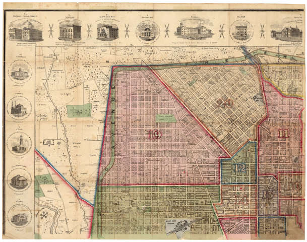
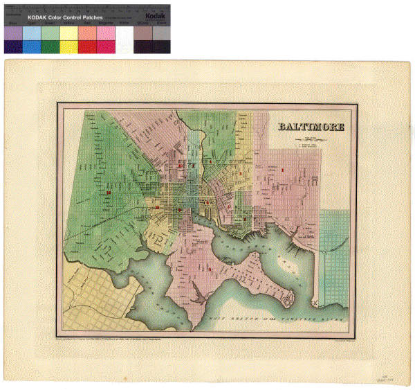
Thomas Poppleton, ... Plan of the City of Baltimore. MSA SC 1427-1-582.
Stitch Posted 4/23/02
50% jpg and Thumb on CD S050002156
Archival tif on CD S050002178
If unable to view linked jpgs use corresponding gif images below.
|
|
MSA SC 5339-7-2
|
|
1891
|
|
|
|
Contact the Department of Special Collections for location.
|
Description
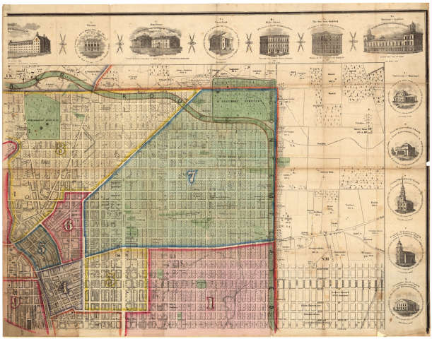
Lloyd's Baltimore Elevated Building Map [proposed] of the Five Hundred Million Business District of Baltimore. Projected by J. T. Lloyd, 1891. Made from actual photographic views at an expense of many thousand dollars and two years time. Library of Congress. Paper copies in MSA SC.
|
|
MSA SC 5339-7-3
|
|
1857
|
|
|
|
Contact the Department of Special Collections for location.
|
Description
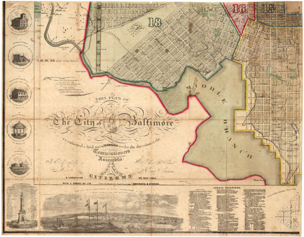
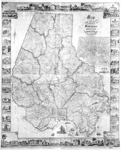
SPECIAL COLLECTIONS (Hammond Harwood House Atlas Collection) Map of the city and county of Baltimore, Maryland, Robert Taylor, [Publisher], 1857, MSA SC 1213-1-470
|
|
MSA SC 5339-7-4
|
|
1877
|
|
|
|
Contact the Department of Special Collections for location.
|
Description
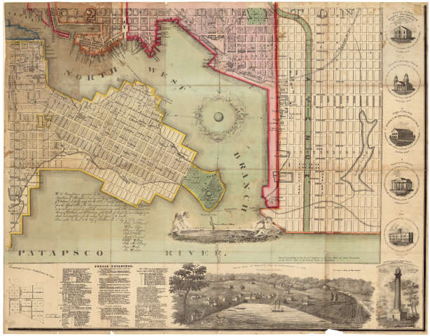
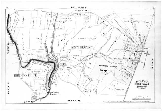
SPECIAL COLLECTIONS (Hammond Harwood House Atlas Collection) Plate R: Parts of 3rd and 9th Districts, Baltimore Environs from City Atlas of Baltimore Maryland and Environs, 1877, George M. Hopkins, 1877, MSA SC 1213-1-453
|
|
MSA SC 5339-7-5
|
|
1852
|
|
|
|
Contact the Department of Special Collections for location.
|
Description
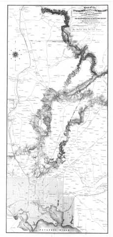
SPECIAL COLLECTIONS (Hammond Harwood House Atlas Collection) Map of the City of Baltimore and Part of Baltimore County, by Thomas P. Chiffelle, 1852, MSA SC 1213-1-264
|
|
MSA SC 5339-7-6
|
|
1850
|
|
|
|
Contact the Department of Special Collections for location.
|
Description
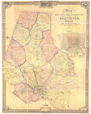
SPECIAL COLLECTIONS (Joseph M. Coale Collection of Baltimore County Maps) Map of the City and County of Baltimore, Maryland, from Original Surveys, J.C. Sidney and P.J. Brown, 1850, MSA SC 4386
|
|
MSA SC 5339-7-7
|
|
1935
|
|
|
|
Contact the Department of Special Collections for location.
|
Description
Map of the City of Baltimore Showing Boundaries of Wards and Councilmanic Districts, 1935
Scanned at Martenet S050001801
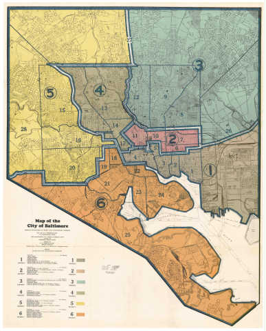
New version of map was digitally enahnced to remove pink streak on the left portion of the map, 11/01/2008;
Enhanced version
|
|
MSA SC 5339-7-8
|
|
1841
|
|
|
|
Contact the Department of Special Collections for location.
|
Description
08-123 Fielding Lucas, Jr. Plan of the City of Baltimore, 1841
Original: Baltimore City Archives
MSA SC 1213-445
MSA S 1604-2-17259 Posted 2/28/02
CD S050001972
|
|
MSA SC 5339-7-9
|
|
1801
|
|
|
|
Contact the Department of Special Collections for location.
|
Description
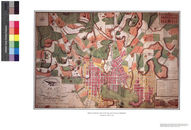
08-119 Charles Varle. Warner & Hanna's Plan of the City and Environs of BaltimoreMSA SC 1213-172 MSA S 1604-2-13555-4 Posted 1/22/02
CD S050001910
|
|
MSA SC 5339-7-10
|
|
1838
|
|
|
|
Contact the Department of Special Collections for location.
|
Description
08-124a Thomas G. Bradford. Baltimore, Maryland.
MSA SC 1399-1-177
MSA S 1604-2-16446 Posted 2/15/02
CD S050001939
|
|
MSA SC 5339-7-11
|
|
1811-1812
|
|
|
|
Contact the Department of Special Collections for location.
|
Description
Proposal of Thomas Poppleton to Mayor of Baltimore to survey the City. Includes bond for conducting survey, 20 May 1811; defense of survey, 4 May 1812; and explanation of surveying methods, 12 May 1812. See also MSA SC 806-1-1. MSA SC 5087-1-1.
![]()
![]()
![]()
![]()
![]()
![]()
![]()
|
|
MSA SC 5339-7-12
|
|
1852
|
|
|
|
Contact the Department of Special Collections for location.
|
Description
08-125 Thomas Chiffelle, Map of the City of Baltimore and... County, 1852 [photostat]MSA SC 1213-1-264 Posted 4/03/02
CD S050002095
Thumb on CD S050002130
|
|
MSA SC 5339-7-13
|
|
1853
|
|
|
|
Contact the Department of Special Collections for location.
|
Description
08-126 James Slade, Plan of Baltimore & Vicinity...Water, 1853 [photostat].MSA SC 1213-1-447 Posted 4/3/02
CD S050002095
Thumb on CD S050002130
|
|
MSA SC 5339-7-14
|
|
1853
|
|
|
|
Contact the Department of Special Collections for location.
|
Description
08-127 William Sides, Map of the City... Baltimore, 1853 [photostat].MSA SC 1213-1-222 Posted 4/3/02
CD S050002095
Thumb on CD S050002130
|
|
MSA SC 5339-7-15
|
|
1876
|
|
|
|
Contact the Department of Special Collections for location.
|
Description
[??-???; fig.155] G. M. Hopkins, Atlas of Baltimore, 1876 [plate A].MSA SC 2111-1-34 (A) Posted 4/2/02
CD S050002095, CD S050002088
Thumbs on CD S050002130
|
|
