This website works best with a newer web browser such as Chrome, Firefox, Safari or Microsoft Edge. Internet Explorer is not supported by this website.

How fast can you create JPSS imagery from data on the Amazon Cloud using Polar2Grid?

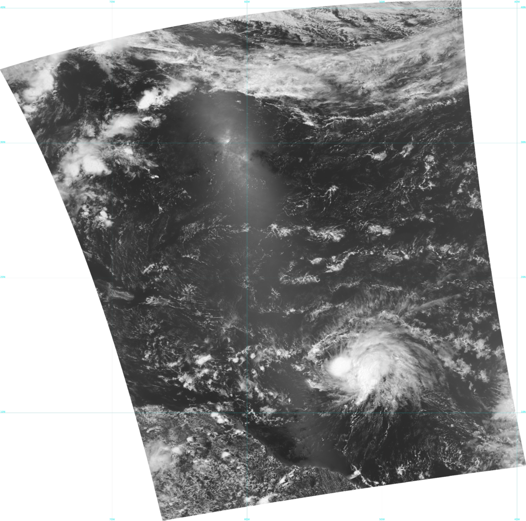
Orbits from NOAA-20 (link, from this site) show a NOAA-20 overpass over Tropical Storm Bret at around 1700 UTC on 21 June 2023. Data from NOAA-20 were available at this site by 1730 UTC, and downloading files from the VIIRS-I1-SDR and VIIRS-IMG-GEO directories (as discussed in this blog post), and running a simple Polar2Grid (software... Read More

VIIRS I01 visible imagery (0.64 µm) over Tropical Storm Bret, 1655-1705 UTC on 21 June 2023 (Click to enlarge)

Orbits from NOAA-20 (link, from this site) show a NOAA-20 overpass over Tropical Storm Bret at around 1700 UTC on 21 June 2023. Data from NOAA-20 were available at this site by 1730 UTC, and downloading files from the VIIRS-I1-SDR and VIIRS-IMG-GEO directories (as discussed in this blog post), and running a simple Polar2Grid (software downloadable here) command yields the full-resolution image above. For ascending (daytime!) passes, then, this could be done within 45 minutes. This particular image was posted on the blog by about 1840 UTC.


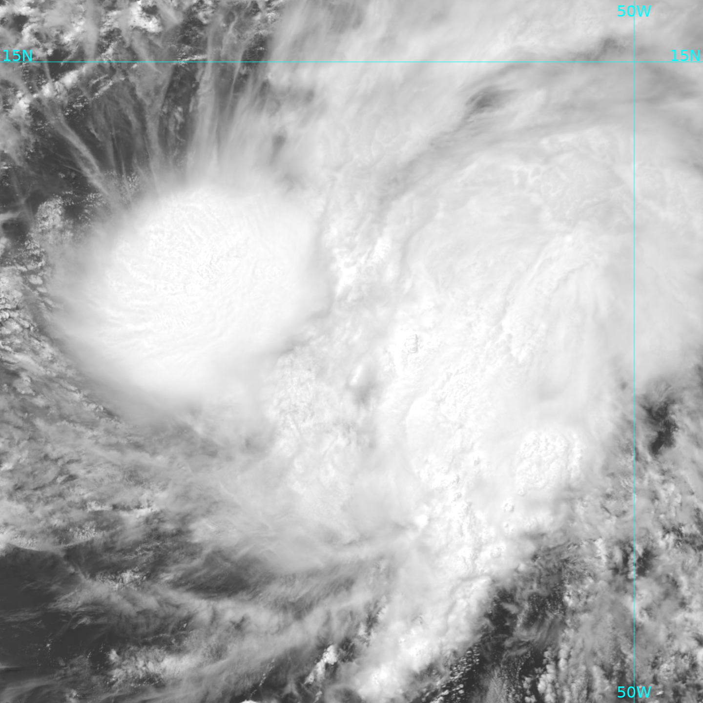
Of course, you might not want all the imagery outside the Tropical Cyclone! Polar2Grid allows for simple definitions of grids (via the p2g_grid_helper shell script: ./p2g_grid_helper.sh GridName -52.0 13.0 375 -375 1440 1440 > $POLAR2GRID_HOME/FileName.yaml). An I01 visible image (0.64 µm) centered near Bret with the defined grid in the command above is shown below.

VIIRS I01 visible imagery (0.64 µm) over Tropical Storm Bret, ca. 1700 UTC on 21 June 2023 (Click to enlarge)

View only this post Read Less

Tropical Storm Bret

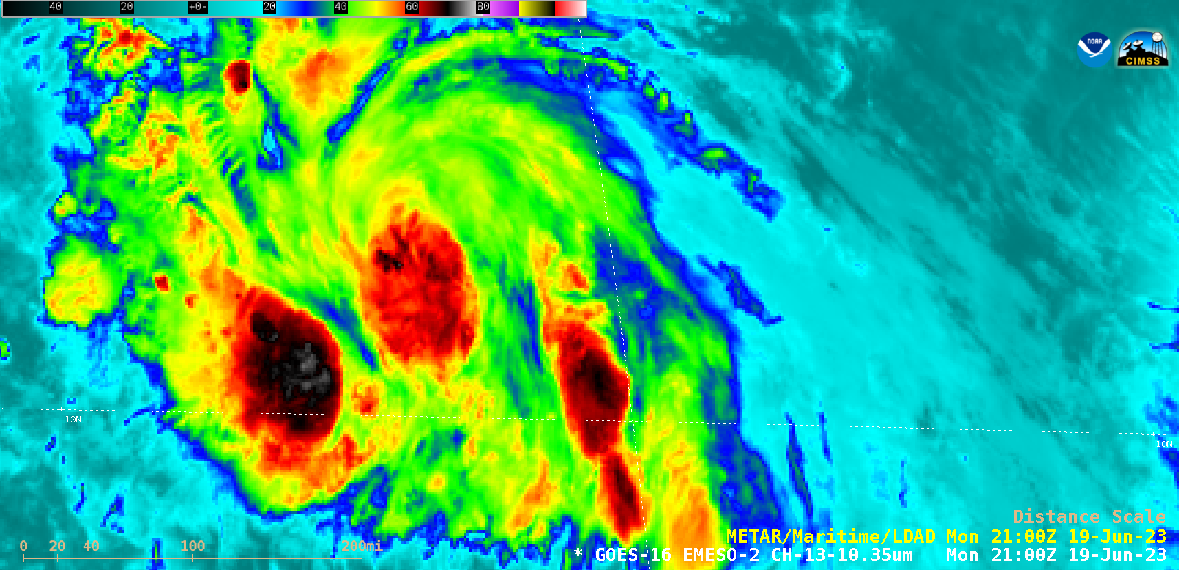
1-minute Mesoscale Domain Sector GOES-16 (GOES-East) “Clean” Infrared Window (10.3 µm) images (above) showed Atlantic Tropical Depression Three as it intensified to become Tropical Storm Bret at 2100 UTC on 19 June 2023. Overshooting tops exhibited infrared brightness temperature values as cold as -79ºC.Bret was in a favorable environment for continued intensification, as shown by low values of deep-layer wind shear from the CIMSS Tropical Cyclones site (below)... Read More

GOES-16 “Clean” Infrared Window (10.3 µm) images [click to play animated GIF | MP4]

1-minute Mesoscale Domain Sector GOES-16 (GOES-East) “Clean” Infrared Window (10.3 µm) images (above) showed Atlantic Tropical Depression Three as it intensified to become Tropical Storm Bret at 2100 UTC on 19 June 2023. Overshooting tops exhibited infrared brightness temperature values as cold as -79ºC.

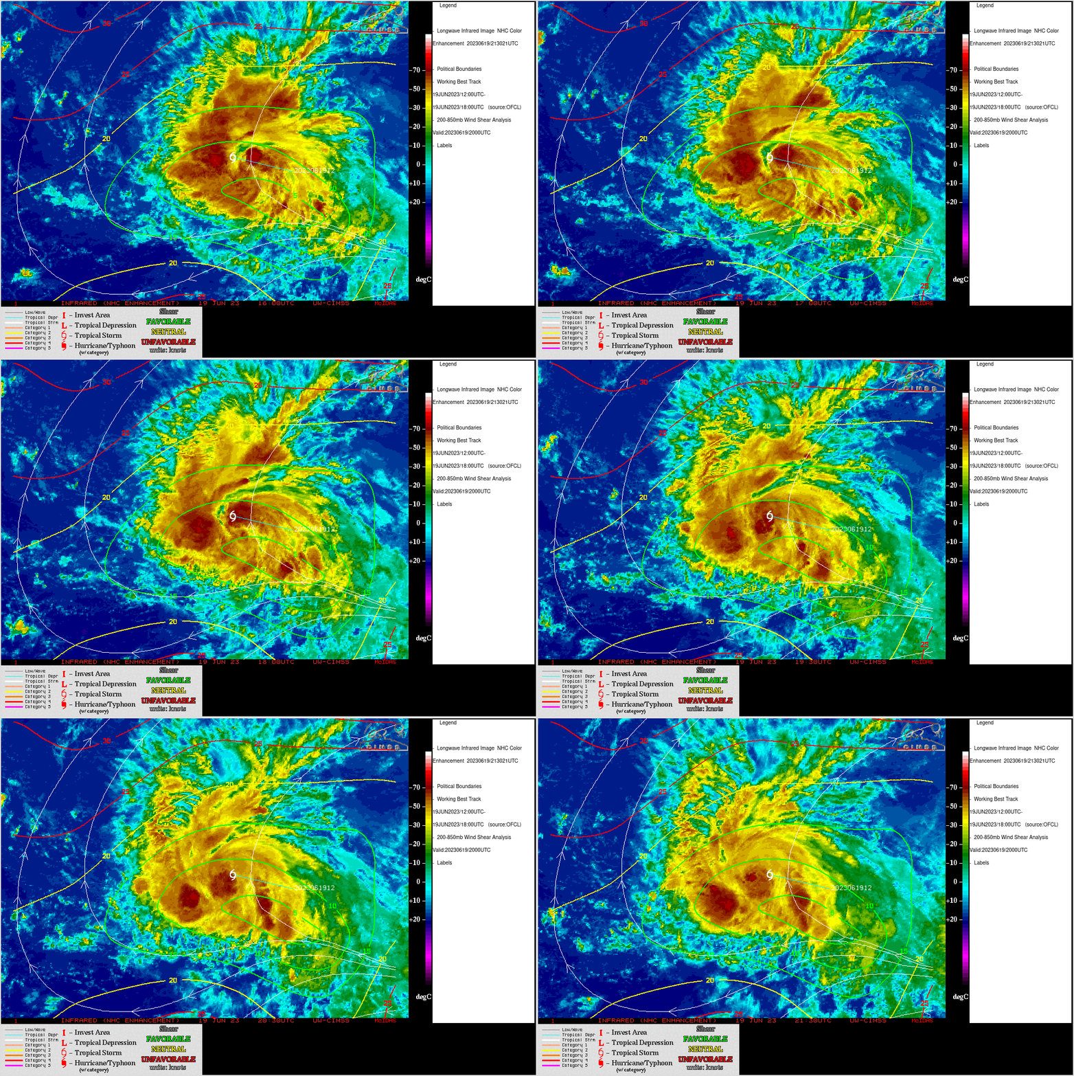
Bret was in a favorable environment for continued intensification, as shown by low values of deep-layer wind shear from the CIMSS Tropical Cyclones site (below) — and the storm was moving over relatively warm water (Sea Surface Temperature).

GOES-16 Infrared images, with contours/streamlines of deep-layer wind shear at 2000 UTC on 19 June [click to enlarge]

View only this post Read Less

Pyrocumulonimbus cloud produced by the Pulp Road Fire in North Carolina

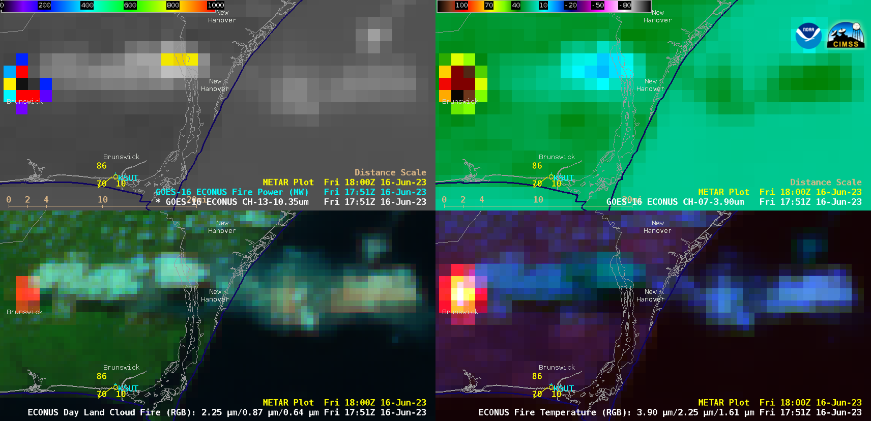
GOES-16 (GOES-East) “Clean” Infrared Window (10.3 µm) + Fire Power (a component of the GOES Fire Detection and Characterization Algorithm FDCA), Shortwave Infrared (3.9 µm), Day Land Cloud Fire RGB and Fire Temperature RGB images (above) showed thermal signatures and pyrocumulus pulses associated with the Pulp Road Fire in far southeastern North Carolina on 16 June 2023. Beginning at 1646... Read More

GOES-16 “Clean” Infrared Window (10.3 µm) + Fire Power (top left), Shortwave Infrared (3.9 µm, top right), Day Land Cloud Fire RGB (bottom left) and Fire Temperature RGB (bottom right) [click to play animated GIF | MP4]

GOES-16 (GOES-East) “Clean” Infrared Window (10.3 µm) + Fire Power (a component of the GOES Fire Detection and Characterization Algorithm FDCA), Shortwave Infrared (3.9 µm), Day Land Cloud Fire RGB and Fire Temperature RGB images (above) showed thermal signatures and pyrocumulus pulses associated with the Pulp Road Fire in far southeastern North Carolina on 16 June 2023. Beginning at 1646 UTC, the fire occasionally exhibited 3.9 µm brightness temperatures of 137.71ºC (the saturation temperature of the GOES-16 ABI Band 7 detectors) — and Fire Power values exceeded 2300 MW at times. The fire rapidly grew in size from 2,500 acres at 1300 UTC on 16 June to 11,500 acres at 0000 UTC on 17 June.

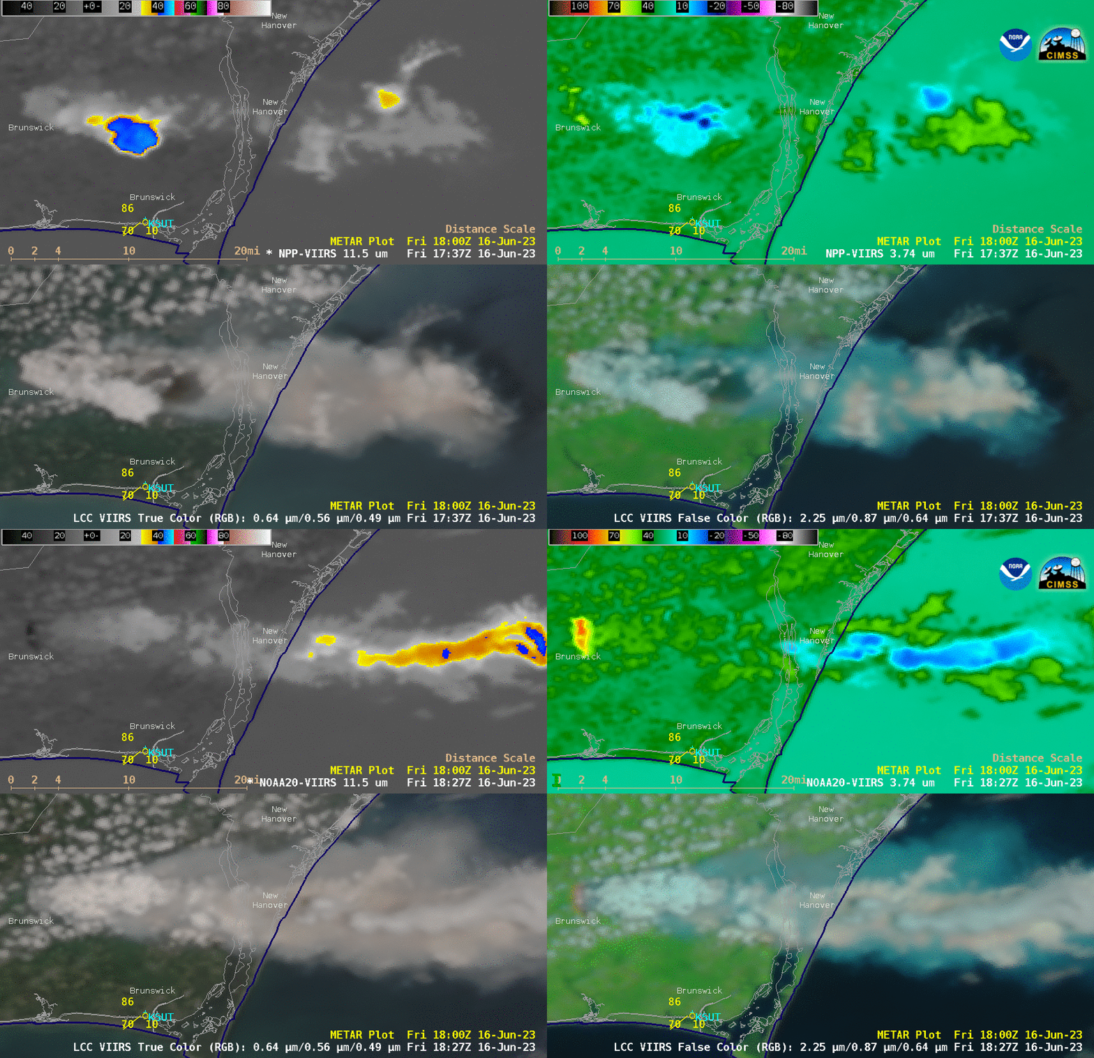
A toggle between VIIRS Infrared Window (11.45 µm), Shortwave Infrared (3.74 µm), True Color RGB and False Color RGB images from Suomi-NPP (valid at 1747 UTC) and NOAA-20 (valid at 1819 UTC) (below) revealed that the fire produced a pyrocumulonimbus (pyroCb) cloud, which exhibited anvil-top 11.45 µm brightness temperature values of -40ºC and colder (shades of blue). Data used to create the VIIRS imagery were downloaded and processed by the SSEC/CIMSS Direct Broadcast ground station.

Suomi-NPP and NOAA-20 VIIRS Infrared Window (11.45 µm, top left), Shortwave Infrared (3.74 µm, top right), True Color RGB (bottom left) and False Color RGB (bottom right) [click to enlarge]

To the best of our knowledge, this is the first documented case of a pyroCb in the State of North Carolina.

View only this post Read Less

Perryton, Texas tornado

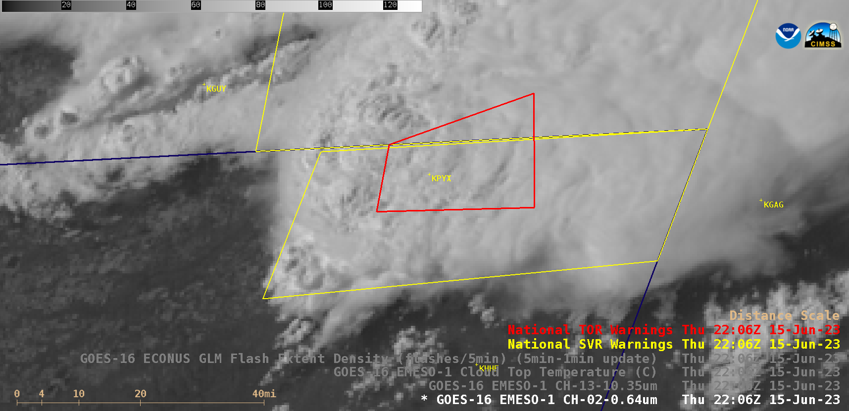
1-minute Mesoscale Domain Sector GOES-16 (GOES-East) “Red” Visible (0.64 µm) images (above) with/without an overlay of GLM Flash Extent Density (above) showed the development of a thunderstorm that produced the fatal EF3-rated tornado that moved through Perryton, Texas (located about 4 miles southwest of airport identifier KPYX) from 2206-2217 UTC on 15 June 2023. A modest amount of lightning activity was associated... Read More

GOES-16 “Red” Visible (0.64 µm) images, with/without an overlay of GLM Flash Extent Density [click to play animated GIF | MP4]

1-minute Mesoscale Domain Sector GOES-16 (GOES-East) “Red” Visible (0.64 µm) images (above) with/without an overlay of GLM Flash Extent Density (above) showed the development of a thunderstorm that produced the fatal EF3-rated tornado that moved through Perryton, Texas (located about 4 miles southwest of airport identifier KPYX) from 2206-2217 UTC on 15 June 2023. A modest amount of lightning activity was associated with these storms. Prior to convective initiation in the far northern Texas Panhandle, orphan anvil pulses were evident south of Perryton (indicating that convective inhibition was diminishing across that area).

The corresponding GOES-16 “Clean” Infrared Window (10.3 µm) and Cloud Top Temperature derived product images are shown below; just prior to the tornado, the coldest 10.3 µm infrared brightness temperature and Cloud Top Temperature values were -73.41ºC and -76.92ºC, respectively, at 2158 UTC (note that the coldest temperature for this infrared color enhancement was adjusted to be -95ºC).
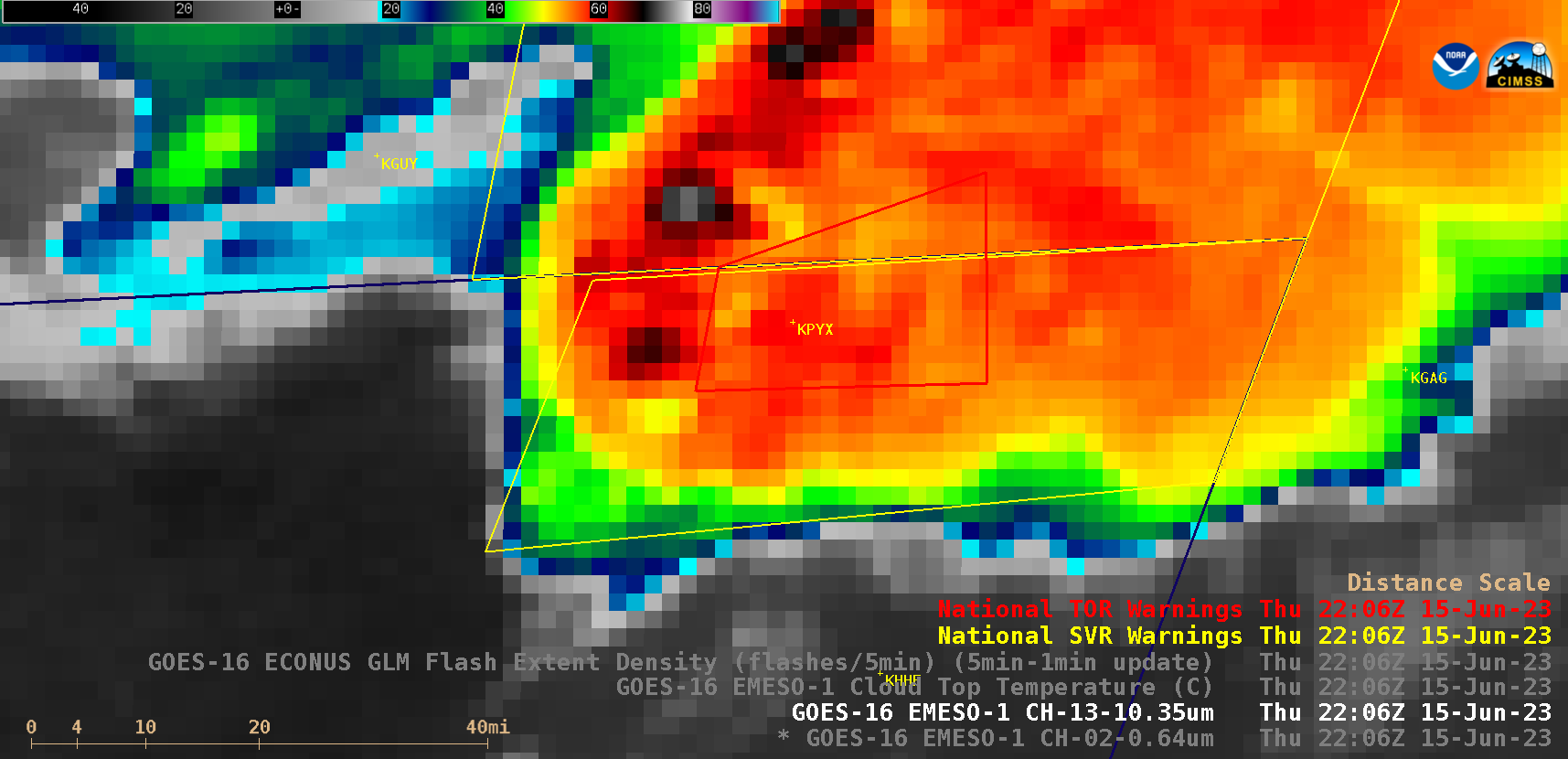
GOES-16 “Clean” Infrared Window (10.3 µm) and Cloud Top Temperature derived product images [click to play animated GIF | MP4]

In a toggle between GOES-16 Visible and Infrared images at 2158 UTC (below), the apparent location of the thunderstorm’s cold overshooting top was over the Oklahoma Panhandle — but taking parallax into account, the actual location of that overshooting top would have been about 20 km (12 miles) to the southeast (closer to Perryton).
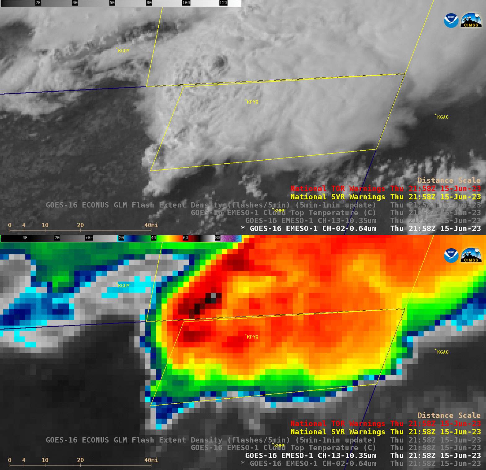
GOES-16 “Red” Visible (0.64 µm) and “Clean” Infrared Window (10.3 µm) images 2158 UTC [click to enlarge]

GOES-16 Lifted Index (LI) and Convective Available Potential Energy (CAPE) derived products (below) showed that the thunderstorms were approaching a N-S oriented corridor of instability (as was also discussed in this blog post). The most unstable LI values within that corridor were around -10ºC, with CAPE values around 2500 J/kg.
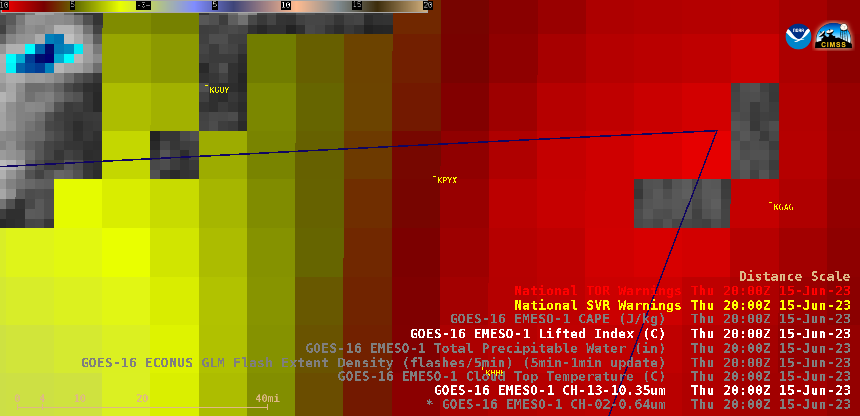
GOES-16 Lifted Index and Convective Available Potential Energy (CAPE) derived product images [click to play animated GIF | MP4]

GOES-16 Total Precipitable Water (TPW) derived product images (below) indicated that an axis of moisture was also in place within the corridor of instability. Peak TPW values were around 1.3 inches.
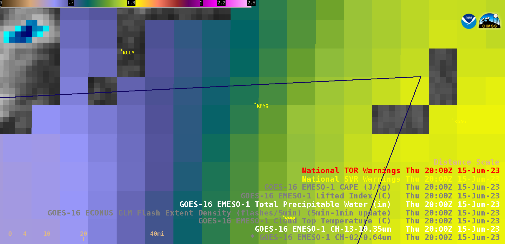
GOES-16 Total Precipitable Water derived product images [click to play animated GIF | MP4]

GOES-16 Visible and Infrared images (below) include time-matched (+/- 3 minutes) plots of SPC Storm Reports.
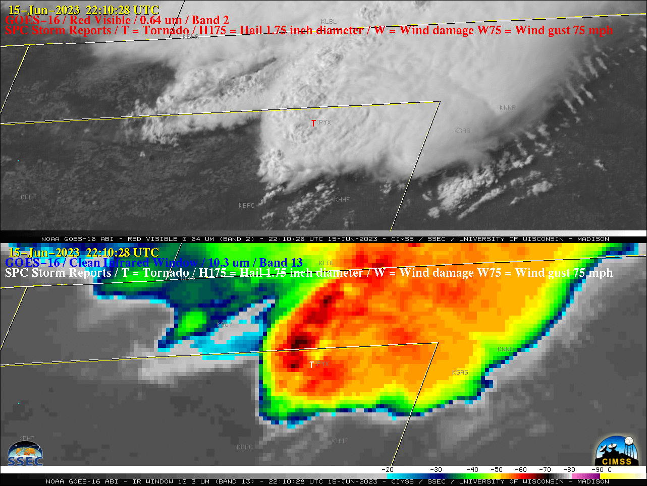
GOES-16 “Red” Visible (0.64 µm, top) and “Clean” Infrared Window (10.3 µm, bottom) images, with time-matched plots of SPC Storm Reports [click to play animated GIF | MP4]

View only this post Read Less