Public reports pack PDF 10 MB - Cherwell District Council
Public reports pack PDF 10 MB - Cherwell District Council
Public reports pack PDF 10 MB - Cherwell District Council

You also want an ePaper? Increase the reach of your titles
YUMPU automatically turns print PDFs into web optimized ePapers that Google loves.
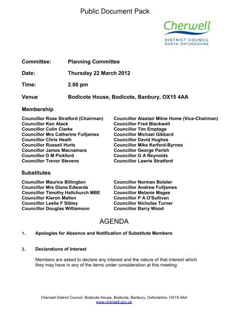
Committee: Planning Committee<br />
Date: Thursday 22 March 2012<br />
Time: 2.00 pm<br />
Venue Bodicote House, Bodicote, Banbury, OX15 4AA<br />
Membership<br />
<strong>Council</strong>lor Rose Stratford (Chairman) <strong>Council</strong>lor Alastair Milne Home (Vice-Chairman)<br />
<strong>Council</strong>lor Ken Atack <strong>Council</strong>lor Fred Blackwell<br />
<strong>Council</strong>lor Colin Clarke <strong>Council</strong>lor Tim Emptage<br />
<strong>Council</strong>lor Mrs Catherine Fulljames <strong>Council</strong>lor Michael Gibbard<br />
<strong>Council</strong>lor Chris Heath <strong>Council</strong>lor David Hughes<br />
<strong>Council</strong>lor Russell Hurle <strong>Council</strong>lor Mike Kerford-Byrnes<br />
<strong>Council</strong>lor James Macnamara <strong>Council</strong>lor George Parish<br />
<strong>Council</strong>lor D M Pickford <strong>Council</strong>lor G A Reynolds<br />
<strong>Council</strong>lor Trevor Stevens <strong>Council</strong>lor Lawrie Stratford<br />
Substitutes<br />
<strong>Council</strong>lor Maurice Billington <strong>Council</strong>lor Norman Bolster<br />
<strong>Council</strong>lor Mrs Diana Edwards <strong>Council</strong>lor Andrew Fulljames<br />
<strong>Council</strong>lor Timothy Hallchurch <strong>MB</strong>E <strong>Council</strong>lor Melanie Magee<br />
<strong>Council</strong>lor Kieron Mallon <strong>Council</strong>lor P A O'Sullivan<br />
<strong>Council</strong>lor Leslie F Sibley <strong>Council</strong>lor Nicholas Turner<br />
<strong>Council</strong>lor Douglas Williamson <strong>Council</strong>lor Barry Wood<br />
AGENDA<br />
1. Apologies for Absence and Notification of Substitute Members<br />
2. Declarations of Interest<br />
<strong>Public</strong> Document Pack<br />
Members are asked to declare any interest and the nature of that interest which<br />
they may have in any of the items under consideration at this meeting<br />
<strong>Cherwell</strong> <strong>District</strong> <strong>Council</strong>, Bodicote House, Bodicote, Banbury, Oxfordshire, OX15 4AA<br />
www.cherwell.gov.uk
3. Petitions and Requests to Address the Meeting<br />
The Chairman to report on any requests to submit petitions or to address the<br />
meeting.<br />
4. Urgent Business<br />
The Chairman to advise whether they have agreed to any item of urgent business<br />
being admitted to the agenda.<br />
5. Minutes (Pages 1 - 15)<br />
To confirm as a correct record the Minutes of the meeting of the Committee held on<br />
22 February 2012<br />
Planning Applications<br />
6. Banbury Gateway, Acorn Way, Banbury 11/01870/F<br />
(Pages 19 - 86)<br />
7. Land South of Overthorpe Road and Adjacent the M40, Banbury, Oxfordshire<br />
(Pages 87 - <strong>10</strong>8) 11/01878/OUT<br />
8. OS Parcels 7977, 8962 and 9553 north of Lince Lane, Kirtlington 11/01766/F<br />
(Pages <strong>10</strong>9 - 121)<br />
9. Heathfield Golf Centre, Heathfield, Bletchingdon 11/01784/F<br />
(Pages 122 - 134)<br />
<strong>10</strong>. Stable Block Corner, Farnborough Road, Mollington 11/01808/F<br />
(Pages 135 - 142)<br />
11. Yew Tree Farm, Station Road, Launton, Bicester 11/01907/F<br />
(Pages 143 - 167)<br />
12. Cherry Orchard, Green Lane, South Newington OX15 4JH 11/01915/F<br />
(Pages 168 - 173)<br />
13. Cherry Orchard, Green Lane, South Newington OX15 4JH 11/01916/LB<br />
(Pages 174 - 179)<br />
14. Land North of Willowbank Farm, Fritwell Road, Fewcott 11/01932/F<br />
(Pages 180 - 190)<br />
15. Bloxham Business Centre, Barford Road, Bloxham 12/00005/F<br />
(Pages 191 - 206)<br />
16. Paragon Fleet Solutions, Heyford Park, Camp Road 12/00040/F<br />
(Pages 207 - 226)
17. Unit 3A, Bessemer Close, Bicester OX26 6QE 12/00152/F<br />
(Pages 227 - 236)<br />
18. Ferris Hill Farm, Hook Norton Road, Sibford Ferris 12/00244/CM<br />
(Pages 237 - 241)<br />
19. Ferris Hill Farm, Hook Norton Road, Sibford Ferris 12/00249/CM<br />
(Pages 242 - 245)<br />
20. Old Bodicote House, White Post Road, Bodicote 12/00245/LB<br />
(Pages 246 - 250)<br />
Tree Preservation Orders<br />
21. Tree Preservation Order (No. 11/99) The Pre School, Fir Lane, Steeple Aston<br />
(Pages 251 - 254)<br />
Report of Head of <strong>Public</strong> Protection and Development Management<br />
Summary<br />
To seek the revocation of Tree Preservation Order no 11-99 relating to one beech<br />
tree to the front of The Pre School, Fir Lane, Steeple Aston (copy plan attached as<br />
Annex 1)<br />
Recommendations<br />
The Planning Committee is recommended to:<br />
(1) Revoke Tree Preservation Order 11/99 at the site of The Pre School, Fir<br />
Lane, Steeple Aston.<br />
22. Two Trees to the Front of Stradella, Twyford Grove, Adderbury<br />
(Pages 255 - 258)<br />
Report of Head of <strong>Public</strong> Protection and Development Management<br />
Summary<br />
To seek the confirmation Tree Preservation Order no 12-11 with no objections<br />
relating to two trees to the front of Stradella, Twyford Grove, Adderbury (copy plan<br />
attached as Annex 1)<br />
Recommendations<br />
The Planning Committee is recommended to:<br />
(1) Confirm Tree Preservation Order 12/2011 at the site of Stradella, Twyford<br />
Grove, Adderbury be confirmed without modification in the interest of public<br />
amenity.
23. Lime Tree House Main Road, Swalcliffe, OX15 5EH (Pages 259 - 262)<br />
Report of Head of <strong>Public</strong> Protection and Development Management<br />
Summary<br />
To seek the confirmation Tree Preservation Order no 13-11 with no objections<br />
relating to one beech tree to the front of Lime Tree House Main Road, Swalcliffe,<br />
OX15 5EH (copy plan attached as Annex 1).<br />
Recommendations<br />
The Planning Committee is recommended to:<br />
(1) Confirm Tree Preservation Order 13/2011 at the site of Lime Tree House<br />
Main Road Swalcliffe OX15 5EH be confirmed without modification in the<br />
interest of public amenity.<br />
24. Beech Tree, Etheldredas Church, Little Lane, Horley (Pages 263 - 266)<br />
Report of Head of <strong>Public</strong> Protection and Development Management<br />
Summary<br />
To seek the confirmation Tree Preservation Order no 19-11 with no objections<br />
relating to one beech tree to the front of St Etheldredas Church, Little Lane, Horley<br />
(copy plan attached as Annex 1).<br />
Recommendations<br />
The Planning Committee is recommended to:<br />
(1) Confirm Tree Preservation Order 19/2011 at the site of St Etheldredas<br />
Church, Little Lane Horley without modification in the interest of public<br />
amenity.<br />
Review and Monitoring Reports<br />
25. Decisions Subject to Various Requirements (Pages 267 - 269)<br />
Report of Head of <strong>Public</strong> Protection and Development Management<br />
Summary<br />
This report aims to keep members informed upon applications which they have<br />
authorised decisions upon to various requirements which must be complied with<br />
prior to the issue of decisions.<br />
An update on any changes since the preparation of the report will be given at the<br />
meeting.
Recommendations<br />
The Planning Committee is recommended to:<br />
(1) Accept the position statement.<br />
26. Progress on the Exemplar Application at NW Bicester <strong>10</strong>/01780/HYBRID<br />
(Pages 270 - 278)<br />
Report of Director of Development<br />
Summary<br />
To advise Members of the progress that has been made towards the completion of<br />
the S<strong>10</strong>6 agreement for NW Bicester<br />
Recommendations<br />
The Planning Committee is recommended to:<br />
(1) Note the progress towards completion of the legal agreement for the<br />
exemplar development at NW Bicester which, once signed, will enable the<br />
planning permission to be issued.<br />
(2) Note the progress with regard to the masterplan for NW Bicester.<br />
(3) Consider the requirement of Section 143 of the Localism Act 2011 to take<br />
into account local finance considerations.<br />
27. Appeals Progress Report (Pages 279 - 282)<br />
Report of Head of <strong>Public</strong> Protection and Development Management<br />
Summary<br />
This report aims to keep members informed upon applications which have been<br />
determined by the <strong>Council</strong>, where new appeals have been lodged. <strong>Public</strong><br />
Inquiries/hearings scheduled or appeal results achieved.<br />
Recommendations<br />
The Planning Committee is recommended to:<br />
(1) Accept the position statement.<br />
<strong>Council</strong>lors are requested to collect any post from their pigeon<br />
hole in the Members Room at the end of the meeting.
Information about this Agenda<br />
Apologies for Absence<br />
Apologies for absence should be notified to democracy@cherwell-dc.gov.uk or 01295<br />
221589 / 01295 227956 prior to the start of the meeting.<br />
Declarations of Interest<br />
Members are asked to declare interests at item 2 on the agenda or if arriving after the<br />
start of the meeting, at the start of the relevant agenda item. The definition of personal<br />
and prejudicial interests is set out in the constitution. The Democratic Support Officer will<br />
have a copy available for inspection at all meetings.<br />
Personal Interest: Members must declare the interest but may stay in the room, debate<br />
and vote on the issue.<br />
Prejudicial Interest: Member must withdraw from the meeting room and should inform<br />
the Chairman accordingly.<br />
With the exception of the some very specific circumstances, a Member with a personal<br />
interest also has a prejudicial interest if it is one which a Member of the public with<br />
knowledge of the relevant facts would reasonably regard as so significant that it is likely to<br />
prejudice the Member’s judgement of the public interest.<br />
Local Government and Finance Act 1992 – Budget Setting, Contracts &<br />
Supplementary Estimates<br />
Members are reminded that any member who is two months in arrears with <strong>Council</strong> Tax<br />
must declare the fact and may speak but not vote on any decision which involves budget<br />
setting, extending or agreeing contracts or incurring expenditure not provided for in the<br />
agreed budget for a given year and could affect calculations on the level of <strong>Council</strong> Tax.<br />
Evacuation Procedure<br />
When the continuous alarm sounds you must evacuate the building by the nearest<br />
available fire exit. Members and visitors should proceed to the car park as directed by<br />
Democratic Services staff and await further instructions.<br />
Access to Meetings<br />
If you have any special requirements (such as a large print version of these papers or<br />
special access facilities) please contact the officer named below, giving as much notice as<br />
possible before the meeting.<br />
Mobile Phones<br />
Please ensure that any device is switched to silent operation or switched off.<br />
Queries Regarding this Agenda<br />
Please contact Natasha Clark, Law and Governance<br />
natasha.clark@cherwellandsouthnorthants.gov.uk, 01295 221589<br />
Sue Smith<br />
Chief Executive<br />
Published on Wednesday 14 March 2012
<strong>Cherwell</strong> <strong>District</strong> <strong>Council</strong><br />
Planning Committee<br />
Minutes of a meeting of the Planning Committee held at Bodicote House,<br />
Bodicote, Banbury, OX15 4AA, on 23 February 2012 at 4.00 pm<br />
Present: <strong>Council</strong>lor Rose Stratford (Chairman)<br />
<strong>Council</strong>lor Alastair Milne Home (Vice-Chairman)<br />
Apologies<br />
for<br />
absence:<br />
<strong>Council</strong>lor Ken Atack<br />
<strong>Council</strong>lor Fred Blackwell<br />
<strong>Council</strong>lor Colin Clarke<br />
<strong>Council</strong>lor Tim Emptage<br />
<strong>Council</strong>lor Michael Gibbard<br />
<strong>Council</strong>lor Chris Heath<br />
<strong>Council</strong>lor David Hughes<br />
<strong>Council</strong>lor Russell Hurle<br />
<strong>Council</strong>lor Mike Kerford-Byrnes<br />
<strong>Council</strong>lor James Macnamara<br />
<strong>Council</strong>lor George Parish<br />
<strong>Council</strong>lor D M Pickford<br />
<strong>Council</strong>lor G A Reynolds<br />
<strong>Council</strong>lor Trevor Stevens<br />
<strong>Council</strong>lor Mrs Catherine Fulljames<br />
<strong>Council</strong>lor Lawrie Stratford<br />
Officers: Bob Duxbury, Development Control Team Leader<br />
Jenny Barker, Major Developments Team Leader<br />
Paul Ihringer, Planning Officer<br />
Jon Brewin, Arboriculture Officer<br />
Ross Chambers, Solicitor<br />
Natasha Clark, Team Leader, Democratic and Elections<br />
Aaron Hetherington, Democratic and Elections Officer<br />
Page 1<br />
Agenda Item 5
168 Declarations of Interest<br />
Planning Committee - 23 February 2012<br />
Members delcared interests in the following agenda items<br />
8. Land Between 22 and 23A Harts Close, Kidlington.<br />
<strong>Council</strong>lor Tim Emptage, Prejudicial, as a member of Kidlington Parish<br />
<strong>Council</strong> which had been consulted on the application and had met with<br />
residents to discuss in detail..<br />
<strong>10</strong>. 140 Oxford Road, Kidlington.<br />
<strong>Council</strong>lor Tim Emptage, Personal, as a member of Kidlington Parish <strong>Council</strong><br />
which had been consulted on the application..<br />
11. Smiths, Bloxham Road Caravan Site, Bloxham Road, Milton.<br />
<strong>Council</strong>lor Chris Heath, Prejudicial, as friends with the applicant.<br />
12. 9 Sandell Close Banbury.<br />
<strong>Council</strong>lor Alastair Milne Home, Personal, as a member of Banbury Town<br />
<strong>Council</strong> which had been consulted on the application..<br />
<strong>Council</strong>lor Colin Clarke, Personal, as a member of Banbury Town <strong>Council</strong><br />
which had been consulted on the application..<br />
13. Bicester & Ploughley Sports Centre, Queens Avenue, Bicester.<br />
<strong>Council</strong>lor D M Pickford, Prejudicial, as a member of Executive.<br />
<strong>Council</strong>lor G A Reynolds, Prejudicial, as a member of Executive.<br />
<strong>Council</strong>lor George Parish, Prejudicial, as a member of Executive.<br />
<strong>Council</strong>lor James Macnamara, Prejudicial, as a member of Banbury Town<br />
<strong>Council</strong> and Upper Heyford Parish <strong>Council</strong>.<br />
<strong>Council</strong>lor Ken Atack, Prejudicial, as a member of Executive.<br />
<strong>Council</strong>lor Michael Gibbard, Prejudicial, as a member of Executive.<br />
22. 16 & 18 Bucknell Road, Bicester.<br />
<strong>Council</strong>lor D M Pickford, Prejudicial, .<br />
<strong>Council</strong>lor Rose Stratford, Personal, .<br />
169 Petitions and Requests to Address the Meeting<br />
The Chairman advised that petitions and requests to address the meeting<br />
would be dealt with at each item.<br />
170 Urgent Business<br />
There was no urgent business.<br />
Page 2
171 Minutes<br />
Planning Committee - 23 February 2012<br />
The Minutes of the meeting held on 26 January 2012 were agreed as a<br />
correct record and signed by the Chairman, subject to the following<br />
amendment:<br />
Minute 150: Declarations of Interest<br />
Delete declaration of interest for <strong>Council</strong>lor Tim Emptage Personal for agenda<br />
item as a member of Kidlington Parish <strong>Council</strong> which had been consulted the<br />
application from 9. White Post Road, Bodicote and insert the declaration to<br />
agenda item 11. 157 Oxford Office Village, Langford Lane, Kidlington.<br />
172 Hornton Grounds Quarry<br />
The Committee considered a report to vary conditions 1, 2 and 5 of the<br />
existing Planning Permission Ref: 06/01117/CM and Condition 80 of existing<br />
Planning Permission Ref: 06/01119/CM to allow the following; Replacement of<br />
existing substandard portable building with an improved timber panelled<br />
building for staff use; Extension of time for the retention of the stone<br />
cutting/dressing buildings and conservation yard from 31 December 2013 to<br />
31 December 2023 with subsequent restoration of the site by 31 December<br />
2024; Increase in the amount of stone imported to the site from 4,000 tonnes<br />
pa. (OCC ref. MW.0011/12).<br />
The Committee was satisfied with the evidence presented and noted that<br />
<strong>Cherwell</strong> <strong>District</strong> <strong>Council</strong> was a consultee on this application. Oxfordshire<br />
County <strong>Council</strong> would be determing the application.<br />
In reaching their decision, the committee considered the officers’ report and<br />
presentation.<br />
Resolved<br />
That Oxfordshire County <strong>Council</strong> be advised that <strong>Cherwell</strong> <strong>District</strong> <strong>Council</strong> has<br />
no objections to the proposal, subject to the imposition of suitable conditions<br />
to control environmental impact relating to traffic, noise and dust associated<br />
with the continuing use of the site; and providing the County <strong>Council</strong> is<br />
satisfied with the proposal in highway safety and convenience terms.<br />
<strong>Cherwell</strong> <strong>District</strong> <strong>Council</strong> request that they be informed of the outcome of the<br />
application once a decision has been made.<br />
173 Former Upton Dairy, Upton Estate, Stratford Road, Shenington<br />
The Committie considered an application for the erection of one storage unit<br />
(B8 use), one business unit (B1, B2 and B8 use), associated car parking and<br />
landscaping.<br />
The Committee was satisfied with the evidence presented.<br />
Page 3
Planning Committee - 23 February 2012<br />
In reaching their decision, the Committee considered the officers’ report and<br />
presentation.<br />
Resolved<br />
That application 11/01641/F be approved subject to the following conditions:<br />
(1) SC 1_4A (Time limit for implementation)<br />
(2) Except where otherwise stipulated by conditions attached to this<br />
permission, the development shall be carried out strictly in accordance<br />
with the following plans and documents and the materials and finishing<br />
details included therein;<br />
I. drawing 012 Rev P3 (submitted with the application)<br />
II. drawing 013 Rev P2 (submitted with the application)<br />
III. drawing 014 Rev P2 (submitted with the application)<br />
IV. drawing 015 Rev P3 (submitted with the application)<br />
V. drawing 116 Rev P2 (submitted with the application)<br />
VI. drawing U4.5-002 – External Lighting Plan and the Dextra Avalon<br />
Wall<strong>pack</strong> data-sheet (received on 12 January 2012)<br />
VII. the details set out in the Application Forms and Design & Access<br />
Statement (submitted with the application)<br />
(3) That the transport impact of the development hereby approved shall be<br />
mitigated against by adherence to the Workplace Travel Plan for the<br />
site, dated September 20<strong>10</strong>, approved under application reference<br />
<strong>10</strong>/00228/DISC on 21 October 20<strong>10</strong>.<br />
(4) That before the development is first occupied, the parking and<br />
manoeuvring areas shall be provided in accordance with the submitted<br />
details and shall be constructed, laid out, surfaced, drained and<br />
completed in accordance with specification details therein and shall be<br />
retained unobstructed except for the parking and manoeuvring of<br />
vehicles at all times thereafter.<br />
(5) That ‘The Heath’ building shall be used only for purposes falling within<br />
Class B8; specified in the Schedule to the Town and Country Planning<br />
(Use Classes) (Amendment) (England) Order 2005 and for no other<br />
purpose(s) whatsoever.<br />
(6) That no goods, materials, plant or machinery shall be stored, repaired,<br />
operated or displayed in the open without the prior express planning<br />
consent of the Local Planning Authority.<br />
(7) That no plant, air compressor or air extraction equipment shall be<br />
installed on the site or in the buildings without prior written consent of<br />
the Local Planning Authority.<br />
(8) The existing trees along the eastern boundary of the site shall be<br />
retained and properly maintained and that any tree which may die<br />
within five years from the completion of the development shall be<br />
replaced and shall thereafter be properly maintained in accordance<br />
with this condition.<br />
Page 4
Planning Committee - 23 February 2012<br />
(9) That, notwithstanding the provisions of Class A of Part 8, Schedule 2 of<br />
the Town and Country Planning (General Permitted Development)<br />
Order 1995 and its subsequent amendments, the approved building<br />
shall not be extended without the prior express planning consent of the<br />
Local Planning Authority.<br />
(<strong>10</strong>) Notwithstanding the provisions of section 55 (2) (a) (i) of the Town and<br />
Country Planning Act 1990 and Class A of Part 8, Schedule 2 of the<br />
Town and Country Planning (General Permitted Development) Order<br />
1995 and its subsequent amendments, no internal operations<br />
increasing the floor space available within the building hereby<br />
permitted shall be carried out without the prior express planning<br />
consent of the Local Planning Authority.<br />
(11) That the development shall be carried out in accordance with the<br />
contaminated land phased risk assessment and mitigation strategy<br />
approved by this authority on 11 February 20<strong>10</strong>, under submission<br />
reference 09/01861/DISC.<br />
174 Land Between 22 and 23A Harts Close, Kidlington<br />
The Committee considered a report for the proposed erection of 3 no. 3 bed<br />
and 2 no. 1 bed properties and associated parking.<br />
<strong>Council</strong>lor Tim Emptage addressed the Committee as Ward Member.<br />
Following his address, he left the meeting for the debate and vote on the<br />
application.<br />
Members noted that they did not object to proposals for new houses in<br />
Kidlington however they must be appropriate. The Committee noted that the<br />
proposal provided no information regarding alternative parking for residents<br />
and would result in the loss of a children’s play area.<br />
In considering the application, the Committee agreed that officers should be<br />
requested to write to the applicant advising that they felt the application was<br />
inappropriateas it emanates from a fellow Local Planning Authority, and the<br />
failings of the scheme should have been seen as self-evident.<br />
In reaching their decision, the committee considered the officers’ report and<br />
presentation.<br />
Resolved<br />
That application 11/01785/OUT be refused on the grounds that:<br />
(1) The applicant has failed to provide information which would justify the<br />
change of use of the existing car park for residential purposes.<br />
Therefore, it is considered that the parking area is required for use as<br />
such and therefore that it's loss will result in vehicles parking and<br />
manoeuvring on the public highway to the detriment of the safety and<br />
Page 5
Planning Committee - 23 February 2012<br />
convenience of other road users. The development therefore does not<br />
accord with Government guidance contained within PPG13: Transport<br />
and Policies TR5 and TR11 of the Non-Statutory Local <strong>Cherwell</strong> Local<br />
Plan 2011.<br />
(2) The proposed development will result in the loss of a children’s play<br />
area. Without an acceptable justification, the development therefore runs<br />
contrary to Government guidance contained within PPS3: Housing and<br />
PPG17: Planning for Open Space, Sport and Recreation and Policy S1<br />
of the South East Plan 2009 and Policy R7 of the Non-Statutory Local<br />
<strong>Cherwell</strong> Local Plan 2011.<br />
(3) The applicant has failed to demonstrate that it is possible to<br />
accommodate the proposed development within the application site<br />
without harming the amenities of the neighbouring residents with<br />
particular regard to 23A Harts Close. The development therefore does<br />
accord with Government guidance contained within PPS3: Housing,<br />
Policy BE1 of the South East Plan 2009 and saved Policy C30 of the<br />
adopted <strong>Cherwell</strong> Local Plan.<br />
175 Stable Block Corner, Farnborough Road, Mollington<br />
The Committee considered an application for the erection of day-room –<br />
resubmission of 11/00430/F. Consideration of this item had been deferred<br />
from the previous meeting to allow for a site visit.<br />
Paul Stephenson, Chairman of Mollington Parish <strong>Council</strong>, spoke in opposition<br />
to the application.<br />
In considering the application, Members questioned the size of the day-room<br />
and the materials that would be used to construct it. Members raised<br />
concerns over parking.<br />
Members commented that there were outstanding enforcement issues relating<br />
to the site. The Solicitor confirmed that these issues were being addressed<br />
and reminded the Committee that they were not relevant to this application.<br />
The Development Control Team Leader confirmed that the day room would<br />
not be permitted to be used as overnight accommodation.<br />
<strong>Council</strong>lor Reynolds proposed that consideration of the application be<br />
deferred to allow for further investigation and information to be provided to the<br />
committee. <strong>Council</strong>lor Blackwell seconded the proposal.<br />
In reaching their decision, the Committee considered the officers’ report,<br />
written update and presentation and the address of the public speaker.<br />
Resolved<br />
That consideration of application 11/01808/F application be deferred to allow<br />
for further investigation and information to be provided to the Committee.<br />
Page 6
176 140 Oxford Road, Kidlington<br />
Planning Committee - 23 February 2012<br />
The Committee considered a report for a single storey extension with access<br />
ramp to adjacent church.<br />
Tim Cooper, neighbouring resident, spoke in opposition to the application<br />
Chris Pack, Chair of the Church group that had been driving the application,<br />
spoke in support of the application.<br />
Members raised concerns over the size and proximity of the development to<br />
the existing buildings. The Committee noted that the proposed conditions<br />
would ensure minimal impact on residents in the vicinity.<br />
In reaching their decision, the committee considered the officers’ report,<br />
written update, presentation and the addresses of the public speakers.<br />
Resolved<br />
That application 11/01816/F be approved subject to:<br />
(a) The following conditions:<br />
(1) 1.4A - Full Permission: Duration Limit (3 years) (RC2)<br />
(2) Except where otherwise stipulated by conditions attached to this<br />
permission, the development shall be carried out strictly in accordance<br />
with the following approved plans: 1123 001; 1123 002; 1123 003 B;<br />
and 1123 004 D<br />
(3) SC 2.6AA - Materials to Match<br />
(4) That no amplified sound equipment shall be operated or used in the<br />
building hereby approved.<br />
(5) The use of the building hereby approved shall be limited to the activity<br />
as set out in the Statement of Justification which formed Appendix 1 of<br />
the Applicant’s design and Access Statement.<br />
(b) and other conditions as agreed between the Head of <strong>Public</strong> Protection<br />
and Development management and the Chairman to deal with the<br />
concerns expressed in his address to the Committee by Mr Cooper.<br />
177 Smiths, Bloxham Road Caravan Site, Bloxham Road, Milton<br />
The Committee considered an application for the use and continued use of<br />
the site as a gypsy and traveller site to provide 36 no. household pitches with<br />
associated landscaping, landscape bund, amenity/play area, dayrooms,<br />
access road, hardstanding and parking areas.<br />
Page 7
Planning Committee - 23 February 2012<br />
In introducing the report, the Development Control Team Leader advised the<br />
committee of the comments received regarding land contamination.<br />
In considering the application, some members of the committee spoke in<br />
support of the application and made reference to the fact the proposed<br />
development was a good design and enhanced the site both visually and in<br />
terms of amenities for the community.<br />
Members commented that the development would help meet future<br />
accommodation needs for gypsies and travellers in the district and it was a<br />
good site in an appropriate location.<br />
In reaching their decision, the committee considered the officers’ report,<br />
written update and presentation.<br />
Resolved<br />
That the application 11/01863/F be approved subject to the following<br />
conditions:<br />
(1) SC 1_4A (Time limit for implementation)<br />
(2) The site shall not be occupied by any persons other than gypsies and<br />
travellers as defined in paragraph 15 of ODPM Circular 01/2006.<br />
(3) No commercial activities shall take place on the land; including the<br />
storage of materials and no vehicle over 3.5 tonnes shall be stationed,<br />
parked or stored on this site.<br />
(4) No more than 64 caravans, as defined in the Caravan Sites and<br />
Control of Development Act 1960 and the Caravan Sites Act 1968 (of<br />
which no more than 12 shall be park homes and 16 shall be static<br />
caravans or mobile homes) shall be stationed on the site at any time.<br />
(5) Except where otherwise stipulated by conditions attached to this<br />
permission, the development shall be carried out strictly in accordance<br />
with the documents submitted with the application and the following<br />
drawings: amended site location plan received 30.01.12 and 2228/01,<br />
03A and 04 received with the application.<br />
(6) That prior to the commencement of the development a scheme for<br />
landscaping the site shall be submitted to and approved in writing by<br />
the Local Planning Authority, the scheme shall include:<br />
(a) full details of the landscape bund, which shall include; the<br />
dimensions of the landscape bund (height, shape, width at base,<br />
length); the depth of top-soils to support any planting; a planting<br />
scheme for the bund; and proposals for the long-term landscape<br />
maintenance.<br />
(b) details of the proposed tree and shrub planting including their<br />
species, number, sizes and positions, together with grass<br />
seeded/turfed areas.<br />
Page 8
Planning Committee - 23 February 2012<br />
(c) the reinforcement of the existing hedges along the northern and<br />
western boundaries by additional planting, which shall include<br />
defensive planting and shall also include details of the proposed<br />
tree and shrub planting including their species, number, sizes<br />
and positions.<br />
(d) details of the existing trees and hedgerows to be retained as<br />
well as those to be felled, including existing and proposed soil<br />
levels at the base of each tree/hedgerow and the minimum<br />
distance between the base of the tree and the nearest edge of<br />
any excavation.<br />
(e) details of the hard surface areas, pavements, pedestrian areas,<br />
crossing points and steps.<br />
(7) That thebund and all planting, seeding or turfing comprised in the<br />
approved details of landscaping shall be carried out in the first planting<br />
and seeding seasons following the occupation of the building(s) or on<br />
the completion of the development, whichever is the sooner; and that<br />
any trees and shrubs which within a period of five years from the<br />
completion of the development die, are removed or become seriously<br />
damaged or diseased shall be replaced in the next planting season<br />
with others of similar size and species, unless the Local Planning<br />
Authority gives written consent for any variation.<br />
(8) No wastes other than inert non recyclable waste arising from the Waste<br />
Transfer Station adjacent to the land shall be used in the construction<br />
of the landscape bund.<br />
(9) That prior to the commencement of the development samples of the<br />
materials to be used in the construction of the external surfaces of the<br />
day rooms, toilet blocks and bin stores hereby permitted shall been<br />
submitted to and approved in writing by the local planning authority.<br />
Development shall be carried out in accordance with the approved<br />
details.<br />
(<strong>10</strong>) The development hereby permitted shall be carried out in accordance<br />
with the recommendations set out in Extended Phase 1 Habitat Survey<br />
of the Caravan Park, Milton Road, Bloxham by Martin Ecology dated<br />
August 2011 unless otherwise agreed in writing by the Local Planning<br />
Authority and that there will be no removal of trees, scrub or<br />
hedgerows between the months of March to August inclusive.<br />
(11) That, before the development is first occupied the access drive and<br />
parking areas shall be constructed, surfaced, laid and marked out,<br />
drained to SuDs compliance and completed in accordance with<br />
specification details to be submitted to and approved in writing by the<br />
Local Planning Authority prior to the commencement of development.<br />
(12) A Local Area of Play (LAP) shall be provided in accordance with the<br />
<strong>Council</strong>’s adopted policy. Details of the siting and design of the LAP<br />
shall be submitted to and approved in writing by the Local Planning<br />
Authority prior to the commencement of development and thereafter it<br />
shall be provided in accordance with the approved details prior to the<br />
occupation of any dwelling.<br />
Page 9
178 9 Sandell Close Banbury<br />
Planning Committee - 23 February 2012<br />
The Committee considered a report for single storey side and rear extensions.<br />
The Committee was satisfied with the evidence presented.<br />
In reaching their decision, the committee considered the officers’ report and<br />
presentation.<br />
Resolved<br />
That application 11/01919/F be approved subject to the following conditions:<br />
(1) That the development to which this permission relates shall be begun<br />
not later than the expiration of three years beginning with the date of<br />
this permission.<br />
(2) Except where otherwise stipulated by condition, the application shall be<br />
carried out strictly in accordance with the following plans and<br />
documents: Application forms, and drawings numbered 2226/01 and<br />
02.<br />
179 Bicester & Ploughley Sports Centre, Queens Avenue, Bicester<br />
The Committee considered an application for the installation of roof mounted<br />
solar panels.<br />
The Committee was satisfied with the evidence presented.<br />
In reaching their decision, the committee considered the officers’ report,<br />
written update and presentation.<br />
Resolved<br />
That application 12/00012/F be approved subject to:<br />
(a) the expiration of the consultation period (end of today - 23 February)<br />
(b) the following conditions:<br />
(1) SC1.4 (RC2)<br />
(2) Except where otherwise stipulated by conditions attached to this<br />
permission, the development shall be carried out strictly in accordance<br />
with the following plans and documents: dwg nos. 561-31-L301(P3),<br />
34-D301(P2), 34-D303(P2) and site location plan submitted with the<br />
application<br />
(<strong>Council</strong>lor Pickford requested that her abstention from the vote be recorded)<br />
Page <strong>10</strong>
Planning Committee - 23 February 2012<br />
180 OS Parcel 4<strong>10</strong>0 Adjoining and South of Milton Road, Adderbury<br />
The Committee considered an outline application for the erection of 65<br />
dwellings with associated access, open space and landscape works and<br />
provision of a sports pitch (football) with changing facilities and car park –<br />
Resubmission.<br />
Sue Jelfs, Member of Adderbury Parish <strong>Council</strong>, spoke in objection to the<br />
application.<br />
The Committee was satisfied with the evidence presented.<br />
In reaching their decision, the committee considered the officers’ report, public<br />
speaker, written update and presentation.<br />
Resolved<br />
That application 12/00026/OUT be refused on the grounds that:<br />
(1) The proposal represents development beyond the built up limits of<br />
Adderbury, a rural settlement where development is less sustainable<br />
than the urban areas, and where it will cause harm to the character and<br />
appearance of the countryside. Notwithstanding the <strong>Council</strong>’s short<br />
term inability to demonstrate that it has the 5 year supply of housing<br />
land required by PPS3 Housing, the development of this site cannot be<br />
justified on the basis of a temporary land supply deficiency alone as it<br />
will result in an unplanned development potentially undermining the<br />
<strong>Council</strong>’s emerging Core Strategy. As such the proposed development<br />
is contrary to the saved policies H12, H13, H18 and C7 of the adopted<br />
<strong>Cherwell</strong> Local Plan, Policies H15, H19 and EN34 of the Non-Statutory<br />
<strong>Cherwell</strong> Local Plan, Policies H2 and SP3 of the South East Plan,<br />
Planning Policy Statement 3 - Housing, Planning Policy Statement 7 –<br />
Sustainable Development in Rural Areas.<br />
(2) In the absence of a satisfactory unilateral undertaking or any other form<br />
of Section <strong>10</strong>6 legal agreement the Local Planning Authority cannot<br />
guarantee that the infrastructure directly required to service or serve<br />
the proposed development will be provided, thus adding to the<br />
pressures on local infrastructure and services, contrary to Policy CC7<br />
of the South east Plan, Policies H5, TR1 and R12 of the adopted<br />
<strong>Cherwell</strong> Local Plan and Policies H7, TR4, R8, R9 and R<strong>10</strong>A of the<br />
Non-Statutory <strong>Cherwell</strong> Local Plan 2011.<br />
181 Paragon Fleet Solutions, Heyford Park, Camp Road<br />
The Committee considered an application for change of use to allow the<br />
continued use of land, buildings and other structures and continued retention<br />
of security trench, concrete rings and temporary lamp posts until 1 April 2015.<br />
The Team Leader requested that the committee agreed to defer consideration<br />
of the application to allow for further negotiations with the applicant.<br />
Page 11
Resolved<br />
Planning Committee - 23 February 2012<br />
That application 12/00040/F be deferred for further consultation with the<br />
applicant.<br />
182 Ardley Composting Site, Ashgrove Farm, Middleton Stoney Road, Ardley<br />
The Committee considered an application relating to details pursuant to<br />
condition 11 (floodlighting) of planning permission (MW.0073/<strong>10</strong>)<br />
09/01312/CM (OCC ref: MW.0024/12).<br />
The Committee was satisfied with the evidence presented and noted that<br />
<strong>Cherwell</strong> <strong>District</strong> <strong>Council</strong> was a consultee on this application. Oxfordshire<br />
County <strong>Council</strong> would be determining the application.<br />
In reaching their decision, the committee considered the officers’ report and<br />
presentation.<br />
Resolved<br />
That Oxfordshire County <strong>Council</strong> be advised that <strong>Cherwell</strong> <strong>District</strong> <strong>Council</strong><br />
raises no objections to the proposal subject to the imposition of conditions<br />
concerning hours of operation of the lighting to normal working hours only i.e.<br />
proposes 0800-1800 Mon – Fri and 0800-1230 Saturday only as per the<br />
current operation.<br />
183 Various Trees, Hall Close, North Aston<br />
The Arboricultural Officer - South advised the committee that Tree<br />
Preservation Order No. 15/2011 Various Trees, Hall Close, North Aston had<br />
been withdrawn.<br />
184 Open Space Greenwood & Shakespeare Drive, Bicester<br />
The Committee considered a report which sought the confirmation of an<br />
unopposed Tree Preservation Order (No. 16/2011) relating to Open Space at<br />
Greenwood & Shakespeare Drive, Bicester.<br />
Resolved<br />
(1) That Tree Preservation Order no. 16/2011 be confirmed without<br />
modification<br />
185 Rowarth House, Little Lane, Horley<br />
Page 12
Planning Committee - 23 February 2012<br />
The Committee considered a report which sought the confirmation of an<br />
unopposed Tree Preservation Order (No. 17/2011) relating to Rowarth House,<br />
Little Lane, Horley.<br />
Resolved<br />
(1) That Tree Preservation Order no. 17/2011 be confirmed without<br />
modification<br />
186 Stonebrook House, Williamscott<br />
The Committee considered a report which sought the confirmation of an<br />
unopposed Tree Preservation Order (No. 18/2011) relating to ‘Stonebrook<br />
House, Williamscott’<br />
Resolved<br />
(1) That Tree Preservation Order no. 18/2011 be confirmed without<br />
modification<br />
187 Aldous Drive, Bloxham<br />
The Committee considered a report which sought the confirmation of an<br />
unopposed Tree Preservation Order (No. 20/2011) relating to Aldous Drive,<br />
Bloxham<br />
Resolved<br />
(1) That Tree Preservation Order no. 20/2011 be confirmed without<br />
modification<br />
188 16 & 18 Bucknell Road, Bicester<br />
The Committee considered a report which sought the confirmation of an<br />
unopposed Tree Preservation Order (No. 21/2011) relating to 16 & 18<br />
Bucknell Road, Bicester.<br />
Resolved<br />
(1) That Tree Preservation Order no. 21/2011 be confirmed without<br />
modification<br />
189 Decisions Subject to Various Requirements<br />
Page 13
Planning Committee - 23 February 2012<br />
The Committee considered a report which updated Members on decisions<br />
which were subject to various requirements.<br />
Resolved<br />
(1) That the position statement be accepted.<br />
190 Appeals Progress Report<br />
The Committee considered a report which updated Members on applications<br />
where new appeals had been lodged, public inquiries/ hearings scheduled or<br />
appeal results received.<br />
Resolved<br />
(1) That the position statement be accepted<br />
191 Exclusion of <strong>Public</strong> and Press<br />
Resolved<br />
That, in accordance with Section <strong>10</strong>0A (4) of Local Government Act 1972, the<br />
press and public be excluded from the meeting for the following item of<br />
business, on the grounds that they could involve the likely disclosure of<br />
exempt information as defined in paragraph 3 of Schedule 12A of that Act.<br />
192 OS Parcel 4<strong>10</strong>0 Adjoining and South of Milton Road, Adderbury<br />
The Head of <strong>Public</strong> Protection and Development submitted a report which<br />
updated members on the OS Parcel 4<strong>10</strong>0 Adjoining and South of Milton<br />
Road, Adderbury.<br />
Resolved<br />
That the resolution as set out in the exempt minute be agreed.<br />
The meeting ended at 6.35 pm<br />
Page 14<br />
Chairman:<br />
Date:
By virtue of paragraph(s) 3 of Part 1 of Schedule 12A<br />
of the Local Government Act 1972.<br />
Document is Restricted<br />
Page 15
Agenda Annex<br />
CHERWELL DISTRICT COUNCIL<br />
PLANNING COMMITTEE<br />
22 March 2012<br />
PLANNING APPLICATIONS INDEX<br />
The Officer’s recommendations are given at the end of the report on each<br />
application.<br />
Members should get in touch with staff as soon as possible after receiving this<br />
agenda if they wish to have any further information on the applications.<br />
Any responses to consultations, or information which has been received after the<br />
application report was finalised, will be reported at the meeting.<br />
The individual <strong>reports</strong> normally only refer to the main topic policies in the <strong>Cherwell</strong><br />
Local Plan that are appropriate to the proposal. However, there may be other<br />
policies in the Development Plan, or the Local Plan, or other national and local<br />
planning guidance that are material to the proposal but are not specifically referred<br />
to.<br />
The <strong>reports</strong> also only include a summary of the planning issues received in<br />
consultee representations and statements submitted on an application. Full copies<br />
of the comments received are available for inspection by Members in advance of<br />
the meeting.<br />
Legal, Health and Safety, Crime and Disorder, Sustainability and Equalities<br />
Implications<br />
Any relevant matters pertaining to the specific applications are as set out in the<br />
individual <strong>reports</strong>.<br />
Human Rights Implications<br />
The recommendations in the <strong>reports</strong> may, if accepted, affect the human rights of<br />
individuals under Article 8 and Article 1 of the First Protocol of the European<br />
Convention on Human Rights. However, in all the circumstances relating to the<br />
development proposals, it is concluded that the recommendations are in<br />
accordance with the law and are necessary in a democratic society for the<br />
protection of the rights and freedom of others and are also necessary to control the<br />
use of property in the interest of the public.<br />
Background Papers<br />
For each of the applications listed are: the application form; the accompanying<br />
certificates and plans and any other information provided by the applicant/agent;<br />
representations made by bodies or persons consulted on the application; any<br />
submissions supporting or objecting to the application; any decision notices or<br />
letters containing previous planning decisions relating to the application site.<br />
Page 16
Applications<br />
6<br />
7<br />
8<br />
9<br />
<strong>10</strong><br />
11<br />
12<br />
13<br />
14<br />
15<br />
Site Application<br />
No.<br />
Banbury Gateway, Acorn<br />
Way, Banbury<br />
Land South of Overthorpe<br />
Road and Adjacent the<br />
M40, Banbury, Oxfordshire<br />
OS Parcels 7977, 8962<br />
and 9553 north of Lince<br />
Lane, Kirtlington<br />
Heathfield Golf Centre,<br />
Heathfield, Bletchingdon<br />
Stable Block Corner,<br />
Farnborough Road,<br />
Mollington<br />
Yew Tree Farm, Station<br />
Road, Launton, Bicester<br />
Cherry Orchard, Green<br />
Lane, South Newington<br />
OX15 4JH<br />
Cherry Orchard, Green<br />
Lane, South Newington<br />
OX15 4JH<br />
Land North of Willowbank<br />
Farm, Fritwell Road,<br />
Fewcott<br />
Bloxham Business<br />
Centre, Barford Road,<br />
Bloxham<br />
11/01870/F<br />
11/01878/OUT<br />
Ward Recommendation Contact<br />
Officer<br />
Banbury<br />
Grimsbury &<br />
Castle<br />
Banbury<br />
Grimsbury &<br />
Castle<br />
Refusal<br />
Approval<br />
11/01766/F Kirtlington Approval<br />
11/01784/F Kirtlington Approval<br />
11/01808/F Cropredy Approval<br />
11/01907/F Launton Approval<br />
11/01915/F<br />
11/01916/LB<br />
Hook<br />
Norton<br />
Hook<br />
Norton<br />
11/01932/F Caversfield<br />
12/00005/F<br />
Bloxham<br />
and<br />
Bodicote<br />
Page 17<br />
Approval<br />
Approval<br />
That Condition 21<br />
be amended<br />
Approval<br />
Jane<br />
Dunkin<br />
Jane<br />
Dunkin<br />
Paul<br />
Ihringer<br />
Graham<br />
Wyatt<br />
Jane<br />
Dunkin<br />
Rebecca<br />
Horley<br />
Graham<br />
Wyatt<br />
Graham<br />
Wyatt<br />
Caroline<br />
Roche<br />
Tracey<br />
Morrissey
16<br />
17<br />
18<br />
19<br />
20<br />
Site Application<br />
No.<br />
Paragon Fleet Solutions,<br />
Heyford Park, Camp<br />
Road<br />
Unit 3A, Bessemer Close,<br />
Bicester OX26 6QE<br />
Ferris Hill Farm, Hook<br />
Norton Road, Sibford<br />
Ferris<br />
Ferris Hill Farm, Hook<br />
Norton Road, Sibford<br />
Ferris<br />
12/00040/F<br />
12/00152/F<br />
12/00244/CM<br />
12/00249/CM<br />
Old Bodicote House,<br />
White Post Road, Bodicote 12/00245LB<br />
Page 18<br />
Ward Recommendation Contact<br />
Officer<br />
The Astons<br />
and<br />
Heyfords<br />
Bicester<br />
Town<br />
Hook<br />
Norton<br />
Hook<br />
Norton<br />
Bloxham<br />
and<br />
Bodicote<br />
Approval<br />
Approval<br />
That Oxfordshire<br />
County <strong>Council</strong> be<br />
advised that<br />
<strong>Cherwell</strong> <strong>District</strong><br />
<strong>Council</strong> objects to<br />
this proposal<br />
That Oxfordshire<br />
County <strong>Council</strong> be<br />
advised that<br />
<strong>Cherwell</strong> <strong>District</strong><br />
<strong>Council</strong> objects to<br />
this proposal<br />
Approval<br />
Andrew<br />
Lewis<br />
Graham<br />
Wyatt<br />
Simon<br />
Dean<br />
Simon<br />
Dean<br />
Simon<br />
Dean
¯<br />
El Sub Sta<br />
Scale<br />
1:1,850<br />
Drain<br />
ACORN WAY<br />
Tanks<br />
Lake<br />
7 8<br />
1<br />
Agenda Item 6<br />
11/01870/F<br />
WILDMERE ROAD<br />
WB<br />
12<br />
ACORN WAY<br />
El Sub Sta<br />
I<br />
H<br />
Drain<br />
D<br />
C<br />
Page 19<br />
94.9m<br />
DAVENTRY ROAD<br />
DAVENTRY ROAD NORTH<br />
© Crown Copyright and database right 2012. Ordnance Survey <strong>10</strong>0018504<br />
UNNAMED M40 DUAL CARRIAGEWAY (6802813)<br />
UNNAMED M40 DUAL CARRIAGEWAY (6802807)<br />
Drain
¯<br />
UNNAMED M40 DUAL CARRIAGEWAY (6802813)<br />
NORAL WAY<br />
GRIMSBURY GREEN<br />
CHERWELL STREET<br />
Scale<br />
1:<strong>10</strong>,000<br />
FOWLER ROAD<br />
WELLINGTON AVENUE<br />
HENNEF WAY<br />
WEST STREET<br />
WATES WAY<br />
JUGGLERS CLOSE<br />
11/01870/F<br />
GRIMSBURY DRIVE<br />
NORTH STREET<br />
UNNAMED M40 DUAL CARRIAGEWAY (6802807)<br />
WILDMERE ROAD<br />
MANOR ROAD<br />
HOWARD ROAD<br />
MIDDLETON ROAD<br />
ACORN WAY<br />
DAVENTRY ROAD<br />
CALDER CLOSE<br />
EAST CLOSE<br />
DAVENTRY ROAD NORTH<br />
BEGBROKE LANE<br />
Page 20<br />
WOBURN CLOSE<br />
WILLIAMSCOT HILL<br />
MIDDLETON CLOSE<br />
ERMONT WAY<br />
UNNAMED-A361-SINGLE CARRIAGEWAY (6811280)<br />
UNNAMED M40 DUAL CARRIAGEWAY (6802912)<br />
© Crown Copyright and database right 2012. Ordnance Survey <strong>10</strong>0018504<br />
LO<strong>MB</strong>ARD WAY<br />
OVERTHORPE ROAD<br />
BANBURY LANE
Application No:<br />
11/001870/F<br />
Applicant:<br />
Site Address:<br />
Ward: Banbury Grimsbury<br />
and Castle<br />
LXB RP (Banbury) and Prodrive Holdings Ltd<br />
Banbury Gateway, Acorn Way, Banbury<br />
Date Valid: 13.12.11<br />
Proposal: Demolition of existing units. Construction of new retail units (Use Class<br />
A1), restaurants and cafes (Use Class A3), associated access, servicing<br />
and landscape works<br />
1. Site Description and Proposal<br />
1.1 The site is situated on the northern side of the Wildmere Industrial Estate on the<br />
very northern edge of Banbury. It is bounded by the River <strong>Cherwell</strong> to the north and<br />
north west, the M40 to the east, Wildmere Road to the south and neighbouring<br />
industrial buildings to the south west. The site largely consists of Prodrive’s existing<br />
buildings and operations however there is an undeveloped lawned area to the north<br />
and an area of separate grazing land, triangular in shape, situated between the M40<br />
and the former route of the Daventry road which runs through the site to the east of<br />
the existing buildings, and along which a right of way still remains. These two<br />
undeveloped areas together with the area occupied by Prodrive’s buildings form the<br />
site for the proposed retail units. A lake and amenity area exist in the north western<br />
part of the site which would remain unchanged.<br />
1.2 The proposal involves demolishing all of the existing buildings on the site and<br />
redeveloping it to create a retail park consisting of <strong>10</strong> retail units and three<br />
restaurant/café units. The proposed development would be expected to generate<br />
340 jobs. The development would have a total floor area of 26,503sqm and would<br />
include an anchor store (unit 11) with a ground floor area of 4,647sqm and a<br />
secondary store with garden centre (unit 2) with a ground floor area of 2,790qm.<br />
The remainder of the retail units would have ground floor areas ranging from<br />
465sqm to 929sqm. All retail units would have a mezzanine floor. The three smaller<br />
A3 units (units 3-5) would have ground floor areas ranging from 164sqm to 326sqm.<br />
The anchor store together with eight of the proposed units would be arranged on<br />
the north west side of the site, the anchor being closest to the motorway; the<br />
smaller units running towards Acorn Way. Two units (units 1 and 2) would back onto<br />
Wildmere Road and two further units (units 12 and 13) would be positioned in the<br />
south east corner of the site. All parking and manoeuvring areas would be<br />
positioned centrally amongst the buildings and include pedestrian walkways. The<br />
proposal would result in realigning the public right of way away from the former<br />
route of Daventry Road to the front of units 12 and 13 and then running parallel with<br />
the Motorway. The area of the A3 uses would include a covered walkway and<br />
seating area. New planting is proposed across the whole site. Servicing areas for<br />
deliveries would be situated to the south of units 1 and 2, fronting Wildmere Road,<br />
to the north of units 9 and <strong>10</strong> between the buildings and the amenity area and to the<br />
west of units 12 and 13.<br />
1.3 With regard to the site’s constraints, The <strong>Council</strong>’s records indicate that the site lies<br />
within Flood Zones 2 and 3, The River <strong>Cherwell</strong> flows through the site, a public right<br />
of way including cycle way crosses the site, there is evidence of water vole and<br />
Page 21
green woodpecker in the vicinity and the site is also located on potentially<br />
contaminated land.<br />
2. Application <strong>Public</strong>ity<br />
2.1 The application has been advertised in the local press (on 29.12.11) and by way of<br />
three site notices positioned around the site, one at each existing vehicular access<br />
into the site and one adjacent to the public footpath at the northern end of the site.<br />
The application has been advertised as a major development, a departure from the<br />
development plan and as affecting a public right of way. The final date for comment<br />
was 19 January 2012. 29 representations have been received as a result of this<br />
publicity which include representations of behalf of Castle Quay, Banbury Cross<br />
Retail Park and by Local <strong>Council</strong>lors. These are summarised below (See <strong>Public</strong><br />
Access for full responses)<br />
2.2 Comments of Opposition<br />
� Proposal will directly compete with Banbury Town Centre contrary to<br />
National Planning Policy<br />
� No safeguards to control nature of goods sold<br />
� Likely to draw key retailers out of Castle Quay to the detriment of the town<br />
centre as a whole – suffering irreparable damage<br />
� Impact upon Banbury Town Centre significantly underestimated by the<br />
Retail Assessment<br />
� Overestimation of trade diversion from out of centre floorspace in Banbury<br />
� Lack of cumulative impact assessment as required by PPS4<br />
� Sequentially preferable sites exist for elements of the proposal<br />
� Evidence of significant adverse impacts on Banbury Town Centre in direct<br />
conflict with EC16.1 and EC17 of PPS4<br />
� Failure to comply with sequential approach in conflict with EC15 and EC17.<br />
� Concerned about any proposal being so accessible by private car<br />
� Runs contrary to established planning policy<br />
� Potential to draw trade from and adversely affect Banbury Town Centre<br />
� Holding objection (further time required to fully assess) application raises<br />
complex and strategic planning issues which affect not just Banbury but the<br />
wider sub-region.<br />
� Significant drop in customers over last 15 years - free parking in out of town<br />
centre seen as considerable advantage<br />
� If town centre shops close they wont be occupied by new retailers<br />
� Consider long reaching effects on Banbury<br />
� Banbury needs more than to shop, consider leisure centre instead<br />
(cinema/ice skating)<br />
� Don’t believe M&S would stay open in the town center<br />
� Banbury cannot support another out of town retail park<br />
� It wont attract new customers<br />
� Prodrive holding town to ransom (threat of moving)<br />
� Neither viable or necessary<br />
� Government advice is not to encourage out of town shopping<br />
� Job losses in the town centre<br />
� Good quality businesses need to be encouraged to exiting retail units<br />
� Large project wont solve the current problems<br />
� Independent retailers being brushed aside<br />
� Shoppers, customers, businesses losing confidence in economy<br />
Page 22
� Examples of losses in Leamington Spa where retail park has been<br />
developed<br />
� Multi-million pound business rewarded whilst family businesses penalised.<br />
� Vital to town centre that proposals are quashed<br />
� Amenity of Banbury will be damaged<br />
� Industrial site more valuable to Banbury – providing work for citizens<br />
� Death sentence for Banbury – should never be allowed to go ahead<br />
� Many empty premises so why do we need more out of town shopping?<br />
� People can already shop out of town and get everything that they need<br />
� Approval would demonstrate that CDC is oblivious to the real world and the<br />
survival of retail in the heart of Banbury.<br />
� Represents significant comparisons goods in out of town locations<br />
� Must not adversely undermine nearby centres such as Banbury<br />
� Retail Impact and trade draw<br />
� Potential loss of significant retailers from town centre<br />
� If approved necessary to restrict type and scale of A1 use<br />
� Inadequate application of sequential approach and issues of disaggregation<br />
2.3 Comments of Support<br />
� Great benefit to Banbury as a whole and the local economy: secure/create<br />
jobs, secure investment, entice people off M40<br />
� All towns are suffering in these tough economic times. Many high street<br />
shops have closed nationally (not just Banbury)<br />
� Due to tough times this development is essential<br />
� With the right marketing and encouragement people can also visit town<br />
centre<br />
� Viability of small businesses in town centre would be boosted by increased<br />
footfall<br />
� Shopping habits are changing. Out of town retail is a fact of life and Bnabury<br />
has to adapt<br />
� Cannot let opportunity pass by and to be built elsewhere<br />
� Support long term future<br />
� Desperate need to draw more people into town<br />
� Shops of this scale will never be built in town centre. If not built as proposed<br />
will go elsewhere taking jobs and customers with it.<br />
� Major bonus by motorway – no parking fees and putting Banbury back on<br />
the map<br />
� Will stop regular visits to Solihull, High Wycombe, Oxford and Milton Keynes<br />
� If not allowed Banbury will remain as small market town with no<br />
ambition/aspiration to grow<br />
� Shortsightedness must be overlooked<br />
� Dis-benefits of losing Prodrive and jobs (high profile, high technology<br />
business)<br />
� Will reduce traffic congestion in town<br />
� Only a small number of units proposed and all are large so unsuitable for<br />
most town centre shops<br />
� This will encourage big retail names providing more choice<br />
� Appreciate town centre fears but many examples of successful town centre<br />
and out of town retail in the same place<br />
� Much rather see colourful shops than another factory<br />
� Can see merits<br />
� Draw passing trade from M40<br />
� Must retain high profile business in Banbury (Prodrive)<br />
Page 23
2.4<br />
2.5<br />
� Times have changed/shopping habits have changed<br />
� Town centres and retail parks have to co-exist<br />
� Will make Banbury more desirable<br />
� People will travel many miles to visit<br />
� Keep Prodrive and money stays in Banbury<br />
� <strong>Council</strong> has to take into account the bigger picture<br />
� Could offer bigger shops that the town needs<br />
<strong>Council</strong>lor Bonner as ward Member supports the application subject to mitigation<br />
measures to ensure the development does not give rise to increased pollution levels<br />
and would like confirmation as to the number of years the proposed shuttle bus<br />
would run for.<br />
Marks and Spencer (the intended occupier of the anchor store on the application<br />
site) has written with supporting evidence stating the following:<br />
� They remain committed to their existing town centre store; it is profitable and<br />
has benefited from extensive refurbishment and significant investment.<br />
� The existing and proposed stores will fulfill differing needs designed to<br />
compliment each other and widen shopping options available (additional<br />
choice).<br />
� Full furniture range not available without travelling out of Banbury to a<br />
Regional Flagship Store.<br />
� In many cases catchment of stores overlap.<br />
� Gives customers opportunity to shop whenever convenient at any given<br />
time.<br />
� Constant programme of modernisation and refurbishment at existing store.<br />
2.6 Next (the intended occupier of the second largest store on the application site) has<br />
confirmed that they would be willing to commit to the town centre until the expiry of<br />
their current lease (24/03/2016).<br />
3. Consultations<br />
3.1 Banbury Town <strong>Council</strong> raises no objections and supports the application on the<br />
following grounds:<br />
� Would provide flagship shopping park<br />
� Situated in an important gateway to the Town<br />
� Prime access from/to M40<br />
� Opportunity for exemplary development<br />
� Replacement of existing outdated building stock<br />
� Exciting new facility for Banbury<br />
� Whilst conscious of need to guard against adverse impact upon viability of<br />
town centre Members are hopeful that additional footfall will be attracted to<br />
the area and the town centre would benefit accordingly.<br />
� Would offer additional employment generating opportunities over and above<br />
any warehouse/distribution use of the site.<br />
3.2 Bourton Parish <strong>Council</strong> (CDC) has not commented on the application<br />
3.3 Chacombe Parish <strong>Council</strong> (SNC) raises no objections however would have liked<br />
to have seen the proposal include a supermarket for the eastern side of Banbury<br />
Page 24
3.4 South Northamptonshire <strong>Council</strong> has offered a holding objection pending receipt<br />
and consideration of the following:<br />
� Assessment of potential impact upon Brackley town centre<br />
� A sequential test to include Brackley<br />
� Assessment of likely impact on the regeneration of Brackley with particular<br />
regard to Brackley Master Plan.<br />
3.5 Head of Strategic Planning and the Economy (Planning Policy) considers the<br />
proposal to be contrary to planning policy (PPS4) for the following reasons:<br />
� Inappropriate location for major retail development<br />
� Loss of employment land<br />
� Arguments about disaggregation unacceptable in policy terms<br />
� No thorough, detailed examination of the availability and viability of the<br />
sequentially preferable sites.<br />
� Retained presence of Next and M&S in town centre not guaranteed<br />
� No restriction on sales proposed<br />
� Impact on Banbury Cross Retail Park not fully explored<br />
� Shuttle Bus does not integrate with existing development<br />
� Unsustainable location<br />
� BREEAM ‘very good’ only indicated on M&S – should be achieved across<br />
whole site<br />
� Site not located within knowledge driven, technology centers identified in<br />
Economic Development Strategy<br />
� Positive impacts on Banbury if site retained for employment use<br />
� Employment Land Review seeks to retain all existing B use class land<br />
� No evidence of marketing of site for employment use<br />
� Impact on investment – There is capacity in Banbury for comparison goods,<br />
Bolton Road could address some of this capacity<br />
3.6 Head of Strategic Planning and the Economy (Urban Design) states that the<br />
proposal does not constitute high quality inclusive design as required by PPS1 and<br />
misses opportunities for the following reasons:<br />
� Inward looking environment/turns back on Wildmere Road<br />
� Servicing to perimeter<br />
� Buildings uncomfortably close to M40<br />
� Lost opportunity to link to landscaped areas<br />
� Re-routed footpath should be better incorporated into site<br />
� Extent of hard surfacing together with inadequate planting<br />
� Unscreened and inactive elevations facing M40<br />
� Food court separated from amenity area by service road (likely to become<br />
redundant)<br />
� Significantly larger than nearby buildings<br />
� Appearance of distribution warehouse rather than retail<br />
� Materials/colours/quality typical of industrial premises<br />
� Plant and machinery would be visible<br />
� Canopy – main eye catching element but tucked away<br />
� Lack of cohesiveness<br />
� Renewables/sustainability?<br />
� <strong>Public</strong> art should be integrated into the scheme<br />
� Lack of pedestrian circulation space<br />
Page 25
3.7 Head of <strong>Public</strong> Protection and Development Management (Anti Social<br />
Behaviour) states that noise from the site should not be an issue given the<br />
surrounding development (industrial and M40). Lighting details required.<br />
3.8 Head of <strong>Public</strong> Protection and Development Management (Environmental<br />
Protection)<br />
� Proposals outlined in Geoenvironmental and Geotechnical Desktop Study<br />
for the next stage of investigation and risk assessment are acceptable<br />
regarding the potential risk from land contamination.<br />
� Further investigation of shallow soils required.<br />
� Development has potential to impact on air quality in the Air Quality<br />
Management Area on Hennef Way and potentially other areas being<br />
assessed to determine whether national air quality objectives are exceeded.<br />
� The level of impact should be determined and where necessary, mitigation<br />
measures proposed.<br />
Conditions recommended relating to intrusive land contamination investigation and<br />
remediation details where necessary and an air quality assessment and<br />
subsequent mitigation.<br />
3.9 Head of Environmental Services (Arboriculture) states that although a number<br />
of reasonable trees are to be removed significant replanting is proposed to mitigate<br />
for their removal. Tree protection must be installed prior to any construction or<br />
demolition work as per recommendations described in the eco urban limited report<br />
ref. 11234-AIA. Planting schedule required showing the proposed sizes and what<br />
species going where. Also planting pit details: dimensions and surfacing methods.<br />
3.<strong>10</strong> Head of Environmental Services (Landscape Services) makes the following<br />
comments<br />
Landscape and Visual Impact<br />
� Little practical change to views from footpaths<br />
� Buildings will be visible from Daventry Road beyond the motorway<br />
� Site visible from the undeveloped land to the NW. Although there are no<br />
footpaths in this area at present part of it is likely to become a country park<br />
� Proposals include no additional screening on this side of the development<br />
� Concerns about the wall like appearance of the development compared with<br />
the existing arrangement of separate buildings which at least give a broken<br />
profile<br />
� Views out of site have been ignored<br />
� Turns back on the open countryside<br />
� Layout forms isolated enclave which could be anywhere<br />
� Increase in the built up area close to the motorway<br />
� Additional landscape impact on wider area will not be significant<br />
Design<br />
The Design and Access Statement contains a desire for an exemplary<br />
development, this desire is not translated into reality for the following reasons.<br />
� Design completely ignores noise from M40 and does nothing to shield<br />
shoppers from it<br />
� As M40 embankment is approx 3-4m high pedestrians won't experience<br />
views out of the site.<br />
� The layout does nothing to incorporate the lake and existing landscape of<br />
Page 26
pond and ornamental garden area into the design. It simply puts up a wall<br />
against it and cuts it off.<br />
� Further evidence required that alternative layout is not possible (due to<br />
service runs)<br />
� Approach taken is not conducive to a sympathetic quality scheme.<br />
Planting Scheme<br />
� The amount of landscaping is very limited. There is no additional screening<br />
along the motorway boundary. The amount of planting proposed on site is<br />
minimal and simply fills the spaces left over.<br />
� The choice of plants is poor. No evidence of high quality in the landscape<br />
scheme.<br />
� The quality and type of hard landscape materials is nothing special, eg:<br />
concrete block paving and tarmac.<br />
3.11 Head of Community Services (Safer Communities Manager) requires the<br />
provision of a CCTV scheme to be installed in association with the development<br />
and for that scheme to be monitored and controlled by Thames Valley Police.<br />
3.12 Head of Community Services (Nature Conservation) is satisfied that no<br />
protected species were found on site. Nesting birds to be protected via condition in<br />
relation to hedge removal. A minimal amount of biodiversity enhancements are<br />
proposed given the scale of the scheme. Opportunities for enhancements on the<br />
ground are limited. Extensive green roofs would be an appropriate way of<br />
enhancing and increasing biodiversity in accordance with draft core strategy<br />
policies and PPS9. Biodiversity enhancements to include swift nesting boxes.<br />
Advice given re type of bat boxes. Further detail re creation and a management of<br />
wildflower meadow required. River <strong>Cherwell</strong> forms an important commuting and<br />
foraging route for bats, therefore no light spillage on the river should occur and<br />
external lighting to the rear should be kept to a minimum and the hours restricted.<br />
3.13 Head of Community Services (Rights of Way)<br />
� If approved, proposal could not go ahead unless affected public rights of<br />
way have been diverted which may lead to objections and subsequently an<br />
inquiry.<br />
� The application contains insufficient detail with regard to the public rights of<br />
way.<br />
� The applicant has neither accommodated the existing line nor demonstrated<br />
that the circumstances justify not doing so.<br />
� Even if diversion justified the alternative is not satisfactory: conflict between<br />
shoppers and cyclists where the proposed route runs along the frontages of<br />
Units 12 and 13.<br />
� Potential for an alleyway to develop overtime where the proposed path runs<br />
tightly between the car park and the motorway embankment. Outside<br />
boundary hedge could lead to its maintenance being informally deprioritised<br />
and eventually neglected.<br />
� The continuing amenity of the route could be better protected if it was taken<br />
up Acorn Way and through the ornamental garden.<br />
� The applicant should submit a statement justifying and detailing the<br />
diversion and the proposed alternative with reference to CDC policy and<br />
section 7 of DEFRA circular 1/09.<br />
Page 27
3.14 Head of Recreation and Health (Arts and Tourism Manager) requires £265,300<br />
towards public art<br />
3.15 Head of <strong>Public</strong> Protection and Development Management (Building Control)<br />
provides comments on the application in relation to Part B and Part M of the<br />
building regulations<br />
3.16 Head of Strategic Planning and the Economy (Economic Development)<br />
summarises as follows:<br />
3.17<br />
3.17.1<br />
Whilst the growth of successful businesses and investment in Banbury is<br />
welcomed. The documentation presented as part of this application does not justify<br />
why policy should be over ridden to remove this established site for<br />
industrial/business use.<br />
CBRE (instructed by HPPDM to provide retail planning advice in relation to the<br />
application) concludes that the sequential test has not been satisfied and although<br />
the direct impact on the town centre may not be significant it may put at risk the<br />
development of proposed investment at Bolton Road and, to a lesser extent, the<br />
Canalside site. Either would justify refusal of the application.<br />
There is little doubt that there will be an adverse impact, but there may be some<br />
positive benefits including an extension of consumer choice albeit it in an out of<br />
centre location with little prospect of significant numbers of linked trips to the town<br />
centre. It is also recognised that new jobs would be created and that the proposal<br />
may cross subsidise the relocation of the Prodrive development.<br />
3.18 Oxfordshire County <strong>Council</strong> supports the proposals subject to further clarification<br />
of the transport impacts and identification and securing necessary mitigation<br />
measures. The following comments have been received from individual officers:<br />
3.18.1 OCC Economic Development:<br />
� Provision of new retail development on previously developed land<br />
� Increased retail offer would help sustain Banbury’s role as a major service<br />
centre<br />
� Development would provide 340 jobs assisting with deprivations<br />
(unemployment current above average)<br />
� CDC needs to consider retail consultant’s findings<br />
� If permitted, linked trips between site and town centre should be<br />
encouraged (improvements to walking/cycling routes and signage)<br />
3.18.2 OCC Transport:<br />
� Traffic generation figures are reasonable. The development will have an<br />
impact on highway network, however this can be managed by off site works<br />
including CCTV and minor improvements to Hennef Way roundabout.<br />
� Robust travel plan required<br />
� Bus service acceptable in principle<br />
� Travel plan addresses justification for lower levels of parking for private<br />
vehicles and cycles<br />
3.18.3 OCC Ecology:<br />
� Site contains no ecologically valuable habitats. Conditions re nesting birds,<br />
lighting and biodiversity required<br />
Page 28
3.18.4 OCC Archaeology:<br />
� Some potential for archaeological deposits on site to be dealt with via<br />
planning condition<br />
3.18.5 OCC Local Member View:<br />
� In favour of proposals to enable Prodrive to relocate to new premises and<br />
sustain its presence in town<br />
3.18.6<br />
OCC (Footpaths)<br />
� Proposed diversion of public footpath raises safety issues. This needs to be<br />
resolved. The diversion is being sought under s247 of the Planning Act and<br />
secured through a condition to planning permission.<br />
3.18.7 OCC (Drainage)<br />
� requires final design for drainage system. EA approval will be required to<br />
pipe/culvert existing ditches as well as filling in surplus ditches. Discharge<br />
rate needs to be agreed with Thames Water. 30% should be used for the<br />
climate change calculation and not 20%.<br />
3.19<br />
3.20<br />
3.21<br />
3.22<br />
3.23<br />
3.24<br />
3.25<br />
Highways Agency raises no objections<br />
Thames Valley Police Architectural Liaison Officer with regard to Crime<br />
Prevention through environmental design, Thames Valley Policy states that<br />
recommendations made by them prior to the submission of the application have<br />
been incorporated into the design and layout of the development. Planning<br />
informatives recommended in relation to Secured by Design and Safer Parking.<br />
RPS of behalf of Thames Valley Police states that the proposal requires effective<br />
and visible policing and therefore the site would require police presence in the form<br />
of two police community safety officers and a two desk office. Total requirement is<br />
£291,784.00 to provide the office and to fund two officers for four years.<br />
Environment Agency raises no objections subject to conditions.<br />
Thames Water provides advice in relation to public sewers, discharge of ground<br />
water, surface water drainage, fat traps and collection of waste oil (in relation to<br />
catering establishments), trade effluent consent and water pressure.<br />
BBOWT raises no objections on biodiversity grounds and site is of limited<br />
ecological value at present. Comment from CDC Ecology Officer re the provision of<br />
swift nesting boxes is supported.<br />
Ramblers Association/Oxford Fieldpaths Society/Open Spaces Society have<br />
not commented on the application.<br />
4. Relevant Planning Policies<br />
4.1 ADOPTED POLICY<br />
4.1.1 National Planning Policy<br />
PPS 1 Delivering Sustainable Development<br />
Page 29
PPS Planning and Climate Change - Supplement to Planning Policy<br />
Statement 1<br />
PPS 4 Planning for Sustainable Economic Growth<br />
PPS 9 Biodiversity and Geological Conservation<br />
PPG 13 Transport<br />
PPS 23 Planning and Pollution Control<br />
PPG 24 Planning and Noise<br />
PPS 25 Development and Flood Risk<br />
4.1.2 South East Plan<br />
Policy SP3 Urban Focus and Urban Renaissance<br />
Policy CC1 Sustainable Development<br />
Policy CC2 Climate Change<br />
Policy CC3 Resource Use<br />
Policy CC4 Sustainable Design and Construction<br />
Policy CC6 Sustainable Communities and Character of the Environment<br />
Policy CC7 Infrastructure and Implementation<br />
Policy RE1 Contributing to the UK's Long Term Competitiveness<br />
Policy RE3 Employment and Land Provision<br />
Policy T1 Manage and Invest<br />
Policy T4 Parking<br />
Policy NRM1 Sustainable Water Resources and Groundwater Quality<br />
Policy NRM4 Sustainable Flood Risk Management<br />
Policy NRM5 Conservation and Improvement of Biodiversity<br />
Policy NRM9 Air Quality<br />
Policy NRM<strong>10</strong> Noise<br />
Policy NRM11 Development Design for Energy Efficiency and Renewable Energy<br />
Policy C4 Landscape and Countryside Management<br />
Policy C5 Managing the Rural-Urban Fringe?<br />
Policy BE1 Management for an Urban Renaissance<br />
Policy TC1 Strategic Network of Town Centres<br />
Policy TC2 New Development and Redevelopment in Town Centres<br />
Policy TC3 Out of Centre Regional/Sub Regional Shopping Centres<br />
4.1.3 Adopted <strong>Cherwell</strong> Local Plan 1996 (Saved Policies)<br />
Policy EMP1 Allocation of Sites for Employment Generating Development<br />
Policy S<strong>10</strong> Development in Banbury commercial areas<br />
Policy TR1 Transportation Funding<br />
Policy TR14 Formation of New Accesses to the inner relief road and Hennef Way<br />
Policy R7 Protection and enhancement of the recreational roles of the Oxford<br />
Canal and River <strong>Cherwell</strong><br />
Policy C1 Protection of sites of nature conservation value<br />
Policy C2 Development affecting protected species<br />
Policy C4 Creation of new habitats<br />
Policy C7 Landscape conservation<br />
Policy C8 Sporadic development in the open countryside<br />
Policy C9 Scale of development compatible with a rural location<br />
Policy C17 Enhancement of the urban fringe through tree and woodland planting<br />
Policy C28 Standards of layout, design and external appearance)<br />
Policy ENV1 Development likely to cause detrimental levels of pollution<br />
Policy ENV7 Development affecting water quality<br />
Policy ENV12 Development on Contaminated Land<br />
Page 30
4.2 DRAFT POLICY<br />
4.2.1 Draft Core Strategy<br />
Policy E1 Employment Development<br />
Policy E2 Supporting Urban Centres<br />
Policy SD5 Sustainable Construction<br />
Policy SD6 Sustainable Drainage Systems<br />
Policy SD8 Protection and Enhancement of Biodiversity and the Natural<br />
Environment<br />
Policy SD13 The Built Environment<br />
Policy I1 Infrastructure<br />
Policy BAN7 Supporting Banbury Town Centre<br />
Policy BAN8 Land at Bolton Road<br />
Policy BAN9 Banbury Cultural Quarter<br />
4.2.2 A Draft National Planning Policy Framework (NPPF) has been published. This<br />
document retains the ‘town centre first’ principles of PPS4, however as a draft<br />
document carries very little weight. The finalised document is intended to be<br />
published within a month.<br />
4.3 NON STATUTORY POLICY<br />
4.3.1<br />
5. Appraisal<br />
Non-Statutory <strong>Cherwell</strong> Local Plan<br />
The non-statutory <strong>Cherwell</strong> Local Plan is not part of the statutory development plan<br />
but it has been approved as interim planning policy for development control<br />
purposes.<br />
5.1 Background<br />
5.1.1 Prodrive is a world leading motorsport and automotive technology business. The<br />
company’s existing headquarters is situated on the site adjacent to the M40 and<br />
comprises thirteen separate units that have been acquired and developed during<br />
the time that Prodrive has occupied the site (in excess of 25 years). The Banbury<br />
site employs almost 398 people and there are two other branches at Warwick<br />
and Milton Keynes which employ 52 and 68 staff respectively. Prodrive plans to<br />
expand its business and employ more people, however the piecemeal fashion in<br />
which the Banbury site has developed no longer meets Prodrive’s needs; the<br />
layout of the buildings is inefficient and it is claimed that the existing site could<br />
not accommodate the planned expansion.<br />
5.1.2 An alternative site at the former Hella factory, situated off Southam Road to the<br />
north of Banbury, has recently been identified as a suitable single building to<br />
accommodate Prodrive, offering almost twice the space that is available at the<br />
existing site and with room to expand in the future. Moving Prodrive’s operations<br />
to the former Hella site would allow the company to consolidate all three<br />
branches to one.<br />
5.1.3 Planning permission has recently been granted under delegated authority for<br />
alterations to, and the refurbishment of, the existing building on the Hella site<br />
Page 31
together with alterations to the parking provision to suit Prodrive’s needs<br />
(application reference 11/01868/F). In order to finance the refurbishment of the<br />
building and the alterations, Prodrive states that it is necessary to sell its existing<br />
site for retail development, hence the application currently under consideration.<br />
5.2 Relevant Planning History<br />
5.2.1 Over the 25 years that Prodrive has occupied this site there have been a<br />
significant number of planning applications approved as the site has expanded<br />
and developed. None of this planning history is of any major implication in<br />
relation to the proposal currently under consideration.<br />
5.2.2 More recently and of significance to flood risk in and around Banbury are a<br />
number of flood alleviation applications which have been approved along the<br />
River <strong>Cherwell</strong> corridor and largely completed on site. Prodrive has been a<br />
stakeholder of these applications due to some of the work being carried out on<br />
land owned by them (application 11/00092/F refers).<br />
5.2.3<br />
An application has recently been submitted by the <strong>Council</strong> for the change of use<br />
of the land immediately to the north of the River <strong>Cherwell</strong> and west and east of<br />
the M40 to a country park (application 12/00302/CDC refers).<br />
5.2.4 In association with this particular proposal an application for a Screening Opinion<br />
(application 11/00019/SO refers) was made last year which was assessed by the<br />
<strong>Council</strong>. It was concluded that it was not necessary for an Environmental Impact<br />
Assessment to accompany the application now under consideration.<br />
5.3 Key Issues<br />
5.3.1 The application stands to be assessed against the following key issues:<br />
� Principle<br />
− Loss of Employment Land<br />
− Change of Use to Retail<br />
� Sequential Assessment and Retail Impact<br />
� Transport Impact<br />
� Landscape Impact/Design/Layout<br />
� <strong>Public</strong> Footpath Impact<br />
� Sustainability<br />
� <strong>Public</strong> Safety<br />
� Flood Risk/Drainage<br />
� Contaminated Land<br />
� Air Quality<br />
� Noise<br />
� Biodiversity/Ecology<br />
� Trees<br />
� Archaeology<br />
5.4 PRINCIPLE<br />
5.4.1 Loss of Existing Employment Use<br />
The overarching objective of PPS4 is sustainable economic growth and in terms<br />
Page 32
of development management the document states that applications to secure<br />
sustainable economic growth should be treated favourably. PPS4 classes<br />
economic development as all of the B Class uses, public, community and main<br />
town centre uses. The objectives to secure sustainable economic growth include<br />
(amongst other criteria); reducing the need to travel, promoting the vitality and<br />
viability of town centres, focusing new growth on town centers and enhancing<br />
competition.<br />
5.4.2 The South East Plan reflects the content of PPS4 and more locally seeks to<br />
facilitate a flexible supply of land to meet the varying needs of economic sectors<br />
(Policy RE3).<br />
5.4.3 The adopted <strong>Cherwell</strong> Local Plan identifies the undeveloped parts of the<br />
application site as committed sites for employment generating development. The<br />
introduction to the employment chapter of this Plan states that its content relates<br />
to employment generating development other than retail development.<br />
5.4.4 The non-statutory <strong>Cherwell</strong> Local Plan allocates the land to the north of the<br />
Prodrive Buildings for B1 and B2 uses, stating that the site is close to the M40<br />
and it is reasonable to expect a high standard of design that will help to improve<br />
the quality of this view of the town. This is most likely to be achieved through a<br />
B1 development or a high quality B2 design such as the adjoining Prodrive<br />
building.<br />
5.4.5 The same plan allocates the triangular shaped land to the east of the site and<br />
adjacent to the M40 for B1/B2/B8 uses stating that the site is prominent at the<br />
approach to Banbury from the M40 and it is important that a high quality<br />
development is achieved that gives a positive image for the town to those<br />
arriving by the M40.<br />
5.4.6 The Draft Core Strategy makes no specific reference to the site or the two site<br />
allocations referred to above. However Policy E1 (Employment Development)<br />
states that the <strong>Council</strong> will, as a general principle, continue to protect existing<br />
employment land and buildings for employment (B class) uses.<br />
5.4.7 The <strong>Council</strong>’s Economic Development Strategy sets out the direction to be taken<br />
to ensure that the economy and society of the <strong>District</strong> is prosperous and resilient.<br />
5.4.8 The <strong>Cherwell</strong> <strong>District</strong> <strong>Council</strong> Employment Land Review (prepared for the<br />
<strong>Council</strong> as part of the LDF preparation) recommends that the undeveloped<br />
element of the site adjacent to the M40 should be reserved for B8 development<br />
as it has excellent connections to the M40 and would supplement the existing<br />
uses on the adjacent sites. The Review also states that future development in<br />
Banbury Business Park should be strictly limited to employment use . . . to<br />
provide a good quality cluster offering a range of premises to accommodate all<br />
uses including B8 to take advantage of existing demand for B8 space and the<br />
cluster’s strategic, edge-of-town location.<br />
5.4.9 The key findings of the Annual Monitoring Review in relation to business<br />
development and town centers refer to overall employment land availability, the<br />
extent of employment land lost to other uses and completed town centre uses.<br />
This review has led to recommended actions including maintaining up to date<br />
Page 33
information on employment land availability, the consideration of developing a<br />
policy to protect employment land and closely monitoring loss of employment<br />
land.<br />
5.4.<strong>10</strong> Taking the above policy references, the supplementary evidence and guidance<br />
into account, together with the varying status of each and the weight that should<br />
be afforded to them it is clear that strategically, sustainable economic growth<br />
should be supported.<br />
5.4.11 The site is an established employment generator and those parts of the site that<br />
remain undeveloped are identified in the development plan as committed sites<br />
for employment generating development and whilst guidance suggests that each<br />
site should be reviewed for the purposes of the next plan period, the nonstatutory<br />
<strong>Cherwell</strong> Local Plan although not adopted, continues to identify the<br />
undeveloped land for B class uses, uses which the Draft Core Strategy, as a<br />
general principle will continue to protect.<br />
5.4.12 The <strong>Council</strong>’s Economic Development Officer advises that employment land in<br />
Banbury is already limited and evidence of business expansion is clear (current<br />
proposals on allocated sites). He considers that it is important to retain land<br />
affordable and available and that in this case, the existing buildings on the site<br />
could be marketed and occupied, particularly for business such as those in the<br />
advanced engineering sector who could make use of the buildings as they exist<br />
with very little change. There is also likely to be a demand for smaller<br />
employment generating units as a result of businesses relocating from<br />
Canalside, which could be provided by the buildings being vacated by Prodrive. It<br />
should be noted that Banbury’s expansion for employment generating<br />
development is restricted by geographical and physical boundaries and<br />
therefore, as a major employment centre, the maintenance of industrial sites to<br />
the north east of Banbury is critical.<br />
5.4.13 The proposed development would result in the loss of employment generating<br />
land (not including retail land), which, based on current figures of Banbury’s<br />
whole offer, would be approximately 2.6%. Whilst this figure may appear to<br />
represent a minor loss, all evidence and emerging policy points to the critical<br />
requirement to protect a flexible supply of employment land. It is noted that there<br />
are currently real commitments for significant employment generating<br />
development in other parts of Banbury (in excess of what has been accounted<br />
for by development plan allocations), however it is recognised that such<br />
development may not provide the opportunities for smaller businesses that the<br />
current accommodation at Prodrive could.<br />
5.4.14 It is HPPDM’s view that the indicated loss of employment generating land would<br />
cause harm to the overriding objectives of sustainable economic growth.<br />
However it must be recognised that the <strong>Council</strong> currently has no adopted policy<br />
which protects such land from changes of use. Therefore the overall judgement<br />
that must be made in this case is whether the <strong>Council</strong> could sustain a reason for<br />
refusal based on a 2.6% loss of employment land in Banbury. As the proposal, in<br />
this case, involves, a very minor representation of Banbury’s total offer, HPPDM<br />
concludes that a reason for refusal could not be sustained.<br />
Page 34
5.4.15 Proposed Retail Use<br />
Independent from the conclusions drawn in relation to the loss of employment<br />
land, the proposed use of the site for retail development must be considered.<br />
The principle of such a use in this location is considered here, however the<br />
specific details in relation to sequential testing and town centre impact of the<br />
proposed development are set out from para 5.5.<br />
5.4.16 Whilst PPS4 identifies economic development as, amongst others, ‘main town<br />
centre uses’, by this very definition, such development should be situated within<br />
the town centre. The principle of retail development on this out of town centre<br />
site is not considered to be in accordance with this objective.<br />
5.4.17 Policy TC3 of the South East Plan clearly states that no need has been identified<br />
for any further out-of-centre regional or sub-regional shopping centres.<br />
5.4.18 Policy E2 of the Draft Core Strategy states that retail and other town centre uses<br />
will be directed towards the three urban centres of Banbury, Bicester and<br />
Kidlington.<br />
5.4.19 The objective behind these policies is primarily to protect the vitality and viability<br />
of the town centre and whilst there is scope for developers to attempt to<br />
demonstrate that there are no sequentially preferable sites and that the proposal<br />
would not cause harm to a town centre, the principle of retail development<br />
outside of a town centre is not supported.<br />
5.4.20 It is interesting to note at this stage that the <strong>Council</strong>’s Economic Development<br />
Officer points out that consultation carried out as part of the preparation of the<br />
Strategy did not reveal a strategic desire for an out of town retail development.<br />
However, the importance of <strong>Cherwell</strong>’s town centres was repeatedly expressed<br />
with a wish that they become more vibrant through increased investment.<br />
5.4.21 The proposal for retail development on the site in question, at face value, does<br />
not focus on the town centre and furthermore it has the potential to undermine<br />
the vitality and viability of Banbury Town Centre. For this reason it is considered<br />
that the change of use of the land to a retail use does not accord with planning<br />
principles.<br />
5.4.22<br />
Departure Procedures<br />
Given the fact that the proposed development is in conflict with the land use<br />
allocations set out in the adopted <strong>Cherwell</strong> Local Plan it is considered to be a<br />
departure from the development plan. Furthermore as the application proposes<br />
retail development in an out of town centre location, the <strong>Council</strong> is directed to<br />
consult the Secretary of State in the event that members resolve to approve the<br />
application. For both reasons, should Members resolve to approve the<br />
application it would be sent to the Secretary of State who would decide whether<br />
to make the ultimate decision in relation to the application or to allow the Local<br />
Authority to do so.<br />
5.5 SEQUENTIAL ASSESSMENT AND RETAIL IMPACT<br />
5.5.1 Due to the fact that the site is in an out of town centre location and is not a site<br />
Page 35
that is allocated for retail development through local adopted policies, PPS4<br />
requires the applicant to demonstrate that there are no sequentially preferable<br />
sites that are available, suitable and viable and, that there would be no significant<br />
adverse impacts, in terms of the impact on centres and in terms of wider<br />
environmental, economic and regeneration impacts. The applicant has produced<br />
a Retail Assessment and an addendum to that Assessment to address these<br />
matters. These are available to view via the <strong>Council</strong>’s website.<br />
5.5.2 Given the scale and importance of the application, the <strong>Council</strong> instructed retail<br />
planning consultants CBRE to provide a critique of the submitted Retail<br />
Assessment. A copy of CBRE’s original critique together with an updated critique<br />
responding to the Retail Addendum are attached at appendices A and B<br />
respectively. The key issues raised by CBRE are set out below:<br />
5.5.3 Geographical Scope<br />
5.5.3.i WYG had identified only Banbury sites in their original Retail Assessment<br />
however CBRE felt that town centres such as Bicester and Kidlington should<br />
have been included in the search. WYG in their addendum considers that the<br />
scale of the development would be inappropriate for these centres in the light of<br />
the hierarchy of centres within the district, at the top of which is Banbury. CBRE<br />
is content with this explanation assuming there is no scope for disaggregation<br />
which is discussed below. WYG claims the same for Brackley. It is known that<br />
South Northamptonshire Officers have concerns about the impact upon Brackley<br />
and its development opportunities which needs further research in their view.<br />
5.5.4 Flexibility and Scope for Disaggregation<br />
5.5.4.i WYG argues that a ‘critical mass’ of development is needed to meet commercial<br />
requirements, however CBRE points out that this assertion is not supported in<br />
the CLG Practice Guidance on Need, Impact and the Sequential Approach as an<br />
argument for promoting development in less central locations (see para. 6 of<br />
Appendix B). A ‘critical mass’ has the likelihood of developing into a standalone<br />
retail destination, particularly given the provision of A3 units alongside substantial<br />
A1 units which would have implications for the town centre given the likelihood of<br />
reduced linked trips (See para. 7 of Appendix B). HPPDM agrees with this<br />
position, noting that there is scope to locate some of the smaller retail units on<br />
sequentially preferable sites.<br />
5.5.4.ii CBRE does however agree with WYG that although sequentially preferable sites<br />
and/or units are available and suitable for the A3 units, the disaggregation of the<br />
A3 units from the rest of the development is not, on its own, a sound reason to<br />
dismiss the whole development.<br />
5.5.4.iii If it is considered reasonable to disaggregate some of the units (not just the A3<br />
units) which is discussed below, CBRE considers that there is a case for<br />
widening the search area to, for example, Bicester and Kidlington. This has not<br />
been undertaken.<br />
5.5.5 Assessment of Alternative Sites<br />
5.5.5.i CBRE is satisfied that the smaller sequentially preferable sites referred to in<br />
WYG’s sequential test are neither available nor suitable, however they required<br />
Page 36
further information in relation to whether the Bolton Road and Canalside sites<br />
were sequentially preferable. Availability (which is defined as whether a site is<br />
available now or within a reasonable time) is one of the criteria for assessment<br />
and WYG claims that given the level of retail leakage from Banbury that they<br />
have identified, availability should be assessed over a [short] three to five year<br />
period and therefore neither of the sites are considered to be available.<br />
5.5.5.ii CBRE does not accept that [Banbury’s] market share must be urgently improved<br />
as other centres within the study area quite reasonably catch some of the<br />
available expenditure (see para. 12 of Appendix B). There is therefore<br />
considered to be no compelling case made by the applicant for urgently providing<br />
the amount of floorspace proposed. It cannot therefore be reasonable to search<br />
only for sites which might come forward in the next three to five years.<br />
5.5.5.iii Bolton Road<br />
In terms of availability, CBRE states that the Bolton Road site is likely to be<br />
available in the long term and therefore it cannot be discounted (based on<br />
conclusions made in relation to market share) (see para. 16 of Appendix B).<br />
They identify that there is not an immediate need to provide the total amount of<br />
floorspace proposed at Banbury Gateway and as such, Bolton Road would be<br />
available in an appropriate timescale. CBRE therefore concludes that the site is<br />
available.<br />
5.5.5.iv With regard to suitability WYG argues that the Bolton Road site cannot<br />
accommodate the proposed development as a whole, which is acknowledged<br />
based on the size of the site, however their arguments made in relation to<br />
disaggregation are not accepted by CBRE. Furthermore, whilst WYG considers<br />
that a foodstore would be the most appropriate use on the site, CBRE considers<br />
that the site could support both an element of comparison retail and a food store<br />
(both of which are referred to in the <strong>Council</strong>’s SPD for Bolton Road). Lastly it is<br />
not considered that matters of land ownership could not be overcome. For these<br />
three reasons, it is concluded that WYG on behalf of the applicant has not done<br />
enough to render the site unsuitable for consideration. CBRE therefore<br />
concludes that the site is suitable.<br />
5.5.5.v Turning to the viability of the Bolton Road site, whilst it is accepted that it is not<br />
WYG’s role to undertake a detailed viability appraisal, it is noted that they agree<br />
that the development would be viable if supported by a food store. CBRE<br />
therefore sees no reason why some of the proposed floor space might be<br />
developed alongside a food store. CBRE therefore concludes that the site is<br />
viable.<br />
5.5.5.vi CBRE concludes that Bolton Road is available, suitable and viable and as such<br />
they are not satisfied that the site is not sequentially preferable, i.e. capable of<br />
taking some of the development proposed at the application site, which is<br />
considered by HPPDM to be a desirable option.<br />
5.5.5.vii Policy EC17 of PPS4 states that planning applications for main town centre uses<br />
which do not demonstrate compliance with the sequential approach should be<br />
refused. CBRE states that the application should be refused solely on this basis<br />
given the conclusions in relation to the Bolton Road site. This is agreed by<br />
HPPDM.<br />
Page 37
5.5.5.viii Canalside<br />
The same conclusions relating to Bolton Road apply to the Canalside site in that<br />
its availability in the long term cannot be discounted. However, whilst the site is<br />
considered to be available, a number of factors have a bearing on the viability<br />
and suitability of the site, including approximately 75 different land ownerships,<br />
utility constraints which would involve negotiating easements and diversions with<br />
the relevant authorities, ground conditions which would require significant and<br />
costly remediation together with other issues that would affect deliverability such<br />
as a public right of way diversion and the presence of listed buildings on the site.<br />
These constraints lead CBRE to conclude that the site is not sequentially<br />
preferable.<br />
5.6 TOWN CENTRE IMPACTS<br />
5.6.1 Progressing to the assessment of impact is only required to be done where it is<br />
concluded that the sequential approach has been acceptable, which is not the<br />
case in this instance.<br />
5.6.2 PPS4 states that if it is considered that the proposed development would have a<br />
significant adverse retail impact the application must be refused. If however it is<br />
considered that the impacts would not be significant, the application must be<br />
determined taking account of the positive and negative impacts and any other<br />
material considerations. For Members information, in their original Retail<br />
Planning Assessment, WYG estimates that the impact of the proposed retail<br />
floorspace on all major stores, centres and shopping facilities in the town centre<br />
only would be -3.4% at 2016.<br />
5.6.3 Policy EC16 of PPS4 sets out the criteria to be assessed when considering<br />
impact (see para 25 of Appendix B). CBRE highlights the assessment of the<br />
impact of the proposal on in-centre trade/turnover and on trade in the wider area.<br />
To consider this, CBRE required more information from WYG on the types of<br />
retailer that the development might seek to attract. Whilst the end user can never<br />
be guaranteed very little information was forthcoming which is inconsistent with<br />
WYG’s assertion that there is an urgent need to improve market share.<br />
5.6.4 Impact of the proposal on in centre trade/turnover<br />
5.6.4.i CBRE accepts that some comparison goods shopping trips are likely to be<br />
diverted from, for example, Oxford and Milton Keynes, although the retail offer at<br />
both of these destinations is of a different order than the proposal. It is also noted<br />
that M&S and Next will have a substantial draw. However CBRE considers that<br />
the impact of the proposal upon some of the town centres in the study area has<br />
been underestimated (see para. 29 of Appendix B where CBRE is critical of<br />
WYG’s claim that 44% will be diverted from centres/locations outside of the study<br />
area). If the trade is not drawn from outside of the area, the implication is that<br />
more will come from within, i.e. the town centre (see para 30 of Appendix B).<br />
5.6.4.ii CBRE also raises concerns about the analysis of convenience goods trade<br />
diversion (see para 31 of Appendix B)<br />
5.6.5 Impact of the proposal on town centre vitality and viability<br />
5.6.5.i Based on CBRE’s own assessment of retail draw, the most significant diversions<br />
Page 38
of trade would be from out of centre locations and do not immediately suggest a<br />
significant impact upon overall vitality and viability of the town centres given their<br />
current health.<br />
5.6.5.ii However CBRE states that, the long term future of M&S and Next in the town<br />
centre cannot be assured. It is indicated that Next is prepared to commit to the<br />
town centre until 2016 and M&S has provided a letter of comfort that they will<br />
remain in the town centre. At this stage, there is no formal obligation for either<br />
presence to remain in the town centre and as both are important anchors, CBRE<br />
states that their loss could have a significant impact upon the town centre.<br />
5.6.5.iii CBRE also considers that the proposed M&S foodhall at Banbury Gateway<br />
would provide shoppers with a greater opportunity to do all their shopping at the<br />
same site thus discouraging trips to the town centre.<br />
5.6.6 Impact of the proposal on existing, committed and planning public and private<br />
investment<br />
5.6.6.i WYG does not consider that the impact of the proposal upon Bolton Road would<br />
be significant for the reasons stated at para 35 of Appendix B, however CBRE<br />
sets out that the Bolton Road site SPD specifically refers to larger retail units to<br />
compliment the smaller units in the town centre and therefore the Banbury<br />
Gateway proposals could put this element of the Bolton Road proposals at risk.<br />
5.6.6.ii CBRE also finds it hard to see how investor confidence in the town centre would<br />
be encouraged by out of town retail particularly if the future of the town centre<br />
M&S and next stores is uncertain.<br />
5.6.6.iii Furthermore, even if considerable comparison goods capacity does remain,<br />
Banbury Gateway would only serve to delay implementation of the scheme at<br />
Bolton Road and in addition to this WYG has been unable to identify likely<br />
occupiers for the proposed development which does not prove a ‘strong demand<br />
for retail floorspace’<br />
5.6.6.iv The implications for the Canalside site are the same, however CBRE considers<br />
these to be less significant given the longer timetable.<br />
5.6.6.v CBRE concludes that there is a strong possibility the proposal will hinder the<br />
delivery of a scheme at Bolton Road.<br />
5.6.7 Wider Impacts<br />
5.6.7.i CBRE states that no account has been taken of possible job losses at existing<br />
stores, however overall a positive impact is anticipated in terms of job creation.<br />
5.5.8 Conclusion on Sequential Assessment and Town Centre Impacts<br />
5.5.8.i The proposed development does not accord with Policy EC17 of PPS4 as WYG<br />
has not demonstrated compliance with the requirements of the sequential<br />
approach for the following reasons:<br />
� There is no convincing argument that some of the A1 units could not be<br />
disaggregated<br />
Page 39
� Banbury’s market share does not need to be urgently improved therefore<br />
the Bolton Road site must be considered as an available site<br />
� The Bolton Road site is sequentially preferable and could accommodate<br />
some larger A1 units alongside a convenience goods retail offer<br />
HPPDM agrees with these conclusions and therefore, based on the advice in<br />
accordance with Policy EC17, planning permission should be refused solely on<br />
these grounds.<br />
5.5.8.ii Notwithstanding the above conclusions, the proposal would have significant<br />
impacts upon the town centre as set out below:<br />
� Banbury Gateway would exist as a standalone destination due to the<br />
presence of A3 units and a foodhall therefore discouraging linked trips to<br />
the town centre<br />
� Even if M&S and Next agree to retain a presence in the town centre this<br />
could only be secured over a short time period. Their loss would reduce<br />
investor confidence in the town centre.<br />
� The proposal would hinder the delivery of the Bolton Road site thereby<br />
negatively impacting upon planned investment<br />
5.5.8.iii HPPDM considers that these impacts would be significant and as such the<br />
application does not accord with Policy EC16 of PPS4.<br />
5.6 TRANSPORT<br />
5.6.1 The site lies adjacent to the M40 and is accessed by Ermont Way only, a single<br />
carriageway road leading from the Hennef Way roundabout which is controlled<br />
by two sets of traffic light signals. 580 parking spaces are proposed (together<br />
with parking for the disabled and parent and toddler spaces) and 146 cycle<br />
parking spaces are proposed. Given the scale of the development, it has the<br />
potential to have a significant transport impact. The County <strong>Council</strong> as Local<br />
Highway Authority however raises no objections to the proposed development<br />
subject to conditions. The key issues and recommended conditions are set out<br />
below.<br />
5.6.2 Traffic Generation<br />
5.6.2.i With regard to traffic generation, the Transport Assessment and Addendum are<br />
acceptable and figures used are considered to be reasonable. It is concluded<br />
that the development would have an impact upon the highway network,<br />
particularly in relation to the Bridge Street/Windsor Street junction, however other<br />
junctions that have been assessed would continue to have capacity. The<br />
application is considered to be acceptable in terms of traffic generation subject to<br />
off site works which would include the installation of CCTV works to monitor and<br />
manage the traffic signals at Daventry Road/Wildmere Road and minor<br />
improvements to the Hennef Way roundabout.<br />
5.6.3 Access Arrangements<br />
5.6.3.i The indicative details within the site are acceptable. Off site improvements are<br />
required to pedestrian and cyclist access to the site for sensory impaired users<br />
(tactile paving). Signage directing pedestrians and cyclists to the site from the<br />
Page 40
town centre and back would be required.<br />
5.6.3.ii All works must be secured by planning condition and would be the subject of a<br />
S278 Agreement between the developer and OCC.<br />
5.6.4 <strong>Public</strong> Transport<br />
5.6.4.i A new bus service would be provided by the developer running from Banbury<br />
Bus Station to the site via Bridge Street, Middleton Road and Ermont Road. It<br />
would run every 20 minutes 8am – 8pm Monday to Saturdays and 8am – 6pm on<br />
Sundays. Concerns have been raised in relation to keeping to this frequency at<br />
peak times and if the bus service were to fail. A s<strong>10</strong>6 agreement is required to<br />
ensure that the developer maintains the frequency of the bus and that the service<br />
runs for no less than 5 years.<br />
5.6.5 Parking Levels<br />
5.6.5.i The parking levels for both vehicles and cycles do not meet the minimum<br />
requirement for a site of this scale and the justification for each is not robust. In<br />
addition there is no indication of where staff would park. However, OCC<br />
considers the parking levels to be acceptable subject to a Car Parking<br />
Management Plan to be in place at recognised peak times (to be agreed by<br />
planning condition). Staff parking and cycle parking would be linked to the<br />
development’s Travel Plan (to be secured via s<strong>10</strong>6) which is considered to be<br />
acceptable. Cycle provision is expected to be sheltered and secure and<br />
showering and changing facilities must be provided; both to be secured via<br />
planning condition.<br />
5.6.6 Layout<br />
5.6.6.i Layout within the site (vision splays, parking spaces, bus stop and service yards)<br />
is considered to be acceptable. The changes to the road layout (giving priority<br />
access to the retail development) are considered to be acceptable subject to a<br />
S278 agreement between OCC and the applicant. The indicated details of the<br />
new footpath are considered to be acceptable subject to a S38 agreement<br />
between OCC and the applicant (to dedicate the new link as public highway). Full<br />
details of the new footpath link are to be secured via planning condition. The<br />
hedge bounding the public right of way should be no higher than 0.9m to retain<br />
visibility.<br />
5.6.7.ii An alternative pedestrian/cycle route would be available to the rear of units 3 –<br />
11 during the opening hours of the development – this is considered to be<br />
acceptable.<br />
5.6.8 Travel Plan<br />
5.6.8.i To be part of s<strong>10</strong>6 agreement with obligations for monitoring and providing a<br />
Travel Plan coordinator. £900 is required for the monitoring of the Plan.<br />
5.6.9 Legal Agreements<br />
5.6.9.i A s<strong>10</strong>6 agreement is required to secure appropriate financial contributions to<br />
public transport services and off site works. Based on the <strong>Council</strong>’s Draft<br />
Page 41
Planning Obligations Supplementary Planning Document £309,913 is required at<br />
January 2012 prices.<br />
5.6.9.ii S278 Agreements would be required for footway/cycle links, new tactile paving,<br />
signage and kerb realignment.<br />
5.6.9.iii A routeing agreement would be required for construction traffic. Details to be<br />
agreed with OCC/CDC<br />
5.6.9.iii Admin fee for monitoring the S<strong>10</strong>6 agreement is £3,750.<br />
5.6.9.iv Subject to the recommended conditions and agreements, HPPDM is satisfied<br />
that the application complies with PPG13 and Policies T1 and T4 of the South<br />
East Plan.<br />
5.7 LANDSCAPE IMPACT/DESIGN AND LAYOUT<br />
5.7.1 Landscape Impact<br />
As the site is situated on the very edge of the urban area the development has<br />
the potential to have a significant landscape impact given its proposed scale.<br />
Wider views of the site beyond the urban area are gained mainly from the M40<br />
and the Daventry Road on approach to Banbury and some views can be gained<br />
across Banbury from the Southam Road. Views from the footpath adjacent to the<br />
Oxford Canal to the north of the site are limited given the distance and screening<br />
between.<br />
5.7.2 The existing buildings, which are not of any significant scale, are seen from these<br />
viewpoints within the context of the wider industrial estate and there is currently<br />
an undeveloped buffer of land to the east and the north of the buildings which<br />
allows for a comfortable transition between the Prodrive buildings and the open<br />
countryside.<br />
5.7.3 The proposed buildings would be of greater scale than the existing Prodrive<br />
buildings (the tallest being 13.2m), and would be sited immediately adjacent to<br />
the River <strong>Cherwell</strong> to the north, immediately adjacent to the northern part of the<br />
public footpath at the point where it runs under the M40 (unit 11) and adjacent to<br />
the M40 itself (units 11 and 12). For these reasons the development would have<br />
a significantly greater impact upon its immediate surroundings than the current<br />
site, creating a hard urban edge to the north when viewed from the open<br />
countryside (where the country park is proposed) and the M40 and having a<br />
dominating impact upon the public footpath which would be significantly<br />
enclosed, particularly at the point where it emerges from under the M40 towards<br />
the site.<br />
5.7.4 Design and Layout<br />
With regard to design, PPS1 states that: ‘Planning authorities should plan<br />
positively for the achievement of high quality and inclusive design for all<br />
development, including individual buildings, public and private spaces and wider<br />
area development schemes. Good design should contribute positively to making<br />
places better for people. Design which is inappropriate in its context, or which<br />
fails to take the opportunities available for improving the character and quality of<br />
Page 42
an area and the way it functions, should not be accepted’.<br />
5.7.5 In terms of the design principles for the proposed development, the Design and<br />
Access Statement submitted with the application identifies a number of physical<br />
site constraints that had an impact upon the development of initial ideas. These<br />
include the location of the River <strong>Cherwell</strong> and the existing lake on the site, the<br />
motorway together with its embankment and landscaping, the flood alleviation<br />
scheme to the north, existing industrial buildings and strategic servicing along the<br />
route of the former Daventry Road.<br />
5.7.6 Whilst five different options are explored within the Design and Access<br />
Statement based around the physical constraints of the site, they largely follow<br />
the same theme; large buildings located around the edge of the site with a<br />
significant area of centrally located parking, open views to and from the<br />
motorway and the separation of the amenity area and open countryside from the<br />
overall layout.<br />
5.7.7 During pre-application discussions, officers advised that the layout of the site<br />
was disappointing, representing a 1980’s out of town retail development which<br />
turns its back on the surrounding industrial estate, river and open countryside<br />
and which, because of this layout, misses opportunities to create a high quality<br />
development in such a prominent location.<br />
5.7.8 The final solution does little to address these fundamental layout and design<br />
concerns however the statement lists some finer details that have been<br />
incorporated into the design including using local materials, relocating the A3<br />
units and opening them up to the amenity area, and introducing distinctive design<br />
via use of materials, parapets and a glazed roof over the courtyard of the A3<br />
units.<br />
5.7.9 These alterations to the scheme are noted, however the A3 units together with<br />
the canopy roof would be tucked away into the north western most section of the<br />
site beyond the A3 units, which is the least visible part of the site and<br />
furthermore, whilst a pedestrian route is indicated between the A3 units to the<br />
amenity land, this land would still be situated to the rear of the core block of<br />
buildings and segregated from the main circulation area of the site as a whole.<br />
The use of local materials only appears to be a token effort and the reference to<br />
ironstone indicates that it would be reconstituted stone which is disappointing.<br />
5.7.<strong>10</strong><br />
In addition to the above comments, the <strong>Council</strong>’s Design and Conservation Team<br />
Leader raises further issues about the layout and design. Her key concerns<br />
being the large scale of the development compared to nearby buildings, the<br />
uncomfortably close relationship between the buildings and the motorway, the<br />
visual appearance of the scheme akin to a distribution warehouse development<br />
rather than retail, together with quality typical of industrial units which would have<br />
inactive elevations facing the motorway. Furthermore, due to the layout, it is<br />
considered that pedestrian circulation areas would be minimal, the public<br />
footpath would be poorly incorporated into the scheme and the service yards<br />
including plant and machinery would be easily viewed from beyond the site. In<br />
addition, the <strong>Council</strong>’s Landscape Officer does not consider that the landscaping<br />
proposals have been comprehensively designed as part of the scheme, stating<br />
that it would simply fill the spaces left over. Furthermore, there is no evidence of<br />
high quality planting or hard landscaping materials.<br />
Page 43
5.7.11 In response to these criticisms, WYG makes the following comments:<br />
� The services along the former Daventry Road which include water, gas<br />
and electricity prohibit the construction of buildings along this route as the<br />
relocation of these services would likely have a significant impact on the<br />
Banbury area.<br />
5.7.12 � The service areas are kept to a minimum (unlike Banbury Cross Retail<br />
Park), soft landscaped areas extend to 24% of the site and the pedestrian<br />
walkways extend to 1.7km throughout the site.<br />
5.7.13 � The existing 2.4m palisade fencing to the boundary of Wildmere Road<br />
would be replaced with a 6m wide landscaping buffer to screen servicing<br />
and the service yard to the north west would be screened by a 2.4m high<br />
hedge and existing and proposed trees.<br />
5.7.14 � The M&S building has design impact, accentuated by large glazed<br />
window/wall elements, overhanging canopies, brise soleil and exemplar<br />
wall cladding materials. WYG believe that the buildings would have an<br />
active frontage with the M40 and that the scheme would represent a<br />
transition or gateway from the open countryside to the north.<br />
5.7.15 � In terms of scale, the maximum height of the buildings (the canopy over<br />
the A3 element) would be 11.2m, compared to some of the industrial<br />
buildings in the area which amount to 18m at ridge height.<br />
5.7.16 Overall, the Design and Access Statement, in justifying the design, states that it<br />
is based on maximizing the site’s development potential and given the two<br />
prestigious anchor tenants, the remainder of the development including the<br />
parking is required to support the success of these.<br />
5.7.17 Whilst the amendments to the scheme are noted, HPPDM remains of the view<br />
that the proposed development ultimately misses a number of opportunities,<br />
namely:<br />
� It would not present an attractive entrance to the town when travelling<br />
south on the M40 – instead it would have the appearance of warehousing<br />
and views from the M40 would look directly into the servicing areas which<br />
would do nothing to promote the town<br />
� It would fail to achieve any transition between the open countryside and<br />
the urban area<br />
� It would not face the public realm and would not properly address the<br />
motorway<br />
� It would not retain the historic alignment of the route to Daventry<br />
� It would fail to achieve links between the development and the open<br />
countryside/existing amenity areas/planned country park<br />
5.7.18 Furthermore, the scheme would fail to achieve high quality inclusive design,<br />
worthy of its prominent edge of urban area location for the following reasons:<br />
� The high density of buildings, maximising retail footprint, in turn<br />
maximizes the requirement for parking so pushing the historic public right<br />
of way to the edge of the site.<br />
Page 44
� Standard materials are proposed such as white rain screen cladding<br />
� Architectural detailing is restricted and includes only small accented<br />
areas (corner of M&S building and A3 canopy)<br />
� Significant hard landscaping is proposed with very little soft landscaping<br />
or amenity space<br />
5.7.19 For the above reasons, the scheme, due to its relationship with its surroundings,<br />
layout, orientation, design, materials and landscaping would fail to achieve high<br />
quality and inclusive design and fails to take the opportunities available for<br />
improving the character and quality of the area and the way it functions. The<br />
development is therefore in direct conflict with PPS1, Policies CC6, C4 and C5 of<br />
the South East Plan and Policy C7 of the adopted <strong>Cherwell</strong> Local Plan.<br />
5.8 PUBLIC FOOTPATH<br />
5.8.1 The former Daventry Road marks the route of the existing public right of way<br />
which runs across the site. The route runs along Wildmere Road (west/east)<br />
before turning north to the east of the existing Prodrive buildings and to the west<br />
of the triangular agricultural field. As the footpath leaves the site, it turns north<br />
east adjacent to the River <strong>Cherwell</strong> and under the M40.<br />
5.8.2 To achieve a maximum number of buildings for the development, the associated<br />
and maximized parking would be arranged across most of the route of the<br />
existing footpath. The footpath is subsequently indicated as being realigned<br />
around the eastern edge of the proposed parking area firstly along the frontages<br />
of units 12 and 13 and then turning back towards the existing route adjacent to<br />
the motorway embankment. In addition to this route which would be<br />
approximately 70m longer than the existing, an alternative non-public right of way<br />
route is suggested running along the frontages of units 1 and 2 and then<br />
following the service road to the rear of unit 5 before entering the amenity land to<br />
the rear. This route would be 230m longer than the existing route and would be<br />
open for public use during the opening hours of the retail park.<br />
5.8.3 The <strong>Council</strong>’s Rural Development and Countryside Manager is not convinced by<br />
the submission as it includes insufficient detail in terms of the impact of the<br />
development upon the existing public right of way, furthermore, the proposal<br />
neither accommodates the existing route or demonstrates that there are<br />
circumstances not to do so. It is also stated that even if the new route were<br />
justified, it is not satisfactory in terms of conflict between cyclists and shoppers<br />
and the potential for an alleyway to develop overtime between the boundary<br />
hedge of the car park and the motorway embankment. The County <strong>Council</strong> also<br />
considers that there are safety issues concerning the realigned footpath.<br />
5.8.4 In response to the comments of the <strong>Council</strong>’s Rural Development and<br />
Countryside Manager, WYG has stated that retaining the public right of way in its<br />
current location would diagonally intercept the car park, significantly reducing the<br />
number of parking spaces available and the efficiency of the layout. The public<br />
right of way where it runs in front of units 12 and 13 would be 4m in width to<br />
reduce conflict and it is not considered appropriate to align the public right of way<br />
to the north west of the parking in front of units 12 and 13 as this would be a<br />
greater risk of conflict between cyclists and vehicles reversing from spaces.<br />
Page 45
5.8.5 Policy R4 of the adopted <strong>Cherwell</strong> Local Plan has not been saved, in its place<br />
but not forming part of the statutory development plan is Policy R4 of the nonstatutory<br />
<strong>Cherwell</strong> Local Plan which states that the <strong>Council</strong> will safeguard and,<br />
where possible, enhance the existing public rights of way network. Development<br />
over public rights of way will not be permitted unless a suitable diversion can be<br />
secured which will not prejudice public rights.<br />
5.8.6 In this case, the existing right of way would not be safeguarded or enhanced.<br />
The realigned footpath would be less convenient than the existing as it would no<br />
longer take a direct route across the site and it would have the potential to<br />
reduce public enjoyment given the likely conflict between pedestrians, motor<br />
vehicles, cyclists and shoppers and the fact that the footpath would be more<br />
enclosed by the proposed buildings and the M40. The detail of Policy R4 carries<br />
little weight due to its non-statutory status and therefore it would not be<br />
sustainable to recommend that the application be refused on these grounds.<br />
5.8.7 Instead Policy C6 of the South East Plan seeks to maintain, enhance and<br />
promote the <strong>Public</strong> Rights of Way system to facilitate access to eh countryside.<br />
Ultimately the development would secure a footpath through the site providing<br />
access to the countryside despite not necessarily enhancing the existing<br />
arrangement. Measures could be adopted and secured via planning condition in<br />
the event that the application is approved to promote the use of the path by the<br />
use of signage and with these arrangements (and notwithstanding the earlier<br />
conclusions in relation to the lack of inclusive design) HPPDM considers that the<br />
public right of way is satisfactorily maintained in accordance with Policy C6 of the<br />
South East Plan.<br />
5.8.8 It should be noted that if the application is approved, the proposal could not go<br />
ahead unless the affected public rights of way have been diverted. If this process<br />
leads to an objection the diversion would be considered at an inquiry.<br />
5.9 SUSTAINABILITY<br />
5.9.1 As set out in PPS1, sustainability is the core principle underpinning planning<br />
which is echoed in Policy CC1 of the South East Plan. The key areas of priority<br />
are identified as social and inclusive progress, sustainable resource use,<br />
conservation of the natural environment, addressing climate change and<br />
economic growth.<br />
5.9.2 The submitted sustainability statement discusses the way in which the proposal<br />
has been developed to address the key principles. These include making use of<br />
previously developed land, conserving resources and using sustainable<br />
construction methods, introducing renewable energy, addressing pollution,<br />
creation of jobs and social opportunities, ecological enhancement and promoting<br />
sustainable transport.<br />
Page 46
5.8.3 The <strong>Council</strong>’s Planning Policy Officer and Urban Design Officer (commenting on<br />
sustainable design), do not believe that the proposals go far enough given the<br />
unsustainable location of the site. Sustainable commitments relate to M&S only,<br />
(including BREEAM) and not the whole site for example no details are indicated<br />
of PV arrays on the rest of the buildings. Furthermore, it is not clear why more<br />
PV is not proposed given the size of the roofs. Other green technologies such as<br />
rain water harvesting are referred to but appear to be an afterthought to the<br />
design process, rather than influencing the conceptual approach. For these<br />
reasons, the <strong>Council</strong>’s Urban Design Officer considers the proposals to be a<br />
disappointing response to the green agenda, in what could be a ground breaking<br />
approach to design.<br />
5.8.4 In response to these comments, WYG refers to the Energy Strategy which<br />
attempts to reduce energy demand for the site, through building design, before<br />
applying renewable energy measures. The orientation of the site and the layout<br />
of the buildings means that good levels of daylight are expected to be achieved.<br />
The plans have been updated to indicate sky lights and PV rays on all of the<br />
units and through the proposed measures the development will meet Policy<br />
NRM11 of the South East Plan which requires all development to achieve <strong>10</strong>% of<br />
it energy from renewables. In addition to this, although it is not practicable to<br />
commit to BREEAM ‘Very Good’ on buildings where occupiers are speculative,<br />
the developer is willing to agree to a condition which secures this BREEAM level<br />
across the whole site.<br />
5.8.5 In HPPDM’s view, the measures set out by WYG to secure sustainable<br />
approaches to development, are considered to be in accordance with PPS1 and<br />
Policies CC1, CC4 and NRM11 of the South East Plan.<br />
5.<strong>10</strong> PUBLIC SAFETY<br />
5.<strong>10</strong>.1 Given the scale and nature of the proposed development and in accordance with<br />
PPS1 to promote public safety and prevent crime RPS on behalf of Thames<br />
Valley Police (TVP) has identified a specific need for effective and visible policing<br />
of the proposed development. To this end the applicant would be required to<br />
fund two police community safety officer posts (working on a shift basis) for a<br />
period of four years and a two desk office on the development. This would<br />
amount to a total figure of £291,784 being secured via a s<strong>10</strong>6 Agreement.<br />
5.<strong>10</strong>.2 As an alternative, the <strong>Council</strong>’s Safer Communities Manager in conjunction with<br />
Thames Valley Police requires a CCTV monitoring system to be installed within<br />
the site together with all necessary infrastructure to enable the CCTV to operate<br />
fully and efficiently as part of the district wide CCTV system. The CCTV facility<br />
and any ancillary CCTV would be fully controlled by TVP operators as an<br />
integrated system and the recording, storing and interrogation of data and data<br />
handling would be conducted by them.<br />
5.<strong>10</strong>.3 In response to RPS’s request for police presence the <strong>Council</strong>’s Safer<br />
Communities Manager considers that the provision of CCTV would be a<br />
preferred option over a police presence in this particular case as the posts are<br />
unlikely to be frequently used in relation to the development due to its out of town<br />
centre location where it would be difficult for TVP to reliably staff the required<br />
posts other than as drop ins.<br />
Page 47
5.<strong>10</strong>.4 Given the concerns raised in relation to the reality of the provision of police posts<br />
on the site and the fact that the CCTV approach would be a permanent<br />
arrangement (not just funded for four years) it seems that CCTV would be the<br />
most appropriate approach to providing public safety in this case. With such<br />
measures, to be funded by the applicant, in place HPPDM is satisfied that if the<br />
application is to be approved, the development would achieve levels of public<br />
safety as required by PPS1.<br />
5.11 FLOOD RISK/DRAINAGE<br />
5.11.1 Parts of the site lie within Flood Zones 2 and 3. An objection was initially issued<br />
by the Environment Agency in relation to the submitted drawings, as the<br />
proposals included the culverting of a water course on the site. Further<br />
investigations have been carried out in relation to the watercourse which<br />
demonstrates that its catchment is minimal. The Environment Agency therefore<br />
accepts the principle of the proposed culverting and has withdrawn the objection,<br />
however states that the proposed development will only be acceptable if certain<br />
measures are implemented and secured. These can be secured via planning<br />
condition in the event that the application is approved which include:<br />
� Carrying out the development in accordance with the revised FRA (Feb<br />
2012)<br />
� Submission and approval of a surface water drainage scheme<br />
� Submission and approval of scheme to deal with land contamination<br />
� Submission and approval of a verification report demonstrating<br />
completion of works in accordance with a remediation strategy.<br />
� Carrying out the development in accordance with the illustrative<br />
Landscape Masterplan (including scrape and pond).<br />
5.11.2 OCC as Drainage Authority reiterates the requirement for the design of the<br />
drainage system<br />
5.11.3 The Environment Agency also provides advice in relation to the Flood Alleviation<br />
Scheme and emergency planning, surface water drainage design, foul drainage,<br />
pollution prevention, relevant consents required (other than planning permission)<br />
and waste management.<br />
5.11.4 Given the advice of the Environment Agency and the Local Drainage Authority<br />
together with the recommended conditions, HPPDM is satisfied that the<br />
proposed development would not increase the risk of flooding in the area and for<br />
this reason, the application is considered to be in accordance with PPS25 and<br />
Policies NRM1 and NRM4 of the South East Plan.<br />
5.12 CONTAMINATED LAND<br />
5.12.1 The Campbell Reith Geoenvironmental and Geotechnical Study submitted with<br />
the application concludes that due to the presence of an underlying aquifer and<br />
the River <strong>Cherwell</strong> and pond, the site has, respectively, medium and high<br />
hydrological environmental sensitivity. It is further concluded that the proposed<br />
end user presents a medium risk.<br />
5.12.2 The report recommends that further investigative work would be required in order<br />
to confirm the underlying geology of the site, the existing ground water regime<br />
and the engineering properties of the underlying soil. In addition, works would be<br />
Page 48
equired in order to investigate the ground gas conditions and the existence or<br />
otherwise of waste and asbestos in the ground.<br />
5.12.3 Subject to the findings, the report recommends that appropriate remediation<br />
strategies are put in place.<br />
5.12.4 The <strong>Council</strong>’s Environmental Protection Officer considers that the work done to<br />
date in terms of land contamination is acceptable and agrees that further<br />
investigative work would be required.<br />
5.12.5 In the event of approval, conditions are recommended which secure the further<br />
investigative works required, the remediation works that may subsequently be<br />
necessary and if so the detail of that remediation strategy.<br />
5.12.6 Subject to the recommended conditions, HPPDM is satisfied that the proposed<br />
works comply with PPS23 and Policies ENV7 and ENV12 of the adopted<br />
<strong>Cherwell</strong> Local Plan.<br />
5.13 AIR QUALITY<br />
5.13.1 Policy NRM9 of the South East Plan states that proposals should contribute to<br />
sustaining the current downward trend in air pollution in the region. The <strong>Council</strong>’s<br />
Environmental Protection Officer believes that the proposal has the potential to<br />
affect the Air Quality Management Area (AQMA) on Hennef Way (500m from the<br />
site), which was designated in this first quarter of 2011 and the significance of<br />
the expected impact requires assessment.<br />
5.13.2 The application was not accompanied by an Air Quality Assessment however a<br />
section relating to pollution is included within the submitted Sustainability<br />
Statement which incorrectly concludes that the site is not located within or<br />
nearby an AQMA. The Statement does however set out that it is not expected<br />
that the development would be significantly detrimental to existing air quality.<br />
5.13.3 Policy NRM9 identifies motor vehicles as one of the key sources of emissions<br />
affecting an AQMA. The only vehicular access into the site is from the Hennef<br />
Way/Wildmere Road roundabout which is situated within the identified AQMA.<br />
For this reason, the <strong>Council</strong>’s Environmental Protection Officer considers that it<br />
would be necessary to secure an Air Quality Assessment of the proposed<br />
development and mitigation measures where necessary. Mitigation can include<br />
best practice during construction to reduce dust and other pollutants and reduced<br />
traffic movements.<br />
5.13.4 The application as submitted shows signs of some of these measures, including<br />
the details set out in the sustainability assessment, the provision of a free shuttle<br />
bus to and from the site into the town centre and cycle parking.<br />
5.13.5 For these reasons and subject to appropriate mitigation measures, details of<br />
which would be secured by the recommended condition relating to the<br />
submission of an Air Quality Assessment, HPPDM is satisfied that the proposed<br />
development is unlikely to cause harm to air quality or be detrimental to the<br />
identified AQMA on Hennef Way.<br />
Page 49
5.14 NOISE<br />
5.14.1 Lying adjacent to the M40, there is already a significant noise impact upon the<br />
site and surrounding area, which could have a negative impact upon the<br />
proposed development; reducing the quality of the environment and the<br />
experience of the space created. However the proposal is not a noise sensitive<br />
development and due to its nature, much of the time spent by shoppers would be<br />
inside the retail units where noise emanating from the motorway would be<br />
reduced. Furthermore, the proposed A3 units, where shoppers would have an<br />
opportunity to sit outside, would be located at the furthest point on the site from<br />
the motorway, shielded from the noise created by it, by the proposed retail units<br />
and the canopy roof intended to contain the outside space between the A3 uses.<br />
The enjoyment of the amenity space to the rear of the retail units may be<br />
affected by noise from the motorway, however again this is positioned at one of<br />
the furthest points from it.<br />
5.14.2 The proposed retail destination itself is not likely to result in significant levels of<br />
noise beyond that arising from vehicular movements as a result of shoppers and<br />
deliveries and there are no noise sensitive developments within the vicinity of the<br />
site such as residential development that would be affected by the development.<br />
The proposals are considered therefore to comply with PPG24.<br />
5.15 BIODIVERSITY/ECOLOGY<br />
5.15.1 With regard to the value and protection to be afforded to the site in ecological<br />
terms, it does not lie within any statutory or non-statutory designated sites of<br />
ecological importance. It is noted that there is a Site of Special Scientific Interest<br />
and a Local Wildlife Site within a 2km radius of the site however due to their<br />
location, it is not considered that the proposal would have an adverse impact<br />
upon these sites.<br />
5.15.2 Developed over time as part of Prodrive’s ongoing expansion since the<br />
company’s first occupation, a large proportion of the site offers little natural<br />
habitat or quality foraging for wildlife given the existence of the buildings, the<br />
lawned areas that are regularly mown and the agricultural field to the west which<br />
is grazed by stock. An ecological assessment of the site was carried out in<br />
August 2011 which revealed that there are no bats present on the site nor<br />
evidence of reptiles or other species such as badgers, otters or water voles.<br />
5.15.3 Of notable ecological value however are the River <strong>Cherwell</strong> lying just to the north<br />
of the site boundary; the corridor of which provides an important foraging and<br />
commuting route for bats, and the pond lying within the site to the north which<br />
provides habitat for wildlife. As proposed, the development due to its location<br />
would not physically disturb these ecologically valuable areas, however their<br />
protection should be achieved at the time of construction should the application<br />
be approved in order that they be conserved in accordance with PPS9.<br />
5.15.4 The <strong>Council</strong>’s Ecologist is satisfied that there is no evidence of protected species<br />
on the site and that the proposal would not cause direct harm to parts of the site<br />
of ecological value. Conditions relating to the removal of hedging outside the bird<br />
nesting season, the provision of suitable bat and swift nesting boxes and controls<br />
over lighting type and times to protect the river corridor for bats are<br />
recommended as planning conditions.<br />
Page 50
5.15.5 However the <strong>Council</strong>’s Ecologist does not consider that the proposals include<br />
sufficient ecological enhancements in accordance with PPS9 given the scale of<br />
the development and the limited opportunities for enhancements on the ground.<br />
Green roofs for the majority of the buildings are recommended to enhance and<br />
increase biodiversity by improving natural habitat for invertebrates and birds and<br />
having the added benefits of reducing water run-off in times of heavy rainfall and<br />
reducing heat loss thereby helping to save energy.<br />
5.15.6 WYG does not agree with the <strong>Council</strong>’s Ecologist’s opinion in relation to<br />
ecological enhancements, particularly the suggestion of incorporating green<br />
roofs on the proposed buildings. They consider that this would result in<br />
significant additional cost and is not a necessary requirement as the site offers<br />
other opportunities for ecological enhancement. They consider that given the<br />
ecological value of the site (which is not considered to be high other than around<br />
the river and the pond) that the enhancements that are proposed, including new<br />
hedge and tree planting, the planting of wildflower grassland and wildflower<br />
meadow grassland and the provision of suitable bat and bird boxes together with<br />
controlling lighting is enough to achieve the ecological protection and<br />
enhancements required by PPS9.<br />
5.15.7 PPS9 states that ‘the aim of planning decisions should be to prevent harm to<br />
biodiversity and geological conservation interests’ it continues by stating that<br />
where significant harm would be caused, an alternative site should be<br />
considered. Where an alternative site is not available appropriate mitigation<br />
should be achieved and if this is not the case appropriate compensation should<br />
be secured. Finally if compensation cannot be secured the application should be<br />
refused.<br />
5.15.8 In this case, given the low ecological value of the main part of the site and the<br />
fact that the proposal would not physically affect the areas to the north that are of<br />
greater value, it could not be considered that the proposed development would<br />
cause significant harm. For this reason, there is no requirement for an alternative<br />
site to be considered and it could be argued that as significant harm is not<br />
envisaged mitigation measures are not required, however in this case, the<br />
proposal includes measures to protect and enhance biodiversity which are fully<br />
supported and it is agreed that in the event of the application being approved<br />
these will be secured via planning condition.<br />
5.15.9 The Environment Agency is satisfied with the impact of the development subject<br />
to conditions to control adverse impact in relation to the ecological value of the<br />
water courses.<br />
5.15.<strong>10</strong> With regard to the overall impact of the proposal upon biodiversity it is<br />
recognised that the site does not lie within a statutory or non-statutory<br />
designated site and would not have an impact upon those designated sites within<br />
the vicinity. A large part of the site is of low ecological value and no European<br />
Protected Species were found to be present. The River <strong>Cherwell</strong> Corridor and<br />
pond are of important value to wildlife and foraging and commuting bats,<br />
however neither will be physically disturbed by the proposed development.<br />
Measures to protect existing biodiversity and to achieve enhancements are<br />
proposed and are considered to be appropriate and commensurate with the<br />
scale of the development and the recognised value of the existing site. For these<br />
Page 51
5.16 TREES<br />
reasons, HPPDM considers that the application is acceptable in terms of its<br />
impact upon biodiversity in accordance with PPS9, Policy NRM5 of the South<br />
East Plan, Policies C1, C2 and C4 of the adopted <strong>Cherwell</strong> Local Plan and Policy<br />
SD8 of the Draft Core Strategy.<br />
5.16.1 There are a number of trees on the site arranged in small groups adjacent to the<br />
main access from Wildmere Road, around the buildings, within the area of open<br />
space by the river and along some of the boundaries of the site. None of the<br />
trees are of such individual significant merit that they appear as outstanding<br />
specimens on the site, however, arranged as groups and individuals around the<br />
buildings, the existing trees do provide some amenity value within the site in the<br />
form of typical landscaping. The arboricultural report accompanying the<br />
application states that there are 52 trees in total on the site and in order to<br />
accommodate the proposed development, 20 of these trees would need to be<br />
removed, which the report identifies as lower and moderate grade trees.<br />
5.16.2 The <strong>Council</strong>’s Arboricultural Officer recognises that there are a number of<br />
reasonable trees to be removed from the site however he is satisfied that<br />
significant replanting is proposed to mitigate against their removal. In the event of<br />
a recommendation of approval, conditions are recommended relating to tree<br />
protection, a planting schedule and construction of planting pits.<br />
5.16.3 HPPDM is satisfied that, notwithstanding the concerns raised in relation to the<br />
landscaping scheme as a whole, whilst a number of trees would be removed<br />
from the site, the proposed tree planting in association with the development<br />
would serve to secure appropriate mitigation against this loss in accordance with<br />
Policy C4 of the South East Plan.<br />
5.17 ARCHAEOLOGY<br />
5.17.1 It is noted by both GK Heritage (the applicant’s Archaeological consultants) and<br />
the County Archaeologist that, whilst the site has quite significant archaeological<br />
potential owing to evidence of Iron Age and Roman settlements, it has<br />
undergone considerable modern disturbance as a result of the development of<br />
the industrial estate and the construction of the existing buildings on the site.<br />
Therefore it is considered that the site has limited potential to produce significant<br />
archaeological deposits. However there may still be some small pockets of<br />
undisturbed archaeological evidence in the undeveloped areas or beneath large<br />
areas of hardstanding and the existing buildings, and for this reason, an<br />
archeological Watching Brief is recommended in the event of the application<br />
being approved.<br />
5.17.2 Based on these circumstances, the County Archaeologist recommends that if the<br />
application is to be approved, relevant conditions should be imposed to secure<br />
an appropriate level of archaeological monitoring and recording action to take<br />
place throughout the period of construction works.<br />
5.17.3 With these measures in place, it is considered that the application complies with<br />
PPS5 and Policy BE6 of the South East Plan.<br />
Page 52
5.18 S<strong>10</strong>6 MATTERS<br />
5.18.1 As the application is recommended for refusal a s<strong>10</strong>6 Agreement is not required.<br />
If the recommendation is not accepted however, an agreement would be needed<br />
to secure off site highway infrastructure contributions, security CCTV, public art,<br />
a shuttle bus, the retention of M&S in the town centre and the retention of<br />
Prodrive in Banbury.<br />
5.19 CONCLUSION<br />
5.19.1 The development would result in the loss of valuable employment land and the<br />
proposal for retail development is not acceptable in principle, in an out of town<br />
centre location.<br />
5.19.2 A sequential assessment of other sites has been carried out, however HPPDM is<br />
not satisfied that the development could not be disaggregated and because of<br />
this conclusion that there are no other sequentially preferable sites.<br />
Notwithstanding this position, which in itself should be a reason for refusal in its<br />
own right as set out in PPS4, it is considered that the development would have a<br />
significant impact on Banbury due to the establishment of a standalone site that<br />
would not encourage linked trips and the high probability that the anchor stores<br />
of M&S and Next in the town centre would not remain in the medium term.<br />
5.19.3 The design and layout of the proposed development is not of high quality or<br />
inclusive design and a number of opportunities available for improving the<br />
character and the quality of the area have been missed in direct conflict with<br />
PPS1.<br />
5.19.4 The transport impact of the development has been addressed and is acceptable<br />
subject to conditions and off site works.<br />
5.19.5 Issues relating to the public right of way, sustainability, public safety, flood risk,<br />
contaminated land, air quality, noise, biodiversity/ecology, trees and archaeology<br />
have either been addressed by the submission or are capable of being<br />
addressed via planning agreement and/or condition in the event that the<br />
application is approved.<br />
5.19.6 For the reasons given the application is considered to be unacceptable in<br />
planning terms as it does not demonstrate compliance with the sequential<br />
approach and would have significant impacts upon Banbury Town Centre and<br />
planned investment, furthermore the application is considered to be<br />
unacceptable by virtue of its design and layout. However, members are reminded<br />
of the context of the application as set out in para. 5.1 of this report which is that<br />
Prodrive wish to move to the Hella site. This is clearly a finely balanced<br />
judgement however the recommendation is one of refusal for the reasons set out<br />
below.<br />
6. Recommendation: REFUSAL for the following reasons:<br />
1. The application for an out of town centre retail development which is not in<br />
accordance with an up-to-date development plan in the manner and of the size<br />
proposed does not meet the requirements of the sequential approach in direct<br />
conflict with Policy EC17 of PPS4 and policy E2 of the <strong>Cherwell</strong> Draft Core<br />
Page 53
Strategy (20<strong>10</strong>) in that it has not been satisfactorily demonstrated that some of<br />
the proposed A1 (retail) units could not be disaggregated onto a sequentially<br />
preferable site.<br />
2. The application for a retail development at this out of town centre location<br />
does not accord with the national policy imperative to direct uses of this kind<br />
to locate in established town centres where they can be easily accessible to<br />
all modes of transport and can also increase trips to complementary service,<br />
cultural and retail uses in those centres. In this out of town centre location<br />
and offering both an element of A3 (restaurant and cafes) use and an element<br />
of convenience goods alongside the comparison goods offer, the<br />
development would discourage visits to the town centre which would have a<br />
significant impact upon the vitality and viability of the town centre.<br />
Furthermore the continued presence of the Next and M&S stores in the town<br />
centre could only be guaranteed in the short term thus reducing investor<br />
confidence in the town centre which would significantly affect the vitality and<br />
viability of the town centre and in addition, the development would hinder the<br />
delivery of the planned redevelopment of sequentially preferable sites thus<br />
prejudicing the future regeneration, improvement and vitality and viability of<br />
the town centre as a whole. The development is therefore contrary to policies<br />
and guidance within PPS4: Planning for Sustainable Economic Growth, Policy<br />
TC2 of the South East Plan and Policies E2 and BAN8 of the <strong>Cherwell</strong> Draft<br />
Core Strategy (20<strong>10</strong>).<br />
3. The proposed development by virtue of its layout, orientation, design, scale<br />
and appearance would fail to achieve any transition between the open<br />
countryside and the urban area, would not present an attractive entrance to<br />
Banbury, would not relate well to the public realm or provide links to the<br />
countryside and would not retain the historic alignment of the existing public<br />
rights of way. As such the application misses a number of opportunities<br />
available for improving the character and the quality of the area. Furthermore,<br />
by virtue of its density, architectural detailing, use of standard materials,<br />
extensive hard landscaping and minimal soft landscaping, the development<br />
would fail to achieve high quality and inclusive design. For these reasons, the<br />
application is contrary to advice contained within PPS1, Policies CC6 and BE1<br />
of the South East Plan, Policy C28 of the adopted <strong>Cherwell</strong> Local Plan and<br />
Policy SD13 of the <strong>Cherwell</strong> Draft Core Strategy (20<strong>10</strong>).<br />
CONTACT OFFICER: Jane Dunkin TELEPHONE NO: 01295 221815<br />
Page 54
BANBURY GATEWAY<br />
<strong>Cherwell</strong> <strong>District</strong> <strong>Council</strong><br />
Critique of Retail Planning Assessment<br />
January 2012<br />
Page 55
CONTENTS<br />
1.0 Introduction .............................................................................. 2<br />
2.0 Sequential approach ................................................................. 4<br />
3.0 Trade diversion analysis ........................................................... 9<br />
4.0 Town centre-specific impacts................................................... 14<br />
5.0 Wider impacts......................................................................... 17<br />
6.0 Overall assessment ................................................................. 19<br />
Page 56
CBRE | BANBURY GATEWAY<br />
1.0 Introduction<br />
BACKGROUND<br />
1.1 CBRE is instructed by <strong>Cherwell</strong> <strong>District</strong> <strong>Council</strong> to critique a Retail Planning Assessment<br />
prepared by ��������������������������������������� in support of an application for the<br />
development of a retail scheme of 27,432sqm GIA floorspace.<br />
1.2 The application proposes the redevelopment of an out-of-centre site known as the Banbury<br />
Gateway. The site is �����������������������������������������������������������������������<br />
north-east of Banbury town centre.<br />
1.3 Proposals for the site include the relocation of Prodrive within Banbury (as part of a<br />
separate planning application) and provide a new shopping park totalling 13 units,<br />
����������������������������������������������������������������������������<br />
1.4 A full breakdown of the each unit and proposed floorspace, including mezzanine floorspace<br />
is provided below:<br />
Table 1.1<br />
Proposed Floorspace Breakdown<br />
FLOORSPACE GROUND FLOOR (GIA) SQ M<br />
GROUND FLOOR AND MEZZANINE<br />
(GIA SQ M)<br />
Unit 1 929 1,858<br />
Unit 2 (Next excluding Garden Centre) 2,790 5,580<br />
Unit 2 (Garden Centre) 929 929<br />
Unit 3 326 326<br />
Unit 4 171 171<br />
Unit 5 164 164<br />
Unit 6 744 1,488<br />
Unit 7 744 1,488<br />
Unit 8 929 1,858<br />
Unit 9 697 1,394<br />
Unit <strong>10</strong> 697 1,394<br />
Unit 11 (Marks and Spencer) 4,647 9,294<br />
Unit 12 465 744<br />
Unit 13 465 744<br />
Total Floorspace (sq m) 14,697 27,432<br />
1.5 Marks and Spencer and Next both have stores currently operating in Banbury town centre.<br />
WYG say that both retailers will retain their town centre presence and consider Banbury<br />
Gateway as a suitable location for their larger format stores although they do not state how<br />
they will safeguard the long term future of the town centre stores.<br />
1.6 There are no confirmed operators for the remaining units at the planning application stage.<br />
WYG state that that there are a number of retailers, not currently represented in Banbury,<br />
who have a requirement for a unit in Banbury and specifically have expressed an interest in<br />
the development. The details of these requirements have not been set out in the �����������<br />
retail assessment.<br />
Page 57<br />
Page 2<br />
INTRODUCTION
CBRE | BANBURY GATEWAY<br />
1.0 Introduction<br />
THE DRIVERS FOR THE RETAIL DEVELOPMENT AND POTENTIAL<br />
BENEFITS<br />
1.7 The aim of the proposal is to provide a flagship shopping park and enhance the retail<br />
consumer choice within the catchment area.<br />
1.8 Although the proposal is linked to the application for the relocation of Prodrive, WYG<br />
regard the retail scheme in accordance with national and local planning policy guidance in<br />
its own right. We do however note that the Economic Benefits Assessment, prepared by<br />
Drivers Jonas Deloitte (DJD) and submitted in support of the application for the relocation<br />
of Prodrive, states the success of Prodrive ������������������������������������������������<br />
other major retailers to Banbury on the existing site��<br />
RETAIL PLANNING POLICY CONSIDERATIONS<br />
1.9 WYG provide a review of relevant planning policy in section 4 of the Statement. Regrettably,<br />
it does not conclude by identifying the key issues to be addressed. Given that the site is not<br />
allocated and lies outside a defined town centre the key issues are:<br />
� Whether there are any sequentially preferable sites that are available, suitable and<br />
viable (Policy EC15 of PPS4); and<br />
� Whether there will be any significant adverse impacts, in terms of the impact on centres<br />
(Policy EC16.1 of PPS4) and in terms of wider environmental, economic and<br />
regeneration impacts (Policy EC<strong>10</strong>.2 of PPS4).<br />
1.<strong>10</strong> If it can be demonstrated that there are no sequentially preferable sites that are available,<br />
suitable and viable and there is no clear evidence that the proposal is likely to lead to<br />
significant adverse impacts (having taken account of the likely cumulative effect of recent<br />
of PPS4 says that the application must then be determined by taking account of:<br />
� The positive and negative impacts of the proposal in terms of Policy EC<strong>10</strong>.2 and Policy<br />
EC16.1 and any other material considerations; and<br />
� The likely cumulative effect of recent permissions, developments under construction and<br />
completed developments<br />
1.11 WYG address:<br />
� The sequential approach in section 5 of the Retail Planning Assessment;<br />
� Trade diversion, a key part of the impact assessment, in section 6 of the Retail Planning<br />
Assessment;<br />
� Impact on town centres in section 7 (sub-sections 7.2 to 7.4) of the Retail Planning<br />
Assessment;<br />
� Wider impacts in section 7 (sub-sections 7.5 to 7.<strong>10</strong>) of the Retail Planning Assessment;<br />
and<br />
� Overall positive and negative impacts in section 8 of the Retail Planning Assessment.<br />
1.12 ��������������������������������������������������������������������������������<br />
respectively. Throughout the critique we highlight areas where we think that further work or<br />
clarification would be helpful. We underline these for ease of reference.<br />
Page 58<br />
Page 3<br />
INTRODUCTION
CBRE | BANBURY GATEWAY<br />
2.0 Sequential approach<br />
CONTEXT<br />
2.1 Policy EC15 of PPS4 indicates that in considering sequential assessments prepared in<br />
support of applications, local planning authorities should:<br />
� Ensure that sites are assessed for their availability, suitability and viability;<br />
� Ensure that all in-centre options have been thoroughly assessed before less central<br />
options are considered; and<br />
� Ensure that where it has been demonstrated that there are no town centre sites to<br />
accommodate a proposed development preference is given to edge of centre locations<br />
which are well connected to the centre by means of easy pedestrian access;<br />
� Ensure that in considering sites in or on the edge of existing centres, developers and<br />
operators have demonstrated flexibility in terms of:<br />
Scale: reducing the floorspace of their development;<br />
Format: more innovative site layouts and store configurations such as multi-storey<br />
developments with smaller footprints;<br />
Car parking provision: reduced or reconfigured car parking areas; and<br />
The scope for disaggregating specific parts of a retail or leisure development onto<br />
separate, sequentially preferable, sites.<br />
APPROACH TO SEQUENTIAL ASSESSMENT<br />
Assessment of availability, suitability and viability<br />
2.2 We understand that WYG regard the application site as available and suitable and that<br />
development of the proposed retail uses is viable. Other sites have been considered by<br />
WYG in those terms. We consider the robustness of that assessment below, taking into<br />
account the advice in the CLG Practice Guidance on Need, Impact and the Sequential<br />
Approach. We summarise this advice in Appendix A.<br />
Order of search<br />
2.3 There is no dispute that the site is out of centre. For that reason, potential alternative sites<br />
that are in or at the edge of town centres need to be considered. The area of search is<br />
dependent on the intended role and catchment of the retail and leisure development<br />
proposed.<br />
2.4 WYG only consider Banbury������������� town centre and edge-of-centre sites as their area<br />
of search. In doing this they identify a total of seven edge-of-centre sites, both within and<br />
outside ������������������town centre boundary.<br />
2.5 Given the likely catchment of the proposed development, particularly the likely draw of a<br />
9,294 sq m GIA Marks and Spencer department store and a 6,509 sq m GIA Next Home<br />
store and Garden centre, which will extend beyond the Banbury catchment, we question<br />
whether it is reasonable to search for sites in town centre and edge-of-centre locations to<br />
Banbury only.<br />
2.6 We recommend that the applicant assesses sequentially preferable sites across the <strong>District</strong>,<br />
specifically at in-centre and at edge-of-centre locations in Bicester and Kidlington.<br />
Page 59<br />
Page 4<br />
SEQUENTIAL APPROACH
CBRE | BANBURY GATEWAY<br />
2.0 Sequential approach<br />
2.7 In dealing with each centre, PPS4 explains that for retail purposes, sites within the Primary<br />
Shopping Area should be regarded as an in-centre location and that edge-of-centre sites<br />
are those well-connected to and within easy walking distance of the Primary Shopping Area.<br />
It seems apparent from their sequential assessment that WYG have defined the sites<br />
assessed in accordance with PPS4. Using these definitions, all of the sites assessed are<br />
considered edge of centre sites by WYG.<br />
Flexibility<br />
2.8 PPS4 requires applicants to be flexible in terms of the scale of development, the format of<br />
development, car parking provision and the scope for disaggregation. Dealing with each in<br />
turn:<br />
� Scale:<br />
� Format:<br />
WYG claim that the proposed scale is the minimum required to ��������������������<br />
significant proportion of the shopping trips and retail expenditure currently identified<br />
������������������� ����������������������������������������������������� (para<br />
5.2.7). Furthermore WYG consider that Ma���������������������������<br />
commitment to retain their town centre stores is evidence that smaller stores cannot<br />
meet the need identified.<br />
We question if it is reasonable or appropriate, considering the size and role of<br />
Banbury town centre, to propose over 27,000 sq m GIA additional retail floorspace<br />
in an out-of-centre location. We do not consider the retention of the scheme�s<br />
anchor town centre stores enough justification for the large scale formats of the<br />
proposed units and total retail floorspace proposed.<br />
WYG state that the proposed �layout� accommodates a business model that is<br />
complementary to town centre retailing and that the adjoining retail units will be<br />
������������������������������������������������������������������������������<br />
furnishing/furniture market, which is poorly represented in Banbury�.<br />
We presume WYG mean there is a requirement for units that can accommodate<br />
goods of a more bulky nature, however this is more of an impact issue rather than<br />
a sequential one. One aspiration for the redevelopment of the sequentially<br />
preferable Bolton Road site is for the provision of larger retail units to complement<br />
the smaller units located in the town centre. As we note below we do not see how<br />
this site is not available, suitable or viable to accommodate some of the proposed<br />
retail floorspace.<br />
� Car parking provision:<br />
WYG do not justify the proposed car provision other than to claim that what is<br />
proposed is the minimum required as part of the proposal which will ������������<br />
expenditure currently identified as leaking from the Banbury catchment.<br />
As with our consideration of �������������������������������������������������������<br />
enough to justify a proposal of this size, including its level of car parking provision.<br />
� Scope for disaggregation:<br />
In considering scope for disaggregation, WYG note that commercial viability is an<br />
important factor for consideration. In relation to this, WYG conclude that the<br />
smaller units cannot be disaggregated from the scheme if the scheme is to �to work<br />
Page 60<br />
Page 5<br />
SEQUENTIAL APPROACH
CBRE | BANBURY GATEWAY<br />
2.0 Sequential approach<br />
as a whole� and in order to provide a �range and choice within Banbury Gateway<br />
rather than the Marks and Spencer and Next units operating as solo destinations���<br />
WYG also note that the retailers with a requirement for locating to Banbury<br />
Gateway ���������������������������������������������������������������������������<br />
WYG regard the opportunity for the interested retailers to locate to a different<br />
location in isolation extremely limited.<br />
��������������������������������������������������������������������������<br />
provided to justify this. We recommend that the applicant is asked to provide<br />
further information to justify why the Marks and Spencer and Next units would not<br />
work without the other smaller retail units. Secondly, WYG claim that it is extremely<br />
unlikely that interested retailers would not locate in isolation to a different location.<br />
While we appreciate the benefits for retailers to locate to a retail destination such as<br />
that proposed at Banbury Gateway, this does not provide justification to why these<br />
smaller retailers cannot locate to sequentially preferable sites. We recommend that<br />
the applicant is asked to identify which retailers have requirements for Banbury<br />
Gateway and provide further justification why some/all of these cannot be<br />
disaggregated from the wider retail scheme.<br />
2.9 The above considerations have led WYG to consider the sites listed below. We are pleased<br />
to see that WYG have considered a number of sites including those allocated in the Draft<br />
Core Strategy. We are not aware of any further sites to be considered, but welcome<br />
confirmation from <strong>Cherwell</strong> <strong>District</strong> <strong>Council</strong> that they do not consider any additional sites to<br />
assess.<br />
POTENTIAL ALTERNATIVE SITES CONSIDERED BY WYG<br />
2.<strong>10</strong> WYG assess a total of seven sites as part of their sequential approach. These are:<br />
� Site 1 � Bolton Road (Strategic Allocation 8);<br />
� Site 2 � Land at White Lion Walk and Church Walk;<br />
� Site 3 � Calthorpe Street (car park);<br />
� Site 4 � George Street/Pepper Alley, Land at Christchurch Court and Land at the<br />
junction of <strong>Cherwell</strong> Street and Bridge Street;<br />
� Site 5 � Land at Lower <strong>Cherwell</strong> Street and Land at Junction of Concorde Avenue and<br />
Bride Street;<br />
� Site 6 � Banbury Canalside (Strategic Allocation 6); and<br />
� Site 7 � Banbury Cultural Quarter (Strategic Allocation 9)<br />
2.11 We acknowledge the sequential site appraisal in Appendix 6 of the Retail Planning<br />
Assessment. We appreciate that not all of these sites are available, suitable and viable.<br />
However we consider it likely that some more information needs to be provided to<br />
adequately justify each site against these criteria. Before we can identify which specific sites<br />
may require additional justification we would like to review the information requested as<br />
part of this critique with regards to the proposal and likely retailers to locate at the Banbury<br />
Gateway. In the meantime we do have specific concerns over Site 1 and Site 6 at Bolton<br />
Road and Canalside, considered below:<br />
Page 61<br />
Page 6<br />
SEQUENTIAL APPROACH
CBRE | BANBURY GATEWAY<br />
2.0 Sequential approach<br />
Bolton Road (Strategic Allocation 8)<br />
2.12 We accept that:<br />
� The site may not come forward for development in the short-medium term.<br />
� The site is smaller than the application site and too small to accommodate all of the<br />
proposed floorspace.<br />
2.13 While we note that the Draft SPD, setting out the likely phased development proposals for<br />
the site, is not yet finalised, we are not aware of any particular reasons for why the site<br />
should not become available for development in the future.<br />
2.14 The Draft SPD identifies a mix of uses on the site, including retail and specifically a new<br />
foodstore of 3,000-6,000 sq m. Furthermore the focus for the site should be on the<br />
provision of larger retail units to complement the smaller units in the town centre. While we<br />
acknowledge that the site is smaller than the application site we do not accept that some of<br />
the proposed units, for example a mixture of the smaller units or one of the larger units<br />
could not be located at Bolton Road.<br />
2.15 We do not accept that the site is not viable on the basis that the need to replace most of the<br />
existing uses on the site will impact on the viability of the proposed scheme. We recommend<br />
that a more detailed assessment of viability of future development at the site is provided.<br />
2.16 We therefore are content that WYG have not adequately dismissed the site in terms of<br />
availability, suitability and viability. We recommend that the applicant addresses these<br />
criteria again.<br />
Banbury Canalside (Strategic Allocation 6)<br />
2.17 We accept that:<br />
� The aspiration for the site in the Draft SPD is for a mixed used site, including 1,200 new<br />
homes and retail, office and leisure floorspace up to a maximum of 17,500 sq m.<br />
� The site may not come forward for development in the short-medium term.<br />
2.18 As with the Bolton Road site, we note that the SPD for Canalside is not yet finalised,<br />
however we do not consider that the site cannot come be made available for development<br />
in the future.<br />
2.19 We acknowledge that in terms of suitability the 23 hectare site is large enough to<br />
accommodate the proposed development. WYG consider the redevelopment of the<br />
Canalside site in line with a comprehensive masterplan and as such dismiss the site in terms<br />
of suitability. We question, given the large redevelopment nature of the proposed site,<br />
whether this qualifies as sufficient justification for the site to be dismissed upon in relation to<br />
its suitability.<br />
2.20 We acknowledge that the draft SPD states that no retail unit should exceed 2,500 sq m on<br />
the eastern side of the site, nevertheless all of the proposed units, with the exception on the<br />
large scale Marks and Spencer and Next, fall within this threshold. WYG also consider that<br />
some of the smaller retailer units may be suitable at this site. We agree that this is the case,<br />
but do not consider that a required number of dwellings need to come forward in the first<br />
instance. As such we contend that the site is suitable for the disaggregation of the smaller<br />
retail units.<br />
2.21 WYG state that the viability of the site is unknown at this stage. They do however note that<br />
the scheme is residential led, as such it is unlikely given the current climate that the<br />
Page 62<br />
Page 7<br />
SEQUENTIAL APPROACH
CBRE | BANBURY GATEWAY<br />
2.0 Sequential approach<br />
comprehensive development of the site will be achieved. While we consider this is a broad<br />
generalisation, we agree that without a timescale for development there may be issues with<br />
the deliverability of the site in a reasonable period of time.<br />
2.22 We therefore are content that WYG have not adequately dismissed the site in terms of<br />
availability, suitability and viability. We recommend that the applicant addresses these<br />
criteria again.<br />
CONCLUSIONS ON SEQUENTIAL ASSESSMENT<br />
2.23 WYG conclude that there is not a reasonable prospect of a sequentially preferable<br />
opportunity coming forward which is capable of meeting the same requirement as Banbury<br />
Gateway. For the reasons set out above we do not agree that WYG has adequately<br />
addressed that there are no sequentially preferable sites. We recommend that WYG provide<br />
the additional information set out above.<br />
Page 63<br />
Page 8<br />
SEQUENTIAL APPROACH
CBRE | BANBURY GATEWAY<br />
3.0 Trade diversion analysis<br />
CONTEXT<br />
3.1 WYG rightly note at paragraph 6.1.1 of the Retail Planning Assessment that a trade<br />
diversion analysis helps to inform an assessment of the inter-�����������������������������<br />
Policy EC16.1 of PPS4. In particular, it helps us to understand (a) the prospects of existing<br />
town centre stores closing, (b) the likely impact on linked trips between stores in town<br />
centres, and (c) the potential impact on delivery of any committed development or allocated<br />
sites.<br />
3.2 We are pleased to see that WYG have drawn on the CLG Practice Guidance on Need,<br />
Impact and the Sequential Approach. It sets out five steps for assessing trade diversion to<br />
new retail development:<br />
� Step 1: Determine what is being assessed and establish base/design years;<br />
� Step 2: ����������������������������������<br />
� Step 3: Assess turnover and trade draw;<br />
� Step 4: Assess impact on existing centres and facilities;<br />
� Step 5: Consider the consequences of impact.<br />
3.3 W������������������������������������������������������������������������������������<br />
Practice Guidance.<br />
COMPARISON GOODS<br />
Nature of comparison floorspace<br />
3.4 �����������������������������������������������������������������������������������������<br />
of 17,984 sq m.<br />
3.5 A total of thirteen separate retail units area proposed, the largest of which will be occupied<br />
by Marks and Spencer and Next. No named operators are confirmed for the remaining<br />
units.<br />
Diversion of comparison goods expenditure<br />
Step 1: Establish base/design years, and determine what is being assessed<br />
3.6 ���������������������������������������������� In accordance with PPS4, the design<br />
year (2016) represents a reasonable five year period in which to assess impact. PPS4<br />
considers that the design year should normally be taken as 1-2 years after the likely<br />
completion of a development. WYG consider the 2016 design year appropriate in that it<br />
allows for the new retail floorspace to achi���������������������������������e regard a<br />
proposed completion date of 2014/2015 for the development may be a tight timescale,<br />
particularly when considering the relocation of Prodrive is also required to facilitate this<br />
development.<br />
3.7 �������������������������������������������������sed total gross floorspace is 26,770<br />
(although this includes the foodstore and cafe element of Marks and Spencer). The total<br />
comparison net sales area given is 17,984 sq m. WYG state that they have applied a gross<br />
to net ratio of 70%. Our calculation (once the foodstore and cafe element of the Marks and<br />
Spencer is deducted from the gross floorspace area) is in accordance with this ratio. We<br />
note that existing non food floorspace data taken from GOAD is calculated at a gross to net<br />
ratio of 80%. WYG apply their own wider ratio of 70%. Nevertheless, we consider it<br />
Page 64<br />
Page 9<br />
TRADE DIVERSION ANALYSIS
CBRE | BANBURY GATEWAY<br />
3.0 Trade diversion analysis<br />
reasonable to apply 70% given the proposed large format stores and likely level of bulky<br />
goods storage and back-of-house.<br />
������������������������������������������������������������������������<br />
development does not take place?<br />
3.8 WYG have examined a ������������������������� in their quantitative tables. PPS4<br />
consider that is this required to establish what will happen if the development does not take<br />
place. �������������������������������������scenario, WYG assume the same market<br />
share for 2011 and 2016. We are happy with this approach.<br />
Step 3: Assess turnover and trade draw i.e. what turnover will the development<br />
generate and where will it come from?<br />
3.9 WYG model two separate scenarios based on different assumed turnover forecasts.<br />
Scenario 1:<br />
3.<strong>10</strong> Scenario 1 estimates a total sales density of £86.9million (at 20<strong>10</strong> prices) for the proposed<br />
development. This level of turnover assumes that Marks and Spencer has a sales density of<br />
£5,142 per sq m. While WYG claim this is �������������������������������������nsider that<br />
given the proposed store format and attention to improving customer experience, the store<br />
is likely to turnover at a lower company average than Marks and Spencer town centre<br />
formats. CBRE estimate (at 2008 price base) the average sales density for Marks and<br />
Spencer main UK stores to be of a similar turnover at £5,651 per sq m. As such we agree<br />
�����������������������������������<br />
3.11 The remaining comparison units, including the Next Home and Garden store, have an<br />
estimated sales density of £4,250 per sq m. WYG note that this estimate is the assumed<br />
average sales density for non-central stores, ������������������<strong>Council</strong> Retail Assessment.<br />
3.12 We appreciate the difficulty in estimating a nominal average sales density for a retail<br />
scheme where many of the operators are unnamed. In addition ��������������������<br />
justification for applying £4,250 per sq m on the basis of �������Retail Study Update data<br />
for non-central stores. However, we consider that the proposal will create a retail<br />
destination, and is described by WYG ��������������������������������s such it may be<br />
likely to turnover at a higher rate than our average non-central comparison store estimate.<br />
Considering this it may turnover at a level more in line with Banbury town centre. In<br />
accordance with ��������������������������������, a nominal figure of £6,000 per sq m is<br />
applied for the turnover of comparison floorspace in Banbury town centre. Without knowing<br />
the likely operators/types of stores which will locate at Banbury Gateway, we cannot<br />
accurately estimate the average sales density. With this element of uncertainty, we are not<br />
suggesting that WYG recalculate the turnover of the proposal based on an average sales<br />
density of £6,000/sq m sales density, but consider that the turnover of the development<br />
should be regarded with some caution. It would be useful to inform the sales density issue<br />
further by forecasting the turnover of the development based on the likely operators. We<br />
welcome that WYG have sought to do this under scenario 2, assessed below.<br />
3.13 In relation to the named operator Next, we consider that no bespoke sales density has been<br />
applied to this larger format store. We do appreciate that there is a lack of evidence on the<br />
turnover of the new �Home and Garden� format, nonetheless, considering the bulky goods<br />
nature of the store, including fitted kitchen and bathroom displays, we consider that the<br />
likely and sales density of the store will be lower than the nominal figure of £4,250 applied.<br />
Applying a lower, and perhaps more accurate sales density to the Next store, would in fact<br />
lower the estimated turnover of the development proposals. It would be useful if WYG could<br />
Page 65<br />
Page <strong>10</strong><br />
TRADE DIVERSION ANALYSIS
CBRE | BANBURY GATEWAY<br />
3.0 Trade diversion analysis<br />
consider the likely turnover of the smaller retail units based on their likely operator or type<br />
of store, and in turn estimate a specific average sales density for the Next store to further<br />
inform the total likely turnover of the proposals. The turnover estimate for the new format<br />
Next store could be informed by data extracted ����������������������������������������<br />
out-of-centre ������Home and ��������������<br />
Scenario 2:<br />
3.14 Scenario 2 forecasts a lower proposed turnover based on an illustrative mix of operators<br />
who may be interested in locating at Banbury Gateway. Using this scenario WYG estimates<br />
a total sales density of £78 million (at 20<strong>10</strong> prices) for the proposed development. As such<br />
WYG claim that scenario 1 overestimates the proposal�s sales density by approximately<br />
<strong>10</strong>%.<br />
3.15 We are pleased to see that WYG have assessed impact on what they claim is the worst case<br />
scenario (scenario 1). We note that no indication is given of the likely operators� sales<br />
����������������������������������������������������������������������������������������million<br />
is more likely. As such, we cannot conclude that ����������������������������occupy the<br />
scheme the impact on the centres detailed within the economic tables will be lower rather<br />
than higher�� In order for WYG to substantiate this claim they need to provide further<br />
information on who the likely operators are and what are their average turnovers. At the<br />
very least an indication of the type of stores that are likely to locate here and the goods to<br />
be sold, i.e. fashion, bulky goods, is required in order to assess the likely sales density<br />
which should be applied and the likely trade draw.<br />
3.16 The applicant makes the broad assumption that the proposed development will achieve<br />
similar trade draw patterns to the out-of-centre Banbury Cross Retail Park.<br />
3.17 �������������������������������������������������������������������������������������<br />
of 15% from outside of the study area. The remaining 85% trade draw from within the<br />
study area has been apportioned between the nine zones in accordance with the existing<br />
trade draw of Banbury Cross Retail Park.<br />
3.18 We question whether it is broadly reasonable to apportion the trade draw from the study<br />
area in accordance with the existing pattern of trade draw of Banbury Cross Retail Park.<br />
While Banbury Cross Retail Park is in a similar out-of-centre location, it is of a smaller scale<br />
(approximately 15,700 sq m) and comprises a different format to that proposed at Banbury<br />
Gateway. We acknowledge that without knowing the majority of likely operators at Banbury<br />
Gateway we cannot provide an informed view on the likely trade draw patterns in<br />
comparison to the Banbury Cross Retail Park. However, we consider that the large format<br />
Marks and Spencer and Next stores alone have the capability of drawing significantly more<br />
trade from the surrounding area than this existing retail park.<br />
3.19 We agree that the Marks and Spencer will draw some trade from beyond the study area.<br />
We do however question how realistic it is to draw 15% of the proposal�s trade from beyond<br />
the study area when considering the significant size of this area and the nearby large<br />
centres located beyond the catchment, including Oxford and Birmingham which will have<br />
their own significant trade draws. We recommend that the applicant provides some<br />
additional information on the likely catchment for the Marks and Spencer and Next format<br />
stores in order to further justify drawing 15% trade from beyond the study area. This is<br />
required in order to help us reach a view on the level of trade diversion.<br />
Page 66<br />
Page 11<br />
TRADE DIVERSION ANALYSIS
CBRE | BANBURY GATEWAY<br />
3.0 Trade diversion analysis<br />
3.20 The trade diversion assessment concludes that the greatest impact in relation to trade draw<br />
will be on out-of-centre locations within Banbury, notably Southam Road and Banbury<br />
Cross Retail Park. We agree that there will be an impact on Ba�����������-of-centre<br />
locations; however we question whether the impact on Banbury town centre to be minimal.<br />
�����������������������������������������������ation that the type of larger format retailers<br />
are likely to be new operators to Banbury (or only present within retail parks) and as such<br />
����������������������-for-��������������������������������������������������������������<br />
contrary, we consider that new operators not currently represented within the town may be<br />
more of a draw away from the designated centre and, depending on the operators likely to<br />
locate at Banbury Gateway, there development is likely to compete with the town centre<br />
retail offer. We consider again that more information on the likely operators is required and<br />
that it would be helpful to have more evidence to clarify the minimal impact upon Banbury<br />
town centre.<br />
Step 4: Assess impact on existing centres and facilities, i.e. quantify the effects of<br />
trade diversion<br />
3.21 WYG estimate an approximate impact on Banbury town centre of £15.5m. With a forecast<br />
comparison goods turnover in the centre of approximately £454.9m, the perceived trade<br />
diversion of comparison goods expenditure to the proposed scheme is an impact of -3.4%<br />
on the town centre.<br />
3.22 We consider this impact to be underestimated for a scheme of this size in an out-of-centre<br />
location from Banbury town centre. We require additional evidence to justify this minimal<br />
trade diversion and in order for us to consider whether there will be a significant impact<br />
upon Banbury.<br />
Step 5: Consider the consequences of impact, including quantitative and qualitative<br />
issues<br />
3.23 WYG have carried out a health check of Banbury town centre. The results of this assessment<br />
are included in Appendix 7. We consider the quantitative and qualitative impact of the<br />
proposal in Section 4 below.<br />
CONVENIENCE GOODS<br />
Nature of convenience floorspace<br />
3.24 The application proposes 938 sq m convenience sales floorspace as part of the Marks and<br />
�����������������������������������������-�����������������visitors primarily visiting the<br />
store for comparison goods shopping. While we consider that a proportion of visitors to the<br />
��������������������������-���������������������������������������hat the majority of trips<br />
����������������������������������������-��������������<br />
Diversion of convenience goods expenditure<br />
3.25 WYG have not undertaken an assessment of trade diversion for convenience goods. The<br />
Retail Planning Assessment justifies the level of proposed convenience floorspace by<br />
����������������������������������������������������������������������������������������<br />
���������������������������������������������������������������������������������������������<br />
no longer requires applicants to d�����������������. As such we do not consider it<br />
adequate to justify the convenience element through the need case only.<br />
Page 67<br />
Page 12<br />
TRADE DIVERSION ANALYSIS
CBRE | BANBURY GATEWAY<br />
3.0 Trade diversion analysis<br />
3.26 WYG acknowledge that the new convenience floorspace will turnover at approximately £9.9<br />
million. We consider this a healthy turnover. As such we recommend an assessment of<br />
convenience expenditure trade draw to consider where the £9.9million, required to support<br />
the foodhall, will be drawn from, and the potential impact of this on existing convenience<br />
floorspace and committed and planned floorspace.<br />
Page 68<br />
Page 13<br />
TRADE DIVERSION ANALYSIS
CBRE | BANBURY GATEWAY<br />
4.0 Town centre-specific impacts<br />
CONTEXT<br />
4.1 At paragraph 7.1.1 of the Retail Planning Assessment, WYG note that town centre-specific<br />
impacts are identified in Policy EC16 of PPS4. These are:<br />
� The impact of the proposal on existing, committed and planned public and private<br />
investment in a centre or centres in the catchment area of the proposal;<br />
� The impact of the proposal on town centre vitality and viability, including local<br />
consumer choice and the range and quality of the comparison and convenience retail<br />
offer;<br />
� The impact of the proposal on allocated sites outside town centres being developed in<br />
accordance with the development plan;<br />
� In the context of a retail or leisure proposal, the impact of the proposal on in-centre<br />
trade/turnover and on trade in the wider area, taking account of current and future<br />
consumer expenditure capacity in the catchment area up to five years from the time the<br />
application is made;<br />
� If located in or on the edge of a town centre, whether the proposal is of an appropriate<br />
scale (in terms of gross floorspace) in relation to the size of the centre and its role in the<br />
hierarchy of centres; and<br />
� Any locally important impacts identified in the development plan.<br />
4.2 WYG helpfully address all of these criteria, and in doing so draw on their modelling of<br />
likely trade diversion and assessment of town centre health. We consider their approach to<br />
each below.<br />
THE IMPACTS<br />
Impact on existing, committed and planned public and private investment in<br />
a centre or centres<br />
4.3 WYG refer to a table in paragraph 7.3.2 that should highlight a limited amount of<br />
committed floorspace. While it appears that this table has not been inputted, the table<br />
included in Appendix 11 sets out the key retail commitments. We recommend that WYG<br />
specifically justify the impact on the committed floorspace identified in the defined centres.<br />
4.4 In relation to the impact on planned public and private investment, WYG assess the impact<br />
on Bolton Road and the Canalside site.<br />
4.5 We recommend that WYG provide more evidence to justify that there will no negative<br />
impacts on the Bolton Road site coming forward for development. It is not enough to<br />
assume that there will be no impact on the grounds that the proposals at Banbury Gateway<br />
are of a larger scale and do not accord with the aspirations for Bolton Road. According to<br />
the Draft SPD for Bolton Road, aspirations for the site include a foodstore. We consider,<br />
particularly in the absence of an impact assessment for the proposed convenience<br />
floorspace, WYG should consider further the impact of the development on the Bolton Road<br />
site<br />
4.6 Little justification is given to clarify ������claim that there will be no impact on the<br />
Canalside site coming forward as a result of the Banbury Gateway scheme. In this respect<br />
more evidence is required to justify this.<br />
Page 69<br />
Page 14<br />
TOWN CENTRE-SPECIFIC IMPACTS
CBRE | BANBURY GATEWAY<br />
4.0 Town centre-specific impacts<br />
Impact on town centre vitality and viability including consumer choice<br />
4.7 WYG estimate an approximate trade diversion of £15.5m from Banbury town centre which<br />
represents a total impact on the town centre of � 3.4%.m. WYG do not consider that this<br />
level of trad���������������������������������������������������������������������������������<br />
4.8 �������������������������������������������� and their methodology of apportioning<br />
trade draw across the study area in accordance with the existing shopping patterns of the<br />
Basnbury Cross Retail Park. We consider that there will be a greater impact on Banbury<br />
town centre as a result of the Banbury Gateway scheme which is proposing more than<br />
27,000 sq m of new floorspace.<br />
4.9 ��������������������������������������������������������pact on Banbury town centre is also<br />
informed by a health check in which the Retail Planning Assessment considers the town<br />
centre both vital and viable. We note in relation to vacancy rates that, although Banbury is<br />
below the national average in most categories (categorised by size of units), in some cases<br />
the town centre falls just below the UK averages. In the example of units below 93 sq m<br />
Banbury vacancy rate is 41.3 % compared to the UK average of 42.54%. For unit sizes<br />
between 465-929 sq m, Banbury vacancies rates are higher than the UK average at a rate<br />
of 8.69% compared to 3.92%. A full health check of the town centre is welcome, but it is for<br />
the <strong>Council</strong>, with their local knowledge, to consider if they agree with the conclusion of this.<br />
4.<strong>10</strong> With regard to the town centre vitality and viability, WYG issue assurances that Marks and<br />
Spencer and Next will continue to trade from their existing town centre stores. While we<br />
appreciate that this may not be the case, there can be no certainty that these town centre<br />
stores will not close in the future? Equally, we have concerns over the potential future<br />
relocation of other town centre stores to the modern, purpose built premises proposed at<br />
Banbury Gateway. We recommend that the <strong>Council</strong> seeks advice on assurances and<br />
safeguards that the future of the town centre will be protected should this development be<br />
permitted.<br />
4.11 Finally ������������������������������������������������������������������������������������<br />
floorspace, particularly when this impact is assessed against the overall positive trading,<br />
economic and employment benefits of the scheme. We consider that the balance between<br />
the negative impact on the town centre vitality and viability, and the wider regeneration and<br />
employment benefits of the scheme need to be considered and weighed accordingly by<br />
<strong>Cherwell</strong> <strong>District</strong> <strong>Council</strong>.<br />
Impact on allocated sites outside town centres<br />
4.12 WYG are not aware of any allocated sites outside town centres. We agree.<br />
Page 70<br />
Page 15<br />
TOWN CENTRE-SPECIFIC IMPACTS
CBRE | BANBURY GATEWAY<br />
4.0 Town centre-specific impacts<br />
Impact of the proposal on in-centre trade/turnover and on trade in the<br />
wider area<br />
4.13 WYG address this in a separate assessment of trade diversion, on which we comment in<br />
section 3 of this critique.<br />
Scale<br />
4.14 PPS4 says that this criterion is relevant only to town centre and edge of centre sites. WYG do<br />
not address it, presumably because the application site lies at an out of centre location. We<br />
appreciate that scale is not addressed in relation to impact, however, we consider that scale<br />
needs to be addressed in relation to the sequential assessment.<br />
Locally important impacts<br />
4.15 WYG say at 7.1.1 that no locally important impacts have been identified by the LPA. We are<br />
also not aware of any locally important impacts.<br />
Page 71<br />
Page 16<br />
TOWN CENTRE-SPECIFIC IMPACTS
CBRE | BANBURY GATEWAY<br />
5.0 Wider impacts<br />
CONTEXT<br />
5.1 WYG note at paragraph 7.5 of the Retail Planning Assessment that there is a range of wider<br />
������������������������������������������������������������� Some of these impacts are<br />
addressed by the applicant in separate planning documents, however these are<br />
summarised in the Retail Planning Assessment. We consider below their approach to each<br />
���������<br />
THE IMPACTS<br />
Limiting carbon dioxide emissions and minimising vulnerability/providing<br />
resilience to climate change<br />
5.2 ���������������������������consideration of the proposals design to minimise energy<br />
consumption and C02 emissions. The sustainable approach to design includes<br />
consideration of building orientation, recycled content of materials and access to natural<br />
light. Furthermore, as part of the surface water drainage strategy, the recommended SUDS<br />
drainage system will be used where possible.<br />
5.3 We acknowledge the applicants commitment to utilising renewable technologies and<br />
reducing the amount of carbon emissions in accordance with the principles of sustainable<br />
development.<br />
Accessibility by a choice of means of transport and the effect on traffic and<br />
congestion<br />
5.4 WYG state that the development proposals will be fully accessible by a variety of transport<br />
modes, including the integration of the development with the existing public transport<br />
infrastructure, and cycle and pedestrian movement.<br />
5.5 The proposed access strategy also aims to enhance the opportunities for non car modes of<br />
transport for customers and staff through the provision of a dedicated shuttle bus service.<br />
The details of transport and accessibility are set out in the applicant�s Transport Assessment<br />
and Travel Plan.<br />
5.6 ����������������������������������������������������������������������������<br />
���������������������������������������������������������������������������������������������������<br />
whether this is adequate.<br />
High quality and inclusive design<br />
5.7 It ���������������������������������������������������������������������, but we are pleased to<br />
see the applicant has identified energy efficiency as a key factor. Improved pedestrian and<br />
���������������������������������������������������������so welcomed, as well as landscape<br />
proposals.<br />
Impact on economic and physical regeneration including the impact on<br />
deprived areas and social inclusion objectives<br />
5.8 We recognise that economic and physical regeneration would result from this development<br />
and agree that the proposal will provide some positive benefits as set out in paragraph<br />
7.9.3. However we do consider that the proposal needs to be considered in the context of<br />
Banbury town centre. In relation to physical regeneration, WYG consider that there will be a<br />
neutral effect on the town centre.<br />
Page 72<br />
Page 17<br />
WIDER IMPACTS
CBRE | BANBURY GATEWAY<br />
5.0 Wider impacts<br />
5.9 WYG comment on the benefits of the retail sector for supporting social inclusion by<br />
employing a wide diversity of socio-economic groups, including those on a low income and<br />
minority groups. We agree with this, but consider that the benefits of the retail sector are<br />
also available when the retail development is located within sequentially preferable<br />
locations. The applicant also notes that further benefits extend beyond the new development<br />
as people employed in the new shops at Banbury Gateway are likely to spend their money<br />
in the local economy thereby having a positive spin-off effect. Considering the vast scale of<br />
the new development and the lack of immediate retail facilities around the proposed site,<br />
we disagree with the extent to which further spinoff expenditure will occur in the local<br />
economy.<br />
5.<strong>10</strong> In considering the application in the context of Banbury town centre, the <strong>Council</strong> need to<br />
weigh up the likely adverse impact of the proposal on the town centre and the positive<br />
benefits which would result from the proposal, including the physical regeneration of the<br />
site.<br />
Impact on local employment<br />
5.11 The creation of new jobs is welcome, although for clarity it would be helpful if WYG<br />
indicate:<br />
� Whether the estimated 340 new jobs are FTE, or an absolute number;<br />
� �����������������������������������������������������������������������������<br />
development.<br />
Page 73<br />
Page 18<br />
WIDER IMPACTS
CBRE | BANBURY GATEWAY<br />
6.0 Overall assessment<br />
CONTEXT<br />
6.1 Policy EC17 of PPS4 sets out how planning applications for development not in an existing<br />
centre or in accordance with an up to date development plan should be determined. This is<br />
one such application.<br />
6.2 There are two circumstances under which planning permission should be refused:<br />
� Where the applicant has not demonstrated compliance with the sequential approach;<br />
� Or where there is clear evidence that the proposal will lead to significant adverse<br />
impacts in terms of any one of the impacts set out in Policy EC<strong>10</strong>.2 and Policy EC16.1,<br />
taking account of the likely cumulative effect of recent planning permissions,<br />
development under construction and completed developments.<br />
6.3 We are not satisfied that the applicant has adequately satisfied the sequentially approach<br />
nor are we satisfied that they have demonstrated that no significant adverse impact will<br />
arise.<br />
6.4 Before we can reach a view we need the further information identified throughout our<br />
critique.<br />
6.5 In the event that WYG satisfactorily demonstrate that there are no sequentially preferable<br />
sites and that there will be no significant adverse impacts, officers will need to reach a<br />
judgement, taking into account the positive and negative benefits of a new retail scheme<br />
and, in particular, the retention of Prodrive in the area.<br />
Page 74<br />
Page 19<br />
OVERALL ASSESSMENT
Page 75<br />
Legal or<br />
ownership<br />
problems<br />
� Such as:<br />
� Multiple ownerships<br />
� Ransom strips<br />
� Tenancies<br />
� Operational requirements<br />
of landowners<br />
Based on advice in CLG Practice Guidance on Need, Impact and the Sequential Approach<br />
Sequential assessment criteria<br />
Availability<br />
Pre-conditions to<br />
development<br />
� Such as:<br />
� Allocation in DPD<br />
� Remedial action by third<br />
parties<br />
Ownership<br />
� Willingness of owner to<br />
bring forward the site for<br />
development within a<br />
reasonable timescale; or<br />
� Progress made by the<br />
authority on site assembly<br />
through compulsory<br />
purchase
Page 76<br />
Policy<br />
restrictions<br />
� Such as:<br />
� Designations<br />
and protected<br />
areas<br />
� Existing planning<br />
policy<br />
� Corporate or<br />
community<br />
strategy policy<br />
Based on advice in CLG Practice Guidance on Need, Impact and the Sequential Approach<br />
Sequential assessment criteria<br />
Suitability<br />
Physical<br />
problems<br />
� Such as:<br />
� Access<br />
� Infrastructure<br />
� Ground<br />
conditions<br />
� Flood risk<br />
� Hazardous risks<br />
� Pollution or<br />
contamination<br />
Potential<br />
impacts<br />
� Such as effects<br />
on:<br />
� Landscape<br />
features<br />
� Built heritage<br />
Amenity of<br />
future users
Page 77<br />
Market factors<br />
� Such as:<br />
� Adjacent uses<br />
� Economic return of<br />
existing, proposed and<br />
alternative uses in terms<br />
of land values<br />
� Attractiveness of the<br />
locality<br />
� Level of potential market<br />
demand<br />
Based on advice in CLG Practice Guidance on Need, Impact and the Sequential Approach<br />
Sequential assessment criteria<br />
Viability<br />
Cost factors Delivery factors<br />
� Such as:<br />
� Site preparation costs<br />
related to any physical<br />
constraints<br />
� Any exceptional works<br />
� Planning policies or<br />
obligations bearing on the<br />
site<br />
� Prospect of funding or<br />
investment to address<br />
identified constraints or<br />
assist development<br />
� Such as:<br />
� �����������������������<br />
� Realistic build-out rates<br />
on larger sites (including<br />
likely earliest and latest<br />
start and completion<br />
dates)<br />
� S<strong>10</strong>6/CIL costs<br />
� Whether there is a single<br />
developer or several<br />
developers and their size<br />
and capacity
BANBURY GATEWAY<br />
<strong>Cherwell</strong> <strong>District</strong> <strong>Council</strong><br />
Critique of Supplementary Retail Assessment<br />
March 2012<br />
Page 78
CBRE<br />
INTRODUCTION<br />
1. CBRE was instructed by <strong>Cherwell</strong> <strong>District</strong> <strong>Council</strong> to critique a Retail Planning Assessment<br />
prepared by WYG Planning & Design (herea�������������������������������������������������<br />
development of a retail scheme of 27,432sqm GIA floorspace.<br />
2. We raised a number of issues in our critique, which WYG have sought to address in a<br />
Supplementary Retail Assessment. A draft copy of the Supplementary Retail Assessment was<br />
made available to CBRE on the afternoon of Friday 20 February 2012 for discussion by<br />
CBRE, WYG and <strong>Cherwell</strong> <strong>District</strong> <strong>Council</strong> officers at a meeting on the morning of Monday<br />
23 February 2012. Following the meeting, WYG issued a final version of their<br />
Supplementary Retail Assessment. This paper provides a critique of that final version.<br />
APPROACH TO SEQUENTIAL ASSESSMENT<br />
Area of search for sites<br />
3. At paragraph 2.6 of our initial assessment we recommended that WYG assess potential<br />
sites for at in-centre and at edge-of-centre locations in Bicester and Kidlington.<br />
4. WYG contend at paragraphs 4.1.1 of their Retail Statement Addendum that this would not<br />
be appropriate, as the scale of development would not be appropriate for these centres.<br />
Assuming there is no scope for disaggregation, and we consider this below, we are content<br />
with this explanation.<br />
Flexibility and the scope for disaggregation<br />
5. At paragraph 2.8 of our initial assessment we recommended that the applicant is asked to<br />
provide further information to justify why the Marks & Spencer and Next units would not<br />
work without the other smaller retail units, i.e. why they cannot be disaggregated from<br />
another.<br />
6. �������������������������������������������������������������������������������������<br />
required to meet commercial requirements. That may be the case, but the CLG Practice<br />
Guidance on Need, Impact and the Sequential Approach is not sympathetic to this<br />
argument, noting at paragraph 6.35 that:<br />
The requirement to incorporate a range of uses in order to achieve a viable development is<br />
unlikely in itself to be sufficient reason for promoting development in less central locations<br />
where more central appropriate sites exist, which can accommodate elements of the<br />
proposal.<br />
7. Moreover, the likely ����������������������������������������������development is that the<br />
development will be a standalone retail destination, with a greater potential for a significant<br />
impact, an issue with which we deal below.<br />
8. Finally, if it is reasonable to disaggregate the proposed floorspace, the case for widening<br />
the search area much improves. We therefore think there is a strong case to look for sites in<br />
Bicester and Kidlington, an exercise which has not been undertaken.<br />
9. ������������������������������������� that the availability of alternative sites (or rather<br />
units) for the proposed A3 units is not, on its own, a sound reason to dismiss the whole of<br />
the development. However, the provision of A3 units on the site alongside a substantial<br />
amount of A1 floorspace is likely to consolidate the proposed development as a standalone<br />
Page 79<br />
Page 1
CBRE<br />
destination, which again has implications for the impact on the town centre, as the<br />
likelihood of a linked trip is reduced.<br />
Assessment of alternative sites<br />
Background<br />
<strong>10</strong>. At paragraph 2.11 of our initial assessment we advised that more information is required<br />
on whether the sites at Bolton Road and the Canalside are sequentially preferable, that is,<br />
whether they are available and suitable and whether development is likely to be viable.<br />
11. WYG note at 4.1.11 that the Practice Guidance on Need, Impact and the Sequential<br />
Approach �����������������������������������������������������������������������������������<br />
available for development within a reasonable period of time (determined on the merits of<br />
a particular case, having regard to inter �����������������������������������������������<br />
suggest that availability should be assessed ���������������������������������������������<br />
������������������������������������������� Elsewhere in their report (at paragraph 5.3.5)<br />
������������������������������������������������������<br />
12. We do not accept that there is significant leakage from Banbury. The market share<br />
identified in the retail study reflects the fact that other centres lie in and around the study<br />
area, and these centres quite reasonably capture some of the available expenditure. It<br />
follows that we do not accept that the market share must be urgently improved (or, as WYG<br />
�������������������������������������������<br />
13. Moreover, given that clawing back expenditure will almost certainly divert trade from town<br />
centres (with potential negative impacts), there needs to be a very clear rationale for doing<br />
so. In principle, it might be for one or more of the following:<br />
� To maintain or improve the vitality and viability of one or more town centres;<br />
� A need to regenerate or boost the economic performance of one or more town centres;<br />
� To reduce the need to travel, particularly by private car<br />
14. That rationale has not been provided.<br />
15. In short, no compelling case has been made for urgently providing the amount of<br />
floorspace proposed. This leads us to conclude that it cannot be reasonable to search only<br />
for sites which might come forward in the next three to five years.<br />
Bolton Road<br />
16. WYG suggest at paragraph 4.1.14 and 4.1.17 to 4.1.18 that the Bolton Road site is<br />
unlikely to be available in the short- to medium-term and that it should therefore be<br />
discounted. For the reasons we set out above, we do not see an immediate need to provide<br />
the amount of floorspace proposed. We consider that the site is likely to be available in the<br />
long-term, and it cannot therefore be discounted on that basis.<br />
17. Turning to suitability, WYG argue at paragraphs 4.1.16 to that 4.1.17 that the site is not<br />
large enough for the development as a whole. For the reasons we set out above we do not<br />
�������������arguments on disaggregation, and thus this is not in itself enough to render<br />
the site unsuitable. It is also not enough to suggest, as WYG appear to do at paragraph<br />
4.1.18, that a foodstore is a more appropriate use, as other retail development could<br />
forward alongside a foodstore. Finally, we understand from officers that the land ownership<br />
issues are unlikely to be an insurmountable barrier.<br />
Page 80<br />
Page 2
CBRE<br />
18. Finally, in terms of viability, �����������������������������������������������������������<br />
viability appraisal. Nevertheless, we note that they accept that development would be viable<br />
if supported by a foodstore. We therefore see no reason, in principle, why some of the<br />
proposed floorspace might be developed alongside a foodstore.<br />
19. In summary, we are not satisfied that this site is not sequentially preferable.<br />
Canalside<br />
20. WYG suggest at paragraph 4.1.21 that this site should be discounted on the basis that it is<br />
not available in the short- to medium-term. For the reasons we set out above, we do not see<br />
an immediate need to provide the amount of floorspace proposed in the short- to mediumterm.<br />
We consider that the site is likely to be available in the long-term, and it cannot<br />
therefore be discounted on that basis.<br />
21. Nevertheless, we accept that a number of factors bear on the suitability of the site for<br />
substantial retail development and the likely viability of development, and these are<br />
helpfully set out by WYG at paragraphs 4.1.25 to 4.12.7 of their statement. Together, these<br />
lead us to conclude that the site is not sequentially preferable.<br />
TOWN CENTRE IMPACTS<br />
Background<br />
22. Policy EC17 of PPS4 makes clear that planning applications for main town centre uses<br />
which do not demonstrate compliance with the sequential approach should be refused. On<br />
that basis, the application should be refused solely on that basis.<br />
23. ��������������������������������������������������������������������������������������������<br />
preferable sites, attention must then turn to whether there will be an adverse impact. If the<br />
adverse impact, if any, is significant, the application must be refused.<br />
24. If the adverse impact is not significant, Policy EC17 requires that the application is<br />
determined by taking account of the positive and negative impacts of the proposal and any<br />
other material considerations.<br />
25. An assessment of impact requires consideration of the criteria at Policy EC16 of PPS4:<br />
� The impact of the proposal on existing, committed and planned public and private<br />
investment in a centre or centres in the catchment area of the proposal;<br />
� The impact of the proposal on town centre vitality and viability, including local<br />
consumer choice and the range and quality of the comparison and convenience retail<br />
offer;<br />
� The impact of the proposal on allocated sites outside town centres being developed in<br />
accordance with the development plan;<br />
� The impact of the proposal on in-centre trade/turnover and on trade in the wider area,<br />
taking account of current and future consumer expenditure capacity in the catchment<br />
area up to five years from the time the application is made, and, where applicable, on<br />
the rural economy;<br />
� Any locally important impacts on centres identified in the development plan.<br />
26. The fourth of these criteria influences the preceding three. Whilst accepting fully that there<br />
can be absolutely no certainty about the final occupiers of the proposed development, we<br />
Page 81<br />
Page 3
CBRE<br />
sought advice from WYG on the types of retailers that LXB might seek to attract to the<br />
scheme.<br />
27. Very little information has been provided by WYG on the types of retailer that LXB might<br />
seek to attract. They note simply at paragraph 3.1.09 that occupiers might include retailers<br />
of electricals, fashion, toys, furniture, homewares, clothing and shoes (though it is not clear<br />
how this differs from fashion), carpets and flooring, DIY goods and sports goods. This<br />
implies that th��������������������������������������������������������������������������������<br />
there is an urgent need to improve market share. Additionally, we sought advice on<br />
convenience goods trade diversion.<br />
Impact of the proposal on in-centre trade/turnover<br />
Comparison goods<br />
28. Notwithstanding the uncertainty over likely occupiers, we have re-examined the impact<br />
analysis prepared by WYG and summarised in Table 6.2 of their original Retail Planning<br />
����������������������������������������������������������������������������������������<br />
whereby the proposed new development trades at £86.9m in 2016.<br />
29. The second column of Table 6.2 shows the anticipated diversion from each of the<br />
centres/locations in the study area used in the <strong>Cherwell</strong> Retail Study. It totals £48.5m, which<br />
implies that the remaining £38.4m (44% of the total £86.9m) will be diverted from<br />
centres/locations outside the study area. We accept that some shopping trips are likely to be<br />
diverted from, for example, Oxford and Milton Keynes, and that the proposed Next and<br />
Marks & Spencer will have a substantial draw, but the retail offer in Oxford and Milton<br />
Keynes is of a different order. We also recognise that, if we have properly understood<br />
�������������������������������������������������������������������������������<br />
residents living outside the study area. However, this seems ambitious, given the alternative<br />
retail provision in and around the study area. As such, 44% is, in our view, an<br />
overestimate.<br />
30. The result of the exercise is that the impact on some of the centres in the study area is likely<br />
to have been underestimated. We have therefore rerun the exercise, assuming a much<br />
greater draw from stores in the study area. This is, we think, a more realistic assessment of<br />
likely draw. A copy of our analysis is attached as an appendix.<br />
Convenience goods<br />
31. We have some concerns about the analysis of convenience goods trade diversion. In short:<br />
� ����������������������������������������������������������������������������������<br />
� ���������������������������������������������������ade will be from other, similar<br />
����������������������������������������������������������������������������������������<br />
�������������������������������������������������������������������������������������������<br />
an overestimate;<br />
� Even if 58% of trade diversion is from stores outside <strong>Cherwell</strong> district, it is not clear from<br />
which stores it is likely to be drawn, and therefore impossible to assess impact on other<br />
centres outside <strong>Cherwell</strong> district.<br />
Page 82<br />
Page 4
CBRE<br />
Impact of the proposal on town centre vitality and viability<br />
32. We recognise that even under the revised scenario, the most significant diversions of trade<br />
are from the out of centre locations, and do not immediately suggest a significant impact<br />
on overall vitality and viability of the town centres, bearing in mind their current health.<br />
33. However, we are mindful of the possibility that Next may not remain in Banbury town centre<br />
in the long-term. WYG say that they will remain until at least 2016, but that is only four<br />
years away. This suggests that they may run two stores for no more than two years.<br />
Additionally, Marks & Spencer have prov������������������������������������������������������<br />
continue to operate two stores, but it places no formal obligation on them. The long term<br />
future of a Marks & Spencer store in the town centre cannot, therefore, be assured. As both<br />
are important anchors, their loss could have a significant impact on the town centre.<br />
34. We are also mindful that whatever the direct impact of the proposed Marks & Spencer food<br />
hall, it will provide shoppers with a greater opportunity to all their shopping on one site,<br />
thereby discouraging journeys to the town centre (whether as part of a linked trip or on<br />
another occasion). This would have a further impact on the town centre.<br />
Impact of the proposal on existing, committed and planned public and<br />
private investment<br />
35. Turning to the remaining criterion on which we sought further information, we are<br />
concerned that there may be an impact on the aspirations for development of the Bolton<br />
Road and Canalside side (and in particular the former). WYG argue that the impact on<br />
Bolton Road at paragraph 6.1.3 that will not be significant, for the following reasons:<br />
� A key factor in securing the success of the Bolton Road site is bringing a supermarket to<br />
the heart of the town centre, and the Banbury Gateway proposals will not impact on<br />
retail demand for convenience food floorspace within the town centre which is the<br />
cornerstone to its success and viability;<br />
� The anchor retailers at Banbury Gateway are likely to strengthen investor confidence in<br />
the Banbury catchment area. Other retailers are likely to be more willing to invest in the<br />
Banbury catchment area, including the town centre, given the significant investment<br />
being made by Marks & Spencer and Next, who are confident that they can support a<br />
store in the town centre as well as at Banbury Gateway.<br />
� Considerable capacity remains for comparison goods retail floorspace after the<br />
floorspace for Banbury Gateway is taken out, this is particularly the case given the<br />
timescales involved in bringing forward the Bolton Road site. Provided that the Bolton<br />
Road proposals accord with retailer requirements, there is proven strong demand for<br />
retail floorspace in the catchment area.<br />
36. Dealing with each of these in turn:<br />
� We recognise that a foodstore is a key part of the aspirations for the Bolton Road site,<br />
but it is only part of the aspirations for the site. The draft SPD says that the focus for the<br />
site should be on the provision of larger retail units to complement the smaller units in<br />
the town centre. The Banbury Gateway proposals could put delivery of this element of<br />
the Bolton Road proposals at risk.<br />
� It is hard to see how investor confidence in the town centre will be encouraged by the<br />
development of a major out of centre retail development. Moreover, as we explain<br />
above, the long-term future of the town centre Marks & Spencer and Next stores is far<br />
from certain.<br />
Page 83<br />
Page 5
CBRE<br />
� Even if considerable capacity does remain:<br />
It seems likely that a retail development at Banbury Gateway proposals will serve<br />
only to delay implementation of a scheme at Bolton Road;<br />
It is not clear that there is �proven strong demand for retail floorspace in the<br />
catchment area��� WYG have themselves been unable to identify likely occupiers of<br />
the proposed development at Banbury Gateway.<br />
37. WYG apply the same arguments to the Canalside site. The same responses apply, although<br />
we recognise that the implications are less significant given the longer timetable for<br />
delivery.<br />
38. In summary, we think there is a strong possibility that the proposed scheme at Banbury<br />
Gateway will hinder delivery of a scheme at Bolton Road and, to a lesser extent, at the<br />
Canalside site. We regard this as a potentially significant impact, which might justify refusal<br />
of the application in the terms identified in Policy EC17 of PPS4.<br />
WIDER IMPACTS<br />
39. We sought advice on the information provided on number of jobs created. WYG have<br />
explained that the 340 new jobs referred to:<br />
� Do not refer to net additional jobs; and<br />
� Represent a full time equivalent.<br />
40. In other words, no account has been taken of possible job losses at existing stores as a<br />
result of trade diversion. However, we are pleased to see that the estimate does not over<br />
inflate the likely number of job losses by counting all part time jobs as individual jobs.<br />
Overall, we anticipate a positive impact in terms of jobs creation.<br />
CONCLUSIONS<br />
41. In our view, the sequential approach has not been satisfied, and although the direct impact<br />
on the vitality and viability of the town centre may not be significant, it may put at risk the<br />
development of proposed investment at Bolton Road and, to a lesser extent, the Canalside<br />
site. Either would justify refusal of the application.<br />
42. If, however, officers are content that the sequential approach has been satisfied and the<br />
adverse impacts will not be significant, the positive and adverse impacts of the scheme will<br />
need to be weighed against one another.<br />
43. There is little doubt that there will be an adverse impact, but we also recognise that there<br />
may be some positive benefits, including an extension of consumer choice, albeit at an out<br />
of centre location with, in our view, little prospect of significant numbers of linked trips to<br />
the town centre. We also recognise that new jobs would be created and that, subject to<br />
��������������������������������������������������������������������������������������������<br />
it may cross-subsidise the relocation of the Prodrive development, securing jobs in the area.<br />
All these factors will need to be weighed against one another. In doing officers will<br />
doubtless wish to consider the appeal decision referred to by WYG at paragraph 7.1.5<br />
(PINS ref APP/Z4718/V/11/2155777).<br />
Page 84<br />
Page 6
DO NOT DELETE<br />
CBRE<br />
APPENDICES<br />
Page 85<br />
Page 7
Page 86<br />
Table 1<br />
CBRE assessment of trade diversion<br />
TURNOVER WITHOUT<br />
CENTRE/LOCATION<br />
DEVELOPMENT IN 2016 (£M)<br />
WYG ESTIMATE OF TRADE<br />
DIVERSION (£M)<br />
IMPLIED TRADE DRAW (%) IMPLIED IMPACT (%)<br />
CBRE ALTERNATIVE ASSESSMENT OF<br />
TRADE DRAW (%)<br />
IMPLIED TRADE DIVERSION (£M) IMPLIED IMPACT (%)<br />
Notes 1 2 3 4 5 6 7<br />
Banbury town centre 454.89 15.50 17.8% 3.4% 30.0% 26.1 5.7%<br />
Banbury out of centre 117.16 25.70 29.6% 21.9% 33.0% 28.7 24.5%<br />
Bicester town centre 125.1 0.40 0.5% 0.3% 8.0% 7.0 5.6%<br />
Bicester out of centre 54.95 4.<strong>10</strong> 4.7% 7.5% 9.0% 7.8 14.2%<br />
Chipping Norton town centre 28.43 0.<strong>10</strong> 0.1% 0.4% 0.0% 0.0 0.0%<br />
Charlberry 2.22 0.00 0.0% 0.0% 0.0% 0.0 0.0%<br />
Moreton-in-Marsh town centre 12.01 0.<strong>10</strong> 0.1% 0.8% 0.2% 0.2 1.4%<br />
Stow-on-the-Wold town centre 4.76 0.00 0.0% 0.0% 0.0% 0.0 0.0%<br />
Shipston on Stour 11.97 0.00 0.0% 0.0% 0.0% 0.0 0.0%<br />
Southam 9.15 0.00 0.2% 0.0% 0.0% 0.0 0.0%<br />
Daventry toen centre 70.62 0.20 0.7% 0.3% 1.0% 0.9 1.2%<br />
Daventry out if centre 4.2 0.60 0.1% 14.3% 0.0% 0.0 0.0%<br />
Towcester 9.87 0.<strong>10</strong> 0.1% 1.0% 0.0% 0.0 0.0%<br />
Buckingham town centre 34.26 0.<strong>10</strong> 0.8% 0.3% 1.5% 1.3 3.8%<br />
Buckingham oout of centre 4.74 0.70 0.1% 14.8% 0.2% 0.2 3.7%<br />
Brackley 14.58 0.<strong>10</strong> 0.1% 0.7% 0.2% 0.2 1.2%<br />
Kidlington 42.67 0.<strong>10</strong> 0.6% 0.2% 1.0% 0.9 2.0%<br />
Witney town centre 203.37 0.50 0.2% 0.2% 0.5% 0.4 0.2%<br />
Witney out of centre 2.74 0.20 0.2% 7.3% 0.4% 0.3 12.7%<br />
Total diversion from centres/locations inside study area 48.50 55.8% 85.0% 73.9<br />
Total diversion from centres/locations outside study area 38.4 44.2% 15.0% 13.0<br />
Total turnover of proposed development 86.9 <strong>10</strong>0.0% <strong>10</strong>0.0% 86.9<br />
Notes:<br />
1. Sourced from WYG Retail Statement, Table 8 (final column)<br />
2. Sourced from WYG Retail Statement, Table <strong>10</strong> (column 6)<br />
3. WYG estimate of trade diversion / total turnover of proposed development<br />
4. WYG estimate of trade diversion / turnover without development in 2016<br />
5. CBRE estimate<br />
6. Total tunover of proposed development * CBRE alternative assessment of trade draw<br />
7. Implied trade diversion under CBRE scenario estimate of trade diversion / turnover without development in 2016
¯<br />
THORPE DRIVE<br />
THORPE WAY<br />
THORPE MEAD<br />
Scale<br />
1:5,000<br />
Estate<br />
THORPE CLOSE<br />
Sewage Works<br />
Agenda Item 7<br />
11/01878/OUT<br />
Dismantled Railway<br />
Page 87<br />
UNNAMED M40 DUAL CARRIAGEWAY (6811250)<br />
UNNAMED M40 DUAL CARRIAGEWAY (6811249)<br />
© Crown Copyright and database right 2012. Ordnance Survey <strong>10</strong>0018504
¯<br />
COPE ROAD<br />
SOUTHAM ROAD<br />
PIPE LANE<br />
MARLEY WAY<br />
CASTLE STREET<br />
HIGH STREET<br />
OXFORD ROAD<br />
GRANGE ROAD<br />
NORAL WAY<br />
FARMFIELD ROAD<br />
ELMSCOTE ROAD<br />
WYKHAM LANE<br />
Scale<br />
1:24,000<br />
BRITANNIA ROAD<br />
CHERWELL STREET<br />
HIGHTOWN ROAD<br />
ELTON ROAD<br />
SYCAMORE DRIVE<br />
11/01878/OUT<br />
BRIDGE STREET<br />
TRAMWAY ROAD<br />
HENNEF WAY<br />
KINGFISHER DRIVE<br />
WEST STREET<br />
BANKSIDE<br />
BROAD GAP<br />
WILDMERE ROAD<br />
MANOR ROAD<br />
AUSTIN ROAD<br />
CAUSEWAY<br />
WEEPING CROSS<br />
ERMONT WAY<br />
THORPE WAY<br />
THORPE MEAD<br />
OVERTHORPE ROAD<br />
BANBURY ROAD<br />
Page 88<br />
BANBURY LANE<br />
UNNAMED M40 DUAL CARRIAGEWAY (6811249)<br />
TWYFORD ROAD<br />
M40 UNNAMED SECTION ( 6819285)<br />
© Crown Copyright and database right 2012. Ordnance Survey <strong>10</strong>0018504
Application No:<br />
11/01878/OUT<br />
Applicant:<br />
Site Address:<br />
Ward: Banbury Grimsbury<br />
and Castle<br />
Date Valid: 20.12.2011<br />
Barwood Developments Ltd and Kennet Properties<br />
Land South of Overthorpe Road and Adjacent the M40, Banbury,<br />
Oxfordshire<br />
Proposal: Erection of up to 115,197sqm of floorspace to be occupied for either B2<br />
or B8 (use classes) or a mixture of both B2 and B8 (use classes). Internal<br />
roads, parking and service areas, landscaping and the provision of a<br />
sustainable urban drainage system incorporating landscaped area with<br />
balancing pond and bund (OUTLINE)<br />
1. Site Description and Proposal<br />
1.1<br />
Located on the eastern edge of Banbury, this 28.47ha site, is bounded on its<br />
eastern edge by the M40 motorway and to the west by existing warehouse<br />
development and the Thames Water sewage works. To the north lie existing and<br />
recently constructed B2/B8 units and to the south the site to be developed is<br />
bounded by the former railway line, however a balancing pond is proposed for the<br />
agricultural field to the south of this physical boundary. Access to the site is via an<br />
existing roundabout on the Overthorpe Road. At a lower level than the surface of<br />
the M40, the site is relatively flat and mainly characterised by scrub type vegetation<br />
of no significant maturity together with trees of varying maturity and value on the<br />
field boundaries. <strong>Public</strong> footpaths run adjacent to part of the western boundary of<br />
the site before crossing the site diagonally towards the motorway and then turning<br />
north along the eastern edge of the site adjacent to the motorway. A ditch runs<br />
along most of the western boundary of the site and a surface water culvert runs<br />
across the southern section of the site.<br />
1.2 The application proposes to develop the site for a mix of B2 and B8 uses with<br />
ancillary B1 floorspace. The indicative plans indicate six very large buildings<br />
arranged on the site, accessed by an extension to the existing spine road, with<br />
servicing and lorry parking situated to the rear (between the buildings and the<br />
motorway). Balancing ponds are proposed to the south of the dismantled railway.<br />
The application proposes to divert the footpaths so that the route runs along the<br />
spine road and around the southern edge of the proposed buildings before rejoining<br />
the existing footpath to the east of the site and continuing in a straight line north<br />
rather than following the <strong>District</strong> boundary as it does now. A planted landscape<br />
bund is proposed on the eastern side of the site adjacent to the public footpath. The<br />
application is submitted in outline with all matters reserved other than access.<br />
1.3 The site lies largely within this <strong>Council</strong>’s administrative area, however there are<br />
parts that lie within South Northamptonshire’s administrative area. The parts of the<br />
site beyond this <strong>District</strong>’s boundary include a small lozenge shaped area on the<br />
eastern side of the site and the south eastern most corner of the site together with<br />
the area proposed for the balancing ponds. Around 9000sqm of built footprint would<br />
be situated on this land. An application for the proposed development has been<br />
submitted to South Northamptonshire <strong>Council</strong> which is being considered by<br />
Members of its committee on 15 March 2012.<br />
Page 89
2. Application <strong>Public</strong>ity<br />
2.1 The application has been advertised as a major development, a departure from the<br />
development plan and as affecting a public right of way. Site notices were posted<br />
around the site and an advertisement was published in the local press. The final<br />
date for comment was 02 February 2012.<br />
2.2<br />
One letter of representation has been received from <strong>Council</strong>lor Ann Bonner (ward<br />
member) who objects to the proposals on the following summarised grounds:<br />
� Number of additional vehicular movements<br />
� Original designation of land (not B8)<br />
� No opportunity for relief road<br />
� Vastness of proposals<br />
� Loss of valuable industrial land to warehouses<br />
� Town requires more diverse mix of industries and companies with more<br />
technical/scientific base<br />
� Smaller units required<br />
� Non-aspirational jobs for school leavers<br />
� Few jobs in warehouses<br />
� No lorry park – environmental health problems in laybys<br />
� Area doesn’t have infrastructure for HGVs<br />
� Improvements on Middleton Road will be undone = traffic congestions<br />
� Environmental effect – higher levels of pollution<br />
3. Consultations<br />
Banbury Town <strong>Council</strong> objects to the application for the following reasons:<br />
� Site has potential to deliver SE relief road (priority of the town council and<br />
supported by OCC)<br />
� Access strip needs to be fully protected and road needs to be built to standard of<br />
Ermont Way without junctions<br />
� Increased B8 = fewer employees and not very skilled (detriment to Banbury’s<br />
manufacturing heritage<br />
� Town needs more diverse mix of jobs<br />
� Banbury doesn’t have infrastructure to cope with number of HGVs associated<br />
with the development<br />
� HGV parking concerns<br />
� Air quality concern/pollution levels exacerbated.<br />
� Overnight parking outside of the site leads to obstruction, litter, environmental<br />
health issues. TVP are concerned<br />
Bodicote Parish <strong>Council</strong> (CDC) comments that the area is susceptible to flooding.<br />
As the site is next to the motorway HGVs wont need to go through Banbury town<br />
centre.<br />
Warkworth Parish <strong>Council</strong> (SNC) raises concerns about traffic generation, traffic<br />
routes from the site, some of which are unsuitable for HGVs (weight and height<br />
restrictions). They make suggestions for carriageway improvement and traffic lights<br />
ensuring easy passage to M40. They state that a relief road would be the best<br />
solution and the route should be preserved for the future.<br />
Page 90
Overthorpe Parish <strong>Council</strong> (SNC) raises the following concerns:<br />
� Increase in traffic using Overthorpe Road particularly at peak times<br />
� Current road infrastructure insufficient to accommodate<br />
� Vehicle speeds already excessive<br />
� Little/no protection for cyclists/pedestrians<br />
� Development increase likelihood of accidents<br />
� Premature degradation of new road surface<br />
� ‘Access Only’ often abused: this will compound problem.<br />
� Lack of clear signage. No access to M40 through Overthorpe should be properly<br />
addressed.<br />
� Increase in parking of HGVs on road overnight.<br />
Chacombe Parish <strong>Council</strong> (SNC) no comments to date<br />
Middleton Cheney Parish <strong>Council</strong> (SNC) no comments to date<br />
Head of Strategic Planning and the Economy (Planning Policy Officer CDC)<br />
states that the application largely accords with Policies SP3 and RE3 of the South<br />
East Plan and PPS1 and PPS4 however this is subject to matters of flood risk,<br />
justification for extending the site beyond allocated land and the nature of the<br />
employment (original preference B1/B2).<br />
Head of Strategic Planning and the Economy (Planning Policy Officer SNC) No<br />
policy objection. Proposal would not undermine important open gap providing<br />
development does not breach M40.<br />
Head of Strategic Planning and the Economy (Design and Conservation Team<br />
Leader CDC) considers the application to be contrary to planning policy for the<br />
following reasons:<br />
� Very prominent site<br />
� Important that it presents an attractive and welcoming image to help promote the<br />
town<br />
� ‘Appropriate transition between town and country’ (Design and Access<br />
Statement) not achieved<br />
� High density (leaving little space for landscaping and amenity)<br />
� SPD guidance re height and density not followed<br />
� Inward looking with little attempt to address M40<br />
� Entire frontage to M40 marked by service yards with little room for screening<br />
� Not convinced that disused railway will effectively screen<br />
� Dev not designed around retention of historic right of way<br />
� Layout should build on landscape features not obliterate them<br />
� <strong>10</strong>m buffer insufficient to mitigate. Minimum of 20m required adjacent M40 (C8<br />
aCLP)<br />
� Option for relief road should not be precluded by development<br />
� Proposals constitute over development<br />
Head of <strong>Public</strong> Protection and Development Management (Environmental<br />
Protection Officer CDC) raises no objections subject to conditions which cover<br />
further investigative works that are required in relation to developing the site.<br />
Head of <strong>Public</strong> Protection and Development Management (Environmental<br />
Protection Officer SNC) Not likely to cause any significant pollution impacts in<br />
Page 91
South Northamptonshire <strong>District</strong> if reasonable precautions taken.<br />
Head of <strong>Public</strong> Protection and Development Management (Anti Social<br />
Behaviour Manager CDC) Appropriate noise levels and lighting design to be<br />
achieved at the detailed planning stage.<br />
Head of <strong>Public</strong> Protection and Development Management (Health Protection<br />
Officer SNC) Scheme should be designed to meet standards of Health and Safety<br />
Executive guidance document HSG136 ‘Workplace Transport Safety’.<br />
Head of Strategic Planning and the Economy (Economic Development Officer<br />
CDC) states that the principle of employment generation is established through the<br />
non-statutory <strong>Cherwell</strong> Local Plan. However makes the following remarks:<br />
� <strong>Cherwell</strong> Economic Development Strategy looks for number of jobs and variety.<br />
� Should support needs/demands of local businesses. Canalside business will be<br />
looking to relocate locally had hoped this proposal could meet their needs.<br />
� Design should be of higher quality to inspire pride, visitors an future investors<br />
� Travel Plan doesn’t make allowances for <strong>10</strong>00 commuters<br />
� Relief Road should not be overlooked<br />
� Reserved Matters should address all concerns raised.<br />
Head of Strategic Planning and the Economy (Economic Development Officer<br />
SNC) is supportive of scheme which would generate a significant number of jobs and<br />
the uses are appropriate for this strategic location. Query over number of jobs<br />
created and suggested s<strong>10</strong>6 requirements re local workforce and training initiatives<br />
Head of Environmental Services (Tree Officer CDC) objects on following grounds:<br />
� Every significant oak tree within the footprint of the proposed buildings has been<br />
removed including those identified as being worthy of retention<br />
� Emergency TPO placed on the rest of the trees<br />
� Insufficient detail – no method statement and no protective fencing.<br />
Landscape proposals are not enough to mitigate against loss or provide green buffer<br />
to M40.<br />
Head of Environmental Services (Landscape Officer CDC) states that:<br />
� No consideration has been given to the impact on the Oxford Canal and railway<br />
corridor<br />
� Detailed landscaping proposals required<br />
� Further landscape mitigation is required<br />
� Gently undulating bund visually better than a uniform bund<br />
� Ecological enhancements supported<br />
� One years maintenance required together with management plan<br />
Head of Community Services (Nature Conservation CDC) states that an<br />
incomplete summary of wildlife value is available. The work did not cover all of the<br />
site and was carried out at sub-optimal times. No European Protected Species were<br />
noted however reptiles are likely to present. Relatively small amount of ecological<br />
enhancement proposed given the scale of the scheme. Green roofs are suggested.<br />
Conditions relating to biodiversity enhancement and reptile mitigation are<br />
recommended.<br />
Page 92
Head of Community Services (Rights of Way Officer CDC)<br />
� Footpath diversion required to enable development.<br />
� No <strong>Public</strong> Rights of Way Statement submitted<br />
� PPO could be justifiable given nature of development however insufficient<br />
information to assess suitability.<br />
� Detailed proposals for footpath diversion required if approved.<br />
� Complicated by fact that diversion would cross border into South<br />
Northamptonshire’s district<br />
Head of Recreation and Health (Arts and Tourism Manager CDC) requires<br />
£1,151,970 towards public art<br />
Oxfordshire County <strong>Council</strong> recommends to <strong>Cherwell</strong> <strong>District</strong> <strong>Council</strong> that, given<br />
that the need for economic development is so important at the current time, it does<br />
not object to the development proposed provided that:<br />
a) permission is subject to a legal agreement to secure contributions to<br />
improvements to infrastructure and transport measures to mitigate the impact<br />
of the development; and<br />
b) permission takes into account recommendations from the County<br />
<strong>Council</strong> as Highway Authority on an appropriate split of employment use<br />
classes for the gross floor area of the proposed development site.<br />
It is also recommended that the County <strong>Council</strong> informs <strong>Cherwell</strong> <strong>District</strong> <strong>Council</strong><br />
that, whilst the need for economic development is supported, there are wider<br />
considerations. The County <strong>Council</strong> shares the concerns raised by local <strong>Council</strong>lors<br />
and, hence, would ask <strong>Cherwell</strong> <strong>District</strong> <strong>Council</strong> to take these into account when<br />
setting any planning conditions.<br />
Local Member View summary of to Member’s comments:<br />
a. could lead to an imbalance of unskilled warehouse/distribution<br />
(class B8) employment for Banbury, contrary to the objectives of<br />
Brighter Futures in Banbury Programme;<br />
b. could give over too much valuable industrial land to<br />
warehousing, inhibiting relocation of businesses currently<br />
occupying sites within the Canalside regeneration area;<br />
c. could generate large numbers of HGV trips on the local road<br />
network with consequent air quality and lorry parking problems<br />
affecting local residents; and<br />
d. would include visually intrusive, large scale buildings<br />
OCC Transport<br />
Transport Assessment<br />
� There are traffic restrictions on surrounding roads<br />
� No alternative routes for definitive footpaths shown<br />
� Construction management travel plan required<br />
- Wheel washing<br />
- Routeing<br />
- Delivery times<br />
Page 93
Traffic Generation, Distribution and Modelling<br />
� 50:50 B2/B8 split required<br />
� S<strong>10</strong>6 contributions required towards sustainable highway infrastructure<br />
<strong>Public</strong> Transport<br />
� Nearest bus service beyond recommended walking distances<br />
� Travel plan must take robust approach<br />
Parking<br />
� Parking levels to be conditioned<br />
Layout<br />
� Road = acceptable width<br />
� Footway to be same as existing<br />
� Tactile paving and crossing points required<br />
� Loading/unloading/manoeuvring/waiting layout to be conditions<br />
� Private Road agreement required<br />
Relief Road<br />
� Long term aspiration for OCC for town’s future growth (LTP3)<br />
� Previous application did not prejudice relief road<br />
� As proposed application will terminate future delivery<br />
� Relief road not considered necessary to serve the development as there is<br />
exiting capacity within the network<br />
Routeing Agreement<br />
� Already restrictions over HGVs through residential areas and site provides own<br />
parking facilities for HGVs<br />
� Routeing agreement not necessary<br />
Travel Plan<br />
� Shower facilities essential to encourage walking and cycling<br />
� Travel Plan coordinator to be identified and funded<br />
� 1 x Travel Plan required per unit<br />
� Signed, safe and convenient walking and cycle routes required to site.<br />
Conclusion<br />
� Not sustainable to recommend refusal<br />
OCC Archaeology states that the site has been the subject to an archaeological<br />
evaluation which did not record any archaeological features. Therefore no further<br />
work is required.<br />
OCC Footpaths Proposed diversions are reasonable. £50,000 is required for the<br />
diversions and to formalise access to former railway line<br />
OCC Drainage Roof water and hard standing run off to go to soak away or SUDs<br />
and not to highway drainage. Full drainage plan /calculations required<br />
Northamptonshire County <strong>Council</strong> comments as follows:<br />
� No measures re impact on Northamptonshire or enhancing sustainability of site<br />
� Poor location in terms of encouraging non-car modes<br />
Page 94
� Existing footways limited<br />
� Limited safe crossing points<br />
� Limited public transport service<br />
� Majority of site located in excess of reasonable walking distance from bus<br />
services<br />
� Travel Plan should indicate 20% shift away from single car occupancy trips but<br />
only shows <strong>10</strong>% (should be amended accordingly)<br />
� Indicative layout prevents buses entering and turning<br />
� Basic level of sustainability to be achieved by<br />
- Bus infrastructure<br />
- 2 x bus stops<br />
- Pedestrian cross facilities and footway connections<br />
- Financial contribution of £75,000 towards bus service<br />
- Walking/cycling audit to improve measures<br />
- Revised travel plan<br />
� Signage strategy required<br />
� £30,000 toward traffic calming in Overthorpe should rat running become a<br />
problem<br />
� Junctions indicated at over capacity in 2016 yet no mitigation proposed.<br />
� 2021 as future year should be assessed (not 2016)<br />
Conclusion<br />
No objections in principle subject to agreement of the above, S<strong>10</strong>6 and conditions.<br />
NCC Archaeology Part of site used for munitions manufacturing during first world<br />
war. Recording of remains required. Proposals will have a detrimental impact upon<br />
any archaeological deposits on the site. Therefore detailed investigation and<br />
recording required.<br />
OCC Developer Funding Team No objections or requirements<br />
NCC External Funding Partnership considers that a contribution towards Fire and<br />
Rescue would be necessary.<br />
Highways Agency states that the application should be refused or granted subject<br />
to the following condition: Not more than 5% B1 and not more than 50% B2.<br />
Police Architectural Liaison Officer states that an addendum to the Design and<br />
Access Statement is required in terms of creating safe/sustainable<br />
places/environments. Units would be exposed on all sides and therefore would be<br />
vulnerable to crime. Security provisions are vital in terms of reducing opportunities<br />
for crime.<br />
Environment Agency raises no objections as the submitted flood risk assessment<br />
is sufficient. It demonstrates that the development will not increase flood risk. Some<br />
concerns raised about the proposed pumped system. Conditions recommended<br />
relating to development being carried out in accordance with FRA, detailed design,<br />
surface water drainage scheme, management of flows in western ditch and fluvial<br />
flood storage.<br />
Thames Water advises in relation to ground water, surface water drainage, waste<br />
water infrastructure and water pressure.<br />
Page 95
BBOWT no comments received to date<br />
Ramblers Association/Oxford Fieldpaths Association/Open Spaces Society no<br />
comments to date<br />
4. Relevant Planning Policies<br />
4.1 ADOPTED POLICY<br />
4.1.1 National Planning Policy<br />
PPS 1 Delivering Sustainable Development<br />
PPS 4 Planning for Sustainable Economic Growth<br />
PPS 5 Planning for the Historic Environment<br />
PPS 9 Biodiversity and Geological Conservation<br />
PPG 13 Transport<br />
PPS 23 Planning and Pollution Control<br />
PPG 24 Planning and Noise<br />
PPS 25 Development and Flood Risk<br />
4.1.2 South East Plan<br />
Policy SP3 Urban Focus and Urban Renaissance<br />
Policy CC1 Sustainable Development<br />
Policy CC2 Climate Change<br />
Policy CC7 Infrastructure and Implementation<br />
Policy RE1 Contributing to the UK’s Long Term Competitiveness<br />
Policy RE3 Employment and Land Provision<br />
Policy T1 Manage and Invest (Transport)<br />
Policy T4 Parking<br />
Policy NRM1 Sustainable Water Resources and Groundwater Quality<br />
Policy NRM4 Sustainable Flood Risk Management<br />
Policy NRM5 Conservation and Improvement of Biodiversity<br />
Policy NRM9 Air Quality<br />
Policy NRM<strong>10</strong> Noise<br />
Policy C4 Landscape and Countryside Management<br />
Policy C5 Managing the Rural-Urban Fringe<br />
Policy BE1 Management for and Urban Renaissance<br />
4.1.3 Adopted <strong>Cherwell</strong> Local Plan 1996 (Saved Policies)<br />
Policy S<strong>10</strong> Development in Banbury commercial Areas<br />
Policy TR1 Transportation Funding<br />
Policy C1 Protection of Sites of Nature Conservation Value<br />
Policy C2 Protected Species<br />
Policy C4 Creation of New Habitats<br />
Policy C7 Landscape Conservation<br />
Policy C8 Sporadic development in the open countryside<br />
Policy C9 Scale of development compatible with a rural location<br />
Policy C17 Enhancement of the urban fringe through tree and woodland planting<br />
Policy C28 Standards of layout, design and external appearance<br />
Policy ENV1 Development likely to cause detrimental levels of pollution<br />
Policy ENV7 Development affecting water quality<br />
Policy ENV12 Development on Contaminated Land<br />
Page 96
4.2 DRAFT POLICY<br />
4.2.1 Draft Core Strategy (February 20<strong>10</strong>)<br />
Policy E1 Employment Development<br />
Policy SD5 Sustainable Construction<br />
Policy SD6 Sustainable Drainage Systems<br />
Policy SD8 Protection and Enhancement of Biodiversity and the Natural<br />
Environment<br />
Policy SD13 The Built Environment<br />
Policy I1 Infrastructure<br />
4.3 NON STATUTORY POLICY<br />
4.3.1 Non-Statutory <strong>Cherwell</strong> Local Plan<br />
The non-statutory <strong>Cherwell</strong> Local Plan is not part of the statutory development plan<br />
but it has been approved as interim planning policy for development control<br />
purposes.<br />
5. Appraisal<br />
5.1<br />
5.1.1<br />
5.1.2<br />
Planning History<br />
In relation to the northern quarter of the site and within <strong>Cherwell</strong> <strong>District</strong> <strong>Council</strong>’s<br />
administrative area only, Members resolved to approve planning application<br />
<strong>10</strong>/01823/OUT for 19,000sqm of B2/B8 development subject to a legal agreement<br />
to secure transport infrastructure contributions. The legal agreement was not<br />
finalised and the application has recently been withdrawn. There is no other<br />
planning history relating to the site.<br />
Planning permission has recently been granted for B2 and B8 uses on the site to<br />
the north which are being occupied by Firstline and Goodrich (applications<br />
<strong>10</strong>/01868/HYBRID and 11/00867/REM refer).<br />
5.2 Key Issues<br />
5.2.1 The application stand to be assessed against the following key issues:<br />
� Principle<br />
� Transport Impact<br />
� Landscape Impact and Design<br />
� Trees<br />
� Rights of Way<br />
� Flood Risk and Drainage<br />
� Land Contamination<br />
� Air Quality<br />
� Noise?<br />
� Archaeology<br />
� Ecology<br />
� Crime Prevention<br />
� <strong>Public</strong> Art<br />
� Planning Obligation<br />
Page 97
5.3<br />
5.3.1<br />
PRINCIPLE<br />
The application seeks permission for a mix of B2 and B8 uses on the site. Whilst<br />
the land is not allocated for any development in the adopted <strong>Cherwell</strong> Local Plan<br />
1996, approximately one half of the site is allocated for employment use (B1/B2) in<br />
the non-statutory <strong>Cherwell</strong> Local Plan (adopted as non-statutory policy in 2004).<br />
Although this Plan did not proceed to adoption, the principle of employment use on<br />
this site had been identified as being appropriate through the evidence base<br />
supporting the non-statutory <strong>Cherwell</strong> Local Plan, which subsequently led to its<br />
draft allocation for employment use.<br />
5.3.2 The Employment Land Review (2006), undertaken to inform new planning policies<br />
in the Local Development Framework (LDF), recommends that the site be<br />
designated for future B2/B8 employment development 'to supplement the existing<br />
employment uses in the area'. This 2006 report is currently being updated.<br />
5.3.3 The Draft Core Strategy 2009 (which, when adopted, will form part of the LDF for<br />
<strong>Cherwell</strong>), proposes to allocate the site for employment generating development.<br />
The supporting text highlights that development should be predominantly a mix of<br />
B1 and B2 uses. However it is stated that the Highways Agency and the County<br />
<strong>Council</strong> have previously expressed concerns about traffic generation as a result of<br />
high density employment uses.<br />
5.3.4 With regard to the acceptability of the proposal in principle, national guidance PPS4<br />
states that local planning authorities should adopt a positive and constructive<br />
approach towards planning applications for economic development and that<br />
planning applications that secure sustainable economic growth should be treated<br />
favourably subject to a number of considerations.<br />
5.3.5 HPPDM is advised by HSPE that from a planning policy perspective, the proposal<br />
accords largely with Policies SP3 and RE3 of the South East Plan and the National<br />
Planning Policy context. However consideration needs to be given to flood risk, the<br />
justification for (and adverse impacts of) developing land beyond the allocation and<br />
the nature of the employment use proposed given earlier indicated preferences for<br />
B1 and B2.<br />
5.3.6 Flood risk is addressed below at para 5.7, and it is stated that the proposal does<br />
not pose a risk.<br />
5.3.7 The justification for developing this land is employment generation and it is not<br />
considered that the there would be any adverse impacts of developing the land<br />
beyond the non-statutory <strong>Cherwell</strong> Local Plan and draft Core Strategy allocations<br />
as despite the fact that, strictly speaking, the development would encroach into<br />
open countryside, the land in question is no longer farmed, as access to it is quite<br />
limited and the development would be situated between the M40 and existing<br />
industrial and sewage works land, which already have an urbanising affect on the<br />
site’s context. The southern extent of the site would be bounded by the former<br />
railway line, which is considered to be a defensible boundary. Other matters of<br />
detail are addressed below, however strategically and as a matter of principle, it is<br />
not considered that the development of the land would cause material harm.<br />
Page 98
5.3.8 Turning to the nature of the employment use proposed, consultee and Members<br />
concerns are noted about extensive B8 floorspace and the subsequent job<br />
numbers and job type created. However the application states that around <strong>10</strong>00<br />
new jobs would be generated by the development, and the applicant’s agent has<br />
provided some supporting information which sets out that whilst logistics and<br />
distribution fall into the B8 use class, the sector has become a vital part of the UK<br />
economy employing 8% of the UK’s workforce which is equal to the construction<br />
sector and higher than the Financial Services Sector (estimated at 4% of the UK’s<br />
workforce).<br />
5.3.9 This information supports a shift in the characteristics of B8 which have become<br />
more sophisticated (more skilled jobs) and requiring a greater number of<br />
employees. For this reason and in light of the current economic downturn and<br />
together with the content of the Employment Land Review HPPDM considers that<br />
the creation of jobs and the subsequent strengthening of the employment sector,<br />
even if this is as a result of a significant amount of B8 use, must not be overlooked.<br />
5.3.<strong>10</strong> However, the proposal seeks an unrestricted B2/B8 use which would be market<br />
driven and as such, if the application was approved as submitted, the site would be<br />
in a position to respond to any demand for employment floorspace which could<br />
mean <strong>10</strong>0% B8 use. This would not fully reflect the non-statutory <strong>Cherwell</strong> Local<br />
Plan and <strong>Cherwell</strong> Draft Core Strategy allocations and for this reason and to<br />
address the concerns raised by consultees and third parties relating to the sole use<br />
of the site for B8 use HPPDM considers it necessary to impose a condition<br />
restricting B8 use to no more than 50% of the total floor area.<br />
5.3.11 For the reasons stated and subject to the condition restricting B8 use, HPPDM<br />
considers the proposal to be acceptable in principle as it complies with the<br />
provisions of PPS4, Policies CC1 and RE3 of the South East Plan and Policies<br />
EMP1 and EMP2 of the non-statutory <strong>Cherwell</strong> Local Plan. The finer detail of the<br />
application is discussed below.<br />
5.3.12 Due to the fact that the land is not allocated for development in the aCLP 1996, if<br />
Members resolve to approve the application, this would be a departure from the<br />
Development Plan and as such departure procedures must be followed.<br />
5.4 TRANSPORT IMPACT<br />
5.4.1 It is proposed to access the site via the existing roundabout junction on the<br />
Overthorpe Road, which was constructed as part of the previously approved<br />
planning application. This roundabout has been adopted by the Local Highway<br />
Authority and also provides access to the industrial units located off Lombard Way.<br />
The roundabout leads to an existing spine road which remains unadopted and<br />
which leads to the site in question. The two routes that can be taken from the site<br />
include travelling east along the Overthorpe Road towards the villages of<br />
Overthorpe and Warkworth, or west and then to the north along Ermont Way<br />
leading to either the M40 or Banbury.<br />
5.4.2 With regard to the impact of the development upon the existing network, the<br />
Transport Assessment submitted with the application gives consideration to the<br />
likely traffic generation arising from two different use scenarios. The use scenario<br />
with the greatest likely impact on the highway network being 50% B2 and 50% B8.<br />
The Transport Assessment does not assess the impact of <strong>10</strong>0% B2 use across the<br />
Page 99
site. Both the Highways Agency and the County <strong>Council</strong> have therefore assessed<br />
the application based on a 50/50 use split and it is recommended that the<br />
application should only be permitted if it is subject to a condition restricting the B2<br />
use to a maximum of 50%. The Highway Agency states that this is required to limit<br />
the impacts on the highway network to the predictions in the Transport<br />
Assessment.<br />
5.4.3 The Local Highway Authority concurs with this recommendation subject to a<br />
financial contribution to be paid by the developer towards sustainable highway<br />
infrastructure. The amount to be paid is currently under negotiation.<br />
5.4.4 The Local Highway Authority advises that there is adequate parking and<br />
manoeuvring space for both cars and heavy goods vehicles within the site. Full<br />
details of the layout of loading, unloading, waiting and manoeuvring space to be<br />
assessed at the reserved matters stage.<br />
5.4.5 A detailed and robust Travel Plan will be required at the time of any reserved<br />
matters application. NCC also considers it necessary to require £75,000 towards a<br />
bus service and to secure a signage scheme clearly directing traffic along Ermont<br />
Way from the site. Negotiations are ongoing with the developer in relation to these<br />
matters.<br />
5.4.6 Consideration has been given to securing a routeing agreement to and from the<br />
site, however the County <strong>Council</strong> believes that there are sufficient restrictions in<br />
place in the form of weight and height limits along the Overthorpe Road and an<br />
access only restriction into Overthorpe itself. Overthorpe is perhaps the most<br />
vulnerable to increased traffic movements as the village provides alternative<br />
access to the M40 rather than using Ermont Way in times of heavy traffic. For this<br />
reason and in spite of the access only restriction, NCC considers it necessary to<br />
secure £30,000 from the developer in the event that traffic increases as a direct<br />
result of the development. Negotiations are currently taking place with the<br />
developer in order to secure this.<br />
5.4.7 A routeing agreement for construction traffic is required by Oxfordshire County<br />
<strong>Council</strong> which the developer is in agreement with.<br />
5.4.8 Reference is made by a number of consultees that land must be reserved to form<br />
part of a south eastern relief road from the new roundabout on Overthorpe Road,<br />
running adjacent to the application site and then around the southern side of<br />
Banbury. This is based on significant concern about congestion within the town<br />
centre and inner relief roads. The adopted Oxfordshire Local Transport Plan (LTP)<br />
2011-2030 sets out strategic targets for Banbury which include making the best use<br />
of existing road space, making improvements to junctions and roads within the<br />
town and working in partnership with the Highways Agency and <strong>Cherwell</strong> <strong>District</strong><br />
<strong>Council</strong> as required. The plan states that when resources and opportunities allow,<br />
the targets will be achieved by a number of objectives which include continuing to<br />
promote the long-term aspiration of Banbury relief roads (although these are major<br />
infrastructure projects likely to require Central Government funding that will not be<br />
available within the period of this Plan).<br />
5.4.9 The <strong>Council</strong>’s Draft Core Strategy makes reference to a South East Relief Road in<br />
the context of its evidence base, however the draft Strategy makes no reference to<br />
Page <strong>10</strong>0
such a road in any of its policies or proposed allocations.<br />
5.4.<strong>10</strong> Given the wording of the LTP, which clearly states ‘when resources or opportunities<br />
allow’ and the direct reference to the requirement for Central Government funding<br />
which will not be available within the plan period, together with the fact that there is<br />
no other policy background to this aspiration, the <strong>Council</strong> is not in a position to<br />
insist that land is preserved for the relief road in question. Furthermore, the County<br />
<strong>Council</strong> confirms that the development itself would not generate a level of traffic<br />
that would require a relief road to be constructed as a direct consequence of the<br />
proposal and as such it would be unreasonable to require the developer to reserve<br />
land for such an aspiration. For these reasons, Members should note that the<br />
County <strong>Council</strong> would not be prepared to defend a reason for refusal for the<br />
application based on the termination of an opportunity for a future relief road.<br />
5.4.11 With the imposition of a condition restricting the use of the site to no more than<br />
50% B8 of the total floorspace as required by both the Highways Agency and<br />
Oxfordshire County <strong>Council</strong> as Highway Authority HPPDM is satisfied that the<br />
proposed development would not have a detrimental transport impact. Access to<br />
the site (which is a matter of detail) is considered to be acceptable. Therefore, and<br />
subject to all other necessary conditions and the developer entering into an<br />
agreement which secures the financial contributions referred to, HPPDM considers<br />
that the application complies with PPG13: Transport, Policies T1 and T4 of the<br />
South East Plan, Policy TR1 of the adopted <strong>Cherwell</strong> Local Plan and Policies TR1,<br />
TR3, TR4 and TR5 of the non-statutory <strong>Cherwell</strong> Local Plan.<br />
5.5 LANDSCAPE IMPACT/DESIGN AND LAYOUT<br />
5.5.1 This undeveloped site is visible from many vantage points, including from the<br />
adjacent countryside and rights of way immediately adjacent, and from along the<br />
Oxford Canal. Some of the key vantage points due to being on higher ground are<br />
from Bankside, the A422 and from the Overthorpe Road on approach to Banbury.<br />
Clear views of the site are also gained from the motorway given its direct<br />
relationship with the site.<br />
5.5.2 The area to the north and east of the site is characterised by industrial<br />
development, with open countryside to the south. The buildings immediately to the<br />
north are those recently granted consent (for Firstline and Goodrich) which are both<br />
in the region of 12,000sqm and 12.5m in height. To the west of these new buildings<br />
is the 3663 building which is approximately 16,000sqm and between 12 and 14m in<br />
height.<br />
5.5.3 The concept of large industrial units in this location is therefore established and for<br />
this reason, together with the <strong>Council</strong>’s objective for employment generating<br />
development on the site, such an approach is considered to be appropriate in<br />
principle. However the buildings as shown indicatively are particularly large; some<br />
of them shown as far greater in footprint than the existing buildings and they are<br />
indicated as being up to 19m in height. Officers understand that the height of each<br />
building would be occupier led and therefore dependant upon the operational<br />
requirements of each, details of which would be secured at the reserved matters<br />
stage.<br />
5.5.4 The footprint and maximum height of the buildings has generated much concern<br />
Page <strong>10</strong>1
amongst consultees and third parties. The <strong>Council</strong>’s Design and Conservation<br />
Team Leader in particular has reservations about the scheme, raising concerns<br />
about the density, scale and indicated layout of the buildings given the prominence<br />
of the site, together with limited opportunities for comprehensive landscaping and<br />
failing to achieve a successful transition between town and country. She refers to<br />
the <strong>Council</strong>’s adopted SPD ‘Design and Layout of Employment Sites’ which gives<br />
guidance in relation to the height of buildings (16m as an absolute maximum) and<br />
their distance from the boundary (a ratio of 1:2 - height: distance to boundary). She<br />
also makes reference to the fact that the proposal indicates that the entire frontage<br />
to the M40 would be service yards with little room for screening.<br />
5.5.5 As indicatively proposed, the buildings would dominate views of the site,<br />
particularly due to their scale given the scale of surrounding development. Whilst in<br />
most cases the buildings are shown as being capable of complying with the<br />
distance from the boundary ratio as set out in the SPD referred to above, they<br />
would not accord with the height guidance. Each building would have the potential<br />
for being up to 5m higher than the surrounding buildings, which would be significant<br />
in terms of the visual and landscape impact of the proposal.<br />
5.5.6 It is recognised that the site is not particularly sensitive due to its location adjacent<br />
to existing industrial development and the M40 and therefore the extent of building<br />
coverage across the site is considered to be appropriate, however officers consider<br />
that it would be necessary to restrict the height of the buildings at the outline stage<br />
to no more than 16m in height. This would allow the developer some flexibility<br />
when marketing the site to potential occupiers; however the overall height limitation<br />
would better respect the scale of the surrounding development.<br />
5.5.7 In terms of the positioning of the service yards, the developer recognises this<br />
concern, however states that the design concept of the development as a whole is<br />
a high end business park and as such all servicing etc is intended for the rear of<br />
the units. A landscape bund is proposed and officers have discussed a fast growing<br />
hedge line on the top of the bund to assist with screening the services areas in a<br />
short time period whilst the rest of the landscaping establishes itself. It is expected<br />
therefore that the landscaping scheme would be designed to almost fully screen<br />
the service areas when viewed from the motorway and soften the appearance of<br />
the buildings, whilst not obscuring them completely from view.<br />
5.5.8 With regard to the appearance of the buildings it would be critical to ensure that<br />
they are designed and finished (materials and colouring) to reduce the overall<br />
visual impact of the proposal (details to be secured at the reserved matters stage)<br />
and a comprehensive and well designed landscaping scheme would be paramount<br />
to ensuring that the buildings are integrated into their surroundings.<br />
5.5.9 Comments received from the <strong>Council</strong>’s Landscape Officer state that further<br />
consideration needs to be given to the impact of the proposal upon the Oxford<br />
Canal and the railway corridor and that further landscape mitigation is required.<br />
A gently undulating bund rather than a uniform bund would be more visually<br />
appropriate. If the application is approved, landscaping would be dealt with at the<br />
reserved matters stage and an exceptional landscaping scheme would be expected<br />
together with a comprehensive management plan.<br />
5.5.<strong>10</strong> HPPDM considers that on balance an appropriate scheme can be achieved in<br />
Page <strong>10</strong>2
scale and design terms and that subject to the detail of each building, particularly,<br />
scale, design and finishing (including colour finish) together with a comprehensive<br />
landscaping scheme the application complies with Policy C7 of the adopted<br />
<strong>Cherwell</strong> Local Plan and Policies EN34, EN36, D1 and D12 of the non-statutory<br />
<strong>Cherwell</strong> Local Plan.<br />
5.6 RIGHTS OF WAY<br />
5.6.1 The proposals involve diverting the existing public footpaths on the site as referred<br />
to previously. Rather than taking a diagonal route across the existing field, the path<br />
would be diverted along the new road into the site and then around the end unit<br />
before returning north immediately adjacent to the motorway.<br />
5.6.2 The amenity of the eastern parts of the footpath would change quite significantly<br />
from the existing field to a formal, urbanised layout amongst the proposed buildings<br />
and adjacent to the vehicular access into the site which is somewhat unfortunate.<br />
The amenity of the western parts of the footpath is already affected by noise<br />
emanating from the motorway. On this side, the proposed landscaping scheme<br />
could assist with improving the amenity of the footpath.<br />
5.6.3 The <strong>Council</strong>’s Countryside and Communities Manager believes that the diversion<br />
could be justified given the nature of the development and to avoid HGVs however<br />
there is insufficient detail to assess the suitability of the proposals at this stage.<br />
The diversion is Complicated by fact that diversion would cross border into South<br />
Northamptonshire’s district however this is resolvable.<br />
5.6.4 The County <strong>Council</strong>’s Rights of Way Officer states that the proposal should mitigate<br />
against any impact of the proposal upon the current footpath and support measures<br />
to provide links with the open countryside. For this reason, whilst it is considered<br />
that the proposals for the footpath diversion are reasonable, £50,000 is required to<br />
formalise a link from the south east corner of the site onto the former railway line<br />
which would provide a publicly accessible route for workers and residents in the<br />
area.<br />
5.6.5 Given the above assessment HPPDM considers that securing and formalising the<br />
link to the former railway line would compensate for any loss of amenity to the<br />
existing footpath on the eastern side of the site and as such the development would<br />
not cause overall harm to the amenity of the footpaths which is in accordance with<br />
Policy R4 of the non-statutory <strong>Cherwell</strong> Local Plan.<br />
5.6.6 It should be noted that if the application is approved, the proposal could not go<br />
ahead unless the affected public rights of way have been diverted. If this process<br />
leads to an objection the diversion would be considered at an inquiry.<br />
5.7 FLOOD RISK AND DRAINAGE<br />
5.7.1 Parts of the site lie within Flood Zones 2 and 3 and a Flood Risk Assessment has<br />
been submitted with the application. The Environment Agency raises no objections<br />
to the application stating that as proposed the development will not increase flood<br />
risk. This view is subject to a number of conditions relating to carrying out the<br />
development in accordance with the FRA, surface water drainage design, fluvial<br />
flood storage design and the management of flow in the western ditch.<br />
Page <strong>10</strong>3
5.7.2<br />
Oxfordshire County <strong>Council</strong> as Drainage Authority raises no objections subject to<br />
conditions relating to SUDS, and full drainage details.<br />
5.7.3 Subject to the recommended conditions, HPPDM is satisfied that the proposal<br />
accords with PPS25, NRM4 of the South East Plan and Policy EN15 of the nonstatutory<br />
<strong>Cherwell</strong> Local Plan.<br />
5.8 LAND CONTAMINATION<br />
5.8.1 Ground condition <strong>reports</strong> have been submitted with the application. The <strong>Council</strong>’s<br />
Environmental Protection officer has assessed these and raises no objections to<br />
the application however further investigative work is required prior to the<br />
commencement of the development relating to gas monitoring and risk<br />
assessment, risk from land contamination and the remedial measures required in<br />
relation to any findings. Prior to he occupation of the development all remediation is<br />
to be carried out in accordance with that identified as required.<br />
5.8.2 Subject to the recommended contaminated land conditions, HPPDM is satisfied<br />
that the proposal accords with PPS23.<br />
5.9 AIR QUALITY<br />
5.9.1 Policy NRM9 of the South East Plan states that proposals should contribute to<br />
sustaining the current downward trend in air pollution in the region. The <strong>Council</strong>’s<br />
Environmental Protection Officer believes that the proposal has the potential to<br />
affect the Air Quality Management Area (AQMA) on Hennef Way which was<br />
designated in this first quarter of 2011 and the significance of the expected impact<br />
requires assessment.<br />
5.9.2 An Air Quality Assessment was submitted with the application which concluded that<br />
there would be a slight increase in the levels of nitrogen dioxide as a result of the<br />
proposed development, however it is not expected that the development would<br />
exceed any of the AQMA objectives and as such no further mitigation would be<br />
required other than those measures set out in the Travel Plan.<br />
5.9.3 For these reasons, HPPDM is satisfied that the proposed development is unlikely<br />
to cause harm to air quality or be detrimental to the identified AQMA on Hennef<br />
Way.<br />
5.<strong>10</strong> ARCHAEOLOGY<br />
5.<strong>10</strong>.1 An archaeological field evaluation was carried out in relation to the site in October<br />
2008 which revealed no deposits of archaeological significance and as such it was<br />
concluded that the site has no archaeological potential. The County Archaeologist<br />
is satisfied with these conclusions and makes no further recommendations other<br />
that making the developer aware of their responsibility should further finds be<br />
discovered during the implantation of the development.<br />
5.<strong>10</strong>.2 The application therefore complies with the elements of PPS5 which relate to<br />
archaeology.<br />
Page <strong>10</strong>4
5.11 ECOLOGY<br />
5.11.1 The <strong>Council</strong>’s Ecologist remarks that the ecological assessment does not cover the<br />
whole site and was carried out at a suboptimal time. It is also noted that the three<br />
key trees on the site that had potential for bat habitat (however which were recently<br />
surveyed as not supporting habitats for bats) have now been removed. For this<br />
reason, which is noted in the survey the site is unlikely to support any bat habitat or<br />
resting place and as such it is concluded that the proposed development is unlikely<br />
to have an impact upon European Protected Species. For this reason an offence<br />
would not be committed under Regulation 41 of the Conservation Regulations 20<strong>10</strong><br />
and as such a licence from Natural England would not be required.<br />
5.11.2 There is potential for reptiles on the site. Reptiles are not a European Protected<br />
Species and as such a licence from Natural England would not be required.<br />
However the developer must mitigate against any impact which is required via<br />
planning condition as set out by the <strong>Council</strong>’s Ecologist.<br />
5.11.3 With regard to biodiversity, PPS9 states that ‘the aim of planning decisions should<br />
be to prevent harm to biodiversity and geological conservation interests’ it<br />
continues by stating that where significant harm would be caused, an alternative<br />
site should be considered. Where an alternative site is not available appropriate<br />
mitigation should be achieved and if this is not the case appropriate compensation<br />
should be secured. Finally if compensation cannot be secured the application<br />
should be refused.<br />
5.11.4 In this case, it is not considered that the proposal would cause significant harm to<br />
biodiversity and as such it must be accepted that the development is appropriate<br />
for the site. Mitigation and enhancement measures are proposed and would be the<br />
subject of planning conditions in the event that the application is approved.<br />
5.11.5 HPPDM is satisfied that the application pays due regard to the current ecological<br />
and biodiversity issues on site and that subject to the recommended conditions<br />
relating to mitigation and enhancements, the application complies with PPS9 and<br />
Policy NRM5 of the South East Plan.<br />
5.12 CRIME PREVENTION<br />
5.12.1 Thames Valley Policy raises concerns about the fact that the site would be<br />
exposed on all sides due to the location of the diverted public footpath and for this<br />
reasons, opportunities for crime would be created. A comprehensive scheme for<br />
securing the site is required which can be dealt with at the reserved matters stage.<br />
5.13 PUBLIC ART<br />
5.13.1 The <strong>Council</strong>’s <strong>Public</strong> Art Advisor requires the developer to create a locally relevant<br />
work of art on or near the site which is based on the <strong>Public</strong> Art Policy and the<br />
<strong>Council</strong>’s Draft Planning Obligations SPD. The requirement for public art is applied<br />
to any development exceeding <strong>10</strong>0sqm, the calculation for which is £<strong>10</strong> per sqm of<br />
development.<br />
5.13.2 The developer has indicated verbally that they may be willing to contribute towards<br />
an identified requirement for a piece of artwork, however the <strong>Council</strong> has not<br />
Page <strong>10</strong>5
identified such a requirement within the immediate area. Suggestions by officers<br />
include contributing towards a piece of art on the Hennef Way/Ermont Road<br />
Roundabout.<br />
5.13.3 Negotiations are ongoing with the developer in relation to this matter.<br />
5.14 PLANNING OBLIGATION(S)<br />
5.14.1 Based on the consultation responses to the proposed development, it is considered<br />
that any permission relating to the proposed development should be the subject of<br />
an agreement acceptable to both Oxfordshire and Northamptonshire County<br />
<strong>Council</strong>’s to secure contributions towards the sustainable highway infrastructure,<br />
the provision of a bus service, traffic calming, the provision of a footpath link and to<br />
secure appropriate highway signage and the implementation and monitoring of a<br />
Travel Plan. Negotiations in relation to all matters are ongoing.<br />
5.15 CONCLUSION<br />
5.15.1 The proposed development for B2 and B8 uses is considered to be acceptable in<br />
principle when considered against planning policy and guidance as although a<br />
large extent of B8 would not normally be acceptable, there is evidence through the<br />
Employment Land Review that B8 uses could be supported. Furthermore, the<br />
proposal would secure a considerable number of jobs for Banbury which would<br />
assist with complementing the current employment sector which is considered to<br />
be particularly important in the current economic climate. However in order to<br />
ensure that a mix of employment generating development is achieved and to<br />
address consultee and Members’ concerns, it is recommended that a condition be<br />
imposed which restricts B8 use to 50% of the total floorspace. HPPDM agrees with<br />
this approach.<br />
5.15.2 With regard to transport impact the Highways Agency and Oxfordshire County<br />
<strong>Council</strong> as Local Highway Authority is satisfied that the proposal would not give rise<br />
to unacceptable transport impacts subject to a condition which restricts the B2 use<br />
of the site to no more than 50%. HPPDM agrees with this approach.<br />
5.15.3 The proposal raises significant concerns about scale and design which are<br />
reserved matters in this instance, however the Design and Access Statement<br />
documents the likely scale and appearance in detail. As layout and appearance are<br />
reserved matters, and given the fact that the development of the land for<br />
employment generating development is, as referred to above, considered to be<br />
acceptable, HPPDM is satisfied at this stage that the proposal is acceptable subject<br />
to significant alterations to the detailing and a condition restricting the height of the<br />
buildings to 16m.<br />
5.15.4 Given the preceding assessment of the proposal, HPPDM is satisfied that the<br />
proposed development is acceptable in principle as it would not cause material<br />
harm in terms of transport/highway impact, landscape impact (subject to detailing)<br />
or in relation to matters of flood risk, contamination, biodiversity/ecology and<br />
archaeology. Any approval would be subject to an agreement securing<br />
contributions towards the town’s infrastructure.<br />
5.15.5 For the above reasons, the application accords with the principles set out in<br />
Page <strong>10</strong>6
national and local planning policy, in particular PPS1, PPS4, PPG13 and PPS25<br />
and Policies SP3, CC1, T1 and NRM4 of the South East Plan.<br />
5.15.6 The exact wording of the recommended conditions is still subject to discussions<br />
between CDC and SNC officers and the applicant. It is hoped this will be resolved<br />
before the committee meeting, however if further discussions are required, HPPDM<br />
seeks delegated authority to finalise the wording of the conditions after the<br />
committee meeting.<br />
5.15.7 Due to the fact that the site is not allocated in the adopted <strong>Cherwell</strong> Local Plan<br />
however, the proposal must follow departure procedures.<br />
6. Recommendation<br />
Approval, subject to:<br />
(i) Applicant entering into an Agreement acceptable to Oxfordshire County<br />
<strong>Council</strong> (and Northamptonshire County <strong>Council</strong> if necessary) to secure<br />
contributions towards sustainable highway infrastructure and the<br />
implementation and monitoring of a Travel Plan (and a bus service and<br />
traffic calming where Northamptonshire County <strong>Council</strong> is party to the<br />
agreement).<br />
(ii) South Northamptonshire <strong>District</strong>’s resolution in relation to the same<br />
application (to be presented to Committee Members at SNC on 15 March<br />
2012).<br />
(iii) Departure procedures;<br />
(iv) Conditions which cover the matters listed below.<br />
1. Standard time limit re submission of REM<br />
2. Standard time limit re commencement of development<br />
3. Approved Drawings<br />
4. No more than 50% B2<br />
5. No more than 50% B8<br />
6. Height restriction for all buildings of 16m<br />
7. Landscaping buffer width and details<br />
8. Landscaping scheme<br />
9. Landscape management<br />
<strong>10</strong>. Carrying out of planting scheme<br />
11. Biodiversity enhancement<br />
12. Reptile mitigation<br />
13. Fluvial flood storage<br />
14. Development to be carried out in accordance with FRA<br />
15. Surface water drainage scheme details<br />
16. Details of management of flows in western ditch<br />
17. Parking levels<br />
18. Roof water and hard standing run off to go to soak away or SUDs and<br />
not to highway drainage.<br />
19. Details of drainage plan and calculations<br />
20. COU does not relate to area beyond dismantled railway line<br />
21. Noise details<br />
Page <strong>10</strong>7
22. Lighting details<br />
23. DAS and some drawings NOT approved<br />
24. Tree protection<br />
25. Access formed and laid out<br />
26. HGV plan<br />
27. Construction management plan<br />
28. Construction materials for roads<br />
29. Footpath/cycle path to remain available<br />
30. Archaeological work (SNC only)<br />
31. Cycle parking provision<br />
32. Green Travel plan<br />
33. Phased risk assessment (contaminated land)<br />
Planning Notes:<br />
Thames Water letter (via public access)<br />
Secure by Design<br />
Breeam Excellent consultation with CPDA<br />
SNHs Key Principles<br />
Ecology<br />
SUMMARY OF REASONS FOR THE GRANT OF PLANNING PERMISSION AND<br />
RELEVANT DEVELOPMENT PLAN POLICIES<br />
The <strong>Council</strong>, as local planning authority, has determined this application with<br />
primary regard to the development plan and other material considerations. Although<br />
a departure from the development plan, it is considered to be acceptable on its<br />
planning merits as the proposal would introduce increased employment<br />
opportunities in a sustainable location and would not give rise to any unacceptable<br />
transport or landscape impact, furthermore the proposal is considered to be<br />
acceptable in terms of flood risk, land contamination, biodiversity, archaeology and<br />
the affected <strong>Public</strong> Right of Way. As such, the proposal is in accordance with<br />
government advice contained within PPS1: Delivering Sustainable Development,<br />
PPS4: Planning for Sustainable Economic Growth, PPS9: Biodiversity and<br />
Geological Conservation, PPG 13: Transport, PPS25: Development and Flood<br />
Risk, Policies SP3, CC1, RE3, T1, T4, NRM4 and NRM5 of the South East Plan,<br />
Policies TR1, C2, C7, C17, C28 and ENV12 of the adopted <strong>Cherwell</strong> Local Plan<br />
and Policies EMP1, EMP2, TR1, TR3, TR4, TR5, R4, EN6, EN17, EN25, EN34,<br />
EN36, D1 and D12 of the non-statutory <strong>Cherwell</strong> Local Plan. For the reasons<br />
given above and having regard to all other matters raised, the <strong>Council</strong> considers that<br />
the application should be approved and planning permission granted subject to<br />
appropriate conditions, as set out above, and a legal agreement to secure the<br />
essential infrastructure requirements.<br />
CONTACT OFFICER: Jane Dunkin TELEPHONE NO: 01295 221815<br />
Page <strong>10</strong>8
¯<br />
Scale<br />
1:1,250<br />
Agenda Item 8<br />
11/01766/F<br />
SS<br />
Woodstock Gap<br />
CC A 4095<br />
69.0m<br />
Page <strong>10</strong>9<br />
© Crown Copyright and database right 2012. Ordnance Survey <strong>10</strong>0018504<br />
70.6m<br />
LINCE LANE
¯<br />
BANBURY ROAD<br />
Tackley<br />
Scale<br />
1:15,000<br />
STATION ROAD<br />
JEROME WAY<br />
11/01766/F<br />
Page 1<strong>10</strong><br />
MILL LANE<br />
LINCE LANE<br />
CROWCASTLE LANE<br />
© Crown Copyright and database right 2012. Ordnance Survey <strong>10</strong>0018504<br />
HATCH WAY<br />
OXFORD ROAD<br />
TROY LANE<br />
HEYFORD ROAD<br />
BLETCHINGDON ROAD<br />
PORT WAY<br />
SPRINGWELL HILL<br />
OXFORD ROAD<br />
HAMPTON GAY VILLAGE STREET<br />
AKEMAN STREET<br />
CAUSEWAY
Application No: 11/01766/F Ward: Kirtlington Date Valid: 22/11/11<br />
Applicant:<br />
Site<br />
Address:<br />
Proposal:<br />
Stephen Bell<br />
OS Parcels 7977, 8962 and 9553 north of Lince Lane, Kirtlington<br />
Erection of commercial glasshouse and ancillary agricultural building,<br />
requiring the levelling of part of the site and new access on to Lince Lane.<br />
1. Site Description and Proposal<br />
1.1<br />
1.2<br />
1.3<br />
1.4<br />
Bridgeside Farm is the name given to a recently acquired piece of land (approx.<br />
<strong>10</strong>.5 hectares) located between Enslow and Kirtlington. Roughly rectangular in<br />
shape and having a maximum depth and width of 230m and 115m respectively, the<br />
application site forms part of an arable field which makes up a significant proportion<br />
of the applicant’s plot. Fronting directly on to Lince Lane (A4095) the application site<br />
is bounded by Kirtlington Golf Club to the east and north and the Oxford Canal, The<br />
Enslow Marsh Sedgebed, and a wooded area to the west. The field lies just outside<br />
the Oxford Green Belt, but inside an Area of High Landscape Value. There are two<br />
footpaths in the close proximity, one runs alongside the canal (134/24 & 270/16)<br />
and the other cuts through the golf course (270/12). The site would also be visible<br />
from a footpath (270/13 & 134/1) on the opposite side of Lince Lane which provides<br />
a links the golf course to Bletchingdon. The ‘bridge’ referred to in the site name is a<br />
grade II listed late 18 th Century tilting canal bridge which is located to the west of the<br />
application site roughly in line with the north west boundary of the red line area.<br />
Planning permission is being sought to erect a large commercial glasshouse which<br />
has a footprint of 96.3m x 68.3m and a ridge height of 5.4m. Positioned immediately<br />
behind the glasshouse, when viewed from the road, would be a steel clad<br />
agricultural building (15m x 55m). The agricultural building, which has a ridge height<br />
of 8m, would be sub-divided into the following: boiler room; fuel store; refrigeration<br />
room; <strong>pack</strong>aging store; rest room; and toilet. The ‘store’ areas account for most of<br />
the floor space. The biomass (wood chip) boiler would be served by an 11.6m high<br />
flue.<br />
The undulating field, which slopes away from the golf course down to the canal, will<br />
have to be levelled. It is estimated that the cut and fill required to level the site will<br />
roughly cancel each other out (the maximum amount of cut will be approximately<br />
5m deep). The applicant is also proposing to relocate the entrance to the field in an<br />
attempt to overcome issues with the existing vision splay.<br />
It is estimated that the operation will require a full-time member of staff, with a<br />
further six employees being hired on a part-time basis. The number of movements<br />
to and from site is therefore expected to be relatively limited, particularly as the<br />
strawberries will not be sold to passing members of the general public. The fruit<br />
produced would be destined for the supermarket shelf requiring a single HGV visit<br />
to the site each day.<br />
Page 111
1.5<br />
1.6<br />
1.7<br />
Despite the size of the glasshouse, the applicant argues that the 6,584m² of space<br />
is the minimum required to ensure long-term viability of his operation (strawberry<br />
production). Much is made of the eco credentials of the business. Aside from<br />
making use of state of the art equipment including a computer controlled<br />
environment, the applicant argues that all the water requirements for the business<br />
will be met by harvesting the rainwater from the roof of the glasshouse. The<br />
applicant is also proposing a reed bed to the west of the buildings which will deal<br />
with much of the operation’s waste material and the biomass boiler will use a<br />
carbon neutral fuel.<br />
An earlier application (<strong>10</strong>/01784/F) was withdrawn to allow the owner more time to<br />
address the proposal shortcomings by providing much more detail. This fresh<br />
application is supported by a Transport Statement, Landscape Impact Assessment,<br />
and an Arboricultural Report.<br />
Aside from these <strong>reports</strong>, the applicant has provided a brief overview of his<br />
business and his intentions for the site. It reads as follows:<br />
“I am 48 years old & have been involved in glasshouse growing for 32 years<br />
(17 years in soft fruit production).<br />
“I personally feel that the way forward for the industry is to build small units<br />
supplying local markets with fresh produce.<br />
“I am currently the managing director of a family run glasshouse business<br />
growing strawberries. My daughter is a director and is now ready to take over<br />
the management task which would leave me free to develop & manage the<br />
proposed glasshouses at Lince Lane, a site which I have owned since 2009. It<br />
is my intention to apply for a temporary agricultural dwelling, allowing my wife<br />
and I to live on site and manage the crop. For most of the year we would not<br />
need any outside help, but during the picking seasons we intend to recruit<br />
local labour, so avoiding the need to accommodate seasonal workers.<br />
“I hope to build a state of the art unit which is ecologically & environmentally<br />
friendly which does not use Polytunnels.<br />
“The principal customer will be one of the major supermarkets as they are<br />
very keen to source local ethically produced fruit over as long a season as is<br />
possible. One of the advantages of dealing with the supermarkets is that all<br />
the day’s fruit is picked up by one vehicle, usually in the late afternoon or early<br />
evening, thus avoiding the traffic issues associated with farm gate sales.<br />
“The glasshouse will produce two crops per year both in a high value season<br />
when U. K. fruit is in very short supply. Producing 65-70 tonnes of fruit per<br />
year the business should turnover £300k-£350k per year with a profit margin<br />
of approximately 15%.”<br />
2. Application <strong>Public</strong>ity<br />
2.1<br />
The application has been advertised by way of site notice. The final date for<br />
comment was the 22 March 2012.<br />
Page 112
As of the time of writing, 1 letter has been received. The following issues were<br />
raised:<br />
• Highway safety<br />
• Potential water shortage given volume of water required by operation<br />
• Potential problems with reed bed sewage system<br />
3. Consultations<br />
3.1<br />
3.2<br />
3.3<br />
Kirtlington Parish <strong>Council</strong> objects to the proposal on the following grounds:<br />
“scale of development too large, negative impact on the public view across the<br />
land, negative impact on the rural surroundings (ref also <strong>Cherwell</strong> DC 1996<br />
Local Plan, Policies C7, C8 and C9)<br />
“The Parish <strong>Council</strong> repeats its concerns about the access: the slight change in<br />
the access position will not improve road safety here. The straight section of<br />
road past the bend is used for speeding and overtaking.<br />
“The Parish <strong>Council</strong> repeats its scepticism about the water supply.<br />
“The Parish <strong>Council</strong> interprets this development as catering for fruit production<br />
on a substantial scale designed to cater for supermarket demand. There is<br />
scepticism about the stated employment level of the equivalent of 3 full-time<br />
jobs, and an expectation that this would be a 24-hour operation.”<br />
The Environmental Protection Officer raises no objection subject to informative.<br />
The Landscape Officer has raised no strong objection to the scheme and provided<br />
the following comments:<br />
“From the report it appears that the lower magnitudes/significance of<br />
effects on receptor / viewpoints 3 to 8 and the medium to high impact magnitude<br />
and moderate / substantial significance of effect associated with receptor<br />
experience on the Oxford Canal towpath 270/15 is appropriate – refer to<br />
viewpoints 1 and 2, pp 14. However, upon reading the EA’s response<br />
concerning the onsite fill material and whether it is appropriate for the<br />
development and if additional fill material is to be imported, this will increase the<br />
construction magnitude impacting on Lince Lane, the B 4027, Enslow and<br />
Kirtlington with increase in lorry traffic, associated noise, dust, and extension of<br />
construction timescales. I assume that a survey is to be implemented to<br />
ascertain the fill viability and the depth of bedrock. The work involved in<br />
removing the bedrock will also increase construction magnitude.<br />
“A large volume of topsoil will have to be taken off site. Topsoil is a valuable<br />
and diminishing resource that must be conserved. I would expect the topsoil to<br />
be sent to local development sites.<br />
“Because of the potential increase in magnitude of construction and the rather<br />
Page 113
3.4<br />
significant visual landscape impact of the development on receptors on the<br />
Oxford Canal (identified in viewpoints 1 and 2). I understand that with the 15<br />
year period of growth of the landscaping/woodland to the northwest site<br />
boundary indicates a low / negligible /slight evaluations – a photomontage of<br />
viewpoints 1 and 2 would clarify this – the early intervention of structure planting<br />
on this boundary would be welcomed prior to excavations/ ground works. For<br />
example planting must be implemented in the next planting season 12/13 after<br />
planning approval, if granted. Planting density and size of stock and<br />
maintenance is crucial to the success of the structure planting as a screen for<br />
receptors on the canal.<br />
“In the report I would welcome a consideration of the above mentioned matters,<br />
along with:<br />
a) more information about landscape mitigation measures, including a<br />
landscape masterplan;<br />
b) a photomontage of Viewpoints 1 and 2 showing before and after images<br />
with a 15 year period of landscape growth;<br />
c) the impact of glare on receptors and especially Oxford Airport (and<br />
specification/example of anti-glare glass as indicated in DAS).<br />
“The Arboricultural Impact Assessment by Sylva Consultancy shows the extent<br />
of the proposed woodland planting but with little detail. The tail end of the<br />
woodland planting, near the NW boundary needs to be thickened to ensure of an<br />
adequate screen for receptor/viewpoints 3 and 7. Understory planting is required<br />
to the woodland adjacent to the canal to ensure adequate screening for<br />
receptors on the canal. Detailed information regarding the species, the stock<br />
sizes and planting densities , including a landscape and maintenance<br />
specification (both to comply with HTA’s National Plant Specification – plant<br />
handling, establishment and maintenance) to ensure the landscaping is<br />
successfully established. All areas on site are to be identified as to the<br />
landscape treatment i.e grass, meadow, hardstanding/car parking etc.”<br />
OCC Highways Liaison Officer has raised no objections subject to condition. He<br />
comments as follows:<br />
“An appropriate vehicular access to County <strong>Council</strong> specifications will need to be<br />
constructed prior to development under a Section 278 Agreement.<br />
“The existing agricultural use generates few, if any vehicle movements per day.<br />
It is understood that staffing levels will consist of only 1 full-time member of staff,<br />
with 6 part-time being employed during harvesting periods. On this basis vehicle<br />
movements associated with the development are predicted to be low despite the<br />
relatively unsustainable location. It is not considered likely that staff will travel to<br />
the site by bus, or by foot, but there is some potential to cycle and cycle parking<br />
is to be provided.<br />
“A single LGV is expected to visit the site per day, with one further LGV<br />
delivering fuel once a week. A fortnightly waste collection is expected. In<br />
addition to the staff vehicle movements, this level of traffic generation is<br />
considered unlikely to raise any significant highway safety concerns.<br />
Page 114
3.5<br />
3.6<br />
3.7<br />
3.8<br />
3.9<br />
“The construction of the development will require the extraction of a significant<br />
amount of material. However, subject to an appropriate access being<br />
constructed prior to development (including provision of visibility splays), it is<br />
considered unlikely that the predicted level of HGV movements over an 18<br />
month period will be a significant concern. Details of site management, including<br />
routeing, wheel washing, contractor parking etc will need to be secured by<br />
condition.”<br />
OCC Drainage Officer raises no objections subject to condition<br />
OCC Rights of Way Officer has not commented at the time of writing<br />
Environment Agency has raised no objections but have informed the applicant that<br />
they will need to acquire an environmental permit for the discharge of trade effluent<br />
into the proposed reed bed<br />
Thames Water raises no objections following the receipt of additional information<br />
from the applicant.<br />
London Oxford Airport (commenting on the 20<strong>10</strong> application) did not raise any<br />
objections, but asked that the trees used to screen the development should be of a<br />
species that does not attract birds and that non-reflective glass should be used<br />
given the proximity of an aircraft manoeuvring area.<br />
4. Relevant Planning Policies<br />
4.1<br />
4.2<br />
4.3<br />
PPS1: Delivering Sustainable Development<br />
PPS4: Planning for Sustainable Economic Growth<br />
PPS5: Planning for the Historic Environment<br />
PPS7: Sustainable Development in Rural Areas<br />
PPG13: Transport<br />
PPS23: Planning and Pollution Control<br />
PPS25: Development and Flood Risk<br />
Policies CC3, CC4, C4, NRM1, NRM4, NRM5 and T4 of the South East Plan 2009<br />
Policies AG2, C7, C8, C13, C29, ENV1 and ENV12 of the adopted <strong>Cherwell</strong> Local<br />
Plan<br />
5. Appraisal<br />
5.1<br />
5.2<br />
The Principle<br />
This type of development is relatively unusual in <strong>Cherwell</strong>. Indeed, there is only one<br />
recent similar proposal which was at Hill Farm on Blackthorn Hill (05/00502/F<br />
refers). Located just off the A41, this scheme was for the growing and processing of<br />
bean sprouts and oriental vegetables. It included the erection of a glasshouse and a<br />
processing facility which footprints of around 8,000m² and 4,700m² respectively.<br />
Despite receiving permission, following a protracted application process,<br />
thatapproval has not been implemented.<br />
There was much debate with the Hill Farm case as to whether the processing of the<br />
Page 115
5.3<br />
5.4<br />
5.5<br />
5.6<br />
5.7<br />
5.8<br />
vegetables constituted an industrial rather than an ancillary agricultural operation.<br />
Both the applicant’s and the <strong>Council</strong>’s legal representation ultimately concluded that<br />
the processing (i.e. cleaning, <strong>pack</strong>ing, chilling and distributing) of the vegetables<br />
was an ancillary function that complied with the definition of agriculture as set out in<br />
Section 336 of the 1990 Town and Country Planning Act. The fact that the<br />
vegetables would degrade quickly, i.e. the processing had to be done on site, was a<br />
key consideration. As strawberries also have a limited shelf life, it is reasonable to<br />
conclude that the growing and associated processing of strawberries is also<br />
agricultural.<br />
Having established its agricultural credentials, it is now a question of assessing the<br />
impact the buildings and the associated activity will have on the local environment<br />
against any agricultural/sustainability benefits to be derived from the operation.<br />
Visual Impact<br />
The most important consideration in this case is the visual impact the development<br />
will have on the surrounding landscape. The first thing to acknowledge is that the<br />
Enslow site is in a more visually sensitive part of the <strong>District</strong> than the Blackthorn Hill<br />
site. The application site is in an Area of High Landscape Value and is in close<br />
proximity to the Oxford Canal. It therefore has to be assessed against Policies C13<br />
and C29 as well as the district-wide landscape policies (C7 and C8) of the adopted<br />
<strong>Cherwell</strong> Local Plan (CLP).<br />
Although the proposed development would have an undoubted impact on the<br />
appearance of the surrounding countryside, the Development Control Practice<br />
website maintains that “a dogmatic stance that horticultural buildings should always<br />
be resisted as a matter of principle, purely because they are in an area of sensitive<br />
landscape is not likely to be supported (by the Inspectorate)…”<br />
It was therefore important to have a professional appraisal of the site - the applicant<br />
was therefore required to submit a landscape impact assessment. The report<br />
submitted focused on three individual criteria: landscape value; landscape quality;<br />
and overall sensitivity. For each of these categories the site was adjudged to have a<br />
medium rating. The report argues that the overall significance of visual effects<br />
would be slight to moderate adverse, reducing to slight adverse in the long-term.<br />
The same conclusion is also reached in respect of the landscape effects.<br />
The <strong>Council</strong>’s Landscape Officer’s (LO) analysis of the area does not contradict this<br />
appraisal. The site is already well screened from most directions; it is only the canal<br />
towpath that would afford the public significant views of the development. The LO<br />
concludes that providing the agricultural justification stands up to scrutiny, the<br />
proposal would be difficult to resist on landscape impact grounds. The LO has<br />
however recommended that the proposed landscaping could be improved so as to<br />
further reduce the impact of the development.<br />
Impact on the setting of a listed structure<br />
The glasshouse and steel clad agricultural building would be in close proximity to<br />
the grade II listed tipping bridge. Although the development would unquestionably<br />
harm the setting of the bridge, particularly in the short-term, the Conservation<br />
Officer did not feel that it would be possible to sustain at refusal at appeal based<br />
solely on these grounds.<br />
Page 116
5.9<br />
5.<strong>10</strong><br />
5.11<br />
5.12<br />
5.13<br />
5.14<br />
5.15<br />
5.16<br />
As Members will be aware, the <strong>Council</strong> has commissioned external consultants to<br />
consider the merits of creating an Oxford Canal Conservation Area. Although it is<br />
quite probable that conservation area designation will ultimately be granted, this<br />
eventuality cannot have a significant bearing on the outcome of this application. It is<br />
also worth pointing out that the conservation area will largely be restricted to the<br />
canal and the towpath and would almost certainly not extend into the application<br />
site.<br />
Economic/sustainability credentials<br />
The one remaining Government objective identified in PPS7: Sustainable<br />
Development in Rural Areas (following the introduction of PPS4: Sustainable<br />
Economic Development) is to promote an agricultural sector that is sustainable,<br />
diverse and adaptable.<br />
The Government’s aspires to having a farming industry that achieves high<br />
environmental standards, minimising impact on natural resources, and manages<br />
valued landscapes and biodiversity; contributes both directly and indirectly to rural<br />
economic diversity; is itself competitive and profitable; and provides high quality<br />
products that the public wants.<br />
From the information submitted, the applicant complies with these criteria. It would<br />
be difficult to argue that the development does not help encourage agricultural<br />
diversity by the growing of a high quality product for which there is an obvious<br />
market. Given the limited amount of labour required, it would also have a much<br />
better environmental footprint than strawberries that are shipped in from abroad.<br />
Concern has been voiced locally that the proposed operation would put undue<br />
pressure on the water supply for surrounding settlements. Thames Water originally<br />
re-iterated this disquiet, which is why further clarification of the scheme’s water<br />
harvesting system was sought. The veracity of the applicant’s calculations was not<br />
questioned and indeed allayed the concerns of the Thames Water officer dealing<br />
with the case.<br />
The effectiveness of the reed-bed soak-away system was also queried by an<br />
objector. Although the Environment Agency did not raise an objection they did point<br />
out that even if planning permission were to be granted, an environmental permit<br />
would be required before any works were carried out. As the applicant has<br />
significant experience of the industry, it is unsurprising that he was well aware of<br />
this and the other Environment Agency requirements.<br />
Although still a balanced decision, the HPP&DM is of the opinion that the merits of<br />
the scheme outlined above, outweigh any harm to both the surrounding landscape<br />
and the setting of the listed tilting bridge. The development is therefore considered<br />
to accord with Government guidance contained within PPS7.<br />
Highway Safety<br />
The OCC Highways Liaison Officer (HLO) had a number of concerns with the<br />
original scheme most notably the acceptability of the vision splay. Before<br />
resubmitting the applicant was encouraged to employ the services of a highways<br />
consultant to draw up a Transport Statement. Following discussions with the HLO, a<br />
new entrance onto Lince Lane was agreed which meets the necessary vision splay<br />
requirements (Since the last application was submitted, the speed limit along the<br />
Page 117
5.17<br />
5.18<br />
5.19<br />
5.20<br />
affected section of Lince Lane has been reduced from 60mph to 50mph).<br />
The HLO is also satisfied with the number of expected vehicle movements which,<br />
with the exception of the construction phase, will be limited to staff and a single<br />
HGV movement each day. It is worth re-iterating that there will be no sales to the<br />
general public from the site (condition 19 would prevent such sales).<br />
Air safety<br />
The applicant has confirmed that the proposed glazing will be non-reflective and will<br />
not therefore cause a problem for pilots flying in the vicinity of the glasshouse. To<br />
ensure that this is the case, if the application is approved, the details of the glass<br />
will be forwarded to the London Oxford Airport for comment.<br />
Other matters<br />
In his personal statement above the applicant alludes to the need for a dwelling. As<br />
with any other agricultural operation there is a procedure that will need to be<br />
satisfied before a dwelling can be erected on the site. The merits of such a proposal<br />
can only be considered when or if an application is submitted.<br />
Conclusion<br />
The HPP&DM concludes that any harm caused to the surrounding landscape and<br />
the setting of the nearby listed building is outweighed by the proposal’s agricultural<br />
and sustainability credentials. Furthermore, the highway/air safety concerns<br />
associated with the development can be appropriately mitigated by condition. As<br />
result the development is considered to comply with Policies CC3, CC4, C4, NRM1,<br />
NRM4, NRM5 and T4 of the South East Plan 2009 and Policies AG2, C7, C8, C13,<br />
C29, ENV1 and ENV12 of the adopted <strong>Cherwell</strong> Local Plan. The HPP&DM<br />
therefore recommends this application for approval subject to condition.<br />
6. Recommendation<br />
Approval, subject to the following conditions:<br />
1. 1.4A - Full Permission: Duration Limit (3 years) (RC2)<br />
2. Except where otherwise stipulated by conditions attached to this permission,<br />
the development shall be carried out strictly in accordance with: the<br />
Transport Statement produced by Badingham and dated 8 June 2011; the<br />
Landscape and Visual Report produced by Landscapevisual and dated the 7<br />
February 2012; and the arboricultural report Ref: 1215/AIA produced by Sylva<br />
Consultancy and the following approved plans: Proposed Glasshouse and<br />
Agricultural Building (1 of 4); and Site Location Plan (4 of 4) and the following<br />
revised plans received in the office on the <strong>10</strong>/2/12: Block Plan (2 of 4); and<br />
Landscaping (3 of 4).<br />
Reason - For the avoidance of doubt, to ensure that the development is<br />
carried out only as approved by the Local Planning Authority, and in<br />
accordance with PPS1: Delivering Sustainable Development.<br />
3. 2.2AA Details of materials and external finishes (RC4A)<br />
Page 118
4. 3.0AA Landscaping scheme (RC<strong>10</strong>A)<br />
5. 3.1AA Carry out landscaping scheme (RC<strong>10</strong>A)<br />
6. That prior to commencement of any development on the site, notwithstanding<br />
the details submitted, an Arboricultural Method Statement (AMS), undertaken<br />
in accordance with BS5837:2005 sections (Please specify if relevant) shall be<br />
submitted and approved in writing by the Local Planning Authority. All works<br />
then to be undertaken in accordance with the agreed document.<br />
Reason - To ensure that no proposed operations impair the health of any<br />
retained trees in the interests of the visual amenity of the area, and to comply<br />
with Policy C4 of the South East Plan 2009 and Policy C28 of the adopted<br />
<strong>Cherwell</strong> Local Plan.<br />
7. No works or development shall take place until a scheme of supervision for the<br />
arboricultural protection measures has been approved in writing by the Local<br />
Planning Authority. This scheme will be appropriate to the scale and duration<br />
of the works and should include details of:<br />
a) Induction and personnel awareness of arboricultural matters<br />
b) Identification of individual responsibilities and key personnel.<br />
c) Timing and methods of scheduled arboricultural site monitoring, record<br />
keeping, and the subsequent submission of information to the LPA.<br />
d) Procedures for dealing with variations and incidents.<br />
Please note, the Local Planning Authority may require the scheme of<br />
supervision to be administered by a qualified arboriculturist approved by the<br />
Local Planning Authority but instructed by the applicant.<br />
Reason - To ensure that no proposed operations impair the health of any<br />
retained trees in the interests of the visual amenity of the area, to ensure the<br />
integration of the development in to the existing landscape and to comply<br />
with Policies G2 and EN1 of the Oxfordshire Local Structure Plan 2016 and<br />
Policy C28 of the adopted <strong>Cherwell</strong> Local Plan.<br />
8. 4.0AB Access, specification proposed (RC13 BB)<br />
9. Prior to commencement of development a construction travel plan is to be<br />
submitted to and approved in writing by the Local Planning Authority.<br />
Reason - In the interests of highway safety and to comply with Government<br />
advice contained in PPG13: Transport.<br />
<strong>10</strong>. 4.13CD Parking and manoeuvring area (RC13 BB)<br />
11. 4.14CC Cycle parking (RC66A)<br />
12. Prior to the commencement of the devepment vision splays measuring 2.4<br />
Page 119
metres x 215 metres shall be provided to each side of the access and<br />
maintained free free of obstructions over 0.9 metres in height thereafter.<br />
Reason - In the interests of highway safety and to comply with Government<br />
advice contained in PPG13: Transport.<br />
13. No vehicles associated with the development hereby by approved shall use the<br />
existing access, following the first use of the new access.<br />
Reason - In the interests of highway safety and to comply with Government<br />
advice contained in PPG13: Transport.<br />
14. The construction of the foul and waste water drainage system, including the<br />
reeedbed treatment system, shall be carried out in accordance with details<br />
which shall be submitted to and approved in writing by the Local Planning<br />
Authority prior to the commencement of development.<br />
Reason - To ensure satisfactory drainage of the site in the interests of public<br />
health, to avoid flooding of adjacent land and property and to comply with<br />
Government advice in PPS25: Development and Flood Risk, Policy NRM4 of<br />
the South East Plan 2009 and Policy ENV1 of the adopted <strong>Cherwell</strong> Local Plan.<br />
15. That no development shall commence on site until full details of a lighting<br />
scheme for the site, including the access drive, has been submitted to and<br />
approved in writing by the Local Planning Authority prior to the<br />
commencement of development. All external lighting shall be installed and<br />
thereafter operated in full accordance with the approved details.<br />
Reason - In order to safeguard the amenities of the area and to comply with<br />
Policies C28 and ENV1 of the adopted <strong>Cherwell</strong> Local Plan.<br />
16. The development hereby permitted shall be used only for the purposes of<br />
agriculture, as defined in Section 336 (1) of the Town and Country Planning<br />
Act, 1990.<br />
Reason - To ensure that the development is used for agricultural purposes<br />
only in accordance with Government guidance contained within PPS7:<br />
Sustainable Development in Rural Areas.<br />
17. That no goods materials, plant or machinery shall be stored, repaired, operated<br />
or displayed in the open without the prior express consent of the Local<br />
Planning authority.<br />
Reason - In order to safeguard the amenities of the area and to comply with<br />
Policies C28 and ENV1 of the adopted <strong>Cherwell</strong> Local Plan.<br />
18. That only crops produced or grown within the application site shall be<br />
processed, stored and distributed within and from the buildings hereby<br />
approved.<br />
Reason - In order to safeguard the amenities of the area, in the interests of<br />
sustainability and to ensure a satisfactory form of development and to ensure<br />
Page 120
that the development is used for agricultural purposes only and to comply with<br />
Government guidance contained within PPS7: Sustainable Development in<br />
Rural Areas and PPG13: Transport and Policy C28 of the adopted <strong>Cherwell</strong><br />
Local Plan.<br />
19. That the on site sale of agricultural produce to members of the public is not<br />
permitted.<br />
Reason - In the interests of highway safety and to comply with Government<br />
advice contained in PPG13: Transport.<br />
Planning Notes<br />
1. In respect of condition 8, a section 278 Agreement with Oxfordshire County<br />
<strong>Council</strong> will be required. The applicant is advised to speak to the Road<br />
Agreement on 01865 815008.<br />
2. ZZ - Contamination<br />
3. U1 - Construction<br />
SUMMARY OF REASONS FOR THE GRANT OF PLANNING PERMISSION AND<br />
RELEVANT DEVELOPMENT PLAN POLICIES<br />
The <strong>Council</strong>, as Local Planning Authority, has determined this application in accordance<br />
with the development plan unless material considerations indicated otherwise. The<br />
development is considered to be acceptable on its planning merits as the proposal<br />
constitutes development for the purposes of agriculture and related processing and<br />
distribution which will not have a seriously harmful effect on visual amenity or highway<br />
safety. The development will also not harm the setting of the nearby listed building or<br />
adversely affect the Area of High Landscape Value. As such the proposal is in accordance<br />
with Government guidance contained within PPS1: Delivering Sustainable Development;<br />
PPS4: Planning for Sustainable Economic Growth; PPS5: Planning for the Historic<br />
Environment; PPS7: Sustainable Development in Rural Areas; PPG13: Transport and<br />
PPS23: Planning and Pollution Control and Policies CC3, CC4, C4, NRM1, NRM4, NRM5<br />
and T4 of the South East Plan 2009 and Policies AG2, C7, C8, C13, C29, ENV1 and<br />
ENV12 of the adopted <strong>Cherwell</strong> Local Plan. For the reasons given above and having regard<br />
to all other matters raised, the <strong>Council</strong> considers that the application should be approved<br />
and planning permission granted subject to appropriate conditions, as set out above.<br />
CONTACT OFFICER: Paul Ihringer TELEPHONE NO: 01295 221817<br />
Page 121
¯Agenda Item 9<br />
Heathfield Cottages<br />
Cottages<br />
Cattery<br />
Scale<br />
Heathfield 1:3,000<br />
Heathfield House<br />
68.9m<br />
Track<br />
67.6m<br />
The Lodge<br />
11/01784/F<br />
HEATHFIELD VILLAGE<br />
Golf Driving Range<br />
Page 122<br />
Pond<br />
UNNAMED-A34-DUAL CARRIAGEWAY (6803621)<br />
A34 BY BLETCHINGDON<br />
© Crown Copyright and database right 2012. Ordnance Survey <strong>10</strong>0018504<br />
UNNAMED-A34-DUAL CARRIAGEWAY (6803602)<br />
64.0m<br />
63.7m
¯<br />
PINCHGATE LANE<br />
ISLIP ROAD<br />
Scale<br />
1:7,500<br />
B4027 FROM A34 ( 6819218)<br />
STREET THROUGH HEATHFIELD VILLAGE<br />
11/01784/F<br />
HEATHFIELD VILLAGE<br />
UNNAMED-A34-DUAL CARRIAGEWAY (6803602)<br />
A34 BY BLETCHINGDON<br />
Page 123<br />
© Crown Copyright and database right 2012. Ordnance Survey <strong>10</strong>0018504<br />
UNNAMED-A34-DUAL CARRIAGEWAY (6803621)
Application No:<br />
11/01784/F<br />
Applicant:<br />
Site<br />
Address:<br />
Proposal:<br />
Investfront Ltd.<br />
Ward: Kirtlington Date Valid: 03/01/12<br />
Heathfield Golf Centre, Heathfield, Bletchingdon<br />
Change of use to caravan park to include replacement of existing building<br />
with new (office/reception, shop, store, launderette, kitchen, toilets,<br />
showers and washing facilities) together with static mobile to house<br />
managers accommodation and new bund<br />
1. Site Description and Proposal<br />
1.1<br />
The site forms a former golf driving range at Heathfield Village. The site is<br />
essentially a field bounded to the south east by the A34 and by fields for the<br />
remainder of the site. A golf shop and covered range are located at the western<br />
entrance to the site. To the rear (west) of the site lies Heathfield Nursing Home and<br />
associated buildings, the Oxfordshire Inn and other hotel accommodation. Various<br />
equestrian uses lie further west. The site is mainly flat and contains a number of<br />
trees. The area is generally rural in character. The site lies within the Green Belt<br />
and within flood zone 2 and 3.<br />
1.3 The proposal seeks to change the use of the land from a golf driving range to a<br />
touring caravan park. As part of the development the existing golf shop and range<br />
building will be replaced by a similar sized building providing a launderette, toilets,<br />
showers, bin store, shop and office space for the site. It is also proposed to place a<br />
mobile home for the site manager at the entrance to the site. A new bund is also<br />
proposed on the south east boundary to shield the site from the A34.<br />
2. Application <strong>Public</strong>ity<br />
2.1 The application has been advertised by way of two site notices. One was placed at<br />
the entrance to the site on fencing at the golf shop. A further site notice was placed<br />
at the entrance via the B4027. At the time of drafting this report 13 letters of<br />
objection have been received. The material planning considerations raised as<br />
objections are as follows:<br />
• Impact on highway safety;<br />
• Other caravan parks are in the area;<br />
• Caravan park would disturb the dog kennels adjacent to the site;<br />
• Impact on wildlife;<br />
• Impact on character and appearance of the area;<br />
• Noise and disturbance;<br />
Two letters of support were also received which commented as follows:<br />
• Supports the rural economy, and<br />
• Provides employment and business to the area.<br />
Page 124
3. Consultations<br />
3.1<br />
Bletchingdon Parish <strong>Council</strong> –objects for the following reasons:<br />
• 150 mobile homes is far too many and will ruin the visual impact of the area.<br />
This is contrary to Planning Policy in the Green Belt which endeavours to<br />
avoid coalescence of settlements and safeguard the countryside from<br />
encroachment.<br />
• Point 6.8 [from Design and Access Statement] re access states that there<br />
are currently two points of access which suggests that they are considering<br />
using the new road from the B4027 to Heathfield Village. Coming from the<br />
A34 and turning in at this point would be extremely dangerous as there is no<br />
right hand turning lane. The Parish <strong>Council</strong> would also point out that the<br />
existing main entrance road is virtually a single lane access with no passing<br />
points.<br />
• 150 mobile homes would create a lot more movements than listed. These<br />
movements would cause problems when passing a large horse yard and<br />
would be disturbing when passing Heathfield House Nursing Home for the<br />
elderly. It would also be dangerous for residents of the Nursing Home if they<br />
wished to walk outside the grounds. The Parish <strong>Council</strong> notes that the<br />
application declares 33 parking spaces (as current) while the plan shows 81<br />
parked cars. It further notes that 150 touring caravans require 150 vehicles<br />
to bring them to the site. The expectation is that these cars will be parked<br />
on site.<br />
• There are established dog kennels next door to the site and noise from the<br />
mobile homes is likely to upset the dogs and cause them bark and create a<br />
general disturbance. This would also be an annoyance for the residents of<br />
the mobile homes and the current residents of Heathfield. Noise emanating<br />
from the mobile homes (300+ temporary residents) would also be disturbing<br />
to the residents of the Nursing Home.<br />
• The Parish <strong>Council</strong> is concerned that some of the mobile homes would<br />
become permanent homes if all year round accommodation is allowed.<br />
• There is really no need for another caravan park in the vicinity as we already<br />
have two in this parish (Diamond Farm and Greenhill Farm) and one in the<br />
nearby parish of Weston –on-the-Green (Godwins).<br />
• The Parish <strong>Council</strong> queries if provision for 150 accommodation units is the<br />
best use or even appropriate in what is acknowledged as a non-residential<br />
area of the parish.<br />
3.2 The Local Highway Authority – Raise no objection to the proposal with regard to<br />
parking and highway safety subject to a condition requiring the submission of<br />
signage details at the site .<br />
3.3 The Environment Agency – Raise no objection to the proposal with regard to<br />
flooding subject to a condition requiring details of foul drainage.<br />
3.4 Thames Water – Raise no objection with regard to water infrastructure.<br />
3.5 Arts and Visitor Services Manager - We would welcome the development of a<br />
Touring Caravan site in this area. Considering the proximity to key attractions<br />
within the county and good road links a high quality, inspected touring caravan<br />
Page 125
centre in this location would be beneficial in broadening the available amenities to<br />
this growing market.<br />
3.6 Recreation and Health Improvement Manager – The PPG17 Study identified that<br />
there is an over provision of golf courses in the district which is compounded by<br />
provision located just outside the <strong>District</strong>s boundary. All courses in the <strong>District</strong> are<br />
provided by the private sector and they all have capacity, and a commercial need,<br />
to increase their users. Therefore loss of the Golf Centre at Heathfield would not<br />
have a detrimental effect within the <strong>District</strong>.<br />
4. Relevant Planning Policies<br />
4.1<br />
National Policy<br />
Planning Policy Statement 1:Delivering sustainable development<br />
Policy Guidance Note 2: Green Belts<br />
Planning Policy Statement 7: Sustainable development in rural areas<br />
Policy Guidance Note 13: Transport<br />
Policy Guidance Note 17: Planning for open space, sport and recreation<br />
Planning Policy Statement 25: Development and Flood Risk<br />
4.2 Adopted <strong>Cherwell</strong> Local Plan 1996<br />
GB1 – Development within the Green Belt<br />
GB2 – Change of Use within the Green Belt<br />
C7 – Landscape Conservation<br />
C30 – Development Control – Amenity<br />
4.3 South East Plan 2009<br />
BE1 – Management for an urban renaissance<br />
CO4 – Green Belts<br />
T4 – Parking<br />
LF9 – Green Belt Management<br />
SP5 – Green Belts<br />
NMR4 – Flooding<br />
5. Appraisal<br />
5.1 It is important to note that the reference to ‘mobile homes’ by the Parish <strong>Council</strong> is<br />
incorrect. Only one mobile home is proposed to serve as the managers<br />
accommodation. No other mobile homes are proposed. The site would be utilised<br />
for touring caravans only.<br />
5.2 Heathfield Golf Centre lies to the east of the B4027 and northwest of the A34. The<br />
site is mainly laid to grass with a golf shop and range building to the west. The site<br />
covers an area of just over <strong>10</strong> hectares. There are no public footpaths that cross<br />
the site. The site lies within the Green Belt.<br />
5.3 The proposal seek to change the use of the land to a caravan park. The site would<br />
be used by touring caravans with plots marked out within the site for caravans to<br />
park along with space for the car that towed the caravan. Electricity and water hook<br />
ups would be provide at each of the plots. Access roads and plots would be covered<br />
in grasscrete to allow safe access/egress and parking and to minimise its impact on<br />
the character of the area. It is intended to use the site all year round.<br />
Page 126
5.4 The existing golf shop and driving range building would be demolished and replaced<br />
with an amenity building of a similar footprint. The new building would provide a<br />
small shop with store, a launderette, shower rooms, toilets, a bin store, a campers<br />
kitchen, a staff restroom, a reception/office and waste and wash down area. The<br />
amenity building would be constructed of timber under a slate roof. Brick pillars are<br />
also proposed.<br />
5.5 A bund is proposed on the southeast to shield the development from the A34.<br />
Policy Position<br />
5.6 The development and improvement of recreational facilities in rural areas is<br />
supported by government guidance. The forward to Policy Guidance Note 17:<br />
Planning for open space, sport and recreation states that,<br />
‘the countryside can provide opportunities for recreation and visitors can<br />
play an important role in the regeneration of the economies of rural areas.<br />
Open spaces within rural settlements and accessibility to local sports and<br />
recreational facilities contribute to the quality of life and well being of people<br />
who live in rural areas.’<br />
5.7 Paragraph 15 of Planning Policy Statement 7: Sustainable Development in Rural<br />
Areas also states,<br />
‘Planning policies should provide a positive framework for facilitating<br />
sustainable development that supports traditional land-based activities and<br />
makes the most of new leisure and recreational opportunities that require a<br />
countryside location. Planning authorities should continue to ensure that the<br />
quality and character of the wider countryside is protected and, where<br />
possible, enhanced. They should have particular regard to any areas that<br />
have been statutorily designated for their landscape, wildlife or historic<br />
qualities where greater priority should be given to restraint of potentially<br />
damaging development.’<br />
5.8 And at paragraph 39 that,<br />
‘In considering planning policies and development proposals for static<br />
holiday and touring caravan parks and holiday chalet developments,<br />
planning authorities should:<br />
(i) carefully weigh the objective of providing adequate facilities and sites<br />
with the need to protect landscapes and environmentally sensitive sites, and<br />
examine the scope for relocating any existing, visually or environmentallyintrusive<br />
sites away from sensitive areas, or for re-location away from sites<br />
prone to flooding or coastal erosion;<br />
(ii) where appropriate (e.g. in popular holiday areas), set out policies in<br />
LDDs on the provision of new holiday and touring caravan sites and chalet<br />
developments, and on the expansion and improvement of existing sites and<br />
developments (e.g. to improve layouts and provide better landscaping); and<br />
(iii) ensure that new or expanded sites are not prominent in the landscape<br />
and that any visual intrusion is minimised by effective, high-quality<br />
screening.’<br />
Page 127
The Green Belt<br />
5.9 Policy GB1 of the Adopted <strong>Cherwell</strong> Local Plan 1996 states it is the purpose of the<br />
Green Belt to:<br />
• Protect the special character of Oxford an its landscape setting;<br />
• Check the growth of Oxford and prevent ribbon development and urban<br />
sprawl; and<br />
• Prevent the coalescence of settlements.<br />
And that within the Green Belt, approval will not be given, except in very special<br />
circumstances, for development other than for agriculture, forestry, recreation,<br />
cemeteries or for other uses of land which preserves the openness of the Green<br />
Belt and do not conflict with the purposes of including land in it.<br />
5.<strong>10</strong> Policy GB2 of the Adopted <strong>Cherwell</strong> Local Plan 1996 states that a change of use of<br />
the land within the Green Belt for outdoor recreational purposes will normally be<br />
permitted provided:<br />
• There is no overriding agricultural objection;<br />
• The visual impact on the rural landscape is not unduly harmful; and<br />
• There is no other conflict with other polices within the plan.<br />
Permission for new buildings will only be approved where they are small in scale<br />
and can be demonstrated that that they are essential and ancillary to the use of the<br />
and can be located unobtrusively. This largely reflects the advice within Policy<br />
Guidance Note 2: Green Belts.<br />
5.11 PPG2 states at paragraph 1.6 that the use of land in the Green Belt has a positive<br />
role to play in fulfilling the following objectives:<br />
• to provide opportunities for access to the open countryside for the urban<br />
population;<br />
• to provide opportunities for outdoor sport and outdoor recreation near urban<br />
areas;<br />
• to retain attractive landscapes, and enhance landscapes, near to where<br />
people live;<br />
• to improve damaged and derelict land around towns;<br />
• to secure nature conservation interest; and<br />
• to retain land in agricultural, forestry and related uses.<br />
5.12 PPG2 advises at paragraph 3.1 that there is a presumption against inappropriate<br />
development within the Green Belt which is, by definition harmful to the Green Belt.<br />
However, paragraph 3.4 states that the construction of new buildings inside a Green<br />
Belt is inappropriate unless it is for the following purpose (other purposes are<br />
provided):<br />
‘essential facilities for outdoor sport and outdoor recreation, for cemeteries,<br />
and for other uses of land which preserve the openness of the Green Belt<br />
and which do not conflict with the purposes of including land in it.’<br />
Page 128
Paragraph 3.5 advises that,<br />
‘Essential facilities should be genuinely required for uses of land which<br />
preserve the openness of the Green Belt and do not conflict with the<br />
purposes of including land in it. Possible examples of such facilities include<br />
small changing rooms or unobtrusive spectator accommodation for outdoor<br />
sport, or small stables for outdoor sport and outdoor recreation.’<br />
5.13 Paragraph 30 of Policy Guidance Note 17: Planning for open space, sport and<br />
recreation states;<br />
‘Planning permission should be granted in Green Belts for proposals to<br />
establish or to modernise essential facilities for outdoor sport and recreation<br />
where the openness of the Green Belt is maintained. Development should be<br />
the minimum necessary and nonessential facilities (eg additional function<br />
rooms or indoor leisure) should be treated as inappropriate development.<br />
Very special circumstances which outweigh the harm to the Green Belt will<br />
need to be demonstrated if such inappropriate development is to be<br />
permitted.’<br />
5.14 The use of the land would remain recreational and would change from a golf driving<br />
range to a caravan park. Existing and proposed trees and hedging will create plots<br />
within the site for caravans to park and hook up to services. A grasscrete access<br />
road within the site will allow vehicles to enter plots. Grasscrete will also be used<br />
for the plots to allow vehicles to park without the need to use tarmac within the site.<br />
No floodlighting is proposed or detailed within the site.<br />
5.15 The main consideration is whether the change of use of the land would harm the<br />
openness of the Green Belt. New development would be limited to the<br />
replacement amenity building, managers accommodation and new bund to the<br />
southeast, the site would remain open. The site is likely to be busy during peak<br />
times but this is part of the recreational use that PPG2 encourages at paragraph<br />
1.6. It is not considered that the use of the land for a caravan park will appear<br />
visually prominent or harm the character of the landscape or the openness of the<br />
Green Belt.<br />
5.16 The new amenity building would replace an existing building of a similar footprint.<br />
The design is considered acceptable and proposes materials of a high quality. The<br />
scale and bulk of the proposed building will be similar to existing building and its<br />
impact on the character and appearance of the area would be minimal. The use of<br />
the building would support the use of the land. Therefore, the new amenity building<br />
is considered acceptable as essential facilities that are required for the use of the<br />
land which preserves the openness of the Green Belt and therefore does not<br />
conflict with the purposes of including land in it.<br />
5.17 The applicant states that the managers accommodation is required to:<br />
• Carry out maintenance and repairs;<br />
• Checking on unoccupied caravans;<br />
• Deterring vandalism;<br />
• Dealing with emergencies or issues relating to site security.<br />
Page 129
5.18 It has to be made clear that the applicant is not applying for an essential workers<br />
dwelling under Annex A to Planning Policy Statement 7: Sustainable Development<br />
in Rural Areas. Day to day management, maintenance and site security would not<br />
justify an essential workers dwelling under Annex A, but that is not what is being<br />
applied for here. There is no intention to replace the proposed mobile home with a<br />
permanent dwelling in the future and its occupation can be controlled through a<br />
suitable condition. Therefore, a small unit of temporary accommodation can be<br />
justified in this instance.<br />
5.19 The mobile home would be sited at the entrance to the site, close to existing<br />
hedging. The building would measure approximately 9.6m (l) x 6.6m (w) x 3.4m (h).<br />
The home would provide two bedrooms with en-suite, a kitchen/dining room and<br />
lounge. The home be raised from the ground with a raised deck and would be<br />
constructed of timber under a flat roof. Given the size and location of the mobile<br />
home, it is not considered that it will appear visually prominent or harm the<br />
character of the landscape or the openness of the Green Belt.<br />
5.20 Therefore, the change of use of the land to a caravan park and associated<br />
development is considered to preserve the openness of the Green Belt and would<br />
not conflict with the purposes of including land in it.<br />
Highways and Parking<br />
5.21 Oxfordshire County <strong>Council</strong> as Local Highway Authority were consulted on the<br />
proposal and commented thus:<br />
Roads adjacent the site are not public highway, the B4027 being the highway<br />
boundary both where it forms the slip to the A34 and at the access road<br />
close to Frogsnest Farm.. Whilst strictly beyond the remit of the Local<br />
Highway Authority, routes between the site and the highway raise some<br />
concern as typically they are narrow and winding being of a rural nature. Also<br />
of concern would be towing vehicles turning to/from the site accesses and<br />
B4027.<br />
Having inspected the site and considered these access routes, I recommend<br />
access for towing vehicles is directed along the B4027 via the access<br />
nearest to Frogsnest Farm and not the access to the A34 slip-road.<br />
Therefore I recommend a scheme of signage is submitted and approved<br />
prior to any development and subsequently that signage is provided prior to<br />
first use of the development. Marketing literature, website etc should also<br />
direct customers via this route.<br />
5.22 Therefore, as requested by County a condition requiring the submission of signage<br />
to be agreed and installed before the development commences.<br />
Flooding<br />
5.23 The site lies within flood zone 2 and 3. The Environment Agency have been<br />
consulted and do not raise any objections subject to a condition requiring the<br />
submission of surface water and foul drainage.<br />
Other Matters<br />
Page 130
5.24 Objectors and the Parish have raised an number of other matters that are<br />
considered material to the proposal.<br />
5.25 Game Goer Dog kennels – Concerns are raised that the caravan park will disturb<br />
kennelled dogs (120m south of the site) that will in turn will cause the dogs to bark<br />
and cause further nuisance to neighbouring properties and the caravan park itself.<br />
No evidence has been provided that the dogs will be disturbed or will bark as a<br />
result of the use of the land for caravanning. The site will also be managed so that<br />
noise is kept to a minimum during the night.<br />
5.26 Noise and disturbance – Most caravan parks operate strict entrance and exit<br />
times. No restaurant or drinking facilities are being provided and quiet times<br />
(normally 11pm – 7am) are enforced. There is no evidence that the use of the land<br />
for caravanning will disturb surrounding residential properties or that the site will be<br />
any nosier than existing uses in the immediate area (such as the Oxford Inn).<br />
5.27 Impact on Wildlife – There is no evidence that protected species exist on the site<br />
or that they will be disturbed as a result of the development. Planning permission<br />
does not override the provisions of the Wildlife and Countryside Act 1981 (as<br />
amended).<br />
5.28 Other Caravan Parks – The operators of other caravan parks in the area have<br />
objected to the proposal stating that confusion will arise as tourists will not be able<br />
to find the correct park and that they are never at capacity.<br />
5.29 New signage will be erected to ensure that tourists are directed to the site. The fact<br />
that other caravan parks do not run to capacity is not a reason in itself to refuse<br />
permission.<br />
Conclusion<br />
5.30 Overall, the proposal is considered acceptable and would preserve the openness of<br />
the Green Belt. The development is unlikely to have an unacceptable impact on the<br />
amenities of adjoining occupiers, the character and appearance of the area or<br />
highway safety.<br />
5.31 As a result, the proposal is recommended for approval.<br />
6. Recommendation<br />
Approval, subject to the following conditions:<br />
1. That the development to which this permission relates shall be begun not later than<br />
the expiration of three years beginning with the date of this permission.<br />
Reason – To comply with the provisions of Section 91 of the Town and Country<br />
Planning Act 1990, as amended by Section 51 of the Planning and Compulsory<br />
Purchase Act 2004.<br />
2. Except where otherwise stipulated by conditions attached to this permission, the<br />
development shall be carried out strictly in accordance with the following plans and<br />
documents: Drawing No. SK.11-509-06, SK.509-07 Rev A, SK.11-509-09 and<br />
Page 131
SK.11-509-<strong>10</strong><br />
Reason: For the avoidance of doubt, to ensure that the development is carried out<br />
only as approved by the Local Planning Authority and to comply with Government<br />
Policy contained in PPS1.<br />
3. That samples of the timber and bricks to be used in the construction of the walls of<br />
the amenity building shall be submitted to and approved in writing by the Local<br />
Planning Authority prior to the commencement of development. The development<br />
shall be carried out in accordance with the samples so approved.<br />
Reason - To ensure the satisfactory appearance of the completed development and<br />
to comply with Policy BE1 of the South East Plan 2009 and Policy C28 of the<br />
adopted <strong>Cherwell</strong> Local Plan.<br />
4. That samples of the slate to be used in the covering of the roof of the amenity<br />
building shall be submitted to and approved in writing by the Local Planning<br />
Authority prior to the commencement of development. The development shall be<br />
carried out in accordance with the samples so approved.<br />
Reason - To ensure the satisfactory appearance of the completed development and<br />
to comply with Policy BE1 of the South East Plan 2009 and Policy C28 of the<br />
adopted <strong>Cherwell</strong> Local Plan.<br />
5. That the mobile home shall be occupied by the manager of the site only and by no<br />
other person whatsoever and shall not be sold, leased or occupied as a separate<br />
unit of accommodation.<br />
Reason - This consent is only granted in view of the special circumstances and<br />
needs of the applicant, which are sufficient to justify overriding the normal planning<br />
policy considerations which would normally lead to a refusal of planning consent and<br />
in accordance with Policy H23 of the adopted <strong>Cherwell</strong> Local Plan.<br />
6. That the site shall accommodate not more than 150 caravans at any one time.<br />
Reason - In order to safeguard the visual amenities and character of the area, in the<br />
interests of highway safety and to comply with Government advice in PPS7:<br />
Sustainable Development in Rural Areas.<br />
7. That no caravans, motor caravans or tents shall be stationed anywhere on the land<br />
for more than 28 consecutive nights and a register of occupiers shall be kept and<br />
made available for inspection by an authorised officer of the Local Planning Authority<br />
at all reasonable times.<br />
Reason - In order to limit the use of the site to that of touring and not long-stay<br />
residential caravans and tents to comply with Government advice in PPS7:<br />
Sustainable Development in Rural Areas.<br />
8. That before the development commences a detailed plan of signage directing traffic<br />
to enter the site via the B4027 entrance only shall be submitted to approved by the<br />
Local Planning Authority. The approved signage shall be erected and maintained<br />
permanently thereafter.<br />
Page 132
Reason - In the interests of highway safety and to comply with Government advice<br />
contained in PPG13: Transport.<br />
9. Prior to the commencement of the development hereby permitted, a detailed<br />
scheme for the surface water and foul sewage drainage of the development shall be<br />
submitted to, and approved in writing by, the Local Planning Authority. The<br />
approved surface water drainage scheme shall be carried out prior to<br />
commencement of any building works on the site and the approved foul sewage<br />
drainage scheme shall be implemented prior to the first occupation of any building<br />
to which the scheme relates. All drainage works shall be laid out and constructed in<br />
accordance with the Water Authorities Association's current edition "Sewers for<br />
Adoption.<br />
Reason - To ensure satisfactory drainage of the site in the interests of public health,<br />
to avoid flooding of adjacent land and property and to comply with Government<br />
advice in PPS25: Development and Flood Risk, Policy NRM4 of the South East Plan<br />
2009 and Policy ENV1 of the adopted <strong>Cherwell</strong> Local Plan.<br />
<strong>10</strong>. That no development shall take place until there has been submitted to and approved<br />
in writing by the Local Planning Authority a scheme for landscaping the site which<br />
shall include:-<br />
(a) details of the proposed tree and shrub planting including their species,<br />
number, sizes and positions, together with grass seeded/turfed areas,<br />
(b) details of the existing trees and hedgerows to be retained as well as those to<br />
be felled, including existing and proposed soil levels at the base of each<br />
tree/hedgerow and the minimum distance between the base of the tree and the<br />
nearest edge of any excavation,<br />
(c) details of the hard surface areas, pavements, pedestrian areas, crossing<br />
points and steps.<br />
Reason - In the interests of the visual amenities of the area, to ensure the creation of<br />
a pleasant environment for the development and to comply with Policy C4 of the<br />
South East Plan 2009 and Policy C28 of the adopted <strong>Cherwell</strong> Local Plan.<br />
11. That all planting, seeding or turfing comprised in the approved details of landscaping<br />
shall be carried out in the first planting and seeding seasons following the<br />
occupation of the building(s) or on the completion of the development, whichever is<br />
the sooner; and that any trees and shrubs which within a period of five years from<br />
the completion of the development die, are removed or become seriously damaged<br />
or diseased shall be replaced in the next planting season with others of similar size<br />
and species, unless the Local Planning Authority gives written consent for any<br />
variation.<br />
Reason - In the interests of the visual amenities of the area, to ensure the creation of<br />
a pleasant environment for the development and to comply with Policy C4 of the<br />
South East Plan 2009 and Policy C28 of the adopted <strong>Cherwell</strong> Local Plan.<br />
12. No external lights/floodlights shall be erected on any building or on the land without<br />
Page 133
the prior express consent of the Local Planning Authority.<br />
Reason - In order to safeguard the visual amenities of the area in accordance with<br />
Policy C28 of the adopted <strong>Cherwell</strong> Local Plan.<br />
PLANNING NOTES<br />
Ground conditions are not likely to be suitable for infiltration drainage. Low permeability<br />
ground conditions may be a issue for relying on soakaways for surface water drainage.<br />
The site appears to be primarily Greenfield, there may be some made ground associated<br />
with any golf course. There is always the potential for encountering contaminated material<br />
in made ground. Any visibly contaminated or odorous material encountered on the site<br />
during the development work, must be investigated. The Planning Authority must be<br />
informed immediately of the nature and degree of contamination present.<br />
SUMMARY OF REASONS FOR THE GRANT OF PLANNING PERMISSION AND<br />
RELEVANT DEVELOPMENT PLAN POLICIES<br />
The <strong>Council</strong>, as local planning authority, has determined this application in accordance with<br />
the development plan, unless material considerations indicated otherwise. The development<br />
is considered to be acceptable on its planning merits as the proposed development is of a<br />
design, size and style that is appropriate in its context and would not have a detrimental<br />
impact on the character and appearance of the area, the openness of the Green Belt, the<br />
amenities of adjoining occupiers or highway safety. As such the proposal is in accordance<br />
with the advice within Planning Policy Statement 1:Delivering sustainable development,<br />
Policy Guidance Note 2: Green Belts, Planning Policy Statement 7: Sustainable<br />
development in rural areas, Policy Guidance Note 13: Transport, Policy Guidance Note 17:<br />
Planning for open space, sport and recreation and Planning Policy Statement 25:<br />
Development and Flood Risk,, saved policy GB1, GB2, C7 and C30 of the Adopted<br />
<strong>Cherwell</strong> Local Plan 1996 and policy NRM4, CO4, SP5, BE1, LF9 and T4 of the South East<br />
Plan 2009. For the reasons given above and having regard to all other matters raised<br />
including third party representations the <strong>Council</strong> considers that the application should be<br />
approved and planning permission granted subject to appropriate conditions as set out<br />
above.<br />
CONTACT OFFICER: Graham Wyatt TELEPHONE NO: 01295 221811<br />
Page 134
¯<br />
Scale<br />
1:500<br />
Agenda Item <strong>10</strong><br />
11/01808/F<br />
Page 135<br />
Stables<br />
© Crown Copyright and database right 2012. Ordnance Survey <strong>10</strong>0018504<br />
FARNBOROUGH ROAD
¯<br />
Scale<br />
1:<strong>10</strong>,000<br />
MARCH ROAD<br />
11/01808/F<br />
UNNAMED--SINGLE CARRIAGEWAY(6811431)<br />
WHITEWAY<br />
FARNBOROUGH ROAD<br />
ROUNDHILL ROAD<br />
CHURCH LANE<br />
THE MEAD<br />
MAIN STREET<br />
Page 136<br />
IVY LANE<br />
MOLLINGTON ROAD<br />
UNNAMED--SINGLE CARRIAGEWAY (6802440)<br />
SOUTHAM ROAD<br />
© Crown Copyright and database right 2012. Ordnance Survey <strong>10</strong>0018504
Application No:<br />
11/01808/F<br />
Applicant:<br />
Site<br />
Address:<br />
Proposal:<br />
Mr Thomas Doran<br />
Ward: Cropredy Date Valid: 14.09.11<br />
Stable Block Corner, Farnborough Road, Mollington<br />
Erection of day-room – re-submission of 11/00430/F<br />
1. Site Description and Proposal<br />
1.1<br />
1.2<br />
1.3<br />
The site is situated at the address known as Stable Block Corner which is located<br />
within the wider triangular site immediately to the north of the junction between<br />
Farnborough Road and the A423 Southam Road and approximately 600m north of<br />
the village of Mollington. Access to the site in question is via the northern most<br />
access to the site from Farnborough Road. The area is locally designated as an<br />
Area of High Landscape Value.<br />
The application seeks permission for the construction of a single storey day room.<br />
At the previous Committee Meeting (23 February) Members deferred this<br />
application and instructed officers to seek amendments to significantly reduce the<br />
size of the day room. Since that meeting amended plans have been received which<br />
reduce the floor area of the room to 7.5m x 5.25m (half the size of the original<br />
submission). Height to ridge remains at 4.3m. The day room would be clad in<br />
brickwork under an interlocking concrete tile roof and would be fenestrated on the<br />
front, rear and south west elevations.<br />
Planning Permission was granted for the use of this particular part of the site as a<br />
residential caravan site for two Gypsy families in 2009 (planning ref: 09/0622/F).<br />
1.4 The building is proposed to be situated adjacent to the north west boundary hedge<br />
at right angles to an existing day room on the land which relates to the other gypsy<br />
family on the site.<br />
1.5 The proposed red line for the application includes land which is not authorised for<br />
use as gypsy residency and as such an amended plan is required prior to the<br />
determination of the application.<br />
2. Application <strong>Public</strong>ity<br />
2.1<br />
2.2<br />
The application has been advertised by way of a site notice attached to a road sign<br />
and the Farnborough Road/Southam Road junction. The final date for comment was<br />
12 January 2012.<br />
Two letters of representation have been received which raise the following issues<br />
(see <strong>Public</strong> Access for full content):<br />
� Environmental eye-sore<br />
� Creeping expansion<br />
� Detrimental visual impact<br />
Page 137
� New buildings not normally allowed on agricultural land<br />
� No statutory requirement for a day room<br />
� How can CDC ensure not used for accommodation?<br />
� Conditions are ineffectual/failure to enforce<br />
� What extra drainage is proposed?<br />
� Object to any further development<br />
� Why is CDC not providing other gypsy sites?<br />
3. Consultations<br />
3.1<br />
� Mollington Parish <strong>Council</strong> objects strongly to application for the following<br />
reasons (see <strong>Public</strong> Access for full content)<br />
� Several outstanding conditions<br />
� Enforcement yet to take place<br />
� Several commercial vehicles on site<br />
� New mobile home has recently entered the site<br />
� Well over the maximum permitted touring caravans<br />
� Several HGV containers<br />
� Significant amount of hedgerow removed<br />
� Site clearly visible from both the Farnborough and Southam road not just<br />
in the winter months.<br />
� Site is in an Area of High Landscape Value.<br />
� Compare this site with other caravan sites in the vicinity.<br />
� Planning Committee Members should visit the site.<br />
� Errors with Design and Access Statement<br />
� No statutory requirement for a day room<br />
� No building should be allowed the site.<br />
� Draft policy has led people to believe that the system is unfair and has<br />
led to tension and undermined community cohesion.<br />
� Unwillingness by CDC to enforce conditions<br />
� Application could be viewed as an attempt to build before Circular<br />
01/2006 is replaced.<br />
� Site becoming increasingly intrusive in what was a pleasant rural setting.<br />
� To allow further development would be inappropriate.<br />
� OCC Highways raises no objections to the proposal subject to the use<br />
remaining ancillary and as proposed<br />
� CDC Landscape Officer states that the field boundary hedge on the NW side of<br />
the site in the direction of Farnborough is rather thin at the base during winter so<br />
there will be some visibility as you approach from that direction. No additional<br />
impact from the approach off the A423 or the A423. The door is close to the post<br />
and rail fence - there should be some hardstanding shown around the entrance.<br />
Additional planting to reinforce the base of the existing hedge is recommended.<br />
4. Relevant Planning Policies<br />
4.1<br />
4.2<br />
PPS1: Delivering Sustainable Development<br />
PPS3: Housing<br />
PPG13: Transport<br />
South East Plan<br />
Page 138
4.3<br />
Policy CC1 (Sustainable Development) and C4 (Landscape and Countryside<br />
Management)<br />
Adopted <strong>Cherwell</strong> Local Plan<br />
Policies C13 (AHLV) and C28 (Standards of layout, design and external<br />
appearance)<br />
5. Appraisal<br />
5.1<br />
5.2<br />
5.2.1<br />
5.2.2<br />
5.2.3<br />
5.3<br />
5.3.1<br />
5.3.2<br />
5.3.3<br />
The key considerations for assessment, which are set out below, are:<br />
Principle<br />
Visual Impact/Area of High Landscape Value<br />
Highway Safety<br />
Principle<br />
With regard to the principle of the proposed day room, the authorised use of the<br />
land on which it is proposed is for a residential caravan site for gypsy families. In<br />
which case, any development ancillary to such a use could be considered to be<br />
acceptable in principle, subject to all other material planning considerations.<br />
Whilst the specific requirements of a gypsy and traveller site is not covered in<br />
National or Local Policy (which make reference to the need for gypsy sites and<br />
their location), the Communities and Local Government (CLG) Good Practice<br />
Guide for Designing Gypsy and Traveller Sites has been published to concentrate<br />
on more specific issues relating to Gypsy and Traveller sites, which are referred to<br />
more generally in PPS3: Housing. The Good Practice Guide states that it is<br />
essential for an amenity building to be provided on each pitch and include, as a<br />
minimum a hot and cold water supply; an electricity supply; a separate toilet and<br />
hand wash basin, a bath/shower room, a kitchen and dining area.<br />
The requirement for an amenity room in relation to each gypsy pitch therefore is<br />
recognised by national government, and with regard to the specific merits of the<br />
scheme, these are discussed below.<br />
Visual Amenity/Area of High Landscape Value<br />
The site is not particularly visible in longer distant views on approach to the site<br />
from both directions on the Southam and Farnborough Roads. There is sufficient<br />
natural screening on all sides of the site to obscure such views.<br />
In shorter distant views, the site becomes more apparent from the west (from the<br />
Farnborough Road) and from the east (from the Southam Road). Views of the<br />
static and touring caravans, the stable block, fencing and vehicles can be seen<br />
through the existing boundary treatments from the adjacent highways. And whilst<br />
the site does present a different character area to the wider rural setting and area<br />
of High Landscape Value within which it is located, the use of parts of the site as<br />
residential use for gypsy families is authorised together with the siting of static and<br />
touring caravans.<br />
Reference has been made by the Parish <strong>Council</strong> and third parties to the fact that<br />
Page 139
5.3.4<br />
5.3.5<br />
5.4<br />
5.4.1<br />
5.4.2<br />
5.5<br />
5.5.1<br />
5.5.2<br />
previous conditions have not been complied with which includes the siting of the<br />
caravans and a landscaping scheme to reinforce existing planting, which were<br />
imposed to protect the visual amenities of the area. The <strong>Council</strong> is currently taking<br />
formal action against these breaches of condition in order to rectify these matters. It<br />
would be unreasonable for the <strong>Council</strong> to refuse to deal with this application based<br />
on the fact that the there are breaches of condition on the site.<br />
The proposed building (as amended) would be situated adjacent to the existing<br />
north western boundary hedge and within relatively close proximity to the existing<br />
stable block (albeit a recently erected close boarded fence divides the two). The<br />
proposed location for the building is within the authorised part of the site for gypsy<br />
residency and is in accordance with the guidance set out in the CLG Good Practice<br />
Guide. The building is low rise with a smaller footprint than the former stable block<br />
on the site (the authorised use for which is as ancillary accommodation in<br />
conjunction with the use of the site by another gypsy family) and would be in<br />
keeping, visually with the residential use of the site. In its proposed location it would<br />
not be situated in the most visible parts of the site from the road and would be seen<br />
within the context of the authorised use. As such it is not considered that the<br />
building would cause harm to visual amenity and nor would it be detrimental to the<br />
wider area which is recognised locally as one of High Landscape Value. For these<br />
reasons, HPPDM is satisfied that the proposed amenity room complies with Policy<br />
C4 of the South East Plan and Policies C13 and C28 of the adopted <strong>Cherwell</strong> Local<br />
Plan.<br />
Members should note that whilst comparisons were made between this application<br />
and the application at the Smith’s Bloxham Road Caravan Site which was also<br />
heard by Members at the meeting on 23 February and proposed smaller buildings<br />
(5m x 3m), this application specifically proposes a day room to include a communal<br />
area where the families who live on the site can spend time together in one<br />
location. The facilities proposed at the Smith’s Bloxham Road Caravan Site were<br />
for amenity purposes only, providing washing and utility facilities, hence their<br />
smaller footprint. Reducing the size of the day room to 15sqm would not provide<br />
the day space that is required in this case.<br />
Highway Safety<br />
The construction of an ancillary day room, the function of which would be to provide<br />
additional facilities on the site for the residents who live there, would, by definition<br />
not result in increased vehicular movements to and from the site. The Local<br />
Highway Authority raises no objections to the proposal subject to the use remaining<br />
ancillary and as proposed.<br />
For these reasons I am satisfied that the application complies with PPG13:<br />
Transport.<br />
Consultation Responses and Third Party Representations<br />
The comments made against the application by the Parish <strong>Council</strong> and third parties<br />
are noted and either addressed above or responded to below:<br />
The <strong>Council</strong> is fully aware of the concerns relating to the visual impact of the site<br />
Page 140
5.5.3<br />
5.5.4<br />
5.5.5<br />
5.5.6<br />
5.5.7<br />
5.5.8<br />
5.5.9<br />
5.5.<strong>10</strong><br />
upon the surrounding area and is currently taking formal action to address the<br />
breached conditions which are in place to secure further planting and the siting of<br />
the caravans in order to reduce the impact of the site on the wider area.<br />
Planning permission has been granted to use parts of the site for gypsy residency<br />
and as such it is no longer in agricultural use, therefore the normal policies of<br />
constraint on agricultural land (other than for agricultural buildings) do not apply.<br />
The proposed development is for a day room, which by its very nature is ancillary<br />
accommodation to the existing residential use on the site. Therefore if this<br />
application is approved there would be no planning permission for the building to<br />
be used as a separate unit of accommodation. Use of the building as such would<br />
be unauthorised.<br />
HPPDM is fully aware of the breaches of condition on the site and had previously<br />
advised Members that it was not considered expedient to take enforcement action<br />
against these breaches. Members of the committee however have recently<br />
instructed HPPDM to take enforcement action against the breaches and this is<br />
currently taking place.<br />
A drainage scheme has previously been approved. No details are submitted with<br />
this application as to how the building would be linked to the approved drainage<br />
scheme, therefore a condition requiring the details of the drainage scheme for the<br />
building is recommended below.<br />
Third parties are within their rights to object to any further development on the site,<br />
however the <strong>Council</strong> must give full consideration to any application submitted which<br />
will be assessed on its own merits.<br />
Other Gypsy sites are available around the <strong>District</strong> and the provision for pitches<br />
has recently been expanded (with planning permission).<br />
All breaches of condition are being address through formal channels (number of<br />
caravans permitted, commercial vehicles in excess of 3.5tonnes, HGV containers.<br />
HPPDM notes the Parish <strong>Council</strong>’s views about the draft policy and their wish for<br />
Members to view the site prior to a decision being made.<br />
6. Recommendation: Approval<br />
Subject to the following conditions:<br />
1. That the development to which this permission relates shall be begun not later than the<br />
expiration of three years beginning with the date of this permission.<br />
Reason - To comply with the provisions of Section 91 of the Town and Country Planning<br />
Act 1990, as amended by Section 51 of the Planning and Compulsory Purchase Act<br />
2004.<br />
2. Except where otherwise stipulated by condition, the application shall be carried out<br />
Page 141
strictly in accordance with the following plans and documents: Application forms,<br />
Design and Access Statement and drawings numbered <strong>10</strong>73-TD-4a and <strong>10</strong>73-TD-7a<br />
and <strong>10</strong>73-TD-3a.<br />
Reason: For the avoidance of doubt, to ensure that the development is carried out only<br />
as approved by the Local Planning Authority and to comply with Policy BE1 of the South<br />
East Plan 2009.<br />
3. S.C. 4.21aa (RC19aa)<br />
SUMMARY OF REASONS FOR THE GRANT OF PLANNING PERMISSION AND<br />
RELEVANT DEVELOPMENT PLAN POLICIES<br />
The <strong>Council</strong>, as local planning authority, has determined this application in<br />
accordance with the development plan unless material considerations indicated<br />
otherwise. The development is considered to be acceptable in principle and on its<br />
planning merits as the proposal would not cause harm to visual amenity, the area of<br />
High Landscape Value and is acceptable in terms of its design and external<br />
appearance. Furthermore it would not be a risk to highway safety or convenience. As<br />
such the proposal is in accordance with PPS1: Delivering Sustainable Development,<br />
PPS3: Housing, PPG13: Transport, Policies CC1 and C4 of the South East Plan 2009<br />
and Policies C13 and C28 of the adopted <strong>Cherwell</strong> Local Plan. For the reasons given<br />
above and having regard to all other matters raised, the <strong>Council</strong> considers that the<br />
application should be approved and planning permission granted subject to<br />
appropriate conditions, as set out above.<br />
CONTACT OFFICER: Jane Dunkin TELEPHONE NO: 01295 221815<br />
Page 142
¯<br />
BICESTER ROAD<br />
Scale<br />
1:2,000<br />
SKINNER ROAD<br />
ANCIL AVENUE<br />
Agenda Item 11<br />
11/01907/F<br />
SYCAMORE ROAD<br />
Home<br />
Page 143<br />
LANES END<br />
Green View<br />
BLENHEIM DRIVE<br />
Yew<br />
SYCAMORE ROAD<br />
© Crown Copyright and database right 2012. Ordnance Survey <strong>10</strong>0018504<br />
STATION ROAD<br />
BLENHEIM DRIVE
¯<br />
SKIMMINGDISH LANE<br />
JARVIS LANE<br />
BOSTON ROAD<br />
PEREGRINE WAY<br />
TELFORD ROAD<br />
GAVRAY DRIVE<br />
WRETCHWICK WAY<br />
Scale<br />
1:15,000<br />
CHARBRIDGE LANE<br />
11/01907/F<br />
BICESTER ROAD<br />
THE GLADES<br />
ANCIL AVENUE<br />
WEST END<br />
STATION ROAD<br />
BLACKTHORN ROAD<br />
Page 144<br />
LAUNTON ROAD<br />
© Crown Copyright and database right 2012. Ordnance Survey <strong>10</strong>0018504<br />
STRATTON AUDLEY ROAD
Application No:<br />
11/01907/F<br />
Applicant:<br />
Site Address:<br />
Ward: Launton Date Valid:<br />
19/01/2012<br />
Manor Oak Homes Ltd<br />
c/o Savills Ltd, Wytham Court, 11 West Way, Oxford<br />
Yew Tree Farm, Station Road, Launton, Bicester<br />
Proposal: Erection of 40 residential dwellings (including 3 No. barn conversions), public<br />
open space, improvements to an existing access and ancillary development<br />
1. Site Description and Proposal<br />
1.1<br />
1.2<br />
1.3<br />
1.4<br />
1.5<br />
Site<br />
The Yew Tree Farm site extends to some 2.58 hectares currently used as a farm<br />
yard and paddock for animal grazing. It is approximately 2.5 miles from the centre<br />
of Bicester within the village of Launton. The site is on agricultural land which lies<br />
between the residential streets of Sycamore Road to its southwest and Blenheim<br />
Drive to the northeast of the site. It has a 30 metre wide frontage onto Station Road<br />
and the land beyond to the north is open countryside.<br />
The site is broadly rectangular and quite flat with an existing access onto Station<br />
Road through a low level stone wall. The main features of the site are the<br />
agricultural barns to the front at the Station Road end which face the Grade II listed<br />
Yew Tree Farmhouse situated outside the red line of the application. Other more<br />
modern agricultural buildings occupy the land further into the site where the land<br />
opens out into hedge lined small paddock areas. A large TPO’d oak tree is situated<br />
within the site next to the small spur half way along Blenheim Drive.<br />
Other constraints to the site include the archaeological interests with the site being<br />
close to the historic core of Launton. The site is also identified as being potentially<br />
contaminated. Finally, it is noted that two public footpaths cross the northwestern<br />
part of the site, one of which passes through to Sycamore Road, Ancil Avenue and<br />
onto Bicester Road; and the other crossing into the playing field.<br />
Proposal<br />
This application seeks full planning permission for the development of 40 residential<br />
units, 3 of which are barn conversions and the rest new build in the form of various<br />
house types from 2 storey 5 bed houses to 2 bed bungalows. 14 of the dwellings<br />
are proposed to be affordable which represents 35%. This development is<br />
concentrated in the southeastern half of the site between the built forms of<br />
Blenheim Drive and Sycamore Road. The remainder of the site, to the north west,<br />
is proposed to be public open space. There is also proposed public open space<br />
around the oak tree.<br />
Access to the site is proposed to remain directly from Station Road utilising the<br />
same farm access route between the original farmhouse on the southside and the<br />
barns to the north. The stone wall which runs alongside Station Road will remain,<br />
as will the stone wall which runs along the site boundary with Yew Tree Farmhouse.<br />
Page 145
1.6<br />
The new access is proposed to be to adoptable standard.<br />
There is no relevant planning history relating to this site. It is further confirmed that<br />
the site is not within the Green Belt or in an area of High Landscape Value. Also<br />
the site is not classified as being within a vulnerable flood plain or zone.<br />
2. Application <strong>Public</strong>ity<br />
2.1<br />
2.2<br />
2.3<br />
The application has been advertised by site notice and press notice. The final date<br />
for comment was 23 February 2012. To date there have been 18 responses<br />
received and whilst all the responses to the consultation exercise are detailed on<br />
the core file, available electronically via our website, a summary is provided below:<br />
Material planning matters<br />
• The proposed dwellings which back onto Sycamore Road are too high/large and<br />
too close to the boundary<br />
• Flooding and drainage. The situation has become worse since the Glades<br />
estate was built.<br />
• Windows will overlook existing rear gardens and therefore there is a loss of<br />
privacy issue on both the Sycamore Road side and Blenheim Drive<br />
• The proposed development will not blend in with the village at all.<br />
• Traffic problems particularly during morning and evening rush hour and<br />
especially along Station Road adjacent to the development entrance.<br />
• Conflict of users on the main road with the Jewsons trucks<br />
• Despite the reasonably good safety record there will be traffic problems at the<br />
junction of Station Road with Bicester Road because of the poor visibility which<br />
cannot be improved.<br />
• The proposed dwellings are out of keeping with existing properties – the site is<br />
flanked by bungalows either side<br />
• There are no facilities for the wildlife that currently live in the fields<br />
• Loss of an important open space which is enjoyed by residents and walkers<br />
• Loss of light. The development (particularly plots 23 to 27 inclusive) impinge on<br />
the 45 degree rule.<br />
• Loss of security particularly is public access is allowed between plots 24 and 25<br />
onto the top end of Blenheim Drive.<br />
• The scale of the development is disproportionate in comparison to the number<br />
of houses in the rest of the village.<br />
• Launton School is already oversubscribed and has no more capacity.<br />
• There is no footpath along Station Road at the sites junction so increase in<br />
movement would be increasingly unsafe for pedestrians.<br />
• The proximity of the listed building will mean that it will be harmed to make way<br />
for the new access road.<br />
• The gardens for the new plots are too short<br />
• This is green belt land.<br />
• Runs counter to the local plan policies.<br />
• Effect on bats, not just their roosting sites but their food source.<br />
• Other sites have been given planning permission but no building has taken<br />
place.<br />
Non-material matters<br />
Page 146
2.4<br />
• There is no need for the development – We now have Kingsmere in Bicester<br />
and soon to get the Eco development<br />
• Reduction in the value of properties in the vicinity<br />
• Increase in noise from children playing nearby<br />
• the new properties will affect views from houses along Sycamore Road<br />
• The developers and owners of the site don’t live in Launton so would not be<br />
affected by the proposal. The development is being pushed for their own<br />
personal gain with no consideration for the villagers some of whom have lived<br />
here all their lives<br />
• This proposal will lead to further development as access will be created further<br />
into the countryside.<br />
• Yew Tree Farm is one of only 2 working farms in the village.<br />
• The development of this site will bring more noise on top of the proposed HS2.<br />
• The site is close to 2 prisons which give some residents extra worry when the<br />
prisoners escape.<br />
• Many of the bungalow residents are ex-military who should be given extra<br />
consideration.<br />
13 other objections were also submitted before the application was registered.<br />
These are filed under 11/00018/SO (the screening opinion application) and raise<br />
issues similar to those already identified above.<br />
3. Consultations<br />
3.1<br />
3.2<br />
3.3<br />
Whilst all the responses to the consultation exercise are detailed on the core file,<br />
available electronically via our website, a summary of the submissions received is<br />
provided below:<br />
Launton Parish <strong>Council</strong>: Object on the following grounds:<br />
• Risk of flooding – despite recent improvements by CDC and OCC, local<br />
residential roads have flooded made worse by uncleared ditches preventing flow<br />
into the stream east of Station Road.<br />
• Traffic and highway safety – Existing traffic levels are relatively heavy<br />
particularly at peak periods aggravated by on street parking. The proposed<br />
realignment of the site entrance will restrict visibility for drivers leaving<br />
Sycamore Road and Blenheim Drive. Application 08/00694/F for 2 dwellings<br />
was dismissed at appeal because of inadequacy of the Blenheim Drive/Station<br />
Road junction.<br />
• Building land supply – Tony Baldry has questioned the validity of the 2.8 year<br />
shortfall because of the extant planning permissions. There is no need for a<br />
contribution from surrounding villages.<br />
• Design of the development – 2 storey dwellings are out of keeping with the two<br />
roads either side which are solely bungalows.<br />
• Scale – Any development of more than 30 homes is large scale which,<br />
according to a recent survey, is not what villagers want.<br />
• Overlooking – of particular concern with regard to plots 23 and 24.<br />
Environment Agency: No objection, subject to details required by condition<br />
relating to sustainable drainage principles and an assessment of the hydrological<br />
and hydro geological context of the development.<br />
Page 147
3.4 OCC Highways: No objection, subject to further alterations to the internal and<br />
access, standard conditions and contributions towards localised bus stop<br />
improvements and local transport infrastructure.<br />
Site Access This has limited visibility so improvements will be required and this can<br />
be achieved. The County <strong>Council</strong> notes the local concern regarding the lack of<br />
footway on this side of Station Road and aspires to provide this facility in the future.<br />
As well as improving visibility at the access to the development, the proposed<br />
footway stretches from Blenheim Drive passed the site to Sycamore Road which will<br />
be an improvement for local residents. There is a pedestrian route from the<br />
Sycamore Road cul-de-sac through towards the primary school. Dropped kerbs will<br />
be provided to facilitate crossing over to the bus stop on the opposite side of Station<br />
Road. The new footway will have the benefit of alerting drivers to the presence of<br />
the site access and associated pedestrian activity, and could have a positive<br />
influence of vehicle speeds. All of these alterations to the public highway will be<br />
subject to detailed design and a Section 278 Agreement, with all costs being met by<br />
the applicant.<br />
Crossroads (junction of Station Road with Bicester Road) The submitted Transport<br />
Statement indicates that the impact of traffic from the development will be very<br />
minor. But, the nearby crossroads does not meet current standards for visibility.<br />
The initial mini roundabout proposal has been considered as a potential<br />
improvement. A safety audit was requested to further investigate its suitability. This<br />
report concludes that whilst improving visibility slightly, the roundabout would not be<br />
treated with the same caution as the junction and there may be an increased risk of<br />
accidents as a result. These findings are accepted by the Local Highway Authority,<br />
and the roundabout scheme is not accepted as an appropriate solution.<br />
The alternative slight carriageway and kerbline realignment at the crossroads is<br />
accepted as a more appropriate improvement, along with a review of signing and<br />
lining. The slight narrowing on Bicester Road is likely to deter vehicle speeds.<br />
Speed cushions are not considered appropriate in this location and for clarity an<br />
amended plan without them should be submitted. These alterations will be subject<br />
to a detailed design as part of the Section 278 process. All costs associated with<br />
these works need to be met by the applicant.<br />
Internal Layout The level of parking proposed is considered acceptable and is in line<br />
with the County’s new parking standards. A turning head to an appropriate standard<br />
is provided and will enable refuse and emergency vehicles to turn and leave the site<br />
in a forward gear.<br />
The wide nature of the internal access (up to 7 metres in places) is a concern,<br />
although it is acknowledged that this is to accommodate some on street visitor<br />
parking. A revised scheme has been received (drawing 7259/045l) attempting to<br />
address this, but these revisions are not considered sufficient.<br />
A wider access, some localised narrowing, and designed in on street parking are<br />
considered necessary prior to approval of the scheme.<br />
3.5<br />
3.6<br />
OCC Drainage: No objection. Further details are required and these can be<br />
conditioned if the application is approved.<br />
OCC Archaeology: No objection in principle and conditions are recommended<br />
should the application be approved as this is an area of some archaeological<br />
interest. There are some omissions and inaccuracies in the submitted report so<br />
further evaluation is required particularly given the known archaeological potential of<br />
the area (based on nearby past digs). The application should be responsible for the<br />
implementation of an archaeological field evaluation carried out by a professionally<br />
Page 148
3.7<br />
3.8<br />
3.9<br />
3.<strong>10</strong><br />
3.11<br />
qualified organisation.<br />
OCC Footpaths: Comments awaited.<br />
OCC Developer Funding Officer: No objection, subject to Section <strong>10</strong>6 agreement.<br />
Oxfordshire County <strong>Council</strong> wishes to secure a legal agreement for appropriate<br />
financial contributions to mitigate the effects of this development which would<br />
otherwise be a potential reason to refuse the application in line with policy H5 of the<br />
adopted <strong>Cherwell</strong> Local Plan, OA1 of the non-stat plan and policies CC7, S3, S5<br />
and S6 of the South East Plan. Contributions will be sought for primary, secondary<br />
and SEN school infrastructure; youth centre provision; adult learning; library; day<br />
resource car centre for the elderly; strategic waste management recycling centre;<br />
county museum resource centre infrastructure and fire and rescue. Approval of the<br />
application should be subject to a legal agreement for these financial contributions<br />
(totalling £528,407) plus an administration fee (£5,000) in order to protect the<br />
existing levels of infrastructure for local residents. There is likely also to be a need<br />
for highway, transport and legal costs on top.<br />
CDC Policy: The site cannot be considered as an ‘infilling’ proposal within the<br />
meaning of the village categorisation policy. The most recent Annual Monitoring<br />
Report (AMR) identifies a shortfall in housing land supply for the next 5 years.<br />
PPS3 requires, therefore, that applications be considered favourably and the draft<br />
National Planning Policy Framework suggests an additional 20% on top. On 6 th Feb<br />
2012, the <strong>Council</strong>’s Executive approved a Housing Land Supply Position Statement<br />
to assist in the monitoring and managing of the districts housing land supply<br />
position. This seeks to uphold the urban focus of existing and emerging policy to<br />
increase the supply of deliverable sites in the most sustainable locations whilst<br />
discouraging the sporadic release of land in less sustainable rural areas.<br />
CDC Urban Design: Whilst formal comments on this application are yet to be<br />
received, pre-application discussions have taken place which have influenced the<br />
layout, scale, materials etc. Attempts have been made to move away from a very<br />
strong and unimaginative linear influence to one that has sought to create a<br />
sequence of spaces. Of particular interest has been the relationship of the<br />
traditional barns to the wider site and the relationship of the listed building to those<br />
barns (addressed below). It is expected that the visual impact could be reduced<br />
from the main public vantage point of Station Road by the use of high quality<br />
materials including on the access track eg. use of Addagrip or similar.<br />
CDC Conservation: Whilst formal comments on this application are yet to be<br />
received a view on the situation regarding the relationship between the main listed<br />
farmhouse and the barns opposite and to the north east has been provided.<br />
Consideration has been given as to whether or not the barns are curtilage listed and<br />
it has been concluded that they are not. This decision is based on the advice by<br />
central government and case law which asks that the LPA consider how the listed<br />
building relates to the physical layout of the land, ownership/occupation past and<br />
present and their use or function, past and present. The existence of the wall which<br />
runs alongside the listed farmhouse has a strong influence on the decision and it is<br />
concluded that the barns are not curtilage listed. However, as undesignated assets<br />
within the setting of a listed building the barns will require a high standard of<br />
sensitive conversion.<br />
Page 149
3.12 CDC Ecologist: No objection, subject to condition ensuring compliance with the<br />
recommendations of the submitted Wildlife Protection & Mitigation Plan and an<br />
Informative advising of the requirement for a Habitats Regulations licence. The<br />
species of bats found or likely to be present are relatively common. Further surveys<br />
are required but the proposed option for mitigation is the worst case scenario which<br />
should be sufficient to obtain a licence from Natural England. The option to provide<br />
a shelter with bat loft in the area of open space to the north of the site, adjacent to<br />
the hedgerows is a good option but consideration needs to be given to the<br />
vulnerability of the shelter to disturbance at night or vandalism as it is not<br />
overlooked.<br />
3.13<br />
3.14<br />
3.15<br />
3.16<br />
3.17<br />
3.18<br />
CDC Landscape: No objection in principle though it is considered that the LAP<br />
should be provided on site within easy walking distance (<strong>10</strong>0m or 1 minutes walk<br />
away). Also the pond and ditches should be accommodated within the design and<br />
not ignored. Requests within the Section <strong>10</strong>6 agreement relate to sums for the<br />
maintenance of the LAP, existing pond, existing ditch/water course, existing & new<br />
hedge planting, existing mature oak tree management and for informal amenity<br />
area/public open space.<br />
CDC Arboriculturalist: No objection subject to conditions. The survey indicates<br />
there to be only 3 no. trees worthy of consideration with all remaining trees, tree<br />
groups and hedgerows not considered to be a constraint to the development. The<br />
Oak tree should be retained and the footpath shown should avoid the root<br />
protection area. The 2 other trees (Oak and Sycamore), whilst outside the site<br />
boundary, are within influencing distance of plots 28 and 31 so would need to be<br />
considered further. It is good to see the proposed retention of the stand of Ash<br />
trees and hedgerows.<br />
With regard to the landscaping proposals, spaces to the front of the properties<br />
facing the access road would preclude any substantial or prominent landscaping so<br />
would appear sparse. Generally more space is needed also to the property fronts<br />
of the secondary accesses too and more planting should be shown in the public<br />
open space area.<br />
CDC Rights of Way: No objection subject to a condition relating to a requirement<br />
for details of how the existing rights of way will be maintained particularly with<br />
regard to signage and proper gaps where the paths enter/exit the site through the<br />
hedgerows. It would seem that the details provided in the D&A statement are<br />
inaccurate with regard to the alignment for footpath 9. However, none of the<br />
proposed houses will interfere with the line of the 2 main public rights of way.<br />
CDC Environmental Protection Officer: No objection subject to applying the set of<br />
contaminated land conditions in order to meet the requirements of PPS23.<br />
CDC Building Control: No objection. Based on the descriptions, drawings and<br />
photographs in the report it would appear that the conclusion drawn is reasonable.<br />
The barns can be converted with just remedial work to e.g. rotten timber, replacing<br />
mortar etc.<br />
CDC Housing (Strategic Team): With regard to the Section <strong>10</strong>6 obligations, there<br />
would be a requirement for 35% affordable for rent and shared ownership. All the<br />
housing should meet lifetimes homes standards as far as possible as well as HCA<br />
design and quality standards and code level 3. The housing should be dispersed<br />
Page 150
3.19<br />
3.20<br />
3.21<br />
throughout the development in clusters of no more than 4 units and be tenure<br />
neutral in design.<br />
CDC Head Recreation & Health Improvement Manager: With regard to the Section<br />
<strong>10</strong>6 obligations, there would be a requirement for a public art contribution of £6,000<br />
to create a locally relevant work of art on or near the development.<br />
Thames Water: No objection. It has been identified that the existing waste water<br />
infrastructure is not able to accommodate the needs of this application so a<br />
Grampian style condition would be required. Similarly the existing water supply<br />
infrastructure has insufficient capacity to meet the additional demands so a<br />
condition is recommended.<br />
Police Architectural Liaison Officer: No objection. Minor issues of anti-social<br />
behaviour have been noted in the play area which will be accessible from the<br />
development using the proposed network of footpaths. The majority of the 7<br />
attributes for creating safe sustainable communities are referred to in the scheme.<br />
A condition is recommended.<br />
4. Policy Considerations<br />
National Policy<br />
Guidance<br />
South East Plan<br />
2009 Policies<br />
Adopted <strong>Cherwell</strong><br />
Local Plan 1996<br />
saved policies<br />
PPS1 - Delivering Sustainable Development<br />
PPS3 - Housing<br />
PPS5 – Planning for the Historic Environment<br />
PPS7 – Sustainable Development in Rural Areas<br />
PPS9 – Biodiversity & Geological Conservation<br />
PPG13 – Transport<br />
PPS23 - Planning & Pollution Control<br />
PPS25 – Development & Flood Risk<br />
Cross Cutting – Policies CC1, CC4, CC6 & CC7 – Sustainable<br />
Development & Sustainable Communities, Design & Construction ,<br />
Character of the Environment and Infrastructure & Implementation<br />
Housing – Policies H1, H2, H3, H4 & H5 - Regional Housing Provision<br />
and its Management, Affordable, Type & Size, Design & Density.<br />
Transport – Policies T1 & T4 – Management, Investment and Parking<br />
Natural Resource Management – Policies NRM1, NRM4, NRM5 and<br />
NRM11 – Sustainable Water Resources & Groundwater Quality,<br />
Flood Risk Management, Conservation & Improvement of Biodiversity<br />
and Development Design for Energy Efficiency and Renewable<br />
Energy<br />
Countryside & Landscape Management – Policies C4 & C6 -<br />
Landscape & Countryside Management and Countryside Access &<br />
Rights of Way management<br />
Management of the Built Environment – Policies BE1 & BE6 -<br />
Management for an Urban Renaissance and of the Historic<br />
Environment<br />
H13 – Housing in Category I Settlements<br />
H21 – Conversion of buildings within settlements<br />
TR1 – Transportation Funding<br />
R12 – <strong>Public</strong> Open Space provision within new housing developments<br />
Page 151
Non-Statutory<br />
<strong>Cherwell</strong> Local<br />
Plan 2011<br />
<strong>Cherwell</strong> Local<br />
Development<br />
Framework (LDF)<br />
Draft Core<br />
Strategy 20<strong>10</strong><br />
Other relevant<br />
documentation<br />
C2 – Protected Species<br />
C7 – Landscape conservation<br />
C9 – Compatibility of development with rural location<br />
C27 – Design Considerations - Historic Settlement Pattern<br />
C28 – Design, layout etc standards<br />
C30 – Design control<br />
C31 – Incompatible uses (nuisance or visual intrusion)<br />
C33 – Setting of a listed building<br />
ENV1 – Pollution Control<br />
ENV12 – Contaminated Land<br />
Housing policies H1a, H3, H4, H7, H15 & H22,<br />
Transport & Development policies TR1, TR3, TR4, TR5, TR8 & TR11<br />
Recreation & Community Facilities policies R4, R8, R9, R<strong>10</strong>A<br />
Conserving & Enhancing the Environment policies EN1, EN15, EN16,<br />
EN17, EN24, EN25, EN27, EN30, EN34 & EN44.<br />
Urban Design & The Built Environment policies D1, D5 & D6<br />
General Policy OA1<br />
The draft document went through the first round of public consultation<br />
in the Spring of 20<strong>10</strong>. The second draft is due out for public<br />
consultation. The current plan indicates the strategy that the <strong>Council</strong><br />
is putting forward and contains a series of key objectives and a<br />
number of policies highlighting a focus of growth in and around<br />
Bicester with limited growth in the rural areas towards larger and more<br />
sustainable villages thereby protecting open countryside areas.<br />
Policies seek to mitigate and adapt to climate change and ensure<br />
sustainable construction methods including SuDs.<br />
SD1 – Mitigating and Adapting to Climate Change<br />
SD5 – Sustainable Construction<br />
SD6 – Sustainable Drainage Systems<br />
SD8 – Protection and Enhancement of Biodiversity & the Natural<br />
Environment<br />
SD11 – Local Landscape Protection & Enhancement<br />
SD13 – The Built Environment<br />
H1 – Housing Distribution<br />
H2 – Ensuring Sustainable Housing Delivery<br />
H3 – Efficient and Sustainable Use of Land<br />
H4 – Affordable Housing Target<br />
H5 – Affordable Housing Requirements<br />
H6 – Housing Mix<br />
I3 – Open Space, Sport and Recreation Provision<br />
I5 – Built Sport, Recreation and Community Facilities<br />
RA1 – Village Categorisation<br />
RA2 – Distribution of Housing in the Rural Areas<br />
In May 2007, the site was identified as 3 separate parcels (LA5, LA6<br />
and LA16) in the Bicester & Central Oxfordshire Sites Allocations<br />
Issues and Options Paper for consultation.<br />
Executive Committee Report, Housing Land Supply Position<br />
Statement, 06 February 2012<br />
Page 152
5. Appraisal<br />
5.1<br />
5.2<br />
5.3<br />
5.4<br />
5.5<br />
5.6<br />
The main issues to consider in the determination of this application are as follows:-<br />
• principle of the development in relation to Local Plan Policies for new housing<br />
and the barn conversions<br />
• Housing delivery and effect of the position statement<br />
• Highway safety<br />
• Siting, layout, scale & design<br />
• Landscape Impact including arboricultural matters<br />
• Effect on the heritage assets (setting of Yew Tree Farmhouse as a Grade II<br />
listed building and archaeological matters)<br />
• Ecology<br />
• Neighbour impact<br />
• Section <strong>10</strong>6 legal agreement<br />
Principle of the development<br />
Save for the small section of barn conversions near to the access point, the<br />
application represents new housing development on farmland. Before<br />
consideration can be given to the principle of the development, as Launton is a<br />
Category I settlement, consideration needs to be given to whether or not this site<br />
lies outside the built up limits of the village. If it is, then the application will be<br />
considered alongside policies which address new housing development in the<br />
countryside, namely Policy H18 and, where relevant Policy H6. If the site is<br />
considered to be ‘within the village’ then the requirements of Policy H13 will need to<br />
be met.<br />
Officers have consistently held the view that whilst boundaries to villages are not<br />
specifically defined, they can be readily identified by the established features on the<br />
ground. In essence, boundaries are drawn quite ‘tightly’ around the build up areas<br />
which in this case would lead us to conclude that the northeast and southwest<br />
boundaries to the village are formed by the rear gardens of the properties that back<br />
onto the site along Blenheim Drive and Sycamore Road. Therefore, we can<br />
conclude that the majority of the site is outside the boundary of the built up area and<br />
the proposal needs to be considered under the main policy H18 of the adopted<br />
<strong>Cherwell</strong> Local Plan. The southeast boundary is less clear given the more sporadic<br />
farm outbuildings but it is not considered to be infilling within the meaning of village<br />
categorisation policy.<br />
Policy H18 is clear in its requirements that planning permission will only be granted<br />
where the housing is essential for agriculture or, by virtue of Policy H6 would be<br />
small scale low cost housing development for which there is a specific and identified<br />
local housing need which cannot be met elsewhere.<br />
With regard to the barn conversions (3 No. in total), these would reasonably be<br />
regarded as being within the settlement so would be suitable for conversion under<br />
Policies H13 and H21 of the adopted <strong>Cherwell</strong> Local Plan. These buildings are not<br />
considered to be curtilage listed as part of the main farmhouse, see below.<br />
Having established that the principle of this development proposal would be<br />
contrary to policy, it is reasonable to further the consideration of the application by<br />
Page 153
5.7<br />
5.8<br />
5.9<br />
5.<strong>10</strong><br />
5.11<br />
taking into account any other material planning factors. Section 54(A) of the Town<br />
& Country Planning Act instructs the Local Planning Authority (LPA) to determine<br />
applications in line with the policies of the Development Plan unless material<br />
considerations would warrant not doing so. There would need to be demonstrated<br />
an exceptional need for the development of the site for the use proposed.<br />
Housing Delivery and effect of Position Statement<br />
The case for the applicants does not suggest that the site should be considered as<br />
one which seeks to contribute to the housing land supply shortage but rather one<br />
which has merit in any event. Nonetheless, as it has been concluded that the<br />
application would be contrary to policy, the view is held that the <strong>Council</strong>’s current<br />
position on housing delivery is a material consideration which should be weighed in<br />
the balance. The position highlights that the <strong>Council</strong> has less than a five year<br />
housing land supply, as required by PPS3, identified at the current time. PPS3<br />
requires that the <strong>Council</strong> has in place contingency planning to identify different<br />
delivery options in the event that actual housing delivery does not occur at the<br />
expected rate.<br />
Paragraph 71 of PPS3 states that where LPAs cannot demonstrate an up-to-date<br />
five year supply of deliverable sites it should ……”consider favourably planning<br />
applications for housing, having regard to the policies in this PPS including the<br />
considerations in paragraph 69”. Paragraph 69 goes onto list what LPAs should<br />
have regard to when deciding planning applications including the quality of the<br />
housing, a good mix, environmental sustainability, effective and efficient use of the<br />
land and wider policy objectives.<br />
However there is concern that a piecemeal approach to considering applications,<br />
which seek to contribute to the housing land supply shortage, could lead to<br />
development occurring in an uncoordinated way in less sustainable locations and<br />
that the emerging Core Strategy could be undermined. At the Executive meeting of<br />
6 February 2012 Members considered a Position Statement on Housing Land<br />
Supply. The key element to take from the Position Statement is the suggested<br />
approach to managing supply;<br />
“…it is considered that until such a time that the Core Strategy supersedes this<br />
position statement, or the district returns to a five-year land supply position<br />
(whichever is the sooner), the shortfall in housing supply would be most<br />
appropriately met from the following sources:<br />
i. Development within the built-up areas of Banbury and Bicester<br />
ii. Development on sites identified for residential development in the Non-<br />
Statutory <strong>Cherwell</strong> Local Plan 2011<br />
iii. Development on sites identified for other mixed use development in the<br />
Non-Statutory Local Plan 2011 (as part of mixed use proposals)<br />
iv. Extensions to the built-up areas of Banbury and Bicester which are<br />
demonstrably in accordance with or complimentary to the emerging<br />
Core Strategy<br />
v. Very limited development within the built-up areas of villages having<br />
regard to village categorisation policies.<br />
(All having regard to various other criteria)<br />
Members resolved to approve this Position Statement without amendments.<br />
It is clear that the proposed development does not accord with any of the criteria<br />
Page 154
5.12<br />
5.13<br />
5.14<br />
5.15<br />
5.16<br />
5.17<br />
set out above and is therefore contrary to the <strong>Council</strong>’s Position Statement which is<br />
a material consideration.<br />
Contrary to Paragraph 71 of PPS3, existing and emerging planning policy for<br />
<strong>Cherwell</strong> dictates an urban focused development strategy. The South East Plan,<br />
the saved (adopted) <strong>Cherwell</strong> Local Plan 1996, the Non-Statutory <strong>Cherwell</strong> Local<br />
Plan 2011 and the Draft Core Strategy all have a clear focus on growth at Banbury<br />
and Bicester in the interests of providing access to jobs, services, facilities, public<br />
transport, minimising the need to travel by private car and protecting the<br />
environment and character of rural areas. Development in the rural areas is<br />
restrained and focussed on meeting local needs. The focus on towns is supported<br />
by PPS3 and PPS7. The accepted Position Statement reflects these local and<br />
national policy principles whilst also taking a proactive approach to the current<br />
housing land supply position. Such a proactive approach is required as part of<br />
PPS3 and also reflects Policy H2 of the South East Plan which requires that LPAs<br />
work to allocate and manage a land supply to deliver both the district housing<br />
provision while ensuring appropriate regard to environmental and infrastructure<br />
issues. The <strong>Council</strong>’s Position statement is a proactive interim response to the<br />
identified shortage in housing land supply which also places specific emphasis on<br />
the need to protect the rural areas thus being mindful of the environmental and<br />
infrastructure issues resulting from development in the rural areas.<br />
Neither the applicant nor its agent has to date commented on the Position<br />
Statement but in the application submission they set out that given the site’s<br />
positive planning credentials the application should be approved. The deficient in<br />
the five-year housing land can only be to its advantage.<br />
If the <strong>Council</strong> was looking to approve an application to help contribute to the<br />
shortage in housing land supply it would have to be satisfied that the proposal was<br />
deliverable within 5 years. Being a full application this can be conditioned for 3<br />
years in the usual way so could comfortably contribute to meeting any shortage in<br />
housing land supply. It could also be subject to requirements through the Section<br />
<strong>10</strong>6 agreement in particular to ensure a delivery of 35% affordable housing.<br />
In addition to the need to demonstrate deliverability PPS3 requires sites coming<br />
forward to meet the following requirements:<br />
• provide high quality housing;<br />
• provide a good mix of housing reflecting the accommodation requirements<br />
of specific groups, in particular, families and older people;<br />
• be suitable site for housing, including its environmental sustainability;<br />
• represent an effective and efficient use of land;<br />
• be in line with planning for housing objectives, reflect the need and<br />
demand for housing in, and the spatial vision for, the area and does not<br />
undermine wider policy objectives.<br />
These issues are covered through the more detailed assessment of the proposal in<br />
the subsequent paragraphs.<br />
Highway Safety and Parking<br />
The comments from the County <strong>Council</strong> Highways are noted and it can be reported<br />
that there have been no accidents or incidents at the junction of Station Road with<br />
Bicester Road. The independent safety audit concluded that ‘improvements’ such<br />
Page 155
5.18<br />
5.19<br />
5.20<br />
5.21<br />
5.22<br />
5.23<br />
as the proposed mini roundabout could in fact make matters worse. There is clearly<br />
a strong concern locally but there is no obvious problem in a technical sense with<br />
this junction. Whilst it does not meet visibility standards, the advice in ‘Manual for<br />
Streets’ says that this situation often has a calming influence on drivers producing<br />
less accidents; and this is borne out by the figures. The applicant has committed to<br />
undertaking any works necessary to improve this junction.<br />
Further internal site alterations are still awaited to improve the layout and this is<br />
achievable as are the site entrance improvements. Also, adequate parking<br />
provision has been proposed. Based on the advice from the County <strong>Council</strong>, it is<br />
considered that the application is acceptable in highway safety grounds, subject to<br />
the conditions recommended at the end of this report.<br />
Layout, Scale and Design<br />
The final layout has been produced following consultation with, planning officers,<br />
the urban design team and landscape services the latter of who has criticised the<br />
scheme as there is insufficient softening of the street scene as a result of the lack of<br />
front garden spaces. This limits the opportunities for further landscaping. However,<br />
this has to be weighed in the balance of ensuring there is a maximum amount of<br />
space between the rear of the proposed properties and the existing ones along<br />
Blenheim Drive and Sycamore Road.<br />
The layout and extent of development on the site does not go beyond that<br />
established by Sycamore Road. Indeed there is a set back from the boundary as it<br />
tapers towards the extent of Blenheim Drive with a softening of the boundary by the<br />
extended public space which leads onto the existing playing field to the west. The<br />
street scene is not dominated by parking spaces and the TPO’d oak tree is given an<br />
extended setting breaking up the built form.<br />
There is a mix of housing types which have been laid out addressing principles for<br />
designing out crime. The main issue has been whether or not there should be<br />
enhanced pedestrian routes through the site from Blenheim Road by the oak tree<br />
and on balance given the advice from TV Police this element should be removed,<br />
particularly as some residents have objected to this element. The proposed<br />
footpath in this situation makes it what is referred to as a ‘leaky’ cul-de-sac and<br />
research has shown that this may increase the vulnerability of an area to burglary<br />
and theft.<br />
The scheme has also been criticised by third parties because of the 2 storey<br />
housing element which is argued as not being characteristic of the area given that<br />
both Blenheim Drive and Sycamore Road are bungalow developments. However, 2<br />
storey properties do feature in the wider context and environs of the village and<br />
there is in fact a small element (4 in total) of single storey properties proposed (and<br />
a further 2 single storey barn conversions). Also, it is not the 2 storey element per<br />
se that would be the issue, but rather the impact they would have i.e. overall<br />
appearance in the wider area or effect on existing neighbours (addressed below).<br />
The design of the private and affordable housing seeks to ensure what is referred to<br />
as ‘tenure blindness’. The detailing has sought to be contemporary whilst being<br />
influenced by the traditional materials such as limestone (Cornbrash/Oolitic) with<br />
red brick and some timber weather boarding. Roofs will be slate effect plain tiles<br />
and chimneys are proposed on several of the plots.<br />
Page 156
5.24<br />
5.25<br />
5.26<br />
5.27<br />
5.28<br />
5.29<br />
With particular regard to the barn conversions, these are stable enough structures<br />
not to require rebuilt and are worthy of retention, particularly given their historic<br />
setting. The barns are proposed to be converted to three units (2 No. bungalows<br />
and a two storey dwelling). Existing windows and openings are used and there are<br />
no additions altering the original layout.<br />
Impact on the character and appearance of the rural landscape and trees<br />
The site is within the countryside and its present character and appearance is<br />
greatly valued. PPS7 advises that the countryside be protected for its own sake<br />
and current policies in the local plan (Policies C7 and C8) seek to retain tight control<br />
over all development proposals in the countryside.<br />
Of particular interest in this regard is whether or not the proposed site intrudes into<br />
the landscape to an unacceptable degree. At the present time, being flanked by<br />
linear developments either site, it would appear to be filling in the gap that is<br />
created. The overall effect, it is argued, would be that when viewed from the wider<br />
landscape, the built form would be largely lost against the backdrop of existing<br />
properties. If we look in particular at the evidence provided in Figures 7 and 8 of the<br />
Archaeological Assessment we can see how the village has evolved with linear<br />
developments (Blenheim Drive and Sycamore Road) and the development of this<br />
‘gap’ would suggest a logical and natural growth to the village without intruding into<br />
the most sensitive landscape areas. Given the spacious layout of the site, with<br />
many gaps and varied ridge heights and, to some extent the stepped front<br />
elevations, there is sufficient visual relief to suggest that any harm to the wider rural<br />
landscape character would not be at a level that would be so significant as to be<br />
detrimentally harmful.<br />
Views into the site from Station Road are somewhat hampered by the various<br />
outbuildings associated with the farm. The main farmhouse to the south of the<br />
access track and the barns to the north already suggest development within the<br />
wider site. The barns will remain as features at the front entrance to the site so<br />
would not appear to detrimentally affect the character and appearance of the rural<br />
landscape to an unacceptable degree.<br />
With regard to arboricultural matters, the survey indicates there to be only 3 No.<br />
trees worthy of consideration as all remaining trees, tree groups and hedgerows are<br />
not considered to be a constraint to the development. The Oak tree is being<br />
retained and the footpath can be conditioned to avoid the root protection area. The<br />
2 other trees (Oak and Sycamore), whilst outside the site boundary, are noted by<br />
the arboriculturalist as being within influencing distance of plots 28 and 31.<br />
However, they will largely affect the gardens to the properties and not the actual<br />
dwellings themselves so should not have an undue bearing on the overall layout. It<br />
is noted that it is good to see the proposed retention of the stand of Ash trees and<br />
hedgerows.<br />
Effect on the Heritage Assets<br />
PPS5 advises on how applications, that would affect heritage assets, should be<br />
considered. It should be noted that the overarching aim is that the ‘historic<br />
environment and its heritage assets should be conserved’. A key objective is ‘to<br />
contribute to our knowledge and understanding of our past’. In this case, there are<br />
no Scheduled Ancient Monuments, Historic Parks & Gardens and no Conservation<br />
Page 157
5.30<br />
5.31<br />
5.32<br />
5.33<br />
5.34<br />
Areas. The desk based assessment revealed that whilst there are some historic<br />
archaeological remains within the wider study area, none are within the proposed<br />
development area. Also the farmhouse is Grade II listed but it has been determined<br />
that the barns are not curtilage listed.<br />
The application is supported by a Heritage Appraisal which confirms that the historic<br />
farm buildings at Yew Tree Farm significantly post date the farm house and form a<br />
much later phase. Further, the barns are separated from the farmhouse by the<br />
physical features namely the wall which would not make them candidates for<br />
curtilage listing. Nevertheless they make a major contribution to the character of<br />
the countryside reflecting the long history of agriculture in Britain and are regarded<br />
as undesignated heritage assets. To this end, any conversion would have to be of<br />
particular high standard especially given their significant presence at the entrance to<br />
the site and firmly positioned in the public domain within the setting of the listed<br />
farmhouse.<br />
It is noted that the treatment of the barns is sensitive in that the proposed alterations<br />
retain the barns simplicity of scale and form. The principal characteristics of the<br />
barns are the large open interiors, unbroken roof slopes and interest roof structures.<br />
New openings have been kept to a minimum and the roofs have small conservation<br />
roof lights thereby retaining the roofline. A full height window is proposed in barn<br />
the two storey barn (plot 38) to replace the wagon door opening. All new doors will<br />
be simple robust plank doors and similarly natural materials will be used for any<br />
windows. Together with the structural evidence in support of the view that no<br />
inappropriate alterations would be required for the conversion of these barns this<br />
proposal will ensure their successful retention and re-use into the future. The result<br />
will also not harm the setting of adjacent Yew Tree Farmhouse.<br />
In addition to Yew Tree Farmhouse, there are several other listed buildings within<br />
1km of the proposed development including Home Farm (opposite the<br />
Congregationalist Chapel on Station Road) and Grange Farm (further north along<br />
Station Road) but it is considered that the site is sufficiently distant and contained<br />
from their settings not to be affected by this proposal.<br />
Matters of archaeology also come under the domain of heritage assets and the<br />
application is supported by an archaeological assessment which has been<br />
scrutinised by the County archaeologist. The assessment concludes that, because<br />
of the potential to contain archaeological evidence from the Later Prehistoric and<br />
perhaps Roman periods, further evaluation would be required if the development<br />
were to proceed.<br />
Ecology<br />
The application is supported by an ecological survey to which was carried out in<br />
October last year identifying European Protected Species as well as other birds and<br />
reptiles. It is supplemented by further work regarding bat activity including a bat<br />
survey report dated September 20<strong>10</strong> and a Wildlife Protection and Mitigation Plan<br />
dated January 2012. The main survey concluded that, aside from the bats, there<br />
are no other habitats of international, national or local importance that would be<br />
directly or indirectly affected by the proposal and no protected species have been<br />
recorded to date. The <strong>Council</strong>’s ecologist is satisfied that the recommendations in<br />
the submission are appropriate and the ecological enhancements will be beneficial<br />
in this location and in line with government guidance in PPS9. These are<br />
Page 158
5.35<br />
5.36<br />
5.37<br />
5.38<br />
recommended as conditions of the granting of planning permission.<br />
As bats have been identified in structures designated for development at the site,<br />
the applicants will require the prior acquisition of a statutory bat licence from Natural<br />
England. To this end the <strong>Council</strong> has a duty to determine whether the proposed<br />
development meets the requirements of the EC Habitats Directive. There are 3<br />
tests, the first 2 of which (that of imperative reasons of overriding public need and<br />
there being no satisfactory alternative) are often difficult to reconcile with private<br />
developments. However, it can be reasoned that the existing barns would benefit<br />
from re-use and may continue to deteriorate if not maintained and to ‘do nothing’<br />
would be a missed opportunity given their historic integrity. Given the benefits<br />
associated with bringing the existing buildings into active use, in line with national<br />
guidance contained in PPS7, with the design and nature of the proposed conversion<br />
not being detrimental to the character of the locality or the buildings themselves, no<br />
satisfactory alternative to the proposed scheme has been identified. Further, the<br />
major benefits from the conversion of the barn complex are those of a social,<br />
economic and environmental nature evidenced by the use to which they will be put,<br />
the energy efficiency of the design and the maintenance of the character of the<br />
buildings in their surrounding. Renovation and conversion of the existing buildings<br />
is more environmentally acceptable to demolition and rebuilt particularly given the<br />
buildings historic context.<br />
It is considered that the scheme has been sensitively designed and is acceptable<br />
given the sensitive location with a range of mitigation and enhancement measures<br />
that can be implemented and delivered through an appropriately worded condition.<br />
Therefore, the scheme satisfies the three derogation tests under The Conservation<br />
of Habitats and Species Regulations (20<strong>10</strong>). It is further concluded that, as the<br />
species of bats found or likely to be present are relatively common, providing<br />
mitigation for the loss of a maternity colony (the worst case scenario likely at the<br />
site) is provided, this should be sufficient and the applicants would be likely to<br />
obtain a licence from Natural England.<br />
Neighbour Impact<br />
In terms of the material planning considerations raised by nearby residents, of<br />
principle concern has been the traffic situation and this is addressed under separate<br />
heading. Many other issues have also been raised and covered elsewhere in the<br />
report, so this section will deal specifically with any direct effect on the amenities<br />
currently enjoyed by the neighbours including overlooking and consequential loss of<br />
privacy, loss of light, overdomination and overshadowing.<br />
Turning first to the impact on Blenheim Drive, residents, generally with this estate<br />
being to the north of the site, there could be potential for overshadowing or loss of<br />
light given the site orientation. The closest built form is the gable to plot 32 which is<br />
some 17m from the rear building lines of nos. 25 and 27. The layout does not<br />
obscure the whole of the rear gardens to either property and there are significant<br />
gaps either side of the 9m gable providing relief for sunlight and daylight generally.<br />
The height to eaves at 5.2m is not excessive and there are no first floor windows<br />
proposed on the north east side elevation. Plot 33 and No. 19 and plot 23 and No.<br />
35 have ‘side on’ relationships but again the distances are acceptable and the<br />
nearest property to No. 19 is a bungalow which cannot overlook its most private<br />
space closest to the property.<br />
Page 159
5.39 With regard to Sycamore Road, this has a more favourable outlook generally with<br />
longer gardens and a greater distance between the rear building lines and the site<br />
boundary (approximately 22m which is within the <strong>Council</strong>’s guideline figure). Again,<br />
addressing the most acute relationships, plots 13, 16, 17 and 21 do indeed propose<br />
the largest of the house types but no windows are proposed on the elevations that<br />
could directly overlook the private gardens between nos. 12 and 38 Sycamore<br />
Road. There is also a significant break between the proposed dwellings at plot<br />
numbers 17 and 21 providing visual relief, and again between plots 16 and 13. Plot<br />
8 sides onto no. 8 Sycamore Drive but is a bungalow so the impact will be minimal.<br />
It is recommended, by condition, that the windows on the southern gable to plot 7<br />
be obscurely glazed and fixed at first floor.<br />
5.40<br />
5.41<br />
5.42<br />
Section <strong>10</strong>6 Legal Agreement<br />
The development will give rise to infrastructure and service requirements and is<br />
therefore liable for planning obligations. The following financial contributions<br />
towards general infrastructure related items, facilities or measures which will<br />
mitigate the effect of the development are being sought as follows. These will form<br />
the main heads of terms:<br />
a) Open space and outdoor sport and recreation – £ (to be advised)<br />
b) Indoor sports - £ (to be advised)<br />
c) Community facilities - £ (to be advised)<br />
d) Refuse bins and recycling banks - £2,700<br />
e) General Transport and Access impacts - £ 50,000<br />
f) Primary School Infrastructure - £178,424<br />
g) Senior School Infrastructure - £313,325<br />
h) Special Educational Needs Infrastructure - £8,<strong>10</strong>8<br />
i) Youth Centre Provision - £3,874<br />
j) Library & stock - £9,500<br />
k) Adult learning - £1,208<br />
l) Day Resource Care Centre for the Elderly - £6,090<br />
m) Museum resource centre - £579<br />
n) Strategic Waste Management - £7,299<br />
o) Local Area Play (LAP) - £33,627<br />
p) Mature tree management - £3,036<br />
q) Pond maintenance @ £62.36 per m2 plus management<br />
r) Ditch/water course maintenance @ £54.71 per metre<br />
s) Hedge planting & management @ £39.08 per metre<br />
t) Informal amenity areas/public open space @ £36.61 per m2<br />
u) <strong>Public</strong> Art - £6,000<br />
A further fee for County <strong>Council</strong> administration of £5,000 is required and also<br />
contributions towards legal costs.<br />
Whilst there is a commitment by the developer to enter a legal agreement, at the<br />
time of writing, no such agreement has been entered into. It is likely that further<br />
negotiation will take place in respect of the amounts being sought before a final<br />
decision is made. Whilst some figures are yet to be included, to date the total<br />
contribution sought from the proposal is approximately £ 628,700.<br />
Other matters<br />
Whilst flooding was not identified as a constraint to the development of this site it<br />
has been raised by many third party representations. However, it would seem that<br />
Page 160
5.43<br />
5.44<br />
the problem is one of perception because neither the Environment Agency or the<br />
County <strong>Council</strong> drainage team have identified a problem here that cannot be<br />
managed by appropriate conditions on any planning permission. With regard to<br />
possible land contamination issues, whilst the applicant has submitted a desk top<br />
relating to environmental risk, this was undertaken without a site inspection, further<br />
enquiries or investigation of surface or ground conditions so the full contaminated<br />
land conditions are recommended to ensure the risks are minimised.<br />
Conclusions<br />
The development of this site would be contrary to adopted policy but that in itself<br />
should not be reason to refuse an application if it is otherwise acceptable. The<br />
proposal also runs counter to the <strong>Council</strong>’s recent position statement regarding the<br />
current identified housing shortfall. However, the applicant does not make a case<br />
here that this site is being promoted to fulfil a housing need but rather it has merit in<br />
its own right. It is a linear development which characteristically fills a gap between 2<br />
other linear housing schemes either side. It will not intrude into the landscape or<br />
look odd when viewed from the public domain. The barn conversions are sensitive<br />
and respectful of the historic setting and their retention will be of benefit. Also, the<br />
view is held that there would be no highway safety, parking or flooding problems<br />
(identified as being of particular local concern).<br />
Although the principle of the proposal is contrary to policy, all issues that have been<br />
identified as important have been adequately addressed and are demonstrated as<br />
being wholly compliant with other policies of the development plan. In weighing the<br />
balance of these issues presented, together with the acknowledged shortfall of<br />
housing in the district, the case tips in favour of approval of the scheme. Being a<br />
full detailed application by a housing developer, the scheme is likely to be delivered<br />
quickly and this will contribute to the <strong>Council</strong>’s 5 year housing land supply. Indeed<br />
the applicant has agreed to reducing the usual 3 year duration limit on the consent<br />
to 2 years.<br />
6. Recommendation<br />
Approval, subject to:<br />
a) the applicant/s entering into an appropriate legal agreement to the satisfaction of the<br />
<strong>District</strong> <strong>Council</strong> to secure financial contributions as outlined in paragraph 5.40,<br />
b) the following conditions:<br />
1. SC1.4A Full Permission: Duration Limit (2 years) (RC2)<br />
2. Except where otherwise stipulated by conditions attached to this permission, the<br />
development shall be carried out strictly in accordance with the following plans and<br />
documents listed below:<br />
Planning Support Statement dated March 2012, Design and Access Statement dated<br />
November 2011 by Manor Oak Homes and dwg nos. 7259/008A, 024, 025, 026, 027,<br />
028A, 029A, 030A, 031A, 032B, 033B, 034B, 035A, 036A, 037A, 038B, 039A, 040B,<br />
041B, 042B, 043A, 044A, 045K, 046, 047A, 049 and 050 received with the application.<br />
Reason – For the avoidance of doubt, to ensure that the development is carried out only<br />
as approved by the Local Planning Authority and comply with Government guidance<br />
contained within PPS 1.<br />
3. SC3.OA Submit Landscaping Scheme (RC<strong>10</strong>A)<br />
4. SC3.1A Carry out Landscaping Scheme and Replacements (RC<strong>10</strong>A)<br />
5. Development shall not commence until a drainage strategy detailing any on and/or off<br />
site drainage works has been submitted to and approved by the Local Planning<br />
Page 161
Authority in consultation with the sewerage undertaker. No discharge of foul or surface<br />
water from the site shall be accepted into the public system until the drainage works<br />
referred to in the strategy have been completed.<br />
Reason – In order to avoid sewage flooding, to ensure that sufficient capacity is made<br />
available to cope with the new development, in order to avoid adverse environmental<br />
impact upon the community and to comply with Government advice in PPS25 –<br />
Development and Flood Risk, Policy NRM4 of the South East Plan 2009 and Policy<br />
ENV1 of the adopted <strong>Cherwell</strong> Local Plan.<br />
6. Development shall not be commenced until Impact Studies of the existing water supply<br />
infrastructure have been submitted to and approved in writing by the Local Planning<br />
Authority (in consultation with Thames Water). The studies shall determine the<br />
magnitude of any new additional capacity required in the system and a suitable<br />
connection point. Thereafter the development shall be carried out in accordance with<br />
the recommendations of the Impact Studies.<br />
Reason – To ensure that the water supply infrastructure has sufficient capacity to cope<br />
with the additional demand in the interests of public health and to comply with Policy<br />
NRM1 of the South East Plan 2009.<br />
7. Development shall not commence until a surface water drainage scheme based on<br />
sustainable drainage principles and an assessment of the hydrological and<br />
hydrogeological context of the development including calculations and soakage tests<br />
has been submitted to and approved in writing by the Local Planning Authority. The<br />
development shall be constructed in accordance with the approved details.<br />
Reason – To prevent the increased risk of flooding, to improve and protect water quality,<br />
to improve habitat and amenity, to ensure further maintenance of the drainage system<br />
and in order to comply with Government advice in PPS25 – Development and Flood<br />
Risk and Policy NRM4 of the South East Plan 2009.<br />
8. The development shall be carried out in accordance with the Flood Risk Assessment<br />
proposal by JPP Consulting dated November 2011 accompanying the application unless<br />
otherwise agreed in writing by the Local Planning Authority. (RC88A)<br />
9. The development hereby permitted shall be carried out in accordance with the<br />
recommendations set out in Bat Survey Report by Betts Ecology dated September 20<strong>10</strong><br />
and the Wildlife Protection and Mitigation Plan dated January 2012 unless otherwise<br />
agreed in writing by the Local Planning Authority. (RC85A)<br />
<strong>10</strong>. The development hereby permitted shall be carried out in accordance with the<br />
recommendations and specifications set out in an Arboricultural Method Statement<br />
which shall be submitted to and agreed in writing by the Local Planning Authority prior to<br />
the commencement of the development.<br />
Reason - To ensure that no proposed operations impair the health of any retained trees<br />
in the interests of the visual amenity of the area, and to comply with Policy C4 of the<br />
South East Plan 2009 and Policy C28 of the adopted <strong>Cherwell</strong> Local Plan.<br />
11.No works or development shall take place until a scheme of supervision for the<br />
arboricultural protection measures has been approved in writing by the Local Planning<br />
Authority. This scheme will be appropriate to the scale and duration of the works and<br />
should include details of:<br />
a) induction and personnel awareness of arboricultural matters,<br />
b) identification of individual responsibilities and key personnel,<br />
c) timing and methods of scheduled arboricultural site monitoring, record keeping, and<br />
the subsequent submission of information to the LPA.<br />
d) procedures for dealing with variations and incidents.<br />
Reason - To ensure that no proposed operations impair the health of any retained trees<br />
in the interests of the visual amenity of the area, to ensure the integration of the<br />
development in to the existing landscape and to comply with Policy C4 of the South East<br />
Page 162
Plan 2009 and Policy C28 of the adopted <strong>Cherwell</strong> Local Plan.<br />
12. Prior to the commencement of the development hereby permitted a site walk over to<br />
further identify all potential contaminative uses on site, and to inform the conceptual site<br />
model, shall be carried out by a competent person and in accordance with DEFRA and<br />
the Environment Agency’s ‘Model Procedures for the management of Land<br />
Contamination, CLR 11’ and shall be submitted to and approved in writing by the Local<br />
Planning Authority. No development shall take place until the Local Planning Authority<br />
has given its written approval that it is satisfied that no potential risk from contamination<br />
has been identified.<br />
Reason - To ensure that risks from land contamination to the future users of the land<br />
and neighbouring land are minimised, together with those to controlled waters, property<br />
and ecological systems, and to ensure that the development can be carried out safely<br />
without unacceptable risks to workers, neighbours and other offsite receptors in<br />
accordance with Policy ENV12 of the adopted <strong>Cherwell</strong> Local Plan and PPS23: Planning<br />
and Pollution Control.<br />
13. If a potential risk from contamination is identified as a result of the work carried out<br />
under condition 12, prior to the commencement of the development hereby permitted, a<br />
comprehensive intrusive investigation in order to characterise the type, nature and<br />
extent of contamination present, the risks to receptors and to inform the remediation<br />
strategy proposals shall be documented as a report undertaken by a competent person<br />
and in accordance with DEFRA and the Environment Agency's ‘Model Procedures for<br />
the Management of Land Contamination, CLR 11’ and submitted to and approved in<br />
writing by the Local Planning Authority. No development shall take place unless the<br />
Local Planning Authority has given its written approval that it is satisfied that the risk<br />
from contamination has been adequately characterised as required by this condition.<br />
Reason – as condition 12.<br />
14. If contamination is found by undertaking the work carried out under condition 13, prior to<br />
the commencement of the development hereby permitted, a scheme of remediation<br />
and/or monitoring to ensure the site is suitable for its proposed use shall be prepared by<br />
a competent person and in accordance with DEFRA and the Environment Agency's<br />
‘Model Procedures for the Management of Land Contamination, CLR 11’ and submitted<br />
to and approved in writing by the Local Planning Authority. No development shall take<br />
place until the Local Planning Authority has given its written approval of the scheme of<br />
remediation and/or monitoring required by this condition.<br />
Reason – as condition 12.<br />
15. If remedial works have been identified in condition 14, the remedial works shall be<br />
carried out in accordance with the scheme approved under condition 14. The<br />
development shall not be occupied until a verification report (referred to in PPS23 as a<br />
validation report), that demonstrates the effectiveness of the remediation carried out,<br />
has been submitted to and approved in writing by the Local Planning Authority.<br />
Reason – as condition 12.<br />
16.Prior to any demolition on the site and the commencement of the development a<br />
professional archaeological organisation acceptable to the Local Planning Authority shall<br />
prepare a first stage archaeological Written Scheme of Investigation, relating to the<br />
application area, which shall be submitted to and approved in writing by the Local<br />
Planning Authority.<br />
Reason - To safeguard the recording and inspection of matters of archaeological<br />
importance on the site in accordance with PPS5: Planning for the Historic Environment<br />
17. Prior to any demolition on the site and the commencement of the development and<br />
following the approval of the first stage Written Scheme of Investigation referred to in<br />
condition 16, a programme of archaeological evaluation, investigation and recording of<br />
the application area shall be carried out by the commissioned archaeological<br />
Page 163
organisation in accordance with the approved first stage Written Scheme of<br />
Investigation.<br />
Reason - In order to determine the extent, character and significance of the surviving<br />
remains of archaeological interest and to safeguard the recording and inspection of<br />
matters of archaeological importance on the site in accordance with PPS5: Planning for<br />
the Historic Environment.<br />
18. Prior to any demolition on the site and the commencement of the development and<br />
following the completion of the archaeological evaluation, investigation and recording<br />
referred to in condition 17, a report of the archaeological evidence found on the<br />
application site and full details of a second stage Written Scheme of Investigation<br />
based on the findings, including a programme of methodology, site investigation and<br />
recording, shall be submitted to and agreed in writing by the Local Planning Authority.<br />
Reason - To safeguard the recording and inspection of matters of archaeological<br />
importance on the site in accordance with PPS5: Planning for the Historic Environment<br />
19. Prior to the commencement of the development and prior to any demolition (other than<br />
in accordance with the second stage Written Scheme of Investigation), the further<br />
programme of archaeological investigation shall be carried out and fully completed in<br />
accordance with the second stage Written Scheme of Investigation approved under<br />
condition 18.<br />
Reason - To safeguard the recording and inspection of matters of archaeological<br />
importance on the site in accordance with PPS5: Planning for the Historic Environment<br />
20. Following the completion of the fieldwork all post excavation work including all<br />
processing, research and analysis necessary to produce an accessible and useable<br />
archive and its deposition, and a full report for publication, shall be submitted to the<br />
Local Planning Authority in accordance with the revised Written Scheme of<br />
Investigation approved under condition 18.<br />
Reason – To safeguard the identification, recording, analysis and archiving of heritage<br />
assets before they are lost and to advance understanding of the heritage assets in their<br />
wider context through publication and dissemination of the evidence in accordance with<br />
PPS5: Planning for the Historic Environment.<br />
21. That full details of the means of access between the land and the highway, including<br />
footway works to provide adequate visibility, shall be submitted to and approved in<br />
writing by the Local Planning Authority prior to the commencement of the development.<br />
(RC13BB)<br />
22. That full specification details of the Bicester Road / Station Road crossroad<br />
improvements shall be submitted to and approved in writing by the Local Planning<br />
Authority prior to the commencement of the development. Thereafter the agreed<br />
details shall be constructed prior to first occupation of the development. (RC13BB)<br />
23. SC4.<strong>10</strong>AA Estate Accesses, Driveways (RC14AA)<br />
24. SC4.13CD Parking and Manoeuvring Area Retained (RC13BB)<br />
25. A Travel Plan shall be submitted to and approved in writing by the Local Planning<br />
Authority prior to the first use or occupation of the development hereby permitted. The<br />
Travel Plan shall thereafter be implemented and operated in accordance with the<br />
approved details. (RC66A)<br />
26. SC6.6AB No Conversion of Garage (RC35AA)<br />
27. SC6.2AA No Extensions (RC32A)<br />
28. SC6.3A No New Windows (RC33)<br />
29. That the first floor windows in the south west facing gable elevation to the proposed<br />
property occupying plot 7 shall be fixed and glazed at all times with obscured glass.<br />
(RC6A)<br />
30. That the rooflight/s to the barn conversions shall be a conservation grade rooflight/s<br />
which shall fit flush with the roof plane.<br />
Page 164
Reason – To ensure that the completed development is in keeping with and conserves<br />
the special character of the heritage asset and to comply with Government advice in<br />
PPS5 – Planning for the Historic Environment, BE1 of the South East Plan 2009 and<br />
C28 of the adopted <strong>Cherwell</strong> Local Plan.<br />
31. That samples of the surface finishes for the areas of hardstanding shall be submitted to<br />
and approved in writing by the Local Planning Authority prior to the commencement of<br />
the development. The development shall be carried out in accordance with the details<br />
so approved.<br />
Reason – To ensure the satisfactory appearance of the completed development and to<br />
comply with Policy BE1 of the South East Plan 2009 and Policy C28 of the adopted<br />
<strong>Cherwell</strong> Local Plan.<br />
32. Where detailed on the various plots, the external walls of the dwellings and the<br />
boundary walls shall be constructed in natural limestone which shall be laid, dressed,<br />
coursed and pointed in accordance with a sample panel (minimum 1m2 in size) which<br />
shall be constructed on site to be inspected and approved in writing by the Local<br />
Planning Authority prior to the construction of the development hereby permitted.<br />
(RC5B)<br />
33. That samples of the brick to be used in the construction of the walls of the dwellings<br />
shall be submitted to and approved in writing by the Local Planning Authority prior to<br />
the commencement of the development. The development shall be carried out in<br />
accordance with the details so approved. (RC4A)<br />
34. That details of the render, including colour and texture, to be used in the construction of<br />
the walls of the dwellings shall be submitted to and approved in writing by the Local<br />
Planning Authority prior to the commencement of the development. The development<br />
shall be carried out in accordance with the details so approved. (RC4A)<br />
35. That samples of the tiles to be used in the construction of the new dwellings shall be<br />
submitted to and approved in writing by the Local Planning Authority prior to the<br />
commencement of the development. The development shall be carried out in<br />
accordance with the details so approved. (RC4A)<br />
36. That samples of the slate to be used in the construction of the barn conversions shall<br />
be submitted to and approved in writing by the Local Planning Authority prior to the<br />
commencement of the development. The development shall be carried out in<br />
accordance with the details so approved. (RC5B)<br />
37. That any remedial stonework necessary for the repair or making good of the barns shall<br />
be carried out in natural weathered limestone of the same type, texture, colour and<br />
appearance as the stone on the existing buildings and shall be laid, dressed, coursed<br />
and pointed to match that of the existing buildings unless otherwise approved in writing<br />
by the Local Planning Authority prior to the works commencing. (RC5AA)<br />
38. That full design details of the timber windows and doors for the barn conversions shall<br />
be submitted to and approved in writing by the Local Planning Authority prior to the<br />
commencement of the development. The development shall be carried out in<br />
accordance with the approved details.<br />
Reason – To ensure that the completed development is in keeping with and conserves<br />
the special character of the existing heritage asset and to comply with Government<br />
advice in PPS5 – Planning for the Historic Environment, Policies BE1 and BE6 of the<br />
South East Plan 2009 and Policy C28 of the adopted <strong>Cherwell</strong> Local Plan.<br />
39. That the existing stone walls facing onto Station Road and which face onto the farm<br />
access track shall be retained and any remedial stonework necessary for the repair or<br />
making good of the walls shall be carried out in natural weathered limestone of the<br />
same type, texture, colour and appearance as the existing wall and shall be laid,<br />
dressed, coursed and pointed to match that of the existing wall unless otherwise<br />
approved in writing by the Local Planning Authority prior to the works commencing.<br />
Page 165
(RC5AA)<br />
40. Before commencement of the development details of how the existing rights of way will<br />
be maintained particularly with regard to signage and proper gaps where the paths<br />
enter/exit the site through the hedgerows shall be submitted to and approved in writing<br />
by the Local Planning Authority. Thereafter the development shall be carried out in<br />
accordance with the approved details.<br />
Reason – To ensure that the proposed development maintains, enhances and<br />
promotes the <strong>Public</strong> Rights of Way and to comply with Policy C6 of the South East Plan<br />
2009.<br />
Planning Notes:<br />
1. Attention is drawn to the legal agreement in the form of a Unilateral Undertaking which<br />
has been made pursuant to Section <strong>10</strong>6 of the Town and Country Planning Act 1990.<br />
2. The applicant is advised that the erection of flow control structures or any culverting of a<br />
watercourse requires the prior written approval of the Environment Agency under s.23 of<br />
the Land Drainage Act 1991 or s.<strong>10</strong>9 of the Water Resources Act 1991. The<br />
Environment Agency resists culverting on nature conservation and other grounds and<br />
consent for such works will not normally be granted except for access crossings.<br />
3. With regard to condition 7, the scheme shall include a full detailed design drawings and<br />
associated calculations, a report demonstrating how the final drainage scheme is in<br />
accordance with the principles with the approved surface water drainage strategy/FRA<br />
by R-FRA-N5<strong>10</strong>4P-01-A, JPP Consulting, November 2011) and details of how the<br />
scheme shall be maintained and managed after completion.<br />
4. With regard to condition 11, the Local Planning Authority will require the scheme of<br />
supervision to be administered by a qualified arboriculturalist approved by the Local<br />
Planning Authority but instructed by the applicant.<br />
5. For highway works requiring a Section 278 Agreement, the applicant is advised to<br />
contact the Road Agreements Team 01865 815700. All highway work costs will be met<br />
by the applicant.<br />
6. With regard to conditions 21, 22, 23 and 24, all the proposed specifications shall be to<br />
Oxfordshire County <strong>Council</strong> Highway Authority standard.<br />
7. With regard to condition 25, the Travel Plan shall include Sustainable Travel Information<br />
Packs which shall be provided to each of the households in the proposed residential<br />
development. As a minimum; this should contain information on the alternatives to<br />
single-occupancy car use available to residents, walking and cycling route maps,<br />
discounts, public transport information, the contact details of the Travel Plan Coordinator<br />
for the site and useful resources such as the Transport Direct Journey Planner<br />
website (www.transportdirect.info) to enable people to plan their own journeys. A copy<br />
of the Travel Information Pack should be sent to the Travel Choices Team.<br />
SUMMARY OF REASONS FOR THE GRANT OF PLANNING PERMISSION AND<br />
RELEVANT DEVELOPMENT PLAN POLICIES<br />
The <strong>Council</strong>, as Local Planning Authority, has determined this application in accordance<br />
with the development plan unless material considerations indicated otherwise. The<br />
development is considered to be acceptable on its planning merits being of a layout, scale<br />
and design appropriate in its context and will not have a detrimental effect on the<br />
neighbouring residential amenities. It will not cause harm to the visual amenities of the<br />
wider rural landscape, acknowledged archaeological interests, highway safety, ecology or<br />
flooding. The proposal, therefore, complies with government guidance contained in PPS1<br />
(Delivering Sustainable Development), PPS3 (Housing), PPS5 (Planning for the Historic<br />
Environment), PPS7 (Sustainable Development in Rural Areas), PPS9 (Biodiversity &<br />
Page 166
Geological Conservation) and PPG13 (Transport), PPS23 (Planning and Pollution Control),<br />
PPS25 (Development and Flood Risk), Policies CC1, CC4, CC6, T1, T4, C4, C6, BE1, BE6,<br />
NRM1, NRM4 and NRM5 of the South East Plan 2009 and Policies H13, H21, C7, C9, C28,<br />
C27, C30, C33, ENV1 and ENV12 of the adopted <strong>Cherwell</strong> Local Plan. For the reasons<br />
given above and having regard to all other matters raised, the <strong>Council</strong> considers that the<br />
application should be approved and planning permission granted subject to appropriate<br />
conditions, as set out above.<br />
CONTACT OFFICER: Rebecca Horley TELEPHONE NO: 01295 221837<br />
Page 167
¯Mill<br />
Agenda Item 12<br />
Fenbury<br />
Springfield<br />
Manor<br />
Tink-Tank<br />
Issues<br />
Old Bakehouse<br />
St Peters Close<br />
Scale<br />
1:2,500<br />
Wykham Arms<br />
(Ph)<br />
Bankside<br />
Eastbank<br />
Elm<br />
Pond FB<br />
Vicarage<br />
Pump House<br />
11/01915/F<br />
Inglenook<br />
The Old<br />
Gladstone<br />
Ivydene<br />
Nivantun<br />
Mast<br />
CHURCH LANE<br />
TCB<br />
HIGH STREET<br />
Hall Yew<br />
Home<br />
Church<br />
War<br />
CF<br />
123.4m<br />
School<br />
THE TOWN<br />
GREEN LANE<br />
South<br />
Newington<br />
Wingate Cottage<br />
Exeter<br />
Throstle<br />
Mill Stream Farm<br />
The<br />
College<br />
Forge<br />
Park<br />
Newton<br />
Chapel<br />
The Close<br />
Works<br />
Path (um)<br />
Arcadia<br />
The Stables<br />
Orchard<br />
The Gate House<br />
Jasmine<br />
GREEN LANE<br />
The Barn House<br />
The Gables<br />
Lavender Cottage<br />
Sands House<br />
Barretts<br />
House<br />
Phoenix Cottage Beech Lee<br />
The Barn<br />
BARFORD ROAD<br />
Old Forge<br />
Kaper Cottage<br />
Applegarth<br />
Holm Cottage<br />
Hollowfields<br />
Orchard<br />
124.1m<br />
The Thatched<br />
Page 168<br />
Quarryside<br />
End<br />
Langdale<br />
Stonelea<br />
Murroes<br />
Wardens Post<br />
SANDS LANE<br />
Foxland<br />
The Ranch<br />
Glantaf<br />
Krista<br />
Pump<br />
The Paddock<br />
Revere<br />
Gables<br />
© Crown Copyright and database right 2012. Ordnance Survey <strong>10</strong>0018504<br />
Path (um)<br />
Hollow<br />
The Deans<br />
Pond<br />
The Hive<br />
Oddstones<br />
Aubreys Barn<br />
Cottage<br />
MOOR LANE<br />
BARFORD ROAD
¯Park<br />
Newton<br />
Cottage<br />
Works<br />
Orchard<br />
House<br />
Scale<br />
1:750<br />
GREEN LANE<br />
The Stables<br />
GREEN LANE<br />
Cherry<br />
Orchard<br />
11/01915/F<br />
Barretts<br />
The Gables<br />
The Barn<br />
BARFORD ROAD<br />
BARFORD ROAD<br />
The Thatched<br />
Cottage<br />
Phoenix Cottage<br />
Newgarth<br />
Page 169<br />
Quarryside<br />
124.1m<br />
© Crown Copyright and database right 2012. Ordnance Survey <strong>10</strong>0018504<br />
Old<br />
Orchard<br />
Hollowfields<br />
Beech Lee<br />
SANDS LANE<br />
1<br />
Krista
Application No:<br />
11/01915/F<br />
Applicant:<br />
Site<br />
Address:<br />
Proposal:<br />
Ward: Hook Norton Date Valid:<br />
22/12/2011<br />
Mrs. Sarah Robinson-Smith<br />
Cherry Orchard, Green Lane, South Newington OX15 4JH<br />
Refurbishment of existing house, demolition of two existing extensions<br />
and construction of new side and rear extensions to form replacement<br />
kitchen and living room at ground floor level and two further bedrooms at<br />
first floor level.<br />
1. Site Description and Proposal<br />
1.1<br />
The application relates to a detached dwelling over three floors and constructed of<br />
stone under a slate roof. The site lies on the corner of Green Lane and Barford<br />
Road with the property facing Green Lane. The area is generally rural in character.<br />
The building is listed grade II and lies within the South Newington Conservation<br />
Area.<br />
1.2 The proposal seeks to demolish two existing rear extensions and replace this with a<br />
two storey extension. A dormer window will be relocated as a result of the rear<br />
extension. A further two storey side extension is proposed while the other side an<br />
existing single storey wash house would be converted into a utility room.<br />
2. Application <strong>Public</strong>ity<br />
2.1 The application has been advertised by way of a site notice that was attached to a<br />
telegraph pole close to the property. The final date for comment was 09/02/2012<br />
No letters of representation have been received.<br />
3. Consultations<br />
3.1<br />
South Newington Parish <strong>Council</strong> – No objection.<br />
3.2 OCC Highways – No objection<br />
3.3 Ecology Officer – No comments<br />
3.4 OCC Archaeologist – from the details supplied it would seem unlikely that the<br />
small-scale nature of the proposals would justify an archaeological response<br />
4. Relevant Planning Policies<br />
4.1<br />
National Policy<br />
Planning Policy Statement 1: Delivering Sustainable Development<br />
Planning Policy Statement 5: Planning for the Historic Environment<br />
Page 170
4.2 Adopted <strong>Cherwell</strong> Local Plan 1996<br />
C28 – Development Control - Design<br />
C30 – Development Control – Amenity<br />
4.3 South East Plan 2009<br />
BE1 – Management for an urban renaissance<br />
BE6 - Management of the Historic Environment<br />
5. Appraisal<br />
5.1 The proposal seeks to extend the existing property to the rear with a two storey<br />
extension following the removal of a conservatory and a single storey extension. A<br />
further two storey extension to the side (south) is also proposed an existing single<br />
storey side (north) extension would be converted from a former wash room to a<br />
utility room. The building is constructed of stone under a slate roof and is over three<br />
floors. The site benefits from a very large curtilage with no direct neighbours.<br />
5.2 As the site lies within the South Newington Conservation Area, Section 72(1) of the<br />
Planning (Listed Buildings and Conservation Areas) Act 1990 imposes a<br />
requirement in relation to the consideration and determination of planning<br />
applications which affect conservation areas, that special attention should be paid to<br />
the desirability that the character or appearance of the conservation area should be<br />
preserved or enhanced.<br />
5.3 The rear extension would provide additional accommodation in the form of a kitchen<br />
with bedroom over. The extension would measure some 5.7m (w) x 4.6m (l) x 8.5m<br />
(h) and would be constructed of stone and slate to match the existing building. A<br />
dormer window would be relocated 1m southwards to allow the construction of the<br />
rear extension. Timber windows are proposed in all elevations and a timber door in<br />
the south side entering the garden. New openings from the main house into the<br />
extension would be created at ground and first floor levels.<br />
5.4 The side (south) extension would provide a living room with a further bedroom over.<br />
The extension would again be constructed of stone under a slate roof with dormer<br />
window facing the rear of the property. The extension has been amended following<br />
concerns over the size of the original proposal and has been reduced in size. The<br />
side extension would measure 5m (w) x 4.8m (l) x 6.8m (h). Timber windows are<br />
proposed in all elevations with timber doors to the south at ground floor entering the<br />
garden. The extension would be set back and lower than the main house in order to<br />
remain subservient. The existing washroom on the north elevation would be<br />
converted into a utility room and accessed via the new rear extension with the<br />
existing corrugated roof replaced with a slate covered roof.<br />
5.5 The design of the proposals are considered acceptable and the materials for the<br />
proposed extensions would compliment the existing building at the site. The size<br />
and scale of the proposals are in keeping with the main element of the dwelling.<br />
The setting back and lowering of the roof for the side (south) extension reduces its<br />
overall bulk. Therefore, the proposal would have an acceptable impact on the<br />
character and appearance of the Conservation Area and given the distance from<br />
adjoining properties is unlikely to impact on the amenities of adjoining occupiers to<br />
an unacceptable level.<br />
Page 171
Conclusion<br />
6.1 The proposal has been amended to reduce the size of the side extension. This<br />
amendment overcomes initial concerns regarding additions to the property. The<br />
proposal is therefore considered acceptable. The development would preserve the<br />
character of the Conservation Area and the character and appearance of the area.<br />
6.2 As a result, the proposal is recommended for approval.<br />
6. Recommendation<br />
Approval, subject to the following conditions:<br />
1. That the development to which this permission relates shall be begun not later than<br />
the expiration of three years beginning with the date of this permission.<br />
Reason - To comply with the provisions of Section 91 of the Town and Country<br />
Planning Act 1990, as amended by Section 51 of the Planning and Compulsory<br />
Purchase Act 2004.<br />
2. Except where otherwise stipulated by conditions attached to this permission, the<br />
development shall be carried out strictly in accordance with the following plans and<br />
documents: Drawing 0<strong>10</strong> Rev B dated Sept 2011, 011/1 Rev B dated Dec 2011,<br />
011/2 Rev B dated Sept 2011 and 012 Rev B dated Dec 2011<br />
Reason: For the avoidance of doubt, to ensure that the development is carried out<br />
only as approved by the Local Planning Authority and to comply with Government<br />
Policy contained in PPS1.<br />
PLANNING NOTE<br />
The County Archaeologist has indicated that the proposal does not appear to directly affect<br />
any presently known archaeological sites. However, the County <strong>Council</strong>'s records do show<br />
the presence of known archaeological finds nearby and this should be borne in mind by the<br />
applicant. If archaeological finds do occur during development, the applicant is requested<br />
to notify the County Archaeologist in order that he may make a site visit or otherwise advise<br />
as necessary. Please contact : County Archaeologist, Department of Leisure and Arts,<br />
Oxfordshire County <strong>Council</strong>, Central Library, Westgate, Oxford, OX1 1DJ (Telephone 01865<br />
815749).<br />
SUMMARY OF REASONS FOR THE GRANT OF PLANNING PERMISSION AND<br />
RELEVANT DEVELOPMENT PLAN POLICIES<br />
The <strong>Council</strong>, as local planning authority, has determined this application in accordance with<br />
the development plan, unless material considerations indicated otherwise. The<br />
development is considered to be acceptable on its planning merits as the proposed<br />
development is of a design, size and style that is appropriate in its context and would not<br />
have a detrimental impact on the character and appearance of the area, the Conservation<br />
Area or the amenities of adjoining occupiers. As such the proposal is in accordance with<br />
the advice within Planning Policy Statement 1: Delivering Sustainable Development,<br />
Planning Policy Statement 5: Planning for the Historic Environment, saved policy C28 and<br />
Page 172
C30 of the Adopted <strong>Cherwell</strong> Local Plan 1996 and policy BE1 and BE6 of the South East<br />
Plan 2009. For the reasons given above and having regard to all other matters raised<br />
including third party representations the <strong>Council</strong> considers that the application should be<br />
approved and planning permission granted subject to appropriate conditions as set out<br />
above<br />
CONTACT OFFICER: Graham Wyatt TELEPHONE NO: 01295 221811<br />
Page 173
¯ Park<br />
Agenda Item 13<br />
Orchard<br />
House<br />
GREEN LANE<br />
Scale<br />
1:750<br />
The Stables<br />
GREEN LANE<br />
Cherry<br />
Orchard<br />
11/01916/LB<br />
Barretts<br />
The Gables<br />
The Barn<br />
BARFORD ROAD<br />
Cottage<br />
BARFORD ROAD<br />
The Thatched<br />
Phoenix Cottage<br />
Newgarth<br />
Page 174<br />
Quarryside<br />
124.1m<br />
Old<br />
Orchard<br />
© Crown Copyright and database right 2012. Ordnance Survey <strong>10</strong>0018504<br />
Hollowfields<br />
Beech Lee<br />
1<br />
Krista<br />
SANDS LANE<br />
The Old <strong>Council</strong> Houses
¯ 11/01916/LB<br />
Issues<br />
Wykham Arms<br />
(Ph) Pond FB<br />
Manor<br />
Gladstone<br />
South<br />
Newington<br />
Fenbury<br />
Tink-Tank<br />
Springfield<br />
Old Bakehouse<br />
St Peters Close<br />
Scale<br />
1:2,500<br />
Bankside<br />
Eastbank<br />
Elm<br />
Vicarage<br />
Inglenook<br />
The Old<br />
Ivydene<br />
Nivantun<br />
Mast<br />
CHURCH LANE<br />
TCB<br />
HIGH STREET<br />
Hall Yew<br />
Home<br />
Church<br />
War<br />
CF<br />
123.4m<br />
School<br />
The<br />
College<br />
Forge<br />
THE TOWN<br />
Wingate Cottage<br />
Exeter<br />
Throstle<br />
Park<br />
Newton<br />
Chapel<br />
The Close<br />
Works<br />
Path (um)<br />
Arcadia<br />
The Stables<br />
Orchard<br />
GREEN LANE<br />
The Gate House<br />
Mill Stream Farm<br />
Jasmine<br />
GREEN LANE<br />
The Barn House<br />
The Gables<br />
Lavender Cottage<br />
Sands House<br />
Barretts<br />
House<br />
Phoenix Cottage Beech Lee<br />
The Barn<br />
BARFORD ROAD<br />
Old Forge<br />
Kaper Cottage<br />
Applegarth<br />
Holm Cottage<br />
Hollowfields<br />
Orchard<br />
Quarryside<br />
124.1m<br />
The Thatched<br />
Page 175<br />
End<br />
Langdale<br />
Stonelea<br />
Murroes<br />
Wardens Post<br />
SANDS LANE<br />
Foxland<br />
The Ranch<br />
Glantaf<br />
Krista<br />
Pump<br />
The Paddock<br />
Revere<br />
Gables<br />
© Crown Copyright and database right 2012. Ordnance Survey <strong>10</strong>0018504<br />
Path (um)<br />
Hollow<br />
The Deans<br />
Pond<br />
The Hive<br />
Oddstones<br />
Cottage<br />
MOOR LANE<br />
Aubreys Barn<br />
BARFORD ROAD
Application No:<br />
11/01916/LB<br />
Applicant:<br />
Site<br />
Address:<br />
Proposal:<br />
Ward: Hook Norton Date Valid:<br />
22/12/2011<br />
Mrs. Sarah Robinson-Smith<br />
Cherry Orchard, Green Lane, South Newington OX15 4JH<br />
Refurbishment of existing house, demolition of two existing extensions<br />
and construction of new side and rear extensions to form replacement<br />
kitchen and living room at ground floor level and two further bedrooms at<br />
first floor level.<br />
1. Site Description and Proposal<br />
1.1<br />
The application relates to a detached dwelling over three floors and constructed of<br />
stone under a slate roof. The site lies on the corner of Green Lane and Barford<br />
Road with the property facing Green Lane. The area is generally rural in character.<br />
The building is listed grade II and lies within the South Newington Conservation<br />
Area.<br />
1.2 The proposal seeks to demolish two existing rear extensions and replace this with a<br />
two storey extension. A dormer window will be relocated as a result of the rear<br />
extension. A further two storey side extension is proposed while the other side an<br />
existing single storey wash house would be converted into a utility room.<br />
2. Application <strong>Public</strong>ity<br />
2.1 The application has been advertised by way of a site notice that was attached to a<br />
telegraph pole close to the property. The final date for comment was 09/02/2012<br />
No letters of representation have been received.<br />
3. Consultations<br />
3.1<br />
South Newington Parish <strong>Council</strong> – No objection.<br />
3.2 OCC Highways – No objection<br />
3.3 Ecology Officer – No comments<br />
3.4 OCC Archaeologist – from the details supplied it would seem unlikely that the<br />
small-scale nature of the proposals would justify an archaeological response<br />
3.5 Design & Conservation – Cherry Orchard is an asymmetrical building with classic<br />
proportions. The proposed extension to the side elevation looks to retain this<br />
appearance and ensure that the building is still readable as originally intended. The<br />
rear extension looks to replace the more modern additions, which I believe replaced<br />
the original rear extension. The proposal to include the existing utility area<br />
(containing the copper) will ensure that this building is retained in good condition.<br />
Page 176
We would strongly recommend retaining the copper as this is of high historical<br />
importance and a feature lost to many buildings over recent years. Internally, the<br />
replacement staircase is justifiable as the current staircase can be seen as a H&S<br />
hazard.<br />
4. Relevant Planning Policies<br />
4.1<br />
National Policy<br />
Planning Policy Statement 5: Planning for the Historic Environment<br />
4.2 Adopted <strong>Cherwell</strong> Local Plan 1996<br />
C18 – Listed Buildings<br />
4.3 South East Plan 2009<br />
BE6 - Management of the Historic Environment<br />
5. Appraisal<br />
5.1 The proposal seeks to extend the existing property to the rear with a two storey<br />
extension following the removal of a conservatory and a single storey extension. A<br />
further two storey extension to the side (south) is also proposed an existing single<br />
storey side (north) extension would be converted from a former wash room to a<br />
utility room. The building is constructed of stone under a slate roof and is over three<br />
floors. The site benefits from a very large curtilage with no direct neighbours.<br />
5.2 As the site lies within the South Newington Conservation Area, Section 72(1) of the<br />
Planning (Listed Buildings and Conservation Areas) Act 1990 imposes a<br />
requirement in relation to the consideration and determination of planning<br />
applications which affect conservation areas, that special attention should be paid to<br />
the desirability that the character or appearance of the conservation area should be<br />
preserved or enhanced.<br />
5.3 The rear extension would provide additional accommodation in the form of a kitchen<br />
with bedroom over. The extension would measure some 5.7m (w) x 4.6m (l) x 8.5m<br />
(h) and would be constructed of stone and slate to match the existing building. A<br />
dormer window would be relocated 1m southwards to allow the construction of the<br />
rear extension. Timber windows are proposed in all elevations and a timber door in<br />
the south side entering the garden. New openings from the main house into the<br />
extension would be created at ground and first floor levels.<br />
5.4 The side (south) extension would provide a living room with a further bedroom over.<br />
The extension would again be constructed of stone under a slate roof with dormer<br />
window facing the rear of the property. The extension has been amended following<br />
concerns over the size of the original proposal and has been reduced in size. The<br />
side extension would measure 5m (w) x 4.8m (l) x 6.8m (h). Timber windows are<br />
proposed in all elevations with timber doors to the south at ground floor entering the<br />
garden. The extension would be set back and lower than the main house in order to<br />
remain subservient. The existing washroom on the north elevation would be<br />
converted into a utility room and accessed via the new rear extension with the<br />
existing corrugated roof replaced with a slate covered roof.<br />
5.5 The design of the proposals are considered acceptable and the materials for the<br />
Page 177
proposed extensions would compliment the existing building at the site. The size<br />
and scale of the proposals are in keeping with the main element of the dwelling.<br />
The setting back and lowering of the roof for the side (south) extension reduces its<br />
overall bulk. The Conservation Officer has considered the external and internal<br />
alterations and is satisfied with the works and the potential impact on the fabric of<br />
the listed building.<br />
Conclusion<br />
6.1 The impact of the proposals are considered acceptable and the materials proposed<br />
are acceptable in their context. The proposal is considered to be sympathetic to the<br />
architectural and historic character of the listed building. Given the above, the<br />
proposal is recommended for approval.<br />
6.2 As a result, the proposal is recommended for approval.<br />
6. Recommendation<br />
Approval, subject to the following conditions:<br />
1. That the works to which this consent relates shall be begun not later than the<br />
expiration of three years beginning with the date of this consent.<br />
Reason: To comply with the provisions of Section 18 of the Planning (Listed<br />
Buildings and Conservation Areas) Act 1990, as amended by Section 51 of the<br />
Planning and Compulsory Purchase Act 2004.<br />
2. Except where otherwise stipulated by conditions attached to this permission, the<br />
development shall be carried out strictly in accordance with the following plans and<br />
documents: Drawing 0<strong>10</strong> Rev B dated Sept 2011, 011/1 Rev B dated Dec 2011,<br />
011/2 Rev B dated Sept 2011 and 012 Rev B dated Dec 2011<br />
Reason: For the avoidance of doubt, to ensure that the development is carried out<br />
only as approved by the Local Planning Authority and to comply with Government<br />
Policy contained in PPS1.<br />
3. The staircase, windows and doors shall be constructed from timber and details, at a<br />
scale of 1:20 including a cross section and colour/finish, shall be submitted to and<br />
approved in writing to the Local Planning Authority prior to the commencement of<br />
the development. The development shall be carried out in accordance with the<br />
approved details<br />
Reason - To ensure appropriate materials are used which preserve the listed<br />
building and to comply with Policy BE6 of the South East Plan 2009 and Policy C18<br />
of the adopted <strong>Cherwell</strong> Local Plan.<br />
4. That full design and construction details of the dormer window(s) shall be submitted<br />
to and approved in writing by the Local Planning Authority prior to the<br />
commencement of development. The development shall be carried out in<br />
accordance with the approved details.<br />
Reason - To ensure that the completed development is in keeping with and<br />
Page 178
conserves the special character of the existing historic building and to comply with<br />
Government advice in PPS5: Planning for the Historic Environment, Policy BE6 of<br />
the South East Plan 2009 and Policy C18 of the adopted <strong>Cherwell</strong> Local Plan.<br />
5. That samples of the slate to be used in the covering of the roof of the extensions<br />
shall be submitted to and approved in writing by the Local Planning Authority prior to<br />
the commencement of development. The development shall be carried out in<br />
accordance with the samples so approved.<br />
Reason - To ensure the satisfactory appearance of the completed development and<br />
to comply with Policy BE1 of the South East Plan 2009 and Policy C28 of the<br />
adopted <strong>Cherwell</strong> Local Plan.<br />
6. That samples of the stone to be used in the construction of the walls of the<br />
extensions shall be submitted to and approved in writing by the Local Planning<br />
Authority prior to the commencement of development. The development shall be<br />
carried out in accordance with the samples so approved.<br />
Reason - To ensure the satisfactory appearance of the completed development and<br />
to comply with Policy BE1 of the South East Plan 2009 and Policy C28 of the<br />
adopted <strong>Cherwell</strong> Local Plan.<br />
7. That full construction details of the connection between the new extensions and the<br />
original structure shall be submitted to and approved in writing by the Local Planning<br />
Authority prior to the commencement of development. The development shall be<br />
carried out in accordance with the approved details.<br />
Reason - To ensure that the completed development is in keeping with and<br />
conserves the special character of the existing historic building and to comply with<br />
Government advice in PPS5: Planning for the Historic Environment, Policy BE6 of<br />
the South East Plan 2009 and Policy C18 of the adopted <strong>Cherwell</strong> Local Plan<br />
SUMMARY OF REASONS FOR THE GRANT OF LISTED BUILDING CONSENT AND<br />
RELEVANT DEVELOPMENT PLAN POLICIES<br />
The <strong>Council</strong>, as local planning authority, has determined this application in accordance with<br />
the Planning (Listed Buildings and Conservation Areas) Act 1990, Government advice<br />
contained within PPS5 and the development plan unless material considerations indicated<br />
otherwise. The works carried out to the listed building are considered to be acceptable as<br />
the conversion works are considered to be sympathetic to the architectural and historic<br />
character and significance of the historic asset. As such the proposal is in accordance with<br />
PPS5: Planning for the Historic Environment, Policy BE6 of The South East Plan and Policy<br />
C18 of the adopted <strong>Cherwell</strong> Local Plan. For the reasons given above and having regard to<br />
all other matters raised, the <strong>Council</strong> considers that the application should be approved and<br />
listed building consent granted subject to appropriate conditions, as set out above.<br />
CONTACT OFFICER: Graham Wyatt TELEPHONE NO: 01295 221811<br />
Page 179
¯Agenda Item 14<br />
11/01932/F<br />
UNNAMED--SINGLE CARRIAGEWAY (6803694)<br />
Scale<br />
1:5,500<br />
UNNAMED M40 DUAL CARRIAGEWAY (6808595)UNNAMED M40 DUAL CARRIAGEWAY (6808687)<br />
Page 180<br />
© Crown Copyright and database right 2012. Ordnance Survey <strong>10</strong>0018504
¯<br />
SOMERTON ROAD<br />
CAMP ROAD<br />
HIGH STREET<br />
SOMERTON ROAD<br />
NORTH STREET<br />
CHILGROVE DRIVE<br />
RAGHOUSE LANE<br />
EAST STREET<br />
UNNAMED--SINGLE CARRIAGEWAY (6808678)<br />
Scale<br />
1:24,000<br />
11/01932/F<br />
UNNAMED-B4<strong>10</strong>0-SINGLE CARRIAGEWAY (6803644)<br />
UNNAMED--SINGLE CARRIAGEWAY (6808689)<br />
UNNAMED M40 DUAL CARRIAGEWAY (6808595)<br />
UNNAMED--SINGLE CARRIAGEWAY (6803694)<br />
STREET TO HORWELL FARM<br />
WATER LANE<br />
Page 181<br />
© Crown Copyright and database right 2012. Ordnance Survey <strong>10</strong>0018504<br />
STATION ROAD<br />
UNNAMED M40 DUAL CARRIAGEWAY (6808593)<br />
UNNAMED-A43-DUAL CARRIAGEWAY (6808691)<br />
UNNAMED--SINGLE CARRIAGEWAY (6803948)<br />
UNNAMED M40 DUAL CARRIAGEWAY (6808594)<br />
ARDLEY ROAD<br />
MIDDLETON ROAD
Application No: 11/01932/F Ward: Caversfield Date Valid: 11/01/12<br />
Applicant:<br />
Site Address:<br />
Bolsterstone Innovative Energy (Ardley) Ltd<br />
Land North of Willowbank Farm, Fritwell Road, Fewcott<br />
Proposal: Variation of condition 21 of 08/02495/F (APP/C3<strong>10</strong>5/A/09/2116152)<br />
1. Site Description and Proposal<br />
1.1<br />
This application seeks consent to vary the wording of Condition 21 of application no.<br />
08/02495/F. The original application was for the erection of 4 no. turbines and<br />
ancillary development at the above address and was granted planning permission<br />
on 6 July 20<strong>10</strong> by an Inspector appointed by the Secretary of State following a<br />
lengthy public inquiry.<br />
1.2 Condition 21 is worded as follows;<br />
‘No development shall take place until written confirmation has been provided to the<br />
local planning authority that a Safety Report has been submitted to an approved in<br />
writing by the operators of London Oxford Airport in consultation with the Civil<br />
Aviation Authority in relation to the safe operation of London Oxford Airport with the<br />
proposed wind farm in place. The turbines shall be operated in accordance with the<br />
terms of the safety report.’<br />
1.3 The applicant’s suggested wording for the variation is as follows;<br />
‘Fitting and maintenance of the air navigation warning lights fitted to the turbine shall<br />
accord with Pager Power document 55701 entitled Lighting Operation<br />
Recommendations – Fewcott Wind development, dated 25 November 2011.’<br />
1.4 This application is for the variation of a condition of a planning consent and as such<br />
is a Section 73 application. The effect of approving such an application is to issue a<br />
new consent for the proposal. The principle of the development was found to be<br />
acceptable by an Inspector appointed by the Secretary of State therefore the<br />
<strong>Council</strong> should only consider the implications of the variation itself and any other<br />
material change in circumstances since the application was determined.<br />
1.5<br />
1.5.1<br />
1.5.2<br />
Planning History<br />
Extracts from documents submitted during the Inquiry into application no.<br />
08/02495/F will be referred to later in the report.<br />
In August 2011 the applicants submitted an application to discharge conditions 21<br />
and 22 of 08/02495/F (11/00218/DISC). Condition 21 is set out above at paragraph<br />
1.2 and condition 22 is as follows;<br />
No development shall take place until written confirmation is received by the local<br />
planning authority and approved in consultation with London Oxford Airport and<br />
Civil Aviation Authority that radar mitigation measures in accordance with CAP<br />
(Policy and Guidance on Wind Turbines) (and any other relevant CAA guidance in<br />
force at the time) can be implemented by London Oxford Airport such that radar<br />
operation at London Oxford Airport will be safe when the turbines become<br />
operational.<br />
Page 182
1.5.3<br />
1.5.4<br />
1.5.5<br />
The submission included a letter from the applicant setting how they had sought to<br />
comply with the conditions. Discussions between the applicant, LOA and the<br />
<strong>Council</strong> have been ongoing but to date no decision has been issued with regard to<br />
discharging these conditions as there are particular issues on which agreement<br />
can’t be reached.<br />
In April 2011 the applicants sought to amend the detail of Condition 23 of the<br />
consent to allow the use of 200 candela aviation lights instead of 25 candela lights<br />
approved by the Inspector. It is understood that the applicants made this request to<br />
satisfy the requirements of London Oxford Airport. Given the way in which the<br />
condition was worded it was possible to amend it with the written approval of the<br />
local planning authority. Prior to agreeing to this amendment the <strong>Council</strong> sought<br />
clarification from London Oxford Airport (who also sought advice from the CAA) and<br />
the Ministry of Defence Safeguarding department. The MOD raised no objections<br />
stating that 25 candela lighting is the minimum requirement for their purposes.<br />
London Oxford Airport were satisfied with 200 candela lights assuming the lights are<br />
LED type or similar with back up on each turbine in case of failure and the lighting<br />
fixtures being subject to regular cleaning and maintenance.<br />
The reason for imposing the condition restricting the lighting to 25 Candela was in<br />
order to protect residential amenity by limiting intensity of the air navigation lights.<br />
However based on the information submitted on 11 April 2011 it is understood that<br />
200 candela aviation lights with variable intensity are likely to have less of an impact<br />
on residential properties than omni-directional 25 candela lights.<br />
2. Application <strong>Public</strong>ity<br />
2.1 The application has been advertised by way of site notice and press notice. The<br />
final date for comment was 23 February 2012. No correspondence has been<br />
received from the general public in relation to this specific proposal.<br />
3. Consultations<br />
Please refer to the electronic copy of consultation responses, available on <strong>Public</strong><br />
Access, for the full responses.<br />
3.1 Although the application only seeks to vary Condition 21 Ardley with Fewcott<br />
Parish <strong>Council</strong> has also referred to the variation of Condition 22. The response is<br />
summarised as follows;<br />
History<br />
• London Oxford Airport (LOA) objected to proposal on grounds of aircraft<br />
safety as turbines were on approach to airport<br />
• Established that revised form of radar installation would overcome main<br />
objection but LOA was unwilling to proceed without some commitment as to<br />
costs from the applicant<br />
• Applicant agreed to contribute up to £<strong>10</strong>0,000 towards costs which was<br />
acceptable to LOA subject to securing the contribution. Applicant unwilling<br />
to provide such security and Inspector suggested it be dealt with by<br />
Condition – wording was agreed by both the applicant and LOA.<br />
Page 183
Current Position<br />
• The intensity of the air navigation warning lights as stated at Condition 23<br />
has been increased without consultation with the Parish but with the<br />
agreement of the applicant, LOA and CDC, with no justification.<br />
• An approved safety report has not yet been submitted to CDC but it is<br />
assumed this will deal with lighting and radar mitigation.<br />
Parish <strong>Council</strong>’s Position on proposal<br />
• Objects on the following grounds;<br />
1. CDC should not discharge either condition 21 or condition 22 without the<br />
consent of LOA as stated in the Inspector’s report<br />
2. Aircraft safety and the safety of people on the ground is paramount and for<br />
CDC to discharge these conditions without the consent of LOA could<br />
amount to negligence in the event of an accident attributable to the effect of<br />
the wind turbines<br />
3. HOW Planning LLP has at great length set out to rubbish these condition<br />
but it is the Parish <strong>Council</strong>’s view that CDC should resist this as it was<br />
specifically designed by the Inspector to get over the log jam and therefore<br />
must be regarded as an exception<br />
4. The Parish <strong>Council</strong> is well aware of the cost constraints placed on <strong>Council</strong>s<br />
but if the applicant threatens to appeal to the Inspectorate, CDC should not<br />
compromise their position and give way to the applicant on the grounds of<br />
cost.<br />
3.2 A solicitor on behalf of London Oxford Airport has made the following points;<br />
• There are two issues arising from the Safety Report, namely the<br />
acceptability of air navigation warning lights fitted to the turbines and<br />
Instrument Flight Procedures (IFP)<br />
• The Lighting Operation Recommendation dated 25 November 2011,<br />
produced by Pagerpower is agreed. The recommendation now<br />
satisfactorily deals with repair and maintenance of the lighting<br />
• LOA does not agree to the proposed wording of Condition 21 as the<br />
condition as revised would entirely ignore the Safety Report in relation to<br />
IFPs<br />
• The applicants are asking the <strong>Council</strong> to discharge the condition in so far as<br />
it relates to IFPs, without obtaining the written confirmation that the Safety<br />
Report has been approved by the Airport in consultation with the CAA. The<br />
issue here is simply one of safety.<br />
• It is not possible on basic safety grounds for the Airport to provide details of<br />
new or amended IFPs until such time as the radar installation is fully<br />
operational. The relevant installation procedures are currently in progress<br />
and it is expected that the IFPs can be designed accordingly once these<br />
have been carried out and the radar is Safety Regulatory Group (SRG)<br />
approved for operational use (expected May 2012).<br />
• It is the Airport’s duty to demonstrate to the CAA that it can operate safely<br />
at all times; safety has to be the paramount objective in terms of satisfying<br />
condition 21 and the <strong>District</strong> <strong>Council</strong> is in no position to override the<br />
Airport’s objections in this respect, given the wording of the condition<br />
imposed by the Inspector on appeal.<br />
• The airport believes that the <strong>Council</strong> has previously set out the correct<br />
Page 184
current position is a letter to the applicants of 7 November 2011 in which it<br />
was stated, “…however, the <strong>Council</strong> finds itself in a difficult position as the<br />
condition requires that written confirmation be provided to the <strong>Council</strong> that a<br />
safety Report be submitted to an approved by the operators of the Airport.<br />
This effectively puts the Airport as the determining body and therefore it has<br />
some control as to how quickly this condition could be discharged…if the<br />
<strong>Council</strong> were to approve this condition without the written agreement of the<br />
Airport it could be liable if at a later date safety measures were found to be<br />
inadequate.”<br />
• The Instrument Flight Procedure Notes document supplied by Pagerpower<br />
dated 9 December 2011 cannot give the <strong>Council</strong> any comfort whatsoever<br />
that safety would not be compromised<br />
• The author of the report is not a qualified IFP designer<br />
• The Airport does not know how the radar will be used and how future air<br />
traffic services will be provided – that is the point of testing the procedures<br />
which will be carried out as part of the radar development<br />
• In the critique by Davidson Ltd it is stated that there are requirements both<br />
extant and anticipated that will result in changes to IFPs – Pagerpower’s<br />
document contradicts this<br />
• The Davidson critique states that no design or detailed technical analysis of<br />
the development was carried out<br />
• Although application is in respect of Condition 21 only it is necessary to<br />
consider condition 22.<br />
• The Inspector states at paragraph 91 that; “The proposal would have an<br />
adverse effect on aviation interests; the adverse effect would be the extra<br />
work in making the radar capable of working satisfactorily with the turbines<br />
in place. The ‘no adverse effect’ test would be met only if the radar is not<br />
installed at all, or of the Airport was relieved of the extra work in making the<br />
radar accommodate the wind farm.”<br />
• Wind turbines are known to cause interference through signal clutter which<br />
can give rise to safety issues on radar operations. Such turbines must<br />
comply fully with the CAA’s CAP 764 Policy and Guidelines on Wind<br />
Turbines which indicates that suitable mitigation measures must be taken in<br />
order to safeguard the Airport from such risks. In light of this, no wind farm<br />
development should proceed without the explicit consent of LOA who may<br />
need to take advice from its contractors or other third parties as to the<br />
potential impacts on its operations and any mitigation options available. In<br />
this case, the airport has made it clear to both the <strong>Council</strong> and the<br />
developer that they expect the full cost of mitigation measures to be borne<br />
by the developer before the development proceeds.<br />
• In addition to the capital cost of the radar mitigation measures there will also<br />
be an annual fee to maintain the compliance of the installation and for<br />
hosting it at the Airport together with the provision of any upgrades<br />
necessary for the life of the radar system. The airport will expect the<br />
applicants to fully cover all such costs as is common with wind turbine<br />
development at other airports.<br />
3.3 The Civil Aviation Authority has stated that Oxford Airport is responsible for the<br />
safeguarding of their aviation operations and as such they are the experts on local<br />
aviation issues affecting the airport. Therefore, it is the responsibility of Oxford<br />
Airport to satisfy themselves as to the impact of proposed developments upon their<br />
Page 185
operations, including the discharge or variation of any related conditions.<br />
4. Relevant Key Planning Policies<br />
4.1 National Planning Policy<br />
PPS1: Delivering Sustainable Development<br />
PPS7: Sustainable Development in Rural Areas<br />
PPS22: Renewable Energy<br />
Planning for Renewable Energy: A Companion Guide to PPS22<br />
4.2 South East Plan<br />
NRM14 – Sub-regional targets for land-based renewable energy<br />
NRM15 – Location of Renewable Energy Development<br />
4.3 Adopted <strong>Cherwell</strong> Local Plan<br />
C7 – Topography and character of the landscape<br />
C8 – Sporadic development in open countryside<br />
4.4 Non Statutory <strong>Cherwell</strong> Local Plan<br />
EN21 – Renewable energy schemes and impact on local environment<br />
EN34 – Character and appearance of landscape<br />
4.5 Draft Core Strategy<br />
SD3 – Renewable energy proposals<br />
4.6 Other relevant documents<br />
Renewable Energy and Sustainable Construction Study (CAG September 2009)<br />
<strong>Council</strong>’s Planning Guidance on the Residential Amenity Impacts of Wind Turbine<br />
Development (February 2011)<br />
5. Appraisal<br />
5.1<br />
5.2<br />
5.3<br />
In considering this submission for the discharge of Condition 21 Officers reached<br />
the view that the two main issues which remained unresolved in relation to the<br />
Safety Report submitted in an attempt to discharge the condition were;<br />
a) ensuring the installation and maintenance of appropriate lighting and;<br />
b) the testing/modifications of the Instrument Flight Procedures (IFPs).<br />
The applicants have submitted a light maintenance programme as an addendum to<br />
the Safety Report which is satisfactory to LOA. It would be possible to require<br />
through a revised condition that the submitted maintenance programme be<br />
complied with, thus satisfying LOA in this respect.<br />
In relation to IFP’s the applicants submission was supported by a Review of the<br />
Pager Power Report into IFPs carried out by a UK CAA approved IFP Design<br />
Organisation. The Review concludes that new IFPs will be required as a result of<br />
the installation of radar at LOA but that it was not envisaged that a new IFP will be<br />
affected by the wind turbines. The applicant’s case therefore is that the airport<br />
should be able to operate safely when the turbines are installed and operational.<br />
The <strong>Council</strong> does not benefit from access to expert knowledge in aviation issues<br />
and as such Officer’s were willing to except the conclusions of this report given that<br />
Page 186
5.4<br />
5.5<br />
5.6<br />
5.7<br />
they originated from a UK CAA approved IFP Design Organisation. The <strong>Council</strong><br />
often relies on expert advice submitted on behalf of applicants for example in<br />
relation to ecological issues. However as a result of the wording of the existing<br />
condition 21 the <strong>Council</strong> cannot discharge the condition without the agreement of<br />
LOA and as such the opinion of LOA was sought. When officers contacted LOA it<br />
was requested that if they were to maintain objections on the grounds previously<br />
expressed that they should be substantiated with a report from a suitably qualified<br />
expert. Such a report has not been forthcoming but LOA do maintain their<br />
objections in the form set out in the consultation responses at Para. 3.2.<br />
When considering the wording of the original condition it is apparent that it is<br />
unusual as it requires the Safety Report to be submitted to and approved in writing<br />
by the operators of LOA, a third party. Circular 11/95: Use of conditions in planning<br />
permission clearly states that;<br />
‘It is unreasonable to impose a condition worded in a positive form which<br />
developers would be unable to comply with themselves, or which they could<br />
comply with only with the consent or authorisation of a third party (for example, a<br />
condition which requires an aerodrome owner to impose a particular pattern of<br />
aircraft routeings, where air traffic services for the particular aerodrome are the<br />
responsibility of the Civil Aviation Authority or the National Air Traffic Service).<br />
Similarly, conditions which require the applicant to obtain an authorisation from<br />
another body should not be imposed.’ (Para. 38)<br />
The wording of the condition means that the <strong>Council</strong> cannot discharge the condition<br />
without the consent of LOA and this would seem inappropriate for two reasons.<br />
Firstly it takes the matter completely out of the control of the <strong>Council</strong> and the<br />
applicant and secondly, LOA does not have the same requirements as <strong>Council</strong>’s to<br />
act reasonably and it may well be that LOA could be considered as acting<br />
unreasonably in this instance as it is becoming clear from the content of some of<br />
the correspondence received from them that they are seeking to secure sufficient<br />
funding from the applicants to enable the complete installation and continuous<br />
upgrade/maintenance of the mitigation measures required for the radar when the<br />
wind farm becomes operational. Contrary to what the Parish <strong>Council</strong> understand<br />
to be the position it is believed that the applicants had been willing to contribute a<br />
sum of £<strong>10</strong>0,000 towards a mitigation strategy (discussed at the time of the Inquiry)<br />
but it would seem that LOA now consider that this sum is not sufficient. It also<br />
appears to come down to a matter of timing because if the application for the<br />
turbines had been approved and implemented before the radar was installed the<br />
cost of mitigation would be entirely the responsibility of the airport and certainly not<br />
a matter for the <strong>Council</strong> to get involved in.<br />
The <strong>Council</strong> has a duty to act reasonable and cannot withhold consent for<br />
applications or refuse to discharge conditions unless there is a reasonable<br />
argument to do so. If applicants consider the <strong>Council</strong> has acted unreasonably<br />
there is the opportunity to appeal to the Planning Inspectorate. This is an<br />
opportunity currently open to the applicant’s but it appears that the applicants are<br />
seeking to resolve the issues without resorting to costly and time consuming<br />
appeals. They are also of the view that they have done everything within their<br />
power to demonstrate that the safety of the airport will not be compromised by the<br />
wind farm.<br />
Notwithstanding the fact that the planning system can’t be used to secure<br />
Page 187
payments between applicants and independent commercial third parties and as an<br />
aside it is worth considering the fairness of requiring that the applicants for this<br />
application pay the entire cost of mitigation and upgrade/maintenance when it is<br />
clear that other wind turbines may be constructed in the future that may also affect<br />
the operation of the radar. At this time it is understood that similar negotiations are<br />
ongoing between LOA and <strong>Cherwell</strong> Valley Services about appropriate<br />
contributions, yet this would seem to be doubling up on costs/contributions if LOA<br />
are expecting the applicants for the wind farm to pay for the entire mitigation<br />
<strong>pack</strong>age.<br />
5.8 The revised wording of Condition 21 suggested by the applicants simply requires<br />
that they comply with the agreed maintenance for the lighting. If this was to be<br />
agreed by the <strong>Council</strong> it would in effect result in the original condition 21 being<br />
discharged or complied with and would not necessarily require that the applicants<br />
comply with other aspects of the Safety Report. This is not considered to<br />
satisfactorily deal with the issues that the Inspector sought to secure or the fact that<br />
LOA maintain their objections, although these remain unsubstantiated.<br />
5.9 Officers therefore consider that the following wording would be appropriate;<br />
‘That work to construct the turbine on site shall not be commenced until an<br />
aviation Safety Report has been submitted to and approved in writing by the<br />
local planning authority, in consultation with London Oxford Airport and the CAA<br />
(or any successor body), in relation to the safe operation of LOA with the<br />
proposed turbines in place. The turbines shall only be operated in accordance<br />
with the terms of the Safety Report.’<br />
5.<strong>10</strong><br />
5.11<br />
5.12<br />
The objections from LOA seem to be twofold. Firstly that any revised IFPs can’t be<br />
tested until the radar is fully operational, possibly in May 2012 and secondly that<br />
the applicants have not agreed to pay for the entire radar mitigation strategy. It<br />
would seem unreasonable for LOA and the <strong>Council</strong> to withhold consent based on<br />
issues that are constantly evolving, and have been since the original application<br />
was submitted back in 2008, and as such are out of the control of the applicant.<br />
When the application was submitted for the wind turbines and it was being<br />
considered by Committee Members it was an aspiration of LOA to install radar and<br />
as such Members were advised in the committee report that;<br />
‘given that the issue of radar was only brought to light some time after the end of<br />
the statutory consultation period, it did not form part of the original consultation<br />
response and the potential of installation remains only an intention, it is not<br />
considered reasonable to either hold up the determination of the application or<br />
recommend refusal on these grounds.’<br />
During the Inquiry process it was clear that LOA had made progress towards the<br />
acquisition of radar and this led to the discussion around the safe operation of<br />
radar when the turbines are installed and operational. The Inspectors decision<br />
includes reference to the fact that LOA stated that it is not envisaged that there<br />
would be an outcome where no appropriate form of technical mitigation would be<br />
available; it would be a matter of cost. The decision, at paragraphs 89 to 91, went<br />
on to state;<br />
‘The evidence is that the appellant is prepared to contract with London Oxford<br />
Airport Limited to make a reasonable contribution towards meeting the extra<br />
costs of technical mitigation of the adverse effects expected to be caused to the<br />
Page 188
5.13<br />
5.14<br />
5.15<br />
operation of a future radar installation by the appeal proposal. But<br />
notwithstanding the stated intention of both parties, no such agreement is before<br />
me. Instead, both parties suggest that the matter could be addressed by a<br />
Grampion Condition.<br />
No case was put that, if the appeal were allowed and the wind farm built without<br />
such a condition, the Airport would be constrained to install a radar system that<br />
would lack the features necessary to mitigate the effect of the appeal proposal.<br />
There is no reason to conclude that the future operation of the Airport would be<br />
compromised if the appeal proposal were brought into use. But it seems to me<br />
that aviation interests are wide, and extend to the cost of the planned radar<br />
system.<br />
Paragraph 96 of the Wind Technical Annex to PPS22 places the onus on the<br />
appellant to prove that the proposed wind farm would have no adverse effect on<br />
aviation interests. It is common ground that the proposed radar would be more<br />
expensive if it made provision for the wind farm if it did not. And there is no<br />
dispute that an unmodified radar would be inadequate if the wind farm was built.<br />
Therefore the proposal would have an adverse effect on aviation interests: the<br />
“no adverse effect” test would be met only if the radar is not installed at all, or if<br />
the airport was relieved of the extra work in making the radar accommodate the<br />
wind farm.’<br />
LOA have taken from this that the applicants should be responsible for covering the<br />
entire cost of the radar mitigation measures, yet this is not what the final decision<br />
and the conditions imposed by the Inspector conclude. To reiterate, Condition 22<br />
reads as follows;<br />
‘No development shall take place until written confirmation is received by the<br />
local planning authority and approved in consultation with London Oxford Airport<br />
and the Civil Aviation Authority that radar mitigation measures in accordance<br />
with CAP 764 (Policy and Guidance on Wind Turbines) (and any other relevant<br />
CAA guidance in force at the time) can be implemented by London Oxford<br />
Airport such that radar operation at London Oxford Airport will be safe when the<br />
turbines become operational.’<br />
It is the view of Officers, following the receipt of legal advice, that LOA is not correct<br />
in stating that the applicants have to pay for the implementation of the mitigation<br />
measures, merely that a report should be prepared confirming that there are<br />
measures that could be put in place by London Oxford Airport. Whilst it is relevant<br />
to consider the above paragraphs, as the issues have been raised by London<br />
Oxford Airport and the Parish <strong>Council</strong> it seems that the two conditions can be<br />
considered independently and that areas of disagreement in relation to condition 22<br />
should not distort the issues of dealing with the variation of condition 21.<br />
Therefore to conclude it would seem that there is some dispute between the<br />
applicants and LOA. LOA consider that the applicant’s evidence in relation to IFPs<br />
covered by the Safety Report is not sufficient or reliable, therefore the issue should<br />
not be ignored and the condition should not be amended in a manner that<br />
disregards the concerns of LOA. However the applicants have attempted to show<br />
that there would be no adverse impact on IFPs as a result of operating the turbines<br />
and yet LOA has not provided any substantiated evidence to the contrary. The<br />
proposed reworded condition 21 therefore requires that a Safety Report be<br />
Page 189
5.16<br />
submitted by the applicant to the <strong>Council</strong>, providing the applicants with the<br />
opportunity to expand on their existing <strong>reports</strong>. LOA will then be consulted on the<br />
matter and if they maintain their objection they should substantiate it with a full<br />
report carried out by a suitably qualified expert. Furthermore LOA may be in a<br />
better position to comment on the effects on IFPs as the radar is expected to<br />
become fully operational in May 2012. Without clear evidence, consent should not<br />
be withheld pending the outcome of testing when the timing is in the control of a<br />
third party and subject to change of an indefinite nature. If, when the applicants<br />
seek to discharge the amended condition 21, LOA fails to substantiate their<br />
objections the <strong>Council</strong> would be able to consider if it thought the Airport was being<br />
unreasonable and potentially discharge the condition, something which is not<br />
currently within the <strong>Council</strong>’s power. Whilst the discharge of condition remains in<br />
the control of LOA it would seem that the issue is out of the control of both the<br />
applicant and the <strong>Council</strong> providing no assurances to the applicant that the issue<br />
can ever be resolved, potentially resulting in a consent that can’t be implemented,<br />
an unreasonable outcome.<br />
Whilst the <strong>Council</strong> is not yet in a position to discharge the conditions relating to<br />
aviation conditions it should be possible to resolve these issues when the <strong>Council</strong><br />
considers that sufficient information has been presented so as to demonstrate that<br />
the airport can operate safely when the turbines are in place. Once this is done the<br />
<strong>Council</strong> will have fulfilled its responsibility. The responsibility to ensure that LOA is<br />
operated safely lies directly with the airport itself and as such the matter of how the<br />
safety and mitigation measures are implemented is one to be agreed between the<br />
applicants and the airport.<br />
6. Recommendations<br />
a) That Condition 21 be amended, not in accordance with the applicant’s suggestion but in<br />
the following manner;<br />
‘That work to construct the turbine on site shall not be commenced until an aviation Safety<br />
Report covering the issues of aviation lighting and Instrument Flight Procedures has been<br />
submitted to and approved in writing by the local planning authority, in consultation with<br />
London Oxford Airport and the CAA (or any successor body), in relation to the safe<br />
operation of LOA with the proposed turbines in place. The turbines shall only be operated<br />
in accordance with the terms of the Safety Report.<br />
b) and that the remaining conditions be imposed as set out in the Inspectors decision dated<br />
6 July 2012 with the exception of Condition 23 as discussed at Paragraph 1.5.4.<br />
CONTACT OFFICER: Caroline Roche TELEPHONE NO: 01295 221816<br />
Page 190
¯Pond<br />
9<br />
MAULE CLOSE<br />
1<br />
Path (um)<br />
BARFORD ROAD<br />
Scale<br />
1:1,500<br />
Agenda Item 15<br />
12/00005/F<br />
Bloxham Mill Business Centre<br />
Bloxham Mill Business Centre<br />
Page 191<br />
© Crown Copyright and database right 2012. Ordnance Survey <strong>10</strong>0018504<br />
Pond
¯<br />
TADMARTON ROAD<br />
COURTINGTON LANE<br />
THE AVENUE<br />
BROOKSIDE WAY<br />
Scale<br />
1:<strong>10</strong>,000<br />
GREENHILLS PARK<br />
QUEEN STREET<br />
SOUTH NEWINGTON ROAD<br />
KINGS ROAD<br />
THE POUND<br />
12/00005/F<br />
HIGH STREET<br />
CHURCH STREET<br />
ROSE BANK<br />
GASCOIGNE WAY<br />
BRICKLE LANE<br />
MAULE CLOSE<br />
STRAWBERRY HILL<br />
HOGG END<br />
BARFORD ROAD<br />
Page 192<br />
THE RIDGEWAY<br />
BLOXHAM ROAD<br />
BLOXHAM ROAD (PLACE HOLDER)<br />
Wireless Station<br />
(Disused)<br />
MILTON ROAD<br />
© Crown Copyright and database right 2012. Ordnance Survey <strong>10</strong>0018504
Application<br />
No:12/00005/F<br />
Applicant:<br />
Site<br />
Address:<br />
Proposal:<br />
Bloxham Mill Ltd<br />
Ward: Bloxham and<br />
Bodicote<br />
Bloxham Business Centre, Barford Road, Bloxham<br />
Date Valid: 04.01.12<br />
Construction of a D1/D2 amenity building at Bloxham Mill Centre to<br />
provide a childcare woodland day nursery and dance studio.<br />
1. Site Description and Proposal<br />
1.1 Located on the southern side of Bloxham approx 1.2km from the village centre,<br />
Bloxham Mill Business Centre is a privately owned enterprise and has established<br />
itself as a resource for the locality and the Small Medium Enterprise (SME)<br />
community of North Oxfordshire since 2002. The centre is a satellite location for<br />
many national businesses, providing 36,000 sq.ft of office space and various B1<br />
business uses and occupies some 235 employees in the two storey building.<br />
1.2 The complex is well served by landscaped, onsite parking provision, and secure<br />
cycle storage and is accessed via a long driveway off the Barford Road opposite a<br />
residential area.<br />
1.3<br />
The site is within an Area of High Landscape Value and identified as a notable/UK<br />
BAP Priority & Section 41 Species area of lowland mixed deciduous woodland.<br />
The site has naturally occurring Arsenic Chromium Nickel and is potentially<br />
contaminated land. There are no listed buildings in proximity and it is not within a<br />
Conservation Area.<br />
1.4 Planning permission is sought for the Construction of a two storey, timber framed,<br />
D1/D2 amenity building within the wooded area in the North East section of the<br />
existing operating site to provide a childcare woodland day nursery and dance<br />
studio.<br />
1.5 The two storey, flat roof building has been designed to accommodate the needs of<br />
the two proposed users, the specialist Day Nursery accommodation, complete with<br />
internal amenity and administrative spaces covers a gross internal floor area of<br />
3<strong>10</strong>m², whilst the Dance Studio is 184m². The building has been designed to sit<br />
into the middle of the present woodland/copse clearing retaining a margin of 11m<br />
from the northern and southern boundaries, retaining a number of established<br />
mature trees.<br />
1.6 The external materials chosen include oiled vertical timber boarding and self<br />
coloured render and standing seam zinc roof, the appearance of which will mellow<br />
into its surroundings. The ground floor elevations will include decorative galvanised<br />
mild steel lattice panels which pick up on the woodland setting.<br />
Page 193
2. Application <strong>Public</strong>ity<br />
2.1 The application has been advertised by way of a site notice. The final date for<br />
comment was 13 th February 2012.<br />
2.2 No third party comments have been received.<br />
3. Consultations<br />
3.1 Bloxham Parish <strong>Council</strong> – No objection raised but comment that clear plans to be<br />
submitted showing improvements to the entrance and drive so that two cars can<br />
pass on the access road, and that the pathway on the Barford Road should be<br />
extended so as to allow full and safe pedestrian access to the proposed facility.<br />
3.2 Oxfordshire County <strong>Council</strong> (highways) – Vehicular access, parking and turning<br />
provision is appropriate for the proposed use, therefore no objection subject to<br />
conditions.<br />
They comment that: The site is located to the periphery of Bloxham. It is poorly<br />
located in terms of accessibility, without complete footway links or cycle provision<br />
and with only very limited availability of public transport services. However; other<br />
employment uses on-site have potential to link trips thus reducing the impact of the<br />
proposal. The submitted documents assert there is limited nursery provision in<br />
Bloxham and therefore it would be reasonable to assume that Bloxham residents<br />
are travelling further to access similar services. The existing site travel plan has<br />
been amended to incorporate the proposal with aim of encouraging sustainable<br />
travel. It is also noted that local plan policy is permissive of development in locations<br />
such as this. Having considered the supporting documentation and made a site visit<br />
the accessibility of the site does not raise any significant concerns.<br />
3.3 Thames Water – No objection<br />
3.4 Head of Planning Policy & Economic Development - The employment site is located<br />
on the edge of the village, within the Area of High Landscape Value. The proposal is<br />
for the erection of a new building to the east of the site, to be located partially within<br />
an existing woodland area. This woodland area is identified on the constraints map<br />
layers as potential BAP priority habitat, biodiversity policies therefore apply. There<br />
are no specific local policies in relation to D1 and D2 uses, however the proposal is<br />
set within an existing employment site and therefore EMP4 in the Adopted <strong>Cherwell</strong><br />
Local Plan and NSCLP apply.<br />
3.5 Ecology Officer – No objection to the proposal the Habitat Survey didn't find any<br />
protected species, but identified one particular ash tree that had bat potential.<br />
Looking at the tree survey, this tree will be reduced but not removed. It also said<br />
that the site was good for nesting birds, but the trees were very thin and straight and<br />
therefore not much potential. Suggests condition in respect to nesting birds<br />
3.6 Arboricultural Officer – Raises no objection subject to condition. The arboricultural<br />
Page 194
eport accurately lists the trees which will be affected by the development and the<br />
recommendations set out in the schedule are accepted. The recommended<br />
protection of the retained trees is in accordance with BS 5837 and will prevent<br />
inadvertent damage during the construction.<br />
4. Relevant Planning Policies<br />
4.1 National Policy Guidance:<br />
PPS1: Delivering Sustainable Development and Climate Change Supplement<br />
PPS4: Planning for sustainable economic growth<br />
PPS7: Sustainable development in rural areas<br />
PPS9: Biodiversity and Geological Conservation<br />
PPG13: Transport<br />
Draft National Planning Policy Framework – July 2011<br />
4.2 Regional Policy in the South East Plan 2009:<br />
4.3<br />
CC4:Sustainable design and construction<br />
CC6:Sustainable communities and character of the environment<br />
RE5: Smart growth<br />
NRM5: Conservation and improvement of biodiversity<br />
NRM7: Woodlands<br />
NRM11: Development design for energy efficiency and renewable energy<br />
T4: Parking<br />
T5: Travel plans and advice<br />
C4: Landscape and countryside management<br />
S3: Education and skills<br />
S5: Cultural and sporting activity<br />
CO2: Economy<br />
Local Policy in the Adopted <strong>Cherwell</strong> Local Plan 1996:<br />
C1: Nature conservation<br />
C4: Ecology – habitat creation<br />
C7: Landscape conservation<br />
C8: Sporadic development<br />
C13: Area of High Landscape Value<br />
C14: Trees and landscaping<br />
C28: Layout, design and external appearance to be compatible with the character of<br />
the context of a development proposal<br />
EMP4:Employment generating development in the rural areas<br />
4.4 Non Statutory <strong>Cherwell</strong> Local Plan:<br />
EMP4: Existing employment sites<br />
TR3: Travel plans and transport assessments<br />
TR5: Road safety<br />
TR11: Parking<br />
Page 195
R11: Community facilities<br />
EN22: Nature Conservation<br />
EN23: Ecological surveys<br />
EN24: Protection of sites and species<br />
EN30: Countryside protection<br />
EN34: Landscape character<br />
EN35: Woodland retention/local landscape<br />
EN37: Trees, hedges and landscaping<br />
D3: Local distinctiveness<br />
D9: Energy efficient design<br />
4.5 Draft Core Strategy<br />
Policy RA4 : Directing Employment in Rural Areas<br />
5. Appraisal<br />
5.1 The main issues for consideration in this application are;<br />
- policy context and principle of development<br />
- proposed users, layout and design of building<br />
- visual amenity/landscape impact<br />
- access, parking and highway safety<br />
- ecology<br />
- trees<br />
5.2 Policy Context and principle of development<br />
This application must be determined in line with the development plan unless other<br />
material considerations indicate otherwise; the main policy considerations for an<br />
application of this sort are set out in Section 4 above.<br />
5.3 There are no specific local policies in relation to D1 and D2 uses, however the<br />
proposal is set within the curtilage of an existing employment site and therefore<br />
Policy EMP4 of the Adopted <strong>Cherwell</strong> Local Plan and Non-Statutory <strong>Cherwell</strong> Local<br />
Plan 2011 would generally apply. These policies allow for the construction of<br />
additional buildings for employment generating development within the boundaries<br />
of an existing employment site (both within settlement and the wider countryside)<br />
provided that it complies with the criteria set out:<br />
EMP4 adopted <strong>Cherwell</strong> Local Plan<br />
(a) Within an existing acceptable employment site, including redevelopment<br />
(b) Conversion of an existing building or group of buildings<br />
(c) Within, or adjacent settlements, for a minor extension to an existing<br />
acceptable employment site<br />
EMP4 Non-Statutory <strong>Cherwell</strong> Local Plan 2011<br />
(i) the proposal and any associated activities can be carried out without undue<br />
detriment to residential amenity, highway network, village character, the<br />
landscape character, the environment, designated buildings or features<br />
Page 196
(ii) the proposal is for small firms, whose source of supply, commercial<br />
linkages, labour supply and market make a specific location necessary for<br />
them<br />
(iii) the proposal will not give rise to excessive or inappropriate traffic and will<br />
wherever possible contribute to the general aim of reducing the need to<br />
travel by private car.<br />
5.4 In terms of compliance with adopted policy EMP4, the proposal does not in the<br />
opinion of the HPP&MD sit comfortably. The development comprises the<br />
construction a two storey building located approx 180m east of the existing Bloxham<br />
Mill Business Centre, which is to accommodate two new businesses not associated<br />
with the existing Business Centre. It could therefore only be loosely compliant with<br />
criteria (a) and does not accord at all with criterion (b) or (c). That said, the building<br />
has been designed to an appropriate scale and through the choice of materials to fit<br />
with the rural environment and woodland setting. Therefore whilst it would be an<br />
introduction of a new building in a rural location it would in essence have no<br />
significant harm to the character and appearance of the rural landscape.<br />
5.5 The proposal would accord however with the provisions of the Non-Statutory<br />
<strong>Cherwell</strong> Local Plan Policy EMP4. Paragraph 4.75 of this policy states:<br />
“An “existing acceptable employment site” will be interpreted as an employment<br />
site with planning permission, or a site which has been in existence for at least <strong>10</strong><br />
years and is operating satisfactorily i.e. without detriment to the amenities of<br />
neighbouring properties, the surrounding road network etc. … The policy recognises<br />
that it will often be possible to allow redevelopment or the construction of additional<br />
buildings within the boundaries of an existing employment site, both within<br />
settlements and the wider countryside, helping to protect existing employment<br />
opportunities and where appropriate, leading to the creation of new jobs in the rural<br />
areas”.<br />
5.6 Policy EC12 of PPS4 advises that Local Planning Authorities should support small<br />
scale economic development where it provides the most sustainable option in<br />
villages, or other locations, that are remote from local service centres, recognising<br />
that the site may be acceptable location for development even though it may not be<br />
readily accessible by public transport.<br />
5.7 The Business Centre has been operating for the past <strong>10</strong> years from the site with no<br />
detriment to the locality and as stated in paragraph 5.4, HPP&MD does not consider<br />
that the proposed building would cause any harm to the character of the rural<br />
landscape and therefore no further detriment to the amenities of the locality or<br />
surrounding road network. It is likely that the facilities within the proposed building<br />
will be used by some of the people employed in the Business Centre and will be<br />
creating a much needed childcare facility for the village and together with the dance<br />
academy would lead to local facilities available to the community and as such also<br />
accords with Non-Statutory <strong>Cherwell</strong> Local Plan 2011 Policy R11. Furthermore,<br />
paragraph 6 of PPS7 advises that Local Planning Authorities should identify and<br />
support suitable sites for small scale local community facilities to meet the needs of<br />
Page 197
the whole community, including childcare provision and disabled users.<br />
5.8 Therefore in respect to the principle of the development, HPP&MD is of the opinion<br />
that whilst not generally in accordance with adopted policy, the proposal does not<br />
cause significant harm to the rural landscape, will be providing employment<br />
opportunities within an existing employment site and will be providing new local<br />
facilities for the community and complies with Non-Statutory <strong>Cherwell</strong> Local Plan<br />
2011 Policies EMP4 and R11.<br />
5.9 Proposed users of the site, layout and design of building<br />
From a policy perspective PPS1, Delivering Sustainable Development states that<br />
“Planning Authorities should plan positively for the achievement of high quality and<br />
inclusive design for all development, including individual buildings, public and<br />
private spaces and wider area development schemes. Good design should<br />
contribute positively to making places better for people. (paragraph 34).<br />
5.<strong>10</strong> Policy CC6 of the South East Plan addresses sustainable communities and<br />
character of the environment and seeks to ensure that development respects and<br />
where appropriate enhances, the character and distinctiveness of settlements and<br />
landscapes throughout the region. Development should also use innovative design<br />
processes to create a high quality built environment which promotes a sense of<br />
place.<br />
5.11 The proposal is a for a new two storey timber framed building and associated<br />
external amenity, located within a wooded area in the North East section of the site.<br />
This area lies at the end of the currently developed and used copse car parking to<br />
the Business Centre and will be directly accessed from it.<br />
5.12 The building relates directly to the specialist Nursery use and woodland<br />
management issues associated with the proposed user Acorn Childcare who are<br />
committed to providing outstanding early year’s education and outdoor learning for<br />
children in their care. A full report by Acorn Childcare has been provided in support<br />
of the application which outlines the structure of their organisation, expands upon<br />
the appraisal of the site by them and the viability of the scheme in relation to local<br />
need. Acorn Childcare will occupy the ground floor element of the proposed<br />
building. The report also highlights the lack of day nursery facilities in Bloxham<br />
offering full day care all year round for babies and young children and the limited<br />
availability in Banbury, which has been identified in OCC’s: Childcare Sufficiency<br />
Assessment 2011. Therefore the use will be addressing a recognised childcare<br />
need.<br />
5.13 The second user of the building is The Sharon Green Dance Academy, currently<br />
operating locally from the Old School House in Bodicote. A range of tuition is<br />
provided for children and adults as well as providing mobility and physical classes<br />
for all age groups, including wheelchair-bound personnel, dementia sufferers and<br />
special needs. A full report has also been prepared in support of the proposed use<br />
by the dance academy and has advised that Bright Yellow Care Group and Leonard<br />
Cheshire Disability (both based at the Bloxham Mill Business Centre) are interested<br />
in mental and physical stimulation classes provided by the dance academy at the<br />
Page 198
site. The academy’s current premises do not support such classes due to lack of<br />
space, internal toilet facilities and car parking. The academy will occupy the first<br />
floor element of the proposed building.<br />
5.14 As stated previously, the building has been designed to accommodate the needs of<br />
the two proposed users and provides good amounts of daylight and ventilation into<br />
the centre of the building. The building sits in the middle of the present woodland<br />
clearing retaining a margin of 11m from the northern and southern boundaries and<br />
retains a number of established mature trees, which are identified in the supporting<br />
Arboricultural report. Additional planting is proposed as part of a further landscaping<br />
scheme, particularly a low level to reinforce the woodland margins.<br />
5.15 In terms of its form, scale and appearance, the building is a two storey flat roof<br />
design which slopes away from the front at a height of 5.5m to the rear at a height<br />
of 5m with a single storey element of 2.8m, upon which is a roof garden/terrace<br />
enclosed by a glass balustrade. The external materials chosen complement the<br />
design and include oiled vertical timber boarding and self coloured render and<br />
standing seam zinc roof, the appearance of which will mellow into its surroundings.<br />
The ground floor elevations will include decorative galvanised mild steel lattice<br />
panels which pick up on the woodland setting.<br />
5.16 Visual amenity/landscape impact<br />
The existing Business Centre building occupies the western part of the 1.60 ha Site,<br />
with the carparking area to the east leading to the small woodland/cope. This<br />
section of the site has been identified as a local Biodiversity Action Plan (BAP)<br />
priority habitat; of Lowland mixed deciduous woodland’ with the potential to be rich<br />
in a range flora and fauna. Within the centre of this woodland is a clearing, it is here<br />
that the proposed building is to be sited. Some trees will be removed but essentially<br />
the more significant mature trees will be retained.<br />
5.17 The site is part of a larger area recognised as having High Landscape Value<br />
therefore policy C13 of the adopted <strong>Cherwell</strong> Local Plan applies. The wider area is<br />
recognised as being of particular environmental quality but the actual site has no<br />
more specific landscape designations. The policy seeks to conserve and enhance<br />
such areas and as such a high design standard will be required. It is considered<br />
that as the proposal has only localised visual impacts the overall area designation is<br />
conserved.<br />
5.18 Policy EN34 of the Non-Statutory Local Plan seeks to conserve and enhance the<br />
character and appearance of the landscape through the control of development and<br />
addressing issues relating to visual intrusion into the open countryside, topography,<br />
setting of settlements and historic features and landscapes. The assessment<br />
against this policy is similar to that which has been discussed above. The site is<br />
well contained and as such does not have a significant impact on the wider open<br />
countryside and the topography of the landscape is not changed in any materially<br />
harmful way.<br />
5.19 Clearly the woodland/copse setting and the additional landscaping are key elements<br />
associated with the childcare facility and the benefits provided from the woodland<br />
Page 199
environment it specialises in, through outdoor learning and creativity. Through the<br />
design, choice of materials and scale of built form the proposed building will sit<br />
comfortably within the landscape and will not cause harm to the wider rural Area of<br />
High Landscape Value. The proposal therefore accords with the national and local<br />
policies in respect to design and landscape impact.<br />
5.20 Access, parking and highway safety<br />
Bloxham Mill Business Centre complex currently provides 175 parking spaces. As<br />
a consequence of the proposal an additional 14 parking spaces are required for<br />
staff and ‘drop off’ for the day nursery. The Business Centre has an existing Travel<br />
Plan in operation, to which an addendum has been prepared outlining the existing<br />
site traffic movements and proposed impact of parking traffic movements for the<br />
proposed uses. Essentially whilst the site accommodates 175 parking spaces, on a<br />
typical working day, as surveyed in November 2011 period the existing maximum<br />
parking usage at any one time was 132 spaces. Maximum usage occurs during the<br />
mid morning and mid afternoon periods with minimal usage before 8.30am.<br />
5.21 The Travel Plan Addendum indicates that the proposed day nursery has two peak<br />
periods of activity at each end of the working day, starting at 7.30am – 9.00am and<br />
ending 4.00pm – 6.30pm. The proposed dance studio use will have the main traffic<br />
movements late post school 4.00pm – 5.00pm and then 6.00pm – close at 9.30pm.<br />
Dance classes comprise upto 20 persons.<br />
5.22 PPG13 and Policy TR4 of the South East Plan 2009 seeks to ensure standards of<br />
road safety and parking provision are maintained. The site is accessed off the<br />
Barford Road and utilises an existing established bell mouthed access and driveway<br />
leading to the Business Centre, in the <strong>10</strong> years of operation the applicant has<br />
advised that there have been no <strong>reports</strong> of incidents or accidents relating to<br />
vehicles or pedestrians entering or leaving the site. The applicant proposes a one<br />
way traffic system, around the site to aid traffic flow at peak times.<br />
5.23 HPP&DM agrees with the local highway authority’s assessment in that the site is<br />
poorly located in terms of accessibility, without complete footway links or cycle<br />
provision and with only very limited availability of public transport services.<br />
However, other employment uses on-site have potential to link trips thus reducing<br />
the impact of the proposal. The submitted documents assert there is limited nursery<br />
provision in Bloxham and therefore it would be reasonable to assume that Bloxham<br />
residents are travelling further to access similar services.<br />
5.24 Notwithstanding the concerns of the Parish <strong>Council</strong>s the acceptability of the access<br />
and parking provision has been confirmed by the local highway authority and no<br />
objection has been raised. It is therefore considered that no improvements to the<br />
access are necessary and that the development will not cause harm to highway<br />
safety and accords with PPG13 and Policies T4 and T5 of the South East Plan<br />
2009.<br />
5.25 Ecology<br />
PPS9: Biodiversity and Geological Conservation places a duty upon local planning<br />
authorities to ensure that a protected species survey be undertaken prior to<br />
Page 200
determination of a planning application. The presence of a protected species is a<br />
material consideration when a planning authority is considering a development<br />
proposal. PPS9 states that “It is essential that the presence or otherwise of a<br />
protected species, and the extent to that they may be affected by the proposed<br />
development is established before the planning permission is granted, otherwise all<br />
relevant material considerations may not have been addressed in making the<br />
decision.”<br />
5.26 Paragraph. 98 of Circular 06/05: Biodiversity and Geological Conservation –<br />
statutory obligations and their impact within the planning system states that, “local<br />
planning authorities should consult Natural England before granting planning<br />
permission” and paragraph 99 goes onto advise that “it is essential that the<br />
presence or otherwise of protected species, and the extent that they may be<br />
affected by the proposed development, is established before the planning<br />
permission is granted, otherwise all relevant material considerations may not have<br />
been addressed in making the decision.”<br />
5.27 Section 40 of the Natural Environment and Rural Communities Act 2006 (NERC<br />
2006) states that “every public authority must in exercising its functions, must have<br />
regard to the purpose of conserving (including restoring / enhancing) biodiversity”<br />
and;<br />
Local planning authorities must also have regards to the requirements of the EC<br />
Habitats Directive when determining a planning application where European<br />
Protected Species (EPS) are affected, as prescribed in Regulation 9(5) of<br />
Conservation Regulations 20<strong>10</strong>, which states that “a competent authority, in<br />
exercising any of their functions, must have regard to the requirements of the<br />
Habitats Directive so far as they may be affected by the exercise of those<br />
functions”.<br />
5.28 Articles 12 and 16 of the EC Habitats Directive are aimed at the establishment and<br />
implementation of a strict protection regime for animal species listed in Annex IV(a)<br />
of the Habitats Directive within the whole territory of Member States to prohibit the<br />
deterioration or destruction of their breeding sites or resting places.<br />
5.29 Under Regulation 41 of Conservation Regulations 20<strong>10</strong> it is a criminal offence to<br />
damage or destroy a breeding site or resting place, but under Regulation 53 of<br />
Conservation Regulations 20<strong>10</strong>, licenses from Natural England for certain purposes<br />
can be granted to allow otherwise unlawful activities to proceed when offences are<br />
likely to be committed, but only if 3 strict legal derogation tests are met which<br />
include:<br />
1) is the development needed for public heath or public safety or other<br />
imperative reasons of overriding public interest including those of a<br />
social or economic nature (development).<br />
2) Is there any satisfactory alternative?<br />
3) Is there adequate mitigation being provided to maintain the favourable<br />
Page 201
conservation status of the population of the species?<br />
5.30 Therefore where planning permission is required and protected species are likely to<br />
be found to be present at the site or surrounding area, Regulation 9(5) of<br />
Conservation Regulations 20<strong>10</strong> provides that local planning authorities must have<br />
regard to the requirements of the Habitats Directive so far as they may be affected<br />
by the exercise of those functions and also the derogation requirements (the 3<br />
tests) might be met. Consequently a protected species survey must be undertaken<br />
and it is for the applicant to demonstrate to the Local planning authority that the 3<br />
strict derogation tests can be met prior to the determination of the application.<br />
Following the consultation with Natural England and the <strong>Council</strong>’s Ecologist advice<br />
given (or using their standing advice) must therefore be duly considered and<br />
recommendations followed, prior to the determination of the application.<br />
5.31 In respect of planning applications and the <strong>Council</strong> discharging of its legal duties,<br />
case law has shown that:<br />
1) if it is clear/perhaps very likely that Natural England will not grant a<br />
licence then the <strong>Council</strong> should refuse planning permission<br />
2) if it is likely that Natural England will grant the licence then the <strong>Council</strong><br />
may grant planning permission<br />
3) if it is unclear/uncertain whether Natural England will grant a licence<br />
then the <strong>Council</strong> must refuse planning permission (Morge has clarified<br />
Woolley)<br />
[R (Morge) v Hampshire County <strong>Council</strong> – June 20<strong>10</strong> Court of Appeal case]<br />
[R (Woolley) v Cheshire East Borough <strong>Council</strong> – May 2009 High Court case)<br />
NB: Natural England will not consider a licence application until planning<br />
permission has been granted on a site, therefore if a criminal offence is likely<br />
to be committed; it is in the applicant’s interest to deal with the 3 derogation<br />
tests at the planning application stage.<br />
5.32 In respect to the application site, it is identified as a potential BAP priority habitat;<br />
‘Lowland mixed deciduous woodland’ with the potential to be rich in a range flora<br />
and fauna. a Phase I Ecology Habitat survey has been undertaken which has found<br />
that there are no protected species on site, however the <strong>Council</strong>’s ecologist has<br />
advised that any trees to be removed should be undertaken outside the bird nesting<br />
season.<br />
5.33 Consequently it is considered that art.12(1) of the EC Habitats Directive has been<br />
duly considered in that the welfare of any protected species found to be present at<br />
the site and surrounding land will continue and be safeguarded notwithstanding the<br />
proposed development. The proposal therefore accords with PPS9 and Policy C2 of<br />
the adopted <strong>Cherwell</strong> Local Plan.<br />
5.34<br />
Trees<br />
There are no trees on site subject to a TPO and the site is not within a Conservation<br />
Page 202
Area, however the trees do offer a high amenity value and therefore most of the<br />
significant trees on site should be retained. A comprehensive Tree Report has<br />
been provided with the submission which identifies these significant trees to be<br />
retained together with method statement recommendations during the construction,<br />
for the protection of those retained trees. The <strong>Council</strong>’s Arboricultural Officer has<br />
considered the report and raises no objection to the proposal and its impact on the<br />
copse of trees in which the building is to be positioned. The proposal therefore<br />
accords with the guidance contained in PPS7 and Policies NRM5, NRM7 and C4 of<br />
the South East Plan 2009 and Policies C4, C7 and C14 of the adopted <strong>Cherwell</strong><br />
Local Plan.<br />
5.35 Other matters<br />
The proposed development will have no serious impact on the amenity of any<br />
neighbouring property and whilst the site is potentially contaminated land, there is<br />
no need for a full assessment in this case, a planning note to the applicant relating<br />
to naturally occurring contaminates will be provided.<br />
6. Recommendation<br />
Approval, subject to the following conditions:<br />
1. SC 1_4A (Time limit for implementation)<br />
2. Except where otherwise stipulated by conditions attached to this permission, the<br />
development shall be carried out strictly in accordance with the following plans and<br />
documents: Site location and drawing nos. 6007.<strong>10</strong>, 11 and 12 received with the<br />
application.<br />
Reason: For the avoidance of doubt, to ensure that the development is carried out<br />
only as approved by the Local Planning Authority and to comply with Government<br />
Policy contained in PPS1.<br />
3. That samples of the materials to be used in the construction of the walls and roof of<br />
the building shall be submitted to and approved in writing by the Local Planning<br />
Authority prior to the commencement of development. The development shall be<br />
carried out in accordance with the samples so approved.<br />
Reason - To ensure the satisfactory appearance of the completed development and<br />
to comply with Policy BE1 of the South East Plan 2009 and Policy C28 of the<br />
adopted <strong>Cherwell</strong> Local Plan.<br />
4. That no development shall take place until there has been submitted to and<br />
approved in writing by the Local Planning Authority a scheme for landscaping the<br />
site which shall include:-<br />
(a) details of the proposed tree and shrub planting including their species,<br />
number, sizes and positions, together with grass seeded/turfed areas,<br />
(b) details of the existing trees and hedgerows to be retained as well as<br />
those to be felled, including existing and proposed soil levels at the<br />
base of each tree/hedgerow and the minimum distance between the<br />
base of the tree and the nearest edge of any excavation,<br />
Page 203
(c) details of the hard surface areas, pavements, pedestrian areas,<br />
crossing points and steps.<br />
Reason - In the interests of the visual amenities of the area, to ensure the creation<br />
of a pleasant environment for the development and to comply with Policy C4 of the<br />
South East Plan 2009 and Policy C28 of the adopted <strong>Cherwell</strong> Local Plan.<br />
5. That all planting, seeding or turfing comprised in the approved details of<br />
landscaping shall be carried out in the first planting and seeding seasons following<br />
the occupation of the building(s) or on the completion of the development,<br />
whichever is the sooner; and that any trees and shrubs which within a period of five<br />
years from the completion of the development die, are removed or become<br />
seriously damaged or diseased shall be replaced in the next planting season with<br />
others of similar size and species, unless the Local Planning Authority gives written<br />
consent for any variation.<br />
Reason - In the interests of the visual amenities of the area, to ensure the creation<br />
of a pleasant environment for the development and to comply with Policy C28 of the<br />
adopted <strong>Cherwell</strong> Local Plan.<br />
6. That before the development is first occupied, the parking and manoeuvring areas<br />
shall be provided in accordance with the plan hereby approved and shall be<br />
constructed, laid out, surfaced, drained and completed in accordance with<br />
specification details to be submitted to and approved in writing by the Local<br />
Planning Authority prior to the commencement of development, and shall be<br />
retained unobstructed except for the parking and manoeuvring of vehicles at all<br />
times thereafter.<br />
Reason - In the interests of highway safety and to comply with Government advice<br />
contained in PPG13: Transport.<br />
7. No removal of trees/scrub shall take place in the bird nesting/breeding season<br />
between the months of March to August inclusive.<br />
Reason: Nesting birds are protected from harm/disturbance under the Wildlife &<br />
Countryside Act 1981 (as amended) and to ensure that the development will not<br />
cause harm to any protected species or its habitat in accordance with Policy NRM5<br />
of the South East Plan 2009 and Policy C2 of the adopted <strong>Cherwell</strong> Local Plan.<br />
8. The development hereby permitted shall be carried out in accordance with the<br />
recommendations set out in Extended Phase 1 Habitat Survey of the land near<br />
Bloxham Mill Business Centre by Martin Ecology dated August 2011 unless<br />
otherwise agreed in writing by the Local Planning Authority.<br />
Reason - To protect habitats of importance to nature conservation from any loss or<br />
damage in accordance with the requirements of PPS 9: Planning and Biodiversity,<br />
Policy NRM5 of the South East Plan 2009 and Policy C2 of the adopted <strong>Cherwell</strong><br />
Local Plan.<br />
Page 204
9. The development shall be carried out in accordance with the recommendations and<br />
specifications set out in the Tree Report SB/JS/226/TS including the Tree Protection<br />
Plan (TPP) submitted by Sacha Barnes Ltd dated November 2011 unless otherwise<br />
agreed in writing by the Local Planning Authority.<br />
Reason - To ensure that no proposed operations impair the health of any retained<br />
trees in the interests of the visual amenity of the area, and to comply with Policy C4<br />
of the South east Plan 2009 and Policy C28 of the adopted <strong>Cherwell</strong> Local Plan.<br />
<strong>10</strong>. Prior to occupation, the submitted travel plan addendum to reduce dependency on<br />
the private car, shall be incorporated and operated.<br />
Reason – In the interests of sustainability and to ensure a satisfactory form of<br />
development, in accordance Policy T5 of the South East Plan 2009.<br />
11. That the building shall be used only for the purpose of a childcare nursery and<br />
dance studio and for no other purpose whatsoever, including any other purpose in<br />
Class D1 and D2 of the Schedule to the Town and Country Planning (Use Classes)<br />
(Amendment) (England) Order 2005.<br />
1.<br />
Reason – In the interests of highway safety and in order to maintain and safeguard<br />
the character and amenities of the area in accordance with Policies T4 and BE1 of<br />
the South East Plan 2009 and Policies C28 and C31 of the adopted <strong>Cherwell</strong> Local<br />
Plan and guidance contained in the PPS7: Sustainable development in rural areas<br />
and PPG13: Transport<br />
Planning Notes<br />
The applicant is advised by Thames Water that with regard to surface water<br />
drainage it is the responsibility of a developer to make proper provision for drainage<br />
to ground, water courses or a suitable sewer. In respect of surface water it is<br />
recommended that the applicant should ensure that storm flows are attenuated or<br />
regulated into the receiving public network through on or off site storage. When it is<br />
proposed to connect to a combined public sewer, the site drainage should be<br />
separate and combined at the final manhole nearest the boundary. Connections are<br />
not permitted for the removal of Ground Water. Where the developer proposes to<br />
discharge to a public sewer, prior approval from Thames Water Developer Services<br />
will be required. They can be contacted on 0845 850 2777. Reason - to ensure that<br />
the surface water discharge from the site shall not be detrimental to the existing<br />
sewerage system.<br />
2. The applicant is advised that pursuant of condition no. 6, Thames Water have<br />
advised that petrol / oil interceptors be fitted in all new car parking area to prevent<br />
oil-polluted discharges entering local watercourses, the details of which should be<br />
included in the further detail required under that condition.<br />
3. The applicant’s and/or the developer’s attention is drawn to the requirements of the<br />
Control of Pollution Act 1974, the Environmental Protection Act 1990 and the Clean<br />
Air Act 1993, which relate to the control of any nuisance arising from construction<br />
sites. The applicant/developer is encouraged to undertake the proposed building<br />
Page 205
operations in such a manner as to avoid causing any undue nuisance or<br />
disturbance to neighbouring residents. Under Section 61 of the Control of Pollution<br />
Act 1974, contractors may apply to the <strong>Council</strong> for ‘prior consent’ to carry out works,<br />
which would establish hours of operation, noise levels and methods of working.<br />
Please contact the <strong>Council</strong>’s Anti-Social Behaviour Manager on 01295 221623 for<br />
further advice on this matter.<br />
4. It is known that in some areas of the northern part of <strong>Cherwell</strong> <strong>District</strong> elevated<br />
concentrations of naturally occurring arsenic, chromium and nickel and in Souldern,<br />
Somerton, Upper Heyford, Lower Heyford and Kirtlington elevated levels of naturally<br />
occurring arsenic exist above soil guideline values produced by DEFRA. While<br />
these elements are not considered a risk to residents occupying the completed<br />
development, there exists a potential risk to residents using the garden for home<br />
grown produce or where regular contact with the soil occurs due to ingestion and<br />
dermal contact. A risk may also occur to building site workers during construction,<br />
due to dermal contact and inhalation of potentially contaminated soil and dust. The<br />
applicant is therefore requested to ensure contact with the soil is minimised,<br />
especially where young children are present and not to grow home grown produce<br />
until such a potential risk has been shown to be negligible. In addition, to ensure<br />
that all site workers are informed of this potential risk and that appropriate health<br />
and safety requirements are used to protect the site workers. For further information<br />
please contact the <strong>Council</strong>’s Environmental Protection Officer.<br />
SUMMARY OF REASONS FOR THE GRANT OF PLANNING PERMISSION AND<br />
RELEVANT DEVELOPMENT PLAN POLICIES<br />
The <strong>Council</strong>, as local planning authority, has determined this application in accordance with<br />
the development plan unless material considerations indicated otherwise. The development<br />
is considered to be acceptable on its planning merits as the proposal pays proper regard to<br />
the character and appearance of the site and surrounding area and has no undue adverse<br />
impact upon the amenities of any neighbouring properties, highway safety, landscape<br />
character or ecology. As such the proposal is in accordance with National Policy Guidance<br />
contained in PPS1, PPS4, PPS7, PPS9 and PPG13, Policies CC4, CC6, RE5, NRM5,<br />
NRM7, NRM11, T4, T5, C4, S3, S5 and CO2 of the South East Plan and Policies C1, C4,<br />
C7, C8, C13, C14, C28 and EMP4 of the adopted <strong>Cherwell</strong> Local Plan and Policies EMP4,<br />
TR3, TR5, TR11, R11, EN22, EN23, EN24, EN30, EN34, EN35, EN37, D3 and D9 of the<br />
Non-Statutory <strong>Cherwell</strong> Local Plan 2011. For the reasons given above and having proper<br />
regard to all other matters raised the <strong>Council</strong> considered that the application should be<br />
approved and planning permission granted subject to appropriate conditions as set out<br />
above.<br />
CONTACT OFFICER: Tracey Morrissey TELEPHONE NO: 01295 221812<br />
Page 206
EADY ROAD<br />
GORDON ROAD<br />
ROPER ROAD<br />
GIBSON DRIVE<br />
REID PLACE<br />
¯<br />
CARSWELL CIRCLE<br />
DOW STREET<br />
NETTLETON DRIVE<br />
HARRIS ROAD<br />
Scale<br />
1:9,<strong>10</strong>0<br />
Airfield<br />
12/00040/FAgenda Item 16<br />
(dis)<br />
SODEN ROAD<br />
Upper Heyford Airfield<br />
LARSEN ROAD<br />
CAMP ROAD<br />
Page 207<br />
CHILGROVE DRIVE<br />
UNNAMED--SINGLE CARRIAGEWAY (6808673)<br />
UNNAMED--SINGLE CARRIAGEWAY (6808672)<br />
© Crown Copyright and database right 2012. Ordnance Survey <strong>10</strong>0018504<br />
Heyford Airfield
ROPER ROAD<br />
¯<br />
DOW STREET<br />
Scale<br />
1:7,809<br />
Airfield<br />
(dis)<br />
SODEN ROAD<br />
UNNAMED--SINGLE CARRIAGEWAY (6809489)<br />
12/00040/F<br />
Upper Heyford Airfield<br />
TRENCHARD CIRCLE<br />
LARSEN ROAD<br />
CAMP ROAD<br />
Page 208<br />
© Crown Copyright and database right 2012. Ordnance Survey <strong>10</strong>0018504<br />
CHILGROVE DRIVE<br />
Heyford Airfield<br />
UNNAMED--SINGLE CARRIAGEWAY (6808673)
Application No:<br />
12/00040/F<br />
Applicant:<br />
Site Address:<br />
Ward:<br />
The Astons and Heyfords<br />
Paragon Fleet Solutions<br />
Date Valid:<br />
12.01.2012<br />
Paragon Fleet Solutions, Heyford Park, Camp Road<br />
Proposal: Change of use to allow the continued use of land, buildings and<br />
other structures and continued retention of security trench,<br />
concrete rings and temporary lamp posts until 1 st April 2014.<br />
1. Site Description and Proposal<br />
1.1 The application site for this proposal covers part of the former RAF/USAF<br />
Upper Heyford base. It is identified on the appended site plan and measures<br />
approximately 61 hectares in size, the Heyford base being approximately 505<br />
hectares in total. In terms of the uses on site, its military use ceased in 1994<br />
and since then the site has been used for a series of temporary uses.<br />
1.2 The base was designated a conservation area in 2006, its primary<br />
architectural and social historic interest being its role during the Cold War. The<br />
nature of the site is defined by the historic landscape character of the distinct<br />
zones within the base. The designation also acknowledges the special<br />
architectural interest, and as a conservation area, the character of which it is<br />
desirable to preserve or enhance. This provides the context and framework to<br />
ensure the setting and appearance of the Cold War landscape are preserved.<br />
This application includes a small part of the Technical Area but is<br />
predominantly on the Flying Field and crosses a number of character zones as<br />
classified in the Conservation Appraisal which can be summarised as:<br />
• 1A Central Runway:<br />
Open landscape dominated by the uniform planes of meadow<br />
grassland and hard surfaces and by the wide horizons. The area is<br />
surrounded by HASs (Hardened Aircraft Shelters) and includes the<br />
control tower. The CWS (County Wildlife Site) is located towards the<br />
eastern end of the area.<br />
• 1D South Aircraft Shelters<br />
The open aircraft shelters located in this area lack the dominant<br />
presence of the HASs. Current usage has robbed the landscape of any<br />
defining characteristics.<br />
• 3 Runway East Terminal:<br />
This area has some of the characteristics of 1A but the land dips<br />
slightly to the east and there are wide views across the more-or-less<br />
level surrounding farmland of the Fritwell and Caulcott Plateaux. The<br />
Page 209
overall character is therefore very different from 1A and the area lies<br />
outside the 1940s core, having been constructed in the 1950s.<br />
• 6 Southeast HASs:<br />
This area has a distinctive character because the HASs and ancillary<br />
structures are relatively close together. But the visual link with the<br />
major part of the Landscape of Flexible response is poor and it lacks<br />
the simplicity and openness of Area 1.<br />
• 7. The Tanker Area:<br />
This is an indeterminate area dominated by the grassland of the tanker<br />
standings. It is largely without a character of its own and is influenced<br />
by the mass of buildings beyond the boundary to the south.<br />
1.3 The majority of the site is runway, taxiway or other hardstanding and it is the<br />
use of this land for storage of vehicles that is the main element of this<br />
application. A large part of it (17 hectares) was authorised for “Car<br />
Processing” at appeal in January 20<strong>10</strong> but this application seeks to extend the<br />
use of the remainder of the site for which planning permission was not granted<br />
for a further temporary period until April 2014.<br />
1.4 The current application is a resubmission seeking planning permission for a<br />
“phased and structured transfer” of the car processing use on to the land<br />
authorised by the appeal decision in 20<strong>10</strong>. A previous application for the same<br />
proposal was withdrawn prior to its consideration by Committee in October last<br />
year. That application sought consent until 30 June 2013, the applicant now<br />
seeks permission until 1 st April 2014. The details of the transfer are set out in<br />
a number of documents that accompany the application but namely a Revised<br />
Transitional Arrangements Table (March 2012), Planning Statement and<br />
Design and Access Statement.<br />
1.5<br />
There are also several buildings within the redline site boundary but the<br />
majority of those are now authorised by the appeal or subsequent planning<br />
decisions in B1, B2 or B8 uses. In heritage terms none of them are listed or<br />
scheduled, the nearest statutorily protected building is the control tower<br />
(building 340) and the impact upon this building was fully considered at the<br />
appeal and indeed the layout of the future entrance to the car process area<br />
amended as a result. The other buildings do have a general level of local or<br />
regional significance and, in the case of Buildings 350,172 and 151 (A Frame<br />
Hangers); 370, Squadron Headquarters; and 125, Station Armoury (Paragon’s<br />
HQ Building) are of national significance.<br />
2. Application <strong>Public</strong>ity<br />
2.1 The application was advertised in the press and by site notice. It was clear<br />
for determination on <strong>10</strong> th February 2012. No public comments have been<br />
received.<br />
Page 2<strong>10</strong>
3. Consultations<br />
3.1 Upper Heyford Parish <strong>Council</strong>: No objection. Support the employment<br />
brought by paragon to the site<br />
3.2 Steeple Aston PC-No objection<br />
3.3 English Heritage: Do not wish to comment<br />
3.4 Oxfordshire County <strong>Council</strong> (as Highway Authority): No objection<br />
3.5 Highways Agency: No objection<br />
3.6 CDC-Economic Development Officer:<br />
Paragon is an important employer that has over the years contributed to the<br />
maintenance of the fabric of Heyford Park. It has provided direct and indirect<br />
employment and skill development in a wide range of office, technical and<br />
transport activities. The proposed continuation of activity supports the<br />
aspirations of the <strong>Cherwell</strong> Economic Development Strategy to assist the<br />
success of local businesses and the wider economy.<br />
Whilst it is unfortunate that the transitional arrangements have not been fully<br />
adhered to, the long-term benefits of Paragon are clear. I therefore support<br />
the proposal which should enable Paragon to continue to prosper in <strong>Cherwell</strong><br />
on the condition that the proposed new schedule will be strictly adhered to,<br />
and that day-to-day operation will respect the sensitivity of its surroundings.<br />
Head of Strategic Planning and the Economy (Planning Policy)<br />
Any temporary or transitional measures required to facilitate the<br />
implementation of the lasting arrangement for the site should not prejudice,<br />
discourage, or provide a disincentive to, implementing that lasting<br />
arrangement.<br />
4. Relevant Planning Policies<br />
4.1 National Planning Guidance contained in:<br />
• PPS1-Delivering Sustainable Development<br />
• PPS4-Planning for Sustainable Growth<br />
• PPS5-Planning for the Historic Environment<br />
• PPS7-Sustainable Development in Rural Areas<br />
• PPS13-Transport<br />
The Government also published last year the new National Planning Policy<br />
Framework although at this stage it is a consultation document rather than<br />
policy.<br />
Page 211
4.2 Regional Spatial Strategy for the South East (The South East Plan) 2009<br />
(SEP)<br />
• CC7: Infrastructure and Implementation<br />
• CC1/CC2/CC4: Sustainable Development<br />
• NRM11: Energy Efficiency/Renewable Energy<br />
• BE6: Management of the Historic Environment<br />
• RE3 Employment<br />
• T4:Parking<br />
• T7: Rural Transport<br />
4.3 Oxfordshire Structure Plan 2016 (OSP)<br />
• Saved Policy H2-Upper Heyford<br />
4.4 Adopted <strong>Cherwell</strong> Local Plan 1996 (ACLP)<br />
• C23: Conservation Areas<br />
• C18: Historic Buildings<br />
• TR1: Transportation Measures<br />
• TR7: Traffic on Minor Roads<br />
4.5 Non Statutory <strong>Cherwell</strong> Local Plan (NSCLP)<br />
• UH1, UH2, UH3, and UH4-Upper Heyford<br />
• TR1-TR3 Transport Travel<br />
• TR3 Mitigation<br />
• TR5 Road Safety<br />
• TR6 <strong>Public</strong> Transport<br />
• TR8 Cycling/Walking<br />
• TR16 Large vehicle Traffic<br />
• TR36 Traffic in rural Areas<br />
• D7 Mixed Uses<br />
• EM1/EMP4 Employment<br />
• EN1/EN2 Environmental Protection<br />
• EN7 Noise<br />
• EN46 Heritage-Enabling Development<br />
4.6 <strong>Cherwell</strong> Local Development Framework (LDF)<br />
Draft Core Strategy-February 20<strong>10</strong><br />
• The draft document went through the first round of public consultation<br />
in the spring of 20<strong>10</strong>. A revised draft is due out shortly for further<br />
public comment. Heyford is identified as the major single location for<br />
growth other than Banbury and Bicester. Of course the Strategy is an<br />
emerging document that has little weight at the present time.<br />
4.7 In addition:<br />
• RAF Upper Heyford Conservation Area -Designated April 2006<br />
• RAF Upper Heyford Comprehensive Planning Brief (SPD adopted 5 th<br />
March 2007) (RCPB)<br />
Page 212
5 Planning Policy and the Development Plan<br />
Background<br />
5.1 As Committee will be aware, these are changing times in which applications<br />
to develop land are being considered, both nationally and locally. However,<br />
the main policy issues over the fundamental matter of whether to allow<br />
development, any development, at Heyford have been resolved. A short<br />
explanatory background is required however to put the current application into<br />
context and to set out the relevant development plan policies applicable.<br />
Oxfordshire Structure Plan<br />
5.2 The Structure Plan (OSP) which had effectively been replaced by the South<br />
East Plan (SEP) included, unusually for such a strategic document, a site<br />
specific policy for Upper Heyford. This policy, H2, was saved by the SEP and<br />
remains in place despite the proposed revocation of the regional plan.<br />
Although the thrust of the OSP was to direct development towards urban<br />
centres, paragraph 7.7 of the Structure Plan advises that; “Land declared<br />
surplus by the Ministry of Defence at the former airbase at Upper Heyford<br />
represents an opportunity to achieve an appropriate balance between<br />
environmental improvements to a rural part of Oxfordshire, conservation of<br />
the heritage interest from the Cold War, and reuse of some existing buildings<br />
and previously developed land located in the former technical and residential<br />
areas of the base.” Policy H2 provided for a new settlement of <strong>10</strong>00<br />
dwellings including … employment opportunities and required the<br />
development of the base to be in accordance with a comprehensive<br />
development brief for the site.<br />
The policy in full states:<br />
Upper Heyford<br />
H2 a) Land at RAF Upper Heyford will provide for a new settlement of<br />
about <strong>10</strong>00 dwellings and necessary supporting infrastructure,<br />
including a primary school and appropriate community, recreational<br />
and employment opportunities, as a means of enabling environmental<br />
improvements and the heritage interest of the site as a military base<br />
with Cold War associations to be conserved, compatible with achieving<br />
a satisfactory living environment.<br />
b) Proposals for development must reflect a revised comprehensive<br />
planning brief adopted by the district council and demonstrate that the<br />
conservation of heritage resources, landscape, restoration,<br />
enhancement of biodiversity and other environmental improvements<br />
will be achieved across the whole of the former air base in association<br />
with the provision of the new settlement.<br />
Page 213
c) The new settlement should be designed to encourage walking,<br />
cycling and use of public transport rather than travel by private car.<br />
Improvements to bus and rail facilities and measures to minimise the<br />
impact of traffic generated by the development on the surrounding road<br />
network will be required.<br />
The Revised Comprehensive Planning Brief 2007 (RCPB)<br />
5.3 The RCPB was adopted as a Supplementary Planning Document (SPD) in<br />
March 2007. While it does not form part of the statutory development plan, it<br />
expands on, supplements and provides guidance to Policy H2 of OSP 2016.<br />
The RCPB 2007 SPD is a significant material consideration in the processing<br />
of planning applications concerning the site at the former RAF Upper Heyford<br />
airbase.<br />
5.4 The Brief specifically intends to assist in the quality delivery of:<br />
• a settlement of about 1,000 dwellings as a means of enabling environmental<br />
improvements, conservation of the site’s heritage interests while achieving a<br />
satisfactory living environment;<br />
• necessary supporting infrastructure for the settlement including primary<br />
school appropriate community, recreational and employment opportunities<br />
• conservation of heritage interest<br />
5.5 The RCPB sets out the vision for the site and identifies seven elements<br />
Including, and relevant to this application:<br />
ii) A community that is as sustainable as possible, in the provision of<br />
community facilities and in balancing dwellings and employment<br />
opportunities, given the site’s location<br />
iii) The preservation of the stark functional character and appearance of the<br />
flying field beyond the settlement area, including the retention of buildings of<br />
national interest which contribute to the area’s character (with limited, fully<br />
justified exceptions) and sufficient low key re-use of these to enable<br />
appropriate management of this area.<br />
iv) The achievement of environmental improvement within the site and of<br />
views of it to include the removal of buildings and structures that do not make<br />
a positive contribution to the special character or which are justified on the<br />
grounds of adverse visual impact, including in proximity to the proposed<br />
settlement, together with limited appropriate landscape mitigation,<br />
enhancement of ecological interest and reopening of historic routes.<br />
Adopted <strong>Cherwell</strong> Local Plan 2001 (ACLP)<br />
5.6 The <strong>Cherwell</strong> Local Plan was adopted in November 1996. Although the plan<br />
was intended to cover the period to 2001 it remains part of the Statutory<br />
Development Plan. The <strong>Cherwell</strong> Local Plan was adopted shortly after the<br />
former airbase was declared surplus and therefore does not have any policies<br />
specifically in relation to the site.<br />
Page 214
Non Statutory <strong>Cherwell</strong> Local Plan 2011 (NSCLP)<br />
5.7 The Non Statutory <strong>Cherwell</strong> Local Plan (NSCLP) was originally produced as a<br />
replacement for the adopted local plan. The plan was subject to first and<br />
second draft deposit stages and pre-Inquiry changes were incorporated.<br />
However the decision was taken by the <strong>Council</strong> to discontinue work on the<br />
plan on the 13 December 2004 and withdraw it from the statutory local plan<br />
process as there was no realistic prospect of it being adopted prior to<br />
Government changes and the new planning system coming into force which<br />
would have prevented its subsequent adoption. However to avoid a policy<br />
void, the Non Statutory <strong>Cherwell</strong> Local Plan 2011 (NSCLP) was approved by<br />
the <strong>Council</strong> as interim planning policy for development control purposes on<br />
the 13 December 2004. The NSCLP therefore does not form part of the<br />
statutory development plan and as such is of reduced weight but as interim<br />
planning policy it is a material consideration in the consideration of the current<br />
application. The NSCLP 2011, contains four specific policies, UH1-4, relating<br />
to the former airbase, UH1 seeks to create employment opportunities broadly<br />
compatible to the number of residents.<br />
5.8<br />
Conservation Area Appraisal<br />
The RAF Upper Heyford Conservation Area was designated in April 2006. A<br />
Conservation Area Appraisal (CAA) was produced for the site and adopted by<br />
the <strong>Council</strong> in April 2006. The CAA includes the historic significance of the<br />
site, analyses its character and heritage assets, assesses the special interest,<br />
negative factor’s affecting the site and summarises the issues. It describes<br />
the site as; ‘The landscape setting and hardened concrete structures of the<br />
former RAF Upper Heyford have the power to communicate the atmosphere<br />
of the Cold War.’<br />
The CAA identifies the following key areas in the summary of issues;<br />
1. Protection of the Historic Buildings and Landscape<br />
2. Vulnerability of the site to fragmentation<br />
3. Reuse of the retained buildings<br />
4. Incorporation of a new settlement<br />
6 Planning History<br />
6.1<br />
The former airbase was confirmed surplus to MOD requirements in<br />
September 1994 just before the current Local Plan was adopted in 1996.<br />
The ACLP does not contain any policies specifically relating to the site. A<br />
revised Structure Plan was adopted by the County <strong>Council</strong> in 1998 and<br />
included policy H2 which sought to address the future of the site. Policy H2<br />
identified:<br />
Page 215
• the site for a development of about 1,000 dwellings and supporting<br />
infrastructure including employment opportunities;<br />
• that the future of the site be guided by a comprehensive planning<br />
brief adopted by the <strong>Council</strong>;<br />
• substantial landscaping and other environmental improvements be<br />
provided; and that<br />
• the new settlement be designed to encourage journeys by foot, cycle<br />
or public transport rather than by car.<br />
6.2 A Comprehensive Planning Brief (CPB), as required by OSP 2012 Policy H2,<br />
was first adopted by CDC in 1999. The CPB sought to guide development<br />
proposals for the base and included the clearance of all structures located<br />
beyond the proposed settlement area and restoration of the land. The CPB<br />
included draft Local Plan policies which were adopted for development<br />
control purposes.<br />
6.3 In 2005, a revised Structure Plan 2016 was adopted. Policy H2 was retained<br />
in an amended form identifying the purpose of development on the site as<br />
enabling to deliver environmental improvements, conservation of the<br />
heritage interest across the whole site, compatible with achieving a<br />
satisfactory living environment.<br />
6.4 In November 2005, a Conservation Plan was produced for the flying field.<br />
The plan was jointly commissioned by CDC, English Heritage (EH) and North<br />
Oxfordshire Consortium (NOC). The plan identified the historic importance of<br />
the site as a Cold War landscape and the importance of individual structures<br />
on the site. The plan identified greater levels of significance for the site than<br />
EH had previously identified. A further assessment of the areas excluded<br />
from the Conservation Plan was commissioned by CDC and completed in<br />
March 2006. These studies were used to inform the decision to designate<br />
the whole site as a conservation area in April 2006. A Revised<br />
Comprehensive Planning Brief was adopted as an SPD in March 2007. In<br />
the RCPB approximately 7 hectares were set aside for car storage together<br />
with use of a number of buildings by the company then operating the car<br />
business. However, at the later <strong>Public</strong> Inquiry this figure was not considered<br />
adequate for the company’s needs.<br />
6.5 Over the last <strong>10</strong> years numerous applications have been made seeking<br />
permission to either develop the whole site or large parts of it and most the<br />
land subject of the current application was granted temporary planning<br />
permissions pending the long term and lasting arrangement to be secured in<br />
Page 216
line with the OSP. Numerous cases have gone to appeal the most relevant<br />
to the current application, and most recent, was application ref<br />
08/00716/OUT. This outline application proposed: “A new settlement of <strong>10</strong>75<br />
dwellings, together with associated works and facilities including employment<br />
uses, community uses, school, playing fields and other physical and social<br />
infrastructure (as amended by plans and information received 26.06.08).”<br />
6.6 Following a major public inquiry that commenced in September 2008 the<br />
<strong>Council</strong> finally received the appeal in January 20<strong>10</strong>. The appeal was<br />
allowed, subject to conditions, together with 24 conservation area consents<br />
that permit demolition of buildings on the site.<br />
6.7 Although the appeal was lodged on the basis of non-determination the<br />
<strong>Council</strong> resolved to object to the proposal on several grounds including its<br />
failure to conform to the Planning Brief for the site, that the development was<br />
unsustainable, the type of employment was inappropriate, transport<br />
measures were inadequate to cope with the development, damage to the<br />
character and appearance of the conservation area and the information<br />
submitted was inadequate or failed to justify the proposal. The reasons for<br />
refusing the conservation area consents were either the loss of buildings that<br />
contributed positively to the conservation area, that a cleared site would<br />
detract from the conservation area and/or their demolition was premature<br />
without an approved scheme for redevelopment.<br />
6.8 Due to the scale of the development proposed, the appeal was referred to<br />
the Secretary of State for Communities and Local Government for<br />
determination. The decision letter from the Secretary of State (SoS) can be<br />
read in full on the <strong>Council</strong>’s web site:<br />
http://cherweb.cherwell-dc.gov.uk/Anite<strong>Public</strong>Docs/05757874.pdf .<br />
6.9 The SoS considered there to be three main issues: the policy context for the<br />
proposal, with particular reference to the development plan and PPG15;<br />
Design Principles and PPS1; and Housing and Sustainability of location.<br />
There was also a fourth matter, planning conditions and obligations.<br />
6.<strong>10</strong> On policy, the SoS thought the development was in general conformity with<br />
the Oxfordshire Structure Plan policy H2 which sought to provide a<br />
community of about <strong>10</strong>00 dwellings with schools and employment<br />
opportunities, though not the <strong>Council</strong>’s Development Brief for the site, and<br />
that it would enable environmental improvements, conserve heritage<br />
interests and provide appropriate level of employment. In terms of<br />
Page 217
employment, the SoS recognised that businesses were well established and<br />
there were 500 people currently employed in car processing. Economic<br />
benefits were a “weighty material consideration” although they did not seem<br />
as such to outweigh the harm to the character of the conservation area.<br />
However the Inspector refers to the need to balance heritage interests<br />
against exceptional circumstances to justify overriding the presumption to<br />
preserve and enhance the conservation area. On reuse of buildings, it was<br />
considered their retention would outweigh the breach in the number of jobs<br />
limited on the site. Shops would provide a service to the community and the<br />
employment would stop Heyford becoming a dormitory town.<br />
6.11 The SoS concluded the development would substantially accord with the<br />
development plan, meaning Structure Plan policy H2, limited weight was<br />
given to the <strong>Council</strong>’s development brief for the site. A sustainable and<br />
reasonable balance was secured between retaining the built and natural<br />
heritage, and providing an appropriate and proportionate level of<br />
employment in the context of the site’s location and access to services. In<br />
granting the planning permission, it was therefore felt justifiable to allow the<br />
24 conservation area consents, again subject to conditions. As part of the<br />
decision, 71 conditions were imposed on the grant of planning permission<br />
and 5 on the conservation consents.<br />
6.12 The grant of planning permission authorised many of the uses being<br />
undertaken at the site and sets out the template for future development. In<br />
terms of the main employment use, i.e. car processing, the SoS agreed with<br />
the Inspector that harm would be caused to the Conservation Area and<br />
would not achieve environmental improvements. However, it was outside the<br />
core historic area, in the least significant part of the site overall and largely<br />
concealed from public views. A balance had to be struck between<br />
preservation and enhancement and the exceptional circumstances argument<br />
put forward by the appellant. In the end, it was resolved to accept the<br />
reduced area of 17 hectares and alter the entrance to the site to lessen the<br />
visual impact of car storage.<br />
6.13 As far as the overall development of the settlement area is concerned<br />
however, it is a long way from the end of the story and Committee will recall<br />
the application that proposed to revise the settlement area masterplan<br />
(ref<strong>10</strong>/01642/OUT) which Committee approved in March, although that has<br />
limited relevance to the current proposal.<br />
6.14 Finally, and of more relevance to the current application and as mentioned<br />
Page 218
7 Appraisal<br />
previously above, permission was sought last year for the same proposal<br />
(ref: 11/01247/F), the only difference being the time period for the<br />
permission. That had originally requested consent until June 2014 but was<br />
negotiated down to June 2013. The current application seeks permission<br />
until April 2014.<br />
Background<br />
7.1 Planning permission granted at the appeal included use of 17 hectares of the<br />
flying field (mainly hardstanding and consisting of the former runways and<br />
taxiing area) for car processing. This was defined as the inspection, valeting,<br />
washing, repairing, tyre replacement, processing and delivery of cars and<br />
other car processing activities as may be required from time to time. This<br />
area was based on the minimum operational requirement of the business<br />
taking place by the current applicant. This land was considered to be the<br />
least sensitive part of the overall site being outside the core area of national<br />
significance, largely concealed from public views and from the Aves Ditch<br />
public footpath. The applicant currently has a lease on some 61 hectares of<br />
the base although only about 40% of it is in operational use.<br />
7.2 Nonetheless, the site was in the Conservation Area and in the view of the<br />
Inspector its use would still cause harm but, after weighing up the economic<br />
benefits and possible level of job losses, the SoS considered what was<br />
approved to be a reasonable balance between what he considered to be<br />
exceptional economic circumstances and conservation. In the context of the<br />
current application it should be noted the applicant was agreeable to this<br />
reduced area of operation.<br />
7.3 However, since that time the applicant has found the need to continue using<br />
much of the unauthorised hard standing, including the main runway, for car<br />
storage and their logistical operation. This is not only in breach of the<br />
permission granted at appeal but contrary to two separate enforcement<br />
notices served by the <strong>Council</strong> in 2008. These were both appealed but put<br />
into abeyance. If the current application is refused permission the Planning<br />
Inspectorate will reactivate the appeals and a further public inquiry may be<br />
reconvened to hear them. For Committee’s information, the enforcement<br />
notices were served to come into effect on 6 th October 2008 and gave one<br />
year for Paragon to comply with the requirements to clear the land. It does<br />
not appear to the Officer’s that any attempt to comply with these notices (or<br />
the appeal decision) has been made by the applicant.<br />
7.4 The current application seeks to agree a period of transition in which time the<br />
current levels of use over an area of almost 25 hectares will be reduced<br />
down to the 17 hectares authorised at appeal, although the final figure is<br />
Page 219
7.5<br />
believed to be nearer to 16.2 hectares, and which it seeks to arrive at by<br />
April 2015. This is based on a three year period by which time elements of<br />
the business can be transferred elsewhere and the Heyford site reconfigured.<br />
In discussions with the applicant before the previous application<br />
was submitted, the period of transition had started at 5 years, dropped to 4<br />
years was submitted for 3 years but after even more negotiations whilst<br />
processing application 11/01247/F a final end date based on a two year<br />
period was agreed. The current application is based again on a two year<br />
transition period hence the request for a temporary consent until 2014 as<br />
opposed to the previous submission until 2013.<br />
The actual transition involves a three phased process whereby if permission<br />
is granted (according to the Transitional Arrangements Plan):<br />
1-On grant of permission vehicles will be removed from the runway; the site<br />
area drops from 24.8ha to 19.4ha (61.3 to 47.9 acres).<br />
2-By October 2012 the site area drops to 18ha (44.5acres) by the cessation<br />
of the use of a taxiway. As part of the reconfiguration of the western area the<br />
existing prefabricated gatehouse would be removed and Building 3205<br />
converted for such use. This would also coincide with the formation of a new<br />
transporter load/unloading area instead of its current operation on the more<br />
sensitive eastern runway. A new refuelling facility will also be provided<br />
subject to a separate permission being granted.<br />
3-In the final phase the eastern taxiway ceases to be used but a new hard<br />
standing is created on the former tanker area resulting in the final site area of<br />
16.2 ha (40 acres). So by April 2014, not only will the physical footprint be<br />
adjusted to that approved but all taller vehicles will be restricted to a smaller<br />
less sensitive part of the site and all temporary lighting and security features<br />
not benefitting from full permission will be removed.<br />
Main Issues<br />
7.7 The new application raises a number of issues but the two main ones are<br />
considered to be:<br />
• Employment and<br />
• Impact on the Conservation Area, Heritage and Environment<br />
7.8 Employment<br />
7.9<br />
To make the community sustainable it is necessary to provide employment<br />
opportunities and this is set out in OSP H2, RCPB and UH1(iii) of the<br />
NSCLP. The RCPB states: Upper Heyford “is located in an unsustainable<br />
location and therefore, if it were not for the proposed dwellings, the site<br />
would not be viewed as a suitable location for employment generating<br />
development. However, to create a sustainable settlement, the opportunity<br />
Page 220
for employment accessible to the residents should be provided. To maximise<br />
the opportunities for residents to work close to where they live a range of<br />
employment opportunities will be sought. Employment provision should be<br />
within and part of the settlement to enable access by foot and be<br />
conveniently served by public transport. The premises could support local<br />
services and contribute to the vibrancy and vitality of the settlement.”<br />
It goes on to say:<br />
“A RANGE OF EMPLOYMENT OPPORTUNITIES SHOULD BE PROVIDED<br />
TO MEET THE NEEDS OF THE RESIDENTS AND THE NU<strong>MB</strong>ER SHOULD<br />
REMAIN APPROXIMATELY IN BALANCE WITH THE ECONOMICALLY<br />
ACTIVE POPULATION.”<br />
Historically, the use subject of the current application has been authorised by<br />
temporary consents granted first in 1995 and renewed by short term<br />
permissions ever since. Permissions were granted as an exception to<br />
policies on sustainability and to replace employment lost by the closure of<br />
the base and to raise revenue for the MoD. It was recognised in the 2007<br />
RCPB that many of these businesses have now become established with a<br />
local workforce and therefore need to be handled with a degree of sensitivity.<br />
The criteria for considering each case whether new or existing uses are<br />
acceptable was set out in the RCPB:<br />
“i. the use is compatible with the aspirations for the settlement<br />
ii. the use would not adversely affect residents or other business<br />
through noise, traffic movements, requirement for outside storage,<br />
working outside normal business hours<br />
iii. the use would not have an unacceptable impact on the surrounding<br />
landscape, historic interest of the site or nearby villages.”<br />
7.<strong>10</strong> At the moment the car processing operations do provide a stable economic<br />
base to the site and probably about a third of the total employment. The long<br />
term retention of Paragon on the base was permitted through the appeal to<br />
be part of the so called “lasting arrangement” and is not at issue with the<br />
current application.<br />
7.11 The Company have also pointed out that they are responsible for significant<br />
levels of direct and indirect employment in the local economy; provide a wide<br />
range of employment opportunities including with a high level of skills; it is a<br />
recognised centre of excellence in the automotive industry and in IT; it<br />
provides considerable training and career development opportunities; and it<br />
creates social and economic spinoffs in the local community.<br />
7.12 At present however, the automotive industry is suffering from considerable<br />
economic pressures and is not expected to go through a recovery phrase for<br />
Page 221
another 2 or 3 years. It is the applicant’s submission that it will not be<br />
possible to fully invest and undertake the complete operational requirements<br />
placed on them by the appeal decision other than under the arrangements<br />
set out in the transitional programme set out as part of this application. In the<br />
meantime they intend to focus their main aims on maintaining their economic<br />
base at Heyford and helping support the delivery of key economic aims and<br />
objectives whilst at the same time scaling down the physical footprint of the<br />
car processing operation.<br />
Impact on the Conservation Area, other Heritage Issues and the<br />
Environment<br />
7.13 In terms of local policy, policy H2 of the OSP seeks to “provide for a new<br />
settlement of about <strong>10</strong>00 dwellings and necessary supporting infrastructure,<br />
including … employment opportunities, as a means of enabling<br />
environmental improvements and the heritage interest of the site as a military<br />
base with Cold War associations to be conserved… The majority of<br />
significant heritage assets on site are to be preserved through the main<br />
permission and unilateral undertaking secured with it.<br />
7.14<br />
With regard to Policy H2, the Inspector thought “changes of use should serve<br />
and be subservient to achieving environmental improvements, securing the<br />
heritage interest of the site and achieving a satisfactory living environment<br />
(and within those, provide some employment and some of the other<br />
necessary infrastructure). Whilst it would not impact adversely on the living<br />
environment of the NSA, the 17ha of outdoor car staging would not achieve<br />
an environmental improvement and it would seriously harm the character of<br />
the Conservation Area.”<br />
7.15 She also considered the defining character of the flying field to be its<br />
openness. She agreed with EH that” the southern taxiway relates closely in<br />
character and purpose to the main runway and that they are both key<br />
features of the Conservation Area. Those features with their ultimate purpose<br />
of delivering “flexible response” and all the earlier concepts of Cold War<br />
airborne deterrence is the essential element in the Conservation Area. I saw<br />
that Paragon’s present use of the main runway is highly destructive to the<br />
character of the site.” She went on: “The cars cannot sensibly be viewed as a<br />
transitory impact. When one leaves the ranks it is replaced by another<br />
awaiting processing.”<br />
7.16 In terms of direct impact on heritage, in the supporting documentation the<br />
applicant’s state they propose to cease use of the main runway within 30<br />
days of the grant of planning permission. This part of the flying field is a Core<br />
Area of National Significance and is on the central plateau, a highly<br />
prominent feature in the landscape. As such, the end of car processing and<br />
storage on this area is of great benefit to the heritage interest of the site.<br />
Page 222
7.17 The revised transitional arrangements now include more detail on the<br />
mechanism of reducing the scale of car processing at the site; setting out the<br />
ancillary works (removal of fencing/barriers and the installation of the same<br />
for the new areas of storage) required for each stage of the transition. This<br />
greater level of details gives Officers greater certainty that the revised<br />
transitional arrangements are likely to be achievable and likely to be adhered<br />
to by the applicant.<br />
Other Issues:<br />
Transitional arrangements-RCPB Policy<br />
7.18 In the RCPB it was anticipated that the temporary uses governing the<br />
commercial operations would be wound down. It was expected this would<br />
occur through an agreed timescale which is exactly what is being proposed<br />
now. The RCPB envisaged a period of five years as this would be the time<br />
anticipated to complete the new settlement. It is accepted the settlement is<br />
not likely to be completed for some years but circumstances have changed,<br />
most significantly with the appeal decision. The applicant had several years<br />
up to the <strong>Public</strong> Inquiry to prepare a strategy to reorganise the site and<br />
indeed the business profile. It is recognised however, that changing<br />
economic circumstances have made agreeing and implementing transitional<br />
arrangements difficult.<br />
Access and Highways<br />
7.19 Whilst the Highway Authority had some initial concerns they now advise<br />
there is no material impact, do not object to the development, and do not<br />
require any conditions.<br />
Residential Amenity<br />
7.20 Whilst the proposal integrates commercial activity close to proposed<br />
residential development in line with the guidance contained in the NSCLP<br />
and PPS3, the issue of residential amenity has to be a major consideration<br />
bearing in mind the industrial operations likely to be undertaken in proximity<br />
to the proposed residential buildings. The proposed use of the tanker area<br />
would bring commercial activity much closer to the now approved masterplan<br />
for the residential development and as this was agreed at appeal the Officers<br />
do not think there is likely to be any direct effect to justify refusal of<br />
permission, particularly when the uses closest to housing have been in<br />
operation as such for some 15 years.<br />
Page 223
8.0 Conclusion<br />
8.1 The Inspector and Secretary of State at appeal, as Officers do now, had to<br />
take a balanced view. The appeal decision granted permission for 17<br />
hectares of land for car processing with that size accepted by the appellant,<br />
now applicant. The applicant has not complied with that decision. A further<br />
extension of time is requested.<br />
8.2 It is unfortunate that the applicant has not been able to comply with the terms<br />
and conditions on the planning permission granted at appeal or with the<br />
accompanying legal agreement. However these are difficult economic times<br />
and Upper Heyford is not a normal development site. Whilst there will be<br />
harm to issues of heritage and to the conservation area this will be relatively<br />
short term when viewed over the period since the base was closed and car<br />
processing commenced here, and as the Secretary of State and Inspector<br />
did, they need to be balanced against the benefit of securing local<br />
employment of a type that fits the heritage context of the base. The<br />
application is therefore recommended for approval subject to conditions, as it<br />
represents a pragmatic balance of the <strong>Council</strong>’s duties towards conservation<br />
and economic interests.<br />
Recommendation<br />
Approval subject to the conditions set out below;<br />
1) That at the 1 st April 2014 the uses specified in your application shall be<br />
discontinued other than within the area hatched in red (annotated as ‘Approved<br />
Vehicle Processing Hard Standing Area) on plan P.0754_07-1 and the land shall be<br />
restored to its former condition on or before that date.<br />
Reason – To enable the <strong>Council</strong> to review the position at the expiration of the stated<br />
period and as the long term use of the land for car parking is considered harmful to the<br />
character and appearance of the Conservation Area and permission is only granted in<br />
view of the special/personal circumstances of the case which are such as to override<br />
basic planning objections to the development.<br />
2) Except where otherwise stipulated by conditions attached to this permission, the<br />
development shall be carried out strictly in accordance with the Revised Transitional<br />
Arrangements Table dated March 2012.<br />
Reason: For the avoidance of doubt, to ensure that the development is carried out<br />
only as approved by the Local Planning Authority and to comply with Central<br />
Government guidance contained in PPS1: Delivering Sustainable Development.<br />
3) Within three months of the date of this permission, a lighting strategy shall be<br />
provided. The strategy as approved shall be implemented within 6 months of the date<br />
of this permission and the development shall be undertaken in accordance with the<br />
details as approved unless otherwise agreed in writing by the Local Planning<br />
Page 224
Authority.<br />
Reason - In order to safeguard the visual amenities, character and appearance of the<br />
conservation area in accordance with Policy C23 and C28 of the adopted <strong>Cherwell</strong><br />
Local Plan.<br />
4) Within three months of the date of this permission, a scheme for the construction of<br />
a hard surfaced parking area on the former tanker area shall be provided. The parking<br />
area shall be constructed and available for use as approved within 18 months of the<br />
date of this permission and the development shall be undertaken in accordance with<br />
the details as approved<br />
Reason - In order to safeguard the visual amenities, character and appearance of the<br />
conservation area in accordance with Policy C23 and C28 of the adopted <strong>Cherwell</strong><br />
Local Plan.<br />
5) The area of the application site comprising open hardstanding identified for car<br />
processing (defined so as to comprise the inspection, valeting, washing, repairing, tyre<br />
replacement, processing and delivery of cars and other car processing activities as<br />
may be required from time to time) shall only be used for activity which is related to<br />
car processing, and specifically shall not be used for the parking of any other vehicle<br />
associated with any other use or activity present on the application site.<br />
Reason - In order to safeguard the visual amenities, character and appearance of the<br />
conservation area in accordance with Policy C23 and C28 of the adopted <strong>Cherwell</strong><br />
Local Plan.<br />
6) No car rental or related activities for use by members of the public shall be<br />
permitted from the identified car processing area<br />
Reason – Such use would be inappropriate on the flying field, generate an<br />
inappropriate level of traffic and be contrary to Central Government guidance<br />
contained in PPS1: Delivering Sustainable Development.<br />
7) A scheme and programme for the provision of security for the car processing area<br />
including below ground pressure sensors and infra red cameras and the removal of<br />
the existing concrete rings shall be submitted for approval to the Local Planning<br />
Authority within 3 months of the grant of planning permission and approved in writing.<br />
Thereafter the approved scheme shall be implemented in accordance with the<br />
approved timescale.<br />
Reason - In order to safeguard the visual amenities, character and appearance of the<br />
conservation area in accordance with Policy C23 and C28 of the adopted <strong>Cherwell</strong><br />
Local Plan.<br />
8) No part of the development shall be commenced until a detailed green travel plan,<br />
prepared in accordance with the Department of Transport’s Best Practice Guidance<br />
Note "Using the planning process to secure travel plans" and the emerging<br />
Oxfordshire County <strong>Council</strong> guidance on Developer Travel Plans, including an HGV<br />
routeing agreement, also covering the construction phases and including a timetable<br />
Page 225
for its implementation has been submitted to and approved in writing by the Local<br />
Planning Authority.<br />
Reason - In the interests of highway safety, transport sustainability, to reduce the<br />
impact of vehicle movements on the amenities of surrounding villages and to comply<br />
with Government advice contained in PPG13: Transport.<br />
PLANNING NOTES<br />
1) Your attention is drawn to a Legal Agreement related to this development or land<br />
which has been made pursuant to Section <strong>10</strong>6 of the Town and Country Planning Act<br />
1990, Sections 111 and 139 of the Local Government Act 1972 and/or other enabling<br />
powers.<br />
2) Your attention is drawn to the need to have regard to the requirements of UK and<br />
European legislation relating to the protection of certain wild plants and animals.<br />
Approval under that legislation will be required and a licence may be necessary if<br />
protected species or habitats are affected by the development. If protected species<br />
are discovered you must be aware that to proceed with the development without<br />
seeking advice from Natural England could result in prosecution. For further<br />
information or to obtain approval contact Natural England on 0300 060 2501.<br />
SUMMARY OF REASONS FOR THE GRANT OF PLANNING PERMISSION AND<br />
RELEVANT DEVELOPMENT PLAN POLICIES<br />
The <strong>Council</strong>, as local planning authority, has determined this application in<br />
accordance with the Planning (Listed Buildings and Conservation Areas) Act 1990,<br />
Government advice contained within PPS5, in accordance the Revised<br />
Comprehensive Planning Brief, the development plan and other material<br />
considerations. The development is considered to be acceptable on its merits as part<br />
of a transitional arrangement in which the scale of operation is reduced in accord with<br />
an agreed timeframe in order to secure a lasting solution on the use of this part of the<br />
flying field. The <strong>Council</strong> have taken into account and balanced the potential harm to<br />
the character and appearance of the Conservation Area against the need to provide a<br />
balanced mix of employment opportunities sought through saved policy H2 of the<br />
Oxfordshire Structure Plan. The development is considered to be acceptable on its<br />
planning merits as the proposal is in accordance with Policy H2 of the Oxfordshire<br />
Structure Plan 2016 and UH1 of the Non Statutory <strong>Cherwell</strong> Local Plan. For the<br />
reasons given above and having regard to all other matters raised, the <strong>Council</strong><br />
considers that the application should be approved and planning permission granted<br />
subject to appropriate conditions, as set out above.<br />
CONTACT<br />
OFFICER:<br />
Andrew Lewis TELEPHONE NO: 01295 221813<br />
Page 226
¯<br />
69<br />
26<br />
52<br />
67<br />
75<br />
71<br />
46<br />
65<br />
77<br />
73<br />
79<br />
MOOR POND CLOSE<br />
28<br />
FALLOWFIELDS<br />
8<br />
13<br />
LONGFIELDS<br />
Scale<br />
1:1,250<br />
1<br />
38<br />
36<br />
FALLOWFIELDS<br />
6<br />
40<br />
Issues<br />
2<br />
60<br />
48<br />
58<br />
1<br />
66<br />
26<br />
2<br />
23<br />
76<br />
80<br />
74<br />
4<br />
78<br />
22<br />
<strong>10</strong>0<br />
12/00152/F<br />
84<br />
82<br />
25 29<br />
12<br />
37<br />
32<br />
Tk<br />
Page 227<br />
BESSEMER CLOSE<br />
68.7m<br />
Sub Sta<br />
Garage<br />
CLOSE<br />
© Crown Copyright and database right 2012. Ordnance Survey <strong>10</strong>0018504<br />
Agenda Item 17<br />
SL<br />
LAUNTON ROAD<br />
MP 19<br />
Tk<br />
1416<br />
12
¯<br />
CEDAR DRIVE<br />
BASSETT AVENUE<br />
BALLIOL ROAD<br />
MAPLE ROAD<br />
WITHINGTON ROAD<br />
LINDEN ROAD<br />
PRIORY ROAD<br />
VICTORIA COURT<br />
STATION APPROACH<br />
Scale<br />
1:5,000<br />
DEANS COURT<br />
LONGFIELDS<br />
LONDON ROAD VICTORIA ROAD<br />
KEBLE ROAD<br />
GREEN CLOSE<br />
FALLOWFIELDS<br />
GREBE ROAD<br />
MURDOCK ROAD<br />
WHITLEY CRESCENT<br />
12/00152/F<br />
PE<strong>MB</strong>ROKE WAY<br />
HERTFORD CLOSE<br />
FIELDFARE CLOSE<br />
NUTHATCH WAY<br />
NUFFIELD CLOSE<br />
SANDERLING CLOSE<br />
BESSEMER CLOSE<br />
Page 228<br />
WHI<strong>MB</strong>REL CLOSE<br />
THE BUNTINGS<br />
MALLARDS WAY<br />
ARKWRIGHT ROAD<br />
SISKIN ROAD<br />
LAUNTON ROAD<br />
GAVRAY DRIVE<br />
THE BRA<strong>MB</strong>LINGS<br />
© Crown Copyright and database right 2012. Ordnance Survey <strong>10</strong>0018504<br />
BATTLE CLOSE<br />
CHURCHILL ROAD<br />
WEDGWOOD ROAD<br />
GRANVILLE WAY<br />
REDWING CLOSE<br />
SANDPIPER CLOSE<br />
HERON DRIVE<br />
FALCON MEAD
Application No:<br />
12/00152/F<br />
Applicant:<br />
Site<br />
Address:<br />
Proposal:<br />
Ward: Bicester Town Date Valid: 07/02/12<br />
Joblings Garage Ltd., Mr. Paul Jobling<br />
Unit 3A, Bessemer Close, Bicester OX26 6QE<br />
Retrospective – Change of Use from B8 to B2<br />
1. Site Description and Proposal<br />
1.1<br />
Bessemer Close is a cul-de-sac occupied by a range of buildings that are or were in<br />
commercial use. At the entrance to Bessemer Close is Joblings Garage and the<br />
vacant Lear Corporation building. Behind Joblings Garage is a group of three<br />
buildings of which two are occupied by Space Module (storage rental facility) and<br />
the end building forming the application site.<br />
1.2 The application site is a two storey building of brick construction under a pitched<br />
roof. The site has parking to the front and side of the building. To the north of the<br />
site lies a further building currently occupied by First Line (suppliers of automotive<br />
components) and a large hard surfaced/parking area associated with the building.<br />
To the west of the application site lies residential areas with properties along the<br />
eastern side of Fallowfields backing onto the site.<br />
1.3 The application seeks to change the use of the building from B8 (storage or<br />
distribution) to B2 (general industrial). The building is currently occupied by a<br />
company called ‘The Granite House’ who supply granite, quartz and marble to the<br />
trade and public. The material is cut/milled at the site using diamond cutting<br />
machines and other handheld tools.<br />
1.4 The site has recently been the subject of an enforcement notice and appeal that<br />
was dismissed. The details of the enforcement notice and appeal will be<br />
considered fully later in this report.<br />
2. Application <strong>Public</strong>ity<br />
2.1<br />
The application has been advertised by way of two site notices. One was placed<br />
directly outside the site in Bessemer Close and a further notice placed in<br />
Fallowfields on a telegraph pole opposite number 22. The final date for comment<br />
was 8 th March 2012. At the time of drafting this report 4 letters of objection have<br />
been received from two properties (three letters from 30 Fallowfields & one letter<br />
from 32 Fallowfields) and one letter of support from the owner of the Granite House<br />
(who is not the applicant). The material planning considerations raised as<br />
objections are as follows:<br />
• Forms incorrectly completed<br />
• Noise from site.<br />
• Noise assessment flawed.<br />
• Silica being produced and not controlled<br />
Page 229
2.2<br />
One objector has commented on the fact that the application does not include the<br />
roller shutter door and water tanks within the application. The <strong>Council</strong> cannot insist<br />
on what an individual applies for. The owner is aware that the roller shutter door<br />
and water tanks remain unlawful, but these elements are not the root of the<br />
concerns at the site. One has to take a view on the roller shutter door as and when<br />
the owner applies for permission. Failure to apply may result in the <strong>Council</strong> taking<br />
action against them. However, this can only be done where it is expedient to do so<br />
and where it is in the public interest. This application is only for the change of use<br />
of the building.<br />
2.3 The letter of support from the owner comments that:<br />
• a full noise assessment has been carried out,<br />
• a new milling machine has been installed,<br />
• noise levels have been reduced and complies with CDC officers<br />
expectations.<br />
3. Consultations<br />
3.1<br />
Bicester Town <strong>Council</strong> – Whilst welcoming the application and its potential for<br />
specialized employment, has concerns that this application must meet the<br />
appropriate statutory guidelines with regard to noise levels and the impact on<br />
immediate residents.<br />
Bicester Town <strong>Council</strong> would have no objection to this application if an assurance is<br />
given that this proposed change of use is not transferable.<br />
3.2 The Local Highway Authority – No objection to the proposal.<br />
3..3 Anti-Social Behaviour Manager – Recommends approval subject to conditions<br />
4. Relevant Planning Policies<br />
4.1<br />
National Policy<br />
Planning Policy Statement 1:Delivering Sustainable Development<br />
Planning Policy Statement 4: Planning for Sustainable Economic Growth<br />
Planning Policy Guidance 24: Planning and Noise<br />
4.2 Adopted <strong>Cherwell</strong> Local Plan 1996<br />
C30 – Compatible with scale and character of street scene and standards of<br />
amenity and privacy.<br />
C31 – Compatible with character of the area and does not cause unacceptable<br />
levels of nuisance or visual intrusion<br />
ENV1 – Development that causes detrimental levels of noise, vibration, smell,<br />
smoke, fumes or other types of environmental pollution will not normally be<br />
permitted<br />
5. Appraisal<br />
Background<br />
Page 230
5.1<br />
Members may recall this site from a previous application (11/00995/F) that was<br />
presented to the committee on 11 th August 2011. The application was<br />
recommended for refusal as it was considered that the site gave rise to<br />
unacceptable levels of noise to the detriment of the amenities of adjoining<br />
residential occupiers at Fallowfields. Members of the committee agreed with the<br />
recommendation and the application was refused planning permission for the single<br />
reason of noise impact.<br />
5.2 The site lies within an established commercial area and it is accepted that B1 (light<br />
industrial) and B8 (storage or distribution) are uses that are normally compatible<br />
adjacent to residential areas. However, B2 (general industrial) uses can cause<br />
problems with regards to noise nuisance and other impacts on residential amenity.<br />
5.3 Saved policy ENV1 of the Adopted <strong>Cherwell</strong> Local Plan 1996 states that<br />
developments that are likely to cause material detrimental levels of noise will not<br />
normally be permitted. The policy states further at paragraph <strong>10</strong>.4 that, ‘The<br />
<strong>Council</strong> will seek to ensure…in particular the amenities of residential properties, are<br />
not unduly affected by development proposals which may cause environmental<br />
pollution.<br />
5.4 PPG24 (Planning and Noise) also states at paragraph <strong>10</strong> that,<br />
‘Much of the development which is necessary for the creation of jobs and the<br />
construction and improvement of essential infrastructure will generate noise.<br />
The planning system should not place unjustifiable obstacles in the way of such<br />
development. Nevertheless, local planning authorities must ensure that<br />
development does not cause an unacceptable degree of disturbance. They<br />
should also bear in mind that a subsequent intensification or change of use<br />
may result in greater intrusion and they may wish to consider the use of<br />
appropriate conditions.’<br />
5.5 Following the refusal of 11/00995/F an Enforcement Notice was served on the site<br />
requiring that the milling of stone and other materials to cease. The owner<br />
appealed against the Enforcement Notice under ground (a), that planning<br />
permission should be granted.<br />
5.6 Following a site visit with a Inspector from the Planning Inspectorate, the appeal<br />
was dismissed on 23 rd January 2012 as it was considered at paragraphs <strong>10</strong> and 11<br />
of the decision that,<br />
<strong>10</strong>. Planning Policy Guidance: Planning and Noise (PPG24) explains in<br />
Annex 3 how the likelihood of complaints about noise from such activities can<br />
be assessed. Using information from such an assessment, mitigation and/or<br />
attenuation measures can be investigated to achieve a rating level at which<br />
complaints would be unlikely. However, there is no evidence that the<br />
appellant has carried out such a noise assessment. Instead, the changes<br />
made have been on what the appellant says is an incremental approach but<br />
which might also be described as a ‘trial and error’ basis with claimed decibel<br />
reductions but no strategy to achieve a particular rating level at a specific<br />
point such as the site boundary.<br />
11. On the totality of the evidence before me I consider that the magnitude<br />
Page 231
and character of the sounds produced by the items of equipment is such that<br />
the development carried out causes harm to the living conditions of the<br />
occupiers of nearby properties. The development therefore conflicts with<br />
policy ENV1 of the <strong>Cherwell</strong> Local Plan adopted in November 1996. This<br />
policy was saved by a Direction issued by the Secretary of State in<br />
September 2007 and continues to have effect. Although neither party has<br />
suggested any conditions that might nevertheless allow planning permission<br />
to be granted, PPG24 includes a number that could be appropriate.<br />
However, these require an assessment of background noise levels to have<br />
been made and the rating level to be achieved at a specific point to have<br />
been calculated and set. As I have no evidence about any of these<br />
parameters no such condition could be drafted and, even if it could, there is<br />
no evidence that its requirements could be achieved.<br />
5.7 The owner of the site had 28 days to comply with the Enforcement Notice and the<br />
milling and cutting of stone, granite and quartz should have ceased on 20 th February<br />
2012. Visits to the site have been made on a daily basis by <strong>Council</strong> Officers and<br />
only two instances of milling have been heard. Advice from the Legal Department is<br />
that this does not constitute a continuous breach and further evidence would be<br />
required before a prosecution could be brought forward.<br />
5.8 This application seeks to address the concerns raised by the <strong>Council</strong> regarding<br />
noise at the site should be assessed by way of its impact on the amenities of<br />
adjoining residential occupiers in terms of noise and disturbance caused as a result<br />
of the operations from the site.<br />
5.9 Following the appeal decision, the applicant commissioned a noise report from<br />
Acoustical Investigation and Research Organisation (AIRO). This report concludes<br />
that,<br />
‘it is considered that the acquisition of a new machine to limit the need for hand<br />
grinding should enable noise emissions from the building at The Granite House<br />
to be limited so that the rating level does not exceed the background noise<br />
level at existing residential properties.<br />
5.<strong>10</strong> The Anti-Social Behaviour Manager (ASBM) was consulted on the application and<br />
the AIRO report. While comments from consultees are normally abridged, it is<br />
important to provide them verbatim in this case to ensure that the basis of the<br />
recommendation is fully understood. The comments are as follows:<br />
The planning history associated recent planning history of this site is that a<br />
retrospective planning application was submitted seeking approval for the<br />
change in the permitted us of the building from B8 to B2. This planning<br />
application was refused on noise grounds and planning enforcement action<br />
authorised. The applicants appealed the <strong>Council</strong>’s decision to take enforcement<br />
action but the Planning Inspectorate upheld the <strong>Council</strong>’s position.<br />
Prior to the current planning application being made the occupants of the<br />
premises, on the advice of the <strong>Council</strong>s' Anti Social Behaviour Team, sought<br />
the advice of acoustic consultants. The consultants brief was to prepare a<br />
report quantifying the amount of noise being emitted from the premises and to<br />
assess the likely impact of changes in the specification of the equipment being<br />
used within the building. The company engaged to carry out these works was<br />
Page 232
the Acoustical Investigation & Research Organisation Ltd. The report they<br />
produced is numbered DLW/6594.<br />
Prior to producing this report they sought our advice as to the performance<br />
standard we would be seeking in order that we would not have objections to<br />
their clients planning application on noise grounds. Our advice was that for the<br />
noise emitted from the premises to be considered acceptable it the rated level<br />
of noise should not exceed background.<br />
It should be noted that the reference to 'the rated' level means that the noise<br />
should be assessed in accordance with British Standard BS 4142:1997 Method<br />
for rating industrial noise affecting mixed residential and industrial areas.<br />
We further advised the noise at weekends and noise outside those which would<br />
be considered 'normal' working hours should be taken in to account. Concern<br />
was also expressed that based on the experience of measuring noise close to<br />
The Granite House premises and visits made to residential properties in<br />
Fallowfields the structure of the building containing The Granite House<br />
operation could have an affect on the way sound was propagated. We provided<br />
AIRO with our own measurements of the background noise taken in<br />
Fallowfields.<br />
Whilst there was some discussion as to what levels should be used and<br />
considered 'background' for the purposes of making the assessment AIRO<br />
accepted our measurements.<br />
Noise measurements were taken within the building whilst the processing of<br />
granite was taking place. The shaping of granite with hand grinding equipment<br />
was identified as the activity producing most noise. A range of noise<br />
measurements were taken reflecting the various machinery operating within the<br />
building. The measurements included the grinding and cutting of granite using<br />
hand held tools and the sawing and milling of granite using a fixed equipment.<br />
The noise produced by air compression equipment used to power the fixed<br />
equipment was also captured during these measurements.<br />
As hand grinding and cutting has and was identified as being the activity that<br />
produced the most noise an assessment was also made of the noise impact of<br />
specialist equipment that could replace hand grinders. This assessment was<br />
based on data provided by the equipment manufacturers.<br />
These measured and predicted values were used to calculate the various<br />
amounts of noise being emitted from the various elevations of the building. This<br />
exercise confirmed our belief that the roof of the building was the element of<br />
the structure that performed most poorly in terms of sound attenuation. By<br />
combining the quantity of sound emitted from each elevation of the building a<br />
total figure can be obtained and those figures, when corrected for tonality and<br />
distance indicate that the predicted sound levels at two specified properties in<br />
Fallowfields were shown to be at or just below the day time background level.<br />
When compared with the weekend background level the sound level form<br />
machining was predicted to exceed background by between 1 and 3 dB.<br />
It is my interpretation of the report that the hand grinding and shaping of granite<br />
products would generate unacceptable levels of noise. The noise prediction<br />
Page 233
exercise demonstrated that by the use of alternative equipment it would be<br />
possible to achieve sound levels at premises in Fallowfields that when<br />
assessed in accordance with British Standard BS 4142:1997 would indicate<br />
that justified noise complaints would be unlikely.<br />
It should be stressed that this does not mean noise from The Granite House<br />
would be inaudible at properties in Fallowfields at all times. The reason for this<br />
being that the BS4142:1997 assessment process compares the integrated<br />
average sound level measured over 1 hour with the background level. It is<br />
therefore possible for some noise to be heard for short periods without<br />
exceeding the specified noise target.<br />
The AIRO report goes on to suggest that with the exception of the slight<br />
exceedances on Saturday mornings with use of alternative equipment for<br />
cutting and shaping granite the <strong>Council</strong>s recommended noise target can met.<br />
This equipment has now been installed and has been demonstrated. Its<br />
performance reflects that predicted in the AIRO report.<br />
One further activity that has been carried out at The Granite House in the past<br />
that has produced excessive and unacceptable levels of noise is dressing or<br />
levelling of the bed of the stone saw/mill. The carrying out of this operation<br />
would without doubt result in an exceedance of the <strong>Council</strong>s noise target.<br />
Equally under certain conditions the milling of granite has resulted in elevated<br />
levels of noise being heard at properties at Fallowfields.<br />
Having assessed the evidence presented by AIRO on behalf of the applicants<br />
and considered this information in the context of our own observations of the<br />
premises in operation I would conclude that it is now possible to approve a<br />
planning application for the change of use of these premises. However any<br />
approval granted must be subject to [the following] panning conditions.<br />
5.11 Therefore, the ASBM accepts that the noise levels have been reduced sufficiently<br />
though the installation of a new milling machine and recommends that the<br />
application is approved subject to conditions.<br />
5.12 It should be noted that the appeal decision is a material consideration in the<br />
determination of this application. The Inspector dismissed the appeal as he<br />
considered that the noise from the site caused harm to residents of Fallowfields.<br />
However, he also confirmed that in the absence of an assessment of background<br />
noise he could not approve the application subject to conditions. The report from<br />
AIRO provides this information and overcomes the concerns raised by the<br />
Inspector.<br />
Other Matters<br />
5.13 Noise Assessment Flawed – Following an objection which stated that the noise<br />
assessment undertaken was flawed, the applicant commissioned a further response<br />
from AIRO. The response takes into account all the comments made by the<br />
objector and concludes that,<br />
‘Having carefully considered the observations made by an objector to the<br />
planning application (set out in email dated 21 February 2012 and provided to<br />
Page 234
AIRO), we confirm that, in our opinion, AIRO report DLW/6594 dated 30<br />
January 2012, provides a rigorous, objective and independent environmental<br />
noise assessment of the situation pursuant to the planning application.’<br />
5.14 The report referred to has been assessed and accepted by the ASBM. Therefore,<br />
there is no doubt that the report is correct and is not flawed as suggested.<br />
5.15<br />
Forms Incorrectly Completed – The <strong>Council</strong> has a local validation checklist for all<br />
planning applications. This check list states what must be submitted in support of<br />
an application before it will be registered as valid. The staff that check applications<br />
for validity cannot and do not know the constraints of every site and rely on the<br />
application forms to provide the correct information. However, the forms were<br />
correctly completed although some of the information was incorrect. This does not<br />
have a bearing on the decision.<br />
5.16 Silica Hazard – The ASBM has taken samples of dust at the site for analysis.<br />
However, this does not affect the decision being recommended. Should silica be<br />
identified as a hazard the ASBM has separate powers to control the issue.<br />
6. Recommendation<br />
Approval, subject to the following conditions:<br />
1. That the building shall be used only for the purpose of milling and cutting of stone,<br />
granite and quartz and for no other purpose whatsoever, including any other<br />
purpose in Class B2 of the Schedule to the Town and Country Planning (Use<br />
Classes) (Amendment) (England) Order 2005.<br />
Reason - In order to maintain the character of the area and safeguard the amenities<br />
of the occupants of the adjoining premises in accordance with Policy BE1 of the<br />
South East Plan 2009 and Policies C28 and C31 of the adopted <strong>Cherwell</strong> Local<br />
Plan.<br />
2. That the rated level of noise emitted from the building shall not exceed 46 dB Laeq<br />
1hr between 08:00 and 18:00 hrs Monday to Friday and 43 dB Laeq between 09:00<br />
and 12:30 hrs on Saturdays as measured <strong>10</strong> metres from the building and at a<br />
microphone height of 4 metres from ground level.<br />
Reason - To ensure the creation of a satisfactory environment free from intrusive<br />
levels of noise and to comply with advice in PPG24: Planning and Noise, and<br />
Policies C30 and ENV1 of the adopted <strong>Cherwell</strong> Local Plan.<br />
3. That the operational use of the premises shall be restricted to the following times:-<br />
Monday-Friday - 8.30 a.m. to 6.00 p.m.<br />
Saturday - 8.30 a.m. to 1.00 p.m.<br />
Sunday and <strong>Public</strong> Holidays - No time.<br />
Reason - In order to safeguard the amenities of the area and to comply with Policy<br />
BE1 of the South East Plan 2009 and Policies C31 and ENV1 of the adopted<br />
Page 235
<strong>Cherwell</strong> Local Plan.<br />
SUMMARY OF REASONS FOR THE GRANT OF PLANNING PERMISSION AND<br />
RELEVANT DEVELOPMENT PLAN POLICIES<br />
The <strong>Council</strong>, as local planning authority, has determined this application in accordance with<br />
the development plan, unless material considerations indicated otherwise. The<br />
development is considered to be acceptable on its planning merits as the proposed<br />
development is of a design, size and style that is appropriate in its context and would not<br />
have a detrimental impact on the character and appearance of the area, the Conservation<br />
Area or the amenities of adjoining occupiers. As such the proposal is in accordance with<br />
the advice within Planning Policy Statement 1:Delivering Sustainable Development,<br />
Planning Policy Statement 4: Planning for Sustainable Economic Growth, Planning Policy<br />
Guidance 24: Planning and Noise, saved policy ENV1, C30 and C31 of the Adopted<br />
<strong>Cherwell</strong> Local Plan 1996. For the reasons given above and having regard to all other<br />
matters raised including third party representations the <strong>Council</strong> considers that the<br />
application should be approved and planning permission granted subject to appropriate<br />
conditions as set out above.<br />
CONTACT OFFICER: Graham Wyatt TELEPHONE NO: 01295 221811<br />
Page 236
¯<br />
Scale<br />
1:1,500<br />
171.7m<br />
Pond<br />
Pond<br />
Spring<br />
UNNAMED--SINGLE CARRIAGEWAY (6808741)<br />
12/00244/CM Agenda Item 18<br />
The Gate Hangs High<br />
(PH)<br />
Ferris Hill Farm<br />
Page 237<br />
175.6m<br />
© Crown Copyright and database right 2012. Ordnance Survey <strong>10</strong>0018504<br />
GP<br />
UNNAMED--SINGLE CARRIAGEWAY (6808742)<br />
176.9m<br />
UNNAMED--SINGLE CARRIAGEWAY (6808743)
¯<br />
UNNAMED--SINGLE CARRIAGEWAY (6808608)<br />
Scale<br />
1:5,000<br />
12/00244/CM<br />
Page 238<br />
UNNAMED--SINGLE CARRIAGEWAY (6808742)<br />
UNNAMED--SINGLE CARRIAGEWAY (6808743)<br />
© Crown Copyright and database right 2012. Ordnance Survey <strong>10</strong>0018504
Application No:<br />
12/00244/CM<br />
Applicant:<br />
Site<br />
Address:<br />
Proposal:<br />
Ward: Hook Norton Date Valid:22<br />
February 2012<br />
NL Matthews incorporating Banbury Plant Hire<br />
Ferris Hill Farm, Hook Norton Road, Sibford Ferris<br />
Variation of conditions 3 and 5 of 07/00058/CM (for the extension of<br />
operational area and enlarged and relocated materials recycling building)<br />
to vary the tonnage of material treated from 24,999 tonnes to 44,000<br />
tonnes and extend the operating hours (OCC Ref: MW.0032/12)<br />
1. Site Description and Proposal<br />
1.1 The application site is the Banbury Plant Hire site, on former agricultural land to the<br />
rear of The Gate Hangs High public house to the North of Hook Norton, accessed<br />
from the Sibford Road.<br />
1.2 This consultation seeks the comments of <strong>Cherwell</strong> <strong>District</strong> <strong>Council</strong> on a planning<br />
application currently being dealt with by Oxfordshire County <strong>Council</strong> to vary the<br />
conditions attached to the Banbury Plant Hire site as set out in the proposal above.<br />
1.3 Condition 3 of that consent states:<br />
No operations authorized by or required by this permission shall be carried out and<br />
plant shall not be operated, other than during the following hours:-<br />
Between 0800 and 1700 hours Monday to Fridays<br />
Between 0800 and 1200 hours on Saturdays<br />
No operations shall take place on Sundays and <strong>Public</strong> and Bank Holidays and<br />
Saturdays immediately following <strong>Public</strong> and Bank Holiday Fridays.<br />
Reason – To protect the amenities of adjoining properties.<br />
1.4 The application seeks consent to amend this condition to:<br />
No operations authorized by or required by this permission shall be carried out and<br />
plant shall not be operated, other than during the following hours:-<br />
Between 0700 and 1800 hours Monday to Fridays<br />
Between 0700 and 1300 hours on Saturdays<br />
No operations shall take place on Sundays and <strong>Public</strong> and Bank Holidays and<br />
Saturdays immediately following <strong>Public</strong> and Bank Holiday Fridays.<br />
Reason – To protect the amenities of adjoining properties.<br />
1.5 Condition 5 currently states:<br />
The annual throughput of construction and demolition waste at this facility shall not<br />
Page 239
exceed 24,999 tonnes per annum.<br />
Reason – For the avoidance of doubt and to ensure the development carried out is<br />
in accordance with approved plans and details.<br />
1.6 This application to OCC seeks to amend this condition to allow the processing of<br />
not more than 44,000 tonnes of waste per annum. The information presented by the<br />
applicant suggests that approval of this figure would not cause harm to the amenity<br />
of the area, or harm to highway safety or convenience because the number of<br />
similar businesses in the area has reduced and the working practices of this<br />
business have been altered for efficiency reasons and have limited the scale of<br />
highway movements.<br />
2. Application <strong>Public</strong>ity<br />
2.1<br />
As this application is a County Matter, all publicity has been undertaken by<br />
Oxfordshire County <strong>Council</strong>.<br />
3. Consultations<br />
3.1<br />
As this matter is a County Matter, all formal consultations have been undertaken by<br />
Oxfordshire County <strong>Council</strong>.<br />
4. Relevant Planning Policies<br />
4.1<br />
4.2<br />
4.3<br />
4.4<br />
PPS1: Delivering Sustainable Development<br />
PPS9: Biodiversity and Geological Conservation<br />
PPS<strong>10</strong>: Sustainable Waste Management<br />
PPG13: Transport<br />
The South East Plan: Policies BE1, CO4, waste policies<br />
Adopted <strong>Cherwell</strong> Local Plan: Policies GB1, C7<br />
Oxfordshire Minerals and Waste Local Plan<br />
5. Appraisal<br />
5.1 The key issues to consider in responding to this consultation from the County<br />
<strong>Council</strong> are the impact of the proposal on the character and the amenities of the<br />
area. Whilst Officers note that there is only one property immediately adjacent to the<br />
site (The Gate Hangs High PH), the majority of the traffic relating to the operation of<br />
the site travels towards, and through Milcombe, meaning that any additional vehicle<br />
movements, particularly earlier in the day could have a potentially adverse impact.<br />
5.2 Officers note the relatively minor alteration to the operating times at the site, but it is<br />
considered that taken in tandem with the potential increase in the throughput of<br />
waste (from 24,999 to 44,000 tonnes), considers that the cumulative impact would<br />
have an unacceptable impact on the amenities and character of the area.<br />
Page 240
5.3 Officers have no wish to prejudice any sustainable economic development of this<br />
rural business, especially in the current economic and financial climate, but<br />
considers the protection of the character and amenities of the area to be worthy of<br />
robust protection. As such, it is essentially the proposed increase in the scale and<br />
subsequent impact of the proposal given the location and nature of the site which<br />
leads Officers to recommend objecting to this proposal.<br />
6. Recommendation<br />
That Oxfordshire County <strong>Council</strong> be advised that <strong>Cherwell</strong> <strong>District</strong> <strong>Council</strong> objects to<br />
this proposal as the impact of the operation of the site on the amenities of local<br />
residents and residents of surrounding villages could increase to unacceptable<br />
levels by virtue of the increase to the intensity, scale and hours of operation of the<br />
site.<br />
<strong>Cherwell</strong> <strong>District</strong> <strong>Council</strong> request that they be informed of the outcome of the<br />
application once a decision has been made.<br />
CONTACT OFFICER: Simon Dean TELEPHONE NO: 01295 221814<br />
Page 241
¯Agenda Item 12/00249/CM<br />
19<br />
Pond<br />
Spring<br />
Pond<br />
Scale<br />
1:1,000<br />
The Gate Hangs High<br />
(PH)<br />
Ferris Hill Farm<br />
Page 242<br />
© Crown Copyright and database right 2012. Ordnance Survey <strong>10</strong>0018504<br />
UNNAMED--SINGLE CARRIAGEWAY (6808742)
¯<br />
UNNAMED--SINGLE CARRIAGEWAY (6808608)<br />
Scale<br />
1:5,000<br />
12/00249/CM<br />
Page 243<br />
UNNAMED--SINGLE CARRIAGEWAY (6808742)<br />
UNNAMED--SINGLE CARRIAGEWAY (6808743)<br />
© Crown Copyright and database right 2012. Ordnance Survey <strong>10</strong>0018504
Application No:<br />
12/00249/CM<br />
Applicant:<br />
Site<br />
Address:<br />
Proposal:<br />
Ward: Hook Norton Date Valid: 24<br />
February 2012<br />
NL Matthews incorporating Banbury Plant Hire<br />
Ferris Hill Farm, Hook Norton Road, Sibford Ferris<br />
Variation of condition 16 of 07/00058/CM (for the extension of operational<br />
area and enlarged and relocated material recycling building) to allow until<br />
31 October 2012 or the completion of the construction of the concrete<br />
apron (OCC Ref: MW.0034/12)<br />
1. Site Description and Proposal<br />
1.1 The application site is the Banbury Plant Hire site, on former agricultural land to the<br />
rear of The Gate Hangs High public house to the North of Hook Norton, accessed<br />
from the Sibford Road.<br />
1.2 This consultation seeks the comments of <strong>Cherwell</strong> <strong>District</strong> <strong>Council</strong> on a planning<br />
application currently being dealt with by Oxfordshire County <strong>Council</strong> to vary the<br />
conditions attached to the Banbury Plant Hire site as set out in the proposal above.<br />
1.3 Condition 16 of that consent states:<br />
A concrete surface shall be constructed on land outlined in red on approved plan<br />
H175 001B within three months of the erection of the building. The concreted<br />
surface of the site and site access shall be maintained in a good state of repair and<br />
kept clean and free from mud and other debris at all times until such time as the site<br />
is no longer required for these operations.<br />
Reason – In the interests of highway safety and safeguarding the local environment.<br />
1.4 The application seeks consent to amend this condition to allow an extended period<br />
of time for compliance with this condition. The applicant is requesting more time for<br />
compliance (until 31 October 2012) as the operational use of the building and<br />
ground conditions have so far prevented completion of the concrete apron.<br />
2. Application <strong>Public</strong>ity<br />
2.1<br />
As this application is a County Matter, all publicity has been undertaken by<br />
Oxfordshire County <strong>Council</strong>.<br />
3. Consultations<br />
3.1<br />
As this matter is a County Matter, all formal consultations have been undertaken by<br />
Oxfordshire County <strong>Council</strong>.<br />
Page 244
4. Relevant Planning Policies<br />
4.1<br />
4.2<br />
4.3<br />
4.4<br />
PPS1: Delivering Sustainable Development<br />
PPS9: Biodiversity and Geological Conservation<br />
PPS<strong>10</strong>: Sustainable Waste Management<br />
PPG13: Transport<br />
The South East Plan: Policies BE1, CO4, waste policies<br />
Adopted <strong>Cherwell</strong> Local Plan: Policies GB1, C7<br />
Oxfordshire Minerals and Waste Local Plan<br />
5. Appraisal<br />
5.1 The key issue to consider in responding to this consultation from the County <strong>Council</strong><br />
is the impact of delayed compliance with the condition on the reasons for imposing<br />
that condition. The condition was imposed “in the interests of highway safety and<br />
safeguarding the local environment”. It is not appropriate for the <strong>District</strong> <strong>Council</strong> to<br />
comment on highway safety matters in a case such as this, so the consideration<br />
falls to the impact of delayed compliance on the local environment.<br />
5.2 As the area for the concrete apron is within the site, delayed compliance will not<br />
have any significant impact on the local environment.<br />
5.3 Officers have no wish to prejudice any sustainable economic development of this<br />
rural business, especially in the current economic and financial climate, so do not<br />
wish to offer any objections to this extension of time, providing the County <strong>Council</strong><br />
ensures compliance by the newly suggested date.<br />
6. Recommendation<br />
That Oxfordshire County <strong>Council</strong> be advised that <strong>Cherwell</strong> <strong>District</strong> <strong>Council</strong> raises no<br />
objections to the proposal, subject to the County <strong>Council</strong> ensuring and monitoring<br />
compliance with the new time limit.<br />
<strong>Cherwell</strong> <strong>District</strong> <strong>Council</strong> request that they be informed of the outcome of the<br />
application once a decision has been made.<br />
CONTACT OFFICER: Simon Dean TELEPHONE NO: 01295 221814<br />
Page 245
37<br />
¯Agenda Item 12/00245/LB<br />
20<br />
39<br />
1<br />
37<br />
The Bungalow<br />
38<br />
TCB<br />
Yew Tree<br />
WYKHAM LANE<br />
45<br />
28<br />
116.1m Scale<br />
30<br />
2449<br />
1:1,000<br />
53<br />
WHITE POST ROAD<br />
HIGH STREET<br />
34<br />
32<br />
117.3m<br />
Knyveton<br />
Tall Timbers<br />
Brown Thatch<br />
GP<br />
The Lodge<br />
Ivy Cottage<br />
Hornton End<br />
House<br />
Works<br />
Works<br />
Page 246<br />
El Sub Sta<br />
CHAPEL LANE<br />
Cornerways<br />
Bodicote House<br />
White<br />
Rivendell<br />
Butterflies<br />
© Crown Copyright and database right 2012. Ordnance Survey <strong>10</strong>0018504<br />
Oakwood House<br />
BROAD GAP<br />
Henbury Lodge<br />
26<br />
2
¯<br />
Scale<br />
1:2,500<br />
WYKHAM LANE<br />
PADDOCK FARM LANE<br />
MALTHOUSE LANE<br />
GOOSE LANE<br />
12/00245/LB<br />
SYCAMORE DRIVE<br />
SALT WAY<br />
HIGH STREET<br />
WHITE POST ROAD<br />
Works<br />
CHAPEL LANE<br />
Page 247<br />
EAST STREET<br />
BROAD GAP<br />
© Crown Copyright and database right 2012. Ordnance Survey <strong>10</strong>0018504<br />
LOWER CLOSE<br />
RYDES CLOSE<br />
Bodicote<br />
OXFORD ROAD<br />
THE RYDES<br />
WEEPING CROSS<br />
SIDELEIGH ROAD<br />
PARK END<br />
WATERCRESS CLOSE
Application No:<br />
12/00245/LB<br />
Applicant:<br />
Site<br />
Address:<br />
Proposal:<br />
<strong>Cherwell</strong> <strong>District</strong> <strong>Council</strong><br />
Ward: Bloxham and<br />
Bodicote<br />
Old Bodicote House, White Post Road, Bodicote<br />
Date Valid: 24<br />
February 2012<br />
Strengthening work on second floor, work consisting of new steelwork to<br />
support the floor as indicated on drawing 5918-001-003, floor to be used<br />
for offices<br />
1. Site Description and Proposal<br />
1.1<br />
The application site is Old Bodicote House, a Grade II listed 18 th – 19 th Century<br />
stone built [former] stately home under a complex slate roof. The building has been<br />
linked to the 20 th Century council office building, and its use as offices has led to a<br />
number of unsympathetic internal alterations and an accumulation of minor changes<br />
and upgrades, common to office buildings undergoing modernisation and<br />
computerisation.<br />
1.2 The proposal is for internal works for the structural upgrading of the second-floor of<br />
a similar type to the works previously carried out to the first floor.<br />
1.3 The proposals are the result of extensive pre-application discussions between the<br />
Conservation Team of the <strong>Council</strong> and the applicants, and follow the publication of<br />
‘Historical and Architectural Survey’ of the building, carried out by the <strong>Council</strong> in<br />
2009.<br />
1.4 The application is supplemental to an earlier approved scheme for the wider<br />
refurbishment of the building, considered by this Committee in March 2011 under<br />
application reference <strong>10</strong>/01867/LB.<br />
2. Application <strong>Public</strong>ity<br />
2.1 The application has been advertised by way of a press notice and site notice. The<br />
final date for comments is 29 March 2012.<br />
2.2 At the time of writing, no third party representations were received; any comments<br />
received will be<br />
3. Consultations<br />
3.1<br />
Bodicote Parish <strong>Council</strong> – no comments received<br />
3.2 Conservation Officer – no objections, subject to conditions<br />
4. Relevant Planning Policies<br />
Page 248
4.1 National Policy Guidance:<br />
PPS5: Planning for the Historic Environment<br />
4.2 Regional Policy in the South East Plan 2009:<br />
BE6 – Management of the Historic Environment<br />
4.3 Local Policy in the Adopted <strong>Cherwell</strong> Local Plan 1996:<br />
C18 – Development proposals affecting a listed building<br />
5. Appraisal<br />
5.1<br />
As the application site is a Listed Building, in determining the application special<br />
regard must be paid to the desirability of preserving the building, its setting and/or<br />
any features of special architectural or historical interest which it possesses.<br />
5.2 The structural works to the building are considered to be necessary and<br />
appropriate; they will preserve the building and consequently preserve the inherent<br />
special architectural and historic interest. The strengthening works to the floor<br />
structures allow the retention of the existing oak beams, which are substantial and<br />
are in themselves of historic interest; dictating as they do the size of the rooms. The<br />
works also allow the building to be brought back into active use; a state widely<br />
recognised as being the best way of securing long-term preservation of the historic<br />
building.<br />
5.3 The works are similar in scale and nature to the already approved structural works<br />
to the first floor.<br />
5.6 In conclusion the proposal is considered to be minor and sympathetic to the<br />
architectural and historic character of the building. In addition, the proposal offers a<br />
significant improvement to the preservation and retention of the historic fabric of the<br />
building and therefore its significance.<br />
5.7 The scheme is therefore considered acceptable in terms of the relevant national,<br />
regional and local policy and is recommended for approval.<br />
6. Recommendation<br />
Approval, subject to;<br />
i) the expiry of the consultation period;<br />
ii) referral of the application to the secretary of state and;<br />
iii) the following conditions;<br />
1) SC 1_5A (Time for implementation of Listed Building Consents)<br />
2) Except where otherwise stipulated by conditions attached to this permission, the<br />
development shall be carried out strictly in accordance with the plans and<br />
documents submitted with the application, including the material and finishing details<br />
set out therein.<br />
Reason - For the avoidance of doubt, to ensure that the development is carried out<br />
only as approved by the Local Planning Authority and to comply with government<br />
guidance in PPS5: Planning for the Historic Environment.<br />
3) SC 5_7B (Making good in materials to match)<br />
Planning Notes<br />
1) The applicant is reminded that this building is included in the Statutory List of<br />
Page 249
Buildings of Architectural or Historic Interest, and no works to the exterior or interior<br />
of the building, which materially affect the character may be carried out without the<br />
prior express consent of the Local Planning Authority (given through the submission<br />
of an application for, and subsequent grant of Listed Building Consent). This consent<br />
gives approval only to those works shown on the plans and details submitted to and<br />
approved in this application.<br />
2) The applicant is further reminded that the carrying out of unauthorised work to a<br />
listed building is an offence, punishable by a fine, imprisonment or both, as detailed<br />
in Section 9 of the Planning (Listed Buildings & Conservation Areas) Act 1990.<br />
3) T1 – Third party rights<br />
4) O1 - Archaeology<br />
Summary of Reasons for the Grant of Planning Permission and Relevant<br />
Development Plan Policies<br />
WLB2 “BE6” and “C18”<br />
CONTACT OFFICER: Simon Dean TELEPHONE NO: 01295 221814<br />
Page 250
Planning Committee<br />
Tree Preservation Order (No. 11/1999)<br />
The Pre School, Fir Lane, Steeple Aston<br />
22 March 2012<br />
Report of Head of <strong>Public</strong> Protection<br />
and Development Manager<br />
PURPOSE OF REPORT<br />
To seek the revocation of Tree Preservation Order no 11-99 relating to one<br />
beech tree to the front of The Pre School, Fir Lane, Steeple Aston (copy plan<br />
attached as Annex 1)<br />
Recommendations<br />
This report is public<br />
The Planning Committee is recommended to:<br />
(1) Revoke Tree Preservation Order 11/99 at the site of The Pre School,<br />
Fir Lane, Steeple Aston.<br />
Summary<br />
1.1 The <strong>District</strong> <strong>Council</strong> made an emergency TPO September 1999.<br />
1.2 This has subsequently declined in health becoming a hazard and<br />
removed under the dead, dying and dangerous exemption (5 day<br />
notice) in 2003.<br />
Agenda Item 21<br />
1.3 A recent review of the Order brought to light the fact that the tree over<br />
which the order had been made is no longer there. A replacement for<br />
the tree, which would have assumed the same protection as the tree<br />
removed was not conditioned as part of the “five day notice” due to<br />
space constraints, therefore a Preservation Order is no longer required.<br />
1.4 A Preservation Order cannot simply be removed. It requires a formal<br />
order revoking the order. The original order may then be endorsed<br />
stating that t has been revoked and the copy kept available for public<br />
inspection can be withdrawn<br />
Page 251
Background Information<br />
1. Statutory powers are provided through :<br />
i. Section 198 Town and Country Planning Act 1990<br />
(section 333).<br />
ii. Town and Country Planning (Trees) Regulations 1999<br />
(regulations 8 and 9)<br />
Key Issues for Consideration/Reasons for Decision and Options<br />
None<br />
Implications<br />
Financial: The cost of processing the Order can be contained<br />
within existing estimates.<br />
Comments checked by Karen Muir, Corporate<br />
Systems Accountant, Karen.muir@cherwelldc.gov.uk<br />
01295 221559<br />
Legal: The <strong>Council</strong> has the power under s198 Town and<br />
Country Planning Act 1990 to make a tree<br />
preservation order if it appears expedient in the<br />
interests of amenity. The committee must consider<br />
any objections and representations duly made.<br />
Comments checked by Ross Chambers, Solicitor,<br />
ross.chambers@cherwell-dc.gov.uk 01295 221690<br />
Risk Management: The existence of a Tree Preservation Order does not<br />
remove the landowner’s duty of care to ensure that<br />
such a tree is structurally sound and poses no<br />
danger to passers by and/or adjacent property. The<br />
TPO legislation does contain provisions relating to<br />
payment of compensation by the Local Planning<br />
Authority in certain circumstances, but these relate to<br />
refusal of applications to carry out works under the<br />
Order and no compensation is payable for loss or<br />
damage occurring before an application is made.<br />
Wards Affected<br />
The Astons and Heyfords<br />
Comments checked by Claire Taylor, Corporate<br />
Performance Manager,<br />
claire.taylor@cherwellandsouthnorthants-dc.gov.uk<br />
0300 0030113<br />
Page 252
Document Information<br />
Appendix No Title<br />
Appendix 1 Plan<br />
Background Papers<br />
TPO file reference 11-1999<br />
Report Author Mark Harrison,<br />
Contact<br />
Information<br />
01295 221804<br />
Mark.Harrison@<strong>Cherwell</strong>-dc.gov.uk<br />
Page 253
Appendix 1 - Plan<br />
Page 254
Planning Committee<br />
Tree Preservation Order (No. 12/2011)<br />
Two Trees to the Front of Stradella,<br />
Twyford Grove, Adderbury<br />
22 March 2012<br />
Report of Head of <strong>Public</strong> Protection<br />
and Development Manager<br />
PURPOSE OF REPORT<br />
To seek the confirmation Tree Preservation Order no 12-11 with no objections<br />
relating to two trees to the front of Stradella, Twyford Grove, Adderbury (copy plan<br />
attached as Annex 1)<br />
Recommendations<br />
This report is public<br />
The Planning Committee is recommended to:<br />
(1) Confirm Tree Preservation Order 12/2011 at the site of Stradella,<br />
Twyford Grove, Adderbury be confirmed without modification in the<br />
interest of public amenity.<br />
Summary<br />
Introduction<br />
1.1 The <strong>District</strong> <strong>Council</strong> made an emergency TPO on 8 September 2011<br />
following an assessment of the trees prompted by a planning<br />
application submitted by the resident and owner of Stradella.<br />
1.2 The trees to be protected are a Lime and Horse Chestnut situated to<br />
the front of the property adjacent to Twyford Grove.<br />
Conclusion<br />
No objections to the TPO have been received.<br />
Agenda Item 22<br />
1. It is recommended that the Committee confirm Tree Preservation Order<br />
Page 255
12/2011 without modification.<br />
Background Information<br />
1. Statutory powers are provided through :<br />
i. Section 198 Town and Country Planning Act 1990.<br />
ii. Town and Country Planning (Trees) Regulations 1999<br />
1.2 The Scheme of Reference and Delegation authorises the Head of<br />
Development Control and Major Developments to make Tree<br />
Preservation Orders under the provisions of Section 201 of the Town<br />
and Country Planning Act 1990, subject to there being reason to<br />
believe that the tree in question is under imminent threat and that its<br />
retention is expedient in the interests of amenity. The power to confirm<br />
Tree Preservation Orders remains with the Planning Committee.<br />
1.3 The above mentioned Tree Preservation Order was authorised and<br />
made on 19 August 2011. The statutory objection period has now<br />
expired and no objections to the Order have been received.<br />
Key Issues for Consideration/Reasons for Decision and Options<br />
None<br />
Implications<br />
Financial: The cost of processing the Order can be contained<br />
within existing estimates.<br />
Comments checked by Karen Muir, Corporate<br />
Systems Accountant, Karen.muir@cherwelldc.gov.uk<br />
01295 221559<br />
Legal: The <strong>Council</strong> has the power under s198 Town and<br />
Country Planning Act 1990 to make a tree<br />
preservation order if it appears expedient in the<br />
interests of amenity. The committee must consider<br />
any objections and representations duly made.<br />
Comments checked by Ross Chambers, Solicitor,<br />
ross.chambers@cherwell-dc.gov.uk 01295 221690<br />
Risk Management: The existence of a Tree Preservation Order does not<br />
remove the landowner’s duty of care to ensure that<br />
such a tree is structurally sound and poses no<br />
danger to passers by and/or adjacent property. The<br />
TPO legislation does contain provisions relating to<br />
payment of compensation by the Local Planning<br />
Authority in certain circumstances, but these relate to<br />
refusal of applications to carry out works under the<br />
Order and no compensation is payable for loss or<br />
damage occurring before an application is made.<br />
Page 256
Wards Affected<br />
Adderbury<br />
Document Information<br />
Comments checked by Claire Taylor, Corporate<br />
Performance Manager,<br />
claire.taylor@cherwellandsouthnorthants-dc.gov.uk<br />
0300 0030113<br />
Appendix No Title<br />
Appendix 1 Plan<br />
Background Papers<br />
TPO file reference 12-11<br />
Report Author Mark Harrison, Arboricultural Officer – North<br />
Contact<br />
Information<br />
01295 221804<br />
Mark.Harrison@<strong>Cherwell</strong>-dc.gov.uk<br />
Page 257
Appendix 1 - Plan<br />
Page 258
Planning Committee<br />
Tree Preservation Order (No. 13/2011)<br />
Lime Tree House Main Road, Swalcliffe, OX15 5EH<br />
22 March 2012<br />
Report of Head of <strong>Public</strong> Protection<br />
and Development Manager<br />
PURPOSE OF REPORT<br />
To seek the confirmation Tree Preservation Order no 13-11 with no objections<br />
relating to one beech tree to the front of Lime Tree House Main Road,<br />
Swalcliffe, OX15 5EH (copy plan attached as Annex 1).<br />
Recommendations<br />
This report is public<br />
The Planning Committee is recommended to:<br />
(1) Confirm Tree Preservation Order 13/2011 at the site of Lime Tree<br />
House Main Road Swalcliffe OX15 5EH be confirmed without<br />
modification in the interest of public amenity.<br />
Summary<br />
Introduction<br />
1.1 The <strong>District</strong> <strong>Council</strong> made an emergency TPO on 13th September<br />
2011 following an assessment of the trees prompted by a conservation<br />
area 206 notification submitted by the agent acting on behalf of the<br />
resident and owner of Lime Tree House.<br />
1.2 The tree to be protected is a Beech situated in a shrub bed adjacent to<br />
the drive<br />
Conclusion<br />
No objections to the TPO have been received.<br />
Agenda Item 23<br />
1. It is recommended that the Committee confirm Tree Preservation Order<br />
Page 259
13/2011 without modification.<br />
Background Information<br />
1. Statutory powers are provided through :<br />
i. Section 198 Town and Country Planning Act 1990.<br />
ii. Town and Country Planning (Trees) Regulations 1999<br />
2. The Scheme of Reference and Delegation authorises the Head of<br />
Development Control and Major Developments to make Tree Preservation<br />
Orders under the provisions of Section 201 of the Town and Country<br />
Planning Act 1990, subject to there being reason to believe that the tree in<br />
question is under imminent threat and that its retention is expedient in the<br />
interests of amenity. The power to confirm Tree Preservation Orders<br />
remains with the Planning Committee.<br />
3. The above mentioned Tree Preservation Order was authorised and made<br />
on 9 September 2011. The statutory objection period has now expired and<br />
no objections to the Order have been received.<br />
Key Issues for Consideration/Reasons for Decision and Options<br />
None<br />
Implications<br />
Financial: The cost of processing the Order can be contained<br />
within existing estimates.<br />
Comments checked by Karen Muir, Corporate<br />
Systems Accountant, Karen.muir@cherwelldc.gov.uk<br />
01295 221559<br />
Legal: The <strong>Council</strong> has the power under s198 Town and<br />
Country Planning Act 1990 to make a tree<br />
preservation order if it appears expedient in the<br />
interests of amenity. The committee must consider<br />
any objections and representations duly made.<br />
Comments checked by Ross Chambers, Solicitor,<br />
ross.chambers@cherwell-dc.gov.uk 01295 221690<br />
Risk Management: The existence of a Tree Preservation Order does not<br />
remove the landowner’s duty of care to ensure that<br />
such a tree is structurally sound and poses no<br />
danger to passers by and/or adjacent property. The<br />
TPO legislation does contain provisions relating to<br />
payment of compensation by the Local Planning<br />
Authority in certain circumstances, but these relate to<br />
refusal of applications to carry out works under the<br />
Order Page and no 260<br />
compensation is payable for loss or
Wards Affected<br />
Sibford<br />
Document Information<br />
damage occurring before an application is made.<br />
Comments checked by Claire Taylor, Corporate<br />
Performance Manager,<br />
claire.taylor@cherwellandsouthnorthants-dc.gov.uk<br />
0300 0030113<br />
Appendix No Title<br />
Appendix 1 Plan<br />
Background Papers<br />
TPO file reference 12-11<br />
Report Author Mark Harrison, Arboricultural Officer (North)<br />
Contact<br />
Information<br />
01295 221804<br />
Mark.Harrison@<strong>Cherwell</strong>-dc.gov.uk<br />
Page 261
Appendix 1 - Plan<br />
Page 262
Planning Committee<br />
Tree Preservation Order (No. 19/2011)<br />
Beech Tree, Etheldredas Church, Little Lane, Horley<br />
23 February 2012<br />
Report of Head of <strong>Public</strong> Protection<br />
and Development Manager<br />
PURPOSE OF REPORT<br />
To seek the confirmation Tree Preservation Order no 19-11 with no objections<br />
relating to one beech tree to the front of St Etheldredas Church, Little Lane,<br />
Horley (copy plan attached as Annex 1).<br />
Recommendations<br />
This report is public<br />
The Planning Committee is recommended to:<br />
(1) Confirm Tree Preservation Order 19/2011 at the site of St Etheldredas<br />
Church, Little Lane Horley without modification in the interest of public<br />
amenity.<br />
Summary<br />
Introduction<br />
1.1 The <strong>District</strong> <strong>Council</strong> made an emergency TPO on 28th November 2011<br />
following an assessment of the trees prompted by a conservation area<br />
206 notification submitted by the agent acting on behalf of the Diocese<br />
of Oxford<br />
1.2 The trees to be protected are two Birch and a Walnut situated along the<br />
eastern boundary of the church grounds.<br />
Conclusion<br />
No objections to the TPO have been received.<br />
Agenda Item 24<br />
1. It is recommended that the Committee confirm Tree Preservation Order<br />
19/2011 without modification.<br />
Page 263
Background Information<br />
1. Statutory powers are provided through :<br />
i. Section 198 Town and Country Planning Act 1990.<br />
ii. Town and Country Planning (Trees) Regulations 1999<br />
2. The Scheme of Reference and Delegation authorises the Head of<br />
Development Control and Major Developments to make Tree Preservation<br />
Orders under the provisions of Section 201 of the Town and Country<br />
Planning Act 1990, subject to there being reason to believe that the tree in<br />
question is under imminent threat and that its retention is expedient in the<br />
interests of amenity. The power to confirm Tree Preservation Orders<br />
remains with the Planning Committee.<br />
3. The above mentioned Tree Preservation Order was authorised and made<br />
on 28 November 2011. The statutory objection period has now expired and<br />
no objections to the Order have been received.<br />
Key Issues for Consideration/Reasons for Decision and Options<br />
None<br />
Implications<br />
Financial: The cost of processing the Order can be contained<br />
within existing estimates.<br />
Comments checked by Karen Muir, Corporate<br />
Systems Accountant, Karen.muir@cherwelldc.gov.uk<br />
01295 221559<br />
Legal: The <strong>Council</strong> has the power under s198 Town and<br />
Country Planning Act 1990 to make a tree<br />
preservation order if it appears expedient in the<br />
interests of amenity. The committee must consider<br />
any objections and representations duly made.<br />
Comments checked by Ross Chambers, Solicitor,<br />
ross.chambers@cherwell-dc.gov.uk 01295 221690<br />
Risk Management: The existence of a Tree Preservation Order does not<br />
remove the landowner’s duty of care to ensure that<br />
such a tree is structurally sound and poses no<br />
danger to passers by and/or adjacent property. The<br />
TPO legislation does contain provisions relating to<br />
payment of compensation by the Local Planning<br />
Authority in certain circumstances, but these relate to<br />
refusal of applications to carry out works under the<br />
Order and no compensation is payable for loss or<br />
damage occurring before an application is made.<br />
Comments checked by Claire Taylor, Corporate<br />
Performance Manager,<br />
Page 264
Wards Affected<br />
Wroxton<br />
Document Information<br />
claire.taylor@cherwellandsouthnorthants-dc.gov.uk<br />
0300 0030113<br />
Appendix No Title<br />
Appendix 1 Plan<br />
Background Papers<br />
TPO file reference 19-11<br />
Report Author Mark Taylor, Arboricultural Officer (North)<br />
Contact<br />
Information<br />
01295 221804<br />
Mark.Harrison@<strong>Cherwell</strong>-dc.gov.uk<br />
Page 265
Appendix 1 - Plan<br />
Page 266
Planning Committee<br />
Decisions Subject to Various Requirements – Progress Report<br />
22 March 2012<br />
Report of Head of <strong>Public</strong> Protection<br />
and Development Management<br />
PURPOSE OF REPORT<br />
This report aims to keep members informed upon applications which they<br />
have authorised decisions upon to various requirements which must be<br />
complied with prior to the issue of decisions.<br />
An update on any changes since the preparation of the report will be given at<br />
the meeting.<br />
Recommendations<br />
This report is public<br />
The Planning Committee is recommended:<br />
(1) To accept the position statement.<br />
Details<br />
The following applications remain outstanding for the reasons stated:<br />
Subject to Legal Agreement with <strong>Cherwell</strong> <strong>District</strong> <strong>Council</strong><br />
01/00662/OUT<br />
(24.3.11)<br />
Agenda Item 25<br />
Begbroke Business and Science Park, Sandy Lane,<br />
Yarnton<br />
Subject to legal agreement re:off-site highway works,<br />
green travel plan, and control over occupancy now<br />
under discussion. Revised access arrangements<br />
refused October 2008. Appeal dismissed.<br />
Decision to grant planning permission re-affirmed<br />
April 2011. New access road approved April 2011<br />
Page 267
Development commenced in November 2011 and<br />
due to open in April 2012<br />
<strong>10</strong>/00<strong>10</strong>/00640/F Former USAF housing South of Camp Rd, Upper<br />
Heyford<br />
Subject to legal agreement concerning on and off site<br />
infrastructure and affordable housing. May be<br />
withdrawn upon completion of negotiations on<br />
<strong>10</strong>/01642/OUT<br />
<strong>10</strong>/01<strong>10</strong>/0<strong>10</strong>21/F Otmoor Lodge, Horton-cum-Studley<br />
<strong>10</strong>/01302/F<br />
(4.11.<strong>10</strong> and<br />
3.11.11)<br />
<strong>10</strong>/01667/OUT<br />
(8.9.11)<br />
<strong>10</strong>/01780/HYBRID<br />
(11.8.11)<br />
11/01530/F<br />
(1.12.11)<br />
11/00524/F<br />
(6.<strong>10</strong>.11)<br />
11/01369/F<br />
(5.1.12)<br />
Subject to legal agreement concerning building<br />
phases and interim appearance. Draft agreement<br />
prepared. Alternative applications refused Jan 2012.<br />
Further discussions to be held<br />
Land south of Bernard Close, Yarnton<br />
Subject to legal agreement concerning on and off site<br />
infrastructure and affordable housing<br />
Land between Birmingham-London rail line and<br />
Gavray Drive, Bicester<br />
Subject to obligation linking previous agreement to<br />
this application<br />
Bicester Eco Town Exemplar site, Caversfield<br />
Subject to completion of a legal agreement as set out<br />
in resolution<br />
42 South Bar Street, Banbury<br />
Subject to obligation to secure financial contributions<br />
to outdoor sports facilities and other off-site<br />
infrastructure<br />
<strong>Cherwell</strong> Valley MSA, Ardley<br />
Awaiting confirmation of appropriateness of the<br />
intended condition concerning radar interference<br />
OCVC (south site), Broughton Rd. Banbury<br />
Subject to legal agreement re public art and<br />
comments of local drainage authority<br />
Page 268
11.01484/F<br />
(5.1.12)<br />
11/01624/LB<br />
(26.1.12)<br />
11/01732/F<br />
(26.1.12)<br />
Implications<br />
Phase 3, Oxford Spires Business Park, Langford<br />
Lane, Kidlington<br />
Subject to Env.Agency comments and receipt of<br />
Unilateral Undertaking<br />
Bodicote House, White Post Road, Bodicote<br />
Awaiting clearance by Secretary of State<br />
Oxford Office Village, Langford Lane, Kidlington<br />
Subject to Unilateral Undertaking and comments of<br />
Oxford Airport<br />
Financial: There are no additional financial implications arising<br />
for the <strong>Council</strong> from this report.<br />
Comments checked by Karen Muir, Corporate<br />
System Accountant 01295 221559<br />
Legal: There are no additional legal implications arising for<br />
the <strong>Council</strong> from accepting this monitoring report.<br />
Comments checked by Nigel Bell, Team Leader<br />
Planning and Litigation 01295 221687<br />
Risk Management: This is a monitoring report where no additional action<br />
is proposed. As such there are no risks arising from<br />
accept the recommendation.<br />
Wards Affected<br />
All<br />
Document Information<br />
Comments checked by Nigel Bell, Team Leader<br />
Planning and Litigation 01295 221687<br />
Appendix No Title<br />
- None<br />
Background Papers<br />
All papers attached to the planning applications files referred to in this report<br />
Report Author Bob Duxbury, Development Control Team Leader<br />
Contact<br />
Information<br />
01295 221821<br />
bob.duxbury@<strong>Cherwell</strong>-dc.gov.uk<br />
Page 269
Agenda Item 26<br />
Planning Committee<br />
Progress on the Exemplar Application at NW Bicester<br />
<strong>10</strong>/01780/HYBRID<br />
Planning Committee 22 March 2012<br />
Report of Director of Development<br />
PURPOSE OF REPORT<br />
To advise Members of the progress that has been made towards the completion of<br />
the S<strong>10</strong>6 agreement for NW Bicester<br />
Recommendations<br />
This report is public<br />
The Planning Committee is recommended to:<br />
(1) Note the progress towards completion of the legal agreement for the<br />
exemplar development at NW Bicester which, once signed, will enable the<br />
planning permission to be issued.<br />
(2) Note the progress with regard to the masterplan for NW Bicester.<br />
(3) Consider the requirement of Section 143 of the Localism Act 2011 to take into<br />
account local finance considerations.<br />
Executive Summary<br />
Introduction<br />
1.1 Members will probably recall that there was a resolution to grant planning<br />
permission for the Exemplar application at NW Bicester. The August 2011<br />
committee <strong>reports</strong> can be viewed at<br />
http://modgov.cherwell.gov.uk/mgChooseDocPack.aspx?ID=1687. This<br />
report is to update Members on the progress of matters that needed to be<br />
addressed prior to the issue of the planning permission.<br />
1.2 The report further considers material changes that have taken place since<br />
the resolution to grant planning permission in August 2011, specifically the<br />
enactment of the Localism Act and the duty to take into account local<br />
financial considerations, so far as material to the application, when handling<br />
Page 270
applications for planning permission.<br />
Proposals<br />
1.3 The resolution to grant planning permission was subject to the following<br />
matters;<br />
� Confirmation that the scheme meets building for life Silver Standard<br />
• The conclusion of a review of the viability work (carried out on an open<br />
book basis)<br />
• Completion of a S<strong>10</strong>6 agreement (in accordance with the Heads of<br />
Terms set out below but subject to the clarification of the infrastructure<br />
fund as identified above)<br />
• Conditions set out in the report<br />
1.4 In addition the report contained the following paragraph;<br />
The applicant will note that concerns around funding for infrastructure and<br />
service needs must be addressed through the masterplan and an outline<br />
application for the whole of the NW Bicester site. Prior to the completion<br />
of the s<strong>10</strong>6 agreement satisfactory progress on the masterplan must have<br />
been made including an agreed way forward for the wider development to<br />
fund the necessary service needs arising from the increase in population<br />
from the NW Development as a whole.<br />
1.5 Since the resolution to grant planning permission the Localism Act has also<br />
been enacted. This includes the amendment to S70 of the Town & Country<br />
Planning Act to include ‘any local finance considerations, so far as material to<br />
an application’ as a matter to which the local planning authority shall have<br />
regard in dealing with applications for planning permission.<br />
1.6 These matters are considered further below.<br />
1.7 Building for Life<br />
1.8 Building for Life is a method of appraising the design of schemes developed<br />
by Cabe. The PPS requires Eco Towns to meet at least silver standard. The<br />
scheme works on a scoring basis and at the time that the application was<br />
reported to committee the scheme did not meet silver standard as certain<br />
details were not available. However following the resolution to grant planning<br />
permission further work has been carried out relating to the method of<br />
construction of dwellings and building for life awards points in relation to the<br />
inclusion of modern methods of construction. These details have now been<br />
provided to ATLAS who carried out the original assessment on behalf of the<br />
<strong>Council</strong>, and their confirmation that the scheme now meets Silver Standard is<br />
Page 271
awaited and Members will be updated verbally at committee.<br />
1.9 Conclusion of Viability Work<br />
1.<strong>10</strong> In August 2011 when the application was originally considered viability work<br />
had been undertaken. Further work has since been completed to check that<br />
the build costs within the original appraisal were appropriate. The <strong>Council</strong>s<br />
consultant has confirmed this is the case and therefore there is no<br />
amendment to the position set out in the original report with regard to viability.<br />
1.11 Completion of the S<strong>10</strong>6 Agreement<br />
1.12 Although detailed Heads of Terms (see attached) were part of the resolution<br />
to grant planning permission there has still been considerable work to be<br />
undertaken in the detailed drafting of the agreement. This work is now largely<br />
complete and it is anticipated that the outstanding issues in relation to the<br />
drafting will be resolved by the date of the committee.<br />
1.13 Conditions<br />
1.14 Conditions were included in the original committee report for the application.<br />
Following the resolution to grant planning permission some minor changes<br />
have been sought to the conditions to allow for the discharge of the conditions<br />
on a phased basis and to address some detailed development of the design<br />
that has taken place since the resolution to grant permission. It is<br />
recommended that the final agreement of the wording is delegated to the<br />
Head of <strong>Public</strong> Protection and Development Management in consultation with<br />
the Chair of the Planning Committee.<br />
1.15 Master Plan Progress<br />
1.16 The exemplar application is accompanied by a framework masterplan. It<br />
shows how the proposals can fit with a scheme for the wider site. Never the<br />
less it was acknowledged that further work was required to develop the<br />
masterplan for the NW Bicester site as a whole. Since August further work<br />
has been done with regard to the masterplan including work on energy and<br />
water strategies for the site, archaeological work, updating of ecological<br />
surveys and potential housing mix. However there remains further work<br />
necessary to develop a comprehensive masterplan to accompany an outline<br />
application for the site. This includes further work on energy, waste and<br />
water, employment, transport, green infrastructure and design. It is<br />
anticipated that the masterplan will be developed during 2012 to accompany<br />
an outline application for the site.<br />
1.17 In August 2011 the committee report was clear that not all the contributions<br />
sought in connection with the Exemplar application were affordable from the<br />
scheme. The report advised;<br />
1.18 Oxfordshire County <strong>Council</strong> objected to the application at the committee on<br />
the 14 July raising concerns about the lack of funds to meet the full level of<br />
obligations they have sought to address the needs of the population of the<br />
development. The delivery of community infrastructure is a concern for all the<br />
public bodies that have sought contributions that may not be able to be met.<br />
Most public bodies are facing reduced resources at the current time making it<br />
particularly important that new development mitigates the impact of the<br />
increased population that it brings about. There is therefore a need to<br />
Page 272
alance the reasonable requirements for funding for community infrastructure<br />
and the need to ensure that development, that in other respects is acceptable<br />
and will bring benefits through investment, employment and homes to meet<br />
identified needs, can go ahead. In the case of the current application as a first<br />
phase of a development it is potentially carrying higher costs than later<br />
phases may need to and therefore it is envisaged that current concerns<br />
around funding may be addressed through the masterplan and an outline<br />
application for the whole of the NW Bicester site. It is proposed, with the<br />
applicants agreement, to commence work on identifying the necessary<br />
development to serve the whole site and the mehanism for delivery of the<br />
necesary infrastructure in parallel with the completion of the drafting of the<br />
S<strong>10</strong>6 agreement for this application. Oxfordshire County <strong>Council</strong> would want<br />
to see that there has been progress on the masterplanning and funding for<br />
infrastructure before they would complete a joint S<strong>10</strong>6 Agreement.<br />
1.19 Since August more work has been done with regard to the viability of<br />
masterplan proposals as well as progressing base line assessments and work<br />
to feed in to an amended plan.<br />
1.20 The viability work has considered the likely costs associated with developing<br />
the scheme and values arising from the development. As with most large<br />
schemes this has shown some difficulties in demonstrating viability in the<br />
current market. However a number of approaches have been looked at to<br />
ensure the scheme is viable. This includes looking at land values, costs,<br />
potential growth in sales values, design and density and reduction in the costs<br />
of providing community infrastructure by looking at options for joint use and<br />
co location, town wide provision and different methods of procurement. This<br />
demonstrates that there are a number of ways in which the scheme could be<br />
viable whilst still delivering the high sustainability standards the PPS on Eco<br />
Towns set out.<br />
1.21 The comments of the County <strong>Council</strong> will be reported verbally at the meeting.<br />
1.22 Ultimately proposals to develop land beyond the exemplar application site will<br />
need to be the subject of a planning application. Accompanying any<br />
application, the <strong>Council</strong> would expect detailed Heads of Terms setting out the<br />
level of infrastructure to be provided to support the proposed development. At<br />
this stage therefore it is not looking to prejudge the outcome of such<br />
consideration but merely ensure that a scheme supported by essential<br />
community infrastructure could be delivered. The current work provides such<br />
reassurance.<br />
1.23 Localism Act 2011<br />
1.24 The Localism Act introduces a number of changes to the planning system.<br />
With regard to the consideration of planning applications it places additional<br />
requirements for developers to consult before submitting major application<br />
proposals and a requirement for local planning authorities to have regard to<br />
local financial considerations, so far as material to the application, when<br />
dealing with applications for planning permission.<br />
1.25 Although the new consultation obligation applies only to prospective<br />
applications for permission the Exemplar application was the subject of<br />
extensive pre-application discussions details of which are set out in the<br />
original committee report. This would have complied with the Act’s<br />
Page 273
equirements had they been in force at the relevant time.<br />
1.26 The Localism Act through the amendment of S70 of the Town & Country<br />
Planning Act inserts a new requirement to have regard to local finance<br />
considerations so far as material to the application when dealing with<br />
applications for planning permission alongside the existing requirements of<br />
consideration of the development plan and other material considerations. The<br />
Localism Act further defines Local financial considerations as;<br />
(a) a grant or other financial assistance that has been, or will or could be, provided to a<br />
relevant authority by a Minister of the Crown, or<br />
(b) sums that a relevant authority has received, or will or could receive, in payment of<br />
Community Infrastructure Levy;<br />
1.27 Grants or financial assistance includes New Homes Bonus (NHB) which is<br />
now provided to the <strong>Council</strong> on the basis of the number of new homes<br />
provided within the <strong>District</strong>. It could also include The Eco Town Grant Funding<br />
that has been provided. The <strong>District</strong> does not currently have a Community<br />
Infrastructure Levy.<br />
1.28 The receipt of NHB will be of benefit for the district. As the Exemplar<br />
development would contribute to meeting the <strong>District</strong> Housing need, and if<br />
this need was not met on this site it would need to be met elsewhere in the<br />
<strong>District</strong> it is not considered that the grant of NHB by this provision adds any<br />
significant weight in the consideration of the merits of the application.<br />
However HCA funding for affordable housing has been identified for the<br />
delivery of affordable housing specifically in relation to the current application.<br />
1.29 The Eco Town Grant Funding was received on the back of proposals to<br />
develop a 5000 dwelling eco development at NW Bicester. However the grant<br />
is not tied to any particular planning application. Therefore in considering the<br />
current application it is considered that the development plan and other<br />
material considerations, as set out in the original committee report, continue<br />
to be the matters that carry greatest weight in the determination of the<br />
application.<br />
Conclusion<br />
1.30 Since the original resolution was taken in August 2011 there have been no<br />
material change in circumstances that would lead to a different<br />
recommendation on the application.<br />
1.31 Significant progress has been made since August and that the requirements<br />
set out at that time for the entering of the legal agreement have now been<br />
met. it is anticipated that the S<strong>10</strong>6 agreement will shortly be signed enabling<br />
the planning permission to be issued<br />
Page 274
Background Information<br />
2.1 Application <strong>10</strong>/01780/HYBRID<br />
2.2 PPS1<br />
2.3 Localism Act 2011<br />
Key Issues for Consideration/Reasons for Decision and Options<br />
3.1 To consider the progress that has been made to enable the issuing of the<br />
planning permission for application <strong>10</strong>/01780/HYBRID<br />
The following options have been identified. The approach in the recommendations is<br />
believed to be the best way forward<br />
Option One To note the progress towards the issuing of the planning<br />
permission<br />
Option Two To ask for the report into the application to be brought<br />
back to the committee to amend the requirements for the<br />
issuing of the planning permission.<br />
Consultations<br />
Oxfordshire County<br />
<strong>Council</strong><br />
Implications<br />
To be reported verbally at the meeting.<br />
Financial: This report does not raise any new financial<br />
considerations but does highlights the requirements for<br />
the Localism Bill to have regard to the local financial<br />
considerations in planning decisions.<br />
Comments checked by Karen Muir, Corporate Systems<br />
Accountant 01295 221559<br />
Legal: The resolution to grant planning permission was subject to<br />
various matters. This report updates the Planning<br />
Committee on progress on those matters and other<br />
material considerations that have arisen since the<br />
Committee’s resolution.<br />
Comments checked by Ross Chambers, Solicitor 01295<br />
221690<br />
Risk Management: This report does not raise any new risk management<br />
considerations<br />
Comments checked by Ross Chamber, Solicitor 01295<br />
221690<br />
Page 275
Wards Affected<br />
Caversfield<br />
Document Information<br />
Appendix No Title<br />
Appendix 1 Plans<br />
Background Papers<br />
Application <strong>10</strong>/01780/HYBRID, PPS1, Localism Act 2011<br />
Report Author Jenny Barker , Team Leader Development Management &<br />
Major Developments<br />
Contact<br />
Information<br />
01295 221828<br />
Jenny.barker@<strong>Cherwell</strong>-dc.gov.uk<br />
Page 276
¯<br />
Scale<br />
1:5,000<br />
<strong>10</strong>/01780/HYBRID<br />
Page 277<br />
UNNAMED-B4<strong>10</strong>0-Single Carriageway (6809193)<br />
MULLEIN ROAD<br />
GERMANDER WAY<br />
UNNAMED-B4<strong>10</strong>0-Single Carriageway (6808913)<br />
(c) Crown Copyright and database right 2011. Ordnance Survey <strong>10</strong>0018504.<br />
BANBURY ROAD<br />
SOUTHWOLD LANE
¯<br />
ARDLEY ROAD<br />
BAINTON ROAD<br />
Scale<br />
1:20,000<br />
BICESTER ROAD<br />
<strong>10</strong>/01780/HYBRID<br />
BICESTER ROAD<br />
HOWES LANE<br />
DRYDEN AVENUE<br />
SHAKESPEARE DRIVE<br />
BUCKNELL ROAD<br />
BUCHAN ROAD<br />
DANES ROAD<br />
LORDS LANE<br />
ORCHARD WAY<br />
LEACH ROAD<br />
GEORGE STREET<br />
BARRY AVENUE<br />
KINGSCLERE ROAD<br />
KENNEDY ROAD<br />
LILY CLOSE<br />
PURSLANE DRIVE<br />
HUDSON STREET<br />
Page 278<br />
KING'S END<br />
MULLEIN ROAD<br />
QUEENS AVENUE<br />
UNNAMED--Single Carriageway (6804237)<br />
BANBURY ROAD<br />
UNNAMED--Single Carriageway (6808694)<br />
SOUTHWOLD LANE<br />
HOLM WAY<br />
BLAKE ROAD<br />
ROMAN WAY<br />
SHEEP STREET<br />
MANORSFIELD ROAD<br />
BUCKINGHAM ROAD<br />
BASSETT AVENUE<br />
KEBLE ROAD<br />
LONGFIELDS<br />
LAUNTON ROAD<br />
TURNPIKE ROAD<br />
CHURCHILL ROAD<br />
SKIMMINGDISH LANE<br />
MURDOCK ROAD<br />
(c) Crown Copyright and database right 2011. Ordnance Survey <strong>10</strong>0018504.<br />
BOSTON ROAD<br />
GRANVILLE WAY<br />
GAVRAY DRIVE<br />
JARVIS' LANE
Planning Committee<br />
Appeals Progress Report<br />
22 March 2012<br />
Report of Head of <strong>Public</strong> Protection<br />
and Development Management<br />
PURPOSE OF REPORT<br />
This report aims to keep members informed upon applications which have<br />
been determined by the <strong>Council</strong>, where new appeals have been lodged.<br />
<strong>Public</strong> Inquiries/hearings scheduled or appeal results achieved.<br />
Recommendations<br />
This report is public<br />
The Planning Committee is recommended to:<br />
(1) Accept the position statement.<br />
Details<br />
New Appeals<br />
Agenda Item 27<br />
1.1 11/01391/F – Land at Bury Court Farm, North of Hanwell,<br />
Warwick Road, Banbury – appeal by Regeneco Ltd against the<br />
refusal of planning permission for the erection of a temporary wind<br />
monitoring mast – Written Reps<br />
1.2 11/01565/F – 60 Queensway Banbury – appeal by Mr Eddy Davis<br />
against the refusal of planning permission for a proposed two storey<br />
side extension – Householder Written Reps<br />
1.3 11/01403/CLUE – Arncott Racetrack, Murcott Road, Upper<br />
Arncott - appeal by Schyde Investment ltd against the refusal of an<br />
application for a Lawful Development Certificate for an existing use<br />
of the land as a motor-cross practise/race track- Inquiry<br />
Page 279
1.4<br />
1.5<br />
1.6<br />
1.7<br />
1.8<br />
11/01272/F – 42 The Paddocks, Yarnton - appeal by Ms A<br />
Williams against the refusal of planning permission for the erection<br />
of a timber fence and gates ( retrospective)- Householder Written<br />
Reps<br />
11/01841/F- 162 Barry Avenue Bicester – appeal by Stewart<br />
Robinson against the refusal of planning permission to raise the<br />
front of house up by one level removing dormer window and<br />
replacing with a hip front roof- Householder Written reps<br />
11/0<strong>10</strong>49/F – Land to the rear of Far Close, Crossing Lane<br />
Claydon – appeal by Mr N Gardner against the refusal of planning<br />
permission for the erection of 3 no. chalet bungalows and garages<br />
and upgrading existing access to Crossing Lane – Written Reps<br />
11/01682/F – Field Farm, Bainton Crossroads, Stoke Lyne-<br />
appeal by Mr Gordon Jones against the refusal of planning<br />
permission for the use of the land for the temporary stationing of a<br />
mobile home for an essential worker, associated decking and<br />
ancillary outbuilding ( part retrospective) - Hearing<br />
12/00013/EUNDEV – Land at Field Farm, Bainton Crossroads,<br />
Stoke Lyne – appeal by Mr Gordon Jones against the service of an<br />
enforcement notice alleging a breach of planning control – Without<br />
planning permission, the change of use of the land to a mixed use of<br />
agriculture and residential use by the siting and residential<br />
occupation of a mobile home and erection of associated decking -<br />
Hearing<br />
1.9 11/00042/EUNDEV- 14 Woodstock Road East, Begbroke -<br />
appeal by Mr M Bott against the service of an enforcement notice<br />
alleging a breach of planning control – Without planning permission,<br />
a wooden building has been constructed in the rear garden of the<br />
property- Written Reps<br />
1.<strong>10</strong> 12/00020/ECOU- Bishops End, Burdrop, Banbury – appeal by Mr<br />
Geoffrey Richard Noquet against the service of an enforcement<br />
notice alleging a breach of planning control – Without planning<br />
permission, the material change of use of the land from a public<br />
house (use Class A4) to a residential dwelling house (Use Class<br />
C3)- Inquiry<br />
Page 280
Forthcoming <strong>Public</strong> Inquiries and Hearings between 22 March 2012 and<br />
19 April 2012<br />
2.1 Inquiry commencing at <strong>10</strong>.00am on Tuesday 17 April 2012 at the<br />
<strong>Council</strong> Chamber, Bodicote House, White Post Road, Bodicote to<br />
consider the appeal by Berkeley Homes (Oxford & Chiltern) Ltd<br />
against the non – determination of application 11/01409/OUT for the<br />
erection of 65 dwellings and associated access, open space and<br />
landscape works and provision of a sports pitch with changing<br />
facilities and car park at OS Parcel 4<strong>10</strong>0 adjoining and South of<br />
Milton Road Adderbury<br />
Results<br />
Inspectors appointed by the Secretary of State have:<br />
3.1 Dismissed the appeals by J A Pye (Oxford) Land Ltd against the<br />
refusal of applications 11/00234/OUT for the erection of 2<br />
dwellings (Appeal A) and application 11/00812/OUT for the<br />
erection of 1 dwelling (Appeal B) at land off Webbs Way<br />
Kidlington (Delegated) – In the Inspector’s view, the erection of 2<br />
dwellings as proposed in Appeal A would not preserve or enhance<br />
the character or appearance of the Conservation Area. With regard<br />
to Appeal B, the Inspector did not accept that a single dwelling<br />
would be detrimental to the Conservation Area. Both schemes<br />
involve similar access arrangements linking the new development<br />
with Webbs Way across land within the Oxford Green Belt. The<br />
Inspector considered that it was inevitable that a road in this<br />
location, however discreet, would have a visual impact on the<br />
landscape and encroach upon countryside in a sensitive location on<br />
the edge of the settlement. Both schemes would be contrary to the<br />
provisions of national guidance and policy GB1 of the <strong>Cherwell</strong> Local<br />
Plan. The schemes had also given rise to concerns regarding<br />
overlooking and loss of privacy. In view of the potential separation<br />
distances between the proposed and existing dwellings, the<br />
Inspector agreed with the <strong>Council</strong> that this did not warrant a further<br />
reason for refusal of planning permission.<br />
Implications<br />
Financial: The cost of defending appeals can normally be met<br />
from within existing budgets. Where this is not<br />
possible a separate report is made to the Executive<br />
to consider the need for a supplementary estimate.<br />
Comments checked by Karen Muir, Corporate<br />
System Accountant 01295 221559<br />
Page 281
Legal: There are no additional legal implications arising for<br />
the <strong>Council</strong> from accepting this recommendation as<br />
this is a monitoring report.<br />
Comments checked by Nigel Bell, Team Leader-<br />
Planning and Litigation 01295 221687<br />
Risk Management: This is a monitoring report where no additional action<br />
is proposed. As such there are no risks arising from<br />
accepting the recommendation.<br />
Wards Affected<br />
All<br />
Document Information<br />
Comments checked by Nigel Bell, Team Leader-<br />
Planning and Litigation 01295 221687<br />
Appendix No Title<br />
- None<br />
Background Papers<br />
All papers attached to the planning applications files referred to in this report<br />
Report Author Bob Duxbury, Development Control Team Leader<br />
Contact<br />
Information<br />
01295 221821<br />
bob.duxbury@<strong>Cherwell</strong>-dc.gov.uk<br />
Page 282