JTWC Report PDF - Weather Underground
JTWC Report PDF - Weather Underground
JTWC Report PDF - Weather Underground
- No tags were found...

You also want an ePaper? Increase the reach of your titles
YUMPU automatically turns print PDFs into web optimized ePapers that Google loves.
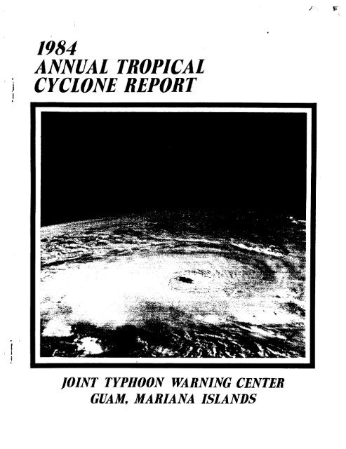
1984ANNUAL TROPICALi CYCLONEREPORT1JOINT TYPHOON WARNINGCENTERGUAM,MARIANA ISLANDS
FRONTCOVER:Ahqnop.tl.c viwo~ TaopicdCyclone30S (Kutndg).&dunon 8 Apmil19~4bgSpaceSktt-!khtdbion 41C. Kam.i.bgLLU4located tm.t-nokthea.d o{ Madagabm withane@ima.ted intenb-i.tg 0~ 100k-t(51d~ ]. Thdphotoghszph m Iakenwith a 100mmlea #wman uLtLtudeo~ 260m [482km).Noakthewnu~ent banding wc12 mug {xom the ege.Thec.dmu.a out@owiA Qz?%emetgM9Wngpvu%attg obbtig the nm tiktdimge.(Pho.toghaph Ptou.ided bg MVR (U. T. A&i.ingm,NAA~AR;~~fEN Iktmhment,JohtionSpace* .
U,S, NAVAL OCEANOGRAPHY COMMAND CENTERJOINT TYPHOON WARNING CENTERCOMNAVMARIANAS BOX 17FPO SAN FRANCISCO 96630* KENDALL G. HINMANCaptain, United States NavyCHARLESG. STEINBRUCKCaptain, United States NavyCOMMANDINGDAVID W. MCLAWHORNLieutenant Colonel, United States Air ForceDIRECTOR, JOINT TYPHOON WARNING CENTERCOMMANDER, DETACHMENT 1, 1ST WEATHER WING●transferred during 1S84
LCDR Scott A. Sandgathe, USNMAJ Mark E. Older 111, USAF*LCDR Robert L. Allen Jr. , USNLCDR Janice P. Garner, USNCAPT Boyce R. Columbus, USAFLT Brett T. Sherman, USN*cApT Robert so Lilianstrom, USAF*LT Henry Jones, USNCAPT Michael T. Gilford, USAFLT Mark J. Gunzelman, USNRLT William P. Wirfel, USN*AG1 James A. Frush, USN*AG2 Carl L. Hurless, USN*SSGT Michael W. Blackburn, USAFAG2 Kevin L. Cobb, USN*AG2 Anne W. Lackey, USNAG2 Teddy R. George, USN*AG3 Judith L. Allen, USN*SGT Jeffrey A. Goldman, USAF*SRA Jeffrey L. Cimini, USAFSRA Margaret E. Gray, USAFAG3 Kristopher W. Buttermore, USNSRA Thomas L. Parra, USAFAIC James Kelley III, USAFAIC Ronald W. Jones, USAFAGAN Shirley A. Murdock, USNAGAN Randall J. McKillip, USNCONTRIBUTOR: Detachment 1, lWW - USAFSatellite OperationsMAJ Frank H. Wells, USAF*CAPT David T. Miller~ USAFlLT Donna P. McNarnara, USAF*MSGT Michael R. Puka-jlo~ USAF*TSGT Terrence M. Young, USAFTSGT William H. Taylor, USAF*SSGT Terry R. Sandmeier~ USAFSSGT Charles B. Siniff Jr., USAFSSGT Patti A. Ashby, USAF*Transferred during 1984II
FOREWARDThe Annual Tropical Cyclone <strong>Report</strong> isprepared by the staff of the Joint TyphoonWarninq Center (<strong>JTWC</strong>), a combined USAF/USNorgani~ation operating under the command ofthe Commanding Officer, U. S. NavalOceanography Command Center/ Joint TyphoonWarning Center, Guam. <strong>JTWC</strong> was establishedin April 1959 when USCINCPAC directedUSCINCPACFLT to provide a single tropicalcyclone warning center for the westernNorth Pacific region. The operations of<strong>JTWC</strong> are guided by CINCPACINST 3140.1(series).The mission of the Joint Typhoon WarningCenter is multi-faceted and includes:1. Continuous monitoring of alltropical weather activity in the Northern andSouthern Hemispheres, from 180 degreeslongitude westward to the east coast ofAfrica, and the prompt issuance of appropriateadvisories and alerts when tropicalcyclone development is anticipated.2. Issuing warnings on all significanttropical cyclones in the above area ofresponsibility.3. Determination of reconnaissancerequirements for tropical cyclone surveillanceand assignment of appropriate priorities.4. In depth post-storm analysis ofall tropical cyclones occurring within thewestern North Pacific and North Indian Oceansfor publication in this report.5. Cooperation with the NavalEnvironmental Prediction Research Facility,Monterey, California, on the operationalevaluation of tropical cyclone models andforecast aids, and the development of newtechniques to support operational forecastscenarios.Satellite imagery used throughout thisreport represents data obtained by thetropical cyclone satellite surveillancenetwork. The personnel of Detachment 1,lWW, colocated with <strong>JTWC</strong>”at Nimitz Hill,Guam, coordinate the satellite acquisitionsand tropical cyclone surveillance with thefollowing units:Det 5, lWW, Clark AB, RPDet 8, lWW, Kadena AB, JapanDet 15, 30WS, Osan AB, KoreaDet 4, lWW, Hickam AFB, HawaiiAir Force Global <strong>Weather</strong> Central,Offutt AFB, NebraskaIn addition, the Naval Oceanography CommandDetachment, Diego Garcia, and DMSP equippedU.S. Navy aircraft carriers have beeninstrumental in providing vital satelliteposition fixes of tropical cyclones in theIndian Ocean.Should <strong>JTWC</strong> become incapacitated, theAlternate Joint Typhoon Warning Center(A<strong>JTWC</strong>) located at the U. S. Naval WesternOceanography Center, Pearl Harbor, Hawaii,assumes warning responsibilities. Assistancein determining satellite reconnaissancerequirements, and in obtaining the resultantdata, is provided by Det 4, lWW, Hickam APB,Hawaii.A special thanks is extended to the menand women of: 27th Information SystemsSquadron, Operating Location C, for their “continuing support by providing high qualityreal-time satellite imagery; the PacificFleet AQdio-Visual Center, Guam, for theirassistance in the reproduction of satelliteand graphics data for this report; to theNavy Publications and Printing ServiceBranch Office, Guam, for their efforts tomeet publication deadlines; and to Mrs.Patricia G. Lizama for her patience andperseverance in typing the many drafts andfinal manuscript of this report. A specialthanks is also extended to SSGT Charles B.Siniff Jr. for gridding the numeroussatellite pictures used in this report.NOTE : Appendix V contains information onhow to obtain Dast issues of theAnnual Tropicai Cyclone <strong>Report</strong>(titled Annual Typhoon <strong>Report</strong>prior to 1980).Ill
TABLEOF CONTENTSCHAPTERCHAPTERIII------------ —-.-——--——.VI’MWI’J.UNAL PIWJCEDURES PAGE1. General ------------------------------------------------ I2. Data Sources ------------------------------------------- 13. Communications ----------------------------------------- 14. Analyses ----------------------------------------------- 25. Forecast Aids ------------------------------------------ 26. Forecasting Procedures --------------------------------- 2-J. Warnings ----------------------------------------------- 38. Prognostic Reasoning Messages -------------------------- 49. Tropical Cyclone Formation Alert ----------------------- 410. Significant Tropical <strong>Weather</strong> Advisory ------------------ 4RECONNAISSANCE AND FIXES1-. General ------------------------------------------------ 52. Reconnaissance Availability ---------------------------- 53. Aircraft Reconnaissance Summary ------------------------ 54. Satellite Reconnaissance Summary ----------------------- 65. Radar Reconnaissance Summary ___________________________ 76. Tropical Cyclone Fix Data ------------------------------ 7CHAPTERIIISUMMARY OF TROPICAL CYCLONES1. Western North Pacific Tropical Cyclones ---------------- 11TROPICAL CYCLONE(Olw) TS VERNON(02W) TS WYNNE(03W) TY ALEX(04W) TS BETTY(05W) TY CARY(06W) TY DINAH(07W) TY ED(C18W) TS FREDA(09W) TD 09W(1OW)(llW)TS GERALDTY HOLLY(12W) TD 12W(13W) TY IKE(14W)(15W)TS JUNETY KELLYAUTHORINDIVIDUAL TROPICAL CYCLONESEDITOR : LT WIRFELPA&’SHERMAN ----- 16GARNER ------ 18OLDER ------- 22COLUMBUS ---- 26WIRFEL ------ 30SHERMAN ----- 34GARNER ------ 38OLDER ------- 40COLUMBUS ---- 44WIRFEL ------ 46GI’LFORD----- 50GUNZELMAN --- 54SHERMAN ----- 58GARNER ------’ 62OLDER ------- 66TROPICAL CYCLONE(16W)(17W)TS LYNNTS MAURY(18W) TS NINA(19W) TY OGDEN(20W) TY PHYLLIS(21W) TS ROY(22W) TS SUSAN(23W) TD 23W(24W)(25W)TY THADSTY VANESSA(26W) TY WARREN(27w) TY AGNES(28w) STY BILL(29w) TY CLARA(30W) TY DOYLEAUTHORPAGECOLUMEUS ------GILFORD -------70WIRFEL --------GUNZELNAN -----%80GARNER -------- 84SHERMAN -------OLDER --------- !!;COLUMBUS ------ 96WIRFEL -------- 98GILFORD ------- 102GUNZELMAN ----- 106GARNER -------- 110SHERMAN ------- 114OLDER --------- 122COLUMEUS ------ 1262. North Indian Ocean Tropical Cyclones ------------------ 130TROPICALCYCLONE(OIA) TC OIA(02B) TC 02BINDIVIDUAL TROPICALCYCLONESAUTHOR PAGE TROPICAL CYCLONEGARNER ----- 134 (03B) TC 03BSHERNAN ---- 136 (04B) TC 04BAUTHORPAGEOLDER --------- 138COLUMBUS ------ 142CHAPTERIVSUMMARY OF FORECAST VERIFICATION1. Annual Forecast Verification -------------------------- 1472. Comparison of Objective Techniques -------------------- 152Iv
CHAPTER VAPPLIED TROPICAL CYCLONE RESEARCH SUMMARY PAGENAVENVPREDRSCHFAC -------------------------------------- 156The Navy Two-Way Interactive Nested TropicalCyclone Model (NTCM)Tropical Cyclone Synoptic Analysis Display SystemTropical Cyclone Objective Decision-TreeAidForecasting<strong>JTWC</strong> ClimatologicalData SetA Statistical Method for 1 to 3 Day TropicalCyclone Track PredictionTropicalCyclone Haven StudiesNavy Tactical Applications Guide (MTAG), Vol 6Statistical Tropical Cyclone ForecastingFor The Soubhern HemisphereAidsSatellite Based Tropical Cyclone Intensity ForecastsCharacteristics of North Indian Ocean TropicalCyclone ActivityTropical Cyclone Readiness Condition Setting ProgramANNEX ATROPICAL CYCLONE TRACK AND FIX DATA1. Western North Pacific Cyclone Data --------------------- 1592. North Indian Ocean Cyclone Data ------------------------ 208APPENDIXI. Contractions ------------------------------------------- 213II. Definitions -------------------------------------------- 215III. Names for Tropical Cyclones ---------------------------- 216IV. References --------------------------------------------- 217v. Past Annual Tropical Cyclone <strong>Report</strong>s ‘------------------ 218DISTRIBUTION ---------------- ------------------------- ------------------------ 219v
CHAPTER I - OPERATIONAL PROCEDURES1.GENERALThe Joint Typhoon Warning Center (<strong>JTWC</strong>)provides a variety of routine services to theorganizations within its area of responsi-bility, including:a. Significant Tropical <strong>Weather</strong> Advisories:issued daily, this product describesall tropical disturbances and assesses theirpotential for further development during theadvisory period;b. Tropical Cyclone Formation Alerts:issued when synoptic, satellite and/oraircraft reconnaissance data indicatesdevelopment of a significant tropical cyclonein a specified area is likely;Tropical Cyclone Warnings: issuedperi~dically throughout each day for significanttropical cyclones, giving forecastsof position and intensity of the system; andd. Prognostic Reasoning Messages:issued twice daily for tropical storms andtyphoons in the western North Pacific; thesemessages discuss the rationale behind themost recent <strong>JTWC</strong> warnings.The recipients of the services of <strong>JTWC</strong>essentially determine the conte~t of <strong>JTWC</strong>*Sproducts according to their ever-changingrequirements. Therefore, the spectrum ofroutine services is subject to change fromyear to year. Such changes are usually theresult of deliberations held at the AnnualTropical Cyclone Conference.2. DATA SOURCESa. COMPUTER PRODUCTS:A standard array of synoptic-scalecomputer analyses and prognostic charts areavailable from the Fleet Numerical OceanographyCenter (FLENUMOCEANCEN) at Monterey,California. These products are provided to<strong>JTWC</strong> via the Naval Environmental DataNetwork (NEDN).b. CONVENTIONAL DATA:This data set is comprised of land-basedand shipboard surface and upper-air observationstaken at or near synoptic times, cloudmotionwinds derived twice daily fromsatellite data, and enroute meteorologicalobservations from commercial and militaryaircraft (AIRSPS)within six hours ofsynoptic times. Conventional data charts areprepared daily at 00002 and 12002 using handandcomputer-plotted data for the surface/gradient and 200 mb (upper-tropospheric)levels. In addition to these analyses,charts at the 850, 700, and 500 mb levels arecomputer-plotted from rawinsonde/pibalobservations at the 12-hour synoptic times.c. AIRCRAFT RECONNAISSANCE:Aircraft weather reconnaissance data areinvaluable for locating the position of thecenter~f developing systems and essentialfor the accurate determination of numerousparameters, including;- maximum surface and flight level wind- minimum sea-level pressure- horizontal surface and flight levelwind distribution- eye/center temperature and dewpointIn addition wind and pressure-height dataat the 500 and/or 400 mb levels, provided bythe aircraft while enroute to, or from fixmissions, or during dedicated synoptic-scaleflights, provide a valuable supplement to theall too sparse data fields of <strong>JTWC</strong>CS area ofresponsibility. A more detailed discussionof aircraft weather reconnaissance ispresented in Chapter II.d. SATELLITE RECONNAISSANCE:Meteorological satellite data obtainedfrom the Defense Meteorological SatelliteProgram (DMSP) and National Oceanic andAtmospheric Administration (NOAA) spacecraftplayed a major role in the earlydetection and tracking of tropical cyclonesin 1984. A discussion of the role of theseprograms is presented in Chapter II.e. RADAR RECONNAISSANCE:During 1984, as in previous years, landbasedradar coverage was utilized extensivelywhen available. Once a tropical cyclonemoved within the range of land-based radarsites, their reports were essential fordetermination of small scale movement. Useof radar reports during 1984 is discussed inChapter II.3. COMMUNICATIONSa. <strong>JTWC</strong> currently has access to threeprimary communications circuits.(1) The Automated Digital Network(AUTODIN) is used for dissemination ofwarnings, alerts and other related bulletinsto Department of Defense installations.These messages are relayed for furthertransmission over U.S. Navy Fleet Broadcasts,and U.S. Coast Guard CW (continuous waveMorse Code) and voice broadcasts. Inboundmessage traffic for <strong>JTWC</strong> is received via.AUTODIN addressed to NAVOCEANCOMCEN GUAM,<strong>JTWC</strong> GUAM, or DET 1 lWW NIMITZ HILL GU.”(2) The Air Force Automated <strong>Weather</strong>Network (AWN) provides weather data to <strong>JTWC</strong>through a dedicated circuit from theAutomated Digital <strong>Weather</strong> Switch (ADWS) atHickam AFB, Hawaii. The ADWS selects end1
outes the large volume of meteorologicalreports necessary to satisfy <strong>JTWC</strong> requirementsfor the right data at the right time,<strong>Weather</strong> bulletins prepared by <strong>JTWC</strong> areinserted into the AWN circuit via the NEDSand the Nimitz Hill Naval TelecommunicationsCenter (NTCC) of the Naval CommunicationsArea Master Station Weetern Pacific.(3) The Naval Environmental DataNetwork (NEDN) is the communications linkwith the computers at FLENUMOCEANCEN. <strong>JTWC</strong>is able to receive environmental data fromFLENUMOCEANCEN and to access the computersdirectly to execute numerical techniques.b. The Naval Environmental DisplayStation (NEDS) has become the backbone ofthe <strong>JTWC</strong> communications system. It is theterminal that provides a direct interfacewith the NEDN and AWN circuits, and iscapable of preparing messages for indirectAUTODIN transmission. The NEDS alsoprovides a means for the Typhoon DutyOfficer (TDO) to request forecaet aids whichare processed on the FLENUMOCEANCENcomputers and transmitted to the TDO overthe NEDN circuit.4. ANALYSESA composite surface/gradient level(3000 ft (915 m)) manual analysis of the<strong>JTWC</strong> area of responsibility is accomplishedon the 00002 and 1200Z conventional data.Analysis of the wind field using streamlinesis stressed for tropical and subtropicalregions. Analysis of the pressure field isaccomplished routinely by the NavalOceanography Command Center (NOCC)Operations watch-team and is used by <strong>JTWC</strong> inconjunction with their analysis of thetropical wind fields.A composite upper-tropospheric manualstreamline analysis is accomplished dailyutilizing rawinsonde data from 300 mbthrough 100 mb, winds derived from cloudmotion analysis, and AIREPS (taken plus orminus 6 hours of chart valid time) at orabove 29,000 feet (8,839 m). Wind andheight data are used to generate a representativeanalysis of tropical cyclone outflowpatterns, mid-latitude steering currents,and features that may influence tropicalcyclone intensity. A1l charts are handplottedin the tropics to provide allavailable data as soon as possible to theT’DO. Theee charts are augmented by computerplottedcharts for the final analysis.Computer plotted charts for the 850, 700,and 500 mb levels are available for streamlineand/or height-change apalysis from the0000Z and 1200Z data base. Additionalsectional charts at intermediate synoptictimes and auxilary charts such as stationtimeplot diagrams and pressure-changecharts are also analyzed during periods ofsignificant tropical cyclone activity.5. FORECAST AIDSThe following objective techniques wereemployed in tropical cyclone forecastingduring 1984 (a description of these techniquesis presented in Chapter IV) :a. MOVEMENT(1) 12-HOUR EXTRAPOLATION(2) CLIMATOLOGY(3) TPAC (Extrapolation andClimatology Blend)(4) TYAN78 (Analog)(5) COSMOS (Model OutputStatistics)(6) OTCM (Dynamical Model)(7) NTCM (Nested Grid DynamicalModel )(8) TAPT (Empirical)b. INTENSITY(1) THETA E (Empirical)(2) DVORAK (Empirical)(3) CLIMATOLOGY(4) WIND RADIUS (Analytical)6. FORECAST PROCEDURESa. INITIAL POSITIONINGThe warning position is the bestestimate of the center of the surface circulationat synoptic time. It is estimatedfrom an analysis of all fix informationreceived up to one and one-half hours aftersynoptic time. This analysis is based on asemi-objective weighting of fix informationbased on the historical accuracy of the fixplatform and the meteorological featuresused for the fix. The interpolated warningposition reduces the weighting of any singlefix and results in a more consistentmovement and a warning position that is morerepresentative of the larger-scale circulation.If the fix data is not available dueto reconnaissance platform malfunctions orconununication problems, synoptic data orextrapolation from previous fixes are used.b. TRACK FORECASTINGA preliminary forecast track is developedbased on an evaluation of the rationalebehind the previous warning and the guidancegiven by the most recent set of objectivetechniques and numerical prognoses. Thispreliminary track is then subjectively modifiedbased on the following considerations:2
(1) The prospects for recurvatureor erratic movement are evaluated. Thisevaluation is based primarily on the presentand forecast positions and amplitudes of themiddle-tropospheric, mid-latitude troughsand ridges as depicted on the latest upperairanalysis and numerical forecasts.(2) Determination of the best steeringlevel is partly influenced by thematurity and vertical extent of the tropicalcyclone. For mature tropical cycloneslocated south of the subtropical ridge,forecast changes in speed of movement areclosely correlated with anticipated changesin the intensity or relative position of theridge. When steering currents are relativelyweak, the tendency for tropical cyclones tomove northward due to internal forces is animportant consideration.(3) Over the 12- to 72-hour forecastperiod, speed of movement during the earlyforecast period is usually biased towardspersistence, while the subsequent forecastperiods are biased toward objective techniques.When a tropical cyclone moves poleward,and toward the mid-latitude steeringcurrents, speed of movement becomes increasinglymore biased toward a selective group ofobjective techniques capable of estimatingsignificant increases in speed of movement.(4) The proximity of the tropicalcyclone to other tropical cyclones is closelyevaluated tc determine if there is a possibilityof interaction.A final check is made againstclimatology to determine whether the forecasttrack is reasonable. If the forecastdeviates greatly from one of the climatolog~caltracks, the forecast rationale may bereappraised.c. INTENSITY FORECASTINGIn this parameter, heavy reliance isplaced on intensity trends from aircraftreconnaissance reports, wind and pressuredata from ships and land stations in thevicinity of the tropical cyclone, theDvorak satellite empirical model andclimatology. An evaluation of the entiresynoptic situation is made, including thelocation of major troughs and ridges, the@osition and intensity of any nearbytropical upper-tropospheric troughs (TUTT’S),the vertical and horizontal extent of thetropical cyclone’s circulation and the~xtent of the associated upper-levelOutflow pattern. An essential elementa~fecting each intensity forecast is theaccompanying forecast track and theinfluence of environmental parameters alongthat track, such as terrain influences,ver’$icalwind shear, and the existence ofan extratropical environment.OnCe the forecast intensities have beenderived, the horizontal distribution ofsurface winds (winds greater than 30-, 50-,and 100-knots) is determined. The mostrecent wind radii and associated asymmetriesare deduced from all available surfacewind observations and reconnaissanceaircraft reports. Based on the currentsurface wind distribution, ~reliminaryestimates of future wind radii are providedby an empirically derived objectivetechnique. These estimates may besubjectively modified based upon theanticipated interaction of the tropicalcyclone’s circulation with forecastlocations of large-scale wind regimes andsignificant landmasses. Other factorsincluding the tropical cyclone’s speed ofmovement and possible extratropicaltransition are considered.7. WARNINGSTropical cyclone warnings are issuedwhen a closed circulation is evident andmaximum sustained winds are forecast toincrease to 34 knots (18 meters per second)within 48 hours, or if the tropical cycloneis in such a position that life or propertymay be endangered within 72 hours. Warningsmay also be issued in other situations ifit is determined that there is a need toalert military or civil interests toconditions which may become hazardous in ashort period of time.Each tropical cyclone warning isnumbered sequentially and includes thefollowing information: the position of thesurface center; estimate of the positionaccuracy and the supporting reconnaissance(fix) platforms; the direction and speed ofmovement during the past six hours; and theintensity and radial extent of surface windsover 30-, 50-, and 100-knots, whenapplicable. At forecast intervals of 12-,24-, 48-, and 72-hours, information on thetropical cyclone’s anticipated position,intensity and wind radii are also provided.Starting on 1 July 1984, vectors indicatingthe mean direction and mean speed betweenforecast positions were also included in allwarnings.Warnings in the western North Pacificand North Indian Ocean are issued every sixhours valid at standard times (00002, 06002,12002, and 18002). All warnings arereleased to the communications network noearlier than synoptic time and no later thansynoptic time plus two and one-half hours sothat recipients will have a reasonableexpectation of having all warnings “in handbysynoptic time plus three hours (0300Z,0900z, 1500z, and 21OOZ).Warning forecast positions are laterverified against the corresponding “besttrack” positions (obtained during detailedpost-storm analysis to determine the actualpath of the cyclone). A summary of theverification results from 1984 is presentedin Chapter IV.3
8. PROGNOSTIC REASONING MESSAGESFor tropical storms and typhoons in thewestern North Pacific Ocean, prognosticreasoning messages are transmitted followingthe 00002 and 12002 warnings, or wheneverthe forecast reasoning is no longer valid.This plain language message is intended toprovide meteorologists with the reasoning behindthe latest <strong>JTWC</strong> forecast.In addition to this message, prognosticreasoning information applicable to allcustomers is provided in the remarks sectionof warnings when significant forecastchanges are made or when deemed appropriateby the TDO.9.TROPICALCYCLONEFORMATION ALERTTropical Cyclone Formation Alerts(TCFAS) are issued whenever interpretationof satellite imagery and other meteorologicaldata indicates that the formation of asignificant tropical cyclone is likely.These formation alerts will specify a validperiod not to exceed 24 hours and musteither be cancelled, reissued, or supersededby a tropical cyclone warning prior to theexpiration of the valid time.10.SIGNIFICANT TROPICALWEATHER ADVISORYThis product contains a general, nontechnicaldescription of all tropical disturbancesin the <strong>JTWC</strong> area of responsibilityand an assessment of their potential forfurther (tropical cyclone) development. Inaddition, all tropical cyclones in warningstatus are briefly discussed. This messageis issued at 06002 daily and is valid for a24 hour period. It is reissued whenever thesituation warrants. For each suspect area,the words “poor”, “fair”, and “good” will beused to describe the potential for furtherdevelopment. “Poor” will be used to describea tropical disturbance that is not expectedto require a TCFA during the advisory period;“Fair” will be used to describe a tropicaldisturbance that is currently not covered bya TCFA, but for which it is likely that aTCFA will be issued during the advisory period;and “Good” will be used when the tropicaldisturbance is covered by a TCFA.4
CHAPTER 11- RECONNAISSANCE AND FIXES1. GENERALThe Joint Typhoon Warning Center dependson reconnaissance to provide necessary,accurate, and timely meteorologicalinformation in support of each warning. <strong>JTWC</strong>relies primarily on three reconnaissanceplatforms: aircraft, satellite, and radar.In data rich areas synoptic data are alsoused to supplement the above. Optimumutilization of all available reconnaissanceresources is obtained through the SelectiveReconnaissance Program (SRP); various factorsare considered in selecting a specificreconnaissance platform including capabilitiesand limitations, and the tropicalcyclone’s threat to life and property bothafloat and ashore. A summary of reconnaissancefixes received during 1984 is includedin Section 6 of this chapter.2. RECONNAISSANCE AVAILABILITYa. AircraftAircraft weather reconnaissance for the<strong>JTWC</strong> is performed by-the 54th <strong>Weather</strong>Reconnaissance Squadron (54th WRS) located atAndersen Air Force Base, Guam. The 54th WRSis presently equipped with six WC-130aircraft and, from July through October, isaugmented by three additional aircraft fromthe 53rd WRS, Keesler Air Force Base,Mississippi, bringing the total number ofavailable aircraft to nine. The <strong>JTWC</strong>reconnaissance requirements are provideddaily to the Tropical Cyclone AircraftReconnaissance Coordinator (TCARC), whomarries the tasking from the <strong>JTWC</strong> with theavailable airframes from the 54th WRS.As in previous years, aircraftreconnaissance provided direct measurementsof height, temperature, flight-level wi?ds,sea-level pressure, estimated surface wln~s(when observable), and numerous additionalparameters. The meteorological data aregathered by the Aerial Reconnaissance <strong>Weather</strong>Officer (~WO) and dropsonde operators ofDetachment 3, 1st <strong>Weather</strong> Wing who fly withthe 54th WRS. These data provi#e the TyphoonDuty Officer (TDO) with indications afchanging tropical cyclone characteristics,radii of associated winds and currenttropical cyclone position and intensity.Another important aspect is the availabilityof the data for research on tropical cycloneanalysis and forecasting.b. SatelliteSatellite fixes from USAF/USN groundsites and USN ships provide day and nightcoverage in the <strong>JTWC</strong> area of responsibility.Interpretation of this satellite imageryprovides tropical cyclone positions andestimates of current and forecast intensitiesthrough the Dvorak technique.c. RadarLand radar provides positioning data onwell developed tropical cyclones when in theproximity (usually within 175 nm (324 km))of the rqdar sites in the Philippines,Taiwan, IfongKong, Japan, South Korea,Kwajalein, and Guam.d. SynopticIn 1984 <strong>JTWC</strong> also determined tropicalcyclone positions based on the analysis ofthe surface/gradient level synoptic data.These positions were helpful in situationswhere the vertical structure of the tropicalcyclone was weak or accurate surfacepositions from aircraft or satellite werenot available.3. &RJw;REcoNNAlssANcEDuring the 1984 tropical cvcloneseason, the <strong>JTWC</strong> levied ~10 .vor~ex fixes and53 investigative missions of which 14 wereflown into disturbances which did notdevelop. In addition to the levied fixes,251 intermediate fixes were also obtained.The average vector error for all aircraftfixes received at the <strong>JTWC</strong> during 1984 was12 nm (22 km).Air”&raft reconnaissance effectivenessis summarized in Table 2-1 using thecriteria set forth in CINCPACINST 3140.1(series).?ASLE2-1. AIRCSAFTRECONNAISSANCEFFECTIVENESS!NUMSEROFEFFECTIVENESS LEVIEDFIXES PERCENT;OMPLSTEDON TIME 202 96.1lAF.LY 2 1.0ATE 4 1.9U SSED 2 1.0TOTAL 210 100.0LEVIEDVS. MISSEDFIXESLEVIED MISSED PERCENTiVERAGE1965-1970 507 10 2.01971 802 7.61972 624 1:: 20.21973 227 13 5.71974 358 30 8.41975 217 7 3.21976 317 111977 203 3 H1978 29o 2 0.71979 289 141980 213 4 :::1981 201 3 1.51982 276 17 6.21983 157 1.91984 210 : 1.05
4.SATELLITE RECONNAISSANCE SUMMARYThe Air Force provides satellitereconnaissance support to <strong>JTWC</strong> using imageryfrom a variety of spacecraft. The tropicalcyclone satellite surveillance networkconsists of both tactical and centralizedfacilities. Tactical DMSP sites are locatedat Nimitz Hill, Guam; Clark AB, Republic,ofthe Philippines; Kadena AB, Japan; Osan AB,Korea; and Hickam AFB, Hawaii. These sitesprovide a combined coverage that includesmost of the <strong>JTWC</strong> area of responsibility inthe western North Pacific from near thedateline westward to the Malay Peninsula.<strong>JTWC</strong> relies on the Air Force Global <strong>Weather</strong>Central (AFGWC) to provide covera9e over theremainder of its area of responsibilityusing stored satellite data. The NavalOceanography Command Detachment, DiegoGarcia, provides NOAA polar orbitingcoverage in the central Indian Ocean as asupplement to this support. U. S. Navyships equipped for direct readout alsoprovided supplementary support.AFGWC, located at Offutt AFB, Nebraska,is the centralized member of the tropicalcyclone satellite surveillance network. Insupport of <strong>JTWC</strong>, AFGWC processes storedimagery from DMSP and NOAA spacecraft.Imagery processed at AFGWC is recordedonboard the spacecraft as it passes over theearth. Later, these data are downlinked toAFGWC via a network of command/readout sitesand communication satellites. This enablesAFGWC to obtain the coverage necessary to fixall tropical systems of interest to <strong>JTWC</strong>.AFGWC has the primary responsibility toprovide tropical cyclone surveillance overthe entire Indian Ocean, southwest Pacific,and portions of the western North Pacific onboth sides of the dateline. Additionally,AFGWC can be tasked to provide tropicalcyclone positions in the entire western NorthPacific as backup to coverage routinelyavailable in that reyion.The hub of the network is Det 1, lww,colocated with <strong>JTWC</strong> on Nimitz Hill, Guam.Based on available satellite coverage, Det 1coordinates satellite reconnaissancerequirements with <strong>JTWC</strong> and tasks theindividual network sites for the necessarytropical cyclone fixes. Therefore, when aposition from a polar-orbiting satellite isrequired as the basis for a warning, calleda “levied fix”, a dual-site tasking conceptcan be applied. Under this concept, twosites are tasked to fix the tropical cyclonefrom the same satellite pass. This providesthe necessary redundancy to virtuallyguarantee <strong>JTWC</strong> a successful satellite fix onthe tropical cyclone. Using this dual-siteconcept, the satellite reconnaissance networkis capable of meeting all of <strong>JTWC</strong>ts leviedsatellite fix requirements.The network provides <strong>JTWC</strong> with severalproducts and services. The main service isone of surveillance. Each site reviews itsdaily satellite coverage for indications oftropical cyclone development. If an areaexhibits the potential for development, <strong>JTWC</strong>is notified. Once <strong>JTWC</strong> issues either aformation alert or warning, the network istasked to provide three products: tropicalcyclone positions, intensity estimates, and24-hour intensity forecasts. Satellitetropical cyclone positions are assignedposition code numbers (PCN) depending on theavailability of geography for precisegridding, and the degree of organization ofthe tropical cyclone”s cloud system (Table2-2). During 1984, the network provided<strong>JTWC</strong> with a total of 1971 satellite fixes ontropical systems in the western North’Pacific. Another 184 fixes were made fortropical systems in the North Indian Ocean.A comparison of those fixes made on numberedtropical cyclones in the western NorthPacific with their corresponding <strong>JTWC</strong> besttrack positions is shown in Table 2-3.Estimates of the tropical cyclone’s currentintensity and 24-hour intensity forecast are?iuure 2-1.POLAR ORBITERS FOR 1984NOAA6(0727LST)D.NOAA7(1529LST)A*NOAA8(0737LST)D17540 (F6Y(062LST)A.18541 (F7~( 100LST)AP1ST = Local Sun Time. . DMSP Spacecraft+ . Operational6
made once each day by applying the Dvoraktechnique (NOAA Technical Memorandum NESDIS45 as revised) to visual imagery. A similartechnique using enhanced infrared imagery isunder development.Four polar orbiters were availablethroughout the season. Figure 2-1 showsthe status of operational polar orbiters.NOAA 6 was reactivated a year after beingplaced in standby mode (20 June 1983) tocompensate for the untimely loss of NOAA 8.Although not shown NOAA 9 was successfullylaunched on 12 December and should be ofbenefit in 1985.6. RADAR RECONNAISSANCE SUMMARYFourteen of the 30 significant tropicalcyclones in the western North Pacific during1984 passed within range of land based radarwith sufficient cloud pattern organizationto be fixed. The land radar fixes that wereobtained and transmitted to <strong>JTWC</strong> totaled510. Two radar fixes were obtained byreconnaissance aircraft.The WMO radar code defines threecategories of accuracy: good (within 10 km(5nm)), fair (within 10 to 30 h (5 to16 rim)),and poor ( within 30 to”50 km(16 to 27nm)). This year 510 radar fixeswere coded in this manner; 167 were good,156 were fair, and 187 poor. Compared tothe <strong>JTWC</strong> best track, the mean vectordeviation for land radar sites was 20 nm(37 km). Excellent support through timelyand accurate radar fix positioning allowed<strong>JTWC</strong> to track and forecast tropical cyclonemovement through even the most difficulterratic tracks.As in previous years, no radar reportswere received on North Indian Ocean tropicalcyclones.TABLE 2-2.PCNPOSITION CODE NUNBERSNETHOD OF CENTER DETERMINATION/GRIDDING1 EYE/GEOGRAPHY2 EYE/EPHEMERIS3 WELL DEFINED CC/GEOGRAPHY4 WELL DEFINED CC/EPHENERIS5 POORLY DEFINED CC/GEOGRAPHY6 POORLY DEFINED CC/EPHENRRIS6.TROPICALCYCLONE FIX DATAA total of 2918 fixes on 30 westernNorth Pacific tropical cyclones and 193fixes on four North Indian Ocean tropicalcyclones were received at <strong>JTWC</strong>. Table 2-4.Fix Platform Summary, delineates the numberof fixes per platform for each individualtropical cyclone. Season totals andpercentages are also indicated.Annex A includes individual fix datafor each tropical cyclone. Fix data aredivided into-four c~teaories: Satellite.Aircraft, Radar, and S$noptic. Those fixeslabeled with an asterisk (*) were determinedto be unrepresentative of the surfacecenter and were not used in determining thebest tracks. Within each category, thefirst three columns are as follows:FIX NO. - Sequentialfix numberTIME (Z) - GMT time in day, hours andminutesFIX POSITION - Latitude and longitudeto the nearest tenth ofa degreeTABLE 2-3. MEAN DEVIATION (NM) OF ALL SATELLITE DERIwD TROPICALCYCLONE POSITIONS FROM THE <strong>JTWC</strong> BEST TRACK POSITIONS.NUMBER OF CASES (IN PARENTHESES).1PCNWESTERN NORTH1972-1983 AVERAGE(ALL SITES)PACIFIC OCEAN NORTH INDIAN OCEAN1984 1980-1983 1984(ALL SITES) (lUL SITES) (ALL SITES)1 13.7217.3(1843)(802)3 20.3 (2691)4 23.1 (999)5 36.8 (4395)640.9 (2298)12.4 (119)15.7 (97)23.6 (259)25.1 (134)43.6 (317)42.4 (265)16.2 (27) 17.8 (13)9.0 (4)“ 32.1 i3)”21.8 (11) 19.0 (2)21.8 (5) 136.033.1 (87) 36.5(3)(84)35.1 (83) 62.7 (23)l&2 14.4 (2645)3&4 20.9 (3690)5&6 38.0 (6693)13.9 (216) 15.5 (31) 20.5 (16)24.1 (393) 26.3 (16) 89.2 (5)43.0. (582) 32.2 (170) 42.2 (107TOTAL NUNBEROF CASES (13028) (1191) (217) (1287
TABLE 2-4. FIX PLATFORN SUNNARY FOR 1984FIX PLATFORM SUMNARYWESTERN NORTHTS VERNONTS WYNNETY ALEXTS BETTYTY CARYTY DINAHTY EDTS FREDATD 09WTS GERALDTY HOLLYTD 12WTY IRETS JUNETY RELLYTS LYNNTS MAURYTS NINATY OGDENTY PHYLLISTS ROYTS SUSANTD 23wTY THADSTY VANESSATY WARRENTY AGNESSTY BILLTY CLARATY DOYLEPACIFIC(Olw)(02W)(03W)(04W)(05W)(06W)(07W)(08W)(09W)(low)(llW)(12W)(13W)(14W)(15W)(16W)(17W)(18W)(19W)(20W)(21W)(22W)(23W)(24W)(25W)(26W)(27W)(28W)(29W)(30W)AIRCRAFT--2352;::529212331; --1329106--1:272219462824SATELLITE261034062858582396368811;:46574123:;37262611601141121081631:;RADAR--373431--.-10212--1:;--:: ------2------------1312444--.-SYNOPTIC--33------------31--3----2------------------1----2--TOTAL2616682951141132035665132220211846768433638514732261274154147131253123139---------------------- -------- ----------------------------------- ---------------------TOTAL 417 1971 512 18 2918% OF TOTALNR OF FIXES 14.3 67.6 17.5 .6 100.0INDIAN OCEAN SATELLITE SmOPTIC TOTALl!C OIA 18 --18l’C 02B40 242!l’C03B37 40I’C 04B 89 : 93l’oTAL 184 9 193% OF TOTALNR OF FIXES 95.3 4.7 100.08
Depending upon the category, the remainderof the format varies as follows:a. Satellite(1) ACCRY - Position Code Numberis used to indicate the accuracy of the fixposition.~ ,!~,,or “ 2“ indicates relativelyhigh accuracy and a “5” or “6” relatively lowaccuracy.(2) DVORAK CODE - Intensityevaluation and trend (Figure 2-2, Table 2-5).(For specifics, refer to NOAA TM; NESDIS -45) .(3) COMMENTS - For explanation ofabbreviations, see Appendix I.E)mmpl.:T3.W4.5+1 w1.5@lms(4) SITE - ICAO call sign of thespecific satellite tracking station.b. Aircraft(1) FLT LVL - The constantpressure surface level, in millibars oraltitude, in feet, maintained durln9 thepenetration. The normal level flow indeveloped tropical cyclones, due to turbulencefactors, is 700 mb. Low-level missionsare normally flown at 1500 ft (457 m).(2) 700 MB HGT - Minimum heightof the 700 mb pressure surface within thevortex recorded in meters.(3) OBS MSLP - If the surfacecenter can be visually detected (e.g., in theeye) , the minimum sea-level Pressure isobtained by a dropsonde release above thesurface vortex center. If the fix is madeat the 1500-foot level, the sea levelpressure is extrapolated from that level.(4) MAX-SFC-WND - The maximumsurface wind (knots) is an estimate made bythe ARWO based on sea state. This observationis limited to the region of the flightpath and may not be representative of theentire tropical cyclone. Availability ofdata is also dependent upon the absence ofundercast conditions and the presence ofadequate illumination. The positions of themaximum flight level wind and the maximumobserved surface wind do not necessarilycoincide.(5) MAX-FLT-LVL-WND - Wind speed(knots) at flight level is measured by theAN/APN 147 droppler radar system aboard theWC-130 aircraft. This measurement may notrepresent the maximum flight level windassociated with the tropical cyclone becausethe aircraft only samples those portions ofthe tropical cyclone along the flight path.In many instances, the flight path isthrough the weak sector of the tropicalcyclone. In areas of heavy rainfall, thedoppler radar may track energy reflectedfrom precipitation rather than from the seasurface, thus, preventing accurate windspeed measurement. In obvious cases, sucherroneous wind data will not be reported.In addition, the doppler radar system onthe WC-130 restricts wind measurements todrift angles less than or equal to 27 degreesif the wind is normal (perpendicular) to theaircraft heading.9F@uLe 2-i?. The cuma.tT-numbm& 3.5 but.tfwCLLtwnt .in.ten.5.i,tg e&t.imRteh 4.5 Ieqiiziiatenzto77 !LtI. The ctoud h@ttWl ha w>ened bq 1.5 T-numbem &i.nm? tic pkev.ioti wztuatton cokkcted ’24how IWLL@L. The ph (+) Ayko.t inchzta an—expected fiewt.wL otj the wakening @tend oh vuy.Li.ttte @fL#IwLweakening 0{ thetmpiua.t ujd.onedwing tie next 24-hoti paiod.?ABLE 2-5.!ROPICALCYCLONE:NTENSITYNUMBER0.00.51.01.52.02.53.03.54.04.55.05.56.06.57.07.5MAXIMUM SUSTAINED WIND SPEED (lCT;AS A FUNCTION OF DVORAK CI s FI(CURRENT & FORSCAST INTENSI1’Y)NIMBER AND MINIMUM SEA LEVELPRESSURE (MSLP)WINDSPEED~2525252530354555657790102115127140155MSLP(NW PACIFIC)1003999994988981973964954942929915900(6) ACCRY - Fix position accuracy.Both navigational (OMEGA and LORAN) andmeteorological (by the ARWO) estimates aregiven in nautical miles.(7) EYE SHAPE - Geometrical‘r~presentation of the eye based on theaircraft radar presentation. The eye shapeis reported only if the center is 50 percentor more surrounded by wall cloud.(8) EyE DIAM/ORIENTATION -Diameter of the eye in nautical miles. Whenan elliptical eye is present, the lengths ofthe major and minor axes and the orientationof the major axis are respectively listed.When concentric eye walls are present, eachdiameter is listed.c. Radar(1) RADAR - Specific type of
platform (land, aircraft, or ship) utilizedfor fix.(2) ACC.RY - Accuracy of fixposition (good, fair, or poor) as given inthe WMO ground radar weather observationcode (FM20-V).(3) EYE SHAPE - Geometricalrepresentation of the eye given in plainlanguage (circular, elliptical, etc.).(4) EYE DIAM - Diameter of eyegiven in kilometers.(5) RADOB CODE - Taken directlyfrom WMO ground weather radar observation;code FM20-v. The first group specifies thevortex parameters, while the second groupdescribes the movement of the vortex center.(6) RADAR POSITION - Latitude andlongitude of tracking station given intenths of a degree.(7) SITE - WMO station number ofthe specific trackimg station.10
CHAPTER Ill - SUMMARY OF TROPICAL CYCLONES1. WESTERN NORTH PACIFIC TROPICAL CYCLONESDuring 1984, the western North Pacificexperienced the sixth consecutive year ofbelow average tropical cyclone activity.Thirty tropical cyclones occurred in 1984,one less than the annual average. Onlythree significant tropical cyclones failedto develop beyond the tropical depression(TD) stage and eleven tropical storms (TS)failed to reach typhoon intensity. Of the16 tropical cyclones that developed totyphoon (TY) intensity, two reached the130 kt (67 m/s) intensity necessary to beclassified as super typhoons (STY). In thewestern North Pacific, tropical cyclonesreaching tropical storm intensity or greaterare assigned names in alphabetical orderfrom a list of alternating male/femalenames (refer to Appendix III). Table 3-1provides a summary of key statistics for allwestern North Pacific tropical cyclones.Each tropical cyclone’s maximum surface wind(in knots) and minimum sea level pressure(in millibars) were obtained from bestestimates based on all available data. Thedistance traveled (in nautical miles) wascalculated from the <strong>JTWC</strong> official besttracks (see Annex A).Table 3-2 through 3-5 provide furtherinformation on the monthly and yearlydistribution of tropical cyclones andstatistics on Tropical Cyclone FormationAlerts and Warnings.TAsLE 31.wEsrEmNoRmPACIFIC1984 SIGNIFICANT TROPICAL CYCLONESCAIJMMR NU?43EROFMAXIMJM SWrTRAalMYSOF WAFN~ SURFACE ESTIMATED DISTAKZTKQPKAL CYCLCNE PEKKD OFWAIWU?G wAEwING — — Is.5uEDWINlX (m) l.SLF (m) TRAVEmD (N&0olwl-svEFNCN 09 JUN-ll JONOiw Ts WYNNE 19 JUN-26JUN03WTYAIEX04w TssElTY05W’TYCARYOIJUL-05JUL06 JUL-09JUL07 JUL-14JUL06W TY DINAH 24 JUL-OIAUG07WTYEDomTS FREDA25 JuL-OIAUG05 AUG-08AUGD9W m 09W 31 AuG-15AuGlowm~llw TY HOILY16 AUG-21AUG16 AUG-22AUG12WTDEW13WTY IKE24 AUG-25AUG27 ALE3-06SEP14W Is JuNE 28 AUG-30AUGMWTYKELLY16wls LYNN13SEP-18SEP24 SEP- 27 SEPliw ’rsmum 28SEP-01LX2r18WTSN3NA28SEP-O1OCC19w TY00XN O7OCI7-1OOCI’20W TY PnYIms llccr-14m23.wTs2t3Y llm-13CX21’2m % slEAN 11OCX-12(XY2W TD 23W 17ccr-18m24W TY ‘HiAD 190CI’-24a?r25W STY VANESSA 22 03?- 31OCI!26WTYWAP.RIN 23 Wl?-310Cr27wTYmOINDV-08N3V28W STY BILL 08 NOV-22DKYV29wTY-14 N3v-211x3v30W’ITEOYLE 04 DB2.-2J.Dm23984~ :* ovERmPPINGLnYs INcLumD cNLYcwEINsLM.38i89;5672364:44322610981588130*9281812303528X2102425542U1814:21213952:3131285230266114060’75559012510055305575$56075:5570803540251201551::13011012599398097098395591.59479829969799639959479839659969929909829749969929989258799769259099389355561609132011571355282617001094132810091712605280673812975538631.2012.23697273557628723623125I..ll.l266628922709296011
TABLE 3-2.1984 SIGNIFICANT TROPICAL CYCLONESWESTE514NORTH PACIFIC (1959-1984)—— JAN FEB MAR —— APR WAY —— JON —— JUL AUG SEP .— OCT __ NOV DEC TOTAL AVSRAGE CASE:TROPICALDEPRESSIONS 0000000 20100 3 3.8 98TROPICAL STORMS O 0 000 2133200 11 10.0 259TYPHOONS 0000004 2153116 17.3 451ALL TROPICALCYCLONES o 000025 7483130 31.1 8081959-1984AVERAGE .5 .3 .7 .8 1.3 2.0 4.9 6.3 5.7 4.6 2.7 1.4 31.1CASES 13 8 18 22 33 51 127 163 148 119 70 36 808FORMATION ALERTS:30 of 37 Formation Alerts developed into significant tropical cyclones.Tropical Cyclone Formation Alerts were issued for all significant tropicalcyclones that developed in 1984.WARNINGS: Number of warning days: 130Number of warning days withtwo tropical cyclones in region: 46Number of warning days with hreeor more tropical cyclones in region: 4-T ABLE 3-3. mYEAR(1945-1958)AVERAGE .4 .119591960196119621963196419651966196719681969197019711972197319741975197619771978197919801981198219831984(1959-1984)AVERAGEFREQUENCYOF TYPHOONS BY MONTR AND YEAR— JAN — FEB WAR — — APR MAY — — JuN JUL — — AUG — SEP — OCT0 000000o01000000000000100001 01 00000010 000000000.26.04.3001000:100000000000101200.2.411011011111030000101100000.6.70022:22010011010200020100.81.11 f, 20 23 R5 R202102221110121020200002100.92.012353643:20644112332;2:2.82.9583733b4434342231022225223.33.23052355::2532344243543113.22.4343443223533344431332213453.1NOV —2.0211304;:11120221221121231.7DEC —.921102101000:2000010102101.612
AsLE 3-4.FREQUENCYOF TROPICAL STORMS AND TYPHOONS BY t40NTHAND YEARYEAR JAN FEB MAR APR MAY JON JuL AUG SEP OCT NOV DEC TOTAI—. —. .— —. —— —— —1945-1958)AVSRAGE .4 .1 .4 .5 .8 1.3 3.0 3.9 4.1 3.3 2.7 1.1 21.61959 0111003 66422 261960 000 13310341 1 2-11961 111 ;325465 11 311962 0101206 73532 301963 0 0113435 503251964 0 ~002279 7661401965 2211235 67221 341966 0001215 87 21 301967 1021116 87 :31 351968 0001113 83640 271969 1010003 43321 191970 0100022 64540 241971 1013428 46420 351972 1000136 54523 301973 oooooo7 524;! 211974 1011144 554 321975 1000002 4553: 201976 1102224 4 11 251977 0010014 1 ;421 191978 10010 475430 281979 10111 ;427322 241980 0001414 264;1 241981 0012025 742 2 281982 0030134 5:311 261983 00000 35 552 231984 00000 :554731 271959-1984)AVERAGE .5 .3 .5 .S 1.1 1.6 4.5 5.4 4.8 4.1 2.5 1.2 27.3CASES 12 7 14 21 29 42 116 140 126 107 65 31 710w .l.Xmrm>-c*-W .—. .mFORMATIONALEAT SUMMARYWESTERN NOP3?HPACIFIC7ALE~ SYSTEMS TOTALNUWBER WHICH BECAME NUNBEREDOF ALERT NUMBERED TROPICAL DEVELOPMENTYSAR SYSTEMS TROPICAL CYCLONES CYCLONES RATE1972 41 29 32 71%1973 26 22 23 85%1974 35 30 36 86%1975 34 25 25 74%1976 34 25 25 74%1977 26 20 21 77%1978 32 27 32 84%1979 27 23 28 85%1980 37 28 28 76%1981 29 28 29 97%1982 36 26 28 72%1983 31 25 25 81%1984 37 30 30 81%(1972-1984) 32.7 26.0 27.8 80aAVERAGECASES425 338 36213
+-s+ +n‘1” L’1 . 1’ .!”.h:. 5II~“’I’’’ ’l ’’’’ ! ’’’l’’”’!’ “’!’’”1‘1 :} tt +\& + + /+!%:Y!,. !!!: :!: I:!!!::::! !.:~: 44:!:::$71: ~:1 /T:/J,] b... s7, 1 % )1{1 I I {: I ~ I -1/:1, “. , It:;L:- “::::- -1 w. I Ik-=---t: S+..-”+” ““+ “+ ‘FS...d . . . .5> - 9.:::, ‘“,” “’ ,- “:” :’ -,:\.. ..’. ..’:. ..”::. .“. “..:.b:al-,>”.“- .:”:”. :::. -“: ‘- -’~ ..-. -“ ,-~~~ j .b,,_, ,.~.,., (:-- ‘- .(. .. );. ... ..h :: {“..
4+-..- .--. -- .- .- .- ..- . . .. . . .- . . ,.. ,.4 1- !.. ,.. ,.. !,”,,.1’”’. ‘“”:. .’ ”’”,/w ? -w-–- 435.w-.J../,! . . -.,’. .,,.,. -,2%1154 r 1 I I ).(. I .I I ....... +!&+1::~Tcw,. ,. An,’‘:hw’ ‘;,,,’ ‘:,,’ ‘,,=,’ ‘,,,’ ‘:,,,~,:,:’. “ ~,. ,, ,.i..’Y\ ‘“+ -— +L++ —w+,,,5.$,\. ~~K$5.‘a?? d+. ~ “,, , ,:, .’ “:!:”m 85. w 95. tow w.. 10 m. 1204 125. 130 135. MU 145. no. 155. WY as 1 7(7 1?s 13!WC6UM3142flo (KH5-W)
t-iilI ,’+“ 3’++ , +*2Itillml-116
TROPICAL STORM VERNON(OIW)The formation of Tropical Storm Vernonmarked the start of the western Pacifictropical cyclone season. This is the secondyear in a row that the first tropical cycloneof the season did not develop until June, andthe first time since <strong>JTWC</strong> was establishedthat two consecutive seasons have started solate in the year.Tropical Storm Vernon was very similarto its 1983 season opening counterpart,Tropical Storm Sarah, in that it formed inthe South China Sea during June, developedinto a weak Tropical Storm, and made landfallin central Vietnam.The disturbance which was to developinto Tropical Storm Vernon was first detectedearly on 7 June as an area of poorly organizedconvection on the eastern end of the monsoontrough in the central South China Sea. Thedisturbance drifted slowly to the northwestand consolidated during the next 24 hours.At 0411Z on the 8th, a TCFA was issued basedon improved organization of the convectionand synoptic data which indicated the disturbancehad a closed surface circulation withwinds of 15 to 25 kt (8 to 13 m/s). Vernoncontinued moving to the northwest at 5 kt(9 km/hr) and at 00002 on the 9th the firstwarning was issued based on numerous 25 to 30kt (13 to 15 m/s) ship reports. The MSI+P atthis time was near.999 mb.Over the next 18 hours Vernon’s forwardspeed doubled to 10 kt (19 km/hr) as thestorm intensified, attaining tropical stormstrength between 00002 and 06002 on the 9thand reaching a maximum intensity of’~0 kt(21 m/s) approximately 6 to 9 hours later(Figure 3-01-1).Vietnamese authorities reported thatVernon caused flooding of rice, sweet potato,and sesame crops in the Quang Nam-Danangprovince. No loss of life or other significantproperty damage was reported.After reaching maximum intensity, Vernonmoved in a more westerly direction at 12 kt(22 krn/hr), and began to weaken as the stormentered a strong shearing environment.Vernon continued toward the coast of Vietnam,making landfall just north of Da Nang (WMO48855) at approximately 1012OOZ. By thistime most of Vernon’s convection was shearedto the west of the low-level circulation.Vernon quickly dissipated over land.F&me 3-01-1. TJLop&aLSWmI Vehnon wL.1% expobedlow-.teuet chd.ationaA.i.tattai.M tmpica.tbtomZn&mutg [090316 ZJune VM.SPv.i4uaLAnagWtgl.17
,. -.. ..- .,. ,.-...- ... ., ,.,- -.. ,..- -,, .,,. /
TROPICAL STORM WYNNS(02W)After Tropical Storm Vernon (~W) dissipatedover Vietnamr the southwest monsoon wasslow to re-establish itself. Surface ridgingfrom an anticyclone over the northernPhilippine Sea and later from a 1030 mb higheast of Japan kept easterlies in thePhilippine Sea and across Luzon until the 14thof June. By then the ridge east of Japan hadmoved far enough east to allow a weak southwestmonsoon to become established from theSouth China Sea eastward into the PhilippineSea. This set the stage for the developmentof Tropical Storm Wynne.The disturbance which developed into thesecond storm of the season was first detectedlate on 16 June in the northern PhilippineSea as an area of concentrated convectionembedded in the southwest monsoon. By 17June a broad, weak sur”facecirculation haddeveloped near 20N 137E with an MSLP of 1005mb and 10 to 20 kt (5 to 10 m/s) surfacewinds. The organization of the convectioncontinued to improve, prompting the issuanceof a TCFA at 1600z on the 18th. At that time,synoptic data indicated a weak upper-levelanticyclone had developed aloft providinggood outflow to the south and west. Late onthe 18th, the first aircraft reconna~ssanceflight into the disturbance found a 6 nm (11km) wide surface center with an MSLP of 998mb and maximum surface winds of 20 kt (10m/s ). At 190933Z the first warning on Wynne,valid at 190600z, was issued.Wynne maintained a predominantly westwardtrack throughout its life. The stormwas steered by the westward flow along thesouthern side of the mid to low-levelsubtropical ridge. This ridge was apparentlytoo narrow to be resolved by <strong>JTWC</strong>’S priinaryforecast aid, the One-Way InteractiveTropical Cyclone Model (OTCM). As a result,OTCM repeatedly predicted a northward trackfor the storm. By the second warning, <strong>JTWC</strong>forecasters had noticed this apparentproblem with OTCM and began forecasting amore westward track than OT,CMindicated.On 19 June a mid-latitude trough passedto the north of Wynne causing Wynne to turnbriefly to the northwest. However, thetrough did not weaken the subtropical ridgeenough to allow for recurvature. After thetrough passed on the 20th, Wynne once againresumed its westward heading which it maintaineduntil landfall.Despite the five days Wynne remained inthe Philippine Sea east of Taiwant it did notintensify beyond 55 kt (28 m/s) . The weakuPPer-level anticyclone which developed overWynne on the 18th remained very small, beingovershadowed by a much larger upper-levelanticyclone to the north over mainland China.Therefore, Wynne remained under a strongshearing environment from the north andnortheast throughout its lifer which hinderedintensification.~FAA 23170 ti?~ @&&f JtxQ2 /0612 s2giG..:.:..,.., .,.. ~~: ..... V?AUGF-Lgune3-02-1. TIopicd .St@mI ((fynnt ab d ptwedAouth 06 Tai.mn OA been bytado,t @om Kaohbuhg(WMO 46744] at 2319002 June [Photigmph COLOL&Ayo~CWUka.tha&ULUU, Ttipsi, T-).19
F@#LIZ 3-02-2. Wgnneab a 50 kt (26 m/b J .z%opicdbti~ en.tex.@ the &Oldh China Sea [240136Z JunaIXLSPuibuathkzgayl .
Wynne strengthened to 55 kt (28 m/s)just prior to passing the southern coast ofTaiwan. The sea level pressure of Lanyu(WMO 46762), located just east of thesouthern tip of Taiwan, dropped 14 mb in the12 hours preceding the storm’s arrival,reaching 984 mb with Wynness passage. AsWynne passed the southern tip of Taiwan(Figure 3-02-1), its low-level circulationwas disrupted causing Wynne to weakenslightly as it entered the South China Sea(Figure 3-02-2).Wynne passed 70 nm (130 km) south ofHong Kong (WMO 45005) about 24 hours afterpassing the southern tip of Taiwan. By thistime Wynne had intensified to its peakintensity of 60 kt (31 m/s). This wasconfirmed by the USS Mauna Kea (AE22) whichinadvertently passed very close to Wynne’scenter and reported “maximum winds to 60 kt,gusts to 70 kt.” Fortunately, no damage orpersonnel injuries were reported aboard theMauna Kea. Further north, Hong Kong reportedgusts to 60 kt (31 m/s) with the passage ofWynne.As Wynne traversed the Philippine Seaand the northern Luzon Straits, the southwestmonsoon was enhanced producing 20 to 30 kt(10 to 15 m/s) winds, high seas and heavyrainfall. In Luzon, at least 20 familieswere reported left homeless and 10,000 hectaresof riceland destroyed by floods.North of Luzon, three fishermen drowned whentheir boats capsized in heavy seas.Tropical Storm Wynne made landfall atapproximately 1200Z on the 25th on the coastof the PeopleTs Republic of China near theLuichow Peninsula, and weakened rapidly asit moved inland. The final warning on Wynnewas issued at 0000Z on the 26th.21
.-TYPHOONALEXBEST TRACK TC-03W -01 JULY-05 JULY 1984MAX SFC WIND 75 KTSMINIMUM 51P 970 MBSLEGENDI* 06 HOUR BEST TRACK POSITA SPEED OF MOVEMENTB INTENSITYC POSITION AT XX/OOOOZo.. TROPICAL DISTURBANCE..* TROPICAL DEPRESSION-- TROPICAL STORM4— TYPHOON- SUPER TYPHOON STARTO SUPER TYPHOON END+++ EXTRATROPICAL● ● * DISSIPATING STAGE~ ,.. FIRST WARNING -. ..- ISSUED -------~ LAST WARNING lSSUtUi“i i“@MARCU.{145° 150” 155°[ I8,, 1SA/PAdY . .GUI {M”l-– -~t-+ --i( ,I.....E:l‘i’:--~-~I.0TRUK,..-.-“+. . . . .
TYPHOON ALEX(03W)Typhoon Alex was the first typhoon ofthe 1984 western Pacific season. It was alsothe season’s first recurver. The satellitefixes during the formative stages of Alexwere somewhat misleading and contributed torather large forecast errors on the firstday in warning status. After reachingtyphoon intensity and crossing Taiwanr thelast phase of Alex’s life was characterizedby a complex transition into an extratropicallow.The seedlings of Alex first caught theattention of the <strong>JTWC</strong> forecasters on the 28thof June. Based on several ship reportsshowing that a circulation center had developedin the Philippine Sea, the SignificantTropical <strong>Weather</strong> Advisory (ABEH PGTW) wasreissued at 281415Z stating that a 10 to 15kt (5 to 8 m/s) surface circulation haddeveloped near 16N 129E, within a disorganizedarea of convection in the monsoon trough(point A on Figures 3-03-1 and 3-03-2).This area was identified as one with a “poor”potential for development (meaning thedisturbance was not expected to require aTCFA during the advisory period). For thenext day-and-a-half the disturbance persistedwith no signs of development. At 2301z onthe 29th, visual satellite pictures indicatedthat a partially exposed low-level circulationhad developed on the northern edge ofthe disturbance (point B on Figures 3-03-1and 3-03-2). Consequently an aircraftinvestigation of the area was requested forthe following day.F.igum3-03-1. Initiallythe expohtd ho-leve.tc.ikculation centezat pointE w though a% be -theotigin od Typhoon M3ex. floweuu, pobt-ana.tyA.iAindititi the actual! point 06 otig.in WA ptobablyneat point A (292301Z June NOAAv.dti .iknagekq).Upon arrival at the invest point, theaircraft radioed back to the <strong>JTWC</strong> forecasterthat a well-defined circulation center waspresent and that a vortex fix would beforthcoming. NOW things happened quickly.The forecaster first notified his customerson Luzon that a tropical depression wasdeveloping just to the east of them and theycould experience 30 kt (15 m/s) winds within18 hours. At 2300Z on the 30th a TCFA wasissued. Shortly thereafter, at 2338Z, thevortex fix was radioed to <strong>JTWC</strong> containingdetails on the closed surface circulation.The first warning on Alex, valid at 0000Z on1 July quickly followed.Unfortunately, the first four warningsforecast Alex to move to the west. Satellitefixes starting late on the 29th and continuingthrough 1800z on the 1st indicated thatthe depression was moving west-southwest.Limited radar fixes indicated that the systemwas nearly stationary. However, when thedaylight satellite pictures became availablelate on 1 July, it was obvious that thesystem had in reality moved north-northwest(along track CD in Figure 3-03-2) and wasnow a tropical storm. Thus it was not untilwarning number five that the westward trackwas abandoned and not umtil warning numberseven that the recurvature scenario was fullydeveloped.The rationale behind the forecasttrack on warning number one now becomesinstructive: When the system was firstdetected “on the doorstep” of Luzon, thereFiguze3-03-2. PointA h bet,ieved to be the aetua.tpoint o~ otig.ino{ Typhoon /&ex; ?oiti B h thepo~i.tion o{ the pattially expohed tow-.teud c.&e&z& ‘oncenakt, .initia.Uy thought to be the om.in o~ ALex;Point C .iA the .2maXion 06 the ceticz iound by theIfiJIAz a.&.c)@tinvtit; Po&tV. i A the btiftich.tktough 021200Z,and Point E .iA the 72 ho#L ~oaeeabt@om uwtningnumbtione.23
F@Uu? 3-03-3. Akd-tt.opobph&c ff&W )2mvu&@o!uhing fit Aomtion 0{ tie ~.t uum.i.ng~ohecabtneaboning [Stmtine @@A~ 06 tic FNOC 400 mbNVA wind {Letkl Vdi.d d 301200Z June).+++’..u, ,..)XJLF-’LR4M-++!Fig#cc 3-03-4. The m&tJLOpObphtiC 6@OJX%Cb.&.d&WI ptevting .dut@ WOA2 o~ .thzL@ o{TyphoonALex. Note tit an.ticytineuhi.cha movedeat X0 the ‘Aou.th o{ Jupan and the a%oughovex CMchinaU#lkh.i.b&o movingeaAZlaL%d (tiumt..ineanulgbibo{ the FNOC NOGAPS 500 mb uind &f.d vo.?dat 0212002 July].24
was an urgency to let the people there knowthat the potential existed for a tropicalcyclone to affect them almost immediately.Therefore it was deemed necessary to devisethe forecast track before all of the <strong>JTWC</strong>forecast aids could be obtained. Availableto the forecaster were the past fixes whichlead to best track BC on Figure 3-03-2 and asynoptic situation characterized by a midtroposphericridge north of the storm asillustrated in Figure 3-03-3. Given thepresent and past position of the storm andthe northeasterly flow across Luzon, a westwardforecast with recurvature beyond the 72hour point seemed logical. This scenariowas briefed to all concerned. When theforecast aids did arrive, they generallyagreed with this reasoning. One of the aidswhich did not agree was the One-Way InteractiveCyclone Model (OTCM), <strong>JTWC</strong>’S primaryforecast aid, which forecast Alex to move tothe north-northwest to near point D inFigure 3-03-2 in twenty-four hours. TheOTCM forecast was discounted for threereasons. First, it was perpendicular. to themid-tropospheric flow and headed toward thecenter of the ridge near Taiwan. Second,the track BCD seemed highly improbable.Finally, OTCM had consistently and erroneouslyforecast a westward moving storm (TropicalStorm Wynne (02w)) to go to the north only aweek earlier in the same general area.As it turned out, the OTCM forecast wasexcellent. Figure 3-03-4 reflects the newsynoptic situation. The anticyclone thathad been over Taiwan did not persist asoriginally anticipated but weakened andmoved to the east. This movement allowedAlex to accelerate to the north-northwesttowards Taiwan. The OTCM had correctlyforecast this to occur. With the postanalysisknowledge that Alex did not transitthe Philippines, but instead went northnorthwest,Figure 3-03-2 should be examinedfor an explanation of the true origin ofAlex. The track BCD seems highly improbableThere is currenkly no explanation for a pathfrom B to C at a speed of nearly 10 kt (19km/hr), a slow down to 3 kt (6 km/hr) at Cfollowed by a sudden 120 degree turn to theright and an acceleration to 12 kt (22 km/hr)by point D. A much more likely path wouldbe genesis near point A, as was indicated bysynoptic data back on 28 June, westwardmovement at about 5 kt (9 km/hr) to C andthen a more gradual turn to the right withacceleration to D. Consequently it is nowthought that the low-level circulationcenter found by satellite imagery at point 13on the 29th of June was a ‘red-herring”;nothing more than an eddy in the monsoontrough.Once the northward movement of Alex waswell established, the forecasts were relativelyaccurate (although the speeds weresomewhat slow) . The only question waswhether Alex would track up the east coastof Taiwan, cross the middle of the EastCnina Sea and transit through the KoreanStrait, or transfer across Taiwan, movealong the coast of mainland China and crossSouth Korea. By warning number 11 thisquestion was correctly resolved as the lasteight warnings had excellent track forecasts.Alex continued to intensify reaching amaximum intensity of 75 kt (39 m/s) justprior to crossing Taiwan (Figures 3-03-5 and3-03-6). During the middle and last phasesof Alex’s life, the southwesterlies infront of a trough that laid over centralKorea provided the steering mechanism.This trough with its associated surfacefront was the same trough observed overnorthern China in Figure 3-03-4 severaldays earlier. Starting on 5 July Alexunderwent a complex extratropical transitionwith this front. The final warning wasissued at 051200z as Alex became indistinguishablefrom the frontal system over theSea of Japan.In summary, Typhoon Alex can be identifiedas a typical, well-behaved recurverthat transitioned into an extratropicalsystern. Th& first four warnings were marredby erroneous rejection of OTCM, and byacceptance of early fixes from a featurethat was probably not part of the genesismechanism.Figtie 3-03-5. Typhoon A&x jubtptioftto atzk&.@maxi.nwn.&tW.ity (022329Z’ JULY NOAAv~ti iMU@.Y) ~F.igwle 3-03-6. Tgphoon A&x j~t ptdktiUttu.in.hlg nwi.mwn.in.tenbi.tgti ban bgzixdm &.omKaohbuiqI(wMO46744) at 022300Z July [Photogn.uphcoutttiq o~ cew%a.t wedhez Guwau, Tu.@si, T-].25
,., . 1 -.. :..,, . /d.. :,, .. . -. .- -.. . ..,...- -., .- -.. . ... . ,., --.1 I , , , ,.,, ,. ,,, ,,, ,,, ,,,.,- -.. . .- -.. ,. ..- . .- -,. . ..,. . .- -., .., -,, .- ... ,-/-”- --l - SHANJ-k1lROPICALSTORM BETTYBEST TRACK TC-04W06 JULY-09 JULY 1984 “MAX SFC WIND 55 KTSMINIMUM SLP 983 MBSLEGEND~ 06 HOUR BEST TRACK POSITA SPEED OF MOVEMENTB INTENSITYC POSITION AT XX/OOOOZ000 TROPICAL DISTURBANCE. . . TROPICAL DEPRESSION-- TROPICAL STORM— TYPHOONe SUPER TYPHOON STARTo SUPER TYPHOON ENDe++ EXTRATROPICAL● ● ● DISSIPATING STAGEA FIRST WARNING ISSUEDM LAST WARNING ISSUEDIQmt-t--t-+!-–~i‘“/::r
TROPICAL STORM BETTY(04W)Tropical Storm Betty originated in theeastern extension of the monsoon trough earlyin July but took several days to develop intoa significant tropical cyclone. Oncedeveloped, Betty moved steadily to the northwestthrough the South China Sea eventuallymaking landfall and dissipating over southernChina.At 0000Z on the 2nd, a disturbance whichlater developed into Tropical Storm Betty waslocated approximately 550 nm (1019 km) southweetof Guam. Synoptic data showed thedisturbance to be a broad, weak surfacecirculation with winds of 10 to 15 kt(5 to 8 m/s). Concurrent satellite imageryshowed the disturbance as an area of poorlyorganized convection. Strong surface ridgingwas present between the disturbance and thedeveloping Tropical Storm Alex (03W) to thenorth which was then located off the eastcoast of Luzon. Above this surface ridginga TUTT was providing good upper-level outflowto the north of the disturbance enhancing theconvective activity.When the disturbance was mentioned onthe 030600Z Significant Tropical <strong>Weather</strong>Advisory (ABEH PGTW), it had moved northwestbehind now Typhoon Alex (03W) which waslocated east of Taiwan and moving rapidlynorthward. With the TUTT providing goodupper-level outflow over the disturbance,the convection exhibited a marked increasein organization and intensity over 24 hoursearlier.By 02002 on the 4th, the disturbancehad moved to ne~r 15N 128E and was becomingmore organized. At this time the first TCFAwas issued on the system. Figure 3-04-1shows the disturbance at the time the TCFAwas issued. Note the banding in the convectionand anticyclonic upper-level outflow.Synoptic data indicated that only a broad10 to 15 kt (5 to 8 m/s) surface circulationwas present. Strong ridging still persistednorth of the disturbance.instrumental in preventingThis ridging wasBetty fromfollowing a path similar to that of TyphoonAlex (03W).F.igluce 3-04-1 Tmpi.d Atom Betty &z .7k tinw tksI@@ TCFA WA .ibbued [0401 162 Juty UMSP V.dlld~w ‘W.27
Aircraft reconnaissance flights on 3 and4 July at the 1500 ft (457 m) level wereunable to close-off a circulation center,finding instead a broad surface trough. TheTCFA was reissued at 050200z July since thepossibility existed that the system wouldremain east of Luzon and develop. Aircraftreconnaissance during the afternoon of $he5th indicated that the system had intensifiedslightly into a weak tropical depressionwith an MSLP of 1002 mb and maximum surfacewinds of 25 kt (13 m/s). However, nofurther development occurred as the systemmoved west and approached the Philippines.By the 6th, the depression had weakenedas it transited Luzon. At this time thethird and final TCFA was issued since it wasconsidered likely that a significant tropicalcyclone would finally develop once thedisturbance moved out over the South ChinaSea.At 1200Z on the 6th, synoptic dataindicated that the disturbance had movedoffshore west of Luzon and was developing.With surface reports of 20 to 25 kt (10 to13 m/s) and further intensification verylikely, the first warning was issued.Visual satellite imagery late on the 6th(Figure 3-04-2) showed Betty, then adepression, with a large, mostly clear areaat its center. b exposed low-levelcirculation is evident as indicated by thespiraling low-level cumulus clouds.Convective activity is heaviest in thesouthern semicircle surrounding the mostlyconvection-free center. Aircraft reconnaissanceat about the same time reported a largelight and variable center 50 to 60 nm (93 to111 km) in diameter associated with thedepression. Surface winds of 25 to 30 kt(13 to 15 m/s) were observed southeast of thecenter where the depression’s flow wasenhanced by the southwest monsoon.F&Juhe 3-04-Z. Thop.icatStoMn Battyab at-topicaldepttition a(ttihaviag tio~hed the PhiUppheb. Note.ihe e.xpobed low-Levct? chc.u@k “on cen.twt m indicatedby @za..Uing CIJMu.tub kti.ide a fiztge wnvetM.on-&eecewkz.t azea [062333Z Ju.2yNOAA v.ibual.imagehy].28
Betty was upgraded to a tropical stormat 1200Z on the Ith based upon receipt of35 kt ship reports and satellite imageryshowing improved convective organization.Aircraft reconnaissance at 080034z indicatedthat Tropical Storm Betty had intensifiedfurther with maximum surface winds of 50 kt(26 m/s) being reported in a small area inthe east semicircle.The Hong Kong Royal Observatory (WMO45005) picked up Betty on weather radar atapproximately 080300z and transmittedposition fixes until 090600Z. These hourlyreports aided greatly in positioning thetropical storm during this period.Between 0600z on the 8th and 0600Z onthe 9th, Betty maintained an intensity of50 to 55 kt (26 to 28 m/s), making landfallat 090300z approximately 135 nm (250 km)west-southwest of Hong Kong. Figure 3-04-3shows Betty at maximum intensity just priorto landfall. Dissipation occurred after091800z over the southwestern portion ofthe Peoples Republic of China. No forecastproblems were encountered with TropicalStorm Betty since it moved steadily to thenorthwest around the southwestern peripheryof the subtropical ridge.f~gwte 3-04-3. rJLQpid ~22Y0rI &.t@O.tmO,%imwnLmtm$itg oi 55 tat (2g mlbl jtif ptioz .tQ &wd@.U(090737Z Jutg v~p v~~ -GWWLY1 .29
—$ v: / -f L I I I ) i I I I , , I I.A47’.-,, !4+“!! ,::.:”!!,I , (r.. .,, ,,- *+++..*l! !/::- : ,: ;OBt.- - :-A--: .--+--”TYPHOONCARYBEST TRACK TC-05W07 JULY-14 JULY 1984MAX SFC WIND 90 KTSMINIMUM SLP 955 MBSLEGENDW 06 HOUR BEST TRACK POSITA ipEED OF MOVEMENTINTENSITYPOSITION AT XX/OOOOZTROPICAL DISTURBANCETROPICAL DEPRESSIONTROPICAL STORM:tA”\ r--- ‘T’000.*.--TYPHOON23”.40+40● .* DISSIPATING22”,1~5” tie”*,,. . . . .,.. - +,~c’-+ +i““tJa\, 1 0 I1r~ ,Pf ,t ‘-”-’ t. --’5” ; t/)5a;7’ *C ,,.;: :-“’- -’””- -0- tiAKE -::,., --..“50,,- -... . . . . -,,-ta..oo5C.Iif /$. ,A:E;60 . -“501’G SPEED INTENSITYi , , , /?%jh ~,. --40/ *., -,-. A.. A+...+ . .0812Z 506- -..0s18255 . ..- -.. .- -..5“3C““”- ‘“0900Z60 ,., .-.. .- -.. ,2~B ..- -... .2~LIT,Hl-$0906260 ir.- ‘$*- ~i’::L”:u1J-YZP. - -.,.- --- -.0912z 65,KWAJO+LEINL,.. - -.. .- -., .,.. ...,0918z 75IALAU IS a a1,- -.. WOLEfi - ““”F-2NAPE1000Z 90.- .,. , .- -.. -.. ..,. ...11006z 90, , ,i , 1KOSRAE2- . . . . .- -.. ,,,, ,,’ .,. .10I2Z 805,, . . ..,. . .- -.. . ,. . . . . .- .,,,1018z 757. . +;;:,.- -,. , .- -.. . .,,. ...,11OOZ 70,::: :6I t t , , II + I , t 1 t I , @RI ‘ .-aSUPER TYPHOON STARTSUPER TYPHOON ENDEXTRATROPICALSTAGEFIRST WARNING ISSUEDLAST WARNING ISSUED1 1 I [ ! I 1 , I , .,, r , 1 1.TRUK . -. ,.. . . . . . . . . ,4, .MAJURO. . . . . . .D TARA,,, - -.. .- ... . .- -,,”. ..,. ,..’ ... ---- w .“ _YF-T#dTIt
TYPHOON CARY(05W)Typhoon Cary was the first storm of theseason to be initiated by tbe Tropical UpperTropospheric Trough (TUTT] in a mannersimilar to that described by Sadler (1976).While remaining over water its entire life,Cary distinguished itself by unusualintensity changes.The disturbance which eventually developedinto Typhoon Cary was first noticed onthe 2nd of July as an area of very poorlyorganized convection near 18N 168E in theeastern, divergent side of a westward moving‘TUTT cell. During the next two days, theconvection remained poorly organized as itmoved to the west-southwest. Surfacesynoptic data indicated only easterly tradeswere present beneath the convection. Earlyon the 5th, the convection became moreorganized with satellite imagery indicatingan anticyclone developing aloft over thesystem: however, due to sparse surfacere~rts, the presence of a surface circulationcould not be confirmed. Because ofthe improved organization, the area ofconvection was mentioned in the 050600ZSignificant Tropical <strong>Weather</strong> Advisory (ABEHPGTW) . Subsequent satellite imagery showedcontinued development of the convection andthe ABEH was reissued at 051200Z indicatingthat the potential for significant tropicalcyclone development was “fair” (meaning thatit is likely that a TCFA will be issuedduring the advisory period). Early on the6th, satellite imagery (Figure 3-05-1)showed that the convection had become commashaped, with evidence that a surface circulationwas forming. Consequently a TCFA wasissued at 060317z. During the following 21hours the disturbance moved to the westnorthwest,with no significant intensification.Aircraft reconnaissance late on the 6th,had no trouble locating a surface circulationand reported that the disturbance hadan NLSP of 1004 mb with estimated maximumsurface winds of 25 kt (13 m/s). Based onthis report, the first warning on Cary wasissued at 0000Z on the 7th. During the next12 hours, satellite imagery indicated thedepression was slowly intensifying. Thiswas confirmed by the next aircraftreconnaissance flight which found Cary hadintensified to storm strength with a narrowband of 35 to 40 kt (18 to 21 m/s) surfacewinds north of its center and an NSLP of999 Mb.Cary continued to intensify as it movedto the northwest toward an apparent break inthe subtropical ridge. Due to uncertaintyin the Fleet Numerical Oceanography Center(FNOC) analysis fields in the data sparseregion southeast of Japan, 400 mb synoptictrack missions were flown on 8 and 9 July tobetter define the mid-level flow north ofCary. These flights confirmed the presenceof a weakness in the ridge, which indicatedthat forecasts for slow northwestwardmovement with eventual recurvature to thenortheast were sound. Cary slowed as itapproached the weakness in the subtropicalrxdge wh~le continuing to intensify. At091200Z, Cary was upgraded to typhoon statusbased on aircraft and satellite data whichindicated that a 30 nm (56 km) wide eye hadformed, 700 mb flight level winds were 64 kt(33 m/s), and an MSLP of 975 mb existed.During the subsequent 12 hours Cary intensifiedquite rapidly, reaching a maximumintensity of 90 kt (46 m\s) with an IISIIP of955 mb at 0923322. Figure 3-05-2 shows Caryjust prior to reaching maximum intensity.F.i.gwLe3-05-1. Su.te.Ui.te imagezg which ptomp.tedi.bmance 04 the TCFA. No.iethe coma hzped convectionand the expo~ed .touMevst cihcuh.tioncentu tofhe40u.thwebt106003623dq WPvbtihgtiy).F.iguze 3-05-2. TgphoonCatyjtit ~ato aeachi,ngmaximumi.n.te@.@(0922212Ju.LyNOAA v.iAL@.imzgVuj).31
Between 0000Z on the 9th and 1200z on the10th, Cary moved very slowly through theridge axis. At the same time, a mid-latitudetrough was forecast to deepen in the lee ofJapan, supress the subtropical ridge furthersouth, and allow Cary to enter the westerliesand be steered to the northeast. Acceleration,although considered, was not forecastsince the strong upper-level westerlies wereforecast to remain well north of 30N throughthe forecast period.Recurvature to the northeast was underwayby 1012OOZ. This was accompanied by asignificant shearing of the convection inthe northwest semicircle of the storm(Figure 3-05-3) resulting in a reduction ofintensity to near minimum typhoon strength.Approximately 18 hours later the troughapproached a blocking ridge along 170E,turned to the north, and weakened. Thisallowed the shearing environment over Caryto decrease resulting in a gradual increasein convection and a halt to the weakeningtrend. At 111118z the ARWO reported thatCary was once again developing an eye; thistime 40 nm (74 km) across. This large eyepersisted for 24 hours (Figure 3-05-4) asCary reintensified. Figure 3-05-5 shows theintensity variations of Cary. Note theweakening when Cary was being shearedfollowed by reintensification as the upperlevelenvironment improved.Fi.gute 3-05-3. Typhoon CiVLgbeing bhe.uhed. Not.iLthe complete abhence o& &ign&icant convectioninnotihwebt bemic.i)de [ 1021562 k&g NOAAV.LAUULimugemj) .Figtie 3-05-4, TgphoonCaiiga&@t tcin.tenbkiyi.ng.MaXiMm baAi5z.ind Wi.ndb me 75 k.t [39 mlb][t 205292 ~tL@ NOAA Vi&LUt i.lM@tlj) .32
AS Cary moved further north, increasing transition to an extratropical low. Thevertical shear and entrainment of cooler,extratropical remains of Cary continued todrier air caused Cary to weaken andweaken and moved west under the influencegradually become extratropical. By 140600z of a surface ridge northeast of Japan. CaryCary had completed its extratropical eventually dissipated to the south of Japan.transition and the final warning was issued. There were no reports.mf injuries orFigure 3-05-6 shows Cary as it completed damages from Cary.100CARY (05W)INTENSITY ANALYSIS?4290?5280?6270)716a979xz~ 5Cm4C8Tu)987 mz9933(2(AT!T999(12001200120012001200 120012001200120012I6 7 8 9 10 11 12 13 14 15F.igl.m 3-05-5. sateuite (Dvotak,, f9731 and a.i.wuz{tzeconmzdmnce [-on and Hofiday, 19771inten.ktgebtimtiti06 TyphoonCahg. Bed .?2ack.in.tenbtitiate bhoumm the boJ?id fine.Fi.guJLe3-05-6. Wllj Complcl%lg ex#u@lopidthamitton. NO.tIZ ah ab~tncco{ convection atoo.nd thebtom , Only htab$e &3ta.tocumuluA ctou& hemain(140504Z July IIOAA v.iAud? .imagtig].33
0[CJ3ilSSl ONINilVM lSV1 ~a3flSSl !DNINdVM lSUlj ~39V1S ONllVdl SSla ● ~*lV31dO?llVUlX3 e++aN3 NOOHdAl l13dnSolilVIS NOOHdAl d3dnS ~NOOHdAl —WUOl SlV31dOW --NOlSS3Nd3a lV31dOW ● **3~NvfiiinlSlCi lV31d Olll o..ZOOOO/XXIV NOlllSOd 3A11SN31NI ElN3W3AOW40C133dS V4VMllSOd X3Viil 1S39 31110H 90 ~ Q)2~iwaN3931~09Lvzv7;’”e;&:$& 1S9W S16 dlS WnWINIW%., 4II ‘Ii 90/t7z*1z Sl)l S21 CINIM 2dS XVW 1 , 1 ,*861 mv LO-mr 92 .. 001% -.,, ., ‘KM90-31 )13VU Asia -. S6~ --HVNI(I 06>-.~’ -hNOOHdA.1“ L T-T;; 73:!% $4... ..,, .dVhT;--e,J3‘- “’”‘“-“;’lHhlYV13A3N3,. ,., . -., , . -.,9,’, ,. - ... ,. ... .{PmO*%7} -’y pall; ~ - ~~~~~?,ll ,1T’ ‘1 ,’,,.. -.,+/” t-f,// 1“1‘6 y-\L[\i 6 :f:’:” i“”’”: ,. ‘“,.+cv\-”\ --1 - ‘ - -“O”..w\ “LL?BL UG Cjl\J -j,\,’ ~so, ; ; - -:;;;- -,, ,,I. ,01‘$”“t’..Oo-i Z908ZsS8 ZO08Zt08 z8’UZBSL ZZTLZt08 z90LZPS8 ZOOLZES8 Z819Zr08 ZZT9ZsSL Z909Z901 ZO09Z*09 !Z81SZ.ALISNZJ.NI asads mub,,. ,.. .,I ,..,S1 l)VIVdt“: : ‘w& : ;oorn::::o“vnir O’MI ““”,; ,e,-:, ,:: jjy: - -::::\.- .:\.,.-.1.-l9P.-’’ ””’ ““. -,., ..-,.. .lno3s... d.- ,. . . . ..“.,y-. “f””” ‘-“,/-’ ”,” s””. . . .,. , .
TYPHOON DINAH(06W)During much of July, the North Pacificwas dominated by slow moving or stationaryfeatures. After Tropical Storm Bettydissipated over southern China, the southwestmonsoon did not re-develop. Instead,surface ridging was established in the SouthChina Sea, Gradually this ridging spreadeastward, and by mid-July dominated thewestern North Pacific from Southeast Asia tothe dateline. This anomalous ridgi”ngpersisted fox almost two weeks. Accompanyingthis ridging was an almost total absence ofsignificant convection in the tropics. Withhigh pressure dominating the climatologicallyfavored area for tropical cyclone development,it was up to a cold front to provide thegenesis mechanism for the next storm of theseason. This front had persisted for nearlya week, extending across much of the centralNorth Pacific southwestward to just north ofWake Island (WMO 91245). while the southernend of the associated trough had, at times,shown some convective activity, it was notuntil the front began to move eastward thatthe disturbance detached from the front anddeveloped into Typhoon Dinah.On the 20th and 21st, satellite imageryindicated that the trough and its associatedsurface front, which had been inactive fornearly a week, were finally moving east. Asthe trough moved eastward, an area of convectionremained behind and began to show someorganization. Synoptic data at 12002 on the21st indicated a surface circulation hadformed beneath the convection, approximatelyFi.guae 3-06-1. Mid-lx.oPobPh&cuind &OU) which. . .~q btetned Typhoon Dinah. Note the z.i.dgetoto.~tth d.th a tintib .intlrz tidge to the[FNOC 400 tnb NVA tiyb.i6 vdi.d at251200Z JuLYI.300 nm (556 km) to the northwest of WakeIsland. During the next two days, thedisturbance drifted slowly westward with nosignificant development. This lack ofdevelopment and slow movement are attributedto the passage to the north of a developingmid-latitude frontal system which significantlyelongated the convection.Late on the 23rdr with the frontalsystem passing to the northeast and itsinfluence lessening, the convectionassociated with the disturbance increasedconsiderably. Based on the 2400002 imagery,a TCFA was issued. As the TCFA was beingissued, the first aircraft reconnaissanceof the disturbance was already underway. By2402502 the aircraft had located a 1000 mbcirculation center, and had observed surfacewinds of 30 kt (15 m/s). Since continueddevelopment was expected, the first warningon Dinah valid at 2406002 was issued.During the next two days, Dinah trackedto the west-southwest and intensified. Lateon the 25th, Dinah attained typhoon intensitywith aircraft reporting that a 30 nm (56 km)wide circular eye had formed. Dinah’s trackto the west-southwest is attributed to theflow around a narrow mid-tropospheric ridgeto its north (Figure 3-06-1). At this time,Tropical Storm Ed (soon to be Typhoon Ed)was moving southeast towards Dinah. Thiscaused the ridge to the north to slide tothe east allowing Dinah to turn to the northwestinto the weakness.Between 00002 on the 26th and OOOOZ onthe 28th, Dinah and Ed were within 900 nm(1667 km) of each other, wi’@ the closestpoint of approach being at 2621OOZ when theywere approximately 630 nm (1167 km) apart(Figure 3-06-2). While <strong>JTWC</strong> was warning onthese systems it was thought that the majortrack changes to both were a result of theirinteraction. However, post-analysisindicates this interaction between Dinah andEd was not nearly as great a factor asinitially thought. It is now believed thatthe proximity of the storms did not have amajor affect on their respective tracks andonly a short-lived influence on Dinahisintensity.Figure 3-06-3 shows the intensityvariations of Dinah as measured by reconnaissanceaircraft. After intensifying forthree days, Dinah weakened for a 12 to 24hour period on the 27th. This weakeninghappened after the closest point of approachbetween the two storms had occurred. Themechanism responsible for this temporaryweakening was the well developed outflow ofEd which interacted with Dinah late on the26th and early on the 27th. Figure 3-06-4contains a series of three infraredsatellite pictures shcwing the approach andinteraction of Ed’s outflow with Dinah.This interaction resulted in a significantshearing and suppression of the convection35
i’nthe northwest quadrant of Dinah, atemporary weakening of the eye and eyewalland an increase in the central pressure asobserved in Figure 3-06-3. Figure 3-06-5shows afienhanced infrared picture ofTyphoon Dinah after interaction with Ed hadtaken place. Note that the eye is open tothe northwest, and there is a lack ofsignificant convection in the northwestquadrant. Although not verifiable, Dinah’sbrief turn to the east-northeast on the 27thmay also be attributable to the pressurefrom Ed’s outflow. By early on the 28th,with the distances between Ed and Dinahincreasing, the shearing decreased andDinah intensified rapidly, reaching itsmaximum intensity of 125 kt (64 m/s) at00002 on the 29th.By now Dinah was moving to the northnortheastand increasing its forward speed asthe storm tracked along the westward edge ofthe mid-Pacific high. At approximately290600z Dinah made its closest point ofapproach to Marcus Island (Minami Tori Shims(WMO 47991)) with an intensity of 115 kt(59 m/s). This was Dinahts only interactionwith land and caused extensive damage tovegetation on the island. The Coast GuardLoran station sustained an estimated $30,000worth of damage to various buildings andequipment. Maximum observed winds on theisland were 63 kt (32 m/a) with a peak gustto 89 kt (46 m/s).F@uLe 3-06-2. V&uo o~ Typhoon V.i.nah and tit dwLLop-.ing Thop.&d! .S.tmn Ed boon to be Typhoon Ed] na.t thetime 06 thti c.tobebt point ad app-toadz 126 ZZ13Z J&yN04A Vi.bUd hO.@My} .I I I I I I I II I n l\ I I IZomvI I I 1 I 1 1 I 1 t # I tIHIZsmDz Z6wz Z7boZ ZMOz Zwoz *Z avoozFigute 3-06-3. lntetitiy vaIL&IXOti o{ Typhoon V.inahah dezived {hOm ai.wuz{t JLecon&Aance data,36
After passing clear of Marcus Island,Dinah continued to move to the north.northeast at 15 to 18 kt (28 to 33 km/hr)and weaken. Early on the 31st Dinah wasdowngraded to a tropical storm. A midlatitudetrough which had already beeninteracting with Dinah for approximately12 hours, now started steering the stormtowards the northeast. Transition to an(a)Fi.guze 3-06-4, Thzee .&@.ted pititi -t&en du.ting a&Lx how pcz.iod ~houing the apptoach o~ Ed’h out~lowand & -&te,tac.tion with Vinah (a. 261g42Z J&y NOAAi.qfmed .imaguy, b. 2b2214Z JL@ NOAA.G@a.ted.i.magtiy, c. 2700372 JuCy NOAA in@axed .imaT#Ly].37
,!!1,,,,1,TYPHOONEDBEST TRACK TC-07W25 JULY -01 AUG 1984MAX SFC WIND 100KTSMINIMUM SLP 947 MBS““T::IL ..I I l=-, /t 1 1 I , , ,r f4’0 I““i””””-‘“ .-..,.. -.. , .-.,, . .--...+ ’. J-1:5”’ 110” 115°I“$i$’$’il$lLEGEND‘#+ 06 HOUR BEST TRACK POSITA SPEED OF MOVEMENTB INTENSITYC POSI TiON” AT XX/OOOOZ. . . TROPICAL DISTURBANCE● ** TROPICAL DEPRESSION-- TROPICAL STORM— TYPHOON- SUPER TYPHOON STARTO SUPER TYPHOON END+0+ EXTRATROPICAL● o. Dl$SlpATING STAC E* FIRST WARNING 1! SUEDh LAST WARNING I SUEDi-l--- ,,,,,t- -;;:‘ i’:’: ;5: ‘ : ,GooT.T ,+‘4””- -“::,4 ‘\ f,,, ,”-l, ,r -:, ,,- -;I 1 *2(3?0,:;; ;;, :. .’. r,.- -‘B35. -X? *-.:: 0:- -:’:- ,::- -“’, .’1,/ 8 ,\ \ I I 1, I (. I I I , I I ,, ! IrI , 1 , I , t 1 I (u. , , 1 +15 , t , IC.lb.kls. .,.-4.. . . -... . .++2cft-[ ,..,., I IA NJ’ , I r , I+10?PALAUIS O..,..~Ll~HlY:P. - .+.,.. . .eWOLEAI,..GUM,- -..‘“i...- -..( 1..- ...... . . . .,.0TR+JKPON:PE,.. - {“eEN EUETAKt }10°+t
TYPHOON ED(07W)Typhoon Ed, like its predecessor TyphoonDinah, originated from a mid-latitude system.Forming just south of Japan, Ed initiallymoved to the southeast, a very unusualdirection of movement for tropical cyclonesin the northwest Pacific. After brieflyinteracting with Typhoon Dinah, Ed turned tothe west-northwest, a course it maintaineduntil it made landfall on the east coast ofChina.The disturbance which eventuallydeve oped into Ed began as an area ofconvtction at the southern end of adissipating cold front transiting Japan.Although the convection was first noticedon 23 July, it was not until late c?nthe24th that the cloud mass became detachedfrom the front and showed signs of becominga tropical disturbance. At 0000Z on the25th, synoptic data indicated a surfacecirculation had formed, with an MSLP near1002 mb. Satellite imagery and synopticdata indicated an upper-level anticyclonehad developed over the disturbance providingexcellent outflow to the south. Thesedevelopments prompted the SignificantTropical <strong>Weather</strong> Advisory (A13EHPGTW) to bereissued at 250135Z in order to include thissystem as a suspect area. The potential forsignificant tropical cyclone development wasassessed as being “fair”. Indeed this wasan understatement. The area rapidlytransitioned from an extratropical featureto a tropical depression as the convectionincreased and became more organized. At250600Z, synoptic data showed surfacepressures had decreased to 999 mb andDvorak satellite intensity analysis estimatedthat surface winds of 30 kt (15 m/s) werepresent. Consequently a TCFA was issued at250745Z. The disturbance continued todevelop overnight and the first warning onEd was issued at 1800z on the 25th.While Ed was developing, Typhoon Dinahlocated approximately 900 nm (1667 km) tothe southeast, was moving to the west andintensifying. The first five warningsforecast Ed to move generally towards Dinah,remain weak and eventually be assimilatedinto Dinah’s inflow. However, Ed did notremain weak but continued to intensify as itmoved to the southeast. Aircraft reconnaissanceat 252219Z found Ed had deepened to985 mb and was supporting winds of 40 to 50kt (21 to 26 m/s). Ed maintained a 50 kt(26 m/s) intensity during the next 24 hoursas it moved closer to Dinah. Throughoutthis period, Ed’s outflow remained very wellorganized and was elongating to the easttowards Dinah. This outflow had a significantshort term effect on Dinah’s convectionand intensity early on the 27th.During the 26th, a short-wave troughmoved eastward across the Sea of Japan. Inresponse to the trough, Ed turned to thenorth while maintaining its intensity. By270000z, the trough had moved to the northeastand was weakening. Ed now came underthe influence of a mid to low-level ridgeeast of Japan. This ridge kept building tothe west and forced Ed to move to the westnorthwestta course it maintained untillandfall.While moving to the west Ed slowlyintensified, reaching its peak intensity of100 kt (51 m/s) shortly after passing southof the island of Kyushu (Figure 3-07-1). AsEd transited the East China Sea, entrainmentof drier air and passage over cooler watersbegan to weaken the system. At 0900Z on the31st, Ed made landfall approximately 60 nm(111 km) north of Shang-Hai (WMO 58367).Maximum sustained winds at landfall were 60kt (31 m/s). After making landfall, Edturned to the northwest, transited alongcoastal China and gradually dissipated. Thefinal warning was issued at 1200z on the 1stof August.The only known damage caused by TyphoonEd occurred to shipping. The Korean registeredIshlin Glory enroute from Pohang,South Korea to Nagoya, Japan sank in theKorea Strait on 29 July. One crew member isknown dead, with eleven others reportedmissing.FLgcuuz 3-07-1. Typhoon Ed neulmaximumitiwialj(292242ZJ~Y NOM V.i.b@tigtiy).39
TROPICA.LSTORM FREDA(08w)Tropical Storm Freda was the first ofseven significant tropical cyclones todevelop durinq Auqust. Freda bewan just asTyphoo& Ed wa~ di~sipating over ~ast;rn Chinaand Typhoon Dinah was completing kts extratropicaltransition well to the east ofJapan. In the wake of these two typhoons,the atmosphere had not yet returned to itsseasonally normal condition before Fredabegan to show signs of developing. Thissituation meant that Freda would be slow todevelop and take several days to pulltogether into a tropical cyclone.On the 1st of August, just prior to thedevelopment of Freda, the western Pacific wasdominated at the surface by a deep troughextending southwest from Dinah into adisturbance north of Guam and then southwestwardinto the southern Philippine Sea(Figure 3-08-1). The southwest monsoon,which had re-established itself during thelast week of July, ha~ not yet returned toits climatological position and would not doso for several more-days. The low-levelconvergence at the bas~ of this trough westof Guam, was the primary genesis mechanismfor Freda. By 0206002, enough convection haddeveloped over the area to merit inclusion ofthe disturbance in the Significant Tropical<strong>Weather</strong> Advisory (AREH PGTW). At 0212002, aclosed surface circulation was first analyzedin the Philippine Sea with an estimated MSLPof 1005 mb. The ABEH was reissued shortlythereafter upgrading the potential forsignificant tropical cyclone development to“fair”. r+naircraft investigation of thearea was requested for the following afternoon.Although at this time it was assumedthat the disturbance would progress into atypical tropical cyclone, it would turn outthat the most difficult part of warning onthis storm would be locating the surfacecenter.L-tIII ,* ,I I Y-t II /, 1. -.1’ I rFi.glLte 3-08-1. The 0100002 hqu&t 1984 AwqfadgnLu&n.i&v&analyti . Low-tad convstgenceattie tie odthe~wjhwebt 06 Guamuw the ptilll~ge.nab mdm.i.bm ffoaT4.Op.idStohm F.teds.41
Since the forecast scenario was not In anticipation of continued slowvery difficult, and Freda followed a general development during the next twenty-fourtrack to the northwest, the remainder of the hours, a TCFA was issued at 040415Z. Two fixdiscussion will focus of Freda’s developmentmissions were also requested for the followingday. Mission number three, originallythrough aircraft reconnaissance and thesubsequent results.tasked as a fix mission for the morning of5 August, could not find the system at theMission number one was a resources- forecast location. Reverting to an investpermitting invest on the afternoon of 3 pattern, the crew was still unable to locateAugust.. It found a very broad, light and a circulation center, although they did findvariable wind center but could not locate aa broad trough some 5 degrees further northdefinite closed circulation. The MSLP than on the previous day. The lowest surfacereported by the aircraft was 1003 mb. <strong>JTWC</strong> pressure reported was 999 ti. In rapidcontinued to watch the area and requested succession mission number four, the afternoonanother invest for the following morning with fix, was cancelled; the TCFA was reissued anda stand-by fix for later that afternoon. The positioned further to the northwest; andsecond invest closed-off a 25 kt (13 m/s) another aircraft invest was requested for thecirculation near 11.ON 132.7E. However, next morning with a follow-on afternoon fix.satellite imagery at that time revealed that At 050716Z, Dvorak satellite intensity analythedisturbance was developing very slowly. sis of the imagery in Figure 3-08-2 indicatedThe t.lSLPobserved on the second flight was the disturbance was developing and estimated1005 mb or two millibars higher than on the that surface winds of 30 kt (15 m/s) were nowprevious day - not a promising sign. Since present. Based on the satellite intensitydevelopment was occurring so slowly, the estimates, the lower pressures reported byafternoon stand-by fix was cancelled and the aircraft and the forecast for continued slowmetwatch continued. intensification, <strong>JTWC</strong> issued the firstwarning on Freda as a tropical depression at0512002.Figr,uu?3-08-2. vuotakA1.ten&Ltyan@@& 06 .th.itl@CVLY Stied 30 k-t (1s ml~) ukndA watt pmaetiphompting the @bt w@uting on Fae& [050716Z AuguA.tNOAAvi-wa.ti.nagtq].Mission number five, an invest scheduledfor NLT 0600002, finally found a 993 mbcirculation center with winds in excess of 35kt (18 m/s) after several hours of searching.Mission number six, an afternoon fix mission,had little trouble fixing the circulationcenter of this now 40 kt (21 m/s) tropicalstorm. At last Preda was showing signs ofcooperating; however, this was ‘not to lastlong ! The ARWO on mission number sixcommented, m This storm was rather weak andunorganized. It was very large and couldvery well have multiple centers.” Indeedthis was the case. Satellite imageryindicated there were now two centers ofactivity - the second one developing to thenorth of the circulation fixed by the aircraft(Figure 3-08-3). Up UrWil this timethe fixes from both aircraft and satellite aswell as the forecast emphasis had been on thesouthern center, but the northern area wasabout to assume dominance. The apparentstorm movement from 060600Z to 070000Z was asmuch a reconsolidation around the northerncenter as it was a simple translation of theentire storm envelope to the northwest. This42
F.igum 3-08-3. Tz.Op.id .$tozm FJLeda(ken hf2WnAOfida:tion aboutthe nozth.tn cen.ta w about to commence.No-te Zhe 4outhVw ties o{ convection,whtieXheai-zmq$t and AateUite kd been &xing the cen.tti anda hewnd a.zea 06 wnvwli.on Located@ztfwh .tothenotth whehe the new centw woutd develop [0610102Au.guhxQh4SP v.ihti .imagezy]reconsolidation was complicated by the factthat it occurred at night when only infraredsatellite imagery was available. Whenmission number seven went into Freda the nextmorning, it could not find a circulationwhere the southern center should have been.However, when the pattern was changed to thatof an invest mission they found Freda locatedsignificantly to the northwest within thenorthern area of convection. The MSLP hadnow decreased to 988 mb with maximum surfacewind of 45 kt (23 m/s) being reported.Mission number eight, the last one flown intoFreda, was unable to penetrate the centersince the storm had moved over Taiwan.Freda quickly transited northern Taiwanand the Formosa Straits before making landfallon the Chinese mainland at approximately0715002. Like Typhoon Ed, a week earlier,Freda held together over land for two moredays before finally dissipating.In summary, Tropical Storm Freda was aslow developing system that exhibited twocenters of action for a portion of its life.The southern center was more dominant untilreconsolidation around the northern centeroccurred just prior to Freda crossing Taiwan.Freda tracked generally to the northwest andwas identifiable over land for several daysafter it moved ashore.43
—++—~~ d-4--+- : : ! +-+-t-t -+—+–rI 1 1 ,I : , ,I. mmt -r,i-=l----- -. ..- -...- ... ..- _. . ..- -.,. . . ..- -.... --.../). .,-a44
TROPICAL DEPRESSION(09W)Tropical Depression 09W, just like itspredecessor Tropical Storm Freda, was ~difficult storm to warn on. The depression’slow-level circulation remained weak andpoorly organized which made it very difficultto locate. Extensive post-analysis indicatesthat <strong>JTWC</strong> warned on the mid-level circulation,which was co-located with the organizedconvection, rather than the ill-defined lowlevelcenter which remained well to the southof the main convection.Tropical Depression 09W first appearedearly on the 7th of August as a broad 1006 mblow in the Near-Equatorial Trough approximately660 nm (1222 km) south of Guam. Thedisturbance was.mentioned on the 070600ZSignificant Tropical <strong>Weather</strong> Advisory (ABEHPGTW) . As it moved to the northwest, thedisturbance showed signs of increasedorganization on satellite imagery, promptingthe issuance of a TCFA at 0B1200Z.Aircraft reconnaissance on the afternoonof 9 August, indicated that the surfacecirculation associated with the disturbancewas broad and weak. only 10 to 15 kt (5 to8 m/s) surface winds were observed with anMSLP of 1004 mb. The TCFA was reissued dailyfrom the 9th to the llth as the systemcontinued to show convective organizationand the presence of a surface circulation inthe synoptic data. During this period, thedisturbance was very slow to develop afavorable upper-level circulation. The 200mb flow persisted in being unidirectional(eaeterly) over the convection. Thiseasterly flow sheared the convectionpreventing the accumulation of warm, moistair at the low-to-mid levels and thesttendant surface pressure drop.north of the depression. In retrospect, themore accurate and synoptically correctforecast, especially with such a weak systemas Tropical Depression 09W, would have beena west-northwest to west track along thenorthern side of the monsoon trough.Complicating the forecasting ofTropical Depression 09W was the difficultyin positioning the surface center. Thesurface circulation center was poorlyorganized because it was embedded in themonsoon trough. The displacement of themid-to-upper level circulation to the northwithin the convection, made accuratepositioning by satellite imagery of theactual low-level depreeeion center verydifficult. Figure 3-09-1 shows one of thefew times that the weak , poorly defined,low-level circulation was visible onsatellite imagery. Post-analysis ofaircraft reconnaissance, synoptic, andsatellite data, shows that the depressioncenter, as reflected in the warningpositions, was the middle-to-upper levelcenter and not the weak and poorly definedsurface circulation center which was locatedapproximately 150 nm (278 km) to the south.<strong>JTWC</strong> warned on this mid-level feature until150000Z when the convection finallydissipated over Taiwan and it was obviousthat no significant low-level circulationpersisted. It is now apparent that thesurface center moved along the monsoontrough as a sheared, sometimes exposedlow-level circulation from 111200Z to131800Z and dissipated shortly thereafteras it merged with a cyclonic circulationin the northern South China Sea. Thiscirculation would develop into TropicalStorm Gerald a few days later.The aircraft reconnaissance investigativeflight on the morning of 10 August could notfind a surface circulation center. By thistime, the system had moved out of the Near-Equatorial Trough and had become the southeasternextension of the monsoon trough.Between 1006OOZ and 1106OOZ, thedisturbance moved almost due north. Thisbrought the disturbance under the influenceof a TUTT cell located to the northwest nearTaiwan. The 200 mb flow over the system nowcame from the south and was diffluent norththrough east of the surface circulation.Satellite imagery confirms this by indicatingthe presence of the heaviest convection inthat area. At 110729Z, aircraft reconnaissanceclosed-off a surface circulation centerwith 25 kt (13 m/s) surface winds and an MSLPof 1003 mb. Based on the improved upperlevelwind flow and the closed circulationfound by aircraft, the first warning onTropical Depression 09W was issued at 111200Z.The first six warnings on 09W forecastit to move to the northwest. These forecastswere based on objective forecast aids,including the One-Way Interactive TropicalCyclone Model (OTCM). Upon post-analysis,these forecasts do not agree well with thesynoptic situation present at the time. Alow-to-middle level ridge was located to theFigume %09-1. TJu@a.t VepU.5&ion 0~~)X14b&lg south06 ra.i.uun. Note the pooz.tg de&ined eqxmed hw-tevettiut.ation&cated & to the bouth 06 the mainw nvecti.m. A.tthetie, the deptubion’h centenw thought to be -hatted undwea.th tti wnvection.Howevtn, pwt-anatqd nowhdtca.tu the expo4edEhw-Levet ticu.httonw the actua.t.tocation o~thedeph.ub.ion’4 cent# [ 1307182 Augubt NOAA vi.ma.finlagay) .45
, .,+I, t l&--+1+3kw+4--+-b+-—‘“i.““t’’ ”t’”””i-:’~’m ““”+ 2J’T%’-%9>e”+ ‘)}-” -$,.:.t \ I r, ; x, I L,. I1’ z we. III+ + t-.+1-iil0 0.I,+1’1’!-t-,I I . ..)?46
TROPICAL STORM GERALD(1OW)Tropical Storm Gerald led a rather the 20 to 30 kt (10 to 15 m/s) winds stilluneventful life. Developing in the northern persisted further south - a classic monsoonSouth China Sea, Gerald remained embedded in depression.the monsoon trough for five days. ItSproximity to Typhoon Holly affected both its The entire monsoon trough had beentrack and intensity. By the time it made discussed on the Significant Tropical <strong>Weather</strong>landfall, it had weakened to a minimal Advisory (ABEH PGTW) since 1306002. However,tropical storm causing little, if any,with improved convective organization anddamage.lower pressures being observed in thenorthern South China Sea, this disturbanceBy mid-August, the southwest monsoon finally warranted inclusion on its own meritshad returned to its climatological position.in the 150600Z ABEH.The associated monsoon trough now extendedfrom~northern Vietnam across the northern Synoptic data at 1512002 indicated aSouth China Sea and then southeast to just broad circulation still persisted, but nowsouth of Guam. As Tropical Depression 09W 15 to 30 kt (8 to 15 m/s) winds were beingdeveloped east of the Luzon Straits, the reported much closer to the center. Thistrough deepened. By the 12th of August, prompted the issuance of a TCFA at 1513272.synoptic data indicated a closed surface Less than 12 hours later the first aircraftcirculation had formed in the northern South reconnaissance mission found the system hadChina Sea near 18N 117E with an MSLP near deepened to 991 mb and was supporting 40 kt1001 mb. The circulation continued to (21 m/s) winds near the center. The firstdevelop and at 1312002 the MSLP had decreased warning on Gerald, valid at 1600002,to 998 ml?with winds near the center of 10followed shortly.to 20 kt (5 to 10 m/s); 20 to 30 kt (10 to15 m/s) winds were located south of the During the next three days, Geraldcirculation center associated with the moved erratically on a generally westwardsouthwest monsoon. course, remaining embedded in the monsoontrough. Gerald continued to intensifyBy 1418002 the convection associated reaching its maximum intensity of 55 ktwith remnants of Tropical Depression 09W near (28 m/s) at 1718002. Gerald then maintainedTaiwan, had nearly dissipated. Up to this this intensity for the next two days. Thepoint there was very little signif~cant inability of Gerald to intensify beyond 55convection in the northern South China Sea. kt (28 m/s) was due to a strong shear overThe convection that was present showed no the storm primarily from the outflow ofreal organization. Between 1418002 and Typhoon Holly which had developed east of1500002, the convection in the northern Taiwan on 16 August and persisted throughoutSouth China Sea increased considerably. most of Gerald’s life. This shearingSurface pressures had now decreased to 997 occasionally resulted in the low-levelmb. However, winds near the center were circulation being exposed east of thelight - only 5 to 15 kt (3 to 8 m/s), while convection (Figure 3-10-1).Fi.gw 3-10-1. EXUm#e Od.the9VLtid@ t2XpOb’2d&w-&vet cihufdion,o~ Thop.4calS.toivn Guuz.tdwhichm ob6vwui pV1.i.Odidty,dlUl.ing the &tokm’Afidtie.!Jott?ttI!? bting eab.ttiyd$owatodthh- tit?wnvecti.ontothewwt. Thibhheatwu cautd bqtheou.t&ow 06 Typhoon ffoUg.Located @.t to the noft.thead( 1702002 /@t.bt IXLSP V.ibUd ima@yqJ) .47
Forecasting Gerald’s movement proved tobe difficult. Initially most forecast aidsand <strong>JTWC</strong>’S official forecast aid called forthe storm to move northwest and make landfallover China. However, as Holly intensifiedand moved west Gerald slowed itswestward movement, doing a small cyclonicloop early on the 17th. When Gerald slowedand moved to the south, the forecastscenario changed and called for Gerald toremain quasi-stationary for twelve totwenty-four hours, and then move slowlynortheast under the influence of the inflowpattern of the developing Typhoon Holly.Figure 3-10-2 shows Tropical Storm Geraldand the developing Typhoon Holly near theirclosest point of approach. However, aftercompleting its loop, Gerald once againresumed its westward course as Holly turnedto the northwest.Starting at 191800Z, Gerald turned tothe northeast as the very large mid-levelcirculation of Typhoon Holly, now locatedin the East China Sea, again affectedGerald. Accompanying this turn to thenortheast was a decrease in the convectionas the shearing increased. This began aweakening trend which continued untildissipation.Gerald accelerated to the northeast andweakened making landfall at 2104OOZ approximately50 nm (93 km) east-northeast of HongKong (WMO 45005). The closest point ofapproach to Hong Kong was at 2101OOZ whenGerald passed 30 nm !56 km) to the southeast.After making landfall, Gerald turned tothe north and weakened rapidly as Holly’sinfluence decreased. <strong>Report</strong>s from thecoastal stations along southern Chinaindicated winds of 20 to 30 kt (10 to 15 m/s)accompanied Gerald as it made landfall.There were no reports of damages as Geraldmcved inland over China and dissipated.49
!,, ,, ,,, ,, ,,TYPHOONHOLLYBEST TRACKTC-1 lW16 AUG-22 AUG 1984MAX SFC WIND 75 KTSMINIMUM SLP 963 MBS4++0) +t=-+l. .= t-i+ ++ -1- .**m..CHICHIJIMALEGEND~ 06 HOUR BEST TRACK POSITA SPEED OF MOVEMENTB INTENSITYC POSITION AT XX/OOOOZo.. TROPICAL DISTURBANCE● ● ● TRoPICAL DEPRESSION-- TROPICAL STORM— TYPHOON* SUPER TYPHOON STARTo/.:! *SUPER TYPHOON END-+EXTRATROPICALDISSIPATING STAGEFIRST WARNING ISSUEDLAST WARNING ISSUED+ 4- ~~ ‘\,1. 1 J. 1145”150”155”lGO” .,,TTT+.t ‘t tF’.w’;I 1 I I k I1 1 8“.0(-+-+20%--+--{“.MANIL%’.63 ./65‘b.-‘“12C “‘“” ““”i,- -;,;,-‘j 4“W/OfiH1 h‘.HI H CITY. . . . .,....*“”‘“i ,..h.:,..%‘\’D,’ ;“”L:“l’’’””-;: I ‘G~:“ ~ “ ‘ ‘-’ T’-”1’” ,.. t . ‘I”:: 1 .:.: 1 t t .....?-....WOKE:).::/,!,I.0TRUK,.. ,IPON;P;+’,,, 1 , @t “
TYPHOON HOLLY(llW)Typhoon Holly formed in the easternextension of the monsoon trough at the sametime that Tropical Storm Gerald was formingin the South China Sea. It was the fourthsignificant tropical cyclone to develop inthe trough in less than two weeks. Holly wasunusual in that it never was, by definition,a tropical depression. Because it evolvedfrom a very active monsoon trough, Holly wasalready at tropical storm strength when itfinally attained a closed circulation.Despite only reaching a maximum intensity of75 kt (39 m/s), Holly significantly affectedmuch of the western North Pacific due to itslarge wind field.Even as Tropical Depression 09W wastransiting the Luzon Straits, synoptic dataindicated that a very active trough withpoorly organized convection persisted to theeast. At 131200Z the monsoon trough extendedfrom the weakening Tropical Depression 09Weastward to just northwest of Guam. By141200z the eastern end of the trough hadmoved northwest and become sharper. Synopticdata indicated the trough had deepened withan MSLP near 1000 mb. Numerous 20 to 35 kt(10 to 18 m/s) ship reports existed south ofthe trough axis in the active southwestmonsoon. Organization of the convectionover the trough also improved during thisperiod, and suggested that a surfacecirculation was forming. These developmentsprompted the issuance of the first of twoTCFAS at 1415152.The first aircraft reconnaissancemission into the disturbance at 0000Z on the15th found only a sharp trough with 25 kt(13 m/s) surface winds and an NSLP of 998 mb.At 151200Z synoptic data indicated that thesouthwest monsoon along with a tight pressuregradient between the monsoon trough and thesubtropical ridge to the northeast, were nowgenerating gale force winds both north andsouth of the trough axis. This occurredbefore any closed circulation was analyzed.These areas of gale force winds werecontained in a NAVOCEANCOMCEN Guam (WWPNPGTW) extratropical wind warning bulletin.The second aircraft investigativemission into the disturbance closed-off acirculation center at 1602252 and found that‘Ae MSLP had decreased to 992 mb. Gale forcewinds were observed within two degrees of thecenter. The first warninng, valid at 1600002,Was issued shortly thereafter with Holly attropical storm strength.Determination of the initial intensitiesof Holly and its associated 30 kt (15 m/s)wind radii were difficult since the galeforce monsoon flow extended for hundreds ofmiles to the south and east of the storm.At first, the monsoon flow was included as agale area in the NAVOCEANCOMCEN Guam extratropicalwind warnings. However, as Hollydeveloped, it took the monsoon flow into itscirculation and subsequently became a verylarge storm. Figure 3-11-1, the 1806002surface analysis, shows the very large areainfluenced by Holly. Aircraft and satellitedata also indicated that Holly was abnormallylarge.F@Ae 3-11-1. Sut{aie andy4h at 1806002 Ahoting.the.Lahge &.zu.fh.tion o~Typhoon Ho.Uy. HoUywa6b.ti.tt COltbO&7ktillg -t& l)IOllbOOM.t {.tOW.ill.tO .i.fMCiJLulta.tion a.tti zi.mc.51
Figure 3-ii-2 shows the wind fIeIdassociated with Hell’~as reported by reconnaissanceaircraft on 18 August. This flightwas representative of the data obtained onmany of the missions while Holly was atyphoon. The center was characterized by alarge area of lighter winds. It was notuntil.the aircraft was more than 60 nm(111 km) from the center that it encounteredwinds above 50 kt (26 m/s). Generallythroughout the life of Holly, the highestwinds were found in a band 60 to 150 nm(111 to 278 km) from the center. Withinthis band, the strongest winds were usuallyobserved in the northern and eastern portionsof the storm. The winds observed at KadenaNoticeAB, Okinawa confirmed the aircraft reports. circulation. - -The strongest winds observed at Kad~na werein two different per~ods: from 1713002 to1809002 and from 1902002 to 1917002 whengusts above 50 kt (26 m/s) were reported.Lighter winds, corresponding to the passageof the huge center, were reported betweenthese periods. The maximum sustained windreported at Kadena was 50 kt (26 m/s) at1913552 with a peak gust to 72 kt (37 m/s) at1908502. Fortunately, despite the strongwinds and the 16.76 in (425 mm) of rain,there were no deaths or serious damagereported on Kadena AB. However, some 16,000air and ferry travelers were stranded on theisland during Holly’s passage. Figure 3-11-3shows Holly as it passed west of Okinawa.the very larcrearea covered by HO1lV’S27N26/“-.P\/%2524123171UL22N1EFiAwLe 3-T J-2. PkM ok a.&cla4z.l mzwnnoiAbanU dataffMM &’z hw2fi Mdbi;n &I.3% ~gphOOnHo~y. Ifo-?tq)bcentti WA &Lxed at 180900Z and 181134Z Augtif. Windbahbbate.themeawr.ed 700mbwLnd6. The.tw digit.Lnthewind a%tetin.d ptot.iedaith .theuhui bb.52
I- - - --i- + 4-. . . . -.,. .,., , -. . . .1“’””I ‘“’ir::l: ::@I:::I’. ”l:::’l’”::i :’t”--,. .,.TROPICALDEPRESSION12WBEST TRACK TC-12W24 AUG -25 AUG 1984MAX SFC WIND 20 KTSMINIMUM SLP 995 MBSLEGENDW+ 06 HOUR BEST TRACK POSIT,., . A SPEED OF MOVEMENT0WAKE,.,t+IL11-KWAJ?4.,LEIN,..MA,:, ,”,,. .1.,.. .--TL
TROPICAL DEPRESSION(12W)Tropical Depression 12W developed in theeastern periphery of the monsoon trough, afavorable position for development, but hada very brief existence. Although thissystem was located in an area of highlyconvergent low-level flow, the upper-levelsupport, while initially favorable fordevelopment was unable to maintain itself andcontributed to the depression’s dissipation.The combination of a weak low-level circulationand ill-defined mid and upper-levelfeatures made satellite fixing difficult,resulting in a wide disparity between fixes.Aircraft reconnaissance also experienceddifficulty in fixing this weak system.The southwest monsoon was slow tore-develop in the wake of Typhoon Holly.Late on 20 August, with a broad troughextending across the northern Philippine Sea,an area of convection began to develop at theeastern end of the trough just to the northof Guam. Synoptic data at 21OOOOZ indicatedthat a weak 1011 mb closed circulation hadformed approximately 200 nm (370 km) northnortheastof Guam. These developmentsprompted a discussion of the disturbance inthe 2106OOZ Significant Tropical <strong>Weather</strong>Advisory (ABEH PGTW). The disturbancetracked generally to the northwest during thenext two days, and slowly consolidated.Satellite imagery at 230000z showed thatthe disturbance was separating from thetrough. Dvorak satellite intensity analysisestimated that surface winds of 25 kt(13 m/s) were now associated with the system.The first aircraft reconnaissance mission wasalready underway, but could only find a broadweak circulation. No winds greater than20 kt (10 m/s) were observed. During thistime, a weak, upper-level ant~cYclonedeveloped over the convection. Its developmentwas aided by a TUTT cell locatedapproximately 6 degrees to the west whichprovided good divergence aluft. These factorscontributed tothe issuance of a TCFA at2305002.During the following 18 hours thedisturbance showed little change. AI-Iaircraft reconnaissance mission the nextmorning fixed a broad wind and pressurecenter, with an MSLP of 999 mb. Once againno winds greater than 20 kt (10 m/s) wereobserved within 250 nm (463 km) of thecenter. Dvorak satellite intensity estimatesnow indicated that maximum sustained windsof 30 kt (15 m/s) were present and forecasted35 kt (18 m/s) winds in 24 hours.Synoptic data revealed that 30 kt (15 m/s)winds were indeed present, but they werelocated approximately 250 nm (463 km)northeast of the disturbance’s center, andwere associated with the tight pressuregradient between the subtropical ridgelocated north of Marcus Island (Minami Tori-Shima (WMO 47991)) and the disturbance.However, upper-level support remainedfavorable for some intensification whichmeant that the disturbance would pose athreat within 36 hours to the military andcivilian populations on the Ryukyu Islands.Accordingly, the first warning on TropicalDepression 12W was issued at 240000z.The favorable upper-level supportproved to be short-lived. Visual satelliteimagery at first light the next morning(Figure 3-12-1) revealed an exposed lowlevelcirculation with the associatedconvective activity displaced severalhundred miles to the north. Upper-levelsynoptic data indicated the TUTT cell hadmoved northwest to near Taiwan, and theconvection had sheared to the north, remainingin the divergent region east of the TUTTcell. There was no longer any evidence ofan upper-level anticyclone over thedepression.. The upper-level flow patternover Tropical Depression 12W was nowdominated by 30 to 50 kt (15 to 26 m/s)easterly winds from a large anticyclonewhich had been present near Japan forseveral days. This flow was sufficient toprevent the redevelopment of any significantconvection near the low-level circulationcenter. With further development now55
unlikely, the final warning was issued at00002 on the 25th.There were a total of four aircraftreconnaissance missions flown into thissystem, but only two could fix a center, andboth of these had large meteorological andnavigational errors. The maximum surface or1500 ft (457 m) winds found within 200 nm(320 km) of the center were 20 kt (10 m/s).The minumum sea-level pressure found byaircraft was 995 mb at 2407082 which couldsupport 35 kt (18 m/s) winds according toAtkinson and Holliday (1977). However, nosuch winds were observed with TropicalDepression 12W.The exposed low-level circulation,completely void of convection, was trackednorthwest after the final warning was issuedwith 15 to 20 kt (8 to 10 m/s) winds andpressures near 1000 mb being reported. Thiscirculation crossed the Ryukyu Islands nearOkinawa before merging with a weak midlatitudefront in the northern East ChinaSea late on 26 August.57
t“1’””# IL”a3nssl s3NINUVM lSV1(13fiSSl $lNINUVM 1SW43EW1S S)NllVdlSSICllV31dOUlVU1X3ClN3 NOOHdAl ti3dilSlUVIS NOOHdAl U3dfKNOOHdAlWNOIS lV31dOWNOlSS3ild3a lV31dOlll,. -;$“ .**+44o*— +--:. . .00. v;:v (.,. -k A-j. -.. ??”-2..tt,:;,+ “7 * ‘,.J \“ o f::-L‘-”’ ;‘“--s6:&.l ‘:L-.,, t , , ,091/ ,,,/#,01 ,.. , --I 1 . ! ~1I &z!..t.;b‘s11”,r. +t t t t tb! A’?=-’*I /“ .+-i+ +“+ vv41r +t “ts9Wfb6 dlS WnWINIWS1)ISZ1 aNlM3ASXVWti861 ld3S 90-mwzzM&l-21 Y3V?111S39mNOOHdAltr,.IH31HJ‘otq“0.’””’t.. t +t-}#Y . . . _. ..- -,, ,,- _,, ok - .,.. .i. . . L ):““’”~m. ‘)+ t 09” H,,. .- -*ti~. ”- -. ..,- -.,, I 1 ! 11 1 DC::
TYPHOON IHE (13W)The deadliest typhoon to strike thePhilippines this century began innocentlyenough as a weak disturbance on the easternend of the monsoon trough. After passingGuam as a developing tropical storm, Iketurned to the west-southwest and graduallyintensified. Four days later, Ike attainedan intensity of 125 kt (64 m/s) and crossedthe central Philippines causing extensivedamage and over 2000 deaths. After wreckinghavoc on the Philippines, a weakened Ikemoved into the South China Sea where itreintensified to 115 kt (59 m/s) beforemaking landfall and finally dissipating overmainland China.As early as 21 August, a weak surfacecirculation was being analyzed southeast ofGuam on the eastern extension of the monsoontrough. From the 21st through the 25th,various Trust Territory of the PacificIslands reporting stations and shipobservations indicated that a weak 1009 mblow persisted in this area. The lack ofdevelopment of this circulation during thisperiod was attributed to the strong windsaloft from the same anticyclone that shearedTropical Depression 12W.Late on the 25th the upper-levelshearing began to decrease. This resulted ina rapid increase in the convection over thelow-level circulation center. By 2600002 thedisturbance, which was to develop into Ike,began to show continuity. Synoptic data at2612002 indicated the disturbance was intensifyingwith 20 to 35 kt (10 to 18 m/s) windsbeing reported on the southern periphery ofthe circulation center. The MSLP of thedisturbance was estimated to be near 1006 mb.The first aircraft reconnaissance flightinto Ike fixed the center at 27051OZ approximately120 nm (222 km) south of Guam with anMSLP of 997 mb and estimated the maximumsurface winds at 35 kt (18 m/s) . Ikecontinued moving to the northwest at a speedof 7 to 9 kt (13 to 17 km/hr) during thenext 24 hours and intensified. The stormremained compact as it passed 90 nm (167 km)southwest of Guam. At its closest point ofapproach to Guam, Ike supported winds of 50to 60 kt (26 to 31 m/s) but due to thecompact circulation, Guam suffered no illeffects from the storm. The NavalOceanography Command Center (NAVOCEANCOMCEN)on Nimitz Hill recorded only 15 kt (8 m/s)sustained winds with a peak gust to 21 kt(11 m/s) during Ike’s passage. Guam returnedto Condition of Readiness IV at 272130zbased on the 2718002 warning position andforecast track.After passing to the southwest of Guam,Ike continued tracking to the northwest forthe next 12 hours. At approximately 0600zon the 28th, Ike reached the northern most’latitude it would attain in the PhilippineSea. At that time Ike was located 160 run(296 km) due west of Guam. For the nextfour days Ike would track towards thePhilippines on a west-southwest course.At 21OOZ on the 26th, a TCFA was issuedbased on the earlier mentioned synopticreports and satellite imagery which showedrapid development of a compact circulation(Figure 3-13-1). Due to the persistentimprovement in organization and the proximityof the disturbance to Guam, the first warningon Ike was issued a few hours later at2700002.The initial forecast track called forIke to move to the northwest. This forecastwas based on persistence and the One-WayInteractive Tropical Cyclone Model (OTCM),the best forecast aid currently available tothe Joint Typhoon Warning Center. Based onthe location of the system and the forecasttrack, Guam was placed in Condition ofReadiness III at 2705302. This was the ,~~rsttime since 1 December 1982 that Guam had”beenin other than Condition of Readiness I*.(At that time Typhoon Pamela was a~proach~ngfrom the east.):iglm 3-73-1. Eattgwwtni.ng picttie o~ Ikea.tthetime the TCFA w i.bhued. A developing uppex-feudantlcgctoned povid.in good ou.i&ouc!mnne.U to 2he~ou.thandwut [262131Z A(qtit NOAA ViMfL? ~VLy).59
This change in track was due to theeffects of the subtropical ridge south ofJapan. From the 26th to the 28th, thisridge was orientated from east to west.However, as Tropical Storm June (whichdeveloped over the western Philippine Sea on28 August) moved westward, the ridge builtsouth in June’s wake and took on a morenorth-south orientation. This forced Ike ona generally west-southwest course until itneared the central Philippines. Between2718002 and 2818002, Ike did not increasein intensity due to strong shearing of theconvection from the north.Late on the 28th, the shearing decreasedslightly which allowed Ike to intensify totyphoon strength. During this intensificationthe Atkinson and Holliday (1977)pressure-wind relationship did not hold.For example, at 282341z aircraft reconnaissancereported surface and flight level windsof 75 kt (39 m/s), yet the MSLP was only991 mb. This would normally be expected tosupport winds of 45 kt (23 m/s), some 30 kt(15 m/s) less than what was being observed.After moving almost due west for 12 hours,Ike again turned to the southwest. Duringthis time Ike weakened to below typhoonforce due to the persistent strong shearingaloft. However, this weakening was to betemporary.As Ike turned more to the west on the30th, the upper-level anticyclone over Ikeredeveloped and the weakening trend ceased.By 301200Z Ike had regained typhoon intensity.During this second intensificationperiod the pressure-wind relationships werein better agreement. At 30231OZ aircraftreconnaissance found the MSLP had decreasedto 971 mb and reported 700 mb flight levelwinds of 65 kt (33 m/s). This was in muchbetter agreement with the 70 kt (36 m/s)winds expected by Atkinson and Holliday(1977). During this second intensification,Ike’s circulation became larger - moretypical of a WESTPAC typhoon.For the next two days Ike trackedtoward the central Philippines at anaverage speed of 12 kt (22 km/hr) anddoubled in intensity. Figure 3-13-2 showsIke as it neared the Philippines. On the1st of September just prior to hitting thePhilippines, the last aircraft reconnaissanceflight was made. The lowest MSLP foundwas 947 mb at O1O845Z and 700 mb flight levelwinds of 117 kt (60 m/s) were measured inthe eyewall of a 25 nm (46 km) circular eye.The maximum surface winds were estimatedat 120 to 130 kt (62 to 67 m/s).For the next 30 hours Ike cut a path ofdeath and destruction across the centralPhilippine Islands that is unequaled inrecent history (Figure 3-13-3). In the wakeof its path, Ike left a reported 1026 peopledead, with 1147 people missing and presumeddead. Published figures for the number ofpeople left homeless in the central Philippinesrange from 200,000 to 480,000. Theworst hit region was the Surigao del NorteProvince of Northern Mindanao whereapproximately 1000 people died (Figure3-13-4).F@(me 3-13-2. Typhoon lkehttenb.i@ng ub XX nathe ?%L@@tti. At ~ tie Ike w Auppotingw.indb o~ about 105 k-t (54 mlh) (3122522 Augu.bt NOAAW&ALU?. i.magemjl .60
Ike tracked to the west-northwest andthen to the northwest at an average speed of11 kt (20 km/hr) as it crossed thePhilippines and weakened. At 00002 on the3rd of September Ike had weakened to 45 kt(23 m/s). Ike guickly reintensified as itmoved into the South China Sea attainingtyphoon intensity by 031200Z. Aircraftreconnaissance penetrating the 30 nm (56 km)wide eye at 0308432 found 65 kt (33 m/s)winds at the surface and 68 kt (35 m/s) windsat 700 mb. Ike continued to track steadilyto the northwest at 12 to 13 kt (22 to 24km/hr) reaching an intensity of 115 kt(59 m/s) at 0418002. Ike gradually lostintensity from this point on, due to theproximity of land restricting the inflow,and shearing from a trough passing to thenorth.Ike transited across Hainan Island on 5Sqptember still packing winds of 70 to 80 kt(36 to 41 m/s). Shortly after 0000Z on the6th, Ike cro~sed the coast of mainland China,as a tropical storm, approximately 60 nm(111 km) south-southeast of Nan-Ning(WMo59431). News reports indicate Ike wasreepensible for at leaet 13 deaths in China.Extensive flooding and crop damage were alsoreported as Ike moved inland and dissipated.Figure 3-13-3. Ike ah .Lz robbed the cen%zlPtipplnu . titi tie lkeum ~uppoting windAO{ about 90 kf [46 mlb] [0201412 Septembm VMSPviAlld .inlagu.g].Fig@e 3-/3-4. Ati fceconnaA&ance photo o{ atown -in Notihezn M.hdanao &ho&ng home 06 theti9e IUUAed by Typhoon Ike. [Photo puwicfed byC17RM. McCaUXAt~, Naval Oceanogtiphq CommandF-y, Cllbi Poa12].61
..——w.,.. - . . .- -., . . L! .!, ,,.,,, . . -.. .- -.. ! - -.. .,’.,.. ,.. . . . . . . . . . ,.., , , , ,)--k. . .-. . . . .-.. .- -.. ,- -.. ,.. . -. . . . . ,,.. , --.. . .- -,. .,,- -.. .1 1130! ! ?W-%06 HOUR BEST TRACK POSIT- ./ t111/.’ L-5+00 ,--50*$$1--++,TROPICALSTORM JUNEBEST TRACKTC - 14W28 AUG -30 AUG 1984MAX SFC WIND 60 KTSMINIMUM SLP 983 MBSLEGEND,1-,!.,..:I
TROPICAL STORM JUNE(14W)Tropical Storm June, the last of sevensignificant tropical cyclones to developduring August, originated in the monsoontrough like most of the other storms beforeit. June would also be typical of severalother storms during the month, in that themost difficult part of warning on the systemwould be in locating the actual surfacecenter.Even as the final warning was beingissued on the exposed low-level circulationof Tropical Depression 12W, satellite imageryindicated a large area of convectionpersisted further south over the activemonsoon trough (Figure 3-14-1). At 1200Z onthe 25th of August, synoptic data indicateda closed 1000 mb circulation had formed inthe trough. During the next two days thiscirculation drifted westward as theassociated convection tried to consolidate.Strong upper-level shearing, from the sameanticyclone which sheared TropicalDepression 12W, inhibited development on the25th and 26th. But early on the 27th, anuPPer-level anticyclone began to form overthe disturbance making conditions morefavorable for development. Although SYnOPtiCdata clearly indicated a surface circulationwas present during this time, the low-levelcenter was not consistently locatable onsatellite imagery within the broad area ofconvection. This problem would plague <strong>JTWC</strong>throughout the life of Tropical Storm June.The first ,aircraft reconnaissancemission into the disturbance at 270651z founda closed 30 kt (15 m/s) circulation with alight and variable wind center 50 nm (93 km)in diameter. Based on this information andindications from satellite imagery that theconvection was becoming more organized, aTCFA was issued at 270800Z. As typical withmost monsoon disturbances, the strongestwinds were observed south of the circulationcenter and associated with the southwestmonsoon.During the following 18 hours, synopticdata indicated the disturbance continued tointensify. However, the convection failed toshow the expected increase in organization.During much of this time satellite imageryactually indicated multiple circulationcenters were present! Although <strong>JTWC</strong> wantedto go to warning status on this disturbanceas early as 271200Z, the inability toaccurately position the surface center madethis impossible. The area of gale forcewinds, however, were covered in theNAVOCEANCOMCEN Guam, extratropical windwarning bulletin (WWPN PGFW).Between 280000Z and 280600Z thedisturbance finally consolidated into asingle circulation center (Figure 3-14-2).Aircraft and satellite fixes now began toconsistently agree on the location of thatcenter. This prompted the issuance of thefirst warning on June as a tropical stem at280600Z.F.@x.e 3-14-2. The devetophg Tfwp.ical.StohmJuneea.bto~the Ph.i2ip@Iu. A.tth.iA ti~Junevmcon40Zldaa%Q about a 4hg-2f2 dmutata n cents[’2g0734z Auguht NOM Vibd imuwLy) .63
At the time of the first warning,Tropical Storm June was located 110 nm(204 km) east of Luzon. June was a broadcirculation with the strongest winds in aband 60 to 150 run (111 to 278 km) from thecenter. During the next 12 hours Juneheaded west steered by the flow along thesouth side of a mid to low-level subtropicalridge. The storm made landfall on the eastcoast of northern Luzon at about 281500Z.After landfall synoptic data indicatedthe surface circulation of June apparentlytracked to the west-northwest following thelow-level terrain over northern Luzon andre-emerged on the northwest coast atapproximately 290000z. However, the midlevelcirculation and nearly all of theconvection continued bo move almost duewest. Since the passage over Luzonoccurred at night when only infraredimagery was available, accurate positioningof the low-level center from satelliteimagery was impossible.F.igukt 3-14-3. T@ica..L~mn Junt .&the notihtinsouthChinasea. ThebJwadbwt@etic@ati.onALocated noti o~ the convection.Tti iA one o~ thedwtimabthdhat~e imagqyuvutdbeabte to~ti~y @ the tow-led ~ ‘no~June~i.ta2amii.&cf.theSo uth Ch.&aSea (2923402 NOA4Vdlla.e -inU@uJ1 .64
As June emerged in the northern SouthChina Sea a mid-latitude trough moved acrosseastern China and weakened the subtropicalridge. This allowed June to turn to thenorthwest. June made landfall at approximately3017002 on the coast of mainlandChina 130 nm (241 km) east of HOn9 KOn9(WMo 45005). Although June did intensify to60 kt (31 m/s) as it transitted the northernSouth China Sea, the storm remained poorlyorganized (Figure 3-14-3). During this timeaircraft and radar were the only accurateand consistent means of locating thecirculation center.TropicalStorm June was the first namedtropical cyclone of the 1984 season todirectly strike the Philippines. Heavy rainsfrom the combination of June and the southwestmonsoon caused extensive floodingthroughout much of Luzon, particularly alongthe west coast and in river valleys. Atleast 67 deaths were attributed to the storm.The deaths resulted primarily from heavyrains, flooding and the accompanyinglandslides. In addition to extensivedamage to crops and vegetation, over 25,000families lost their homes. However, despitethe considerable damage caused by June, itwas relatively minor compared to the deathand destruction Typhoon Ike brought to thecentral Philippines only four days later.
k’ 125° 130” 135° 140° 145” 150” 155° 160° 165° 170” 175°.—— —__ ..__ILEGENDBEST TRACK TC-15WA SPEED OF MOVEMENT13 SEP-18 SEP1984B INTENSITYC POSITION AT XX/OOOOZMAX SFC WIND 75 KTS/000 TROPICAL DISTURBANCE-1● ● . TROPICAL DEPRESSIONMINIMUM SLP 965 MBS -1.~~
TYPHOON KELLY(15W)Typhoon Kelly was quite representative considerable increase in organization. Thisof the first half of the 1984 season which prompted the issuance of the first warning atwas characterized by numerous hiqh latitude, 1318002. While this was occurring in thefast-moving systems; This typho;n developed south , a mid-level cold core low wasat the southern end of a shear line anddeveloping further north on the northerndisplayed some erratic movement during itsremnants of the shear line. This cut-off lowformative stages before accelerating to theand the mid-latitude westerlies just northnorth-northwest towards a mid-level cut-offof it would be the principal steeringlow. During the last phase of its life,mechanisms for Kelly.Kelly recurved very sharply to the northeastand transitioned into an extratropicalAs long as Kelly stayed below tropicalsystern.storm strength it moved slowly. Satellitefixes on the 13th indicated Kelly moved in aDuring the first week of September, acyclonic loop about its point of origin.strong frontal system moved across the NorthHowever, after it became a named storm,Pacific Ocean and left in its wake a quasistationaryshear line extending between 20Neventually to the northwest as it was caughtKelly accelerated to the north and170E and 35N 180E. On 11 September thein the southerlies between the mid-Pacificsouthern portion of the shear line becamehigh and the inflow pattern about the cutofflow. Because of its relatively highdetached and began to take on tropicalcharacteristics.latitude, Kelly entrained cold air into itscirculation almost from the start, and wasDuring the next two days the disturbance slow to intensify. By 141800Z there wasslowly developed as the associated convection a noticeable “dry slot” forming and theincreased in organization. At 00002 on thestorm took on a north-south orientation13th, an exposed low-level circulation was(Figure 3-15-1).observed on satellite imagery west-northwestof the main convection. Dvorak intensityAs Kelly approached the cold lowanalysis of the 1300002 imagery estimated(Figure 3-15-2) it slowed and reachedthat 30 kt (15 m/s) surface winds weremaxunum intensity. Then suddenly, under thepresent near the center. Sparse synoptic ‘influence of the mid-latitude westerliesdata indicated a 20 to 25 kt (10 to 13 m/s)just to the north, it abruptly turned andcirculation was present. Based on thisaccelerated to the northeast. Although <strong>JTWC</strong>information, a TCFA was issued at 130435Zforecasts indicated recurvature to theand an aircraft investigative mission wasnortheast would occur, it was not forecastrequested for the following morning.to begin until Kelly reached 35N. It nowThroughout the evening the system continuedappears the westerlies were located furtherto develop with the convection showing asouth than Figure 3-15-2 indicates. KellyF@l.Q. 3-15-1. KeUyti an.tutatidging tnopi.calAtu~. KsUyuuA UCQA!- .toXhen02.tfMwJL#w?AXa.tthd time [142259Z Septemba VMSP V.ibLkZt~#llj).67
Fi.gLuLe3-15-2. /ii.d--!CV& tipObpk21.i.C @O4.@L’ZA@iZt&2 06 ZhaW)lditiOl14 PJLe4ent tiiq -7%Qlime KeUy w acceLting to fit not.th and at the.ti.nw 0{ AQcWLVUtWle to the notieab.t. The binIj3&@2d.ikzck o~ TyphoonK&g A the daz.hed Line (160000ZSe@embti 500 rnbFNOC NOGAPS analgbfi ].68
weakened very rapidly after recurvature asthe convection began to be sheared. By1712002 the storm had started to loose itstropical characteristics.In this phase, Kelly began todemonstrate intensity anomalies frequentlyobserved in storms becoming extratropical.The low central pressures observed did notcorrespond well with the relatively weakwinds found by aircraft reconnaissance. Onthe other hand, since the central convectionhad nearly disappeared, the Dvorak intensitymodel estimated winds significantly lowerthan what was observed by aircraft. By1800002 Kelly had completed its extratropicaltransition and the final warningwas issued. The remnants of Kelly continuedto the northeast and were locatable onsatellite imagery until the 21st. By thenthe system was east of the InternationalDateline and moving into the Gulf of Alaska.
,..‘“!::$:”:::b::t::t:::h.:7P::Lwu”’:.*’ ““, ,.. ..,. .,. .. . . . . .- ‘., . . .- -.. ,- -.. . .- -.. .TROPICALSTORM LYNNBEST TRACK TC-16W24 SEPT - 27 SEPT 19844:., ,-r
TROPICAL STORM LYNN(16W)After Typhoon Ike moved inland overChina early on 6 September, strong surfaceridging from the subtropical ridge kepteasterlies across much of the tropicalNorthwest Pacific. By mid-September, theridging began to give way to the southwestmonsoon. This helped set the stage for thedevelopment of Tropical Storm Lynn.The disturbance that would eventuallybecome Lynn was first noticed as an area ofpoorly organized convection near Guam on 19September. During the following three daysthe area of convection moved west across thenorthern Philippine Sea with little cievelopmentnoted. The convection was apparentlyassociated with a westward moving TUTT cell.As the TUTT cell weakened east of Luzon,divergence from an upper-level anticyclonenorth of Guam, which was ridging westward,maintained the convection. By the 22nil,asecond upper-level anticyclone had developedjust northeast of Luzon near the disturbanceand the convection began to increase. Duringthis entire time, surface synoptic dataindicated only convergent easterly tradeswere present beneath the convection.At 230000Z, the convection entered theSouth China Sea. At the same time, a leeside low-level cyclonic circulation formed inthe monsoon trough just west of Luzon,apparently the result of persistent easterlyflow across the mountainous terrain ofnorthern Luzon. This provided the low-levelcirculation which would accelerate thedevelopment of Tropical Storm Lynn.During the next several hours thedisturbance rapidly consolidated. Shipreports indicated the surface circulation had10 to 20 kt (5 to 10 m/s) winds with an hiSLPestimated at 1003 mb. The associatedconvection showed a significant increase indevelopment as it tried to organize near thelow-level circulation. In addition, a cutofflow over southern China was enhancing theoutflow from the enticyclone northeast ofLuzon. Based on this collective information,the Significant Tropical <strong>Weather</strong> Advisory(ABEH PGTW) was reissued at 231OOOZ toinclude this disturbance as a suspect area.The potential for significant tropicalcyclone development was assissed as “fair”.Cyclone Noael (OTCM). During the next 18hours Lynn aid intensify some, reachingtropical storm strength at 241800z andpeaking at 40 kt (21 m/s) at 250000z. Afterthat point in time, since Lynn had beenmoving slowly west-southwest away from theupper-level anticyclone northeast of Luzon,it lost its upper-level outflow and entereda shearing environment. This resulted in adisplacement of the convection to the northof the low-level circulation center and thestart of a weakening trend (Figure 3-16-1).In addition to the shearing, the enhancementof the anticyclonic outflow by the cut-offlow over southern China had now ceased asthe low dissipated at about 250000z.At 0600z on the 25th, it was apparentthat Lynn had become a sheared system andthat no further intensification would likelyoccur . The closest convection was locatedmore than 120 nm (222 km) to the northeast.Lynn was now expected to follow a westsouthwesttrack along the northern peripheryof the low-level monsoon trough until itdissipated over central Vietnam. TropicalStorm Lynn posed no further forecastproblems after that except for the difficultyin positioning the exposed low-levelcirculation center at night.During the twenty-four hours prior tolandfall, Lynn did experience a flare-up ofits convection. Synoptic data at 0000Z onthe 27th showed that the upper-level anticyclonehad reformed near Hainan Island andthat the flow over Lynn had become weak butidiffluent. Also possibly contributing tothis convective flare-up prior to landfallwas convergence of the low-level flow andorographic lifting; both caused by themountainous terrain inland of the Vietnamcoast. After making landfall 50 nm (93 km)southeast of Da Nang (WMO 48855) Lynnturned northwest dissipating along theVietnam/Laos border after 2718002. Therewere no reports of damage or injuries fromTropical Storm Lynn.During the next nine hours, the tropicaldisturbance continued to show signs ofincreased organization on satellite imagery.At 231800Z, imagery indicated that a centralarea of intense convection had formed.Synoptic data showed the disturbance now hadwinds of 20 to 30 kt (10 to 15 m/s). Baseaon these developments a TCFA was issued at231900Z.The first warning on Lynn as a tropicaldepression was issued at 2406002 whensatellite imagery indicated that theconvection was moving over the low-levelcirculation center and intensifying. Thefirst few warnings forecast Lynn to slowlyintensify and move to the west-northwest.This forecast track was based on guidancefrom the One-Way Interactive TropicalF.igum 3-16-1. TIwpi.ca.LStown Lgnn being bhwted.The expo~edlow-.teve.t cincula.tioni.a 40@wuz06 themain wnved20n (2S0223ZSeptembehUMSP viAua.C-WI .71
TROPICAJ_ISTORM MAURY(17W)During a four week period extending fromthe last week of September until the middleof October, a large-amplitude long wavetrough persisted in the western NorthPacific. This trough weakened the subtropicalridge and displaced it to the eastof its climatological position. As aresult, tropical cyclones developing in thewestern North Pacific would accelerate tothe north and recurve almost as soon as theydeveloped. Tropical Storm Maury was thefirst of five storms to develop in thewestern North Pacific during this period.As would be the case with the four stormsafter it, Maury failed to show anysignificant westward movement prior toaccelerating to the north and recurving.Tropical Storm Maury formed near MarcusIsland (Minami Tori-Shims (WMO 47991)) atapproximately the same time that TropicalStorm Nina was developing some 700 nm(1296 km) to the west-southwest. Nina’sproximity would ultimately have a significantinfluence on Maury’s future.Usury was originally detected early on27 September as an area of developingconvection on the northeast extension of themonsoon trough. Initially the trough waslinked to the trailing end of a midlatitudefront and this may have suppliedsome low-level vorticity which aided in therapid developmentof the system.The disturbance was first discussed onthe 2706002 Significant Tropical <strong>Weather</strong>Advisory (ASEH PGTW) as one of several weakcirculations embedded in the trough. Duringthe next 10 hours it became evident thatonly two circulations would dominate.Consequently the ASEH was reissued at2716002 to indicate this concern. Thesetwo circulations would soon develop intoMaury and Nina respectively.The disturbance continued to develop ata rapid pace; much faster than <strong>JTWC</strong>anticipated. Dvorak intensity analysisperformed on the 2718002 imagery indicatedthat 25 kt (13 ro/s)winds were present. Theimagery over the area two hours later showedthat a well-defined compact low-levelcirculation center had developed. Consequently,a TCFA was issued at 2723002. At2723412, Dvorak analysis of Figure 3-17-1indicated that 35 kt (18 m/s) winds werenow present in this rapidly developingsystem. Based on the satellite intensityanalysis, <strong>JTWC</strong> issued the first warning onMaury as a 35 kt (18 m/s) tropical storm at2800002. Synoptic data during this Periodwas unable to shed any light on the trueintensity of Maury.Figwce 3-17-1. A wmpac.tThop.icatStohmkkumgjubt@.Ohd% tibUaIVW o{-the @wtwmt.Lng. Vvomzkhttetii.tqana.tg6b 06 tti imagtiy.indkatedtha.t35 kt (Ig m/b] bmdace P&& uwte pument. Thb~mpted <strong>JTWC</strong>to w ontti Atom. The muck.taqefLTILopicdStomnNinaiAdevelopingtitheuxwt(272341Z Septembek.OMSP v-iwa.ti. nwmvLYl.73
The first aircraft reconnaissance,conducted early on the 28th, quickly foundthe well-defined circulation center at280303z and reported that Maury was strongerthan expected. Maximum surface winds of50 kt (26 m/s) were found both southwest andnortheast of the center. Consequently, the280000Z warning was ammended to reflectthese higher wind speeds.During the next 30 hours, Maury movedslowly west, then northwest and furtherintensified reaching its peak intensity of60 kt (31 m/s) at 290600Z. From now on themovement and intensity of Maury would begoverned primarily by the much largerTropical Storm Nina.The upper-level anticyclone which waslocated just east of Nina exertedconsiderable pressure on Maury’s convectionfrom the start. The large anticyclonebrought strong northerly upper-level windsover Maury which displaced the convectionto the south. As a result, Maury’s low -level circulation center was consistentlylocated near the northwest edge of theconvection (Figure 3-17-1). This strongwind shear prevented Maury from everattaining typhoon strength.In addition to affecting Maury’sintensity, these strong winds aloft may alsohave been restJonsible for vrevenkjnq Maurvfrom turning ;O the north on 27 and 28September. It is likely that the outflowfrom the anticyclone descended and generateda weak mid-level induced ridge north ofMaury which temporarily prevented anysignificant movement of the storm until Ninahad moved further north.On 29 September, Nina began to movenortheast and approach Maury. This broughtMaury under the influence of Nina’s largelow-level inflow. As a result, the weakridge eroded and Maury began to accelerateto the north. As Maury accelerated-to thenorth, the strong upper-level winds continued?0 displace Maury’s convection away from thelow-level center. This caused Maury’slow-level circulation to become exposed(Figure 3-17-2) and marked the start of theweakening trend. The subtropical ridgelocated to the east of Maury was ,also afactor contributing to the acceleration.With these two factors combined, Mauryreached a top speed of 26 kt (48 km/hr)between 3006002 and 3012002.The presence of the subtropical ridgedominated the <strong>JTWC</strong> forecast philosophyfrom the start. Maury was forecast to movearound the ridge and recurve to the northeast.The actual movement was fairly closeto the predicted track, although forecastingthe speed of movement and the latitude ofrecurvature was difficult due to theinfluence of Nina.F.iguw 3-r7-2. The expobed Low-level ci.t-on-g d now located jut notthwut 06 Xhe mainwnvection. Nina tich by now had wtaluzned -to 30[15 mfb), A located almo.d due web.t [300042ZSeptembti VM.SPViAlld inw@M.Y] .Fi.gwLe 3-17-4. Imagtiy 06 Ttop&a.t S.ZozmNhux juta@w the ~econnaibmnce @ght h F.iguhe 3-17-3nub wnduded. MawLyi.b no.tlocazizbte (OIO022ZOctobmOMSP v.ibua.t.imagezy).74
At 301200z, Maury was approximately320 nm (593 km) northeast of Nina. Bothstorms were now moving to the northeastaround the subtropical ridge. Instead ofaccelerating to the northeast like stormsnormally do, Maury slowed since it hadentered Nina’s larger circulation. WithNina’moving to the northeast at 28 kt(52 km/hr) it took less than 12 hours tocatch Maury and assimilate it into itscirculation.Maury was no longer identifiable onsatellite imagery after 301831Z; however,aircraft reconnaissance several hours laterwas still able to locate both Maury and Nina(Figure 3-17-3). Satellite imagery at thistime however, showed that only one storm,Nina, was present (Figure 3-17-4). AtO1OOOOZ, with Maury’s continuation as aseparate system highly unlikely, tie finalwarning was issued.F.QwLe 3-17-3. A&hough TJwp.ha2S.to2mMaWLyuu4 notongehtieti@ble on @t@U.te-Gnagmy, tic@tmewnna.i.b~ance late on the 30-th w hti.-f.t abkk to$matethebtoxm’b centm. (IJ.hi andhei.gktdataaze@wn the 700 mb levti. IIMF(O1l &e~Ueti .i%e f?kU-hWllob~aved ~figlzt levet tidb and “MSW”eepze.ben.tb thema.x.inmmobbemed bwt{aee mindb. The a.MOUM wdh tindtiection and bpeed %eptab~ the buhdace L&ndb atthal point. The numbm on‘tiewind bti hepktietitie tenb di.gi.t o{ the 700 mb &nd d.imecti.on.75
-! ,-r” -+II~ ““ -‘“~., I , f ,~,‘t’ ,.-L L .0. .+‘mu) t “t7* !:;!+...+.’”.’! ””!’9!’“7-+-+>}”l-U>:1Qu0,-To\-;/:m.-t--tIIFFFw+ ’l’-: e-L. ..l. ..l1 II9-t t t=++.-1,,., . ,,.h:;:~l,,,?,,i,?76
TROPICALSTORN NINA(18W)Tropical Storm Nina wastropical storm to develop in the thirdthe monsoontrough during the latter-half of September.Despite originating in a region fav~rablefor cyclogenesis, Nina never intensifiedbeyond 55 kt (28 m/s). This was due to theinability of an upper-level anticyclone topersist over the storm. The last phase ofNina’s life was noteworthy due to the storm’sreintensification and assimilation ofTropical Storm Naury into its circulation.On the 25th of September, a midlatitudefrontal system moved across thewestern North Pacific. AS the front passednorth of the monsoon trough, the trough waspulled to the northeast on the 26th. At2700002, the trough extended from the centralPhilippine Sea northeast to near MarcusIsland (Minami Tori-Shims (WMO 47991)) whereit became connected with the trailing edgeof the cold front. Embedded in this troughwere several weak circulations; mostnoticeable were the ones northeast and northwestof Guam. These would later develop intoTropical Storms Maury and Nina respectively.Synoptic data at 2700002 indicated aclosed 1004 mb circulation had formed 500 nm(926 km) north-northwest of Guam. Theconvection associated with the disturbancewas poorly organized, but a large upperlevelanticyclone north of Guam was providinggood outflow channels to the south and east.During the following twelve hours thecirculation and the associated convectionmoved north and consolidated. At 2712002numerous ship reports indicated the systemhad intensified and was detaching from thetrough. Tropical cyclone development duringthe next 24 hours now became a distinctpossibility. Consequently, the SignificantTropical <strong>Weather</strong> Advisory (ASEH PGTW) wasreissued at 2716002 upgrading the potentialfor development of this disturbance toIIfair!l . This was followed by a TCFA at2720302 based on satellite imagery whichshowed the disturbance was consolidating andbecoming comma shaped.The first aircraft reconnaissance flightinto Nina took place late on the 27th andfound only a sharp trough oriented northeastto southwest with an MSLP of 998 mb.However, a band of 30 to 40 kt (15 to 20 m/s)winds were observed south of the trough axis.This prompted the issuance of the firstwarning at 2800002.During the following 24 hours, Ninamoved slowly north reaching an intensity of45 kt (23 m/s) at 2812002. Nina failed todevelop a central dense overcast (CDO) aswould be expected with normal tropicalcyclone development. Instead, due to thedisplacement of the upper-level anticycloneto the east of the low-level circulation,Figuhc 3-18-1. The bzoad expohtd .20w=Lev&ticutation 06 Thop.icat Stohm Nina (2901022Septembu NOAAu~ud.imagay].77
Nina more closely resembled a subtropicalsystem. The convection was located polewardand eastward of the low-level center, andthe radius of maximum winds was removed fromthe center. In addition, reconniassanceaircraft found only sight temperatureincreases at the center.This displacement of the convectionnorth and east of the low-level centerintroduced uncertainty in the storm’sposition on the night of 28 September whenthe low-level circulation was poorlydefined. Analysis of satellite imageryindicated that the upper-level circulationcenter passed east of Iwo-Jima (WMO 47981),but the surface winds at Iwo-Jima remainedfrom the southeast until about 281800Z.This clearly indicates the surfacecirculation passed west of the island.During this time, synoptic data wasessential in fixing the surface center sincethe low-level center was not locatable onsatellite imagery.Early on the 29th, Nina entered thewesterlies and the convection was displacedeven further to the east remaining under thestrongest upper-level diffluence. Thisresulted in a weakening of the storm. Thebroad low-level circulation was nowcontinuously exposed, generally 100 to 180nm (185 to 333 km) west of the mainconvection (Figure 3-18-1).By early on the 30th, Nina had weakenedto depression strength with reconnaissanceaircraft unable to locate the low-levelcirculation center and satellite imageryindicating several possible low-levelcirculation centers. Nina was now foreczstto dissipate over water during the next 12to 24 hours. However, this weakening was tobe temporary.F@#uz 3-18-2. Tmop.i.ul St@tJII Nina a.Z WXhKVIIi.n.ien6ity. kuucy h now ab&in@ukf into -’b&h.m.h%n [oIo022z Octobm W vhuat .ima@g).78
Between 3006002 and 3018002, the lowlevelcirculation moved rapidly northeastunder the active convection resulting in arapid reintensification of Nina. Duringthis intensification, Tropical Storm Maurybecame incorporated into the largercirculation of Nina. However, there is noevidence to indicate that this intensificationwas due to the presence of Maury. At00002 on 1 October, Nina reached maximumintensity of 55 kt (28 m/s) (Figure 3-18-2).Early on the first of October, extratropicaltransition began. The convectionrapidly decreased during the day as Ninacontinued to the northeast. Nina becameextratropical between 011200Z and 011500Z,with the final warning being issued at0118002.79
L*1O(OOZ‘ I::,,.-,TYPHOONOGDENBEST TRACK TC-19W07OCT-10OCT1984MAX SFC WIND 70 KTS’MINIMUM SLP 982 MBSLEGEND~ 06 HOUR BEST TRACK POSITA SPEED OF MOVEMENTB INTENSITYC POSITION” AT XX/OOOOZBOO TROPICAL DISTURBANCEo** TROPICAL DEPRESSION-- TROplcAL STORM— TYPHOON* SUPER TYPHOON START0 SUPER TYPHOON END044 EXTRATROPICAL● ● * DISSIPATING STAGEA FIRST WARNING ISSUEDA LAST WARNING ISSUED4 .,,4AJu ROL.. ‘tt;.A. +...+,...+,.. + ., .,+...,+t.+, . .. +4.+...
TYPHOON OGDEN(19W)Typhoon Ogden was the first of a seriesof eight tropical cyclones during the monthof October which established a new recordfor northwest Pacific tropical cycloneactivity for that month. Ogden like the twostorms before it, moved almost due northfrom the time it developed until it began torecurve. Ogden had great difficulty inbecoming vertically aligned and wouldprobably never have attained typhoon intensityif it had not accelerated afterrecurvature thereby adding the translationspeed of movement to the storm’s wind field.The disturbance that developed into theeighth typhoon of the season was initiallydetected as a weak surface circulation westof Truk (WMO 91334) on the 3rd of October.NO significant convection directly associatedwith the circulation was evident on satelliteimagery at the time. The disturbance movedto the northwest over the next 18 hours andbecame part of the eastward extension of theresurging southwest monsoon trough.Synoptic data at 040000Z indicated a 10 to20 kt (5 to 10 m/s) surface circulation waspresent, with an MSLP near 1008 mb. Thepersistence of the circulation prompted itsinclusion in the 040600Z SignificantTropical <strong>Weather</strong> Advisory (ASEH PGTW).The monsoon trough began to extendnorthwestward on the 4th as it had a weekearlier when Tropical Storms Maury and Ninadeveloped. As the circulation becameembedded in the trough, the disturbancefollowed the trough orientation and trackedto the northeast. Some poorly organizedconvection associated with the surfacecirculation could now be detected on satelliteimagery. Upper-level flow up to thistime was weak but generally diffluent.On 5 October, the convection indicateda further improvement in organization andwas now consolidating in the northeastperiphery of the monsoon trough, severaldegrees northeast of the surface circulation.An upper-level anticyclone was also observedto be developing over the disturbance.Early on the 6th, the convection movedslightly southwest and continued to increasein size and organization. This brought thelow-level circulation in closer proximity tothe mid and upper-level features.It was determined from sparse synopticdata at 0600002 that the circulation hadturned more northward with an MSLP likelybelow 1004 mb. This led to the issuance ofa TCFA at 0604002. At 0606002, a ship nearthe disturbance’s center reported a 1002 mbpressure to confirm the earlier analysis.The first of seven aircraft reconnaissanceflights into Ogden occurred early on6 October. A surface center was not locatedbut a sharp low-level trough orientednortheast to southwest with an MSLP of 1000mb was evident. Maximum sustained winds of20 kt (10 m/s) were reported southeast ofthe trough axis. The second aircraftreconnaissance mission closed-off acirculation center at 0622272 with an MSLPof 999 mh and reported 15 kt (8 m/s) windsnear the broad center. Winds of 35 kt(18 m/s) were found approximately 170 nm(315 km) east-northeast of the centerassociated with the tight pressure gradientbetween the developing Ogden and thesubtropical ridge to the northeast.Intensity estimates from satellite analysisat this time indicated surface winds of25 kt (13 m/s) were present. Although thedisturbance was still located within themonsoon trough, satellite data indicated thesystem was moving north and separating fromthe trough. This in combination with theaircraft data prompted the issuance of thefirst warning on Ogden as a 25 kt (13 m/s)tropical depression at 070000Z (Figure3-19-1).F.@Iw 3-19-1. Ogden atthea%e.the &t6.tuwut&gw hued. Dvohak.in.tetiitganatybb indicatedtkal 25 kt (13 mlb) butdaet@ui4 uwepttient(070002Z Octobm VUSPv&at. Lma.goyJ.81
Over the next 24 hours, Ogden trackedaround the southwest periphery of the nid-Pacific ridge. The ridge was retreatingeastward in advance of a mid-latitudetrough approaching from Japan. Althoughthe first four <strong>JTWC</strong> warnings forecasteventual recurvature to the northeast, theactual recurvature was much sharper thananticipated, with significant accelerationoccurring during the first twenty-fourhours of the forecast period. This was dueto the mid-latitude trough moving eastfaster than anticipated, resulting in a morerapid retreat of the mid-Pacific ridge.This quickly put Ogden under a southwesterlysteering flow.At approximately 0716002, Ogdenobtained tropical storm intensity. At thistime, Ogden was already accelerating to thenortheast. Part of the storm’s intensificationduring the next 30 hours would be aresult of the forward translational speedbeing added to the true wind speed. Thiswould consistently put the stronger windsin the southeast semicircle.The only land affected by Ogden wasMarcus Island (Minami Tori-Shims (WMO47991)). Ogden passed just to the east ofthe island at approximately 0802002. Theisland was subjected to the weaker, northwestsemicircle of the storm, and as aresult, no damage was reported. Thehighest known wind occurred at 0800002 whennortheast winds of 27 kt (14 m/s) wereobserved. At the same time the sea-levelpressure was 990.3 mb. Only two hoursearlier, aircraft reconnaissance reportedan MSLP in Ogden of 993 mb. This suggeststhat the intensifying surface center passedvery close to the island.At 12002 on 8 October, the midlatitudewesterlies began to accelerateOgden to the northeast in earnest and Ogdenbegan its transition to an extratropicallow as it attained typhoon intensity(Figure 3-19-2). A combination of theextratropical transition and a 20 kt(37 km/hr) northeast movement contributedto an expanded asymmetric wind field and tothe typhoon force winds in the southeastsemicircle. Aircraft reconnaissance at0821322 reported 70 kt (36 m/s) surfacewinds 30 nm (56 km) from the surface centerin the southwest and southeast quadrants.82
The ARWO also verified that extratropi-Cal transition had commenced. Stratiformclouds were observed in the surface centerand a 10 nm (19 km) northeast tilt waspresent from the surface to the 700 mbcenter. In addition, the measured MSLP wasonly 993 mb. This would normally supportwinds of 55 kt (28 m/s) according toAtkinson-Holliday (1977) pressure-windcurve. This discontinuity is oftenobserved during extratropical transition.The southwesterlies continued to shearOgden as it accelerated to the northeast,further separating the 700 mb and upperlevelcenters from the surface center.Ogden weakened to tropical storm strengthapproximately twenty-four hours after itobtained typhoon strength, even thoughmaximum sustained winds of 77 kt (40 m/s)were indicated from satellite imagery. Thesatellite intensity estimates at this timewere based on the Dvorak model of asubtropical system. Consequently, Ogden’s25 kt (46 km/hr) movement was directlyadded to the initial model intensity. Itwas apparent on satellite imagery at 0000Zon 10 October that Ogden had lost allconvection and had completed its extratropicaltransition. It still supported 55kt (28 m/s) winds and had a 32 kt (59 km/hr)northeast movement. At this time, the finalwarning was issued. The upper-level centerwas located more than one degree northeastof the surface center based on satelliteimagery. The remains of Ogden continuednortheast towards the International Datelineas an extratropical storm.83
“t ‘‘“t’ ‘-’-+’--+-t1TYPHOONPHYLLISBEST TRACK TC-20W11OCT -14 OCT 1984MAX SFC WIND 80 KTSMINIMUM SLP 974 MBSI. .LEGENDTYpt400NSUPER TYPHOON STARTSUPER TYPHOON ENDEXTRATROPICALDISSIPATING STAGEFIRST WARNING ISSUEDLAST WARNING ISSUED
TYPHOON PHYLLIS(20W)Typhoon Phyllis was the first of foursignificant tropical cyclones to develop inthe monsoon trough during a two day period.Three of these would form in WESTPAC, withthe fourth, Tropical Cyclone 02B developingin the Bay of Bengal. Of the four, Phylliswas by far the strongest, reaching a maximumintensity of 80 kt (41 m/s). However,despite its strength, Phyllis caused noreported damage as it remained over waterthroughout its life.As an intenisfying Typhoon Ogden beganto accelerate to the northeast on 7 October,a broad area of troughing and low-levelconvergence persisted in its wake. By lateon the 7th, the seedling of Phyllis was beinganalyzed as a weak surface circulationembedded in the trough east of Guam. Duringthe next day-and-a-half, the disturbancedrifted to the northeast with no significantdevelopment noted. Figure 3-20-1 depictsthe surface situation at 0900002 as Phyllisfinally began to develop. A broad troughextends southwest from Typhoon Ogden acrossGuam and into the Philippine Sea. Embeddedin this trough are two circulations; one tothe northeast and one to the southwest ofGuam . These would later develop into TyphoonPhyllis and Tropical Storm Roy respectively.Although surface synoptic data wassparse near the circulation northeast ofGuam, satellite imagery during the 9th andinto the 10th indicated that a compactcirculation was developing. This resulted ina TCFA being issued at 10063OZ. At the timethe TCFA was issued, Dvorak intensityanalysis indicated that surface winds of25 kts (13m/s) were present.F@uhe 3-20-1. Sut{ace ana.tyti al the time TyphoonPhyU and Tmp.ka..? SY@un Roy beganto develop(090000ZOctobti 1984).
The first warning on Phyllis was issuedat 11OOOOZ after satellite imagery indicatedthe disturbance had intensified further andnow supported winds of 35 kt (18 m/s). Bynow Phyllis had nearly detached from thetrough and would soon begin to accelerate tothe north. During the next twenty-four hoursPhyllis intensified rapidly reaching typhoonstrength by 120000z. The upgrade to typhoonstatus was based upon reports from reconnaissanceaircraft and from Dvorak intensityanalysis of Figure 3-20-2.Phyllis continued to strengthen reachinga maximum intensity of 80 kt (41 m/s) twelvehours later at 1212002. At the time Phyllisattained its peak intensity, it was locatedunder a well-defined synoptic scale anticyclone(Figure 3-20-3). This anticycloneprovided good outflow to all quadrants of thestorm. As Phyllis moved north, however, theanticyclone would remain quasi-stationarynear Marcus Island (Minami Tori-Shims (WMO47991)). As a result, less than twelvehours later Phyllis would enter the 50 to 70kt (26 to 39 m/s) westerly flow and begin toshear and weaken.Typhoon Phyllis maintained a predominantlynorthward track from the time itseparated from the monsoon trough until itbegan to dissipate. The initial movementnorthward was a result of Typhoon Ogdenweakening and displacing the subtropicalridge to the east. As Phyllis began to movenorth, a digging mid-latitude shortwaveformed a vigorous cut-off low south ofHonshu. This allowed the ridge east ofPhyllis to rapidly build back northward,keeping Phyllis under a strong southerlysteering flow. This southerly flow resultedin Phyllis accelerating to the north andprevented the typhoon from following a moretypical recurvature track to the northeast.F.igwtt 3-20-2. Phy&l.d at.thez%netiw upgnadedto .typhooni.ntetitiq.Duokzhhtted.ty anolybi.4o~.tti .imugtiy .indicated thatwtdace winch06 65 U(33 mlh ) we,te pwu.en.t ( 120002Z Octobw VMSP vduali.niageng) .4-%FLgtie 3-20-3. 200 mb analyd at the tie TyphoonPhyti a.t?izhed mu%imum.in.tenb@. The Ay)lO@iCmateanti.cyctoned .&mated &tectty ovuPhy@.The mid-kevet cu.t-o&j &w .$ou.th o~ Uotihu extended.#vwugh tie zoo mb Levet [121200z O@obti 1984].
As Phyllis passed north of 25N, thecut-off low with its associated frontalsystem began to accelerate to the northeast.At the same time, Phyllis began to encounterthe strong upper-level westerlies and theconvection was displaced to the east of thelow-level circulation (Figure 3-20-4).Phyllis responded by weakening at an evenfaster rate than it had earlier intensified.The last aircraft reconnaissancemission was flown into Phyllis late on 13October and found only a trough at the700 mh level where less than twelve hoursearlier, a well-developed circulationexisted. At the surface, however, thea~rcraft still found a 999 mb surfacecirculation. Satellite imagery at nearlythe same time showed a broad low-levelcirculation center defining the remnants ofPhyllis (Figure 3-20-5). All the convectionhad been displaced to the northeast. At1400002, the final warning was issued asPhyllis became indistinct from the coldfront transiting through the region.There were no reports of damage fromPhyllis although Marcus Island (Minami Tori-Shima (WMO 47991)) did report 20 to 30 kt(10 to 15 m/s) winds for almost two daysas Phyllis passed some 150 nm (278 km) tothe west.F.igute 3-20-4. TgphoonPhyl.th u it beganlowaken und~ bting uppe.z-kevct wind bheat. Notethe e.v%ztzopi,cd Low kth .itA cuhociizted @wuMb@tem -to the wtif ( 1223422 Octobti DMSPvhuat.ho.gULgl .+i.gtie 3-20-5. Phy.UA u .i.t mmged with and became.ind.ibt&ct &omawld@m.t. A?ltha.t fuana[nedodPluJIMA w a had Lotu-.Levet cAcu.t@ion cetia[132321Z Oc-tobw VM8P utiua.t .intagwc.y)87
1t!!! J ,\ I ,I , ,r 1 !’lrH-&-LEGEND~ 06 HOUR BEST TRACK POSITA SpEED oF MOVEMENT6 INTENSITYC POSITION AT XX/OOOOZ... TROPICAL DISTURBANCE● ● . TROPICAL DEPRESSION-- TROPICAL STORM— TYPHOON* SUPER TYPHOON STARTO SUPER TYPHOON END+++ EXTRATROPICAL/1 I 3IIA-v “1TROPICALSTORM ROY“u” ‘“’”” -“”- “ BESTTRACK TC- 21W.4 .,TOKYO - -.. .11OCT-13 OCT 1984)--:;- y(,,
TROPICAL STORM ROY (21W)Tropical Storm Roy developed in themonsoon trough southwest of Guam at the sametime that Typhoon Phyllis was developingfurther to the northeast. Despite formingin an area climatologically favorable fortropical cyclone development, Roy was unableto persist. Strong upper-level wind shearresulted in a rapid weakening and eventualdissipation of the storm after only two daysin warning status.Early on 9 October, a weak circulationwas first analyzed in the monsoon troughsouthwest of Guam. Development of thedisturbance was slow during the next twentyfourhours due to strong wind shear from theupper-level outflow of Typhoon Ogden. Byearly on the 10th, Ogden’s influence hadlessened which resulted in the convectionover the disturbance increasing and becomingmore organized. At 1004OOZ, Dvorak intensityanalysis of the convective bandingindicated that 25 kt (13 m/s) surface windswere present. This prompted the issuance ofa TCFA at 1007OOZ.During the development stage no upperlevelanticvclone was detected over thedisturbance, although the flow did becomediffluent. As it turned out, Roy neverdeveloped an upper-level anticyclone. Thisinability to develop a good outflow patternwould ultimately be responsible for Roy’squick dissipation.The first aircraft reconnaissancemission into the system found a small 1000mb center at 11OO46Z located approximately90 nm (167 km) west-southwest of Guam.Winds of 15 kt (8 m/s) were found aroundmost of the center except for a small areaof 30 kt (15 m/s) winds in the southeastquadrant. The ‘aircraft position of thedisturbance’s center confirmed whatsatellite imagery indicated - that thesystem had turned to a more northerlyheading from the steady northeast course ofthe previous two days. This meant Roy wouldpass safely to the west of Guam.Based on the data obtained by reconnaissanceaircraft and the expectation forfurther intensification, the first warningwas issued at 110227z, valid at 11OOOOZ(Figure 3-21-1). Later that afternoon thesecond reconnaissance flight found Roy hadindeed intensified. The MSLP had decreasedto 998 mb and minimal tropical storm forcewinds existed 20 to 30 nm (37 to 56 km) fromthe center.F.igwie3-21-1. ROy jwt beifoaetit tjim.dwaning WA.Aued. The pa.tiJWy expo~ed.tow-.teuet cdmdmloncentehb u&Me on the em.tehnedge 06 the tinconvection.Tltei.&.mdo6GuantozoXed JIO nm{204km} to the no&#vzaAZ& wmphiefly d’oud-tjtee(702152ZOdobm NW viwcz.!i. mgvcyl.
F.i.gt.uw 3-21-2. TqJZ.CLCS.fmmRoy aA an e-xpobed&OL4Hhd CiAcu&ationc62)t&t b &&& AoI.U.%UAZ 06the wnvec.tion [120002ZWSP v.iAllat i.mlgag).90
As it turned out, these would be thestrongest winds observed in Roy. Roy passed80 nm (148 km) west of Guam as a minimaltropical storm, but caused no damage to theisland. The Naval Oceanography CommandDetachment (NOCD) at Brewer Field, NAS Agana,recorded maximum winds of only 14 kt (7 m/s)during Roy’s passage.As Roy moved to the north-northeast,strong easterlies from the synoptic scaleanticyclone that was nearly co-located withthe developing Typhoon Phyllis began toshear the storm. In addition, much of themonsoon flow which had earlier been directedinto Roy was now feeding into the strongerTyphoon Phyllis. This began a weakeningtrend which continued until Roy’s dissipationless than 36 hours later.During the next twenty-four hours,ROYdid make several attempts to redevelop itsconvection about the low-level circulationcenter, but due to the strong shear, everyattempt was doomed to fail. By the 12th,Roy had become an exposed system with theoverall convection decreasing (Figure3-21-2). However, it was at this time thatthe lowest MSLP was observed. At 1205312,reconnaissance aircraft recorded an MSLP of996 mb. Despite the lower pressures, nosurface winds above 20 kt (10 m/s) werereported.Late on the 12th, the last mission intothe dissipating Roy was flown. It wasunable to locate any circulation center andobserved surface winds of 5 to 15 kt(3 to 8 m/s). This prompted the finalwarning to be issued at 1300002 as Roydissipated over water.91
coIu+.. +, +. .+\...“ ““”“’+fiy@p’r” ‘“.’\~I::E+III:R+Jn ,..,,,.!!%:-.. -m [1 / , I I I I# xl/1I 1 r‘.~’”1 1 1 , vC+/, ,-..,’.,;,->.. . . . . . . . . .mlrr ‘““;!::::--;?>’ “p’””LEGENDVA/ “19=.0 )“” ’25 M 06 HOUR BEST TRACK POSIT‘w7=--%1 /“ +. ..,. .. . . . .,, ,,. ., .:.A SPEED OF MOVEMENT-1 #B INTENSITYeF3_ !, ! 1 , C PO$I TION AT XX/OOOOZ).1’ ,*“ t000 TROPICAL DISTURBANCE● ● . TROPICAL DEPRESSION5 .+).:(..+.- -..-- TROPICAL STORMH .— TyiWOON..-,.~ SUPER TYPHOON STARTO SUPER TYPHOON END-+1$40 EXTRATROPICAL● * m Dl$$lpATING $TAGEt* FIRST WARNING ISSUED* LAST WARNING ISSUED.!-’-’-..$’.. . . . bb. . .,. .’,.. . .. . .,,.. . .-AtFyI, .,I L, 1 F--+ L t
TROPICAL STORM SUSAN (22W)Tropical Storm Susan was the third offour significant tropical cyclones todevelop in the monsoon trough in less thantwo days. During a brief existence Susancaused considerable damage to centralVietnam despite only intensifying to 40 kt(21 In/s).Occasionally, when a typhoon is activein the Philippine Sea a “sympathetic” stormwill form in the South China Sea. Recentexamples of such storm pairs are Abby/Carmenand Orchid/Percy from the 1983 season.mechanism at work in these cases is aThecombination of excess vorticity and convergenceat low-levels, found aroundcirculation centers embedded in the monsoontrough, and upper-level ventilation due tothe divergence in the outflow downstream(west) of the dominant typhoon in thePhilippine Sea. These “sympathetic” stormsoften exhibit erratic movement and are thevictims of significant upper-level shearing.Intensification beyond minimal typhoonstrength is unusual.As a first impression, one mightassume that this scenario was valid in theIcase of Tropical sto~ Susan.situation present as Susan wasThe surfaceforming isshown in Figure 3-22-1. The monsoon troughextends from the Marshall Islands acrossMicronesia, the Philippines, Southeast Asiaand into the Bay of Bengal. Embeddedwithin this trough is the precursor ofTropical Cyclone 02B in the Bay of Sengal,the depression that is soon to be Susan inthe South China Sea and the short-livedTropical Storm Roy just west of Guam.Tropical Storm Phyllis (soon to be typhoonPhyllis) had recently separated from thetrough and was accelerating to the north.The first impression, however, is incorrectin this case. Susan was not a sympatheticstorm induced by either of the storms tothe east, but was instead a completelyindependent system. The inflow patternsabout Roy and Phyllis disrupt each otherwhereas the flow around Susan dominates theentire South China Sea and controls muchmore mass than the other two. Given timeand more open ocean, Susan wouldprobably have become the most intense of thefour systems.F.tguhe3-22-1. The 1112002OctObti bU&@e/9Ju.Ui.Lt.ntteve-tan@fAL4 duzhg the ~omw.tiveb.iageotjTmJp&?,.tS.tozmSuAan.
The upper-air pattern present duringthe development stage of Susan is shown inFigure 3-22-2. The anticyclone over theSouth China Sea is well-formed and distinctfrom one northeast of Guam. In fact, theupper-level anticyclone over the PacificOcean does not resemble the typical outflowpattern from a tropical storm. The systemis much more representative of theclimatological synoptic scale high. Theoverall pattern shows clearly that Susandeveloped on its own merits and not as aresult of a “s~pathetic” reaction.The disturbance, which would laterdevelop into Susan, was first noticed on 10October as a loosely defined but very broadlow-level circulation in the central SouthChina Sea. Synoptic data showed that windsof 10 to 20 kt (5 to 10 m/s) were presentwith the disturbance. The inflow patterncovered a very large area and was slow toconsolidate. During this consolidationperiod the system remained nearly stationary.By 1106OOZ the system had started toaccelerate to the west along the axis ofthe monsoon trough. The convection andorganization had both increased significantly,resulting in the issuance of a TCFA at11073OZ. BY now winds near the center were20 to 25 kt (10 to 13 m/s). The stormcontinued to develop as it moved quickly tothe west-northwest,issued at 111800z.with the first warningSusan made landfall asa 35 to 40 kt (18 to 21 m/s) tropical stormjust north of Nha Trang, Vietnam (WMO 48877)some 16 hours later (Figure 3-22-3) . Afterlandfall, Susan turned northwest andF-igwr.e 3-22-2. The 1100002oc.hb~ 200 mb tUla&jbiA .The uppti-leutian.ticyctmeo vtithe.%uth Chi.naSeati an independentbybdkm. H toaA not ~ozmed by theout#owpa.ttanod .the~ fmpica.tb.toJun4 neamGuam.(TheII1200Z200 mb ana&@A had .i.n6u&f.i.cien.t datato conductamean.ing@.tana&@4).94
transited up the Mekong Valley. Even thoughSusan dissipated as a significant tropicalcyclone at 1300002, its remnants were stillevident three days later as an area ofconvection just to the west of Hanoi(WMO 48820). Initial reports indicate 33people were killed and some 68,000 familiesleft homeless due to the heavy rains andfloods which accompanied Susan. Thousandsof hectares of ripening autumn rice werealso reported destroyed.In summary, although Susan wassimultaneously active with three othertropical cyclones, analysis proves that itwas not a sympathetic storm induced by theinflow/outflow patterns of its companions.Susan started as a very broad systemembedded in the monsoon trough end stayedin the axis of the through as it movedinland over Vietnam. Once over land itrecurved to the north but was identifiablefor several more days.Fi@uLQ 3-22-3. Thopi.catS2@vII Sum nedknnximumi.ntwi.tg. The~totm ntadehttd{d.t OV@l WU.4tdv&t.nanI &v how t@vL [120822ZOtiba NoMviAldilnllg@ .95
iJa 1 .OL1 .!391 .0S)1 .Gsil .0s’1 .SP1 .OW ,m 1 OOE1 .s21 Oozl,,. . . . . . ,. .,.. ... ..,.. . . . .,. ‘..,, , ,,, ,tt, . . -,, ,,. -.*. ..B. - ,+ -- -i--t,,. . ,.*.,. .,, . . . . ... ,. -“’”- ‘“’.- -., . . -. . . . ..,. . . . .“& -. . .0. 6-. . . .b’”””” ‘1Ila 1-●,.. .., .,,vM Vtlvl e,. s. ,,, . . ... . .,,,r, ,,, . .,, .,. . . .,, . . ... , .- .,, . .- .,. . . .,,.,- . . . . . -.. . .I)3vusonOLMIJVB -, .,. . 0. ..- . IV310M - .,.N131VPV”MX ‘“”,.. -.. . .- . .Q ..- .,..i I @+4V131V3N3.. . . ..(3 W)SSI9NlNiiVM lSV1 ~(13nSSl 9NlNiiVM lSNJ + ‘ -- ~~~~39V1S 9NllVdlSSla ● *clV>ldOMVUX3 ~~4aN3 NOOHdAl WdnS O --’”’t lWIS NOOHdAl li3dfIS * NOOHdAl —, ,WNOIS TV31dOal -- “ ““’ -- “NOlSS3iid3a lV>ldOW “*” -.33Nv9anisia nmdotil o..ZOOOO/XX lV NOlllSOd >tA11SN31NI 9 ------- ---- . . ..- -. ..,.. ,,, ,. . . . . .,.. -.. , ..- -,, ,, b“1N3W3AOW 40 a33ds v, t,, , , I I < ,tllSOd X3V?11 1S39 UnOH 90 % ‘3w~ }d. . .,. . .,. . . .,. . ., !.- . . . . .aN3931 @~L :q~L oo--~ . . ..ooo%. ..oo% . . ..QG ~..* A . ... , .,, ,,5KWVW4)””’ ‘vwir QMI. S9W866 dlS WIIWINIW , , ;t I e, 1 , 1 ,, 1 ,,, I 1 , , bSDI SZ aNIM 3dS XVW .. . . . ..,, ,-. . . ..- .“. .VNI, . --. . ..- . ...,.,t7861 DO 81-120 Z1 --- -’ -- - - !Hy’ --. .”... -...,, ,,,MCZ -31 Y3V?U 1S39MCZ NOISSWdXlt 1 t,.. -. . . ,. -.. ,,,lV31dOiU “1 :- “;; -;’,’. ;’ . . .-.,,,’. .,, ,:- . . . ... ., .,, . ,,,1 —— -— .—.“@l :S31
TROPICAL DEPRESSION(23W)Tropical Depression 23w was a shortlivedsystem which developed in the monsoontrough. The lack of upper-level supportresulted in dissipation only 18 hours afterit became a significant tropical cyclone.After the dissipation of TyphoonPhyllis on 14 October, the low-level monsoontrough still extended from Southeast Asia tothe Marshall Islands. At 1500002, the upperlevelwind-flow was similar to the patternpresent several days earlier, with a largeanticyclone located near Marcus Island(Minami Tori-Shims (WMO 47991)). Inaddition, a westward moving TUTT cell wasnow located near 18N 172E. At this time theconvection associated with the monsoon troughshowed little organization. Upper-level flowover the area was generally easterly, withnortheast flow inhibiting convectivedevelopment along the northern side of thelow-level trough.Early on the 16th, the convection beganto show signs of increased organization.This was especially evident near the islandof Truk. (WMO 91334), where the eastwardextension of the monsoon trough and thestrongest low-level cyclonic turning werelocated. Synoptic data at this timeindicated a 1005 mb surface circulation waspresent. The Significant Tropical <strong>Weather</strong>Advisory (ABEH PGTW) at 1606002 mentionedthis area as having a “fair” potential forsignificant tropical cyclone development.Satellite imagery during the next 18hours showed the convection had become moreorganized with the development of a centralconvective feature. Synoptic data revealedsea-level pressures of 1003 mb to 1006 mbaround the periphery of the circulation withthe central pressure estimated to be near1000 mb. These developments prompted theissuance of a TCFA at 1700002. Upper-leveldata indicated the flow was now slightlydiffluent as the disturbance was located inthe TUTT axis.h investigative reconnaissance flightinto the disturbance closed-off a surfacecirculation at 1706002 and reported maximumsurface winds of 25 kt (13 m/s). The MSLPhad decreased to 998 mb. Since furtherdevelopment was expected, the first warningon Tropical Depression 23W valid at 1706002was issued a short time later (Figure3-23-l).During the next 18 hours, TropicalDepression 23W moved northwest and weakenedrather than intensified. Aircraft reconnaissanceat 1720302 could not locate asurface circulation, but instead observedwinds which indicated that a much largercirculation was developing to the southeast.Consequently, the final warning on thedissipated Tropical Depression 23W wasissued at 1800002.Post-analysis indicates that TropicalDepression 23W dissipated as a result ofunfavorable upper-level support. As thepoorly organized depression moved westnorthwestalong the northern periphery ofthe low-level monsoon trough, it moved intoan area of 30 to 40 kt (15 to 21 m/s)northerly upper-level winds from thecombined effects of the anticyclone (nowlocated near Iwo Jima (WMO 47981)) and theTUTT cell to the northeast. The strongwind shear over the depression created anenvironment which was unfavorable fortropical cyclone development. In comparison,the area southeast of Tropical Depression23w was located in a reqion of diffluentflow with the upper-level TUTT cell to thenortheast enhancing the diffluence.Satellite imagery reflected this favorableuPPer-level outflow as much strongerconvection was forming in this area. Thisarea of convection would soon develop intoTyphoon Thad..FigwLe3-23-1. Ttopi.cat Qqxwi%ion 23W at .tk?timeJ%? &A-4kwAn.ingUU4 Llbued. A TUTT ce.UiA tocmkdnozthem.t o~ the depttihion [170537ZOctob&tN04AvLwa.tAnllgulg).97
.,- -.. , ,.. --.. . ,. .,, L# I1 I -~., ,- -.. ,.,. ... , ,- -., . ,. -.. , ,,, ,,,..- -., - -.. . .- -.. , ,- -., 24C. . .*I1 t. . . . - -., . .*,., . . .tI,. .+,., Aw,.,.l- ,,. ,,- .,, , ,. ... . ,- .,.,. --.. , H:L., .,- -., ,.9,. -.. , .- -.. . ‘.. .,‘. &:HA - -,, ,,, . - -,, ... ,., ,. -.. . -.J.\., ,7bḄ ’ “..,. .,,t“ tt.. +t: *,4125”,.- .,. .,.,, ., ..- ... ,.. . . . . . . . ., .,,. ,,.65 .-- -- -1:. , I -4?(3 I. /?5,,. ,,. ..-WA----->45- -’MINIMUM SLP 925 MBS.,l .,,_ . . . . -.. .~< .Y “ 14. /4 3 . . . . .-.! , 1 , , 1 ,IA @. /, I !3“> -I ,~.. -!y . . ..- -- ---- . . . . .. . .+., +.. .~*;,opz(TYPHOONTHADBESTTRACK TC-24W19 OCT-24 OCT 1984MAX SFC WIND 120 KTS:~};:-T:,+;*,: ~:;- ~,, =:)). ,,“, ,~ P+ 06 HOUR BEST TRACK POSIT , I,1”,e/ A SPEED OF MOVEMENTYAP. - . . . ..- -. .,. ‘*TcFA .. --.,.,.. .-.. ,,,B INTENSITY~Bwf-“0)0 ~ .. . . KW$J?,L EIN.- ,.. . ... .C POSITION AT XX/000Q7 ,-PALAU IS 8 ‘“”” ‘“”’- “.. . .\ 000 TROPICAL DISTURBANCE;EWOL L?fl - -’. ” - ~8@uK - - mNppE . -’ -- ~A&& -I. ● .*“A” ,-., mcmnceelnuImurm. mb u.rmca*awu 4.- -,. , . . . . . . . ... , ,. ... . . . -,. . .,. . ... .,, . ,. . . . .-- TROPICAL STORM, , , a $ 1 Q , 1 I1 1 ,r— TYPHoONKOSRAESUPER TYPHOON START,.: -.. , . . ... , .- . . . . . -,, , . -,, . . . . . . . . . . . .SUPER TYPHOON END. -.. . . . . . . . . . . . . .,. . . . . . . . . . . . . . -,. . ,. -,,4 ,,. .EXTRATROPICAL,,. -.. . .- -,. . .- -,. . . . -,, . ,. . . . . . -.. .- -.. . . .,.DISSIPATING STAGE~riRAw ;“”FIRST WARNING ISSUED,.. . .,, . .- . . . . . .,. , ,. . . .. . . . . . . . ,. .,, . . . ,,.LAST WARNING ISSUED‘ , t ,●I ! t 1 1 I t mI r r ,.\122--% -*, ,. A,. A.,,. .I
TYPHOON THAI) (24W)Typhoon Thad developed southeast ofGuam just as Tropical Depression 23W wasdissipating several hundred miles to thenorthwest. Unlike its predecessor, Thaddeveloped under favorable upper-levelenvironment which permitted fmtherintensification. As Thad developed, ittracked steadily to the north-northwestbefore recurving to the northeask. Thetyphoon’s movement was well forecast exceptduring the initial stages.Late on 17 October, satellite imageryrevealed that an area of strong convectionwas developing a few hundred miles southeastof the short-lived Tropical Depression 23W.The development of the convection was aidedsignificantly by the presence of a tieakeningTUTT cell to the north-northeast whichprovided strong diffluence aloft over theconvection.Synoptic data at 180000z confirmed whatthe last aircraft reconnaissance missioninto Tropical Depression 23W had observed afew hours earlier; that a broad surfacecirculation was developing near Truk(WMo 91334). This circulation was underneaththe developing convection and on theeastern end of the monsoon trough. Synopticdata south of the trough axis indicated thesouthwest monsoon was reintensifying withnumerous 20 to 30 kt (10 to 15 m/s) westwinds being reported.Over the next several hours, theconvection rapidly consolidated. Inaddition, satellite imagery and synopticdata showed an anticyclone was developingaloft providing good outflow to allquadrants. As a result, a TCFA was issuedat 180630z.During the next 18 hours satelliteimagery indicated the disturbance was movingnorthwest towards Guam. With Dvorak intensityanalysis indicating 30 M (15 m/s)surface winds present and 45 kt (23 m/s)surface winds forecast in 24 hours, thefirst warning on Thad was issued at 190000Z.The initial warning forecast Thad tocontinue to move to the northwest, paes justsouth of Guam and gradually turn towards thewest-northwest in the 48 to 72 hour period.This forecaet was in good agreement with all<strong>JTWC</strong> forecast aids. Also the NOGAPSanalysis and prog series indicated thesubtropical ridge had returned closer to itsclimatological position north of Guam whichfurther convinced <strong>JTWC</strong> that this track wasreasonable.As it turned out, this forecast wouldbe wrong for two reasons. First, <strong>JTWC</strong> didnot accurately know where the low-levelcenter was located. Second, and moreimportantly., the subtropical ridge was notnearly as strong nor as far west asindicated in the analysis and prog series.Between 190000Z snd 190600z, as Thadsupposedly neared Guam (WMO 91212), thewinds on the island should have veered tothe east or southeast. Instead, theyremained from the northeast. But analysisof satellite imagery indicated that Thadwas heading directly towards Guam. Clearlysomething was amiss! <strong>JTWC</strong>’S efforts tolocate the surface center were furtherhampered by maintenance problems whichprevented reconnaissance aircraft frompenetrating the disturbances center.At 190728Z the first aircraftreconnaissance flight into the center of thedisturbance was finally made and quicklysettled the discrepancy. It located Thadalmost 180 nm (333 km) east of Guam with anMSLP of 990 mb. As a result, the 190600zwarning position relocated Thad some 120 nm(222 km) to the northeast! This meant thatthe storm would now safely c’learGuam.At 2000002, as a now well-developedThad continued to move to the northnorthwestat 13 to 14 kt (24 to 26 km/hr),it became obvious the storm was not going toturn towards the west. Clearly the subtropicalridge was not as well-establishednor as far west as the NOGAPS progs hadearlier indicated (Figure 3-24-l). <strong>JTWC</strong>now forecast continued north-northwestmovement for the next 24 hours withrecurvature to the northeast between21OOOOZ and 220000Z due to the approach ofa mid-latitude trough., As it turned out,this forecast track was excellent, with thespeeds of movement after recurvature beingonly slightly faster than anticipated.Thad intensified steadily from the time<strong>JTWC</strong> went into warning status at 190000Z,until it reached its peak intensity of120 kt (62 m/s) at 211800Z (Figure 3-24-2).By this time Thad had begun to recurve andlink-up with a mid-latitude trough. Aftermaintaining the 120 kt (62 m/s) intensityfor approximately 12 hours, Thad began aS1O.Wweakening trend which continued untilthe storm went extratropical. During thisperiod, Thad accelerated from 16 to 30 kt(3O to 56 km/hr) as it became embedded inthe westerlies. As would be expected withthe storms that accelerate after recurvature,the strongest surface winds wereconsistently observed in the southeastsemicircle.As Thad accelerated to the northeast,strong upper-level westerlies began todisplace the upper-level circulation andconvection from the surface center. Thiswas confirmed by the 22231OZ aircraftreconnaissance fix which found the 700 mbcenter 28 nm (52 km) east-northeast of thesurface center. All significant convectionwas now located north of the surface center.On the 23rd, Thad lost most of itsconvection with an exposed low-levelcirculation center visible on satelliteimagery. The final warning on this systemwas issued by <strong>JTWC</strong> at 240000z. Futurewarnings on the extratropical low werecontained in NAVOCEANCOMCEN GUAN extratropicalwind warning bulletins (WWPN PGFW).
NOGAPS 700 mb 48-hour prog VT: 201200z October201200Z October 700 mb NOGAPS analysisFigwLe 3-24-1. Com~on o~ the 48 kout 700mbNOGAPSpmogavailableto tht TVO uken.the Atituuz.ntngUUA hbl.led and tie veh.idying anatgbh . Thetue4Wtn ex.tenbian ofj the &LWLOpia.t @e W.64OJLL?Wt X0 e%tend webt o-tong ‘MN to nwi 130E.In.5&ad, due to the edfjti o~ a digging mid+ztitudeakougtt nwvhg into the SFXZ otj Japan,the hidgehtie&?&~t4 aPlowedThudh t.wi.dtqtecuwe to the.100
(a)(c)F.igtie3-24-2. Th.tte view o~ Typhoon Thud atmaximum.kZn&ity: (a)Vi4ualinwgtig (b)Tn&wVu?.di.magtny and [c) EnhancedIn@d @9~Y - ~ofiTI@.cuL Cyct.oneCWLve. (22000zzOc.tobtiVM.SPiolageluj) .101
LEGEND—H 06 HOUR BEST TRACK POSITA SPEED OF MOVEMENTB INTENSITYC POSITION AT XX/OOOOZ. . . TROPICAL DISTURBANCE● . . TROPICAL DEPRESSION-- TROPICAL STORM— TYPHOON* SUPER TYPHOON STARTe SUPER TYPHOON END+++ EXTRATROPKAL● ● * DISSIPATING STAGEFIRST WARNING ISSUED* LAST WARNING ISSUED., +.. + ,’?? 0! 1“,’.$SUPERTYPHOON VANESSA +BESTTRACK TC-25W22 OCT -31 OCT 1984MAX SFC WIND 155KTSMINIMUM SLP 879 MBS +t “t t
SUPER TYPHOON VANESSA(25W)Super Typhoon Venessa, the first supertyphoon of the 1984 season, also developedinto the most intense storm of the year. Atpeak intensity Vanessa had an MSLP of 879 mb,only 9 mb above the record 870 mb observedin Super Typhoon Tip (1979). Except for abrief period when the storm brushed Guam,Vanessa remained clear of land and generallyposed a threat only to shipping.Super Typhoon Vanessa originated in theNear Equatorial Trough southeast of Ponape(WMO 91348) three days after Typhoon Thadformed some 700 nm (1296 km) further to thewest. The disturbance was initiallydetected on 20 October as an area of convectionnear 4N 163E. Its rapid developmentresulted in the Significant Tropical <strong>Weather</strong>Advisory (ABEH PGTW) being reissued at201900Z to include this area of convectionas a suspect disturbance.During the 21st and into the 22nd, thearea of convection slowly increased inorganization as the disturbance movednorthwest to just north of Ponape. Thepersistent improvement in organizationduring this period resulted in the issuanceof a TCFA at 220500Z. Sparse synoptic dataat the time of the TCFA was only able toconfirm the presence of a 10 to 15 kt(5 to 8 m/s) surface circulation. By now anupper-level anticyclone had.developed,providing good outflow to all but thenorthwest quadrant which was still feelingsome effects from the outflow of TyphoonThad. The first warning on Vanessa wasissued at 221800z when analysis of satelliteimagery resulted in an estimate that thedisturbance now supported surface winds of35 kt (18 m/s).From beginning to end, Vanessa followeda very climatological track becoming one ofthe “great-recurver” storms of 1984. Fromthe time it attained depression strengthuntil it began to recurve, it moved almostdue west-northwest. After recurving southof Okinawa, Vanessa underwent a complextransition into an extratropical low east ofJapan.Vanessa’s intensity came very close toequalling the records established by SuperTyphoon Tip in 1979. Figure 3-25-1 showsthe NSLP versus time for Vanessa as obtainedby reconnaissance aircraft. The pressuredropped 100 mb in a 48 hour period to reacha miniuum of 879 mb at 2611142. This isonly 9 mb higher than the 870 mb recordedin Tip. (These pressures convert to 155 kt(8O mls) and approximately 165 kt (85 m/s)for Vanessa and Tip, respectively, using theAtkinson and Holliday (1977) pressure-windrelationship) .The initial warning forecast Vanessa tomove west-northwest and pass over Guamwithin 48 hours as a 65 kt (33 m/s) typhoon.The accuracy of the first forecasts gave themilitary and civilian communities on Guamsufficient time to properly prepare.Consequently there was little structuraldamage on the island and no personalinjuries when Vanessa did approach as an 80kt (41 m/s) typhoon. Vanessa’s closestpoint of approach to Guemwas 90 nm (167 km)to the south-southwest at 2411OOZ. Sustainedwinds above 30 kt (15 m/s) were recorded atnumerous locations on the island with apeak gust of 59 kt (30 m/s) recorded at theNaval Oceanography Command Center(NAVOCEANCQMCEN) building on Nimitz Hill.Fi.gwte 3-25-1. Time a.mb-hection o{ kIJIUbU’4minimum bea-.tevet PJLUALJLE u meiw.med btj tewnna&-bance wdt. The ptti~utehopped 100 mb in a48hotipAod mdti.ng atowo~ 879 mb ti 2611142.ThiAh on&j 9 mb Itighmlhantheaewtd 870 mbob.wwed in Sups TgphoonTip in 1979.103
104
The only significant damage on Guam occurretito vegetation. An estimated 1.7 milIiondollars worth of crops were lost, principallybananas. Flooding was also reported inthe southern coastal areas of the island.Vanessa continued to intensify andmove west-northwest after it passed southof Guam. The dominate synoptic feature wasthe subtropical ridge north of Vanessawhich redeveloped in the wake of TyphoonThad. Vanessa moved along the southernside of the ridge for nearly five daysbefore recurving. It was just prior torecurvature, at 2612002 that a peakintensity of 155 kt (80 m/s) was attained(Figure 3-25-2). The ARWO flying the2611142 fix mission that observed the 879mb MSLP, described the 10 nm (19 km)circular eye as exhibiting a “fishbowleffect” with the convection in the eyewallspiraling vertically to the point ofresembling corkscrews. During this flight,at a 700 mb height of 2022 m, the 700 mbtemperature within the eye was an exceptionallyhigh 30”c. Vanessa remained asuper typhoon from 251800z to 280000Z.The recurvature which eventually tookplace on the 27th and 28th was initiallyforecast on the 2500002 warning. A frontalsystem over eastern China was identified asthe mechani~m for recurvature. Vanessa wasforecast to recurve at 21N to 22N, butactually turned to the northeast at 20N asthe frontal system moved slightly fasterthan predicted. At no point during thisperiod was Typhoon Warren in the SouthChina Sea considered to be a factor inVanessa’s movement since Vanessa was thedominant storm both in size and strength.The final phase of Vanessa’s life wasa complex transition to an extratropicallow . Interaction with the front beganshortly after recurvature. The 2823302aircraft reconnaissance mission indicatedthe transition was underway with stratocumulusundercast present throughout muchof the storm. Vanessa continued to weakenuntil the transition was complete.Post-analysis indicates that extratropicaltransition was completed by3012002 as satellite imagery showed noconvection was present. Vanessatransitioned to a storm force low along thefront and rapidly moved off to the northeast.The final warning was issued at31OOOOZ.105
1:7-++T. .-“m ●-‘Ce ,-“h ,-“* ,-‘U1 ,-&u . . . .-., .”,- ..-a ‘h ““1, cu~ ~.,=.ba“””“..*.’ ‘. . . . . .‘La= - —6.Ov
TYPHOON WARREN(26W)Typhoon Warren was the most erraticmoving tropical cyclone of 1984. The systemwas the subject of two TCFAS. It made botha cyclonic and anticyclonic loop and variedin speed from quasi-stationary for 12 hoursto 8 kt (15 m/s). Warren’s erratic movementswere due to interactions with eastwardmoving mid-latitude troughs and SuperTyphoon Vanessa and due to its location inthe monsoon trough.The precursor of Warren appeared lateon 17 October as an area of poorly organizedconvection at the trailing end of a shearline approximately 300 nm (556 km) northeastof Mindanao. Synoptic data at the timeindicated that a broad 15 to 25 kt (8 to 13m/s) circulation was collocated with theconvection and embedded in the monsoontrough. Over the next 24 hours the convectionpersisted and appeared to be separatingfrom the shear zone while increasingslightly in organization and intensity.This prompted the first TCFA to be issued at1815002. Aircraft reconnaissanceinvestigated the alert area at 1901592 andfound a broad weak surface circulation withan MSLP of 1006 mb. Satellite imagery nowshowed the convection to be decreasing whichwas confirmed by the ARWO who reported thatno significant convection was directlyassociated with the disturbance. The TCFAwas cancelled at 1911302 based on the lackof persistent significant convection nearthe low-level center, strong upper-leveleasterly winds over the region, and theproximity of the disturbance to land.Over the next several days the surfacecirculation weakened and moved west-southwestalong the trough axis across the Philippinesand entered the South China Sea on 22.!..,., .! .October. During this period synoptic dataindicated that several weak circulationswere embedded in the monsoon trough. Lateon 22 October the tropospheric patternbecame more favorable for development.Synoptic data showed that west of Palawan astrong northeast monsoon outbreak combinedwith a moderate southwest monsoon to thesouth had produced a well-defined surfacecirculation. Meanwhile, upper-leveldiffluence developed over the South ChinaSea on the western edge of an anticyclonelocated east 05 Luzon (Figure 3-26-l).On 23 October the disturbance rapidlydeveloped. Satellite imagery at 2303002showed that an exposed low-level circulationcenter was present some 30 to 60 nm (56 to111 km) southeast of the developing intenseconvection. Satellite data also indicatedthat the tightly wrapped surface circulationwas moving north towards the convection.The 30 to 40 kt (15 to 21 m,’s) eastsoutheastupper-level wind over thedisturbance, while providing some diffluence,which contributed towards development, alsohindered the surface circulation fromaligning with the convection. At 2306002the disturbance was again mentioned on theAEEH, followed several hours later by thesecond TCFA at 2311OOZ. With continueddevelopment evident, the first warning wasissued at 18002. Infrared satellite imageryat the time of the first warning indicatedthe surface center was now located on theeastern edge of the Central Dense Overcast(CDO). Although Dvorak satellite intensityanalysis on the 2318002 infrared imageryindicated that 35 kt (18 m/s) winds werepresent, <strong>JTWC</strong> did not upgrade Warren fromFiguze3-26-1. 200 mb anatqdh at 230000ZCkiobet.The di6@ence oueAthe SouthChina-% wab@@ient .too-Mow(daz.tendevelop, d-thoughitwouldtieh tindctthe .Low-levztci,tcu.htion ~nombewning coticated with the convection.107
depression status until 12 hours later whenvisual imagery confirmed that the upgradewas warranted. Post analysis indicatesthis upgrade should have occurred at2318002. Warren and the monsoon troughmoved north over the next 18 hours. Visualsatellite imagery showed that a partiallyexposed low-level circulation center wasnow evident on the northeast edge of theconvection.Between 2406002 and 2700002 Warrenmoved erratically. It did a small cyclonicloop on the 24th and 25th, before resuminga slow westward course followed by a turnto the north and a 12-hour quasi-stationaryperiod between 2612002 and 2700002. Thiserratic movement was partially due toWarren’s remaining embedded in the monsoontrough and the passage of a mid-latitudetrough to the north.During this period, despite the stronguPPer-level easterly winds which keptnearly all the convection west of the lowlevelcenter, Warren strengthened totyphoon intensity. Aircraft reconnaissanceat 2603302 found a band of 60 to 70 kt(31 to 36 m/s) surface winds in the southsemicircle of Warren. These winds we= theresult of the southwest monsoon enhancingWarren’s circulation. Warren maintainedthis minimum 65 kt (33 m/s) typhoonintensity through 2818002.Warren became quasi-stationary at2612002. At this time Super TyphoonVanessa (located some 960 nm (1778 km) tothe east of Warren in the central PhilippineSea) was moving towards the northwest.Warren,now came under the influence ofVanessa’s large inflow and a mid-latitudetrough passing to the north. (This troughwould also be responsible for Vanessa’srecurvature) . Warren responded by turningto the east-northeast and accelerating to7 kt (13 km/hr) (Figure 3-26-2). Thisplaced the Philippine Islands north of 14Nincluding Clark AB and the Subic Bay NavalFacilities in imminent danger of being hitby Warren. As a result, all Navy and AirForce Bases in the region were placed inCondition of Readiness I early on the 28th.Fortunately, Warren’s interaction withVanessa and the mid-latitude trough wasshort-lived sparing the Philippines a directhit. On 28 October, with Vanessa recurvingand the trough axis to the east, Warrenslowed and commenced an anticyclonic turnback to the west. At its closest point ofapproach, Warren was 120 nm (222 km) westnorthwestof Clark AB (WMO 98327). As theeffects of the trough and Vanessa eased,Warren completed its turn to the west on29 October. The highest wind reported atClark AB was 22 kt (11 m/s) at 2820552, withthe total rainfall on 28 and 29 Octoberreaching 8.74 inches (222 mm) . No significantdamage was reported at any of themilitary bases.Figwce3-26-2. TyphoonWattenaA i.tmovedZO thteat-notiheut undti$he in&.%enceo{ SupeATyphoonVanebAa. Note the e{ {e& 06 the &thonguppefL-JQvetotifjlow &.om Vanebha &Ap.ta&ng O)~enjh wnuetionto .thewe6.t (2723262OctobtiNOM V.i611d .imqy2hy]:
Other coastal areas and marineinterests were not nearly as fortunate.Heavy rains caused landslides in severalcoastal towns killing at least 42 people.High seas capsized and sank the interislandpassenger ferry, MV VENUS (746 tons)on 28 October off Torrijos and BondocPeninsula. About 36 people were killed butat least 213 passengers were saved. Inaddition, a 930 ton ship, the LorenzoContainer VIII was sunk on 28 October near14.ON 120.6E, with eight crew members listedas missing.Ridging developed in the low to midlevelsin wake of the mid-latitude troughpassage. The subtropical ridge now becameanchored across the northern part of theSouth China Sea. Another surge of thenortheast monsoon entered the South ChinaSea on 29 October and began to expandWarren’s wind radii in the northernsemicircle. Aircraft data indicated thatWarren was beginning to weaken as it drewcooler, dryer air into its center. The ARWOreported that the center was surrounded bystratocumulus clouds. This was also evidenton satellite imagery as the convection beganto decrease in intensity. The deep-layerednortheast monsoon flow pushed Warren’s lowlevelcirculation to the west-southwest on30 October and created a significant tiltfrom the surface to the 700 mb center. Onthe 31st, the hard convection was associatedwith the 700 mb center, displaced approximately60 nm (111 km) west-northwest of theweakening surface center (Figure 3-26-3) .<strong>JTWC</strong> issued the final warning at 3106OOZsince the 30 kt (15 m/s) surface center wasno longer expected to become aligned withthe mid-level center and the convection.This prognosis held true, but becauseWarren’s low-level circulation was still ina region of positive, low-level vorticity,dissipation occurred much slower than wasforecast. Satellite imagery still showedthat a well-defined low-level circulationwas present 24 hours after the last warningwas issued. Warren’s displaced convectioncrossed the central Vietnam coast on1 November with moderate to heavy rainforecast. The combination of the northeastmonsoon and dissipating surface circulationjust offshore resulted in 30 to 35 kt(15 to 18 mls) winds along the Vietnamcoast. By 1800z on 1 November the surfacecirculation was no longer discernible onsatellite imagery and synoptic data on 2November was inconclusive as to the locationof the weakening surface center.finally dissipated.Warren hadF.@he 3-26-3. The pzJu%F& expobed low--?evetcdm&vXon cents tip-heed 60 to 70 nm (111to167 km] hotihm~ 06 the 700mb cen-tem.The noMhemitmotioonbpdti.ngthe Low-Levelcentehto theholLthloeAt. Th.iA imuge.ayutu &zkin jub.t 60UA how.ptio~.to theta btuww.ing(310d04ZQcXobet VAISPVi.busti.mag(ny) .109
I I$I.... .. L ~. , ~,I“.“/. 36Z. .-..Wlav ~“ “./()&. ..., , ( *. .● .A11SN31NI 8.,. *> 1N3W3AOW 40 C133dS “3””, ,.,. .nnu an -V +: ~ ‘ :,:’ 3$YF=T> ‘ F-m “=”””J”iNEi”7”- Gt“ “t t t ~“w’’ut’”Sl)i OiX aNIM H XVW*861 AON 80- AON 10MLZ-31 )mQll ls3atS3NOVNOOI+CIA1,.1‘;.Ot’lvwm O“MII ,vw wIH21H2a),Jk-k ‘.0+, ;4, o AZ,1, *.,,..-‘J-+LiP’e: ~1”*Zt “.4.,.. , . .,. . ,- -.. .Vtwtyn 0#. . . . . . -. . . . .. . . . .#/Q . . . . ..- -.. . -., ,.,.. .- . . . .- -..Am#,*,, .,. 8°.., Oiv”;j~~~~‘ - “’”’,.. .~~ii:+{ i. 72”’ ‘0 ”--3’ “ - ~~~~~ -“”” ~~~~~ 1 ““”.. .... ,,. .....:[. . “,;’ . ;4”~“,,. , -.‘WJ;1 1 ! ,, t k.- -.. . .- -... ..+ ....,. . . .T I i.o.
TYPHOQN AGNES(27w)Typhoon Agnes was the first of threetropical cyclones to develop during themonth of November. It was also the laststorm of the season to directly hit thePhilippines. From the time of the firstwarning until it made landfall over centralVietnam, Agnes moved rapidly on a nearlystraight west-n”orthwest course.The system that eventually developedinto Typhoon Agnes began as an isolated areaof weak convection near the equator on 28October. Synoptic data at the time hintedthat a weak 5 kt (3 m/s) surface circulationmight be present beneath the convection nearlN 149E. The southwest monsoon at this timewas restricted to the South China andnorthern Philippine Seas and did not assistin the development of this system. Even inits incipient stage, however, a small upperlevelanticyclone was analyzed over thedisturbance providing good ventilation.The system slowly developed during thenext three days as the area of convectionand associated weak circulation moved northwestto near 4N. Late on the 31st,satellite imagery revealed that asignificant increase in convection andorganization was taking place. Thisprompted the issuance of a TCFA at 00002 on1 November.During the next six hours the disturbancerapidly pulled itself together into apotent, compact circulation. The firstaircraft reconnaissance mission into thealert area at O1O513Z found a closedcirculation with maximum surface winds of50 kt (26 m/s). Analysis of satelliteimagery conducted just prior to the flighthad indicated that only 35 kt (18 m/s) windswere to be expected. The first warning onAgnes as a tropical storm was issued a shorttime later at O1O6OOZ.From the time the disturbance wasinitially detected until the TCFA wasissued, Agnes had moved slowly to thenorthwest. By early on the lst, Agnes hadmoved far enough north to be influenced bythe easterly flow along the south side ofthe broad mid- to low-level subtropicalridge which now extended from the datelinewest to the coast of Vietnam. This ridgeand its associated easterly steering flowpersisted throughout the life of TyphoonAgnes and kept the storm on a west-northwesttrack from the 1st of November until itdissipated over Vietnam six days later.This ridge was also responsible for makingAgnes’ windenhancementfield asymmetric. Due to theof the storm’s circulation bythe easterly trades, Agnes’ wind field wasconsistently stronger and extended to alarger radii in the northern semicircle.This asymmetry would be present throughoutmuch of the life of Agnes.As Agnes transited the Philippine Seait steadily intensified reaching a peakintensity of 120 kt (62 m/s) at 0418002.This peak intensity occurred just prior toAgnes making landfall 10 nm (19 km) southof Borongan (WNO 98553) on the centralPhilippine Island of Samar. Figure 3-27-1is satellite imagery of Agnes approximatelytwelve hours prior to reaching maximumintensity.Agnes weakened as it crossed thecentral Philippines, but due to its rapidspeed of movement was able to maintaintyphoon intensity. After emerging in theSouth China Sea, Agnes once again intensified,this time to 100 kt (51 m/s).Agnes maintained this intensity until itmade landfall 20 nm (37 km) north of Qui-Nhon, Vietnam (WMO 48870) at approximately11OOZ on 7 November (Figure 3-27-2). Afterlandfall Agnes continued to track to thewest-northwest and rapidly weakened. Thefinal warning by <strong>JTWC</strong> was issued at 080000z.Typhoon Agnes caused substantialdamage and loss of life when it crossed thePhilippine Islands. Storm surge floodingof low-lying coastal ar’eason the islandsof Samar and Leyte was particularly severe.In addition, heavy rainfall causedextensive flooding. The winds, floods andmudslides combined to leave over 350,000homeless. At least 564 people are knowndead as a result of the storm. When thenumber dead are combined with the number ofpeople reported missing, the final deathcount is expected to be near 1000. Newsreports indicated that the damage exceeded600 million pesos (30 million U.S. dollars).When Typhoon Agnes made landfall onVietnam three days later, there wasadditional destruction of property and lossof life. Heavy rains brought floodingwhich severely affected the rice harvestand winter crop cultivation.111
F.Qww 3-27-1. Agnebjut @ok to a&%in.@ peakiJt.tWLLty. At thiA .tinw Agntihad a 5 nm [9 fun)age(0406572NovembtiNOAA v.ibua-t@tiy) .112
Figuze 3-27-2. TyphoonAgnebat 100kZ (51mfb ]intetitiy jmt PIL&VL to mahingtand&zCtovez cent.talV-ktnam [070807ZNovembtiNOAA Vibld hnagexy) .113
++u/A:0..,..--I \xLEGEND06 HOUR BEST TRACK POSITSPEED OF MOVEMENTINTENSITYPOSITION AT XX/OOOOZTROPICAL DISTURBANCETROPICAL DEPRESSIONTROPICAL STORMTYPHOONSUPER TYPHOON STARTSUPER TYPHOON ENDEXTRATROPICALDISSIPATING STAGEFIRST WARNING ISSUEDLAST WARNING ISSUED..+. .fi.---7““ t “f+ , ,* . .,’.. 130?,.,~fl: :..(9 ,1 !. -.. . . . . ..,. ,- -.. . ,. . . .*. .CHICHI.,. . “, d%:HA - .,, .,. ., .,.JIMA, , ,1 I‘“+ ’’tt4=7n7 t!) ‘?7=WmnrSUPERTYPHOON BILLBESTTRACK TC- 28W08 NOV -22 NOV 1984MAX SFC WIND 130 KTSMINIMUM SLP 909 MBS!“.+++-t+H-t-t-)“,, !1 5“?
18*+x+++\,,+++%+ \+ + +++\+X-* . ,+++++++++++++++ + + ~x+-?“X* : 15’“.**●**:21+ + + $-*●✍✎.“.*++ + ●$;2 + +*22/ooz:\~“B123”I124”H125°I126°I127°I I128° 129° -DTG1418z1500Z1506z1512z1518Z1600z1606Z1612z1618Z1’700Z1706z1712z1718z1800Z1806ZSPEED141312788876875433INTENSITY1301301301251251201201151101009090808070DTG1812z1818Z1900Z1906z1912z1918z2000Z2006z2012Z2018z21OOZ2106z2112Z2118z2200ZSPEED371416885576771113INTENSITY656055505045454040303030252525115
SUPER TYPHOON BILL(28W)The second and last super typhoon ofthe 1984 season led a rather unusual life.After forming east of Guam, it made a smallcyclonic loop before heading to the westsouthwest.Two days later, Bill passed justto the south of Guam by which time it hadaccelerated to almost 20 kt (37 km/hr).After causing some damage on the island ofGuam, Bill entered the Philippine Sea andturned to the west-northwest. Although itwas expected to recurve to the northeast andfollow a track sirni~a-rto that of SuperTyphoon Vanessa, due to a complex steeringenvironment including interaction withTyphoon Clara, Bill instead turned to thesoutheast before eventually dissipating eastof the Philippines. Although this track isunusual, it is not uncommon for late seasonstorms to move erratically for at least aportion of their life.Super Typhoon Bill originated as anarea of convection on 7 November near 14N154E . The convection was at the trailing endof an eastward moving cold front and thismay have supplied some low-level vorticitywhich contributed to the rapid developmentof the disturbance. The rapid developmentof the convection resulted in a TCFA at0802002. At the time of the TCFA, analysisof satellite imagery already indicated that25 kt (13 m/s) surface winds were present.The first of a total of 35 aircraftreconnaissance flights flown against Billfound the disturbance’s circulation centerat 0807212 but observed surface winds ofonly 20 kt (10 m/s) . The system showedcontinued development during the next 12hours, and as a result the first warningissued at 081800z.From the 8th until the 10th, Billslowly tracked in a 25 nm (46 km) widecyclonic loop,and continued to strengthen.At 00002 on 10 November, reconnaissanceaircraft reported that Bill had intensifiedto a 50 kt (26 m/s) tropical storm with anMSLP of 990 rob.Bill attained typhoon strength on the10th . The weak steering flow which had beenpresent was replaced by easterly flow as thesubtropical ridge strengthened to the northof the storm. At approximately 1006OOZ Billcompleted its cyclonic loop and started tomove to the west and then southwest on acourse that would eventually bring thetyphoon to the southern tip of Guam. On thellth and 12th, Bill accelerated and graduallyintensified (Figure 3-28-l). With Billforecast to pass within 60 nm (111 km) ofGuam, tropical cyclone Condition of ReadinessIII was set on the afternoon of 11 November.On the morning of the 12th, with Bill nowwasFigww 3-28-1. Sill conbol.idating eab.iodGuam(1100032Nouem&)wUMSP uiAti imagotg).116
forecast to pass less than 30 nrn (56 km)south of the island, Condition of ReadinessII was set at 1123302.Although Guam was forecast to be in the“dangerous” semicircle of the typhoon, thestrength of the flow around the ridge didhave a positive effect on Guam. Billaccelerated from 15 to 20 kt (28 to 37 km/hr)as it passed Guam thereby considerablyshortening the time the typhoon affected theisland. This rapid forward speed may alsohave been a factor in the slow intensificationof the system. Only a 15 kt (8 m/s)increase in intensity occurred during the 24hour period between 111800z and 1218002 asBill approached Guam.Condition of Readiness I was set on theevening of the 12th, as Bill neared Guam.Typhoon Bill passed the southern tip of theisland at 121630z at a distance of 12 nm(22 km). Figure 3-28-2 contains a plot ofthe data obtained by reconnaissance air-Fi.gu/w3-28-2. Plot 06 data obtainedo-tthe 700 mblevctbqadowa$tkewnnado-nce onthtiwo tni.bbiond&ouino.4 tU&t~bed40ti 06Gw.117
craft during the two missions flown whenBill was at its closest point of approach toGuam. On the island itself, a maximum windof 63 kt (32 m/s) was recorded at theNational <strong>Weather</strong> Service Station (WMO 91217)at 1216582, with a gust of 84 kt (43 m/s)recorded at Reserve Craft Beach in ApraHarbor. Typhoon Bill caused some damage onGuam, particularly to agricultural cormnodities.Banana trees that had been slightlydamaged during the passage of Super TyphoonVanessa were completely destroyed by Bill.Total crop damage was estimated at. $7,707,911. Some minor flooding alsooccurred but no personnel injuries werereported. Electrical power was out inceitain sectionsdays.Bill entered the Philippine Sea late onthe 12th moving west at 20 kt (37 km/hr) andintensifying. In the 24 hour period between1312002 and 1412002, the MSLP dropped 54 mbto 912 mb and the wind speed increased from95 kt (49 m\s) to 125 kt (64 m/s) (Figure3-28-3). The pressure continued to drop foranother 12 hours, with aircraft reconnaissanceat 1422342 reporting an MSLP of 909mb. This was the lowest pressure reportedin Bill. Bill attained super typhoonstrength at approximately 1418002 which itthen maintained for 12 hours.Bill turned to the west-northwestearly on the 14th and by 1418002 had turnedof th= island for several to the northwest. It now appeared that Billwas starting to move around the western endF.iguze3-2~-3. TyphoonU CIAit appea.ted onM.WX.& imagay whileundmgoing tip.idLI.tevIb.iIfica-tion(140044ZNouemba OMSP viAuo.L.imag~g)of the subtropical ridge. What wasinitially expected to be a simple recurvaturescenario would soon become a complexinteraction between Bill, the approachingTyphoon Clara (now developing near Truk(WMO 91334)), the mid-latitude westerlies,and the northeast monsoon. These factorswould eventually cause Bill to weaken,double back on its present track andeventually dissipate.Bill slowed down as it moved to thenorthwest and by 1518002 was moving at 7 kt(13 km/hr) down from the 15 kt (28 km/hr)movement of twenty-four hours earlier.This was due to the passage of a midlatitudetrough to the north which weakenedthe subtropical ridge. Bill now began toweaken as it encountered strong upperlevelwesterlies which disrupted its outflowand sheared the convection to the northeast(Figure 3-28-4). This marked the start ofa weakening trend which would continueuntil dissipation.At 12002 on the 15th, the subtropicalridge reintensified temporarily forcingBill back on a west-northwest course whichit maintained until late on the 16th. Onthe 17th, Bill started to track to thenorthwest as the ridge weakened once again.It now appeared that recurvature wasfinally going to occur. At 1800002 Billturned again, this time to the northeastbut unfortunately this was not to be thestart of the long awaited recurvature.At this time, three factors wereinvolved in the steering of Bill: TyphoonClara had become the dominant circulation inthe Philippine Sea (Figure 3-28-5), the flowaround the subtropical ridge was waning, andthe northeast monsoon was gaining strength.The subtropical ridge was the first loser inthis tug-of-war as Clara’s large low-levelcirculation started to draw a weakening Billto the southeast. Figure 3-28-6 shows therapidly weakening Bill with little convectionremaining as it moved towards Clara.Bill continued to track to the southeastand weaken under the combined influenceof Typhoon Clara and the westerlies.Aircraft reconnaissance at 1911302 confirmedthis weakening trend. The MSLP had risen to997 mb and the maximum observed 700 mb flight118
F.igoAe3-2g-4. i3W emt od Luzonab i-tencoutiemdtic uppeh-tevet we-btemlia! and began to weaken.Notethe ctoud covcfwd ege and the I@LA.UA Wztamingto the notihubt (1601452NovembuzV:4SPv.ima.tima@Jcgl .-v 1 c I I T00F. OE 20E 30E~1150EFigluL’2 3-2~-5. The 1fl200Z925 mb NIJAanalyb.i.bdewing -thedominanceod TgphoonC.2@LLZ in thePhilippineSea. 13i_Uwhichbuppotied 65 k-t [33 m/A]winch o-t .th.ib -time w a bmd?.t ciAcu&.tioncompazed.to C&z.IUZ and the notihetu~monboon.119
level wind was 28 kt (14 m/s). (Since themission was flown at night, no surface winddata were available.) Based on the aircraftreconnaissance data and the lack of convectionand organization on satellite imagery,Bill was downgraded to a tropical depressionand finaled at 191200z. As it turned out,this was premature. Early on the 20th, withClara completing recurvature along 132E andaccelerating to the northeast, its influenceon Bill weakened and Bill began to regeneratesome convection. Visible imagery indicatedthat a low-level circulation center waspresent. Aircraft reconnaissance a shorttime later, flying in the daylight at the1500 ft (457 m) level at 2002052 reportedthat Bill was still moving to the southeastand now had an MSLP of 999 mb. The aircraftalso reported, that a well-defined low-levelcirculation with 40 to 55 kt (20 to 28 m/s)winds was present! The strongest winds werelocated in the western semicircle of thestorm and were being enhanced by the northeastmonsoon. As a result Bill was returnedto warning status as a tropical storm at200600Z (Figure 3-28-7).Although the aircraft wind data suggeststhat Bill intensified between 1912002 and2006002, this is not considered likely. Dueto the weak mid-level winds reported on the191130Z fix mission, <strong>JTWC</strong> had the impressionthat Bill was rapidly dissipating. In factBill still possessed a well-defined surfaceFigww?3-2~-6. A weakened Ri.U a6 .Lt headh bouthaz&tundm the @lvtntg oi C.&uuz’ b .&LLow(lg225$ZNouwbu NOAA Vi-4@ tigszyl.circulation which was weakening at a muchslower rate that the mid-level circulation.If the 191130z fix mission had been able toobserve surface winds it would probably havereported that 50 kt (26 m/s) surface windswere still associated with Bill.As it turned out, the increase inconvection was temporary. As Clara movedfurther away, its effect lessened and Billslowed, doing a small cyclonic loop on the21st. Bill was now under the influence ofthe northeast monsoon which pushed the lC)w-22nd the low-level circulation becamelevel circulation to the southwest. By tfieembedded in the northeast monsoon, and Bi.11was no longer identifiable as a significzlnttropical cyclone. The final warning wasissued at 220000z. Although the low-levc!1circulation dissipated in the PhilippineSea, residual convection brought locallyheavy rains to the central Philippines e; lrlyon the 23rd of November.120
Figuzt 3-2~-7. Tgphoon C.&zIUZ aceele,ta.ting to thenotihwt and bag.inning ex.ttatmop.icall a%znz..ition.W now ha mofie convectionthan 24 hou.tA eaMiet,but&iA convective {tie-up w tempoJuIJLy(200700ZMovembtiNOAA V&fU.t .inm@tg] .121
TYPHOON CLAFil (29w)Typhoon Clara was the last significanttropical cyclone to develop during the monthof November. It developed into a textbook,late-season recurver and was noteworthy dueto its effect on Super Typhoon Bill.Clara began as a large, low-latitudedisturbance in the eastern Caroline Islands.It was located by surface synoptic databefore it was identified in satelliteimagery. This disturbance first appearedlate on 11 November as a weak circulationnear 4N 164E and received first mention asa suspect area in the 120600Z SignificantTropical <strong>Weather</strong> Advisory (ABEH PGTW). By130000Z, a very broad area of convectionwas associated with the circulation. Thecirculation’s development was aided by thepresence of a disturbance in the SouthernHemisphere near the Solomons whichstre~gthened the westerly flow south of thecirculation. These westerlies combined withthe northeast trades to the north to supplythe excess low-level vorticity needed forcontinued development. The upper-levelpattern was also favorable with anticyclonesover Super Typhoon Bill and over theSolomons providing divergence aloft over thedeveloping system. This cross-equatorialinteraction at both the surface and 200 mblevel was instrumental in the development ofTyphoon Clara.The area continued to consolidatethroughout the day and at 131600z the ABEHwas reissued upgrading the system’s potentialfor development to “fair”. Analysis ofsatellite imagery at this time yielded anintensity estimate of 25 kt (13 m/s) with aforecast to intensify. An aircraftinvestigation was requested for later in theday and with continued development evident,a TCFA was issued at 1320302. AT 1404542aircraft reconnaissance found a surfacecenter with 15 to 25 kt (8 to 13 m/s) winds;consequently warning number one was issuedat 140600z. Figure 3-29-1 shows Clarafifteen hours later as a 30 kt (15 m/s)tropical depression.F.LgluLL? 3-29-1. (%UA at T~p.icat fkpltbbiOnin.tcnli,tg duling.&b wnbot.ida.tionb.tage. Maximumbuhdacc windb at .thi.b time weze. neti 30 k-t(15mlb 1.Thib byb.temwb upgzadedto Thop&at .StoMCtiLab than nine houm la.teA [ 1421132Novembm NOAAvi-Mlolin!agefcg),123
From this point on, Clara was a wellbehavedand well forecast system. As Claraintensified it developed into a largecirculation. As early as 1512002, Claracontrolled as much inflow as Bill, and bylate on the 16th was clearly the dominant ofthe two storms. Progress along its trackwas typical of a well-behaved fast movingtyphoon, and anticipated well in advance by<strong>JTWC</strong> . Typhoon Clara recurved just east of132E. As Clara recurved, it passed within500 nm (926 km) of the weakening SuperTyphoon Bill. This proximity to Billdisrupted Clara’s outflow and resulted in aslight weakening late on the 18th and intothe 19th. However, Bill’s effect on Clarawas considerably less than the major courseand intensity changes that Clara inflictedon Bill. Late on the 19th, as Clara recurvedto the northeast and opened on Bill, itreintensified to 105 kt (54 m/s). This wasjust 5 kt (3m/s) less than the peak intensityof 110 kt (57 m/s) recorded prior to recurvature.Figure 3-29-2 shows Clara after it hadcompleted recurvature and was about tobegin extratropical transition with afrontal system to the northeast. Thistransition was of the complex variety inwhich the typhoon merges with an existingfront and becomes a wave on the front.This wave then propagates along the frontand usually accelerates to the northeast.In this process the typhoon loses all of itsconvection and tropical characteristics butstill retains a strong low-level wind field.In Clara’s case, the transition was rapidand complete by 2112002. The extratropicallow was still discernible on satelliteimagery as a frontal wave 30 hours later.Figww 3-?9-2. TyphoonC.&Vtajubta{tc4wl?pkti.ngaecumJat@eand about.tobeginex.tAL@wpic.at.t.tanbi-tion & the @ttat bgb~~ to the noz.theab-t.Eventhib C120ACto -theweakeningSuptiTyphoonW,UVUZ bhowed Li-.tt& .Mi.wtion 06 in.tmction(192234ZNovembtiNOAA v.i.bual imagezyl.124
As Clara accelerated to the eastnortheastrit passed to the north ofIwo-Jima (WMO 47981) which put the islandin the dangerous semicircle of the typhoon.Sustained winds of 40 kt (21 m/s) withgusts to 63 kt (32 m/s) were reportedduring Clara’s passage. However, no knowndamage was sustained on the island.In summary, Clara was one of theclassic typhoons of 1984. Forming at lowlatitudesas a very broad disturbance,Clara slowly consolidated and deepened intoa 110 kt (55 m/s) system. Moving rapidlyacross the western Pacific, Clara recurvedand, in textbook fashion, transitioned intoan extratropical low while accelerating tothe east-northeast. During Clara’s entirelifetime, Super Typhoon Bill was active inthe same portion of the ocean. Even thoughthey were at times close to each other,Bill had no noticable effect on Clara’strack and only minor influence on Clara’sintensity.125
ii‘:,;f’-(-$!l$j*; ,;~~:, ..,.... ,- -,. . .- .,, . ,,,,,.1. -. . .. . . . . . . . . . . . . ’. . . . . . . . .. ~*.-+ .-,t.mh-)u:t’’ ”+- + -!.1 ::’: -“””” “’SHANHAIO”’” ““ “’:” ““”t’”’+”’l“” W105”,.. --,. ,- . . . . . -,. ,+145“-% “–-;K’ q“-i-1’ +tiTYPHOONDOYLEBESTTRACK TC-30W04 DEC-11 DEC 1984MAX SFC WIND 125 KTSMINIMUM 51P 935 MBs,.?LEGENDT--hW 06 HOUR BEST TRACK POSITA SPEED OF MOVEMENTB INTENSITYC POSITION AT XX/OOOOZ000 TROPICAL DISTURBANCE150°● *o TROPICAL DEPRESSION-- TROPICAL STORM— TYPHOON- SUPER TYPHOON STARTe SUPER TYPHOON END ;o++ EXTRATROPICAL, ● * DlsslpATING sTAGE* FIRST WARNING ISSUEDy LAST WARNING ISSUEDAAS u.. L 1 4.,“@J M_l_1+ tw-, t,+.itt+... . . . . .. . . . .1~LIT,Hl+ EtlEkf;TAK, , t,; ,; t,,,,,,1-m”%,*($$118Z 1.. .:1’ ”: 1’”:1I11)~ ;../. ,11%\.t-#”w.”- ””” t”--’ “L.: ““t” “t” “--t ;- 1 >, I L +A$--t+AQhJ-+-
TYPHOON DOYLE(30W)Typhoon Doyle was the final tropicalcyclone of the 1984 season and the only oneto develop during the month of December.Doyle followed a typical recurvature trackand remained over open water throughout itslifetime.The tropical disturbance that was tobecome Doyle first appeared as an area ofconvective activity near 5N 156E at 00002 onthe 1st of December. It was mentioned as anew suspect area on the 0106002 SignificantTropical <strong>Weather</strong> Advisory (ABEH PGTW) andwas given a “poor” potential for significanttropical cyclone development.During the next 36 hours the disturbancemoved west-northwest and graduallyincreased in intensity and organization.During this time satellite imagery showedthe disturbance was developing good upperlevelsupport in the form of anticyclonicoutflow. With the potential for significanttropical cyclone development now consideredto be ‘fair”, the AEEH was reissued at0218002.Aircraft reconnaissance early on the3rd was unable to locate a surfacecirculation, but did find a trough with anMSLP of 1004 mb. The system continued toshow signs of increased organizationprompting the issuance of a TCFA at O311OOZ.On the afternoon of the 4th, aircraftreconnaissance indicated that the MSLP haddropped to 1001 roband that 25 kt (13 m/s)surface winds were now associated with thedisturbance. Again no low-level circulationcenter could be found. Since continued slowdevelopment was evident on satellite imagery,the TCFA was reissued at O411OOZ. At thistime imagery showed several spiralingconvective bands were present indicatingthat the formation of a significant tropicalcyclone was imminent. Also present at thistime was a Southern Hemisphere low-levelcirculation in the Coral Sea east of CapeYork. This vortex contributed to thedevelopment of Doyle by increasing thewesterly low-level flow to its south.Satellite imagery at 0416002 indicatedthat the system now had some intenseFigute.,3-30-1. T~hoon Doyleone day be{ote~ mm &ten&i@ [0801ObZ OecembehIMSP ui4LdhtIagehyl.127
convection near the center of the developingcirculation and that two intensifying,convective bands were present. With Dvorakintensity analysis ~f this imagery indicatingthat 35 kt (18 m/s) surface winds werepresent, the initial warning on Doyle wasissued at 0418002.An investigative flight into Doyleseveral hours later was finally able tolocate the storm’s center at 0501292observing 40 kt (21 m/s) surface winds andmeasuring a central pressure of 994 mb.The surface center was very small -measuring a mere 5 nm (9 km) in diameter,with the maximum winds located 5 nm (9 km)from the center and decreasing rapidlyoutward. The small size of the surfacecenter may have been a factor in theinability of previous reconnaissanceflights to locate it.During the next 48 hours, Doyleslowly intensified. Aircraft reconnaissanceconfirmed this slow development until themission late on 6 December, when the centralpressure was measured at 973 mb, a drop of18 mb in just 12 hours. Maximum sustainedsurface winds of 90 kt (46 m/s) wereobserved on the north side of the stormwhere the easterly trades were enhancingDoyle’s circulation. Doyle was upgraded totyphoon strength at 0700002 based on thisinformation. Accompanying this intensificationwas a change in movement to a morenorthwesterly track.The plotted values of equivalentpotential temperatures versus the MSLP forthe 30 hours prior to 0700002 Decemberindicated the strong possibility of rapiddeepening during the next 36 hours(Dunnavan, 1981). This indication wasincorporated in the 0700002 December warningwith some modification. The warnings priorto 0700002 had indicated no significantincrease in intensity was likely due to thepresence of the northwest monsoon flow tothe north of the storm. Since thatsituation was still present, intensificationto more than 120 kt (62 m/s) was notforecast. At this time the area north ofDoyle was marked by the presence ofstratocumulus clouds indicating thestability of the atmosphere in that region.At 072047Z the MSLP had decreased to935 mb, a fall of 43 mb in 24 hours(Figure 3-30-1). Maximum sustained windsreported by the ?.RWO at this time were110 kt (57 m/s). After 0720472, Doyle’scentral sea-level pressure began to rise -reaching 993 mb at 0920372 December (a riseof 58 mb in 48 hours). An unusual featureof Typhoon Doyle was the way the maximumsurface winds lagged the occurrence of itsMSLP . According to the best trackintensities, which are based on allavailable data, Typhoon Doyle reached amaximum intensity of 125 kt (64 m/s) at0900002 some 27 hours after the lowestminimum sea-level pressure was recorded!FZgtie 3-30-2. The expobed low-level c,itcutution o~Vo@e at the time 06 the @at Wng [170601ZVecembw NOAA uA.uztintzgtiy].128
Between 0912002 and 1000OOZ, Doyleturned to the north and rapidly weakenedfrom 95 kt (49 m/s) to 45 kt (23 m/s).Satellite imagery during this time showed adramatic decrease in the intensity andextent of Doylets convection. After1000OOZ Doyle weakened more gradually whileaccelerating to the northeast. The finalwarning was issued at 1106OOZ as the nearlyconvection-free low-level circulationcenter dissipated as a significant tropicalcyclone (Figure 3-30-2).There were no reports of damages fromTyphoon Doyle as it remained over openwater throughout its lifetime.129
2. NORTH INDIAN OCEAN TROPICAL CYCLONESTropical cyclone activity in the North Tables 3-6 through 3-8 provide a summary ofIndian Ocean was nearly normal during 1984. North Indian Ocean tropical cyclone activityFour storms originated in this area as for 1984 as compared to earlier years.compared to the annual average of 4.4.TABLE 3-6.1984 SIGNIFICANT TROPICAL CYCLONESCALENDAR NUNBER OF NAXIMUM BEST TRACKDAYS OF WARNINGS SURFACE ESTIMATED DISTANCEPROPICAL CYLONE PERIOD OF WARNING WARNING ISSUED WIND (KT) M.SLP (MB) TRAVELED (NM1. TC OIA 26 MAY - 28 MAY 3 9 45 990 8192. TC 02B 12 OCT - 14 OCT 3 8 45 980 3803. TC 03B 11 NOV - 15 NOV 5 16 85 975 7194. TC 04B 28 NOV - 08 DEC 11 34 75 973 26621984 TOTALS: 22 67I!ABLE3-7.1984 SIGNIFICANT TROPICAL CYCLONESNORTH[NDIAN OCEANJAN FEB MAR APR NAY JUN JUL AUG SEP OCT NOV DEC TOTAL—. . . —. —— —. _. _L984 TROPICAL 0000 100001 20 4CYCLONES1.975-1984AVERAGE .1 - - .1 .7 .4 - .1 .3 1.0 1.4 .3 4.4CASES 1 - - 1 7 4 - 1 3 10 14 3 44~ORMATION ALERTS: 4 out of 10 Formation Alerts developed into significant tropicalcyclones. Tropical Cyclone Formation Alerts were issued for allsignificant tropical cyclones that developed during 1984.iAIUHNGS: Number of warning days: 22Number of warning days withtwo tropical cyclones in region:Number of warning days with threeor more tropical cyclones in region: oo130
40” 45’30”=.a 55° 60° 65° 70°~5080’ 85° ‘w 95“ locf’,., .-..25”. . . . -. . . . .- ... . . .-.. . . . . . . . . . .7.-: .4, . . . .,, .,. .,, . . .. . .. .-,. ...- -.. . .- -.. . .15“10”. . .. . . . . ..,. , . .. . . . ,5°.,. . . . . ,. . . . . ,, .,, . ,,. . . . . .- . . . . . ..- . . .- . . . . .- -.. . .- -.. . .- -.. . .. . . . ..,, , ,. . . . . ,1 t , 1 , t I I9 =’4 ~o’,-5“40° 50° 55” 60° 65° -0° 75° 80’ 85° 90° 95” mo”1FWC/<strong>JTWC</strong> GUAM 3142/62 (NEW 2-76)
40” 45°30”coJO 55°60” 65° 70° 75° 80”~~.93’ 95‘~l?”” ,P .->,.. . .d. . . . .. . . .MINIMUM SLP 990 MBSLEGEND~ 06 HOUR BEST TRACK POSITo.. TROPICAL DISTURBANCE15°0 SUPER TYPHOON END~e~ EXTR’ATROPICAL● o● DISSIPATING STAGEA FIRST WARNING ISSUED 9 9,-. , A LAST WARNING ISSUED10““- -“”’- ‘“”””. . . . -. -., . -,~... .- .. ”.”..- -.. . .- . . . . .*,. -., ,. .,, .Q..:. ”’ ““’””50-. ..” --.””’ --””. --”’”” ““d\,!. ----- . .. . . . . ----- ----- ..’, .’.’ “.’ ‘“. ““.’ “’”.. . . . . .,. . . . . . . . . . . ---- ,. ... . . . . .,, ... . .,’.J[“ :15 ““ ‘ ‘ -“ ‘-’ ‘ ‘f ‘ ‘ ‘ ‘40° 45° 50”~ 5. 60° 65° m“ 75° 8ff /3’$ (J(y 95
TROPICAL CYCLONEOIATropical Cyclone OIA, the onlytropical cyclone to develop in the NorthIndian Ocean during the Spring transitionseason, distinguished itself by its nonclimatologicaltrack. After developing inthe western Arabian Sea, Tropical CycloneOIA turned to the west-southwest andtransited through the Gulf of Aden ratherthan moving to the north or northwest alongthe climatologically favored track andmaking landfall along the east coast of theArabian peninsula. This is the onlytropical cyclone of record to transitthrough the Gulf of Aden.The disturbance which eventually developedinto Tropical Cyclone OIA was firstdetected on 23 May as an area of strongconvection centered approximately 180 nm(333 km) southeast of Socotra (WMO 61599).The convection persisted and the disturbancewas mentioned as a suspect area in theSignificant Tropical <strong>Weather</strong> Advisory(AJ3EHPGTW) at 06002 on the 24th. Thedisturbance moved slowly northwestwardduring the next 36 hours with a gradualincrease in organization. At 2600512, aTCFA was issued prompted by the persistentslow improvement in the convectiveorganization and by indications fromsatellite imagery that a small but wellorganized low-level circulation wasdeveloping. Throughout this period,synoptic data was unable to confirm thepresence of a surface circulation. At261055Z, the first warning on TropicalCyclone OIA, valid at 260600z was issued.This was based on a Dvorak intensity analysisof Figure 3-31-1 which estimated that surfacewinds of 35 kt (18 m/s) were present.Tropical Cyclone OIA remained a compactsystem throughout its life. Even at itsmaximum intensity of 45 kt (23 m/s) between00002 and 06002 on 27 May, the radius ofgreater than 30 kt [15 m/s) winds wasestimated to be only 60 nm (111 km). Thesmall size of Tropical Cyclone OIA coupledwith the sparsity of synoptic data in thearea precluded any verification of surfaceintensity estimates. Intensity estimates onthis system were based entirely on Dvoraksatellite analysis.Tropical Cyclone OIA moved northwestwarduntil late on the 26th, when it turned to thewest-southwest and entered the Gulf of Adenin response to a strong subtropical ridgeover Saudi Arabia. Tropical Cyclone OIAtransited up the Gulf of Aden until it madelandfall at 03002 on 28 May, approximately35 nm (65 km) west of Berbera, Somalia(WMO 63160). After making landfall,Tropical Cyclone OIA moved inland overSomalia and dissipated. There were noreports of damages or injuries from thissystem.F.i.gwce 3-31-1 Tfiopic.at Cyclone OIA tithe enttanceto the Gu.!d06 Aden {2606172May UMSP UAKT2 .imagtig].135
~o..~GjO‘5°Jo 55° 60° 65° 70° 75° 80”w 95” 100”k’.? , JJ h , I , 1 I \-- 1-----1” I 1(1 -r---T--—-,\“”< TROPICAL ‘~. . . . . .. . .?‘\” ~u --”””’”” --?=”O‘ CYCLONE02B . . .: L.\ . ~~uq’, “L ~ ~- BESTTRACK TC-02B . . ..,, -Y .. . ..A SPEED OF MOVEMENT t /“
TROPICAL CYCLONE02BTropical Cyclone 02B, the first tropicalcyclone to develop in the North Indian Oceand~ring the Fall transition season, led arather uneventful life. Tropical Cyclone02B was first detected early on the 10th ofOctober as a broad area of convection in thenorth-central Bay of Bengal. During the daythe convection showed improved organizationwith cirrus plumes indicating an upper-levelanticyclone existed over the disturbance.No surface synoptic data was available inthe area; however, curvature of the low-levelclouds indicated a developing low-levelcirculation Was present. Dvorak intensityanalysis of the 1018OOZ imagery estimatedthat surface winds of 30 kt (15 m/s) werepresent in the system. This prompted theissuance of the first of two TCFAS at1023OOZ.During the next two days the disturbancedeveloped a broad circulation covering thehead of the Bay of Bengal and intensifiedslowly. Upper-level support remainedfavorable for further intensification andthe only inhibiting factor for developmentwas the proximity of the disturbance to landwhich restricted the low-level inflow.Although Tropical Cyclone 02B formed in themonsoon trough, most of the flow from thesouthwest monsoon was being drawn intoTropical Storm Susan (22W) which wasdeveloping in the South China Sea. If Susanhad not been present, Tropicalmay have developed into a moreCyclone 02Bpotent system.The developing cyclone tracked slowlynorth until 06002 on the 12th when a turn tothe northwest began. At 1218002 the firstwarning was issued. The initial warning onTropical Cyclone 02B was prompted bysatellite imagery which indicated that thesystem had intensified significantly over thepast 24 hours and was now supporting windsof 45 kt (23 m/s). Once again due to lackof synoptic data, the intensity estimate wasbased solely on Dvorak analysis of satelliteimagery. Tropical Cyclone 02B maintainedthis intensity for the next 12 hours untilstrong upper-level easterlies began toshear the convection to the west on 13October (Figure 3-32-l). ‘This started aweakening trend which continued untildissipation.As it weakened, Tropical Cyclone 02Bcontinued moving to the northwest andincreased its forward speed. At about1403002 Tropical Cyclone 02B made landfallon the coast of India approximately 10nm(19 km) south of Balasore (WMO 42895). Thesystem weakened rapidly over land with thefinal warning being issued at 1412002.Although some heavy rains accompanied thisstorm as it made landfalll there have beenno reports of damage.Figww 3-32-1. Tqo.&a& Cy&one 02B nu mux,imwn.in.ten&Ltlj { 1304462 OctobtiVMSP vi.watimqJeAw].137
(9 L-Z M3N) 29/000” 05+3 .06.% I 1 ,$,.. ... .,,,. . . . . ..$ :::. .; ;::. .~., .. . . . .\..- -.. .,“o.... .....,. .. .. ..~.+-+’.0,,. /;l’’’”.,, ,., . 1.. . 1. ,,, 1,,, +. ..1.aWISSl 9NlNdVM lSV1 ~ONISSl 9NlNtiVM lSUIJ x39V1S 9NllVdl SSla ● ● ●lV31d081VWX3 o~~aN3 NOOHdAl ii3dnS OlMVIS NOOHdAl i13dnS *NOOHdAl —WUOIS lV>ldOdl --NOlSS3Ud3a lV>ldOtil ““”33 Nv8unisla midoiii o..ZOOOO/XX lV NOlllSOd >A11SN31NI a1N3W3AOW 40 a33ds vllSOd X>VU1 1S39 iinOH 90 MaN3931!r. . A., ..+ . . .. .t“’ ””;”.”SC Z90S1zSt ZOOS I709 z81bIzOL Zzlt’1zSL Z90PIz08 ZOOVIc58 z81fTvStl ZzlflcS8 Z90fTbS8 Zooclsse z8TZ1908 ZZIZ1ALISN3LNI a33ds ma‘“”+OO;.(xg/-\. . .. . . . ..........,. . . . .1 . . . . 1 .I---l+ +-++”2..-..... .... ...........-1,,:,:S9W SL6 dlS W(IWINIW --, .- -. . ..- . . . . .S11 S8 CINIM MS XVW ‘ ‘“””””’”’ +“- -“””- “’””-It7861 AON S1 - AON 119s0 -31 )13VW 1s39 - >“””” “’””~yfl&O lNO13A3 _ ..--.-.” --: . . .lV31d0211 .> ;>. , ;’+> . . . . .o~— 801-.. .~,. . . . . . . ..L–.L..— 1}, 1 I0’S6 .06 .Gg 008 OCL .OL $x? .09 .ss .J (T.Clvcom
TROPICAL CYCLONE03BTropical Cyclone 03B, the seconddeveloping into a significant tropicalcyclone to form in the North Indian Oceancyclone. However, that was not to be theduring the Autumn transition season,case.developed into the most intense of all 1984North Indian Ocean Storms. The storm wasLate on the 10th, analysis of satelliteresponsible for at least 430 deaths and hasimagery indicated that the overall convectionand organization of the disturbance wasbeen called the worst tropical cyclone toaffect the central east coast of India inincreasing. Since Dvorak intensity analysis15 years.already indicated that 30 kt (15 m/s) windswere present, a TCFA was issued at 11033OZ.The disturbance that would eventuallydevelop into Tropical Cyclone 03B, was firstLess than four hours later, <strong>JTWC</strong>noticed late on 5 November as a broad areareceived a Dvorak intensity analysis fromof poorly organized convection west ofthe Air Force Global <strong>Weather</strong> Central (AFGWC)Sumatra. Over the next few days thewhich indicated the disturbance had intensifiedrapidly and now supported winds ofdisturbance moved northwest. Although thesystem showed periodic convective flare-ups,55 kt (28 m/s)! The first warning onthere was no permanent significant increaseTropical Cyclone 03B was issued at 1112002.in organization until 9 November. By thena well-defined low-level circulation centerFiqure 3-33-1 is a streamline analvsiswas visible on satellite imagery. During of the mid-level flow that was present -the 9th and into the 10th, the disturbancethroughout much of the warning phase of themoved to the west-northwest with only slow storm’s lifetime. The dominant featuresdevelopment noted. At that time it was are the ridging across the Bay of Bengal andthought the disturbance might make landfall the associated neutral point over the eastover the southeast coast of India before coast of India.DEF.igtie 3-33-7. The mid-leveldhu pmebentalhngmud o{ TnOpica.LCyd.one038 ‘b fi&?%e. %tineanak?ybbptidomned on the 1112002Novemb&t500 mbNOGAPS wind @ztd.139
Since Tropical Cyclone 03B was firmlyembedded in the southeasterly flow south ofthe ridge axis, the initial forecasts calledfor continued west-northwest movement, withdissipation over India within 36 hours.However, Tropical Cyclone 03B was to take adifferent course. Responding to the flowaround the periphery of the ridge, the stormcurved to the north and moved into theneutral point, lost all steering, and beganan erratic movement. It took at least oneclockwise loop (and perhaps a second) beforefinally drifting slowly to the northwesttowards India.As the storm moved north on the 12th,it deepened rapidly attaining a peakintensity of 85 kt (44 m/s) at 1218002.During this development stage, the systemwas vertically aligned with the upper-levelanticyclone. From early on the 12th untilthe 14th, a 6 to 15 nm (11 to 28 km) wideeye was observed on satellite imagery(Figure 3-33-2).Figu/w 3-33-2. Tfwp.kd Cgc&ne 038 neatmaximum.im2wL@ [1304272Novmbm QMSP vhtd iJWW’LY].140
On 14 November, strong upper-levelsouthwesterlies began to exert pressure onthe storm. As a result, the convectionbegan to be displaced to the northeast.Gradual weakening followed under thisshearing environment until the storm madelandfall where final dissipation occurred.Unfortunately, the erratic movement andintensification of Tropical Cyclone 03Boccurred very close to the east coast ofIndia and brought a prolonged period ofheavy rain and flooding to much of theregion. At least 430 are known dead as aresult of the storm. Over 20,000 peoplewere stranded in coastal villages due toflooding.At 150600Z the last warning was issuedas the nearly convection-free low-levelcenter dissipated over land just south ofNellore (NMO 43245).
DTG2806Z2812z2818Z2900Z2906Z2912Z2918Z3000Z3006Z3012ZSPEED454455467INTENSITY35404045455050556065m+29K)” ~(’+i+30~. ~~9°84” 85” 86”I *J I~~.73°~-—--T —;_T.l_T..–l. . . .i.,.,j%~’”080°~r---r-,,: ;:_:– . .. . , ~~”T.... , , , . . . . . . ,+?\..-, ”’!TROPICAL.{?;(”” ~..”‘=’ CYCLONE 04B~RiH$ . . . . . . . . . . . . .1BESTTRACK TC- 04B%--tt-+--+-++- -*-+ --l-–. ~ . .28 NOV -08 DEC 1984e+~,.. ., .,+,+....+, ,.. ~ . .+ . . . MAX SFC WIND 75 KTs “.+ ...7...7. . . . . . MINIMUM SLP 973 MBS-i . ...+...; . ...+....w‘~x\{“”’- “’”.”- -’”’- ‘“”””- ““”””- -’””’- - — TYPHOON ... . . ... , ,. . . .+ SUPER TYPHOON START. . . . . -. . . . . --.. . . . . . .. . . . .- . . . . .- -.. . . .. . . . ,- . . .0 SUPER TYPHOON END1 1 I 1 , 1 1 , 1 I , o++ EXTRATROPICAL 1 1 1 I I0“ 45° 50 55° 60° 65° 3° ● ● * DISSIPATING STAGE85° 90° 95°FIRST WARNING ISSUED$ LAST WARNING ISSUED
TROPICAL CYCLONE 04BTropical Cyclone 04B was the last The broad disturbance persisted duringtropical cyclone of 1984 to develop in the the next five davs and bv 06002 on the 25th,Nor%h Indi& Ocean. Like two of the threethe two surface ~irculat~ons on either side”storms before it, Tropical Cyclone 04Bof the equator had moved further apart anddistinguished itself by its unusual track.were becoming more organized. Upper-levelEarly on 20 November a large area ofoutflow over the area appeared weak butdiffluent.convection extended from the southern Bay ofBengal across the equator into the SouthBy 2706002, the disturbance in the BayIndian Ocean. There were two weak low-levelof Bengal had reached tropical depressioncirculations associated with this convection- one on either side of the equator.This was indicated on satellite imagerystrength and had become more organized.Although the convection showed no organiza- . convective banding and the presence ofbytion at this time, it was extensive in size:anticyclonic upper-level outflow. Thisextending from 12N to 12S and from 70E tosystem was now judged to have “fair”100E. The most intense convection was nearpotential for significant tropical cyclonethe equator where northwest low-level flowdevelopment during the next 24 hours.from the northern hemisphere converged withDuring the next 12 hours the intensity andsouthwest flow from the southern hemisphere.organization of the convection continued toincrease prompting the issuance of a TCFAThe tropical disturbance that was tovalid at 271900z.become Tropical Cyclone 04B first appearsdas an organized area of convection withinAt 2806002, the system had furtherthe broad area near 6N 85.5E. The area wasintensified with Dvorak intensity analysismentioned on the 200600Z Significantindicating that surface winds of 35 ktTropical <strong>Weather</strong> Advisory (ABEH PGTW) and(18 m/s) were present. The disturbance nowwas given a “poor” potential for developmenthad a central core of intense convection.into a significant tropical cyclone duringThis prompted the first warning on Tropicalthe next 24 hours.Cyclone 04B to be issued at 2806002.F@M 3-34-1. TJW@?.-! Cyctone048 newt M*bttemity (010509ZPecembti DMSP VAIA-L -inqeA!fl.143
During the next 48 hours, TropicalCyclone 04B moved in a slow anticy;lonicloop while steadily intensifying. At301200z November, it had completed its loopand was estimated to have sustained surfacewinds of 65 kt (33 m/s). Once again thiswas based solely on the Dvorak intensityanalysis of satellite imagery.Tropical Cyclone 04B moved west duringthe next 18 hours, accelerated slightly andintensified to a peak intensity of 75 kt(39 m/s) (Figure 3-34-l). It,then made aslight turn to the west-northwest andaccelerated further to 16 kt (30 km/hr) asit made landfall on the east coast of India40 nm (74 km) north of Nagappattinam(WMO 43340) at O11OOOZ December. Aftermaking landfall, the low-level circulationmoved west across the southern tip of Indiaand rapidly weakened. The mid-to-upperlevel circulation, however, took a morenorthwestward track and became displacedfrom the low-level center by approximately120 nm (222 km). Warning status wasterminated on Tropical Cyclone 04B at0200002 since the system had no convectionassociated with it and the low-levelcirculation was weak and poorly defined.This weak but persistent low-levelcirculation now turned to the westsouthwest,entered the Arabian Sea andslowly redeveloped (Figure 3-34-2) . By the?.rdof December, the convection wasredeveloping near the low-level center andreintensification appeared likely. Thisprompted the issuance of a second TCFA at031200Z. The system continued to intensifyand warning status was resumed at 031800zDecember.F@he 3-34-2. The poot.tg otgan&ihemnant.6 OfTmpicdCyctrIne 04%Lz4 .Ltw-Wwzdthe AMbAnSea~~&o_~i.ntenbi&/ (O!20448Z Zkcembw VMSP144
Figume 3-34-3. The expo~ ed tow-leve.L ci.zwtationo~TtLopiaztCyctone04B located jut odd the emt WaAZod SO- (0706302 Oecemb~ DMSP v.i-wd hzgezyl.Tropical Cyclone 04B continued to movewest-southwest, reaching an intensity of 60kt (31 m/s) at 050600z. For the next 42hours it moved in a general westerlydirection across the Arabian Sea around thesouthern periphery of a low to mid-levelanticyclone located near the Persian Gulf.There was no significant change inintensity during this period.At 070600z, Tropical Cyclone 04B waswithin 25 nm (46 km) of the Somalia coastand had weakened to 35 kt (18 m/s) (Figure3-34-3). At this point, the low-levelcirculation, became exposed, moved inland,and then moved southwestward along thecoast for 24 hours before dissipating overland. The mid-to-upper level circulationand associated convection moved off to thenorthwest. The final warning was issuedat 080000z.145
10NAUTICAL MILE ERROR9Figure4-2aI,I1 1I [Fmzqw.?ncy o!d.thibuzlon o~ -the24-, 4g-, and 72-IZOWLijomcu? emom & 30 m .inc.kemetidonuf.1bigni&ican-tiop-ica.tcyctonu in the mtww NotihPaci&icdumingthe 19~4beaxon.+t--t-tFORECASTERRORS (rim)24-HR 48-HR 72-HR.— .MEAN:117 233 363MEDIAN:101 211 316:,II11ST’ANDARDDEVIATION:77 135 221CASES:492 378 286NAUTKALMILEERRORsobNAUTKALMILEERROR100 200 300 400 500 600 700 800 900 1. Ooo noo 1;00g40V3072- HR146
CHAPTER Iv - SUMMARY OF FORECAST VERIFICATIONl. ANNUAL FORECAST VERIFICATION distributions of vector errors in 30 nmincrements for 24-, 48-, and 72-hour forecastsof all 1984 tropical cyclones in thea. Western North Pacific Ocean western North Paci?ic. A summation of themean vector and right angle errors, asThe positions given for warning calculated for all tropical cyclones in eachtimes and those at the 24-. 48-, and 72-hour year, is shown in Table 4-2. A comparisonforecast times were verified against the of the annual mean vector errors for allpost-analysis “best track” positions at the tropical cyclones as compared to thosesame valid times. The resultant vector and tropical cyclones that reached typhoonright angle (track) errors (illustrated in intensity can be seen directly in Table 4-3.Figure 4-1) were then calculated for each The annual mean vector errors for 1984 astropical cyclone and are presented in Table compared to the ten previous years are4-1. Figure 4-2 provides the frequency graphed in Figure 4-3.BElFosmoNFQEE3ST EBSOR SIRQIARY FOR TIE MISTW W3RTIIPACIFICSIGNIFICM.T TIOMCU CYCLONES OF 1984. (ERJORS IN !W24-EOIJRVD21VR RT AKLE I/R OF_ -n0111. % VERNON31289116 86 5102.. % MYNNz141028934424224114183892241603.. n ALEX272318155931435119710803328604w. TS BPITX139127242101054658380205.. m CARY13730,256261901492228224618C6w. IT Dxtian20113s1427329336178255642842307W. TY w1292814082232321171424612510Om$. m Fmm302012163019328218B448283609W. m 09W1221051029724864202962Low. E G-259241365720311123163311707Ilw. TY PX,r.Y16u2511173212301491742331613Uw. m 12W46e52C416113W. m 1=131042so6339179149352792423114.. T5 JUNE7028111211C4e12585415.. n KZLLY2714182251211430215910244201616W. TS LYNN26211411263102311786402362317W. Ts !UURY2a181321507;42122154470118H. 7s NINA3012151563792798554821463lw. m %DEN3015122211008620219420w. TY PUYU.lS1512131132392331205698113121w. TS FOY21199173875207179122W. T% SUSAN13954725123W. K! 23.1316424V. TY THAD191821114061728617812635319825W. SIY VANESSA1411311026827179106232451651926.. TY !JAPJJN21931955329205128273532192327W. ‘N AGNES117Za7223251395421197691826W. SIY Om.I.20952985046226141414062973929W. TY CL.411A2013309461261859322265131183w. TY mm1310266958221931611939131015363231286147
ANNUAL MEAN FORECAST ERRORS (NM) FOR THE WESTERN NORTH pACIFICYFAR24-HOURVRCTOR RIGHT ANGLE48-HOURVECTOR RIGHT ANGLE72-HOURVECTOR RIGHT ANGLE197119721973ls741975197619771978197919801981’1982’1983*1984*1111171081201381171481271241261231131171176472747884718375777975677266212245197226288230283271226243220237259233118146134157181132157179151164119139152137317381253348450338407410316389334341405363117210162245290202228297223287168206237231* The techniaue for calculating riqht anqle error was revised in 1981; therefore,a direct correlation in right angle statistics cannot be made for theerrors computed before 1981 and the errors computed since 1981.TABLE 4-3. ANNUAL NEAN F0R33CASTERROM (NM) FOR WESTERN NORTH pACIFIC24-HOUR 48-HOUR 72-HOURYEAR ALL — TYPHOON* — ALL TYPHOON * — ALL TYPHOON*1950-58 1701959 117** 267**1960 177** 354**1961 136 2741962 144 287 4761963 127 246 3741964 133 284 4291965 151 303 4181966 136 280 4321967 125 276 4141968 105 229 3371969 111 237 3491970 104 98 190 181 279 2721971 111 99 212 203 317 3081972 117 116 245 245 381 3821973 108 102 197 193 253 2451974 120 114 226 218 348 3511975 138 129 288 279 450 4421976 117 117 230 232 338 3361977 148 140 283 266 407 3901978 127 120 271 241 410 4591979 124 113 226 219 316 3191980 126 116 243 221 389 3621981 123 117 220 215 334 3421982 113 114 237 229 341 3371983 117 110 259 247 405 3841984 117 110 233 228 363 361* for Typhoons only while winds were over 35 kt (18 m/see).** forecast positions north of 35°N were not verified.148
WESTERN NORTH PACIFIC FORECAST ERRORSYEARLY MEAN & MEDIANnm1974 1975 1976 1977 1978 1979 1980 1981 1982 1983 1984m50010040000wla120 i27124 126 123.117 24-HR 4.---- 1--- b. .lo? ia 9a # m 101301974 1975 1976 1977 1978 1979 1980 1981 1982 W83 1984— MEAN------. MEDIANF@ule 4-3. ,@uuz.1mean and medianuectofiQVLOIU(nm} ~OJLa-U .OLOpicdcydonti in the weAM.n IJotiPaci@.149
“b.North Indian OceanThe positions given for warning times Table 4-4 is the forecast error summary forand those at the 24-, 48-, and 72-hour the North Indian Ocean and Table 4-5valid times were verified for tropical contains the annual average of forecastcyclones in the North Indian Ocea~ by the errors for each year through 1974. [?e~torsame methods used for the western North errors are plotted in Figure 4-4. (Seventy-Pacific. It should be noted that due to th~ two hour forecast errors were evaluated forlow number of North Indian Ocean tropical the first time in 1979). There were nocyclones, these error statistics should not verifying 72-hour forecasts in 1983.be taken as representative of any trend.FORWA51’ERR3R~ FoRlnENOI?InINDIPNCKXaNSIQtO?ICAN1’ TKPICPJJCY~ ~R 1984. (ERRCRSIN m)24-HCUR 48-IKIUR 72-HCURF031T Kr?!IWLE NROF PQSIT RI’ AKLE NROF mm m’- NROF KISIT RJ!AKCJZ NRolERROR=WRW3SERRQR ERR3RWFl?GS ERR3R EFR3R -ER.FfR=RWRIKX—— —— —— —— —— ——)1. ‘K! OIA 31 19 9 225 79 5 347 195 112. m 02E 29 13 8 71 40 4)3. 9X 03B 26 16 16 132 107 9M. ~ 04B 38 17 34 160 60 24 271 123 19 388 159 16ILLFwaAsI!: 33 16 67 154 71 42 274 127 20 388 159 16TABLE 4-5.ANNUAL MEAN FORECAST ERRORS FOR THE NORTHINDIAN OCEANYEAR24-HOURVECTOR RIGHT ANGLE48-HOURVECTOR RIGHT “ANGLE72-HOURVECTOR RIGHT ANGLE1971*1972*1973*1974*197519761977J978197919801981**1982**1983**1984**232224 101182 99137 81145138 1::122 94133 86151 99115109 ::138 66117 46154 71410292 112299 160238 146228 144204 159292 214202 128270 20293 87176 103368 175153274 1;;.437 371167 126197762 4::388 159●The western Bay of Bengal and the Arabian Sea were not included inthe <strong>JTWC</strong> area of responsibility until the 1975 tropical cyclone season.● * The technique for calculating right angle error was revised in 1981;therefore, a direct correlation in right angle statistics cannot be madfor the errors comuuted before 1981 and the errors comvuted since 1981.150
NORTH INDIAN OCEAN FORECAST ERRORSYEARLYMEAN1974 1975 1976 1977 1978 1979 W80 1981 1982 1983 1984-lm100—00YEAR-TO-YEAR VARIABILITY CAN BE VERYLARGE IN THIS RSGION BECAUSE OF THERELATIVELY LOW NUNBERS OF FORECASTSINVOLVED AND THE RESULTANT INFLUENCEOF EXTREME VALUES ON THE YEARLY MEAN.—00—00n-m ~,\—00!292—0023a1pus204r2mlSI224-HR ‘ ?3//—00)01974 1975 1976 W77 K8 1979 1980-1’Figwuz4-4.Annualmean VIZCtOJL Q)UKWU [nml{ok alltipicd cyctontiin the NotihlndianOcean.151
2. COMPARISON OF OBJECTWE TECHNIQUESa. GeneralObjective techniques used by <strong>JTWC</strong>are divided into five main categories:(1) extrapolation;(2) climatological and analogtechniques(3) model output statistics;(4) dynamical models; and(5) empirical and analyticaltechniquesIn September 1981, <strong>JTWC</strong> began toinitialize its array of objective forecasttechniques (described below) on the sixhour-oldpreliminary best track position (aninterpolative process) rather than theforecast (partially extrapolated) warningposition, e.g. the 0600Z warning is nowsupported by objective techniques developedfrom the 0000Z preliminary best trackposition. This operational change hasyielded several advantages:*techniques can now be requestedmuch earlier in the warning development timeline, i.e. as soon as the track can beapproximated by one or more fix positionsafter the valid time of the previous warning:*receipt of these techniques isvirtually assured prior to development ofthe next warning; and●improved (mean) forecast accuracy.This latter aspect arises because <strong>JTWC</strong> nowhas a more reliable approximation of theshort-term tropical cyclone movement.Further, since most of the objectivetechniques are biased for persistence, thisnew procedure optimizes their performanceand provides more consistent guidance onshort-term movement, indirectly yielding amore accurate initial position estimate aswell as lowering 24-hour forecast errors.b. Description of Objective Techniques(1) XTRP -- Forecast positions for24- and 48-hours are derived from theextension of a straight line which connectsthe most-recent and 12-hour-old preliminarybest track positions.(2) CLIM -- A climatological aidproviding 24-, 48-, and 72-hour tropicalcyclone forecast positions (and intensitychanges in the western North Pacific) basedupon the position of the tropical cyclone.The output is based’upon data records from1945 to 1981 for the western North PacificOcean and 1900 to 1981 for the North IndianOcean.(3) TPAC -- Forecast positionsare generated from a blend of climatologyand persistence. The 24- and 48-hourpositions are equally weighted betweenclimatology and persistence and the 72-hourposition is one quarter persistence andthree quarters climatology. Persistence isa straight line extension of a lineconnecting the current and 12-hour-oldpositions. Climatology is based on datafrom 1945 to 1981 for the western NorthPacific Ocean and 1900 toNorth Indian Ocean.1981 for the(4) TYAN78 -- h updated analogprogram which combines the earlier versionsTYFN 75 and INJAN 74. The program scansa 30-year climatology with a similarhistory (within a specified acceptanceenvelope) to the current tropical cyclone.For the western North Pacific Ocean, threeforecasts of position and intensity areprovided for 24-, 48-, and 72-hours: RECR -a weighted mean of all accepted tropicalcyclones which were categorized as “recurving”during their best track period; STRA - aweighted mean of all accepted tropicalcyclones which were categorized as moving“straight” (westward) during their best trackperiod; and TOTL - a weighted mean of allaccepted tropical cyclones, including thoseused in the RECR and STRA forecasts. For theNorth Indian Ocean, a single (total) forecasttrack is provided for 12-hour intervals to72 hours.(5) COSMOS -- A model outputstatistics (MOS) routine based on thegeostrophic steering at the 850-, 700-,and 500-mb levels. The steering is derivedfrom the HATTRACK point advection model runon Global prognostic fields from theFLENUMOC13ANCEN NOGAPS prediction system.The MOS forecast is then blended with the6-hour past movement to generate theforecast track.(6) OTCM”-- (One-way InteractiveTropical Cyclone Model) A course-mesh,three-layer in the vertical, primativeequation model with a 205 km grid spacingover a 6400 X 4700 km domain. The model’sfields are computed around a bogused,digitized cyclone vortex usingFLENUMOCEANCEN Numerical VariationalAnalysis (NVA) or NOGAPS prognostic fieldsfor the specified valid time. The pastmotion of the tropical cyclone is comparedto initial steering fields and a biascorrection is computed and applied to themodel. FLENUMOCEANCEN NOGAPS globalprognostic fields are used at 12-hourintervals to update the model’s boundaries.The resultant forecast positions arederived by locating the 850 mb vortex atsix hour intervals to 72-hours.(7) NTCM -- (Nested TropicalCyclone Mode}) A primitive equation modelwith similar properties as the OTCM. TheNTCM differs by containing a finer scale“nested” grid, initializing on NVA analysisfields only, not containing a (persistence)bias correction, and being a channel modelwhich runs independent of FLENUMOCEANCENprognostic fields (not requiring updatingof its boundaries) . The “nested grid”covers a 1200 X 1200 km area with a 4L kmgrid spacing which moves within the coursemeshdomain to keep an 850 mb vortex at itscenter.(8) TAPT -- ?m empirical techniquewhich utilizes upper-tropospheric windfields to estimate acceleration associatedwith the tropical cyclones interaction withthe mid-latitude westerlies. It includesguidelines for duration of acceleration.upper-limits, and probable path of thecyclone.152
(9) CLIP -- A statisticalregression technique based on climatology,current intensity and position and pastmovement. This technique is used as a crudemeasure of real forecast skill when verifyingforecast accuracy.(10) THETA E -- An empiricallyderived relationship between a tropicalcyclone’s minimum sea-level pressure (MSLP)aid 700 mb equivalent potential temperature(9e) was developed by Sikora (1976)Dunnavan (1981). By monitoring MSLP andtrends, the forecaster can evaluate thepotential for sudden, rapid deepening of atropical cyclone.andee(11) WIND RADIUS -- Following ananalytic model of the radial profiles ofsea-level pressures and winds in maturetropical cyclones (Holland, 1980), a set ofradii for 30-, 50-, and 100-knot winds basedon the tropical cyclone’s maximum winds havebeen produced to aid the forecaster indeterming forecast wind radii.(12) Dvorak -- An estimation of atropical cyclone’s current and 24-hour forecastintensity is made from interpolation ofsatellite imagery (Dvorak, 1973, 1982) andprovided to the forecaster. ‘These intensityestimates are used in conjunction with otherintensity-related data and trends to forecasttropical cyclone intensity.<strong>JTWC</strong> currently uses TPAC, TAPT,TYAN78, COSMOS, and OTCM operationally withNTCM in an evaluation mode to develop trackforecasts.c. Testing and ResultsA comparison of mean and median forecasterrors (for a non-homogeneous data set) isprovided for selected techniques in Table4-6 for all western North Pacific tropicalcyclones and in Table 4-8 for all NorthIndian Ocean tropical cyclones.A comparison of selected techniques isincluded in Table 4-7 for all western NorthPacific tropical cyclones and in Table 4-9for all North Indian Ocean tropical cyclones.In these tables, “X-AXIS” refers to techniqueslisted vertically. The example inTable 4-7 compares COSM to OTCM, i.e. in the461 cases available for a (homogeneous)comparison, the average vector error at 24hours was 125 nm for COSMOS and 129 nm forOTCM . The difference of 4 nm is shown in tielower right. (Differences are not always exact,due to computational round-off whichoccurs for each of the cases available forcomparison) .153
= 492 317227 0m459 215 472 L602.28332300~ 408 217 392 130 422 220229 ‘23.17-122200mm 475 u5 471 230 409 237 489 230229 14 229 0230323300-0X334732274562.2P 4D8U9 4732304863.25222 6323-6227 7L22-62Z50/N2G!423U74042.30421320 4223304201Z6 35 323220 33.29-10222 133s-2.12zo -522.30 /EDOEM 46L 316 442 228 403 220 459 L29 461 2.25433 El 474 33022822329 0 132 E? 32809 4 331 10 230 0=3c 484 316 466 129 416 =0 482 =9 479 324 428 220 465 130 499 133332 35 231 223313L32 23339232 2213231330UDl 488 216 470 229 420 220 4i6 229 4S3 325 432 220 469 130 499 133 503 225240 64 181 52 183 63 183 52 383 58 3.82 62 181 52 183 50 183 0X27@ 487 L17 468 X39 43.9320 485 330 482 124 431 221 469 130 498 3.33500 183 s33 225224 7223-6226 6 323 .-5 326 1 226 5325-4325 -7 225 -57 325 0w= 485 216 467 229 417 120 483 329 480 324 429 3.20466 130 498 133 500 183 500 225 500 L33332 25 3.31 233313L31 2 233 9 3,32 12 132 3 3.33 0 133 -69 B3 EL330.71W 378233233 048—mJR3mKMTm2333s(t241.mc5mma.m2wmmQ’! w2u40m4TPAca333x2W =x!= 350 231 376 285277 46 28S O~ 322 232 323 280 344 262255 .23 258 -22 262 0‘K5x% 366 230 374 285 325 257 389 288283 53 284 0 282 26 288 0m ~ 231 263 283 333 261 376 288 387 2466 246 -36 246 -22 242 -45 246 0WM4 331 231 332 280 243 262 344 283 342 246 353 257252 21 255 -24 258 -2 251 -30 255 9 257 0JmvC~CRCLIPXTRPNPAC~ ~ 23; :: 277 334 259 353 284 355 243 321 256 364 242-37 245 -23 238 44 239 -2 246 -9 242 0OPPICIAL WC PORSCASTRSCURVSR (TYAN 78)CLIPPERTOTAL (TYAN 78)COSMOS (Nos)NESTED TROPICAL .CYCLOWSMO12ELONS-WAY TROPICAL CYCLONE MODELCLIM AWO PEPSIS=CE BLEND“ CL163ATOm12-HOUR BXTSAPOLATIONNSAN OF S2’S2 ANO CL166~ 375 231 374 284 343 261 386 286 384 246 352 2n 361 242 395 284 398 3633S3 222 358 74 360 99 360 74 343 2.17359 102 360 US 362 78 363 0X226$ 374 232 372 284 Ml 261 385 288 383 246 350 257 360 242 394 284 395 363 397 2902S1 49 286 2 293 32 286 0 282 46 291 34 286 43 289 5 290 -72 290 0mIC 372 230 371 284 340 261 383 286 381 246 349 257 358 243 394 284 395 363 395 290 3S5 285278 47 282 -1 283 22 281 -4 285 39 201 25 281 39 284 0 2S5 -77 285 -4 285 0J2W2S6363263 072—36J.iR mPscPs2s20ms(t’30m 3eut a3P ‘mmL am! tam 0m4 qTi2 m_mm27237128s4n474 303 4n oam 251 365 2S4 473 267 413404 39420-544330Cat4 277 258 280 473 259 4U 287 467 295 3892S5 28 S7 -74 387 -22 2S3 -72 389 0= ~ 366 :6 :: f$ 414 269 465 267 383 275 43018433 -Z? 42234300OKM ~ 266 244 4S2 22S 426 246 472 244 399 225 451 251 363-1 364-127 359 -66 364-106 358 -39 361 -89 363 02TX 282 340 2S4 476 264 423 291 468 290 380 272 430 246 3S5 289 455450 90 4s7 -17 499 37 453 -14 451 62 449 M 458 93 455 0CLm4 285 361 287 476 267 423 294 470 293 389 275 433 249 364 299 455 302 5145333S25M 395089552242 S3- 2222506 76 539 3.% 533 58 514 0
TABIJ24-9.1984ERR3RSTATISTICSN)R SEUITED @JKTIVE TECHNI~ IN!IHENOIuHINDrANmm 42154NIcNCmMTPAC24-HCURFQRIZ2S7TERR3M (NM)m ‘IW’L NrCll OICM TPAC CIn4 XTRP HFAC311243616039139C!LIN 391891540147-21162-11547148-835130130029 1443.55 u32154341431.30241331014841 21 133584316116101635152-41523047 160160 “o /\ /NUMBERX-AXISOFTECHNIQUECASESERROR/FFT’) x41 148 45 337134 -13 137 0Y-AXISTECHNIQUEERROR41 148 45 337 45 183181 33 183 46 183 0ERRORDIFFERENCEY-xXIRP42133154-2035120130-lo43147161-1346 160 45 137 45 183 50 138138 -21 134 -3 134 -48 138 039 148 34 133 39 152 41 148 45 137 45 183 45 134 45 142145 -2 149 16 146 -5 140 -8 142 5 142 -40 142 8 142 048-HCtlR~ER3K3F6 (NM)m Trn’L I?lt24 Clm4 TPX CLIM XTm? HPr?cJ’IW 20 274274 0 JIWC- OFFICIAL .YTWC FORECASTlY3TL - ANALOG (TYAN 78)‘!s3rL 14 292 26 299 NTCM - NESTED TROPICAL CYCLONE MODEL303 11 299 0OTC!M - ONE-WAY TROPICAL CYCLONE MODELTPAC - CLIM ANO PERSISTENCE BLENDCLIM - CLIMATOLOGYIW734 3.9 271 24 303 33 322 XTR2- 12-HOUR EXTRAPOLATION283 13 345 42 322 0HPAC - MEAN OF XTRP AND CLIMcYK32 18 263 24 293 31 317 33 318289 27 364 71 312 -4 318 0TPAC 19 285 26 299 32 325 32 325 34 308359 73 307 8 310 -15 301 -23 308 0CLIN 19 285 26 299 32 325 32 325 34 308 34 387466 181 379 80 384 59 372 47 387 79 387 0m 20 274 26 299 33 322 33 318 34 308 34 387 35 28227’2 -1 259 -39 287 -33 285 -31 285 -22 285-101 282 ()Hex 19 285 26 299 32 325 32 325 34 308 34 387 34 285 34 308358 73 307 8 309 -15 301 -23 308 0 308 -78 308 23 308 0d’Iv?216 388388 072-HCURFT3RE2?STERFKXIS(NM)JTW2 ‘lXYrL NItkl CnU4 TFPC cm-l‘lVTL 12 368 22 476475 107 476 0I?n31 15 383 21 475 25 547417 34 567 92 547 0m 6 489 I.1 542 11 669 12 290290 -198 304 -237 286 -382 290 0TPAC 16 388 22 476 25 547 12 290 26 566616 229 545 69 553 5 669 379 566 0UIN 16 388 22 476 25 547 12 290 26 566 26 629691 303 616 140 609 61 788 498 629 64 629 0155
CHAPTER V - APPLIED TROPICAL CYCLONE RESEARCH SUMMARYThe following articles delineate theextent of the research program at NavalEnvironmental Prediction Research Facility(NAVENVPREDRSCHFAC) dedicated to supportingthe operations at <strong>JTWC</strong>. There are threemajor research departments at NAVENVPRED-RSCHFAC, each contributing to the overall.program; research on current and futuretropical cyclone models is performed in theNumerical Modeling Department, the TacticalApplications Department conducts statisticalapplications studies, and the SatelliteProcessing and Display Department developscomputer interactive techniques.together to provide tropical cycloneforecasters a means to investigate immediatesynoptic situation changes. This new SPADSsystem will be able to process satellite IR,VIS, and microwave data as they becomeavailable and translate these digital data‘into meteorological information which is tobe merged with the FNOC wind/height fieldanalysis. To maximize the utility of thesystem, the modified wind/height field shouldbe updated every three hours so the forecasterscould detect the most recent chanqesin the synoptic-scale flow influencing thetropical-cyklone movement.THE NAVY TWO-WAY INTEIUACTIVENESTED TROPICALCYCLONE MODEL (NTCM)TROPICAL CYCLONEFORECASTING AIDOBJECTIVEDECISION-TREE(Fiorino, M., NAVENVPREDRSHFAC)(Elsberry~ R.L. and J.Chan, NAVPGSCOL)Two techniques for incorporatingpersistence into the NTCM forecast weretested on 157 independent cases from the1982 and 1983 WESTPAC seasons. The firstmethod uses the bias-corrector strategy inwhich the winds around the storm aremodified to force the storm to initiallymove with the observed current motion. Thebias-corrector is a pre-processing techniquebecause the forecast track is affectedbefore the model integration. The secondmethod uses the post-processing technique ofCOSMOS. In this method, the 72-hour forecastposition is retained and a combinationof persistence and a straight line betweenthe initial position and 72-hour point isused to fill in for the 24- and 48-hourpositions. Superior results were obtained.with the post-processing method. The median#orecast errors at 24, 48, and 72 hours were90, 201, and 296 nm compared to 102, 225,and 312 nm for the pre-processing method.Although the bias-corrector degraded themedian 72-hour forecast error of the NTCM,it was effective in reducing the speed bias.One-Way influence boundary conditionshave been built into the NTCM. The initializationof the large-scale flow and thevortex were also modified to accommodate thechange to the lateral boundary conditions.Experiments are underway to determine howthe time variation of the flow at theboundaries affects the forecast track. Thenew version of the NTCM with one-wayboundaries will be ready for the 1985WSSTPAC season.TROPICAL CYCLONE SYNOPTIC ANALYSIS DISPLAYSYSTEM(Tsui, T., NAVENVPREDRSCHFAC)A new SPADS,software is under developmentfor the purpose of demonstrating thatthe existing computer softwares can beadapted for SPADS and be streamlinedIn view of the short tour lenqth andlimited forecast experience of man~ <strong>JTWC</strong>‘2D0’s, an objective approach to the tropicalcyclone track forecasting decision makingprocess is desired. Forecasters needassistance in determining when, where, andhow to use the objective aids. A researcheffort is now underway to study theperformance of different tropical cycloneforecast aids for various cyclone characteristicsunder different environmentalconditions. Each of the factors, including,center fix errors, affecting the accuracy ofobjective forecast aids will be incorporatedinto a decision tree to assist the forecasterin following a logical and reasonablepath in selecting appropriate aids in anygiven situation. In FYE15,NTCM will be usedas a test case to prove the concept.<strong>JTWC</strong> CLIMATOLOGICALDATA SET(Tsui, T., NAVENVPREDRSCHFAC)The <strong>JTWC</strong> tropical cyclone data base hasbeen updated and expanded. The data baseresides on FNOC computer disks on a stormby-stormbasis containing fix data, besttrack information, and official andobjective aid forecasts. All three datasets have a separate but consistent dataformat . The data period begins at 1966 forthe fix data, 1945 for the best trackinformation, and 1967 for the official andobjective aid forecasts. Currently, thelast year included in this data set is 1983.A STATISTICAL MSTHOD FOR 1 to 3 DAY TROPICALCYCLONE TRACK PREDICTION(Matsumoto, C. R. and W. M. Gray, ColoradoState University)Growing out of the Colorado StateUniversity’s own research effort, a new156
method of incorporating climatology,persistence and synoptic data to forecastthe 1 to 3 day tropical cyclone motion hasbeen developed in an attempt to improve theaccuracy of track prediction. Cyclones arestratified based on their position relativeto the 500 mb subtropical ridge to betterdefine the environmental influences on thecyclones. The 72-hr track forecast issegmented into three 24-hr time steps topermit the application of updated persistenceand synoptic data relative to the newcyclone position as the 24-hr displacementsare stepped forward to the desired forecastprojection. Since the initial resultswarrant further investigations,NAVENVPREDRSCHFAC will evaluate the programunder a simulated operational environment inFY85 .TROPICALCYCLONE HAVEN STUDIES(Brand, S. NAVENVPREDRSCHFAC)With the completion of seven newhurricane haven studies, the HurricaneHavens Handbook for the Xorth Atlantic Oceanprovides 22 port and harbor evaluations. Inaddition, the haven study for Pearl Harborhas been completed and published. Requestsfor copies for official use may be directedto Commanding Officer, Attn: TechnicalLibrary, Naval Environmental PredictionResearch Facility, Monterey, CA 93943-5106.Registered qualified users may requestcopies from Director, Defense TechnicalInformation Center, Cameron Station,Alexandria, VA 22314. Others may purchasecopies from National Technical InformationService, U. S. Department of Commerce,Springfield, VA 22151.NAVY TACTICAL APPLICATIONS GUIDE (MTAG),Vol. 6(Fett, R., NAVENVPREDRSCHFAC)An effort is now underway to develop aseries of examples demonstrating the use ofhigh quality satellite data for analysis andforecasting in the tropics. Both polarorbital and geostationary satellite data areused to study the evolution of certainweather effects or of a particular weatherphenomenon at a given time.are intended for publishingThese examplesin the NTAGVolume 6, Part I, Tropical <strong>Weather</strong> Analysisand Forecast Applications, and VOlumePart II, Tropical ~clone <strong>Weather</strong> Analy~isand Forecast Applications. This NTAG Volume6 is scheduled to be published in 1988.STATISTICAL TROPICAL CYCLONE FORECASTINGAIDS FOR THE SOUTHERN HEMISPHERE(Keenan, T., Bureau of Meteorology,Australia)Statistical models for forecastingSouthern Hemisphere tropical cyclones havebeen adapted and developed. From a limitedsample test, it is apparent that theAustralian aids provide a level of assistancesimilar to the <strong>JTWC</strong> aids. The forecasterrors of the Australian statistical aidsrange from 111 to 148 nm for 24-hr forecastand from 215 to 252 nm for 48-hr forecast.The classical regression technique turns outto be the best aid. This regressiontechnique is derived from prescreened datasets which consist of 1000, 850, 700, 500,and 300 mb height fields, climatologypredictors and persistence predictors. Allthe Australian aid programs reside on <strong>JTWC</strong>disk files in the FNOC computer system.Forecasters can activate these aids byproviding date-time-group, previous andcurrent storm locations and intensities.SATELLITE BASED TROPICAL CYCLONE INTENSITYFORECASTS(Cook, J. and T. Tsui,NAVENVPRSDRSCHFAC)An objective spiral analysis techniquefor tropical cyclone intensity forecastinghas been installed on the Satellite DataProcessing And Display System (SPADS).Through the satellite IR image displayed bySPADS, the technique first accepts a userdescribed outline of a major cloud band ofthe tropical cyclone. The technique thenobjectively finds the best fitting sphericallogarithmic spiral to the cloud band, andperforms multiple Fourier analyses of theradiance field along orthogonal spirals tothe band. By using these Fourier coefficientsalong with climatology andpersistence predictors, tropical cycloneintensity forecasts can be deduced fromregression equations. Independent testsshow that the spiral technique possessesremarkably better skill in estimating thecurrent intensity (6 kts RNS errors) thanthe Dvorak technique (15 kts R&E errors).Also, the spiral technique has a reliable12-hr intensity forecasting skill (14 ktsRMS errors).CHARACTERISTICS OF NORTH INDIAN OCEANTROPICAL CYCLONE ACTIVITY(Lee, C. S. and W. M. Gray, Colorado StateUniversity)A detailed individual case analysis ismade of each of the North Indian Ocean (NIO)tropical cylcones which occxrred during the1979 First GARP GlobalExperiment (FGGE)period. Each NIO tropical cyclone’scharacteristics from genesis to decay arediscussed. These tropical cyclones arefound to form almost exclusively within themonsoon trough. Low-level equatorialwesterly winds and Southern Hemisphereinfluences appear more important for the NIOtropical cyclones than for monsoon troughtropical cyclone formations in otherregions. However, their basic structure,intensity change, and movement characteristicsare very similar to tropical cyclonesoccurring in the other regions. ANAVENVPREDRSCHFAC technical report of thisstudy will be published in early 19S5.157
TROPICAL CYCLONE READINESS CONDITIONSETTING PROGIW.M(Brand, S. NAVENVPREDRSCHFACScience Applications, Inc.)and Jarrel, J.,A procedure for setting tropicalcyclone readiness conditions with a highdegree of reliability has been developed.The methodology utilizes a large number ofcomputer-simulated forecasts for actualtropical cyclones since 1899 that passednear Key West, FL and Guantanamo Bayr Cuba.Wind probabilities were computed from theseforecasts assuming present-day officialforecast error characteristics, and thencompared to hindsight estimates of actualwinds. These data were used to establishtropical cyclone condition thresholds atdesired levels of confidence as related towind probability. Sample nomography with95% threshold confidence values have beendeveloped for hurricane readiness conditionsat Key West and Guantanamo Bay. In thecoming year, the readiness condition settingprogram will be adapted for five Pacificsites (Subic Bay, Buckner Bay, Yokosuka,Guam, and Pearl Harbor). In addition, thisprogram will be developed for the afloatunits in the Pacific area.158
ANNEX ATROPICAL CYCLONE TRACK AND FIX DATA1. WESTERN NORTH PACIFIC CYCLONE DATABEST TR6CK hJnRNING 24 HOUR FOI?EC&ST48 HOUR FORECC!ST 72 HOUR F0RECf4STERRORSERRORSERRORSERRORSP4:~WJf:R PoSIT UIND POSIT w;:D _l:T u;:D POSIT W~ND _iST lJ~ND POSIT IJIND DS7 lJ~uD POSIT U~~D DST LI~:D11.9 i14. e 20 O.e 0.0 0.0 0.0 0,0 ‘a. e :: -0. 0.0 0.0@60S00Z 12,1 114.2 2s ‘8.0 0.0 0. -0. 0. 0.0 0.0 0. -0. 0. 0.0 0.0 -0, 0. 0,0 0.0 0. -0. 0.e6esmz 1Z,3 113.7 .s5 e.e 0.0 e, -’a. e. 9.0 0.0 0. -0. cl. 0.0 O.e 0. -0, 0. 0.0 0.0 0. -e. 0,060S122 12.6 113.3 25 0.0 0.0 0. -0. 0. 0.0 O.@ 0, -0. 0 0,0 0.0 %. -El. ‘a: 0.0 0.9 e. -e. e.06C+Si 8Z 13.0 113.0 30 0.9 %.0-e. e. ~, p:: ~ly:; -0. 0. ~, ~::: p:: $: ~+: S1. o e.e e, -0, ::4:: S82s 0.0 0.0 4+. -0.W0900Z 13,4 112.7 3c3 13.3 112.6 3%06s!9062 14.2 Ilz. z 35 14,0 112.2 35. 1:: e, 16.4 110.6 ;4: 105. 10. e.e @e e, -0. 0. 0.0 0.0 9, -0. 0.c360912Z 14.9 111.9 40 14.9 111.7 40. 12. 0. 17.4 109.189. 15. 0.0 0.0 0. ~:, e. 0.0 0.0 0. -0. ‘a.0609iSZ ls. s 111.1 40 ls. s 111.2 ’44: f+, 18.1 1’J9.0 45. 135. 15. 0.0 @.o 0, 0, 0.0 0.0 0. +: 0,061@3eZ 15.9 1@9.9 3S 16..? ll@.4 3:: s. 1:.: 108.1 3:: 166. 10. 0.0 0.0 0. -0: e. 0.0 0.0 e. 0,061 Ci06Z 16.1 100. S 35 16. S 199.1 35. 30. cl. 0,0 -0. 0. 0.0 0.0 0. -e. e. 0,0 e.e 0, -0. :.Q611J12Z 16.2 108. z 30 17.1 leS.4 35. S5. s. e:e e.e ~. -0. 0. ‘3.0 o.e e. -e. e. e.e 0.0 0. -e.e61e18z 16.3 le?.6 3e 17. s ie7.7 30. 90. e. e.e e.13 -e, Q. e.e 0.e e. -e. e, ~:~ e.e e. -0, e:e.e e:e6 I leez 16.4 107. i 25 17. e ie7. e 25. 36. e. e.e -e. e. 0,0 o.e e. -e. e. 0.e e, -e, e.ALL F~l?~?~STSURNG ;;;;R 72~HRevG FORECflST POSIT ERROR 31. 116.evc RIGHT flNGLE ERROR 28. 86. 55. 0.RVG INTENSITY MWNITUDE ERROR 1.11. 65. 0.evG 1NTENS17V B16S 1. 1;. 27. :.NUMBER OF FORECASTS 9DISTnNCE TRnvELED BY TROPICflL CVCLONE ISRVER6GE SPEED OF TROPIChL CYCLONE ISSS6Ntl7, KNOTSTYPHOONS IJHILE OVER 35 KTSu!?!+: 24-FIR 48-HR 7;:HRe. 0.e. :. e. 0.e. 0. 0.e. e: g. e.e e e‘TROPICFIL STORM VERNONFIx POS1TIONS FOR CVCLONE NO 1SaTELLITEFIXESFIXNO.;;yEFIXPOS1TIONficcRVDVOROK CODE COMMENTSSITEx3*6i4s7lZ.l N 114.7E1i,8N ii4. lE11.4N 114.4E12.6N 113.6E12,9N 113.6Ei2. eti ii3.7E13.4N 112. SE13.3N ill.5E13.4N 112.5E13.4N 112.9E14. lN 112. SE14.3N 11.3. SE14.4N 112. lE14.7N 111.8E15.6N 113. eE14.9N 111.7E1S,4N 111.2E14.8N 1e9. ZE16. eN 111. eElS.8N 1e9.6ElS. SN he. eEIS.9N ie9.3c16, IN 109.2E16.7N 1e7.2E16,7N 107.1E16.2N 107.2E?l. S/1.5 ULAC 9.6N 113. SET2 e/2 .0 ~De 5z24HRST1.O/l. e lNIT 08ST2, @/2. e lNIT 00STz, e/2. e lNIT OBST2 e/2 e-,S@ .e/84HRS EXP LLCCEXP LLCCT2. S/2. 5-tDe 5/23HRS EXP LLCCExP LLCCT2 .ea. 5 /ue. s
xss7 TRncK WIRNINGPOSIT,?0,5 135.120,6 134,6i!e. s 134.12e.8 133,421.2 132.821.3 132.2.?1.7 131.6.?2,0 131.0.2Z, .s 130,42!2..3 129.7.22,4 12s4.032,4 1.?8.5a2.4 128.1Z.3.4 ii2?. B5!2,3 127.322.3 126,9aa.3 1.s6.6ez.3 Ies, a22.2 125,02?!.1 t23,922.1 123. e.s1.9 121.821.9 t2e.7z2. e 118.8.?1.6 11’?.121.2 115.821,2 114.721. ?2 113.221,.3 lt2.2ai. s ite.721,9 ies. si2z.3 le7. eUIND POSIT LUNDze e.e e,e2s e,e e.e :,25 e.e e.e.?s ~e ~t, e,e l /:;3:;3e 35 21.1 Zl,a 131. ~3e,7 S y:3s 21.9 i3e.9 3s4e 22.1 13e.3 45,45 22.4 129,8 45.45 22.4 a29. e so.45 22. S $28.3 4s45 Ew. s 128. e 45.S0 22.5 12?,7 Se,Se 22.5 t27.3 Se,Se 22.3 126,9 Se,5e 22.3 1.36. S S*.se 22.3 12s. s ::.se 22,3 IZS. I55 S5 22,1 22,2 ~23.3 124.1 :::SS 22.1 122,5 55.se ZI.8 t2~.e se.se 21,8 22. s ~,p,a It9. I :.:55 2t. e 115. s se.se 21.1 114.6 se.6e 21.2 113.4 55.55 21.2 11.2.3 55,45 et.3 ile.7 ::.35 ei. s ie9, e3e 22.4 1e7. e 3e:6LL FORECnSTSURNG Z;~nR ;;;:R ;i??HRfIVG FOR ECnST POS1 T ERROR14.(WC RIGHT $)NGLE ERROR Ig ; 4; ; 114. 224.fIVC IN’TENSITY UfiGNITUDE ERRoR14. 13.*VG INTENS17V Binsz:., Zj. 12.NUMBER OF FORECASTS1:” 1sDISTfittCE TRfivELED W’ TROPIC#IL CVCLONE IS 16e9 Ntl13VERtIOE SPEED OF TROPICRL CVCLONE IS9. KNOTSTROPICfiL STORMFIX POSITIONS FORUVNNECVCLONE NO. 2SFITELLITEFIXESFIxPOSITIONWCRVDVOR/IKCODECOMHENTSSITE1:56781:1%1.s* ::* 1sX 161718::al~:.25%%3e::33343s3637383s4e414E::4s46* x49se2.15253545sRSE%616.S63%666768697e71722 n7s2e. eN 135. sE20 .SN 135 .3E2e .SN 134 .8E20.6N 134. lE2e .6N 132 .SE21. e!i 132.8E2kY.9N 132,4E2e.9N 133,1E2e. BN 132. lE2e.9N 132.3E2e.7N 131.8E.3e.8N 131. SEi?e,8C4 i31. ~E2e,8N 131. lE21. en 13e.3E21. lN 13e,6E21 .6N 131 ,2E21. SN i3e. eEZz. lli 13e.8E22.4N 13e,7E21.9N 130. ~E2.2. lN 130.3EZ2.2N i?9.8E2Z.4N i29. SE2Z. ZN 129.2E22,3N 128.9E22. SN 129,3E.!2.2.3?4 1.3.7E.Z.2. SN 128,6EZ.2. lM 128,2Ee2.5N 128, lE22. 6N 128 ,2E.?2.7N 1.S7.8EE’2.4N 127.9E.22.3N 128. lE.32.6N 127. SE2Z.3N 1.S7.7E2?.4N 127.6E.?2.4N 1i?7.6E2?.3N 16!7. SE2.2,4N 1.S7.2E2.3.2N :26.9E2Z.3N 127.2E22.2N 126.4E22.5N 126.8E22.4N 126.5Eili2,4N 1.26. SE22.9H 126.2E2.2,6c4 1.?6.6E2Z.2M 126,2E.32,3N 126. i!E,?2.2M 126,.?E22 .2?4 126 .eE2Z.4N 126. lEZZ. eN 1,?5.7E22. eN 12S.2E22. eN 125. eEZ2. eN 124.6E21.9?4 lZ+.3E22. lN 124. eEa2. eN 124. eEP.I. SN 124. eE2Z.2N 123.7E2.2. i3N 123. lE21.7N l?i!.8E2e. eH 1i?2.8E?l .71{ 121.7E21.9N 121 4E21.8N 12e.7E22. eM 119.6EiL?.3N 119.8E22. eN 118,8E.?l.9N llB.3E.?l. eN 117.5EZI.6N 117.8EPCN 6PCN 5PCN SPCN 6PCN 6PCN SPCN 5PCN 5PCN 6PCN 5PCN 6PCN 6PCN 6PCN 6PCN 6PCN 5PCN 5PCN 5PCM 3PCN 6PCN 5PCN 5PCN SPCN 6PCN 3PCN 4PCN SPCN 3PCN sPCN 6PCN 3PCN 4PCN 4PCN 3PCN 3PCN 6PCN 4PCN 6PCN 6PCM 6PCN SPCN 6PCN 6PCN 3PCN 6PCN 3PCN 5PCN 3PCN 6PCN 6PCN 3PCN sPCN 6PCN 5PCN 6PCN 6PCN 6PCN 6PCN 6PCN 5PCN 6PCN sPCN 6PCN 6PCN 6Pcfl 5PCN 6PCN 6PCN 6PCN 6PCM 6PCN 6PCN 5PCN 5PCN 67e. e/e.010. S/0 .5 /De, S/26HRS7e.5/e.5T2 S/i! ,5 /D1 .S24HRS12 .exa.0 /EII. 5/24HRsT2 .5/Z .S /DZ. ef24HR2T3. e/3. e /De .S/27HRST2,5/c!,sT3 ,e/3 ,e /D1 .e/24HRS73 ,e/3 .O-/De .5/23HRST3 0/3 .B /Se. e/.31HRSr3. e/3 .e e6e. ef22ms72. 5/2. 6 /Se, e/24MRSr3. et3. e /se ,e/22nRsT3. S(3, S13 .5/3.5 /DO. S/Z414RS13. et3. e /se, ef24uRsr3. ef3. eT3. 5/3 .5-/De, SZ.?7HRS73 .5/3 .s -T3 .5X3 .s-~se 0f2sHRs73. e/3. e /se. e/z7uRs13. e/3. s-se. 5/24MRsINITINITULCClNITULCCULCCULCCULCCULCCINITULCCULCCOBS02SFIX0B6FIXFIXFIXFIXFIX0SSFIXFIXPGTUPCTUPGTUPGTuPGTIJPQTUPGTURPMKPGTUPCTUP13TuPGTuPCTUPGTUPCTUPGTuPGTuRPMKPGTuPGTuPGTuRPMKPGTUPQTURODNPQTURPMKRODNPQTUPGTuRPMKPGTLJPGTuRPRKRODNPGTuRPPIKPGTuPGTuPGTuPGTuPGTURPNKRODNPG7UPG7URODNRSKOPGTUPQTUPGTURPMXPGTURODNPCTURP?YKPGTUPGTuPGTURPtlKP(STURODNPG7UPGTuPCTURSKOPGTURPfsKPGTUPGTuRODNPG7UPGTURPMKPGTu
767778798@818.?83848586878889se91Sz9394:287981::10118.210324e6ee24073324e9ee.?41e11.241011.241zoe241417z4iaee.?42017.24212.0.242251243s!s12seeeez50i?5?2503902506wJ2507202509002S1131zs120e.25150925160025299525210025.223ezseeee26e3ee.s6e6ee21.6N 117,2EZC!. eN t16.2E21.7N 116,2E21, aN 11S,9EZ2. eN 116,1E21.2N 115,6E21.3N 114.3E21.3N 115,’2E21. ZN 113.5E.21.3N 114.5E?e.5N 113.5E21. lN 113. SEE!l. Z!N 113.4E21. lN 112.9E21. eN 112.7E21.2N 112..?E21.8N ii1,2EZ1. lN 111.5E21.7N lie.4E21,4N lle.7EZt.6N 1e9.8EZI.9N tea.9Ei21. SN 107.6E22.3N 1e8.2EE!l.9N 1e7. it7?l.6N 19S. SEz?. lN leS. iE21.5N le3.8EPCN 6PCN 5PCN 6PCN 6PCN 5PCN 6PCN SPCN sPCN 6PCN 6PCN 6PCN 4PCN 6PCN 3PCN 4PCN 4PCN 5Pcti 4PCN sPCN 4PCN 4PCN 6PCN 5PCN 6PCN sPCN 6PCN 6PCN 6r3. e/3. eT3. 6/3 ,S-/SO. e/24HRSINITOBST3. ef3 .e /se. e/24HRSTi2. 5/3 ,S /U1 e/24HRS ULCC F1 XT3. 9/3 ,e-/se. w.31HRsT3, e/3. e-/se. e/24HRST3, 5/3 ,5-/De .5/Z4HR5T3, 5/3.5 /De. 5/S!4HR5ULCCULCCULCCFIxFIXF 1XPGTURODNPGTUPQTURSKOPGTURPIIKPGTURODNPGTURODNRPUKPGTURP1’lKPGTIJPCTIARODNPGTURODNPGTLIPGTUPGTURODNPGTURODNPGTUPGTUPGTUfilRCRfiFTFIXE3FIxNo;;:EFIXPOSITIONia2337 2e .ari 133 .2E190542 Zi .3N 13e 9E;::7:: 21.6N 132.7E21 .SN 131 .4E192325 22 ,2N 131 .2E299s33 22. 2N i3e. 6E20e8i9 22. 4N i3e .2E2e2e33 22 .2u i2a .sE2e232S 2.2. 7N 128 .5E219s39 2.2.6N i2a.2c219812 2Z,4N 122. lE21t2i2 .I!2.3N 1.27.7E211437 22.3N 127.6S2129S4 22.2N 127 .2E21.33Za 22. 3N 126 .BE.s29s35 2e. 4N 126 .2E22e83S 22 .3N 126 .3E221159 Ze .2N 125 .aE221435 22 .3N 125 .4E222e4i? 2Z . lN 124. 6E22 S.333 22 .3N 124. ZE239543 22 .eN 123 .4E230824 21 .9?4 123 .eEFL7LVL15eeFT15eeFT15eeFT7eem15eeFTx5eeF7150eFT7eetiB1500FTtseeFr15eeFT7eem7eeMB7eem150eFT15eeFT15eeFT7eenB70em27eoMB15eeFr150eFT1500FT7een2 OBS MRX-SFc-uND HfiX-FLT-LVL-UND nccRvHGT WSLP VEL/8RC/RNC DIR/VEL/BRG/RNG Nav/flET394239s928832983297.?298ez9Be297S99B S!o 190leel 35 e4eieee ie 31089s 39 270982 35 a9e989 45 12299’3 35 E3e35 zaes%? 40 24e996 45 ese99B se x4e98698s 49 3ee986 se e5e986 45 @60988 4e t9e98825 2Ze985 se i3e982 55 3ie982 S5 eae3e243e2e1s::ze262s453e2s252s3945306zzez4e36eI4e29924ei3e32e35ezzes7ee6ecze‘6s0159i4ez4ex2e2401692ae030z9e;;i;354345314444seS642%::5144%se55i9a12e:2:9991.30e3e29ez4ee2eizee3e14e3eee6ee6e199e4e180969i 3e3ieese3e606le 3ie 3637 ie5 le:: 11 515 i2 3te 2;: xe 35B B Ie2s264.253941: lE:224 1: :%3s31797293s~1: 469 13 te4539s ieEVE EVE OR IEN-SHflPE D1nMJTfiT1ONELLIPTICtlL 2e 19 189EVE TEMP
EEElBEST TRACK UhRNING 24 HOUR FO!?ECfiST 48 HOUR FOREC6ST72 HOUR FORECFISTERRORSERRORSERRORSERRoRSMO,DR.HR POSIT wIND POSIT IJIND OST WIND POSIT UIND DST !JIND POSIT IJIND OST WIND POSIT IJ~ND DST IJIND076100z 16.1 1.24,5 30 se 16.1 ~ ~23.6 124,6 $$:-s, 15.9 121.3 30. 1S7. ’15. 16,2 ils, S 3S, 366, -35, 16,9 116,4 59, 706, -10,0701’9SZ 16,1 124,23E : 0. 16.0 120,5 30. 204. -25. 16.4 118.1 40. 4S6. -3S. 17a 11S.8 S0, 814, 0.07s111zz 16.3 1?4,0 3s 16:0 1.?e.8 30. 71. ‘S, 16,2 119.2 30. Z86 ’30. 16,8 116,8 40. S29. ‘aS. 17.7 114,6 S0, 914,0701 18Z 16.8 123.8 40 16.0 122, S 40. 89. 0, 16.0 119.4 3e, 319. -35. 16,7 117.1 40. 6e3. -2S. 17.6 114.8 50.1033, J:e? W?eOZ 17.3 123.6 4S 16.9 122,8 4e. S2 -5. 18,5 121.5 3e. 192, -40, 19.8 12e. e ~!j: ~~84: -2S, 21,4 118,7 S0. 828. 15.0702’96Z 18,1 123.3 55 18.2 123.2 55. 0. 21.6 121.2 75, 103. e, 2s.2 119,418, 2~,: ii~:~ 4S!: 525. ie.e7ezizz 19.3 1?3.0 60 19.1 1?3.1 60, 1:: ‘J. ?2.8 121,8 75. 122, 10. 26,9 122, s 7e, 252, 2s-e.070218Z ?e.6 122.2 6S 2e.3 122,7 65. 33. 0 24. S 1?22,1 70. 111. 5, 29.1 123.7 65, 222. 25. :3: e.e g: -e. ::e703e0z 21.7 121.6 70 21.8 121.6 Se. 6. 10, 27,6 122.6 ?0, 7s. 10, 31.6 125, S 65. 145, 3e, 0,0-0. :;e?e30SZ 23.3 121.5 7S 23.3 121.5 80,5. 29.0 123.3 70. 86. W. 3;:; 127,2 6:: 156. 3.3: 0,0 e.e e. -e,07e312Z 24.7 121. e 65 ?4.6 121.5 75. 2:: 10. Z8.7 122.0 65. 147. 20, e,e-0. e.e 0.0 e. -0. e.e70318Z 28,1 laO.9 65 25.8 121.2 7@. 24, 5. 29.9 12e. S 60. i85. .20, 0,0 e.e 0, ~g: 0. 0,0 e.e ;: -e.97e400Z 27.8 121,2 60 27.0 1.21,3 55. 48. -5. 32.3 lz3.4 45. 133, 10. e.e o.e 0. e.e e.e -e. ::07e4e6Z 29,6 121,8 50 29.4 121. S 4S, 20. -~: 3~:~ 1a6,4 3;; 49. 5. e,e e.e -0. :: 0.0 e.e e. -0, e,070412z 31.1 122.6 45 31, Z 122,4 4s 12. e.e-e, e. e.e 0,0 :: -e. g: e.e e. -e,@7e418z 32.8 123.8 40 3&!.8 123,4 4e. 20. 0. e.e 63,0 0, -e. e. 0,0 o.e e. -0. e.e ::: -e. ::.a7ese0z 34.0 125,1 35 34,1 12s,2 3s. g: g: 0.0 0,0 -e, e. e.e e.o e. -e. e. e.e e,e ;: -e,e7ese6z 35.4 1Z7. E! 30 35.4 127,1 35. %.s$ @.@ :: -e. e. o.e e.e e. -e. e. e.e e,e -e, e:RLL F0RECF15TSURUG :;-+HR ;E&HR ;:%:RfiVG FORECAST POSIT ERROR27.FIVG RIGHT IINGLE ERROR 23. ~:; 197. 32savG 1NTEt4S1TV IIOGNITUDE ERROR 3. 27. 8.fiVG lNTENSITV 81A5 ;~ ;;, 5.NUMBER OF FORECRSTS 1: 6DISTfINCE TRfivELED 8Y TROPICfiL CVCLONE 15 I 3ze. m6vERRGESPEEED OF TROP I CfiL CYCLONE 1S 13. KNOTSTVPHOONS UHILE OVER 35 KTSu::: 24-HR 3:::HR ~:iJ:HR1s3.2: ; 99. 2:: ; 376,lB. 8.-4. -:. ~,1:” 13TYPHOONFIX POSITIONS FOR6\LEXc:VCLON2 NO, 32+ ITELLITEFF 1XNO:;~EFIxPOS1TIONRCCRVDvORhKCODECON14ENTSSITE1 292 le!2 29z3@ I~ 3ee6eeeiees
x2728293%313i?333423.8N 121.6E24.3N 124. ?EZ2.9N laO.7E23.8N li!l.6E22. 6N 120. 3E?2. ON 120.7E24 ,3N 124.2E24.3N 124.2E24, 3N 124. 2E24, 3N 124 .2ESVNOPTICFIXESFIXNo:;tjc FIX INTENSITY NE6RESTPOS1TION ES T1nATE DfiTfi
POS 1714.7 1Z6.314.5 1z5, L314.6 123, S14.8 122,815.1 121,8ls. s 12e,915.9 1.?0.216,3 119,416,8 118.617.2 117,917.6 117,318.1 116,618.6 116.219.0 115.719.6 llS, C32!0.1 114,020.7 113,121,3 11.2.3Zz. e 111.022,4 109,722, ? 10s,5WIND POSIT25 e,e 0,025 O,@ 0,0.25 0,0 0,925 0,0 $3.0.25 @,@ 0,020 e.e @,@Ze 0,0 0,025 16,4 119,02S 17,2 118.330 1?.4 117.830 17.5 117.235 18.0 116,540 18,5 115.945 19.0 115,550 19.8 i15. @se 20.2 114,1S5 20,8 113.2S5 21.3 112.2sO 22,1 111.035 0.0 0.02s 0.0 ‘s,0up0,e.e.e.e.22:3e.30.3e.3e.30.45.se.50.55.55.so.e.e.24 HOUR FORECfiST 48 HOUR FORECIIST 7.2 HOUR FOREC4STERRORSERRORSERRORSERRORSDST W;~D PoSITu;yD DST U;P,+O POSIT u&4D DST U;~D POSIT U&4D _IST UIND-e. 9.0 e.e-e, e.e e.e-e.e.e 0.0-e. 0. e.e e.e e, -0.e.e e.e e: -e, e, e.e e.e e. -e: ::-e. e.e 0.0 e. -e. :;e.e g. ~:.0.0 0.0 e. -e. e.-0. :: ::: a.e g: -e. g. ::; e.e .:: o.e g.: -e. e.-e. g.e.e-e.e.e e.e -e ;e.e :; -e. e.-e.e.e e.e e. -e. ~; e.e e,e :: -e. ~: 0.0 e:e e. -e. e,-e. 0: e.e e.e-e0. e.e24. e. 18,3 1i5.6 4; : 58. 5: 2;:; 11:;? Sz: 1;?; e. 23.1 ie~;~ 3:: ;Z: -;;30, 5, 19.3 115.1 4s 75. 5. 21.8 iit.8 ~S. 98. 5. c~.~ xe; :g 3:: i~~: s.l;: e. 19.4 115.3 se. 33. 5. S!I,9 IIZ.4s. e.%. 19.1 115.0 4s 3e -S, 21,6 112.9 SS: l~g:e;e e.e e. -0. e.-5. 20.0 li4.5 4s. 29. -5, ~~,~ 112,7 3:: i73, -=1 e.e e.e e. -e. ~.i~~ -ie. 2e.8 113.9 4s. 4s. -1::e.e-e. ~, e,ee. -e.il. e. .21.3 113.6 SS, 73,e;e e.e e, -e.~:$ e. -e. e:12, e. 22. s 152.8 5e. ie4. ;, e,e ~.~ ~, -e. ~: ::: e.e ~. -e.8. e. 23.2 Iii.9 4e. 131,e.e-e. e.e e.e -e. ::e. z~:~ Iig:j 2:: 1+3. e:e:e g; -e. e: e.e e.e e: -e. e.2: 0.-e, :. ::: e.e-e, e. e.e e.e ~: -e.e. e.e e.e g. -e.e.e e.e ~; -e. ~: e.e e.e-e. ::-~~ e. e.e e.e-e. ~; e.e e.ee.e e.e ~. -0. ::-e. e. e.e e,e e; -e. e.e e.e e; ~~; e. e.e e.e . -e.*LL Fgqmfi:s7s!JRNG ;~&R 7~6-HRAVG FORECFIST PDSIT ERROR 13. 72.wc RIGHT i+NOLE ERROR :: 42. 46. ● , r3gf.tvc INTENSITY Mm3NITUDE ERROR4VG 1t4TENS1TV B1fi5 ;: ::2. e:NUUBER OF FORECIISTSieS2DISTANCE TRWELED W TROPXCnL CVCLONE IS 11S7. NMfWEReGE SPEED OF TROPIC!?L CYCLONE IS Ie KNOTSTWH00t4~4~~;LE4~~~~ 35 KTSUR[G7gsJHRe. e.e. e. e. e,e. 0. e, e.e. e. e. e.eoeeTROPICFIL STCRH SET7VFIX POSITXONS FCR CVCLONE NO. 42ATELLITEFIXESFIXNO,~;~EFIxPOSITIONf!cCRVDVORflKCODECD!IMEWSi :%%:3 e.2i8ee4 e3ie27s e3.2iat6 e3.23es7 e4et378 e4e7e89 e4e7e9ie e41eeiit e4i2ee12 e4i4i713 e4i8ee14 e4az4i15 e5eit7i6 esei1717 e5e65718 esiii9is esi2eeze ~E.~ ~;;2122 est94223 es222e84 eS.iX3S82s e6eeeea6 e6e64427 e6ie5528 e6isee29 e6 iaeeSe e6192831 e6z33332 e6.233533 e7e21834 e7esee3s e7e8i43637 %%%38 e7i45839 e7i8ee~~ e72e59e72i3842 e?224943 e7.s3e944 eseeee4s e2et5746 e806ee47 e8e8ei4e eBfei749 e811475e eaii4BSI e8izeeS2 e8143B53 e8~8eeS4 e8.2e465s e9eeee66 e9ee265.7 e9e13758 e8e6eeS9 e907496e e91ta7Z 61 e9i13862 e91138PCN SPCN 5PCN 6PCN 5PCN 6PCN SPCN 5PCN SPCN SP(2N 5PCN 6PCN 6PCN 6PCN SPCN 3PCN SPCN SPCN 6PCN 6PCN 6PCN 6PCN 6PCN 5PCN SPCN 6PCN sPCN 6PCN 6PCN 6PCN SPCN sPCN 3PCN SPCN 6PCN SPCH 6PCN 6PCN SPCN 6PCN SPCN sPCN 6PCN SPCN 6PCN SPCN 6PCN 4PCN 6PCN 4PCN 6PCN 6PCN 3PCN 6PCN 3PCN 6.PCN 3Pcti 3PCN 6PCN SPCM sPCN 6PC!l 6Te. e/e. eri. e/i. e11 .5/1.5T1,5/i.5Te. we. srl. e/i. e-.Ti, 5/1.5 /se. e/24msTI e/i. e+/De. WZ4HRST.2. e/2. e11 .s/1 5+8se. e/23HR8’72 .S/2 .S /D1 . SZ24HRST2 e/2 .e /se .e/2snRsT1 ,5/1 .5+/Se .eZ2SHRSrz, ex2. eT2 e~2 .e+me .S/32HRST2. e/Z ,S+/Ue .S/23HRST.S . e/2 e /De 5/26HRST3. e/3. e {Dl e)24HRsT3. e/3. e /Di .e42eHnsT3. eT3 e/3 . e-fDi . e/z4HRsT3. e/3. eXNIT 0SSULCC FIXlNIT OBSlNIT OBSrNrT 02srrixt 0ssXNIT 0SSINIT OBSULCC FIXEXP LLCCINIT 0SS ULCC FIXULCC FrxULCC FXXULCC FIXINIT 0SSeXRCRfiFTFIXES~;~EFIXPOSITIONFLTLVL?eeMB OBS H*X-SFC-UND N6X-FLT-LVL-UND RCCRVHGT HSLP vELIBRCWRNG OIR/VEL/2RG/RNtX NWZUETEvESHFIPEEVE 72MP cc) MaxcuT/ rNz 8P/ssT NO.eeee34e8e2si19.2N ii S.6E29.7N llS. SEiseerr7een8997 6e ese 3e 17e 61 ese 9s 2e s3e3s S87 ss ese 6e tse si efie 48 2e 5+23 +23+le +ti + s31 66RflDfIRFIXESFIxNo,;;yEFIX EvE EYE Rc$DOE-CODEPoslTrON RODRR fiCCRV eHRPE D1414 hSUfiR TDDFF COHHENTSRfiVMPOSXTIONsr7EMMO m.**3iesiseee7ez3ee7e9eei5.2N 123.6E LFIND2i9ee s////17.3N 118. ZE LRND4//// 434e6%9. @N 12e.6E LFIND te2et t//f/EVE 8e PCT ELIPis. sN iai. eE16. 3N Iae .6E16.3N 12e. SE9s333983.2198361164
4s67:1911121314151617::2021.s!22324252627as293’a31@s03e00805@@08054008e6e0980700@8@8000s0900081@00081100081200081300@8140@e81s0e@816@0c38i76e0818@0c38190@eaeeaoea21ee0822e098,?3@00900eec39%1e0e9e2eee9e3eee9e4e.3eseseee9e6eet9.2N19.3M19 .6N19 .6N19.7N19 .8N19, SN20, eNa. e~20. 2N2e 2N20. .zN2e, 2U20. 3N20. 8N20.6N.20, 8N20, 8Nee. 9NZi .eN21 ,2H.21. lN21 .2N21.4N21 .6N?l.8N21. 9N21. 9NLfiNDLRNDLhNDL13NDLfiNDLI)NDLhf4DLflNDLflNDLF4NDLeNDLfiNDLANDLFINDLflNDLfINDLaNDLtiNDLeNDLeNDLANDLtlNDLIINDLfiNDLnNDLANDLeNDLbND3////6.///5////6////s////5////5////5.///s////6////s////s,j~j5///15///15///15///15///1S///t5///15///15///36///3s.~,f5///3s///35///46////6///3///,,//////////////////. /631e773107//////////,///,//.’///////728ee73ee6,’,, //73eiz73112/////731i0/////733te73ee87311083209731148321e83113531e9::.3JSf?:3N.S2 3N22. 3N22. 3N22, 3N22. 3N2a, 3N22. 3N.?2 3N22. 3?4Za 3Nac 3Nei? 3N22. 3N22, 3N:::%22, 3N22. 3?4e~ 3N22. 3N22. 3N22. 3N22. 3N22 .3N20. ON114.2E114.2E1i4, aE114,2E114, aE114,2E114.2E114.2E114,2E114. ZE114.2E114.2E114. aE114. ZE114.2E114..?E114.2E114.2E114.2E114.2E114.2E114.2E114.2E114.2E114.2E114. aE;14. eElie.4E4sees4s.ees4see545ees:::::4see54s0es4see54sees45ee54se9s45ees4sees4sees4sees45.ee54sees4see54sees4sees45ees45ee54sees45ee54see545ee5S9752NOTICE - THE eSTERISK5 (1> lNDICRTE FIXES UNREPRESENTRTIVE ilND NOT USED FOR BEST TRRCK PURPOSES165
TVPHOON CARYBEST TRRCK D6TA*LL F~qm:g5TsuRNG ;13~nR ~~;nRfiVG FORECC+ST PoSIT ERRoR q. 9Zf+vG R1OHT RNCLE ERROR 56. 149. 246.nVG INTENSITY MfIGNITUDE ERROR 12. 1?. qnvG INTENSITV BIRS -::NUISBER OF FOREC13STS 30 z; 2$ 18’DISTnNCE TRIWELED BV TROPIChL CYCLONE IS 13s5 NnAVERi4GE SPEED OF TROPICflL CYCLONE 15 6. KNOTSTYPHOON CeRYFIX POSITIONS FOR CYCLONE NO. SS13TELL1TEFIXESF 1X ~;~E FIXNO POS1TION fiCCRV DVOR6K CODECOFIMENT5SITEx:x?;3481:11121314is1617lBg2223%2627ES2930313233343s36373s39:;4243444s464?4B#S.253545sS6S7SB596e6162%6516.7N 152.7E16.3N 1543.9ElS.4N 150.3E17.7N lSO.5Ei7.7N 149.7ElB.3N 149. lE19. ON 148.7E17.9N 147. OE17.6N 146.9E17.9N 147. lE17.8N 147.2E18.2N 146.7ElB.7N 146.9E19.2N 146.4E19.7N 146.2ElB.6N 146. SElB.9N 146. OE19.4N 146. lE19,7N 14S.8EZO. eN 14S.6E19,0N 145.4E20,2N i45.6E29,5N 145. lE20. SN 14S.3EW.7N 14S.2E21,5N 14S.2Ez1.6N 14S. OE21, SN 145. OE21.9N 144.9EaZ. ON 164.8E21.7N 144.7E2?..9N 144. SE21. BN 144.3E21.7N 144.5E22. ?N 144.4Ezl. BN 144.7E22. ON 144. SEz1.9N 144. SE21.9N 144.4E22, @N 144.4E22,0N 144.4EZ2. ON 144.6E22. lN 1+4. SEi12. lN 144.6E22.2N 144.8E2Z.4N 144.9EZ2.8N 14S. OE23. ON 14S.2Ez1.3N i45.3E23. ZN 14S.6E23. SN 14S.6E?3. BN 146. lE23.7N 146.4E24.2N 146.3Ee4.6N 146.9E24. SN 146.9E25.6N 147.6EE!5. lN 147.4E25.3N 147.6E25.4N 147.9E2S. SN 14S.4E26.2N 149. ?Es6.3N 149. OEZ7. ON 149.9E?7. ON 150.2EPCNPCNPCNPCNPCNPCNPCNPCNPCNPCNPCMPCNPCNPCNPCNPCNPCNPCNPCNPCNPCNPCNPCNPCNPCNPCNPCNPCNPCNPCNPmPCNPCNPCNPCNPCNPCNPCNPCNPCNPCNPCNPCNPCNPCNPCNPCNPCNPCNPCNPCNPCNPCNPCNPCNPCNPCNPCNPCNPCNPCNPCNPCNPCNPCNT1, O/1,6TZ. @/Z. @ ~D1 .f+121HR5TZ.O/Z.e’72. 0/2. @ /S0. 2/23HRST2 ..5S/2 /D@. W24HRST3.0/3.0T3 .S/3 S-/D1 WS6HRST4 ,@/4 .@ /D1 .5z24HRST4 e/4 .0 /De .SZ24HRS’74. S/4, S /DO W24HRSTs.0/s.0T5 ..00/5 zDi . 9z24HRSTS.5/S.5I .@/4 .S Zlde. S/24HRST4. e/4. sT4 0/s ,0-,.,1 dZ24HRST5, 0/S, 5 /bv S/241+7S14. 5/4. S-/D@ 5/24HRSTS 0/s.6-/Di . @f24HRS74 .0/4.0lNITULCClNITOBSFIXoBSEXP LLCCEXP LLCCExP LLCCULCC lB.9N 147.lEULCC FIXULCC FIXINIT0SSULCC FIXULCC FIXEVEUfiLL OPN TO NE *ND !JSUEVE DI+7 .S4NPIINI1lNITlNIToBS0SSOBSEVE DII? 30NMEVE DIS 30NMINITOBS40N1’1 EVEPGTUPGTUPGTuPGTUPGTIJPGTuPGTUPCTUPGTIJ166
27 . ..., , ~,3 .,. E666?:$ ;:x ::?576777879808182838485121?00121Z14 2> 2P! 1513.7E121952 27 -,?rl 150. 3E1221OZ 2S .011 151. lE13 f?@16 2s zri 151.3E13C?6@C3 23 2ri 1s1 SE13@83?? 29.2N 152.2E1312a@ 29.6N 153.2E131257 2s).7N 152.9E131802 30 ON 15S.2S131931 &?9.8N 152.6E13235G 30. lN 1S2.9E140504 3@.31i 153 lE140811 31.51: 152.8E141?09 3@.6Pl 153. lE141237 3} 7N 152. EE150931 31 9N 15?.9E152029 31 4N 151.6E160909 30 7N 151. OE171947 29.9N 14S.2EFt It 2 T4 .
BESTTRI? CKPOS1 T21,0 162,2Z1.0 161.321.0 160.92%.9 160.42e.7 159.82~ 4 159.120.5 1s8.621.0 1S8,2?1.3 1S7.821.6 157,321,7 156.421.3 15s.421.0 154 ?20.6 1s3.9?%.0 152.919.5 152,219.3 151.819.3 151,419.5 150.819,8 150.429,0 150,2Z0,3 150.22$,5 150.52@, -7 1s0.720.8 151.121,0 151.521,9 152.021,1 152,6.21.8 153.22a.8 1s3, s?!4.0 154,325.2 154,626,7 154.9?8.1 155,129,8 155.631.3 156,032.9 156,934.4 1S7,935.6 159.636.7 161,437.8 163,939.3 166.640.1 170.241.1 174,442.8 1?7.2WIND20 O.z20 0,4??0 0,025 0.025 0,025 0.025 0,0$: :::39 0,030 21,935 21,940 21,545 20,950 20.4Ss 19.760 19.570 19,475 19.580 20.085 20.285 20.280 20,575 20.780 20. S85 ?1.0ieo 21.1115 21.1120 21,4125 22.811S 24.2:.3: $::;95 28.290 29, ?80 31,370 32.760 34,4S0 35,845 36,645 37.445 38,740 40,0:: :;::24OSIT0.0@’a%,00.00,00.00.00.00.0‘152::154. @152,3149.9148.8148.5147,7149,9149,0149.0148,6149.2149,3150.6150.61S2.7153.7155.0154.9153.7153.2154. E154,6154,6157.8159.2162,2164,2168,20,0e,e0.00,0@.@@.@HOUR FoREC&STERRORS46 HOURLUND DST u;;D 051T w;;-0. 0.: 0,00, -0. 0, 0.0 0,0-.3, 0. 0.0 0.0 :::: -0. 0. 0.0 0,0 0,0. +: 0. ::: 0.0 0.0, 0.0,0 0.0. -0. 0. 0,0 0.0 f+,0, -0. 0, 0.0 0,00. -0. @,@ 0.0 ;:::0,04:; C;z; -10, 2:;; 152.4 5::44. 222. -11, 24.0 ;g::: 50.45. 200, -15. 23.955.65. 107. -s. 22,6 146.8 75.78, 134, ‘5, 23.1 145,9 75.75, 115, -S, 22.6 ;~~:~ 80.75, i42, ’10. 22.680.75. 51. -10. 20.2 14s.9 75.80. 84, 0. 22. ? 148,0 85.105. 112, 30. 24.3 147.6 115,i113. 163. 30. 24,9 147.3 115.75, 134. -10, B4.2 14?.9 75.75. 164. -25. 24.5 148.0 75,70. 140. -45. 25.0 149,3 7s7S. 152. -45. 25,1 149.3 ?590. 71. -35, 24.2 1S3,6 9s125. 96, 10. 24,5 154,3 135.135, 217. 30. 24,8 155, S 140.135. 198, 35. i!6,9 15S,6 140,135, 112. 40, 30,2 1S1,9 140.120. 142. 3:: :::: 150,4 1~::85, 157.154.980. 191, 10. 33.5 155.1 70.7s 2:; : 15, 34.8 155.8 65,60. 1:: 41.2 164,8 30.50. 106, e.o 0.0 0,45, 116, 0.0 0,0 0.4@, 126, -:: 0,0 003:: 107, -10. 0.0 0.0 ::-0. 0. 0,0 0.0 B,-e, ‘a: 0.0 0.e e.:: -0. 0.0 e.o 0,0. -0, 0, 0.0 0.0 :,-0, 0. 0.0 0,0:: -e. 0. 0.0 0.0 .3:FORECKIST 72ERRORS{D DST U;:D POSIT-e. 0,0 0.0-0. :: 0,0 ‘a::-0. 0.0–’a. e, fl. e 0,0-0, e, 0.0 O,e–0. 0, @,@ 0,0-0, 0, 0,0 :::-0. 0,0-0. :: 0.0 :,:-0.429. -22: 38:: 150,3267. -30. 25,3 150,323S. -30. 2S.4 149.1235. -10, 24.9 145.1300. -5. 25.6 144.5271. 6, 24.7 145,0309. 0. 24,8 144, ?154. -10. 21.3 148,4234, -15. 24,0 147.1337. 0. 27,0 146.9374, -S. 27,7 146.7335. -50, 26,8 146,6346, -40, 26.9 146.3288. -30. 27.5 147,7317. -2S. 27.5 147 5248. 0. 26.3 153,6325, 4S. 26.5 153,2391. 60. 28.8 155.5366. 70, 30.8 156.139s 80. 33,6 149.6510. 65, 34,9 147.3412. 35. 34.2 1S5.9500. 25. 3;:: 15~,~578. 20.2~:; -le. e.o o:e0, o.e-0. e, o,e :::-f! 0,0 e.e-e. :: e.e g.g-e e.e-0, ~: e,e e:o-0. e, a.e e,O-e. e.e e.e-0. :: 0.0 0.e-0. 0. e.o 0,0HOUR FOR Eces TERRORSlJ&D DST 16&D-0.0: -0, e.-0. 0.z: -0, :;0. -0.0. -0, 0.0. ~;: 0.0. 0.0. -e.::s;: 5;2; -2s6e. 27?, -15.65. 297. -15,80. 424, -5.Be, 49?, -20,SS. 472, -30,85. 502. -35,75. 313. -se.95. 395. -20.115. 429. 10.115. 442. 15,75. 459. -20.8e, 521. -le.BO. 490.BO, 585. 1::zeO. s34. 40.145. 622. 95.t4e, S59, 95.130. 57e, Ss130, 884, 8Slee, ii3e, 60,75. 9s9 3s6t3:1e09, ae.-e, 0.e. -0. 0.e. -e. e.0. -0. 0.0. -0. e.0. -0. 0,e. -0. 0.0. -e. e.e. -e.e. -e. ::e. -e. e.e. -e. e.fILL F0RECf18TS TYPH00N~4~fl~LE OVER 3s KTSURNG ~j=HR &HR ~~~:RLh71w+c 48-NR 5~~~HR61VG FORECfIST POSIT ERRoRze.142. 336.WC R16HT IINGLE ERROR 11. 73, 178, 2;;:1;; 73. 178, 284.fiVG INTENSITY HAGNITUDE ERRoR 17. 28.17, 2s. 35.hvG INTENSITY BIh5 :: 13.13.NUMBER OF FOREC6STS 35 2: 22 23 3: 2: 22 Z3OISTfiNCE ‘TRAVELED BY TROPIC(+L CYCLONE 1S 2826. NHAVERIIGE SPEED OF T170P ICflL CVCLONE 15 11, KNOTSFIxTYPHOON D lNAHpOslTIONs FOR CVCLONE NO. 6SflTELLITEFIXESFIxNOFIXPOS1TIOMOCCRVDVORnKCODESITE*9:3456:ie1112::1516171819;!2324252:28293e31323334352$38:::L43444s4647::ses:5253545s565758PCN 6PCN 6PCW 6PCN 6PCN 6PCN 5PCN 6PCN 6PCN 5PCN 5PCN 6PCN 6PCN 6PCN 6PCN 6PCN 6PCN 6PCN 6PCN 5PCN 5PCN 6PCN 6PCN 6PCN 6PCN 5PC!+ 6PCN 6PCN 3PCN 3PCN 3PCN 4PCN 1PCN 1PCN 2PCN 2PCN 2PCN 2PCN 2PCN 2PCN 2PCN 1PCN 1PCN 1PCN 4PCN 2PCN 2PCN 2PCN 2PCN 4PCN 1Pcrl 1PCN 1PCN 1Pcti 2PCN 2PCN 2Pcti 1PCN 2T1.O/l. eTe .5x0.5Tl .0/1 0+/S0 e/24HR5T1 .0/1 .0 /D0,5/Z4HRSTO 5/1 e+/Ue. S/24HRST2. 0/2 e /D1 e/28HRST2, S/2,5T2.5/2, ST3 ,5/3,5 /D1 .5/25HRST4 0/4 .0 /D1 5/24HRST4 S/4 .5 /D1 5/24NRSr5. e/5. eT5 S/S, S-/D1 5/24HRsT5,0/5,eT6, e/6, e /Di ,0/24HRST5. 5/5 5-/D1 .e/24HRST5 e/S ,5-/Ue .5/24HRST6 0/6 .0 /Se .O/24HRS76. 0/6 .0 /DO 5/24HRS?6. 5/6, 5 flDe. S/.34HR5T5. 5.5,5lNIT OBSlNIT 085ULCC FIXULCCULCCFIXFIXULCC FIXlNIT OBS ULCC FIXlNIT0B5EVEW!LL E-s-U OPN NLI-NElNITlNITEvEFIXOBS08sEYE FIXEVE FIXEVE DIA 15NM::’TD;;S12NMPGTUPGTIJPGTLlPGTupGTUPGTUPGTUPGTUpGTUPGTUPGTUPGTIJPGTuPGTLIPGTWPGTIJPGT(JPGTuPGTWRODNPGTIJPGTuPGTUPGTuRODNPGTUPGTUPGTuPGTuPGTuPGTUPGTURODNPGTLIPGTIJPGTuPGTIJPGTIJPGTURSKOPGTuRODNPGTWPGTuPGTUPGTwPGTwPGTIJPCTUPGTuRDDNPGTL!PGTLIPCTURODNPOTURODNpGTLI
59;:62636465666768697071727374757G77?879sO818283848S24 ..2N25.2Nz6,7r+26.71+Z?. *I{2* 3N29. 4N29. 8N3@,5N.3 W.lli31.1?431,31+32.4N3? ,71
BEST TRACK WM?NINGPOSIT28 0 13s,127.0 135.6?6.2 136.425 9 137.52S.6 138,725. ? 140.026.4 148.627,0 140.727.7 140,428.3 139,628,7 138.729,0 137,829.3 136.729,6 13s.529,8 134. S29.8 132.829.8 131.8?9.8 130.830,2 129.630,5 128.331,1 126,831,3 12S,131.6 123.831,8 122.632.2 121.632.4 121.13z.8 120,733.3 120.533.7 120.334.0 120.134,3 119.834.7 119.635.0 i19.4WIND POSIT u;:D25 0,0 0,030 0.0 0,035 ?6.2 136.4 3::4S 25.8 137.3 =S.:50 25.6 138.850 2S,4 140.1 se.50 25.8 141.0 5@.50 26.7 141.0 40.55 27.6 140.9 40.60 ?8.3 140.0 55.65 28. ? 138.8 60.6S 29.0 137.9 60.65 29 4 136.8 65.70 29, S 13S.5 70.6S Z9.8 134.3 70.65 29.8 132.8 70.85 29. S 131.7 9S.90 29.8 130.7 90.90 30.1 129.5 ;;.100 30.4 128.390 31.1 126.7 9@:80 31.4 125.1 80,75 31,6 123.4 7S.70 31,7 122.4 70,60 3.?,1 121.4 6@.S0 32.8 120.8 50.40 33,2 120,3 40.30 33.2 120.4 30.30 33.6 120.2 30.25 34.0 12e.0 2:;Z5 e.e 0.025 0.e 0.0 0,25 0.0 O.@ 0.flLL F0RECfi5TSWRNG ~~;:R ;I;~R ;=&:RfivG FORECOST POSIT ERROR 12.AVG RIGHT eNGLE ERROR 9. 82. 11?. 125,f.wG INTENSITY MFW2N1TUDE ERROR3. 17, 31. 17.AVG INTENSITY BIAS -1. -;; -;;.NUM8ER OF FORECflSTS 28 1:DISTht+CE TR&VELED BY TROPICAL CYCLONE 1S 170@ NM## ERfiGE SPEED OF TROPXCflL CYCLONE 1S 9. KNOTSTYPHOONS WHILE OVER 35 KTSImgc 24-HR ~j~~HR 3=&HR139.9, 81, 126. 137.19. 33. Is-? : -:? -::. -lg.25TVPHOONFIx POS1TION5 FOR:D;YCLONE NO ?SOTELLITEFIXNo~;~EFIXPOS1TION DvOR.4K CODECOMMENTSSITE5-/D1 SZ24HRS26.6N 141.9E PCN 6 T1, e/1.0i27. ON 142,4E PCN 626,4N 142.4E PCN 6:27.7N 143,8E PCN 35?8. SN 146.4E ?CN 5 T1, O/1,9629,7N 135.2E PCN 3 T1, S,l.5782B.2N28,0N135.2E134.9EPCNPCN56T2 ,0/2,026.8N 136. oE PCN 6c ;;26. ON 136.8E PCN 626.2N 136.3E Pcti 6121321S.2N26.2N13S.8E136. lEPCNPCN63,425.9N 136,8E PCN 3is25. BN 137.8E PCN 325.5N 138.7E PCN 5:;25,8N 138.7E PCN 3S_3 S/3T3 ,0/3,072 33.3ri 120 3E PCN 4182S.6N 138.7E PCN S T3,5/3. S25.5N 139.2E PCN 6i:25,4N 140,1E PCN 6212S.6N 140.3E PCN 62226,3N 140.6E PCN 6 T3. 5/3 5-/D1 0/24HRS2326.4N 140.5E PCN 62426.2N 140.4E PCN 62526.2N 140. SE PCN 5 T2 5/3. 0+/UO S/i6HRS26.6N 140.6E PCN 6::27. OP+ 140.7E PCN 327. GN 140.6E PCN 3 73. s/3 5-/D1 e/E!4HRS2927.5N 14’d.4E PCN 3 T3 0/3 5 /UO 5/24HRS3027.7N 140, SE PCN 631?8.’JN 140.2E PCN 63228. lN 139.6E PCN 4332B.4N 138.4E PCN 4 T4 0/4 0-/D0 S/24HRS3428.8N 137.9E PCN 429. ON i37.6E PCN 4:229,4N 136.2E PCN 3 T4 .0/4 .0 /D1 0/24HRS29.3N 136.4E g:fl : T4 .0/4 ..J-/D0 .S/24HRS::25,4N 136. OE39.S9.5N 135.4E g:: :.4:29.6N 134. lET4 .@/4 .%-/S0 .9/24HRS29.8N i33. OE PCN 1 T4 ,0/4,04229.6N 133. OE PCN 243z9,7N 132.8E PCN 1 T4 5/4 S /DO .5/20HRS4429.8N 131.7E PCN 2 T4 0/4 0-/S0 0/24HRS4529.7N 131.8E PCN i4629.9N 131.2E p:; : Ts. O,s, O4729,6N 131. lE4829.6N 130.8E PCN 2 T5. @/S,@ /Di ,0/18HRS29.4N 138.6E PCN 14:30.3N 129. OE PCN 15130. ON 128.8E PCN 15230.2N 128.6E PCM 1 TS.0/5.9 /D1 .O/24HRS5330.3N 128.4E PCN 254313.7N 128.2E PCM 1 14. s/5 .0 AJO, s/16HRsSs31.3N 126.4E PCN 2 T5 0/S C?-/D1 e/i?4HRS5631. @N 1Z6.7E PCN 1S731. lN 125.7E PCN 4S831.6N 12S.7E PCN 6S931.3N 12s.5E PCN 36031.1P+ 125.3E PCN 46131.5N 124.6E PCN 36?31.3N 124.8E PCN 56331. SN 123.2E PCN S T3 5/4 S-/lJ1 S/3eHRS6431.8N 1.33. OE PCN 3 T4 0/4 5-/IJ0 5/23HRS6S31.8N 122.6E Pcw 3663&!.2N 121.7E PCN 46?32,5N 122. OE PCN 3 74. 0/S 0-/Ll1 0/09HRS6832.8N 121. .3E PCN 66933. ON 120.9E PCN 3 T2, S/3.5 -/U1. S/23HRS7033. lN 120.6E PCN 3 T4, @/4.07133.6N 12w.7E PCN 4lNIT 08SlNIT OBS;~t+; 133~ ExP LLCCULCC FIXlNIT OBSULCC FIXINIT OBSlNIT OBSULCC FIXULCC FIXULCC FIXlNIT 08SlNIT OBS EVE DICI 3eNMCIRCULflR EYE12NM EVEULCC FIXULCC FIXlNIT 09SPGTUPGTUPGTUPGTUPGTUPGTUPGTIJPGTUPGTUPGTIJPGTUPGTIAPGTWPGTL!PGTuPGTLIRSKORODNPGTL!PGTUPGTUPGTL!PGTuPGTI,JRSKOPGTIJPGTIJPGTIJRODNPGTLJPGTUPGTIJPGTIJPGTUPGTWRODNPGTIJPGTUPG7UPGTuRSKOPCTWRODNPGTIJRSKORPflKRSKOPGTIJRPMKRPMKRSKORSKOPGTURPNKPGTuR5K0PGTuRPMKRSKOPGT(JPGTuRPf’lKPGTwRPMKPCTIJPGTIJRSKORPflKR5K0RODNVbluPGTU170
73747s7677787s::82010214010600910G28ei1015eli032$3114s90201590zei59020600e2e6i633.3tI iae,gg p:: : T4.0/4. e lNIT OBS33.7N 120.33.7N :20,33,8N 120.33.9N 119,7[ PCN 3PCN 4$: PCN 3ULCC FIXPCN 4PCN 3 T2,5/z.5 lNIT 09S33.8N i?e. bt34,8N 119,8E34 ?N 119. 8E PCN 335, eN 119. GE PCN 435. lN l?e.2E PCN 3EXPLLCCRODNPGT!JRSKOPGTURSKORPMKRPMKRODNPCTL!17SK0fil RCRbFT FIXESFIx FLT 7fi~~S OBS MAX-SFC-WNDPOS1TION LVL MSLP VEL/BRG~RNGMfiX-FLT-LVL-WNDDIR/VEL/BRG/RNGfICCRYN/iV/ME1EYESHAPEEVE OR IEN-D1tiM/T6T10NEYE TEMP (c) MSNOUT. IN/ DP/SST NO: %%;:3 26e8442 :::$i?6 27e8307 2?1116s S720389 27s3s41% 28e83711 28111212 282e2913 2B232e14 .29’983515 29111416 29203017 e9232118 3ee9e219 3e1i3626. i!ti25. 7N25, 7N26. 9N26. 9N27. 9N2B ENZ8 8N28, 9N29. 3N29, 6N?9 9N29. 8N29. 8N29. 8N30,1N30. 4N31 ,2N31 .3N137.2E139. OE139.5E14e.6E140.8E140. lE139.6E138.5E137.9E136. lE135.6E133.3Ei33. OE131 .6E13e.9E129.3E128.4E123. eE1E!5.2E15e0FT7eeMB7e0MB7eemB7eem6i500FT7eems70eMB7eeM87e0mB7eeMB7eenB7e’aMs700MB?e@M87e0MB7e@MB700MB7eemB298429832937z93e28882858.38672842284e28062818262226752658$!~:2771985 7e 220 i 550 140 e5986 25 ,??@ iO4e 200 40982 4e e90 $?976 4e 2ie9745e iee 20976 se e50 5sI967 7e 130 3465 310 12968 65 12e 40945 fee e5e is949947 9e .s40 se953 iiO 150 ie9SB 65 030 4296532ez5eOie2s0I 9ezeelie.z5e3e0i4eI eei4e2eeI 2e3ie33et4e130I se53 22e 1553 140 3930 33e 544s soe 4e56 e9e 306e ile 2eS.I e4e 45;; ::: 742.3 i3e $:7e 3ee 108:$ ::: 2419B4 ese73 230 ~=8% 2s0 2e87 e~e 3e87 050 2887 070 33CIRCULfiRELLIPTICfiLCIRCULARCIRCULRRELLIPTIWL2eiB 10 @9@3e2e25 2ei7e+26 +27 +23 3e+11 +14 +10 23+12 +14 +11 34+13 +17 +ie 4s+12 +16 s6+13 +15 +18 gELLIPTICRL 3s 2s @seELLIPTICAL 25 2e 320CIRCULf+RC1 RCUL*R2eCIRCULAR ::CIRCULnRCIRCUL.4R ;:19:RRDARFIXESFIXPOS1TION RfiDAR hCCRYEVESH61PEEvED1OM?hD08-CODEVSIJAR TDDFFCOtU’lENTSR&DIIRPOS1TIONSITEUMO No28.7N89 .7N29.7N29 .8N29.7?+29, 8N28. 7N29, BN29.6N29, 8N29, 7N29. 7N29. 7N28. 7N29. 7N29,7?429. 7N29, 7N29, 7N29.7N29. 7N29, 7N29. 7N29. 7N29. BU29. 8N29 .8N29. 8?429.8N29 .8N29, BN29.8N29, SN.39. BN29, BN29. 8N29.6Nii9.8ti29. SN29. 9N29. 9N29. 9N3e @N29, 9N29. 9N29.9N3e. iN30. lN3e 2N3e.2N3e.2N30.2N3e.3N3e.8N30. 3N3e. 2N29, 2N3e.2N3e. 3N3e.3N3e 4N3e. 4N3e 5N3e. 6N3e. 8N3e. 6N30. 7N30. 7N3e .BN30. 8N31. eN3e. 8M30. 9N3e. 8N31. ON31. lN31. ON31.2N31 .3?432. SN31 .8N31 ,8?431.9N32, lN32. 2N32. 2N32. 3N32,3N32. 3N32. 3N32. 3N3Z.4N32. SN32. 4N32.4N3.2. 4N32. 4!+32. 4N32.4N132.7E132 .5E13 E!. SE132.4E132.3E13S.2E132.3E132.4E132 ,eE132.2E132,1E131.9Ei31, BEi32, eE131,7E13i,8Ei3i.6E131 .6E131 ,7Ei3i,6E131,4E131.5E131 .3E131 .4E131 .lE131.2E131 .2E131. @Ei3e .9E131. eEi3e ,7E13e,8Ei30.6Ei30.5E13e.4E13e.5E13e.3Ei3e.3Ei30,3E13e. lE130. lE13e. lE129.9E13e, eE13e. eEi3e. eE129.7E129.8E129. SE129. SE129,5E129.2E129.3Et29. BE1z9. eE129. eE129. eE12B.9E126.9E128.7E12B.7E1Z8. SEs22.5E128.2E122.3E12B. lE128 .OE12B. lE127 .8E127.7E127.3E127.3E127,1E127. eE126.9E126.5E126.6ElzS. SE1.?4 .8E123. 6E12?.8Ei22.6E122.5E122.4Ei21.9Eli22.3E121,8E182,2E121 ,7E18e, iE121 ,7E121.7E121.6E121 .7E121 .Se121.4E12i.5E12i.4E121.2ELtlNDLeNDLF3NDLi4NDLF!NDLANDLRNDLfiNDLf?NDLfiNDLANDLANDLI?NDLtWiDL13NDLI+NDLflNDLI+NDL!$NDLfiNDLI+NDLeNDLANDLeNDLANDLIINDLRNDLfiNDLhNDLIJNDLANDL*NDLONDL61NDLeNDLkNDLt3NDLfiNDLFINDL CINDLhNDLONDLRNDLnNDLhNDLaNDLeNDLfiNDLRNDLf+NDLRNDLRNDLfiNDLIINDLRNDLflNDL!+NDLl+NDLflNDLANDLflNDLANDLflNDLANDLIINDLfiNEILeNDLANDLfINDLANDLflNDLf+NDL(WDLFW4DLIINDLANDLaNDLGNDL$INDL4fEDLhNDL6NDL4N DLhNDLhNDLfiNDLfiNDLfiNDLfiNDLANDLISNDLfiNDLIW4DLtINDLfiNDLflNDLfiNDLANDLnNDPOORPOORPOORGOODGOODGOODGOODGOODGOODGOODGOODGOODGOODGOODGOODQOODGOODGOODPOORGOOD1e712 52411Le7ie 5271110771 526111e7i3 5Z811~@711 52711107i2 52711~e711 5271137VMNT 312910612 5261135VNNT 3129le7i2 52611ie712 5271119612 527e835VHNT 272e19612 527e8ieBi2 s27e510612 5Z798[9712 527eB39VMNT S715ie7i2 s27e3ie6iz s27e23eVMNT 271019s22 527e510712 52711Le512 52811le7i2 53eiiVIINT 29191e7i2 5281119512 527113eVMNT 28191e512 527111e712 S271185VMNT .27121e712 5281319212 527t63sVUHT 28aSLe5i3 s22itle712 5z7ii35VMNT 2722le712 528111e513 528il3sVNNT 2818le513 529111e7;2 s3ee73sV14NT 291810712 S39i~1e613 sE!91i39VHN7 32SSle613 5291119612 5301630VHNT 3130ie6i2 s3e111e6i3 s3eIt39MVHNT 3ei510612 5281419612 S271139VHNT 272eiesia 527951e6i2 6281119512 53213ie6i2 s3eiileB62 S2913ie6i2 s3eiile342 53116sE.//2 s29il65//2 S29112esi3 530143035VNNT 3i2eVIINT31192e633 s3ei63s/// s3e273svmir 3eie3s/ff S2S1135VHNT 27103s/// s3eii65/// S89223s VFINT S!9106///2 32612S///2 7?815///Z 7281 E4///2 629194///2 529i04///2 S2919s///2 7311e24273 S2921s///2 53iie34842 629146///2 S311922743 53012s///2 731e832743 S31123e4i2 53ei23e7i3 53010s///2 72899113/2 S2710ii312 S27952//62 seeee2///2 s27e6s///2 7279628.4N 128.5E2B 4N 1=9 .5E3e.6N 131, eE26. 4N 1.39, SE3e.6N 131 .OE2B 4N 129 .SE3e.6N 131. eE31.4N 131.3E3e.6N 131,0E31.7N 129, BE28.4N 1S9. SE2B.4N 129.5E30.6N 131. OE31.4N 131,3E30.6N 131. OE28.4N 129.5E30,6N 131,0EZ8,4N 129.5E31,4N 131.3E28. 4N iZ9 .5E3e,6N 131. eE31,4N 131.3E30.6N i3i. eE28.4N i29. SE30.6N 131. eE2B,4N iS9.5E31.4N 131.3E28,4N 129, SE3@.6N i31. eE3i.4N 131,3E3e.6N i3i. eEZ8.4N i29. SE31.4N 131.3E2B.4N 129. SE3e.6N 131. eE31.4N 131.3E3e.6N 131. eE28.4N 1295E31.4N 131.3E28.4N 1?9.5E3e,6N 13i. eE3i.4N 131.3E3e.6N 131. eE28.4N 129.5E31.4N 131.3E28.4N 129. SE30.6N 13i.9E31.4N 131.3E3e,6N 131.9E28.4N 129.5E31,4N 131,3E26,4N 129,5E3e,6N 131. eE3i.4N i3i.3E3e,6N i3i. eE28.4N 129.5E31.4N 131.3E26.4N 129.5E3e. sN 13i. eE28.4N 129.6E39.6N 131. eE2B.4N 129. SE3e.6N i3i. eE2B.4N 129.5E3e.6N 13i. eE3e.6N 131.’2E28.4N i29.5E31.7N 129.2E31.7N 129.2E28.4N 1?9.5E28.4N 129. SE31 .7N 129.8E28 .4N 128 .SE31.7N L29.8E2B.4N 129. SE28.4N 1S9. SE31.7N 129.8E31.2N 121.4E31.2N 121.4E31.2N 12i.4E31,2N i2i,4E3i,2N 121.4E3t,2N 121.4E31.2N 12i.4E33 .SN i2e .3E31,2N 121.4E33. 8N 12e . 3E31,8N 121.4E33,8N 129.3E31.2N 121 .4E33,2N i29.3E33,8N i20.3E33. BN i2e.3E31 .2N i2i.4E31 .8N 181 .4E31.2N 212.4E31 .2N 12i.4E3L.2N 12i.4E31.2N 121.4E47s09479e947B69479e947869479e947269699S247869699s6479e94790547869699S24786947se947869479e8699s24799947s69699S247869479e9478694790969952479e9478696995247869478e96995.2479e947B6S699s24786S479e968952479e947869698S2:~:g~699S2479e947869699s24?86947909699S2479e947869699S247B66479e969952479e9478694790647869479e947829479e94782847868479e9695I56699S647909479e9699S6479e96995647909479e9699S6S8369S8369S836958369S8369S8369S8369S8151::::::::::S8369S6151681S1Sslsl62366S836958369S2369S83695B36S171
;:; 311700 32.8N 120.7E LIIND3es4 i Sases31199e 32.8N l?O.9E LfIND33, sN l&!e.3E 581s1ze521 seeeex1e2 33. SN 1ze,3E3izee0 33. eFi 120,7ES8ZS1LeND 31452 53213 33.8N 1ee,3E 58151NOTXCE - TME #lSTERISKS (* > lNDICRTE FIXES UMRSPRESENTPTIVE hND NOT USED FOR BEST TReCK PURPOSES172
BEST TR61CK UARNING 24 HOUR FORECfiST4S HOUR FOREC6ST 72 HOUR FORECI?STERRORSERRORSERRORSERRORSPOSIT UIND POSIT U;ND DST LI&D POS r7 LUND D:T lJ&+D PoSIT LI;:D DST w;:D POSIT IJ;:D D:T u;ND11.3 13.3.4 2e e,e e.e-9. $.0 0.0@.e e.e e.e 0.012.2 131. !5 28 e.e e.e e. -0. 0. e.e 0,0 e. -0. 0, e,e 0,0 e. ~g. e. (3,0 0.0 0, -0, s!.13.7 i3e.6 ze e.e e,e e. -e0,0 0,0 0. -e. 0, e.e e.e e. e. e.e 0.0 e. -e. e.14.9 129.6 25 e.e e.e e. -0. :: e.0 e.e e. -e, e, .a,e 0,c3 e. -e: o. e,e e.e 0. -e. e.15, S 128.3 25 e,O e.e e. -e. e. e.0 0.0 0. -0, 0. a.e e.ee. e.e e.e0.16,9 127.2 3e e,e 0,0-0. e. e.e e.ee. 0,0 e.e ~: { ~:{ : ~:. ~$:: ~ee:: ,g : ,;~:ls. e 126.8 3e 17. S 126.3 3:: 31, e. 19.2 124.6 4:: 1;:: e. 21.3 122, S5::18,9 126,2 35 10,8 126.2 30,-5. 20.6 124. S 50, 144, S, 22,7 122,5 70, 308: 2s: 2s.1 120.9 7s. 432. 55.19.7 12s.8 4e 2e. e 1e6.1 4e. 2Z : e. Z!4.0 125.3 5s. 117. e. 27,9 124,6 7e 323, 3e. 31.8 i26. e 85. 514, 6S2e.4 1.35.5 4e 2e.4 125.3 45. Ii, s. 24.0 1.34.4 g;: & le. 27,6 123,8 ?s. 329, 4s, 31.2 1?4. s so. 481. 7e.21.5 ias.1 45 23. e 125.5 45. 93. e. 26. e 124.610. 2s!.6 124.4 Se 386, 55, 33, s 1.25.4 80, s20. 6e23, e i24.6 4S 23,6 124,8 se. 3:. 5. 26.3 123.2 7e. 208. 25, 29,9 122,3 80. 313. 6e, 3::: 12::: 7:: 3?:: se.24.4 123.2 55 .24,3 123.3 5e.-5. 28,2 121,6 6S. 165. .25. 32 ..? 1.?1,8 4s. 3ee. 2s e.25, a 121.3 Se 25,0 121.9 !50 33: e. 22.3 i2i, e 5e. 175. 2:: 3:, : 123:: 4:, 32; 2:: :;; o.e e. -e. e..s6. I i2e.4 55 25,8 121.1 so. 4Z, -~: 2::: 11s.8 2:: 11s,0.0-e. 9..s7, e 119.4 4s 26. e 119.7 45,e.e -e. e. e:e o,e e: -e: e. e.e 0,0 :: -6. e.28, e 11s.5 4e Z8,2 119, e 4e. ::: e. ::: e,e e. -e. e.e e.e e. -e, 0. 0.0 e.e -e. e.C!9.1 117. S 30 29. e 118.2 30, 2s. e. e.e g: -e. ~: e.e e.e e, -e. e. e,e e.e :: -0. e.30. e 117.0 25 e.e e.e e. -e. 0. 0.0 e.e-e. e. e.e e.e e, -0. e, 0.0 e.e e. -e. e.31.1 116.4 2e e.o e.o 0, -0. e. e.o e.e e. -e. ~. e.e e.e e. -e. e.e e,e e. +: e.32,2 115.9 ze e.e e.e e. -e. g: 0.0 0.0 e. -0. e,e e.e e, -e, . j; e.e e.e g. e.33.6 115.4 20 e,e e.e e, -e, e.e e.e e. -e. ~; e.e g.ge.e 0,0 ~:. :.35,2 115.1 29 e.e e.e e. -e. g. 0.0 0,0 0, -0. e,e :: ::: :: e.e e.o g;36.9 116. e ze e.0 e.e e. -e. . e.e e.e 0. -e. e: e.e e:e 0. -e.e.e e.e -e: e:RLL F~~LX;~STSURNG48-FIRhVO FOREChST PoSIT ERROR 3e. 163. 32S*VG RIGHT fiNQLE ERRORze. 81. 218.fiVO lNTENSITV MIIGNITuDE ERROR11. 34.AVG lNTENSITV BIAS ;: : ii, 3:.NUMBER OF FORECRSTS 9DISTIINCE TRfiVELED 2Y’ TROPICflL CYCLONE IS 1894. NNeVERRCE SPEED OF TROPICRL CYCLONE IS 14. KNOTS72-HR448.S.2352.5:.TYPHOONS UH lLE OVERIJR?4G 2::HR 4i$HRe. e.0, :: e.e. e, e,00 e3S KTS7gTHRe.e.e.eTROPIC(4L S-;ORM FREDIlFIX POSITIONS FOR cVCL0P4E NO, 8SaTELLITEFIXESFIxNoFIXPOS1TION4CCRVDvOR6!K COIIE COtIHENTSXTEPCN 6PCM sPCN 6PCN 6PCN 6Pcti 6PCN SPct4 sPCN sPCN 6PCN 5PCN 6PCN 6PCN 6PCN 5PCN SPCN 5PCN 6PCN 5PCN 3PCN 6PCN 4PCN 6PCN 6PCN 3PCN 6PCN 5PCN 6PCN 6PCN 4PCN 3PCN 3PCN 6PCN SPCN 5PCN 5PCN 6PCN 5PCN 6Ti. etl. e lNIT 0SST1.5/1. S IfilT 0SSULCC FIXr.2. e/2. e JDI .O/31HRsT2 .5/2.5 /D1 0/S!2HRSr3, e/3. e If61T OBST2 5/2,5 /De. 5/24HRST3 0/3. 0 /D9. S/27MRST3 5/3. 5 /De. S/24HRST3 e/3. e-/De 5/24HRSULCC F 1XULCC F 1%ULCC FIXULCC F!%ULCC FIXPCTUPGTUPOTLIPGTklPGTUPGTUPGTUPGTIJPGTLIPGTUPGTUPGTLIPGTURODNPGTUPGTURPMKPGTURPMKPGTUPGTIJRODNPGTIJPGTLIPGTIJPGTLIRPMKPGTupGTURODNRPFIKRPI’IKPGTUPGTURODNRODNPGTURPtlKPGTUAIRCRRFTFIXESFIx ~;~E FIxNOPOSITIONFLT 79eNB OBS !tfix-SFC-UND NAX-FLT-LVL-UNDfiCCRVEVELVL HGT USLP vEL/SRG/RNG DIR/VEL/BRG/RNG N6v/MET SHhPEE’fE OR IEN-DIfIP1/ThTIONEvE TEMP (C]OUT/ IN/ DP/SSTfleNNO.X4t e3224e ii .eti i3e.7E2 e6e2e7 19.7N 1E!5.4E3 e6e541 i?9.2N 12S. SEe6eBi3 2e. it4 i25,4E5 e7eei9 c4.3N i23, eEi5eeFT I ees a5 z6e 35 e6e 3e 33015eeFT 993 5e i6e 125 27e 47 i6ei5e0F7 991 4e i3e 12e 22e 36 i3ex5eeFr 989 35 e4e 122 ~;g 2B 31e15eeFT 980 4s iee 55 4s lee2e+2S +25 32+27 +25 33+26 +26+26 +25 +2S2s67RfiDi+RFIXESFIX ~;~E FIXNO.POSITIIANR+lDeRflCCRYEVESHAPEEVE Rf+DOS-CODED1f$M flStJfiR T DDFFRflDflRPOSITIONSITEUMO No21.6N 1Z4. SE22.2N i24. SE.?3. eN 124.7S23. SN 1.24.4E.33,4N 123.9E24,2N 124. lE24.7?i 122.9E24.6N 1ZZ,8EF!4.8N 122,6EZ4 .914 122.2E24,7N i22,3E25. eN i2e.8ELaNDLfiND3//13 S36196//13 s3e3.s6//13 S35S46//13 53.?326///2 S32276S//4 S31786//12 S29283!5//4 5//.. /6//12 729?46//12 7292.35//3 S291S34s74 s3e12E4.3U 124.2?E24.3N 124.2E24,3N 124.2E24.3N 124.2ES4.3N 1S4.2E24. BN 1&!5.3E24.3N 124.2E24.8N 125.3E24.3N 124.2EZ4.3N 1.34.2E.S4.8N 125.3E27.6N 121.lENOTICE - THE ASTERISKS (%) INDICfiTE FIXES UNREPRESENTfiTIVE FIND NOT USED FOR BEST TRRCK PURPOSES173
FILL FORECRSTSURNG $;&R ~~;:R 72;:RfiVG FORECI$ST POSIT ERROR 122,SJVG RIGHT W4GLE ERROR i’e:. a48 296. t3.fiVG INTENSITY MflGNITUDE ERROR 1s 33. 0,flVC INTENSITY B1flS -i: 1:. 3; 0,NUMBER OF FOREC13STS 10 ElDISTANCE TReVELED BY TROPICFIL CYCLONE 1S 132s NMAvER&CE SPEED OF TROPICfiL CVCLONE 1S 13. KNOTS3S KTS73~URe.e.0,0TROPICeL DEPRESSION TD09uFIX POS1TIONS FOR CVCLONE NO 9SeTELLITEFIXESF~xNo;;~EFIXPOS1TION6CCRVDVORF!KCODESITEi34s67Sii111213::161718::2122x :?x :2x 27x 2sx 29x 30x 31x 32* 3334* :gx 37x 3B39x 4e* 41x 42* 43* 44* 45* 4?* 4849:;52535455565758S96061626305000007?048080139080639081238e8z.z02090626@912W‘a914e0091911092>471000S81ee6141013391918s9102.2ssie2zssI i0e39iie6ee1107431i1ee6ii12eeii1319111800111846il.sie4i iz23e12eeeeiee8’ao12e6ee12073112e73i1209441z1109i.2iie9izizeeiai440121s00t22et612222s1ZZ348122348i3014e130718130718i31e4si3i1e413110s131.2@0131420131800i3zee313 Z28J3i322e3132323i4eii914e7e6~4ie43t4tzeei4i400i4i0ee1422591422S97,8N 147,2E6,4N 139.4E8.8N 138.2E8.6N 139.4E8.3N 134,4E7,6N i36.8E9.4N 13S.6E8.9N i33.7E9,.2N 133,4El@. lN 13 C+.?E1e,7N 129,6E11, eN 1Z9.4ElZ, ON 128,4E13.7N 13 C3.4ElS.5N 129. iE15.6N 13e.4ElS. SN 130.9ElS. lN 13e.2E17.6N 129,9E17. SN 129. iE18, eN i29.9E18.4N 13e. OElB, SN 13e.2E19.4N 129.4E19.5N 129.2E19.6N 129.2E2e.2N 128.8E?o.5N 127.2E2k3,8N 1Z7.2EZZ. lN 126.6E21. ?N 128.4Ez2. lN 126.3Ec!2. lN 126. lE21. SN 126.6E21. lN, 126.6E22. lN 126.2E22. C3N 126.2E22 .6N 124.9E28.5N 1.23.7E23.3N 123.3E23.4N i22.8E23, eti 123.8E22.9N 122.4E22.7N 121.7E23. eN 181. SE23. ON 121.4E23.5N lzo.6E23. SN 121. SEz3. lN 121.6E23,2N 121. ?E22.7N l?l. DE22.6N 120.6E21.5N 120. SE21.7M 120.6E2i.9N 12e.2E?l.8N 120.4E22.8M 119.6E23.3N 121.6E23.2N 119.8E23 .8N 120. 9E23.3N I19,2E19.8N 118. SE24.3N ii8.2EPCN 6PCN SPCN sPCN 6PCN 5PCN SPCN 6PCN 6PCN 6PCN 6PCN 6PCN SPCH 6PCN 6PCN 6PCN sPCN 5Pcw 5PCN 6PCN SPCN 6PCN 6PCN 6PCN 6PCN 6PCN 6PCN SPCN 6PCN 5PCN SPCN 5PCN SPCN sPCN 5PCN 6PCN 6PCN 5PCN 6PCN 6PCN 6PCN 5PCN 5PCN SPCN sPCN sPCN SPCN 6PCN 6PCN 6PcN 5PCN 6PCN 6PCN SPCN 5PCN 5PCN 6PCM 6PCN SPCN 6PCN sPCN 6PCN SPCM sT0.5/e. Srl, e
BEST TR&CK URRMINGPOSIT19.2 119.119.7 118,820.0 iia.3.S0,1 117.619,7 116,719.0 116.118,4 116.210,6 116.218,5 115.818,4 115.318,5 114.718.7 114.118,5 113.318,2 112.8ta.1 112,418,4 112.118,7 llF!. o19,0 11?.119.5 112.4.20, e 112,820,7 113.321,4 113.621.0 114.422,9 115.324,2 115.5a5.4 $15.4LIIND POSIT U;ND30 0.0 0.035 0.0 0.040 20.0 118.440 20.3 118.245 20,2 117.94S 20,3 116.850 18.5 116. Z50 18.5 116.250 18.5 116,355 %2.6 116.055 18.4 114.955 1s,5 114.255 18.9 113.155 19,2 112.655 18.2 112.255 18. S 112.355 18.5 111.850 18.5 111.845 19.0 liz. e45 ze. e 118.845 2(?,9 113,465 21,5 113,640 21.7 114,635 23.0 115.430 24.2 115,725 26.8 115.74::40.45.45.se50.50,se.2.5,55.6S55.55.55.5s5e45,4e45.4e4@.35.30.2s24 HOUR FORECflST48 HOUR FORECfiST 72 HOUR FORECaSTERRORSERRORSERRORSERRORSDST U;:D POSIT LI;:D _&T U;:D POSIT LI;:D DST lJ~ND POSIT !J&iD $T U;:D-e. 0.0 0.00.0 @.e -0. 0,0 %.0-e, 0. 0.0a, 0.0 0.0 0. -0, 0:0.0 0, -0. e,0. 21.7 11?:; S:: 2;;: 5. 23.0 115.8 4S, 277, -10, ::: e.e -6: -0, e,3:: 0. 21.8 117.1 6t3, 199, le. 23.4 115.2 4S. 289. -10, 0.0 0.0-e. 0.74. 0. 21.1 116.8 55. 166, 5. 22.8 114,9 55, 273, 0, ~, 2;:: ~1:::87. 0. 20.8 114,7 55. 148, 0. 21.6 112,6 55. 26+43:: Ziz : -2::s. 9. 18.5 116. ? Se. Ss -5. 18,6 117.0 55, 264, 0. 19.2 119,0 4s. 374. e,0. 18.5 112.2 se, 120, -5. 18.6 117,4 S5 302, 0, 19.3 119.3 45, 370. e,8:: 0. 18.5 116.3 S@. 171, -5. 19.1 11s.1 55, 347, 0, 20. S 119.3 60. 337. 15.42. -5. 18.3 116,6 55, 217, 0. 19,4 118,4 !55: 358. 5. 21.1 119.6 65. 336. 29.13. 0. 18.3 113. S SS. 69, 0, 18,3 112.372, 15, 18.4 111,0 65. 280, 2s13, 0, 18. S 11.2.1 60. 12, 5. 18.7 110,9 60, 133, 1S. H2:z 109.6 6: ; .+03. 25.27. 0. 20.5 111.2 se. 117. -5, 22,4 109,6 3s. 23e. -le. 0,0 -e. e.61. 0. 2e.8 lze.7 50. 134. 0. 2.S.6 1e9,1 35. ese, -;:: 0.0 0.0 e. -0. 0.13. e. 28.3 199.6 se. 174. 5. 1s.5 ies.6 se 482. 0,0 e.e ;. -e. 0.13. 0. *9.1 lte..2 4s. 157. 0. 19,6 1e7.8 45, 464. le. 0.e 0,0-e. e.17. e. 18.8 ile.t se. 214. 5. 19,3 ies, i 45. 506. 1s, 0,0 e.e g; -0. 0,3s 0. 18.5 ll@.9 45, 231. e. i~:g ie~:~ 4:: sic. 1s. 0.0 0,0 -e. e.38, 0. i9. e ii2. e ~g: 215. 5.-0, :: e..a 0.0 0. -e. 0,-5. 22,7 115.4 13. 0. e.e e.e 0. -0. e.e 0.0 e, -Q. :.1:; e. 24.3 116.1 3e, 33. e.e 0,0 :: -0,a.e e.e e. -e.-;: 2::; II; .: ze, 40. -:: e.e 0.e-0. :: e.e 0.9 e. -e. e:23.-e. e. e.e e.e e. -0. e. e.e e.e e. -e. e.8. e. 0.0 e:e :: -0. e. e.e o.e e. -0. e.e e.e e. -e. e.11. e. o.e g.g e. -a. e. e.e e,e e. -0. :; e.o e.e e. -e. e.29. e. 0.0 e. -B. 0. e.e e.e 0, -e. e. e,e e.a e. -0. e.fiLL FORECfiSTS TVPHOONS LJHILE OVER 35 KTSURNG ~~.t:R $;:R ~’;HRLIR~G 2~$HR 4;~HR 7~i?HRflVG FOREC!IST POSIT ERROR 2:.fiVG RIGHT fiNGLE ERROR 5:; 123, i7e: e. 0, e. 0.nVQ INTENSITY I’wIGNITUDE ERROR8, 15,0, 0. e. e.fiVG INTENSITY 816S ;:: 9.e. 0. e. :.NUMBER OF FoREcRSTS 2; 12’ 7e 0 0DIST*NCE TRAVELEO B’+ TROPI Cf?L CYCLONE IS iee9 NflflvEReOE SPEED OF TROPICfiL CYCLONE IS 7. KNOTSTR”OPIChL STORM GERflLDFIX PO51TIONS FOR CYCLONE MO leS*TELLITEFIXESFIX ~;~E FIXno, POS1TIOM tICCRVDVORIIK CODE COMMENTSSITEPCN 5PCN 6PCN 6PCN SPCH 5PCN 3Pcli 6PCN 5PCN SPCN 5PCN 6PCN 6PCN 5PCN 3PCN 6t??: :PCN 4PCN 6PCN 4PCN 6PCN 6PCN sPCN 3PCN 3PCN 5PCN 3PCN 6PCN SPCN 3PCN 6PCN 3PCN 4PCN 6PCN 5PCN 3PCN 4PCN SPCN 4Pct4 3PCN 6PCN 6PCN 5PCN 6PCN 5PCN 6PCN 3PCN 5PCN 5PCN 3PCN 6PCN 6PCN 6PCN 6PCN 3PCN sPCN 6PCN 3PCN SPCN 6PCN SPCN 6PCN 6PCN 6Pcld 5PCN 6PCN sPCN 6T1.5/1.5 INIT OBST1.5/1. S INIT 0SS72. e/2. e lNIT 0SST2 .S/2 .5 /D1 .e/24HRST3 .0/3. e-/D0 5/24HRSr3. e/3. eT3 .5/3, S /D1 Sf122HRSr3. e/3. e73, 5/3 5-/Se. e/i2HRS13. S/3 .5 /DO. S/3eHRS73 .S/3 S-/S0 e/19HRS-r3. er3. eT3 .5/3.5 /DO .S/3eHRST3 e/3 .e-/s0 e/24HRST3 e/3 .S /UO S/23HRSr2. e/2. eT3 ,e/3 ,e /se .e/24HRsT3 ,S/3 .S-/Se .e/24HRSr3. e/3 .e-zse .e/24HRs72 .s/3 .e /ue .s/24HRsEXP LLCClNIT 08SEXP LLCCULCCFIXlNIT 0SS ULCC FIX1F41TlNITEXPEXP08SoBSLLCCLLCCRPIIKPGTUPGTUPGTuRPllKRPUKPGT(JRPNKRPMKRODNRODNPGTLIRODNRPMKPGTuRPliXPGTUPGT!JPGTIJRPMKRSKOPGTURPMKRODNPGTuRSKOPGTuPGTIJRPNKRPHKRPMKRODNPGTUPGTIARPMKRPuKPGTIJRSKOPGTLIRPUKPCTIJRODNRPMKPGTURODNPGTuRPMKRSKO:$.{ROONPCTIJRPPIKPGTIJRPMKRODNPGTURPHKPGTURPHKRODNPGTURPMKRODNRPMKPGTURPMKPGTU175
fil RcRfiFT FIXESF1!:POSITIONFLTL VL7G3@n8 08S MnX-SFC-LIND PWX-FLT-LVL-UND RCCRVWGT NSLP VELIBRGTRNG DIR/VEL/8RG/RNG NFW/METEYESHflPEEVE OR IEN- EVE TEfSP (ClDIaM/T.4T10N OUT/ rN/ DP/SST20. ON 118.4E18.8N 116,1E18, SN 116, sElZ 5N 116.3E18.5N 116. zE18.4N 114,9E18.5N 114. SE18.71{ 114.2E18,8N 113,6E15k30FT7%0nB7a0r’lB700f18i500FT7@0MB700MB7L30MB2500FT2?!292g31Z941293029322952CIRCULfiRCIRCULfiR10 +24 +26 +26+15 +16 +13+12 +16 +1420+1s +1? +11+23 +26 +23 29+13 +14+13 +18+25 +27 +26 26ssFIXPOSITION RnDtiR *CCRYEvESHAPEEYED1A14WIDOB-CODEmum TDDFFCOMMENTSRRDRRPOS1TION18.3M 113,8E LfiND18.0N 112.6E LAND18.1N 112.5E LFIND18. lN 112,4E LfiND18.1N 112.4E LFINI)12. lN llZ!.3E L61ND18. lN 112.3E LANDlB.2N 112,3E LeND18.5N 112. lE LRND18.5N 111,9E LP.ND18.5N 111.9E LFIND18.6N 111.9E LrWi@18.7N 112. OE Li+NDiB,7ti 112. iE LfiND18,7N n?. ?E LANDi8.8N 112.2E LAND18,8N 112.2E LRNDlC.8N 112. lE LONDls ,9!+ 111.8E LANDlS.8N 112,1E ~~;;1~.8Pl 112. lElQ. ell 11 Z,3E LAND19,5N 112.4E L$IND19.5N 112,4E LUND19.5ti ll?.5E LfiND19.6N 11?,9E LfiND19,814 112.7E LfiND19.9N llE!.8E L61ND20. ON 112.8E ~~.~20.2N 113. lE2L3.3N 113. lE LfiNDeO.2N 113, ??E LRND2&4N 113.2E L6ND2!3,4N 113.4E LhNDi?@,6N 113.4E LJIND20, SN 112.8E LhND?O.7N 113,4E L63ND.20,7N 113,3E L*ND21.’W 113,5E L@ND21. lN 113.6E LAND21.2N 113,5E LOND21.5N 113.6E LfiND21.5N 113.6E L6W+Del.7N 113.5E LRND21. ?N 113.6E LAND21,5N 113,8E LANDZ1.5N 113,9E LfiMD21,6N i14. lE LeND21.5N 114,6E LAND21.7N 114,4E LWiD22. eN 114.6E LflND22,3N 114,7E Lat+DRDR ECHO OPN TO ESw+oprxcFIXESFIXPOS1TIONINTENSITY NE&RESTESTIMATE DATfl (NM) COMMENTS2?. lN 114, SE 940 02421,5P+ llS. lE 035 02423. SN llS.9E 030 025 S9317 S9316 S9393NOTICE - THE fiSTERISKS 1 z ) lNDICiltE FIXES UNREPRESENTIITIVE QND NOT USED FOR 6EST TRACK PuRPOSE8176
EzElBESTPOSIT19,3 137,619.6 136,820.’d 13S,820.3 134,821.1 134,121.9 133,422.6 13z,622.8 131.822.8 131,12?.8 130. si?2.9 130,022.9 129, S23. !3 129,123,2 128.723.6 128.224.4 tZ7,625,2 127.025.7 126.326,2 126.126.8 1.S6.3S!?. ? 126.528.6 126.3e9. s 126.230.3 126.231,1 126.531.8 126.933.0 127. S34.2 128.935.4 13@.436. S 132.438,4 134.8TR$I( ;K (JnRNINGIJIND POSIT U;ND25 0,0 0.030 @.@ @.@ 6,30 0,0 0.9 :.35 fi, e @.@35 0,0 a,e 0:4e ,0 ~tl: 13;:;4::45 22,0 132,3 40,45 22,8 131.2 4S.Se .22,2 130.5 50.S5 2.?,7 189.6 60.6@ 22.8 129.5 66.60 23.1 128.4 66.60 23.3 .127.7 60.65 23.4 128..2 6$3.65 24.0 127.5 60.6S 2S.2 126.9 6e.65 25.9 126.4 ~:70 26.2 1.36.17e 26.8 126, e 7f$.75 27.5 126.6 75.75 28.5 126.5 75.75 29.5 126.4 75.75 30.3 126.4 7S.75 31.2 126.5 75.?0 32.0 126.6 70.65 33.1 127.9 6S.60 33.9 128.9 6@.55 35.1 130.2 Ss.50 36.6 132.8 S0.45 38. S 135.0 45.hLL FORECfiSTSURNC ;;IuR &:R ~~;~RAVG FORECfiST POSIT ERROR 16.WC RIGHT flNGLE ERROR 11. 73. 149. 3;g.hVG INTENSITY MAGNITUDE ERROR 6. 14..=iVG INTENSITV B14S -:: -:$:NUM2ER OF FOREC4STS 2s 2? 1$”DISTfitW.E TRfiVELED BY TROPICtiL CYCLONE IS 1712. NMaVEReGE 8PEED OF TROPIChL CVCLONE 1S 10. KNOTSTVPH00N~4~fl;LE OVER 35 KTSUmc 48-HR 4~~~HR111. :::.11, 73. 3::,6. 14:-::25-11:2? i!’ 13TVPHOONFIX POSITIONS FORHOLLYCVCLONE NO. 11SI?TELLITEFIXESFIxNO.:1# FIXPOSXTION ACCRVDVORhKCODECOMMENTSSITEr:23427le111213141s:$* ;$x ze* 2122223242s2627282s39313233343s363738*:4243444s46474848se51525354::676859606162n6667S86970717273PCN 6:.~ :PCN 6PCN 6PCN 5PCN 6PCM 5PCN 3PCN 6PCN 6PCN 6PCN SPCN 5PCN 6PCN 5PCN 3PCN 4PCN 6PCN 5PCN 6PCN 5PCN 5PCN 5PCN 5PCN 6PCN 6PCN sPCN 6PCN 6PCN 3PCN 6PCN 4PCN 3PCN SPCN 3PCN 3PCN 5Pctl 5PCN 5PCN 6PCN 5PCN 4PCN 3PCN 4PCN 3PCN 4PCN sPCN 4PCN 4PCN 5PCN 6PCN 4PCN 3PCN 3PCN 3PCN 4PCN 3PCN 3~:: :PCN 4PCN 4PCN 4PCN 4PCU 6PCN 3PCN 3PCN 5PCN 5PCN 5PCN 6PCN 6T@. e/0.eTO .5/0.511 .0/1 .0 /DO. S/24HRS72 .0/2 .0 /D1 .9/e9HRST1 .5/1.5TF?. S/2 .S ZDEI .5/2SHRST3. e/3. eT3 .9/3.6T3 S/3 .5 /D1 .@/24HRST3 .6,3, S fDO . S24KRST3 s/3 . S+xse e/24HRs74. 9/4.0T?. 5/3. 5+/Ui . 0/Z4XR5T3 5/3 .S /S0. W2414RST4 .@/4 . e /S0. 0/.24NRS73 .S/3 .S /D1 0/24HRST4 .0/4 0-/D0 .5/23HRS74 .0/4 .e-zDe. sa4nRsT4 e/4 e /s0 0/3i HRsT4 .0/4,013, @/4 ,9-41 .e/24HRST3 5/4 0-/Ue.5/?5HRST8 .5/3 .5-/lJ1 5/24HRSTe .5/3 .5-/lJ1 .5/27HR5INIT 0B5ULCC FIXlNIT 0B5ItlIT 08SULCC F 1XULCC FIXExP LLCCExP LLCCULCC FIXlNIT OBSULCC F 1XULCC FIXULCC FIXULCC FIXINXT 08SULCC FIXULCC FIXULCC FIXULCC FIXEVEURLL CPN NEULCC FIXULCC FIXPARTIAL EvEUALL S-SEINIT OBSULCC FIXULCC FIXULCC FIXPwuPGTUPGTuPGTUPGTuPGTUPGTuPGTURODNPGTURODNRSXOPGTUPGTUPGTUPGTUPGTUPGTUPGTURODNPCTUPGTLIPGTUPGTUPGTUPGTUPGTupGTUPGTUPGTURSKOPGTUPGTURSKOPGTUPGTuPGTuPGTuPGTuRPflKPGTuRODNPGTURSKOPCTUPGTuPGTUR8K0PGTuPGTUPGTUPGTuRODNPGTUPGTUPGTUPCTURSKORPMKPGTURODNPGTuPGTUPCTURODNPGTuRODNRPWKPGTUR5K0PGTURSKOPGTU177
+ ++++++ ++++++++++++- . . . . . . ..*...,. #mmll JllJ* *lJlm*Lrl* ulnmlJlfJu A1.!mln Lnlr,+ ++++++ ++++++++++++. -e-i-.. . . ..”. ---nlnlmnlmu mmmmmm m*mmmu Atiummm+ ++++ +++++ ++ ;G ;;;: ;:::& ;: A.,
1::101102103Ib.1105106107let)10911011111?113114115*116X117211300 3S,6N211300 3S,6N21130 ti-32&N:;]j::2s.8?+35, 9Ne11400 35,9N211s00 36,1N211500 36. zri2115063 36, F?N211600 36,5N211700 36,7N211800 36 ,~.211900 37,0N212000 37.2N212100 37.5N212200 37. 6N212300 37,9N220100 38.7N220200 39. 2N131,2E131. lE131.2Ei31.4E131,4E131.3E131, EE131.6E131.5E;:::::13e.7E133. ZE133.6E134. f+E134.5E134.9E137.7E137.9ELeNDLRNDLeNDLeNDLANDL*NDLW+DLRtiDLONDL&NDLflNDLF3NDL13NDLnNDLANDLANDLeNDLANDLoND65/513’s4/165.//55//16s/s155///6S/1/5///155///65///65///65///6s///65///6s///65///75///6/////////34.3N 132.6E 4779233.4N 130.4E 4780635. SN 132. lE 4779133.4N 130.4E 4780634,3N 132.6E 4779235.5N 133. lE 4779134.3!+ 132.6E 4779233.4N 130.4E 4780635.5N 133. lE 4779135.5N 133. lE 477913S.5N 133. lE 4779135.5N 133,1E 4779135.5N 133. lE 4779135.5N 133. lE 477913S.5N 133. lE 4779135.5N 133,1E 4779135. SN 133. lE 4779137.7N 138.8E 4757237.7N 138,8E 47S72S’/NOPTI C FIXESFIx ~;~E FIXINTENSITY NE fiRESTNoPOS1TION EST IMFITE DRTA (NM)Comsms1 181890 25,8N 126,3E “ %60 040 47929 47936 4?927HOTICE - THE ASTERISKS (%) lNDICtiTE FIXES UNREPRESENTATIVE tw+D NOT USED FOR BEST TR+ICK PuRPOSES179
BESTTRA(POSIT19.1 142.719,5 141.819.7 140.820.0 139.820.3 138 7.?0.8 137,421,4 136 122.2 134.5E!3,3 133.0EzcEiElfiLL FORECRSTSLIRNG z4-HR 48;:R 7Z;:R13VG FORECAST POSIT ERRoR46, 204.P)VG RIGHT fW+GLE ERROR 16,0. 0.hVG INTENSITY MAGNITUDE ERROR:: 25. 0. 0.QVG INTENSITY 81?+S6. 25, :. 0.NUUBER OF FORECQSTS 51 0DISTFINCE TRfivELED 8Y TROPICtiL CYCLONE 15 6’d5 NM6VERAGE SPEED OF TROP1C6L CYCLONE 1S 13. KNOTSTYPHOONS WHILE OVER 35 KTSLIRP+G ?~~HR 4~~WT 7~~HR0. 0. e.:: e. 0,0, 0, :: 0.90 e 0TPCPICOL DEPRESS1ON TD12LIT 1;? PO5ITIONS FoR CVCLONE NO. 12SIITELLITEFIXESFIX ~~E FIXNoPOS1TIONCaccRvDV0Rf4K CODE COnMENTSSITExix3x5x6X8x 1:47:;13i:x 16x 17x 18s 192121512200002205262Z?0342223592306@023091423100S2312392317S8232%12?!400@024012024064224085224094124192724213324221917. S)N16.7N17, c3N19. lti19. EN20. 3N19. ON19. ?NZ0,4N19,2N19,5N20.5w20, 5N21.5N?1,6N19.5N17. ON17.5N17,8M142. OE143.2E138,2E143. SE142.4E14’a.8E141,4E142.4E141,1E;:*::E139.4E139,2E137,6E137.5E139. iE138.3E137.9E137,7EPCN 6PCN 6PCN 6PCN 6PCN 5PCN 6PCN 6PCN 6PCN 6PCN 6PCN 6PCN 6PCN 6PCN 6PCN 6PCN 6PCN 5PCN SPCN 571 .0.1.0 lNIT oBSULCC FIXULCC FIXT% .S/1 S fDO 5/2GHRST2 .0/Z.@ULCC FIXULCC FIXULCC FIX SCNDRY 18.6M 142.3ElNIT OBSULCC FIX72. 0/2.0 /DO. SZ.2SHRS ULCC FIXULCC 24. 4N 136. 9EULCC FIXULCC FIX SCNDRY 2S.3N 136. lEPGTUPGTUPGTWPGTIAPGTIJPGTIAPGTIJPGTIAPGTuPGTIJPGTcJPGTIJPGTUPGTuPCTWPGTuPCTWPGTuPGTWAI RCRllFTFIXESFIX ~;~E FIXNoPOS1TION240010 20.3N 138.4E; 24’J?OO 2Q. 3N 13?.2EFLTLVL1500FT150@FT7:.278 OBS FlfiX-SFC-lJND MOX-FLT-LVL-UND hccRv EVE EYE ORIEN- EYE TEIIP (C) MSNMSLP VELf BRG/RNG DIR/VEL/BRG/RNG Nflv/MET SHAPE D1&M/TfIT1ON OUT/ IN/ DP/SST NO.999 2’a 100 9e 160 20 100 90 15 40 +26 +25 299s 20 140 15e 160 20 030 90 10 60 +25 +2s +.23 3NOTICE - THE hSTERISKS ( %) lNDICfiTE FIXES UNREPRCSENT&TIVE 6ND NOT USED FOR BEST TRACK PURPOSES
BESTTRnCKHOUR FORECRSTERRORSlJ&iD DST L&i D-0.e. ~:: ‘a.0. ??.-0.4:: :7: -1:;60. 0.6s 61.70. 139, l::70. 190, 0,70, 239,?s 279, 1::75. 222, 15.90. 83. 30.90, 127. 30.90. 1s0, 2s80, 144. 1s.7$3. 32.70, 40. -1::7s 67. -10,80. 89. -1s.9s 81. -10,105. 199, -le.ile. 99. -15.115, S1.119. 4s 1:.90. 48. 1s.100. ;:: 35.100. 4s75. 48. 30.80. 80. 25.8S 69, 20.85. 72, 10.75. 51. -10.80. 51, -le.90. 38. -le.m: 19. :15,11. -,?5,70. 8. -10,70. 13,75. 16. Iz:70. 25. 80.30. 32. -10.30. 68, 0,0. -0, e,0. -0, 0,0. -0. e,0. -0. 0.POSIT8.0 $::e,’a@,@ 0,00,’? 0,01s,9 141.516.3 140,116,5 138.317. @ 137.218.0 136.318.7 135, a1s.9 134.016.2 132.813.7 136.514.4 134.614.7 132.913,9 133,812.0 129.911.7 129.311.7 129.011.3 128.012,0 1?6.012.7 124.013.2 121.91?.5 119,813.’a 119.013.4 117,316.2 11?.414.4 116,814,8 116, .315,4 11s,215.5 114,216.3 113,517.5 112,918,1 111,920,6 110.581.2 199.021,8 108,122,9 1f?7.22;:; 107.4e.e::: 0.00,0‘a. e 0,00.0 0.00.0 0.00.0 0.00.0 0.048 IHDUR FORECe5T 72ERRORSLl;~D DST U;:D POSIT-0, 0.0 0,0-0. 0, 0,0 0.0:: -0,0, -0, $: ~;;; &~60, 227,70, 248. 0, 17.7 136,285, 273. 20. 18,3 134.18s. 333, 25. 19.1 133,080. 430. 20. 20.2 132.38e. Sel 20. 20.6 130,380, S27 1S. aO.7 129,380. 385, 15. 18.0 128,1I@@. 249. 30. 16.1 134.7leO. 27s. 20. 17.0 131,610S. 292. 20. 17,4 129,390, 316. -S. 16.2 130.325. 146. -ZO. 13,7 125.38S. 155. -30. 12.9 124.685. 189. -4e, 13.1 124.795. 128, -20. 12. ? i23.3115. 169. 20. 14.2 120.5te5. 1S6, 3%. 1S.3 118,890. 144. 25. 15.5 117.590, 109, 35. 1S,3 115.425, 90. 40. 16.1 11S.185, 126, 30. 17.3 114.49s, 1s5. 30, ei. o t13.490. 35. 15. 12. ? ii2,190, 27. 5. i8,4 112.990. 32. 0. 18,6 112, ?90, 72. -10. i8,8 it0,990, ?4. ’25, 19,6 109, ?85. 62. -15. 2e.3 108.89e. 77. le. 21.4 ie?, s70. 31, e. 2::: 106,66s 33. 5.e.eSO. 46.e.e35. 50. -$: ::: e.e3:: 61. .3. e.0 e.e-0. e, e,e f+. ee. -0. ~, e.e e.ee. -0. e.ee. -0. e; :;: e.ee. -e. e, e.e e.o0. -e. 0. e.o e.ee. -e. g, e.e e.oe. -e. e.e 0.0HOURFORECnSTERRORSLUND D5T I$:NDe. -e. :;e. -0.7:: 4;!: 1::80. 429, 2%9e. 491, 2s95, S46. 30,9e. 618. 2e.90. 659. 10,90. 668. 5.90. 526. -;he. 494.he. 5e’0. -5.i15. 5e2. -le.195. 472, -1;;100, 239.ice. 182. 85.100. 210. 35.110. 149. 55.9e. 12i. 45,85, 1+8. :: ;75, 115.95, 1$:: 2:.85.85. 10.3. -5:9S 263. -5.8S SS. -3e.ice. 40,tee. 92, 2::ice, 83, 3e.ice. 74, 4e.8s 78. 3s75, 7.2, 35,3:. 63, s,-e.0: -e. ::e. -e. e,e. -e. e.e. -e. e.e. -0. 0.0. -e. e.e. -e. g:e. -e.e. -e. 0.-0. :.:: -e. .fiLL FORECOSTSURNG 2;;:R ;;x3:R ~$;:R&VG FORECfiST POSIT ERROR 13.fiVG RIGHT ANGLE ERROR 10, 63. 149. 242,evG INTENSITY tlflGNITUDE ERROR 3. 14. 17. 19.I)VG INTENSITY BIAS 15.NUMBER OF FORECnSTS 4: 3: 3Z 31DISTRNCE TRfiVELED BY TROPIChL CYCLONE 1S 2806, NMTVPHOONS UH1 LE OVER 35 KTS16~:G 24-HR ,~.4~HR ~~i’~NR80.10. 63. 149. 24.3,~; 14. 12. ::.42 33 3: 30tlVERfiGE SPEED OF TROPICfiL CYCLONE IS le. KNOTSTYPHoON IKEFIX POSITIONS FOR CYCLONE NO. i3SfiTELLITEFIXESFIX ~;~E FIxNO POS1TION fiCCRVDVORRK CODE COMMENTSPCN 6PCN 5PCN 6PCN 3PCN 3PCN 5PCN 5PCN 6PCN 6PCN 6PCN 6F’CN 6PCN ePCN 3PCN 5PCN 6PCN 6PC?+ 6PCN 6PCN 3PCN 3PCN 5Pcri sPCN 5PCN 6PCN 5PCN 6PCN sPCN 5PCN 4PCN 4PCN 4PCN 6PCN 4PCN 3PCN 4Pcti .3PCN 2PCN 3PCN iPCN 4PCN 1PCN iPCN 1PCN iPCN 1PCN 2PCN 2PCN 4PCN 2g:fi :PCM 3PCN 3Te. ete. e lNIT OBST1. e/1. o lNIT OBST2 e/2 e /D2 e/z41tRsr3. e/3. e lNIT 0B8 ULCCT3. 5/3, S /Di ,Szi34HRST3 S/3 S tDe S/24HR8T3. sr3. 5+/se .e/2sHRsT3 S/3 S-/S0 ,e/24HRS13. 5/3 ,5+/se .e/24nRsT4. 5/4.5 /D1 .e/.34HRSTS e/S .6 /D1 .S/363HR2T6 0/6. @ zD1 .S3ZHRSr6 ,0/6 .e-T5 .S/5 .S-/D0 .5/24HRST5 .0/6 .O+/U1 0/24HRS75 .0/6 .O-/U1 0/20HRSULCC FIXULCC FIXULCC FIXULCC FIXULCC FIXULCCFIXFRMG EVEUhLLFRMG EYEUALLFRI’IG E+’EUfiLLFRmG EvEufiLLEVEFIXEVE DIA 12toiEYE DIR 9NMINIToBSEvE D1f4 12NMii, ON 143,7Ed-s-c181
56:;5.960616e63x :;6667686970x 7;7374;:7?78;:818283848586x ::!3:929394959697981::10110.21031041e51061n7108109110020800020141020600%208140210450211060214210.S191602214402234402234503012103012103024603060003Q8010308010310?4@3104Z03120002140103180003230403.3320032320040242040600040748041003041158@411590412000415236418000+203304Z243056!000050037050222fJ;J:::0511340s11340512L309515020518000520210s9000e6eoi3060013e60724e6110206i102061110061200. . ..- ....9.9){ 1?4. lE10. IN 123,6E10,7N 12 F2.7E1!3,5N 122.3E10.3N 121,5E10,2N 121.9Eii. eN 121.8E10.8N 1.21.4E12.2N 120,2ElZ.5N 121,1E12,0N 120.7E12,3N 119.9E12. F?N 119,8E15,1N 116.9E1e,9N 119.5E13. lN 119.2E13,2N 120.4E13.5N 118.9E13,5N 118,9E13,8N ii8,5E14. ON 118. lE14,4N 117,3E15. ON 116.8E15. @N 116,4E15,2N i16.3E15.6N 116,2E16.1N 115.5E16,2N 115,1E16,5N 114.8E17,2PI 114.4E16.8fi 114.8E16,8N 114.3Ei7.6N 114,9E17,5N 113,1E17.8N 112,6E18. ON 112.7E18,4N 112. OE18.2N 112,4E18,5N 111.9E19.3N 111,5E19;3N 111.2E18.3N 11 O,7E20. lN 11O.5E20, @M 11 O.6E20.2N 11 O.1E,?O.9N 109.3E20,9N 109.1EZ1.6N 109,0E21.8N 1L38.6EZ1.8N 1e9. OE22,4U 1s37.8EZ2.5N ie7,3E22,5N 1%7,3EZ,?.5N i07,2E22,6M 1e6.8EPCN 3PCN 4PCN 4PCN 6PCN 3PCN 4PCN 6PCN 4PCN 6PCN 4PCN 3PCN 3PCN 3PCN 3PCN 3PCN 2PCN 1PCN 3PCN 1PC!! 4PCN 2PCN 2g:: :PCN 3PCN 3PCN 3Pcti 2PCN 1PCN 2Pcri zPCN 2PCN 2PCN 2PCM 2PCN 1PCN 1PC)+ 2Pcti 3PCN 3PCN 4PCN 3PCN 4PCN 3PCN 6PCN 4PCN 4PCN 4PCN 6PCN 3PCN 3PCN 3PCN 4PCN 4PCN 5PCN 6T4.5/5. S+/IJ1 .e/?3HRST4.5/5. 5+/ LI1.5/26HRsT3.5/4. 5+,u I.5/24HRsT4,5,4, ST4.5/5, 0+/u I, O/26HRST5,0/s,5T4.5f5.T5 ,5,5.5/D0,5/24HRS0+/sO.0/24HRST5 .0/5,0 /D0,5/24HRS75 .5/5,5 /D0,5/24HRs75 .5/5.576.5/6 .5-/D I.0/24HRsT5,5/5.5-/D0,T3 .5/3.5T4 ,5,4.55/25HRST4 e/S 0-/Id2. 5/24HR5lNT1 08SEYE FIXULCC FIXEYE FIXlNIT OBS EVE FIXlNIT OBSEYE DIR 25NFlEYE DIA 12NMlNIT 02slNIT OBSULCC 19, 4N leS ,4EPGTIJPGTl,lPGTuPGTuRPMKRPMKRODNPGTUPGTLIPGTIJRODNRPMKPGTURPMKRPMKPCTURPMKRODNPGTuPGTuF’GTUPGTuFGTURODNPGTURPMKRP1’lKPGTLlRODNPGTuRODNRPMKPCTURpMK?GTURODNRODNPGTwRPMKRPMKPGTURSKORODNRPMKPGTuRODNPGTuRSKOPGTURPMKRODNPGTuPGTWRSKORPMKPGTUfllRCRf+FTFIXESFIxNO;;~EFIXPOSITIONFLT 7fig~B “g~~ tifIx-sFc-uND MFIX-FLT-LVL-LIND flCCRYEVELVLVEL/8RG/RNG DIR/vEL/8RG/RNG NAv/MET SHfiPEEYE ORIEN-D16vI/T4T10NEvE TEMP ( C 1OUT, IN/ DP/SST {~:;345581:1112131415161718$:212.32324252627Zs$:31:$27 fiS1027071327212028000728053128084428211128234129084529111829203529232230091730112030204030231031083731111131.S356f7ie246010845011118011222‘?2114402141702205502233903084303113203203303233804083904111211.3NII,4Ni2. BN13, ZN13.7N13,7N12.4N12, 3N12. lN12. lN11.3Nli. ew10 ,7Nle.6N10. lNle. zmie. lN9,9N9.7N9.5N9.4N9.3N9.4Nle.9N10.9N12, eN12. ON13.2Ni3.8Ni4,7NlS, lN16.3N16.6N144,5E144.2E142.6E142.4Ei41.8E141,6Ei4e,7E14e,4E139, SE139, eE138.3E138,0s136 .7E136 ,4E135 .eE134.6E132 .SE132.2E129.6E1e8.8E127,7E126.9E126.7E122. eE121.8E120.8E12e.4E119. lE118,4Et16.4E116, SE115,1E1i4. SElseeFTlseOFT15eeFT7eemB7eemB7e0MBlsOeFTiseeF77eeMB700MB7eem27e0m87001i 27eem B7e0MB7eenB7e0MB700MB7eema700MB7eeM8700MB7eeM8700MB7eeM87eenB?e0n67e@w87e0mB700PlB7e0MB700MB7e0m03e77297130e629692978293.329152B722851277S2757267e26562630265126593e633@42298630zF?29622978293729132?89274799799999799e9919899859739S196e9539479499513ss’sse65ee25657545::7585100120i 3e990992229899B4981 7086S S@961 seii1: 210 181 CIRCULnR s755s C IRCULfiR i3eS53 C lRCULeR 201: 1 c IRCULAR10 1 ELLIPTIcAL $: 3S y;:ElliptiCal 46 3e1; g ELLIPTIc&L 4S 35 050ELLIPTICaL $; 2e 17e1: z CIRCULflR;e 5 CIRCULAR 156S72 cIRcuLhR 2575 CIRCULRR 30B5 Cl RCULhR 25777745 CIRCULIIR 3S45 CIRCULeR77 CIRCULhR ::ii : CIRCULhR .?eC1 RCULAR 2e12 s C1 RCUL*R 2013 s cl RcuLaR 20+26 +2si+24 +ZSi+23 +24 +24 28 e2+14 + s3+le +11 + 63.42 ?zi: ie12121313::141s1s16161717181s1s19MD(+RF lXESFIXNo~;~EFIXPOS1TIOHR+IDARBCCRVEYESHF!PEEYE RIID08-CODEDIAM W6URR TDDFFCOMNENTSf?RDr?RPOS1TIONUMOSITENO:3427s1:11121314151617;:2021222324Es26Z72829:;32::3s363?3827073Sc!7e93527104327123S27133527143527183S2721550114000115ee011600e11700e118e0e307eee3e800e3e9eec+31ee0e31ieee31200e3;2aee3i300e3t5e0e4iee0e4i30ee4 IS923e4 i6eee417ek3e4i8eee419eee42eeee5e0eees0200e5e3eee5e4eee5e5eee5e6eee5e7eee6e1eePOORPOORPOORPOORF$+l RPOORPOORPOORCIRCUL.9Rieseiie6i111B91104821438.3s....s....sis7e22S8/3s64,/////ie5e2106121e7631e426ie3is1e316te3isie3isie3iste3t5ie314214342141421414214s43//.43,,s44///42i8i24a71e4281S4281S4261S42612331/.331..s33e843ze8433e8433094291@4291242718::.;?S3114s3i1453ei4s3ei4s3ei453114s3ei IS3011S3111s3e12S3214S3114S321463211I’iov1Be5MOV e6eBnov eBte EYE OPN ERN OuaDs13.6N 144.9E13.6N 144.9E13.6N 144. YE13.6N 144.9E13.6N 144.9E13.6N 144.9E13.6N 144.9E13.6N 144.9Eie.3N 124. eEte.3M i24. eEle.3N 124. eEle.3N 124. eEle.3N 124. OE14.8N i2e.3E14.8N 12e.3E14,8!4 12e.3E14 .SN 120.3E14.8N 12e.3Et4 .8N i22e.3E16,3N 12e.6E16.3N 120.6E16. 3N 12e .6E16.8N 112.3E16.8N 112.3E16.8N 11.?.3E16. SW 11.?.3E16.8N 11.3.3E16, SN 11.Z!.3E16,8N 11.?.3E16.8N lla.3E16.8N 11?3Ei6.8N 112.3E16. BN 112.3E16, SN 112.3E16.8N 11.2.3E16,8N ll?.3E16.8N 112.3E16. BN 11.3.3E9121891218912189121B91218912;89121B912109B64698646986469B64698646984269S42698426984+?698426984?69832198321983315898159981S9981S9981S998 IS99S 1S9981S9981S99S1S998159981S99S1S9981S99S 1S9981599s 1182
SYNOPTICFIXES;? ~~~E FIX lr+TENSITY riERkisTPOS1TION EST 11’1/ITE DflTfl (N?+] COMMENTS0512e0 ZO.2N 110. ZE 070 01759758 S96S8 59355 59845i 05180@ 21. ON 109. ZE 065 018 59647 59644 5965S S963.33 060600 2.S.3N 108. OE e4e 025 59431 59417NoTICE – THE RSTERISKS ($) INDICATE FIXES UNREPRESENT.4T1VE AND MOT USED FOR BEST TRfiCK PURPOSES183
MO/DR/HR0828ee2e8&!806z082812208281s2082900Z0S29t26Z98291zzB8ZS18Z08300@z083ee6z083012ZeE30t8Z083100ZBEST Tf26CK LIARNING24 HOUR FOREcAST 48 HOUR FORECeST 72 HOUR FORECnSTERRORSPOSIT u;~D POSITERRORSLI;:D DST U;~D POSITERRORSlJIND Dg~R8~fiD POSIT17,7 k25.3 U&4D,5 ~;:g ~2::gDST LIIND POSIT;:;U;;D DST IJ;:D~, ,::: ,ey:: 0, -0. 0, a,e1?.9 124.20.045.-0. 0,0 0.0 -’a.55. 117, 5. .21.0 118,2 70. 4s. $17.9 122.9 SS t8. O 1z4. @0.0 0,0 0.50. 63. -0. 0.‘~. 19.2 121.6 20, 149. 10. 20.9 118.318. z 121.670. 112. 0.0 0.045 18.9 122.8 Sii: 69,-0. e,19.6 119,2 60. 28.18,6 120.65. 23!.3 115.645 17.7 121.470. 65, 25. 0,071.0.0 -$:0. 18.7 116,3-0, 0.70, 1S7. 10. 2;:: 112.018,7 119.6S:: 2~; ;50 se 18,2 ~8s 119.45:. 0.% 0.0 0,,,8,7 ::: 32. 0. 19,7 11s,3-0. 0,75. 14s, 15.i8,9 119.00,00.029.0.0-0.0, 20, S 114.8 70, 131.19, S 118.710. 0,0 e.e 0.55 18,6 117.7-e. 0, 0.055. 71.0.e :: -e,0, 21,3 113, s::7s, 189, 30. 6+.0 8,020,4 118,4-0. 0.60 ?0.9 118,8 0.0 @,@ 0.60. 37. 0. 2;:: 116.8 40.-0, 0.53. 1s. 0.0 0,021,1 1!.7.4:: -0.60 21,9 117,40,0 0.0 0,60. ,., ~:FJ: _2::-0. 0.e. -0. 0, 0.0 0,0 0. -e,21.9 116.6 fie 24.1 115.2:; @,@ O,@ :: -0, e.0.0 ;;$ a, -0. & 0,023,1 116,40,0 0, -0. e, 0,045 2S.3 114.3 25: 1~~: -20. 0.00,0-e. 0.0. -0,24.1 116,0 2S .3.0 . 0.09.0 0.0 0. -e, & e,o ‘a:: 0.e. 0.0 0.0 0,-e, 0.-0. 0. 0,0 0,0 e, -0. 0, 0,0 0. -0. 0,fiLL Fg~wfig3TsURNG ;~;:R 72;nR+lVG FOREC&ST POSIT ERRoR 70. 121.*G RIGHT ANGLE ERROR 28. 104, 85.RVG 1NTENSIT% llFTGNITUDE ERROR13. E5 ::eVG INTENSITY 81eS;;: 13, 2:.e,NUMBER OF FORECfISTS8 0DISTfiNCE TRRVELED BV TROPICfiL CYCLONE IS 738, NMTYpnoONS WHILE OVER 3s KTSURt+G 2;=?HR 4f3;HR 7~THR0. 0, 0. 0,0, 0. 0.:: :. :. 0,0 0eVERRGE SPEED OF TR0P2CnL CYCLONE 1S I@ KNOTSTROPICI?L STORM JUNEFxx POsIT IONs FOR CVCLONE NO, 14SfiTELLITEFIXESFIXPOS1TIONiiCCRYDVORnK CODE COMMENTSSITElS, lN 136.3E18. lN 136. OE19.7N 133. OE19.6N 1?!6,3ElS, lN 128.8E18.4N 129.4E19. OM 128.9E19. ZN 12B. BE19.4N 126. lE17.4N 1Z4,5E18,9N 123,8Et8.3N 1?4 ,6E17. SN 124,4E18. eN 12S,1E17.8N 123.5Ei7.8N 1Z3. eElB, lN 124. lE17.7N 122,9E17. SN 122.4Ei7. SN l??.4E17.9N 12e.4E17. SN 121.6E17,2?+ 121.7E18. ZN 119,7E17,7N 121. OE18,2N 12e.2E18,1N i18.5E18, eN 118,2E18, SN 118,8E18.9N 1i8,2E19. eN 1i7,7E19.4N 117,4E21. lN 1i8.8E18. SN ii7,3E22.7N 116.3E23.8N iIs,6E24.2M 11S,2E23.5N 116. lE23,4N 116,1E23. ON llS.3E23.7N 115.3E24. ?N 114.7E2S,9N llS. OE24. lN 119.4E2S. SN 114.4E26, eN i14. SEPCN 6PCN 6PCN sPCN SPCN SPCN 6PCN 6PCN 6PCN 6PCN 5PCN SPCN sPCN 5PCN sPCN 5PCN 6PCN 6PCN 6PCN 6PCN sPCN SPCN SPCN 6Pcu sPCN 5PCN SPctl sPCN 6PCN sF’CN 6?CN 6PCN 6PCN 3PCN 6PCN 4PCN 6PCN 6PCN SPCN 6PCN 5PCN 5PCN SPCN 5PCN 5PCN SPCN STe, s/e.5 INIT 08SULCC FIXTe 0/0 S /l,N3. S/24HRST1 e/i e /D1 e/24HRsT1.’a/l.e INIT 08S ULCC FIXULCC FIXULCC FIxULCC FIXT2, S/2. S lNIT OBST2 .S/2 .S /D1 5/25HRSTZ. S/Z,572, 5/2 5 /D1 5/24HRST3. @/3 e /De ,5/2eHRST3 S/3 S-/Di ,e/Z2HRST3 S/3 ,S /D1 .O/24HRST3 e/3 .e /De S23eHRST2 .5/3 .5-/U1 0/24HRSULCC FIXULCC FIXULCCTz, s/2, s lNIT OBSFIxPCTUPGTuPGTIJPGTUPGTIAPGTUPGTuPGT(JPGTI,IPGTURPNKPGTURPNKRODNRPMKRODNPGTI.IpGTUPGTuRPMKRODNRPMKPGTLIl?ODNRPMKPGTUPGTuPGTuRPmKPGTuPGTUPGTIJRPMKRPMKPGTIJPGTIJPGTLIRPMKPGTLJRDDNRODNRPNKPCTLIRODNRPPIKRSKOA IRcRfiFTFIXES;::EFIXPOSITIONFLTLVL7CJ~~B 08S I’114X-SFC-UNDFSSLP VEL/BRG/RNGMflX-FLT-LVL-UNDDIR/VEL/8RG/RNGhCCRVNnV/tIETEVESH6PEEVE ORIEN-DIRM/TtiT1ONEVE TEI’IP CC) HSNOUTf lN/ DP/SST MO2706S127234128@S4e.S80B20290627290838z9z3’es17. SN 129,7E17.5N 124,9E18, eN 124,6E17.9N 1?4,2E18. ?N 119,3E18.7N 119,6E2e.7N 118,9EiseOFrlseeFT1 SOeFTi5eev77e0M8150eFT7eemB993 ~: ~gg 9e 26e 3s 27e 14s 7 is9906S 2se se ise 6s 13 i9S6 4s ese lee i7e 35 e8e ieo ie 20986 5s 23e 6s e4e 44 3ie lee 10 102972S% 18@ 3e 2Se 42 18e 3%9B6 40 3ee 70 2se 6e ifie 3e ;: ;$2939 9B3 65 e8e fie zie 4s 13e 9e 6 7+26 +24 +24 27+2s +2s ;+26 +26334+26 +2s+13 +14 +12 :RQDIW? F lXES~;~EFIX EYE EvE RfiDOB-CODEPOSITION RfiDeR *CCRY SHAPE D1fIIi W31,WIR TDDFFRaDIIRPOSITIONSITEUIIO NO,2812003e1e0e301 lee3eiiiee3e12ee3e13ee3e14ee3e1see3ei6ee3e37ee3ei8ee302eee3e2 tee3022ee2e3s1 7341B7///4 73ee77///4 43ee86///3 s3eeBSs/// //
EiiElfiLL FORECflSTSURNG ~&HR $I;:R ;~;--R14VG FORECnST POS 17 ERROR 27.F3VG RIGHT fiNGLE ERROR 14. 121. 15:. 201.W’G INTENSITY MflGNITUDE ERROR 5. s!6fWG INTENSITY B1@S ;~ : ;: 2:.NuMBER OF FORECfiSTS 1:”DIS’TfiNCE TRWELED EV TROPICIIL CVCLONE 1S 1297, NMWERfiGE SPEED OF TROPICIiL CVCLDNE IS 11. KNOTSTYPHOON KELLvFIx POSITIONS FOR CYCLONE NO. 15S*TELLITEFIXESFIX ;;~E FIXNo. POS1TION RCCRYDVOR#IKCODECDMMENTSSITEx 121800; 1221583 1300001306002 130651X6 131039131200x : 13165813i B@@* ;; 13,?13814000014@4611;: 14060e1406301s 14t?7561410i B:: 14164S18 141800i419ie;; 14191121 142’J352.2 14.225923 14230%24 15034825 159600150750* :? 1s1139ZB 1s120029 151633151800* :? 151B4932 15223933 16000%34 16060035 16072936 16111337 16120038 16162039 161B004e 161s2841 16221942 17w0043 17%50544 17060045 17@70846 17105947 1712004s 171750171800* g 17$80717?158S&! lBOOOOS3 1B060@54 1B085S1B1039:2 1B213SS7 190’3e0.31.5N 173,3E?2.6N 171,5E22,4N 171.5E22. lN 171 ,eE22,6N 170.7E?2.5N 170.4E20,5N 172. OE21.6N 169,4E?O.4N 17?.3E?l. SN 170,4E21. ?N 172.5E21.9N i73. OE2?,0N 172.3E22.3N 171,6E21,7N 17?.5EZ2,3N 171.8E?3.2N 17?.4E23,2N 172.4E24,3N 17?. OEZ4.2N 172,211,?4.3N 17?. lE24,8ti 17Z,4E24.7N 171. BE25.6N 171,6EZ6.3N l?l.3E26,4N 171.2E2?. eN l?l.5E2?,3N 171,1E28. BN 170.7E28. SN 170.5E2S,~M 170. SE3@.4M 169,1E30,2N 16S.8E31,5N 167,4E31.0t4 167.3E31.7N 166.7E3i.4ti 167.4E32.2N 166. OE31.7N 165.7E3E!,2N 165,6E31,5N 165,3E3F?,1N 165.3E32.4N 166. OE32.9N 166,3E3t?.6N 165.9E33,4H 166. SE33.5N 167.3E34. &’N 16S. lE34.5N 16B. OE3S. ON 169.2E3S.4N 16B.9E35. Sti 169.2E37, ?N 171,1E37,6N 171.9E38.13N 172.5E39,4N 17S, ?E4e.4N i79. OEPCN 6PCN 4PC?+ 4PCN 6PCN 4PCf4 6PCN 6PCN 6PCN 6PCN 4PCN 6PCN 6PCN 6PCN 6PCN 6PCN 6PCN 6PCN 6PCN 2PCN 6PCN 6PCN 6PCN 3PCN 2PCN 4PCN 6PCN 2PCN 6PCN 2PCN 4PCN 2PCN i?PCN 6PCN 4PCN 4PCN 6PCN 6PCN ZPCN 6PCN 6PCN 6PCN 6PCN 6PCN 6PCN 6PCN 6PCN 6PCN 4PCN 6PCN 4PCN 4Pcw 6PCN 6PCN 6PCN 4PCN 6PCN 6T1.0/i.0T1 .5/1,5T2 ,0/2.0T2. S/2, S /D1 .S/,24HRST2. 5/e .s /DI. 13/24HRs73. 9/3 .e /D1 .e/3eHRsT3. 5/3 5 /D1 .O/24HRST3 s/3 .S /D1 0/Z5HRST3 @/3 .0 /S0 0/17HRST3 S13 .S-/S0 0/Z4HRST4 ,0,4.0 /DO. 5/24HRSr3, s/3 .s-/D0. 5/e5HRslNIT OBSlNIT 0B5 EXP LLCClNIT 0SS ExP LLCCEXP LLCC ULaC 21, 7NULF3C 21 ,3P+ 171 ,5EULf4C 20, 6N 17? 6EuLtiC 21 ,ON 172,8EULRC 22. W 173, 3EULi+C 2?. 5N 172, 2EULCC FIXLILAC .32, 5N 173, eEULhC 23,6N 172, lEULAC .34. 4N 172, 4EULCC FIXULCC FIXULAC 26, SN 171, 6EULfiC 31 ,7N 167 ,SEULAC 31, ?N 166 ,5ET3, Q/3, s /UO.5/1SH#6 ULCC 31, 6N 166, SEULCC 3? .?N 16S 7ET4 0/4 ,0 /DO .S/24HRSULAC 3.3, @N 165, SET3 S.4 ,0 /lJe 5/?4HRsTZ 5/3 ,0 /Lll .e/24HRS ULCC FIXT2 b3/2 S /lJ1 43/24HRSTZ 0/3 .5 /U1 5/24HRSTi!. s/.2. sULCCFIX171 ,5EEXP LLCC ULAC 3S .3N 168 .eEEXP LLCC ULeC 3S .3N 170 .9EExP LLCClNIT OBSLILAC 38. 2N 172, 7E70 .5.1,5 /ul .5/?4HRs UL17C 40, 5N 177. 9EPGTWKGWCPGTuPGTLIKGUCKGIJCPGTIJKGUCPGTuKGUCPGTuKGUCPGTUKGUC;:.:K GIJCPGTL!12wcPGTUPGTUKGUCPGTIJKcucPGTWKGIJCKGWCPGTwKGUCPCTUKGUCI(GUCPCTUPGTuKGUCKGLJCy’:PGTwKGUCKGLICPGTwKGWCPGTuKGWCKGLIC;:;:~:cm:KGIJCPGTLIg;:gKGLJCUGWCPCTUIll RCRfiFT FIXESi419i?11s05311 S0894151813152107160534;:;::;162037170540170S27FIXPOS1TION24.2N 172,0E.36.2N 171, SE26.8N 17i.3E29,2N 170. OE&!9.5N 169.4E30.9N 167.4E31,1N 167, FJE31.7N 16S,6E31.8N 16S.4E32.8N 166,0E33,3N 166.3EFLTLVL?eeMB1500FT700MB700MB7W3MB700flB7e@ilB7%0MB70eMs7@WlB70WlB7~;~B2981290s2S3SeBe628112s1327s427992B172s2808SMSLPy:97797097e9699S6972HOX-SFC-UND MnX-FLT-LVL-lJND I%CCRY EvEVEL/BRG/RNG DIR/VELflBRG/RNG NWf/MET SHhPE45 leo60 03070 03070 27060 04035 e5e40 3204s 1ss270120070140220131?06014003028’?3202s 199 3s5s 030 1039 3.30 5’a72 030 6@44 230 9066 @40 6S60 320 12660 040 9060 3WJ 6049 i9e 10347 239 1.30les:! ~10 310 1010 10te sie sl’a 3ie 3CIRCULIIRCIRCULfiRCIRCULfIRCIRCULAREVE OR IEN-DIRM/TnTXON4075ie1sEVE TEflP (C) USNOUT/ IN/ DP/SST NO.+12+26+14+1?+13+15+13:;:+1?+13+14 +10+26 +19+16 + 8+14 +14● 17 +13+15 +11+15 +12+14 +14+14 +14+13 +1?+13 +1.?228 445577823 899NOTICE - THE ASTERISKS ( x ) INDICnTE FIXES UNREPRESENTFITIVE &NII NOT USED FOR BEST TR#iCK PURPOSES.185
BEST TRflCK IJARNINGPOSIT18,6 115.718.5 115,218,4 114.918. z 114.118,0 113.517,6 112.817,2 112.117, @ 111.516.4 111.015,8 110,715.6 110,415,4 109,915.4 109,41s,5 10s.615.7 108,016,1 107.4IJ~&D POSITso ~::: ~ig::30 18.7 114.735 18,8 114.340 18.3 113.535 17,6 112.930 17.2 112,33@ 16,9 111.725 16.6 110.925 16. % 110.02s 16.0 110.025 16,0 110.025 14.7 109,425 15,0 109.0f: l::; 108,40.0EEEizI24 HOUR FORECAST48 HOUR FORE CCIST ?2 HOUR FORECASTERRORSERRoRSERRORSERRORSDs7 U;ND POSIT WIND DST WIND POSIT LI&t,iD D5T U~UD POSIT ld&,+D DST LI;:D-0 0.0 0,0J3: ~y:; ~oO:; -0. 0,0 0,0 -0,11. 0. 19.5 111.7 5:. A:40. 346. 1S. 22.9 105,1 25, 486.19. 0. 19.4 112,7 5e. 136, 20, 20,6 110 4 60. 300. 3S. 22,3 108,4 30, 397. 1::;:; -5, 19.4 112,2 40. 149. 10. 20,2 109.8 40. 288, 1=: 2;:: 107,2 30. 3:;: 15,-5. 18.7 111,2 40. 138, 1S, 20.1 108.8 30. 284.0.0, 16,9 110.8 30, 66. 5. 16.5 107.9 ~S.: 72. 0 0.0 ::: :: -e. 0,1:: 0. 16,.? 109,4 25, 68, 0. l;:; 106.493. :; !3:: %,0 e. -0, 0.13. 0. 16.0 108,3 2s 99. O.@ o –00,0 0. -0. 0,13. 0. 15,9 107,4 20, 119, -:: 0,0 0.0 0. -0. Q, 0.0 0.0 :: -0, 0.42, 0, 1s.3 107.0 20, 93. -!3: 0,0 0,0 0. -0. 0. 0,0 0.0-0, 0,33. 0, 1::: 110.0 2:: 117, 0.0 e.e 0. -0. 0. 0.0 0.0 0, -0, 0.36. 0. 0,0-0. 0. 0,0 0.% 0. -0, 0. 0.0 0.0 0, -e42. 0. 0,0 0.0 0. -%, 0, 0.0 0.0 0, -0. 0, 0.0 0.0 0. -0, ::38. 0,0 0.0 0. -0. 0. 0.0 0.0 0. -0. 0, ‘a. @ 0.0 ‘a: -0. e.43, :: 0,0 0.0-0, 0, 0.0 0.0 0, -0. :: 0,0 0.0 -0. ::-0, 0. 0.9 0.0 :: -0. 0. 0.0 0.@ 0. -0,0,0 0.e 0. -0.6LL F~IT~$;STS TVPHOONS UHILE OVER 3S KTSURNG -44;:R 72-HR URtJG 2:-HI? 4Et;HR 7i2:HRfiVG FOREL?RST P051T ERROR 26. 11.?. 402.4VG RIGHT (INGLE ERROR 21. 63, 178. 362. 0, e.: e, 0.fiVG INTENSITY Flf+GNITUDE ERROR 8. lZ 8.e. 0, ‘.3. 0,AVG XNTENSITV BIAS -i:1:. 8.e, 0. :, :.Num8ER OF FOREcfiSTS 14 1~”3 00DISTfiNCE TRRVELED BV TROPIC*L CYCLONE 1S 553. NMAVERfiGE SPEED OF TROP!CFIL CYCLONE 15 6. KNOTSTROPICAL STORII LVNNFIX POS1TIONS FOR CYCLONE NO. 16SATELLITEFIXES;$;EFIxPOS1TIONQCCRVDVORfIK CODE COMNENTSSITE16113123060023100S23180023.S224523?341240’aOO2402432406@0241039241125241200241523242317242317Z423172S0ZE32506002508312S11@3252116252Z2332S22032?6003426020326020326060026e818261131261200261443.s6180026210327000927001027032427060027120027120327160027180015. lN 111.8E18.8N 119. SE19.2H 118,8E19.4N 117.3E20.0N 117,9E20. lN 118. OE18. lN 11 S,4E18.9N llS.7E18.6N 115,0E1S,7N 114.8E19,7N 116, iE18,8N 114.8E19,3N 115,3E18.’dN 113.6E18. lN 113,7E19,2N 114,3E17.8N 113,5E17,4N 112.9E17.4N 112,6E17.3P+ 111.9E16,8N ill, SE16.6N 110.8E17. ON ill, lE17,2N 111.4Ei6.7N ill, OE16.2N 110,2Ei5.8N 110.2E16.8N 111. OE15,7N 11 O.6ElS.7N 111,5E15,7N 111.2E16. ON 110,9E1S,5N 109.9E14,5N 109.3E14. SN 109,7E15,5N 110,6E!5.8N 108,8E15,8N 108.3E15.6N i98,8E16,2N 107,6E16.3N 107,2EPcti 5PCN ePCN 6PCN GPCN SPCN 5PCN 4PCN sPCN 6PCN 5?Cti 5PCN 6PCN 5PCN 3PC!! sPCN 5PCN 3PCN 4PCN 5PCN 3PCN 5PCN 3PCN 5PCN 5PCN 3PCN 5PCN 6PCN SPCN 6PCN 6PCN 5PCN 6PCN 5PCN 6PCN SPCN 3?CN 6PCN 6PCN 6PCN 6PCN 6T1, S/1. S INIT OBST1 .5/1.5T1.5f1.5T2. o/2,0 lNIT 08ST2 5/2 .5 /Di ‘8/24HRSlfll T OBS LILCC FIXINIT OBSULCC FIX72 .w2,0 /rIO. s/2sHRsT2,5/2. S /SO, O/18HRST3.’3/3,0 INIT OBSTO. s/I ,s /IJI. 6/24HRsT1 5/2.5 /lJ1 0/Z3NRST2 5/3 0 /UO. 5/23HRs11 .0/1 ,5 /W1 .O/24HRSTO. 5/0 5 /S0 O/24HRS72.5/2, 5-/ Di.0/i4HRsT1 ,0/1 ,s /sc3, e/22HRsT1. O/l. O-ULCClNITFIXOBSRPMKPGTIJPGTUPGTLIRPMKRPMKPGTWRODNPGTUPGTwRODNPGTwRPMKRPtlKPGTLIRSKORPMKPGTWRODNRPMKRPNKPGTI,IRSKORODNRPMKPGTWPGTI,IRODNRODNPGTLIRODNPGTWRPMKRODNRPRKRPMKPGTLIPGTI.IRPMKPGTwPGTWSVNOPTICFIXES~;~EFIXPOSITIONlNTENSITY NEaREsTESTIMATE D4T.4 (NM]COMMENTS2s120025180016.4N 113. OE16.7M 111.9Ee20 040020 020BfiSED ON 599B5 eND S9981 4ND SHIPBF3SED ON 5998S AND S998iNOTICE - THE ASTERISKS (x) INDICRTE FIXESUNREPRESENTeTIVE AND NOT USED FOR BEST TRfICK PURPOSES,186
BEST TRRCK WRN INGPOSXT24.6 152.324.4 152.2744.3 15 Z.%F?4. a i51. z?4.1 151.634.1 1s1.3e4.3 150.824.7 154?.225.4 149.926.6 149.728.2 149,430.4 149.233,0 149,134.9 150.236. @ 151.6UIND POSIT25 e,e 0.03s CJ, e 0.045 23,8 1s1.9S0 Z!3,9 152.150 23,8 152.15S 23,8 1S2,1S5 .?4 ..? 150.760 2s,0 150.36Q 25.3 149.960 .26.6 149.860 27 .9.249.655 29,4 149.85e 32.5 149,545 35a 1s0.140 35,5 150,7up5::50.50,so.50.50.55.50.55.S@.50.+5.45.RLL F;;~Fl;STSURNG48-MU 7i?-HROVG FORECRST PoSIT ERROR 2s 215, 421, 447.IWO RIGHT eNGLE ERROR 18. 87. 221.QVG INTENSITY MnGNITUDE ERROR 10, 2::flVG INTENSITY BIAS ;;; -; : 1:. 2:.NUMBER OF FORECR8T6DISTfiNCE TRW/ELED BY TROPICAL CVCLONE 1S 863, NMwERP.GESPEEDOF TROPICC!L CYCLONE 1S 10, KNOTSTYPHOONS WHILE OVERIJR[: WTHR 4~~HR0. 0. 0.0, 0. 0.0. :, :.035 KTS7::HR0,0.e,0TROPI ceL STORM M. WRYFIX POS1TION5 FOR CVCLONE NO 17SFITELLITEFIxESFIxNo.~;~EFIXPOS1TIONlaccRvDVORhK CODE COMMENTSSITEPet+ 6PCN 4PCN 4PCN 4PCN sPCN 6PCN 6PCN 6PCN 5PCN 6PCN 5PCN 5PCN 4PCN 6PCN 2PCti 6PC?! 5PC!+ 6PCN 3PCN 3PCN SPCN 6PCN ST1.5/l, S INIT 08ST2.5/2. S 1N17 OBSULCC FIX72. sfz. 5 fDi, 0/26HRsT1 ,5/2, S /U1 ,0 TZ8HRS EXP LLCCT3 0/3 O-/D0 .S/.Z!5HRSEXP LLCCEXP LLCCFIIRCRfiFTFIXESFIx ;;~E FIXNO,POS1TIONFLTLVL7~W~B OBS Mflx-SFC-IJND MAX-FLT-LVL-UND fICCRYMSLP VEL/BRG/RNG DIR/VEL/SRC/RNG NhV/METEYE EYE OR IEN- EYE TEMP (C)SHflPE DIeMYTATION OUT. lN/ DP/SST7’J@M8i500FTlSOOFT1500FT700Pl B150@FTlSOOFT70@M8700M87G30ti B700f18iSOOFT7.30?!83027 992 50 060 30 ;~~ ~~ W: ;: 1: S994 55 020 40 s99s 55 140 65 ;:: 44 130 35995 65 040 35 64 040 ,?5 : 1230584s 050 lZO 64 060 36 8 S997 70 020 :; 130 77 020 37 4 5998 45 230 15 ?6L3 S3 230 133065 996 230 45 12SI 45 1: 23.355Z1O 59 130 70 12 s298660 080 85 200 45 080 S0 102986 45 050 10 200 45 090 78 5 ~994 70 130 60 220 7? 130 46 5 2301? 996 360 42 300 80 13 ?+14 +11+24 +25 +.SS 25+13 +13 + 8+.S6 +28 +25+26 +28 +24 31+14 +17 +10+ 9 +13+24 +26 +22 30+12 +14 + 9NoTICE - THE ASTERISKS (%1INDICATE FIXES UNREPRESENTATIVE /lND NOT USED FOR BEST TRACK PURPOSES
EEEiiElBEST TROCK URRNING 24 HOUR FORECI+ST48 HOUR FORECaST 72 HOUR FORECflSTERRORS ERRORS ERRoRS!’10/DFI/HR POSIT POSIT IJIND D~;R~!;D POSIT U~:D D:T iJ~~D POSIT u;:D DST U~ND POSIT U;ND D:T U&D0927122 2Z.3 141.3 ‘&!D 0.9 e.e -0. 0, e.i? @,@e.e 0.0-e 0.0 0.069271SZ 23,2 141.1 30 0.0 0,0 :; -e. =, 0, 27,e e.e ~4i,3 e.e =:. -e,4:; 3:’?.; ~,g:: ~g: & X:.e9z8eez 23,8 140. s 35 24,5 141,4 4e, se. 1;: z;:! 142:: 7:: 1;;:‘9s32806z 24, 2 140,8 4e 2s,2 141, e 45, 61. s. 2s. e i4e,9 6e: i=: 20. 31.1 i42. e 70. t61. 40. 34. e 145.3 65: 373. 10:es2st2z 24.6 14e,7 4S 24,4 140, S se. 13. s. 2s. s 14e. s 6e.ze. 27.6 t4e. s 7e. 242. 35. 2::; 14~:~ 7:: 84e. aSm3sisz 25, e t4e,7 45 24.8 14@,6 50. 1:: s. 2s.9 14e,6 6e, 69: 25. 27. S 14e.6 70. 385. 25. -e. g:esz9eez 25. s i4e. 6 45 Zs. s 14e.6 45, 0. Z7.6 14e,8 3e,‘e. 2:. : 14*:g 2:. 4::: -30. 0.0 e.o e, -e.e929e6z 26.0 140.7 4e Z6. I 140,7 4s. . 6. 5. 22.3 140,9 30, 1;?:e. e.e e.e e, -0. ::09.2912z Z6,5 14e.8 4e 26.5 14e.6 45. 11. 5. 28.4 i4i. e 30, 197. -z : e:e e,e e: -e. e. e.e e.e e. -e,e92918z a7. e 141, e 3s 27. e 140,7 40. 16. 5. 29,0 141,0 3e, 336. -15. e.o e.e ~. -0. :: e.e e.e6830e0Z 27.6 141,6 3e 27,3 141,5 30. 19. 0. 3::: 14::: 2:; 3f84: -35. 9.0 e,e -e, 0.0;: ::: ::e93S+06Z 29.5 142, S 30 27,9 142.5 30. 39.e. e.e e.e ~; -e. e. e.e ~;~ e. -e. e.993012Z 29.6 144. S 35 28.9 143. e 3e, 29. -; ; e,e e.e e. -0. e. e.e e.e -e.e.e e. -0. :.~g~y~g; 31.1 i47. e 4s 3e.4 145.5 3e. 8:: -15, e,e e.e e. ~g: e.e.e ;; -e, :: e.e ::: :, -e.32. S 149. S 55 32. S 149. S so. -5. e.o e.e e.e. ;:: e.e -e. e. e.e e.e -e. e;ieele6z 33,9 IS2.8 S5 34.2 152.7 Se. i9. -5. e,e e.e ~: -e. e. e.e e.e g; -e. e. e.e e.e g; -e. e.zeez~zz 35.1 i56. e se 35. e tss. s 4s 25. -5. e.e e.e-e. e. e.e e.e -e. e. .3.0 e.o -e. e.fILL F0RECeSTS4URNG ;$;:R #l&#R ~~~:RAVC FOREOIIST POSIT ERROR 3e,QVG RIGHT RNGLE ERROR 1:: 37. S5 146.6vG INTENSITY MIWNITUDE ERROR 1s. 34. 13.fiVG INTENSITY 81fiS 3. 2:, 1:.NUM8ER OF FORECRSTS 1;” 9DISTfiNCE TRaVELED 8Y TROPICfiL CYCLONE IS i2ei. NHiWERFIGE SPEED OF TROPILWL CVCLONE 1S 13, KNOTS3S KTS7~~XRe.e.e.eTROPIChL STORM NINfiFIX POSITIONS FOR CYCLONE NO. 18Si!TELLITEFIXESFIXNO.pyFIxPOS1TIONfiCCRYDVORfIK CODE CORMENTSSITE*5281:4513111213141516171s;:::232425.?62728293e3132::PCN 6PCN 6PCN 6PCN 6PCN 6PCN 6PCN 6PCN 6PCN 4PCN 4PCN 3PCN 3PCN 3PCN sPCN 5PCM 6PCN 3PCN 5PCN 3PCN sPCN 4PCN 6PCN 6PCN 6PCN 6PCN SPCN 5PCN 6PCN 6PCN 5PCN 6PCN 5PCN 4PCN 6T1.O/l. e INIT 08ST1. S/1.5 1?417 OBSEXP LLCC TO NUULCC FIXULCC F: XT2 e/2. 9 zD1 9/22HRSExP LLCCEXP LLCCExP LLCC71. 5/2. e /Ue S/24HRS EXP LLCC‘71. s/1.5 XNIT OBSEXP LLCCrz, O/2. e lNIT 08sEXP LLCCExP LLCCEXP LLCCTi e/1. 5 /ue, 5fz4HRsm. e/2. e-jse. e/24wisT2 5/8. S-/Di S/24t4RST3. 5/3. S-/D1 S/24HRSPGTUPGTUPGTuPGTUPGTUPCTUPCTUPCTUPGTUPGTuPGTUPGTUPGWRPMXPGTuPGTUPGTUPGTUPGTuPGTuPC-WPGTuPCTUPGTUPGTUPGTUPGTUPGTuPGTUPGTUPGTuPGTUPGTUPGTUn lRCRhFTFIXESFIXNo.~;yFIXPOS1TIONFLTLVL7eem8 OBS fInx-sFc-uND IWX-FLT-LVL-UND *ccRvHCT MSLP VEL/BRG/RNG DIR/VEL/SRC/RNG NIW/METEVE EVE ORIEN-SHRPE DIWWT6TIONIYS TEXP (C)OUT. 1N8 DP/SSTWSNNo.:282249 27, St+ 14i SE3ez34 I 32,6t+ 149.8ElseeFr7e0m829829942s 33e 4e e3e 38 33e 4e s is7s 23e i2e 3se 2s 32e se 8 7CIRCULflRle+2s +2s +24 ae+ 7 +11:R4DIiRFIXESFIXNo.~;~E FIX EVE EVE R&DOB-CODEPOSITION RRDFIR eCCRV SH*PE DII+H twufiR TDDFFCOMtlENTSR4DhRSITEPOSITION WIO NO.* k2812ee 24.6N i41. eE e3e 1926 32. lN 147.2E ficFTsee2aRJIWUllo479s1NOTICE - THE (ISTER15KS (X) lNDICfiTC FIXES UNREPRESENTATIVE fiNDNOT USED FOR 8EST TR#!CK PuRPOSES●188
EEEl~~~~f3~~R1f7e706zi6@71zz1@63718Zleewoz1 e0806ZIeeslzz1@0818Z10090021G39906Ziee912z1W3918ZBE8T TRfiCK UARNINGERRORSPOSIT WIND POSIT18.1 1S2.3 25 18,5 152,419.1 1s2,1 :: ~:.: &:g % ‘:s’ ‘jND:;;.2%.4 1s2,221.9 1S2,7 35 ?0:4 151.6 ;: l~~; 0. ,?3.23,8 153.7 4s 24,0 1s3,3-S, 32,2S.4 154,6 50 2s. s 155..3 50. 32, e. 3s.26,5 1SS.5 S5 26,6 155.6 S6. 8. -5. 31,27,8 156,6 60 27.6 1S6.4 S0, 16. -1:: 32,29.4 158,1 7@ 29.1 157.7 70. 2s e,3@.9 160.3 65 3e.7 1S9,8 65. 28. e. 0.32.4 162.8 6S 32.2 162.8 65. 12. 0. 0,33.9 165.5 6!3 33.9 16S.8 60. 15. e. e,72 HOUR FORECfiSTERRORSPOSIT U;:D -~5T U;:De.e e,ee.e Q,@ :: -e. w.O,e 0.0 -0. e.e.e e.a ~: -e. e.e.e e.e -e. e.e.e e.o 0. -e. e.O.cl o.e e. -e. 0.e.e e.e e. ~~: O.0.0 e.e 0.e.e.e e.e e. -0. e,e.0 e.e e. -e. o.0.0 0,0 e. -e. 0.hLLURNGeVG FORECCIST POSIT ERRoR 30.fiVC RIGHT fiNGLE ERROR 15,RVG lNTENSITY MnGNITUDE ERROR.cw2 INTENSITV BIW ;: :NUMBER OF FOREC.9ST5mm::srs48-HR:;; 6ze.219.14: 14.-1;, -14.4DISTRNCE TROVELED BY TROPICAL CVCLONC IS 1236, NMTVPH00N~4~~~LE OVER 35 KTSu::: 48-HR 7:THR;7’: ; 620.1:: 219.14. 14,e.0.-~. -1~, -i:. :..WERAGE SPEED OF TROPICAL CVCLONE IS 19. KNOTSFIXTYPHOON DGDENPOS1TIONS FOR CYCLONE NO. 19SATELLITEFIXESFIXNO.~;~EF 1XPOS1TIONACCRVDVORAKCODECOMMENTS81TE*1i:14*s6:7%8*9* 101112::x 1s* 16x 17% ;:* :!222324* 2227?8::313233343s36373839:!42051800060000060300060600i360900061200@61600061800@619500621@0070002070300070601070830071242071 see6+71 800072124e7Z3420?2342e8e3eee8es4Ee8es42@8@821e8t222e81 222@816@0081833e82ieee82321t39030ee9es36e9e9ee09120009i6eeC491638e918e0e9i820e9is460923011000eOI e234e012,4N 1S1,2E13, SN 1S2. SE17.9N 1s4 .4E18. lN 1S5. lE18. SN lSS. eE18.7N 155,1E18.5N iss. eE18.6N 154.8E18.6M 1S5. eE18.4N 154.8E18.4N 152.9E19. ON 151.6E!8,9N 1S2.3Ei9. ON lS1.6E19.9N 153.5Eze. zti IS3.6E2e.8M 1S4. lE21 .9N 1S2.8E24. SN 153.3E24. ?N 1S3.8E2S.6N 154.6E?S.7N 154.8E25.3N 154.8E26. eN 155. lE26.6N lSS.6E2S.9N 154. SE27.2N 1S6. lE27.6N 156. SE8S.4N 1S7.3E29.2N 158. lE29,8N 159.2E3e. SN 16e,7E31.4N 161.6E32. 2N 16? ,7E33, SN 164,8E33. IN 16S. lE34 ,eN 16S,7E34.3N 166. eE34 ,3N 166. eE3S. SN 169. SE3S.8N 169.3E37.7ti 172,8EPCN 6PCN 6PCN 6PCN 6PCN 6PCN 6PCN 6PCN 6PCN 6PCN 6PCN 5PCN 4PCN 3PCN sPCN 6PCN 6PCN 6PCN 6PCN 4PCN 3PCN 4PCN 3PCN 3PCN 4PCN 3PC!! 4PCN 6PCN 5PCN 6Pcri 3PCN 4Pcri 4PCN 6PCN 6PCN 6PCN 6PCN 6PCN 5PCN 6PCN 6PCN 6PCN 6re. effa. elNIT 08sT1. e/1. elNIT 08SULCC FIXULCC FIXT1 .S/1 .S /D1 .S/22HRSTI. eft. e /se. e/24HRs ExP LLCCT2 e/2. e /De S/??4HRSULCC 23 .@N 1SS .SE72, S/2. S-/Di S/i?i HRST3.5/3. SlNIT 08ST3 5/3. 5 fD2, S/24HRS73. 0/3. e-/D1 O/24HRST4 e/4 e-/De. S/24HRSULCC F 1XT4 5/4 .5 /D1 5/24HRSULCC FIXULRC 34, ?N 167, iET4 e/4 0-/se .e/25HRSPGTuPGTuPGTUPGTwPGTUPGTUPGTwPGTUPGTIJPGTIJpGTUPGTUPGTIAPGTuPGTUPGTUPGTIJPGTIAPGTURDDNPGTUPCTURODNPGTUPGTIARODNPGTUPGTuPGTIAPGTIJPGTIJPGTLIPGTuPGTuPGTuKGUCPCTWRODNKGWCKGWCPGTUPGTuhl RCRilFT FIXESFIXNo.~~~EFIXPOSITIONF LTLVL7@8N8 0SS WIX-SFC-UND IIAX-FLT-LVL-UND fiCCRVHGT MSLP VELf2RG/RNG DIR/VEL/BRG/RNG NfW/METEVE EYE OR lEN- EVE TEMP (C) HSNSHRPE DI+lM/TATION OUT/ IN. DP/SS’7 ?40r:is67:e6ze27e7e533e70a2~e72e46e72359e8e54e98e817e82132‘s8231218.4N 1S2.2E18.8N 152.2E19,9N 152.6E22, IN 1S2.2E23.8N 1S4. OE25,5N 154.7E25.8N lS5. OE29, eN iS7.6E29.2N iS8. eEi50@FT1 seeFT7eemB15eeFTi seeFr7een87eetsa7eeM87een8999 15 340 ?e lse 16 e3e 7e ie 3997 4s i3e *4e 2ie 38 i3e 12s le 2s3e8e ieee18e 29 e8e S4 13 7998 25 04e 12.S 340 3e 22e 82 4S 1S993 4S leO 25 240 24 iSe 4S 1s s2976:3 ::: ;: 22e S8 i3e 6e t2 1529St 98613e si e4e 9e i: 1:294S 983 7e 2S6 3e 31e 76 2S0 28Z942 982 4e 28e 9e i7e 68 e6e 7e s s+26 +26 +25 26 2+F!9 +29 +2S 26 3+16 +16 + 9 3+29 +29 +Se 27 S+29 +3e +23 28 5+12 +13 +13 6+13 +13 +11 6+12 +1s +14 7C IRCULfiR 4e +i3 +14 +14 7NOTICE - THE *STERISKS [1)I ND ICfITE FIXES UNREPRESENTfiTIVE fIND NOT USED FoR BEST TRfiCK PuRPOSES189
EiElBEST TRRCK WQRNINGPOSIT WIND POSIT w;:D18.4 1S1.3 20 0.0 0.018 7 1S1.6 25 e,O 0,0 0.19 1 151.9 2S 0.0 0.0 0.19. s 1s?.1 .25 0,0 0,019 4 15?.2 30 0.0 0.0 ::19.6 152.3 30 0.0 ‘J. @19.7 152,4 3s 19, s 1s2.2 3::a@, l 152.4 45 19.9 1S2.3 4s20,7 152,1 Ss 20.6 1s2.1 55.21.4 151,7 60 21,4 151,7 SS.E!Z.1 1S1.3 65 22,2 151.3 6S.22.9 151,2 70 22,9 1S0,9 70.Z39 151.2 80 23,7 150.8 S5.24.8 1S1,3 80 24.7 150.7 90.26.0 151.4 7’8 2S,9 151,2 80.27.7 lS1. S 65 27,7 1S1.4 70.29.5 151. S S5 29,6 1S1.2 65.31.6 1S1.7 45 31. ? 1S1.3 60.33.8 15Z;6 3S 34,0 152,2 3S.aLL FORECWTSURNG ~;;i? $&R ~~;:RAVG FOREC(iST POSIT ERROR 1sfiVG RIGHT fiNGLE ERROR 12. 23. 120. 113.RVC INTENSITY MAGNITUDE ERROR s. 19. 20. 4eAVG INTENSITY B1$IS 1:. Z;. 4;.NLNIBER OF FORECASTS 1:’DISTeNCE TRWELED BY TROPICIIL CYCLONE 1S 9?2. tinhVERflGE SPEED OF TRoPIc.41. CYCLONE 1S 9. KNDTSTYPHOONS WILE OVER 3~2~;;u~gG 24-HR #~~HR113. 498.12. 23. 120. 113.s. 19. 20. 4e1:. 2:. q .1:’TYPHOON PHYLLISFIX POSITIONS FOR CYCLONE NO. 20SW7ELL1TEFIXESFIXNO.FIXPOSITION6CCIWDvORJ4K CODE COMNENTSSITEt:*T*is81:11121314;:171s::212223242s26:;293e31323334x ::* 37PCN 6PCN 6PCN 6PCN 6PCN 6g:[ ~PCN 6PCN 6PCM 6PCN 4PCN 4PCN sPCN 3PCN 4PCN 6PCN 3PCN 4PCN 4PCN 3PCN 3PCN 3PcN 4PCN 4PCN 4PCN 4Pcti 2PCN 4PCN 3PCN 4PCN 6PCN 6PCN 6PC?4 4PCN 6PCN SPCN 6Te. e/e. eTe, s/e.sTi. S/1. S‘r2. e/2. eT2. S/.? .S ~D1 ,9/2SHRS’73. 5/3. S /D1 5/26HRST4 0/4.0 /Di 5/24HRSTS .0/5.0 /D1 5/24HRST3 .S/4 .9-A10 S/24HRS72, e/2, elNIT 0B9INIT 08SULCC FIXINIT OBSULCC 20. 7N 1S2. 3ElNIT oBSULCC F1 XULCC FIXEXP LLCCULCC FIXlNIT oBSPGTUPGTUPGTIJPGTIJPGTuPGTUPGTIJPGTU.GTuPGTuPGTUPGTUPGTL!PGTUPGTUPGTUPGTUPGTk4PGTUPCTUPGTUPGTUPGTUPGTLIPGT!JPGTLIPGTUPGTUPGTIJPGTLIPGTLIPGTLIPGTUPGTURODNROZINPGTUAIRCR6FTFIXESFIXPOSITIONFLTLVL110401 2e. ON i52.4E lsOeFTA 112e42 21.7N 151.6E 7eeNs 29S63 ;~~~~~ 22. lN ls1.3E 70eNn 29s34 23.3N lS1.2E 7eerin 292e~ ;~;;$; 23. Sti 151. lE 70eMB 29272S. lN ls1.3E 7eem B 29se7 1223e4 2S.2N 151.2E 7@er12 2973B 13e64S 28. @N 151 .SE 7eemB 3es613e831 28.5N lS1.4E 70eMB 3e851: 132327 33 .7N 152. 4E lseerr7fiW~B ~~m~ MfIX-SFC-UND W*x-FLT-LvL-UND RCCRVVEL/2RG/RNG DIR/VEL/BRG/RNG NCO//!iE1989S2S9s397s974988997999se 24e6S 2709s 12e7e iie6s e5e6s 2ee3sise33e16e24e26e32026e14e1s026@a6ese 24e6e e3eS7 i se91 22e74 23eS5 lie5s eso6s e4ese 13043 ise1: ?12 1le s1: Ele 5IS le1s 1s84EVE EYE OR lEN- EVE TEllP (C) MstlSHePE DIAM/ThT1ON OUTf IN/ DP/SST NOCIRCULfiR ;$ +3e +3e 2sCIRCULAR +11 +17 +19 :CIRCULhR 1S +17 +1S +12 2CIRCULeR 15 +16 +24 +le 3cIRCULfIR +14 +27 +le 3CIRCULRR ;: +1s +24 +12 4CIRCULfiR 3e +16 +24 4+17 +23 +le s+18 +22 + 7 s+26 +26 +18 25 6NOTICE - THE ASTERISKS (*)1 ND I CnTE FIXES UNREPRESENTATIVE fiND NOT USED FOR BEST TIWCK PURPOSES.
BEST TReCK IJARNING 24 HOUR FORECfiST 4S HOUR FoRECAST 72 HOUR F0REC+7STERRORS ERRORS ERRORS ERRORSIWW
BEsr 7RIICK UC+RNING 24 HOuR F0REc~74s HOUR FOREC6ST7e vow F0Rcc6~T~~;;W~RPosITERRoR5POSIT U&iD #R~!&ERRORSPOSIT11. S 116.2 ‘i;D V.OU;~D $7 W!D0.0PoSIT U;:D DST U~D u&!D Dn!D1%111 ZZ 11,4 114.6 0.0POSIT0.025 9.0 e.e e.eieiiisz -0. e. -0.11.9 113.0 30 Iz. e LIZ:; 3~1e.e 0.0e.e e.e-e. e.e e.e e.101 20ez 3:; e. i~:g ;e~:;-e. 0. e.e e.e 0 -e. e,12.1 111.63;: 47. ;:3s le.’? 111.5 :::e,e e.e -e.e.e 0.0 e. -0. e.ieiae6z 12. s iie, i-e.4e 12. s ile. i e.e e.e .$ -0, ::ieiz12z ::12. s ie8.6e.e e.e0.0 e.e 03e 12.3 ies, s-e. ::-e. ee.e e.e e,i:: e.-e.iei.aez 13. e 1e7. s e.e e.ee.e;;e,e e.25 1.2,9 ie;:~ .2::-e. e. e.e-e. g:e.e e,::1ei3eez13. 0.-e.e.e e.ee.e e.e 0,13.6 106. S ze e.e-e. e.e, -e, e.e.e e.e-e.-e.e.e e.e e, e.e e,e-e. e. -e. ee.e e.e :: -e. t; o.e e.e ;: -e. e.W& yyfi:=&R TVPH00N~4~~;LE OVER 3S KTSnVG FORECOST POS I ‘T ERROR72;;RURt#i13. 47.f)VC RIGHT /INCLE ERRORe. e.z~ ;evG INTENSITY Ma~N~~~EJ~ ~R~~~e.e:;:OVC INTENSITV SIAS e. ::e,e,::~. e.NUMBER OF FORE CRSTSe.e, 2.,s e e eeDISTeNCE TRWELED BY TROPICRL CYCLONE IS 576. MI!AVEReCE SPEED OF TRoPIC(4L CYCLONE 1S14. KNOTS4~THR 7~TXRe.e.e.e.e. :.eTROPICFIL STORM SUSC!NFIX POSITIONS FOR cvcLONE NO, z?S* TELLITE FIXESFIXNO~$~EFIxPOSITIONF3CCRYDVORAKCODECOMMENTSSITEPCN 4PCN SPCN 6PCN S::: :PCN SPCN 5PCN 6PCN 5PCN 6PCN 6PCN 6PCN 5PCN 5PCN 6PCN 6PCN 6PCN 5PCN 6PCN 6PCN 6PCN 6PCN sPCN 5Pcw 5T1. s/1. s-rl. e/t. e72. 5/1. S+/Se. e/2.SHRST1.5/l,ST2. 5/2.5 /D1 .5/22HRST3 e/3 . 0-,D1 .5,24HRS?2 e.~ .43-/De .5,24NRSlNIT 02SlNT1 08s L!LCC FIXlNIT 0SSNOTICE - THE W. TERISKS (x1INDIcfiTE FIXES UNREPRESENTATIVE nND NOT USED FOR BEST TRIICK PURPOSES,192
ll~l;
OEST TRFICK IWRNINGPOSIT8.7 1s0,19.7 149,610. s 149.111.9 148. s13.1 147.914.3 147,415,5 146.716.7 146,117,8 14S.619.0 145,020.3 144.321.6 143.922.7 143.723,7 143.724.9 144,126,1 14s.227,3 146.928,6 i49.030,1 151.131.7 153,233,4 15s.734.6 158,535,3 162,035.5 165,6WIND POSIT L&4D20 0,0 @.@25 0,9 0.030 so ~1, e.e e ~4,,z 0,0 =::35 13.0 147,9 j3;4@ 14,1 14?,155 4s 15.4 ~6,7 146,1 ~45,g $:65 17.8 14S.7 $::7S 19.0 145,490 20.3 144, S 80.100 21.8 144.0 100.110 22.9 143.6 95.11S 23,6 143.7 95.120 24,8 144.0 i2e.120 26.0 145,1 115,120 27.2 146.7 110.115 28.6 149.0 i@O,110 30.2 151.2 95,100 31. S 153,0 ii%,90 33.2 155.2 100,80 34.8 157, !3 90.75 35.9 161,1 75.70 35.5 165,5 75.ALL F~~Wfi~3T8URNG 4S-HR 7’7;IRWC FoREcRsr pOSIT ERROR 19. 114, 286.AVG RIQHT ANGLE ERROR 18, 86. 1;; ; 3::.IWG INTENSITY MaGNIWDE ERROR 22,fiVG INTENSITY B1fIS -: +14+1? +20+19 +21 + 8NOTICE - THE FISTERISKS (x) INDIC(iTE FIXES UNREPRESENT#ITIVE fiND NOT USED FOR BEST TReCK PURPOSES194
BEST TR+3CK IJARNINcPOSIT7,5 1s9,28.1 157.80.6 156,49,i 1s4.99,4 1s3,49,E 152,0Le, l 15*.510.4 149,010,8 i4?,411.3 14s,811.8 144,012.3 142,212. * 140,4L3.4 138, ?14.1 t37,114.8 132. .515.3 134.0is. ? 13.2.716.0 131. ?16.5 130.9i?.2 130.317,9 i29.818.8 12.9.419.7 1.29.320.6 129.521.4 130,1.2Z. a 131. te2.9 13a.423.5 134,124. e 136.025.2 138.1=6.5 140.328.3 143,030.2 146.6LIIND POSIT U~ND25 e.o 0,0.s!5 0,0 0.0 0,25 ~e 0,0 9,5 ~5L3:l3::35 9,4 153.9 30,4e 9.? 15?.1 35.50 10,2 150. ? 45.60 10.7 149,0 55.70 10,6 147,6 70.75 11. ? 146,1 75,SO 1?.0 144.1 75.85 12,4 142,1 85.95 12,8 141s.4 90,110 13.4 .138,8 110.lee 14,0 13?,3 1.25,130 i5, e 135,6 130.i4e 15.5 i34. e i4e.150 16, ,? 13?,6 140.155 16,3 131.6 155.15e 16,7 130,8 155.145 17.1 130,3 145,14e 17.9 12S.8 140.135 18.6 1Z9.3 135.13S 19.6 129.1 135.13e 20.6 129,3 135.125 21.3 i3e.2 125.lZe ZZ.3 131.2 120.11S 23.2 132.4 115,110 23.5 134.2 120.110 24.2 136, Z? 115.10S 25.1 132.0 105.95 26,4 140.3 95.se .2S. e 143.1 90,7e 3e.3 347. e 75.EiEEElaLL F~;WWfi~3TS!JRNG :;S!HR 72-HRWG FORECfiST POSIT ERROR 14. 1::. ::~WC RIGHT nNGLE ERROR11, ie6f+vG INTENSITY HFIGNITuDE ERROR3. 21. 23:I+VG lNT!ZNSITV o1fiS :2: -::. -;:.NUMBER OF FORECFISTS 3? 27DISTtiNCE TRWELED BV TROPICFIL CYCLONE IS 3125. NMfIVERhGE SPEED OF TROPICnLc;VCLONE 1S 16. KNOTSTVPHOONS WHILE OVERlJmG 24-HR ~$~~HRtez.le. 68. ie613, 21.:: -6, -;;39 2735 KTS72-HR24s16S23,-:;.SUPER TVPHOON V& NESSAFIX POSITIONS FOR CVCLONE NO. 25S4TELLITEFIXESFIXNo.FIXPOS1TION$ICCRYDVORhK CODE COMMENTSSITE3.9N 162, SE4.iN 16 F2.4E4.4N i62, i?E4.9N 162?,4E5.2N lG1.7E7.4N 1S9. lE7.7N 158.6E8.1 N 158. lE8.3N 157.6E8.8N 156.0E8,7N 155.7E9.4N 154.6E9.SN 153.7E9.1 N 153.8E9.5N 154.4E9.ON 153.8E9.6N 153. eE5’,8N 152. eE9.8N ls1.4E10,1!4 151.2Eie.2N 150,6Ele.5N 149.6E10.7N i48,7E10.4N 147.9Ele. sri 147, SE11.4N 147, ZE11,5N 145.9E11.7N 145,3E11.9N 145,0E11.8N 145,1E12. ON 144.’aE12, ZN 142.7E12.4N 141.8E13. lN 14?. lE12.3N 141.3E12.4N 141. eEl&!.8N 140,2E13.1N 139.7E13.7N 138,4E13.6N 138. OE14, eti 138. eE14,3N 137.5E14.3N 136.9Ei4,7N 136. lE14.9N 135.6E15. lN 135.3E14.8N 13S,6E15.2N 135. eE15.2N 134.8E15.2N 134.5E15.5N 133.5Eis,5N 133.8E1S,8N 133,3E15.9N 132,6E16,9H 132,2E!6. eN 131,9E16. ON 131.6E16. ON 131.6E16.2N 131.3E16.4N 131,1E16.8ri 13e.8E16.7N 13e.8E16.8N 13e.8E16.7N 13e,8Et7, BN 13e.7E17.3N 13e.4E17.4N 13e.5E17.4N 13e,3E17.6N 139. lE18. ON 12.9.8E18.4N 1.29.5E18.6N 1.29,4E18.8N 1.29.5E18. SIN 129.4EPCN 6PCH 6PCN 6PCN 6PCN 6PCN 6PCN 6PCN 6PCN 6PCN 6PCN 5PCN 6PCN 6PCN 6PCN 4PCN 5PCN 6PCN 5PCN 4Pct4 4PCN 3PCN 4PCN 3PCN 3PCN 5PCN 4PCN 3PCN 3PCN 4PCN 4PCN 4PCN 4PCN 4PCN 4PCN 3PCN 3PCN 2PCN 2PCN .2PCN 2PCN 2PCN 2PCN 2PCN 2PCN zPCN 2PCN 2PCN 2PCN 2PCN 2PCN 1PCN 1PCN 2PCN iPCN ZPCN 1PCN 2PCN zPCN 2Pert 2PCN 2PCM 2Pcri 2PCN 2PCN 2PCN 2PCN 2PCN 1p:; :PCN 2PCN zPC- zPCN 2T1.e/t.eT2 0/2 e /D1 e/24HRS72. 5/2,5r3. e/3. 0 /Di 0/24HRsT4 e/4 ,0 /D1 .5/24HRST5 e/5 ,e /D2 .(3/24HRST4. e/4.015, 0/5 .e /D1 .eZ26HRS1S .5/5 .5 /De 5/2i HRS’76, 5/6 S /D1 5/22HRSr7. ex7. oT7, SI/7,0 /D1 ,S/24URST7 0/7 .O-/D0 5/.24HRSINIT 08SULCC FIXULCC FIXULCC FIXULCC FIXlNITlNITlNITOBSOBSOBS17 ,e/7 ,e-/se ,e/25HRs EVE DII? 9NMEVE DIR 9NMPGTL!PGTI,IPGTUPGTWPGTuPGTUPGTuPGTuPGTldPGTUPGTuPGTLlPGTuPCTUPGTWPGTwPGTl,lPGTwPGTuPGTL!PGTuPGTwPGTLIPGTuPGTUPGTLlPCTURODNPGTUPGTwPGTIJpGTUPGTURPMKPGTLIPGTIAPGTUpGTIJPGTUPGTUpGTWPGTuPeruPGTwPGTLIRODNPGTL!PGTWPGTuPGTwRODNPGTWPGTWPGTwPGTWPGTuPGTwPGTUPCTL!PGTwRODNPGTURODNPGTIJPGTUPGTURODNPOTWPGTIJPGTwPGTL!PGTUPGTIJPGTu195
75;;z:80al828384858887::9091::94;297981::101102103te4I e51 e6ie71e81e9116111112113114z7i6ee2718@@E!719402719402?2051Z723Z627832628ei24280124280300280643Z80931281e?32812ee2814c352816ee281800281928.28.? 100282301282302z9eeet3.290ie4z9e3e029e63e29@90029e920z9e95s2918ee291344291664.2918002919152920092922373e004430e6183008483e180030180019,4N19.7NZ@. ON20 .EW20, eNze 6NZO 5Nee.7N20. 8N2e. 9N21. 4N21 .9M2Z 3NZ2,4N.?? SN.?2 8N?3. eN23. eN?3 4N23. 3N23. 4NE!3. 4NC!3.5N23, 8N24 ,2N24,6P!Z4,6N24 ,8N2S,1N25, 5N26, Sria6 ,7N26. 8N28 .9N27 .5N28. 3N30 .Sri31 .eN32 .7N34 .5N129,4E129,4E1?9,3E129 ,SE129 .2E129. SEi29.6E129,6Ei29.6E129.8E130.3Ei30.8E131,0E131,1Ei3i, sE131,9E132,4E132.8E133.2E133,9E133 9E134,0E134.5E134.9E136.3E137. eEi37. eE137,5E138,1E139. OE139,5E140, ZE140.7E141.3E142, SE143.3E147.4E147.8E1s1 .2E154.5EP~N 2PCN 2Pcw .?PCN 2Pcri 1PCN 2PCN 2PCN 1PCN 1PCN 2PCN 1PCN 1PCN 1Pcti 2PCN 1PCN 2PCN 2PCN 1PCN 2PCN 6PCN 1PCN 2PCN iPCN 2PCN 2PCN 4PCN 4PCN 4PCN 4PCN 3PCN 6PCN 6PCN 5PCN 3PCN 4PCN 4PCN 4PCN 6PCN 6PCN 676 .S/7. e /UO. 5/24HRSTs. 5/6.575. 5-%. 5 /u%. 5/24HRsT5. e/S. O zU1 ,S/24HRST5. e/6. e /wI. 5/22HRsT4 .5,5.5 /ul e/e4HRsT4, e/5, e ,UI .O/a6HRS13 ,5/4,5 /ul.0/24HR5IF(1T OBSEYE D1fl 6NtlEYE DIA lBNtlEYE D1fi lZNnULCCULCCULCCFIXFIXFIXULCC 31 .F!N 147.7EULCC 34. 7N 152, 3EPGTuPGTuPGTWRPMKPGTUPGTURODNPGTLJRODNPGTuPCTWPGTL!PGTuPGTIJPGTLJpGTWPGTwpGTLIPGTIJRODNPGTIJPGTuPGTuPGTuPGTuPGTwPGTLJPGTUPGTuPGTLJPGTIJPGT!JPGTwPGTUPGTUPGTLJPGTUPGTuPGTwPGTwAIRCRAFTFIXESFIxNO~;~EFIXPOS1TIONFL’TLVL700MBHGTOBSMSLPNfix-sFc-uND NfiX-FL7-LVL-uND ficcRYvEL/8RG/RNG DIR/vEL/BRG/RNG N.4v/METEYE EvE OR IEN-SHRPE DI.WVTATIONEVE TEMP {C)OUT/ IN/ DP/8STMSNNo.i %:%?3 2320544 232345s 24e5476 24e8257 .342e338 85eSS69 gg::s:;: z6ee4912 86e84113 :~?::i1415 26232616 270830;; a71106::::;?i: 88113521 88.2e3222 28Z33423 29e91e24 29115625 29ze492s 29235e27 3e1e549.6NS.8!+10.5N10.6N11.2N11.7N12.3N13.3N13.5N15,4N1S,5N1S,8N1S,9Ni6.6N17,1N18.3N18,6N20. 7N21 ,8NE2 3N23, 3N83. 5N24. 6N2S 2N27, 2N28, 3N32. 3N152.3E151 .6E148.2E147,6E146. OE14S,1E141.5E138.8E138.2E134.2E133.9E132.2Ei31.8E130,6E130,4E129 .6E129. 3E129.6E130.7E131, eE133,2E134. lE137.2E138. eE141.3E142,9E1St3,2ElSOOFT15eeFr7eeM87een87eenB7eeMB7e0M870en87001’lB7eeM27@eM87een870enB7een8700M87&3M8700MB700MB700M5i700MB7eenB7eenB7een87eenB700M87eenB7W+IB99699698498s983967934916B92883879287B9+9e49159199299.s393694e957961353sSsBe557s1::I 3ei 3e13013eR1?:909e12006e32025013e060:;$e6e3eee4ee38240300%60i5e25e2101%3054233ewe08e200I seesei 3e14036018ee3e2eelee2e0ea.a28e29e19*31e010230ose33e22e21024e3ee260,35 3sess 30e60 i4e6e 04055 34e75 e6e74 e4eiee 230iie ile81 31e107 10e115 e.2e11s 13@122 e20IIO zze1e9 82eIws 12e98 2407s 30e105 12eB@ 020ile 270IIi 15e97 25e1:: :::92 22eCIRCULRRCIRCULFIRc IRCULORELLIPTIcfiLcl RcuLfiRElliptiCalCIRCULhRcl RcuL13RCl RCULeRCIRCULfiRC 1 RCUL!WCOticENTR1cC0NCEN7RICCIRCULARCONCENTRICCIRCULfiRC1RCUL6RClRCULARCIRCULGRC lRCULfiRCIRCULARse09036e+85 +2S +22+24 +25 +22+18 +21 +10+15 +21 +11+13 +14 +11+12 +14 +ie+12 +14+12 +25 + 6+16 +2B + S+13 +31+14 +29+13 +3e + 7+16 +29 + 8+16 +2e +16+17 +12 +17+16 +19 +18+15 +18 +18+12 +lB +18+17 +2e +IS+16 +19 +13+13 +17 +14+13 +1S +1s+13 +16 +15+1s +1s +1s+14 +22+14 +19+14 +.221:344:s;91:ie1111131414:21616171719RhDRRF1XE8FIX ~~~E FIXEYE EVE ReD08-CODENO POS1TION IWD13RRCCRVSITESH.4PE DIAM &SUfIR TDDFF COMHENTSPOSITION Utlo ?40.24e2z624e23s.?!403e624e4ee24e6is24 L373524e83524!393524103S24123524133524143S241535111111Ii11Ii111111121212la5N3N7N5N6NSN6N7N9Ni?NINor+INi46. lE146.7E145,7E14S. BE145.9E145.2E145.3E145.3E144.6E143.9E143.7E143.5E143,3EL61NDLhNDL61NDLnNDLi4NDLWiDLRNDLANDL*NDLANDL*NDLaNDLilNDGOODGOODFfil RFAIRFfil RF!al RGOODGOODFAIRHov i22eHOvG NuCIRCULRR 30 EVE W08TLV OPNELLIPTICAL 40ELLIPTICfiL 3513, SN13.6N13, SN13,5N13.6N13 .6N13.6N13.6N13.6Ni3.6N13 .SN13 .6N13.6N144.9E144.9E144.8E144,8E144,9E144,9E144 .9E144 .9E144,9E144,9E144,9E144, 9E144 ,9E91218912129121.291Z189121891.3189121891.21s91218912189121891218NOTXCE - THE ASTERISKS (*I INDlCATE FIXES UNREPREsEN7firIVE nND NOT usED FOR nEsT TR,.3CK pURpOSES,196
EiEElBEST TRaCK tJ#IRNINGPOSIT11,1 116.011.6 116,212,0 116,31?.4 116.312,9 116,213.6 116.114 ..3 11s,714.2 11s,313,8 11S.614,2 11s,014.6 115.814,6 iiS, P.14.6 114.714, S 114,61s.1 114,61S,1 114,61s,1 114,61s.3 iis. e1s.4 11s.71s.5 116,415,5 117,11s.6 117. s16.7 118.2.15.5 lis, +15.4 118.215.4 11?.81s.4 117.415.4 117.015.4 116.715.4 116.315.3 115.615. % 114. s14.8 114.1:4.4 113.414.0 112.713.6 112.013.3 111.413.0 110. sIJIND POSITZ5 9,6 e.e2s e.o 0.03e e.e e,e3s 1?!.2 115.935 12. s 115,740 13,4 116.24S 13, S 116,1se 14,3 11s.3so 14,0 11s,5SS i4. S 115,855 14.9 11s.26e is. e 115,06e 1s,3 115,365 14,6 114.46S 1S.0 114.365 15. s 114,365 lS. @ 114.96s ls. s 11s.065 15,5 ti5.365 15,6 115, S65 15.2 117.765 15,5 117.96S iS.7 118.165 15,6 118.06@ iS.6 118.055 15.5 117.855 15.5 117.350 15.4 116.545 15.4 116,64s 15.4 li6.240 15.4 115,840 15.4 115.335 14.7 114.13* 14.4 113.430 0.0 0.025 0.% 0.025 0.0 0.025 0.0 0.0U;NDe:3::3.3,45.50.55.60.60.6@.55.55.65.65.65.6s65.65.65.g:;55.6e60.6e55.55.50.se.45.4s.30.?!5e.0.0,e,6LL FORECeSTSLIRt+~ 2~;uR ;~~:R ;~;:R&VG FoRECRST POSIT ERROR*VG RIGHT IINGLE ERROR 9: 53. 128. Z19.IWO INTENSITY MflGNITUDE ERROR 10. 15. 24.*VG lN?ENSITV 8168 :: 11. 20.NUNBER OF FORECnSTS 31 8; B7 .s3DIST#INCE TRRVELED BV TROPICfiL CWLONE IS 1111. NMIWERRGE SPEED OF TROPICRL CVCLONE 1S 5. KNOTSTYPHOONS WILE oVER 3S KTSU:gc 24-HR 2&-W ~7~HR93.9. 54, 139. 207,4. 9, 1$. 20.15,3: 2: 2.? “ 18TYPHOON U&RRENFIX POSITIONS FOR CYCLONE NO26SW7ELLITEFIXESFIxNO.;;~EFIxPOSITIONhccwfDVORfiKCODESITEPCN 4PCN 4PCN 3PCN 6PCN 6PCN 6PC)+ sPCN 6PCN 3PCN 5PCN SPCN 5PCN 4PCN 3PCN 6PCN 6PCN SPCN 5PCN 6PCN 5PCN 6PCN sPCN 5PCN 6PCN 3PCN 4PCN 3PCN 3PCN 3PCN 4PCN 6PCN 3PCN 6PCN 5PCN 3PCN 6PCN 3PCN 6PCN 4PCN 6PCN 3PCN 6PCN sPCN 6Pcrl 6PCN 4PCN 3PCN 3PCN 4PCN 4PCN 4PCN 3PcFl 6PCN 6PCN SPCN 3Pcrl 6PCN 6PCH sPCN 3PCN 6Pcn 6PCN 5T1. W1,9T1. s/1.sTZ,5/S!.T3.0/3.SeT2 .S/2 .S /D1 .W19HRST3 ,S/3. S /D2 .S/i?4HRST3. e/3 .9 /D1 .5/24HRST4 .0/4,0 /D1 ,5/24MRS74, 0/4.0 /D1 Wi!SHRST3. e/3. 0+/s0. e/B4HRsT3 9/4. 0+/Lll .W2214RS13. 0/3 .9 /SO. $3/19HRST3 L3/3 .5 /S9. 0/20HRST2. S/3 .0 /UO. S/24HRST3.5/4 .0 /UO. S/ZiHRST3 .e/3.0+/SO 0/24HRST3 .0/3 .e /s9. e/31HRs13 .S/3. S /DO.5/lSHRST4 e/4 .e-zDi .O/24HRST3 .5/3 .S-/D0.5/24HRS;?44TL~~~ EXP LLCClNIT 03S EXP LLCCINIT 06SULCC FIXULCC FIXlNIT 0SSExP LLCCEXP LLCCULCC FIXEXP LLCCExP LLCCEXP LLCCULCC FIXPGTUPGTURPHKPOTUPGTUPQTuRPMKPGTURODNRODNRPNKRPNKPGTURPMKPGTUPGTURODNRPUKPGTURPIIKPGTUPCTURPMKPGTURODNPCTIJRPHKl??::RODNPGTURODNPGTURPMKRPI’IKPGTuRPEtKPGTuPGTUPGTWl?PnK:gt;PGTUPCTURODNRPIIKPGTURODNPGTuPGTURPMKPQTUPGTURPtlKRPMKPGTuRODNPGTURPI!KPGTu;:;:
6465666768697071x ;;7576777679608182::6S::88899e9191!93949sS697981::101102103104$105106ie71061091101%1112a8i11z281112261405281800.281805291928282100282302C!8i33022900e0290?452902452903e02906002963812290900291140291140291a002912S029152s29160029180029.20573000003000183000193W.22530@60030075930 S18@03ee.9W3(!11153011163@i5053@16c+93018003e2e443023543ie2e431920s3ie3e031e6ee31z1ee010000.21ei45eie3e.3@l 180e0ee6ef315,6N 118.3E15,3N i18.3ElS.5N 118, eE15,5N 118,3E15,4N i18,1E15,5N 118.4E15.4w 118,3E15,2P+ 117, SE15.3N 117,7E15. ZN 116,9E15,2N 117,6E15,3N 117,9E1S,4N 117,6E15,5N 117,5E15.4N 117, eE15,9N i17. eE15, .2N i17, eE15,5N 116.9E15,4N 116,8ElS, SN 116, SE15.3?4 116,8E15,5N 116,6E15, SN 116,2E15. SN 11 S,9E15.4N 116.9E15.4N 116.6E15,6M llS.9E15.5N 116,1E15,4N 116. OE15.3N 115,8E15.3N 115.9E15.3N 115,9E15,4N 115.9E15. lN 115,4E15.2N 115,5E15. ?N llS.3E15. iN 115.5E15.2N 114.4E14.8N 114,5E14,8)+ 113,6E14.9N 114. eE15.2N 114.7E14.6N 113.6E14.3N 112. eE13.5N 111.5E13. lN 111. lE12.9N 111. eE13. SN 1e9.7E14.0N le5. eEPCN 5PCN 4PCN SPCN 6PCN 4PCN 5PCN 6PCN 3PCN 5PCN 6PCN 3PCN 3?CN 6PCN 6Pcri 3PCN 6PCN sPCN 6PCN 6PCN 4PCN sPCN 6PCN 6PCN 5PCN 4PCN 5PCN SPCN 3PCN 4PCN 3PCN 3PCN 4PCN 3PCN 6PCN 3PCN 6PCN 6PCN 5PCN 3PCN 3Pcti 3PCN 4PCN 4PCN 6PCN 5PCN 3PCN 4PCN 6PCN 6T4 .0/4.0 lMIT 0B6T4 0/4 .$ /De 5/24HRST4 ,%/4 e /Se $/24HRST4, S/4 .5 /D1 ,0/24HRST3 5/4 e /uO. 5, Z2HRST3 5/3 5 /S$, e/22HRST3. e/4. e+zku, e/24HRsT3 ,0/4.0 /W1 .e/Z6HRST3 e/4 .0 /lJ1 .e/3eHRsT?, 5/3 e z(J1 .e/24HRST2 5/3 .5 /lJ1 e/?6HRST2 S/3 ,0 /Ue. 5/24HRST1 ,S/.?. S /U1 .S/24HRSULCCULCCFIXFIXEXP LLCCEXP LLCCExP LLCCEXP LLCCEXPLLCCT1 s/2 .e /kll e/24HRs EXP LLCCEXP LLCCULCCFIXRPMKRODNRPMKPGTURPMKRPMKPGT(JRPMKPGTL!gg~[RODNPGTwPGTURPliKPGTLIRPMKRODNPGTIJPGTIJRPMKPGTLIPGTuRPMKPGTUROONRPMKRPMKPGTklRODNRPMKPGTwRPMKRODNRPMKPGTIAPGTURODNRPMKRODNRpNKPGTIAPGTIAPGTIAPGTwRPMKPGTuPGTLIPGTUAIRCRfiFTFIXESFIXNo.~;~EFIXPOS1TIONFLTLVL700n2 09S nnx-sFc-LIND PMIX-FLT-LVL-IJND aCCRVHGT ISSLP VEL/BRG/RNG DIR/VEL/BRG/RNG NAV/METEVESHhPEEVE OR I EN- EYE TEMP (C)DIfMi/TAT1 ON OUT/ IN/ DP/8STIISNNO.#i3267812;:151617i8ii21Z2.250216260316260551E7003z27e3ez2?e951Z71E27Z80257880601280957a8113S2969412911432920452923333002333008S63011293014103022323101?!831054514. eN llS.8E14.7N 114.5E14.5N 114,4E14.9N 114,7E15.3N 114.8E1S,4N 115. ZE15. E!N 115.5E15.5N 117.4E15.7N 117,8E15.7N 118,3E15.7N 118. iEiS. SN 117,5E15.5N 117.3E15.4N 116.7E15.3N 116. ?ElS. SN 116. eE15.4N ii6. eElS.3N 115.3E15..?N llS, lE14,9N 114,4E14.6N 113,9E14.4N 113,5Et5eeFTi5eeFT700tlB7een87001’18i5eeFr7een87eem8?eenw7eew870WlBi5eeFr700WB7eem8lseeFT7eem815eeFT7eeM8?@OflBi5eeFT15WFTi5eeFT?951297729S1289229e5E!8022918292930033ee43e7i3e5630s798588e98297998397697697699e9s499499s9925e 36e 4e6s iiee 9e7s 130 4e~: W: :34s e5e 6e5e 290 3e65 e9e 203e e7e se4s e7e 3ese e3e t3e5.. ~;~ ies602s 18e 3e25 e30 6e3e e6e 4523eI ee2zea2e32e27e24eele2ee21e3iee7029@3te22ee7e14eteezee24eiee2904? 18e 246e ese 375s lee 6077 i2e 56S7 e4e 8368 190 6e58 130 8653 3ee ee58 100 6e51 iee 956e 24e 1555 130 5052 22e 754e 0s0SI e3e ?:44 330 S54e. e7e 6e42 36e i’ao42 ile 4s39 1s034 e3e ;;34 e2e 6e12 s4545446555i: 510 257s ieS566s le851: :ie iele ie1s 7ie s6 ieCIRCULfiR+29 +29+Z4 +26 +26+17 +20 + 8+21 +21is:44s56677888991:;?RnDfiRFIXESFIXNo~~~EFIXPOS1TION R4D*R 4CCRVEVE EYE RnDOB-CODESHAPE D1aFl OSUfiR TDDFFCOMMENTSRhDfiRSITEP081TION UMO NOi34z 276X9* 19* 11x 1.2zsesee28(3600.380900Z81Ze0Z81500Zsiaee2818002819W29e1eei29e3ee2se40029e8eeie4i/ j~yjt1042/ s7e2eie4i2 49e05 EVE 6$ PCT OPN////, /////ie212 423e5 EVE 6e PCT Cl R OPN NNU///// ////////// /////1e412 4z4e54//// 527es4//// 427e41e312 427es EVE 6$ PcT CIR OPN E4,/// s27esSVNOPTICFIXESFIXNo;;~EFIX INTENSITY NEaRESTPOS1TION ESTIMATE OAT(4 (NM)COMMENTS12518eei5. eri ii5. eE e55 eesSHIPNOTICE - THE WSTERISKS [ * > 1 ND1 C6TE FIXES UNREPRESENTIITIVE FIND NOT USED FOR SEST TRfiCK PURPDSES .198
EiEiIlBESTTRe( >KPOSIT3.0 146.13.3 14S,83,6 145.63.9 14S.34.4 144,94.8 144,55.4 143,85,9 i43. e6.8 141,87,4 140.47.8 139,48.3 138.48.6 137.38,8 136.39.1 135, ?9,4 134. @9.6 132,79.8 131.410.1 130.110.5 128,810,8 127,411,2 1?!5.811,5 124,0li.6 izz,411,8 120.812.1 119,412,2 117,712,5 115.812.9 114,013.3 112.313.7 111.313.9 110.214.2 199.014,3 107,814.7 12+6.215,3 1e4.916,3 104, @WINDi?5 O,G25 0,025 0,025 0,02s 0,03G3 0,035 0.045 5.850 6.755 7.s55 8.060 8,4~ :::9,2100 9.5110 9,6110 9.8110 10.0115 10.4115 10.8120 !1.2100 11,625 11.770 11.980 12.29@ 12.295 12.6100 12,9Io’a 13. Z100 13.6100 13.885 14.2se 14.225 14.4m e.o15 0,0UIIRNINC081T U::D0.00,00.0 ::0,0 0.0.0 0.0.0 0,0,0143.0 4g;14!.7 50.140.3 SS,139.2 S5.138.3 60.137,3 60.136.3 70,13s. e 90.133.9 100.132.6 110.131.5 110.130,2 115.128.9 115,127,5 115.126,0 125.124. ? 110.122.2 90,120.8 75.119.5 90.117. ? 80,116.1 85.li4, i 95,llZ.4 963.111,4 95.110,3 100,109,1 8s,108.1 60.10::: 2;:0,0 0,40UR FOREC6ST 72 HOUR FORECflSTERRORSERRORS!J;ND DST Ll&D POSIT U&D _~ST U&lD-0. e.0 0.0e. -0, 0. 0,0 0.0 0, -0. 0.0, -0, 0. 0.0 0,0-0. :;0. -0, 0. 0.9 0.0 :: -0.0. -0. 0. 0.0 0.0 e. -e.0. -0, :: 0.0 0.0 0. -e ::9::-0.8. -10.0,0le.00,0i2s,0 I@g:& f::90, 158. -20, 9.0 124,1 lee, 223, -1s.9S. 161 -15. ie.3 122,6 133, 196, -40,95, 183. -15, 11, ? 121,8 1:3, -26.100. 118. -15. 11.8 121,6 80:-s105, 13. ’10. 11.8 122.2 80. 82: 19.115. 48. ‘5, 11,0 121,3 80. 130, 0.135, 113. 35, 12,2 121.5 8e. 823. -10.120, 124, 35, 12.6 120,2 75. 2s8 -20.195, 112, 35. 13.2 118.9 65. 287. -3s90, 141, 19. 13.7 117.5 70. 304. -30.S0, 205. -le. 14,3 116.4 75, 299. -2S70, 229, -25. 13.8 114.4 E& ~;~: -2s+,75, 2S2. -25, 14,4 113.480. 207, -.?0. 14.8 111.1 95. 194. 4::90. 17.2. -20. 18,0 108.0 90. 223. 6S90. 125. -10. 18.3 106.3 100. 197. Be,lf!o. 145. 15. 1::: 10::: 11:: 1::: 95,110. 171, 60. e.70. 111. ;;: 0.0 e.o e. -e.S~: 128, @.@ O,e e. -13. :;-0. 0, 0.0 @.@ e, -0. a.0. -0.e.e 0,0 0. -0. e.0. -0. :: e.e e,e @, -e. 0,0. -0, e.e e,e-e. e.0. -0. :: 0,0 :,: :: -e,0, -0. :: e,ee. -e, ::0. -0.0.0 e:e 0, -e.0. -e, e. e.e e,ci e, -e, ~:e, -0. e, e,e e.e e, -e, e.I$LL FORECF18TS!JRNG 2;;:R ;;;HR ~g;HRevc FOREcesr po51 T ERROR 11,fiVC R 1 GHT F)NGLE ERROR 7, ;:. 54: 69,hVG INTENSITY MRCNITUDE ERRoRfiVC INTENSITY 81AS-:: -1:2:. 29.NUMBER OF F0RECi3STS 28 2s 21 1:DISTANCE TRflVELED BY TROPICAL CVCLONE IS 2666, NMAVERAGE SPEED OF TROPIC+)LCYCLONE Is 12. KNOTSTYPH00N~4~~;LE4~~~~ 35 KTSlJR~:72-HR66. 141, 19s.7. 23. 56. 59.15, 21. 19,-:: -2. ;; -::,27 237VPHOON fIGNESFIX POS1TIONS FOR CYCLONE ?40 27ShTELLITEFIXESFIxNO.FIXPOS1TION12cci=+vDvORhK cODE CONMENTSSITE1326:1:11;:1415:;:::?22232425262728293e::::3536373839404142434445464748495051525354::5758596061626364PCN 6PCN 6PCN 6PCN 5PCN 6PCN 6PCFi 6PCN 5PCN 5PCN 6PCN 5PCN 6PCN 4PCN 6PCN 6PCN 3PCN 3Pcti 3PCN 3PCN 4PCN 3PCN 4PCN 6PCN 6PCN 6PCN 2PCN 2PCN 4PCN 4PCN 2PCN 1PCN 1PCN 4PCN 1PCH 1PCN 2PCN 2PCN 2PCN 2PCN 2PCN 2PCN 2PCN 2PCN 1PCN 1PCN 2PCN 2PCN 1PCN iPCN 2PCN 1PCN 1PCN 1PCN 2PCN 1PCN 2PCN iPcri 3Pcu 3PCN 3PCN 4PCN iPCN 1PCN ZT1 .5/1.5ULCC FIXlNIT OBST1.O/l, e IHIT OBST?, 5/2. 5 /D1 e/24HRST3, 5/3,5 /DS .S/.Z!7HRST3 ,5/3,5T4. e/4, e /ni .s/24nRsTS. e/5 .e XDI .5.z22HRsT4 5/4 .5 /D1 e/24HRST5 ,@/5 .e /D1 .e/24HR515 .5/5.5 /De. 5/24HRs75. S/5 5-/D0. 5/2414RST6 0/6. e /D1 5z3eHRsr6, szs, s-/Di. e/26HRsT5, e/5.0TS, O/6,0 /U1 ,ef19HRS75, 0/s 6+.ue 5/24HRsINIT 0SSEVEUALL FRMG N-E-SEULCCULCCFIXFIXEYE DIA 6NMEYE FIXEYE FIXEYE D1fi 6NMEYE FIXEVE DIGI llFIMEYE D1#I 8NMEVE FIXEvE FIXEYE DlfI 6NMEYE D1fl 78NM~~~ :;~ leNMlNITOBSEYE FIXEVE DIA 25NNPGTUPGTUPOTIAPGTUPGTUPGTuPGTUPGTUPGTIJPGTuPGTLJPGTUPCTIJRODNPGTUPGTLIPGTwRPMKPCTUPGTIJPCTUPCTUPCTUPGTuPGTIJpGTIJPGTupGTIJPGTuPGTURPMKpGTIJpGTUPGTIJPGTIAPGTIJPOTUPGTIJPGTIJPGTuPGTIJPGTuPGTIJPGTUPGTIJPGTWPGTIJRPMKPGTUPGTUPGTIJRPNKPGTIApGTLIPGTIJPGTIAPGTIJpGTIJRPMKRODNPGTUPGTIJRPMKPGTIJ199
%67::;;7.273747s7677787980818283848s868788as9e9192939495::981::1011021e3104105106ie710sese645e5064505:0040s1200051446e51600esiseme519280s21000522440S23100s231096%14506f1145@603ee06060006’J814e6L3814060900::~i::@61200e6i4z606i8eee620s9e62223e7eeeee7ee27e7a3eee7e3060706eee70st31e7e9ee071103e7a200071547e7i6e0e718eee7ze46e7zi0eeseeeo080e03e8e3000s120011.6N11.4N11,8N11.9N11,9N12. lN12.3NlZ.5N12.6NlE!.4N12.4N1a,5N12. SN12.6Ni2,5Ni2. ?Nl?.8N12.5N12,9N12.9N13.63N12.8N13, W13.4N13.4Ni3. SN13,6N13.8N13,7N13.8Ni3.8N14. eN14. lN14.4N14.2N14.2M14. ON14.2N14,2N14.3N14.6N15.4NlS.4N16 .5N122. OE1Z2.5E121 .3Ei2e.9E12e. OE119.9E119.5E118,8E118,4E117.9E117,8E117.8Ei17.3E117.2E118.9E115.8E115. lEllS.6E114.9E113.9E114. SEi13.9E113.6E11i3.5E112.4E111.8Eill, SE111.3E111. lEi1e,9E11O.4E1e9,7Eie9.9E109. lEie9,1E108,8F108 ,eEles .eE107 .eEiefi ,SE1Ci6. eEle6.2E105.2E1e3 .SEPet+ 3PCN 3PCN 3PCN 4PCN 3PCN 4PCN 4PCN 3PCN 4PCN 1PCN iPCN 1PCN 1PCN 1PCN zPC?+ 2PCN 1PCN 1PCN zPCN 3PCN 3PCN 2PCN 4PCN 4PCN 3PCN 3PCN 2PCN 2PCN .2PCN 1PCN 2PCN 2Pcw 2PCN 1PCN i!PCN 5PCN 4PCN 6PGN 6PCN 6PCN 6PCN 5PCN SPCN 6T5 e/5. S+/U1 5/24HRS75, 0/5 0+/S0 e/23HRST5 e/s 0 /s0 .O/21HRsT5 0/S e /S0 0/27HRSTS e/S .0 /S0 e/24HRST4 .5/S .e-/Ue 5/24HRSEvE FIXEVE D1O 3eNMEYEFIXEYE FIXEYE FIXT5 5/5 5-/D0. S/24HRSTS S/5. S-/De. 5/25URS EYE DIfI 3eNf4ULCC FIXULCC F 1XULCC FIXULCC FIX41 RCRflFT F lXESFIxNo::~EFIXPOS1TIONFLT 7~W3;2 “~CI~ PWIX-SFC-UNDLVLvEL/8RG/RNGPieX-FLT-LVL-UNDDIR/VEL/BRG/RNGfiCCRVN9V/HETE’t’E EVE ORIEN-SHhPE DItIM/TfiTIoNEVE TEHP (C)OUT. lN/ DP/sSTUSNNO,23:6z1:111213;:16171819e1e5i30t2e320123E502 C153S0Z083102Z117!322321e30532e3e746e32eese323e3e408see4ii2705e9eee5iis4e5204ses2324e6e843e61i365.8N i43, eE7.5N 14e. eE7.7N 139. SE8,2N 138. SE8.4N 138,0E9.eN 13S,7E9.1 N 135.3E9.4N i34, eE9,5N 133. SE9.9N 131, eEie. eN i3e.3Eie.7M 128. lElb3.8N 127, SE11.5N i21.8E11.7N 120,9E12. lN 118.4Ei2,1N 117,9E12,7N llS.3E12.9N 1j4. lE7eet487eeM8780MB7eemi 5eem7eem7een67eeMB7eeM87eem07eem87e0MB7een87eewB7eeM870eM87eeri87eems700M83e:s3e2i3e2s.2994996 se 030 t7e 48 e9ei3e sfi e6eSsese ee 3406ee60 6s 36e6028e 28 ace99398898798e9789S69s 19269259779739661::leeaxeieo:eo1::3s34036e26e36e33ee3e33e2eeew3Wezee6eI 5e24ei see5e19%e6ee3eesee6eI 4eI see7e07e16ee9e3eee7e33e2W3ee36eeaeese3seCIRCULRRELLIPTICAL is .2@ a4eELLIPT1C6L 1S ie 22.eCIRCULfiR .SeC 1RCUL4R 1SCIRCUL&R ;:CIRCULeRC1RCUL6R 1:CIRCULARCIRCULIIRCONCENTRIC 1: 3@CONCENTRIC Ci8 2SCIRCULIIRCIRCULnRCIRCULRRCIRCULRR1S2e5e4S*ie +13 tie+ie +14 + 7+14 + 7+26 +28 +27+1s +17 +ie+13 +16 +le+16 +19 +le+12 +18 +le+11 +19 +se+ 9 +21 +ie+ 8 +1S +14+ 8 +19 +12+4+7+e+3+6+8+1s+6+9+15+7+11 +18 + 8+11 +16 + 9::s66778891:i?111212RAD*RF lXESFIxNO;;~EFIXPOSITION RfiDoR fiCCRVEYE EYE ReDOB-CODESHaPE DlfiM K&W? TDDFFRflDfiRPOSITIONSITELVIO NO.*A34e5e2ee05e3eee5e4eee5e6ee11. SN 123.4E LAND11,4N 1.23.8E LhND11.5N 122,9E LFWD11,8N 122. SE LAND2e963 s273e1e8e2 4////ie782 s273e25/S2 S3037 EYE BECOMING LESS DISTINCTi4, eN 1?4,3E 9e44714, eN 1.24,3E 9B44714, @N 124,3E 9844?14, eN 124,3E 98447NOTICE - THE ASTERISKS (*] lNDICflTE FIXES UNREPRESENTFITIVE ItND NOT USED FoR BEST TRACK PuRPOSES.200
EEa!lf{l~~;R1 ie806z1 l’e812z1198i8Z110900Z11e9e6z110912Z11691SZ11 leeez1112$06211ie12z111018Zx1i2eez111106Z111112Z111118Z11 12WZ111206Z111212Z111*18Z1113e0ZI I >3e6z111312Z111318Z;:; :::$II141ZZ1114182lllseezlllSWZ111S12Z11i5isz1116@0Z1i16@6Z1116122II1618Z11170eZ11176+6Z111712Z11171SZIllseez111S06Z11181.SZIliaisz1 119eez1 119e6z111912Z111918Z11 Zeoez1 12ee6z112e1.sz112018Zii2ieez1121LT6Zi1e112zi12118Z1 i.220@zBEST TRACK u fiRNINGPOSIT IJIND POSIT4.3 1s3,9 2s e,e e,e4.4 $53,7 25 0.0 %,e4.1 153, S 30 9,9 0,03,9 153.5 35 13,9 1s3.53.9 1s3,7 35 13,9 153,63,9 1S3.8 4@ 14,1 153.74.0 1s3.9 40 14,1 153,84.2 153,9 4S 14,0 1S3.84.3 153,8 SO 14,0 1S3,84.4 153.7 S0 14,2. 1S3.84,s 153.5 S5 14,2 153,74.S 1S3,2 60 14.2 153.64.5 152.8 6S 14,3 1s2,74.3 152.1 65 14.6 1S2.24.1 151.3 ?0 14.3 15i,43.7 1S0,3 70 13.9 1s0.43.4 149.0 70 13.6 149.23,3 147.6 7S 13,3 147.72.8 146.1 80 12,8 146.63,1 144.2 85 i3.0 144.12.7 142.3 90 13,0 142.12.6 140.4 90 lE.9 140.52.s 138,4 9s 12.7 138.5?.6 136,9 100 12.8 137.0E,8 135.3 110 12.8 135.33.3 i33.9 120 t3.3 134.03.S 132,4 125 i3.7 132.34.2 131.0 130 14.3 131,05,0 129.9 t30 tS.0 129,65.9 128.9 130 i5.8 i28.86.S 127.8 125 t6.6 15!?.96.9 127.2 12S 17.0 IE7.47.3 126.5 120 17.4 126.67.5 125.7 120 17,6 126,07.? 124.8 115 1?. S 124.97.9 124.2 ltO 17.9 124,28.1 123.6 100 18.2 123.68.7 123.0 90 18.7 123.09,4 i22. s 90 19. S t22.89.9 iez.4 80 20.0 122,30.2 122.6 80 20.2 lZE.6e.3 LZ2.9 ?0 20.4 122.70.2 123.3 65 20. S 123.60.0 123.7 60 EO.5 1S!3.59,4 124.1 S5 19.5 124.08.2 124,8 S0 18,2 123.76.8 12s.8 S0 17.0 t25. L36.1 126.2 4s 0,0 0,0S,6 12?.0 ● 45. *g:: 12:::5.3 127,4S.1 128.0 40 15.2 128.14,7 128.5 30 1S.2 128,54,4 i29. i 30 14.3 129.25,2 129,2 30 14.5 129.05.$ 128.4 25 14. s 129. L34,1 188.0 2S 14.4 i.29.22,9 127.3 Z5 14.4 i29.2U;;D0.3::3s40.40.45.50.55.SsS570.7s6S65.764.75.ZZ :85.90.9e9slee.lee,11s,11s.13e,ize.11s,120.115,1;:,90:9s9s1@5,W:.9s :9e85.6S45.30.e.4::45,se.3e,3e.3e,3e.2e.Z4ERRORSDST u&,+D POSIT-e. e.e e.e-e. e. e.e e.e-e.0, -:: 1::: 15:::e, 14,3 152,31:: 0, 14,4 15.2.58, 0, 14,4 152.513. 0. 14.1 153.018. e. 14,3 i53. e13, S, 14,3 152.821. 14,3 1s2.729, -~. 14.4 152. e13. 5. 14,3 148.619, ie. 14,6 148. e13, -5, 14.3 14?.013. -5 13. e 14S.817. 0. 12,9 143.76. e. 12.9 141.26. -s, 12.6 139.28. -ie. 13.5 136,421. -S. 14.1 134.219. e. 13. s 134.913. -5. 14.0 i32. e13. -5. 14.5 131,2e. -le. 14.2 t3e.86. ‘2e. 15.’6 129,813. -10. 15.8 128.16. ’15. 16.7 127.417. 0. 17.9 126. S8. ‘le. 18.9 126.4S. -le. 19.7 126.313. ‘5. 19.8 127.2-S. 19.9 125.0l:: -le. 19,1 124.613, -2S. 1S.4 122.3e. -2e. 19.9 122.36. -S. 19.5 120.8e. s. 20.1 12e,818. 15. 21.5 121.88. 25. 22. e 121.715. Zt.3 122.41:: 25. 21.7 122.92s 2S, 21.6 126.132. 25. 21.2 125.98. le. i~:~ 1,27.963. -5, e.o47. -2e. e.e e.e-e. e. e.e e.e-e. e. e, & ~3:::44.5. 15.5 23e.23;; 20. 15. S 130.3e. t~:~ 131,144. e, e.ese. s. e.e 0.072, e.e e.o143. -:: e.e e.eI40URFORECRSTERRORSu~:D D5T L&-e.-e. 0.45, :: ~;:: e.e.S@ a7. 0,5s 70. F,.5s 58, e,6’2. 27.55. 17. -1;;65. 41.a5. a2.. -5.6S. ie7. -s95. 59. 25,ieo. 81. 25.7s. 1e4. -5,7s 94. -19.ae. 83, -10,8S se. ~, -~:as.9e. 61. -le.95. lel. -15.fie. -Z51::. 38. -2Sfes. 21. -25.lte. 71. -2e,110. 75. -2e.12s, 45. e,12s. ;:;140. 2::126. 93.105. 147. -Ie:105. z05. -:.1:2: 96.94. ~1, -1::75.7s -::as. ii;:8S, 119, 15:tee. 115. 35.9S. 164, 3s9e. 149. 35.85. 236, 3s7e 289, ee.55. 3e6 ie.4L3: 147, -5.-e.-e :::: -e. e.-e.s:: S2 2::55. ie7. 3e.6e. 1s8. 3s4; ; 267, 1:.-e.-e. e::: -e. e.e. -e. e.48D POSITe.o e.e@.@ e.e0,0 e.e14.5 lSe, l14,8 149,615.1 149,615,1 149.614.2 1s0,914.5 lsO, ?14, s 149,114, S 149,014.5 ~4a.314,3 142,114.3 141,514.3 i4e.313.2 139.413, S 137.214,1 134,914,7 132,915.4 131,717.6 t29. e15.3 131. e17.1 i2a.217.8 127.816,9 127.917,3 127. S18,4 126.119,3 1.Z6,2.s0,6 t27. e21. a 127.922.9 129.523, e 132,122,6 128,622.5 t2a.422, s 125.723. e 127.121, i 119.321.6 ~~9.a23,7 122.723.7 123.4.23. e 123.323.2 124. ?22.6 129. a2~:~ 129,5e.e0.0 0,0e.e e.ee.o o.ee.e e.00.0 0.0e.e 0.0e.e e.ee.e e.ee.e e.oe.o e.ee.e e.ee.e e,eHOuR F0RECRS7ERRORS72 IHOURU1F4D DST L& D POSITe, -0.e.e e.e-0. e. e.e 0,0 0. -e.:: -0, e. p: ~+~.a:65. 18’2. g:7e. 1a7,1s.3 145.575, 153. 10. 15.6 145. S75. 116, s, 1s.6 i45. s75. 46. 5, 14,3 146,8?s, 119,14.5 146.3se. 113. z: 14.6 144.1se. 197. e. 14,6 144, eSe, 2S3. -s 14. S 143.2115. 97. 2s 1s.3 135,711s, 121. 25, 16,1 13S.275, 155, -20. 15. e 134.280. 1S1. -2e, 14,6 133.4as, 1i9. -25. 15.5 131,49’2. 76. -3e 17,2 129.39s 78. -3e. Ia, l 128.2i0k3 83. -30, 12,9 127.1lee. 164. -30. 21,5 127.4K3W: 127. -30, ia.4 i27. a43. -30. 21. e 127.895. 54. -30, 21.6 i2a.4lle. 84. -10. 20.3 126.2ile. Igw: -ie. 20.3 12s,2Izw1.2e. 141, l::22,322,612a.5129.4130, 244. 30. 24.9 132.811s. 333, 25, 26. e 13S.29s, 444.27,4 137.795. S73. 1:: 27.7 i4e.785. 365. 15. 27.4 137.28S 334. 15. 27.2 136a60. 192. -$ ; E!6.5 134,26e 262.27.6 136.375. 2a9. 2e. 22.6 118a7s, 34a. 25. 23.3 119.890. 449. 4e. 24.9 12s.08S. 483. 40, 24.8 125.7aO. 491. 3s 24.2 12S.675. se7. 3s a;:: 126.46S. 461. 25.0.05:: 46e 2e. e.e e.e-0. e. e.e e.e0. -e. :.: e.e e.e0. -0,e.e 0.0e. -e. e. e.e e.e0. -e. e. e.e e.ee. -0, 0. e.e e.0e. -e. e. e.e e.ee. -0. e. e.e e.0e. -e. e. e.e e.ee. -e.e.e o.e0, -e. :: e.e e.ee, -e. e. e.e e.ee. -e. 0. ‘2.0 e.eF0RECklS7ERRORSLI;:D D:T u;;D::2:: 2::: 15.9e 233, 2e9s. 1a4, 2e.95, 172, 1s,95. 168, 10.lee, 257. 10.1e5. 247, 15.ies. 3se. 1:;105. 3a5.11s, 1s2.11S, 85, 184. ~3a -::05. i42. -4S,90. 92, -40,90, al. -40,ies. 9a. -2e.iIe. i2e. -Is,85. 2S7 -25,95. 131. -.2s.9e. 261. -2S,a5. 325. -?5iie. i9a. I@ile. 2es. 2e,lle. 379. 2elie. 424. 3e.11S. 631. 3s100. 7s9. 3e.85. 90e. 20,ae. ie4e. 2e.80. a65 25.75. 255. 2s50. 747. e.5e 689.65. 626. 2;:60. 644. 2@.8e. 612. 4e.75. 626. 4s70. 62e 4e.6; ; S?; ; 35.e. -e. ::e. -0. e,0. -e. e.e. -e. ;:-e.;; -e.-e. ::e. -e. e.e. -e. e.e. -e. e.e. -e, e,e. -e. 0.e. -e. e,e. -Q. e.4LL F~~CI;;STSURHG4S-HR ~~;HR$WG FORECFi8T POSIT ERROR ae. 98. 228.fiVG RIGHT lW4GLE ERROR 9, ;: ; 141. 297.!wW 1 MTENS lTv MAGNITUDE ERROR 18. 2:.JWG 1NTENSIT% 81fiS-::NUMBER OF FORECIWTS S2 4: 4: “ 39 “DISTIIMCE TRWELED BY TROPIChL CYCLONE 1S 2892. NMevERfiOE SPEED OF TROPICnL CVCLOF4E 1S 9, KNOTSTYPHOONS UHILE OVER 3S KTSuFiiG 24-HR 2~~~HR 72-HR83. 3a9.8. 4a. 136, 2a8.s. 1.?. la. 21.-1.46 4: 4: 3:TYPHOONFIX POSITIO?tS FORSILLCVCLD24E NO. 2SStiTELLITEF1XE5FIXNO.;;ljEFlxPOSITIONnccRvDVORfIKCODECOMMENTSSITE+3X6::z1:111213141s1617la::* $22324.2526272829:!3233343s36::394e414243::460723.23 13, SN 154. SEe8e3ee 14, (W 154.2Ee8e6e7 13,9N 1S4. ?Ee8e9ee 14,1N IS4. SEe2i2e4 14,7N 1S4.2Ee816ee 14. lN lSS.3Ee81 800 14.6N 1S3.6Ee819s9 14.2N 1S3,8Ee8*3e3 i4. eN 1s4, IEe9e3e0 14. lN 153,6Ee9es54 14.2N 1S3,7Eeee839 14. eN 1s3,9Ee9i~43 14.3N 1s4. eEe9i6ee 14.3N 1S4 ,3Ee91839 14.2U 1S4.3Ee9~e37 14.3N 1S4, SE;~~~~~ 14, 4N 153 .8E14. ON 154.2Eiee3ee 14. lti 1S3.7Ezees42 14. i?N 1S3.8E1ee817 14.3N 153.7Eae12ee 15. SM 1S3.2Eiei6ee 14.7N 153.3Eae18ee 14.2N 153. lE1e1916 14.2N 152.8Eae.s2e9 14.3N 1!32.4EI zeee4 14. ZN 152. SE2 8e3ee 14.6N 152.7Ei ies29 14.7N 1S2.3E11e756 14.2N 151.7E}11244 14.3H lS@.9E1t16ee i4. eN i5e.5E111814 13.2N 1S9.3E1 12e36 13.8N 149.9E2822ee 13.8N 15e. lE112344 13.7N 149.2EY2e3ee t3.6r3 148.5Ei2e517 13.4N 147.7E12e316 13.2N 146.7Ei212z4 12.81{ 145.6Et2s6ee 13. lN 144.8Ei2jae1 13. lN t44. OE12201s 13. lN 143.5E130165 12. a14 t41.8Ez 3e3e0 12.814 141.3E13e646 12.7N 14%.3EPCN sPCN SPCN SPCN 5PCN 5PCN 6PCN 6PCN sPCN sPCN 6PCN 5PCN SPCN sPCN 6PCN sPCN 6PCN 5PCN 3PCN GPCN 3PCN 6PCN 6PCN 6PCN 6PCN 6PCN 5PCN 3PCN 2PCN 2PCN 4PCN 3PCN 6PCN 6PCN 6PCN 6Pcti 3PCN 4PCN 5PCN 3PEN 4PCN 4PCN 4PCN 4Pcli 3Pc ,, .2PC?4 3T1. S/i, STl, s/1. sT3 e/3 .9 /Di . 2J24HRST3. e.3 .e /D1 .s/22HRs73 e/3 .e+8se .e/2SHRS73 e/3. e+~se. e/24HRsT4 .et4. e /Di .e/24HRs73. S/3. S /D9. 5/24HRST3. S.4 e+/ue. 5/24HRST4 .S/4 .S fD1 e/24HRST4, S/4, S /D1 ,9 Z2SHRSlNXT02SULCC i4.1 N lSS.8EULCC FIXlNIT 02S ULCC 14.9N 1SS,3EULCC 14.2N 155, lEULCC 14. SN 154, aEULCCFIXULCC FIXULCC FIXULCC 14. SN 159. SEPIZTUPCTUPGTUPGTUPGTuPGTuPGTUPGTUPGTUPGTLIPGTUPGTUPGTUPGTuPGTuPGTUPGTUPGTUPGTuPGTUPGTuPGTuPGTuPGTuPGTI.IPGTUPGTuPCTUPGTUPGTUPOWPCTUPGTUPGTUPGTUPGTUPGTUPGTUPGTUPGTUPGTUPGTUPCTUPGTUPGTUPGTU201
.-..,..-=.- ..7 .PCN 3PCN 4PCN 3PCN 2PCN 2PCN 1PCN 1?CN 2i%7778;;82::25S6878889:!9293:29697981::10110.210310410510610?i es10911’a1111121131141151161171181191.?0121122123124125126127128X129x;:;13213313413sX136i 37138139i:~y14Z143144145146147148149x;::152t S31541 Ss1 S6157X15815916016116216312.7N 138,5E12. SN 138. lE12. SN 137,4ElZ.8N 137.0Ei2,7N 136,6E12,7N 136.0E12.9N 13S,4El?.9N 135.0E1.2,9N 134,7E13,2N 134.0E13,5N 133,9E13.4N 133.4E13.3N 133. lE13,4N i32.9E13.7N 132,4E13,6N 131.9E14. ON 131,4E14.3N i31. OE14.6N 13 Cj.3E14,8N i30,4E14.9N i3@. lE15,0N 1?9.9E15.4N 129.5E15.9N 129,0E16. lN 1z8,7E16.4N 128,5E16. SN 128.3E16.5N 127.7E16.5N 127.6E16.8N 127,6E17. ON 127.3Ei7,1N 127,0El?.2N 127.0E17.3N i26.7E17, SN l?S.5E1?,3N 126.4E17.3N 1E!6,5E17, SN 1?6. iE17, SN 125,8E17,3N 125,9Et?,4N 125,3E17,-IN 125, SE17, ?N 1?5,4E17,7N l?S. OE18. ON 124.3E18. ON 1.24. OE17,9N 123, SEi8.2N 1,33.9E18.2N 123,6E18. ON 1.?3,6E18. lN 123,3E18.2N 123.5E18.4N 123.3E18.8N 1?3. lE1S,9N 123. oEi8,9N 1z3. L3E19,3N 122,8E19,4N 1? F2,6Et9,4N 122,8E19,8N 122,5E20,0N 122,2E20,’JN 122,7E20,0N 122.7E20,2N 122.7E20,2N 122.7EZO, lN 122.6E20,3N 122.7E?@.3N 1e2.9EZO.4N 123,2E20. SN 123.2E20.3N 123. lE20.2N 123.2Ei?O.3ti 123. IE28.3N 123.5E20.2N ;23.6E20,2N 123.3E20,1N i23,0E.?0,5N 1?3. SE20.2N 123,6E20. lN 123,7E19.8N 123,7E19.8N 124,9Ei9.6N 12S,0E20,4N 123.6E19.3N 124,3E2@,3N 124. SE17.8N 123,1E16.7N 125.2E15.9N 124, SEi6,2N 127. OE16.2N 127.5E16.3N 127.4E16,3N 127.8E15,7N 127.9E15,8N i27.2E15,9N 1Z7.5E15,4N i28.3E15.-IN 128,5E15,4N 1?6.5E15.6N 128,4E14.6N 129,1E15. &!N 129,3E14.5N 129,2E15.2N 129,4E14.6N 128,9ElS. lti 128,4E15.4N 128,0ElS.2N i28,1E14.9N 128,6E14,9N 128.5E14.8N 129,1E13.9N 127.9E13,4N 127.3E14. SN 129,8E14.8N i29.8E12.8N 127.4EPCN zPCN 2PCN 2p:: :T5. W5, 0 /DO, 5.24HRsTG .9x6.0 /Di ,S/24HRSTS.5/5, SPCN 2PCN ZPCN 2Pc 14 !?PCN 2PCN ? T6. 0/6.0 /D1 0/26HRsPC!4 2PCN 2PCN 1PCN 2PCN 4 T5 0/6 0 /L!l 0/25HRsPcbl 2PCN 2PCN 4PCN 4Pcri 4PCN 2PCN 2 T6.6/6. 5-/ D0.5/22HRSPCN 2PCN 2PCN 2PCN 1PCN 4PCN 3PCN 3 T6 .0/6,0PCN 4 T4 5/5 .0 ,’WO S/24HRSPCN 4PCN 1PCN 6PCN 5PCN 3PCN 5PCN 6 7s. 0/6. 5 /wi. 5/26HRsPCN 1PCN 6PCN 1PCN 1 T5 .0/5,0PCN 3 T5 0/6 .0 /u1 ,@/22HRSPCN 1PCN iPctl 2PCN 2PCN 1PCN 1 T6 e/6 .e-/D1 5/28HRSPCN 1PCN 1PCN 2PCN 3PCN 4 T4 ..5S/S /WO. S/24HRSPcti 1PCN 2PCN 1 T4. S/S. e zwo, 5/24HRsPCN 4PCN 2 T5.’ws. 0 /s0. W24HRSPCN 4 T.i 0/s O+,uz 0/20H,qsPCN 4PCN 3PCN 6PCN 3PCN 3PCN 4PCN 6PCN 5PCN 6PCN 6 T4 0/4 5-/u0 ,5/22HRSPCN 5PCN 6PCN 6Pcw 6PCN 3PCN 6PCN SPCN 6PCN 5 T3 ,5/3,5PCN 5 T2. L3/3, 0 /L12. e/28HRsPCN 6PCN 6PCN 6PCN 5PCN 6 72. 0/2. e+fso, 0/2eHR5PCN 6PCN 6PCN 6PCN 6?CN 6 Ti,5/l, s?CN 6PCN SPCN 5PCN SPCN 6PCN 5PCN 6PCN 5 T2 .0/2 .e-zse .e/a7HRsPCN 5PCN 5PCN GPCN 5PCN 6PCN 6 T1 5/1 S-/S0 L3z26HRSPCN 5PCN 5PCM 5 T1, e/t. ePcti 5 T1 .0/1,0PCN 5EVE FIxEVE FIXEVE FIXlNIT OBS EVE DIR 18NMltil T OBSEVE FIXEvE DIA 12NMULCC FIXULCC FIXULCC FIXExp LLCCULCC 2@.2N 123 .5EINIT 08S ULCC FIXULCC FIXULCC FIXULCC FIXULCC FIXlNIT 088ULCC ● 1XULCC FIXlNIT OBSlNIT OBSPGTUPGTL!PGTuPCTUPGTIJPGTupGTLIpGTLIPGTUPGTIJPGTIJPGTLIRPMKPGTLIPGTIJPGTwPGTuPGTL)PGTL!PGTwPGTl,lPGTwPGTwPGTl,lPGTuPGTWPGTuPGTuPGTUPGTUPGTWPGTuPGTuPGTuPGTwpGTUPGTwRPMKPGTL)PGTU6!PMKPGTURPMKRODtiPGTLIPGTuRPMKPGTuRODNRODNRPMKRPPIKPGTuPGTUPGTuRPliKPGTUPGTuRODNPGTLIPGTLIPGTuRPMKPGTWRODNPGTwRPMKPGTUpGTURPMKPGTLIRPMKRODNRSKOPGTLIRPFIKPGTUPGTURPMKPGIIJRPMKPGTIJRPMKPGTwRSKOPGTWRSKOPGTIJPGTuPGTUPGTURODNPGTLIPGTwPGTuPGTLIPGTwPGTuP(2TuPGTupGTUPGTuPGTLIPGT1.1PGT(JPGTl,lPGTUPGTwPGTUPGTUPGTIJPGTUPGTldPGTIJRODNRPMKPGTUelRCRclFTFIXES: :X%@8234809e5552 e908266 0921e27 09.?332s 10e60i9 1008351@2042;! 10232312 110832111036;2 1120s015 112331121213:: 12164116 122300130741:: 131019FIxPOS1TION14.4N 1S3,6E13,9N 153,6E13,8N 153,7E14, Z!N 153,9E14.2N 1S3,6E14.3N 153,9E14.3N 1S3. BE14,3N 153,7E14.3N 153.7Ei4,3N 153. lE14 6N 152.9E14.3N 151,8E14.2N 151.6E13,4N 149,9E13.4N 149,1E12.7N 146. OE13,0N i44.6E12. BN 142.5E12,7N i39.7E12, SN i38,9EFLT 7: W&B 0ssLVLMSLP850MB15 E+0FT 10001500FT 9997e0MB 307070@Tl B 3071 998?00M8 3e37 990lsOOFT9907041MB 3e04700MB 303870em8 304670@ti B 2964 986700MB ~~;~ 99370@n8 99270@MB 3019700MB 3009 99170011B 2323 981700MB 2859 97370C3MB 2S41 969700MB 2817 967?OOMB 2?92 966~g~;;~:;~~g MAX-FLT-LvL-uND f4ccRvDIRtVEL/BRG/RNG NeV/MET20 24e443 3204s 35040 260Se 26050 36065 2.4,>50 270100 350?0 2?07% 0301:: :;:20403:le1028e050e6(?22e1s034012030018026e080190088;;3350080f+90030e9e30 2,?e 6e40 320 4948 3S0 4@31 i4e 1w337 04e 6SS6 260 3350 360 145S 230 1748 060 3039 18@ 2057 3s0 le33 130 140S0 ele 6064 320 S847 e3e ieo65 320 1S078 33@ 4S76 33e 9069 280 3090 360 2e8 ie12 =121281:1015101:106s1;66EVESHfiPEEVE OR IEN-DIRM/T6T10N1s: C lRCULI+RELLIPTIcaL :; 8 070: CIRCULARCONCENTRIC 4 82 COnCentriC ;: 2e2 CIRCUL#IREVE TEMP (C) USNOUT/ lN/ DP/5ST NO+21 +i?@ +16 i+24 +2S +23+24 +25 +23 :4+13 +15 + 9+i?l +21 :+26 +2? +26 s+18 +23 +10 ?+19 +22 + 7+13 +1? + 7 9+12 +17 + Q+17 +,9 + 7 1:+15 +19 + 6 1,.+12 +19 +1,. 11+13 +17 + 9 11+11 +14 + s t .4+16 +.?’1 + a 14+14 +17 +11 15+1.2 +1s +13 1G+11 +15 +lc- ,,:202
$2?324252627282930313.233343s:938394041424344454613203813?312140X31141103142030142?3415083815111015203015230916083516113716?0301623061705431708281721@017i?343180842182@45182326191130192315?0020520211?202325;:::;13.4N13.6N14.5N14.8N16, &!N16.5tl17, iN17.2F417,4!{l?. SN17.9N18. ON18.8N19. ON20 ON20. 2N20 3N20. ON19.4W16.9N15.8Pi15.3N15 5N14.4N./OOMB700MB700MB700MB7001’1 B700Pl B700MB700MB70QM8700ma70011B700MB700M8700MB700MB700M87001’lB700MB700MB70011B700t13700MB1500FT1500FT7001’18lSOOFT25662511233623342325228Z25402554252s23s82641266929?7267’22S3625482661?6762766296330143059310093291391?90993793994195195193s93695396298799710009991002100i 00;::1251001109090:;505s::30101016152027::102?010830z10340220010190030190240150@60170090220090200240150040190130320290080010190320330240130Z701102901101 S@02e33@040:::038;::0902901300202s0220330200120z7e21e10 110 172::21: z16 25?3342812 31: 3282::15 210 512 3l! ?.j3.212 s12 1ELLIPTICALELL1PTIC6LC lRCULARCIRCULCIRCONCENTRICC1RCUL4RC lRCULARCIRCULOREL LIP TICeLELL1PT1C6LC lRCULAPC1RCUL6RC lRCULe RCIRCULeRELL1PT1C6LCIXCULtiI?C lRCUL&RCONCENTRICCIRCULeRELLIPTICeL1801301??01201s0240+12+12+18+17+17+14+17+17+1?+14+12+13+::+11+12+13+14+14+1.?+11+16+27+28+12+28+18+2 1+26+27+2s+24+19+2@+22+23+19+23+::+20+16+17+2 1+24+19+20+18+27+Z!7+14+3@+12+10+s+13+15+15+12+11+13+8+::+10+12+13+9+11+6+10+8+24+24+16+23R4DRRFIXESFIxNo~;~iFIXPOS1TIONRl+DeRficcRvEVESHRPEEYED1fWl-CODETDDFFCOMMENTSRfi DnRPOS1TIONSITEUMO NOi34:7s1:111213x ;2161718::212223242s26:::::2333435363738* ::x 41% 42x 43* 44FRIRPOORGoODGOODGOODGOODGOODGOODGOODGOODGOODGOODPOORPOORCIRCUL*R 12CIRCULQR 12CIRCULQR 14ELLIPTICRLCIRCULeRieCIRCULRR 11CIRCULfiR 9CIRCULRR 9CIRCULRR ;4././/////4////4,./,/,///:W:4////i 1782,////11?4210672ie7911068111861118s0/////11741:;4; :45///4s///55./055//05./. /5..//s.,,,5////5/.///////433084000053610//,//43S125290Z43S08/////432084360543460407034e4e34021052704/////509046090850L300S12e4si 2e45020150000//,, /S250450902S250262010UeL1novIIOvMovnovMovMovmovMovmov-0:::08209818051212101114101510170710LIRLL CLD OPN SWOPN EWALL CLD OPN EUQLL CLD OPN NEMAJOR RX15 12/6LlhLL CLD oPN NNUlJALL CLD OPN SSNSP!R oVRL% 015 DEGSPIR OVRLV 015 DEGEvE 60 PCT ELIP OPN NESPIR OVRLV 01S DEGEYE 6e PCT CIR OPN NE-SE-2EYE 70 PCT CIR OPN SWEYE 75 PCT CIR OPN SWEVE 60 PCT ELIP OPN SEEVE S% PCT ELIPSPIR OVRLV 10 DEG13,6N 14-I,9E13.6N 144.9E13,6N 144,9E13,6N 1’?4.9E13,6N 144,9Ei3.6N 144.9E13,6N 144.9E13.6N 144,9E13,6N 144.9E13.6N 144,9E13,6N 144.9E13.6N 144.9Ei3.6N 144.9E13,6Fi t44,9E13,6N 144.9E16.3N 12e.8E16.3N 120.6E16.3N 120.6E16.3N 12e.6E18.4N 121.6E16.3N l?e.6E18.4N 12i.6E16.3N 120.6E18.4N 121.8E18.4N 121.6E18.4N 121.6E18,4N lel.6E18,4N 121.6E18.4N 121.6E18.4P+ 121. sE18.4N 121,6E18,4N 121.6E18.4N 121.6E18.4N 121 .6E18,4N 121,6E18.4N 121.6E16,3N 12e,6E16,3N 12e,6E16,3N 120,6Ei8.4N 1.21 .6E18.4N 121,6E18.4N l?l.6E16.4N 121.6E18,4N 121,6E912189121891218912189121891218912189121891.S189121891i?i891,?1891218912189121898321983219832198321982319832198231983219823196231982319823198231982319823198231982319a23198231982319823198321983219832. t9823198231982319823198231NOTICE - THE ASTERISKS (X> lNDICflTE FIxES UNREPRESENTOTIVE eND{OT USED FOR BEST TRCICK PuRPOSES
EEiEilBEST TRQCK WI%RNINGPOSIT5.4 156,45.7 15s,46,1 154.46.7 153,17.2 151.77.7 149,97.9 148,2S.4 147,29.1 146,09.4 144.69.8 142.810.2 141.310,5 139.910,9 138.511.5 137,1Iz, e 135.812,5 134,713.2 133.814.0 133,115.0 132.716,0 132.417.3 132.4lB.6 132.519.7 132,720. s 133.322.0 134.423.4 136.024.7 138.225.8 1+0.426,6 143.02?.1 145.7WIND POSIT lJ&,iD20 9,025 5.6 lS;:~ 25,25 6,1 164,0 30.2S 6.9 152.6 40,3e 7,3 152.0 35.35 7.8 150.9 35.B.6 148.9 35:; 9.1 147.3 40,60 9,2 145,9 60.65 9.6 144.6 60,7% 9.9 142.9 60.75 10.4 141.1 60,80 10,5 140.3 70,S5 11.0 138,6 75,95 11,5 137.3 85.1e5 12.4 135.8 90,110 12.6 134 7 110.110 13.3 133.5 116.100 13 9 133.1 115.90 15.0 132.7 120.80 15.9 132.4 95.90 17.3 132.3 B5.100 18.6 132.4 95,110 19.9 132.7 100.105 20. B 133,1 105.100 22,1 134,6 1;;.90 23.6 136.075 25.0 137.7 80:75 26.0 140.5 80.70 27.2 143.9 70,60 Z7.2 146.9 60.24 HOUR FORECfIST4S HOUR FORECCIST 72 HOUR FORFCfiSTERRORSERRORSERRORSERRoRsDST U;MD POSIT lJ~:D DST LIJND POSIT WIND DST lJIND POSIT WIND DST LI;ND-0. 0.0 0.@ 0.0 0.0 & 2;.-: 0: 0.0 0.0 0. -0,0. K.@ 152.3 ~~: 176, 0, 6.7 142,57,6 143, S 75. 360, -10:2::7.2 149.3 72, 5. 2.0 144.6 60. 152. -10. 8.9 139.9 75. .227, -20,::; 1:. B 7 148.3 5S. 68, 0. 10.0 143.8 65. 148. –10. 11.2 139,1 80. 200. -,?s.5. 9.4 147.8 5s, 108, -5. 11.5 143.3 65. 209. -1S. 13.5 138.7 ;3. 241, -36.60. 0. 10.2 146.5 ;;: 122, -10. 11,9 141,8 65, 203, -&!@, 12.7 136. S 178. -30,59. -10. 11,0 143,4BE. -10. 12.5 137.4 75. 63. -.30. 15.1 131. B 90, 100, -l@,4:: -15. 11.6 142.0 65. 94, -10. 13,9 136.3 S0. 118, -25. 1S.7 130,9 95, 146.0. 11.3 14@,3 7s 53. -5. 14.1 134.9 95. 97. -15. 16.8 130.3 105. 130, 22:6, -5. 11.1 139.4 ?5, S4. ’10. 13.4 134.6 95. 48, -15, 16.4 130.1 10S. 143. 1s,8. -10. 11,9 136, B 75. 30, -20. 14.7 132.3 95. 63. –5. 18.1 1Z8, Z 16S, 247,17. -15, 12,9 135.2 7s 64. -30, 15.8 130. B 95. ig:: 5. 19.5 127,0 1E5. 322, -::24. -le. 12.6 13s,6 9@ 53, -20. 15.9 131.4 100.20. 20.3 129,4 110, z21.8, -10, 13.7 133.4 9s 38. -15. 17.5 130.4 1k35. 115. 15, 21.9 129,2 110. 289. I@ :12..-10. 15.0 132,6 105, ~S: 5. 19.9 131.3 115. 103. 15. 23.9 133.2 110. 157, 20,2;: -1S, 16,3 132,2 110.20. 20.4 131.3 120. 89. 10. 24.3 133,1 110. 279. 3s%. 16,2 130,9 130, 87. 50. 20.1 130.1 130. 185. 25, 23.7 133,9 120. 376, 45.19. 5. 17.2 130,4 130, 115. 40, 21.2 130. B 13L3. ?06. 30. ,?4.2 134,5 115. 483, 45.6. 1S, 17,5 131,3 130, 95. 30. 20.8 131.6 130. 890. 49, 2~..j 13;:; 11:: 677. S5.0, 30. 18.8 132.0 130. 67. 20. 21. B i33. @ 120, ,335. 4s-e. 9.6. 15, 19.9 132, ? B5, 82. -20. 22. B 133.7 80. 408. 5, :3: e,e 0, -0. e,6. ‘5. 22.1 133.1 713, 73. -30. 25.7 135.0 65. 434. -5.0,0 Q, -e. 9.-5, 24.8 134,6 90, 114. e. 3::g 14;F3~ 8:: 33s. 20. 0,0 ‘8:: 0, -0. e,12: -10. 2s.8 135.3 90. 171, 15.-w0.0@. -e. 0.11, 0. 25,6 135.2 95. 249. T;; 0.0 0.0 0, -0. :: e.o @.e 0, -e. 0.13. 0, 27.1 142.3 85. 48,0,0 0,0 0, -0, 0, 0.0 0.0 0. -0. e.:: 2::: 144,7 74?: 165. 1:. e,e Cl.@ @. -e, e. e.e %.0 0. -0. e.::: @.@-0.0,0 0,0 0. -0.O.e e.e 0, -0. e.13. 5. 0,0 0,0 0, -0. e: e.e O,@ 0, -0, :: 0.0 9.0 0. -e. e,60, 0. 0.0 e.e 0, -0, e, 0,0 e.o 0. -0, 0, .a.e 0.0 0. -e. 0.64. 0. 0.0 0,0 0. -0. 0. 0,0 0,0 0, -0. e. e.e 0,0 0. -0. e,CILL FOREcf+sTSURNG 2;; :R ;~C&H+ ~~&:RfWG FORECfIST POSIT ERRoR 20.eVG RIGHT fiNGLE ERROR 13. 61, 93. 131.6W3 INTENSITY MIIGNITUDE ERROR 16. 17. 2: ;IY.JG INTENSITY azes -; :NUMBER OF FORECfiSTS 30 2: 2; 18DISTnNCE TRFWELED BV TROPIChL CWLONE IS 2709. NM4VER
x?27374757677787980818283848Sx :$X S8899091x ::1918e0192100192109192Z34200024200300200600i?0@70020W931201200Z01305201600.201800201945202@48202.21021@004.21030021c+6@021124521180021202722000022030019.9N 132 7E20.2N 132.9E20 3N 132.9E2@.4N 133,1E20.8N 133.3E21.4N 133,8E22. lN 134.6E22.3N 135 OE22,1N 135,5E23.4N 136.3E23 7N 136,6E24,5N 137.2E24.9N 137,7125,1N 138.9E25.4N 139.7E25,6ti 140. lE26. lN 14@.6E26.8N 143. OE25 ZN 1.13,2E27.3N 146. @EZ7,8N 148. OE?? 9N 149,5E27.1N 150,7E27. ON 151,5EPCN 2PCN 2PCN 2PCN zPCN 1PCN 2PCN 2PCN 1PCN 1PCN 4PCN 3PCN 6PCN 6PCN 5PCN 5FCN 5PCN 5PCN 6PCN 6PCN 5Pcti 6PCN 5PCN 6PCN 6T5,0/5.0-/S0 .0.24HRST3 ,5/4. S /lJi?,5/?4HRST3 .5/4.0 /LI1 ,S/21HRSEYEEYEEYEEXPFIXFIXFIxLLCCPGTUPGTIJPGTIJPGTwPCTUPGTIJPGTUPGTIJPGTIJPGTLlPGTL!PQTUPGTIJPGTUPGTUPGTuPGTIJPGTwPGTUPGTLIPGTIJPGTwPGTUPGTuRI RCR/lFTFIXESFIx ~;~E FIXNOPOS1TIONFLTLVLVRX-SFC-WND MOX-FLT-LVL-LIND hccRYvEL/8RGTRNG DIR/vEL/BRG/RNG Nhv41ETEVESHAPEEVE OR IEN-DIFiM/TeT1ONEYE TENP [c]OUT, lN/ DP/SSTiS@OFT850t’1 B1500FT1500FT700MB850MB700MBlSOOFT700MB70c3MB700MB700tlB7@0M8700MB7@0MB700MB700NB7@0MB7@F3MB70L3M8700n8700MB700M8700MB700MB70@NB700MB1500FT10011:::9889B29749679659609S69579S894894Z9439S2100315 30025 @903L3 0403S 09050 13070 3S055 36065 35080 0s090 090110 050ss 30012@ 3006s 36080 1608e 090?s 330110 2s03s 110%E3030801510152:10601010551060300 20 300020 23 340150 27 040200 40 090020 30 280;;: 36 130S8 090070 49 3600S0 S4 3102+90 61 350;7’: ?0 3s084 050060 60 340180 100 050110 126 050350 88 300060 96 330220 92 230170 82 090260 78 170100 8? 090220 112 120020 111 020060 113 330200 105 100290 84 220200 62 0403!50 50 120CIRcuLRR40CIRCULeRELLIPTICAL ~~ 20 05eELLIPTIcAL :$ 3e %70CIRCULfiRCIRCULFIRCIRCULfiR ::ELLIPTICRL 2e 1S eleELLIPTICRL 30 ze 020CIRCULeR 3eCIRCULOR ;;C lRCULFIRCIRCUL6RELLIPTICSL ~~ ?e 360ELLIPTIC)% $: 20 36eC lRCULF?RCIRCULeRs+24 +2?5 +23 27+18 +19 +18+24 +23 +23+24 +26 26+19 +23 +18+14 +16 + 9+26 +&!7 +25 2S+12 +15 +13+14 +16 +11+16 +17 +1S+13 .17 +14+is +18 +ie+18 +21 + 9.13 +.23 +14+13 +?@ +18+13 +19 +13+18 +12+16 +ze +11+18 +19 +10+12 +?0 +i3+13 +19 +13+22 +19 +11+14 +20 +11+14 +16 +10.10 +17 +11+10 416 +10+23 +22 +21SVNOPTICFIXESFIX ;;~E FIXNO.POSITIONINTEN51TV NEORESTEST IMfiTE DATQ (NM) COMmENTs:141200 6.3N 153.9E150900 8.3N 149.7E030 +35s SVNOP STaT1ONS 91334 nND 9133803s 065 SvHOp ST fiT1ONS 91324 &ND 91334NOTxcE - THE RSTERISKS c* ) INDICATE FIXES UNREPRESENTATIVE AND NOT USED FOR BEST TRRCK PURPOSES
8EST TR.4 CKUfiRNING24 HOUR FORECeST 48 HOUR FOREC&ST ?2 HOUR FORECRSTERRORS~~~~O~gRERRORSPOSIT kll ND P081TERRORSLI;:D D5T U~:DERRORSPOSIT U;ND _tI:T IJ;ND POSIT6,3 149,2bl;~D D5T IJ;ND POSIT2e e,e U;:D -&T LUNDo.e@.e e.etcezlzz6.4 148,10 0,0 -e.20 o,e e,O 0,0,0~g, e, e.e1s!02182e.e e. -e. 0. 06,s 146,8e.e g. -.6, 0,20 e.o0.0 ~1~ e. -e: 0,0.0 0, e. e.eize3e0ze.0 e. -e. e,6,s 145.40.0 0.0-0, 0, e,e20 0.0 0,00.0 e. -0.-0: :. e,e1a03e6ze. -0. 0,7,0 144.1e.e ~:~20-0. e.e e,.a ;:e.e 0,0 ::-e. ::-0. e,ci Z:: e. -o.1203122e,O?,? 142.9:: -0. :: 0.0 0.00,0 0.-0, e.-6. ‘a; e.e Ci,e 0.1203182 ?,4 141.9-e. :: 0.0 0,0 0.R :::-e. 0. es+ 0.0e.e g:-e, e.-0. 0,0 e.e e. -0, e, e,eii?040ez 7,5 i4i. e0.0 0. -0. e. 0.e e.e2s 0,9 e,O:: -e. ::-0. :, e.e e.e ;:1F$a4e6z-0. 0. e.e 0,0 0. -0, 0.7.7 140.20.0 0.e e,.25 e.e e.e 0,-e,-e.e.e e.e-e. e.1204i2Ze.e e.e g:8,e 139,2-0. 0, e.e e.e30 35 8,5 e,e ~>::: -e. e.e e.e0,1204182e.e 0,08.3 138,3-e, 0. e, ~y:$ ~zg::3:: 13.~~ ; & ; -4;:-:: 9.4 134.6 5:: :;: 5. 10.5 13e.7120500z 8.6 137,565. 214.8,8 137.4 35. 13. -5. 9.8 133. s SS. 5. 11,2 129.312% SS36Z 9.1 136.770. 265. ’10. 12.7 124,7 6e. 447, -SO,:: 9.0 136.8 45.e. 9.9 133.1 65, 118, 15. 11,2 128.9i20F,1s!z80. 294.9.6 136. e-10. 12.8 124.2 65. 463. -se.so 9.6 13S.8 se. 1:: e. ii. e 132.6 6S. lel, 10, 12.4 129,2 7e. 239, -,?@, 13,2 125, .2 6S. 385. -5e,1z0518z 1L3.Z 135.3 se 30.1 135.0 5S. 19, 5. 12.0 131.6 65. 118, 0. 13.3 1E!7.8 70, 272, -35, 13,9 123,5 65. +~6, -SS.129699Z 10,8 134.8 S0 11.9 134.9 ~~: 13, 0. 13.7 132.4 65, 41. ’15, 15.1 129.012e6e6z 11.5 134.36S. i62. ’45. 16.3 12S.5 ~;: ~gg: -?e.5e 11.9 134.527, 5. 14.1 132.1 65, gg: :;;: 15.3 sa9. i 6e, 141,1.2 L3612z 12. ? 133.8-SS, 16,3 12S,3S5 12.2 133.8 se. e.-7e.‘5. 14. S 131, S Se,16.0 128.0 5S, 121, -6e, 16.9 124. @1ze6i8z 12.9 133.4se. 3s9. -4s.65 12.9 133.2 45. i=: “20. 1S.0 13e.8 SS, 70. -50. 16.2 127.312c37%0zS5. Zel, -6S. 1S.9 1.5!3.113.6 133,1 80 13, S 133.1 75,50. 412. -;:.-S. 1S,6 131,2 ice. f;: ’10. 16.4 128.8 10S, l;;: -.20, 1s.6 12s,8 he, 315. .1207@6z 14,4 132.7 90 14.5 132,9 95. 13. S. 16,3 131.2 i2e.5. 16.8 129, ? 11s, -S. 17.0 127,5 110. 281.120712Z 15.0 132,3 9e 15,1 13?,57e:8e 13. e. ie, s 131,8 lee. 6. -15, 17. e i29, e 90, 117.12@718Z 15. s 131.9 105 15.6 132,2 100,‘5. 17. e 126.9 8e. 382,18. -5. 16,8 130,8 1e5. 13, -15. I?. @ 1.3s,7 95. 149.lzeaeOz iS.8 131,730. 17.0 126.6 65, 478,iie 15,7 131.9 iie, 13.:::e. 16,4 13e.6 110, 67. ’15. 17.7 1Z2.9 l@O, 149.1208’66z55, 19, s 127,116,1 131,4Se. 439, 60,115 16.1 131,4 110. 0. -s, i7, e b29.3 ies. 80, -;:. 18, .2 1.? 7,7 lee. 218.1Z0812Z 16, s 13:. $ 115 16.5 131,1 115. e.gg: 1::: 123:: 9:: 568, 6Se. 17.7 129.7 %::: 62.19,3 1S!8 ..2 95. z3e.120818z 17. e 13e,7 i2e 16.9 i3e,7 ies,-e. e.6. -1S, 18.9 129.338. 25. S1l. i? 128.6 8e, 230. 45.i20900z0.e e.e e, -e, e.17,5 130,4 12s 17.5 i3e.4 lee, 0. -2S, Ze.4 128.8 8e 79. 3s, 8S,2 13e.~ 6s, 196. 3s,1 W906ze.e18.1 i3e, ie.e ~, -e. e.120 1s,4 130,1 100, 18. -20. 22.6 12s.1 75. 130. 3S, a~:~ 132.4 6: ; 223.120912Z3:: 0.01s.7 i3e. ee.e -e. e.95 i8.7 129.8 9e. ii. -S. 22.7 129.2 65. 1~~: efi,e.e-e.i20918ze.e e.e O:19.2 129,9-e. e.65 19, ? 13e,2 W: 34. 1S. 24.4 133. e 55..~~, e.e e.e e, -0. e. e.e121000ze.e19.9 13@,1-e. e.45 20.1 i3e. t12. e. 23:: i3~:g 2:. 74,e.e 0.e ~: -e. e. e.o e,eI.sloofiz iY3.8 13@,4:: --a. e.4e .21, e 13e.6 4e. IS. e. -e.e.e e.e-e.e.e1F!101ZZ 21.9 131,2e.e :: -e. e.40 Z1,4 131.3 4e. -e, 31. ~, e. e.e e.e “ -e. :: e.e 0.0 0, -e. ::12ie18z@.@ e.e2.S.9 132,3-0. .6:3s 0,0 0.0 e.e e.e :: -e. e. e.o e.e e. -0. e. e,e e,e e,ieiieez 23.9 133.4-e.30 23,9 133.5 3:: e. e.o e.e e, -e. e. e.e e.0 0. -e. .3. e,e1211@6z0.e 0.24.8 135,0-e. e,25 25,0 134. S 25. 3:: s+, e.o e.e e, -e, e. e.o e.e e. -e. e. e,e e,e O, -e. e.6LL FORECtISTSURNG a~--~R ;&HR ~~;:RWC FOREChST POSIT ERROR13.WC RI GH’T hNOLE ERROR ie, S8 1:~: 3ie.:.VG INTENSITY MfiQNSTUDE ERRoR 18.53.;4VG lfiTENSITV B1f16 -5: -1. -1: -6.NuMzIEf7 OF FOREC,4STS .?6 22 19 16DISTIINCE TRAVELED BY TROPICFIL CYCLONE 1S 186e. Nf4TYPHOONS UHILE OVER 3S KTSuFW# Z4-HR &-HR 3~~~HR69.9. S9 i::: 329,19. 52.-; : -e. -s : -17,24 21 17 136VERIlGE SPEED OF TROPICfIL CYCLONE IS 9, KNOTSTYPHOON DOYLEFIX ?OSITION6 FOR CYCLONE NO 3eS4TELL1TEFIXESFIXNO.FIXPOS1TIONnCCRVDVORfiK CODE COMMENTSSITES,6N 148.4E6,SN 148.2E7.eN 147.7E7,2N 147. SE7,3N 147.4E7.1 N 144.7E7.?N 14S.6E7.5N 143.9E7,SN 143,3E7,9M 142.9E7.6N 142.3E7.4N 141.8E7.SN 141,9E8.3N l+e.8ES.3N 142.4E8,3N 141.9ES.!W 141.7E8,6N 141.7E8..sN i4e. eE8,7N 141, SE8.eN 139.6E8,1N 139,3E8,SN 138,7E8.5N 136,3E8,9N 137,6E8,7H 137, SE9,eN 136,7E9,2N 136,6E9.6N 136, SE9.4?+ 136,2E9.9N 13S,2E9,9N 13S,7E9.7N 135,6Eie. eN 13S. SEae.4N 135,4E10.8N 134.6Eie. lN 134.8Eie.7N 134. lEle.6N 134.7E10.2N 135. t3E11.1N 13S. lE11.7N 134,1E11. SN 13S, eE11.9N 134,2E11.7N 133,9E11,7N 133.9E11,9N 133, SElZ..?N 133,6Eli?.4ti 133. @E13. lN 133,4E13.4N 133. SE13,2N 133,4E13.5N 133. lE13.9N 133.2E14,1N 133,1E14.6N 13.?.9E14,8N 132.6E14.8?4 13Z.5ElS. SN 131.9E15. lN 13a.4E15. ?N 132. SE15.3N 132:3S15.6N 132.2ElS. SN 131.9E15.6N 131.7EPCN SPCN 6PCN 6PCN 6PCN SPCN 6PCN 6PCN 6PCN 5PCN 6PCN SPCN 6PCN 6PCN 6PCN 6PCN 5PCN 6PC?+ 6PCN 5PCN 6PCN 6PNSPN6 EPCN 6PCN SPCN 6PCN 6PCN 6PCN 6PCN 6PCN 4PCN SPCN 6PCN 3PCN 6PCN 6PCN 4PCN 4PCN 6PCN 3PCN 4PCN 3Pcw 4PCN 4PCN 4PCN 4PCN 4PCN 4PCN 4PCN 4PCM 6PCN 3PCN 4PCN 1PCN 2PCN 2PCN 2PCN 2PCN 3PCN 2PCN 1PCN 2PCN 2PCN 2PCN 2T1. e/1. e INIT 08ST1.O/l. e lNIT 08ST1 S/1 . S /De,5/Z4HRS ULCC 7,2N 144.7EULCC FIXULCC FIXULCC FIX7i efi”. e+/se, e/24nRsuLCC FIXULCC FIXULCC FIXULCC FIXULCC FIXT2 . e/a 9 /De. 5/84HRST2 S/2 ,S /D1 .SZ24HRST3 ,e/3 ,e /D1 .e/24HRS13 .S/3 .S-/Di .e/24HRST3. e/3. eT3. s/3.573 .s/3.5 /no. 5/24HRs74 e/4 .e /D9.5/24NRS74 e/4 .e /D1 .e/24HRSTS e/S .e+/D1 5/24HRST5 e/5 .e /D1 5/24HRST5 .5/5,5 /Di 5/24HRSULCC FIXULCC F: XULCC FIXULCC FIXULCC FIXlNITINITOBS06s4e PCT EYEUflLL E-SUEvE D1fi SNIIEYE FIXEYE FIXEVE FIXEYEFIXPGTLIPGTuPGTIJPGTLIPGTUPGTuPCTUPGTuPGTUPGTuPGTwPGTIJPGT!JPGTUPGTupGTWPGTuPGTuPGTUPGTuPGTUPGTuPGTUPGTuPGTuPGTL4PGTIJPGT!JRODNPGTURODNRPMKPGTURPMKPGTuPGTIJRODNRODNPGTURPfiKPGTIJRODNPGTUPGTuPGTuRODNRODNPGTUPGTIJPGTUPGTuRPNKPGTIJRODNPGTUPGTuPGTuRODNRPMKPGTURPNKPGTuPGTuPGTURODNm
------ .- . . --- --.>.arl ,Je, et15.7N 131,7E15.7N 131.9E15.7N 131.8E16. ON 131.6E16.1N 131.4E16. ?N 131.3E16.3N 131. OE16.5N 131.7Ei6. SN 131. i!E16. SN 131.2E16. SN 130,9E17. ON 130.7E16. SN 130.5E17. lN 130.8E17. lN 131. lE17.5N 130,6E17.3N 130.5E17.2N 130.3Et8.4N 130,1E17.8N 130. lE18 7N 129,9E18.8N 129.9E18.8N 129.9E19. lN 130. lEZO. @N 131,2E19,5N 130.8EZO. ON 131,3E20,1N 131 ,5EZ@. ON 130.7E20. lN 13&!. OE20,3N 131.3E20.4N 130,5EZ0,2N 13@.6E?O.5N 13@.3E21 ,4N 130.7E21.4N 131.2E21,4N 130. sE?1 .ZN 131. lE23.2N 133,5E23. lN 134. lE23. ON 133,2E23.2N 134,7E??.8N 135. OE23.8N 133.6E?3.2N 133. OE23.2N 133.3E24.6N 13S. @E24.4N 135.4E29.9N 144.9EPCN 1PCN 2PCN 2PCN 1PCN 2PCN 2PCN ZPCN 2PCN 1PCN 2PCN 1PCN 4PCM 4PCN 4PCN 4PCN 3PCN 4PCN 3PCN 4PCN 4PCN 5PCN 6PCN 6PCN 6PCN 6PCN 5PCN 6PCN 6PCN 6PCN 6PCN 6PCN 6PCN 6PCN 6PCN 6PCN 6PCN 3PCN 6PCN 6PCN 6PCN SPCN 6PCN 6PCN 6PCN 4PCN 6PCN 6PCN 4PCN 3PCN 6T5,0/5.0 /D1 .@/24HRS EVE FIXEVE FIX 50 PCT E’fEL!nLLT5.5/5, 5- fD0,5x24HRsTS 0/S .5 /LIO 5Z24HRST5, -.3/5, 9-/s0, 0/26HRsT4 ,5/5.5 /U1 .@/Z4HRST3. 0/4 0+/UZ ,0/24HRS73.5.4. s ZIJl .S,25NRST3. 0/4 @ zU1 .5/F34NRsEYE FIXEVE FIXEYEULCCULCCFIXFIXFIXULCC FIXULCC FIXULCC FIXULCCFIXULCC FIXULCC 21 ,4N 132,8EULCC FIx:~l.cL~:;T1 ,5/2, S /U1 .5/Z IHRSTi,5/l, S lNIT 06ST1 ,5/1,5 lNIT 0SST1 s/e ,5 ZIJ2 .0z30HRs EXP LLCCRPMKRODNPGTURpMKPGTUPGTUPGTI,IRODNRPMKPGTURPMKPGTLIPGTuRODNRODNRPMKPGTURPMKPGTUPGTURPMKPGTuRODNRODNPGTuRPMKPGTIAPG7’URPtlKRODNPGTWRODNPG’TIARPMKPGTIJPGTIJRPMKPGTI,IPGTIJPGTUPGTIJRODNPGTwRODNpGTWRODNRSKOPGTURPtlKPGTIARIRCRr+FTFIXESFIXPOSITIONFLTLVL7@0MB OBS MfiX-SFC-l.INDHOT flSLP VEL/8RG/RNGMI?X-FLT-LVL-UND ACCRV EVEDIR/VEL/BR~/RNG NW/f4ET SHAPEEVE OR IEN- E’fE TEMP (C 1 HSNDIWl~TfITION OUT/ IN/ DP/SST NO.8.7N 137.3E9.1 N 137. OE10,6N 135.3E11. lN 13S. lE11. SN 134. OE12. ON 133. SE13. lN 133.5E13.5N 133..SE14.8N 138.6E12.. IN 132.4E15.6N 131.8E15.8N 131,8E16.2N 131, ZE16.4N 131.2Et7.2N 13%.5E17.4N 130.5ElS.4N 130. lE18.8N 129.8E19.4N 130.3E20. IN 130. @E20.9N 130.6E21.2N 130.8E?3.5N 133. OE24.2N 133.5ElSOOFT1500FT700M81500FT700M8700MB700MB700MB700MB700mB71301167e0tiB700HB7eeMB7WNIB7eenB7eeMB7@0MB7k30PiB1500FT1500FT1500FT150eFT15’JOFTa80 35 180110 41 010160 47 110f~~ 48 15045 060.290 35 23ee90 62 eie;:: 74 i9e89 e60260 89 170@80 99 02019e 9s ize140 113 03026e lei iselse 110 120i9e 125 i6e100 74 360Z8e 40 i9eise se eie300 43 200230 38 15e3se 35 28e2i2e 49 i4e35e 31 260Sz1: 1:10 10ie s1: :ie s1: sS2S3S3::1: 785Ss2:1s s8s82C lRCULIIR 70CIRCULAR fieCIRCULWl 20ELLIPTICIIL ~; L@CIRCULflRCIRCULI+R SCIRCUL#IRELL1PT1C6L ;= 10&~~L.~;;AL ;: 10CIRCULeR 2eC1RCUL6R 20CIRCUL+M? 2eCIRCULflR 40+23 +E7 +23+27 +e9 +i?6+14 +15 + 8+25 +s.7 +2s 30+15 +1? +11+14 +17 +12+16 +1S +12+15 +19 +12+14 +19 +13+15 +18 +14+14 +i9 +14+14 +Ze +13+11 +16 +1S+ 9 +17 +1s+13 +21 +12+13 +Z1 +11+18 +21 + 4+22 +24 + 3+22 +81 + 7+28 +27 +2S+24 +S!4 +24+24 +24 +24+.2? +29 +2426+ E7+ Z44566 .:891:ie11111212131314141s1s161SNOTICE - THE fiSTERISKS (*> lNDICflTE FIXES UNREPRESENTATIVE RND NOT USED FOR BEST TR#ICK PURPOSES207
2. NORTH INDIAN OCEAN CYCLONEBEST TRQCK !JRRNINGPos 1710,7 56,210.9 56. @11,1 55.711,3 55.511.5 55.311,7 55,211.9 54.912,1 54,712a 54.412.4 53.912.7 53.413.0 53.013.2 SZ,413.5 5i,713,5 50,413,0 49.012.3 47.611,6 45,9113,9 44. B10,0 44.4WIND POSIT20 0.0 0.0?0 0,0 0,020 0,0 0.020 0.0 @.@20 0,0 0.025 0.0 0.06!5 0,0 0.025 0.0 0.030 0,0 0.030 0.0 0.035 0,0 0.@35 13,2 53,040 13,7 52.440 13.4 51.945 13,7 51,245 13.7 49.840 13,3 48,035 11,6 46.335 11,1 44,530 10,0 44.3lJ~t,iD::0.0,0.0,::0,3::40,40,45.45.45.40,40.30.fiLL FORECflSTSfIVG FOR EChST pOSIT ERRORIJRNG31,~;-4:R ;~;UR 7ZGyROVGwwRI GMT QNGLE ERRoRINTENSITY MQGNITIJDE ERROR19.~,79,~,195,~a0.~,FlvG INTEN51TY BIAS 2. 4, -10,0.NUMBER OF FORE C#ISTS 95 1 0D15TRNCE TRWJELED BY TROP*C,QL CYCLONE IS 819, NMTVPH00N~4~fli3LE4:f~ 35 KTSLIR~G7~THR0,0, ::0, 0. 2: ::0. 0. 0. @,0 000fiVEReGE SPEED OF TROPIC&L CYCLONE 1S 7. KNOTSF1x pOSrTIONS FOR ztgt~NE NO, iSRTELLITEFIXESFIXNo~;~EFIxPOS1TIONACCRVDVORRK CODE cOMMENTS SITEl::;:ti.eNlZ.5N12. ?NlZ.9N13,0N15,3N13,2N13,1N13 ,6N13.4N13.5N12,1M11.7N11,6N11,2N9.9N56, 2E54, OE55. 3E55. 4E53, 7E53,1E53, 4E53,1E52,6E5&!,1E51.6E50. 4E49 .9E47 .7E46, 7E45. 3E44, 7E44. 9ET1. o/i.0 INIT OBS KGUCFJDG71.5/1, S /DO. S/16HRS ULRC i0,8N 54.4E~:w:Ti .5/1.5 /SO.0/24HRS UL*C 11,4N 55.85KGUCULQC 12,3N S2,4E KGUCLILAC ia.6N S3.6E KCUCT2.5/Z!.5 /D1, O/24HR5UL61C 1.?.8N S3.2EKGIJCUL(IC 12.9N 52.7EKCUCUL(3C 12,6N 52,4E KGWCULAC 13,1N 51. ?E KGIJCTz.5/s. s /S0,0,Z2HRsLILflC 13,6!N SO. lE KGuCLILflC 13. oN 49,3E KGUCLILec 11.8N 47, ?E KGIJCULhC 11.9N 47,0E KGIJCULR,C 11.4N 4S,3EKGWCLILAC 11,2N 4S,0EKGWCKGUCNOTICE - THE ASTERISKS (X) INDIC&TE FIXES UNREPRESENTnTIVE IIND NOT USED FOR BEST TRFICK PURPOSES.
TROPIC*L CVCLOME 02-84I BEST 7RacK DATf! I~~13;W~RBEST TRIICK U13RNINGPOSIT16, S 88,6101018Z 17.5 88.61s1 leOz 17,7 88.61911@6Z 18. @ S8.61e11i2z :::: 88.6101118Z 88.6101?@Oz 18,7 88,8ie.120sz 19.0 88.6I01Z12Z 19.2 88, s10121SZ 1s.5 88.41013OOZ 19.7 !33. :101306Z 19. S101312Z 20.2 87:9101318Z aO. S 87, ?1014OOZ 21.0 87.3101406Z 21.6 86,6101412Z 22.2 85.9WIND ISIT?5 O.:c25 0.025 0.03b3 0,030 0.03s 0.035 e.e40 0.04C3 0.045 19,545 19.845 19,240 19.936 ?0.33S 20.635 ?1,030 =1.70.00,0e.o0.00.00.0e.00.00.08s.8S8.387.888.387,987.887,086,3L&D0.0.0,e.0,0.0.4::45.55.4s45.40.40.3@48 HOUR FORECfiSTERRORSPOSIT LI;ND DST LUND0.0 0.00.0 0.0 0. -0 ::0.0 0.0 0. -0.0.0 0.0 0. -0. :.0.0 0.0 0. -0.0.@ 0.0 0. -0. e.0.0 0.0 0. -0. 0.0.0 %.0 0. -0. 0.0.0 0.0 0. -0, 0.0.4? %.0 0, -0, 0.O.@ @,@ 0. ~:: ::e.e @.@ ::e.e 0,0 -0, 0.e.e ::: a, -0. 0.e.e 0. -0.e.e e.0 0, -0. ::e.% 0.0 0. -0. e.7a HOUR FORECfiSTERRORSPOSIT W:D DST IJ;ND0.0 0.0O,e 0,0 0, ~:. e.e.e e.o e.e.e 0.0 j; -e: e.e,e 0.0 -e. ;:e.e 0.0 0. -e.e.0 0.0 e. -0. e.e.e 0.0 0. -0. 0.e.e 0.0 0. +:0.0 e.e 0. :;0.0 0,0 0. -0. e,e.e 0.0 e. -’a.e.e 0.0 e. -e. ::e.e 0.0 0. -e. 0,0,0 0.0 0. -0. e.e.e e.e 0. -0. 0.e.e 0.0 0. -0. e.t3LL FORECI?STSTYPHOONS UHILE OVER 35 KTSLIRNG 24-HR 4S-#R 72;W? lJRP+G 2.4~HR 4~~HR 72-HR$WG FORECF?ST POSIT ERROR .?9 71.0,.c!vG RIGHT hNGLE ERROR 13. 40. 9: 0:e. e. 0. 0.FIVG INTENSITY MFIGNITUDE ERROR 4. 18. e. 0, 0, 0, 0. 0.fiVG INTENSIW BIAS 4. 1:. *, e. e. 0. :. 0,NUMBER OF FORECFISTS 8 00 00 0DISTeNCE TRfiVELED 8Y TROPICnL WCLONE 1S 380. NMWERhGE SPEED OF TROPICflL CYCLONE 1S 4. KNOT6TCOZBFIX POSI’TIONS FOR CYCLONE NO ZSeTELLITEFIXES;;~EFIXPOSITIONncCRYDVORflK CODE COMMENTSPCN 6PCN SPCN 5PCN 6PCN 6PCN 6PCN 6PCN 6PCN SPCN 6PCN 5PCN SPCN 6PCN 6PC?4 sPCN 5PCN 4PCN 6PCM 6PCN 6PCN 6PCN 5PCN 6PCN sPCN 6PCN SPcti .sPCN 6PCN .3PCN 6PCN 6PCN 6PCN 6PCN 6PCN 6PCN 6PCN 6PCN 6PCN 6PCN 6T1, Stl.5T2 ,0/2.0T1 .5/1.5/DO.5/11HR8T2 .9/2 .0 /S0. 0/24HRSULCC FIXULCC FIXlNIT OBS ULFIC 18. ON 9.3,3ElNIT 08SULCC FIXULeC 18.9N 89,8EULAC 19. ON 089, 7EULaC 19,1N 89. lEULfiC 19. lN 89.6ETZ .@/.S. 0 /DO. 5/24HRS ULnC 18. 8N 088. OEULfiC 18, ON 089. OEULfIC 20. lN 88,0ET3 ,0/3 .0 /D1 0/24HR5ULnC 21. ON 87.6EU~~icl~i~N 88. ?ET3 0/3.0 /D1 0/25HRS U~~I-cl;i;N 89. lETi? 5/3 .O-/U0 ‘~22HRS ULCC FIXULCC FIXEXP LLCC UL#IC 19 .9N 085. 5EULCC FIXULCC FIXULRC ?0 4N 86. 9EULCC FIXULCCF 1XSYNOPTICFIXES:y FIXPOSITION140300 21 .ON 87. ?E141z00 21 .7N 86 ,3EINTENSITY NERRESTEST IMflTE DRTR (NIS) COMMENTS040 e46 48895 42973 4Z977030 e3e 4289S 429?1 42?98NOTICE - THE I?STERISKS (X) INDICFITE FIXES UNREPRESEN7nT1VE fiND NOT USED FOR BEST TRfiCK PURPOSES209
~&WQ&~R1 10s062i10912z1109I8Zl11000z111e@6zI11012Z111018Z111100211110621111122111118Zlllzoez111z06zIllzlzz;;:$;:$1 1130GZ1>131221113182i i i40ez1114062111412211141s211 1500Z1 11506zBE8T 7RRCK UORNING 24 HOUR F0REcf13TERRORSPOSIT UIND ERRORSPOSIT W&D DST LI;ND POSIT U&D8.8DST LJ;:D88,0 20 0,0 0,0 -0. 0.0 e,e9,0-0.87.3 25 0.0 0,0 0. -0. 0, @.@ O,e 0. -0. 0.9.3 86.8 2s 0,0 0.0-0. 0. 0,0 e.0 0. -e, @9.6 86.20,0 ;: -0, 0. 0,0 0.0 0. -e9.9 85.6 ;! ;;; 0.0 ~:: 0, 0.0 0,0 0, -e.10.0 85,0::0,0 0.0, 0,0 0,0 0. -e. c,.10.2 84 ..? 30 0,0 0.0 0. –0.0.0 0.0 0. -0. e.;::: 83.6 35 0.0 0.0 0. -0 z: 0,0 0.0 0. -0. B.82,8 40 0.0 0.0 0. -a. 0, 0.0 0.010 5 82,1 ~,,4 ;: ~::: ~::;-0.10,8~;; & &4:: 17. -2:: 1::: ;::;11.1 81,0 70 10.9 80.6 50. :;: ~$;. 11.23:: 206. -5s.11,6 BO.7 75 11.7 80,4 55.e.0-0.12,2 80.7 80 12,5 80,6 ;;: 19, 0: 1::: 79.2 45, 122, -4;:12.8 80,6 80 13,0 80,6-5. 1::: 7::: 30. 150, -55.13.5 89.7 85 13,5 80.3 65, $:: -26.13,9 80,8 85 14,0 80,6 70. 13. -15. l;:; 7~:~ 3;; 1;:: -5::13,6 80.9 ;; ;~:~ 80.7 70, 67. -15,-0, 0,13.4 80.7 80.7 70. 54. ‘1S. 15.5 W:; 60, 95, -10,13,5 8fI.4 85 14.0 80.7 70, 3;: -15, 15.165. 67. 5.13.8 80.3 80 13.8 BO.3 9@.1:: ;~:f ;::; 5e. i23,14.0 80.3 ;: ;~:~ ;~:~ ;~: 24. 3:: 133, -2:14.0 80,825. 5. 0.014,1 8$.2 132 ;::; 80,314.1 80.1 ;::$ ::; :2: 2: ::: ;:! ;: :~; ::14.1 80,1 35 13,6 31. 0. O,@72 HOUR FOREC6STERRORSPOSIT U;ND _&T u;~De.0 0.00.0 0.0 0: -e0,0 0,0 -0. ::0,0 0,0 :: -e, 0.0,0 0.!3 ‘6. -0. e.0.0 0.0 0. -%. e.0,0 0,@ 0. -0.0.% 0,0 .a: -0, ::0,0 0.0-El0.0 0.0 0. -0, ::0.0 0.0-e. e,0.0 0.0 :: -0. e.0,0 0.0 e, -e. e.0,0 0.0 0. -0. e.0,0 @.@-e. e.‘a.@ 0,0 8: -e. e.0,0 0.0-e. 0,0,0 0.0 :: -0. e.0.0 0.0 0. -e.e.e 0.0 e. -o. ::o.e 0.0 0, -0. ::e.o 0,0 0. -0.@.0 o.e 0. -0. e.0.0 0.0 0. -e. ~:o.e e.0 0, -e.e.e 0,0 e. -e. e.fiLL F;~~;;STSURtiG48;UR 72;:Rwc F0REchs7 po51r ERROR 26, 132.&VG RIGHT fiHGLE ERRoR 16. 107, 0. 0.AVG INTENSITY Mf)GNITuDE ERRoR 11. 31. @. ::*vG INTENSITY B1f!s -7. -22. 0. ~NUMBER OF FORECASTS 18 0DlsTeNcE TRAVELED By TROPICflL CYCLONE rs 719, NMTYP1400N~4~;14LE4~~~~ 3S KTSk!R~G7g:HR0, 0.0, 0, 0. 0,0. 0. e.:: e. 0. 0.000 0sIvcReGE SPEED OF TROPICAL CVCLONE IS S KNOTSFIX PoS1TIONS FORTC03SCVCLONE NO. 3-.. . . .,,”k(z>FIXPOS1TIONflCCRYDVORnKCODESRTELLITEFIXESCO1711ENTSSITEPCN 6PCN 5PCN 6PCN 6PCN 6PCN 5PCN 5PCN 6PCN 5PCN SPCN 5PCN 5PCN 5PCN 6PCN 1PCN 1PCN 1PCN 1PCN 1PCN 5PCN 2PCN 1PCN 1PCN 1PCN 1PCN 1PCN 1PCN 1PCN 1PCN SPCN 5PCN SPCN 5PCN 5PCN 5PCN 5PCN 5T1, O/l,@T1.5/l,T1 .0/1,0STZ 0/2 .0 /DO 5/24HRST3 .5/3 .!5 /D1 5/25HRST2 ,5/2.5T5, 0/5. 0 /Di. 5f24HRs74.5/.?.5 /D2, @/24HRST5.5.,5,5 /DO. S/24HRSlNITlNIT08SOBSlNIT OBSULRC 10. IN W7.5EULI?C 09 ,SN 08S 9EULAC 09 .8N 082. 6EULAC 11.3N 08i,7ElNIT’ 08SEvE D1e 6NMEYE FIXEYE FIXEYE FIXEVE FIXEVE FIXEVE FIXEYE FIXULAC 13, 3N @80 4EULeC 13, 8N 080, 6EPGTLlKGUCPGTUPGT!JPGTUKGUCKCWCKGblCKGLICKGuCKGuCKGLICKGUCFJDGKGuCKGuCKGUCKCWCKG!JCFJDGKGUCKGWCKGUCKGuCKGUCKGUCKGIJCKGLICKGUCKGIJCKGUCKGuCKGUCKGIJCKGUCKGLICKGWCSVNOPT’lCFIXES;;~EFIxPOS1TIONINTENSITY NEARESTEST1M6TE DeTR CNM) COMMENTS130300 13.8N 80. SE130900 13.7N 80.2E142100 13.7N 80 .OE070 05% ST fiT1ONS 43245 *ND 43279070 Q4S STATIONS 43245 fiND 43279030 03@ STATIONS 4324S fiND 432.79NOrxcE - THE 9sTERIsKs [x) lNDICfiTE F1xEs UNREPRESEWfATIVE AND NOT U5EDFOR BEST TR6CK PuRPOSES210
TROPICI%L CYCLONE 04-84BEST TRfiCK DATABESTTRticKPOSIT8.4 85,8S.6 85.58,8 85.29.0 84,99.3 84.79.7 84.610.2 84.710.3 85.110.2 85.49.7 85,69.3 85.39.5 84.99.9 84.510.3 83.91%.5 82.910,6 8Z. @10.8 ;l:~11,712, e 77.811.8 ?6.111,4 74.411,1 ;:::11.010.9 69.810,9 68.610.8 67.610.7 66.510.5 65.510.3 64.318.1 63.310. % 62,29.7 60.89.2 59,.28.7 S7.58.C 55,98.1 54.68.1 53,58.1 52.58.1 51,58,0 50.87,8 50.37.0 49.25,7 48.3S.’a 47. s4,7 47,0WIND?5 La,:c26 0.030 0.030 0.035 9.440 9.840 10.345 10, ?45 10.350 10,150 10,155 9,76L3 9.665 9.765 10,370 10,275 10.365 10,930 11.7?0 12.320 @.@20 0.025 0.030 0.030 0.030 0.035 11.340 11.445 11.35L3 10.455 10,355 1L3.360 9,9:8 ;::60 8.060 7.660 8.055 :7?5035 7,930 ?.725 7,0f~ 4.60,0U+)RNING)s17 !J;:D0.0@.@ 0.0,0 ::0,085.0 ~3:84, s84.4 40,84.5 4!585.0 45.84,6 4s,84.6 50.84.7 55.84.8 60.84.2 60,82.8 65.82.0 70.81.1 75.79,8 65.78.2 ~~:76,60.0 0,0.00.0 ::0.0 0.0.0 0,0.0 0.66.0 35.64. ? 40.64.2 45.62.9 4s62.2 SS,61.4 55,59.9 60,58.0 60,55.8 sO,54.0 60,53.0 60.52.2 80.50,9 SS,50.1 50,50.4 40,50,0 35,49,2 .ss,47,3 2:;0,0Z4 1HOURERRORSDST LMND POSIT-0. 0,0 0,0-0. 0, 0.0 0,0-0. 0. 0.0 0,0-0. 0, @,@ 0.019. 0, 10,4 83, S0. 11, .? 83,01$: 0. 11.7 82.843. 0. 11.7 83,1324. 0, 11,3. ~2:~64. -s, 11,063. 0. l;::1?. 0,83.683, ?Z5. 0, 9,4 83,8;:; ‘5. 10,7 82,20, 12,3 ?9.824. 0. 11,6 78,938, 0, 11,3 78.253. 0, 1::: 76,630. 20. 0.042. 0. @.@ 0,0-0. e. 0.0 e.o-0, 0, e,’a 0,0-0, 0. 0.0 0,0-0, Q, 0,0 0,0-0, 0, 0,0 0.0-0, 0, 0,0 0,047. 0. 12.3 61,272, 0, 12,7 60,160. 0. 11.8 60,9323. -!5: :::: 59,318, 5s.861. 0, 10,3 58.259. :, 10,1 55.930, 8,2 54.413. e: 7.6 49.436, 7,5 48, ef: :: 0,0 e,e0. a,o 0.938: 0, 0,0 0,042, 0, 0.0 0,0s. Q.@ 0,06:: S, 0,0 0.99s. 0, 0,0 0.038, 0, 0,0 @.o-0, 0, e.e 0.0FORE CI+STERRORSlJ~ND DST W;:D-0, ‘$.V0, -0. ‘a. 0.00. -0. :: 0.0-0. 0.05:: 113. S. 11.666, 178. 10. 1.2.555, .206, 5. 12.955, 173. 0. 12.4S5, 103, -s, 12,3::. ;,; -10. 11.90. 11.375: 124. 5. 9.375, 201,7S, 175. 1:: 1;::6s. 119, ;:: 14,050, 16s. 0.030, 224, IQ. 0.025, 238. s. 0,00, -0, 0, 0.00. -0. e. 0.0-0. 0, 0.0:: -0. 0, 0.00, -0. 0, 0.0-0. 0, 0.0:: -0, 0, 0.0J: p; 0, 0,00. 13.86e. 185. 5. 14.16s 18s 5. 13.06S. 156, 5. 11.67s, 217, 15. 10.965. 251, 5. 10.770. 186. 10. 10. ?633. 113. 0, 8,0128. -20. 0.02~; 1~~: -30. 0.00. 0.0e. -0. 0. 0.00. -0, 0. 0.0e. -0. 0. 0.00. -0. 0. 0.0‘d. -e, :: 0.0e. -0. 0.00. -0. 0, 0.00. -0. 0. 0.048 Hour+ FORECAST 7? HOUR FORECPSTERRoRSERRORS)s17 tl~: D DST U&iD POSIT U&+D SI:T LI;:D0.0-0.0.0e.o e, -0, 0: ::: @.@ 0. -0. e.0.% 0, -’d. 0. 0,0 0,% ‘a: -0. 0,0,0 e. Q.@ 0.0 -0. 0.81.3 6:: 2;?: 5. 12.4 79.3 40, 126, -35.81.0 70. 216. 5. 13.4 79.3 35, 10E. -3C3:80.8 65, 190, 0. 13.4 78.8 35, 102,80,6 70. 136. 0. 1.2.7 78,2 30. 134. 10.81.2 70, 9s, -5, 12,7 78. S 36. 270. 1s.81.1 70. 101. 5. 12.2 78,8 3s 3s9. 15.81.3 7’6. 210, 40, 12,0 79.0 35. 468. lm.81,7 80. 36.9. 60. 9,7 78.9 50. 542. 29.S1.8 80. 453. 60. 9.7 79.0 55. 618. 25.80.0 60. 4.S6. ;~; 13.2 78.5 3:: 6s6, s.78.0 3:: 442, 0.0 0.0-%0,0-0. 0. 0.0 0.0 0. -0. ::0.0 0, -0. :: 0.0 0.0 0, -0. &0.0 0. ~::0,0 0.0-e .0.0 0. 0.0 0,0 :: -e. e.0.0 .a: -0. :: 0.0 0.0 0. -0, 0.0.0 -0. 0. 0.9 e.o 0. -e. e,0.0 0. -0. k-l. 0.0 0.0-0, a.0,0 0, -0, 0, O.@ 0,0 :: -0. 0.0.0 0. -0.@.@ 0.0 & -0. 0.0.0 0. -0. :: O.@ 0.0 -e. 0.0,05?,4 7:: 3i; : i;: t;:: s::: 7:: 4;:: 2::S6.5 75. 377. 1s, is,2 53,8 ?5, 462, 2sS7.5 75. 377. 15. 14.2 S4,0 60. 441, 2sS6.7 75, 321. 15, 12,4 S4,9 6S, 467, 3s56.1 7S 320. 20. 11,8 54,4 65, S14, 40.5s,4 70, 317, 20. i;:: 5;:: 7:: 477, 5:.S1.9 ;;: i:;: 35.-e.49,75, 0,0 0,0 0, -0. e:0.0 0. ~:: :. e,’a 0.0 0, -0, 0,0,0 0.e.o :, -0, e,0,0 0, -0. e: ::: 0,0-@, 9,0.0 0. -0. 0, 0,0 0,0 e: -0, 0.0.0 0. -0, :. e.e 0.0 e, -e, e.o.e -0,e.e o.e e, -e. e,0.0 :: -0. e.e g, -0, e,0.0 e. -e, :: {l! e.e-0. 0,o.e g: -0. 0,0,0 0: -e. e.O.e-0. e, e,e e,e-e. 0.0.0 e, -0, 0. e.e e.o :: -e. e,f3LL FCH;2STS TVPHOONS LIHILE OVER 3S KTSLIRNG 48-HR ~~;:R LIR~: 2::HR 4g:HR 7::HRF7VG FORECIIST POSIT ERRoR38. 16@. 271.nVG RIGHT RNCLE ERROR 1:: 60, 123. 159.e. @. 0. 0,evG INTENSITY MAGNITUDE ERROR9. 19. 23. 0. 0. e. e.fiVG INTENSITY BIRS19. 15.0. e. 0. 0,NuMBER OF FORECtlSTS 32 2: 19 16e e e eDISTFINCE TRAVELED BY TROPIC(+L CYCLONE IS 2S6? NfleVEReGE SPEED OF TROp IC6L CVCLONE Is 10, KNOTSTce4BFIx pOSITIONS FOR CVCLONE NO. 4SATELLITEFIXESFIXPOS1TIONQCCRVDVORaK CODE COMMENTSSITE; :;;%::*3X4 2721 4e5 280@e0* 6 Z801(147 2803e08 Z8e4289 2806L20ie 2803e@11 281e2512 Z81.2e013 28120314 2816ee15 281?0816 28180017 z8i?1e018 282310:: ::::2:21 ?9030022 29e4e823 29@60024 29e9ee25 291e1326 29120027 29132328 29160029 291648:: 2918e029210032 292258:2 3ee0e03e002 I35 30030036 3ee34737 3606003ee900:: 3e10e04e 30120041 2n13@14Z 30162?43 O1OeeO44 ‘ale@*@45 0t03e946 e:e50647 ele6e@48 0103002: :!?2::eli?
e3L3609@311040311@5031339e317@90323+9e40z19040549e41@52041052841457041830@423370423380s01s8050s29051224051’138:ga:;:060318L3606S006141706193107ei?571370630071537071911e8eZ3508075111. oti 69. 4E11, lN 68, OE11.2N11. ZN g;:~~lilt+ 66 lEle.8N 65. 6E10.2N 65. 7E9.7N 64. OE9,9N G3.3E10.6N 82,5E9.9N 62.7E9 9N 62 .2E10. ON 61 ,aE11. ON 59, OE9,3N 60. OE9,0N 59.3E8.6N 57.3E8 IN 56, 6E9.7N 56. 6E8 5N 55,1E7,5N 54. 4E8.6N 53, 4E8,1N 51 .5E8.2N 51.2E8.2N 49. 7E7.6N 50. 4E6.2N 48.9E5,5N 47.9E5.1 N 46. SE5,1N 46.7EPCN 5PCN 5PCN 3PCN SPCN sPCN 5PCN 5PCM SPCN 5Pcti 5PCN sPcri 5PCN SPCN 4Pcri 5PCN 5PCN 5PCN 5PCN 5PCN 5PCN 5PCN 5PCN 5PCN 5Pcri sPCN 3PCN 5PCN !5PCN SPCN 5T? .5/2. 5 /D2 5/2SHRS ULOC 10.4N 069,4ET2.0/2.0+60 .5/ IiHRsULhC 11 ,ON 067 .8E73, 0/3 0 /DO 5/24HRS UL&C 10, oN 064. lET3. s/3,5 lNIT 08s UL.CIC e9,1N 061.8EULOC 09 .6N 061, 3ET3. o/3,0T4, t3/4,0 ,D1 .O/24HRST3 S/4 e /UO 5/24HRST3 ef4 ,0 /ul 0/25HRsT1 ,5/2.5 /LI1 ,5/Z4HRSULOC 08 .ON 0S3 7EULFIC 08. lN 049,6EEXP LLCC ULaC 08. iN 048. 3EExP LLCC ULIIC 09, ZN 047. lEEXP LLCC ULFIC Ie, ON e47. OEEXP LLCCKoucKGUCFJDGKGIJCKGI,JCKGLICKG(JCKGUCKGUCFJDG~:wl:KGUCFJDGKGWCKGLICKGIJCKGIJCFJDGKGIJCKGwCKGIJCKGUCKGI’ICKGLICKGUCKGIJCKGIJCKCUCKGLICSYNOPTICFIXES~;~EFIXPOS1TIONINTENSITY tiEfiREsTESTIMATE DATFI (NM) COMMENTS011200e115e0011800ezeOOO11. SN 79,2E @65 060 43344 4329s 4327916!.1F4 78,8E 060 09@ 43295 43279 4224S11,5N 77,8E 050 060 43321 43344 43,?79 4329S12,2N 77,0E 020 040 4329S 43284 43279 43201NOTICE - THE hSTERISKS (x) INDICfiTE FIxES UNREPRESENTATIVE tiND NOT USED FOR BEST TRflCK PURPOSES212
APPENDIXCONTRACTIONSIACCRYAccuracyFIForecast Intensity (Dvorak)ACFTAircraftFLTFlightADPAFGWCAIREPAutomatedAirForceDataProcessingGlobal <strong>Weather</strong> CentralAircraft V7eather <strong>Report</strong>(s)(Commercial and Military)FNocFTGMTFleet Numerical OceanographyCenterFeetGreenwich Mean TimeANTAORAPIUiTAntennaArea of ResponsibilityApparentGOESHATTRACKGeostationaryEnvironmentalOperationalSatelliteHurricane and Typhoon Tracking(Steering) ProgramAPTAutomatic Picture TransmissionHGTHeightARWOAerial Reconnaissance <strong>Weather</strong>OfficerHPACMean of XTRP and CLIM Techniques(Half Persistence and Climatology)ATTAttenuationHR(s)Hour (s)AVGAverageHvYHeavyAWNBPACBRGCDOAutomated <strong>Weather</strong> NetworkBlended PersistenceBearingCentral Dense Overcastand ClimatologyICAOINITINJAHInternational Civil AviationOrganizationInitialNorth Indian Ocean Componentof TYANCIUSCINCPACCirriform Cloud or Cirrus alsoCurrent Intensity (Dvorak)Commander-in-Chief PacificAF- Air Force, FLT - Fleet (Navy)INSTIRKMInstructionInfraredKilometer(s)CLDCloudKTKnot(s)CLIMClimatologyLLCCLow-1evel CirculationCenterCLSDClosedLVLLeve1CMCentimeterMMeter(s)CNTRCenterM/sMeter(s)per SecondCPAClosestPoint of ApproachMAxMaximumCscCloud System CenterMBMillibar(s)CYCLOPSDEGDIAMDIRDMSPTropical Cyclone Steering Program(HATTRACK and MOHATT)Degree(s)DiameterDirectionDefense MeteorologicalProgramSatelliteMETMINMOHATTMOVGMSLPMSNMeteorologicalMinimumModifiedMovingMinimumMissionHATTRACKSea Level PressureDSTDistanceNAVNavigationalELElongatedNEDNNaval EnvironmentalData NetworkELEVEXPElevationExposedNEDSNaval EnvironmentalStationDisplay213
NEPRFNESSNaval Environmental PredictionResearch FacilityNational Environmental SatelliteServiceSSTSTSTRSea SurfaceSubtropicalSubtropicalTemperatureRidgeNESDISNETNational Environmental Satellite,Data, and Information ServiceNear Equatorial TroughSTYTAPTSuper TyphoonTyphoon AccelerationTechniquePredictionNMNautical Mile(s)TCTropicalCycloneN/ONOAANot ObservedNational Oceanic and Atmos~hericAdministrationTCARCTCFATropical Cyclone AircraftReconnaissance CoordinatorTropicalCyclone Formation AlertNOCCNaval Oceanography Command CenterTCMTropical Cyclone ModelNOGAPSNwocNRNavy Operational GlobalAtmospheric Prediction SystemNaval Western Oceanography CenterNumberTDTDOTIROSTropicalDepressionTyphoon Duty OfficerTelevisionSatelliteInfrared ObservationNRLNTCMOBSol’ct4Naval Research LaboratoryNested Tropical Cyclone ModelObservationsOne-Way (Interactive) TropicalCyclone ModelTPACTSTYTYANExtrapolationblendTropicalTyphoonStormand ClimatologyTyphoon Analog ProgramPCNPSBLPacific CommandPosition Code NumberPossibleTYFNTUTTWestern North Pacific Component(Revised) of TYANTropical Upper-TroposphericTroughPTLYPartlyULACUpper-levelAnticycloneQUADQuadrantULCCUpper-level Circulation CenterRADOBRadar ObservationsVELVelocityRECONReconnaissanceVISVisualRNGRangeVMNTVector Movement(ddff)RTRightWESTPACWestern(North) PacificSATSatelliteWMoWorld MeteorologicalOrganizationSFCSurfaceWNDWindSLPSea Level PressureWANG(S)Warning(s)SPOLSpiral OverlayWRS<strong>Weather</strong> Reconnaissance SquadronSRPSelective Reconnaissance ProgramXTRPExtrapolationSTNRYStationaryzZulu Time(Greenwich Mean Time)214
APPENDIXDEFINITIONSIIBEST TRACK - A subjectively smoothedpath, \-ersus a precise and very erratic fixto-fixpath, used to represent tropicalcyclone movement.CENTER - The vertical axis or core ofa tropical cyclone. Usually determined bywind, temperature, and/or pressure distribution.CYCLONE - A closed atmospheric circulationrotating about an area of low pressure(counterclockwise in the Northern Hemisphere).EPHEMERIS - Position of a body (satellite)on space as a function of time; usedfor gridding satellite imagery. Sinceephemeris gridding is based solely on thepredicted position of the satellite, it issusceptible to errors from vehicle pitch,orbital eccentricity, and the oblatenessof the earth.EXPLOSIVE DEEPENING - A decrease in theminimum sea level pressure of a tropicalcyclone of 2.5 mb/hr for 12 hrs or 5.0 mb/hrfor six hrs (ATR 1971).EXTRATROPICAL - A term used in warningsand tropical summaries to indicate that acyclone has lost its “tropical” characteristics.The term implies both poleward displacementfrom the tropics and the conversionof the cyclone’s primary energy sourcesfrom release of latent heat of condensationto baroclinic processes. The term carriesno implications as to strength or size.EYE - A term used to describe thecentral area of a tropical cyclone when itis more than half surrounded by wall cloud.FUJIWHARA EFFECT - An interaction inwhich tropical cyclones within about 700 nm(1296 km) of each other begin to rotate aboutone another. When intense tropical cyclonesare within about 400 nm (741 km) of eachother, they may also begin to move closer toeach other.MAXIMUM SUSTAINED WIND - Highest surfacewind speed averaged over a one-minute periodof time. Peak gusts over water average 20to 25 percent higher than sustained winds.RAPID DEEPENING - A decrease in theminimum sea level pressure of a tropicalcyclone of 1.25 mb/hr for 24 hrs (ATR 1971).RECURVATURB - The turning of a tropicalcyclone from an initial path toward the westor northwest to a path toward the northeast.RIGHT ANGLE ERROR - The distance describedby a perpendicular line from the besttrack to a forecast position. (See figure4-1) .SIGNIFICANT TROPICAL CYCLONE - A tropicalcyclone becomes “S.lgnlficantwwith theissuance of the f;rst numbered warning bythe responsible warning agency.SUPER TYPHOON/HURRICANE - A typhoon/hurricane in which the maximum sustainedsurface wind (one-minute mean) is 130 kt(67 m/s) or greater.TROPICAL CYCLONE - A non-frontal lowpressure system of synoptic scale developingover tropical or subtropical waters andhaving a definite organized circulation.TROPICAL CYCLONE AIRCR4FT RECONNAISSANCECOORDINATOR - A USCINCPACAF representativedesignated to levy tropical cyclone aircraftweather reconnaissance- requirements on reconnaissanceunits within a designated area ofthe PACOM and to function as coordinatorbetween USCINCPACAF, aircraft weather reconnaissanceunits, and the appropriate typhoon/hurricane warning center.TROPICAL DEPRESSION - A tropical cyclonein which the maximum sustained surface wind(one-minute mean) is 33 kt (17 m/s) or less.TROPICAL DISTUF.BANCE - A discrete systemof apparently organized convection---generally100 to 300 nm (185 to 556 km) in diameter--originating in the tropics or subtropics,having a non-frontal migratory character, andhaving maintained its identity for 24 hoursor more. It may or may not be associatedwith a detectable perturbation of the windfield. As such, it is the Sasic genericdesignation which, in successive stages ofintensification, may be classified as atropical depression, tropical storm ortyphoon (hurricane).TROPICAL STORM - A tropical cyclone withmaximum sustained surface winds (one-minutemean) in the range of 34 to 63 kt (17 to 32m/s) inclusive.TROPICAL UPPER-TROPOSPHERIC TROUGH(’l’UTT)-‘A dominant climatoloaical svstem. and a dailvsyn-optic feature, of ;he sun&er season over “the tropical North Atlantic, North Pacificand South Pacific Oceans,” from Sadler, J.C.,Feb. 1976: Tropical Cyclone Initiation bythe Tropical-Upper Tropospheric Trough(NAVENVPREDRSCHFAC Technical Paper No. 2-76).TYPHOON/HURRICANE - A tropical cyclonein which the maximum sustained surface wind(one-minute mean) is 64 kt (33 m/s) or greater.West of 180 degrees longitude they arecalled typhoons and east of 180 degrees theyare called hurricanes. Foreign governmentsuse these or other terms for tropical cyclonesand may apply different intensity criteria.VECTOR ERROR - The distance described bya straight line from the forecast position tothe position at verification time as foundon the best track. (See Figure 4-l).WALL CLOUD - An organized band ofcumul~form clouds immediately surroundingthe central area of a tropic>l cyclone. ‘Thewall cloud may entirely enclose or onlypartially surround the center.215
APPENDIXIllNAMES FOR TROPICAL CYCLONEScolumnANDYBFJ3NDACECILDOTELLISFAYEGORDONHOPEIRVINGJUDYKENLOLAMAcNANCYOWENPEGGYROGERSARAHTIPVEmWAYNE1 column 2—ABBYBENCARMENDOMELLENFORRESTGEORGIAHERBERTIDAJOEKIMLEXMARGENORRISORCHIDPERCYRUTHSPERRY/ THELNAVERNONWYNNEcolumn 3ALEXBETTYCARYDINAHEDFREDAGERALDHOLLYIKEJUNEKELLYLYNNMAURYNINAOGDENPHYLLISROYSUSANTHADVANESSAWARRENcolumn 4AGNESBILLCLARADOYLEELSIEFABIANGAYHALIRMAJEFFKITLEEMAMIENELSONODESSAPATRUBYSKIPTESSVALNOTE :Names are assigned in rotation, alphabetically. When the lastname (WINONA) has been used, the sequence will begin again with “ANDY”.Source: CINCPACINST 3140.1 (series)216
APPENDIXREFERENCESIVAtkinson, G. D., and C. R. Holliday, 1977: TropicalCyclone Minimum Sea Level Pressure - MaximumSustained Wind F.elationshiv for the Western NorthPacific. Monthly <strong>Weather</strong> keview, Vol. 105, No. 4,PP. 42X-427.Dunnavan, G. M., 1981: Forecasting Intense TropicalCyclones Using 700 MS Equivalent PotentialTemperature and Central Sea Level Pressure.NAVOCEANCOMCEN/<strong>JTWC</strong> TECH NOTE: <strong>JTWC</strong> 81-1, 12 pp.Dvorak, V. F., 1973: A Technique for the Analysis andForecasting of Tropical Cyclone Intensities fromSatellite Pictures. NOAA Technical MemorandumNEss 45, 19 pp. (Note: Updated info in May 1982Training Notes and Appendix: Tropical CycloneIntensity Analysis and Forecasting from SatelliteVisible or Enhanced Infrared Imagery).Holland, G. J., 1980: An Analytic Model of the Wind andPressure Profiles in Hurricanes. Monthly <strong>Weather</strong>Review, Vol 108, No. 8, pp. 1212-1218.Sadler, J. C., 1976: Tropical Cyclone Initiation by theTropical Upper-Tropospheric Trough. NAVENVPREDRSCHFACTechnical Paper No. 2-76, 103 pp.Sikora, C. R., 1976: An Investigation of EquivalentPotential Temperature as a Measure of TropicalCyclone Intensity. FLEWEACEN TECH NOTE: <strong>JTWC</strong> 76-3,12 pp.Weir, R. C., 1982: Predicting the Acceleration ofNorthward-moving Tropical Cyclones Using Upper-Tropospheric Winds. NAVOC~COMCEN/<strong>JTWC</strong> TECH NOTE:NOCC/<strong>JTWC</strong> 82-2.217
APPENDIXPAST ANNUAL TROPICAL CYCLONE REPORTSVCopies of the past Annual Tropical Cyclone/Typhooncan be obtained through:<strong>Report</strong>sNational Technical Information Service5285 Port Royal RoadSpringfieldr Virginia 22161Refer to the following acquisition numberswhen ordering:YEARACQUISITIONNUMBER1959196019611962196319641965196619671968196919701971197219731974197519761977197819791980198119821983A13 786147AD 786148AD 786149AD 786128AD 786208AD 786209AD 786210AO 785891AD 785344AD 785251AD 785178AD 785252AO 768333AD 768334AD 777093~ 010271AD A023601AD A038484AD A055512AD A070904I@ A0820717+13A094668AD A112002AllA124860m A137836218
DISTRIBUTIONAFGWC (2)AF WEACEN TAIWAN (3)HQ AWS/DOR (2)HQ AWS/DNT (1)AWS TECHNICAL LIBRARYBUR OF MET, BRISBANE(2)BUR OF MET, DARWIN (2;3)BUR OF MET, MELBOURNE ,1, ,2)BUR OF MET, PERTHBUR OF PLANNING, GUAM (2)CATHOLIC UNIVERSITY OF ANERICA (1)CENTRAL METEOROLOGICAL OFFICE, SEOUL (1)CENWEABUR TAIWANCINCPACFLT (3)(3)CIUDAD UNIV, MEXICOCIVIL DEFENSE, GUAM(1)CIVIL DEFENSE, SAIPAN(5\l)CNO (OP-952) WASHINGTON DCCOLORADO STATE UNIV (3)(1)COLORADO STATE UNIVCOMFAIRECONRON ONE(LIBP.ARy) (1)(1)COMNAVAIRSYSCOM (1)COMNAVFACENGCOMPACD IVCOMNAVMARIANAS (2)(1)COMNAVOCEANCOM (2)COMNAVSURFGRU WESTPAC (2)COMNAVSURFPAC (3)COMPATRECONFORSEvENT~LT (1)COMPHIBGRU ONECOMSC (1)(1)COMSEVENTHFLT (1)COMSUBGRU SEVENCOMTHIRDFLT (1)(1)COMUSNAVPHIL (1)CONGRESSIONAL SERVICE, MD INFORMATION (1)DEFENSE COMMUNICATIONS AGENCY, GUAM (1)DEFENSE DOCUMENTATION CENTER (12)DEPT OF AIR FORCE (1)DEPT OF COMN3RCE (2)DET 2, lWW (1)DET 4, lWW (2)DET 4,DET 5, lWW (2)DET 8, lWW (2)DET 10, 30WS (1)DET 15, 30WS (1)DET 17, lWW (1)DET 18, 30WS (1)ENVIR SVCS DIV, PENTAGON (1)FAA, GUAM (5)FLENUMOCEANCEN MONTEREY (2)FLORIDA STATE UNIV, TALLAHASSEE (2)GEOLOGICAL SURVEY, GUAM(l;l)GFDL, PRINCETON, N.J.GUAM PUBLIC LIBRARY (5)HUGHES AIRCRAFT COMPANY (1)HQ USAF/XOQRZ (1)INDIA MET DEPT (3)INST OF PHYSICS, TAIWAN (2)INSTITUO DE GEOFISICA, MEXICO (1)JAPAN MET AGENCY (3)JASDF, TOKYO (2)KOTSCH, W.J., RADM (RET) (2)LOS ANGELES PUBLIC LIBRARY (1)MAC/HO, IL (1)MARINERS WEATHER LOG (2)MASS INST OF TECH (1)MCAS FUTENNA (2)MCAS IWAKUNI (3)MCAS KANEOHE BAY (1)MET DEPT BANGKOK (4)MET SOC OF NEW SOUTH WALES, AUST (2)NET RESEARCH INST LIBRARY, TOKYO (1)MICRONESIA RESEARCH CENTER uoG, GUAM (2)NAT CLIM DATA CNTR, NC (2)NAT WE?+ASSOCIATIONNATIONAL WEATHER SERVICE, HONOLULUNAVAL ACADEMY (2)(4)(2)NAVAL CIVIL ENG LAB, PORT HUENEME, CA (1)NAVEASTOCEANCEN, NORFOLK (1)NAVHISTCEN (1)NAVOCEANCOMCEN, ROTA (1)NAVOCEANCOMFAC, JACKSONVILLE (1)NAVOCEANCOMFAC , YOKOSUKANAgA~wc,&&&J:~2)(2)NEPRY (3)NOAA, NHC (2)NOAA/GUAM (2)NOAAIAOML , HRD , MIAMI FL (1)NOAA/HYDROMETEOROLOGY BR SILVER SPRINGS, MDNOAA/ACQUISITION SECTION ROCKVILL , MD (1)NONi/NESDIS , REDWOOD CITY, CA (1)NOAA/PMEL SEATTLE, WA (1)NOCD , AGANA (3)NOCB , ALAMEDA (1)NOCD ,~ASHEVILLENOCD, ATSUGI (1)‘2)NOCD , BARBERS POINTNOCD, DIEGO GARCIANOCD, KADENA (1)NOCD, MISAWA (2)NCCD, MONTEREY (1)NPGS DEPT OF MET (3NPGS LIBRARY (1)OCEAN ROUTES INC, CAOCEANO SERVICES INC,(1)2)(2)Ci ”(l) -OFFICE OF THE NAVAL DEPUTY, NO= (1)OKINAWA MET OBS (1)OLG/HQ AWS/CARCAI”CORAL GABLES (1)PACAF/DOW (2)PACIFIC STARS AND STRIPES (1)PAGASA RP (5)PENNSYLVANIA STATE UNIVERSITY (1)ROYAL OBSERVATORY HONG KONG (5)TAIWAN UNIV (1)TEXAS A&M UNIV (1)TTPI, SAIPAN (5)TYPHOON COM SECR, MANILA (2)UNESCAP, BANGKOK (2)UNIV OC CHICAGO (1)UNIV OF HAWAII DEPT OF MET (3)UNIV OF HAWAII (LIBRARy) (1)UNIV OF PHILIPPINES (5)UNIV OF WASHINGTON (1)UNSECDEF, PENTAGON (2)USCINCPAC (1)USS BELLEAU WOOD (1)USS CONSTELLATIONUss CORAL SEA (1)(1)USS ENTERPRISE (1)USS KITTY HAWKUSS LONG BEACH [~;uss MIDWAY (1)uss NEW ORLEANS (1)uss OKINAWA (1)uSS RANGER (1)--US:TARAWA (1)TJJ:’”&E:;;Ns;: )(1)WEA SERV MET.OBS, AGANA (2)WEATHER MODIFICATION PROGRAM OFFICE (1)WORLD DATA CENTER A, NOAA (2)WORLD WEATHER BLDG, MD (1)lWW/DON (3)3AD/DO (1)3ww/cc (1)5ww/cc (1)17 ws/Do (1)3ows/cc (2)34 AWF, 920 WRG41 RWRW,0L-D (2$’)43 SW/DO (1)54WRS/CC (4)73 WEATHER GROUP, ROK AF (2)219
UNCLASSIFIED;ECURITY CLASSIFICATION OF THIS PAGE {~en Data Entered)REPORTDOCUMENTA~lONPAGE‘“ ‘Ep0RTNY!%5RAnnual TropicalCyclone <strong>Report</strong>READ INSTRUCTIONSBEFORE COMPLETING. FORM2.GOVT ACCESSION NO. 3. REclplE”T”S cATALOGNUMOER4. TITLE (and .%btftle) S. TYPEOF REPORT& PERIOOCOVERED1984 ANNUAL TROPTCAL CYCLONE REPORT Annual (Jan-Dee 1984)6. PERFoRMINGO=4G. REPORT NUMBER7. AuTHOR(8) S. CONTRACTOR GRANT NUMBER(6)9. PERFORMING ORGANIZATION NAME ANO AODRESS 10. PROGRAM ELEMENT,PROJECT. TASKAREA& WORK uNIT NUMSERSU.S. Naval Oceanography Command Center/JointTyphoon Warning Center (NAVOCEANCOMCEN/<strong>JTWC</strong>)FPO San Francisco 96630Il.CONTR”L~IIIJG ”FFICE NAME ANO ADDRESS ~2. REPORT DATEU.S. Naval Oceanography Command Center/Joint 1984Typhoon Warning Center (NAVOCEANCOMCEN/<strong>JTWC</strong>) 13. NUMBEROF PAGESFPO San Francisco 96630 222 plus i through vi4. MONITORING AGENCY NAME & AODRESS(if different fmControflfng Office) !S. SECURITY CEASS. (ofthisteport)IUNCLASSIFIED16. DISTRIBUTION STATEMENT (ofthiaRepori}I158.DECLASSIFICATION/DOWNGRADINGSCHEDULEApproved for public release; distribution unlimited17. DISTRIBUTION STATEMENT (oftheab.stract entered in Biock 20, ffdfffemnf from Repott)IS. SUPPLEMENTARY NOTES19. KEY WORDS (Continua Ontevetee side ifneceae~md identify ~bfocknm~?)Tropical cyclones Tropical depressionsTropical cyclone forecasting Tropical stormsTropical cyclone research Typhoons/Super TyphoonsTropical cyclone best track data Meteorological satelliteTrOD ical cvclone fix &ta Aii-r~ft r~!0. ABSTRACT (Continue on reverse eide ifnecewauy mdidentffyby block numbar)Annual publication summarizing the tropical cyclone season in the westernNorth Pacific, Bay of Bengal and Arabian Sea. A brief narrative is given oneach significant tropical cyclone including its best track. All reconnaissancedata used to construct the best tracks are provided. Forecast verificationdata and statistics for the <strong>JTWC</strong> are summarized.DD , IRj:, 1473_ ED1710NoF 1NOV651SOBSOLETE UNCLASSIFIEDSECURITY CLASSIFICATION OF THIS PAGE (W?WII Dat=8ntorod)
UNCLASSIFIEDSECURITY CLASSIFICATION OF THIS PAGE~on Date lhtorod)Block 19, (Continued)Dynamic tropical .cyclone modelsTyphoon analog modelTropical cyclone steering modelClimatology/persistence techniquesUNCLASSIFIEDSECURITY CLASSIFICATION OF ‘U’= pAGEf~@nD~i~ EIIto-@
w*Taopicd Cydlone 30S (KarniAg) on 9 Ap@2 1984, one daga&ehXhe @imt COVUL pho$ogzaph. MA&ion 41C okbti w dikm.tly0Vf2h Zhe b~O~. ThiA nadi)t viewum take nuitha 250 mm Leti.To give a ~etie o~ ~ize, t/w pic-tube iA apphoximutdhj 55 bt.j55 m (102 bg 102 km). Tha eye diamete, td 10 run (19 km).Mo-te the ovemhooting ZopA .t/mough $he ZJWpopaue -iJI Xheeqeukzll convection. The htiotution LUG%lh.d leru b 40 &o50 matem. (Photogmph phovidecf by LCVR (u. T. AU.ingtm,IVAVPOLAROCEANCENQuizchment, Johnmn Space Centeh, TtzxaA).