

Chauchailles et le Rocher du Cheylaret
This circuit which navigates between woods and meadows will offer you vast panoramas of the main peaks of the Massif Central and a rich vernacular heritage. At the top of the Rocher du Cheylaret, an orientation table will allow you to decipher the vast horizons while at the hamlet of Cheylaret an information panel will reveal the secrets of the region's small heritage.
Route details
Description
From the car park at the entrance to Chauchailles [> information panel, watering hole], head towards the village. Go down in front of the church [> bell tower-wall and round tower] and continue on a path.
In the hamlet of Chauchaillettes, at the height of the common oven, continue along a path opposite to Salecrux [>water trough, well]. At the crossroads, in the hamlet, turn right. Go down a wide track to a stream then go up opposite it.
At the top of the hill, turn left [> view to the right of the Monts du Cantal and Cézallier and to the left of the Monts = d’Aubrac]. The path goes down to Fraissinoux.
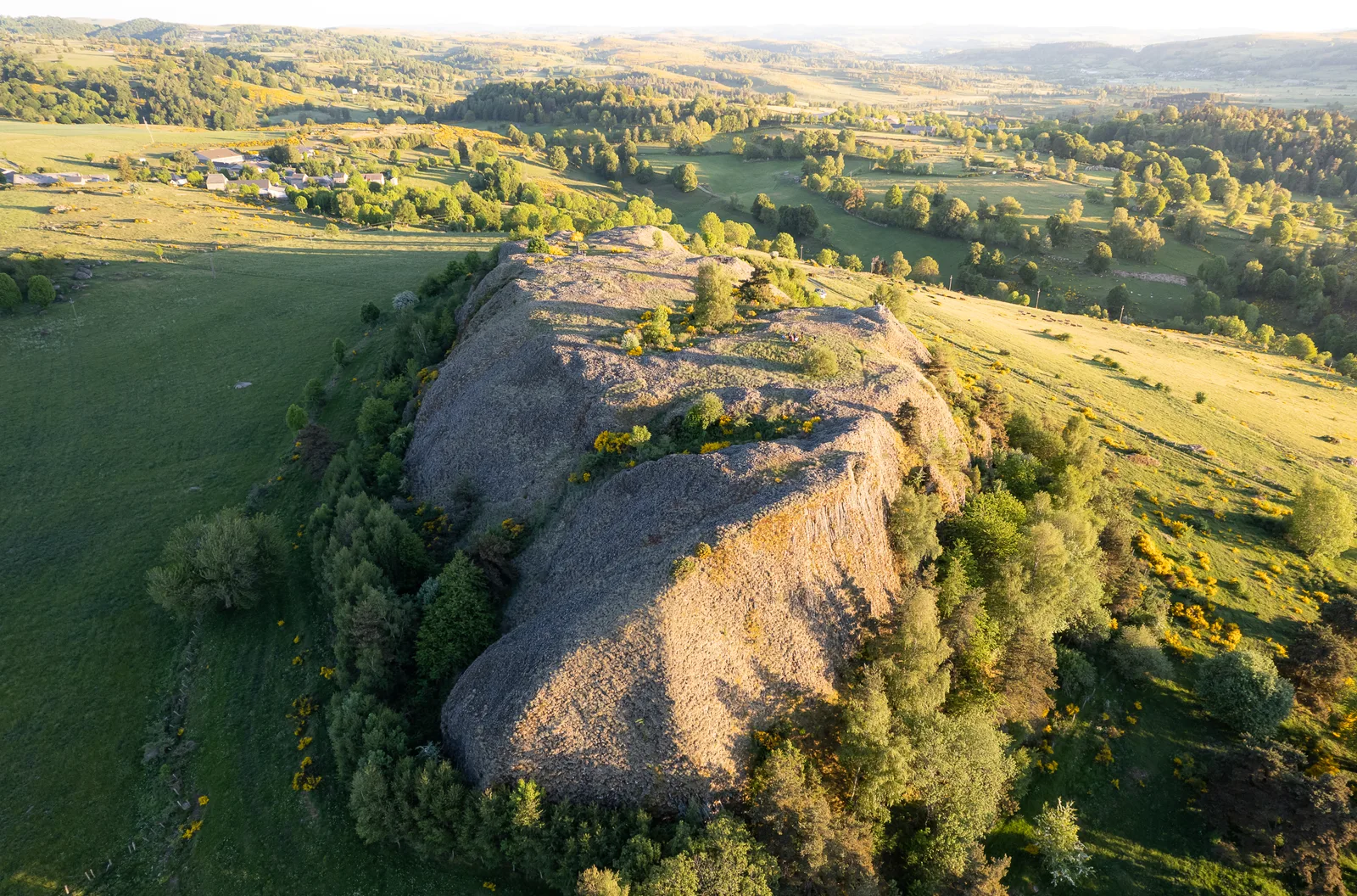
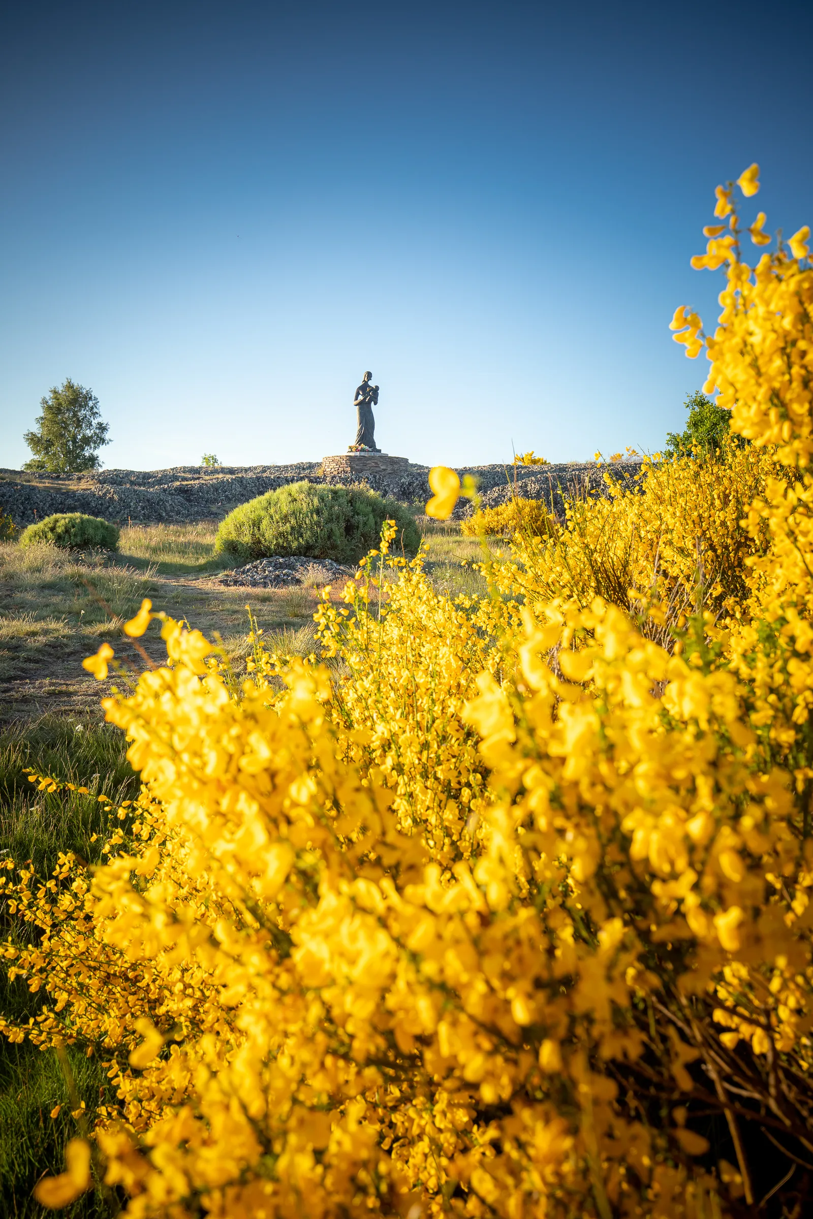
Take the small road on the left for about 1,5 km. It dominates [> the Bès valley]. In a bend, go down the path to the right that leads to Échalouppe. Turn left before entering the hamlet and reach the D 12 road (junction with the GR® de Pays du Tour des Monts d'Aubrac, yellow-red markings). Take it on the left for a few meters and cross it (> be careful!) to take a path on the right. Go up to the foot of the Rocher du Cheylaret. On the left, unmarked, a path climbs to the top of the Rocher du Cheylaret (15 minutes round trip), orientation table, statue of the Virgin, view of the Monts d'Aubrac, Cantal, Cézallier, the Massif du Sancy and the Bès valley. Continue to the hamlet of Cheylaret [> information panel, common oven, cross, “ferradou” or work, watering troughs].
In front of the cross, cross the road and turn right onto a wide track which you follow straight on until you reach a crossroads.
Ignore the wide track opposite and follow, to the left, the wide gravelled track. It first goes due east then turns at right angles towards the north. Reach a small asphalt road and follow it for around 200 m.
Leave this road (Separation from the GR® de Pays du Tour des Monts d’Aubrac) and take a path on the left. Go down towards Chauchailles, ignoring all the junctions on the left. Return to the starting point.
In the hamlet of Chauchaillettes, at the height of the common oven, continue along a path opposite to Salecrux [>water trough, well]. At the crossroads, in the hamlet, turn right. Go down a wide track to a stream then go up opposite it.
At the top of the hill, turn left [> view to the right of the Monts du Cantal and Cézallier and to the left of the Monts = d’Aubrac]. The path goes down to Fraissinoux.
Take the small road on the left for about 1,5 km. It dominates [> the Bès valley]. In a bend, go down the path to the right that leads to Échalouppe. Turn left before entering the hamlet and reach the D 12 road (junction with the GR® de Pays du Tour des Monts d'Aubrac, yellow-red markings). Take it on the left for a few meters and cross it (> be careful!) to take a path on the right. Go up to the foot of the Rocher du Cheylaret. On the left, unmarked, a path climbs to the top of the Rocher du Cheylaret (15 minutes round trip), orientation table, statue of the Virgin, view of the Monts d'Aubrac, Cantal, Cézallier, the Massif du Sancy and the Bès valley. Continue to the hamlet of Cheylaret [> information panel, common oven, cross, “ferradou” or work, watering troughs].
In front of the cross, cross the road and turn right onto a wide track which you follow straight on until you reach a crossroads.
Ignore the wide track opposite and follow, to the left, the wide gravelled track. It first goes due east then turns at right angles towards the north. Reach a small asphalt road and follow it for around 200 m.
Leave this road (Separation from the GR® de Pays du Tour des Monts d’Aubrac) and take a path on the left. Go down towards Chauchailles, ignoring all the junctions on the left. Return to the starting point.
