2014
SS8779 : The former Oystercatcher pub in Laleston
taken 9 years ago, near to Laleston, Bridgend/Pen-y-Bont ar Ogwr, Wales
The Geograph Britain and Ireland project aims to collect geographically representative photographs and information for every square kilometre of Great Britain and Ireland.
Read about the Geograph Project.
Read about the Geograph Project.
We have at least 1 images that match your query [https://www..org.uk//4290016] in the area! View them now
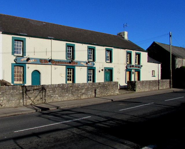
The former Oystercatcher pub in Laleston
Viewed across High Street in December 2014. Text on the wall shows CIRCA 1824 and A Warm Welcome to All Our Customers Old & New, but there is no welcome here now. The pub shut several years ago.
 Map © Crown Copyright")
TIP: Click the map for more Large scale mapping
- Grid Square
- SS8779, 103 images (more nearby 🔍)
- Photographer
- Jaggery (more nearby)
- Date Taken
- Wednesday, 24 December, 2014 (more nearby)
- Submitted
- Thursday, 25 December, 2014
- Subject Location
-
OSGB36:
 SS 8765 7981 [10m precision]
WGS84: 51:30.3611N 3:37.2111W - Camera Location
-
OSGB36: SS 8762 7980
- View Direction
- East-northeast (about 67 degrees)