MyTopo
Millican Texas US Topo Map
Couldn't load pickup availability
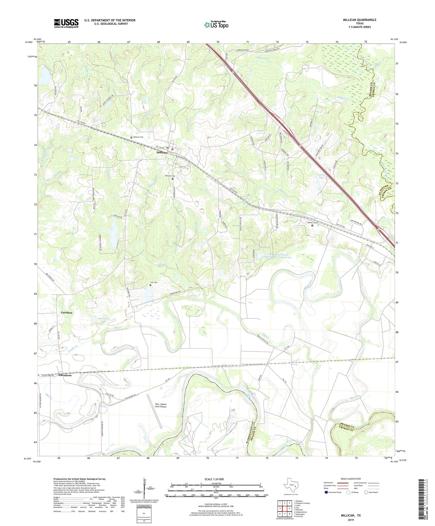
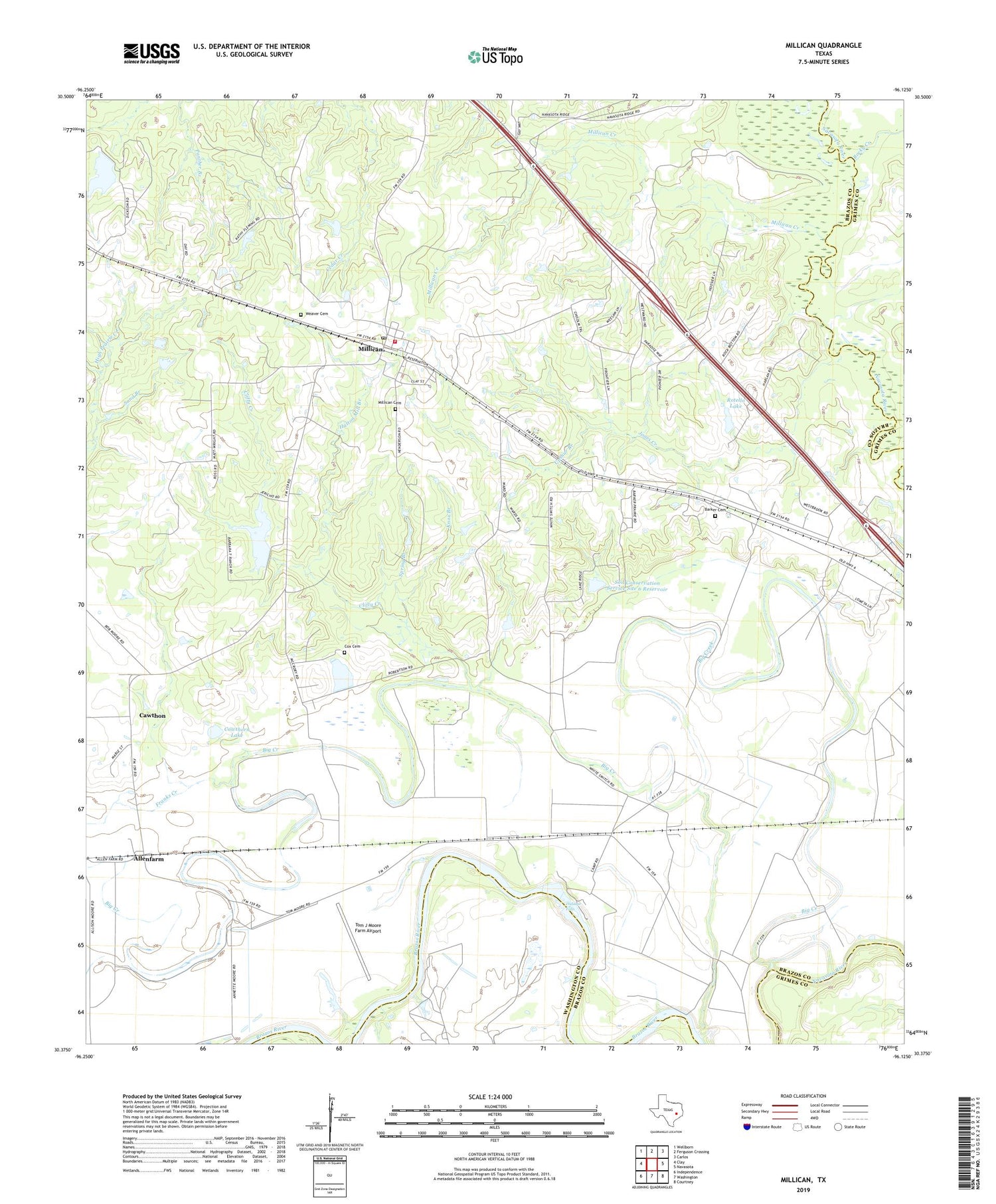
2019 topographic map quadrangle Millican in the state of Texas. Scale: 1:24000. Based on the newly updated USGS 7.5' US Topo map series, this map is in the following counties: Brazos, Grimes, Washington. The map contains contour data, water features, and other items you are used to seeing on USGS maps, but also has updated roads and other features. This is the next generation of topographic maps. Printed on high-quality waterproof paper with UV fade-resistant inks.
Quads adjacent to this one:
West: Clay
Northwest: Wellborn
North: Ferguson Crossing
Northeast: Carlos
East: Navasota
Southeast: Courtney
South: Washington
Southwest: Independence
Contains the following named places: Allenfarm, Barker Cemetery, Big Creek, Brooks Chapel, Cawthon, Cawthorn Lake, Cawthorn Lake Dam, Clifty Creek, Clifty Creek Lake, Clifty Creek Lake Dam, Cox Cemetery, Dallam, Dinkins, Franks Creek, Hidalgo Falls, Hutton Mill Branch, Jones Creek, Knox Branch, Millican, Millican Cemetery, Millican Creek, Millican Post Office, Nelleva, Prescott Dam, Prescott Lake, Rocky Creek, Rotello Lake, Rotello Lake Dam, Sand Branch, Soil Conservation Service Site 5 Dam, Soil Conservation Service Site 5 Reservoir, Soil Conservation Service Site 6 Dam, Soil Conservation Service Site 6 Reservoir, South Brazos County Fire Department Station 2, Spring Branch, Tom J Moore Farm Airport, Town of Millican, Upshur Branch, Weaver Cemetery